The majority of children in Scotland have been learning from home since the Covid-19 pandemic hit the UK in March. Sustrans.
Spaces for schools
It’s been just under one month since children throughout Scotland returned to school after a long hiatus due to the Covid-19 pandemic.
Prior to and during time this time, Sustrans have been working with local authorities through the Spaces for People programme to ensure that children have been able to get to and from class safely.
In this week’s knowledge sharing session, Sustrans Infrastructure Officer Dan Jeffs discusses how temporary infrastructure around schools has been supporting walking, wheeling and cycling.
Dan Jeffs talks about the benefits of children travelling actively to school, both within the Covid-19 pandemic and beyond.
Teaching active travel
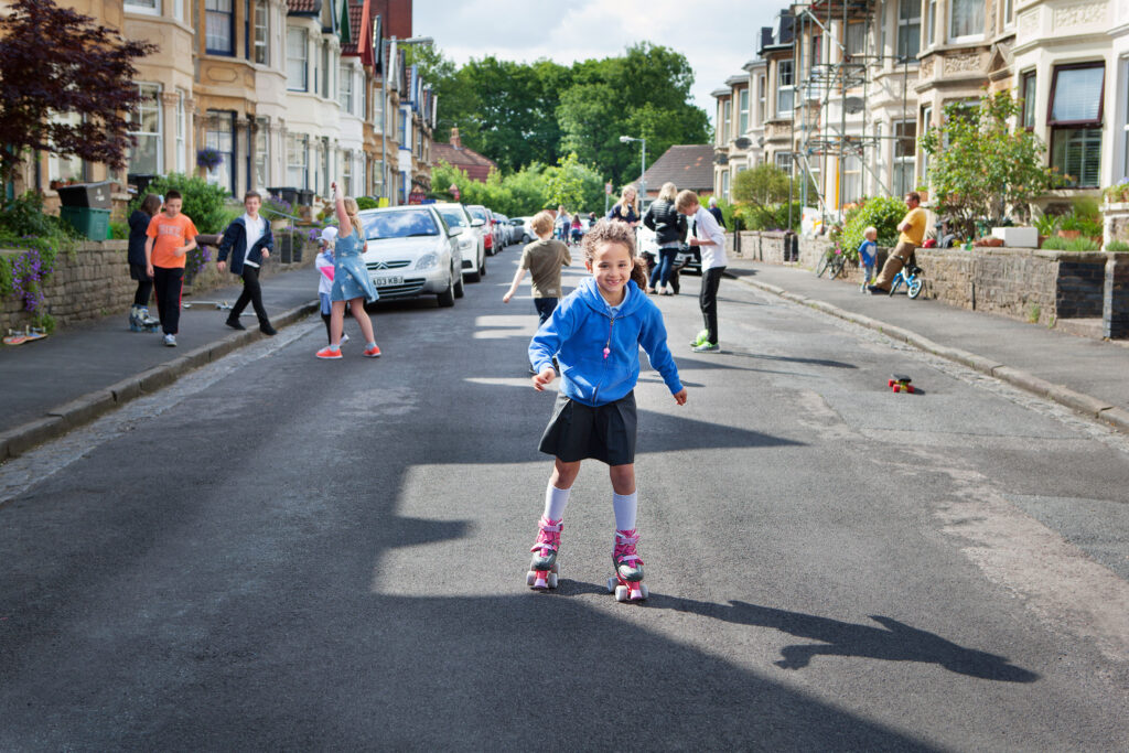
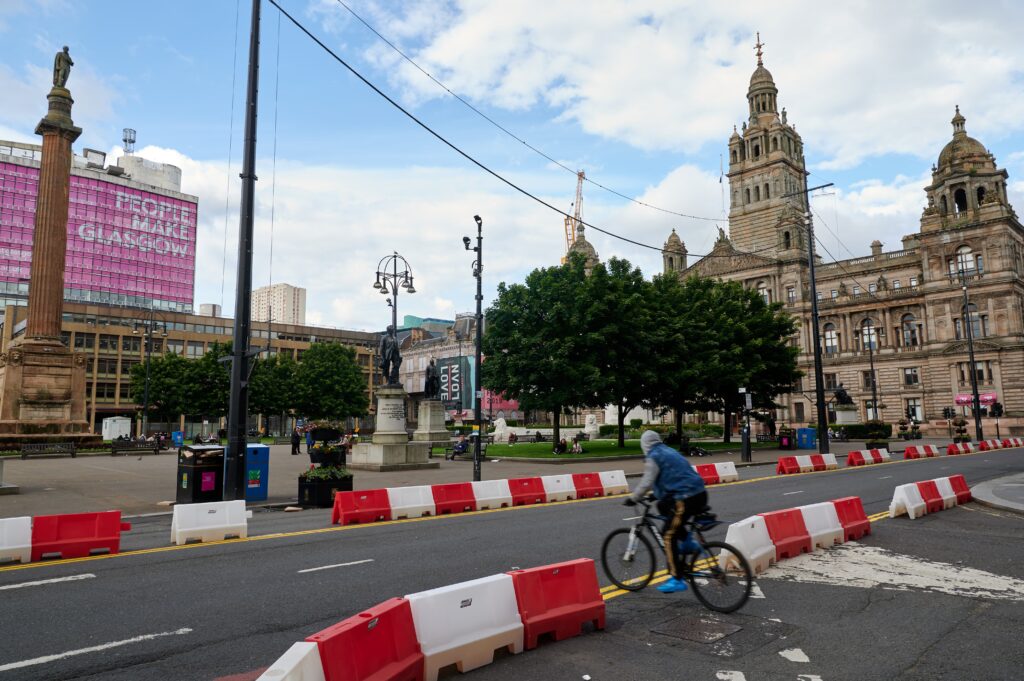
There are three main ways to help parents and children travel actively to and from school:
School Streets
Low Traffic Neighbourhoods
Place-based measures
Whether its through speed limit restrictions, priority access times or closed streets, each of these changes moderates driver behaviour to prioritise the comfort and safety of those the school run.
Thinking smart, staying healthy
National advice very much favours children travelling to school actively where possible. The key here is in expanding what is possible.
Not only do one third of children said they would like to cycle to school if they could, but active travel to school has been shown to increase children’s concentration levels for up to four hours.
Closing roads to traffic encourages children to travel actively and see the playground in the street. Colin Hattersley/Sustrans
“Where possible your child should travel to and from school on foot, bike or scooter while maintaining physical distance.”
www.parentclub.scot
The regular exercise that walking, wheeling and cycling provides also helps to keep children healthy, reducing sick days and improving school conduct.
Less cars on school roads travelling at slower speeds has been shown to reduce traffic accidents.
A breath of fresh air
The Kelvin Way in Glasgow was closed to traffic earlier this year in order to provide access to green spaces and give people room to exercise. Sustrans.
Promoting health and active travel is also about contributing to a sustainable environment, an issue which will affect future generations more than anyone else.
By walking, wheeling or cycling to school instead of taking the car, our air quality has been shown to improve time and again.
With Scottish Climate week just around the corner on September 14th, and Clean Air Day on October 8th, it is now more important than ever to consider the effects our travel habits have on those most vulnerable to the consequences.
Neil Hanna Photography
www.neilhannaphotography.co.uk
07702 246823
What do you need to know?
Following Transport Scotland’s announcement, Places for Everyone is pleased to be able to confirm a significant change in the match funding requirements for projects.
All projects are now eligible to receive up to 70% funding towards construction costs.
In addition, the 10% cap on pre-construction funding will now only be applied once projects reach construction, i.e. pre-construction funding will be extended 100% and any over payment will be deducted from the grant made available for construction (this will be subject to the Places for Everyone teams discretion).
The Spaces for People programme provided Scottish local authorities £38.97 million to create temporary infrastructure for walking, whee;ling and cycling as part of the Covid-19 recovery. John Linton/Sustrans
What do I need to do now?
Category 1-3 projects already at construction stage: Please submit a project update form on the application portal detailing any increased funding request. Where these increases are solely attributable to the increase in intervention rate they will be automatically approved. Should you be requesting increases in funding for any other reason, please include a change control with the form.
Category 1-3 projects at design stage: Pleaseincrease your forecast construction request the next time you provide Places for Everyone with an updated programme and spend profile; this will likely be at the next stage review for your project.
Category 4 projects not yet approved by Panel: Please follow the previous recommendation for category 1-3 projects. Those partners who are about to submit to Panel should ensure that their submission documents reflect any increase in grant request.
Category 4 projects Approved by Panel and other legacy projects in receipt of multi-year funding: Where there is an existing budget or programme revision awaiting approval, please submit revised financial information to the portal via a project update form and both these figures and any previous figures provided will be presented to a Change Control Board alongside your existing change control. If you are not otherwise waiting for approval, please submit a revised grant request via an update form and this increase will be approved.
Neil Hanna Photography
www.neilhannaphotography.co.uk
07702 246823
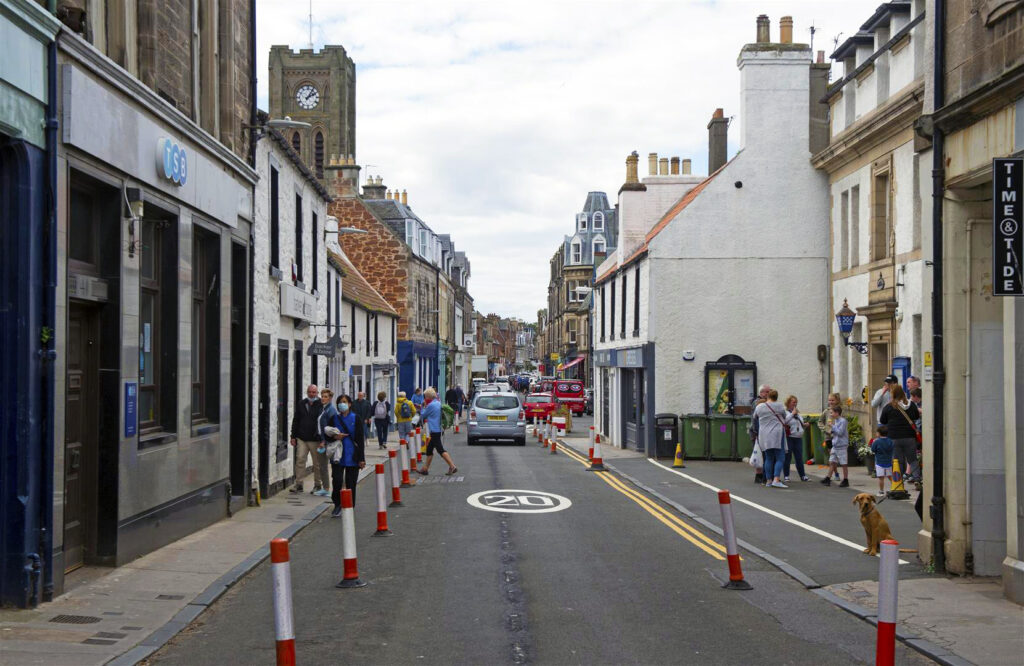
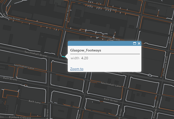
Mapping pavement widths can help local authorities identify pinch points in urban centres or where physical distancing is otherwise unachievable. High Street, North Berwick. Neil Hanna/Sustrans
Responding to a crisis
With the advent of the Covid-19 pandemic, the scarce amount of space allotted to people across Scotland’s towns and cities is firmly in the forefront.
Attempting to maintain a two-metre physical distance from other pavement users whilst navigating by foot or wheel can be a nuisance at the best of times and an impossibility at others.
In aid of this, Sustrans’ Spaces for People programme, funded by the Scottish Government, has distributed almost £40 million to local authorities to provide temporary infrastructure to help people walk, wheel and cycle.
Spaces for People is delivering temporary infrastructure throughout Scotland to help people walk, wheel and cycle safely through the Covid-19 pandemic. Forrest Road, Edinburgh. Sustrans/Neil Hanna
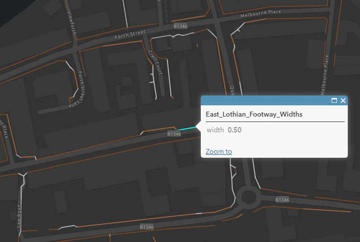
With a common bid by local authorities’ being to widen public footways, Sustrans have set to calculate and map pavement widths in towns and cities through Scotland to help identify potential crowding pinch points and support physical distancing.
Early mapping in Edinburgh
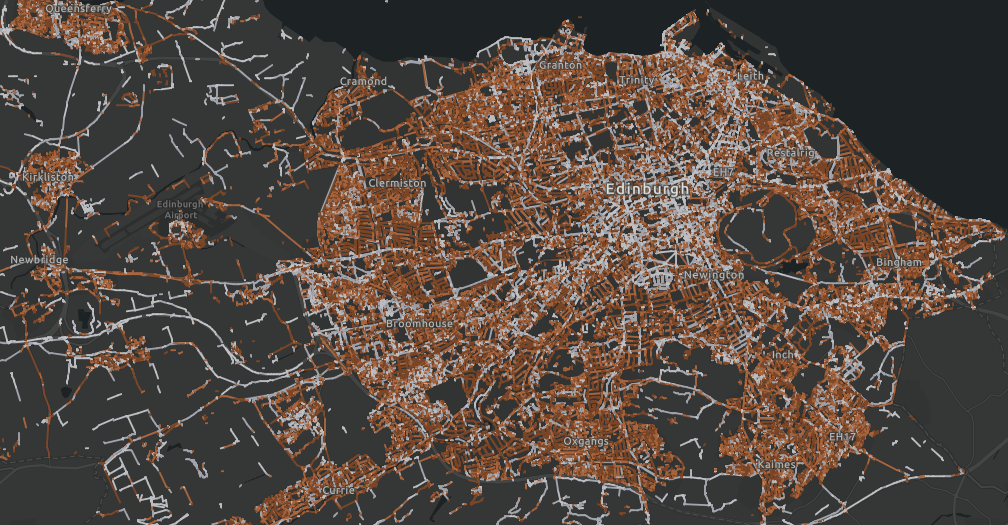
In 2010, City of Edinburgh Council began work on developing an Active Travel Action Plan, a long-term city-wide project to improve the accessibility and safety of walking, cycling and wheeling infrastructure.
One of the ways Sustrans has been assisting the council with this ambitious project is by undertaking the painstaking work of mapping individual pavement widths throughout the city.
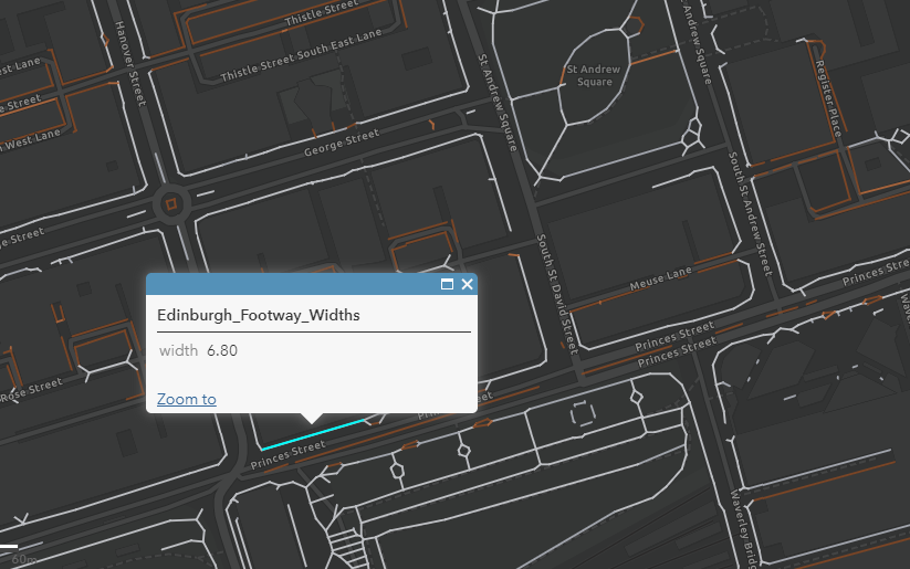
Princes Street allows 6.8m of pavement width. However, for such a busy street this often is not enough
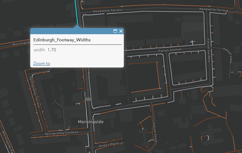
Morningside Road has been widened with traffic wands in several locations in order to bolster the 1.7m width the pavement currently allows for.
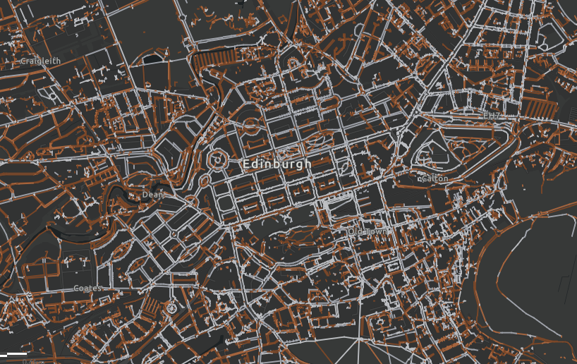
Edinburgh is an historic and densely packed urban centre within which pavement widths vary greatly.
With physical distancing guidelines now in effect as a matter of public health, the construction of a working pavement width database for the whole of Scotland has taken on a new urgency.
Once lockdown was announced, Sustrans accelerated work on providing City of Edinburgh Council with a comprehensive dataset of pavement widths.
This was achieved by adapting code developed for New York to complement Ordinance Survey data.
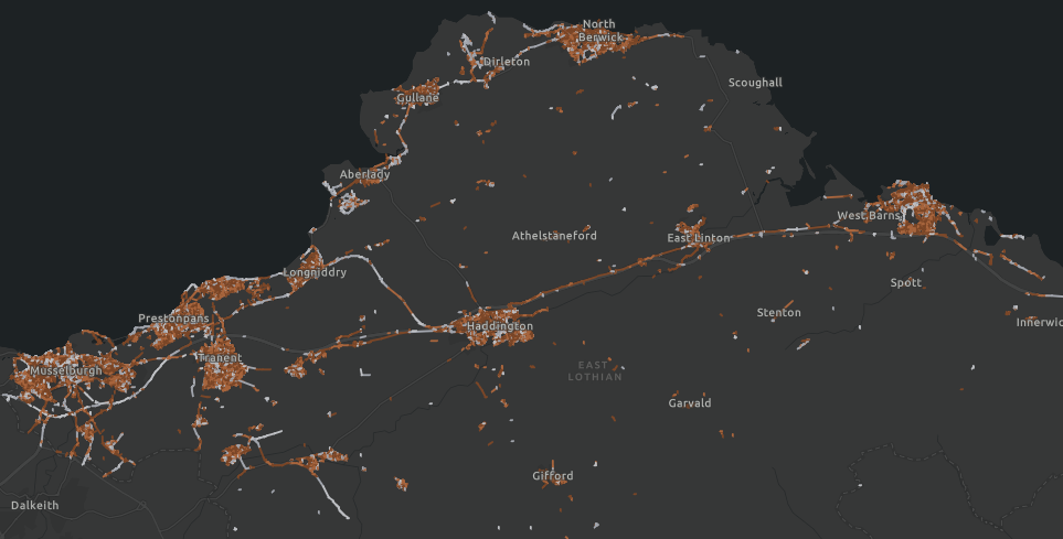
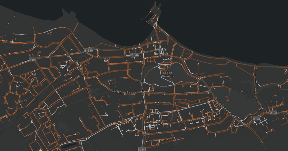
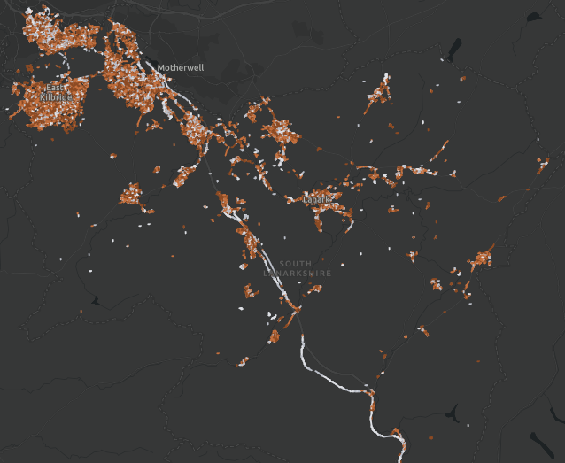
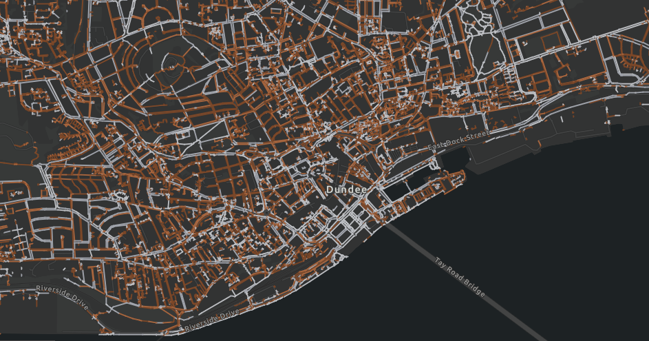
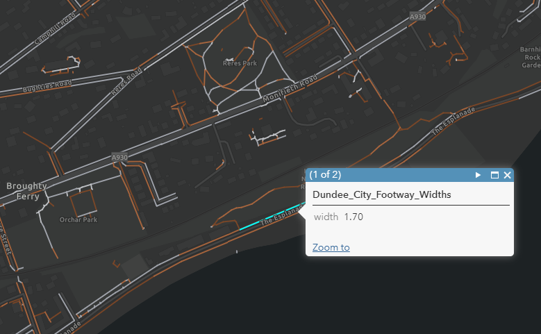
From this initial success, Sustrans has been able to develop further datasets for Glasgow, East Lothian, Dundee, East Ayrshire and South Ayrshire, with the offer being extended to any other local authorities who would find such data useful.
The coding process
Infrastructure Coordinator for Sustrans Alasdair Anderson was a key player in developing the mapping datasets. As lead on the project, he explains:
“The Python code used to do the analysis utilised Ordinance Survey’s most detailed Mastermap Topograpic Area mapping.
This identifies pavements and paths within a given local authority and accomplishes the surprisingly difficult task of measuring the width of an irregularly shaped object by using a tailored algorithm.
By first calculating the centreline for each of the thousands of bits of pavement that have already been identified, the algorithm then measures the distance back from individual pavement centre point to the pavement edge to calculate the width.
Finally, the results are compiled into a GIS dataset which can be analysed statistically or displayed on a map”.
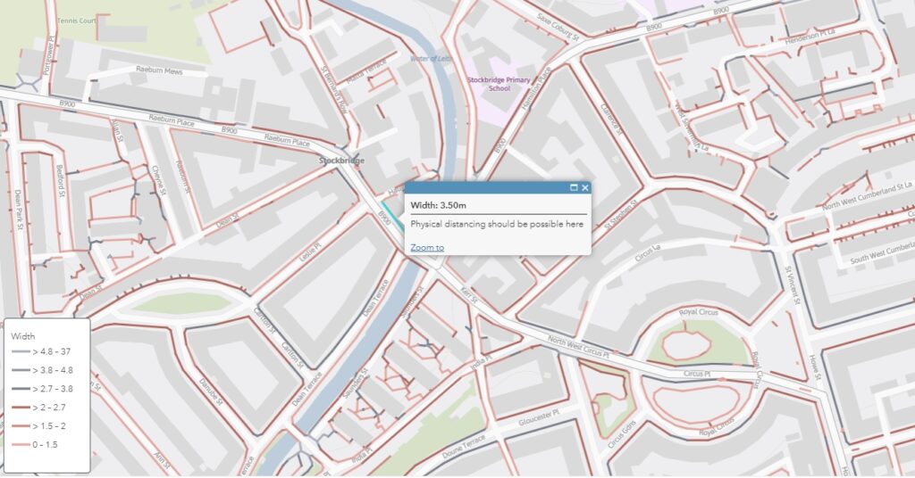
Even Edinburgh’s busiest shopping streets have very narrow pavements. Raeburn Place, Stockbridge. Ordinance Survey.
Using the data
An immediate benefit of this data is that it can be used to help people navigate routes which only follow wider pavements.
For example, Sustrans officers have been looking to use pavement widths data to enable them to plan led walks with volunteers or school children once lockdown restrictions are sufficiently eased.
The larger impact, however, of these mapping capabilities is apparent when the data is combined with other information in order to identify the narrowest or busiest streets in order to prioritise them for widening interventions.
While the £38.97 million available under the Spaces for People fund is a lot of money, it is not nearly enough to widen every pavement in Scotland. As such, working out how to prioritise pavement widening initiatives becomes crucial.
Pavement distancing description
Width
km
%
Easy
>4.7m
133.97
4
Comfortable
3.8 to 4.7m
105.93
3.1
Possible
2.7 to 3.8m
362.75
10.7
Difficult
2 to 2.7m
608.84
18
Too narrow
1.5 to 2m
975.01
28.9
Less than minimum design guidance
<1.5m
1192.8
35.3
Total ‘difficult’ or narrower
<2.7m
2776.65
82.2
Table demonstrating the widths of pavements throughout Edinburgh as they relate to physical distancing health guidelines.
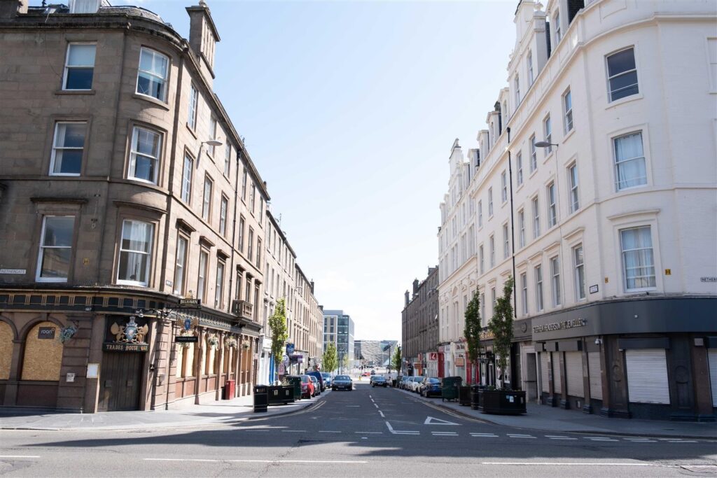
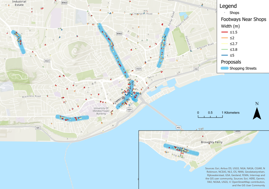
Applications in Dundee
One of the first practical applications of Sustrans’ pavement mapping capabilities took place in Dundee city centre.
While nearly empty during lockdown, Union Street in Dundee has been closed to traffic in anticipation of crowds of people returning as businesses reopen. Union Street, Dundee. Paul Reid/Sustrans
A dataset of shops and services in Dundee was first created. This was then overlaid with the footway width dataset Sustrans had created to help identify narrow pavements where high footfall was likely to occur. From this, a unique set of Covid-19 emergency proposals for shopping streets in Dundee was able to be generated.
Using these emergency proposals, Sustrans was then able to highlight particular areas where it would be most crucial to prioritise pavement widening interventions.
Areas in blue are streets which would most benefit from widened pavements. Similar approaches have now been utilised in Edinburgh and East Ayrshire.
Looking forward
Looking beyond the Covid-19 pandemic, the datasets Sustrans has created provide local authorities with an invaluable resource with which to maximise the benefit of footway renewal programmes.
Initial progress can be made by first focussing on pavements which fall short of 1.5m, normally considered to be the minimum.
Interventions in areas such as these would improve accessibility for those with additional mobility support needs immensely, such as those manoeuvring a wheelchair or a pram.
Recent adaptations in the code used to calculate pavement widths have now enabled Sustrans to calculate the widths of entire streets.
This new capability could be instrumental in helping Scottish local authorities understand where it would be most beneficial to deliver cycling infrastructure in the future.
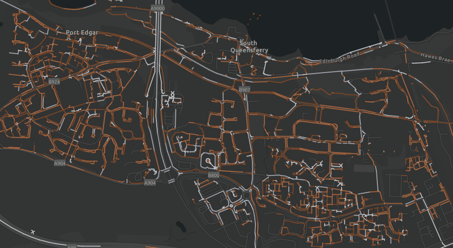
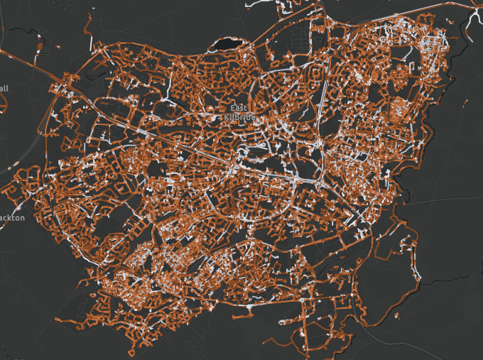
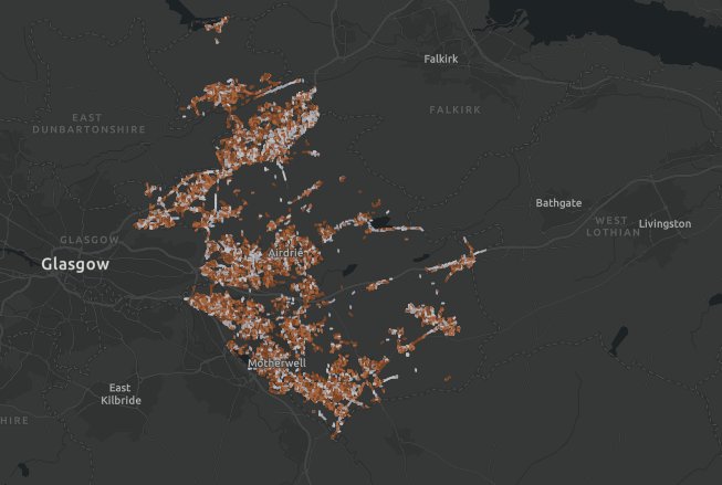
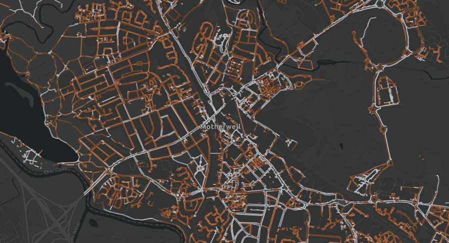
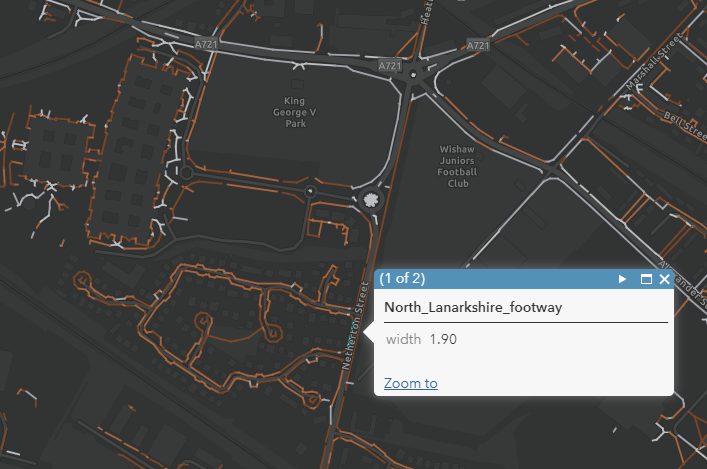
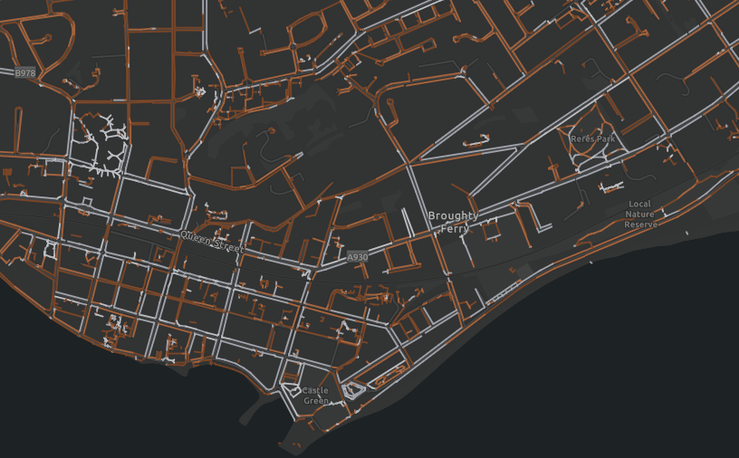
Gallery
Take a look at some of the Scottish towns and cities Sustrans has created GIS pavement width maps for in the image gallery below.
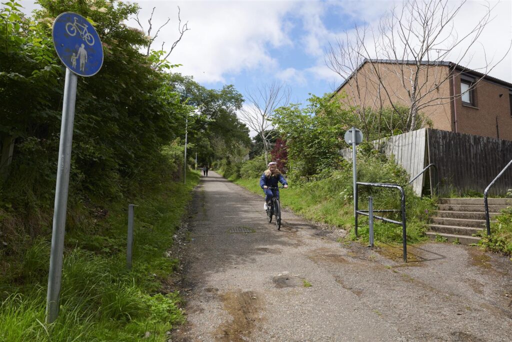
A combination of Spaces for People and Places for Everyone initiatives will help safeguard the school run as a safe and enjoyable commute. Sustrans/Julie Howden.
Schools throughout Scotland have been largely closed since the beginning of March due to the Covid-19 pandemic.
Now, with their imminent return this month, temporary measures are being introduced through Spaces for People in order to safeguard the health of pupils, parents and teachers, as well as wider communities.
Forward thinking
Due to the increased hesitance around the use of public transport, concerns have been growing that school access roads could quickly become congested with parents attempting to drop off and pick up their children from school.
As well as contributing to the poor health outcomes that are associated with stationary vehicles, pavement parking would greatly reduce the footway space available to path users for physical distancing.
This, ultimately, could increase the likelihood of transmitting Covid-19 within the community.
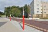
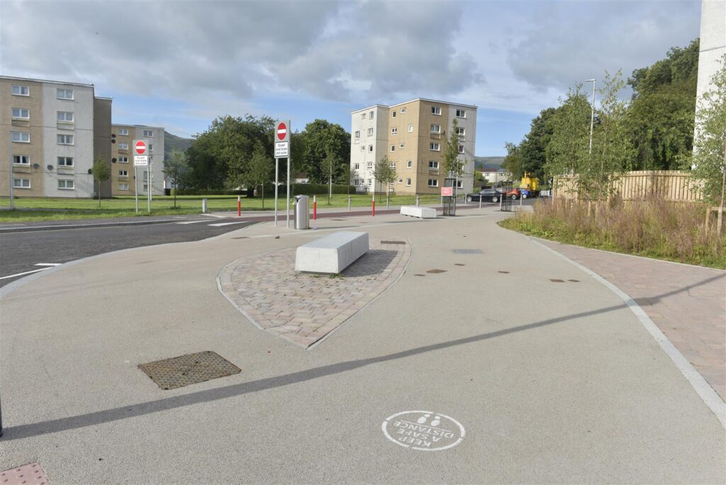
Taking steps to prevent this, Clackmannanshire Council, supported by Sustrans, have allocated a portion of their Spaces for People funding to ensuring that the school run is still enjoyable and safe
Lamp post wraps and floor stencils have been installed in the area surrounding Abercromby Primary School to improve vigilance of public health guidelines. Sustrans/Julie Howden.
These plans include restricting through traffic to buses and cyclists on The Orchard, Tullibody, an access road to Bernadette Primary School.
As well as promoting a healthy and active commute to school, reallocating road space will allow pupils to walk, wheel and cycle to school with the space they need to maintain physical distance.
As well as this, Covid-19 messages that remind path users of the importance of maintaining a safe physical distance have been installed on pavements using spray painted stencils.
Lamp post wraps and bolted on street signs have also been introduced.
Permanent solutions
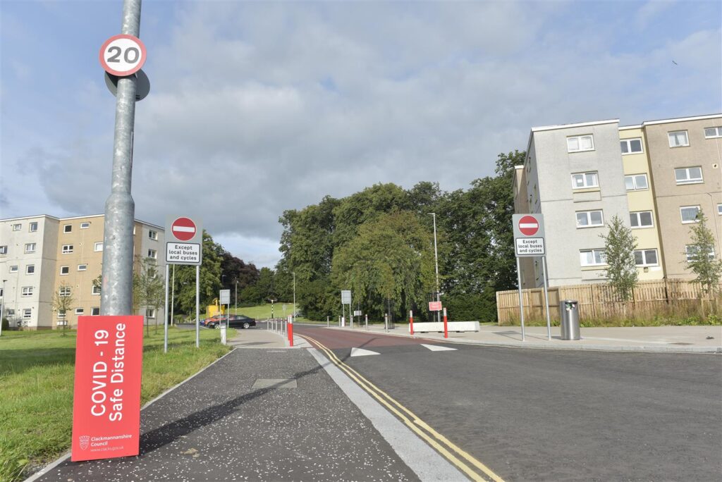
Through Sustrans’ Places for Everyone programme, large pencil-shaped bollards have been erected along The Orchard as part of a wider School Street project undertaken during a refurbishment of the school building.
Trees and comfortable seating areas have also been introduced to offer waiting parents a distanced but convenient alternative to gathering outside of the school gate.
Seating areas outside of the school will ensure parents have a comfortable place to wait away from the school gates. Sustrans/Julie Howden.
Where traffic cannot be restricted, fixed installations such as these increase driver awareness of their presence in a school zone and also provide an effective deterrence to mounting the kerb.
Some emergency measures proposed by Clackmannanshire Council as part of their Spaces for People application have already been fast-tracked towards becoming permanent.
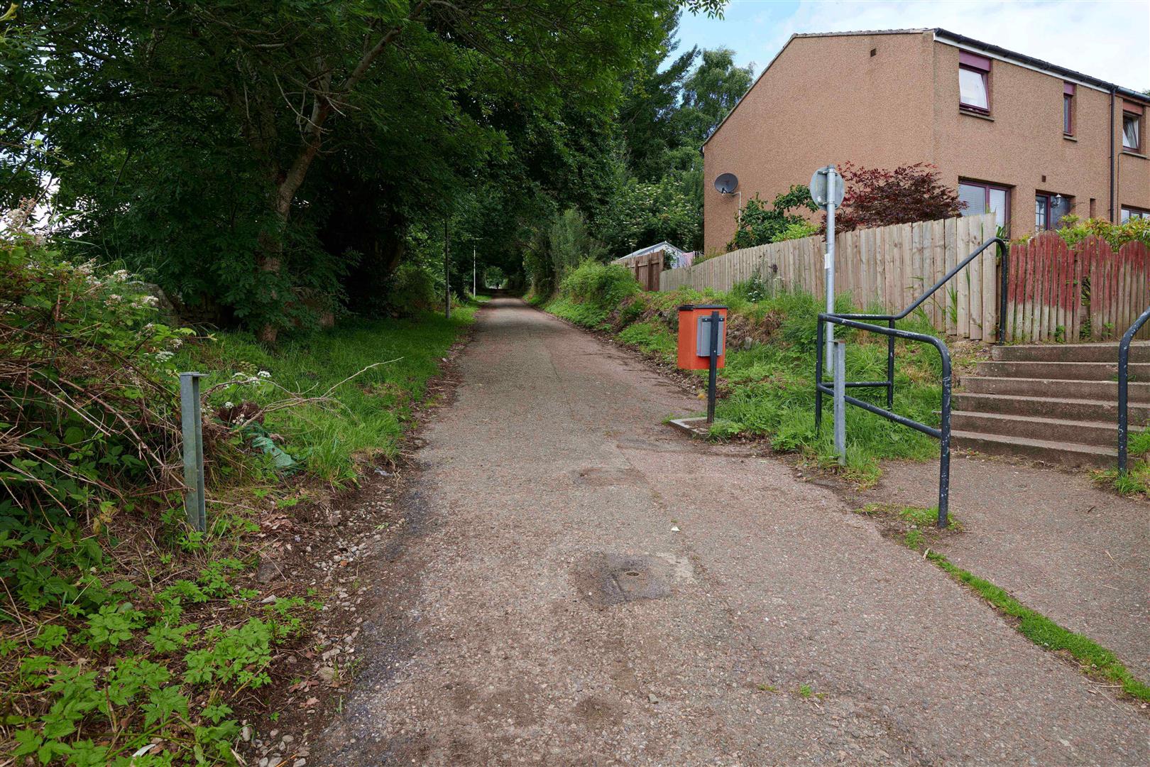
Over the coming years, the informal walking, wheeling and cycling links that currently links Sauchie and Glenochil with the nearby Lornshill Academy will be upgraded through the Place for Everyone School Street project into a permanent shared-use path.
This will not only encourage children and parents to stay healthy and active whilst commuting to school, but also improve air quality and safety in the surrounding area.
“Clackmannanshire are making the school run safer, cleaner and more fun for all. Their ambition to prioritise active travel is evident in their Places for Everyone projects and remains at the heart of these Spaces for People interventions. Over the coming years, we will continue to support Clackmannanshire improve school journeys for all.”
Andrew Scoles, Infrastructure Officer, Sustrans
For more information on Clackmannanshire Council’s Space for People project click here.
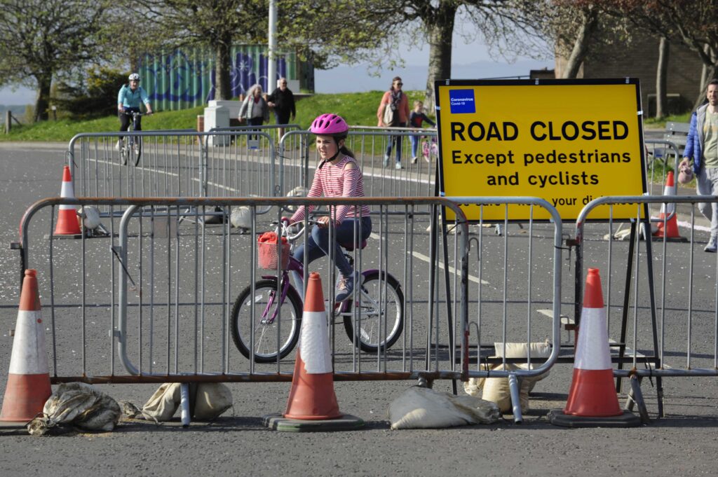
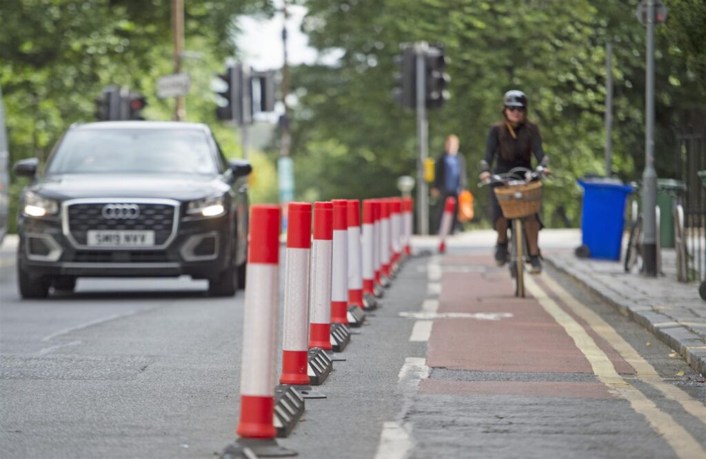
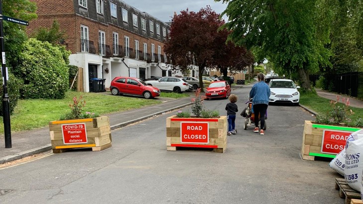
There have been big increases in the amount of traffic on residential streets over the past few decades. This has resulted in more noise and air pollution as well as a greater danger on roads.
To address this problem, some local authorities have put in place filters such as bollards or planters, through which people can walk or cycle, but not drive.
Other local authorities have taken a more strategic, holistic approach, and removed through-traffic from entire residential areas..
This application, known as a Low Traffic Neighbourhood (LTN) is widespread in the Netherlands. It means that private motorised vehicles can still access all homes and businesses, but they cannot cross through a neighbourhood. People can therefore only travel through the area on foot, wheel, bicycle or bus.
Low Traffic Neighbourhoods: where people can only only travel through an area on foot, bicycle or bus.
What makes them so good for communities?
Low Traffic Neighborhoods have been proven to significantly reduce traffic volumes, both in the residential streets and across the entire residential area.
This is known as traffic evaporation – when short trips previously made by cars are now taken by other modes, such as by foot or bike.
In light of this, Low Traffic Neighbourhoods can be described as a public health tool rather than a transport tool.
This knowledge sharing session explores the different ways in which towns and cities across Scotland can implement Low Traffic Neighbourhoods so that local communities can reap the benefits of this simple, cost-effective measure.
Note: the examples shown are in no way prescriptive and are for information only. Where specific products are shown in this document, this does not constitute Sustrans’ endorsement of that product.
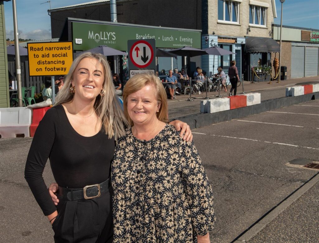
Aberdeen , Scotland, Friday, 7 August 2020
Pictured is Janice Langdon, the owner of Molly’s Cafe in Stonehaven with her daughter Megan Ann Langdon, the cafe’s manager.
Picture by Abermedia / Michal Wachucik
Janice Langdon, owner of Molly’s Cafe and Bar, along with her daughter Megan Ann Langdon, the cafe’s manager. welcome the temporary changes. Abermedia / Michal Wachucik
For the better part of the last five months, businesses throughout the UK have been largely non-operational due to the public health crisis caused by the Covid-19 pandemic.
Whilst protecting public health, indefinite closure and reduced footfall has had a devastating impact on the livelihoods and future prospects of businesses, especially small and local owners.
The appetite for change
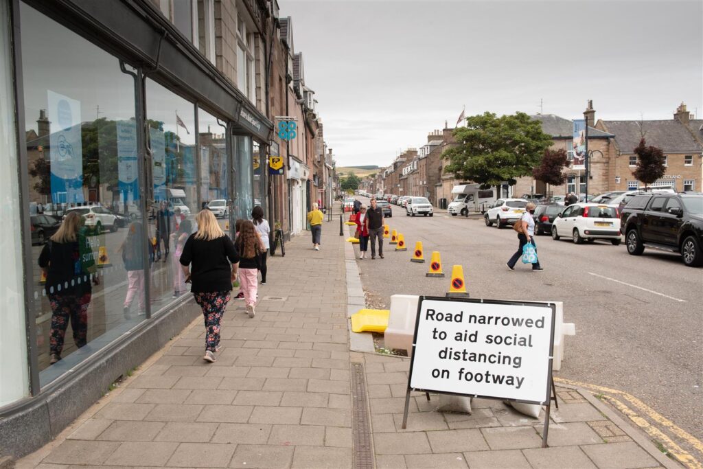
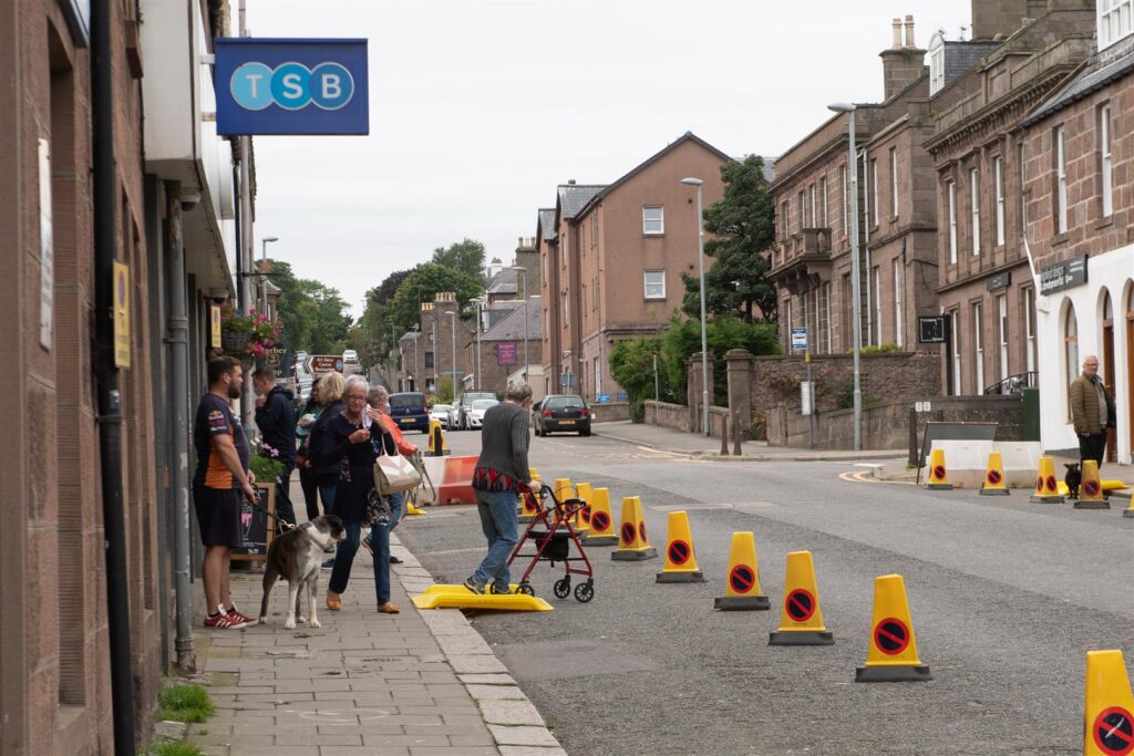
Stonehaven has a number of streets primed for high footfall, including Allardice Street, Market Square and The Links.
In each of these locations, car-parking spaces have been removed using cones and lengths of coloured separators in order to facilitate additional space for pedestrians to pass one another and queue outside of shops safely.
Pavements were widened using signage and cones at Market Square, Stonehaven, to allow people to move around safely. Abermedia / Michal Wachucik
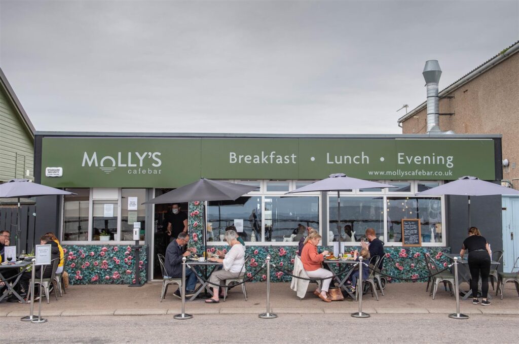
The Links, in particular, has benefitted from the Spaces for People interventions.
With car-parking spaces removed, customers are now able to queue safely outside of local cafés and eateries, and enjoy expanded seating areas with an unrestricted view of the bay.
Janice Langdon, Owner at Molly’s Café Bar, was delighted by the interventions.
“Without the change of layout to the road, I would not have been able to open the business safely due to the constant queues from another business next door. All of our customers, old and new, comment about how safe they feel with the set-up we have outside. Covid-19 has had such a negative effect on people but this set-up, I must say, is all positive. People are so delighted to be getting out again and to make them feel safe is our priority.”
Janice Langdon, Owner, Molly’s Cafe and Bar
Businesses like Molly’s Cafe and Bar have been able to resume business safely by using reallocated road space to serve customers outdoors. Abermedia / Michal Wachucik
Equally, Nicci Dollar who owns Aunty Betty’s, a popular ice cream shop along The Links, has felt supported by the changes.
“We’ve found the changes to be wonderful. The changes at the beachfront have allowed us to create a queuing system and safe area for the public and our staff. We wish for this to be a permanent feature at the beachfront.”
Nicci Dollar, Owner, Aunty Betty’s
A coordinated effort
Following the award of Spaces for People funding, Sustrans worked closely with Aberdeenshire Council to develop a suite of appropriate temporary measures which were also conducive with physical distancing guidelines.
Parking has been temporarily removed and pavements widened on Banchory High Street to give more people space to physically distance. Abermedia / Michal Wachucik
The key urban centres of Stonehaven, Banchory, Inverurie, Ellon, Fraserburgh, Peterhead and later Turriff were identified as areas which would benefit most from these measures, with changes having been rolled out from July 15th onward.
Now in effect, temporarily widened footways and one-way traffic flows allow pedestrians the space needed to move around, shop, visit essential services and enjoy their local areas whilst maintaining a safe physical distance.
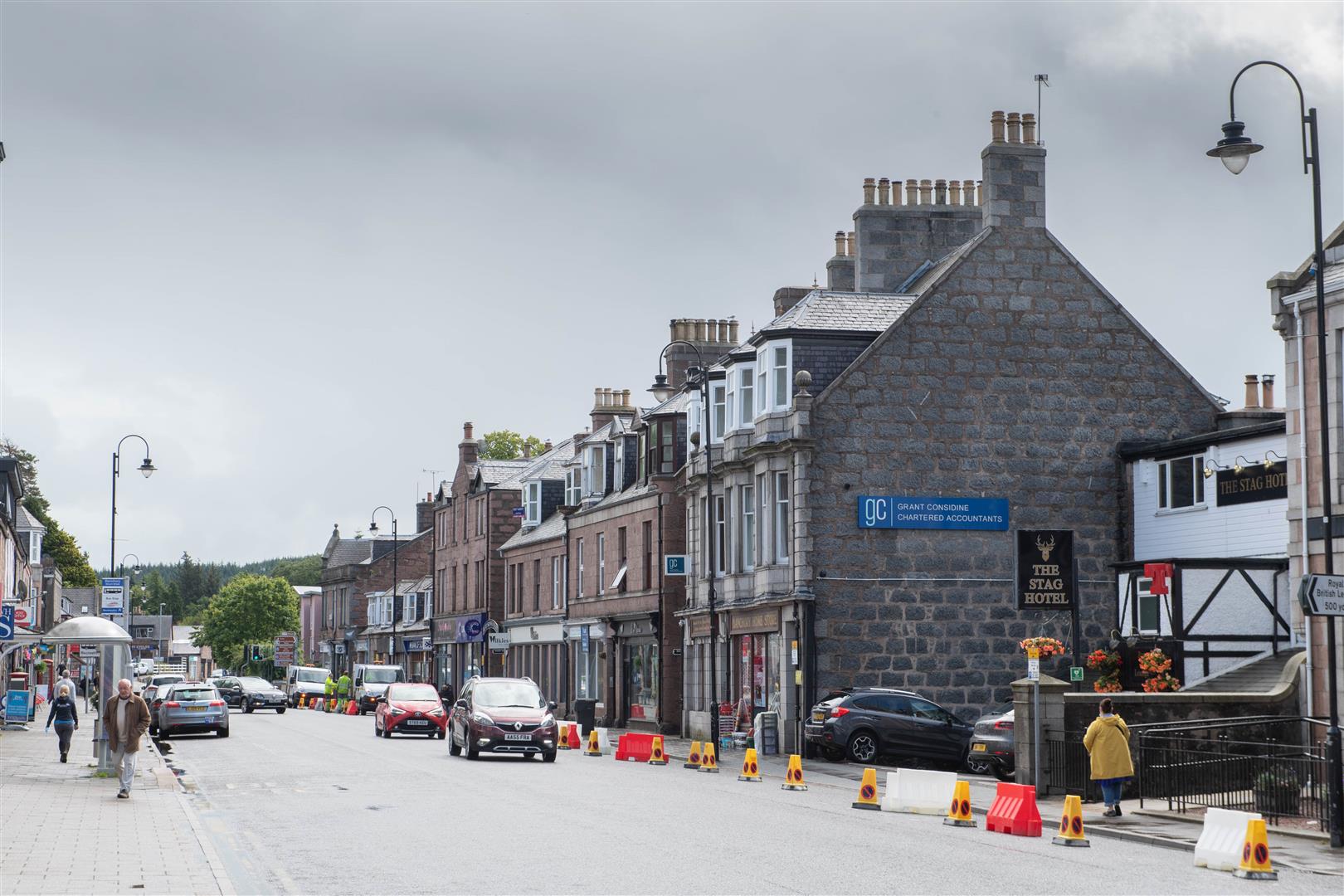
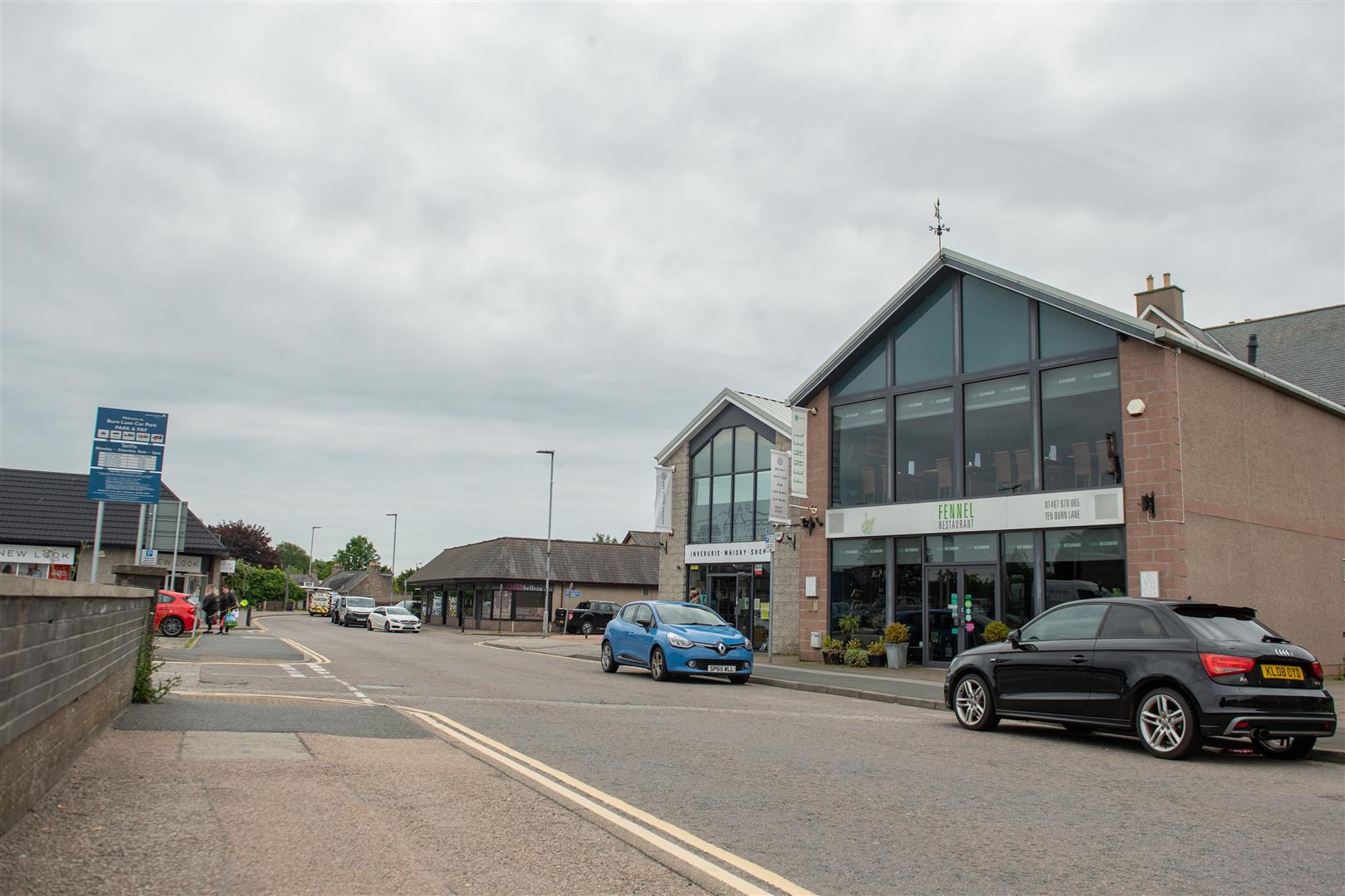
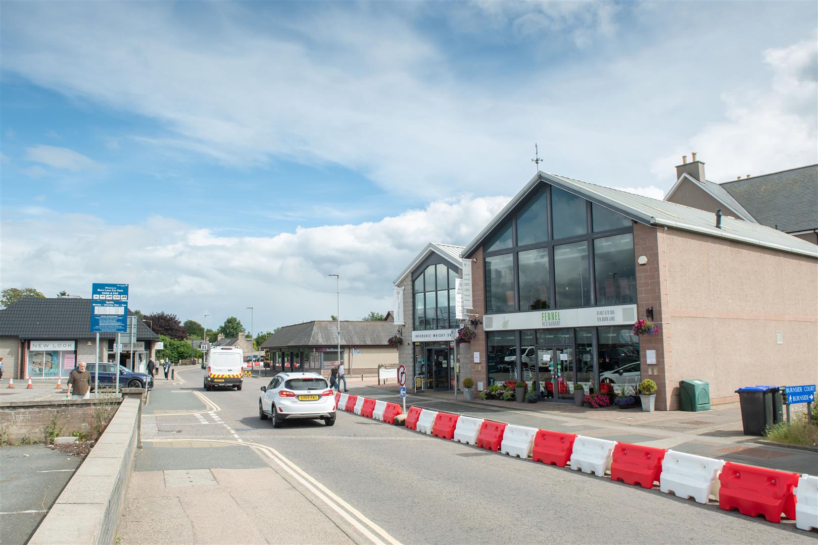
Temporary physical barriers on Burn Lane, Inverurie, will help provide space to shoppers once footfall returns. Abermedia / Michal Wachucik
Bonnie Thomson, Infrastructure Coordinator at Sustrans, has been overseeing the Aberdeenshire project since it was annouced.
We are delighted to see the temporary measures that have been introduced throughout Aberdeenshire. These changes will allow residents to complete essential journeys and access vital public services safely and with peace of mind.
Physical barriers and space-limiting infrastructure, such as narrow footpaths, metal fencing and overgrown vegetation are normally no more than a minor nuisance to people travelling on bike or by foot.
But, because of Covid-19, they have become a major public health concern, as they make it much harder for people to physically distance when out and about.
However, for those with additional mobility needs, this kind of infrastructure has always been an issue. And, whether steering a pram, a cargo bike, or a wheelchair, for many, trying to navigate these kind of obstacles can be a major barrier to a simple journey.
Breaking down barriers
Through Sustrans’ Space for People programme, councils across Scotland have been addressing this problem. Many physical obstructions on walking and cycling routes have either been replaced with more accessible designs, or removed altogether
In Inverness, the Highland Council, identified a number of these barriers along busy active travel commuting routes to the city centre.
Gate removed from Caulfield Road North (left) and the bollards installed in its stead (right). Sustrans/Ewen Donaldson
They included Caulfield Road North, to the east of the city centre. This road links suburban communities with a number of essential services, including Raigmore Hospital, Insches Retail Park and the Inverness Campus.
The council replaced a large yellow gate with brightly coloured bollards in Resaurie, to make it easier for people to walk, cycle and wheel along the route.
Meanwhile, at the other end of Caulfield Road North, at the entry way to Cradlehall Business Park, the council added a dropped kerb in the pavement. This has helped create a smoother and safer crossing point for all users.
Kinmylies Way with metal barriers and overgrown vegetation (left) and after removal (right). Sustrans/Ewen Donaldson
Similarly, to the west of the city centre, Kinmylies Way, a busy walking and cycling route with commuters had become overgrown with vegetation and was marred by imposing intermittent metal fencing.
This created a series of uncomfortable pinch points for path users. It also made it harder for people with cargo bikes, prams or wheelchair users to travel along the path.
The council removed lengths of metal barriers and broadened gravel paths. They also cut back vegetation, including tree cover which reduced the areas visibility. It is now much easier and safer for users travelling along the route.
The future is accessible
These small changes are not only cost-effective for local authorities but quick to apply, making them ideal for Spaces for People projects.
Most importantly of all however, is the difference they can make to how people move around their local areas and make every day journeys.
Find out more about the Highland Council’s Spaces for People project here.
Temporary measures introduced through Spaces for People are designed to protect public health and facilitate essential journeys for all groups, including those with additional support and mobility needs.
In support of this, Sustrans are working closely with local authorities to ensure that people with disabilities and other affected groups are considered appropriately throughout every project.
Today, we’re joined by Ali MacDonald, Organisational Lead for Healthy and Active Environments, Public Health Scotland as well as David Hunter, Independent Consultant at Mobility Access Committe Scotland (MACS) to discuss appropriate accessibility provisions across a variety of contexts in temporary infrastructure design.
Temporary ramps provide a quick, simple and cost-effective solution to the mobility needs of those maneuvering a wheelchair, pram or a walker. Market Square, Fraserburgh. Abermedia/Sustrans
Main Considerations
In terms of specific measures, please consider:
Many disabled people are more reliant on their cars and taxis than others. Appropriate provision must be made for parking, access etc.
Safe space for pedestrians should be separate from cyclists.
Pavements should be kept free of obstacles/clutter, including roadworks. signs, bins, encroaching vegetation. These can be a particular hazard for visually impaired people and constrain footways for everyone.
Any areas separated off to provide extra walking or cycle space must take into account how disabled people can get on or off the pavement; this is especially important at bus stops.
Barriers (for example used to delineate a temporary pavement from a traffic lane) should be detectable by a blind person using a long cane.
Attention should be given to making sure enforcement (for example of traffic speed, parking/cycling on pavements) is effective.
Further guidance on how to design inclusive walking, wheeling and cycling infrastructure in response to Covid-19 can be found here.
Questions Answered
How do we ensure that projects meet the needs of everyone?
How can we effectively consider the needs of disabled people without deepening existing health inequalities?
What are the accessibility considerations around removing things from the streetscape to create more space?
Note: the examples shown are in no way prescriptive and are for information only. Where specific products are shown in this document, this does not constitute Sustrans’ endorsement of that product.
Countries all over the world have responded to the Covid-19 pandemic with creative and effective temporary infrastructure solutions to help protect public health.
What has happened around the world?
From Bogota to Milan, and Winnipeg to Brighton; all around the world, countries have responded to the continuing Covid-19 pandemic through the installation of temporary infrastructure measures in order to promote effective physical distancing and protect public health.
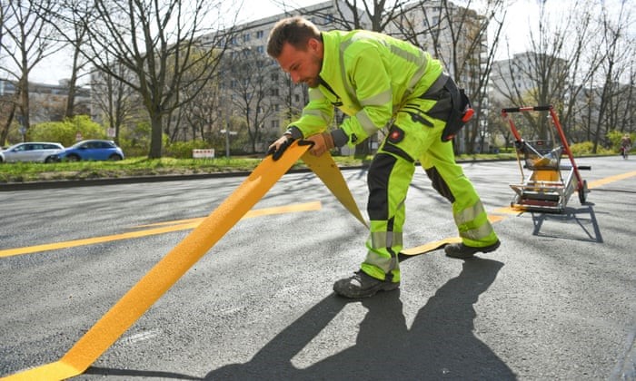
Temporary cycle lanes were installed across Berlin to make it easier for cyclists to complete essential journeys.
In Paris, ‘Corona Cycleways’ link up the city for active travel in order to help facilitate safer travel while also safeguarding against severe congestion as people become more wary use public transport.
Aukland, meanwhile, has removed parking spaces in order to extend the footways of busy streets, utilising basic materials such as planter boxes and colourful paint.
Regardless of geographical location and the measures being adopted, however, once thing is clear – people everywhere are reevaluating how we use shared spaces and the ways we move within them.
How can we learn from this?
In this knowledge sharing session, Infrastructure Officers for Sustrans Sam Valentine, Daniel Jeffs and Poppea Daniel discuss the transformative temporary infrastructure changes taking place outside of Scotland in a bid to inspire Scottish local authorities implementing their own.
Across the various case studies presented, three types of temporary measures are discussed:
Pavement widening
Temporary Cycle lanes
Open Streets
To learn more about what is happening elsewhere in the world to promote safe walking and cycling during the Covid-19 pandemic, click here.
Note: the examples shown are in no way prescriptive and are for information only. Where specific products are shown in this document, this does not constitute Sustrans’ endorsement of that product.This webinar was recorded early June, and was up to date at the time of recording.
How public spaces will operate as lockdown restrictions are eased is key. Here, we look at how we can make the most of public spaces to safeguard community health going forward.
Thinking for the Future
As lockdown restrictions are further eased throughout Scotland, we can begin to look beyond the simple but nonetheless effective space reallocation measures that have already been implemented by local authorities, and instead consider how we can re-imagine the design of our public spaces so as to be more conducive with public health.
In this knowledge sharing session, Infrastructure Officer for Sustrans Dan Jeffs provides a comprehensive oversight of how reallocated spaces in towns and cities can be re-imagined through simple, affordable and inspiring measures.
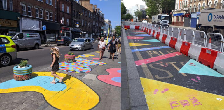
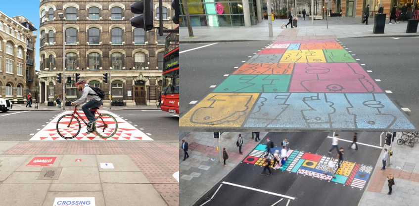
Practical design installations can be not only visually appealing but also serve as positive reinforcements of where space is prioritised in the street. Essex, London (Avenue of Art Initiative)
The Case for Change
In all likelihood, there will be an extended period of time within which physical distancing guidelines are prescribed by UK government. This, however, needs to be compatible with people’s legitimate needs to move around in order for society to function.
Ensuring people are able to safely access their places of work, receive essential healthcare, exercise in parks, shop for groceries, and get their children to school are all crucial components of how we design temporary infrastructure and utilise space going forward.
In addition to this, and in a broader more holistic sense, how we move around our local areas has a big impact on our wellbeing. Walking, cycling or wheeling in fresh air is not only positive for physical health, but also helps people feel connected in times of increased isolation.
As such, adapting infrastructure to be more visually appealing and meaningful to communities is also an invaluable untaking.
“Streets need to be adapted to play a broader role in people’s general wellbeing, by offering a social, cultural and community experience”
Dan Jeffs, Infrastructure Officer, Sustrans
Art and infrastructure design can complement one another in a multitude of ways in order to effect positive behaviour change in our streets. London (Better Bankside)
How this can help
Making spaces function better – to assist physical distancing
Helping to moderate driver – safeguarding cyclists and pedestrian using reallocated carriageway space
Creating multi-sensory environments – to support people’s well-being by creating pleasant and attractive spaces for people to socialise and feel connected
Designs for everyone – to appeal to a broader range of user groups, defined by age, ability and purpose
Encouraging people to be/stay active – whether through walking, cycling, wheeling or playing
Building cultural/community connections – to communicate a shared sense of place and community
Giving people a greater sense of ownership – likely to reduce upkeep and maintenance
Set out an exciting vision – to be inspired and inspire others
Gauging public response – to assess the climate for broader range of permanent interventions
Re-invigorating high streets and commercial areas – to safely allow people to shop, rest and socialise within these spaces
Note: the examples shown are in no way prescriptive and are for information only. Where specific products are shown in this document, this does not constitute Sustrans’ endorsement of that product.