Burrard Inlet Environmental Indicators Report - the BIEAP and ...
Burrard Inlet Environmental Indicators Report - the BIEAP and ...
Burrard Inlet Environmental Indicators Report - the BIEAP and ...

Create successful ePaper yourself
Turn your PDF publications into a flip-book with our unique Google optimized e-Paper software.
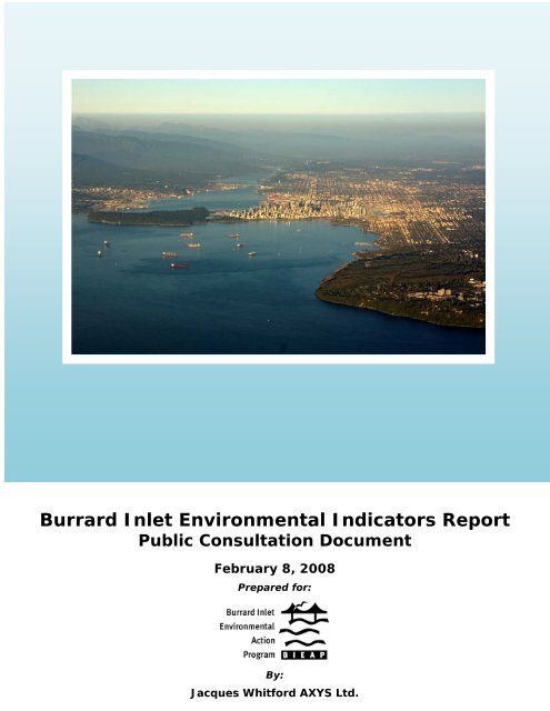
<strong>Burrard</strong> <strong>Inlet</strong> <strong>Environmental</strong> <strong>Indicators</strong> <strong>Report</strong><br />
Public Consultation Document<br />
February 8, 2008<br />
Prepared for:<br />
By:<br />
Jacques Whitford AXYS Ltd.
Public Input<br />
Public input is important to <strong>the</strong> <strong>BIEAP</strong> <strong>and</strong> its partner agencies. For fur<strong>the</strong>r information about<br />
public consultation opportunities surrounding this document, or to order any of our<br />
publications, please contact us at:<br />
<strong>Burrard</strong> <strong>Inlet</strong> <strong>Environmental</strong> Action Program (<strong>BIEAP</strong>)<br />
501-5945 Kathleen Avenue,<br />
Burnaby, BC<br />
V5H 4J7<br />
Tel: 604-775-5756<br />
Fax: 604-775-5198<br />
e-mail: mail@bieapfremp.org<br />
Visit our website at www.bieapfremp.org<br />
“A thriving port <strong>and</strong> urban community co-existing within a healthy environment”<br />
<strong>BIEAP</strong>’s overall vision for <strong>Burrard</strong> <strong>Inlet</strong><br />
Citation: Jacques Whitford AXYS Ltd. 2008. <strong>Burrard</strong> <strong>Inlet</strong> <strong>Environmental</strong> <strong>Indicators</strong><br />
<strong>Report</strong>: Public Consultation Document. <strong>Report</strong> prepared for <strong>Burrard</strong> <strong>Inlet</strong><br />
<strong>Environmental</strong> Action Program, Burnaby BC by Jacques Whitford AXYS Ltd.<br />
Burnaby BC. February 2008. 47 pp.
<strong>Burrard</strong> <strong>Inlet</strong> <strong>Environmental</strong> <strong>Indicators</strong> <strong>Report</strong> February 2008<br />
Acknowledgements<br />
The Plan Implementation Committee of <strong>BIEAP</strong> has guided development of <strong>the</strong> environmental<br />
indicators approach over several years. Core members of <strong>the</strong> Committee are:<br />
Ken Ashley, Metro Vancouver<br />
Juergen Baumann, Vancouver Port Authority<br />
Ken Bennett, District of North Vancouver<br />
Darrell Desjardin (chair), Vancouver Port Authority<br />
Robyn McLean, Environment Canada<br />
Brent Moore, BC Ministry of Environment<br />
Brian Naito, Fisheries <strong>and</strong> Oceans Canada<br />
<strong>BIEAP</strong> program staff include:<br />
Michelle Gaudry<br />
Daria Hasselmann<br />
Anna Ma<strong>the</strong>wson<br />
Many people <strong>and</strong> agencies assisted <strong>the</strong> Committee by providing data, reviewing reports,<br />
providing guidance on indicator development, <strong>and</strong> in several cases developing <strong>the</strong> indicators.<br />
These include <strong>the</strong> following:<br />
BC Ministry of Environment<br />
Chris Dalley<br />
Liz Freyman<br />
Diane Su<strong>the</strong>rl<strong>and</strong><br />
Les Swain<br />
Cindy Walsh<br />
Bird Studies Canada<br />
Peter Davidson<br />
Caslys Consulting Ltd.<br />
Ann Blyth<br />
City of Port Moody<br />
Julie Pavey<br />
City of Vancouver<br />
Don Brynildson<br />
Andrew Ling<br />
David Desrochers<br />
Environment Canada<br />
Greg Ambrozic<br />
Wendy Avis<br />
Rob Butler<br />
John Elliott<br />
Andrew Green<br />
Deanna Lee<br />
Gevan Mattu<br />
John Pasternak<br />
Bill Taylor<br />
Cecilia Wong<br />
Metro Vancouver<br />
Nimet Alibhai<br />
Jim Armstrong<br />
Stan Bertold<br />
Dianna Colnett<br />
Terry Hoff<br />
Derek Jennejohn<br />
Andrew Marr<br />
Roger Quan<br />
Ken Reid<br />
Shelina Sidi<br />
John Swalby<br />
Albert van Roodselaar<br />
Post Consumer Pharmaceutical<br />
Stewardship Association<br />
Ginette Vanasse<br />
UBC Co-op Program<br />
Hea<strong>the</strong>r Brekke<br />
Vancouver Port Authority<br />
Christine Rigby<br />
Westcam Consulting Services<br />
Mike Preston<br />
Yarnell & Associates<br />
Patrick Yarnell<br />
ESSA Technologies Ltd. evaluated potential environmental indicators <strong>and</strong> prepared <strong>the</strong><br />
baseline datasets for <strong>the</strong> Plan Implementation Committee.<br />
Jacques Whitford AXYS Ltd. prepared this consultation document.<br />
Page | i
<strong>Burrard</strong> <strong>Inlet</strong> <strong>Environmental</strong> <strong>Indicators</strong> <strong>Report</strong> February 2008<br />
This page left blank intentionally
<strong>Burrard</strong> <strong>Inlet</strong> <strong>Environmental</strong> <strong>Indicators</strong> <strong>Report</strong> February 2008<br />
Table of Contents<br />
ACKNOWLEDGEMENTS .......................................................................................................... i<br />
EXECUTIVE SUMMARY ........................................................................................................... 1<br />
PART 1 – SETTING THE CONTEXT ........................................................................................ 3<br />
PART 2 – LINKS BETWEEN HUMAN ACTIVITIES AND BURRARD INLET STATUS........... 8<br />
PART 3 – THE INDICATORS.................................................................................................. 11<br />
1. Tree Canopy Cover ....................................................................................... 12<br />
2. Parks <strong>and</strong> Protected Areas.............................................................................. 1<br />
3. Waterbird Abundance.................................................................................... 20<br />
4. Air Quality...................................................................................................... 23<br />
5. Greenhouse Gas Emissions.......................................................................... 23<br />
6. Water <strong>and</strong> Sediment Quality.......................................................................... 23<br />
7. Recreational Water Quality, Fecal Coliforms................................................. 23<br />
PART 4 – REFERENCES........................................................................................................ 40<br />
PART 5 – GLOSSARY ............................................................................................................ 43<br />
List of Tables<br />
Table 1: Key Findings <strong>and</strong> Trends for <strong>Burrard</strong> <strong>Inlet</strong> <strong>Environmental</strong> <strong>Indicators</strong>.................... 2<br />
Table 2: <strong>BIEAP</strong> Partners <strong>and</strong> Communities Bordering <strong>Burrard</strong> <strong>Inlet</strong>................................... 3<br />
Table 3: <strong>Burrard</strong> <strong>Inlet</strong> <strong>Environmental</strong> <strong>Indicators</strong> .................................................................. 7<br />
Table 2-1: Management Area Classes ................................................................................. 18<br />
Table 2-2: Amount of Protected <strong>and</strong> Park L<strong>and</strong> in <strong>Burrard</strong> <strong>Inlet</strong> Watershed<br />
(total area <strong>and</strong> % of l<strong>and</strong> in each management class) ........................................ 18<br />
Table 2-3: Proportion of L<strong>and</strong> in Management Classes for Each <strong>Burrard</strong><br />
<strong>Inlet</strong> Catchment ................................................................................................... 19<br />
Table 5-1: Common Sources <strong>and</strong> Contributors of GHGs ..................................................... 28<br />
Table 7-1: <strong>Burrard</strong> <strong>Inlet</strong> Beach Locations ............................................................................. 36<br />
List of Maps<br />
Map 1: Basins <strong>and</strong> Catchments of <strong>the</strong> <strong>Burrard</strong> <strong>Inlet</strong> Watershed ....................................... 4<br />
Map 2: Ortho-Image of <strong>the</strong> <strong>Burrard</strong> <strong>Inlet</strong> Watershed ......................................................... 5<br />
Map 3: Developable vs. Undeveloped Areas for <strong>the</strong> <strong>Burrard</strong> <strong>Inlet</strong> Catchments .............. 13<br />
Map 4: Location of Management Area Classes <strong>and</strong> RCAs in <strong>the</strong> <strong>Burrard</strong> <strong>Inlet</strong>............... 17<br />
Page | ii
<strong>Burrard</strong> <strong>Inlet</strong> <strong>Environmental</strong> <strong>Indicators</strong> <strong>Report</strong> February 2008<br />
List of Charts<br />
Chart 1-1: Current L<strong>and</strong> Cover across <strong>the</strong> Entire <strong>Burrard</strong> <strong>Inlet</strong> Watershed ..........................14<br />
Chart 1-2: Current L<strong>and</strong> Cover in Developable Areas of <strong>Burrard</strong> <strong>Inlet</strong>..................................14<br />
Chart 3-1: Waterbird Abundance in <strong>Burrard</strong> <strong>Inlet</strong> Since 1975...............................................21<br />
Chart 4-1: Smog Forming Pollutants in <strong>the</strong> Canadian Portion of <strong>the</strong> Lower Fraser<br />
Valley, 2005 .........................................................................................................25<br />
Chart 4-2: Total Smog Forming Pollutants (SFPs) in <strong>the</strong> Lower Fraser Valley<br />
(Canadian <strong>and</strong> United States Sources) ...............................................................25<br />
Chart 5-1: Total Annual Emissions of GHGs Within <strong>the</strong> <strong>Burrard</strong> <strong>Inlet</strong> Airshed<br />
(marine <strong>and</strong> l<strong>and</strong> sources, including vehicles) .....................................................29<br />
Chart 6-1: Copper Concentrations in <strong>Burrard</strong> <strong>Inlet</strong> Sediment (1985 to 2005).......................32<br />
Chart 6-2: PCB Concentration in <strong>Burrard</strong> <strong>Inlet</strong> Sediment (1985 to 2004) .............................33<br />
Chart 7-1: Number of Days <strong>Burrard</strong> <strong>Inlet</strong> Beaches were Closed for Swimming<br />
(2002 to 2006)......................................................................................................37<br />
Chart 7-2: Fecal Coliform Data for Deep Cove (2002 to 2006).............................................37<br />
Chart 7-3: Fecal Coliform Data for Old Orchard Park (2002 to 2006)...................................38<br />
Chart 7-4: Fecal Coliform Data for Sunset Beach (2002 to 2006) ........................................38<br />
List of Figures<br />
Figure 1: Examples of Contaminant Pathways in <strong>the</strong> <strong>Burrard</strong> <strong>Inlet</strong> <strong>and</strong> Strait of<br />
Georgia Ecosystems............................................................................................10<br />
Figure 5-1: Past <strong>and</strong> Future CO2 Levels in <strong>the</strong> Atmosphere ..................................................27<br />
Page | iii
<strong>Burrard</strong> <strong>Inlet</strong> <strong>Environmental</strong> <strong>Indicators</strong> <strong>Report</strong> February 2008<br />
Executive Summary<br />
The <strong>Burrard</strong> <strong>Inlet</strong> <strong>Environmental</strong> Action Program (<strong>BIEAP</strong>) is an inter-governmental partnership<br />
that coordinates environmental management of <strong>Burrard</strong> <strong>Inlet</strong>. In 2002, <strong>BIEAP</strong> prepared a<br />
Consolidated <strong>Environmental</strong> Management Plan (CEMP) to facilitate continued sustainability of<br />
<strong>the</strong> <strong>Inlet</strong>. Effectiveness of <strong>the</strong> CEMP can be assessed by following trends in indicators over<br />
time. These indicators will suggest whe<strong>the</strong>r current environmental management practices are<br />
successful in protecting <strong>Burrard</strong> <strong>Inlet</strong> or whe<strong>the</strong>r <strong>the</strong>y should be refined.<br />
This consultation document was prepared to provide current information about certain<br />
environmental indicators <strong>and</strong> to help guide planning for future development in <strong>the</strong> <strong>Burrard</strong> <strong>Inlet</strong><br />
watershed. The report also describes ways in which <strong>the</strong> environment is being or can be<br />
protected by regulatory agencies, o<strong>the</strong>r decision-makers <strong>and</strong> <strong>the</strong> public.<br />
Seven environmental indicators have been selected from a list of potential c<strong>and</strong>idates<br />
suggested by <strong>the</strong> many monitoring programs conducted over <strong>the</strong> past two decades. These<br />
were chosen because <strong>the</strong>ir existing data sets <strong>and</strong> on-going monitoring programs are<br />
sufficiently robust to reliably reflect <strong>the</strong> effects of human activities on <strong>Burrard</strong> <strong>Inlet</strong> air <strong>and</strong><br />
water quality 1 , <strong>and</strong> to demonstrate <strong>the</strong> consequences of l<strong>and</strong> development on ecosystem<br />
health. The selected indicators are tree canopy cover, parks <strong>and</strong> protected areas, waterbird<br />
abundance, air quality, greenhouse gas emissions, water <strong>and</strong> sediment quality (albeit only as<br />
reflected in copper <strong>and</strong> PCB levels), <strong>and</strong> recreational use <strong>and</strong> fecal coliform bacteria. For each<br />
indicator, four key questions are discussed in this document:<br />
• What actions can governments, agencies, industries <strong>and</strong> <strong>the</strong> public take to maintain or<br />
improve <strong>the</strong> condition of this indicator? Why look at this indicator?<br />
• How are data ga<strong>the</strong>red <strong>and</strong> benchmarks established to evaluate <strong>the</strong> indicator?<br />
• What are <strong>the</strong> results <strong>and</strong> trends?<br />
• What actions can governments, agencies, industries <strong>and</strong> <strong>the</strong> public take to maintain or<br />
improve <strong>the</strong> condition of this indicator?<br />
Table 1 provides a summary of <strong>the</strong> key findings <strong>and</strong> trends. Collectively, <strong>the</strong> indicators<br />
describe an ecosystem in fairly good condition, with improved sediment <strong>and</strong> air quality.<br />
However, <strong>the</strong>re continue to be challenges associated with human activities:<br />
• Tree canopy cover needed to provide a wide range of economic <strong>and</strong> ecosystem<br />
benefits is under continuous pressure from development<br />
• The occasional accidental release of contaminants <strong>and</strong> <strong>the</strong> ongoing release of<br />
contaminants from storm water are still of concern<br />
• Contaminant concentrations in killer whales <strong>and</strong> o<strong>the</strong>r animals remain a serious issue<br />
in <strong>the</strong> Strait of Georgia because of persistence of some old compounds <strong>and</strong> <strong>the</strong><br />
emergence of new compounds <strong>and</strong> sources<br />
• Greenhouse gas emissions continue to increase with a growing population.<br />
The indicator data used in this report provide a baseline for comparison over time. They will<br />
help show whe<strong>the</strong>r <strong>the</strong> environmental management practices described in <strong>the</strong> CEMP are<br />
fulfilling <strong>BIEAP</strong>’s m<strong>and</strong>ate <strong>and</strong> goals to protect <strong>the</strong> ecological functioning of <strong>Burrard</strong> <strong>Inlet</strong> while<br />
encouraging sustainable development, or whe<strong>the</strong>r adjustments to <strong>the</strong> Plan are needed.<br />
1<br />
However, <strong>the</strong>ir scope of coverage of environmental issues is at present not sufficient for a “State of <strong>the</strong><br />
Environment” report.<br />
Page | 1
<strong>Burrard</strong> <strong>Inlet</strong> <strong>Environmental</strong> <strong>Indicators</strong> <strong>Report</strong> February 2008<br />
<strong>BIEAP</strong> remains committed to translating information into action. As our underst<strong>and</strong>ing of <strong>the</strong><br />
connections between a healthy environment, society <strong>and</strong> economy deepens, we learn about<br />
<strong>the</strong> many actions that individuals, communities, businesses <strong>and</strong> corporations can take to<br />
maintain <strong>the</strong> health of <strong>Burrard</strong> <strong>Inlet</strong>.<br />
Table 1: Key Findings <strong>and</strong> Trends for <strong>Burrard</strong> <strong>Inlet</strong> <strong>Environmental</strong> <strong>Indicators</strong><br />
Indicator Current Status<br />
1. Tree Canopy<br />
Cover<br />
2. Parks <strong>and</strong><br />
Protected<br />
Areas<br />
3. Waterbird<br />
Abundance<br />
The urban tree canopy provides economically valuable environmental services such as<br />
improving air quality, purifying water <strong>and</strong> helping manage stormwater. It is assessed for<br />
developable <strong>and</strong> undeveloped areas of <strong>the</strong> watershed 2 based on 2002 satellite imagery. Tree<br />
canopy cover is 42% in <strong>the</strong> developable areas (ranging from 26% in <strong>the</strong> English Bay <strong>and</strong> Inner<br />
Harbour catchments to 84% in <strong>the</strong> Indian Arm catchment) <strong>and</strong> 96% in <strong>the</strong> higher elevation<br />
undeveloped areas. The 42% value for tree cover in <strong>the</strong> developable area is high compared to<br />
many cities in Canada <strong>and</strong> <strong>the</strong> United States (25% to 40%), indicating that communities in <strong>the</strong><br />
<strong>Inlet</strong> currently do a better than average job at protecting <strong>the</strong>ir urban forests. However, <strong>the</strong> 26%<br />
cover in some areas indicates <strong>the</strong> need to continue to protect urban forests through planning.<br />
In developable areas 2 , 59% of <strong>the</strong> l<strong>and</strong> is urban <strong>and</strong> suburban <strong>and</strong> 41% has some form<br />
of protection (wildlife reserve, regional or municipal park, green belt, golf course).<br />
Considering <strong>the</strong> entire watershed, 19% is urban <strong>and</strong> suburban l<strong>and</strong> <strong>and</strong> 81% has some<br />
type of protection. These percentages are unlikely to change over time, as <strong>the</strong> l<strong>and</strong> uses<br />
are designated, but habitat quality may decrease recreational uses increases.<br />
Populations of four species of resident waterbirds (Double-crested Cormorant, Pelagic<br />
Cormorant, Black Oystercatcher) have been stable or increased since <strong>the</strong> mid 1990s.<br />
Glaucous-winged Gull populations have declined since 1975. Gulls are very sensitive to<br />
predation by <strong>the</strong> Bald Eagle, <strong>and</strong> <strong>the</strong>ir decreased abundance may reflect movement out<br />
of <strong>the</strong> <strong>Inlet</strong> as <strong>the</strong>y adapt to <strong>the</strong> increasing danger posed by eagles. Results for waterbird<br />
populations indicate stable <strong>and</strong> favourable environmental conditions in <strong>the</strong> <strong>Inlet</strong> to date.<br />
4. Air Quality Air quality in <strong>the</strong> <strong>Burrard</strong> <strong>Inlet</strong> airshed is currently acceptable most of <strong>the</strong> time, <strong>and</strong> has<br />
improved notably over <strong>the</strong> past 20 years. Levels of “Criteria Air Contaminants” generally<br />
are below Metro Vancouver management targets. Carbon monoxide, nitrogen dioxide<br />
<strong>and</strong> sulphur dioxide levels have declined since <strong>the</strong> 1980s. Particulate matter (PM10) <strong>and</strong><br />
ozone levels have been more stable. There are not enough data yet for PM2.5 to establish<br />
a time trend. Emissions of smog-forming pollutants have declined steadily since 1985.<br />
5. Greenhouse<br />
Gas<br />
Emissions<br />
6. Water <strong>and</strong><br />
Sediment<br />
Quality<br />
(copper <strong>and</strong><br />
PCB levels)<br />
7. Recreational<br />
Use <strong>and</strong><br />
Fecal<br />
Coliform<br />
Bacteria<br />
Greenhouse gas emissions (carbon dioxide, methane, nitrous oxide) have increased steadily<br />
since 1990 <strong>and</strong> are projected to increase along with population growth. The rate of increase has<br />
slowed since 1990 (from 19% increase between 1990 <strong>and</strong> 1995 to 7% increase between 2000<br />
<strong>and</strong> 2005). Emissions are projected to increase by 4% per five-year period to 2025.<br />
Copper levels in water are variable; although 20% of samples collected since 1985<br />
exceeded <strong>the</strong> provincial water quality guideline for copper, no trend over time is<br />
apparent. Copper levels in sediment have declined since 1985, although two locations<br />
(Outer Harbour North, Inner Harbour) still exceeded <strong>Burrard</strong> <strong>Inlet</strong> sediment quality<br />
guidelines in 2005. In <strong>the</strong> 1980s, PCB levels in sediment were well above <strong>Burrard</strong> <strong>Inlet</strong><br />
guidelines at most sites; however, levels have decreased markedly at most sites. Four of<br />
six samples collected in 2004 were below objectives but two sites (False Creek <strong>and</strong> Inner<br />
Harbour) remained above objectives. The trend of improved levels of copper <strong>and</strong> PCB in<br />
sediment over time is related to reduced discharges of <strong>the</strong>se contaminants.<br />
Water quality at 15 of <strong>the</strong> 19 <strong>Burrard</strong> <strong>Inlet</strong> beaches is excellent for swimming, with no closures<br />
for elevated coliform levels over <strong>the</strong> past five years. Four beaches (Deep Cove <strong>and</strong> Cates Park<br />
in North Vancouver, Barnet Marine Park <strong>and</strong> Old Orchard Park in Port Moody) had periodic<br />
closures in 2002, 2005 <strong>and</strong> 2006, in part related to <strong>the</strong> lower amount of tidal flushing in <strong>the</strong>se<br />
areas. Fecal coliforms are present at o<strong>the</strong>r beaches but not at, levels high enough to trigger<br />
beach closures. Shellfish harvesting has been prohibited in <strong>Burrard</strong> <strong>Inlet</strong> since <strong>the</strong> 1970’s.<br />
There have been no closures for secondary contact recreation (boating, kayaking, windsurfing).<br />
2<br />
The boundary for developable vs. undeveloped l<strong>and</strong> is set at 320 m elevation to <strong>the</strong> west of Lynn Creek (in<br />
North Vancouver) <strong>and</strong> 200 m to <strong>the</strong> east.<br />
Page | 2
<strong>Burrard</strong> <strong>Inlet</strong> <strong>Environmental</strong> <strong>Indicators</strong> <strong>Report</strong> February 2008<br />
PART 1 – Setting <strong>the</strong> Context<br />
Overview of <strong>BIEAP</strong> <strong>and</strong> <strong>the</strong> Region<br />
The <strong>Burrard</strong> <strong>Inlet</strong> <strong>Environmental</strong> Action<br />
Program (<strong>BIEAP</strong>) was established in<br />
1991 to provide a management<br />
framework to protect <strong>and</strong> improve <strong>the</strong><br />
environmental quality of <strong>Burrard</strong> <strong>Inlet</strong>’s<br />
ecosystem. <strong>BIEAP</strong> brings toge<strong>the</strong>r <strong>the</strong><br />
agencies responsible for setting <strong>and</strong><br />
enforcing environmental legislation <strong>and</strong><br />
policy with those responsible for l<strong>and</strong> <strong>and</strong><br />
water management to coordinate<br />
planning <strong>and</strong> operational decision-making<br />
False Creek <strong>and</strong> surrounding area<br />
to ensure a sustainable future for <strong>Burrard</strong> <strong>Inlet</strong>. <strong>BIEAP</strong> provides environmental assessments of<br />
development projects within <strong>Burrard</strong> <strong>Inlet</strong>, with partners using a consensus-based approach to<br />
finding ‘made in <strong>the</strong> <strong>Inlet</strong>’ environmental management solutions. Partners <strong>and</strong> communities<br />
bordering <strong>the</strong> <strong>Inlet</strong> are listed in Table 2.<br />
Table 2: <strong>BIEAP</strong> Partners <strong>and</strong> Communities Bordering <strong>Burrard</strong> <strong>Inlet</strong><br />
The <strong>BIEAP</strong> Partners Communities Bordering <strong>Burrard</strong> <strong>Inlet</strong><br />
BC Ministry of Environment<br />
Environment Canada<br />
Fisheries <strong>and</strong> Oceans Canada<br />
Transport Canada<br />
Metro Vancouver<br />
Vancouver Port Authority<br />
Village of Anmore<br />
Village of Belcarra<br />
City of Burnaby<br />
City of North Vancouver<br />
District of North Vancouver<br />
City of Port Moody<br />
City of Vancouver<br />
District of West Vancouver<br />
Geographically, <strong>BIEAP</strong> jurisdiction includes <strong>the</strong> marine foreshore <strong>and</strong> tidal waters east of a line<br />
between Point Atkinson <strong>and</strong> Point Grey, including False Creek, Port Moody Arm <strong>and</strong> Indian<br />
Arm. It also includes upl<strong>and</strong> areas that drain into <strong>the</strong> <strong>Inlet</strong> because activities on <strong>the</strong> l<strong>and</strong><br />
influence conditions in <strong>the</strong> water. All or portions of eight municipalities bordering <strong>the</strong> <strong>Inlet</strong> form<br />
<strong>the</strong> <strong>Burrard</strong> <strong>Inlet</strong> watershed. Map 1 shows <strong>the</strong> basins (water areas) <strong>and</strong> catchments (l<strong>and</strong><br />
areas) of <strong>the</strong> <strong>Burrard</strong> <strong>Inlet</strong> watershed:<br />
• six basins – Outer Harbour, Inner Harbour, Central Harbour, False Creek, Port Moody<br />
Arm <strong>and</strong> Indian Arm <strong>and</strong><br />
• four catchments – English Bay, Inner Harbour, Indian Arm <strong>and</strong> Port Moody Arm.<br />
<strong>Burrard</strong> <strong>Inlet</strong><br />
<strong>Burrard</strong> <strong>Inlet</strong> is in <strong>the</strong> traditional territories of many Coast Salish peoples, including <strong>the</strong> Tsleil-<br />
Waututh, Squamish <strong>and</strong> Musqueam First Nations. Over <strong>the</strong> last 150 years, <strong>the</strong> inlet has seen<br />
much change. With European settlement, it became <strong>the</strong> active port of a burgeoning west coast<br />
timber industry <strong>and</strong> <strong>the</strong> industrial centre of <strong>the</strong> province. In recent years, <strong>the</strong> <strong>Inlet</strong> has become<br />
<strong>the</strong> centre of a highly urbanized city-region <strong>and</strong> <strong>the</strong> Port of Vancouver now serves <strong>the</strong><br />
increasing needs of international trade.<br />
Page | 3
<strong>Burrard</strong> <strong>Inlet</strong> <strong>Environmental</strong> <strong>Indicators</strong> <strong>Report</strong> February 2008<br />
Map 1: Basins <strong>and</strong> Catchments of <strong>the</strong> <strong>Burrard</strong> <strong>Inlet</strong> Watershed<br />
Adapted from <strong>BIEAP</strong><br />
The mountains of <strong>the</strong> North Shore <strong>and</strong> <strong>the</strong> waters of <strong>Burrard</strong> <strong>Inlet</strong> give Vancouver its<br />
reputation as one of <strong>the</strong> most scenic cities in <strong>the</strong> world. Over 650,000 people live in <strong>the</strong><br />
watershed <strong>and</strong> <strong>the</strong>y, along with visitors <strong>and</strong> <strong>the</strong> remaining 1.4 million lower mainl<strong>and</strong> residents,<br />
enjoy <strong>the</strong> many recreational opportunities <strong>the</strong> <strong>Inlet</strong> provides. Characterized by a temperate<br />
marine climate, <strong>the</strong> <strong>Burrard</strong> <strong>Inlet</strong> ecosystem includes rugged mountain peaks, magnificent old<br />
growth forests <strong>and</strong> fjords rich with terrestrial <strong>and</strong> aquatic life. Its forested slopes provide habitat<br />
for deer, bears, cougars <strong>and</strong> many small animals <strong>and</strong> birds <strong>and</strong> its shorelines, intertidal areas,<br />
mudflats <strong>and</strong> salt marshes support many species of marine organisms. The Pacific Flyway<br />
transects <strong>the</strong> inlet, attracting tens of thous<strong>and</strong>s of migratory birds each year. An aerial view<br />
(Map 2) shows <strong>the</strong> variety of natural <strong>and</strong> developed l<strong>and</strong>scapes of <strong>the</strong> watershed.<br />
Page | 4
<strong>Burrard</strong> <strong>Inlet</strong> <strong>Environmental</strong> <strong>Indicators</strong> <strong>Report</strong> February 2008<br />
Map 2: Ortho-Image of <strong>the</strong> <strong>Burrard</strong> <strong>Inlet</strong> Watershed<br />
Source: Metro Vancouver<br />
Page | 5
<strong>Burrard</strong> <strong>Inlet</strong> <strong>Environmental</strong> <strong>Indicators</strong> <strong>Report</strong> February 2008<br />
Consolidated <strong>Environmental</strong> Management Plan<br />
<strong>Environmental</strong> management of such a rich area requires balancing many priorities of <strong>the</strong><br />
human population while ensuring clean air, water <strong>and</strong> habitat for both humans <strong>and</strong> wildlife. In<br />
addition to <strong>the</strong> effects of current <strong>and</strong> future l<strong>and</strong> use, legacies from historic activities have left<br />
<strong>the</strong>ir imprint. These include accumulations of contaminants such as heavy metals or organic<br />
compounds (e.g., petroleum products, poly-chlorinated biphenyls [PCBs]), loss of stream <strong>and</strong><br />
shoreline habitat, <strong>and</strong> closure of shellfish harvesting due to fecal coliform levels.<br />
<strong>BIEAP</strong>’s Consolidated <strong>Environmental</strong> Management Plan (CEMP) was approved in 2002 <strong>and</strong><br />
provides a framework for improving <strong>the</strong> environmental quality of <strong>Burrard</strong> <strong>Inlet</strong>. The four main<br />
goals of <strong>the</strong> CEMP are to:<br />
• Improve water quality in <strong>Burrard</strong> <strong>Inlet</strong><br />
• Minimize <strong>the</strong> effects of contaminated soils <strong>and</strong> sediments on human <strong>and</strong> ecological<br />
health<br />
• Maintain <strong>and</strong> enhance productive fish <strong>and</strong> wildlife habitat <strong>and</strong> <strong>the</strong> natural biodiversity of<br />
<strong>Burrard</strong> <strong>Inlet</strong><br />
• Encourage human <strong>and</strong> economic development activities that enhance <strong>the</strong><br />
environmental quality of <strong>Burrard</strong> <strong>Inlet</strong><br />
The Plan consolidates all <strong>the</strong> environmental<br />
management systems employed by <strong>the</strong> <strong>BIEAP</strong><br />
partners to protect <strong>Burrard</strong> <strong>Inlet</strong>. The CEMP will<br />
help ensure that environmental values are<br />
integrated with economic <strong>and</strong> social considerations<br />
for <strong>the</strong> <strong>Inlet</strong>. It establishes a common basis for<br />
reviewing development proposals <strong>and</strong> recommends<br />
facilitation, research <strong>and</strong> information sharing to<br />
improve <strong>and</strong> enhance <strong>the</strong> <strong>Inlet</strong>’s ecosystem over<br />
time. A Plan Implementation Committee was<br />
established in 2003 to help implement <strong>the</strong> CEMP<br />
<strong>and</strong> monitor its performance.<br />
State of <strong>the</strong> <strong>Burrard</strong> <strong>Inlet</strong> Environment<br />
One of <strong>the</strong> key commitments of <strong>the</strong> CEMP is to<br />
prepare a State of Environment report for <strong>Burrard</strong><br />
<strong>Inlet</strong>. In 2004, <strong>BIEAP</strong> began researching potential<br />
indicators that could be used to describe <strong>the</strong> status <strong>and</strong> trends in <strong>the</strong> <strong>Inlet</strong> to policy makers,<br />
planners <strong>and</strong> <strong>the</strong> general public. Many datasets <strong>and</strong> 19 distinct indicators were evaluated for<br />
<strong>the</strong>ir ability to ‘tell <strong>the</strong> story’ of <strong>Burrard</strong> <strong>Inlet</strong> accurately (reliable dataset, ability to provide<br />
science-based statements on <strong>the</strong> state of <strong>the</strong> <strong>Inlet</strong>) <strong>and</strong> help <strong>the</strong> public underst<strong>and</strong> <strong>the</strong><br />
interconnected nature of <strong>the</strong> ecosystem. Although <strong>the</strong>re are a lot of data, <strong>the</strong>y did not always<br />
allow for conclusive, science-based statements to be made. <strong>BIEAP</strong> settled on seven key<br />
indicators that, taken toge<strong>the</strong>r, help describe <strong>the</strong> complex relationship between human actions<br />
<strong>and</strong> environmental conditions in <strong>Burrard</strong> <strong>Inlet</strong>. These indicators will be monitored over time to<br />
assess performance of <strong>the</strong> CEMP <strong>and</strong> contribute information to a State of Environment report.<br />
Page | 6
<strong>Burrard</strong> <strong>Inlet</strong> <strong>Environmental</strong> <strong>Indicators</strong> <strong>Report</strong> February 2008<br />
<strong>Indicators</strong> Used to Monitor <strong>the</strong> CEMP<br />
The CEMP uses a risk management approach; it has identified priority ecosystem risks <strong>and</strong><br />
issues <strong>and</strong> selected indicators to monitor <strong>the</strong> risks. Table 3 lists <strong>the</strong> indicators used, which fall<br />
into two types:<br />
• those that quantify ecosystem assets, such as <strong>the</strong> water’s ability to supply nutrients to<br />
fish <strong>and</strong> birds, <strong>and</strong> <strong>the</strong> tree canopy’s ability to purify air<br />
• those that assess <strong>the</strong> impacts of human activities on air <strong>and</strong> water.<br />
Table 3: <strong>Burrard</strong> <strong>Inlet</strong> <strong>Environmental</strong> <strong>Indicators</strong><br />
Indicator<br />
Type<br />
Quantifies<br />
ecosystem<br />
assets<br />
Describes<br />
impacts of<br />
human<br />
activities<br />
Indicator Relevance<br />
1. Tree Canopy Cover A measure of current levels of l<strong>and</strong> development;<br />
recognizes <strong>the</strong> importance of forested l<strong>and</strong> in purifying water<br />
<strong>and</strong> air, storing carbon <strong>and</strong> managing stormwater runoff<br />
2. Parks <strong>and</strong> Protected<br />
Areas<br />
A measure of <strong>the</strong> amount of l<strong>and</strong> protected for wildlife<br />
habitat <strong>and</strong> for recreational use<br />
3. Waterbird Abundance An indicator of general ecosystem condition, as bird<br />
abundance depends on amounts of available habitat <strong>and</strong><br />
food, <strong>and</strong> is affected by levels of contaminants in <strong>the</strong> area<br />
4. Air Quality Related to vehicle, vessel, residential <strong>and</strong> industrial<br />
emissions; has socio-economic implications (human health,<br />
smog) <strong>and</strong> environmental implications (acid rain)<br />
5. Greenhouse Gas<br />
Emissions<br />
6. Water <strong>and</strong> Sediment<br />
Quality (copper <strong>and</strong><br />
PCB levels)<br />
7. Recreational Use <strong>and</strong><br />
Fecal Coliform Bacteria<br />
Related to amounts of fossil fuels burned <strong>and</strong> to global<br />
climate change<br />
Related to discharges to water from point sources (permitted<br />
outfalls) <strong>and</strong> non-point sources (stormwater, road runoff,<br />
contaminated sites, air deposition) <strong>and</strong> affects <strong>the</strong> health of<br />
aquatic organisms<br />
Related to fecal contamination (human <strong>and</strong> animal waste) in<br />
<strong>the</strong> water; affects recreational uses such as swimming,<br />
boating <strong>and</strong> harvesting of shellfish<br />
Because <strong>the</strong> high elevation forested mountain terrain will not be developed, indicators of l<strong>and</strong><br />
use are evaluated in terms of <strong>the</strong> lower elevation l<strong>and</strong> where development has taken place or<br />
will occur. The highest elevation where development can be planned is 320 m in West<br />
Vancouver <strong>and</strong> in North Vancouver west of Lynn Creek <strong>and</strong> 200 m in areas to <strong>the</strong> east of Lynn<br />
Creek. Results are also discussed for <strong>the</strong> higher elevation areas because <strong>the</strong>se areas<br />
contribute significantly to watershed functioning.<br />
Page | 7
<strong>Burrard</strong> <strong>Inlet</strong> <strong>Environmental</strong> <strong>Indicators</strong> <strong>Report</strong> February 2008<br />
Part 2 – Links Between Human Activities <strong>and</strong> <strong>Burrard</strong> <strong>Inlet</strong> Status<br />
Before discussing <strong>the</strong> indicators in detail, it is useful to look at <strong>the</strong> types of human activities<br />
that affect <strong>the</strong> state of <strong>Burrard</strong> <strong>Inlet</strong>, in terms of availability of wildlife habitat, introduced<br />
invasive species, <strong>and</strong> sources of contaminants <strong>and</strong> <strong>the</strong>ir effects on birds, fish <strong>and</strong> mammals in<br />
<strong>the</strong> <strong>Inlet</strong>. This information adds context about historic <strong>and</strong> current activities <strong>and</strong> illustrates <strong>the</strong><br />
interconnectedness of <strong>the</strong> ecosystem.<br />
Habitat <strong>and</strong> shoreline change over time<br />
Stanley Park Seawalk<br />
The 190 km of shoreline <strong>and</strong> 11,300 hectares of water<br />
<strong>and</strong> seabed of <strong>Burrard</strong> <strong>Inlet</strong> are biologically diverse<br />
ecosystems that provide habitat for many species of<br />
fish <strong>and</strong> shellfish. Changes to <strong>the</strong>se habitats can have<br />
significant consequences, <strong>and</strong> can occur as a result of<br />
natural processes as well as human activities. The<br />
<strong>Burrard</strong> <strong>Environmental</strong> Review Committee (BERC), a<br />
<strong>BIEAP</strong> subcommittee of agencies with project<br />
environmental review m<strong>and</strong>ates, began reviewing<br />
project proposals in <strong>Burrard</strong> <strong>Inlet</strong> in 1991. BERC<br />
objectives are to ensure that projects are designed <strong>and</strong><br />
located to minimize or avoid significant habitat impacts<br />
<strong>and</strong> to promote habitat development.<br />
Significant changes in <strong>Burrard</strong> <strong>Inlet</strong> have taken place<br />
since <strong>the</strong> start of European settlement, <strong>and</strong> have resulted<br />
in substantial declines in some habitat types (e.g., salt<br />
marsh <strong>and</strong> tidal flats). However, <strong>the</strong> BERC project review<br />
process helps ensure that fur<strong>the</strong>r human-induced habitat<br />
changes over time are neutral or positive.<br />
Invasive marine species<br />
Invasive species have massive potential for<br />
ecological <strong>and</strong> economic impacts on existing<br />
species <strong>and</strong> habitat. Most invasive marine<br />
species found in <strong>Burrard</strong> <strong>Inlet</strong> were accidentally<br />
introduced through ship ballast water, pleasure<br />
boat traffic <strong>and</strong> ocean currents (e.g., Manila <strong>and</strong><br />
varnish clams), although some (Japanese oyster)<br />
were intentionally imported to increase shellfish<br />
production.<br />
Introduced species pose a risk to <strong>the</strong> environment<br />
by taking over habitat used by native species.<br />
Two categories of invasive marine species can be<br />
considered: those that were introduced decades<br />
ago <strong>and</strong> are now well established (making it<br />
difficult to eliminate <strong>the</strong>m) <strong>and</strong> those that have<br />
been recently introduced (where a program to<br />
eliminate <strong>the</strong>m may still be successful).<br />
Currently <strong>the</strong> risks from invasive marine plants<br />
are considered relatively low; however, <strong>the</strong><br />
status of <strong>the</strong>se organisms should be reviewed<br />
periodically. The Vancouver Port Authority is<br />
reducing <strong>the</strong> risk of ongoing introduction of<br />
invasive marine species by requiring exchange<br />
of ship ballast water at mid-ocean to prevent<br />
introduction of Asian Pacific species to <strong>the</strong><br />
west coast.<br />
Recent introductions <strong>and</strong> threats<br />
English cord grass (Spartina anglica), identified<br />
at Roberts Bank <strong>and</strong> Boundary Bay in Delta in<br />
2003, but not yet in <strong>Burrard</strong> <strong>Inlet</strong>; this plant has<br />
an aggressive growth pattern <strong>and</strong> high potential<br />
for damage.<br />
Salt marsh cord grass (Spartina patens), found at<br />
<strong>the</strong> western boundary of Maplewood<br />
Conservation Area; has spread to Port Moody<br />
Arm <strong>and</strong> possibly to o<strong>the</strong>r areas.<br />
Page | 8
<strong>Burrard</strong> <strong>Inlet</strong> <strong>Environmental</strong> <strong>Indicators</strong> <strong>Report</strong> February 2008<br />
Contaminants<br />
There are many sources of contaminants in <strong>Burrard</strong> <strong>Inlet</strong>: combined sewer overflows,<br />
wastewater treatment plant discharges <strong>and</strong> non-point sources such as stormwater runoff <strong>and</strong><br />
atmospheric deposition, seepage from contaminated sites <strong>and</strong> spills or accidental releases of<br />
oils <strong>and</strong> o<strong>the</strong>r compounds. Some compounds (e.g., PCBs, PBDEs) persist in <strong>the</strong> sediment, are<br />
taken up by worms <strong>and</strong> shellfish <strong>and</strong>, because <strong>the</strong>y tend to be stored in fatty tissue, become<br />
highly concentrated in predators such as whales <strong>and</strong> fish-eating birds. Contaminants can also<br />
be passed on to humans, where <strong>the</strong>y can lead to disease. Figure 1 describes some pathways<br />
of contaminants in <strong>Burrard</strong> <strong>Inlet</strong>, from source to effects on organisms in <strong>the</strong> <strong>Burrard</strong> <strong>Inlet</strong><br />
ecosystem <strong>and</strong> beyond.<br />
O<strong>the</strong>r Potential <strong>Indicators</strong> for a <strong>Burrard</strong> <strong>Inlet</strong> State of Environment <strong>Report</strong><br />
The Plan Implementation Committee is considering additional indicators to monitor <strong>the</strong> state of<br />
environment in <strong>Burrard</strong> <strong>Inlet</strong>. As additional information becomes available, some of <strong>the</strong><br />
following topics may provide useful monitoring tools:<br />
• species at risk<br />
• mussel health<br />
• total <strong>and</strong> effective impervious (impermeable) area<br />
• health of benthic invertebrate communities in streams<br />
• marine mammal abundance or levels of contaminants in tissue<br />
• Industrial permits (numbers, discharge loadings, characteristics)<br />
• stormwater monitoring data for streams<br />
• water quality assessment using <strong>the</strong> Canadian Water Quality Index for a full suite of<br />
monitored parameters<br />
• trends in air quality health index, CCME sediment quality index <strong>and</strong> new soil quality index<br />
Including <strong>the</strong>se indicators would give a wider breadth to our underst<strong>and</strong>ing of ecosystem<br />
health in <strong>Burrard</strong> <strong>Inlet</strong>. Additional trends would enable decision makers to assess with<br />
increased certainty <strong>the</strong> ecosystem risks of development activities <strong>and</strong> <strong>the</strong> benefits of toxin<br />
reduction efforts. Over time, <strong>the</strong>se indicators would offer a robust picture of how human<br />
populations are having an impact on <strong>the</strong> local ecosystem.<br />
Page | 9
<strong>Burrard</strong> <strong>Inlet</strong> <strong>Environmental</strong> <strong>Indicators</strong> <strong>Report</strong> February 2008<br />
This page left blank intentionally
<strong>Burrard</strong> <strong>Inlet</strong> <strong>Environmental</strong> <strong>Indicators</strong> <strong>Report</strong> February 2008<br />
Figure 1: Examples of Contaminant Pathways in <strong>the</strong> <strong>Burrard</strong> <strong>Inlet</strong> <strong>and</strong> Strait of Georgia Ecosystems<br />
Contaminated sites<br />
The provincial Ministry of Environment maintains a database with reports<br />
on sites that are or may be contaminated. A contaminated site in B.C. is<br />
defined as an area of l<strong>and</strong> in which <strong>the</strong> soil or underlying groundwater or<br />
sediment contains a hazardous substance in an amount or concentration<br />
that exceeds provincial environmental quality st<strong>and</strong>ards. The st<strong>and</strong>ards<br />
vary according to l<strong>and</strong> use <strong>and</strong> closeness to a waterway.<br />
Sites may be contaminated because of previous commercial or industrial<br />
activity that deposited or spilled contaminants into surrounding l<strong>and</strong>.<br />
Examples include gas stations, wood treatment operations, ab<strong>and</strong>oned<br />
underground oil tanks, rail <strong>and</strong> port facilities <strong>and</strong> dry-cleaning shops.<br />
Sites may contain metals (e.g., lead, arsenic, cadmium, mercury),<br />
petroleum hydrocarbons (benzene, toluene <strong>and</strong> polycyclic aromatic<br />
hydrocarbons from gasoline <strong>and</strong> o<strong>the</strong>r sources) <strong>and</strong> o<strong>the</strong>r organic<br />
compounds (polychlorinated biphenyls from electrical equipment,<br />
chlorophenols in wood preservatives).<br />
Professional environmental site assessors conduct a formal process for<br />
investigating <strong>and</strong> cleaning up a contaminated site to an appropriate<br />
st<strong>and</strong>ard. Although contaminated sites may not be a visible hazard, it is<br />
important to remediate <strong>the</strong>m to prevent contamination from leaching into<br />
<strong>the</strong> groundwater <strong>and</strong> fur<strong>the</strong>r afield.<br />
Contaminants from Combined Sewer Overflows, stormwater,<br />
wastewater treatment plants, <strong>and</strong> industrial discharges<br />
Please see Indicator 6.<br />
Spills in <strong>Burrard</strong> <strong>Inlet</strong><br />
Sources of coliforms in waterways<br />
Please see Indicator 7.<br />
Contaminants sometimes enter <strong>Burrard</strong> <strong>Inlet</strong> through accidental spills. Most spills are shorebased<br />
<strong>and</strong> small, although spills from vessels <strong>and</strong> unidentified sources also occur. The larger<br />
spills (e.g., release of canola oil during loading of a vessel in 1999; release of crude oil from a<br />
rupture of <strong>the</strong> Kinder Morgan oil pipeline in 2007) occur infrequently <strong>and</strong> are relatively easy to<br />
trace. Small spills can be difficult to trace <strong>and</strong> may not be recorded or cleaned up, but are a<br />
chronic source of contaminants to <strong>the</strong> inlet.<br />
Hydrocarbons (bunker, gasoline <strong>and</strong> diesel fuel, canola oil) are <strong>the</strong> most commonly reported<br />
compounds spilled. The resulting oil sheen is highly visible <strong>and</strong> can have immediate negative<br />
effects on wildlife <strong>and</strong> plant life (e.g., oiled birds, which may die from exposure), as well as longer<br />
term effects of <strong>the</strong> contaminants. O<strong>the</strong>r types of spills can be more difficult to detect.<br />
There is a coordinated oil spill response plan for <strong>Burrard</strong> <strong>Inlet</strong>. The Port Authority <strong>and</strong><br />
Environment Canada organize an emergency response when a spill is reported. For oil spills,<br />
<strong>Burrard</strong> Clean Operations deploys equipment to contain <strong>and</strong> remove <strong>the</strong> oil. Given <strong>the</strong> amount of<br />
industry, rail <strong>and</strong> port activity in <strong>the</strong> inner harbour, this is <strong>the</strong> area with <strong>the</strong> highest number of<br />
spills reported. Many companies have minimized spill risk by developing management plans,<br />
building containment facilities <strong>and</strong> training staff in spill response.<br />
<strong>Burrard</strong> <strong>Inlet</strong> Ecosystem<br />
<strong>Indicators</strong><br />
1. Tree Canopy Cover<br />
2. Parks <strong>and</strong> Protected Areas<br />
3. Waterbird Abundance<br />
4. Air Quality<br />
5. Greenhouse Gas Emissions<br />
6. Water <strong>and</strong> Sediment Quality<br />
7. Recreational Use <strong>and</strong> Fecal<br />
Coliform Bacteria<br />
Contaminants in birds<br />
There are many causes of fluctuations or declines in bird numbers, such as<br />
loss of overwintering or breeding habitat, increases in predation, or changes in<br />
food supply. However, many species of birds take up contaminants along with<br />
food in <strong>the</strong>ir diet, which can have an impact on bird health <strong>and</strong> populations.<br />
Levels of organic contaminants have been studied in several waterbird<br />
species in British Columbia over <strong>the</strong> past 25 years, although not specifically in<br />
<strong>Burrard</strong> <strong>Inlet</strong>. These studies, many by Environment Canada scientists, have<br />
looked at relationships between industrial discharges, contaminant levels in<br />
sediment <strong>and</strong> prey organisms (fish, shellfish), <strong>and</strong> health of bird populations<br />
(Elliot et al. 2001, 2001a, 2005, 2007; Harris et al. 2003, 2005, 2007).<br />
Levels of dioxins, furans, PCBs <strong>and</strong> organochlorine pesticides have declined<br />
in eggs of herons, cormorants <strong>and</strong> osprey over <strong>the</strong> study period, while levels<br />
of PBDEs have increased. <strong>Report</strong>ed biological effects include deformities in<br />
chicks, thin egg shells <strong>and</strong> altered physiology <strong>and</strong> biochemistry.<br />
Levels of butyltin (anti-fouling agent in marine paints) <strong>and</strong> some o<strong>the</strong>r metals<br />
were significantly higher in livers of surf scoters that overwinter in Vancouver<br />
harbour than in scoters from an undisturbed area on Vancouver Isl<strong>and</strong>, <strong>and</strong><br />
levels increased over <strong>the</strong> winter (Harris et al., 2007). The study also measured<br />
a decrease in body condition with increase in butyltin levels, suggesting a link<br />
between bird health <strong>and</strong> extent of industrialization in <strong>the</strong>ir winter habitat as<br />
<strong>the</strong>y prepare to migrate to breeding habitat.<br />
These trends reflect improved environmental management (e.g., changes in<br />
pulp mill bleaching processes, restrictions on use of PCBs, tributyl tin, wood<br />
preservatives, anti-sapstain compounds <strong>and</strong> several pesticides) for legacy<br />
contaminants <strong>and</strong> introduction of new contaminants of concern (e.g., PBDEs).<br />
However, results also show <strong>the</strong> persistence of many legacy compounds in <strong>the</strong><br />
environment, decades after <strong>the</strong>ir use has been eliminated, <strong>and</strong> <strong>the</strong>ir longrange<br />
transport <strong>and</strong> deposition from <strong>the</strong> air.<br />
Flame retardants (PBDEs) in marine mammals<br />
Polybrominated diphenyl e<strong>the</strong>rs (PBDEs) have been used as fire-retardants<br />
since <strong>the</strong> 1970s. In 2006 <strong>the</strong> Ministers of Environment <strong>and</strong> Health recommended<br />
that PBDEs be added to <strong>the</strong> List of Toxic Substances in <strong>the</strong> Canadian<br />
<strong>Environmental</strong> Protection Act 1999. It was concluded that PBDEs are entering<br />
<strong>the</strong> environment in a quantity or concentration or under conditions that have or<br />
may have an immediate or long-term harmful effect on <strong>the</strong> environment or its<br />
biological diversity.<br />
PBDEs are present in many consumer products, including electronics, plastics,<br />
upholstery, carpets <strong>and</strong> textiles. Although PBDEs are not produced in Canada,<br />
<strong>the</strong>y are imported in consumer products <strong>and</strong> for use in manufacturing. PBDEs<br />
are released to <strong>the</strong> environment when products are made or disposed of. Like<br />
polychlorinated biphenyls (PCBs), PBDEs degrade very slowly <strong>and</strong> are<br />
transported widely by winds <strong>and</strong> currents, even into pristine areas. They settle in<br />
<strong>the</strong> sediment <strong>and</strong> enter <strong>the</strong> food chain through benthic organisms, making <strong>the</strong>ir<br />
way up to marine mammals through fish such as salmon <strong>and</strong> herring. PBDEs are<br />
toxic to humans <strong>and</strong> o<strong>the</strong>r animals, are easily stored in fatty tissue <strong>and</strong><br />
biomagnify <strong>and</strong> bioaccumulate in <strong>the</strong> food chain. Elevated levels of PBDEs have<br />
been measured in resident killer whales in <strong>the</strong> Strait of Georgia (Ross 2006).<br />
Page | 10
<strong>Burrard</strong> <strong>Inlet</strong> <strong>Environmental</strong> <strong>Indicators</strong> <strong>Report</strong> February 2008<br />
Part 3 – The <strong>Indicators</strong><br />
1. Tree Canopy Cover<br />
2. Parks <strong>and</strong> Protected Areas<br />
3. Waterbird Abundance<br />
4. Air Quality<br />
5. Greenhouse Gas Emissions<br />
6. Water <strong>and</strong> Sediment Quality<br />
7. Recreational Use <strong>and</strong> Fecal Coliform Bacteria<br />
Page | 11
<strong>Burrard</strong> <strong>Inlet</strong> <strong>Environmental</strong> <strong>Indicators</strong> <strong>Report</strong> February 2008<br />
This page left blank intentionally
<strong>Burrard</strong> <strong>Inlet</strong> <strong>Environmental</strong> <strong>Indicators</strong> <strong>Report</strong> February 2008<br />
1. Tree Canopy Cover<br />
Why look at tree canopy cover?<br />
Natural vegetation, measured as tree canopy, provides<br />
many ecosystem <strong>and</strong> economic benefits. Tree canopy is<br />
particularly valuable in an urban environment, where<br />
development tends to replace natural vegetation with paved<br />
surfaces. L<strong>and</strong> use in <strong>the</strong> <strong>Burrard</strong> <strong>Inlet</strong> watershed includes<br />
urban <strong>and</strong> residential areas at lower elevations <strong>and</strong> forested<br />
mountain terrain at higher elevations.<br />
Measuring tree canopy over time in <strong>the</strong> developable area<br />
will track how well <strong>the</strong> region balances population growth<br />
<strong>and</strong> development with ecosystem health. A decrease in tree<br />
cover could be a trigger for policy makers to increase<br />
Benefits of trees<br />
Treed areas <strong>and</strong> a healthy tree canopy<br />
provide many benefits to urban, residential<br />
<strong>and</strong> undeveloped areas, such as:<br />
• removing air pollutants<br />
• providing shade<br />
• providing natural rainwater<br />
management<br />
• taking up carbon dioxide<br />
• evapotranspiration of up to 1/3 of<br />
rainfall<br />
• recharging groundwater <strong>and</strong> increasing<br />
summer stream flows<br />
• providing wildlife habitat <strong>and</strong><br />
maintaining biodiversity<br />
When tree cover is reduced during<br />
development, <strong>the</strong>se functions can be<br />
reduced. Communities replace lost natural<br />
services with infrastructure, such as<br />
stormwater conveyance <strong>and</strong> treatment<br />
systems, <strong>and</strong> pay for long-term health <strong>and</strong><br />
economic issues related to air quality <strong>and</strong><br />
o<strong>the</strong>r contaminants.<br />
Lions Gate Bridge <strong>and</strong> North Shore<br />
Mountains<br />
protection of tree canopy in <strong>the</strong> approval processes for l<strong>and</strong> development.<br />
Current status: Tree canopy cover is currently 42% of <strong>the</strong> entire developable watershed, <strong>and</strong> ranges<br />
from approximately 26% in English Bay <strong>and</strong> Inner Harbour catchments to 84% in Indian Arm catchment.<br />
Using tree canopy an indicator<br />
The amount of tree canopy provides an indicator of<br />
how l<strong>and</strong> is used today <strong>and</strong> can be used to monitor<br />
changes in <strong>the</strong> future. To describe <strong>the</strong> indicator, <strong>the</strong><br />
<strong>Burrard</strong> <strong>Inlet</strong> watershed has been divided into two<br />
categories (undeveloped <strong>and</strong> developable l<strong>and</strong>) <strong>and</strong><br />
four catchments (English Bay, Indian Arm, Inner<br />
Harbour <strong>and</strong> Port Moody Arm) as shown in Map 3.<br />
Undeveloped l<strong>and</strong> is defined as higher elevation areas<br />
that will remain mostly forested. Developable l<strong>and</strong><br />
includes lower elevation l<strong>and</strong> that contains or has <strong>the</strong><br />
potential to become urban <strong>and</strong> residential areas. 3<br />
The <strong>Burrard</strong> <strong>Inlet</strong> watershed has a total area of<br />
98,235 ha, with 76% of l<strong>and</strong> in <strong>the</strong> undeveloped area<br />
<strong>and</strong> 24% in <strong>the</strong> developable area. The undeveloped<br />
area will remain forested, given <strong>the</strong> mountain terrain<br />
<strong>and</strong> political boundaries; however, development will<br />
continue in <strong>the</strong> lower elevation developable area.<br />
Monitoring tree canopy cover in <strong>the</strong> developable<br />
area keeps <strong>the</strong> focus on l<strong>and</strong>s most likely to change.<br />
The indicator was calculated by combining satellite<br />
<strong>and</strong> Geographic Information Systems (GIS) data for<br />
<strong>Burrard</strong> <strong>Inlet</strong> with a software model called CITYgreen to assess <strong>the</strong> quality <strong>and</strong> amount of forest in<br />
<strong>the</strong> <strong>Inlet</strong>. Map 2 (<strong>the</strong> aerial photograph in Section 1) provides an overview of l<strong>and</strong> use in <strong>Burrard</strong><br />
<strong>Inlet</strong>. Information on conditions such as rainfall, soil type, l<strong>and</strong> use, zoning <strong>and</strong> elevation is<br />
included. The model gives a measurement of tree canopy cover over <strong>the</strong> entire inlet, <strong>and</strong> allows a<br />
breakdown of l<strong>and</strong> cover type in <strong>the</strong> developable area.<br />
3 The boundary between developable <strong>and</strong> undeveloped l<strong>and</strong> is shown in Map 3 – 320 m elevation to <strong>the</strong> west of<br />
Lynn Creek (in North Vancouver) <strong>and</strong> 200 m to <strong>the</strong> east of Lynn Creek, consistent with Official Community Plans.<br />
This line places drinking water reservoirs <strong>and</strong> protected areas within <strong>the</strong> undeveloped area.<br />
Page | 12
<strong>Burrard</strong> <strong>Inlet</strong> <strong>Environmental</strong> <strong>Indicators</strong> <strong>Report</strong> February 2008<br />
Map 3: Developable vs. Undeveloped Areas for <strong>the</strong> <strong>Burrard</strong> <strong>Inlet</strong> Catchments<br />
Results <strong>and</strong> Trends<br />
Charts 1-1 <strong>and</strong> 1-2 illustrate types of l<strong>and</strong> cover for <strong>the</strong> <strong>Burrard</strong> <strong>Inlet</strong> watershed as a whole <strong>and</strong><br />
for developed versus undeveloped areas within <strong>the</strong> watershed, as measured in 2002 satellite<br />
imagery. This indicator will measure tree canopy in <strong>the</strong> developable area over time to assess<br />
how well communities balance <strong>the</strong>ir development plans with environmental <strong>and</strong> sustainability<br />
considerations.<br />
Page | 13
<strong>Burrard</strong> <strong>Inlet</strong> <strong>Environmental</strong> <strong>Indicators</strong> <strong>Report</strong> February 2008<br />
Chart 1-1: Current L<strong>and</strong> Cover across <strong>the</strong> Entire <strong>Burrard</strong> <strong>Inlet</strong> Watershed<br />
area (hectares)<br />
area (hectares)<br />
90,000<br />
80,000<br />
70,000<br />
60,000<br />
50,000<br />
40,000<br />
30,000<br />
20,000<br />
10,000<br />
0<br />
Trees Open space<br />
& shrub<br />
Trees Open space<br />
& shrub<br />
Water Urban Impervious<br />
surfaces<br />
Water Urban Impervious<br />
surfaces<br />
Considering <strong>the</strong> entire<br />
watershed (Chart 1-2), tree<br />
canopy, open space <strong>and</strong><br />
shrubs cover 88% of <strong>the</strong><br />
l<strong>and</strong>, reflecting <strong>the</strong> fact that<br />
76% of l<strong>and</strong> lies in <strong>the</strong><br />
forested upper l<strong>and</strong>s.<br />
In <strong>the</strong> undeveloped watershed,<br />
96% of l<strong>and</strong> is<br />
covered with trees <strong>and</strong> 3%<br />
with shrubs <strong>and</strong> grassy<br />
areas. The remaining 1%<br />
consists of water <strong>and</strong><br />
impervious cover (roads).<br />
Chart 1-2: Current L<strong>and</strong> Cover in Developable Areas of <strong>Burrard</strong> <strong>Inlet</strong><br />
12,000<br />
In <strong>the</strong> developable area<br />
(Chart 1-2), l<strong>and</strong> is<br />
10,000<br />
classified as 42% trees,<br />
8,000<br />
11% open<br />
shrubs, 4%<br />
space<br />
water,<br />
<strong>and</strong><br />
12%<br />
6,000<br />
impervious <strong>and</strong> 31%<br />
urbanized (commercial,<br />
4,000<br />
residential). A total of 53%<br />
2,000<br />
of developable l<strong>and</strong> is<br />
currently covered by trees,<br />
0<br />
shrubs <strong>and</strong> open space.<br />
Inner Harbour, 55% in Port Moody Arm <strong>and</strong> 84% in Indian Arm.<br />
Values for tree canopy in<br />
individual catchments are<br />
26% in English Bay, 26% in<br />
Tree canopy in <strong>the</strong> developable area will likely decline as <strong>the</strong> population continues to increase<br />
<strong>and</strong> l<strong>and</strong> continues to be developed.<br />
How does <strong>Burrard</strong> <strong>Inlet</strong> compare to existing targets <strong>and</strong> o<strong>the</strong>r localities?<br />
Comparing tree canopy data for <strong>the</strong> <strong>Burrard</strong> <strong>Inlet</strong> watershed to o<strong>the</strong>r regions can be useful.<br />
However, it is important to recognize <strong>the</strong> exceptional environmental setting of <strong>Burrard</strong> <strong>Inlet</strong> <strong>and</strong><br />
<strong>BIEAP</strong>’s goals of preserving <strong>the</strong> unique biodiversity <strong>and</strong> enhancing <strong>the</strong> environmental quality<br />
of our region when setting a target. Targets for tree canopy in urban areas range from 25 to<br />
40%, depending on population density, location <strong>and</strong> regional context. Examples from o<strong>the</strong>r<br />
jurisdictions include:<br />
• <strong>the</strong> CITYGreen model, with a suggested target of 50% for suburban residential (low<br />
density), 25% for urban residential (high density) <strong>and</strong> 15% for a central business area.<br />
• Toronto, Ontario, with a tree canopy target of 30% to 40% by 2020, <strong>and</strong> a current tree<br />
canopy of 17%<br />
• Portl<strong>and</strong>, Oregon, with 25% tree canopy cover <strong>and</strong> a goal of increasing this value.<br />
Page | 14
<strong>Burrard</strong> <strong>Inlet</strong> <strong>Environmental</strong> <strong>Indicators</strong> <strong>Report</strong> February 2008<br />
Tree cover in <strong>Burrard</strong> <strong>Inlet</strong> watershed is higher than for many o<strong>the</strong>r cities, with 42% canopy in<br />
<strong>the</strong> developable area <strong>and</strong> 11% shrubs <strong>and</strong> open space. This benchmark reflects <strong>the</strong> forested<br />
mountain slopes on <strong>the</strong> <strong>Inlet</strong>’s north shore, <strong>and</strong> should be protected as population growth<br />
continues. The lower tree canopy cover of 26% in developable areas of English Bay <strong>and</strong> Inner<br />
Harbour catchments indicates <strong>the</strong> loss of trees that tend to accompany urban growth.<br />
Economic benefits of tree cover<br />
Trees provide natural stormwater management, air purifying <strong>and</strong> climate control functions,<br />
assets that help municipalities balance <strong>the</strong>ir infrastructure costs. The CITYgreen model can<br />
generate information about <strong>the</strong> monetary value of ecosystem services provided by <strong>the</strong> tree<br />
canopy (Caslys 2006), as has been done by Metro Vancouver for its regional biodiversity<br />
assessment (AXYS 2006). Although assigning economic value to ecosystem services can<br />
divert attention from <strong>the</strong> non-monetary benefits, it does provide powerful information to<br />
decision-makers who manage infrastructure budgets.<br />
Based on <strong>the</strong> CITYgreen model, maintaining <strong>the</strong> current level of tree canopy in <strong>the</strong> 13,800 ha<br />
of developable area in <strong>Burrard</strong> <strong>Inlet</strong> will provide many economic savings, including:<br />
• $44M per year in tax dollars that would o<strong>the</strong>rwise be spent on stormwater infrastructure over<br />
<strong>the</strong> next twenty years (based on a comparison of <strong>the</strong> current condition vs. 0% tree canopy<br />
<strong>and</strong> $3,200 per hectare per year)<br />
• $6M per year for pollution removal (air pollutants such as nitrogen dioxide, sulphur dioxide,<br />
ozone, carbon monoxide <strong>and</strong> particulate matter; water pollutants such as nitrogen,<br />
phosphorus, suspended solids, metals, organic matter)<br />
• $1.2M for carbon storage <strong>and</strong> sequestration (carbon credits for preservation of existing trees<br />
equal to 89 tons per hectare)<br />
• additional savings in health care costs related to improved air quality.<br />
Fur<strong>the</strong>r information about <strong>the</strong> current status of air quality, greenhouse gas emissions <strong>and</strong><br />
water quality, <strong>and</strong> related issues in <strong>the</strong> <strong>Burrard</strong> <strong>Inlet</strong> watershed is provided in <strong>Indicators</strong> 4, 5<br />
<strong>and</strong> 6, respectively.<br />
What can we do to maintain or improve tree canopy cover?<br />
Changing our thinking to value trees as a public utility will be helpful during municipal<br />
budgeting <strong>and</strong> planning processes. O<strong>the</strong>r options include:<br />
• establishing a tree canopy goal as part of municipal development <strong>and</strong> maintenance projects<br />
• creating a formal process for measuring tree cover <strong>and</strong> recording data in <strong>the</strong> region’s GIS system<br />
• adopting policies, regulations <strong>and</strong> incentives to increase <strong>and</strong> protect <strong>the</strong> green infrastructure<br />
<strong>and</strong> to promote natural infiltration of rainwater<br />
• supporting installation of green roofs by providing incentives, development guidelines <strong>and</strong><br />
education<br />
• planting an appropriate mix of trees <strong>and</strong> o<strong>the</strong>r vegetation, along with adequate soil depths, in<br />
residential gardens<br />
For more information…<br />
• CITYgreen model: www.americanforests.org/resources/urbanforests/analysis.php<br />
• Green Roofs: www.greenroofs.org/, www.toronto.ca/greenroofs/index.htm,<br />
www.inhabit.com/2006/08/01/chicago-green-roof-program/<br />
• Tree Canopy Policy: www.fundersnetwork.org/usr_doc/Urban_Forests_FINAL.pdf<br />
Page | 15
<strong>Burrard</strong> <strong>Inlet</strong> <strong>Environmental</strong> <strong>Indicators</strong> <strong>Report</strong> February 2008<br />
2. Parks <strong>and</strong> Protected Areas<br />
Why look at parks <strong>and</strong> protected areas?<br />
The parks <strong>and</strong> protected areas indicator helps<br />
describe <strong>the</strong> overall health status of <strong>the</strong> <strong>Burrard</strong> <strong>Inlet</strong><br />
ecosystem. These areas include provincial, regional<br />
<strong>and</strong> municipal parks, protected drinking water<br />
watersheds <strong>and</strong> areas such as <strong>the</strong> Lower Seymour<br />
Conservation Reserve. The parks <strong>and</strong> protected<br />
areas in <strong>Burrard</strong> <strong>Inlet</strong> are managed to conserve fish<br />
<strong>and</strong> wildlife habitat, <strong>and</strong> to preserve natural <strong>and</strong> built<br />
environments for public use.<br />
Parks allow a range of recreational activities,<br />
Capilano Reservoir, Capilano River Regional Park<br />
including medium <strong>and</strong> high impact activities such<br />
as field sports, mountain biking <strong>and</strong> skiing, as well as lower impact hiking activities. Balanced<br />
l<strong>and</strong> use programming is important to ensure recreational activities do not have a negative effect<br />
on habitat.<br />
Current status: For <strong>the</strong> watershed as a whole, 66% of <strong>the</strong> l<strong>and</strong> has some measure of protection,<br />
<strong>and</strong> a fur<strong>the</strong>r 15% is in high elevation areas outside of <strong>the</strong> Metro Vancouver classification system,<br />
leaving 19% designated as residential <strong>and</strong> urban areas. Most of <strong>the</strong> protected l<strong>and</strong> is in <strong>the</strong><br />
undeveloped portion of <strong>the</strong> watershed (only 3% is residential or urban). The amount of protected<br />
l<strong>and</strong> in <strong>the</strong> developable area is 41% <strong>and</strong> varies for individual catchments.<br />
Using parks <strong>and</strong> protected areas as an indicator<br />
Parks <strong>and</strong> protected areas fall into three management classes,<br />
defined by Metro Vancouver, <strong>and</strong> Rockfish Conservation Areas,<br />
defined by Fisheries <strong>and</strong> Oceans Canada. These categories are<br />
described in Table 2-1, along with examples for each category.<br />
The indicator was developed by calculating <strong>the</strong> proportion of l<strong>and</strong> in<br />
each management class for <strong>the</strong> four main catchments in <strong>Burrard</strong><br />
<strong>Inlet</strong> for both developable <strong>and</strong> undeveloped areas (Map 4). The<br />
developable area (below <strong>the</strong> 320 m elevation to <strong>the</strong> west of Lynn<br />
Creek in North Vancouver, <strong>and</strong> 200 m to <strong>the</strong> east of Lynn Creek)<br />
includes suburban,<br />
urban <strong>and</strong> some<br />
protected areas.<br />
The undeveloped<br />
area at <strong>the</strong> higher<br />
Black Bear<br />
Protected areas conserve<br />
or manage habitat<br />
required for:<br />
• endangered, threatened,<br />
sensitive or vulnerable<br />
species<br />
• a critical life-cycle phase<br />
of a species, e.g.,<br />
spawning, rearing,<br />
nesting, or winter feeding<br />
• migration routes or o<strong>the</strong>r<br />
movement corridors<br />
• areas of very high<br />
productivity or species<br />
richness<br />
• recreational uses<br />
elevations includes l<strong>and</strong> in Classes 1 through 3 <strong>and</strong><br />
small amounts of l<strong>and</strong> used for park facilities <strong>and</strong><br />
forestry.<br />
Page | 16
<strong>Burrard</strong> <strong>Inlet</strong> <strong>Environmental</strong> <strong>Indicators</strong> <strong>Report</strong> February 2008<br />
Map 4: Location of Management Area Classes <strong>and</strong> RCAs in <strong>the</strong> <strong>Burrard</strong> <strong>Inlet</strong><br />
Modified from ESSA (2007)<br />
Page | 17
<strong>Burrard</strong> <strong>Inlet</strong> <strong>Environmental</strong> <strong>Indicators</strong> <strong>Report</strong> February 2008<br />
Table 2-1: Management Area Classes<br />
Class Description Examples<br />
1 L<strong>and</strong>s with <strong>the</strong><br />
highest degree<br />
of protection<br />
2 L<strong>and</strong>s that are<br />
protected due<br />
to <strong>the</strong>ir park or<br />
l<strong>and</strong> use<br />
designation<br />
3 Forest reserve<br />
areas<br />
4 Rockfish<br />
Conservation<br />
Areas (RCAs)<br />
Protected watersheds<br />
Provincial wildlife management areas,<br />
parks, <strong>and</strong> ecological reserves<br />
Existing <strong>and</strong> pending federal wildlife<br />
preserves<br />
Crown l<strong>and</strong>s secured for environmental<br />
management<br />
Metro Vancouver regional parks<br />
Areas more heavily affected by human<br />
disturbance than Class 1<br />
May not have long-term protection<br />
Specific port recreation designated areas<br />
Municipal parks, reserves<br />
Nature reserves<br />
Conservation areas<br />
Greenbelts<br />
Golf courses<br />
Areas where urban expansion is unlikely<br />
to occur<br />
Urban forest, provincial forest<br />
Timber supply areas<br />
Crown l<strong>and</strong><br />
Areas designed to alleviate fur<strong>the</strong>r<br />
declines in rockfish population in Coastal<br />
BC (inshore rockfish are protected from<br />
mortality associated with recreational <strong>and</strong><br />
commercial fisheries.<br />
Thwaytes L<strong>and</strong>ing Regional Reserve<br />
Indian Arm Provincial Park<br />
Mount Seymour Provincial Park<br />
Belcarra Regional Park<br />
Capilano River Regional Park<br />
Lower Seymour Conservation Reserve<br />
Pacific Spirit Regional Park<br />
Vancouver:<br />
Stanley Park<br />
Devonian Harbour<br />
Park<br />
Coal Harbour Park<br />
C.R.A.B. Park<br />
New Brighton Park<br />
Burnaby:<br />
Montrose Park<br />
Barnet Marine Park<br />
Port Moody:<br />
Rocky Point Park<br />
<strong>Inlet</strong> Park<br />
Old Orchard Park<br />
Shoreline Park<br />
Tidal Park<br />
North Vancouver:<br />
Maplewood<br />
Conservation Area<br />
Cates Park<br />
Upper Indian Arm catchment<br />
Upper Port Moody Arm catchment<br />
UBC research forest<br />
Berry Point<br />
Twin Isl<strong>and</strong>s<br />
Crocker Isl<strong>and</strong><br />
Results <strong>and</strong> Trends<br />
The amount of l<strong>and</strong> in various management classes is listed in Table 2-2.<br />
Table 2-2: Amount of Protected <strong>and</strong> Park L<strong>and</strong> in <strong>Burrard</strong> <strong>Inlet</strong> Watershed<br />
(total area <strong>and</strong> % of l<strong>and</strong> in each management class)<br />
Management Class Total Watershed Developable Area Undeveloped Area<br />
Total area 983 km 2<br />
– 273 km 2 – 710 km 2 –<br />
Class 1 515 km 2 52%<br />
62 km 2 23% 453 km 2 64%<br />
Class 2 57 km 2 6% 39 km 2 14% 18 km 2 3%<br />
Class 3 76 km 2 8% 10 km 2 4% 65 km 2 9%<br />
Unclassified (beyond Metro<br />
Vancouver boundary)<br />
149 km 2 15% 1 km 2 0% 149 km 2 21%<br />
No Class (urban <strong>and</strong> suburban) 186 km 2 19% 161 km 2 59% 25 km 2 3%<br />
Catchment area (km 2 ): English Bay = 308, Inner Harbour = 311, Indian Arm = 329, Port Moody Arm = 35<br />
Considering <strong>the</strong> entire watershed, 66% of <strong>the</strong> l<strong>and</strong> has park or protected status (total of<br />
Classes 1 through 3). A fur<strong>the</strong>r 15% of <strong>the</strong> l<strong>and</strong> lies in remote areas of <strong>the</strong> watershed<br />
(unclassified l<strong>and</strong> outside of Metro Vancouver boundaries).<br />
Page | 18
<strong>Burrard</strong> <strong>Inlet</strong> <strong>Environmental</strong> <strong>Indicators</strong> <strong>Report</strong> February 2008<br />
Considering only <strong>the</strong> developable areas, 51% of <strong>the</strong> l<strong>and</strong> has park or protected status. The amount<br />
varies among <strong>the</strong> catchment areas, as shown in Table 2-3. The total for Classes 1 through 3 is<br />
27% for Port Moody Arm, 32% for English Bay, 36% for Inner Harbour catchment <strong>and</strong> 78% for<br />
Indian Arm.<br />
Table 2-3: Proportion of L<strong>and</strong> in Management Classes for Each <strong>Burrard</strong> <strong>Inlet</strong> Catchment<br />
Management Class English Inner Indian Arm Port Moody<br />
Bay Harbour<br />
Arm<br />
Class 1 23% 18% 42% 2%<br />
Class 2 9% 18% 15% 25%<br />
Class 3 0% 0% 21% 0%<br />
Unclassified (outside Metro Vancouver) 0% 0% 1% 0%<br />
No class (residential <strong>and</strong> urban areas) 68% 65% 22% 73%<br />
In <strong>the</strong> undeveloped areas, 76% of <strong>the</strong> l<strong>and</strong> is in Classes 1 through 3 <strong>and</strong> 21% is in remote areas<br />
beyond <strong>the</strong> Metro Vancouver boundary. With a high proportion of protected l<strong>and</strong> <strong>and</strong> mountain terrain<br />
that restricts extensive development, <strong>the</strong> undeveloped area is likely to remain in its current state.<br />
These data provide a baseline for monitoring changes in amounts of parks <strong>and</strong> protected areas as<br />
development pressures increase. It does not assess <strong>the</strong> quality of habitat preserved, or <strong>the</strong> amount<br />
of wildlife inhabiting <strong>the</strong> protected area. Although <strong>the</strong>re is no dedicated habitat quality monitoring<br />
program for <strong>the</strong> watershed, it can be assumed that l<strong>and</strong> in Class 1 provides <strong>the</strong> most benefits for<br />
wildlife because <strong>the</strong>se forests are largely intact, with restrictions to human use <strong>and</strong> development,<br />
<strong>and</strong> topographic limitations to human access. These limitations protect natural ecosystems, <strong>and</strong><br />
<strong>the</strong> benefits of Class 1 protected areas can be seen in <strong>the</strong> outcomes of o<strong>the</strong>r indicators, such as<br />
tree canopy, air quality <strong>and</strong> water quality.<br />
What more can we do to maintain protected areas?<br />
Government policy, public awareness <strong>and</strong> certification programs for park management all play a<br />
role in enhancing <strong>the</strong> natural environment <strong>and</strong> preserving parks <strong>and</strong> protected areas.<br />
• Governments can designate l<strong>and</strong> use within <strong>the</strong> management classes, ensuring that highly<br />
valued recreational opportunities do not have a detrimental impact on <strong>the</strong> surrounding<br />
sensitive ecosystems<br />
• Limiting intensive recreational activities such as mountain biking <strong>and</strong> ATVs to designated<br />
areas will help ensure <strong>the</strong> quality of protected l<strong>and</strong> is maintained<br />
• Pesticide use in parks, golf courses <strong>and</strong> residential areas can be limited or eliminated to<br />
protect <strong>the</strong> natural environment <strong>and</strong> human health. This can be encouraged through by-laws,<br />
parks management plans, demonstration gardens, or <strong>the</strong> Audubon Sanctuary Protection<br />
Program (an international education <strong>and</strong> certification initiative that helps golf courses<br />
preserve <strong>the</strong> environment)<br />
• Park users are encouraged to explore protected areas respectfully <strong>and</strong> enjoy <strong>the</strong> recreational<br />
opportunities. This means treading lightly with activities that do not damage <strong>the</strong> forest, being<br />
mindful of wildlife <strong>and</strong> leaving no waste.<br />
For more information…<br />
• http://www.audubonintl.org/programs/acss/golf.htm<br />
• http://www.env.gov.bc.ca/bcparks/legacy.html<br />
• http://www.pac.dfompo.gc.ca/recfish/Restricted_Areas/RCAs/booklet/RCA_booklet_2007.pdf<br />
Page | 19
<strong>Burrard</strong> <strong>Inlet</strong> <strong>Environmental</strong> <strong>Indicators</strong> <strong>Report</strong> February 2008<br />
3. Waterbird Abundance 4<br />
Why look at waterbird abundance?<br />
Waterbirds are an indicator of <strong>Burrard</strong> <strong>Inlet</strong> health due to<br />
<strong>the</strong>ir sensitivity to pollutants, human disturbance <strong>and</strong><br />
dependence on a rich, functioning ecosystem. Their<br />
abundance reflects <strong>the</strong> cumulative influences of human<br />
activities, as well as o<strong>the</strong>r ecosystem processes, such as<br />
predation from o<strong>the</strong>r species. Waterbirds require<br />
sufficient habitat for nesting, clean air <strong>and</strong> water, <strong>and</strong><br />
ample food resources, including fish, shellfish, <strong>and</strong><br />
invertebrates. Their position in <strong>the</strong> food web makes <strong>the</strong>m<br />
vulnerable to bioaccumulation of toxic compounds from<br />
<strong>the</strong> environment. Human activities can remove valuable<br />
habitat or release contaminants into <strong>the</strong> environment,<br />
which can have a negative impact on bird populations.<br />
Great Blue Heron<br />
Current status: Abundance of four resident waterbirds (Black Oystercatchers, Double-crested<br />
Cormorants, Pelagic Cormorants <strong>and</strong> Great Blue Herons) has remained stable or increased over<br />
time. Numbers of Glaucous-winged Gulls have decreased over time. Linking bird declines to any<br />
one cause is challenging. For example, one hypo<strong>the</strong>sis for <strong>the</strong> decline of Glaucous-winged Gulls in<br />
<strong>the</strong> inlet is that <strong>the</strong>y have moved to o<strong>the</strong>r breeding sites to gain safety from predation by increasing<br />
populations of Bald Eagles.<br />
Black Oystercatcher<br />
Black Oystercatchers are a lesser<br />
known resident species in <strong>Burrard</strong><br />
<strong>Inlet</strong>. They live along <strong>the</strong> Pacific<br />
coast from Baja through to <strong>the</strong><br />
Aleutian Isl<strong>and</strong>s. They eat<br />
mussels, limpets, <strong>and</strong> o<strong>the</strong>r marine<br />
invertebrates, using <strong>the</strong>ir long, thin<br />
orange bills to pry <strong>the</strong>ir prey from<br />
hard surfaces. These birds mate<br />
for life, nesting along rocky<br />
shorelines just above <strong>the</strong> high tide<br />
line. Both parents alternate<br />
incubating <strong>the</strong> eggs <strong>and</strong> feeding<br />
chicks until <strong>the</strong>y leave <strong>the</strong> nest<br />
only a few days after hatching.<br />
4 Photo credits: Heron: Kiyoshi Takahashi, all o<strong>the</strong>rs: Tom Middleton<br />
Using waterbird abundance as an indicator<br />
This indicator tracks abundance of five species that are yearround<br />
residents of <strong>Burrard</strong> <strong>Inlet</strong>: Double-crested Cormorants,<br />
Pelagic Cormorants, Black Oystercatchers, Glaucous-winged<br />
Gulls <strong>and</strong> Great Blue Herons. Although many o<strong>the</strong>r species<br />
use <strong>Burrard</strong> <strong>Inlet</strong> during winter, breeding or migration periods,<br />
changes in abundance of year-round residents are more likely<br />
to reflect local changes than are birds that spend much of <strong>the</strong><br />
year elsewhere.<br />
Two sources of data were used to examine <strong>Burrard</strong> <strong>Inlet</strong> bird<br />
populations: Audubon Society Christmas Bird Counts (1975 to<br />
2006) <strong>and</strong> Bird Studies Canada Coastal Waterbird Surveys<br />
(1999 to 2004).<br />
Volunteer birdwatchers conduct <strong>the</strong>se surveys. The Christmas<br />
Bird Count is a one-day count conducted within a 24 km<br />
diameter circle, mid December through mid January. Coastal<br />
Waterbird Surveys are conducted on <strong>the</strong> second Sunday of<br />
<strong>the</strong> month from September through April. Survey results are<br />
viewed with some caution, due to <strong>the</strong> nature of data collection<br />
<strong>and</strong> because <strong>the</strong> more frequent Coastal Waterbird Surveys<br />
have only occurred since 1999.<br />
Monitoring bird populations provides an early warning system<br />
for changes in health of <strong>the</strong> <strong>Burrard</strong> <strong>Inlet</strong> ecosystem. If <strong>the</strong>re<br />
Page | 20
<strong>Burrard</strong> <strong>Inlet</strong> <strong>Environmental</strong> <strong>Indicators</strong> <strong>Report</strong> February 2008<br />
are changes in <strong>the</strong> abundance of <strong>the</strong>se species over time, researchers can use a science-based<br />
approach to determine <strong>the</strong> underlying cause. By comparing trends here to o<strong>the</strong>r areas in <strong>the</strong><br />
Georgia Basin or to global trends, researchers can determine if local, regional or global factors are<br />
affecting <strong>the</strong> populations. Levels of organic contaminants such as dioxins, furans, polychlorinated<br />
biphenyls <strong>and</strong> polybrominated diphenyl e<strong>the</strong>rs have been studied in eggs of several species of<br />
birds in British Columbia (herons, osprey, pelagic <strong>and</strong> double crested cormorants, bald eagles <strong>and</strong><br />
petrels). Some of <strong>the</strong>se studies, discussed in Part 2, show linkages between contaminant levels in<br />
sediment, fish tissue (prey items) <strong>and</strong> bird eggs, <strong>and</strong> with improved environmental management<br />
practices, although effects at <strong>the</strong> population level are not always evident.<br />
Results <strong>and</strong> Trends<br />
Chart 3-1 shows <strong>the</strong> considerable variation in bird abundance from year to year <strong>and</strong> <strong>the</strong><br />
importance of looking for longer term trends <strong>and</strong> links to contaminants <strong>and</strong> habitat availability.<br />
Chart 3-1: Waterbird Abundance in <strong>Burrard</strong> <strong>Inlet</strong> Since 1975<br />
Bird abundance per observer effort<br />
45<br />
40<br />
35<br />
30<br />
25<br />
20<br />
15<br />
10<br />
5<br />
1.6<br />
1.4<br />
1.2<br />
1.0<br />
0.8<br />
0.6<br />
0.4<br />
0.2<br />
Christmas Bird Counts<br />
0.0<br />
1975 1980 1985 1990 1995 2000 2005<br />
Black Oystercatcher<br />
Double-crested Cormorant<br />
Glaucous-winged Gull<br />
Great Blue Heron<br />
Pelagic Cormorant<br />
Year<br />
SOURCE: Bird Studies Canada; Audubon Christmas Bird Count Data<br />
Glaucous-winged Gull populations in <strong>Burrard</strong> <strong>Inlet</strong> have decreased<br />
significantly since 1975. Abundance elsewhere in <strong>the</strong> Georgia Basin<br />
remains stable (Badzinski et al. 2005). Gulls are very sensitive to<br />
predation by <strong>the</strong> Bald Eagle, <strong>and</strong> <strong>the</strong>ir decreased abundance may reflect<br />
movement of gulls out of <strong>the</strong> <strong>Inlet</strong> as <strong>the</strong>y adapt to <strong>the</strong> increasing danger<br />
posed by eagles.<br />
Bird Abundance<br />
Coastal Waterbird Survey<br />
800<br />
600<br />
400<br />
200<br />
0<br />
140<br />
120<br />
100<br />
80<br />
60<br />
40<br />
20<br />
0<br />
1999 2001 2003<br />
Glaucous-winged Gull<br />
Page | 21
<strong>Burrard</strong> <strong>Inlet</strong> <strong>Environmental</strong> <strong>Indicators</strong> <strong>Report</strong> February 2008<br />
Pelagic Cormorant <strong>and</strong> Double-crested<br />
Cormorant populations have increased in <strong>Burrard</strong><br />
<strong>Inlet</strong> <strong>and</strong> in <strong>the</strong> Georgia Basin in recent years<br />
(1999 – 2004). A study by Chatwin et al. (2002)<br />
showed that numbers of Pelagic Cormorants<br />
nesting in <strong>the</strong> Georgia Basin have declined by<br />
almost 50% between 1987 <strong>and</strong> 2000. Despite<br />
possible earlier declines elsewhere, <strong>the</strong>se birds,<br />
which feed by diving for fish, appear to be thriving<br />
in <strong>Burrard</strong> <strong>Inlet</strong>. Many cormorants vacated former<br />
nesting cliffs in favour of bridges in <strong>Burrard</strong> <strong>Inlet</strong>.<br />
Double-crested Cormorant<br />
Great Blue Heron numbers have been stable in <strong>Burrard</strong> <strong>Inlet</strong> over much of <strong>the</strong> past 30 years,<br />
<strong>and</strong> <strong>the</strong>ir numbers have been increasing significantly in <strong>the</strong> Georgia Basin as a whole<br />
(Badzinski et al. 2005).<br />
Black Oystercatcher populations increased significantly in <strong>Burrard</strong> <strong>Inlet</strong> between 1999 <strong>and</strong><br />
2004, while <strong>the</strong>ir numbers have increased slightly in o<strong>the</strong>r areas of <strong>the</strong> Georgia Basin over <strong>the</strong><br />
same time period. This suggests <strong>Burrard</strong> <strong>Inlet</strong> provides especially good living space for this<br />
disturbance-sensitive species.<br />
What can we do to maintain bird populations in <strong>Burrard</strong> <strong>Inlet</strong>?<br />
Pelagic Cormorant<br />
Protecting bird habitat is essential to <strong>the</strong>ir continued health. Local, provincial <strong>and</strong> federal<br />
governments provide frameworks for maintaining habitat:<br />
• The <strong>Burrard</strong> <strong>Environmental</strong> Review Committee (BERC), comprised of regulatory<br />
agencies, reviews applications for development that may affect shoreline <strong>and</strong> o<strong>the</strong>r<br />
habitat.<br />
• Governments <strong>and</strong> industry have programs in place to reduce <strong>the</strong> amounts of<br />
contaminants entering <strong>the</strong> marine environment through stormwater <strong>and</strong> combined<br />
sewer-stormwater outfalls, permitted industrial discharges <strong>and</strong> accidental releases.<br />
These continue to be refined.<br />
• The Maplewood Conservation Area, in North Vancouver east of <strong>the</strong> Seymour River,<br />
was established in 1992 with agreement from <strong>the</strong> Vancouver Port Authority,<br />
Environment Canada, Fisheries <strong>and</strong> Oceans Canada <strong>and</strong> District of North Vancouver.<br />
This conservation area <strong>and</strong> wildlife sanctuary provides valuable mudflat, saltmarsh <strong>and</strong><br />
upl<strong>and</strong> habitat for many species. The Wild Bird Trust operates <strong>the</strong> wildlife sanctuary<br />
<strong>and</strong> provides educational opportunities for <strong>the</strong> public.<br />
Residents <strong>and</strong> visitors can support <strong>the</strong>se efforts by learning about how individual actions affect<br />
<strong>the</strong> health of <strong>Burrard</strong> <strong>Inlet</strong> <strong>and</strong> by reducing discharges from <strong>the</strong>ir properties <strong>and</strong> local streets<br />
into storm drains (see Indicator 6).<br />
Page | 22
<strong>Burrard</strong> <strong>Inlet</strong> <strong>Environmental</strong> <strong>Indicators</strong> <strong>Report</strong> February 2008<br />
This page left blank intentionally
<strong>Burrard</strong> <strong>Inlet</strong> <strong>Environmental</strong> <strong>Indicators</strong> <strong>Report</strong> February 2008<br />
4. Air Quality<br />
Why look at air quality?<br />
Air quality <strong>and</strong> air emissions have direct <strong>and</strong> indirect<br />
effects on <strong>the</strong> environment, regional economy <strong>and</strong><br />
human health. Improved air quality increases <strong>the</strong> socioeconomic<br />
well-being of Canadians, reducing illness <strong>and</strong><br />
associated health care costs <strong>and</strong> improving productivity<br />
of industry while decreasing health care costs.<br />
Current Status: Air quality in <strong>the</strong> <strong>Burrard</strong> <strong>Inlet</strong> airshed<br />
has improved notably over <strong>the</strong> past 20 years <strong>and</strong> is<br />
currently acceptable most of <strong>the</strong> time, although it may<br />
occasionally be of concern for vulnerable members of<br />
<strong>the</strong> population.<br />
Effects of poor air quality<br />
on humans<br />
Short- <strong>and</strong> long-term exposure<br />
to air pollutants is harmful to<br />
human health, depending on<br />
how much <strong>and</strong> how long people<br />
are exposed. Asthma,<br />
bronchitis <strong>and</strong> exacerbation of<br />
pre-existing conditions such as<br />
diabetes <strong>and</strong> heart problems<br />
have been clearly linked with<br />
air pollution. In Canada,<br />
thous<strong>and</strong>s of premature deaths<br />
per year, as well as increased<br />
rates of medical treatment <strong>and</strong><br />
hospitalization are associated<br />
with poor air quality. Pregnant<br />
women, children <strong>and</strong> <strong>the</strong> elderly<br />
are especially at risk.<br />
The increased health care<br />
costs <strong>and</strong> missed time from<br />
work or school affect <strong>the</strong><br />
economy. O<strong>the</strong>r socioeconomic<br />
costs include lost<br />
tourism dollars associated with<br />
degraded visibility related to<br />
smog, <strong>and</strong> environmental<br />
damage related to acid rain,<br />
which may affect water <strong>and</strong> soil<br />
chemistry, <strong>and</strong> abundance <strong>and</strong><br />
condition of vegetation.<br />
Vancouver skyline<br />
Air quality as an indicator<br />
Air quality in <strong>the</strong> <strong>Burrard</strong> <strong>Inlet</strong> area can be assessed by<br />
measuring <strong>the</strong> quality of <strong>the</strong> ambient air <strong>and</strong> by assessing <strong>the</strong><br />
amounts of contaminants emitted into <strong>the</strong> air from local sources.<br />
This indicator looks at both ambient air quality <strong>and</strong> emissions, as<br />
information about emissions is useful in determining causes of<br />
declining or improving air quality <strong>and</strong> developing approaches for<br />
reducing emissions. Emissions come from both human (e.g.,<br />
burning of fossil fuels in transportation <strong>and</strong> heating of buildings,<br />
emissions from industries) <strong>and</strong> natural (e.g., dust from wind<br />
erosion, ash from forest fires) activities. In addition, air<br />
contaminants transported from outside <strong>the</strong> <strong>Burrard</strong> <strong>Inlet</strong> area<br />
can affect local air quality.<br />
Several air pollutants are defined as Criteria Air Contaminants<br />
(CACs, see sidebar on <strong>the</strong> following page) as <strong>the</strong>y affect<br />
human health <strong>and</strong> contribute to smog, acid rain <strong>and</strong> reduced<br />
visibility. For example, particulate matter (PM10 <strong>and</strong> PM2.5)<br />
is of particular concern for health <strong>and</strong> visibility effects,<br />
whereas SOx <strong>and</strong> NOx contribute to acid rain <strong>and</strong> visibility<br />
degradation, as well as to <strong>the</strong> subsequent formation of<br />
particulate matter in <strong>the</strong> atmosphere.<br />
Air quality information was provided by Metro Vancouver, which<br />
manages <strong>the</strong> Lower Fraser Valley Air Quality Monitoring<br />
Network. CAC levels are recorded continuously <strong>and</strong> reported as<br />
hourly or longer averages. There are nine monitoring stations<br />
located within <strong>the</strong> <strong>Burrard</strong> <strong>Inlet</strong> area, five of which were used for<br />
this indicator. These stations (Kitsilano in Vancouver,<br />
Kensington Park in Burnaby, Second Narrows <strong>and</strong> Mahon Park<br />
in North Vancouver <strong>and</strong> Rocky Point Park in Port Moody) were<br />
selected because <strong>the</strong>y provide <strong>the</strong> most complete time series for CACs <strong>and</strong> best represent ambient<br />
conditions in <strong>the</strong> area. For each station, data were calculated over three time periods (annual<br />
average, annual maximum 24-hour <strong>and</strong> annual maximum 1-hour) to reflect short-term <strong>and</strong> longterm<br />
conditions. Data are generally available for <strong>the</strong> period from 1981 to 2006, although <strong>the</strong>re is<br />
some variation in terms of when stations began operation <strong>and</strong> when particulate monitoring data<br />
Page | 23
<strong>Burrard</strong> <strong>Inlet</strong> <strong>Environmental</strong> <strong>Indicators</strong> <strong>Report</strong> February 2008<br />
became available. Results were compared to Metro<br />
Vancouver objectives for CACs <strong>and</strong> to federal Canada-<br />
Wide St<strong>and</strong>ards for ozone <strong>and</strong> fine particulate matter<br />
(PM2.5). Data can also be presented as an air quality<br />
index, which uses a scale of 0 (good) to >100 (very poor),<br />
derived from <strong>the</strong> individual pollutant driving <strong>the</strong> index, or<br />
<strong>the</strong> recently developed Air Quality Health Index based on<br />
multiple pollutants.<br />
Emissions data for all sources were drawn from <strong>the</strong> 2005<br />
Metro Vancouver Emissions Inventory, considering<br />
contributions from <strong>the</strong> Lower Fraser Valley airshed, which<br />
includes Metro Vancouver, <strong>the</strong> sou<strong>the</strong>ast portion of <strong>the</strong><br />
Fraser Valley Regional District <strong>and</strong> Whatcom County in <strong>the</strong><br />
State of Washington. The emissions inventory also includes<br />
forecasts of 2005 emissions to <strong>the</strong> year 2030, based on<br />
projected population growth, economic trends <strong>and</strong> o<strong>the</strong>r<br />
available data, <strong>and</strong> backcasts to 1990, to allow equitable<br />
Criteria Air Contaminants<br />
(CACs)<br />
CACs are contaminants that affect<br />
human health <strong>and</strong> contribute to air<br />
pollution problems such as smog,<br />
acid rain <strong>and</strong> reduced visibility.<br />
CO – carbon monoxide<br />
NOx – nitrogen oxides<br />
SOx – sulphur oxides<br />
VOCs – volatile organic compounds<br />
O3 – ground-level ozone<br />
PM10 – particulate matter<br />
(< 10 micron size)<br />
PM2.5 – fine particulate matter<br />
(< 2.5 micron)<br />
NH3 – ammonia<br />
comparison of emission trends. Results for all <strong>the</strong>se sources are presented as total annual<br />
emissions of individual pollutants <strong>and</strong> collectively as smog forming pollutants or SFPs, <strong>the</strong> sum of<br />
NOx, PM2.5, SOx, VOCs, <strong>and</strong> NH3.<br />
Results <strong>and</strong> Trends<br />
Ambient Air Quality<br />
For <strong>the</strong> five stations assessed for <strong>the</strong> <strong>Burrard</strong> <strong>Inlet</strong> area, concentrations of CO, NOx, O3, PM10,<br />
PM2.5 <strong>and</strong> SOx have been below <strong>the</strong> Metro Vancouver <strong>and</strong> federal management objectives <strong>and</strong><br />
st<strong>and</strong>ards all or nearly all <strong>the</strong> time since at least <strong>the</strong> early 1990s. This indicates that air quality in<br />
<strong>the</strong> <strong>Burrard</strong> <strong>Inlet</strong> area is good most of <strong>the</strong> time <strong>and</strong> fair or poor for brief periods. In general, <strong>the</strong><br />
levels of NOx <strong>and</strong> SOx monitored in <strong>the</strong> <strong>Burrard</strong> <strong>Inlet</strong> area are higher than o<strong>the</strong>r areas in <strong>the</strong> Lower<br />
Fraser Valley.<br />
Regionally, levels of CO, NOx <strong>and</strong> SOx have decreased since 1981, while levels of ozone <strong>and</strong><br />
PM10 appear to have remained stable or increased. Since <strong>the</strong> early 1990s, ozone levels have<br />
generally met <strong>the</strong> Metro Vancouver objective <strong>and</strong> <strong>the</strong> numerical target within <strong>the</strong> Canada-Wide<br />
St<strong>and</strong>ard (4 th highest annually, averaged over 3 years), but have been between <strong>the</strong> federal<br />
acceptable <strong>and</strong> desirable objectives (annual maximum 1-hour level). Ozone levels are influenced<br />
by global as well as local sources, so some variability may be related to an increase in background<br />
levels. PM2.5 is included in <strong>the</strong> PM10 data, but has been measured separately since 2003, <strong>and</strong><br />
<strong>the</strong>re is not enough data to identify a trend at this time (GVRD <strong>and</strong> FVRD 2005a, GVRD <strong>and</strong> FVRD<br />
2005b <strong>and</strong> GVRD <strong>and</strong> FVRD 2006).<br />
Air Emissions<br />
Emissions of SFPs for 2005, broken down by source sector, are shown in Charts 4-1 <strong>and</strong> 4-2.<br />
Emissions from some sources are expected to increase, while emissions from o<strong>the</strong>rs are expected<br />
to decrease. Due to increasing dem<strong>and</strong> for international trade <strong>the</strong>re is a potential for port-related<br />
emissions, including those from ocean going vessels (OGVs), to increase over time. However, <strong>the</strong><br />
industry is working to reduce those emissions wherever possible. Results of Metro Vancouver’s<br />
emissions inventory <strong>and</strong> trend analysis will be available in 2008 from <strong>the</strong>ir website at<br />
www.metrovancouver.org.<br />
On <strong>the</strong> whole, <strong>the</strong>re are fewer emissions of SFP’s now than a generation ago. For example,<br />
Canada’s Sulphur in Diesel Fuel Regulations <strong>and</strong> various engine emissions st<strong>and</strong>ards apply to rail,<br />
marine, onroad <strong>and</strong> offroad engines, <strong>and</strong> have reduced emissions from <strong>the</strong>se sources.<br />
Page | 24
<strong>Burrard</strong> <strong>Inlet</strong> <strong>Environmental</strong> <strong>Indicators</strong> <strong>Report</strong> February 2008<br />
Chart 4-1: Smog Forming Pollutants in <strong>the</strong> Canadian Portion of <strong>the</strong> Lower Fraser Valley, 2005<br />
Ocean Going<br />
Marine Vessels<br />
5%<br />
Heavy-Duty<br />
Vehicles<br />
4%<br />
Light-Duty<br />
Vehicles<br />
20%<br />
Natural<br />
Sources<br />
10%<br />
Total = 152,000 tonnes<br />
[NOx, VOC, SOx, PM 2.5 , NH 3 ]<br />
SOURCE: Metro Vancouver, 2008<br />
O<strong>the</strong>r Marine<br />
Vessels<br />
3%<br />
All O<strong>the</strong>r<br />
Sources<br />
23%<br />
Non-Road<br />
Engines<br />
16%<br />
Solvent<br />
Evaporation<br />
13%<br />
Heating<br />
5%<br />
Petroleum<br />
Refining<br />
1%<br />
Chart 4-2: Total Smog Forming Pollutants (SFPs) in <strong>the</strong> Lower Fraser Valley<br />
(Canadian <strong>and</strong> United States Sources)<br />
Smog - Forming Pollutants (kilotonnes / yr)<br />
2005 Smog Forming Pollutants Emissions<br />
205,000 tonnes<br />
All O<strong>the</strong>r Sources<br />
25%<br />
400<br />
300<br />
200<br />
100<br />
-<br />
Non-Road<br />
12%<br />
Marine<br />
7%<br />
Light-Duty Vehicles<br />
17%<br />
Agricultural<br />
10%<br />
Natural Sources<br />
18%<br />
Solvent Evaporation<br />
11%<br />
Point Sources<br />
Area Sources<br />
Light-Duty Vehicles<br />
O<strong>the</strong>r Mobile Sources<br />
1990 1995 2000 2005 2010 2015 2020 2025 2030<br />
Page | 25
<strong>Burrard</strong> <strong>Inlet</strong> <strong>Environmental</strong> <strong>Indicators</strong> <strong>Report</strong> February 2008<br />
L<strong>and</strong> sources of air<br />
contaminants<br />
• Point sources – large industrial<br />
facilities or utilities operating<br />
under an air discharge permit<br />
• Area sources – light industrial,<br />
residential, commercial <strong>and</strong><br />
institutional sources not normally<br />
operating under an air discharge<br />
permit<br />
• Mobile sources – passenger<br />
cars, trucks, buses, motorcycles,<br />
aircraft, railways, construction<br />
• lawn <strong>and</strong> garden equipment<br />
Marine sources of air<br />
contaminants<br />
• ocean-going vessels<br />
• harbour vessels<br />
• ferries<br />
• fishing vessels<br />
• recreational vessels<br />
• tank venting<br />
What can we do to improve air quality?<br />
To preserve good air quality we must manage <strong>the</strong> effects of a<br />
growing population <strong>and</strong> international trade on health, <strong>the</strong><br />
environment <strong>and</strong> <strong>the</strong> economy. Industry, governments,<br />
regulatory agencies <strong>and</strong> o<strong>the</strong>r stakeholders are responding<br />
with programs to reduce emissions <strong>and</strong> improve air quality.<br />
Because motor vehicles are <strong>the</strong> largest source of air<br />
emissions, several programs have been developed that target<br />
reductions in vehicle emissions. The reduction of marine<br />
vessel emissions is also important for <strong>the</strong> <strong>Burrard</strong> <strong>Inlet</strong> area.<br />
For example, <strong>the</strong> International Maritime Organization is<br />
considering stricter international regulations to reduce NOx,<br />
SOx <strong>and</strong> PM emissions from ships.<br />
Quality of our air depends on emissions, meteorology <strong>and</strong><br />
chemistry. Emissions are a function of technology, fuel quality,<br />
operational efficiency <strong>and</strong> <strong>the</strong> number <strong>and</strong> magnitude of<br />
sources. In many cases, reducing SFP emissions can also<br />
reduce greenhouse gas (GHG) emissions. Although <strong>the</strong> issue<br />
is complex, <strong>the</strong>re are some clear <strong>and</strong> intelligent choices to be<br />
made by both industry <strong>and</strong> members of <strong>the</strong> public. These<br />
include cleaner fuels, more efficient technologies, more<br />
efficient operations <strong>and</strong> changes in behaviour.<br />
Local <strong>and</strong> regional initiatives such as airshed planning, anti-idling <strong>and</strong> air quality by-laws, open burning<br />
restrictions, HOV lanes <strong>and</strong> transit upgrades are having a positive effect on air emissions. In 2007,<br />
Metro Vancouver initiated a study for <strong>the</strong> <strong>Burrard</strong> <strong>Inlet</strong> area to assess air quality issues at a more<br />
localized scale. The study will integrate emission inventory, air quality monitoring <strong>and</strong> modeling data to<br />
characterize emission sources <strong>and</strong> air quality impacts in <strong>Burrard</strong> <strong>Inlet</strong>. Federal <strong>and</strong> provincial initiatives<br />
also contribute to air emission reductions.<br />
The Vancouver Fraser Port Authority (VFPA) is working to reduce emissions of CACs <strong>and</strong> GHGs by<br />
developing a data baseline, improving operational efficiency, making technological innovations <strong>and</strong><br />
supporting regulatory change as a part of <strong>the</strong>ir Air Action Program. Examples of emission reduction<br />
initiatives by <strong>the</strong> VFPA, terminal operators <strong>and</strong> o<strong>the</strong>r industries include:<br />
• Differentiated Harbour Dues to encourage <strong>and</strong> recognize vessels that reduce emissions<br />
• use of alternative fuels including biodiesel, hydrogen <strong>and</strong> lower sulphur diesel<br />
• idle reduction programs <strong>and</strong> technologies<br />
• container truck license system that phases out older, dirtier trucks <strong>and</strong> includes, idling <strong>and</strong><br />
education requirements<br />
• truck reservations, extended gate hours <strong>and</strong> rail co-production<br />
• collaborative efforts to reduce emissions such as <strong>the</strong> Northwest Ports Clean Air Strategy<br />
• green buildings<br />
• employee programs to increase awareness <strong>and</strong> facilitate sustainable commuting<br />
For more information…<br />
• http://www.ec.gc.ca/cleanair-airpur/Home-WS8C3F7D55-1_En.htm<br />
• http://www.portvancouver.com/<strong>the</strong>_port/air_quality/<br />
• http://www.hc-sc.gc.ca/ewh-semt/air/out-ext/air_quality_e.html<br />
• http://www.env.gov.bc.ca/air/airquality/index.html <strong>and</strong>/or http://www.metrovancouver.org<br />
Page | 26
<strong>Burrard</strong> <strong>Inlet</strong> <strong>Environmental</strong> <strong>Indicators</strong> <strong>Report</strong> February 2008<br />
• 5. Greenhouse Gas Emissions<br />
Why measure greenhouse gas emissions?<br />
Greenhouse gas (GHG) emissions change <strong>the</strong><br />
composition of <strong>the</strong> earth’s atmosphere <strong>and</strong><br />
contribute to global climate change. In simple terms,<br />
GHGs prevent infrared heat from escaping into <strong>the</strong><br />
atmosphere <strong>and</strong> reflect this heat back onto <strong>the</strong><br />
surface of <strong>the</strong> planet, altering <strong>the</strong> Earth’s energy<br />
budget. The natural process of heat leaving <strong>the</strong><br />
atmosphere has been altered through human<br />
activities, which are increasing GHG emissions,<br />
primarily through burning of fossil fuels. Increased Traffic on Highway 1<br />
GHG emissions have also been linked to changes in air temperature <strong>and</strong> moisture,<br />
ecosystem-level processes, desertification <strong>and</strong> sea-level rise.<br />
Current status: GHG emissions in <strong>Burrard</strong> <strong>Inlet</strong> have increased steadily since 1990 <strong>and</strong> are<br />
projected to increase along with population growth.<br />
Greenhouse gases as an indicator<br />
GHGs occur naturally in <strong>the</strong> atmosphere <strong>and</strong> are also released as a result of human activities.<br />
GHGs include carbon dioxide (CO2), methane (CH4), nitrous oxide (N2O), <strong>and</strong> water vapour<br />
(H2O). Figure 5-1 shows <strong>the</strong> increase in CO2 levels in <strong>the</strong> atmosphere since <strong>the</strong> late 1800s,<br />
<strong>and</strong> <strong>the</strong> dramatic increase over <strong>the</strong> past 40 years. Although climate change is a global issue,<br />
reducing local emissions will help reduce global impacts. It is important to note that our climate<br />
will continue to change even if large local <strong>and</strong> global reductions are made. Preparing for<br />
climactic changes by adapting our region for inevitable change will enhance <strong>the</strong> resiliency of<br />
<strong>the</strong> <strong>Burrard</strong> <strong>Inlet</strong> over time.<br />
Figure 5-1: Past <strong>and</strong> Future CO2 Levels in <strong>the</strong> Atmosphere<br />
Source: International Panel on Climate Change 2001<br />
Page | 27
<strong>Burrard</strong> <strong>Inlet</strong> <strong>Environmental</strong> <strong>Indicators</strong> <strong>Report</strong> February 2008<br />
Human sources of CO2, CH4 <strong>and</strong> N2O include activities<br />
such as burning of fossil fuels, deforestation for agriculture<br />
<strong>and</strong> urban development, <strong>and</strong> increased use of nitrogencontaining<br />
fertilizers (Table 5-1). Natural sources include<br />
decomposing natural materials <strong>and</strong> methane from animals.<br />
Table 5-1: Common Sources <strong>and</strong> Contributors of GHGs<br />
GHGs <strong>and</strong> <strong>the</strong>ir sources (EC, 2007) Contributors to GHG<br />
CO2 is emitted during fossil-fuel combustion <strong>and</strong><br />
industrial processes such as cement production;<br />
deforestation removes important carbon sinks<br />
CH4 is emitted during livestock cultivation, biomass<br />
burning, natural gas delivery, l<strong>and</strong>fill use <strong>and</strong> coal<br />
mining<br />
N2O is emitted as a result of use of nitrogenous<br />
fertilizers <strong>and</strong> combustion of fossil fuels <strong>and</strong> wood<br />
Did you know…<br />
A vehicle releases 2.3 kg of CO2 per litre of gasoline or 2.7 kg of<br />
CO2 per litre of diesel fuel.<br />
Even low emission vehicles can<br />
emit N2O in <strong>the</strong> exhaust.<br />
Point Sources – large industrial facilities or utilities<br />
operating under an air discharge permit<br />
Area Sources – light industrial, residential,<br />
commercial <strong>and</strong> institutional sources not normally<br />
operating under an air discharge permit<br />
Mobile Sources – passenger cars, trucks, buses,<br />
motorcycles, aircraft, marine vessels, railways,<br />
construction <strong>and</strong> lawn <strong>and</strong> garden equipment<br />
Emission inventory data for <strong>the</strong> <strong>Burrard</strong> <strong>Inlet</strong> were obtained from <strong>the</strong> Metro Vancouver Air<br />
Quality Policy <strong>and</strong> Management division (GVRD <strong>and</strong> FVRD 2003a; 2003b). These reports<br />
include a variety of air emissions data, including GHGs. The amount of GHGs emitted in each<br />
municipality (or portion within in <strong>the</strong> <strong>Burrard</strong> <strong>Inlet</strong> watershed) was determined using <strong>the</strong> 2000<br />
database <strong>and</strong> estimated for point, area <strong>and</strong> mobile sources. Estimates for 1985 to 1995 were<br />
backcast using historic data <strong>and</strong> estimates for 2005 were forecast using population growth<br />
rates. These estimates are based on data available at <strong>the</strong> time of study, <strong>and</strong> provide a rough<br />
estimate of GHG measurements. Accurate data for ocean going vessels are not available at<br />
this time, but will be calculated for future reports.<br />
Results <strong>and</strong> Trends<br />
Quantities of GHG emissions in <strong>the</strong> <strong>Burrard</strong> <strong>Inlet</strong> watershed are increasing over time, with<br />
steady increase in CO2 <strong>and</strong> low, relatively constant CH4 <strong>and</strong> N2O emissions (Chart 5-1). The<br />
rate of increase has slowed since 1990 (from 19% increase between 1990 <strong>and</strong> 1995 to 7%<br />
increase between 2000 <strong>and</strong> 2005), <strong>and</strong> is projected to be 4% per five-year period to 2025. The<br />
increase in GHG emissions is related to increased local use of fossil fuel associated with<br />
increased motor vehicle traffic, urban <strong>and</strong> commercial development <strong>and</strong> marine traffic. These<br />
activities will continue to increase with increased population growth <strong>and</strong> associated<br />
development in <strong>Burrard</strong> <strong>Inlet</strong> <strong>and</strong> as <strong>the</strong> Vancouver port responds to increasing levels of<br />
international trade.<br />
Targets for reduction of GHG emissions are being discussed at various levels of government.<br />
The Kyoto Protocol is an international protocol signed by Canada <strong>and</strong> many o<strong>the</strong>r nations as a<br />
commitment to reduce GHGs to 6% below 1990 emissions by 2008 to 2012. The trend shown<br />
in Chart 5-1 indicates <strong>the</strong> importance of setting realistic goals for reduction in GHG emissions.<br />
Page | 28
<strong>Burrard</strong> <strong>Inlet</strong> <strong>Environmental</strong> <strong>Indicators</strong> <strong>Report</strong> February 2008<br />
Chart 5-1: Total Annual Emissions of GHGs Within <strong>the</strong> <strong>Burrard</strong> <strong>Inlet</strong> Airshed<br />
(marine <strong>and</strong> l<strong>and</strong> sources, including vehicles)<br />
GHG emissions, CO2 equivalents<br />
(million tonnes/year)<br />
6<br />
5<br />
4<br />
3<br />
2<br />
1<br />
0<br />
1990 1995 2000 2005<br />
SOURCE: ESSA (2006)<br />
NOTES: Emissions of CH4 <strong>and</strong> N2O are calculated as CO2 equivalents. CH4 has 21 times more global warming<br />
potential than CO2 while N2O has 310 times more global warming potential<br />
Data from 2005 (dotted bar) represent a forecast based on 2000 data.<br />
What can we do to reduce GHG emissions?<br />
Government <strong>and</strong> industry-sponsored programs to reduce GHG emissions are important<br />
locally, nationally <strong>and</strong> globally. In many cases, a reduction in GHG emissions is linked with<br />
improvements in air quality (see Indicator 4). Integrated public transit infrastructure <strong>and</strong> smart<br />
urban design will reduce congestion <strong>and</strong> link people to workplaces <strong>and</strong> o<strong>the</strong>r destinations.<br />
Energy-wise community planning <strong>and</strong> <strong>the</strong> adoption of efficient building practices will improve<br />
energy efficiency <strong>and</strong> conservation.<br />
Examples of local programs to cap <strong>and</strong> reduce emissions in <strong>the</strong> <strong>Burrard</strong> <strong>Inlet</strong> watershed include:<br />
• municipal anti-idling by-laws, energy <strong>and</strong> GHG emissions planning, community planning<br />
• all <strong>Burrard</strong> <strong>Inlet</strong> municipalities are participants in <strong>the</strong> Federation of Canadian Municipalities’<br />
Partners for Climate Protection program, which aims to reduce GHG emissions<br />
• City of North Vancouver initiatives (community energy <strong>and</strong> greenhouse gas emissions<br />
planning, a Local Action Plan, establishing corporate <strong>and</strong> community reduction targets)<br />
• City of Port Moody initiatives (corporate energy <strong>and</strong> GHG emissions planning <strong>and</strong><br />
establishment of corporate <strong>and</strong> community reduction targets)<br />
• Metro Vancouver improvements to public transit <strong>and</strong> l<strong>and</strong> use planning<br />
• support for alternative fuels <strong>and</strong> energy technologies, energy efficiency <strong>and</strong><br />
conservation initiatives, green buildings<br />
• Vancouver Port Authority’s Integrated Air Emissions Reduction Program, with<br />
development of a data baseline, improving operational efficiency, technological<br />
innovation <strong>and</strong> supporting regulatory change<br />
• education <strong>and</strong> awareness programs<br />
N2O<br />
CH4<br />
CO2<br />
Page | 29
<strong>Burrard</strong> <strong>Inlet</strong> <strong>Environmental</strong> <strong>Indicators</strong> <strong>Report</strong> February 2008<br />
Individuals can do <strong>the</strong>ir part by taking positive actions to save energy <strong>and</strong> reduce<br />
emissions of GHGs:<br />
• improve energy efficiency at home (space heating, appliances, household<br />
•<br />
management)<br />
reduce fuel use for transportation (plan trips efficiently, use alternative transportation)<br />
<strong>and</strong> vacations<br />
Provincial <strong>and</strong> national programs include:<br />
• <strong>the</strong> Partners for Climate Protection (PCP) Program, a national initiative founded by <strong>the</strong><br />
Federation of Canadian Municipalities <strong>and</strong> <strong>the</strong> International Committee on Local<br />
<strong>Environmental</strong> Issues. The goal of <strong>the</strong> PCP Program is to support municipal<br />
governments in <strong>the</strong>ir efforts to reduce greenhouse gas emissions, which addresses <strong>the</strong><br />
larger issues of <strong>the</strong> greenhouse effect, global climate change, <strong>and</strong> its implications to<br />
<strong>the</strong> world's inhabitants.<br />
• an announcement in 2007 by <strong>the</strong> Province of British Columbia to challenge<br />
municipalities to be carbon neutral by 2012, which was signed by 62 municipalities in<br />
September 2007.<br />
International cooperation for GHG reduction is essential. Climate change is a global <strong>and</strong> local<br />
issue; our global climate is affected by local actions, <strong>and</strong> <strong>the</strong> effects of global climate change<br />
are evident in local regions. This year, <strong>the</strong> International Panel on Climate Change concluded<br />
that anthropogenic activities are directly linked to climate change.<br />
Industry <strong>and</strong> governments are becoming involved in carbon trading partnerships <strong>and</strong> global<br />
reforestation <strong>and</strong> many international initiatives have begun to address <strong>the</strong> political challenges<br />
of reducing global GHG emission levels. The Kyoto Protocol has raised awareness <strong>and</strong> set<br />
strong targets for nations to pursue, although not all countries, including Canada, will meet<br />
<strong>the</strong>ir targets. While local pollution reduction programs <strong>and</strong> mitigation/adaptation strategies play<br />
a role in rebalancing <strong>the</strong> energy budget, international cooperation, such as <strong>the</strong> post-Kyoto<br />
framework currently being developed, is necessary to ensure all nations are contributing to<br />
reducing GHG production.<br />
Page | 30
<strong>Burrard</strong> <strong>Inlet</strong> <strong>Environmental</strong> <strong>Indicators</strong> <strong>Report</strong> February 2008<br />
6. Water <strong>and</strong> Sediment Quality<br />
Why look at water <strong>and</strong> sediment quality?<br />
Water <strong>and</strong> sediment quality reflect <strong>the</strong> state of <strong>the</strong> aquatic<br />
environment <strong>and</strong> <strong>the</strong> effects of activities on l<strong>and</strong>, water <strong>and</strong><br />
air. Good quality water is linked to <strong>the</strong> health of all living<br />
organisms, including humans.<br />
Contaminants such as metals, nutrients, pesticides,<br />
hydrocarbons <strong>and</strong> chlorinated organic compounds enter<br />
<strong>Burrard</strong> <strong>Inlet</strong> from many sources, including combined<br />
sewer overflows, wastewater treatment plant discharges<br />
<strong>and</strong> non-point sources such as stormwater runoff <strong>and</strong><br />
Intertidal area, north shore of <strong>Burrard</strong> <strong>Inlet</strong><br />
atmospheric deposition.<br />
These contaminants can be dissolved, attach to particles that float on <strong>the</strong> water surface <strong>and</strong>/or<br />
settle in sediment on <strong>the</strong> ocean floor. Contaminants that settle on <strong>the</strong> sediment can ei<strong>the</strong>r become<br />
covered over time by fur<strong>the</strong>r sedimentation, resuspended in <strong>the</strong> water column, or move into <strong>the</strong><br />
food chain as <strong>the</strong>y are consumed by bottom feeders.<br />
Current status: Levels of copper <strong>and</strong> polychlorinated biphenyls (PCBs) in sediment have declined<br />
since 1985, although levels remain above provincial sediment quality objectives to protect marine<br />
life (100 mg/kg copper, 0.03 mg/kg PCBs) in areas such as <strong>the</strong> Inner Harbour <strong>and</strong> False Creek.<br />
Copper levels in water are above guidelines (0.003 mg/L) in 20% of samples collected over <strong>the</strong><br />
past 20 years, but <strong>the</strong>re are no clear trends over time or space.<br />
Copper in <strong>the</strong> environment<br />
Copper occurs naturally in water,<br />
<strong>and</strong> is also introduced through<br />
many human activities. The most<br />
common sources of copper for<br />
<strong>Burrard</strong> <strong>Inlet</strong> are wastewater<br />
treatment plant effluents, combined<br />
sewer overflows, stormwater runoff<br />
<strong>and</strong> industrial discharges.<br />
Copper is an essential element for<br />
many plants <strong>and</strong> animals, but in<br />
high concentrations it is toxic for<br />
humans <strong>and</strong> aquatic organisms,<br />
including crustaceans, cyprinids,<br />
salmonids, worms <strong>and</strong> algae.<br />
Young fish are particularly sensitive,<br />
as elevated copper levels can<br />
interfere with ion transport (affecting<br />
gill activity) <strong>and</strong> can reduce <strong>the</strong><br />
ability of coho salmon smolts to<br />
adapt to seawater.<br />
Water <strong>and</strong> sediment quality as an indicator<br />
There has been considerable monitoring of metals <strong>and</strong><br />
organic compounds in water <strong>and</strong> sediment of <strong>Burrard</strong> <strong>Inlet</strong><br />
over <strong>the</strong> past 35 years by Metro Vancouver, Environment<br />
Canada <strong>and</strong> <strong>the</strong> BC Ministry of Environment (Goyette <strong>and</strong><br />
Boyd 1989; Boyd et al. 1998; Paine 2004; McPherson et<br />
al. 2005, 2005a, 2006; Ministry of Environment 2007).<br />
Results are compared to provincial guidelines for<br />
protection of marine life. <strong>BIEAP</strong> selected copper <strong>and</strong><br />
PCBs as indicators of water <strong>and</strong> sediment quality<br />
because <strong>the</strong>y have been identified as persistent concerns<br />
over <strong>the</strong> years. Levels of some o<strong>the</strong>r contaminants also<br />
exceed guidelines occasionally. O<strong>the</strong>r assessment<br />
approaches, such as <strong>the</strong> Canadian Water Quality Index,<br />
may be considered in <strong>the</strong> future.<br />
Historic monitoring programs have differed in terms of<br />
sampling locations, frequency <strong>and</strong> parameters measured,<br />
making it a challenge to develop an accurate monitoring<br />
baseline. However, Metro Vancouver has developed an<br />
ambient monitoring program to consistently monitor<br />
sediment <strong>and</strong> water quality at seven locations across <strong>the</strong><br />
<strong>Inlet</strong> (Nautilus 2006). Data for this <strong>BIEAP</strong> indicator have been summarized to be consistent with <strong>the</strong><br />
Metro Vancouver sampling design, to help address <strong>the</strong>se historic differences. Provincial objectives<br />
for <strong>Burrard</strong> <strong>Inlet</strong> (Nijman <strong>and</strong> Swain 1990) were used. The sediment objective for PCB is being<br />
reviewed <strong>and</strong> may be lowered to provide greater protection for organisms at higher trophic levels.<br />
Page | 31
<strong>Burrard</strong> <strong>Inlet</strong> <strong>Environmental</strong> <strong>Indicators</strong> <strong>Report</strong> February 2008<br />
Results <strong>and</strong> Trends<br />
Copper <strong>and</strong> PCB levels are <strong>the</strong> selected<br />
indicators; however, many o<strong>the</strong>r contaminants<br />
also enter <strong>Burrard</strong> <strong>Inlet</strong>, where <strong>the</strong>y may have a<br />
negative effect on marine life. Water <strong>and</strong><br />
sediment are also monitored for pH (acidity or<br />
alkalinity), dissolved oxygen, suspended solids,<br />
turbidity, o<strong>the</strong>r metals (arsenic, cadmium,<br />
chromium, lead, mercury, nickel <strong>and</strong> zinc)<br />
bacteria (total coliforms, enterococci), chlorineproduced<br />
oxidants, cyanide, ammonia,<br />
hydrogen sulphide, phenol, chlorophenol,<br />
styrene, tributyl tin, 1,2-dichloroethane <strong>and</strong><br />
polycyclic aromatic hydrocarbons (PAHs).<br />
Copper concentrations in water<br />
Between 1985 <strong>and</strong> 2005, 86 samples were<br />
collected from several sites in <strong>Burrard</strong> <strong>Inlet</strong>.<br />
Copper levels ranged from 0.0001 mg/L to 0.012<br />
mg/L, with 17 samples (20%) exceeding <strong>the</strong> water<br />
quality guideline maximum of 0.003 mg/L. Data<br />
were examined for change over time, but no<br />
statistically significant trends were apparent.<br />
Samples from <strong>the</strong> Central Harbour had <strong>the</strong> lowest<br />
number of exceedances. These results highlight<br />
<strong>the</strong> difficulties associated with sampling water,<br />
which can easily miss transient events. In such<br />
cases, copper levels in sediment can provide<br />
more reliable indications of changes over time.<br />
Copper concentration in sediment (mg/kg)<br />
Copper in <strong>the</strong> surface microlayer<br />
The surface microlalyer, <strong>the</strong> 50 to 100 micron<br />
thin boundary between water <strong>and</strong> air is<br />
ecologically important. This is <strong>the</strong> area where<br />
complex transport processes occur between<br />
<strong>the</strong> ocean <strong>and</strong> atmosphere <strong>and</strong> where larval<br />
forms of many fish <strong>and</strong> invertebrates live. The<br />
surface microlayer has been shown to contain<br />
contaminants at levels many times higher than<br />
in <strong>the</strong> water column, which may have an<br />
impact on marine life stages that inhabit this<br />
layer.<br />
In 2000, <strong>the</strong> Ministry of Environment collected<br />
surface microlayer samples at six locations in<br />
<strong>Burrard</strong> <strong>Inlet</strong> (Moore <strong>and</strong> Freyman 2001).<br />
Copper levels exceeded water quality<br />
guidelines, <strong>and</strong> were 3 to 30 times higher than<br />
in <strong>the</strong> underlying water. Levels were greatest<br />
in <strong>the</strong> Inner Harbour <strong>and</strong> Port Moody Arm. This<br />
suggests contamination in areas immediately<br />
surrounding point sources, or in embayed<br />
areas adjacent to developed l<strong>and</strong>s, which can<br />
supply atmospheric deposition <strong>and</strong> runoff.<br />
Based on this limited sampling, it is not<br />
expected that significant microlayer<br />
contamination extends over large areas of<br />
Georgia Strait; however, fur<strong>the</strong>r monitoring is<br />
required to characterize <strong>the</strong> environmental<br />
significance of microlayer contamination.<br />
Chart 6-1: Copper Concentrations in <strong>Burrard</strong> <strong>Inlet</strong> Sediment (1985 to 2005)<br />
400<br />
350<br />
Central Harbour<br />
False Creek East<br />
Inner Harbour<br />
Copper concentrations in<br />
sediment have decreased<br />
consistently between 1989 <strong>and</strong><br />
300<br />
250<br />
Outer Harbour North<br />
Outer Harbour South<br />
Port Moody Arm<br />
Sediment quality objective<br />
2005 as shown in Chart 6-1,<br />
although levels still exceed<br />
guidelines (108 mg/kg, probable<br />
200<br />
effects level) at <strong>the</strong> Outer Harbour<br />
North <strong>and</strong> Inner Harbour locations.<br />
150<br />
Levels higher than this guideline<br />
100<br />
put sediment-dwelling organisms<br />
at risk for toxic effects. Historically,<br />
50<br />
levels were highest within <strong>the</strong><br />
0<br />
1984 1986 1988 1990 1992 1994 1996 1998 2000 2002 2004 2006<br />
Inner Harbour <strong>and</strong> lowest in Outer<br />
Harbour South. The amount of<br />
copper in surface sediments is<br />
decreasing, in part due to decreased levels from permitted effluents, combined sewer overflows<br />
<strong>and</strong> industrial sources <strong>and</strong> in part because Metro Vancouver has added buffering to <strong>the</strong> drinking<br />
water (less acidic drinking water results in less leaching of copper from older household pipes).<br />
Page | 32
<strong>Burrard</strong> <strong>Inlet</strong> <strong>Environmental</strong> <strong>Indicators</strong> <strong>Report</strong> February 2008<br />
PCB concentrations in sediment<br />
Historically, PCBs were used as coolants <strong>and</strong> lubricants in transformers, capacitors <strong>and</strong> o<strong>the</strong>r<br />
electrical equipment. Production <strong>and</strong> import to Canada stopped in 1977. However, this stable<br />
substance entered <strong>the</strong> air, water <strong>and</strong> soil, <strong>and</strong> can still be released from hazardous waste sites,<br />
improper disposal of equipment containing PCBs <strong>and</strong> incinerators. PCBs persist for a very long<br />
time. They adhere to particles <strong>and</strong> settle in <strong>the</strong> bottom sediments. Small organisms <strong>and</strong> fish that<br />
feed on organic particles <strong>and</strong> sediments also take up <strong>the</strong> PCBs. Larger organisms consume <strong>the</strong><br />
smaller ones. The resulting biomagnification of PCBs along <strong>the</strong> food chain can result in extremely<br />
high levels <strong>and</strong> toxicity in larger marine mammals such as seals <strong>and</strong> whales. Effects on mammals<br />
include disruption of endocrine, reproductive <strong>and</strong> immune systems <strong>and</strong> presence of physical<br />
deformities. Although concentrations in sediment are relatively low compared to copper, PCBs are<br />
more toxic than copper, as a result of <strong>the</strong>ir direct effects on organisms <strong>and</strong> <strong>the</strong>ir biomagnification.<br />
Between 1985 <strong>and</strong> 2004, 30 sediment samples were collected from locations in <strong>Burrard</strong> <strong>Inlet</strong>.<br />
Results are shown in Chart 6-2. PCB levels exceeded <strong>the</strong> <strong>Burrard</strong> <strong>Inlet</strong> sediment quality objective<br />
(0.03 mg/kg) in 50% of <strong>the</strong> samples, <strong>and</strong> decreased over time at most locations. Not all sites were<br />
sampled in each year, making temporal trends difficult to assess. Maximum values of up to 0.42<br />
mg/kg were reported in 1985 <strong>and</strong> 1986, but most values have been below 0.15 mg/kg. In 2004,<br />
PCB levels remained above guidelines in two of <strong>the</strong> six samples collected (False Creek East <strong>and</strong><br />
<strong>the</strong> Inner Harbour). The proposed lowering of PCB sediment objectives (to protect marine<br />
mammals) could result in a re-evaluation of this indicator.<br />
Chart 6-2: PCB Concentration in <strong>Burrard</strong> <strong>Inlet</strong> Sediment (1985 to 2004)<br />
PCB concentration (mg/kg)<br />
0.45<br />
0.40<br />
0.35<br />
0.30<br />
0.25<br />
0.20<br />
0.15<br />
0.10<br />
0.05<br />
0.00<br />
1980 1985 1990 1995 2000 2005<br />
year<br />
Central Harbour<br />
False Creek East<br />
Indian Arm<br />
Inner Harbour<br />
Outer Harbour North<br />
Outer Harbour South<br />
Port Moody Arm<br />
PCB guideline, <strong>Burrard</strong> <strong>Inlet</strong><br />
What can be done to protect water <strong>and</strong> sediment quality?<br />
Government agencies, alone <strong>and</strong> through <strong>BIEAP</strong>, conduct several initiatives to protect <strong>Burrard</strong> <strong>Inlet</strong>:<br />
• monitoring of ambient water <strong>and</strong> sediment quality <strong>and</strong> point-source discharges<br />
• Integrated Stormwater Management Planning for all watersheds in Metro Vancouver, to be<br />
completed by 2012. This will help identify contaminant sources, stormwater treatment options<br />
<strong>and</strong> Best Management Practices to reduce levels of contaminants<br />
• <strong>the</strong> Metro Vancouver program to separate combined sanitary <strong>and</strong> stormwater sewers<br />
(CSOs), which should result in improved water quality in <strong>Burrard</strong> <strong>Inlet</strong> over time (water pipes<br />
are a common source of copper, <strong>and</strong> CSOs discharge a variety of contaminants untreated<br />
into <strong>Burrard</strong> <strong>Inlet</strong>)<br />
• Metro Vancouver plans to upgrade <strong>the</strong> Lions Gate plant to secondary treatment; <strong>the</strong> original<br />
timeline of 2030 is being reviewed at <strong>the</strong> request of <strong>the</strong> regulatory agencies. Because<br />
Page | 33
<strong>Burrard</strong> <strong>Inlet</strong> <strong>Environmental</strong> <strong>Indicators</strong> <strong>Report</strong> February 2008<br />
wastewater treatment plants cannot remove 100% of <strong>the</strong> copper, <strong>the</strong> Lions Gate Wastewater<br />
Treatment Plant is an ongoing source of copper to <strong>Burrard</strong> <strong>Inlet</strong><br />
• ongoing identification <strong>and</strong> remediation of contaminated sites, which will help reduce amounts<br />
of contaminants that enter <strong>Burrard</strong> <strong>Inlet</strong><br />
• ongoing improvements in spill containment <strong>and</strong> treatment technology<br />
Residents can play an important role in reducing non-point sources of contaminants to roadways,<br />
<strong>the</strong> storm drain system, local streams <strong>and</strong> <strong>Burrard</strong> <strong>Inlet</strong>:<br />
• by ensuring <strong>the</strong>y properly use or eliminate use of moss <strong>and</strong> algae killing products (pesticides,<br />
treated roof shingles), which may contain copper<br />
• by avoiding release of common household contaminants (runoff from roads <strong>and</strong> gardens,<br />
draining of hot tubs <strong>and</strong> pools, improper disposal of household products)<br />
Links with o<strong>the</strong>r water <strong>and</strong> sediment quality issues<br />
Separation of<br />
Combined Sewer<br />
Overflows (CSOs)<br />
Areas of Vancouver <strong>and</strong><br />
Burnaby are served by a<br />
CSO system. CSOs<br />
discharge a combination of<br />
stormwater <strong>and</strong> domestic<br />
waste to <strong>the</strong> wastewater<br />
treatment plant under dry<br />
<strong>and</strong> low rainfall conditions.<br />
However, <strong>the</strong>y discharge<br />
waste untreated to <strong>Burrard</strong><br />
<strong>Inlet</strong> when <strong>the</strong> sewer<br />
capacity is exceeded<br />
during heavy rainstorms.<br />
Metro Vancouver is<br />
committed to reducing<br />
CSO discharges into<br />
<strong>Burrard</strong> <strong>Inlet</strong>. At present, a<br />
comprehensive automatic<br />
sampling program is<br />
underway to assess <strong>the</strong><br />
volume of overflows <strong>and</strong><br />
determine concentrations<br />
<strong>and</strong> loading of pollutants in<br />
order to prioritize CSO<br />
separation activities.<br />
Surfactant Reduction<br />
Program<br />
Surfactants are used to make<br />
detergents <strong>and</strong> o<strong>the</strong>r personal<br />
care products more effective<br />
cleaners. However, <strong>the</strong>y have<br />
been shown to be a cause of fish<br />
mortalities in some of <strong>the</strong><br />
regularly scheduled effluent<br />
toxicity tests at <strong>the</strong> Lions Gate<br />
Wastewater Treatment Plant.<br />
High levels of surfactants can<br />
impair gill function of fish,<br />
resulting in mortalities.<br />
To reduce toxicity of <strong>the</strong><br />
wastewater, Metro Vancouver<br />
developed a Surfactant<br />
Reduction Program to inform<br />
<strong>and</strong> educate Lower Mainl<strong>and</strong><br />
residents about using less<br />
detergent. With <strong>the</strong> soft tap water<br />
in <strong>the</strong> Lower Mainl<strong>and</strong>, much<br />
less detergent is needed than in<br />
areas of hard water (<strong>the</strong><br />
amounts listed on <strong>the</strong> packages).<br />
Reducing <strong>the</strong> amount of<br />
detergent used will save<br />
residents money, prolong<br />
appliance <strong>and</strong> clothing lifetime,<br />
<strong>and</strong> reduce <strong>the</strong> negative<br />
environmental effects of<br />
surfactants in <strong>Burrard</strong> <strong>Inlet</strong>.<br />
For more information:<br />
www.gvrd.bc.ca/sewerage/reside<br />
ntial_sources.htm<br />
Pharmaceutical Return Program<br />
Pharmaceuticals, personal care products<br />
<strong>and</strong> cleansers enter <strong>the</strong> wastewater stream<br />
when people shower, take medication or<br />
clean <strong>the</strong>ir house. Many of <strong>the</strong>se compounds<br />
are not removed at <strong>the</strong> wastewater treatment<br />
plant, so are discharged to <strong>the</strong> environment.<br />
Specialized chemical analysis has indicated<br />
<strong>the</strong> presence of over one hundred organic<br />
compounds, <strong>and</strong> <strong>the</strong>ir degradation products,<br />
in receiving waters across North America<br />
(Kolpin et al. 2002). It is difficult to measure<br />
<strong>the</strong> effects of low levels of so many<br />
compounds on marine organisms; however,<br />
disruption of reproductive systems of fish<br />
<strong>and</strong> o<strong>the</strong>r organisms has been well<br />
documented (United States Geological<br />
Survey 2007).<br />
Providing alternatives for disposal of leftover<br />
medications so people do not dispose of<br />
<strong>the</strong>m in <strong>the</strong> garbage or <strong>the</strong> toilet is one way<br />
to address this situation. BC Ministry of<br />
Environment developed <strong>the</strong> <strong>Environmental</strong><br />
Protection Division Medications Return<br />
Program, <strong>and</strong> has tracked amounts of<br />
medications returned to pharmacies since<br />
1998. Amounts returned have increased<br />
annually, which may be attributable to<br />
increased general awareness, increased<br />
pharmaceutical use among <strong>the</strong> population,<br />
<strong>and</strong>/or increased awareness of <strong>the</strong> return<br />
program resulting from targeted awareness<br />
raising campaigns.<br />
For more information:<br />
www.env.gov.bc.ca/epd/epdpa/ips/meds/ind<br />
ex.html<br />
Page | 34
<strong>Burrard</strong> <strong>Inlet</strong> <strong>Environmental</strong> <strong>Indicators</strong> <strong>Report</strong> February 2008<br />
7. Recreational Water Quality, Fecal Coliforms<br />
Why look at fecal coliform bacteria?<br />
Fecal coliform bacteria are one indicator of water<br />
quality, as <strong>the</strong>y reflect <strong>the</strong> presence of human or<br />
animal waste in a waterway. Fecal coliforms live in <strong>the</strong><br />
lower intestines of warm-blooded animals <strong>and</strong> are<br />
excreted in feces. These bacteria are used as an<br />
indicator for <strong>the</strong> potential presence of pathogenic<br />
organisms associated with fecal material that may<br />
cause gastrointestinal illnesses.<br />
The presence of fecal coliforms affects recreational<br />
uses (swimming, boating) <strong>and</strong> harvesting of shellfish<br />
English Bay, mouth of Capilano River<br />
in <strong>Burrard</strong> <strong>Inlet</strong> by raising <strong>the</strong> risks of exposure to<br />
disease in humans using <strong>the</strong> water.<br />
Current Status: Primary contact recreation (swimming) is excellent at 15 of <strong>the</strong> 19 beaches in<br />
<strong>Burrard</strong> <strong>Inlet</strong>, with no closures over <strong>the</strong> past five years. There have been occasional closures at<br />
beaches in <strong>the</strong> eastern part of <strong>the</strong> <strong>Inlet</strong>, where tidal flushing is lower than in o<strong>the</strong>r areas. Shellfish<br />
harvesting has been prohibited in <strong>Burrard</strong> <strong>Inlet</strong> for several decades. There have been no closures<br />
of secondary contact recreation (boating, kayaking, windsurfing) in <strong>Burrard</strong> <strong>Inlet</strong>.<br />
Common sources of<br />
coliforms in waterways<br />
• fecal waste from pets,<br />
mammals <strong>and</strong> birds<br />
• agricultural <strong>and</strong> garden runoff<br />
when manure is used or<br />
stored<br />
• combined storm sewer<br />
overflows<br />
• leaks in <strong>the</strong> sewage collection<br />
system<br />
• ineffective disinfection of<br />
wastewater treatment plant<br />
effluent<br />
• improperly maintained septic<br />
tanks<br />
• release of raw sewage from<br />
boat holding tanks (many<br />
marinas provide pumping<br />
facilities)<br />
Fecal coliforms as an indicator<br />
Recreational use<br />
Metro Vancouver monitors swimming beaches weekly from<br />
May through September for numbers of fecal coliforms.<br />
Samples are taken less frequently during <strong>the</strong> rest of <strong>the</strong> year.<br />
The entire list of monitored beaches is provided in Table 7-1.<br />
This report focuses on several well-used beaches: Ambleside,<br />
Third Beach, Locarno Beach, Wreck Beach Acadia, Old<br />
Orchard Park, Belcarra Park <strong>and</strong> Cates Park.<br />
Coliform numbers are compared with provincial water<br />
quality criteria for primary contact recreational use <strong>and</strong> o<strong>the</strong>r<br />
uses. When levels exceed <strong>the</strong> criteria, <strong>the</strong> relevant health<br />
authority (Vancouver Coastal Health or Fraser Health)<br />
closes <strong>the</strong> beach to protect human health <strong>and</strong> requires <strong>the</strong><br />
beach owner (e.g., a municipality) to post clear warning<br />
signs without delay at <strong>the</strong> affected beach. The signage is<br />
left in place until coliform levels are below <strong>the</strong> guideline. The<br />
number of days that beaches are closed for swimming <strong>and</strong><br />
o<strong>the</strong>r recreation uses is an indicator of water quality <strong>and</strong><br />
associated fecal coliform contamination.<br />
The provincial criteria for bacteria in water are:<br />
• for swimming (primary contact), fecal coliforms less than or equal to 200 bacteria per 100 mL,<br />
E. coli less than or equal to 77 per 100 mL <strong>and</strong> enterococci less than or equal to 20 per 100<br />
mL (all as geometric means from weekly sampling over a five-week period).<br />
• for boating (secondary contact) <strong>and</strong> crustacean harvesting, E. coli less than or equal to 385<br />
per 100 mL <strong>and</strong> enterococci less than or equal to 100 per 100 mL (all as medians); <strong>the</strong>re are<br />
no criteria for fecal coliforms.<br />
Page | 35
<strong>Burrard</strong> <strong>Inlet</strong> <strong>Environmental</strong> <strong>Indicators</strong> <strong>Report</strong> February 2008<br />
Table 7-1: <strong>Burrard</strong> <strong>Inlet</strong> Beach Locations<br />
Area Location Beach closures since 2002<br />
Outer Harbour<br />
Dundarave<br />
Ambleside<br />
Third Beach<br />
Second Beach<br />
English Bay Beach<br />
Sunset Beach<br />
Kitsilano Beach<br />
Jericho Beach<br />
Locarno Beach<br />
Point Grey Beach (Spanish Banks)<br />
Wreck Beach – Foreshore East<br />
Wreck Beach – Acadia<br />
Wreck Beach – Trail 4<br />
Inner Harbour Brockton Point 2002<br />
Central Harbour Barnet Marine Park 2005, 2006<br />
Indian Arm<br />
Cates Park<br />
2005<br />
Deep Cove<br />
2002, 2005, 2006<br />
Bedwell Bay Belcarra – Picnic Area<br />
No<br />
Sasamat Lake – White Pine Beach<br />
No<br />
Port Moody Arm Old Orchard Park 2006<br />
False Creek No beaches Not applicable<br />
Shellfish harvesting<br />
Clams, oysters <strong>and</strong> mussels are filter feeders, <strong>and</strong> take up bacteria <strong>and</strong> contaminants, along with<br />
nutrients from <strong>the</strong> water. As a result, humans could become ill from eating contaminated shellfish<br />
<strong>and</strong> <strong>the</strong>re are stringent coliform guidelines for harvesting shellfish (14 bacteria per 100 mL,<br />
median). First Nations, recreational <strong>and</strong> commercial harvesting of shellfish was an important<br />
activity in <strong>Burrard</strong> <strong>Inlet</strong> in <strong>the</strong> past. However, <strong>the</strong> <strong>Inlet</strong> was closed to shellfish harvesting after<br />
Environment Canada conducted coliform <strong>and</strong> water quality surveys in <strong>the</strong> 1970s. Currently <strong>the</strong> <strong>Inlet</strong><br />
is unclassified <strong>and</strong>, <strong>the</strong>refore, closed to harvest. This has affected First Nations <strong>and</strong> recreational<br />
users of this resource. Shellfish also play an important ecosystem function: <strong>the</strong>y are food for many<br />
o<strong>the</strong>r species; <strong>the</strong>ir filter feeding improves water clarity; <strong>and</strong> <strong>the</strong>y remove organic matter from <strong>the</strong><br />
water that would o<strong>the</strong>rwise lead to low oxygen levels.<br />
Results <strong>and</strong> Trends<br />
Beach closures<br />
Results are presented for 2002 to 2006, <strong>the</strong> most recent five-year monitoring period. Primary<br />
contact recreational water quality throughout <strong>Burrard</strong> <strong>Inlet</strong> was excellent in 2003 <strong>and</strong> 2004, with no<br />
beach closures to protect swimmers from potential contact with disease-causing bacteria. There<br />
were several closures in 2002, 2005 <strong>and</strong> 2006, but at only a few beaches (Chart 7-1). The total<br />
number of beach-closure days ranged from 0 (2003 <strong>and</strong> 2004) to 73 days (2005). Overall, <strong>the</strong><br />
percentage of time each year that <strong>Burrard</strong> <strong>Inlet</strong> beaches were deemed acceptable for swimming<br />
ranged from 98% to 100% during <strong>the</strong> bathing season.<br />
No<br />
No<br />
No<br />
No<br />
No<br />
No<br />
No<br />
No<br />
No<br />
No<br />
No<br />
No<br />
No<br />
Page | 36
<strong>Burrard</strong> <strong>Inlet</strong> <strong>Environmental</strong> <strong>Indicators</strong> <strong>Report</strong> February 2008<br />
Chart 7-1: Number of Days <strong>Burrard</strong> <strong>Inlet</strong> Beaches were Closed for Swimming (2002 to 2006)<br />
80<br />
When <strong>the</strong>y occur, beach closures<br />
typically last one to seven days;<br />
70<br />
however, areas such as Deep<br />
60<br />
Cove <strong>and</strong> Barnet Marine Park<br />
50<br />
Old Orchard Park<br />
Barnet Marine Park<br />
have been closed for up to 33 days<br />
in some years. When closures<br />
40<br />
Brockton occur, Metro Vancouver staff take<br />
30<br />
Cates Park extra water samples <strong>and</strong> work with<br />
20<br />
Deep Cove<br />
<strong>the</strong> local government to try to<br />
determine <strong>the</strong> cause. Potential<br />
10<br />
causes such as pleasure craft,<br />
0<br />
rainfall, sanitary sewer cross-<br />
2002 2003 2004 2005 2006<br />
connections, aging infrastructure,<br />
poorly maintained septic fields,<br />
waste from pets <strong>and</strong> geese <strong>and</strong> tidal flushing rates are considered possible sources, but it is often<br />
difficult to identify a specific cause. Beaches with persistent problems tend to be in areas that<br />
receive poor tidal flushing.<br />
Beach closure days<br />
Fecal coliform data<br />
The fecal coliform data used to determine beach closure status are useful in showing underlying<br />
trends. The data can be used to identify areas <strong>and</strong> times when <strong>the</strong> beaches remain open, but<br />
where <strong>the</strong>re may be concerns about upward trends in fecal contamination. The following figures<br />
summarize fecal coliform data (30-day geometric mean) for two affected beaches (Deep Cove in<br />
North Vancouver <strong>and</strong> Old Orchard Park in Port Moody Arm) <strong>and</strong> one unaffected beach (Sunset<br />
Beach in Vancouver), exp<strong>and</strong>ing on information provided in Chart 7-1.<br />
Chart 7-2: Fecal Coliform Data for Deep Cove (2002 to 2006)<br />
Geometric Mean - Fecal Coliform Bacteria/100 mL<br />
600<br />
500<br />
400<br />
300<br />
200<br />
100<br />
Receiving Water Bacteriological Quality - Deep Cove<br />
Guideline<br />
0<br />
2-May 17-May 1-Jun 16-Jun 1-Jul 16-Jul 31-Jul 15-Aug 30-Aug 14-Sep 29-Sep<br />
2002 2003 2004 2005 2006<br />
Deep Cove (Chart 7-2) had closures in 2002 (33 days in June), 2005 (30 days in July) <strong>and</strong><br />
2006 (3 days in June), <strong>and</strong> no closures in 2003 or 2004.<br />
Page | 37
<strong>Burrard</strong> <strong>Inlet</strong> <strong>Environmental</strong> <strong>Indicators</strong> <strong>Report</strong> February 2008<br />
Old Orchard Park (Chart 7-3) has been monitored since 2004. There were two closures of<br />
four days each in 2006. Levels have been elevated at various times in 2004 <strong>and</strong> 2006, but did<br />
not exceed <strong>the</strong> guideline.<br />
Chart 7-3: Fecal Coliform Data for Old Orchard Park (2002 to 2006)<br />
Geometric Mean - Fecal Coliform Bacteria/100 mL<br />
600<br />
500<br />
400<br />
300<br />
200<br />
100<br />
Receiving Water Bacteriological Quality - Old Orchard Park<br />
Guideline<br />
0<br />
3-May 18-May 2-Jun 17-Jun 2-Jul 17-Jul 1-Aug 16-Aug 31-Aug 15-Sep<br />
2002 2003 2004 2005 2006<br />
Sunset Beach (Chart 7-4), in <strong>the</strong> West End of Vancouver, has had no beach closures between<br />
2002 <strong>and</strong> 2006, although levels have been elevated in mid-summer in several years.<br />
Chart 7-4: Fecal Coliform Data for Sunset Beach (2002 to 2006)<br />
Geometric Mean - Fecal Coliform Bacteria/100 mL<br />
600<br />
500<br />
400<br />
300<br />
200<br />
100<br />
Receiving Water Bacteriological Quality - Sunset Beach<br />
Guideline<br />
0<br />
1-May 16-May 31-May 15-Jun 30-Jun 15-Jul 30-Jul 14-Aug 29-Aug 13-Sep 28-Sep<br />
2002 2003 2004 2005 2006<br />
Page | 38
<strong>Burrard</strong> <strong>Inlet</strong> <strong>Environmental</strong> <strong>Indicators</strong> <strong>Report</strong> February 2008<br />
What can we do to protect recreational use of <strong>the</strong> <strong>Inlet</strong>?<br />
Liquid wastes, including stormwater, untreated<br />
sanitary waste <strong>and</strong> wastewater treatment plant<br />
effluent, contain fecal bacteria, along with many o<strong>the</strong>r<br />
contaminants, which can accumulate in <strong>Burrard</strong> <strong>Inlet</strong><br />
<strong>and</strong> have a negative effect on marine life.<br />
All levels of government take <strong>the</strong> issue of fecal<br />
contamination seriously:<br />
• when persistent elevated coliform counts are<br />
reported, potential causes are investigated<br />
• municipalities work to identify potential<br />
cross-connections between <strong>the</strong> sanitary <strong>and</strong><br />
storm sewers<br />
Metro Vancouver suggests <strong>the</strong><br />
following ways of safe pet waste<br />
disposal:<br />
• Flush it into <strong>the</strong> municipal wastewater<br />
system<br />
• Compost it in a separate location <strong>and</strong><br />
use it for flower beds<br />
• Burry it with a carbon source (wood<br />
chips or ash) away from food<br />
• Bag it <strong>and</strong> place it in a park bin<br />
www.gvrd.bc.ca/recycling-<strong>and</strong>garbage/dog-waste.htm<br />
• Metro Vancouver plans to separate <strong>the</strong> combined sanitary-storm sewers <strong>and</strong> to<br />
upgrade <strong>the</strong> Lions Gate Wastewater Treatment Plant, as described in Indicator 6.<br />
Enterococci monitoring protocols<br />
Many agencies (BC Ministry of<br />
Environment, US <strong>Environmental</strong><br />
Protection Agency, World Health<br />
Organization) recommend <strong>the</strong> use of<br />
Enterococci, ra<strong>the</strong>r than fecal coliforms<br />
as a human health indicator in marine<br />
waters. Enterococci offer several<br />
advantages over fecal coliforms in <strong>the</strong><br />
marine environment:<br />
• <strong>the</strong>ir numbers are more strongly<br />
correlated to incidents of<br />
gastrointestinal symptoms<br />
• <strong>the</strong>y are more resistant to sewage<br />
treatment, including chlorination<br />
• <strong>the</strong>y survive longer in water <strong>and</strong><br />
sediment<br />
The revised primary contact guidelines<br />
for Enterococci are 35/100 mL<br />
(logarithmic mean of at least 5 samples)<br />
<strong>and</strong> 70/100L (maximum for one sample),<br />
with a minimum of one sample per week<br />
recommended. Secondary contact<br />
recreational guidelines for Enterococci<br />
have been proposed for False Creek by<br />
<strong>the</strong> Ministry of Environment.<br />
• Municipalities <strong>and</strong> Metro Vancouver have<br />
long-term budgets for replacement of aging<br />
infrastructure. Aging storm <strong>and</strong> sanitary sewer<br />
pipes become leaky, so that water enters<br />
(infiltrates) <strong>the</strong> pipes <strong>and</strong> wastewater exits<br />
(exfiltrates) into surrounding l<strong>and</strong> <strong>and</strong> water.<br />
The same processes occur on a small scale<br />
for individual property owners.<br />
Residents can help reduce <strong>the</strong> potential for fecal<br />
contamination by in several ways:<br />
• collecting <strong>the</strong>ir dog waste <strong>and</strong> disposing of it<br />
as suggested by municipal authorities<br />
• maintaining septic fields properly (e.g., in rural<br />
areas of Indian Arm)<br />
• taking care not to leave waste when<br />
spreading manure on garden areas<br />
• reporting breaks in <strong>the</strong> sewage lines to your<br />
municipality (identifiable by odour <strong>and</strong> sight)<br />
Boaters should use holding tanks <strong>and</strong> pump out<br />
sewage at marinas ra<strong>the</strong>r than emptying tanks into <strong>the</strong><br />
sea. Although older boats often lack holding tanks, <strong>the</strong><br />
number of such boats is decreasing over time.<br />
Page | 39
<strong>Burrard</strong> <strong>Inlet</strong> <strong>Environmental</strong> <strong>Indicators</strong> <strong>Report</strong> February 2008<br />
PART 4 – References<br />
AXYS <strong>Environmental</strong> Consulting Ltd. 2006.Assessment of Regional Biodiversity <strong>and</strong> Development of a<br />
Spatial Framework for Biodiversity Conservation in <strong>the</strong> Greater Vancouver Region. Prepared for<br />
<strong>the</strong> Greater Vancouver Regional District, Burnaby, BC. 137 pp.<br />
Badzinski, S.S., R.J. Cannings, T.S. & J. Komaromi. 2005. British Columbia Coastal Waterbird Survey:<br />
An Evaluation of Survey Power <strong>and</strong> Species Trends after Five Years of Monitoring.<br />
BC Ministry of Environment. 2007. Water Quality Data.<br />
wlapwww.gov.bc.ca/sry/p2/eq/wat_qual_data/index.html#burrard<br />
Boyd, J., J. Baumann, K. Hutton, S. Bertold <strong>and</strong> B. Moore. 1998. Sediment quality in <strong>Burrard</strong> <strong>Inlet</strong> using<br />
various chemical <strong>and</strong> biological benchmarks. November 1998. Prepared for <strong>Burrard</strong> <strong>Inlet</strong><br />
<strong>Environmental</strong> Action Program by <strong>BIEAP</strong> <strong>Environmental</strong> Quality Objectives <strong>and</strong> Monitoring<br />
Action Team. 87 pp. + appendices.<br />
Brekke, H. 2006. Review of upl<strong>and</strong> issues in <strong>Burrard</strong> <strong>Inlet</strong>: a background report to assist in developing<br />
indicators for <strong>Burrard</strong> <strong>Inlet</strong>. Prepared for Vancouver Port Authority, <strong>BIEAP</strong> Plan Implementation<br />
Committee.<br />
<strong>Burrard</strong> <strong>Inlet</strong> <strong>Environmental</strong> Action Plan. 2002. Consolidated <strong>Environmental</strong> Management Plan for<br />
<strong>Burrard</strong> <strong>Inlet</strong>.<br />
<strong>Burrard</strong> <strong>Inlet</strong> <strong>Environmental</strong> Action Plan. 2006. Consolidated <strong>Environmental</strong> Management Plan for<br />
<strong>Burrard</strong> <strong>Inlet</strong>. Plan Implementation Tracking <strong>Report</strong> 2006.<br />
Caslys Consulting Ltd. 2006. <strong>BIEAP</strong> CITYgreen Analysis Results, Summary <strong>Report</strong>. Prepared for <strong>the</strong><br />
<strong>Burrard</strong> <strong>Inlet</strong> <strong>Environmental</strong> Action Program, Burnaby, BC. 24 pp.<br />
Chamber of Shipping. 2007. Emissions data for vessels using <strong>the</strong> Port of Vancouver. www.chamber-ofshipping.com<br />
Chatwin, T.A., M.H. Ma<strong>the</strong>r, T.D. Giesbrecht. 2002. Changes in Pelagic <strong>and</strong> Double-crested Cormorant<br />
nesting populations in <strong>the</strong> Strait of Georgia, British Columbia. Northwestern Naturalist 83:109-<br />
117.<br />
Elliott, J.E., M.L. Harris, L.K. Wilson, P.E. Whitehead, R.J. Norstrom. 2001. Monitoring temporal <strong>and</strong><br />
spatial trends in polychlorinated dibenzo-p-dioxin (PCDDs) <strong>and</strong> dibenzofurans (PCDFs) in eggs<br />
of Great Blue Heron (Ardea herodias) on <strong>the</strong> coast of British Columbia, Canada, 1983-1998,<br />
Ambio 30: 416-428.<br />
Elliott, J.E., Wilson, L.K., Henny, C.J., Trudeau, S.F., Leighton, F.A., Kennedy, S.W., Cheng, K.M.<br />
2001a. Assessment of biological effects of chlorinated hydrocarbons in osprey chicks:<br />
<strong>Environmental</strong> Toxicology <strong>and</strong> Chemistry 20: 866-879.<br />
Elliott, J.E., Wilson, L.K., <strong>and</strong> Wakeford, B. 2005. Polybrominated diphenyl e<strong>the</strong>r trends in eggs of<br />
marine <strong>and</strong> freshwater birds from British Columbia, Canada, 1979-2002. <strong>Environmental</strong> science<br />
& technology 39: 5584-5591. 2005.<br />
Elliott, J.E., M.L. Harris, L.K. Wilson, B.D. Smith, S.P. Batchelor <strong>and</strong> J. Maguire. 2007. Butyltins, trace<br />
metals <strong>and</strong> morphological variables in surf scoter (Melanitta perspicillata) wintering on <strong>the</strong> south<br />
coast of British Columbia, Canada. <strong>Environmental</strong> Pollution 149: 14 -124<br />
Environment Canada. 2007. Information on greenhouse gas sources <strong>and</strong> sinks.<br />
http://www.ec.gc.ca/pdb/ghg/about/gases_e.cfm<br />
Page | 40
<strong>Burrard</strong> <strong>Inlet</strong> <strong>Environmental</strong> <strong>Indicators</strong> <strong>Report</strong> February 2008<br />
ESSA 2007. <strong>Burrard</strong> <strong>Inlet</strong> <strong>Indicators</strong> Development – Indicator Data Collection <strong>and</strong> Analysis. Prepared by<br />
ESSA Technologies Ltd. for <strong>the</strong> <strong>Burrard</strong> <strong>Inlet</strong> <strong>Environmental</strong> Action Program, Burnaby, B.C.<br />
Government of Canada. 2006. Polybrominated Diphenyl E<strong>the</strong>rs Regulations.<br />
http://canadagazette.gc.ca/partI/2006/20061216/html/regle3-e.html<br />
Goyette, D. <strong>and</strong> J. Boyd. 1989. Distribution <strong>and</strong> <strong>Environmental</strong> Impact of Selected Benthic<br />
Contaminants in Vancouver Harbour, British Columbia, 1985 to 1987. Environment Canada,<br />
Conservation <strong>and</strong> Protection, <strong>Environmental</strong> Protection, Pacific <strong>and</strong> Yukon Region.<br />
Greater Vancouver Regional District (GVRD) <strong>and</strong> Fraser Valley Regional District (FVRD). 2003b. 2000<br />
Emission Inventory for <strong>the</strong> Canadian Portion of <strong>the</strong> Lower Fraser Valley Airshed: Detailed<br />
Listing of Results <strong>and</strong> Methodology.<br />
Greater Vancouver Regional District (GVRD) <strong>and</strong> Fraser Valley Regional District (FVRD). 2005a. Lower<br />
Fraser Valley Ambient Air Quality <strong>Report</strong> 2004.<br />
Greater Vancouver Regional District (GVRD) <strong>and</strong> Fraser Valley Regional District (FVRD). 2005b. Lower<br />
Fraser Valley Air Quality Monitoring Network: Ambient Air Quality Monitoring <strong>Report</strong> Technical<br />
Appendix Air Quality Data 2004.<br />
Greater Vancouver Regional District (GVRD) <strong>and</strong> Fraser Valley Regional District (FVRD). 2006. Lower<br />
Fraser Valley Ambient Air Quality <strong>Report</strong> 2005. Available at: www.gvrd.bc.ca/air/pdfs/<br />
AmbientAirQuality<strong>Report</strong>2005.pdf<br />
Harris, M. L.; Wilson, L. K.; Norstrom, R. J.; Elliott, J. E. 2003. Egg Concentrations of Polychlorinated<br />
Dibenzo-p-dioxins <strong>and</strong> Dibenzofurans in Double-Crested (Phalacrocorax auritus) <strong>and</strong> Pelagic<br />
(P. pelagicus) Cormorants from <strong>the</strong> Strait of Georgia, Canada, 1973-1998. Environ. Sci.<br />
Technol. 37: 822-831.<br />
Harris, M. L.; Wilson, L. K.; Elliott, J. E. 2005. An Assessment of PCBs <strong>and</strong> OC Pesticides in Eggs of<br />
Double-crested (Phalacrocorax auritus) <strong>and</strong> Pelagic (P. pelagicus) Cormorants from <strong>the</strong> West<br />
Coast of Canada, 1970 to 2002Ecotoxicology 14: 607-625.<br />
Harris, M.L., L.K. Wilson, S.F. Trudeau <strong>and</strong> J.E. Elliott. 2007. Vitamin A <strong>and</strong> contaminant<br />
concentrations in surf scoters (Melanitta perspicillata) wintering on <strong>the</strong> Pacific coast of British<br />
Columbia, Canada. Science of <strong>the</strong> Total Environment (in press)<br />
International Panel on Climate Change (IPCC). 2001. Past <strong>and</strong> future CO2 atmospheric concentrations.<br />
http://www.ipcc.ch/present/graphics/2001syr/large/02.21.jpg<br />
Kiehl <strong>and</strong> Trenberth, 1997: Earth’s Annual Global Mean Energy Budget, Bull. Am. Met. Soc. 78, 197-<br />
208. http://www.grida.no/climate/ipcc_tar/wg1/041.htm<br />
Kolpin, D.W., E.T. Furlong, M.T. Meyer, E.M. Thurman, S.D. Zaugg, L.B. Barber <strong>and</strong> H.T. Buxton. 2002.<br />
Pharmaceuticals, Hormones, <strong>and</strong> O<strong>the</strong>r Organic Wastewater Contaminants in U.S. Streams,<br />
1999-2000. <strong>Environmental</strong> Science & Technology 36: 1202-1211.<br />
Levelton Engineering Ltd (Levelton). 2002. Marine vessel air emissions in <strong>the</strong> lower Fraser Valley for <strong>the</strong><br />
year 2000. Prepared for Greater Vancouver Regional District, Policy <strong>and</strong> Planning Department,<br />
Burnaby, BC <strong>and</strong> Environment Canada, Pacific <strong>and</strong> Yukon Region, North Vancouver, B.C.<br />
Prepared by Levelton Engineering Ltd., Richmond, BC.<br />
Levelton Engineering Ltd (Levelton). 2003. Backcast <strong>and</strong> forecast of year 2000 Lower Fraser Valley<br />
Marine Vessel Emissions. Prepared for Greater Vancouver Regional District, Policy <strong>and</strong><br />
Planning Department, Burnaby, B.C. <strong>and</strong> Environment Canada, Pacific <strong>and</strong> Yukon Region,<br />
North Vancouver, B.C. Prepared by Levelton Engineering Ltd., Richmond, BC.<br />
Page | 41
<strong>Burrard</strong> <strong>Inlet</strong> <strong>Environmental</strong> <strong>Indicators</strong> <strong>Report</strong> February 2008<br />
McPherson, C.A., P.M. Chapman, M.K. Lee, M.L. Fanning, J. Olson <strong>and</strong> F. Chen. 2005a. Lions Gate<br />
Outfall, 2003 Sediment Effects Survey. Final Draft <strong>Report</strong>. Prepared for <strong>the</strong> Greater Vancouver<br />
Regional District (GVRD), Burnaby, BC by EVS Environment Consultants, North Vancouver,<br />
BC. 100 pp. + appendices.<br />
McPherson, C.A., P.M. Chapman, S.J. McKinnon, M.L. Fanning, B.J. Burd, J. Olson, F. Chen <strong>and</strong><br />
G. Brooks. 2005. Lions Gate Outfall, 2004 Sediment Effects Survey. Final Draft <strong>Report</strong>.<br />
Prepared for <strong>the</strong> Greater Vancouver Regional District (GVRD), Burnaby, BC by EVS<br />
Environment Consultants Ltd., North Vancouver, BC. 210 pp. + appendices.<br />
McPherson, C.A., P.M. Chapman, S.J. McKinnon, M.L. Fanning, B.J. Burd, J. Olson, F. Chen <strong>and</strong><br />
G. Brooks. 2006. Lions Gate Outfall, 2005 Sediment Effects Survey. Draft <strong>Report</strong>. Prepared for<br />
<strong>the</strong> Greater Vancouver Regional District (GVRD), Burnaby, BC by EVS Environment<br />
Consultants Ltd., North Vancouver, BC. 212 pp. + appendices.<br />
Metro Vancouver. 2008. 2005 Lower Fraser Valley Air Emissions Inventory <strong>and</strong> Forecast <strong>and</strong> Backcast<br />
Moore, B., <strong>and</strong> E. Freyman. 2001. A preliminary survey of surface microlayer contaminants in <strong>Burrard</strong><br />
<strong>Inlet</strong>, Vancouver, B.C., Canada. Puget Sound Research 2001.<br />
Nautilus <strong>Environmental</strong>. 2006. Ambient Monitoring Program for <strong>Burrard</strong> <strong>Inlet</strong>. Final <strong>Report</strong> submitted to<br />
Greater Vancouver Regional District, Burnaby, BC.<br />
Nelitz, M., C Murray <strong>and</strong> K Pawley. 2006. Developing <strong>Environmental</strong> <strong>Indicators</strong> for a State of<br />
Environment <strong>Report</strong> of <strong>Burrard</strong> <strong>Inlet</strong>. Final <strong>Report</strong>. Prepared for: <strong>Burrard</strong> <strong>Inlet</strong> <strong>Environmental</strong><br />
Action Program, Burnaby BC by ESSA Technologies Ltd, Vancouver, BC<br />
Nijman, B. <strong>and</strong> L.G. Swain. 1990. Coquitlam-Pitt River Area: <strong>Burrard</strong> <strong>Inlet</strong> Water Quality Assessment<br />
<strong>and</strong> Objectives. Water Management Branch, Ministry of Environment. Victoria, BC.<br />
Paine, M.D. 2004. <strong>Environmental</strong> Significance of Sediment Quality <strong>and</strong> Tissue Residue Monitoring Data<br />
for <strong>the</strong> GVRD Iona <strong>and</strong> Lions Gate Outfall Study Areas. Draft <strong>Report</strong>. Prepared for Greater<br />
Vancouver Regional District (GVRD), Burnaby, B.C. by Paine, Ledge <strong>and</strong> Associates (PLA),<br />
North Vancouver, BC. 31 pp. + tables <strong>and</strong> figures. December 2003. [Appendix B, Cautions,<br />
Warnings <strong>and</strong> Triggers document]<br />
Ross, P. 2006. Fireproof killer whales (Orcinus orca): flame-retardant chemicals <strong>and</strong> <strong>the</strong> conservation<br />
imperative in <strong>the</strong> charismatic icon of British Columbia, Canada. Can. J. Fish. Aquat. Sci. 63:<br />
224-234<br />
US <strong>Environmental</strong> Protection Agency. 2007. Emission Facts: Average Carbon Dioxide Emissions<br />
Resulting from Gasoline <strong>and</strong> Diesel Fuel. http://www.epa.gov/otaq/climate/420f05001.htm<br />
United States Geological Survey 2007. Endocrine disruption.<br />
http://toxics.usgs.gov/regional/emc/endocrine_disruption.html<br />
Page | 42
<strong>Burrard</strong> <strong>Inlet</strong> <strong>Environmental</strong> <strong>Indicators</strong> <strong>Report</strong> February 2008<br />
PART 5 – Glossary<br />
Ambient air pollution – outdoor air pollution<br />
within a region<br />
Airshed – geographical area associated with a<br />
given air supply <strong>and</strong> air supply in a given region<br />
Anthropogenic – effects, processes, objects, or<br />
materials derived from human activities, as<br />
opposed to those occurring in natural<br />
environments without human influences<br />
Atmospheric deposition – refers to <strong>the</strong><br />
movement of pollutants from <strong>the</strong> air to <strong>the</strong> l<strong>and</strong> or<br />
water surface through rain <strong>and</strong> snow, falling<br />
particles, <strong>and</strong> absorption from <strong>the</strong> gas phase to<br />
<strong>the</strong> water.<br />
Basin – a region drained by a single river<br />
system, i.e., Fraser Basin<br />
BERC – <strong>the</strong> <strong>Burrard</strong> <strong>Environmental</strong> Review<br />
Committee, a coordinated project review body<br />
that operates under <strong>BIEAP</strong><br />
<strong>BIEAP</strong> – <strong>Burrard</strong> <strong>Inlet</strong> <strong>Environmental</strong> Action<br />
Program (<strong>BIEAP</strong>), an inter-governmental<br />
partnership established to coordinate <strong>the</strong><br />
environmental management of <strong>Burrard</strong> <strong>Inlet</strong><br />
Benthic organism – <strong>the</strong> organisms living on or<br />
very near, <strong>the</strong> bottom of <strong>the</strong> ocean, sea, river, or<br />
lake; an important food source for fish<br />
Biodiversity – <strong>the</strong> variation of life forms within a<br />
given ecosystem, region or <strong>the</strong> entire planet;<br />
often used as a measure of <strong>the</strong> health of<br />
biological systems.<br />
Biomagnification – <strong>the</strong> increase in concentration<br />
of a substance, such as <strong>the</strong> pesticide DDT, from<br />
one link in a food chain to ano<strong>the</strong>r<br />
Bioaccumulation – uptake of a toxic substance<br />
by an organism at a rate greater than its loss<br />
(excretion or metabolisms)<br />
Buffering – <strong>the</strong> ability to moderate <strong>the</strong> effect of<br />
addition of acidic or alkaline substances<br />
Catchment – an area of l<strong>and</strong> where water from<br />
rain or snow melt drains downhill into a body of<br />
water; also includes <strong>the</strong> streams <strong>and</strong> rivers that<br />
convey <strong>the</strong> water (watershed)<br />
Carbon sink – <strong>the</strong> natural ability of trees, o<strong>the</strong>r<br />
plants <strong>and</strong> <strong>the</strong> soil to soak up carbon dioxide <strong>and</strong><br />
temporarily store <strong>the</strong> carbon in wood, roots,<br />
leaves <strong>and</strong> <strong>the</strong> soil<br />
CITYgreen – software used to calculate <strong>the</strong><br />
environmental <strong>and</strong> economic benefits of tree<br />
cover in a region<br />
Coliform – bacteria abundant in <strong>the</strong> feces of<br />
warm-blooded animals, <strong>and</strong> also in water, soil<br />
<strong>and</strong> on vegetation; Eschericia coli <strong>and</strong> fecal<br />
coliform bacteria are commonly used as<br />
indicators of fecal (sanitary waste) contamination<br />
in water <strong>and</strong> <strong>the</strong>ir presence may indicate <strong>the</strong><br />
presence of pathogenic organisms of fecal origin<br />
CSO – combined sewer overflow, a system<br />
where sanitary <strong>and</strong> stormwater waste flow in <strong>the</strong><br />
same pipe to <strong>the</strong> wastewater treatment plant;<br />
during heavy rainfall, increased flows can result<br />
in discharge of untreated sewage <strong>and</strong> stormwater<br />
through an overflow pipe into a river or <strong>the</strong><br />
marine environment<br />
CACs – Criteria Air Contaminants (ground-level<br />
ozone, carbon monoxide, nitrogen oxides,<br />
sulphur oxides, volatile organic compounds,<br />
particulate matter (
<strong>Burrard</strong> <strong>Inlet</strong> <strong>Environmental</strong> <strong>Indicators</strong> <strong>Report</strong> February 2008<br />
GHG – Greenhouse Gases; emissions that cause<br />
<strong>the</strong> greenhouse effect<br />
Exfiltrate – loss of wastewater from a sanitary<br />
system as <strong>the</strong> result of seepage into <strong>the</strong><br />
surrounding soil<br />
Habitat – <strong>the</strong> place or environment where a plant<br />
or animal naturally or normally lives <strong>and</strong> grows,<br />
which provides food, water, shelter <strong>and</strong> space<br />
IMO – International Maritime Organization, a<br />
United Nations agency responsible for improving<br />
marine safety <strong>and</strong> preventing pollution from ships<br />
Impermeable – a surface that does not allow<br />
water to pass through, e.g., pavement, concrete<br />
Infiltrate – <strong>the</strong> downward movement of water<br />
through soil; also <strong>the</strong> movement of water into a<br />
wastewater pipe<br />
Intertidal – <strong>the</strong> zone of influence from <strong>the</strong> tide; a<br />
component of <strong>the</strong> foreshore, includes <strong>the</strong> part of<br />
a shore between <strong>the</strong> high tide mark <strong>and</strong> <strong>the</strong> low<br />
tide mark<br />
Mobile source pollution – a source of pollution<br />
that is not fixed in space, such as <strong>the</strong> exhaust<br />
from a car, or boat<br />
Non-point source – a source of pollution that is<br />
not concentrated in one specific area, such as<br />
stormwater collected from a neighbourhood<br />
OGV – Ocean going vessel, a size classification<br />
of ships<br />
PBDE – Polybrominated diphenyl e<strong>the</strong>rs; PBDEs<br />
are flame retardants that have been used in a<br />
wide array of household products, including<br />
fabrics, furniture, <strong>and</strong> electronics<br />
PCB – Polychlorinated biphenyl; PCBs are<br />
persistent organic pollutants that were<br />
manufactured as cooling <strong>and</strong> insulating fluids for<br />
industrial transformers <strong>and</strong> capacitors, <strong>and</strong><br />
electronic components. PCB production was<br />
banned in <strong>the</strong> 1970s due to <strong>the</strong> high toxicity.<br />
PCP – Partners for Climate Protection; program<br />
run by <strong>the</strong> Federation of Canadian Municipalities<br />
for municipalities to measure <strong>and</strong> reduce carbon<br />
emissions<br />
Pathogen – a biological agent that causes<br />
disease or illness to its host<br />
Permeable – capable of passing water or o<strong>the</strong>r<br />
materials through<br />
PM10 – Particulate Matter of 10 micrometre<br />
diameter or less. Larger particles are generally<br />
filtered in <strong>the</strong> nose <strong>and</strong> throat <strong>and</strong> do not cause<br />
problems, though small particulate matter can<br />
settle in <strong>the</strong> bronchi <strong>and</strong> lungs <strong>and</strong> cause health<br />
problems, including asthma, lung cancer,<br />
cardiovascular issues, <strong>and</strong> premature death.<br />
PM2.5 – particulate matter of less than 2.5<br />
micrometres in diameter. See PM10 for a<br />
description of associated health effects.<br />
Point source – a source of pollution that comes<br />
from a localized area, such as a smoke stack or<br />
an industrial discharge pipe<br />
Sanitary sewers – sewers that carry sanitary<br />
(human) liquid waste<br />
Secondary treatment – a level of sewage<br />
treatment that is designed to substantially<br />
degrade <strong>the</strong> biological content of <strong>the</strong> sewage<br />
derived from human waste, food waste, soaps<br />
<strong>and</strong> detergent<br />
Short sea shipping – <strong>the</strong> movement of freight<br />
along coasts <strong>and</strong> inl<strong>and</strong> waterways<br />
SFP – Smog Forming Pollutants<br />
Sub-Basin – a smaller division of a catchment or<br />
basin<br />
Substrate – sediment, s<strong>and</strong>, gravel, cobble,<br />
boulder or bedrock in <strong>the</strong> bottom of a water body<br />
Subtidal – below <strong>the</strong> low tide line; submerged<br />
virtually continuously<br />
Surfactant – wetting agent that lowers <strong>the</strong><br />
surface tension of a liquid, allowing easier<br />
spreading<br />
Tree canopy – area taken up by canopy of a<br />
tree; can be a measure of <strong>the</strong> area under leafy<br />
cover in a region, to quantify green space<br />
Toxicity – degree to which a compound<br />
produces illness or damage to an exposed<br />
organism<br />
Turbidity – cloudiness or haziness of a fluid<br />
caused by individual suspended solids that are<br />
generally invisible to <strong>the</strong> eye<br />
Waterbird – all birds that live in or around water;<br />
includes seabirds, waterfowl, shorebirds, etc.<br />
Watershed – region of l<strong>and</strong> whose water drains<br />
into a particular watercourse<br />
Page | 44