Carlwood Development Mineral Report - National Training Center
Carlwood Development Mineral Report - National Training Center
Carlwood Development Mineral Report - National Training Center

You also want an ePaper? Increase the reach of your titles
YUMPU automatically turns print PDFs into web optimized ePapers that Google loves.
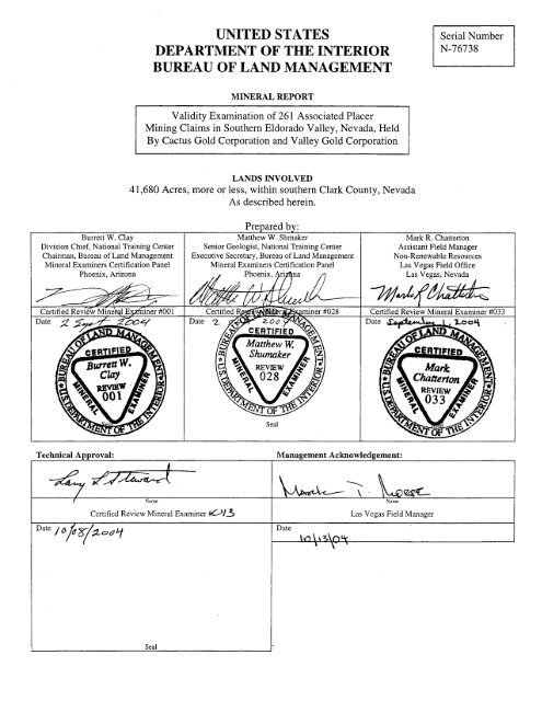
UNITED STATES<br />
DEPARTMENT OF THE INTERIOR<br />
BUREAU OF LAND MANAGEMENT<br />
Serial Number<br />
N-76738<br />
MINERAL REPORT<br />
Validity Examination of 26 1 Associated Placer<br />
Mining Claims in Southern Eldorado Valley, Nevada, Held<br />
By Cactus Gold Corporation and Valley Gold Corporation<br />
LANDS INVOLVED<br />
41,680 Acres, more or less, within southern Clark County, Nevada<br />
As described herein.<br />
Technical Approval:<br />
/ Nune<br />
Certified Review <strong>Mineral</strong> Examiner 013<br />
Management Acknowledgement:<br />
--.<br />
\ . agsL.<br />
Name<br />
Date<br />
Las Vegas Field Manager<br />
1
Table of Contents<br />
Summary ......................................................................................................................................... 1<br />
Conclusions ..................................................................................................................................... 1<br />
...........................................................................................................................<br />
Recommendations 2<br />
Introduction ..................................................................................................................................... 5<br />
Purpose ................................................................................................................................ 5<br />
History ................................................................................................................................. 5<br />
Land Status and Record Data .......................................................................................................... 6<br />
Lands Involved .................................................................................................................... 6<br />
Lands Status ........................................................................................................................ 7<br />
Claim Data ........................................................................................................................... 8<br />
The 1993 Placer Mining Claim Locations .............................................................. 9<br />
Current Status of Placer Mining Claims Located in 1993 ........................ 12<br />
The 1999 Placer Mining Claim Locations ............................................................ 12<br />
Current Status of Placer Mining Claims Located in 1999 ........................ 13<br />
Transfer of Interest ............................................................................................................ 13<br />
Association Placer Mining Claim Requirements .............................................................. 15<br />
Evidence of Improper Location of Association Placer Mining Claims ............................ 17<br />
The 1993 Placer Mining Claim Locations ............................................................ 17<br />
The 1999 Placer Mining Claim Locations ............................................................ 18<br />
Evidence of Use of Dummy Locators to Locate Association Placer Mining Claims ....... 18<br />
The 1993 Placer Mining Claim Locations ............................................................ 18<br />
The 1999 Placer Mining Claim Locations ............................................................ 22<br />
Tables<br />
Association Placer Mining Claims Located in 1993 ....................................................... 3<br />
Association Placer Mining Claims Located in 1999 ....................................................... 4<br />
Lands Encumbered by CGC and VGC Placer Mining Claims ....................................... 6<br />
Association Placer Mining Claims Affected by ROW CC-0002073 .............................. 7<br />
Corporate Chart of the Locating Corporations in 1993 ................................................ 10<br />
Pilot Plant Corporate Officers and Related Filings ....................................................... 14<br />
Table 1 .<br />
Table 2 .<br />
Table 3 .<br />
Table 4 .<br />
Table 5 .<br />
Table 6 .<br />
Table 7 . Corporate Officers in Cactus Gold Corporation and Valley Gold Corporations at<br />
Incorporation Dates ................................................................................... ,.......................<br />
16<br />
Table 8 . Corporate Officers in Cactus Gold Corporation and Valley Gold Corporation at<br />
Time of 1996 Quitclaims ............................................ .....................................................<br />
16<br />
Table 9 . 1999 Locating Association's Relationship to Charles Ager ......................................... 20
Maps<br />
Map 1<br />
Map 2<br />
Claims Located by Agents Map 3<br />
Location Map ..........................................................................................................................<br />
Mining Claims Held by Cactus Gold and Valley Gold ...........................................................<br />
......................................................................................................<br />
Appendices<br />
............................................................................................<br />
....................................................<br />
...................................................................<br />
Photo of Typical Location Monument 1<br />
Survey Plats for Townships Containing Subject Mining Claims 2<br />
Use Authorizations Affecting Subject Mining Claims 3<br />
Clark County Conservation of Public Land and<br />
Natural Resources Act of 2002 4<br />
Plan Maintenance Document for the Las Vegas Resource Management Plan ............................... 5<br />
6<br />
Mining Claim List. by Location Date. Showing Legal Description and Size ................................. 7<br />
Mining Claim List. by Recordation Number. showing Locating Agent and<br />
Present Corporate Claimant 8<br />
Corporate Data: Broadway Enterprises. Inc .................................................................................. 9<br />
Corporate Data: Camel. Inc ........................................................................................................... 10<br />
Corporate Data: <strong>Carlwood</strong> <strong>Development</strong>. Inc ............................................................................... 11<br />
12<br />
...........................................................................................<br />
Master Title Plats ............................................................................................................................<br />
................................................................................................<br />
Corporate Data: Crescent Corporation ..........................................................................................<br />
Corporate Data: Geosearch, Inc .................................................................................................... 13<br />
Corporate Data: Mincor, Inc ......................................................................................................... 14<br />
. .<br />
Corporate Data: Geotech Mining, Inc ........................................................................................... 15<br />
Corporate Data: Pilot Plant, Inc ................................................................................................. 16<br />
Decision of Administrative Law Judge Sweitzer, May 8, 2003, Case N-66052 ........................... 17<br />
Corporate Data: Cactus Gold Corporation .................................................................................... 18<br />
Corporate Data: Valley Gold Corporation ................................................................................... 19<br />
Summary of Transfers of Interest, Subject Association Placer Mining Claims ............................ 20<br />
Placer Mining Claim Location and Administrative Record Documents ....................................... 21<br />
Corporate Data: Cactus Mining Corporation ............................................................................... 22
SUMMARY, CONCLUSIONS, AND RECOMMENDATIONS<br />
Summary<br />
In 1993 three individuals used eight corporations to locate 169 160-acre association<br />
placer mining claims and one 80-acre association placer mining claim. These 170 placer mining<br />
claims were transferred to the control of Charles A. Ager in 1996. In 1999, an association of<br />
eight individuals located 91 additional 160-acre association placer mining claims for the benefit<br />
of Charles A. Ager. These 261 placer mining claims were located in the southern portion of<br />
Eldorado Valley, Clark County, Nevada (see Map 1.) All of the subject placer mining claims<br />
were located by agents working on behalf of the locators. Through the initial locations and<br />
subsequent transfers of interest, all of the 261 association placer mining claims are under the<br />
control of Charles A. Ager.<br />
On November 6,2002, the public lands underlying all except six of the 261 association<br />
placer mining claims were withdrawn from mineral entry. On January 24, 2003, the<br />
representative for the Ager controlled corporations currently holding the placer mining claims<br />
submitted a plan of operations amendment to BLM. The amendment required BLM to undertake<br />
a validity examination of the 39 affected placer mining claims to verify that the placer mining<br />
claims possess valid existing rights.<br />
Examination of placer mining claim records indicated irregularities in the location and<br />
maintenance of the entire placer mining claim block, therefore the scope of the validity<br />
examination was expanded. The mineral examiners determined that it was not in the public<br />
interest to expend public funds to verify the presence of a valuable mineral deposit, if one exists,<br />
until questions about the legitimacy of the subject placer mining claims were answered.<br />
Therefore, the resulting validity examination focused only on the propriety of the location and<br />
maintenance of the subject placer mining claims.<br />
Conclusions<br />
All of the 261 association placer mining claims involved in this examination were located<br />
by agents. Eight corporations were involved in the 1993 locations. Those placer mining claims<br />
were transferred to two corporations controlled by Charles Ager. In 1999, eight individuals<br />
formed an association and had one of the eight act as agent for the other seven. This agent<br />
located association placer mining claims that were transferred, shortly thereafter, to one of the<br />
two corporations controlled by Charles Ager. The eight corporations involved in the 1993<br />
locations were controlled by James T. Roe, 111, Charles Ager and Kenneth Ian Matheson. The<br />
two corporations that received placer mining claim title to the 1993 and 1999 locations were<br />
controlled at the time, and continue to be controlled, by Charles Ager.<br />
The 261 association placer mining claims involved in this examination do not appear to<br />
have been properly located. The evidence shows that the 261 association placer mining claims<br />
were located using dummy locators, who lent their names to the project so as to increase the<br />
acreage that Mr. Ager could control. The evidence also indicates that Mr. Ager would have been<br />
entitled only to placer mining claims of 20-acres each, and not association placer mining claims<br />
of any size over 20-acres.
By these actions, the evidence indicates that Mr. Ager has failed to pay the United States<br />
Treasury a minimum of $1,626,400 (1.63 million dollars) in annual mining claim maintenance<br />
fees that should have been paid for an equal acreage of the appropriate 20-acre placer mining<br />
claims.<br />
Recommendations<br />
It is recommend that contest be initiated against the 261 placer mining claims listed in<br />
Tables 1 and 2, charging:<br />
For Association Placer Mining Claims located in 1993:<br />
The controlling party (Charles Ager) of the placer mining claims in Table 1 was qualified<br />
to locate only individual 20-acre placer mining claims. The placer mining claims located in 1993<br />
were located for the use and benefit of Charles Ager, and not for the use and benefit of the<br />
association members, namely Geosearch, Inc.; Broadway Enterprises, Inc.; <strong>Carlwood</strong>, Inc.;<br />
Geotech Mining, Inc.; Pilot Plant, Inc.; Crescent, Inc.; Mincor, Inc.; and Camel, Inc. Therefore<br />
these placer mining claims are null and void. Even if it is determined that the other associates<br />
do form an association, the 160-acre placer mining claims were located for the benefit of only 3<br />
associates and therefore, these placer mining claims are null and void.<br />
For Association Placer Mining Claims located in 1999:<br />
The controlling party of the placer mining claims in Table 2 was qualified to locate only<br />
individual 20-acre placer mining claims. Therefore, the placer mining claims listed in Table 2<br />
were improperly located as 160-acre placer mining claims.<br />
These placer mining claims were located for the use and benefit of Charles Ager, and not<br />
for the use and benefit of the associated members, namely Andrew L. Dall, Shannon L. Dall,<br />
Charlton S. Ager, Caroline I. Ager, Carol J. Ager, Fred J. Toti, George R. Stephen, JY, and<br />
Kathleen M. Stephen. Therefore, these placer mining claims are null and void.<br />
For the Association Placer Mining Claims located in conflict with Right-of-way<br />
CC-002073:<br />
The 23 association placer mining claims listed in Table 3 are in conflict with Federal Aid<br />
to Highway Act, right-of-way, CC-002073. The Interior Board of Land Appeals has previously<br />
ruled that claims which overlay this type of right-of-way are considered null and void ab initio.<br />
Portions of the 23 association placer mining claims listed in Table 3 are null and void ab<br />
initio. Where a mining claim is split by the right-of-way, one of the two portions is null and void<br />
ab initio.
BLM Recordation<br />
No. NMC<br />
Table 1 - Association Placer Mining Claims Located in 1993<br />
Claim Name<br />
Date of<br />
Location<br />
3<br />
BLM Recordation<br />
No. NMC<br />
Claim Name<br />
Date of<br />
Location<br />
682148 BROWN 33 9/1/1993 682296 RED 271 9/1/1993<br />
682149 BROWN 34 9/1/1993 682297 RED 272 9/1/1993<br />
682150 BROWN 101 9/1/1993 682199 BLACK 61 9/1/1993<br />
682151 BROWN 102 9/2/1993 682200 BLACK 62 9/1/1993<br />
682152 BROWN 103 9/2/1993 682201 BLACK 63 9/1/1993<br />
682153 BROWN 104 9/2/1993 682202 BLACK 64 9/1/1993<br />
682154 BROWN 111 9/2/1993 682203 BLACK 71 9/1/1993<br />
682155 BROWN 112 9/2/1993 682204 BLACK 72 9/1/1993<br />
682156 BROWN 113 9/2/1993 682205 BLACK 73 9/1/1993<br />
682157 BROWN 114 9/2/1993 682206 BLACK 74 9/1/1993<br />
682158 BROWN 121 9/2/1993 682207 BLACK 81 9/1/1993<br />
682159 BROWN 122 9/2/1993 682208 BLACK 83 9/1/1993<br />
682160 BROWN 123 9/2/1993 682209 BLACK 171 9/1/1993<br />
682161 BROWN 124 9/2/1993 682210 BLACK 173 9/1/1993<br />
682162 BROWN 131 9/2/1993 682211 BLACK 181 9/1/1993<br />
682163 BROWN 133 9/2/1993 682212 BLACK 182 9/1/1993<br />
682164 BROWN 134 9/2/1993 682213 BLACK 183 9/1/1993<br />
682165 BROWN 141 9/2/1993 682214 BLACK 184 9/1/1993<br />
682166 BROWN 142 9/2/1993 682215 BLUE 191 9/1/1993<br />
682167 BROWN 143 9/2/1993 682216 BLUE 192 9/1/1993<br />
682168 BROWN 144 9/2/1993 682217 BLUE 193 9/1/1993<br />
682169 BROWN 153 9/2/1993 682218 BLUE 194 9/1/1993<br />
682170 BROWN 154 9/2/1993 682219 BLUE 201 9/1/1993<br />
682171 GREEN 221 9/2/1993 682220 BLUE 202 9/1/1993<br />
682172 GREEN 222 9/2/1993 682221 BLUE 203 9/1/1993<br />
682173 GREEN 223 9/2/1993 682222 BLUE 204 9/1/1993<br />
682174 GREEN 224 9/2/1993 682223 BLUE 211 9/1/1993<br />
682175 GREEN 232 9/2/1993 682224 BLUE 212 9/1/1993<br />
682176 GREEN 233 9/2/1993 682225 BLUE 213 9/1/1993<br />
682177 GREEN 234 9/2/1993 682226 BLUE 214 9/1/1993<br />
682178 GREEN 241 9/2/1993 682227 BLUE 291 9/1/1993<br />
682179 GREEN 242 9/2/1993 682228 BLUE 292 9/1/1993<br />
682180 GREEN 243 9/2/1993 682229 BLUE 293 9/1/1993<br />
682181 GREEN 244 9/2/1993 682230 BLUE 294 9/1/1993<br />
682182 GREEN 251 9/2/1993 682231 BLUE 301 9/1/1993<br />
682183 GREEN 252 9/2/1993 682232 BLUE 302 9/1/1993<br />
682184 GREEN 253 9/2/1993 682233 BLUE 303 9/1/1993<br />
682185 GREEN 254 9/2/1993 682234 BLUE 304 9/1/1993<br />
682186 GREEN 261 9/2/1993 682235 BROWN 11 9/1/1993<br />
682187 GREEN 263 9/2/1993 682236 BROWN 12 9/1/1993<br />
682188 GREEN 271 9/2/1993 682237 BROWN 13 9/1/1993<br />
682189 GREEN 272 9/2/1993 682238 BROWN 14 9/1/1993<br />
682190 GREEN 351 9/2/1993 682239 BROWN 21 9/1/1993<br />
682191 GREEN 352 9/2/1993 682240 BROWN 22 9/1/1993<br />
682192 GREEN 354 9/2/1993 682241 BROWN 23 9/1/1993<br />
682193 GREEN 361 9/2/1993 682242 BROWN 24 9/1/1993<br />
682194 GREEN 362 9/2/1993 682243 BROWN 31 9/1/1993<br />
682195 GREEN 363 9/2/1993 682244 BROWN 32 9/1/1993<br />
682196 GREEN 364 9/2/1993 682245 ORANGE 281 9/1/1993<br />
682197 BLACK 51 9/1/1993 682246 ORANGE 282 9/1/1993<br />
682198 BLACK 53 9/1/1993 682247 ORANGE 283 9/1/1993<br />
682286 Purple 91 9/1/1993 682248 ORANGE 284 9/1/1993<br />
682287 Purple 92 9/1/1993 682249 ORANGE 291 9/1/1993<br />
682288 RED 251 9/1/1993 682250 ORANGE 292 9/1/1993<br />
682289 RED 252 9/1/1993 682251 ORANGE 293 9/1/1993<br />
682290 RED 253 9/1/1993 682252 ORANGE 294 9/1/1993<br />
682291 RED 254 9/1/1993 682253 ORANGE 311 9/1/1993<br />
682292 RED 261 9/1/1993 682254 ORANGE 312 9/1/1993<br />
682293 RED 262 9/1/1993 682255 ORANGE 313 9/1/1993<br />
682294 RED 263 9/1/1993 682256 ORANGE 314 9/1/1993<br />
682295 RED 264 9/1/1993 682257 ORANGE 321 9/1/1993<br />
682258 ORANGE 322 9/1/1993 682282 Purple 71 9/1/1993<br />
682259 ORANGE 323 9/1/1993 682283 Purple 72 9/1/1993<br />
682260 ORANGE 324 9/1/1993 682284 Purple 81 9/1/1993<br />
682261 Pink 202 9/1/1993 682285 Purple 82 9/1/1993<br />
682262 Pink 202E 9/1/1993 682298 RED 273 9/1/1993<br />
682263 Pink 211 9/1/1993 682299 RED 274 9/1/1993<br />
682264 Pink 212 9/1/1993 682300 RED 341 9/1/1993
BLM Recordation<br />
No. NMC<br />
Claim Name<br />
Date of<br />
Location<br />
BLM Recordation<br />
No. NMC<br />
Claim Name<br />
Date of<br />
Location<br />
682265 Pink 213 9/1/1993 682301 RED 342 9/1/1993<br />
682266 Pink 214 9/1/1993 682302 RED 343 9/1/1993<br />
682267 Pink 281 9/1/1993 682303 RED 344 9/1/1993<br />
682268 Pink 282 9/1/1993 682304 RED 351 9/1/1993<br />
682269 Pink 284 9/1/1993 682305 RED 352 9/1/1993<br />
682270 Pink 323 9/1/1993 682306 RED 353 9/1/1993<br />
682271 Pink 324 9/1/1993 682307 RED 354 9/1/1993<br />
682272 Pink 332 9/1/1993 682308 RED 361 9/1/1993<br />
682273 Purple 41 9/1/1993 682309 RED 362 9/1/1993<br />
682274 Purple 42 9/1/1993 682310 RED 363 9/1/1993<br />
682275 Purple 43 9/1/1993 682311 RED 364 9/1/1993<br />
682276 Purple 44 9/1/1993 682312 YELLOW 11 9/2/1993<br />
682277 Purple 52 9/1/1993 682313 YELLOW 22 9/2/1993<br />
682278 Purple 53 9/1/1993 682314 YELLOW 122 9/2/1993<br />
682279 Purple 54 9/1/1993 682317 Brown 151 9/2/1993<br />
682280 Purple 63 9/1/1993 682318 Brown 152 9/2/1993<br />
682281 Purple 64 9/1/1993 682704 GREEN 231 9/28/1993<br />
BLM Recordation<br />
No. NMC<br />
Table 2 - Association Placer Mining Claims Located in 1999<br />
Claim Name<br />
Date of<br />
Location<br />
4<br />
BLM Recordation<br />
No. NMC<br />
Claim Name<br />
Date of<br />
Location<br />
804090 Blue 321 5/4/1999 804137 Purple 93 5/2/1999<br />
804091 Blue 322 5/4/1999 804138 Purple 94 5/2/1999<br />
804092 Blue 323 5/4/1999 804139 Purple 161 5/2/1999<br />
804093 Blue 324 5/4/1999 804140 Purple 162 5/2/1999<br />
804094 Gold 51 5/4/1999 804141 Purple 163 5/2/1999<br />
804095 Gold 62 5/4/1999 804142 Purple 164 5/2/1999<br />
804096 Gold 63 5/4/1999 804143 Purple 171 5/2/1999<br />
804097 Gold 64 5/4/1999 804144 Purple 172 5/2/1999<br />
804098 Gold 72 5/4/1999 804145 Purple 173 5/2/1999<br />
804099 Gray 191 5/2/1999 804146 Purple 174 5/2/1999<br />
804100 Gray 192 5/2/1999 804147 Purple 181 5/2/1999<br />
804101 Gray 201 5/2/1999 804148 Purple 182 5/2/1999<br />
804102 Gray 202 5/2/1999 804149 Purple 183 5/2/1999<br />
804103 Gray 204 5/3/1999 804150 Purple 184 5/2/1999<br />
804104 Gray 211 5/3/1999 804151 Red 221 5/4/1999<br />
804105 Gray 212 5/3/1999 804152 Red 222 5/4/1999<br />
804106 Gray 213 5/3/1999 804153 Red 223 5/4/1999<br />
804107 Gray 214 5/3/1999 804154 Red 224 5/4/1999<br />
804108 Gray 281 5/3/1999 804155 Red 231 5/4/1999<br />
804109 Gray 282 5/3/1999 804156 Red 232 5/4/1999<br />
804110 Gray 283 5/3/1999 804157 Red 233 5/4/1999<br />
804111 Gray 284 5/3/1999 804158 Red 234 5/4/1999<br />
804112 Gray 292 5/3/1999 804159 Red 241 5/4/1999<br />
804113 Gray 294 5/3/1999 804160 Red 242 5/4/1999<br />
804114 Gray 331 5/3/1999 804161 Red 243 5/4/1999<br />
804115 Gray 332 5/3/1999 804162 Red 244 5/4/1999<br />
804116 Gray 333 5/3/1999 804163 Yellow 13 5/3/1999<br />
804117 Gray 334 5/3/1999 804164 Yellow 21 5/3/1999<br />
804118 Green 273 5/3/1999 804165 Yellow 23 5/3/1999<br />
804119 Green 274 5/3/1999 804166 Yellow 24 5/3/1999<br />
804120 Green 341 5/3/1999 804167 Yellow 31 5/3/1999<br />
804121 Green 342 5/3/1999 804168 Yellow 32 5/3/1999<br />
804122 Green 343 5/3/1999 804169 Yellow 33 5/3/1999<br />
804123 Green 344 5/3/1999 804170 Yellow 34 5/3/1999<br />
804125 Orange 191 5/4/1999 804171 Yellow 101 5/3/1999<br />
804126 Orange 193 5/4/1999 804172 Yellow 102 5/3/1999<br />
804127 Peach 42 5/3/1999 804173 Yellow 103 5/3/1999<br />
804128 Peach 44 5/3/1999 804174 Yellow 104 5/3/1999<br />
804129 Peach 92 5/3/1999 804175 Yellow 111 5/3/1999<br />
804130 Pink 311 5/4/1999 804176 Yellow 112 5/3/1999<br />
804131 Pink 312 5/4/1999 804177 Yellow 113 5/3/1999<br />
804132 Pink 331 5/3/1999 804178 Yellow 114 5/3/1999<br />
804133 Purple 73 5/2/1999 804179 Yellow 121 5/3/1999<br />
804134 Purple 74 5/2/1999 804180 Yellow 123 5/3/1999<br />
804135 Purple 83 5/2/1999 804181 Yellow 124 5/4/1999<br />
804136 Purple 84 5/2/1999
INTRODUCTION<br />
Purpose<br />
This report documents the findings of a validity examination of 261 association placer<br />
mining claims located for gold, silver, platinum and palladium in southern Nevada. The authors<br />
have determined that the question of serious irregularities in placer mining claim tenure, must be<br />
resolved prior to expending the public resources necessary to confirm the presence or absence of<br />
a valuable mineral deposit, as defined by the United States Mining Laws. The examination and<br />
this report address the question as to whether or not the placer mining claims involved are<br />
properly located and held.<br />
The use of this report is limited to the action prompting the report and it is not intended<br />
for any other purpose. It will not in any way serve as an appraisal of monetary value of the<br />
placer mining claims involved.<br />
History of the Case<br />
On January 24,2003, Gordon Ellis, representative (at the time) of Cactus Gold and<br />
Valley Gold Corporations, submitted an amendment to Cactus' approved Plan of Operations,<br />
under 43 CFR 8 3809. Placer mining claims affected by the plan of operations are held by<br />
Cactus Gold Corporation (CGC) and Valley Gold Corporation (VGC). The lands affected by the<br />
plan amendment have been withdrawn from mineral entry. Subsection 3809.100(a) requires a<br />
validity determination for plans of operation and notices where the lands are withdrawn. On<br />
April 1, 2003, the BLM initiated the validity examination of 39 association placer mining claims,<br />
and assigned BLM mineral examiners Mark Chatterton, Burrett Clay, and Matthew Shumaker to<br />
the case.'<br />
After an initial field review of the 39 placer mining claims involved in the validity<br />
examination, the <strong>Mineral</strong> Examiners determined that only 33 of the association placer mining<br />
claims would be affected by the amended mining plan. The <strong>Mineral</strong> Examiners therefore<br />
reduced the list of placer mining claims involved in the examination to 33, and notified the<br />
claimants of the change on May 1,2003.<br />
The <strong>Mineral</strong> Examiners obtained and reviewed the placer mining claim recordation files<br />
from the Bureau of Land Management (BLM) Nevada State Office for the 33 association placer<br />
mining claims being examined. As part of the examination process, the <strong>Mineral</strong> Examiners<br />
reviewed the contents of those files, including the Certificates of ~ocation.~ The evidence<br />
indicated that dummy locatorsi had been used when the claims were located so that by lending<br />
I<br />
For purposes herein, this report will refer to mineral examiners Chatterton, Clay, and Shumaker as<br />
"<strong>Mineral</strong> Examiners."<br />
2<br />
These are more commonly called "Notices of Location" or "Location Notices." The locators in this case<br />
have styled the documents as "Certificates of Location." There is no relevant difference, however.<br />
% "dummy locator" (fictitious locator) is an entity that lends its name for use in the location of a placer<br />
mining claim so that a controlling party obtains more acreage than would normally be allowed under the General<br />
Mining Law of 1872. The dummy locator then transfers its interest in the placer mining claim to the controlling<br />
5
their names, larger placer mining claims were located than would be legally warranted. As a<br />
result of this finding, the <strong>Mineral</strong> Examiners determined that a review of the entire claim block<br />
consisting of 261 association placer mining claims held by CGC and VGC, was warranted prior<br />
to completing a validity determination related to any placer mining claims involved with the plan<br />
of operations.<br />
LAND STATUS AND RECORD DATA<br />
Lands Involved<br />
The placer mining claims involved in this validity exam consist of 261 association placer<br />
mining claims held by CGC and VGC. These claims, illustrated on Maps 2 and 3, were located<br />
by legal subdivision in Township 26 South, Range 63 ~ ast;~ T. 27 S., R. 63 E.; T. 28 S., R. 63 E.;<br />
T. 26 S., R. 64 E.; T. 27 S., R. 64 E.; T. 28 S., R. 64 E., Mount Diablo Meridian. In totality these<br />
claims encumber more than 65 square miles, which is nearly all of the southern Eldorado Valley.<br />
The claims are approximately 40 miles south of downtown Las Vegas, Nevada along<br />
both sides of U.S. Highway 95. In the early stages of the examination, Chatterton physically<br />
confirmed the presence of 33 of the 26 1 claims by use of survey grade Global Position Satellite<br />
(GPS) signal reception equipment and by recovering5 the cadastral survey brass cap monuments.<br />
Location monuments were normally found adjacent to these cadastral survey monuments. The<br />
location monuments consisted of a 4 inch by 4 inch wooden post that extended above the ground<br />
approximately 4 feet. Anchored to the monument post are foot long lengths of one inch diameter<br />
white polyvinyl chloride (PVC) plastic pipe, with caps on each end containing a copy of the<br />
location notice. These location notices and monument methods were consistent at all 33 placer<br />
mining claims. Appendix 1 contains a photograph which illustrates one of the location<br />
monuments. Based on the physical confirmation of the 33 claims in the initial examination, and<br />
later spot checks of other claims, the <strong>Mineral</strong> Examiners anticipate that all claims have similar<br />
monuments. Table 3 identifies what sections in each Township and Range are encumbered by<br />
the 261 placer mining claims held by CGC and VGC.<br />
Table 3 - Lands Encumbered by CGC and VGC Placer Mining Claims<br />
I towns hi^ I Ranrre 1 Sections 1<br />
party, allowing the controlling party to obtain and hold acreage to which it would not otherwise be allowed. See<br />
43 CFR 5 3832.22.<br />
Legal descriptions are hereinafter abbreviated in this manner: T. 26 S., R. 63 E.<br />
' "Recovering" is a term that describes the process of finding and confirming a brass cap or other survey<br />
monument.
The Townships identified above are all surveyed. T. 26,27, and 28 S., R. 63 E., were<br />
also independently resurveyed under the auspices of the General Land Office. Copies of the<br />
approved survey plats are in Appendix 2, and the placer mining claims involved conform to the<br />
survey plats.<br />
Land Status<br />
On July 10, 2003, Chatterton obtained a Master Title <strong>Report</strong> (MTR), which is a historical<br />
index of the BLM records database, to identify the land use authorizations related to the lands<br />
underlain by the subject placer mining claims. Appendix 3 lists the land use authorizations,<br />
including rights-of-way, by case serial number identified in the MTR; who holds the<br />
authorization; the township, range, and section encumbered by the authorization; and when the<br />
authorization was granted.<br />
Fourteen right-of-way authorizations predate the location of the subject placer mining<br />
claims. The most notable of these authorizations is CC-0020733, granted April 13, 1939, to the<br />
Nevada Department of Transportation, which coincides with U.S. Highway 95. This right-ofway<br />
(ROW) was granted prior to the Federal Aid to Highway Act (FAHA), (23 U.S.C. 5 3 17).<br />
When the FAHA was enacted, the right-of-way automatically assumed the status and protection<br />
of the FAHA. Tracts of land granted or covered by this Act are withdrawn from entry and<br />
location under the mining law.<br />
The Interior Board of Land Appeals @LA) has previously ruled that claims which<br />
overlay rights-of-way of this type are considered null and void ab initio (Jesse R. Collins et al,<br />
127 IBLA 122 (1993)). This ROW severs portions of 23 association placer mining claims which<br />
are listed in Table 4, below. In Collins, the IBLA also noted that a single placer mining claim<br />
notice of location cannot apply to noncontiguous parcels of land. CC-002073 splits 23 placer<br />
mining claims in two, and may have effectively rendered them null and void ab initio in whole or<br />
in part. In situations like this one, the existence of a FAHA ROW closes the land within the<br />
ROW to mineral entry, and any portion of a placer mining claim within such a FAHA ROW is<br />
null and void ab initio. However, if a placer mining claim is split by the ROW, the locator is<br />
normally entitled to choose which portion to keep. The remainder becomes null and void. This<br />
remains a secondary issue here because the 23 affected claims are also subject to the dummy<br />
!scator issue, which is discussed later.
Appendix 3 shows that two use authorizations were granted during the general period of<br />
1993 through 1999 when the claims were located. Both ROWS were granted to IXC Carrier<br />
Group for fiber optic cables supporting the telecommunications industry. Right-of-way,<br />
N-6185 1 was granted on February 6, 1998, and ROW, N-62 1 10 was granted on June 4, 1999,<br />
which is after the location of the CGC and VGC placer mining claims.<br />
At the time of location in 1993, the lands now encumbered by the claims were public<br />
domain, open to mineral entry, and administered by the BLM, Las Vegas Field Office (LVFO).<br />
On October 5, 1998, the BLM State Director for Nevada signed the Record of Decision for the<br />
Las Vegas Resource Management Plan. This plan designated the area underlying all but six of<br />
these placer mining claims as the Piute-Eldorado Desert Tortoise Area of Critical Environmental<br />
Concern (ACEC) to protect the desert tortoise. The final resource management plan contained<br />
direction to withdraw the ACEC from mineral entry as part of the management strategy for the<br />
protection of the desert tortoise.<br />
On November 6,2002, Congress passed Public Law 107-282, Clark Countv Conservation<br />
of Public Land and Natural Resources Act of 2002 (see Appendix 4). Section 502 of the Act<br />
withdrew from mineral entry all ACECs identified in the Las Vegas Resource Management Plan.<br />
This withdrawal is subject to review and renewal at the end of five years. A legal description of<br />
the withdrawn area is found in Appendix 5. Appendix 6 contains copies of the master title plats<br />
for the Townships and Ranges encumbered by the subject placer mining claims. As previously<br />
stated placer mining claims located on lands that are withdrawn from mineral entry now require<br />
that valid existing rights be determined prior to authorizing surfacing disturbing activities. (See<br />
43 CFR 3809.100.)<br />
Six of the placer mining claims involved, namely ORANGE 28 1, ORANGE 282,<br />
ORANGE 283, ORANGE 284, ORANGE 19 1, and ORANGE 193 are not within the withdrawn<br />
ACEC. Placer mining claims ORANGE 28 1 through ORANGE 284 were located with the first<br />
group of placer mining claims in September 1993. ORANGE 191 and ORANGE 193 were<br />
located in May 1999. While not on withdrawn lands, these six placer mining claims are also<br />
affected by the dummy locator issue.<br />
Claim Data<br />
In the southern Eldorado Valley, CGC holds 205 association placer mining claims and<br />
VGC holds 56 association placer mining claims, for a total of 261 association placer mining<br />
claims between them. One of the association placer mining claims is 80-acres, and the<br />
remaining 260 claims are 160-acres each for a total of 4 1,680 acres, more or less. The location<br />
of each claim is generally illustrated on Map1 and specifically located on Map 2. Appendix 7<br />
lists the claim name, the location date, the associated legal description, and the size of the claim<br />
in acres. Appendix 8 contains a complete list of all 261 association placer mining claims<br />
organized by the name of the current claimant, Nevada BLM Mining Claim Recordation<br />
Number, claim name, date of location, and the agent who located the association placer mining<br />
claim. To some extent, the 261 placer mining claims that are the subject of this examination<br />
were preceded by other mining claims covering roughly the same ground. However, the placer<br />
mining claim locations subject to this examination were adverse to the prior mining claims, and<br />
all prior mining claims have lapsed in BLM records.
There were two periods of time when these claims were located. The first occurred in<br />
September 1993 and the second occurred in May 1999.<br />
The 1993 Placer Mining Claim Locations<br />
During this claim location episode, two agents, Donald J. Hales and Kathleen M.<br />
Stephen, located 170 association placer mining claims on behalf of an association of eight<br />
corporations, as described below. On September 1 and 2, 1993, 169 association placer mining<br />
claims were located by the above described agents for the following eight Nevada-registered<br />
corporations:<br />
Geosearch, Inc.<br />
Broadway Enterprises, Inc.<br />
<strong>Carlwood</strong>, Inc.<br />
Geotech Mining, Inc.<br />
Pilot Plant, Inc.<br />
Crescent, Inc.<br />
Mincor, Inc.<br />
Camel, Inc.<br />
This block of locations included 168 association placer mining claims of 160-acres each,<br />
and one association placer mining claim of 80-acres.6 One additional 160-acre association placer<br />
mining claim was located on September 28, 1993, by Donald J. Hales on behalf of the same<br />
association of eight corporations. Map 3 illustrates the arrangement of placer mining claims, and<br />
which agents located them.<br />
At the time the claims were located, at least three individuals were corporate officers and<br />
resident agents for more than one corporation, as described in Tables 6,7, and 8, which were<br />
compiled using copies of corporate documents on file at the Office of the Nevada Secretary of<br />
State (hereinafter referred to as "Nevada").<br />
Table 5 indicates that the placer mining claims were located primarily to benefit James T.<br />
Roe, 1117, Charles A. ~ ~ eand r Mr. ~ Matheson. , Within 35 months of locating the placer mining<br />
claims, all interest in all of the placer mining claims was transferred to two corporations under<br />
the direct control of Mr. Ager. Further, Mr. Matheson and Mr. Ager have a long-standing<br />
All except one of the 1993 mining claims in a block covering more than 26,000 acres were reportedly<br />
located within a two day period. This is an inexplicably short period of time for such a large project. Not all<br />
cadastral monuments in the subject lands are marked with brass-cap monuments. Locating corners not marked, or<br />
marked in ways other than the use of a brass cap monument, is normally a time consuming process.<br />
' As of May 1, 2003, the charter each of the four corporations held by Mr. Roe has been permanently<br />
revoked by Nevada.<br />
8<br />
Depending on the document, Mr. Ager's name appears as "Charles A. Ager," "Charles Ager," or "Chuck<br />
Ager" We believe that this is the same person in each case. For purposes herein, this report will refer to him as<br />
"Charles Ager" or "Mr. Ager." During the Pass <strong>Mineral</strong>s hearing, Charles Ager testified that Caroline I. Ager is his<br />
daughter, and that Carol J. Ager is his spouse. U.S v. Pass <strong>Mineral</strong>s, Kiminco, Inc., Pilot Plant, and K. Ian<br />
Matheson, Office of Hearings and Appeals Docket No. 66052, Tr. V. 20 pages 35 14-5.<br />
9
usiness relationship. That relationship was thoroughly examined in Administrative Law Judge<br />
(ALJ) Sweitzer's Decision in United States v. Pass <strong>Mineral</strong>s, Kiminco, Inc., Pilot Plant, and K.<br />
Ian Matheson, Office of Hearings and Appeals Docket number N-660522,~ pages 24 - 29, which<br />
is included as Appendix 17.<br />
Only the incorporation date of Pilot Plant, Inc. significantly predates the location of the<br />
1993 placer mining claims.10 The remaining corporations were all incorporated on the same day,<br />
July 29, 1993." This date is only 34 days prior to the location of 169 of the 170 claims located<br />
in 1993. This has led the mineral examiners to question the intent of the creation of the seven<br />
corporations.<br />
Corporate Name<br />
Broadway<br />
Enterprises, Inc.<br />
Camel, Inc.<br />
<strong>Carlwood</strong><br />
Table 5 - Corporate Chart of the Locating Corporations in 199312<br />
Incorporation<br />
Date<br />
July 29, 1993<br />
July 29, 1993<br />
President<br />
James T. Roe, I11<br />
James T. Roe, I11<br />
Secretary<br />
James T. Roe, I11<br />
James T. Roe, I11<br />
Treasurer<br />
James T. Roe, I11<br />
James T. Roe, I11<br />
Resident Agent<br />
James T. Roe, I11<br />
James T. Roe, 111<br />
See Appendix<br />
<strong>Development</strong> I July 29, 1993 I James T. Roe, I11 I James T. Roe, I11 I James T. Roe, I11 1 James T. Roe, 111 I 11 1<br />
9<br />
10<br />
Crescent<br />
Corporation<br />
Geosearch, Inc.<br />
Mincor, Inc.<br />
Geotech Mining<br />
Inc.<br />
Pilot Plant, Inc.<br />
July 29, 1993<br />
July 29, 1993<br />
July 29, 1993<br />
july 29, 1993<br />
March 6, 1990<br />
James T. Roe, I11<br />
Carol J. Ager<br />
Caroline I. Ager<br />
Charles A. Ager<br />
K. Ian Matheson<br />
James T. Roe, 111<br />
Charles A. Ager<br />
Charles A. Ager<br />
Charles A. Ager<br />
K. Ian Matheson<br />
James T. Roe, 111<br />
Charles A. Ager<br />
Charles A. Ager<br />
Charles A. Ager<br />
K. Ian Matheson<br />
James T. Roe, I11<br />
Kenneth Ian<br />
Matheson"<br />
Kenneth Ian<br />
Matheson<br />
Kenneth Ian<br />
Matheson<br />
Darrell Lincoln<br />
rlnrC14<br />
12<br />
13<br />
14<br />
15<br />
16<br />
Decision of Administrative Law Judge Sweitzer, May 8, 2003, Office of Hearings and Appeals Docket<br />
No. 66052. As of the date of this report Judge Sweitzer's decision is on appeal to IBLA and docketed as IBLA<br />
2003-268. On August 8, 2003, the IBLA issued an order denying the appellants "Emergency Motion for Temporary<br />
Stay." Thus, Judge Sweitzer's May 8, 2003, decision is considered the Department's final decision until the IBLA<br />
resolves the appeal.<br />
10<br />
All of Pilot Plant's corporate officers use the residence address of Mr. Matheson, which is 2215 Lucerne<br />
Circle, Henderson, Nevada. Mr. Matheson testified during the U.S v. Pass <strong>Mineral</strong>s, Kirninco, Inc., Pilot Plant, and<br />
K. Ian Matheson, Office of Hearings and Appeals Docket No. 66052, that Michael Anderson and Ferrell Drozo are<br />
the youngest and oldest sons, respectively, of Mr. Matheson's wife. "Drozo" is sometimes spelled "Drozd" or<br />
"Droves." We believe that the correct spelling is "Drozd."<br />
" As shown in Appendices 9 through 15, the seven corporations incorporated on July 29, 1993 were likely<br />
incorporated at the same time or close in time because they were assigned sequential file numbers by Nevada:<br />
<strong>Carlwood</strong> <strong>Development</strong>, Corp. was assigned # 9123-1993; Camel, Inc. was assigned #9124-1993; Mincor, Inc. was<br />
assigned # 9 125- 1993; Geosearch, Inc. was assigned # 9 126- 1993; Broadway Enterprises, Inc. was assigned # 9 127-<br />
1993; Geotech Mining, Inc. was assigned # 9128-1993; and Crescent Corp. was assigned #9l29- 1993.<br />
l2 This chart lists Officers of the eight corporations locating the 1993 claims on the date each was<br />
incorporated and each of the 1993 mining claims were located. Source: Nevada Secretary of State Corporate<br />
Records. Copies of applicable Nevada State corporate records are appended to this report, and identified as indicated<br />
in the "See Appendix" column.<br />
13<br />
Depending on the document, Mr. Matheson's name appears as "Kenneth Ian Matheson," "K. Ian<br />
Matheson," or "Ian Matheson." For purposes herein, this report will refer to him as "Mr. Matheson."<br />
10
Broadway Enterprises, Inc., Camel. Inc.,<br />
<strong>Carlwood</strong> <strong>Development</strong> Corporation, and Crescent Corporation<br />
Broadway Enterprises, Inc., Camel, Inc., <strong>Carlwood</strong> <strong>Development</strong> Corp., and Crescent<br />
Corp. ("Roe Corporations") were all incorporated in Nevada on July 29, 1993. For each<br />
corporation, James T. Roe, I11 was listed as President, Secretary, Treasurer, and Resident Agent.<br />
Mr. Roe signed all articles of incorporation on July 27, 1993.15 The receipt for each<br />
corporation's filing fee was issued to Mr. Matheson.<br />
Mr. Roe filed the required annual list of officers, directors, and agent in 1994, but<br />
apparently not in 1995. In 1996, each Roe Corporation was granted a reinstatement by Nevada.<br />
However, no further annual lists of officers, directors, and agents were filed for the four Roe<br />
Corporations after 1996. Nevada records show that each Roe Corporation is Permanently<br />
Revoked as of May 1,2003.<br />
Geosearch, Inc.. Geotech Mining, Inc., and Mincor, Inc.<br />
Geosearch, Inc., Geotech Mining, Inc., and Mincor, Inc. ("Ager Corporations") were also<br />
incorporated on July 29, 1993. At the time of incorporation for each Ager Corporation, Charles<br />
Ager was listed as Secretary and Treasurer, and he was also President of Geotech Mining, Inc.<br />
Mr. Matheson was listed as Resident Agent for all Ager Corporations. As with the four Roe<br />
Corporations, the Nevada filing fee receipts for the Ager Corporations were all issued to Mr.<br />
Matheson.<br />
Mr. Matheson was listed as the resident agent for these three Ager Corporations through<br />
July 3 1,2000. On that date, Robert D. McDougal became the Resident Agent for each Ager<br />
Corporation. Minor changes have occurred in corporate offices since the transfer of interest in -<br />
1996. On August 7, 2003, "The Annual List of Officers, Directors, and Agents" of Mincor, Inc.<br />
changed the name of Caroline I. Ager to Caroline I. McNeil. This was done by means of hand<br />
written notation. Further, Ms. McNeil replaced Charles Ager as Secretary and Treasurer for<br />
Mincor, 1nc.16<br />
Another change in corporate officers occurred on August 7,2003 when "The Annual List<br />
of Officers, Directors, and Agents" for Geosearch, Inc. showed Carol J. Ager replacing Charles<br />
A. Ager as Secretary and Treasurer. Again this change was made by way of hand written<br />
notation on the form.17<br />
l4 Darrell Lincoln Clark was the resident agent for the Pilot Plant, Inc. until May 17, 1993, when Mr.<br />
Matheson replaced Mr. Clark as resident agent for Pilot Plant, Inc.<br />
time.<br />
l5 As indicated in footnote 14 these four corporations were part of the seven filed on or about the same<br />
l6 See Appendix 14, page 14<br />
l7 See Appendix 13, page 14
Pilot Plant. Inc.<br />
Pilot Plant, Inc., was incorporated in Nevada on March 6, 1990, by Darrell Lincoln Clark,<br />
Pamela Clark, and Susan D. ~ un~ara~.'~ Darrel Lincoln Clark is listed as Resident Agent.<br />
Clark and Mungaray are not named again in Pilot Plant corporate filings, which are provided in<br />
Appendix 16.19 Table 6 is a list of the corporate officers and related filings for Pilot<br />
Plant, Inc.<br />
Current Status of Placer Mining Claims Located in 1993<br />
As shown later through the issuing of quitclaims20 all associates of the 170 association<br />
placer mining claims transferred their interest to Cactus Gold Corporation. Shortly there after<br />
the interest to 56 of CGC's placer mining claims were transferred to VGC.<br />
The 1999 Placer Mining Claim Locations<br />
The second episode of placer mining claim location took place on May 2,3, and 4, 1999,<br />
when Andrew L. Dall, acting as agent for an association of eight individuals located 91<br />
additional association placer mining claims of 160-acres each. Those individuals were Andrew<br />
L. Dall, Shannon L. Dall, Charlton S. Ager, Caroline I. Ager, Carol J. Ager, Fred J. Toti, George<br />
R. Stephen, IV, and Kathleen M. Stephen.<br />
Agents<br />
Chatterton made initial arrangements to interview Kathleen stephen2' concerning her role<br />
as agent for the corporations, and as a claimant. This interview was to occur on October 22,<br />
2003. On October 20, 2003, Chatterton was notified by a third party that Ms. Stephen, now a<br />
resident of Wyoming, was declining to be interviewed. In a follow-up phone call from<br />
Chatterton, she confirmed that she preferred not to be interviewed.<br />
Chatterton and Shumaker also attempted to locate Donald J. Hales of Plain City, Utah,<br />
the other agent. The <strong>Mineral</strong> Examiners have not been able to locate Mr. Hales. When asking<br />
'' Although the papers of incorporation are dated February 26, 1990, they are stamped "RECEIVED" by<br />
Nevada on March 2, 1990. The current records show the incorporation was filed on March 6, 1990.<br />
l9 with the exception of pages 26 - 29 of Appendix 16, all information in the Corporate Data Appendices<br />
was received from the Nevada Secretary of State's Office. The information in Appendix 16, page 26 was obtained<br />
through an internet search, page 27 is a copy of a BLM document, and the information on pages 28 and 29 was<br />
obtained from Mr. Matheson.<br />
20 The term "quitclaim," as used herein, comports with the usual definition as applied.to transfers of title to<br />
mining claims. "Quitclaim" is a shorthand term for "quitclaim deed which is a deed of conveyance through which<br />
one or more owners transfer all right, title and interest to new owners, without warranty as to the actual quality or<br />
validity of the title being transferred.<br />
2' As of the writing of this report we have not been able to interview Ms. Stephen regarding her role in<br />
locating the subject mining claims.<br />
12
Gordon Ellis, the field representative (at that time) of CGC and VGC, if he knew the location of<br />
Mr. Hales he indicated that he did not.<br />
Mr. Andrew L. Dall was the agent and one of eight claimants for the location of the<br />
placer mining claims located in 1999. Shannon L. Dall was also listed as a claimant. Several<br />
attempts were made by Chatterton and Shumaker to locate Mr. Dall and Ms. Dall for an<br />
interview. In addition to asking Mr. Dall what his role was when he acted as agent the <strong>Mineral</strong><br />
Examiners also wanted to ask both of the Dalls what participation, as claimants, they had in<br />
deciding the types of activities to be conducted on the claims, and what level of finances and<br />
other resources they may have committed. Gordon Ellis provided Chatterton with telephone<br />
numbers and e-mail addresses, ostensibly for Mr. Dall. To date, the <strong>Mineral</strong> Examiners have<br />
been unable to locate Mr. or Ms. Dall, even using the contact information provided by Mr. Ellis.<br />
Current Status of Placer Mining Claims Located in 1999<br />
As shown later through the issuing of quitclaims, all associates of the 9 1 association<br />
placer mining claims transferred their interest to Cactus Gold Corporation. There is no evidence<br />
that any of the original associates participated either monetarily, physically, or provided direction<br />
in the decisions related to the operation and development of the association placer mining claims.<br />
Transfer of Interest<br />
Through a series of quitclaims, all interest in the 170 placer mining claims located in<br />
1993 was transferred from the association of eight original corporate locators to Cactus Gold<br />
Corporation on August 12, 1996. Three days later, on August 15, 1996, all interest in 56 of these<br />
claims was further transferred to Valley Gold Corporation. The transfers are summarized in<br />
Appendix 20.<br />
The four Roe Corporations apparently had been allowed to lapse after 1994. Mr. Roe<br />
was able to reinstate" each corporation on August 23, 1996, by payment of the 1995 and 1996<br />
recording fees, as well as a $50 per corporation reinstatement fee. As shown in Appendices 9<br />
through 12, the reinstatement request and reinstatement certificates were signed, filed, and issued<br />
on the same day. This indicates that the reinstatement was made after the interest in the placer<br />
mining claims had been transferred on August 12 and 15, 1996. No further filings were made for<br />
the Roe Corporations after 1996, and those four corporations have been permanently revoked by<br />
Nevada.<br />
Cactus Gold Corporation was incorporated approximately four months before the 1993<br />
placer mining claim locations. At time of incorporation, Mr. Roe was President, Secretary, and<br />
Treasurer. Mr. Ager is listed in the role of those officers beginning on August 12, 1994, instead<br />
of Mr. Roe. In addition to serving as each Corporate Officer in Cactus Gold, Mr. Ager testified<br />
during the U.S v. Pass <strong>Mineral</strong>s, Kiminco, Inc., Pilot Plant, and K. Ian Matheson, hearing that he<br />
is also the major stock holder23<br />
22 We assume that the reinstatement was retroactive under Nevada law.<br />
2".~ V. Pass <strong>Mineral</strong>s, Kiminco, Inc., Pilot Plant, and K. Ian Matheson, Office of Hearings and Appeals<br />
Docket No. 66052, Tr. V. 20, page 3520.
officers, March 22,<br />
directors, and 1 1990<br />
agent<br />
List of officers,<br />
February<br />
directors, and<br />
5,1991<br />
agent<br />
List of officers,<br />
May 18,<br />
directors, and<br />
1992<br />
agent<br />
List of officers,<br />
directors, and<br />
agent<br />
Change of May 17,<br />
Change of<br />
May 17,<br />
1993<br />
January<br />
List of officers,<br />
directors, and<br />
1994<br />
agent<br />
Change of I July 5,<br />
corporate name 1 1994<br />
List of officers, 1<br />
rcwuiu y<br />
directors, and I , 7, 17YJ<br />
agent<br />
List of officers, 1 ,<br />
I "Y':' -'<br />
directors. and<br />
IYYO<br />
agent<br />
List of officers, 1 n-L .~<br />
reDrumy<br />
directors, and I ,, ,<br />
I, IYYI<br />
agent<br />
List of officers,<br />
,<br />
directors, and 1 :$:' ''<br />
agent<br />
I ..--_,<br />
1770<br />
List of officers. 1 .. . -<br />
directors, and I E",',"" L'<br />
agent<br />
I YYY<br />
List of officers, I , . ,,<br />
directors, and 1 yJLy'<br />
LUUU<br />
agent<br />
List of officers,<br />
-<br />
I .._--, ,<br />
LVIdLLII LL<br />
directors, and I ,<br />
LUU l<br />
agent<br />
List of officers. I . .. .,<br />
directors, and<br />
List of officers,<br />
directors, and<br />
agent<br />
Corporate<br />
Information ,<br />
Nevada<br />
February<br />
7, 2003<br />
August<br />
Table 6 - Pilot Plant Corporate Officers and<br />
9,<br />
-<br />
-<br />
-<br />
-<br />
-<br />
-<br />
-<br />
-<br />
-<br />
L<br />
President Secretary Treasurer<br />
K. Ian<br />
K. Ian K. Ian K. 1an<br />
Matheson Matheson Matheson<br />
Resident<br />
Agent<br />
Darrell<br />
Uarre"<br />
Lincoln<br />
Clark<br />
K. Ian K. an 1 K. ,an<br />
1 :Eyn<br />
Matheson Matheson Matheson Clnrk<br />
K. Ian<br />
Matheson<br />
Michael<br />
Anderson<br />
K. Ian Michael Farrell Kenneth Ian<br />
Matheson 1 Anderson 1 Drozd 1 Matheson<br />
K. Ian Michael Farrell Kenneth Ian<br />
Matheson<br />
K. Ian<br />
Matheson<br />
K. Ian<br />
Matheson<br />
K. Ian<br />
Matheson<br />
FarrelI<br />
Drozd<br />
Darrell<br />
Lincoln<br />
Clark<br />
Michael Farrell Kenneth Ian<br />
Matheson<br />
Michael<br />
Anderson<br />
Michael<br />
Anderson<br />
Michael<br />
Anderson<br />
K. Ian Michael Farrell Kenneth Ian<br />
Farrell Kenneth Ian<br />
Matheson<br />
K. Ian Michael Farrell Kenneth Ian<br />
Matheson I Anderson / Droid I Matheson<br />
Patrick B.<br />
McNaught<br />
Michael<br />
Anderson<br />
Farrell<br />
Drozd<br />
Farrell<br />
Drozd<br />
Farrell<br />
Drozd<br />
Farrell<br />
Drozd<br />
Kenneth Ian<br />
Matheson<br />
Kenneth Ian<br />
Matheson<br />
Kenneth Ian<br />
Matheson<br />
Kenneth Ian<br />
Matheson<br />
Remarks<br />
For time period of March, 1990<br />
to March, 1991.<br />
For time period of March, 199 1<br />
to March, 1992.<br />
For time period of March, 1992<br />
to March 1993<br />
For the time period of March<br />
1993 to March 1994. This<br />
filing added the following as<br />
"Directors" Patrick B Matheson<br />
of Henderson, NV; Michael I.<br />
Matheson of Aurora, CO; and<br />
Kenneth R. Matheson of<br />
Scottsdale, AZ. Document<br />
appears to be hand-dated April<br />
20, 1993<br />
Document hand-dated April 29,<br />
1993.<br />
Corporate renamed "Pilot<br />
Research. . Inc.." . dated Dec. 4.<br />
1993<br />
Filing Date Stamp is very faint,<br />
and may not show on<br />
subsequent copies. Last<br />
received ~ ehnky, 17, 1994<br />
Corporation name returned to<br />
"pilot Plant, Inc."<br />
For time period of March, 1995<br />
to 1996<br />
For time period of March, 1996<br />
to 1997<br />
For time period of March, 1997<br />
to 1998<br />
For time period of March, 1998<br />
to 1999<br />
For time period of March, 1999<br />
to 2000<br />
For time period of March, 2000<br />
to 2001<br />
For time period of March, 2001<br />
to 2002<br />
For time period of March, 2002<br />
to 2003<br />
Nevada records show new<br />
president as "Patricia B.<br />
Menaught." New name is hand<br />
printed on form, and of poor<br />
legibility. See pages 27 - 29 of<br />
Appendix 16<br />
This is a Corporate Information<br />
summary sheet from the<br />
Secretary of State, Nevada.<br />
See page 30, Appendix 16.<br />
24 Source: Nevada Secretary of State Corporate Records. See Appendix 16.<br />
14
Valley Gold Corporation was incorporated on August 7, 1996, about one week prior to<br />
receiving all interest in 56 of the above claims. The articles of incorporation were signed by Mr.<br />
Matheson, who also became the Resident Agent.<br />
The November, 1996, list of officers, directors, and agent for VGC does not list a<br />
Resident Agent by name. It shows only Mr. McDougalYstreet address. Mr. Matheson is again<br />
listed as Resident Agent, at his own residence address, for the 1997 filing. The 1998 - 2003<br />
filings show Mr. McDougal as Resident Agent. Mr. McDougal is listed as Secretary in the<br />
November 7, '1996 filing, but from November 18,2003, Mr. Ager is listed as secretary. Valley<br />
Gold Corporation appears to have lapsed in 2000 - 2001 but it was reinstated in June 2001.<br />
Cactus Gold Corporation and Valley Gold Corporation both appear to be currently<br />
controlled by Mr. Ager. The corporate officer and resident agent relationship at incorporation<br />
dates and quitclaim dates are summarized in Tables 7 and 8.<br />
Similarly, all interest in the 9 1 placer mining claims located in 1999 was transferred from<br />
the original association of eight individual locators to CGC on July 1 1, 2000. The 1999 placer<br />
mining claims were located after Cactus Gold Corporation took control of the 1993 placer<br />
mining claims. The 1999 placer mining claims were named similarly to the 1993 placer mining<br />
claims, and were evidently located to complete CGCIVGC holdings in the same geographic area.<br />
Appendix 20 summarizes these transfers.<br />
Association Placer Mining Claim Requirements<br />
Under the Mining Law, eight associated persons are required in order to locate a 160-acre<br />
association placer mining claim. Owyhee Calcium Products, Inc., 72 IBLA 235, 238 (1983). An<br />
individual or corporation may locate only 20-acre placer mining claims. 30 U.S.C. 8 35;<br />
<strong>Center</strong>ville Mine & Milling Company, 49 I.D. 508 (1923). If an individual or corporation locates<br />
an association placer mining claim containing more than 20-acres, that portion of the claim that<br />
exceeds 20-acres is invalid. Alumina <strong>Development</strong> Corp., 77 IBLA 366, 269 (1983).<br />
If an individual locator uses the names of other people who do not have any personal or<br />
individual interest in the locations with the purpose and intent to secure a greater area than may<br />
be lawfully included in a single location by one individual or corporation, the association claim<br />
is unlawful and, therefore, invalid. Id. IBLA has concluded that:<br />
Id. At 370.<br />
A person cannot use the names of his friends, relatives, or employees as dummies,<br />
in order to locate for his own benefit a greater area of placer ground than is<br />
allowable by law. Cook v. Klonos, [I 64 F. 529 (1 9081. Any sham or device<br />
entered into whereby one individual is to acquire by location an amount or portion<br />
of a placer mining claim in an area more than 20 acres constitutes a fraud upon<br />
the Government, from which title is to be acquired, and any location made<br />
pursuant to such scheme or device is without legal support and void.
Table 7 - Corporate Officers in Cactus Gold Corporation<br />
And Valley Gold Corporation at Incorporation ~ates~'<br />
Corporation<br />
Name<br />
Cactus Gold<br />
Corporation<br />
Corporation<br />
Incorporation<br />
Date<br />
May 3, 1993<br />
August 7, 1996<br />
President Secretary<br />
James T. Roe, James T. Roe,<br />
111<br />
I11<br />
Chuck ~ ~<br />
Robert D.<br />
e r ~<br />
McDougal<br />
~<br />
Treasurer<br />
James T. Roe,<br />
I11<br />
Robert D.<br />
McDougal<br />
Resident Agent<br />
Jones, Jones<br />
Close & Brown<br />
Kenneth Ian<br />
Matheson<br />
Table 8 - Corporate Officers in Cactus Gold Corporation and<br />
Valley Gold Corporation at Time of 1996 ~uitclaims~~<br />
Corporation<br />
Name<br />
Cactus<br />
Corporation<br />
Go'd<br />
Corporation<br />
Incorporation<br />
Date<br />
August 12, 1996<br />
August 15, 1996<br />
President<br />
Charles A. Ager<br />
Chuck Ager<br />
Secretary<br />
Charles A. Ager<br />
Chuck Ager<br />
Treasurer<br />
Charles A. Ager<br />
Robert D.<br />
McDougal<br />
Resident Agent<br />
Kenneth Ian<br />
Mathesonzg<br />
Kenneth Ian<br />
ath he son'^<br />
In determining whether a mining claimant has used dummy locators, the Department has<br />
considered various forms of evidence, including (1) the amount each association member has<br />
invested in the venture, McKittrick Oil Co., 44 I.D. 340, 343-44 (1915); (2) whether each locator<br />
has a material interest in the claim, Centewille Mining &Milling Co., 49 I.D. at 509; (3) the<br />
intent of each locator in taking up and developing the land, id. At 523; (4) the location notices,<br />
which are considered "the best evidence," Alumina <strong>Development</strong> Corp., 77 IBLA 366 at 371;<br />
and (5) who has control over the claims, id. at 370. It is important for the Department to make<br />
such determinations because of the obvious temptation for mining claimants to locate association<br />
placer mining claims, using dummy locators, to avoid paying the $125 maintenance fee3' for<br />
eight times as many individual 20-acre claims. In the past doing so has saved the mining<br />
25 Source: Nevada Secretary of State Corporate Records. See Appendices 18 and 19.<br />
26 In testimony at the U.S v. Pass <strong>Mineral</strong>s, Kiminco, Inc., Pilot Plant, and K. Ian Matheson, Office of<br />
Hearings and Appeals Docket No. 66052, pages 24 - 29, Charles Ager stated he was "indirectly the majority<br />
shareholder" (Tr. V. 20:3519-23, 3529-32) of Cactus Gold Corporation.<br />
27 Source: Nevada Secretary of State Corporate Records. Data as of the 1996 transfers of interest in the<br />
subject mining claims. See appendices 18 and 19.<br />
28 On August 9, 1996, Mr. Matheson accepted the position of Resident Agent. See page 12 of Appendix<br />
18. The previous Resident Agent resigned on April 17, 1996.<br />
29 on August 2, 1996, Mr. Matheson accepted the position of Resident Agent for Valley Gold Corporation.<br />
See page 6 of Appendix 19.<br />
30 Starting on August 31, 2004 the schedule for maintenance fees to hold a mining claim was increased<br />
from $100 per mining claim to $125 per mining claim.
claimant $700 per year, and under the new fee schedule it will save the mining claimant $875 per<br />
year in maintenance fees for each placer mining claim.<br />
Evidence of Improver Location of Association Placer Mining; Claims<br />
The 1993 Placer Mining; Claim Location<br />
In May 1993, Mr. Roe created the Cactus Gold Corporation, naming himself as President,<br />
Secretary, and Treasurer. Approximately three months later, in July 1993, Mr. Roe created four<br />
of the eight corporations that make up the association (the Roe Corporations). Mr. Roe named<br />
himself President, Secretary, Treasurer, and Resident Agent for all four corporations. With the<br />
exception of the period during which the corporations lapsed under Nevada law, they remained<br />
so organized until the claims were transferred to CGC and subsequently to VGC in August 1996.<br />
This evidences Mr. Roe's control over all four Roe Corporations for the time during which the<br />
association was the claimant from September 1993 to August 1996.<br />
Likewise, in July 1993, three corporations (the Ager Corporations) were created by Mr.<br />
Ager, his wife, and daughter. During the relevant time period from September 1993 to August<br />
1996, the three Ager Corporations were a part of the asserted association that held the 1993<br />
locations. According to Nevada State corporate records, Mr. Ager was Secretary and Treasurer<br />
of Geosearch and Mincor. Mr. Ager's wife was President of Geosearch, and his daughter was<br />
President of Mincor. During the same time period Mr. Ager was President, Secretary, and<br />
Treasurer of Geotech Mining. As previously shown, Mr. Ager testified that he was the indirect<br />
"majority shareholder" in Cactus Gold ~orporation.~' This is evidence that Mr. Ager controlled<br />
.'1 three corporations during the relevant time period.<br />
The eighth corporation, Pilot Plant, Inc., was created by three individuals on March 6,<br />
1990, but two weeks later, by March 22, 1990, Mr. Matheson was named President, Secretary,<br />
and Treasurer (see Appendix 16). He remained in those positions until May 1993, when Mr.<br />
Matheson kept his position as President, named himself Resident Agent, and named two stepsons<br />
(family members) Secretary and Treasurer. Pilot Plant remained so organized until the<br />
claims were transferred to CGC and VGC in August 1996. Page 3 of the Decision rendered by<br />
ALJ Sweitzer for U.S v. Pass <strong>Mineral</strong>s, Kiminco, Inc., Pilot Plant, and K. Ian Matheson, Office<br />
of Hearings and Appeals Docket No. 66052, states the following:<br />
. . . The shareholders of Pass <strong>Mineral</strong>s are Contestees Pilot Plant, Kiminco, and a<br />
defunct company called Pure Air (Tr. v. 3:579). The share holders of Kiminco<br />
are Mr. Matheson, his wife Debra Matheson, and Pilot Plant (Tr. v. 3:579). The<br />
shareholders of Pilot Plant are Mrs. Matheson's three children (Tr. v. 2:480,482).<br />
Consequently, the ultimate beneficiaries of any monetary gains derived from the<br />
Mijo claims are Mr. Matheson and his family.<br />
This is evidence that Mr. Matheson and his family controlled Pilot Plant during the relevant time<br />
period, when Pilot Plant was a member of the association that located and maintained the 170<br />
3 1<br />
See footnote 23.
acre claims. While each point of evidence may not individually serve as an adequate basis to<br />
support a charge of dummy locator use, the combined evidence is compelling.<br />
First Mr. Roe created Cactus Gold Corporation on May 3, 1993, before any of the subject<br />
claims were located. Approximately three months later, on July 29,2003, Mr. Roe created four<br />
of the eight corporations that located the 170 claims as association placer mining claims in<br />
September 1993. Also on July 29,2003, Mr. Ager, his spouse, and daughter created three of the<br />
eight corporations that located the 170 association placer mining claims in September 1993.<br />
As discussed above, Mr. Roe is the only corporate Officer for the four Roe Corporations.<br />
This evidences Mr. Roe's exclusive control over all four Roe Corporations at the time of<br />
location. Accordingly, the Roe Corporations enabled Mr. Roe or the claimant to add acreage to<br />
the association that otherwise would have been unauthorized. This indicates that the claimant<br />
intended to circumvent the location requirements for an association placer mining claim.<br />
Similarly, Mr. Ager created the three Ager Corporations with his spouse and a daughter,<br />
over which Mr. Ager appeared to have significant or complete control at the time of location.<br />
Accordingly, the Ager Corporations enabled Mr. Ager to add acreage to the association placer<br />
mining claim that otherwise would have been unauthorized. This indicates that the claimant<br />
intended to circumvent the location requirements for an association placer mining claim.<br />
Mr. Ager is the only corporate officer for CGC, the current claimant, which evidences his<br />
exclusive control over CGC. As discussed above, the 170 placer mining claims located in 1993<br />
were transferred to CGC on August 12, 1996. Three days later, 56 of those claims were<br />
transferred to VGC, for which Mr. Ager holds corporate positions of President and Secretary.<br />
This also indicates that Mr. Ager largely controls VGC, and that the claimant intended to<br />
circumvent the location requirements for an association placer mining claim.<br />
Second, according to testimony in the contest U.S v. Pass <strong>Mineral</strong>s, Kiminco, Inc., Pilot<br />
Plant, and K. Ian Matheson, Office of Hearings and Appeals Docket No. 66052, the<br />
Administrative Law Judge, Sweitzer, adduced that Mr. Matheson, who formed the eighth<br />
corporate member of the association, has a history of close, intermingled business ties with Mr.<br />
Ager. Thus, the evidence indicates that Mr. Ager used Mr. Matheson and Pilot Plant, Inc., as the<br />
eighth corporate member of the association, to circumvent the requirements for a placer<br />
association claim and locate for his own benefit a greater area of placer ground than is allowable<br />
by law.<br />
Third, the mineral examiners have found no evidence showing that each corporation had<br />
a specific material interest in the locations or an intention to operate a mining property. Indeed,<br />
the fact that none of the eight original corporations is a current claimant tends to show that none<br />
had an intention to operate a mining property on the subject claims.<br />
Fourth, there is no facial evidence from the location notices or any other source showing<br />
that all eight corporations had an equal economic interest in the location of these claims. Nor,<br />
have the <strong>Mineral</strong> Examiners found any evidence showing all eight corporations had equal shares<br />
in the placer association. As mentioned above, lBLA has considered the amount each<br />
association member has invested in the venture in determining whether a mining claimant has<br />
used dummy locators. McKittrick Oil, Co., 44 I.D. at 343-44.
Table 9 - 1999 Locating Association's Relationship to Charles Ager<br />
Associate<br />
Andrew L. Dall<br />
Shannon L. Dall<br />
Charlton S. Ager<br />
Caroline I. Ager<br />
Carol J. Ager<br />
Fred J. Toti<br />
George Stephen, IV<br />
Kathleen M. Stephen<br />
Relationship to Charles Ager<br />
Employee of CGC, Mr. Dall signed BLM Plan of Operations, N-66542,<br />
submitted on April 5, 2001 as Operator (Authorized Official). An<br />
attachment to the Plan of Operations is a letter dated April 17, 1996<br />
Address to Andrew L. Dall, Cactus Mining Corporation, from<br />
Analytical Materials Laboratory, Santa Barbara, California<br />
Shannon L. Dall is believed to be the spouse to Andrew L. Dall. When<br />
Chatterton interviewed Gordon Ellis concern the location of Andrew<br />
Dall he was also asked about Shannon Dall and Mr. Ellis indicated that<br />
she was his spouse. Internet searches also link Andrew Dall and<br />
Shannon Dall to the same addresses.<br />
The specific relationship of Charlton to Charles Ager is uncertain<br />
however, the <strong>Mineral</strong> ~iaminers believe there is a-family tie. He signed<br />
the quitclaim (see Appendix 21, page 22) at the same time, using the<br />
same notary, that Carol Ager and Caroline Ager signed their quitclaims<br />
in Whatcom County, Washington.<br />
Caroline is a daughter to Charles Ager, U.S v. Pass <strong>Mineral</strong>s, Kiminco,<br />
Inc., Pilot Plant, and K. Ian Matheson, Office of Hearings and Appeals<br />
Docket No. 66052. Tr. v. 20:3514<br />
Carol is the spouse to Charles Ager, U.S v. Pass <strong>Mineral</strong>s, Kiminco,<br />
Inc., Pilot Plant, and K. Ian Matheson, Office of Hearings and Appeals<br />
Docket No. 66052. Tr. v. 20 3515<br />
Uncertain relationship to Mr. Ager.<br />
Employee of CGC when the <strong>Mineral</strong> Examiners visited the CGCNGC<br />
mill on June 18,2003 we were introduced to George Steven, IV. The<br />
<strong>Mineral</strong> examiners were specifically informed that he was the son of<br />
George Steven and Kathleen Stephen. BLM was informed that George<br />
Stephen, IV's relationship with CGCIVGC ended during the 1" half of<br />
calendar year 2004.<br />
Kathleen acted as an employee of Mr. Ager, Mr. Roe, and Mr.<br />
Matheson when she was-the agent for locating a portion of the 170<br />
placer mining claims located in 1993. While the mineral examiners<br />
have no direct evidence to her employment by CGC or VGC, BLM's<br />
routine contact with individuals associated with the CGCIVGC<br />
operations included Ms. Stephen. Ms. Stephen's relationship to the<br />
CGCNGC operations appears to have ended during the calendar year<br />
2002.<br />
A review of the payment of location and maintenance fees up to the time of transfer of<br />
interest to CGC shows that Mr. Matheson, through Pilot Plant, Inc., paid all the fees for the 170<br />
placer mining claims. This included the payment of the maintenance fees on August 12, 1996,<br />
the same day Pilot Plant, Inc. transferred its interest to CGC, controlled by Mr. Ager. (See<br />
Appendix 21, pages 7 through 10.) There is no evidence that other association members<br />
contributed to the payment of maintenance fees.
The lack of any evident contribution on the part of at least the four Roe Corporations and<br />
the three Ager Corporations, constitutes evidence that these corporations held no monetary<br />
interest in the association. Further the fact that Mr. Matheson, through Pilot Plant, Inc., paid all<br />
the maintenance fees, including the 1996 maintenance fees just prior to the transfer of interest,<br />
adds to the argument that Mr. Matheson was lending his corporation's name to Mr. Ager. It<br />
would further appear that Mr. Matheson was probably doing this for a fee. This would be<br />
supported by the action taken by on August 12, 1996, when Mr. Matheson paid $17,900 in fees<br />
(see Appendix 21, page 10) and transferred all interest in the claims on the same day for $10 and<br />
a royalty interest (see Appendix 2 1, pages 1 1 through 19).<br />
Fifth, the location of this large block of claims by an association saved Mr. Ager, CGC,<br />
and VGC thousands of dollars in annual maintenance fees. A mining claimant was required to<br />
pay a $100 per claim maintenance fee (see footnote 30) on an annual basis, regardless of the size<br />
of the claim. 30 U.S.C. $ 28(f) - (k). For the 170 association placer mining claims located in<br />
1993, $17,000 would have been paid to the United States annually. This amounts to $187,000<br />
for the eleven-year period from 1993 - 2004. Had the claims been properly located as 20-acre<br />
claims, $135,600 would have been due annually, which amounts $1,49 1,600 for this same<br />
period. This indicates that, by holding association placer mining claims larger than those to<br />
which he is entitled as a person, Mr. Ager has avoided paying the United States $1,304,600 in<br />
maintenance fees for the 1993 claims.34<br />
IBLA has indicated that the best evidence of dummy-locator is the location certificates<br />
themselves. Alumina <strong>Development</strong> Corp., 77 IBLA 366 at 37 1. Two agents were used by the<br />
association of corporate locaters in 1993. Representative copies of the location certificates are<br />
contained in Appendix 21, pages 1 through 4. A simple review of these certificates reveals very<br />
little. Of note from these certificates is the address for the eight locating corporations. There are<br />
two different addresses for all eight. The addresses for the Roe Corporations are all at a mail box<br />
drop. The addresses for the Ager Corporations and Pilot Plant, Inc. are Mr. Matheson's<br />
residence. These addresses are within 4 mile of each other.<br />
Thus, it is reasonable to conclude that Mr. Ager intentionally utilized dummy locators to<br />
locate the subject placer mining claims in 1993, and such locations are without legal support and<br />
void. While Mr. Ager might normally be entitled to relocate placer mining claims of 20-acres<br />
each, relocation of 1,356 20-acre claims is not possible because most of the subject lands have<br />
been closed to mineral entry. Four of the original 160-acer placer mining claims can be<br />
relocated as 20-acre claims because the area is outside of the withdrawn area. This would result<br />
in the location of up to thirty-two 20-acre placer mining claims.<br />
34<br />
This estimated calculation accounts for the one claim that is 80 acres and the 169 claims that are 160<br />
acres, but it does not include applicable first-year maintenance fees or any additional recordation fees that would<br />
have been owed for a larger number of properly sized placer mining claims. Nor does this estimate take into<br />
consideration the additional $25.00 per mining claim increase for maintenance fee. Thus, the actual annual fees due<br />
would increase by $4,250 for this 170 association placer mining claims or $33,900 additional fees per year under the<br />
new fee schedule for properly located 20-acre mining claims.<br />
2 1
The 1999 Placer Mining Claim Locations<br />
The evidence indicates that Mr. Ager intended to use his family members'/friends'/<br />
employees'/co-workers' names as dummy locators to locate these 91 160-acre placer mining<br />
claims, presumably to avoid paying the $100 maintenance fee for eight times as many individual<br />
20-acre claims. While each point of evidence may not individually serve as an adequate basis to<br />
support a charge of dummy locator use, the combined evidence is compelling.<br />
First, the <strong>Mineral</strong> Examiners have found no convincing documentation or evidence<br />
showing that the association is anything more than a collection of names. As explained above,<br />
the eight members of the association either were related to, friends of, or employed by Mr. Ager.<br />
There is no evidence showing that each individual had a personal material interest in the<br />
locations or an intention to operate a mining property.<br />
Second, there is no facial evidence from the location notices, or any other source,<br />
showing that all eight individuals had any economic interest in the location of these claims. Nor<br />
have the <strong>Mineral</strong> Examiners found any evidence showing all eight individuals had equal shares<br />
in the association. As mentioned above, JBLA has considered the amount each association<br />
member has invested in the venture in determining whether a mining claimant has used dummy<br />
locators. McKittrick Oil, Co., 44 I.D. at 343-44. The lack of any evident contribution on the part<br />
of Mr. Ager's family members, friends, or employees (the locating association) is evidence that<br />
they were merely loaning their names as locators, without any intention of being involved in the<br />
location or development of these claims.<br />
Third, only fourteen months after the 91 claims were located, all interest in those claims<br />
was transferred to CGC, which is exclusively controlled by and benefits Mr. Ager.<br />
Fourth, the location of this large block of placer mining claims by an association saved<br />
Mr. Ager thousands of dollars in annual maintenance fees. For the 91 association placer mining<br />
claims located in 1999, $9,100 would have been paid to the United States annually, which totals<br />
$45,500 through 2004. Had the claims been pro erly located as 20-acre claims, $72,800 would<br />
have been due annually, which equals $364,000. 5<br />
As previously indicated, IBLA states that the best evidence of dummy-locator is the<br />
location certificates themselves. Alumina <strong>Development</strong> Corp., 77 JBLA 366 at 37 1. The 91<br />
certificates of location for the 160-acre association placer mining claims located in 1999, were<br />
prepared by Andrew L. Dall. His signature is as locator and not as agent.'6 A representative<br />
copy of the location certificates is contained in Appendix 21, page 5 and 6. While all locaters are<br />
" This estimated calculation does not include applicable first-year maintenance fees or any additional<br />
recordation fees that would have been owed for a larger number of properly sized placer mining claims. Also see<br />
comments in footnote 33 concerning the increased fee scheduled. Implementing the new fee schedule will result in<br />
an additional $25 per claim. For the existing 91 claims the fees will increase $2,275 per year and if the proper<br />
number of 20-acre mining claims were located the fees would increase by $9,100 per year. Had Mr. Ager located all<br />
261 subject claims as appropriately sized 20-acre placer mining claims, he would have owed the United States a<br />
total of approximately $1.67 million in Maintenance fees. Further he would be paying the United States Government<br />
under the new fees schedule $130,375 annually instead of the $26,100 for the 261 160-acre association placer<br />
mining claims.<br />
" BLM believes that Andrew L. Dall acted as agent for the other seven members of the association.
not required to sign the location documents, it leads one to look for other evidence of the other<br />
locators' participation. None can be seen except for the signature contained on identical<br />
quitclaim deeds which were all executed in July 2000 (see Appendix 21, pages 20 through 31).<br />
Of note is where each of the location notices signed by the Grantors (the original locators). Only<br />
three of the original locators were signed in Clark County, Nevada (the location of the claims).<br />
These three are Andrew Dall, George Stephen, IV, and Kathy M. ~te~hen'~. As previously<br />
stated it is the mineral examiner's assertion that all three of these individuals were employees of<br />
Cactus Gold Corporation or Mr. Ager during this time. Fred J. Toti was the only other original<br />
locator located in the State of Nevada at the time the quitclaims were executed. Shannon Dall<br />
was in Gila County, Arizona. Charlton Ager, Caroline Ager, and Carol Ager signed in<br />
Whatcom County, ~ashin~ton.~'<br />
Additional evidence that the eight original locators were lending their names to Cactus<br />
Gold Corporation is the May 7, 1999, "Receipt and Accounting Advice" contained in the placer<br />
mining claim location file. This instrument is the document prepared by the BLM to record the<br />
payment of fees related to maintenance and location of the placer mining claims. Of note are the<br />
names that are contained on the instrument. The " ~~~licant"~~ is Andrew L. Dall, however, the<br />
emitter"^^ in this case is Cactus Mining Corporation. (See Appendix 21, pages 33 and 34.)<br />
Cactus Mining Corporation was incorporated on August 7, 1996 with Charles Ager as President,<br />
Secretary, and Treasurer, and K. Ian Matheson as Resident Agent. Incorporation documentation<br />
is found in Appendix 22.<br />
Thus, it is reasonable to conclude that Mr. Ager utilized dummy locators to locate the<br />
subject 91 association placer mining claims in 1999, as such locations are without legal support<br />
and void. While Mr. Ager might normally be entitled to relocate 720 20-acer placer mining<br />
claims, from the revocation of the 91 association placer mining claims it is not possible because<br />
the subject lands have been closed to mineral entry. Two of the 160-acre placer mining claims<br />
located in 1999, are outside of the withdrawn area and 16 20-acre placer mining claims can be<br />
relocated.<br />
" Kathy M. Stephen is the signature on the "Deed to Placer Mining Claims." Referring to the Notary<br />
Public statement the name is Kathleen M. Stephen. The mineral examiners assume that Kathy M. Stephen and<br />
Kathleen M. Stephen is the same individual.<br />
38<br />
Whatcom County is located in the far northwest corner of the State of Washington. The northern border<br />
of Whatcom County is with British Columbia (BC) Canada. It is a short drive from Surrey, BC to Whatcom County<br />
to utilize the services of a United States based notary. Mr. Ager maintains a residence in Surrey, BC (see Appendix<br />
22, pages 7, 10, 11, 12, and 14). It is reasonable to assume that Caroline Ager, Charlton Ager, and Carol Ager<br />
traveled to Whatcom County on July 19, 2000 at the behest of Charles Ager, and executed quitclaim deeds before<br />
notary Sue Knowlton. (Appendix 21, pages 22 through 24.) According to records on file with the State of<br />
Washington, Ms. Knowlton is a notary public located in Blaine, which is a very short distance from the border with<br />
Canada (see Appendix 21, page 32).<br />
BLM for filing.<br />
39<br />
In this case the "Applicant" is the name of the individual or company submitting the documents to the<br />
40 In this case the "Remitter" is the name of the individual or company providing payment to the BLM for<br />
the filing.
This page is<br />
INTENTIONALLY BLANK
Map 1<br />
Location Map<br />
Clark County, Nevada<br />
I<br />
0 2 4 8 12 16 20<br />
Miles<br />
Map prepared by: Mark Chatterton<br />
April 2. 2004<br />
Source To~ographic maps of the region.
Location Date Location Date Locntion Date
ap 3 - (aims Ioca-te<br />
Agents<br />
U<br />
Claims iocote by Agent Donald J Hales in 1993
Appendix 1. Photograph of Typical Location Monument. Photograph by M. Chatterton, April<br />
17, 2003. Scene faces approximately west. Location monument is the white PVC pipe. Yellow<br />
device with wire leading to yellow backpack on all-terrain vehicle is the RTK Global Positioning<br />
Satellite receiving system used to confirm locations Ljilear feature in background is<br />
construction opeia!!on oil U.S. Route 95.
Appendix 2<br />
Paae 1 of 9 ~aaes<br />
Survey Plats for Townships Containing<br />
Subject Mining Claims
TOWNSHIP N' 26 SOUTH, RANGE N"3 EAST, MOUNT DlABLO MERIDIAN, NEVADA.<br />
INDEPENDENT RESURVEY<br />
Appendix 2<br />
Page 2 of 9 pages<br />
Survey Plats for Townships Containing<br />
Subject Mining Claims
Appendix 2<br />
Pane 3 of 9 panes<br />
Survey Plats for Townships Containing<br />
Subject Mining Claims
0fiIGiiii.L<br />
TOWNSHIP N3 27 SOUTti, RANGE Ns 63 EAST, MOUNT DlABLO MERIDIAN, NEVADA.<br />
INDEPENDENT RESURVEY
Appendix 2<br />
Paae 5 of 9 ~aaes<br />
Survey Plats for Townships Containing<br />
Subject Mining Claims
A~pendix 2 Paae 6 of 9 ~aaes<br />
Survey Plats for Townships Containing<br />
Subject Mining Claims
A~~endix 2 Paae 7 of 9 ~aaes<br />
Survey Plats for Townships Containing<br />
Subject Mining Claims
Appendix 2<br />
Paae 8 of 9 ~aaes<br />
Survey Plats for Townships Containing<br />
Subject Mining Claims
Appendix 2<br />
Paae 9 of 9 ~aae<br />
Survey Plats for Townships Containina<br />
"<br />
Subject Mining Claims
This page is<br />
INTENTIONALLY BLANK
RUNTIME: 11 :18 AM<br />
UNITED STATES DEPARTMENT OF INTERIOR<br />
BUREAU OF LAND MANAGEMENT<br />
GEOGRAPHIC CROSS REFERENCE<br />
Sorted by Meridian Township Range<br />
RUNDATE: Page 0711012003<br />
1 of 5<br />
Admin State:<br />
Geo State:<br />
Mer Twp Rng:<br />
NV<br />
NV<br />
21 0260s 0630E<br />
Serial Number Casetvpe Disposition Actn Code<br />
NVCC 0018307 2851 30 AUTHORIZED 307<br />
SO CA METRO WATER DlST BOX 541 53<br />
Section Sur Nr Sur Suffix Sur Tvpe<br />
021 ALlQ<br />
027 ALlQ<br />
028 ALlQ<br />
029 ALlQ<br />
033 ALlQ<br />
034 ALlQ<br />
035 ALlQ<br />
Actn Txt<br />
- Date<br />
ROW GRANTED-ISSUED 12/01/1934<br />
Aliauot Part<br />
E2;<br />
SW .S2SE;<br />
S2NW,E2NE,N2SE,SESE;<br />
N2NE,SENE;<br />
E2E2;<br />
E2NE;<br />
SWNW,W2SW;<br />
Action Remarks<br />
LOS ANGELES CA 90054<br />
Total Acres = 3598.69<br />
100.00000 HOLDER<br />
Serial Number Casewe Disposition Actn code Actn ~ x t Date<br />
-<br />
NVCC 0020733 2821 05 AUTHORIZED 304 AUTH AMENDEDIMODIFIED 09/26/1 985 /B/<br />
Action Remarks<br />
NV DEPT OF TRANS 1263 S STEWART ST CARSON CITY NV 89712<br />
Total Acres = 726.1 8<br />
100.00000 HOLDER<br />
Section Sur Nr Sur Suffix Sur Tvpe Aliauot Part<br />
028 ALlQ W2NW ,SW;<br />
029 ALlQ E2NE;<br />
033 ALlQ W2NE,SENE,NENW,E2SE,NWSE;<br />
034 ALlQ SWSW;<br />
-<br />
Serial Number Casetv~e Disposition ~ctn Code Actn ~ x t Date<br />
NVCC 0020736 285003 AUTHORIZED 037 POST AUTH APLN WlTHDRl 07/23/2002<br />
Action Remarks<br />
Total Acres = 884.036<br />
NV POWER CO PO BOX 9891 0 LAS VEGAS NV 89151<br />
100.00000 HOLDEWBILLEE<br />
Appendix 3<br />
Paqe 1 of 21 Daaes<br />
Use Authorizations Affecting Subject Mining<br />
Claims T. 26 S., R. 63 E.<br />
FOR PURPOSES NOT INTENDED BY BLM<br />
No WAFWiNTY IS MADE BY BLM FOR USE OF THE DATA
RUNTIME: 11 -1 8 AM<br />
UNITED STATES DEPARTMENT OF INTERIOR<br />
BUREAU OF LAND MANAGEMENT<br />
GEOGRAPHIC CROSS REFERENCE<br />
Sorted by Meridian Township Range<br />
RUNDATE: 0711 012003<br />
Page 2 of 5<br />
Section Sur Nr Sur Suffix SY~ Tv~e Aliauot Part<br />
021 ALlQ E2E2;<br />
028 ALIQ E2E2;<br />
033 ALlQ E2E2;<br />
034 ALIQ SWSW;<br />
Serial Number Casetvpe Disposition Actn Code ~ctn Txt<br />
- Date<br />
NVCC 0024550 285003 AUTHORIZED 304 AUTH AMENDEDIMODIFIED 0811 411 958<br />
Action Remarks<br />
WAPA BOX 6457 PHOENIX AZ 85005<br />
Section Sur Nr Sur Suffix Sur Tvpe Aliauot Part<br />
022 ALIQ SWNE,E2NW,W2SE,SESE;<br />
026 ALlQ E2NE,NESE;<br />
027 ALlQ W2SW;<br />
035 ALlQ E2W2,NWNW ,SW SE;<br />
Serial Number Casetv~e Disposition ~~t~ Code Actn ~ fi Date Action Remarks<br />
NVN 000869 285002 AUTHORIZED 304 AUTH AMENDEDIMODIFIED 0810711974 /A/<br />
SOUTH CAL EDISON CO 1851 W VALENCIA #G FULLERTON CA 92633<br />
Section Sur Nr Sur Suffix Sur Tv~e Aliauot Part<br />
021 ALlQ N2S2;<br />
022 ALIQ N2SW,SESW,NWSE,S2SE;<br />
023 ALlQ S2S2;<br />
024 ALlQ S2S2;<br />
025 ALlQ NENE;<br />
Serial Number Casetv~e Disposition Actn Code Actn ~ fi Date Action Remarks<br />
NVN 007841 288100 AUTHORIZED 304 AUTH AMENDEDIMODIFIED 1211611988 161<br />
SOUTHWEST GAS CORP PO BOX 9851 0 LAS VEGAS NV 89193<br />
-<br />
-<br />
Total Acres = 1054.637<br />
100.00000 HOLDER<br />
Total Acres = 469.003<br />
100.00000 HOLDEWBILLEE<br />
Total Acres = 359.29<br />
100.00000 HOLDERIBILLEE<br />
Section Sur Nr Sur Suffix Sur Tvpe Aliauot Part<br />
028 ALIQ SWNW,NWSW,S2SW;<br />
029 ALIQ E2NE;<br />
033 ALIQ SWNE,E2NW ,N2SE,SESE;<br />
A~~endix 3 Pacle 2 of 21 ~aaes<br />
Use Authorizations Affecting Subject Mining NO WARRANTY IS MADE BY BLM FOR USE OF THE DATA<br />
Claims T. 26 S., R. 63 E. FORPURPOSESNOTINTENDEDBYBLM
RUNTIME: 11 :I 8 AM<br />
UNITED STATES DEPARTMENT OF INTERIOR<br />
BUREAU OF LAND MANAGEMENT<br />
GEOGRAPHIC CROSS REFERENCE<br />
Sorted by Meridian Township Range<br />
Serial Number Ca~etvpe Disoosition Actn Code Actn ~ x t<br />
-<br />
Date<br />
NVN 052050 286203 AUTHORIZED 037 POST AUTH APLN WITHDRI 0911812000<br />
AT&T RNV RM PA165 1200 PEACHTREE ST NE ATLANTA<br />
Section Sur Nr Sur Suffix Sur Tvpe Aliauot Part<br />
028 ALlQ W2NW,SW;<br />
029 ALlQ E2NE;<br />
033 ALlQ E2,NENW;<br />
034 ALlQ SWSW;<br />
Serial Number Casetvpe Disoosition AC~,, Code Adn ~ fi<br />
- Date<br />
NVN 052985 286203 AUTHORIZED 304 AUTH AMENDEDIMODIFIED 07/25/2002<br />
CENTRAL TELEPHONE CO 330 S VALLEY VIEW BLVD LAS VEGAS<br />
Section Sur Nr Sur Suffix Sur Tvpe Aliquot Part<br />
028 ALlQ W2NW,SW;<br />
029 ALlQ E2N E;<br />
033 ALlQ E2,NENW;<br />
034 ALlQ SWSW;<br />
Serial Number Casetvoe Disuosition A& Code Actn ~ x t<br />
- Date<br />
NVN 054045 288100 AUTHORIZED 304 AUTH AMENDEDIMODIFIED 0111611992<br />
SOUTHWEST GAS COUP PO BOX 9851 0 LAS VEGAS<br />
Section Sur Nr Sur Suffix Sur Tvpe Aliauot Part<br />
028 ALlQ SWNW,NWSW,S2SW;<br />
029 ALlQ E2NE;<br />
033 ALlQ E2NW,SWNE,N2SE,SESE;<br />
Action Remarks<br />
lClD/U<br />
Action Remarks<br />
503-.25;<br />
Action Remarks<br />
/A/<br />
RUNDATE: 0711 012003<br />
Page 3 of 5<br />
Total Acres = 61.1 34<br />
100.00000 HOLDEWBILLEE<br />
Total Acres = 78.1 94<br />
100.00000 HOLDEWBILLEE<br />
Total Acres = 28.48<br />
100.00000 HOLDEWBILLEE<br />
-<br />
Serial Number CasetVpe Disposition Actn code Actn Tfi<br />
Date<br />
NVN 061851 285003 AUTHORIZED 307 ROW GRANTED-ISSUED 02/06/1998<br />
Action Remarks<br />
Total Acres = 78.497<br />
IXC CARRIER GROUP INC 1122 S CAPITAL OF TEXAS HWY AUSTIN TX 787466426 100.00000 HOLDEWBILLEE<br />
mendix 3<br />
Paae 3 of 21 ~aaes<br />
se Authorizations Affecting Subject Mining<br />
laims T- 26 S-s R- 63 E- NO WARRANTY IS MADE BY BLM FOR USE OF THE DATA<br />
FORPURPOSESNOTINTENDEDBYBLM
RUNTIME: 11 :I8 AM<br />
UNITED STATES DEPARTMENT OF INTERIOR<br />
BUREAU OF LAND MANAGEMENT<br />
GEOGRAPHIC CROSS REFERENCE<br />
Sorted by Meridian Township Range<br />
RUNDATE: 0711 012003<br />
Page 4 of 5<br />
Section Sur Nr Sur Suffix Sur Tv~e Aliquot Part<br />
028 ALlQ W2NW,SW;<br />
029 ALlQ E2N E;<br />
033 ALlQ E2,NENW;<br />
034 ALlQ SWSW;<br />
Serial Number Casetvpe Disposition Actn Code Actn Txt Date<br />
-<br />
Action Remarks<br />
NVN 076881 231 145 AUTHORIZED 868 EFFECTIVE DATE 1 1 /06/2002 Total Acres = 325271.5<br />
BLM 4701 N TORREY PINES DR LAS VEGAS NV 891302301 100.00000 HOLDING AGENCY<br />
Section<br />
021<br />
021<br />
022<br />
022<br />
023<br />
024<br />
025<br />
025<br />
025<br />
026<br />
027<br />
028<br />
029<br />
030<br />
031<br />
032<br />
033<br />
034<br />
035<br />
036<br />
Sur Nr<br />
Sur Suffix Sur Type<br />
ALIQ<br />
FF<br />
ALlQ<br />
FF<br />
FF<br />
FF<br />
ALlQ<br />
FF<br />
RSDL<br />
ALL<br />
ALL<br />
ALL<br />
ALL<br />
ALL<br />
ALL<br />
ALL<br />
ALL<br />
ALL<br />
ALL<br />
ALL<br />
Aliquot Part<br />
S2S2;<br />
ALL-S OF ROW N689 CTRLN;<br />
S2S2S2;<br />
ALL-S OF ROW N689 CTRLN;<br />
ALL-S OF ROW N689 CTRLN;<br />
ALL-S OF ROW N689 CTRLN;<br />
W2NE,SENE,W2,SE;<br />
ALL-S OF ROW N689 CTRLN;<br />
S2N2NENE;<br />
ENTIRE SECTION<br />
ENTIRE SECTION<br />
ENTIRE SECTION<br />
ENTIRE SECTION<br />
ENTIRE SECTION<br />
ENTIRE SECTION<br />
ENTIRE SECTION<br />
ENTIRE SECTION<br />
ENTIRE SECTION<br />
ENTIRE SECTION<br />
ENTIRE SECTION<br />
Serial Number Casetvpe Disposition Actn Code Actn Txt Date Action Remarks<br />
NVN 0015814 288100 AUTHORIZED 304 AUTH AMENDED/MODIFIED 07/25/2002 503-1320';<br />
-<br />
Total Acres = 31 7.051<br />
SOUTHWEST GAS CORP PO BOX 9851 0 LAS VEGAS NV 89193<br />
100.00000 HOLDERIBILLEE<br />
Appendix 3<br />
Pacre 4 of 21 paaes<br />
Use Authorizations Affecting Subject Mining<br />
Claims T. 26 S., R. 63 NO WARRANTY IS MADE BY ELM FOR USE OF THE DATA<br />
FORPURPOSESNOTINTENDEDBYBLM
, .<br />
RUNTIME: 11 :18 AM<br />
UNITED STATES DEPARTMENT OF INTERIOR<br />
BUREAU OF LAND MANAGEMENT<br />
GEOGRAPHIC CROSS REFERENCE<br />
Sorted by Meridian Township Range<br />
RUNDATE: 0711 012003<br />
Page 5 of 5<br />
Section<br />
028<br />
029<br />
033<br />
Sur Nr<br />
Sur Suffix Sur Tv~e<br />
ALlQ<br />
ALlQ<br />
ALlQ<br />
Aliauot Part<br />
SWNW,NWSW,SESW;<br />
E2N E;<br />
SWNE,NENW,N2SE,SESE;<br />
Serial Number<br />
NVN 0046127<br />
Casetvpe Disposition Actn code<br />
285003 AUTHORIZED 307<br />
Actn Txt - Date<br />
ROW GRANTED-ISSUED 0912111959<br />
Action Remarks<br />
Total Acres = 51 1.043<br />
WAPA<br />
BOX 6457<br />
PHOENIX AZ 85005<br />
100.00000 HOLDER<br />
Section<br />
022<br />
026<br />
027<br />
035<br />
Sur Nr<br />
Sur Suffix Sur Tv~e<br />
ALlQ<br />
ALlQ<br />
ALlQ<br />
ALlQ<br />
Aliauot Part<br />
W2NE,E2NW,W2SE,SESE;<br />
W2SW;<br />
E2NE,NESE;<br />
N2NW,SENW,E2SW,SWSE;<br />
A~~endix 3 Pacle 5 of 21 ~anes<br />
Use Authorizations Affecting Subject Mining<br />
Claims<br />
T. 26 S., R. 63 E. NO WARRANTY IS MADE BY BLM FOR USE OFTHE DATA<br />
FORPURPOSESNOTINTENDEDBYBLM
, RUNTIME: 01 :40 PM<br />
UNITED STATES DEPARTMENT OF INTERIOR<br />
BUREAU OF LAND MANAGEMENT<br />
GEOGRAPHIC CROSS REFERENCE<br />
Sorted by Meridian Township Range<br />
RUN DATE: 0711 012003<br />
Page 1 of 6<br />
Admin State:<br />
Geo State:<br />
Mer Twp Rng:<br />
NV<br />
NV<br />
21 0270s 0630E<br />
Serial Number Casetype Dis~osition Actn Code<br />
NVCC 0018307 285130 AUTHORIZED 307<br />
SO CA METRO WATER DlST BOX 541 53<br />
Section<br />
002<br />
002<br />
003<br />
003<br />
004<br />
004<br />
009<br />
01 0<br />
01 1<br />
01 4<br />
01 5<br />
022<br />
023<br />
026<br />
027<br />
034<br />
035<br />
- Sur Nr<br />
Sur Suffix Sur Tvpe<br />
ALlQ<br />
LOTS<br />
ALlQ<br />
LOTS<br />
ALIQ<br />
LOTS<br />
ALlQ<br />
ALlQ<br />
ALlQ<br />
ALlQ<br />
ALlQ<br />
ALlQ<br />
ALlQ<br />
ALlQ<br />
ALlQ<br />
ALlQ<br />
ALlQ<br />
-<br />
Actn Txt<br />
Date<br />
ROW GRANTED-ISSUED 12/01/1934<br />
Aliquot Part<br />
SWNW,W2SW;<br />
8;<br />
SWNW,W2SW;<br />
8;<br />
SENE,E2SE;<br />
5;<br />
E2NE;<br />
W2W2;<br />
W2;<br />
W2;<br />
W2W2;<br />
W2W2;<br />
E2w2;<br />
E2W2;<br />
W2NW,SW;<br />
W2;<br />
E2W2;<br />
Action Remarks<br />
LOS ANGELES CA 90054<br />
Total Acres = 3598.69<br />
100.00000 HOLDER<br />
Serial Number Casetvpe Disposition Actn Code<br />
NVCC 0020733 282105 AUTHORIZED 304<br />
Actn Txt<br />
- Date<br />
AUTH AMENDEDIMODIFIED 09/26/1985<br />
Action Remarks<br />
/B/<br />
NV DEPT OF TRANS 1263 S STEWART ST CARSON CITY NV 89712<br />
Total Acres = 726.1 8<br />
100.00000 HOLDER<br />
A~~endix 3 Paae 6 of 21 Daqes<br />
Use Authorizations Affecting Subject Mining<br />
Claims<br />
T. 27 S., R. 63 E. NO WARRANTY IS MADE BY BLM FOR USE OF THE DATA<br />
FORPURPOSESNOTINTENDEDBYBLM
RUNTIME: 01 :40 PM<br />
Section<br />
003<br />
003<br />
004<br />
01 0<br />
01 1<br />
01 4<br />
023<br />
026<br />
035<br />
Serial Number<br />
NVCC 0020736<br />
- Sur Nr<br />
Sur Suffix Sur Tvpe<br />
ALlQ<br />
LOTS<br />
LOTS<br />
ALlQ<br />
ALlQ<br />
ALlQ<br />
ALlQ<br />
ALlQ<br />
ALlQ<br />
UNITED STATES DEPARTMENT OF INTERIOR<br />
BUREAU OF LAND MANAGEMENT<br />
GEOGRAPHIC CROSS REFERENCE<br />
Sorted by Meridian Township Range<br />
Aliquot Part<br />
S2NW,SWNE,E2SW ,W2SE,SESE;<br />
6-8;<br />
5;<br />
NWNE,S2NE,E2SE;<br />
W2W2;<br />
W2W2;<br />
W2;<br />
NW,E2SW;<br />
E2W2;<br />
-<br />
Casetype Dis~osition Actn Code Actn ~ fi Date<br />
285003 AUTHORIZED 037 POST AUTH APLN WITHDRI 07/23/2002<br />
Action Remarks<br />
RUN DATE: 0711 012003<br />
Page 2 of 6<br />
Total Acres = 884.036<br />
NV POWER CO PO BOX 9891 0 LAS VEGAS NV 89151<br />
Section<br />
003<br />
003<br />
01 0<br />
01 5<br />
022<br />
027<br />
034<br />
- Sur Nr<br />
Sur Suffix Sur Tvpe<br />
ALlQ<br />
LOTS<br />
ALIQ<br />
ALlQ<br />
ALlQ<br />
ALlQ<br />
ALlQ<br />
Aliquot Part<br />
SWNW,W2SW;<br />
8;<br />
W2W2;<br />
w2w2;<br />
W2W2;<br />
W2NW,NWSW,SESW;<br />
E2W2;<br />
-<br />
Serial Number Casetype Dis~osition Act" Code ~ctn ~fi<br />
Date<br />
NVCC 0024550 285003 AUTHORIZED 304 AUTH AMENDEDIMODIFIED 0811411958<br />
Action Remarks<br />
WAPA BOX 6457 PHOENIX AZ 85005<br />
Section<br />
001<br />
002<br />
002<br />
01 1<br />
01 2<br />
01 3<br />
024<br />
- Sur Nr<br />
Sur Suffix Sur Tvpe<br />
ALlQ<br />
ALlQ<br />
LOTS<br />
ALlQ<br />
ALlQ<br />
ALlQ<br />
ALlQ<br />
Aliquot Part<br />
SWSW;<br />
S2NE,E2SE;<br />
6;<br />
NENE;<br />
W2NW,N2SW,SESW;<br />
W2E2,NENW,SESE;<br />
E2NE;<br />
100.00000 HOLDEWBILLEE<br />
Total Acres = 1054.637<br />
100.00000 HOLDER<br />
Appendix 3 ' paae 7 of 21 Dacles Cnde Actn Txt Date Action Remarks<br />
Use Authorizations Affecting Subject Mining NO WARRANTY IS MADE BY BLM FOR USE OF THE DATA<br />
Claims T. 27 S., R. 63 E. FORPURPOSESNOTINTENDEDBYBLM
@<br />
RUNTIME: 01 :40 PM<br />
NVN 003827 285002 AUTHORIZED<br />
NV POWER CO<br />
SALT RIVER PROJECT<br />
SOUTH CAL EDISON CO<br />
LA DEPT OF WATER & POWER<br />
Section - Sur Nr<br />
006<br />
006<br />
007<br />
017<br />
018<br />
020<br />
028<br />
029<br />
033<br />
033<br />
Serial Number<br />
NVN 007841<br />
-1. W""" .<br />
UNITED STATES DEPARTMENT OF INTERIOR<br />
BUREAU OF LAND MANAGEMENT<br />
GEOGRAPHIC CROSS REFERENCE<br />
Sorted by Meridian Township Range<br />
PO BOX 98910<br />
BOX 1980<br />
1851 W VALENCIA #G<br />
PO BOX 51111 RM 424<br />
Sur Suffix Sur Tvpe Aliuuot Part<br />
ALlQ<br />
LOTS<br />
ALlQ<br />
ALlQ<br />
ALlQ<br />
ALlQ<br />
ALlQ<br />
ALlQ<br />
ALlQ<br />
LOTS<br />
Casetvpe Disposition Actn Code<br />
288100 AUTHORIZED 304<br />
.--.. .--- - ---<br />
304 AUTH AMENDEDIMODIFIED 1012011975 181<br />
SESW;<br />
12-1 4;<br />
SWNE,E2NW,W2SE,SESE;<br />
SWSW;<br />
E2NE,NWNE;<br />
E2NW ,NW NW .NESW ,W2SE;<br />
W2SW;<br />
E2NE,NWNE,NESE;<br />
E2NW,NWNW,NESW,NWSE;<br />
3;<br />
Actn Txt - Date<br />
AUTH AMENDEDIMODIFIED 1211611988<br />
LAS VEGAS NV 89151<br />
LAS VEGAS NV 85001<br />
FULLERTON CA 92633<br />
LOS ANGELES CA 90051<br />
Action Remarks<br />
IBI<br />
SOUTHWEST GAS CORP PO BOX 9851 0 LAS VEGAS NV 89193<br />
RUNDATE: 0711 012003<br />
Page 3 of 6<br />
Total Acres = 969.7<br />
21 .I4000 HOLDER<br />
15.10000 HOLDER<br />
33.56000 HOLDEWBILLEE<br />
30.20000 HOLDER<br />
Total Acres = 359.29<br />
100.00000 HOLDERBILLEE<br />
Section<br />
003<br />
003<br />
004<br />
01 0<br />
01 5<br />
022<br />
027<br />
034<br />
Sur Nr<br />
Sur Suffix Sur ~vpe<br />
ALlQ<br />
LOTS<br />
LOTS<br />
ALlQ<br />
ALlQ<br />
ALlQ<br />
ALlQ<br />
ALlQ<br />
Aliuuot Part<br />
SWNW,NWSW,S2SW;<br />
8;<br />
5;<br />
E2W2;<br />
E2W2,SWSE;<br />
W2E2;<br />
W2E2;<br />
W2NE,SE;<br />
Serial Number<br />
NVN 052050<br />
Casetvpe Disposition Actn Code<br />
286203 AUTHORIZED 037<br />
Actn Txt - Date<br />
POST AUTH APLN WlTHDRl 0911812000<br />
Action Remarks<br />
/C/D/E/<br />
AT&T WW RM PA165 1200 PEACHTREE ST NE ATLANTA GA 30309<br />
Total Acres = 61.1 34<br />
100.00000 HOLDEWBILLEE<br />
A~~endix 3 Paae 8 of 21 ~aaes<br />
Use Authorizations Affecting Subject Mining<br />
Claims T. 27 S., R. 63 E.<br />
FOR PURPOSES NOT INTENDED BY BLM<br />
NO WARRANTY IS MADE BY BLM FOR USE OF THE DATA
RUNTIME: 01 :40 PM<br />
Section<br />
003<br />
003<br />
004<br />
01 0<br />
01 1<br />
01 4<br />
023<br />
026<br />
035<br />
Serial Number<br />
NVN 052985<br />
- Sur Nr<br />
Sur Suffix Sur Tvpe<br />
ALlQ<br />
LOTS<br />
LOTS<br />
ALIQ<br />
ALlQ<br />
ALIQ<br />
ALlQ<br />
ALlQ<br />
ALlQ<br />
Casetvpe Disposition Actn Code<br />
286203 AUTHORIZED 304<br />
UNITED STATES DEPARTMENT OF INTERIOR<br />
BUREAU OF LAND MANAGEMENT<br />
GEOGRAPHIC CROSS REFERENCE<br />
Sorted by Meridian Township Range<br />
Aliauot Part<br />
S2NW ,E2SW,W2SE;<br />
8;<br />
5;<br />
NE,E2SE;<br />
W2SW;<br />
W2W2;<br />
W2;<br />
E2W2;<br />
E2W2:<br />
Actn Txt - Date Action Remarks<br />
AUTH AMENDEDIMODIFIED 07/25/2002 503-.25;<br />
CENTRAL TELEPHONE CO 330 S VALLEY VIEW BLVD LAS VEGAS NV 89152<br />
Section<br />
003<br />
003<br />
004<br />
01 0<br />
01 1<br />
01 4<br />
023<br />
026<br />
035<br />
- Sur Nr<br />
Sur Suffix Sur Tvpe<br />
01 LOTS<br />
02 ALlQ<br />
LOTS<br />
ALIQ<br />
ALlQ<br />
ALIQ<br />
ALIQ<br />
ALIQ<br />
ALIQ<br />
Aliquot Part<br />
8;<br />
S2NW,E2SW,W2SE;<br />
5;<br />
NE,E2SE;<br />
W2SW;<br />
W2W2;<br />
W2;<br />
E2W2;<br />
E2W2;<br />
Serial Number Casetvpe ~is~osition Actn code Actn T X~ Date<br />
-<br />
NVN 054045 2881 00 AUTHORIZED 304 AUTH AMENDED/MODIFIED 0111 611 992 IN<br />
Action Remarks<br />
SOUTHWEST GAS CORP PO BOX 9851 0 LAS VEGAS NV 89193<br />
RUNDATE: 0711 012003<br />
Page 4 of 6<br />
Total Acres = 78.1 94<br />
100.00000 HOLDERIBILLEE<br />
Total Acres = 28.48<br />
100.00000 HOLDE WBILLEE<br />
Section Sur Nr Sur Suffix Sur T v~e Aliauot Part<br />
003 01 LOTS 8;<br />
003 02 ALlQ SWNW;<br />
004 LOTS 5;<br />
Serial Number Casetvpe Disposition Actn code Actn ~ x t Date<br />
-<br />
NVN 061851 285003 AUTHORIZED 307 ROW GRANTED-ISSUED 02/06/1998<br />
Appendix 3<br />
Paqe 9 of 21 Panes NO WARRANTY IS MADE BY BLM FOR USE OF THE DATA<br />
Use Authorizations Affecting Subject Mining<br />
FORPURPOSE~NOTINTENDEDBYBLM<br />
Claims T. 27 S.. R. 63 E.<br />
Action Remarks<br />
Total Acres = 78.497
RUNTIME: 01 :40 PM<br />
UNITED STATES DEPARTMENT OF INTERIOR<br />
BUREAU OF LAND MANAGEMENT<br />
GEOGRAPHIC CROSS REFERENCE<br />
Sorted by Meridian Township Range<br />
RUNDATE: 0711 012003<br />
Page 5 of 6<br />
IXC CARRIER GROUP INC<br />
Section Sur Nr Sur Suffix<br />
003 01<br />
003 02<br />
004<br />
010<br />
011<br />
014<br />
023<br />
026<br />
035<br />
1122 S CAPITAL OF TEXAS HWY AUSTIN<br />
Sur Tv~e<br />
Aliuuot Part<br />
ALlQ<br />
S2NW,E2SW,W2SE;<br />
LOTS 8;<br />
LOTS 5;<br />
ALlQ<br />
NE,E2SE;<br />
ALlQ<br />
W2SW;<br />
ALlQ<br />
W2W2;<br />
ALlQ W2;<br />
ALlQ<br />
E2W2;<br />
ALlQ<br />
E2W2;<br />
-<br />
Serial Number Casetvpe Disposition Actn Code Actn ~ x t Date<br />
NVN 062110 286203 AUTHORIZED 307 ROW GRANTED-ISSUED 06/04/1999<br />
TX 787466426 100.00000 HOLDEWBILLEE<br />
Action Remarks<br />
IXC COMM INC 11 22 S CAPITOL OF TEXAS HWY AUSTIN TX 78746<br />
Section<br />
006<br />
007<br />
01 7<br />
01 8<br />
020<br />
028<br />
029<br />
033<br />
Sur Nr<br />
Sur Suffix Sur Tvpe<br />
ALL<br />
ALL<br />
ALL<br />
ALL<br />
ALL<br />
ALL<br />
ALL<br />
ALL<br />
Aliuuot Part<br />
ENTIRE SECTION<br />
ENTIRE SECTION<br />
ENTIRE SECTION<br />
ENTIRE SECTION<br />
ENTIRE SECTION<br />
ENTIRE SECTION<br />
ENTIRE SECTION<br />
ENTIRE SECTION<br />
Serial Number Caset~pe Disposition Actn Code Actn ~ x t Date Action Remarks<br />
NVN 0015814 288100 AUTHORIZED 304 AUTH AMENDEDIMODIFIED 07/25/2002 503-1320';<br />
-<br />
Total Acres = 1 100.29<br />
100.00000 APPLICANT<br />
Total Acres = 31 7.051<br />
SOUTHWEST GAS CORP PO BOX 9851 0 LAS VEGAS NV 89193<br />
100.00000 HOLDEWBILLEE<br />
A~~endix 3 Pacle 10 of 21 ~anes<br />
Use Authorizations Affecting Subject Mining<br />
NO WARRANTY BY BLM FOR USE DATA<br />
Claims T. 27 S., R. 63 E. FORPURPOSESNOTINTENDEDBYBLM
,<br />
RUNTIME: 01 :4O PM<br />
Section<br />
003<br />
003<br />
004<br />
01 0<br />
01 1<br />
01 4<br />
023<br />
026<br />
035<br />
- Sur Nr<br />
Sur Suffix Sur Tvve<br />
ALlQ<br />
LOTS<br />
LOTS<br />
ALlQ<br />
ALlQ<br />
ALlQ<br />
ALlQ<br />
ALlQ<br />
ALlQ<br />
UNITED STATES DEPARTMENT OF INTERIOR<br />
BUREAU OF LAND MANAGEMENT<br />
GEOGRAPHIC CROSS REFERENCE<br />
Sorted by Meridian Township Range<br />
Aliquot Part<br />
S2NW ,E2SW,SWSE;<br />
8;<br />
5;<br />
W2NE,SENE,E2SE;<br />
SWSW;<br />
W2W2;<br />
W2W2;<br />
E2W2,NWNW;<br />
E2W2,SWSW;<br />
RUNDATE: 0711 012003<br />
Page 6 of 6<br />
Serial Number<br />
NVN 0046127<br />
-<br />
Casetvoe Dis~osition Actn Code ~ct" ~a Date<br />
285003 AUTHORIZED 307 ROW GRANTED-ISSUED 09/21/1959<br />
Action Remarks<br />
Total Acres = 51 1.043<br />
WAPA<br />
BOX 6457 PHOENIX AZ 85005<br />
100.00000 HOLDER<br />
Section<br />
002<br />
002<br />
01 1<br />
01 2<br />
01 3<br />
024<br />
Serial Number<br />
NVN 0060005<br />
SOUTHWEST GAS CORP<br />
- Sur Nr Sur Suffix Sur Tvpe Aliauot Part<br />
ALlQ<br />
S2NE,E2SE;<br />
LOTS 6;<br />
ALlQ<br />
NENE;<br />
ALlQ<br />
W2NW,N2SW,SESW;<br />
ALlQ<br />
W2NE,E2NW,W2SE,SESE;<br />
ALlQ<br />
E2NE;<br />
-<br />
Casetv~e Dis~osition Actn Code Actn TH Date Action Remarks<br />
288100 AUTHORIZED 304 AUTH AMENDED/MODIFIED 06/01/1994 /C/<br />
Section Sur Nr Sur Suffix<br />
003<br />
010<br />
015<br />
022<br />
027<br />
034<br />
Sur Tvve<br />
ALlQ<br />
ALlQ<br />
ALlQ<br />
ALlQ<br />
ALlQ<br />
ALlQ<br />
PO BOX 9851 0 LAS VEGAS NV 89193<br />
Aliquot Part<br />
SWNW,NWSW,E2SW;<br />
E2W2;<br />
E2W2,SWSE;<br />
W2E2;<br />
W2E2;<br />
WPNE,SENE,E2SE,NWSE;<br />
Total Acres = 83.1 28<br />
100.00000 HOLDEFUBILLEE<br />
A~~endix 3 Paqe 11 of 21 paqes<br />
Use Authorizations Affecting Subject Mining<br />
NO WARRANN IS M ~ BY E BLM FOR USE OF THE DATA<br />
Claims T. 27 S., R. 63 E. FOR PURPOSES NOT INTENDED BY BLM
RUNTIME: 01 :43 PM<br />
UNITED STATES DEPARTMENT 3F INTERIOR<br />
BUREAU OF LAND MANAGEMENT<br />
GEOGRAPHIC CROSS REFERENCE<br />
Sorted by Serial Number<br />
RU NDATE:<br />
O7/l OI2OO3<br />
Page 1 of 4<br />
Admin State:<br />
Geo State:<br />
NV<br />
NV<br />
j$s 63E<br />
Serial Number Casewpe Disposition Actn Code Actn Txt<br />
NVCC 0018307 285130 AUTHORIZED 307 ROW GRANTED-ISSUED 12/01 I1 934<br />
- Date<br />
Action Remarks<br />
SO CA METRO WATER DIST BOX 541 53 LOS ANGELES CA 90054<br />
- Mer<br />
21<br />
21<br />
21<br />
21<br />
21<br />
21<br />
21<br />
Township<br />
0280s<br />
0280s<br />
0280s<br />
0280s<br />
0280s<br />
0280s<br />
0280s<br />
Range<br />
0630E<br />
0630E<br />
0630E<br />
0630E<br />
0630E<br />
0630E<br />
0630E<br />
Section<br />
002<br />
002<br />
003<br />
003<br />
010<br />
011<br />
011<br />
Sur Nr<br />
Sur Suffix Sur Tvpe<br />
01 LOTS<br />
02 ALlQ<br />
01 LOTS<br />
02 ALlQ<br />
ALlQ<br />
ALlQ<br />
RSDL<br />
Aliquot Part<br />
3;<br />
SENW,NESW,S2S2;<br />
3;<br />
SENW,E2SW;<br />
W2;<br />
E2SW;<br />
W2W2NE;<br />
100.00000 HOLDER<br />
Total Acres = 3598.69<br />
Serial Number Casetvpe Disposition Actn Code Actn Txt - Date<br />
Action Remarks<br />
NVCC 0020733 282105 AUTHORIZED 304 AUTH AMENDEDIMODIFIED 0912611985 161<br />
NV DEPT OF TRANS 1263 S STEWART ST CARSON CITY NV 89712<br />
- Mer towns hi^ Rame Section Sur Nr Sur Suffix Sur Tvpe Aliquot Part<br />
21 - 0280s 0630E 002 ALlQ S2NW.SW;<br />
21 0280s 0630E 002 LOTS 3;<br />
21 0280s 0630E 011 ALlQ W2W2;<br />
100.00000 HOLDER<br />
Total Acres = 726.1 8<br />
Serial Number Casetype_ Disposition Actn Code Actn Txt - Date<br />
NVCC 0020736 285003 AUTHORIZED 037 ' POST AUTH APLN WITHDRAWN 07/23/2002<br />
Action Remarks<br />
Total Acres = 884.036<br />
NV POWER CO PO BOX 98910 LAS VEGAS NV 89151<br />
!k Township Ranqe Section Sur Nr Sur Suffix Sur Type Aliquot Part<br />
21 0280s 0630E 003 ALIQ SENW,E2SW;<br />
21 0280s 0630E 003 LOTS 3;<br />
21 02805 0630E 010 ALlQ E2NW,NESW,SWSW;<br />
100.00000 HOLDEWBILLEE<br />
Appendix 3<br />
Paqe 12 of 21 paqes NO WARRANN IS MADE BY BLM FOR USE OF THE DATA<br />
Use Authorizations Affecting Subject Mining<br />
FOR PURPOSES NOT INTENDED BY BLM
RUNTIME: 01 :43 PM<br />
UNITED STATES DEPARTMENT OF INTERIOR<br />
BUREAU OF LAND MANAGEMENT<br />
GEOGRAPHIC CROSS REFERENCE<br />
Sorted by Serial Number<br />
Serial Number Casetvpe Disposition Actn Code Actn Txt - Date<br />
NVN 003827 285002 AUTHORIZED 304 AUTH AMENDEDlMODIFIED 10/20/1975 /B/<br />
Action Remarks<br />
NV POWER CO PO BOX 98910<br />
LAS VEGAS NV 89151<br />
SOUTH CAL EDISON CO 1851 W VALENCIA #G<br />
FULLERTON CA 92633<br />
SALT RIVER PROJECT BOX 1980<br />
LAS VEGAS NV 85001<br />
LA DEPT OF WATER & POWER<br />
POBOX51111 RM424<br />
LOS ANGELES CA 90051<br />
& Township Range Section Sur Nr Sur Suffix Sur Tvpe Aliquot Part<br />
21 0280s 0630E 003 ALlQ SWSW;<br />
21 0280s 0630E 004 ALlQ SENE,NESE;<br />
21 0280s 0630E 004 LOTS 12;<br />
21 0280s 0630E 010 ALlQ W2W2;<br />
Serial Number Casewpe Disposition Actn Code Actn Txt - Date<br />
NVN 007841 288100 AUTHORIZED 304 AUTH AMENDEDIMODIFIED 12A 611988 lB/<br />
Action Remarks<br />
SOUTHWEST GAS CORP PO BOX 98510 LAS VEGAS NV 89193<br />
Mer Township Ranae Section Sur Nr<br />
Sur Suffix Sur Type Aliquot Part<br />
21 0280s 0630E 003 ALlQ SENE,E2SE; - --<br />
LOTS 1;<br />
ALIQ<br />
NENE,W2E2;<br />
Serial Number Casetype Disposition Actn Code Actn Txt - Date<br />
Action Remarks<br />
NVN 052050 286203 AUTHORIZED 037 POST AUTH APLN WITHDRAWN 0911812000 /C/D/E/<br />
AT&T WW RM PA1 65 1200 PEACHTREE ST NE ATLANTA GA 30309<br />
!kK Township Range Section<br />
-<br />
Sur Nr Sur Suffix Sur Tvpe<br />
Aliauot Part<br />
21 0280s 0630E 002 ALIQ S2NW SW;<br />
LOTS 3;<br />
ALlQ W2;<br />
Serial Number Casetype Dis~osition Actn Code Actn Txt - Date<br />
Action Remarks<br />
NVN 052985 286203 AUTHORIZED 304 AUTH AMENDEDfMODIFIED 07/25/2002 503-.25;<br />
CENTRAL TELEPHONE CO 330 S VALLEY VIEW BLVD LAS VEGAS NV 89152<br />
RUNDATE: 0711 012003<br />
Page 2 of 4<br />
21 .I4000 HOLDER<br />
Total Acres = 969.7<br />
33.56000 HOLDEWBILLEE<br />
15.10000 HOLDER<br />
30.20000 HOLDER<br />
Total Acres = 359.29<br />
1 00.00000 HOLDEWBILLEE<br />
Total Acres = 61.1 34<br />
100.00000 HOLDEWBILLEE<br />
Total Acres = 78.1 94<br />
100.00000 HOLDEWBILLEE
. RUNTIME: 01 :43 PM UNITED STATES DEPARTMENT OF INTERIOR<br />
BUREAU OF LAND MANAGEMENT<br />
GEOGRAPHIC CROSS REFERENCE<br />
Sorted by Serial Number<br />
RUN DATE: 0711 012003<br />
Page 3 of 4<br />
- Mer Township Ranae Section Sur Nr Sur Suffix Sur Tv~e<br />
21 0280s 0630E 002 01 LOTS<br />
21 0280s 0630E 002 02 ALlQ<br />
21 0280s 0630E 011 ALlQ<br />
Serial Number Casetype Disposition Actn Code Actn Txt<br />
NVN 061851 285003 AUTHORIZED 307 ROW GRANTED-ISSUED<br />
IXC CARRIER GROUP INC<br />
1122 S CAPITAL OF TEXAS HWY<br />
Aliauot Part<br />
3;<br />
S2NW,SW;<br />
W2;<br />
- Date<br />
Action Remarks<br />
02/06/1998 Total Acres = 78.497<br />
AUSTIN TX 787466426 100.00000 HOLDEWBILLEE<br />
5 Township Ranae Section Sur Nr Sur Suffix Sur Type<br />
21 0280s 0630E 002 01 ALIQ<br />
21 0280s 0630E 002 02 LOTS<br />
21 0280s 0630E 011 ALlQ<br />
Serial Number Case&= Dis~osition Actn Code Actn Txt<br />
NVN 062110 286203 AUTHORIZED 307 ROW GRANTED-ISSUED<br />
IXC COMM INC<br />
1122 S CAPITOL OF TEXAS HWY<br />
!& towns hi^ Ranae Section sur ~r Sur Suffix Sur Tvpe<br />
21 0280s 0630E 003 ALL<br />
21 0280s 0630E 004 ALL<br />
21 0280s 0630E 010 ALL<br />
Aliauot Part<br />
S2NW,SW;<br />
3;<br />
W2;<br />
- Date<br />
06/04/1999<br />
Action Remarks<br />
AUSTIN TX 78746<br />
Aliquot Part<br />
ENTIRE SECTION<br />
ENTIRE SECTION<br />
ENTIRE SECTION<br />
Total Acres = 1 100.29<br />
100.00000 APPLICANT<br />
Serial Number Casetype Disposition Actn Code Actn Txt<br />
NVN 076881 231145 AUTHORIZED 868 EFFECTIVE DATE<br />
BLM<br />
4701 N TORREY PINES DR<br />
- Date<br />
Action Remarks<br />
11 /06/2002 Total Acres = 325271 .E<br />
LAS VEGAS NV 891 302301 100.00000 HOLDING AGENCY<br />
A~~endix 3 Paae 14 of 21 ~aues<br />
Use Authorizations Affecting Subject Mining<br />
Claims T. **<br />
R' 63 E' NO WARRANTY IS MADE BY BLM FOR USE OF THE DATA<br />
FORPURPOSESNOTINTENDEDBYBLM
- Mer<br />
Township<br />
21 0280s<br />
21 0280s<br />
21 0280s<br />
21 0280s<br />
21 0280s<br />
21 0280s<br />
21 0280s<br />
21 0280s<br />
21 0280s<br />
21 0280s<br />
Section<br />
001<br />
002<br />
003<br />
004<br />
009<br />
009<br />
01 0<br />
01 1<br />
01 2<br />
01 2<br />
Sur Nr<br />
UNITED STATES DEPARTMENT OF INTERIOR<br />
BUREAU OF LAND MANAGEMENT<br />
GEOGRAPHIC CROSS REFERENCE<br />
Sorted by Serial Number<br />
Sur Suffix Sur Tvpe<br />
ALL<br />
ALL<br />
ALL<br />
ALL<br />
ALlQ<br />
RSDL<br />
ALL<br />
ALL<br />
ALlQ<br />
LOTS<br />
Aliauot Part<br />
ENTIRE SECTION<br />
ENTIRE SECTION<br />
ENTIRE SECTION<br />
ENTIRE SECTION<br />
N2,SW,N2SE,SESE;<br />
N2SWSE,E2SWSWSE,SESWSE;<br />
ENTIRE SECTION<br />
ENTIRE SECTION<br />
N2;<br />
1-8:<br />
RUNDATE: 0711 012003<br />
Page 4 of 4<br />
Serial Number Casetvpe Disposition Actn Code Actn Txt<br />
NVN 0015814 288100 AUTHORIZED 304 AUTH AMENDEDlMODlFlED<br />
SOUTHWEST GAS CORP PO BOX 98510<br />
& Township Range Section Sur Nr Sur Suffix Sur Type<br />
21 0280s 0630E 002 ALlQ<br />
21 0280s 0630E 002 LOTS<br />
21 0280s 0630E 003 ALlQ<br />
21 0280s 0630E 010 ALlQ<br />
- Date<br />
Action Remarks<br />
LAS VEGAS NV 89193<br />
Aliauot Part<br />
SWNW,NWSW;<br />
4;<br />
E2SE;<br />
NENE,WPNE,SESW,NWSE;<br />
Total Acres = 31 7.051<br />
100.00000 HOLDEWBILLEE<br />
Serial Number Casetvpe Disposition Actn Code Actn Txt<br />
NVN 0060005 288100 AUTHORIZED 304 AUTH AMENDEDIMODIFIED<br />
SOUTHWEST GAS CORP PO BOX 98510<br />
Mer Township Ranue Section Sur Nr<br />
- Sur Suffix Sur Tvpe<br />
21 0280s 0630E 002 ALlQ<br />
21 0280s 0630E 003 ALlQ<br />
21 0280s 0630E 003 LOTS<br />
21 0280s 0630E 011 ALlQ E2W2;<br />
- Date<br />
Action Remarks<br />
US VEGAS NV 89193<br />
Aliauot Part<br />
W2SW ,SESW;<br />
SENE,NESE;<br />
1;<br />
Total Acres = 83.128<br />
1 00.00000 HOLDE FUBILLEE<br />
p~endix 3 Paae 15 of 21 ~aaes<br />
se Authorizations Affecting Subject Mining<br />
laims T' ** ''' R' 63 E' NO WARRANTY IS MADE BY BLM FOR USE OF THE DATA<br />
FOR PURPOSES NOT INTENDED BY BLM
RJNTIME: 01:51 PM<br />
UNITED STATES DEPARTMENT OF INTERIOR<br />
BUREAU OF LAND MANAGEMENT<br />
GEOGRAPHIC CROSS REFERENCE<br />
Sorted by Meridian Township Range<br />
RUNDATE: 0711 012003<br />
Page 1 of 2<br />
Admin State:<br />
Geo State:<br />
Mer Twp Rng:<br />
NV<br />
NV<br />
21 0260s 0640E<br />
Serial Number Casetvpe Dis~ositbn Actn Code Actn Txt - Date Action Remarks<br />
NVN 000869 285002 AUTHORIZED 304 AUTH AMENDEDIMODIFI ED 08/07/1974 /A/<br />
SOUTH CAL EDISON CO 1851 W VALENCIA #G FULLERTON CA 92633<br />
Total Acres = 469.003<br />
100.00000 HOLDEWBILLEE<br />
Section Sur Nr Sur Suffix Sur Tvpe Aliquot Part<br />
028 ALlQ N2;<br />
029 ALlQ N2N2;<br />
Serial Number Casetvue Disuosition Actn Code Actn ~ x t Date<br />
-<br />
NVN 046068 286001 AUTHORIZED 304 AUTH AMENDEDIMODIFIED 1012811 988 181<br />
Action Remarks<br />
Total Acres = 1 .16<br />
UNIVERSITY OF NV RENO SEISMOLOGICAL LAB RENO NV 895570141 100.00000 HOLDER<br />
Section<br />
028<br />
Serial Number<br />
NVN 076658<br />
BLM<br />
Section<br />
028<br />
029<br />
032<br />
Serial Number<br />
NVN 076881<br />
BLM<br />
- Sur Nr Sur Suffix Sur Tv~e<br />
Aliquot Part<br />
ALlQ<br />
SW;<br />
-<br />
Casetvue Disposition Actn Code Actn ~ x t Date<br />
Action Remarks<br />
231 106 AUTHORIZED 868 EFFECTIVE DATE 1 1 10612002 Total Acres = 32745<br />
4701 N TORREY PINES DR LAS VEGAS NV 891302301 100.00000 HOLDING AGENCY<br />
- Sur Nr Sur Suffix Sur Tvpe Aliquot Part<br />
ALL<br />
ENTIRE SECTION<br />
ALL<br />
ENTIRE SECTION<br />
ALL<br />
ENTIRE SECTION<br />
-<br />
Casetvpe Disposition Actn Code Actn Txt Date<br />
Action Remarks<br />
231 145 AUTHORIZED 868 EFFECTIVE DATE 1 1 106/2002 Total Acres = 325271.5<br />
4701 N TORREY PINES DR LAS VEGAS NV 891302301 100.00000 HOLDING AGENCY<br />
Awendix 3 Paqe l6 *'<br />
Use Authorizations Affecting Subject Mining<br />
NO WARRANTY IS MADE BY BLM FOR USE OF THE DATA<br />
FORPURPOSESNOTINTENDEDBYBLM<br />
Claims<br />
R. 64 E.<br />
T. 26 S.,
RUNTIME: 0151 PM<br />
4<br />
-<br />
UNITED STATES DEPARTMENT OF INTERIOR<br />
BUREAU OF LAND MANAGEMENT<br />
GEOGRAPHIC CROSS REFERENCE<br />
Sorted by Meridian Township Range<br />
RUNDATE: 0711 012003<br />
Page 2 of 2<br />
Section Sur Nr Sur Suffix Sur Type Aliquot Part<br />
029 ALlQ S2N2,S2;<br />
029 FF ALL-S OF ROW N869 CTRLN;<br />
031 ALL ENTIRE SECTION<br />
032 ALL ENTIRE SECTION<br />
Amendix 3<br />
Pacle 17 of 21 ~aaes<br />
Use Authorizations Affecting Subject Mining<br />
Claims T. 26 S., R. 64 E.<br />
NO WARRANTY IS MADE BY BLM FOR USE OF THE DATA<br />
FOR PURPOSES NOT INTENDED BY BLM
Admin State:<br />
Geo State:<br />
Mer Twp Rng:<br />
Serial Number<br />
--<br />
NVCC 0024550<br />
WAPA<br />
Section<br />
01 9<br />
01 9<br />
030<br />
030<br />
032<br />
Serial Number<br />
NVN 076881<br />
BLM<br />
Section<br />
005<br />
006<br />
007<br />
008<br />
01 7<br />
01 8<br />
01 9<br />
020<br />
021<br />
029<br />
030<br />
032<br />
Serial Number<br />
RUNDATE: 0711012003<br />
UNITED STATES DEPARTMENT OF INTERIOR<br />
Casetvpe Disposition<br />
Actn Code Actn Txt - Date BUREAU OF LAND MANAGEMENT<br />
Page 1 of 2<br />
GEOGRAPHIC CROSS REFERENCE<br />
Sorted by Meridian Township Range<br />
NV<br />
NV<br />
21 0270s 0640E<br />
Casetvpe Disposition Actn Code Actn Txt - Date Action Remarks<br />
285003 AUTHORIZED 304 AUTH AMENDEDIMODI FIED 0811411958<br />
Total Acres = 1054.637<br />
BOX 6457<br />
PHOENIX AZ 85005<br />
100.00000 HOLDER<br />
Sur Suffix Sur Tvpe Aliquot Part<br />
ALlQ<br />
SESW;<br />
LOTS<br />
234;<br />
ALlQ<br />
E2NW,NESW,W2SE;<br />
LOTS<br />
1;<br />
ALlQ<br />
SWSW;<br />
Casetvpe Disposition Actn Code Actn ~ x t<br />
- Date Action Remarks<br />
231145 AUTHORIZED 868 EFFECTIVE DATE 11 I0612002<br />
Total Acres = 325271.5<br />
4701 N TORREY PINES DR<br />
LAS VEGAS<br />
100.00000 HOLDING AGENCY<br />
- Sur Nr Sur Suffix Sur Tvpe Aliquot Part<br />
ALL<br />
ENTIRE SECTION<br />
ALL<br />
ENTIRE SECTION<br />
ALL<br />
ENTIRE SECTION<br />
ALL<br />
ENTIRE SECTION<br />
ALL<br />
ENTIRE SECTION<br />
ALL<br />
ENTIRE SECTION<br />
ALL<br />
ENTIRE SECTION<br />
ALL<br />
ENTIRE SECTION<br />
ALL<br />
ENTIRE SECTION<br />
FF<br />
ALL-EXCL MS3541 PAT;<br />
ALL<br />
ENTIRE SECTION<br />
FF<br />
ALL-EXCL MS3541 PAT;<br />
- Sur Nr<br />
Appendix 3<br />
Pane 18 of 21 ~aaes NO WARRANTY IS MADE BY BLM FOR USE OF THE DATA<br />
Use Authorizations Affecting Subject Mining<br />
FORPURPOSESNOTINTENDEDBYBLM<br />
Pl~ima<br />
T37C DGAC
RUNTIME: 02:OO PM<br />
UNITED STATES DEPARTMENT OF INTERIOR<br />
BUREAU OF LAND MANAGEMENT<br />
GEOGRAPHIC CROSS REFERENCE<br />
Sorted by Meridian Township Range<br />
RUNDATE: 0711 012003<br />
Page 2 of 2<br />
NVN 0046127 285003 AUTHORIZED 307 ROW GRANTED-ISSUED 09/21/1959<br />
WAPA BOX 6457 PHOENIX AZ 85005<br />
Total Acres = 51 1.043<br />
100.00000 HOLDER<br />
Section Sur Nr Sur Suffix Sur Tvpe Aliauot Part<br />
01 9 ALlQ SESW;<br />
019 LOTS 234;<br />
020 ALlQ E2NW,W2SE;<br />
032 ALlQ W2SW;<br />
Amendix 3<br />
Paae 19 of 21 ages<br />
Use Authorizations Affecting Subject Mining<br />
Claims T. 27 S., R. 64 E.<br />
No WARRwn IS MADE BY BUI MR USE OF DATA<br />
FORPURPOSESNOTINTENDEDBYBLM
RUNTIME: 02:02 PM<br />
UNITED STATES DEPARTMENT OF INTERIOR<br />
BUREAU OF LAND MANAGEMENT<br />
GEOGRAPHIC CROSS REFERENCE<br />
Sorted by Meridian Township Range<br />
RU NDATE: 0711 012003<br />
Page 1 of 2<br />
Admin State:<br />
Geo State:<br />
Mer Twp Rng:<br />
Serial Number<br />
NVCC 0024550<br />
WAPA<br />
Section<br />
005<br />
005<br />
NV<br />
NV<br />
21 0280s 0640E<br />
Casetvpe Disposition Actn Code Actn ~ fi - Date<br />
285003 AUTHORIZED 304 AUTH AMENDEDIMODIFIED 0811411958<br />
Action Remarks<br />
BOX 6457 PHOENIX AZ 85005<br />
Sur Nr Sur Suffix Sur Tvpe Aliauot Part<br />
ALIQ<br />
S2NW,E2SW,SWSE;<br />
LOTS 4;<br />
Total Acres = 1054.637<br />
100.00000 HOLDER<br />
Serial Number<br />
NVN 021065<br />
-<br />
Casetvpe Dis~osition Actn Code Actn ~fi Date<br />
285003 AUTHORIZED 307 ROW GRANTED-ISSUED 02/19/1980<br />
Action Remarks<br />
Total Acres = 13.55<br />
REYNOLDS MARY 11 664 ARROYO AVE SANTA ANA CA 92705<br />
100.00000 HOLDEWBILLEE<br />
Section Sur Nr Sur Suffix Sur Tvpe Aliauot Part<br />
007 ALIQ SESE;<br />
-<br />
Serial Number Casetvpe Disposition Code Actn ~fi Date<br />
NVN 046708 285003 AUTHORIZED 307 ROW GRANTED-ISSUED 03/02/1988<br />
Action Remarks<br />
Total Acres = 0.54<br />
TROUTNER A L 707 TROUTNER WY BOISE ID 83704<br />
100.00000 HOLDEWBILLEE<br />
Section Sur Nr Sur Suffix Sur Tvpe Aliauot Part<br />
007 ALIQ NESW,SE;<br />
Serial Number Casetvpe Disposition Actn Code Actn ~ fi Date<br />
-<br />
NVN 076881 231 145 AUTHORIZED 868 EFFECTIVE DATE 1 1 106/2002<br />
Action Remarks<br />
Total Acres = 325271.5<br />
BLM 4701 N TORREY PINES DR LAS VEGAS NV 891302301 100.00000 HOLDING AGENCY<br />
Appendix 3<br />
Paae 20 of 21 panes<br />
Use Authorizations Affecting Subject Mining NO WARRANTY IS MADE BY BLM FOR USE OF THE DATA<br />
Claims T. 28 S., R. 64 E. FORPURPOSESNOTINTENDEDBYBLM
RUNTIME: 02:02 PM<br />
UNITED STATES DEPARTMENT OF INTERIOR<br />
BUREAU OF LAND MANAGEMENT<br />
GEOGRAPHIC CROSS REFERENCE<br />
Sorted by Meridian Township Range<br />
RUNDATE: 0711 012003<br />
Page 2 of 2<br />
Section Sur Nr Sur Suffix Sur Type Aliquot Part<br />
005 ALL ENTIRE SECTION<br />
006 ALL ENTIRE SECTION<br />
007 ALlQ NE,NENW ,W2SE;<br />
007 LOTS 1;<br />
007 01 FF ALL-EXCL MS&ME PAT;<br />
007 02 FF PART L 2,3,4;<br />
Serial Number Casetvpe Disposition Actn Code Actn Txt Date<br />
-<br />
NVN 0046127 285003 AUTHORIZED 307 ROW GRANTED-ISSUED 09/21/1959<br />
Action Remarks<br />
Total Acres = 51 1.043<br />
W APA BOX 6457 PHOENIX AZ 85005<br />
Section Sur Nr Sur Suffix Sur Type Aliauot Part<br />
005 ALlQ SZNW,NESW,W2SE;<br />
005 LOTS 4;<br />
100.00000 HOLDER<br />
4~oendix 3 Paae 21 of 21 oaqes<br />
Jse Authorizations Affecting Subject Mining<br />
3aims T. 28 s., R. 64 E.<br />
NO WARRANTY IS MADE BY BLM FOR USE OF THE DATA<br />
FORPURPOSESNOTINTENDEDBYBLM
This page is<br />
INTENTIONALLY BLANK
PUBLIC LAW 107-282-NOV. 6,2002<br />
CLARK COUNTY CONSERVATION OF PUBLIC<br />
LAND AND NATURAL RESOURCES ACT OF<br />
2002<br />
Appendix 4<br />
Paae 1 of 27 ~aaes<br />
Clark County Conservation of Public Land<br />
And Natural Resources Act of 2002
116 STAT. 1994 PUBLIC LAW 107-282-NOV. 6,2002<br />
Nov. 6, 2002<br />
[H.R 52001<br />
Clark County<br />
Conservation of<br />
Public Land and<br />
Natural<br />
Resources Act of<br />
2002.<br />
16 USC<br />
460qqq note.<br />
Public Law 107-282<br />
107th Congress<br />
An Act<br />
To establish wilderness areas, promote conservation, improve public land, and provide<br />
for high quality development in Clark County, Nevada, and for other purposes.<br />
Be it enacted by the Senate and House of Representatives of<br />
the United States ofAmerica in Congress assembled,<br />
SECTION 1. SHORT TITLE.<br />
This Act may be cited as the "Clark County conservation<br />
of Public Land and Natural Resources Act of 2002".<br />
SEC. 2. TABLE OF CONTENTS.<br />
The table of contents of this Act is as follows:<br />
Sec. 1. Short title.<br />
Sec. 2. Table of contents.<br />
Sec. 3. Definitions.<br />
Sec. 4. Authorization of appropriations.<br />
TITLE I-RED ROCK CANYON NATIONAL CONSERVATION AREA LAND<br />
EXCHANGE AND BOUNDARY ADJUSTMENT<br />
Sec. 101. Short title.<br />
Sec. 102. Definitions.<br />
See. 103. Findings and purposes.<br />
Sec. 104. Red Rock Canyon land exchange.<br />
Sec. 105. Status and management of lands.<br />
Sec. 106. General provisions.<br />
TITLE 11-WILDERNESS AREAS<br />
Sec. 201. Findings.<br />
Sec. 202. Additions to <strong>National</strong> Wilderness Preservation System.<br />
Sec. 203. Administration.<br />
Sec. 204. A acent management.<br />
Ss 205. W%tary overflights.<br />
Sec. 206. Native American cultural and religious uses.<br />
Sec. 207. Release of wilderness study areas.<br />
Sec. 208. Wildlife management.<br />
Sec. 209. Wildfire management.<br />
Sec. 210. Climatological data collection.<br />
Sec. 211. <strong>National</strong> Park Semce lands.<br />
TITLE 111-TRANSFERS OF ADMINISTRATIVE JURISDICTION<br />
Sec. 301. Transfer of administrative jurisdiction to the United States Fish and<br />
Wildlife Service.<br />
Sec. 302. Transfer of administrative jurisdiction to <strong>National</strong> Park Service.<br />
TITLE IV-AMENDMENTS TO THE SOUTHERN NEVADA PUBLIC LAND<br />
MANAGEMENT ACT<br />
Sec. 401. Disposal and exchange.<br />
TITLE V-IVANPAH CORRIDOR<br />
Sec. 501. Interstate Route 15 south corridor.<br />
Sec. 502. Area of Critical Environmental Concern segregation.<br />
Appendix 4<br />
Pane 2 of 27 ~anes<br />
Clark County Conservation of Public Land<br />
And Natural Resources Act of 2002
PUBLIC LAW 107-282-NOV. 6, 2002 116 STAT. 1995<br />
TIZE VISLOAN CANYON NATIONAL CONSERVATION AREA<br />
Sec. 601. Short title.<br />
Sec. 602. Pu<br />
Sec. 603. ~ e z ~ n s .<br />
Sec. 604. Establishment.<br />
Sec. 605. Management.<br />
Sec. 606. Sale of Federal parcel.<br />
Sec. 607. Right-of-way.<br />
TITLE VII-PUBLIC INTEREST CONVEYANCES<br />
Sec. 701. Definition of ma<br />
Sec. 702. Conveyance to tte University of Nevada at Las Vegas Research Foundation.<br />
Sec. 703. Conveyance to the Las Vegas Metropolitan Police Department.<br />
Sec. 704. Conveyance to the City of Henderson for the Nevada State College at<br />
Henderson.<br />
Sec. 705. Conveyance to the City of Las Vegas, Nevada.<br />
Sec. 706. Sale of Federal parcel.<br />
TITLE VIII-HUMBOLDT PROJECT CONVEYANCE<br />
Sec. 801. Short title.<br />
Sec. 802. Definitions.<br />
Sec. 803. Authority to convey title.<br />
Sec. 804. Payment.<br />
Sec. 805. Compliance with other laws.<br />
Sec. 806. bvocation of withdrawals.<br />
Sec. 807. Liability.<br />
Sec. 808. <strong>National</strong> Environmental Policy Act.<br />
Sec. 809. Future benefits.<br />
TITLE M-MISCELLANEOUS PROVISIONS<br />
Sec. 901. Technical amendments to the Mesquite Lands Act 2001.<br />
SEC. 3. DEFINITIONS.<br />
In this Act:<br />
(1) AGREEMENT.--T~~ term "Agreementn means the Agreement<br />
entitled "Interim Cooperative Management Agreement<br />
Between the United States of the Interior Bureau of Land<br />
Management and Clark County", dated November 4, 1992.<br />
(2) C~w.-The term "County" means Clark County,<br />
Nevada.<br />
(3) SECRETARY.-T~~ term "Secretary" means-<br />
(A) the Secretary of Agriculture with respect to land<br />
in the <strong>National</strong> Forest S stem; or<br />
r<br />
(B) the Secretary o the Interior, with respect to other<br />
Federal land.<br />
(4) STATE.-T~~ term "State" means the State of Nevada.<br />
SEC. 4. AUTHORIZATION OF APPROPRIATIONS.<br />
There is authorized such sums as may be necessary to carry<br />
out this Act.<br />
16 USC<br />
460qqq-1<br />
note.<br />
TITLE I-RED ROCK CANYON NATIONAL Red ~ock Canyon<br />
<strong>National</strong><br />
CONSERVATION AREA LAND EX- Area ~mwervation Protection<br />
CHANGE AND BOUNDARY ADJUST- and<br />
MENT<br />
Enhancement<br />
Ad of 2002.<br />
SEC. 101. SHORT TITLE.<br />
16 USC<br />
460ccc-4<br />
This title may be cited as the "Red Rock Canyon <strong>National</strong> nok.<br />
Conservation Area Protection and Enhancement Act of 2002".<br />
A~~endix 4 Page 3 of 27 ages<br />
Clark County Conservation of Public Land<br />
And Natural Resources Act of 2002
116 STAT. 1996 PUBLIC LAW 107-282-NOV. 6,2002<br />
16 USC SEC. 102. DEFINITIONS.<br />
460ccc-4<br />
note.<br />
16 USC<br />
460ccc-4<br />
note.<br />
16 USC<br />
460cm-4<br />
note.<br />
Deadline.<br />
As used in this title:<br />
(1) CORPORATION.-The term "Corporationn means the<br />
Howard Hughes Corporation, an affiliate of the Rouse Com-<br />
B<br />
pany, with its principal lace of business. at 10000 West<br />
Charleston Boulevard, Las egas, Nevada.<br />
(2) RED ROCK CANYON.-T~~ term ''Red Rock Canyon"<br />
means the Red Rock Canyon <strong>National</strong> Conservation Area, consisting<br />
of approximately 195,780 acres of public lands in Clark<br />
County, Nevada, speciall designated for protection in the Red<br />
Rock Canyon <strong>National</strong> 6 onsenation Area Establishment Act<br />
of 1990 (16 U.S.C. 460ccc et seq.), as depicted on the Red<br />
Rock Canyon Map.<br />
(3) RED ROCK CANYON MAP.-T~~ term "Red Rock Canyon<br />
Map" means the map entitled "Southern Nevada Public Land<br />
Management Actn, dated October 1,2002.<br />
SEC. 103. FINDINGS AND PURPOSES.<br />
(a) Frn~~~s.--The Congress makes the following findings:<br />
(1) Red Rock Canyon is a natural resource of major significance<br />
to the people of Nevada and the United States. It must<br />
be protected in its natural state for the enjoyment of future<br />
generations of Nevadans and Americans, and enhanced wherever<br />
possible.<br />
(2) In 1998, the Congress enacted the Southern Nevada<br />
Public Lands Management Act of 1998 (Public Law 105-263),<br />
which provided among other things for the protection and<br />
enhancement of Red Rock Canyon.<br />
(3) The Corporation owns much of the private land on<br />
Red Rock Canyon's eastern boundary, and is engaged in developing<br />
a lar e-scale master-planned community.<br />
(4) 1nJuded in the Corporation's land holdings are 1,071<br />
acres of high-ground lands at the eastern edge of Red Rock<br />
Canyon. These lands were intended to be included in Red<br />
Rock, but to date have not been acquired by the United States.<br />
The protection of this high-ground acreage would preserve an<br />
important element of the western Las Vegas<br />
(5) The Corporation has volunteered to<br />
of the high-ground lands, and proposes that<br />
acquire title to the lands so that they can be preserved in<br />
e etuity to protect and expand Red Rock Canyon.<br />
~b~~ SES.-The urposes of this title are:<br />
(1) To accom lis! an exchange of lands between the United<br />
States and the 6orporation that would transfer certain highground<br />
lands to the United States in exchange for the transfer<br />
of other lands of approximately equal value to the Corporation.<br />
(2) To protect Red Rock Canyon and to expand its boundaries<br />
as contemplated by the Bureau of Land Management,<br />
as depicted on the Red Rock Canyon Map.<br />
(3) To further fulfill the purposes of the Southern Nevada<br />
Public Lands Management Act of 1998 and the Red Rock<br />
Canyon <strong>National</strong> Conservation Area Establishment Act of 1990.<br />
SEC. 104. RED ROCK CANYON LAND EXCHANGE.<br />
(a) Acgu~srrro~<br />
REQUIREMENT.-^^ the Corporation offers to<br />
convey to the United States all right, title, and interest in and<br />
to the approximately 1,082 acres of non-Federal land owned by<br />
Appendix 4 Paae 4 of 27 paaes<br />
Clark County Conservation of Public Land<br />
And Natural Resources Act of 2002
PUBLIC LAW 107-282-NOV. 6, 2002 116 STAT. 1997<br />
the Corporation and depicted on the Red Rock Canyon Map as<br />
"Offered Lands proposed addition to the Red Rock Canyon NCA",<br />
the Secretary shall accept such offer on behalf of the United States,<br />
and not later than 90 days after the date of the offer, except<br />
as otherwise provided in this title, shall make the following conveyances:<br />
(1) To the Corporation, the approximately 998 acres of<br />
Federal lands depicted on the Red Rock Canyon Map as "Public<br />
land selected for exchange".<br />
(2) To Clark County, Nevada, the approximately 1,221 acres<br />
of Federal lands depicted on the Red Rock Canyon Map as<br />
"Proposed BLM transfer for county park".<br />
(b) SIMULTANEOUS CoNvE~~~c~s.-Title to the private property<br />
and the Federal property to be conveyed pursuant to this section<br />
shall be conveyed at the same time.<br />
(c) -.-The Secretary shall keep the Red Rock Canyon Map<br />
on file and available for public inspection in the Las Vegas District<br />
Office of the Bureau of Land Management in Nevada, and the<br />
State Office of the Bureau of Land Management, Reno, Nevada.<br />
(d) CONDITIONS.-<br />
(1) HAZARDOUS MATERIALS.-As a condition of the conveyance<br />
under -subsection (a)(l), the Secretary shall require that<br />
the Corporation be responsible for removal of and remediation<br />
related to any hazardous materials that are present on the<br />
property conveyed to the United States under subsection (a).<br />
(2) SURVEY.-As a condition of the conveyance under sub- Deadline.<br />
section (aXl), the Secretary shall require that not later than<br />
90 days after the date of the offer referred to in subsection<br />
(a), the Corporation shall provide a metes and bounds survey,<br />
that is acceptable to the Corporation, Clark County, and the<br />
Secretary, of the common boundary between the parcels of<br />
land to be conveyed under subsection (a).<br />
(3) LANDS CONVEYED TO CLARK COUNTY.-As a condition<br />
of the conveyance under subsection (aX2), the Secretary shall<br />
require that-<br />
(A) the lands transferred to Clark County by the<br />
United States must be held in perpetuity by the County<br />
for use only as a public park or as part of a public regional<br />
trail system; and<br />
(B) if the County attempts to transfer the lands or<br />
to undertake a use on the lands that is inconsistent with<br />
their preservation and use as described in subparagraph<br />
(A), such lands shall, at the discretion of the Secretary,<br />
revert to the United States.<br />
(e) VALUATION.-<br />
(1) EQUAL VALUE ExcHm~~.--The values of the Federal<br />
parcel and the non-Federal parcel, as determined under paragraph<br />
(2t-<br />
(A) shall be equal; or<br />
(B) if the values are not equal, shall be equalized<br />
in accordance with para aph (3).<br />
(2) APPRAIsAL.-T~~ vges of the Federal parcel and the<br />
non-Federal parcel shall be determined by an appraisal, to<br />
be approved by the Secretary, that complies with the Uniform<br />
Standards for Federal Land Acquisitions.<br />
(3) EQUALIZATION.-<br />
dpbendlk + Paae 5 of 27 pages<br />
Ctaik Coufity ~onservatiai of Public Land<br />
And Naturaf Resources Act of 2002
116 STAT. 1998 PUBLIC LAW 107-282-NOV. 6,2002<br />
(A) h GENERAL-If the value of the non-Federal parcel<br />
is less than the value of the Federal parcel-<br />
(i) the Corporation shall make a cash equalization<br />
payment to the Secretary; or<br />
(ii) the Secretary shall, as determined to be appropriate<br />
by the Secretary and the Corporation, reduce<br />
the acreage of the Federal parcel.<br />
(B) DISPOSITION OF PROCEEDS.-The Secretary shall<br />
de osit any cash equalization payments received under<br />
su aragra h (AX9 in accordance with section 4(eXlXC)<br />
of t e Sout \ ern Nevada Public Land Management Act of<br />
1998 (112 Stat. 2345).<br />
16 USC SEC. 105. STATUS AND MANAGEMENT OF LANDS.<br />
460ccc-4<br />
note.<br />
(a) INCLUSION AND MANAGEMENT OF ~ s . - U on the date<br />
Effectivedate. of the enactment of this Act, the Secretary shall afminister the<br />
lands depicted on the Red Rock Ma as "Public Lands-pro osed<br />
addition to the Red Rock Canyon N~A", exclusive of those yands<br />
used for the Corps of Engineers R-4 Detention Basin, as part<br />
of Red Rock and in accordance with the Red Rock Canyon <strong>National</strong><br />
Conservation Area Establishment Act of 1990 (16 U.S.C. 460ccc<br />
et se .) and all other applicable laws.<br />
(1) INCLUSION OF ACQUIRED hNDS.-Upon acquisition by the<br />
United States of lands under this Act, the Secretary shall-<br />
(1) administer the lands as part of Red Rock and in accordance<br />
with the Red Rock Canyon <strong>National</strong> Conservation Area<br />
Establishment Act of 1990 (16 U.S.C. 460ccc et seq.), the<br />
Southern Nevada Public Lands Management Act of 1998 (Public<br />
Law 105-263), and all other applicable laws; and<br />
(2) create new maps showing the boundaries of Red Rock<br />
as modified or pursuant to this Act, and make such ma s<br />
available for review at the Las Vegas District Office of tRe<br />
Bureau of Land Management and the State Office of the Bureau<br />
of Land Management, Reno, Nevada.<br />
(c) CONFORMING AMENDMENT.--Section 3(aX2) of the Red Rock<br />
Canyon <strong>National</strong> Conservation Area Establishment Act of 1990<br />
(16 U.S.C. 460ccc-l(a)(2)) is amended by inserting before the period<br />
the following: ", and such additional areas as are included in the<br />
consemation area pursuant to the Red Rock Canyon <strong>National</strong> Conservation<br />
Area Protection and Enhancement Act of 2002".<br />
16 USC SEC. 106. GENERAL PROVISIONS.<br />
460ccc-4<br />
note.<br />
(a) REVIEW OF APPRAISAL-Not later than 90 days &r the<br />
Deadline. date of the enactment of this Act, the Secretary shall complete<br />
a review of the a praisal entitled, "Complete Self-contained<br />
Appraisal Red Rock exchange, Las Vegas, Nevada", completed on<br />
or about June 3, 2002. The difference in appraisal values shall<br />
be reimbursed to the Secretary by the Corporation in accordance<br />
with the Southern Nevada Public Lands Management Act of 1998.<br />
(b) VALID EXISTING RIGHTS.-The land exchange under this<br />
Act shall be subject to valid existing rights. Each arty to which<br />
pry is conve ed under this Act shall succeecf to the rights<br />
an ob igations o r the conveying arty with respect to any lease,<br />
right-of-way, permit, or other vzid existing right to which the<br />
property is subject.<br />
(c) TECHNICAL CORRECTIONS.--NO~~~~~ in this Act prohibits<br />
the parties to the conveyances under this Act from agreeing to<br />
Amendix 4, Paae 8 af32"~aaes<br />
Clark County Conservation of Pubtiq Land<br />
And,,Natura( Resources Act of 2002<br />
", r ,
PUBLIC LAW 107-282-NOV. 6,2002 116 STAT. 1999<br />
the correction of technical errors or omissions in the Red Rock<br />
Map.<br />
(d) WITHDRAWAL OF AFFECTED LANDS.-To the extent not<br />
already accomplished under law or administrative action, the Secretary<br />
shall withdraw from operation of the public land and mining<br />
laws, subject to valid existing rights-<br />
(1) those Federal lands acquired by the United States under<br />
this Ad; and<br />
(2) those Federal lands already owned by the United States<br />
on the date of enactment of this Act but included within the<br />
Red Rock <strong>National</strong> Conservation Area boundaries by this Act.<br />
TITLE 11-WILDERNESS AREAS<br />
SEC. 201. FINDINGS.<br />
The Congress finds t hat<br />
(1) public land in the County contains unique and spectacular<br />
natural resources, including-<br />
(A) riceless habitat for numerous species of plants<br />
and wildefe; and<br />
(B) thousands of acres of pristine land that remain<br />
in a natural state;<br />
(2) continued preservation of those areas would benefit<br />
the County and all of the United States by-<br />
(A) ensuring the conservation of ecologically diverse<br />
habitat;<br />
(B) conserving primitive recreational resources; and<br />
(C) protecting air and water quality.<br />
SEC. 202. ADDITIONS TO NATIONAL WILDERNESS PRESERVATION<br />
SYSTEM.<br />
(a) A~~1no~s.-The following land in the State is designated 16 USC 1132<br />
as wilderness and as components of the <strong>National</strong> Wilderness note.<br />
Preservation System:<br />
(1) ARROW CANYON WILDERNESS.-^^^^^^^ Federal land<br />
managed by the Bureau of Land Management, comprising<br />
approximately 27,530 acres, as generally depicted on the ma<br />
entitled "Arrow Canyon", dated October 1, 2002, which shd<br />
be known as the "Arrow Canyon Wilderness".<br />
(2) BLACK CANYON WILD~~~~ss.-certain Federal land<br />
within the Lake Mead <strong>National</strong> Rxreation Area and an adjacent<br />
portion of Federal land managed by the Bureau of Land<br />
Management, comprising approximatel 17,220 acres, as generally<br />
depicted on the map entitled "El'7<br />
orado/Spirit Mountain",<br />
dated October 1, 2002, which shall be known as the "Black<br />
Canyon Wilderness".<br />
(3) BRIDGE CANYON WTLDERNESS.-~~~~ Federal land<br />
within the Lake Mead <strong>National</strong> Recreation Area, comprising<br />
approximately 7,761 acres, as general1 depicted on the map<br />
entitled "Eldorado,Spirit Mountain", Lted Odober 1, 2002,<br />
which shall be known as the "Bridge Can on Wilderness".<br />
(4) ELWRADO WILDERNESS.--^^^^^^^ ~ec&ral land within<br />
the Lake Mead <strong>National</strong> Recreation Area and an adjacent portion<br />
of Federal land managed b the Bureau of Land Management,<br />
comprising approximate r y 31,950 acres, as generally<br />
depicted on the map entitled '%ldorado/Spirit Mountain", dated<br />
A erkfix'4 ~aae 7 of 27 liaaes<br />
h t y 6onsenrallon of Public Land<br />
And Nafurat Resources Act of 2002
116 STAT. 2000 PUBLIC LAW 107-282-NOV. 6,2002<br />
October 1,2002, which shall be known as the "Eldorado Wilderness".<br />
(5) ~ZETEBA PEAKS wILDE~~EsS.-certain Federal land<br />
within the Lake Mead <strong>National</strong> Recreation Area and an adjacent<br />
portion of Federal land managed by the Bureau of Land<br />
Management, comprising approximate1 32,745 acres, as generally<br />
depicted on the map entitled "El d' oraddspirit Mountain",<br />
dated October 1, 2002, which shall be known as the "Ireteba<br />
Peaks Wilderness".<br />
(6) JIMBILNAN WILDERNESS.---^^^^^^^ Federal land within<br />
the Lake Mead <strong>National</strong> Recreation Area, com rising approximately<br />
18,879 acres, as generally depicted on t R e map entitled<br />
"Muddy Mountains", dated October 1, 2002, which shall be<br />
known as the "Jimbilnan Wilderness".<br />
(7) JUMBO SPRINGS WILDERNESS.-^^^ Federal land<br />
managed by the Bureau of Land Management, comprising<br />
approximately 4,631 acres, as generally depicted on the map<br />
entitled "Gold Butte", dated October 1, 2002, which shall be<br />
known as the "Jumbo Springs Wilderness".<br />
(8) MADRE MOUNTAIN WILDERNESS.-&^^^^^^ Federal<br />
land within the Toiyabe <strong>National</strong> Forest and an adjacent portion<br />
of Federal land managed b the Bureau of Land Management,<br />
comprising approximate r y 47,180 acres, as enerally<br />
depicted on the map entitled "Spring Mountains", dated october<br />
1, 2002, which shall be known as the "La Madre Mountain<br />
Wilderness".<br />
(9) LIME CANYON ~ILDERNESS.-&I%~~II Federal land managed<br />
by the Bui-eau of Land Mana ement, com rising approximately<br />
23,233 acres, as generally d epicted on t 1 e map entitled<br />
"Gold Butte", dated October 1, 2002, which shall be known<br />
as the "Lime Canyon Wilderness".<br />
(10) MT. CHARLESTON WILIlERNESS AD~~~Io~s.---Certain<br />
Federal land within the Toi abe <strong>National</strong> Forest and an adjacent<br />
portion of Federal lan 2' managed by the Bureau of Land<br />
Management, comprising approximately 13,598 acres, as generall<br />
depicted on the map entitled "Spring Mountains", dated<br />
0ctoter 1, 2002, which shall be included in the Mt. Charleston<br />
Wilderness.<br />
(11) MUDDY MOUNTAINS WILDERNESS.--C~~~~~~ Federal<br />
land within the Lake Mead <strong>National</strong> Recreation Area and an<br />
adjacent portion of land managed b the Bureau of Land<br />
Management, comprising approximate r y 48,019 acres, as generall<br />
depicted on the map entitled "Muddy Mountainsn, dated<br />
odder 1, 2002, which shall be known as the "Muddy Mountains<br />
Wilderness".<br />
(12) NELLIS WASH WILDERNESS.-^^^^^^^ Federal land<br />
within the Lake Mead <strong>National</strong> Recreation Area, comprising<br />
approximately 16,423 acres, as generally depicted on the map<br />
entitled "EldoradoISpirit Mountain", dated October 1, 2002,<br />
which shall be known as the Wellis Wash Wilderness".<br />
(13) NORTH MCCUmUGH WILDERNESS.--C~~~~~~ Federal<br />
land managed by the Bureau of Land Management, comprising<br />
approximately 14,763 acres, as generally depicted on the ma<br />
entitled "McCulloughs", dated October 1, 2002, which shd<br />
be known as the Worth McCdough Wilderness".<br />
(14) PINT0 VALLEY WILDER.NESS.-&~~&~ Federal land<br />
within the Lake Mead <strong>National</strong> Recreation Area, comprising<br />
@~endix 4 Paae 8 of'27 ~aaes<br />
Clark Cbunty Consewatloh of Pub1.k Land<br />
And Natural Resources Act of 2002'
PUBLIC LAW 107-282-NOV. 6,2002 116 STAT. 2001<br />
approximately 39,173 acres, as generally depicted on the ma<br />
entitled "Muddy Mountains", dated October 1, 2002, whic%<br />
shall be known as the "Pinto Valley Wilderness".<br />
(15) RAINBOW MOUNTAIN wrLDER.N~Ss.--Certain Federal<br />
land within the Toiyabe <strong>National</strong> Forest and an adjacent portion<br />
of Federal land managed b the Bureau of Land Management,<br />
comprising approximate r y 24,997 acres, as<br />
depicted on the map entitled "Spring Mountains", date f=ally October<br />
1, 2002, which shall be known as the "Rainbow Mountain<br />
Wilderness".<br />
(16) SOUTH MCCULLOUGH WILDERNES~.--&~~~~II Federal<br />
land managed by the Bureau of Land Management, comprising<br />
approximately 44,245 acres, as generally depicted on the ma<br />
entitled "McCulloughs~~, dated October 1, 2002, which shd<br />
be known as the "South McCullough Wilderness".<br />
(17) SPIRIT MOUNTAIN WILDERNESS.-&^^^^^ Federal land<br />
within the Lake Mead <strong>National</strong> Recreation Area and an adjacent<br />
portion of Federal land managed by the Bureau of Land<br />
Management, comprising approximately 33,518 acres, as generally<br />
depicted on the map entitled "Eldorado/Spirit Mountain",<br />
dated October 1, 2002, which shall be known as the "Spirit<br />
Mountain Wilderness".<br />
(18) WEE THUMP JOSHUA TREE ~aDE~~~ss.---Certain Federal<br />
land managed by the Bureau of Land Management, comprising<br />
approximately 6,050 acres, as generally depicted on<br />
the map entitled "McCulloughs", dated October 1, 2002, which<br />
shall be known as the 'Wee Thump Joshua Tree Wildernessn.<br />
(b) BOUNDARY.-<br />
(1) LAKE OFFSET.-The boundary of any portion of a wilderness<br />
area desi ated by subsection (a) that is bordered by<br />
Lake Mead, LS Mohave, or the Colorado River shall be 300<br />
feet inland from the high water line.<br />
(2) ROAD OFFSET.-The boundary of any portion of a wilderness<br />
area designated by subsection (a) that is bordered by<br />
a road shall be at least 100 feet from the edge of the road<br />
to allow public access.<br />
(c) MAP AND LEGAL DESCRIPTION.-<br />
(1) IN GENERAL.-As soon as practicable after the date<br />
of enactment of this Act, the Secretary shall file a map and<br />
legal description of each wilderness area designated by subsection<br />
(a) with the Committee on Resources of the House<br />
of Representatives and the Committee on Energy and Natural<br />
Resources of the Senate.<br />
(2) EFFECT.-E~C~ map and legal description shall have<br />
the same force and effect as if included in this section, except<br />
that the Secretary may correct clerical and typographical errors<br />
in the map or legal descri tion.<br />
(3) A~AILA.BILITY.-&C~ map and legal description shall Public inspection.<br />
be on file and available for ublic inspection in the appropriate<br />
offices of the Bureau of &md Management, <strong>National</strong> Park<br />
Service, or Forest Service, as applicable.<br />
(d) w ~~~~~~wAL.~ubject<br />
to valid existing rights, the wilderness<br />
areas designated in this section are withdrawn from-<br />
(1) all forms of entry, appropriation, and disposal under<br />
the public land laws;<br />
(2) location, entry, and patent under the mining laws;<br />
and<br />
AB~endix 4 Paae 9 of 27 pages<br />
Clark County Conservation of Public Land<br />
And Natural Resources Act of 20CQ
116 STAT. 2002 PUBLIC LAW 107-282-NOV. 6, 2002<br />
(3) operation of the mineral leasing, mineral materials,<br />
and geothermal leasing laws.<br />
SEC. 203. ADMINISTRATION.<br />
(a) MANAGEMENT.-&I~~~c~ to valid existing rights, each area<br />
designated as wilderness by this title shall be administered by<br />
the Secretary in accordance with the Wilderness Act (16 U.S.C.<br />
1131 et seq.), except that-<br />
(1) any reference in that Act to the effective date shall<br />
be considered to be a reference to the date of enactment of<br />
this Act; and<br />
(2) any reference in that Act to the Secretary of Agriculture<br />
shall be considered to be a reference to the Secretary of the<br />
Interior with respect to lands administered by the Secretary<br />
of the Interior.<br />
(b) L~v~s~oc~-Within the wilderness areas designated under<br />
this title that are administered by the Bureau of Land Management,<br />
the grazing of livestock in areas in which grazing is established<br />
as of the date of enactment of this Act shall be allowed to continue,<br />
subject to such reasonable regulations, policies, and practices that<br />
the Secretary considers necessary, consistent with section 4(dX4)<br />
of the Wilderness Act (16 U.S.C. 1133(dX4)), including the guidelines<br />
set forth in Appendix A of House <strong>Report</strong> 101405.<br />
(c) INCORPORATION OF ACQUIRED LANDS AND INTERESTS.--~~<br />
land or interest in land within the boundaries of an area designated<br />
as wilderness by this title that is acquired by the United States<br />
after the date of enactment of this Act shall be added to and<br />
administered as part of the wilderness area within which the<br />
acquired land or interest is located.<br />
(d) WATER RIGHTS.-<br />
(1) FINDINGS.-Congress finds that-<br />
(A) the lands designated as Wilderness by this Act<br />
are within the Mojave Desert, are arid in nature, and<br />
include e hemeral streams;<br />
(B) tie hydrology of the lands designated as wilderness<br />
by this Act is locally characterized by complex flow patterns<br />
and alluvial fans with impermanent channels;<br />
(C) the subsurface hydrogeology of the region is<br />
characterized by ground water subject to local and regional<br />
flow gradients and artesian a uifers;<br />
(D) the lands designate% as wilderness by this Act<br />
are generally not suitable for use or development of new<br />
water resource facilities and there are no actual or roposed<br />
water resource facilities and no opportunities for gversion,<br />
storage, or other uses of water occurring outside such lands<br />
that would adversely affect the wilderness or other values<br />
of such lands; and<br />
(E) because of the unique nature and h drology of<br />
these desert lands designated as wilderness $ this Act<br />
and the existence of the Clark County Multi-S cies<br />
Habitat Conservation Plan it is possible. to provig for<br />
proper management and protection of the wilderness,<br />
perennial springs and other values of such lands in ways<br />
different from those used in other legislation.<br />
(2) STATUTORY CONSTRUCTION.-<br />
(A) Nothing in this Act shall constitute or be construed<br />
to constitute either an express or implied reservation by<br />
&i~@ndM 4 Paae 10 of 27 ~aaes<br />
Clark Cotlnty conservation of Public Land<br />
And Naturd ReSmrce6 Pict of 2002
PUBLIC LAW 107-282-NOV. 6,2002 116 STAT. 2003<br />
the United States of any water or water rights with respect<br />
to the lands designated as Wilderness by this Act.<br />
(B) Nothin in this Act shall affect an water rights<br />
in the State of 8evada existing on the date of%he enactment<br />
of this Act, including any water rights held by the United<br />
States.<br />
(C) Nothing in this subsection shall be construed as<br />
establishing a precedent with regard to any future wilderness<br />
designations.<br />
(Dl Nothing in this Act shall be constwed as limiting,<br />
altering, modifying, or amending any of the interstate compacts<br />
or equitable apportionment decrees that ap ortion<br />
water among and between the State of Nevada an$ other<br />
states.<br />
(El Nothing in this subsection shall be construed as<br />
limiting, alterin , modifying, or amending the Clark Coun<br />
Multi-Species I-fabitat Conservation Plan (MSHCP) wit<br />
res ect to the lands designated as Wilderness by this Act<br />
inc P uding the MSHCP's specific management actions for<br />
the conservation of perennial springs.<br />
(3) NEVADA WATER LAW.-The Secretary shall follow the<br />
rocedural and substantive requirements of the law of the<br />
&ate of Nevada in order to obtain and hold any water rights<br />
not in existence on the date of enactment of this Act with<br />
respect to the wilderness areas designated by this Act.<br />
(4) NEW PROJECTS.-<br />
(A) As used in this paragraph, the term "water<br />
resource" facility means irrigation and pumping facilities,<br />
reservoirs, water conservation works, aqueducts, canals,<br />
ditches, pi elines, wells, hydropower projects, and transmission<br />
an$ other ancillary fadties, and other water diversion,<br />
storage, and carriage structures. The term "water<br />
resource" facility does not include wildlife guzzlers.<br />
(B) Except as otherwise provided in this Act, on and<br />
&r the date of the enactment of this Act, neither the<br />
President nor an other officer, employee, or agent of the<br />
United States s i all hnd, assist, authorize, or issue a<br />
license or permit for the develo ment of any new water<br />
resource facility within the wil erness areas designated<br />
by this Act.<br />
SEC. 204. ADJACENT MANAGEMENT.<br />
(a) h GENERAL.--CO~~~~SS does not intend for the designation<br />
of wilderness in the State pursuant to this title to lead to the<br />
creation of protective perimeters or buffer zones around any such<br />
wilderness area.<br />
(b) NONWILDERNESS ACTMTIES.-The fact that nonwilderness<br />
activities or uses can be seen or heard from areas within a wilderness<br />
designated under this title shall not preclude the conduct<br />
of those activities or uses outside the boundary of the wilderness<br />
area.<br />
SEC. 205. MILITARY OVERFLIGHTS.<br />
Nothing in this title restricts or precludes-<br />
(1) low-level overflights of military aircraft over the areas<br />
designated as wilderness by this title, including military overflights<br />
that can be seen or heard within the wilderness areas;<br />
(2) flight testing and evaluation; or<br />
B<br />
"K<br />
&kC5i%ty<br />
A ehdix 4 Page 1 $ of 27 ~aaes<br />
Conservatiorl of Public Land ,<br />
ad Idbh i d Resources Ad af 2602<br />
I<br />
I
116 STAT. 2004 PUBLIC LAW 107-282-NOV. 6,2002<br />
(3) the designation or creation of new units of special<br />
use airspace, or the establishment of military flight training<br />
routes, over the wilderness areas.<br />
SEC. 206. NATIVE AMERICAN CULTURAL AND RELIGIOUS USES.<br />
Nothing in this Act shall be construed to diminish the rights<br />
of any Indian Tribe. Nothing in this Act shall be construed to<br />
diminish tribal rights regarding access to Federal lands for tribal<br />
activities, including spiritual, cultural, and traditional food-gathering<br />
activities.<br />
SEC. 201. RELEASE OF WILDERNESS STUDY AREAS.<br />
(a) FINDING.--Congress finds that, for the purposes of section<br />
603 of the Federal Land Policy and Management Act of 1976 (43<br />
U.S.C. 17821, the public land in the County administered by the<br />
Bureau of Land Management and the Forest Service in the following<br />
areas have been adequately studied for wilderness designation:<br />
(1) The Garrett Buttes Wilderness Study Area.<br />
(2) The Quail Springs Wilderness Study Area.<br />
(3) The Nellis A, B, C Wilderness Study Area.<br />
(4) Any portion of the wilderness study areas-<br />
(A) not designated as wilderness by section 202(a);<br />
and (B) designated for release on-<br />
(i) the map entitled "Muddy Mountains" and dated<br />
October 1,2002;<br />
(ii) the map entitled "Spring Mountains" and dated<br />
October 1,2002;<br />
(iii) the map entitled "Arrow Canyon" and dated<br />
October 1,2002;<br />
(iv) the map entitled "Gold Butte" and dated<br />
October 1,2002;<br />
(v) the map entitled "McCullough Mountains" and<br />
dated October 1,2002;<br />
(vi) the map entitled "El DoradoISpirit Mountain"<br />
and dated October 1,2002; or<br />
(vii) the map entitled "Southern Nevada Public<br />
Land Management Act" and dated October 1, 2002.<br />
(b) RELEASE.-EXC~~~ as provided in subsection (c), any public<br />
land described in subsection (a) that is not designated as wilderness<br />
by this title--<br />
(1) is no longer subject to section 603(c) of the Federal<br />
Land Policy and Management Act of 1976 (43 U.S.C. 1782(c));<br />
and<br />
(2) shall be managed in accordance with-<br />
(A) land management plans adopted under section 202<br />
of that Act (43 U.S.C. 1712); and<br />
(B) existing cooperative conservation agreements.<br />
(c) RIGHT-OF-WAY GRANT.-T~~ Secretary shall issue to the<br />
State-regulated sponsor of the Centennial Project the right-of-way<br />
for the construction and maintenance of two 500-kilovolt electrical<br />
transmission lines. The construction shall occur within a 500-footwide<br />
comdor that is released from the Sunrise Mountains Instant<br />
Study Area in the County as depicted on the Southern Nevada<br />
Public Land Management Act map, dated October 1,2002.<br />
Appendix 4 Paae 12 of 27 pages<br />
Clark County Conservation qf Puhlic Land<br />
And Natural Resources Act of 200%
PUBLIC LAW 107-282-NOV. 6,2002 116 STAT. 2005<br />
SEC. 208. WILDLIFE MANAGEMENT.<br />
(a) IN GENERAL-In accordance with section 4(dX7) of the<br />
Wilderness Act (16 U.S.C. 1133(dX7)), nothing in this title affects<br />
or diminishes the jurisdiction of the State with respect to fish<br />
and wildlife management, including the regulation of hunting,<br />
fishing, and trapping, in the wilderness areas designated by this<br />
title.<br />
(b) MANAGEMENT ACTMTIES.-In furtherance of the purposes<br />
and principles of the Wilderness Act, management activities to<br />
maintain or restore fish and wildlife populations and the habitats<br />
to sup ort such populations may be carried out within wilderness<br />
areas t$ esignated by this title where consistent with relevant wilderness<br />
management plans, in accordance with appropriate policies<br />
such as those set forth in Appendix B of House <strong>Report</strong> 101-405,<br />
including the occasional and tem orary use of motorized vehicles,<br />
if such use, as determined by the S ecretary, would promote healthy,<br />
viable, and more naturally distributed wildlife populations that<br />
would enhance wilderness values and accomplish those pu oses<br />
with the minimum impact necessary to reasonably accomplix the<br />
task.<br />
(c) EXISTING Ac~~~~~s.-Consistent with section 4(dX1) of the<br />
Wilderness Act (16 U.S.C. 1133(d)) and in accordance with appropriate<br />
policies such as those set forth in Appendix B of House<br />
Re ort 101-405, the State may continue to use aircraft, including<br />
he f 'copters, to survey, capture, transplant, monitor, and provide<br />
water for wildlife populations, including bighorn sheep, and feral<br />
stock, horses, and burros.<br />
(d) WILDLIFE WATER DEVELOPMENT PROJECTS.--Subject to subsection<br />
(0, the Secretary shall, authorize structures and facilities,<br />
including existing structures and facilities, for wildlife water<br />
development projects, including guzzlers, in the wilderness areas<br />
designated by this title if-<br />
(1) the structures and facilities will, as determined by<br />
the Secretary, enhance wilderness values by romoting healthy,<br />
viable and more naturally distributed wildli P e populations; and<br />
(2) the visual impacts of the structures and facilities on<br />
the wilderness areas can reasonably be minimized.<br />
(e) HUNTING, FISHING, AND RiAPprn~.-The Secretary may designate<br />
by regulation areas in consultation with the appropriate<br />
State agency (exce t in emergencies), in which, and establish<br />
periods during whicp, for reasons of public safety, administration,<br />
or compliance with ap licable laws, no hunting, fishing, or trapping<br />
will be ermitted in t!e wilderness areas designated by this title.<br />
(0 ~OOPEFtATlVE AGREEMENT.-NO later than one year after Deadline.<br />
the date of enactment of this Act, the Secretary shall enter into<br />
a cooperative agreement with the State of Nevada. The cooperative<br />
agreement shall specify the terms and conditions under which the<br />
State (including a designee of the State) may use wildlife management<br />
activities in the wilderness areas designated by this title.<br />
SEC. 209. WILDFIRE MANAGEMENT.<br />
Consistent with section 4 of the Wilderness Act (16 U.S.C.<br />
1133), nothing in this title precludes a Federal, State, or local<br />
agency from conducting wildfire management operations (including<br />
operations using aircraft or mechanized equipment) to manage<br />
wildfires in the wilderness areas designated by this title.<br />
Bendix 4.. Paae 13*ofl,27'pages<br />
Clark County Conservation of Publk Land<br />
And.Natural Resources A'ct of 2002:
116 STAT. 2006 PUBLIC LAW 107-282-NOV. 6,2002<br />
16USC 668dd<br />
note.<br />
SEC. 210. CLIMATOLOGICAL DATA COLLECTION.<br />
Subject to such terms and conditions as the Secretary may<br />
prescribe, nothing in this title precludes the installation and maintenance<br />
of h drologic, meteorologic, or climatological collection devices<br />
in the Aderness areas designated by this title if the facilities<br />
and access to the facilities are essential to flood warning, flood<br />
control, and water reservoir operation activities.<br />
SEC. 211. NATIONAL PARK SERVICE LANDS.<br />
To the extent any of the provisions of this title are in conflict<br />
with laws, regulations, or management olicies applicable to the<br />
<strong>National</strong> Park Service for Lake Mead d ational Recreation Area,<br />
those laws, regulations, or policies shall control.<br />
TITLE 111-TRANSFERS OF<br />
ADMINISTRATIVE JURISDICTION<br />
SEC. 301. TRANSFER OF ADMINISTRATIVE JURISDICTION TO THE<br />
UNITED STATES FISH AND WILDLIFE SERVICE.<br />
(a) IN GENERAL-Administrative jurisdiction over the land<br />
described in subsection (b) is transferred from the Bureau of Land<br />
Management to the United States Fish and Wildlife Service for<br />
inclusion in the Desert <strong>National</strong> Wildlife Range.<br />
(b) DESCRIPTION OF LAND.-The parcel of land referred to in<br />
subsection (a) is the approximately 26,433 acres of land administered<br />
by the Bureau of Land Management as generally depicted<br />
on the map entitled ''Arrow Canyon' and dated October 1, 2002.<br />
(c) WILDERNESS RELEASE.-<br />
(1) Congress finds that the parcel of land described in<br />
subsection (b) has been adequately studied for wilderness designation<br />
for the purposes of section 603(c) of the Federal Land<br />
Policy and Management Act of 1976 (43 U.S.C. 1782(c)).<br />
(2) The parcel of land described in subsection (bl-<br />
(A) shall not be subject to section 603(c) of the Federal<br />
Land Policy and Management Act of 1976 (43 U.S.C.<br />
1782(c)); and<br />
(B) shall be managed in accordance with<br />
(i) the <strong>National</strong> Wildlife Refuge System Administration<br />
Ad, as amended by the <strong>National</strong> Wildlife<br />
Refuge System Improvement Act of 1997 (16 U.S.C.<br />
668dd-668ee); and<br />
(ii) existing cooperative conservation agreements.<br />
16 USC 460n-1 SEC. 302. TRANSFER OF ADMINISTRATnrE JURISDICTION TO NATIONAL<br />
note.<br />
PARK SERVICE.<br />
(a) IN GE~~~~~.-Administrative jurisdiction over the parcel<br />
of land described in subsection (b) is transferred from the Bureau<br />
of Land Management to the <strong>National</strong> Park Service for inclusion<br />
in the Lake Mead <strong>National</strong> Recreation Area.<br />
(b) DESC~ION<br />
OF LAND.-The parcel of land referred to in<br />
subsection (a) is the approximately 10 acres of Bureau of Land<br />
Management land, as depicted on the map entitled "Eldorado/Spirit<br />
Mountain" and dated October 1,2002.<br />
(c) USE OF LAND.-The parcel of land described in subsection<br />
(b) shall be used by the <strong>National</strong> Park Service for administrative<br />
facilities.<br />
bendix 4, Page 14 of 27 ~aaes<br />
Clatk C;qunt)c Conservation of pubfkLand<br />
And Natural Resources Act of 20OE
PUBLIC LAW 107-282-NOV. 6,2002 116 STAT. 2007<br />
TITLE IV--AMENDMENTS TO THE<br />
SOUTHERN NEVADA PUBLIC LAND<br />
MANAGEMENT ACT<br />
SEC. 401. DISPOSAL AND EXCHANGE.<br />
(a) IN GENERAL.--S~C~~O~ 4 of the Southern Nevada Public<br />
Land Management Act of 1998 (112 Stat. 2344) is amended-<br />
(1) in the first sentence of subsection (a), by striking "entitled<br />
Las Vegas Valley, Nevada, Land Disposal Map, dated<br />
April 10, 1997" and inserting "entitled Southern Nevada Public<br />
Land Management Act, dated October 1,2002"; and<br />
(2) in subsection (eX3XAt<br />
(A) in clause (ivt-<br />
(i) by inserting "or regional governmental entity"<br />
after "local government"; and<br />
(ii) by striking "and" at the end;<br />
(B) by redesignating clause (v) as clause (vi); and<br />
(C) by inserting after clause (iv) the following:<br />
"(v) up to 10 percent of amounts available, to be<br />
used for conservation initiatives on Federal land in<br />
Clark County, Nevada, administered by the Depart-<br />
. ment of the Interior or the Department of Agnculture;<br />
and".<br />
(b) EFFECTIVE DATE.-The amendments made by subsection<br />
(a) take effect on January 31,2003.<br />
(c) WITHDRAWAL.--SU~~~C~ to valid existing rights, the land<br />
designated for disposal in this section is withdrawn from entry<br />
and appropriation under the public land laws, location and entry,<br />
under the mining laws, and from operation under the mineral<br />
leasing and geothermal leasing laws until such times as the Secretary<br />
terminates the withdrawal or the lands are patented.<br />
TITLE V-IVANPAH CORRIDOR<br />
SEC. 501. I[NTERSTATE ROUTE 15 SOUTH CORRIDOR<br />
(a) MANAGEMENT OF INTERSTATE ROUTE 15 CORRIDOR LAND.-<br />
(1) IN GENERAL-T~~ Secretary shall manage the land<br />
located along the Interstate Route 15 corridor south of the<br />
Las Vegas Valley to the border between the States of California<br />
and Nevada, generally de icted as Interstate 15 South Corridor<br />
on the map entitled "Clar! County Conservation of Public Land<br />
and Natural Resources Act of 2002" and dated October 1,<br />
2002, in accordance with the Southern Nevada Public Land<br />
Management Act of 1998 (112 Stat. 2343) and this section.<br />
(2) AVAILABILITY OF ~m.-The map described in paragraph Public inspection.<br />
(1) shall be on file and available for public inspection in the<br />
appropriate offices of the Bureau of Land Management.<br />
(3) MULTIPLE USE MANAGEMENT.--~U~~~C~ to any land<br />
management designations under the 1998 Las Vegas District<br />
Resource Management Plan or the Clark County Multi-Species<br />
Conservation Plan, land depicted on the map described in paragraph<br />
(1) shall be managed for multiple use purposes.<br />
Appendig 4 . Paw 15 of 22 tjaaes<br />
CfW Counv Cdnsewatian of PubfiC Land<br />
Acid Naturat Resources Act of 2002 .
116 STAT. 2008 PUBLIC LAW 107-282-NOV. 6,2002<br />
(4) TERMINATION OF ADMINISTRATIVE WITHDRAWAL.--The<br />
administrative withdrawal of the land identified as the Interstate<br />
15 South Comdor on the map entitled "Clark County<br />
Conservation of Public Land and Natural Resources Act of<br />
2002" and dated October 1, 2002, from mineral entry dated<br />
July 23, 1997, and as amended March 9, 1998, as further<br />
amended July 2,2002, is terminated.<br />
(5) WITHDRAWAL OF LAND.--Subject to valid existing rights,<br />
the corridor described in subsection (b) and the land described<br />
in subsection (cX1) are withdrawn from location and entry<br />
under the mining laws, and from operation under the mineral<br />
leasing and geothermal leasing laws, until such time as-<br />
(A) the Secretary terminates the withdrawal; or<br />
(B) the corridor or land, respectively, is patented.<br />
(b) SPORTA AT ION AND UTILITIES CORRIDOR.-Notwithstanding<br />
sections 202 and 203 of the Federal Land Policy and<br />
Management Act of 1976 (43 U.S.C. 1712, 17131, the Secretary,<br />
in consultation with the City of Henderson and the County, and<br />
in accordance with this section and other applicable laws and subject<br />
to valid existing rights, shall establish a 2,640-foot-wide corridor<br />
between the Las Vegas valley and the proposed Ivanpah Airport<br />
for the placement, on a nonexclusive basis, of utilities and transportation.<br />
(c) IVANPAH AIRPORT ENVIRONS OVERLAY DISTRICT LAND<br />
TRANSFER.-<br />
(1) IN ~Em~~~.--Subject to paragraph (2) and valid<br />
existing rights, on request by the County, the Secretary shall<br />
transfer to the County, without consideration, all right, title,<br />
and interest of the United States in and to the land identified<br />
as Ivanpah Airport noise compatibility area on the map entitled<br />
"Clark County Conservation of Public Land and Natural<br />
Resources Act of 2002" and dated October 1,2002.<br />
(2) CONDIT~ONS FOR TRANSFER.--AS a condition of the<br />
transfer under paragraph (I), the County shall agree-<br />
(A) to manage the transferred land in accordance with<br />
section 47504 of title 49, United States Code (including<br />
regulations promulgated under that section); and<br />
(B) that if any portion of the transferred land is sold,<br />
leased, or otherwise conveyed or leased by the County-<br />
(i) the sale, lease, or other conveyance shall be-<br />
(I) subject to a limitation that requires that<br />
any use of the transferred land be consistent with<br />
the Agreement and section 47504 of title 49,<br />
United States Code (including regulations promulgated<br />
under that section); and<br />
(11) for fair market value; and<br />
(ii) of any gross proceeds received by the County<br />
from the sale, lease, or other conveyance of the land,<br />
the County shall-<br />
(I) contribute 85 percent to the special account<br />
established by section 4(eXlXC) of the Southern<br />
Nevada Public Land Management Act of 1998 (112<br />
Stat. 2345);<br />
(11) contribute 5 percent to the State for use<br />
in the general education program of the State;<br />
and<br />
A~hendix4' Paae 16 of a P~&S<br />
ClarkCaiinty Conservation of Public Land<br />
And Natlrral Resources Act of 2002
PUBLIC LAW 107-282-NOV. 6,2002 116 STAT. 2009<br />
(111) reserve 10 percent for use by the Clark<br />
County Department of Aviation for airport development<br />
and noise compatibility programs.<br />
(d) EFFECTIVE DATE.--Subsections (b) and (c) shall not take<br />
effect until construction of the Ivanpah Valley Airport is approved<br />
in accordance with Public Law 106-362.<br />
SEC. 502. .AREA OF CRITICAL ENVIRONMENTAL CONCERN SEGREGA-<br />
TION.<br />
(a) TEMPORARY WITHDRAWAL.-&.I~~~C~ to valid existing rights,<br />
any Federal land in an Area of Critical Environmental Concern<br />
that is designated for withdrawal under the 1998 Las Vegas<br />
Resource Management Plan, and which is not already withdrawn<br />
by the effect of this or any other Act, is hereby withdrawn from<br />
location, entry, and patent under the mining laws for a period<br />
not to exceed five years. The withdrawal shall lapse at the earlier-<br />
(1) five years; or<br />
(2) when the Secretary issues a final decision on each<br />
proposed withdrawal.<br />
(b) ADMINISTRATIVE WITHDRAWAL.-T~~ Secretary shall make<br />
final decisions on each of the temporary withdrawals described<br />
in subsection (a) within five years of the date of enactment of<br />
this Act. Such decisions shall be made consistent with the Federal<br />
Land Polic and Management Act (43 U.S.C. 1714), and in accordance<br />
with t E e 1998 Las Vegas Resource Management Plan.<br />
(c) MINERAL REPORT.-The mineral re orts required by section<br />
204(eX12) of the Federal Land Policy an1Management Act shall<br />
be the responsibility of the United States Geolo 'cal Survey and<br />
shall be completed for each of the temporary with f rawals described<br />
in subsection (a) within four years of the date of enactment of<br />
this Act.<br />
TITLE VI-SLOAN CANYON NATIONAL<br />
CONSERVATION AREA<br />
SEC. 601. SHORT TITLE.<br />
This title may be cited as the "Sloan Canyon <strong>National</strong> Conservation<br />
Area Ad".<br />
SEC. 602. PURPOSE. . -<br />
The purpose of this title is to establish the Sloan Canyon<br />
<strong>National</strong> Conservation Area to conserve, rotect, and enhance for<br />
the benefit and enjoyment of present an S future generations the<br />
cultural, archaeological, natural, wilderness, scientific, geological,<br />
historical, biological, wildlife, educational, and scenic resources of<br />
the Conservation Area.<br />
SEC. 603. DEFINITIONS.<br />
In this title:<br />
(1) CONSERVATION mEA.-The term "Conservation Area"<br />
means the Sloan Canyon <strong>National</strong> Conservation Area established<br />
by section 604(a).<br />
(2) FEDERAL PARCEL.-T~~ term "Federal parcel" means<br />
the parcel of Federal land consisting of approximately 500<br />
acres that is identified as Tract A on the map entitled "Southern<br />
Deadline.<br />
Deadline.<br />
Sloan Canyon<br />
<strong>National</strong><br />
Conservation<br />
Area Act.<br />
16 USC 460qqq<br />
note.<br />
16 USC 460qqq.<br />
16 USC<br />
46'wPl-1.<br />
A06&7&lTX 4 Page 'I%<br />
ofi 27 d@d<br />
Ckrk County Consewatiohk of P'&lic Land<br />
hd Natural. Resources Act of 2002
116 STAT. 2010 PUBLIC LAW 107-282-NOV. 6,2002<br />
Nevada Public Land Management Act* and dated October 1,<br />
2002.<br />
(3) MANAGEMENT PLAN.-T~~ term "management<br />
means the management plan for the Conservation Area eveloped<br />
under section 605(b).<br />
(4) -.-The term "mapn means the map entitled<br />
"Southern Nevada Public Land Management Act" and dated<br />
October 1,2002.<br />
fan"<br />
16 USC SEC. 604. ESTABLISHMENT.<br />
4'mlq-2.<br />
(a) IN GENERAL-For the purpose described in section 602,<br />
there is established in the Stat. a conservation area to be known<br />
as the Sloan Canyon <strong>National</strong> Conservation Area.<br />
(b) AREA ~CLUDED.-T~~ Conservation Area shd consist of<br />
approximately 48,438 acres of public land in the County, as generally<br />
de icted on the map.<br />
(c) hRP *M) LEGAL DESCRIPTION.-<br />
(1) IN GENERAL.-As soon as practicable &r the date<br />
of enactment of this Act, the Secretary shall submit to Congress<br />
a map and legal description of the Conservation Area.<br />
(2) EFTEcT.-The map and legal description shall have<br />
the same force and effect as if included in this section, except<br />
that the Secretary may correct minor errors in the map or<br />
legal description.<br />
(3) PUBLIC AVAILABILITY.-A co y of the map and legal<br />
description shall be on file and avai P able for public inspection<br />
in the appropriate office of the Bureau of Land Management.<br />
16 USC SEC. 605. MANAGEMENT.<br />
4Wqq-3.<br />
(a) IN GENERAL.-The Secretary, acting through the Director<br />
of the Bureau of Land Management, shall manage the Conservation<br />
Area-<br />
(1) in a manner that conserves, protects, and enhances<br />
the resources of the Conservation Area; and<br />
(2) in accordance with-<br />
(A) the Federal Land Policy and Management Act of<br />
1976 (43 U.S.C. 1701 et seq.); and<br />
(B) other applicable law, including this Act.<br />
(b) MANAGEMENT PLAN.-<br />
Deadline. (1) IN GENERAL.-Not later than 3 years after the date<br />
of enactment of this Act, the Secretary, in consultation with<br />
the State, the city of Henderson, the County, and any other<br />
interested persons, shall develop a management plan for the<br />
Conservation Area.<br />
(2) REQUIREMENTS.-The management plan shd-<br />
(A) describe the appropriate uses and management<br />
of the Conservation Area;<br />
(BXi) authorize the use of motorized vehicles in the<br />
Conservation Area-<br />
(1) for installing, re airing, maintaining, and<br />
reconstructing water deve opment rojects, including<br />
guzzlers, that would enhance the 8 onservation Area<br />
by promoting healthy, viable, and more naturally<br />
distributed wildlife populations; and<br />
(11) subject to any limitations that are not more<br />
restrictive than the limitations on such uses authorized<br />
in wilderness areas under section 208; and<br />
Appe~~dix 4 Paae 18.of 2.7 ~acle:<br />
Cta& CaunW Coiisewatior\ of Public tanc<br />
T--- - - -<br />
AWI$ b4aturala~esources Act of 2002
PUBLIC LAW 107-282-NOV. 6,2002 116 STAT. 2011<br />
(ii) include or provide recommendations on ways of<br />
minimizing the visual impads of such activities on the<br />
Conservation Area;<br />
(C) include a plan for litter cleanup and public lands<br />
awareness campaign on public lands in and around the<br />
Conservation Area; and<br />
(Dl include a recommendation on the location for a<br />
right-of-way for a rural roadway to provide the city of<br />
Henderson with access to the Conservation Area, in accordance<br />
with the application numbered N-65874.<br />
(c) USES.-The Secretary shall allow only such uses of the<br />
Conservation Area that the Secretary determines will further the<br />
purpose described in section 602.<br />
(dl MOTORIZED V~~~c~~s.-Except as needed for administrative<br />
purposes or to respond to an emergency, the use of motorized<br />
vehicles in the Conservation Area shall be permitted only on roads<br />
and trails designated for the use of motorized vehicles by the<br />
management plan developed under subsection (b).<br />
(e) WITHDRAWAL-<br />
(1) IN G~m~~L--Subject to valid existing rights, all public<br />
land in the Conservation Area is withdrawn from-<br />
(A) all forms of entry and appropriation under the<br />
public land laws;<br />
(B) location, entry, and patent under the mining laws;<br />
and<br />
(C) operation of the mineral leasing, mineral materials,<br />
and geothermal leasing laws.<br />
(2) ADDITIONA LAND.-Notwithstandin any other provision<br />
of law, if the Secretary acquires miner af or other interests<br />
in a parcel of land within the Conservation Area after the<br />
date of enactment of this Act, the parcel is withdrawn from<br />
o eration of the laws referred to in paragraph (1) on the date<br />
o g acquisition of the land.<br />
(f) HUNTING, FISHING, AND TRAPPING.-<br />
(1) IN GENERAL.-NO~~~~~ in this title affects the jurisdiction<br />
of the State with respect to fish and wildlife, including<br />
hunting, fishing, and trapping in the Conservation Area.<br />
(2) LIMITATIONS.-<br />
(A) REGULATIONS.-T~~ Secre may designate by<br />
regulation areas in which, and esta ": lish periods during<br />
which, for reasons of ublic safety, administration, or<br />
compliance with applica g le laws, no hunting, fishing, or<br />
trapping will be permitted in the Conservation Area.<br />
(B) Co~suL~~~~o~.-Except in emergencies, the Secretary<br />
shall consult with the appropriate State a ency<br />
before promulgating regulations under subparagrap fi (A)<br />
that close a portion of the Conservation Area to hunting,<br />
fishing, or trapping.<br />
(g) No BUFFER ZONES.-<br />
(1) IN GENERAL.-T~~ establishment of the Conservation<br />
Area shall not create an express or implied protective perimeter<br />
or buffer zone around the Conservation Area.<br />
(2) PRIVATE LAND.-If the use of, or conduct of an activity<br />
on, private land that shares a boundary with the Conservation<br />
Area is consistent with applicable law, nothing in this title<br />
concerning the establishment of the Conservation Area shall<br />
prohibit or limit the use or conduct of the activity.<br />
Aopendi ,4 Paas 1 St aF 27 aaaes<br />
Clark: couniy Conservation of Public. Land
116 STAT. 2012 PUBLIC LAW 107-282-NOV. 6,2002<br />
16 USC SEC. 606. SALE OF FEDERAL PARCEL.<br />
460 q-4.<br />
~e.a%iine.<br />
(a) IN G~~~~~~.-NotWithstanding sections 202 and 203 of<br />
the Federal Land Policy and Management Act of 1976 (43 U.S.C.<br />
1712, 1713) and subject to valid existing rights, not later than<br />
1 year after the date of enactment of this Act, the Secretary shall<br />
convey to the highest qualified bidder all right, title, and interest<br />
of the United States in and to the Federal parcel.<br />
(b) DISPOSITION OF PROCEEDS.-Of the gross proceeds from<br />
the conveyance of land under subsection (a)-<br />
(1) 5 ercent shall be available to the State for use in<br />
the gener af education program of the State; and<br />
(2) the remainder shall be de osited in the special account<br />
established under the Southern dvada Public Lands Management<br />
Act of 1998 (Public Law 105-263; 112 Stat. 2345), to<br />
be available to the Secretary, without further appropriation<br />
for-<br />
(A) the construction and operation of facilities to support<br />
the management of the Conservation Area;<br />
(B) the construction and repair of trails and roads<br />
in. the Conservation Area authorized under the management<br />
lan;<br />
(& research on and interpretation of the archaeological<br />
and geological resources of the Conservation Area;<br />
(D) conservation and research relating to the Conservation<br />
Area; and<br />
(E) any other pur ose that the Secretary determines<br />
16 USC SEC. 607. RIGHT-OF-WAY.<br />
479-5.<br />
Dea me.<br />
R<br />
to be consistent with t e purpose described in section 602.<br />
Not later than 180 days after the date of enactment of this<br />
Act, the Secretary shall convey to the City of Henderson the public<br />
right-of-way requested for public trail purposes under the application<br />
numbered N-76312 and the public right-of-way requested for<br />
public trail purposes under the application numbered N-65874.<br />
TITLE VII-PUBLIC INTEREST<br />
CONVEYANCES<br />
SEC. 701. DEFINITION OF MAP.<br />
In this title, the term "map" means the map entitled "Southern<br />
Nevada Public Land Muiagement Act" and dated October 1, 2002.<br />
SEC. 702. CONVEYANCE TO TEE UNIVERSITY OF NEVADA AT LAS VEGAS<br />
RESEARCH FOUNDATION.<br />
(a) FINDINGS AND PURPOSES.-<br />
(1) F~~~IN~s.-Congress finds that-<br />
(A) the University of Nevada, Las Vegas, needs land<br />
in the greater Las Vegas area to provide for the future<br />
growth of the universi<br />
(B) the proposal % y 'the University of Nevada, Las<br />
Vegas, for construction of a research park and technology<br />
center in the greater Las Vegas area would enhance the<br />
high tech industry and entrepreneurship in the State; and<br />
(C) the land transferred to the Clark County Department<br />
of Aviation under section 4(g) of the Southern Nevada<br />
Public Land Management Act of 1998 (112 Stat. 2346)<br />
&wdix 4 Paae 20 of 27 pacres<br />
Clark Countv Conservation of' Public Land<br />
A& ~at~ral~~esources Act of 2002
PUBLIC LAW 107-282-NOV. 6, 2002 116 STAT. 2013<br />
is the best location for the research park and technology<br />
center.<br />
(2) PURPOSES.-The purposes of this section are-<br />
(A) to provide a suitable location for the construction<br />
of a research park and technology center in the greater<br />
Las Vegas area;<br />
(B) to provide the public with opportunities for education<br />
and research in the field of high technology; and<br />
(C) to provide the State with opportunities for competition<br />
and economic development in the field of high technology.<br />
(b) TECHNOLOGY RESEARCH CENTER-<br />
(1) CO~YANCE.-NotWithstanding section 4(g)(4) of the<br />
Southern Nevada Public Land Management Act of 1998 (112<br />
Stat. 2347), the Clark County Department of Aviation may<br />
convey, without consideration, all right, title, and interest in<br />
and to the parcel of land described in paragraph (3) to the<br />
University of Nevada at Las Vegas Research Foundation<br />
(referred to in this section as "Foundation") for the development<br />
of a technology research center.<br />
(2) Co~~rro~.-The conveyance under paragraph (1) shall<br />
be subject to the condition that the Foundation enter into<br />
an agreement that if the land described in paragraph (3) is<br />
sold, leased, or otherwise conveyed by the Foundation.<br />
(A) the Foundation shall sell, lease, or otherwise convey<br />
the land for fair market value;<br />
(B) the Foundation shall contribute 85 percent of the<br />
gross proceeds from the sale, lease, or conveyance of the<br />
land to the special account;<br />
(C) with respect to land identified on the map entitled<br />
"Las Vegas Valley, Nevada, Land Sales Mapn, numbered<br />
73064 and dated May 1980, the proceeds from the sale,<br />
lease, or conveyance of the land identified on the map<br />
contributed to the special account by the Foundation under<br />
subparagraph (B) shall be used by the Secretary of Agriculture<br />
to acquire environmentally sensitive land in the<br />
Lake Tahoe Basin under section 3 of Public Law 96-586<br />
(94 Stat. 3383);<br />
(D) the Foundation shall contribute 5 percent of the<br />
gross proceeds from the sale, lease, or conveyance of the<br />
land to the State. of Nevada for use in the general education<br />
program of the State; and<br />
(E) the remainder of the gross proceeds from the sale,<br />
lease, or conveyance of the land shall be available for<br />
use by the Foundation.<br />
(3) DESCR~ON OF LAND.-T~~ parcel of land refkrred<br />
to in paragraph (1) is the parcel of Clark County Department<br />
of Aviation land-<br />
(A) consisting of approximately 115 acres; and<br />
(B) located in the SAWY4 of section 33, T. 21 S., R.<br />
60 E., Mount Diablo Base and Meridian.<br />
SEC. 703. CONVEYANCE TO THE LAS VEGAS METROPOLITAN POLICE<br />
DEPARTMENT.<br />
The Secretary shall convey to the Las Vegas Metropolitan Police<br />
Department, without consideration, all right, title, and interest<br />
Ap~endix 4 Pade 21 of 27 pagc<br />
Clark Cqupty Cdnservation of Public Lar<br />
And ,..,$ Natural . Resaurce~ Act of 2002 -<br />
. .
116 STAT. 2014 PUBLIC LAW 107-282-NOV. 6,2002<br />
Deadline.<br />
in and to the parcel of land identified as "Tract F on the map<br />
for use as a shooting range.<br />
SEC. 704. CONVEYANCE TO THE CITY OF HENDERSON FOR THE<br />
NEVADA STATE COLLEGE AT HENDERSON.<br />
(a) DEFINITIONS.-I~ this section:<br />
(1) CHANCEUOR.-T~~ term "Chancellor" means the Chancellor<br />
of the University system.<br />
(2) CITY.-T~~ term ''City" means the city of Henderson,<br />
~evada.<br />
(3) COUEGE.-T~~ term "Collegen means the Nevada State<br />
College at Henderson.<br />
(4) Su~v~y.-The term "swe means the land survey<br />
required under Federal law to de L e the official metes and<br />
bounds of the parcel of Federal land identified as "Tract H"<br />
on the map.<br />
(5) UNIVERSITY SYSTEM.-The term Wniversit systemn<br />
means the University and Community College k ystem of<br />
Nevada.<br />
(b) CONVEYANCE.-<br />
(1) IN GENERAL.-Notwithstanding the Federal Land Policy<br />
and Management Act of 1976 (43 U.S.C. 1701 et se ) and<br />
section l(c) of the Act of June 14, 1926 (commonly hown<br />
as the "Recreation and Public Purposes Actn) (43 U.S.C. 869(c)),<br />
not later than 180 days after the date on which the survey<br />
is ap roved, the Secretary shall convey to the City, without<br />
consideration, all right, title, and interest of the United States<br />
in --- and . to the arc el of Federal land identified as "Tract H<br />
---.<br />
- -.<br />
on the map for ;se as a campus for the College.<br />
(2) CONDITIONS.-<br />
(A) IN GENERAL.-AS a condition of the conveyance<br />
under paragraph (I), the Chancellor and the City shall<br />
agree in writing-<br />
(i) to pay any administrative costs associated with<br />
the conveyance, including the costs of any environmental.<br />
wildlife, cultural, or historical resources<br />
studiesi<br />
(ii) to use the Federal land conveyed for educational<br />
and recreational purposes;<br />
(iii) to release and indemnify the United States<br />
from any claims or liabilities which may arise from<br />
uses that are carried out on the Federal land on or<br />
before the date of enactment of this Act by the United<br />
States or any person;<br />
(iv) as soon as practicable &r the date of the<br />
conveyance under paragraph (11, to erect at the College<br />
an appro riate and centrally located monument that<br />
acknowle es the conve ance of the Federal land by<br />
the Unite f States for t K e purpose of furthering the<br />
higher education of citizens in the State; and<br />
(v) to assist the Bureau of Land Management in<br />
providing information to the students of the College<br />
and the citizens of the State on-<br />
(I) public land in the State; and<br />
(11) the role of the Bureau of Land Management<br />
in managing, preserving, and protecting the<br />
public land.<br />
. , .I<br />
Ab~endix 4 . Page 22 of 27 maes<br />
Clark County Conservation of Public Land<br />
And Natural Resources Act of 2002-<br />
:
PUBLIC LAW 107-282-NOV. 6,2002 116 STAT. 2015<br />
(B) VALID EXISTING RIGHTS.-T~~ conveyance under<br />
paragraph (1) shall be subject to all valid existing rights.<br />
(3) USE OF FEDERAL LAND.-<br />
(A) h GENERAL-T~~ College and the City may use<br />
the land conveyed under paragraph (1) for-<br />
(i) any purpose relating to the establishment, operation,<br />
growth, and maintenance of the College; and<br />
(ii) any uses relating to such purposes, includin<br />
residential and commercial development that woul f<br />
generally be associated with an institution of higher<br />
education.<br />
(B) OTHER ENTITZES.-T~~ College and the City may-<br />
(i) consistent with Federal and State law, lease<br />
8" f<br />
or otherwise provide pro rty or space at the Colle e,<br />
with or without consi eration, to religious, pubic<br />
interest, community, or other groups for<br />
+<br />
services and<br />
events that are of interest to the Colle e, the City,<br />
or any community located in the Las egas Valley;<br />
(ii) allow the City or any other community in the<br />
Las Vegas Valley to use facilities of the College for<br />
educational and recreational programs of the City or<br />
community; and<br />
(iii) in conjunction with the City, plan, finance,<br />
(including the provision of cost-share assistance), construct,<br />
and operate facilities for the City on the Federal<br />
land conveyed for educational or recreational purposes<br />
consistent with this section.<br />
(4) REVERSION.-If the Federal land or any portion of the<br />
Federal land conveyed under paragraph (1) ceases to be used<br />
for the College, the Federal land or an portion of the Federal<br />
land shall, at the discretion of the ecretary, revert to the<br />
United States.<br />
SEC. 705. CONVEYANCE TO THE CITY OF LAS VEGAS, NEVADA.<br />
(a) DEFINITIONS.-In this section:<br />
(1) C1W.-The term "City" means the city of Las Vegas,<br />
Nevada.<br />
(2) SECRETARY.-T~~ term "Secretary" means the Secretary<br />
of the Interior, acting through the Director of the Bureau<br />
of Land Management.<br />
(b) CONVEYANCE.-The Secretary shall conve to the Cit , with-<br />
out consideration, all right, title, and interest o P the Unite d' States<br />
in and to the parcels of land identified as "Tract C" and 'Tract<br />
Dn on the map. -<br />
(c) REVERSION.-If a arcel of land conveyed ta the City under<br />
subsection (b) ceases to %e used for affordable housing or for a<br />
purpose related to affordable housing, the arcel shall, at the discretion<br />
of the Secretary, revert to the United tates.<br />
SEC. 706. SALE OF FEDERAL PARCEL.<br />
(a) IN GENERAL-Notwithstanding sections 202 and 203 of<br />
the Federal Land Policy and Management Act of 1976 (43 U.S.C.<br />
1712, 1713) and subject to valid existing rights, the Secretary<br />
shall convey as a single parcel to the highest qualified bidder<br />
all ri ht, title, and interest of the United States in and to a proxi-<br />
mate& 360 acres that is identified as the North Half ( I$ Vz) of<br />
Section 7, Townshi 23 South, Range 61 East, M.D.B.&M., Clark<br />
County, Nevada an g the Northeast Quarter (NEY4) of the Southeast<br />
d<br />
B<br />
Appendix 4 Page 23 af 27 pages<br />
Cfwlj; County Conservation of Pufjlic Land<br />
And Natural Resources Act of 2002'
116 STAT. 2016 PUBLIC LAW 107-282-NOV. 6,2002<br />
Humboldt Project<br />
Conveyance Act.<br />
Quarter (SEV") of Section 7, Township 23 South, Range 61 East,<br />
M.D.M., Clark County, Nevada.<br />
(b) Drs~osrno~ OF PROCEEDS.-T~~ proceeds from the conveyance<br />
of the lands described in subsection (a) shall be deposited<br />
in accordance with section 4(eX1) of the Southern Nevada Public<br />
Land Management Act of 1998 (112 Stat. 2345).<br />
TITLE VIII-HUMBOLDT PROJECT<br />
CONVEYANCE<br />
SEC. 801. SHORT TITLE.<br />
This title may be cited as the "Humboldt Project Conveyance<br />
Actn.<br />
SEC. 802. DEFINITIONS.<br />
For pur oses of this title:<br />
(1) !~&CRETARY.-T~~ term "Secretary" means the Secretary<br />
of the Interior.<br />
(2) STATE.-T~~ term "State" means the State of Nevada.<br />
(3) PCWCD.-The term "PCWCDn means the Pershing<br />
County Water Conservation District, a public entity organized<br />
under the laws of the State of Nevada.<br />
(4) PERSHING COUNTY.-The term "Pershing County" means<br />
the Pershing County government, a political subunit of the<br />
State of Nevada.<br />
(5) LANDER com~~.-The term "Lander County" means<br />
the Lander County government, a political subunit of the State<br />
of Nevada.<br />
SEC. 803. AUTHORITY TO CONVEY TITLE.<br />
(a) IN GENERAL.-& soon as practicable after the date of enactment<br />
of this Act and in accordance with all applicable law, the<br />
Secretary shall convey all right, title, and interest in and to the<br />
lands and features of the Humboldt Project, as generally depicted<br />
on the map entitled the "Humboldt Project Conveyance Act", and<br />
dated July 3, 2002, including all water rights for storage and<br />
diversion, to PCWCD, the State, Pershing County, and Lander<br />
County, consistent with the terms and conditions set forth in the<br />
Memorandum of Agreement between PCWCD and Lander County<br />
dated Janu 24, 2000, the Conceptual eement between<br />
PCWCD andxe State dated October 18, 2001, y t e Letter of Agreement<br />
between Pershing County and the State dated April 16, 2002,<br />
and any agreements between the Bureau of Reclamation and<br />
PCWCD. - - .. --.<br />
(b) MAP.-& soon as practicable after the date of the enactment<br />
of this Act, the Secretary shall submit to Congress a map of the<br />
Humboldt Project Conveyance. In case of a conflict between the<br />
map referred to in subsection (a) and the ma submitted by the<br />
Secretary, the ma referred to in subsection (b shd control. The<br />
map shall have tBe same force and effect as if included in -this<br />
Act, except that the Secretary may correct clerical and typographical<br />
errors in such map and legal description. Copies of the map shall<br />
be on file and available for public inspection in the Office of the<br />
Commissioner of the Bureau of Reclamation and in the Office<br />
of the Area Manager of the Bureau of Reclamation in Carson<br />
City, Nevada.<br />
, Apaendix A Paae 24 of 27 ~aaes<br />
ClarkrCounty Conservation of Public Land<br />
,And Natural Resources Act of 2002
PUBLIC LAW 107-282-NOV. 6,2002 116 STAT. 2017<br />
(c) COMPLIANCE WITH AGREEMENTS.-All parties to the conve -<br />
ance under subsection (a) shall comply with the terms and codtions<br />
of the agreements cited in subsection (a).<br />
(d) REPORT.^^ the conveyance required by this section has Deadline.<br />
not been completed within 18 months aRer the date of enactment<br />
of this Act, the Secretary shall submit a report to the Committee<br />
on Resources of the House of Representatives and the Committee<br />
on Energy and Natural Resources of the Senate that describes--<br />
(1) the status of the conveyance;<br />
(2) any obstacles to completion of the conveyance; and<br />
(3) the anticipated date for completion of the conveyance.<br />
SEC. 804. PAYMENT.<br />
(a) IN GENERAL.--As consideration for an conve ance required<br />
by section 803, PCWCD shall pay to the Aited hates the net<br />
present value of miscellaneous revenues associated with the lands<br />
and facilities to be conveyed.<br />
(b) WITHDRAWN I,ANDS.-AS consideration for any conveyance<br />
of withdra~ lands required by section 803, the entity receivin<br />
,<br />
title shall pay the United States (in addition to amounts pai I<br />
under subsection (a)) the fair market value for any such lands<br />
conveyed that were withdrawn from the public domain pursuant<br />
to the Secretarial Orders dated March 16, 1934, and April 6, 1956.<br />
(c) ADMINISTRATIVE COSTS.-Administrative costs for conveyance<br />
of any land or facility under this title shall be paid in equal<br />
shares by the Secretary and the entity receiving title to the land<br />
or facility, except costs identified in subsections (d) and (e).<br />
(dl REAL ESTATE TRANSFER COSTS.-& a condition of any<br />
conveyance of any land or facility required by section 803, costs<br />
of all boundary surve s, title searches, cadastral surveys,<br />
appraisals, maps, and ot c er real estate transactions required for<br />
the conveyance shall be paid by the entity receiving title to the<br />
land or facility.<br />
(el NEPA COSTS.-Costs associated with any review re uired<br />
under the <strong>National</strong> Environmental Policy Act of 1969 (42 J.s.c.<br />
4321 et seq.) for conveyance of an land or facility under section<br />
803 shall be paid in equal shares ly the Secretary and the entity<br />
receiving title to the land or facility.<br />
(0 STATE OF NEVADA-The State shall not be res onsible for<br />
any payments under this section. Any roposal by t R e State to<br />
reconve to another entity land conveyex by the Secretary under<br />
this tit r e shall be pursuant to an agreement with the Secretary<br />
providing for fair market value to the United States for the lands,<br />
and for continued management of the lands for recreation, wildlife<br />
habitat, wetlands, or resource conservation.<br />
SEC. 805. COMPLIANCE WITH OTHER LAWS.<br />
Following the conveyance required by section 803, the district,<br />
the State, Pershing County, and Lander County shall, with respect<br />
to the interests conveyed, com ly with all requirements of Federal,<br />
State, and local law applicab P e to non-Federal water distribution<br />
systems.<br />
SEC. 806. REVOCATION OF WITHDRAWALS.<br />
Effective on the date of the conveyance required by section Effectivedate.<br />
803, the Secretarial Orders dated March 16, 1934, and April 6,<br />
1956, that withdrew public lands for the Rye Patch Reservoir and<br />
the Humboldt Sink, are hereby revoked.<br />
AbP6hdix 4, Paae 25 of 27 ~aaes<br />
CIarK Coljnty ConservatiQn of Publim Laqd<br />
And Natural Resources Act of 2002
116 STAT. 2018 PUBLIC LAW 107-282-NOV. 6,2002<br />
Effective date.<br />
Deadline.<br />
SEC. 807. LIABILITY.<br />
Effective on the date of the conveyance re uired by section<br />
- 803, the United States shall not be held liable%y any court for<br />
damages of any kind arising out of any act, omission, or occurrence<br />
relatin to the Humboldt Pro'ect, except for damages caused by<br />
acts of negligence committed by the United States or by its<br />
employees or agents prior to the date of conveyance. Nothing in<br />
this section shall be considered to increase the liability of the<br />
United States beyond that current1 provided in chapter 171 of<br />
title 28, United States Code, popu i arly known as the "Federal<br />
Tort Claims Act".<br />
SEC. 808. NATIONAL ENVLRONMENTAL POLICY ACT.<br />
Prior to any conveyance under this title, the Secretary shall<br />
complete all actions as may be re uired under the <strong>National</strong> Environmental<br />
Policy Act of 1969 (42 U%C. 4321 et seq.), the Endangered<br />
Spe'cies Act of 1973 (16 U.S.C. 1531 et seq.), and all other applicable<br />
laws.<br />
SEC. 809. FUTURE BENEFITS.<br />
Upon conveyance of the lands and facilities by the Secretary<br />
under this title, the Humboldt Project shall no longer be a Federal<br />
reclamation project and the district shall not be entitled to receive<br />
any future reclamation benefits with respect to that project, except<br />
those benefits that would be available to other nonreclamation<br />
districts.<br />
TITLE IX-MISCELLANEOUS<br />
PROVISIONS<br />
SEC. 901. TECHNICAL AMENDMENTS TO THE MESQUITE LANDS ACT<br />
2001.<br />
Section 3 of Public Law 99548 (100 Stat. 3061; 110 Stat.<br />
3009-202) is amended-<br />
(1) in subsection (d), by adding at the end the following:<br />
"(3) USE OF PROCEEDS.-The proceeds of the sale of each<br />
parcel completed after the date of enactment of this subsection<br />
shall be deposited in the special account established under<br />
section 4(eXlXC) of the Southern Nevada Public Land Management<br />
Act of 1998 (112 Stat. 2345); and shall be available<br />
for use by the Secretaxy-<br />
"(A) to reimburse costs incurred by the local offices<br />
of the Bureau of Land Management in arranging the land<br />
conveyances directed by this section;<br />
"(B) for the development of a multispecies habitat conservation<br />
plan for the Virgin River in Clark County,<br />
Nevada, including any associated groundwater monitoring<br />
plan; and<br />
"(C) as provided in section 4(eX3) of that Act (112<br />
Stat. 2346).<br />
"(4) TIMING.-Not later than 90 days after the date of<br />
enactment of this section, the Secretary shall complete the<br />
sale of any parcel authorized to be conveyed pursuant to this<br />
section and for which the Secretary has received notification<br />
from the city under paragraph (I)."; and<br />
A "endfx 4 .<br />
h t y ~bnservation<br />
Paae 26<br />
of Public<br />
of 27 paaes Land.<br />
And Nhhl Resources Ad of 2002
PUBLIC LAW 107-282-NOV. 6,2002 116 STAT. 2019<br />
(2) in subsection (fXBXB), by adding at the end the following:<br />
"(v) Sec. 7.".<br />
Approved November 6, 2002.<br />
LEGISLATNE HISTORY-H.R. 5200 (S. 2612):<br />
HOUSE REPORTS: No. 107-750 (Cornm. on Resources).<br />
CONGRESSIONAL RECORD, Vol. 148 (2002):<br />
Oct. 16, considered and passed House.<br />
Oct. 17, considered and passed Senate.<br />
Appendix 4 Page 27 of 27 pages<br />
Clark County Conservation of Public Land<br />
And Natural Resources Act of 2002
This page is<br />
INTENTIONALLY BLANK
PLAN MAINTENANCE<br />
LAS VEGAS F'IELD OFFICE<br />
REFERENCE<br />
Land Use Plan:<br />
Title of Document:<br />
Activity:<br />
Objective:<br />
Las Vegas Resource Management Plan<br />
Las Vegas RMP<br />
ACEC Legal Descriptions and Map Corrections<br />
To ensure all maps and legal descriptions accurately describe each ACEC<br />
CHANGE<br />
The current maps and legal descriptions in the approved Las Vegas Resource Management Plan<br />
do not match or represent the actual areas where protection of the resources is necessary. The<br />
legal descriptions do not match the map and/or the maps do not match the legal descriptions in<br />
every case. This situation requires resolution to ensure any legal descriptions used for various<br />
authorizations or denial of requested uses are accurate and supported by the record. The maps<br />
and legal descriptions will now match for each designated ACEC.<br />
The Clark County Conservation of Public Land and Natural Resources Act of 2002, transferred<br />
lands contained in the Coyote Springs desert tortoise ACEC to the US Fish and Wildlife Service.<br />
This action reduced the ACEC acres designated by the Las Vegas RMP. This land will be<br />
managed under the <strong>National</strong> Wildlife Refuge System Administration Act, as amended; therefore<br />
the provisions of FLPMA and ACEC designation no longer apply.<br />
RATIONALE<br />
New information available (indicate source)<br />
New law, policy or decision (indicate source)<br />
X Error in original document: The original document had conflicting maps and legal<br />
descriptions that required Wer<br />
clarification to ensure the area described was the area that truly<br />
needed the protection status of an ACEC. The possibility exists that a lease or other land use<br />
authorization could be approved in an area classified as an ACEC, but not reflected in the legal<br />
description. Therefore, corrections to the maps and legal descriptions need to be made to ensure<br />
intended protection of the lands within the ACEC. See the attached corrected legal descriptions,<br />
which will be entered into the BLM lands database. Also, amended maps will be provided to the<br />
public upon request. This maintenance action corrects the ACEC acreage depicted in the RMP<br />
from 1,005,031 to 976,738.252 acres.<br />
SCREENING<br />
True<br />
False<br />
- x - The change is consistent with the overall intent of the Land Use Plan<br />
A~~endix 5 Paae 1 of 17 pages<br />
Plan Maintenance Document for the Las<br />
Vegas Resource Management Plan
- x<br />
-<br />
The change is consistent with appropriate non-BLM resource related plans<br />
x, - The change does not require a plan amendment<br />
SIGNATURES<br />
Originator<br />
b h h<br />
AFM Renew //+<br />
Field Manager<br />
A~~endix 5 Paae 2 of 17 waaes<br />
Plan Maintenance Document for the Las<br />
Vegas Resource Management Plan
Areas of Critical Environmental Concern (ACEC)<br />
As Withdrawn by Public Law 107-282 - November 6,2002:<br />
Clark County Conservation of Public Land and Natural Resources Act of 2002,<br />
And Designated in the Las Vegas Field Office<br />
Las Vegas Resource Management Plan and Final EIS, Approved October 1998.<br />
*Acreage totals represent only the land managed by the Bureau of Land Management.<br />
1. Amargosa Mesquite Trees T. 16 s.. R. 51 E.,<br />
Total Acreage = 6,890.97 sec. 35,<br />
(NY~ County) sec. 36,<br />
(NVN 076865)<br />
T, 17 S.. R 51 E..<br />
Sec. 1.<br />
sec. 2,<br />
Sec. 11,<br />
Sec. 12,<br />
sec. 13,<br />
sec. 14,<br />
stc. 23,<br />
sec. 24,<br />
sec. 25,<br />
sec. 26,<br />
Sec. 35,<br />
sec. 36,<br />
lots 3,4, S%NW%, SH;<br />
All,<br />
E%,<br />
All;<br />
All.<br />
E%;<br />
EH,<br />
m,<br />
EX;<br />
All;<br />
All.<br />
2. Arden Historic Sites<br />
Total Acreage = 1,480.10<br />
(Clark County)<br />
(NVN 076866)<br />
T. 22s.. R. 60 E.,<br />
sec. 32,<br />
sec. 33,<br />
T. 23 S.. R 60 E..<br />
sec. 4,<br />
Sec. 5,<br />
lots 1 to 4, inclusive, S%N%;<br />
lots 1 to 4, inclusive, S%N%.<br />
3. Arrow Canyon<br />
Total Acreage = 2,083.68<br />
(Clark County)<br />
(NVN 076867)<br />
T. 14 S.. R 64 E,<br />
Sec. 10,<br />
Sec. 11.<br />
sec. 13,<br />
sec. 14,<br />
sec. 15,<br />
T. 14 S.. R 65 E..<br />
Sec. 7,<br />
NW%. E%SW%, SE%, unsuweyed;<br />
SW%, unsurveyed,<br />
All, unsurveyed,<br />
N%, SEX, unsurveyed;<br />
NE%, E%NW%, unsuweyed.<br />
lots 3,4, E%SW%, SE%.<br />
4. Ash Meadows<br />
Total Acreage =; 36,904.532<br />
(NY~ County)<br />
ACEC Artu WdMnwn by P.L. 107-282 (1 16 SW. 2009)<br />
T. 17 S.. R 50 E.,<br />
Sec. 7,<br />
sec. 8,<br />
Sec. 9,<br />
sec. 10,<br />
All;<br />
lots 1 to 12, inclusive;<br />
lots 1 to 8, inclusive. 12:<br />
A~~endix 5 Paqe 3 of 17 pages<br />
Plan . Maintenance Document for the Las<br />
Vegas Resource Management Plan
P.L. 107-282 (1 16 Stu. 2009) ACEC W iwab<br />
sec. 11,<br />
Sec. 12,<br />
sec. 13,<br />
sec. 14,<br />
sec. 15,<br />
sec. 17,<br />
sec. 18,<br />
sec. 19,<br />
sto. 20,<br />
Sec. 21,<br />
sec. 22,<br />
sec. 23,<br />
sec. 24,<br />
sec. 25,<br />
sec. 26,<br />
sec. 27.<br />
sec. 28,<br />
sec. 29,<br />
sec. 30.<br />
sec. 31,<br />
sec. 32,<br />
Sec. 34,<br />
Sec. 35.<br />
sec. 36,<br />
T. 18 S.. R 50 E,*<br />
Sec. 1,<br />
Sec. 2,<br />
Sec. 3,<br />
sec. 5,<br />
sec. 6,<br />
Sec. 7,<br />
sec. 8,<br />
Sec. 9,<br />
Sec. 10,<br />
sec. 1 1,<br />
sec. 12,<br />
sec. 13,<br />
sec. 14,<br />
Sec. 15,<br />
sec. 16.<br />
All.<br />
lots 1 to 15, inclusive;<br />
Au;<br />
All,<br />
lots 1 to 4, inclusive;<br />
NH, SW%, W%SE%;<br />
'4%<br />
All,<br />
NW%, NWSWR<br />
lots 5,6;<br />
lots 1 t0 5, inclusive, W%SE%, S%N%SE%SE%,SHSE%SE%;<br />
lots 1 to 6, inclusive. N%SE%. E%SW%SE%,SE%SEW,<br />
All,<br />
All,<br />
NE%NE%, E%NW%NE%, S%NE%, SW%NW%, S%SE%NW%, S%,<br />
All,<br />
EViNER<br />
NE%NW%<br />
lots 3 to 10, inclusive, E%SW%, W%SE%;<br />
All,<br />
NE%NE%, Sl/aNE%, WHWH, N%SE%;<br />
NE*;<br />
NYiNE%, SE%NE%, NE%NW%, WKWH, N%NE%SE%, NW%SEW,<br />
NE%. W%, N%SE%, SEXSEW.<br />
lots 1 to 4, inclusive;<br />
lots 1.2, S%NE%, SEW,<br />
SW%SW%,<br />
AU;<br />
lots 1,2,8 to 12, inclusive, S%NE%, SE%NW%, EKSWG, W%W%SE%;<br />
lots 4 to 10, inclusive, S%NE%, E%NW%, NE%SW%, N%SE;<br />
All.<br />
W%NW%, SW%;<br />
E%;<br />
NWNW!h, W%SW%;<br />
WYNE%, NW*;<br />
SW%NE%, SE%SW%, NW%SE%, E%SW%SE%, E%W%SW%SE%;<br />
NE%, E%SW%, SE%;<br />
NE%, EHSWW, SER<br />
lot 2, WmE%, NW%, N%SW%, SE%SW%, WKSEW,<br />
secs. 17 to 23, inclusive;<br />
sec. 24,<br />
N%NE%, SE%NE%, N%NWN. W%SW%;<br />
sec. 25,<br />
S%NE%, W%NW%, SE%NW%, S%;<br />
secs. 26 to 29, inclusive;<br />
sece. 33 to 36, inclusive.<br />
T. 17 S.. R 51 E.,<br />
sec. 7,<br />
sec. 8,<br />
NW%NE%, W%SW%NE%, W%, W%NW%SE%;<br />
sec. 17,<br />
S%NE%NE%, W%NE%. SE%NEK, W%, SEI/I;<br />
secs. 18 to 20, inclusive;<br />
sec. 29,<br />
All;<br />
sec. 30,<br />
All9<br />
sec. 3 1,<br />
lots 1 to 4, inclusive, NE%NE%, WYiNEK, E%NWK, E%SW%, WHSEX;<br />
sec. 32,<br />
lots 1 to 4, inclusive, N%.<br />
T. 18 S.. R 51 E.,<br />
Sec. 5,<br />
lot 1;<br />
sec. 6,<br />
lots 2 to 6, inclusive, SW%NE%, SE%NW%, NE%SWN, SE%<br />
Sec. 7,<br />
NE%, E%NW%;<br />
sec. 8,<br />
NW%;<br />
sec. 17,<br />
Em%,<br />
Sec. 18,<br />
lots 2,3,4, SWGNEK, SE%NW%, E%SW%;<br />
sec. 19,<br />
lots 1.2, NE%, E%NW%, E%SW%, SEK;<br />
sec. 20, a;<br />
sec. 29, m.<br />
sec. 30,<br />
lots 2 to 4, inclusive, NE%NE%, NKNW%NE%, N%S%NW%NE%,<br />
sec. 31,<br />
NW%NW%NE%, SW%NW%NE%, S%N%SE%NWNNE%,<br />
SHSE%NW%NE%, SKNE%, E%NW%, E%SW%, SEN, Excluding Patent<br />
27-70-0091;<br />
All;<br />
Appendix 5<br />
Page 4 of 17 ~acaes<br />
Plan Maintenance Document for the Las<br />
Vegas Resource Management Plan
sec. 32,<br />
All.<br />
5. Big Dune<br />
Total Acreage = 1,920.00<br />
(NY~ Count')<br />
(NVN 076869)<br />
T. 15 S.. R. 48 E,<br />
sec. 8.<br />
sec. 9,<br />
sec. 16,<br />
sec. 17,<br />
S%, unswveyed;<br />
S%, unsweyed;<br />
A& -eyed;<br />
A4 -eyed.<br />
6. Bird Spring<br />
Total Acreage = 160.77<br />
(Clark County)<br />
(NVN 076870)<br />
T. 24 S.. R. 59 E,<br />
sec. 4,<br />
lots 1,2, S%NE%.<br />
7. Coyote Springs Tortoise*<br />
Approx. Total Acreage = 50,824.18<br />
(Clark County)<br />
(NVN 076871)<br />
P.L. 107-282 (I 16 Sw. ZW) ACEC WilMnwrh<br />
T. 13 S.. R 63 E..<br />
Sec. 5,<br />
sec. 8,<br />
sec. 17,<br />
sec. 20,<br />
Sec. 21,<br />
sec. 22,<br />
sec. 23,<br />
sec. 26,<br />
sec. 27,<br />
sec. 28,<br />
sec. 29,<br />
sec. 33,<br />
sec. 34,<br />
sec. 35,<br />
T. 13% S.. R. 63 E,.<br />
Sec. 33,<br />
sec. 34,<br />
Sec. 35,<br />
1. 14 S.. R. 63..<br />
Sec. 2,<br />
Sec. 3,<br />
Sec. 4,<br />
sec. 9,<br />
sec. 10,<br />
sec. 11,<br />
sec. 14,<br />
sec. 15,<br />
sec. 16,<br />
Sec. 21,<br />
Sec. 22,<br />
sec. 23,<br />
sec. 26,<br />
sec. 27,<br />
sec. 28,<br />
Sec. 33,<br />
Sec. 34,<br />
Sec. 35,<br />
T. IS S.. R 63 E,<br />
sec. 2,<br />
Sec. 3,<br />
sec. 4,<br />
sec. 10,<br />
700 Feet West of Right-of-way Ned60729 (Hwy 93) <strong>Center</strong>lie<br />
to Fish & Wildlife (FBW) Management Boundary.,<br />
700 Feet West of Right-of-way Ned60729 (Hwy 93) <strong>Center</strong>line to F&W<br />
Management Boundary.,<br />
700 Feet West of Right-of-way New060729 (Hwy 93) <strong>Center</strong>he to FBiW<br />
Management Boundary.,<br />
700 Feet West of Right-of-way Nev060729 (Hwy 93) <strong>Center</strong>line and All<br />
South of Right-of-way Ned65185 (Hwy 168) <strong>Center</strong>line;<br />
All, South of Right-of-Way Nev065185 (NV Hwy 168) <strong>Center</strong>lie;<br />
All, South of Right-of-way Nev065185 (NV Hwy 168) <strong>Center</strong>line;<br />
All, South of Right-of-way Nev065185 (NV Hwy 168) <strong>Center</strong>line;<br />
NW%NE%, SYaNE%, W'h, SEN, All, South of Right-of-way Nev065185<br />
(NV Hwy 168) <strong>Center</strong>line;<br />
NE%, E%NW%, E%SW%, SE%, All, East of F&W Management Boundary;<br />
All, East of F&W Management Bounw,<br />
NE%, E%NW%, E%SW%, SE%, All, East of F&W Management Boundary,<br />
m,<br />
All.<br />
NE%, NE%NW%, SE%NW%, E%SW%, SEX, All, East of F&W<br />
Management Boundary, unsurveyed;<br />
All, unsweyed,<br />
All, unsurveyed.<br />
All, unsurveyed;<br />
All,unsurveyed;<br />
NEX, E%NW%, SE%, All, East of F&W Management Boundary,<br />
unsweyed.,<br />
E%, All, East of F&W Management Boundary, unsurveyed;<br />
All, unsweyed;<br />
All, unsurveyed.;<br />
All, unsurveyed.,<br />
All, unsurveyed,<br />
NE%,E%SE%, All, East of F&W Management Boundary, unsuweyed;<br />
E%E%, All, East of F&W Management Boundary, unsuweyd,<br />
All, unsurveyed;<br />
All, unsurveyed;<br />
All, unsweyed;<br />
All, unsurveyed;<br />
E%NE%, All, East of F&W Management Boundary, unsurveyed,<br />
E1%E%NE%, All, East of F&W Management Boundary, unsurveyed;<br />
All, -eyed;<br />
All, unsurveyed.<br />
All, unsurveyed;<br />
NE%, E%NW%, E%SW%, SE%, All, East of F&W Management Boundary,<br />
unsurveyed;<br />
All, East of F&W Management Boundarsp,<br />
NE%, E%NW%, E%SW%, SE%, All, East of F&W Management Boundary,<br />
unswwed:<br />
A~~endix 5 Paae 5 of 17 ~arres<br />
Plan Maintenance Document for the Las<br />
Vegas Resource Management Plan 3
sec. 11,<br />
All, unsurveyed;<br />
sec. 14,<br />
All, unsurveyed;<br />
sec. 15,<br />
NE%,E%NW%, E%SW%, SE%, All, East of F&W Management Boundary,<br />
-eyed;<br />
sec. 18,<br />
SW%SW%, All, South of FBW Management Boundary, unswveyed,<br />
sec. 19.<br />
NW%, S'A, All, South of F&W Management Boundary, unsurv~;<br />
sec. 20,<br />
SKSVi, All, South of F&W Management Boundary, ullsurveyed;<br />
sec. 21,<br />
S%SE%, All, South of F&W Management Boundary, unsurveyed;<br />
sec. 22,<br />
NE%, E%NW%, NE%SW%, SW%SW%, SE%, All,East and South of FBW<br />
Management Boundary, unsurveyed.<br />
secs. 27 to 34, inclusive, unswveyed.<br />
T. 16 S.. R 63 E,<br />
secs. 3 10, inclusive;<br />
secs. 15 to 22, inclusive;<br />
secs. 28 to 33, inclusive.<br />
T. 17 S.. R 63 E,<br />
secs. 7 to 9, inclusive;<br />
secs. 16 to 21, inclusive;<br />
sea. 28 to 31, inclusive;<br />
sec. 32,<br />
lots 1, 8, 9,14, 15,16, NW%, NW%SW%, All, West of Powerline Right-of-<br />
Way N53399 <strong>Center</strong>line.<br />
T. 18 S.. R 63 E.,<br />
sec. 5,<br />
lots 4,8,9,16,17, SW%NW%, W%SW%, All, West of Powerline Right-of-<br />
Way N53399 <strong>Center</strong>line;<br />
sec. 6,<br />
A&<br />
Sec. 7, a.<br />
sec. 8,<br />
lots 3, 5,6, 13, 14, All, West of Powerline Right-of-way N53399<br />
<strong>Center</strong>line;<br />
sec. 17,<br />
lots 4,5, 12, All, West of Powerline Right-of-way N53399 <strong>Center</strong>line;<br />
sec. 18,<br />
lots 1 to 4, inclusive. 6,7, NE%, E%NW%, E%SW%, W%SE%, All, West of<br />
Powerline Right-of-way N53399 <strong>Center</strong>line;<br />
sec. 19,<br />
lots 1 to 4, inclusive, 6,7, 10, 11, W%NE%, E%NW%, E%SW%, W%SE%,<br />
All, West of Powerline Right-of-way N53399 <strong>Center</strong>line;<br />
sec. 29,<br />
lots 4.22, All, West of Powerline Right-of-way N53399 <strong>Center</strong>line;<br />
sec. 30,<br />
lots 1 to 4, inclusive, 6 to 8, inclusive, W%NE%, E%NW%, E%SW%,<br />
sec. 31,<br />
T. 19 S.. R. 63 E,<br />
sec. 6,<br />
W%SE%, All, West of Powerline Right-of-way N53399 <strong>Center</strong>line;<br />
lots 7,8,9, 15, 18, NW%NE%, AU, West of Powerline Right-of-way<br />
N53399 <strong>Center</strong>line.<br />
lots 9, All, West of Powerline Right-of-way N53399 <strong>Center</strong>line.<br />
* The U.S. Fish and Wildlife Service Management Boundary that parallels Right-of-way Ned60729 (Hwy 93) is 500 feet west of the right-of-way<br />
boundary, or 700 feet from centerline. This land was transferred to the U.S. Fish and Wildlife Service under P.L. 107-282.<br />
8. Crescent Townsite T. 28 s.. R.61 E.,<br />
Approx. Total Acreage = 420.00 sec. 29, SW%, W%SE%, Except <strong>Mineral</strong> Entry Patents;<br />
(Clark County) sec. 30, E%SE%;<br />
(NVN 076872) sec. 32, W%NE%. E%NW%,.<br />
9. Devil's Throat<br />
Total Acreage = 640.00<br />
(Clark County)<br />
(NVN 076874)<br />
T. 17 S.. R. 70 E..<br />
sec. 26,<br />
All.<br />
10. Gold Butte, Part A T. 14 s.. R 69 E..<br />
Approx. Total Acreage = 185,670.52<br />
(Clark County)<br />
(NVN 076875)<br />
secs. 24 to 26, inclusive;<br />
Secs. 34 to 36, inclusive.<br />
T. 15 S.. R 69 E..<br />
secs. 1 to 3, inclusive,<br />
sec. 9, Al;<br />
sec. 10,<br />
All;<br />
sec. 11,<br />
N%. NKSW%, SW%SW%, N%SE%, SE%SE%;<br />
sec. 12,<br />
All;<br />
sec. 13,<br />
All;<br />
sec. 14,<br />
NE%NE%, S%NE%, NW%NW%, SIANW%, S%;<br />
P.L. 107-282 (1 I6 Stat. 2009) ACEC Withdnwnb<br />
A~~endix 5 Paae 6 of 17 ~aaes<br />
Plan Maintenance Document for the Las 4<br />
Vegas Resource Management Plan
sec. 15,<br />
All;<br />
sec. 16,<br />
All;<br />
secs. 21 to 28, inclusive;<br />
sea. 33 to 36, inclusive.<br />
T. 16 S.. R. 69 E..<br />
sea. 1 to 5, inclusive;<br />
secs. 8 to 17, inclusive;<br />
sec. 18,<br />
SE%SE%;<br />
sec. 19,<br />
EH;<br />
secs. 20 to 28, inclusive;<br />
secs. 33 to 36, inclusive.<br />
T. 17 S.. R 69 E,<br />
sea. 1 to 3. inclusive;<br />
sew. 11 to 14, inclusive;<br />
sec. 24.<br />
sec. 25,<br />
All, Except <strong>Mineral</strong> Survey 4709 Patent;<br />
sec. 36,<br />
All, Except <strong>Mineral</strong> Surveys 4709 and 4710 Patents;<br />
T. 18 S.. R 69 E,<br />
sec. 1,<br />
T. 14 S.. R 70 E.<br />
Sec. 1, m.<br />
secs. 10 to 36, inclusive.<br />
T. 15 S.. R 70 E.,<br />
sea. 2 to 11, inclusive;<br />
secs. 15 to 20, inclusive;<br />
sec. 21.<br />
sec. 22,<br />
secs. 28 to 33, inclusive.<br />
T. 16 S.. R 70 E,<br />
secs. 4 to 11, inclusive;<br />
secs. 13 to 36, inclusive.<br />
T. 17 S.. R 70 E,<br />
secs. 1 to 36, inclusive.<br />
T. 18 S.. R 70 E,<br />
sea. 1 to 6, inclusive, unsurveyed;<br />
secs. 10 to 15, inclusive, unsurveyed;<br />
secs. 22 to 27, inclusive, unsurveycd;<br />
secs. 34 to 36, inclusive, unswveyed.<br />
T. 13 S.. R 71 E,<br />
lots, 1.2, partial lots 3.4, SHNEX, SHNW%, SH, Except <strong>Mineral</strong> Survey<br />
47 10 Patent.<br />
All, Except Mind Survey 1988 Patent;<br />
All, Except <strong>Mineral</strong> Survey 1988 Patent;<br />
sec. 32,<br />
All,<br />
sec. 33, WHNE%, W%, W%SE%, All, West of Range Improvement (Fence) 0101.<br />
T. 14 S.. R. 71 E.,<br />
sec. 4,<br />
lots 2,3,4, partial lot 1, SWKNEK, SKNWK, SWK, WKSEK, All, West of<br />
Range Improvement (Fence) 0 101;<br />
secs. 5 to 8, inclusive;<br />
sec. 9, WKNE%, W%, W%SEK, All, West of Range Improvement (Fence) 0101;<br />
sec. 10, W%W%, All, West of Range Improvement (Fence) 0101;<br />
sec. 15, W%, All, West of Range Improvement (Fence) 01 01 ;<br />
secs. 16 to 20, inclusive;<br />
sec. 21,<br />
NH, SW%, N%SE%, SWKSEK, All, West of Range Improvement (Fence)<br />
0101 (and CC 022455 Pipeline);<br />
sec. 22, W%W%, All, West of Range Improvement (Fence) 0101;<br />
sec. 28,<br />
secs. 29 to 31, inclusive.<br />
T. 16 S.. R 71 E.,<br />
sec. 19,<br />
All;<br />
secs. 29 to 32, inclusive.<br />
T. 17 S.. R 71 E,<br />
secs. 4 to 10, inclusive, unsurveyed;<br />
secs. I5 to 22, inclusive, unsurveyed,<br />
secs. 27 to 34, inclusive, unsurveyed.<br />
T. 18 S.. R 71 E,<br />
secs. 3 to 10, inclusive, unsweyed;<br />
secs. 15 to 22, inclusive, unsurveyed,<br />
secs. 27 to 34. inclusive. unsweved.<br />
'J,19~..~7lE, '<br />
sec. 3,<br />
W%NE%, WH, All, West of Range Improvement (Fence) 0101 (and CC<br />
022455 Pipeline);<br />
AU, unsurveyed;<br />
P.L. 107-282 (1 16 Slu. 2009) ACEC Withdnwab<br />
Appendix 5<br />
Page 7 of 17 paaes<br />
Plan Maintenance Document for the Las<br />
Vegas Resource Management Plan
Sec. 4,<br />
sec. 9,<br />
Sec. 10,<br />
sec. 15,<br />
sec. 16,<br />
Sec. 21,<br />
Sec. 22,<br />
sec. 27,<br />
sec. 28,<br />
Sec. 33,<br />
Sec. 34,<br />
All, unsurveyed;<br />
All, ulwrveyed;<br />
All, unsweyed;<br />
All. m e y e<br />
All, -eyed;<br />
All, -eyed;<br />
AU, -eyed.,<br />
A1Z ulwrveyed;<br />
All, unsurveyed,<br />
All, u~wcveyed;<br />
A1Z unsweyed.<br />
11. Gold Butte, Part B T. 17 s.. R. 69E,<br />
Approx. Total Acreage = 122,270.42 sm. 22,<br />
(Clark County) sec. 23,<br />
(NVN 076876) sec. 26,<br />
sec. 27,<br />
Sec. 34,<br />
sec. 35,<br />
T 18 S.. R. 69E,<br />
Sec. 2.<br />
Ali;<br />
m,<br />
All. Except <strong>Mineral</strong> Survey 4709 Patent;<br />
All;<br />
m,<br />
All, Except <strong>Mineral</strong> Survey 4709 Patent<br />
lots 1 to 4, inclusive, All, Except <strong>Mineral</strong> Survey 4709 Patent;<br />
Sec. 3,<br />
AU;<br />
Sec. 9,<br />
All,<br />
Sec. 10, m,<br />
sec. 11,<br />
All, Except <strong>Mineral</strong> Survey 4710 Patent;<br />
sec. 12,<br />
AU, Except <strong>Mineral</strong> Survey 4710 Patent;<br />
sec. 13, "w<br />
sec. 14,<br />
All, except MS 4710 patent;<br />
secs. 15 to 17, inclusive;<br />
secs. 20 to 29, inclusive;<br />
secs. 32 to 36, inclusive.<br />
T.19 S.. R 69 E.,<br />
sec. 1,<br />
lots 1 to 4, inclusive, All, Except <strong>Mineral</strong> Survey 4707 Patent;<br />
sec. 2,<br />
secs. 3 to 10, inclusive;<br />
sec. 11,<br />
secs. 12 to 36, inclusive.<br />
T. 20 S.. R 69 E.,<br />
secs. 1 to 29, inclusive;<br />
secs. 33 to 36, inclusive.<br />
T. 18 S.. R. 70 E,<br />
secs. 7 to 9. inclusive, unsurveyed,<br />
secs. 16 to 21, inclusive, urneyed,<br />
secs. 28 to 33, inclusive, unsurveyed.<br />
T. 19 S.. R 70 E.,<br />
secs. 1 to 36, inclusive, unsurveyed.<br />
T. 20 S.. R 70 E..<br />
secs. 1 to 11, inclusive, unsurveyed,<br />
secs. 14 to 22, inclusive, unsurveyed;<br />
secs. 27 to 34, inclusive, unsurveyed.<br />
T. 19 S.. R 71 E,<br />
secs. 5 to 8, inclusive, unsurveyed;<br />
secs. 17 to 20, inclusive, unsurveyed;<br />
secs. 29 to 32, inclusive unsurveyed.<br />
lots 1 to 4, inclusive, All, Except <strong>Mineral</strong> Survey 4707 Patent;<br />
AU, Except <strong>Mineral</strong> Survey 4707 Patent;<br />
12. Gold Butte Townsite<br />
Total Acreage = 160.00<br />
(Clark County)<br />
(NVN 076877)<br />
T. 19 S.. R 70 E,<br />
sec. 17,<br />
S%NW%, N%SW%, unsurveyed.<br />
13. Hidden Valley<br />
Total Acreage = 3,360.00<br />
(Clark County)<br />
(NVN 076878)<br />
T. 18 S.. R. 65 E..<br />
sec. 26,<br />
sec. 27,<br />
sec. 34,<br />
WX, unsurveyed,<br />
E%, unsurveyed;<br />
A1Z -eye4<br />
P.L. 107-282 (1 16 Suc. 2009) A CE Wimdnwab<br />
Amendix 5<br />
Paae 8 of 17 pages<br />
Plan Maintenance Document for the Las<br />
Vegas Resource Management Plan
sec. 35.<br />
T. 19 S.. R 65 E..<br />
sec. 2,<br />
sec. 3,<br />
sec. 10,<br />
sec. 11,<br />
All, unsurveyed.<br />
WH, unsurveyed,<br />
All, unsurveyed;<br />
N %, unsurveyd,<br />
NW%, unsurveyed.<br />
14. Keyhole Canyon<br />
Total Acreage = 240.53<br />
(Clark County) .<br />
(NVN 076879)<br />
T. 26 S.. R 63 E,<br />
sec. 3.<br />
lots 6 to 8, inclusive, SW%NE%, S%NW%.<br />
15. Mormon Mesa Tortoise<br />
Approx. Total Acreage = 146,702.28<br />
(Clark County)<br />
(NVN 076880)<br />
T. 13 S.. R. 63 E,<br />
sec. 25, SW%NW%, Sln, All, South of Right-of-way Ned65186 (NV Hwy 168)<br />
<strong>Center</strong>line;<br />
sec. 36,<br />
All.<br />
T. 13% S.. R 63 E,<br />
sec. 36,<br />
All, unsurveyed.<br />
T. 14 S.. R 63 E,<br />
sec. 1;<br />
All, unsurveyed.<br />
T. 13 S.. R 64 E,<br />
secs. 1 to 5, inclusive, unsurveyed;<br />
sec. 6,<br />
EH, unsurveyed,<br />
sec. 7,<br />
NE%, EWSE%, unsurveyed;<br />
secs. 8 to 17, inclusive, unsurveyed,<br />
sew. 20 to 29, inclusive, unsurveyed;<br />
sec. 30,<br />
secs. 31 to 36, inclusive, unsweyed<br />
T. 13% S.. R. 64 E..<br />
secs. 31 to 35, inclusive, unswveyed;<br />
sec. 36,<br />
T. 14 S,. R. 64 E,<br />
secs. 2 to 6, inclusive, unsurveyed;<br />
secs. 8 to 11, inclusive, unsurveyed:<br />
sec. 15.<br />
sec. 16,<br />
T 13 S.. R. 65 E.,<br />
sec. 1,<br />
secs. 2 to 24, inclusive;<br />
sec. 26,<br />
sec. 27,<br />
sec. 28,<br />
sec. 29,<br />
sec. 30,<br />
sec. 31,<br />
sec. 32,<br />
sec. 33,<br />
T. 13 S.. R 66 E,<br />
secs. 1 to 5, inclusive;<br />
sec. 6,<br />
sec. 7 to 18, inclusive;<br />
sec. 19,<br />
secs. 20 to 24, inclusive.<br />
T. 13 S.. R 67 E,<br />
secs. 1 to 36, inclusive.<br />
T. 14 S.. R. 67 E..<br />
secs. 1 to 5, inclusive;<br />
sec. 6,<br />
sec. 7,<br />
secs. 8 to 1 1, inclusive;<br />
Sec. 12,<br />
S%NE%, S%SW%NW%, SE%NW%, S%, All, South of Right-of-way<br />
Ncv065015 (NV Hwy 168) <strong>Center</strong>line, unsu~eyed;<br />
W%NE%, NE%NW%, N%NW%NW%, All, North of Right-of-way<br />
Nev060130 (NV Hwy 168), <strong>Center</strong>line, unsurveyed.<br />
&&eyed;<br />
AU, unsurveyed.<br />
lots 2 to 4, inclusive. SW%NE%, S%NW%, SW%, W%SE%;<br />
N %;<br />
N%,<br />
N%, SW%;<br />
All;<br />
All;<br />
lots 1 to 3, inclusive, partial lot 4, NE%, E%NW%, E%SW%, SEX, All,<br />
North of Right-of-way Nev060130 (NV Hwy 168) <strong>Center</strong>line;<br />
'w<br />
W%.<br />
lots 1 to 4, inclusive, S%NE%, SE%NW%, E%SW%, SEX;<br />
lots 1 to 4, inclusive, SE%NW%, E%SW%, SW%SE%;<br />
lots 1,2, S%NE%, SE%;<br />
NE%;<br />
N%NE%, SW%NE%, NW%, N%SW%, SW%SW%, All, North of Right-of-<br />
Way Ned6475 (Interstate- 15) <strong>Center</strong>line;<br />
All, North of Right-of-way Nev06475 (Interstate-15) <strong>Center</strong>line;<br />
P.L. 107-282 (1 16 St&. 2W) ACEC WnMnwab<br />
Appendix 5<br />
Page 9 of 17 pages<br />
Plan Maintenance Document for the Las 7<br />
Veaas Resource Manan~m~nt Pl~n
sec. 14,<br />
Sec. 15,<br />
sec. 16,<br />
sec. 17,<br />
sec. 20,<br />
Sec. 21,<br />
Sec. 22,<br />
T. 13 S.. R 68 E..<br />
sea. 1 to 32. inclusive;<br />
Sec. 33,<br />
sec. 34,<br />
Sec. 35,<br />
sec. 36,<br />
T. 14 S.. R 68 E.,<br />
Sec. 4,<br />
Sec. 5.<br />
sec. 6,<br />
Sec. 7,<br />
T. 13 S.. R 69 E.,<br />
secs. 1 to 24, inclusive;<br />
sec. 30,<br />
T. 13 S.. R 70 E,<br />
Sec. 4,<br />
sec. 5,<br />
NW%NEK, NW%, All, North of Right-of-way Ned6475 (Interstate-15)<br />
<strong>Center</strong>line;<br />
All, North of Right-of-way Ned6475 (Interstate-1 5) <strong>Center</strong>line;<br />
AU;<br />
NK, SEW,<br />
E%<br />
NH, SW%, NKSEK, All, North of Right-of-Way Ned6475 (Interstate-15)<br />
<strong>Center</strong>line;<br />
NWKNWK, All. North of Right-of-way Nev06475 (Interstate-15)<br />
<strong>Center</strong>line.<br />
NK, SWK, NKSEK, SW%SE%, All, North of Right-of-way Ned6475<br />
(Interstate- 15) <strong>Center</strong>line;<br />
NH, NHSW%, All, North of Right-of-way Nev 06475 (Interstate-15)<br />
<strong>Center</strong>line;<br />
NKNIA, All, North of Right-of-way Nev06475 (Interstate-15) <strong>Center</strong>line;<br />
All, North of Right-of-way Ned6475 (Interstate-15) <strong>Center</strong>line.<br />
partial lots 2,3,4, All, North of Right-of-way Ned6475 (Interstate-15)<br />
<strong>Center</strong>line;<br />
lots 1 to 4, inclusive, SW%NWK, All, North of Right-of-way Ned6475<br />
(Interstate-1 5) <strong>Center</strong>line;<br />
lots 1 to 7, inclusive, S%NE%, SE%NW%, EKSWK. All, North of Right-of-<br />
Way Ned6475 (Interstate-15) <strong>Center</strong>line;<br />
partial lots 1.2, All, North of Right-of-way Ned6475 (Interstate-15)<br />
<strong>Center</strong>line.<br />
lots 1,3, 12.15, partial lots 4,6,8, 1 1, 14, N%, NKSEK, All, North of<br />
Right-of-way Nev06475 (Interstate 15) <strong>Center</strong>line;<br />
lots 1,5, 8, 10, 11. 14, partial lots 2,4.7,9, 12, 15, 17, N%NE%, SE%NE%,<br />
NE%NW% All, North of Right-of-Way Nev06475 (Interstate 15) <strong>Center</strong>line;<br />
lots 1,3,5,7,9, partial lots 2,4,6, 10, 12, 16, All, North of Right-of-way<br />
Ned6475 (Interstate 15) <strong>Center</strong>line;<br />
lots 1, 3, 5, 8, partial lots 2,4,6,9, 14, 16, NKNK, All, North of Right-of-<br />
Way Ned6475 (Interstate 15) <strong>Center</strong>line;<br />
lots 1, 5, 8, 11, 13, partial lob 2,4,7,10, 12,14, NKNE%, SW%NE%,<br />
NW%, All, North of Right-of-way Nw06475 (Interstate 15) <strong>Center</strong>line;<br />
lots 5 to 10, inclusive, 12 to 16, inclusive, 18,20,23,26, partial lots 11.17,<br />
19,21,24,27,NE%, NW%SE%, All, North of Right-of-Way Ned6475<br />
(Interstate 15) <strong>Center</strong>line;<br />
partial lots 8, 10, All, North of Right-of-Way Nev06475 (Interstate 15)<br />
<strong>Center</strong>line.<br />
SW%NW%, W%SW%, All, West of Boundary Line;<br />
lots 7, 8,9, 10, partial lots 5,6, 11, 12, S%NE%, SKNWW, SK, All, West of<br />
Boundary Line;<br />
All,<br />
All;<br />
All, West of Boundary Line;<br />
NW%NW%,NW%, SW%SW%NW%, W%NW%SW%, All, West of<br />
Boundary Lie;<br />
W'/INE%, WK, W%SE%, All, West of Boundary Line;<br />
AU;<br />
All;<br />
W%NE%, WK, W%SE%, All, West of Boundary Line;<br />
NW%NE%, NW%, W%SW%. All West of Boundary Line;<br />
lots 5,6,7,9, 12, 14, 15, 16, 17, partial lots 10, 13, NE%, E%NW%,<br />
NE%SW%, N%SE%, All, North of Right-of-way Nev06475 (Interstate 15)<br />
<strong>Center</strong>line;<br />
partial lots 9, 1 1, All. North of Right-of-way Nev06475 (Interstate 15)<br />
<strong>Center</strong>line;<br />
lots 6,9, partial lots 3,4,7, 10, All North of Right-of-way Ned6475<br />
(Interstate 15) <strong>Center</strong>line and Boundary Lie.<br />
* * The "Boundary Line" as denoted in the above legal descriptions for the Mormon Mesa ACEC refers to the Eastern Boundary line of the ACEC,<br />
which follows closely the edge of the Mesa and Toquop Wash. However, the line is NOT the Mesa edge, nor Toquop Wash, but follows closely<br />
between the two. The "Boundary Line" denoted for the eastern boundary edge of the ACEC is shown on the 7.5" USGS Flat Top Mesa<br />
P.L. 107-282 (1 16 Stat. 2009) ACEC Withdmvsh<br />
A~~endix 5 Paae 10 of 17 pages<br />
Plan Maintenance Document for the Las<br />
8
Topographic Map. This map is in the casefile.<br />
16. Piute-Eldorado Tortoise T. 28 S.. R. 60 E.,<br />
Approx. Total Acreage = 325,271 SO sec. 2, All,<br />
(Clark County) sec. 3, All;<br />
(NVN 076881) sec. 10, All,<br />
Sec. 11, a<br />
sec. 13,<br />
WH;<br />
secs. 14 to 17. inclusive;<br />
secs. 21 to 23, inclusive;<br />
sec. 24,<br />
A& Except <strong>Mineral</strong> Entry Patents;<br />
sec. 25,<br />
NH, All. North of Right-of-way Ned58548 (NV Hwy 164) <strong>Center</strong>line;<br />
sec. 26,<br />
lots 2-7, inclusive, 9, partial lots 8, 10, 11, SW%NE%, SE%NW%,<br />
NW%SE%, AU, North of Right-of-Way Ned58548 (NV Hwy 164)<br />
<strong>Center</strong>line;<br />
sec. 27,<br />
All.<br />
T. 26 S.. R 61 E,<br />
Sec. 1,<br />
All,<br />
Sec. 2,<br />
All,<br />
secs. 11 to 14, inclusive;<br />
sec. 24,<br />
All,<br />
sec. 25,<br />
All;<br />
sec. 36,<br />
All.<br />
T. 27 S., R 61 E,<br />
Sec. 1,<br />
All.<br />
Sec. 12,<br />
All,<br />
sec. 13,<br />
A&<br />
secs. 23 to 26, inclusive;<br />
Sec. 35,<br />
AU;<br />
sec. 36,<br />
All.<br />
T. 28 S.. R. 61 E..<br />
Sec. 1,<br />
All,<br />
sec. 2,<br />
secs. 10 to 12, inclusive;<br />
seo. 13, NMIHNH. All, North of Right-of-way Nev058548 (NV Hwy 164)<br />
<strong>Center</strong>line;<br />
sec. 14, N%NHN%, All, North of Right-of-way Ned58548 (NV Hwy 164)<br />
<strong>Center</strong>line;<br />
sec. 15,<br />
N%NE%, SW%NE%, NW%, W%SW%, All, North of Right-of-way<br />
Ncv058548 (NV Hwy 164) <strong>Center</strong>line;<br />
sec. 16,<br />
All.<br />
sec. 19,<br />
lots 3,4, partial lots 1,2, NE%, E%NW%, EHSW%,SE%, All, Except<br />
<strong>Mineral</strong> Entry Patents;<br />
sec. 20, N%, N%S%, All. North of Right-of-way Ned58548 (NV Hwy 164)<br />
<strong>Center</strong>line and Excluding <strong>Mineral</strong> Survey 4916A Patent;<br />
sec. 21,<br />
sec. 22,<br />
sec. 29,<br />
sec. 30,<br />
T. 29 S.. R 61 E,<br />
sec. 36,<br />
T. 26 S.. R 62 E$,<br />
secs. 3 to 10, inclusive;<br />
secs. 15 to 20, inclusive;<br />
sec. 22,<br />
All, North of Right-of-way Ned58548 (NV Hwy 164) <strong>Center</strong>line;<br />
All, North of Right-of-way Ned58548 (NV Hwy 164) <strong>Center</strong>line;<br />
All ,North of Right-of-way Ned58548 (NV Hwy 164) <strong>Center</strong>line;<br />
lot 1, partial lot 2, NE%NW%, All , North of Right-of-way Ned58548 (NV<br />
Hwy 164) <strong>Center</strong>line.<br />
All.<br />
EX, N%NW%,<br />
secs. 23 to 26, inclusive;<br />
sec. 27,<br />
NE%;<br />
secs. 29 to 32, inclusive;<br />
sec. 35,<br />
All;<br />
sec. 36.<br />
All.<br />
T. 27 S.. R 62 E,<br />
sec. 1,<br />
All;<br />
secs. 5 to 8, inclusive;<br />
Sec. 12,<br />
All,<br />
sec. 13,<br />
E%;<br />
secs. 17 to 20, inclusive;<br />
P.L. 107-282 (1 16 Stat. 2009) ACEC WitMnwab<br />
Appendix 5 Paae 1 I of 17 ~aaes<br />
Plan Maintenance Document for the Las 9<br />
Vegas Resource Management Plan
P.L. 107-282 (1 16 SW. 2009) ACEC Wihdnwab<br />
sec. 24,<br />
E%,<br />
sec. 25,<br />
E%;<br />
secs. 29 to 36, inclusive.<br />
T. 28 S.. R. 62 E.,<br />
secs. 1 to 17, inclusive;<br />
sec. 18, pahl lots 5,6, All, North of Right-of-way Nev058548 (NV Hwy 164)<br />
<strong>Center</strong>line;<br />
sec. 20.<br />
All;<br />
sec. 21,<br />
Au;<br />
sec. 22,<br />
N%, N%SW%, SEK,<br />
secs. 23 to 26, inclusive;<br />
sec. 27,<br />
NE%, S%NW%, S'/4;<br />
sec. 28,<br />
A&<br />
sec. 29,<br />
A&<br />
sec. 31,<br />
lot 15, partial lots 14, N%SE%, Excluding MS 2518 Patent;<br />
secs. 32 to 36, inclusive.<br />
T. 29 S.. R. 62 E..<br />
secs. 1 to 5, inclusive;<br />
sec. 6,<br />
E%;<br />
secs. 7 to 32, inclusive;<br />
sec. 33,<br />
NE%NE%, NW%NW%;<br />
secs. 34 to 36, inclusive.<br />
T. 30 S.. R 62 E..<br />
Sec. 1.<br />
Au;<br />
Sec. 2,<br />
Au;<br />
secs. 11 to 14, inclusive.<br />
-u<br />
sec. 1,<br />
sec. 12,<br />
All, =eyed,<br />
All, unsurveyed;<br />
sec. 13.<br />
All, unsurveyed;<br />
sec. 24.<br />
All, unswveyed,<br />
sec. 25,<br />
All, unsurveyed;<br />
sec. 36,<br />
All, unswveyed.<br />
T. 26 S.. R. 63 E..<br />
sec. 19,<br />
sec. 20,<br />
W%NE%, W%, W%SE%, All, West of Right-of-way CC020733 (Interstate-<br />
95) <strong>Center</strong>linc and South of Powerline Right-of-way N869 <strong>Center</strong>line;<br />
sec. 21,<br />
S%S%, All, South of Powerline Right-of-way N869 <strong>Center</strong>line;<br />
sec. 22,<br />
S%S%S%, AU, South of Powerline Right-of-way N869 Centmihe;<br />
sec. 23,<br />
All, South of Powerline Right-of-way N869 <strong>Center</strong>line;<br />
sec. 24,<br />
All, South of Powerline Right-of-way N869 <strong>Center</strong>line;<br />
sec. 25,<br />
S%N%NE%NE, W%NE%, SE%NE%, WK, SEN, All, South of Powerline<br />
Right-of-way N869 <strong>Center</strong>lie;<br />
secs. 26 to 36, inclusive.<br />
T. 27 S.. R 63 E..<br />
secs. 1 to 36, inclusive.<br />
T m *<br />
secs. 1 to 8, inclusive;<br />
sec. 9,<br />
Sec. lo.<br />
Sec. 11,<br />
sec. 12,<br />
sec. 13,<br />
sec. 14,<br />
sec. 15.<br />
N%, SW%, N%SE%, N%SW%SE%, E%SW%SW%SE%, SE%SWNSE%,<br />
SE%SE%;<br />
m,<br />
m,<br />
lots 1 to 8, inclusive, N%;<br />
lots 1 to 3, inclusive, NWNNEX, S%NEN, NW%, N%SW%, SEX;<br />
lots 1,2, N%, SW%, N%SE%;<br />
lots 1,2, N%, SW%, N%SE%, All, Except <strong>Mineral</strong> Entry Patents;<br />
secs. 16 to 20, inclusive;<br />
sec. 29.<br />
NE%, N%NW%, N%SW%NW%, SE%NW%, All, North of Right-of-way<br />
Ned58548 (NV Hwy 164) <strong>Center</strong>line;<br />
sec. 30.<br />
sec. 31. u;<br />
sec. 32,<br />
W%SW%, SE%SW%.<br />
T. 29 S.. R 63 E.,<br />
secs. 5 to 10, inclusive;<br />
lots 1 to 4, inclusive, N%NE%, E'/INW%, E%SW%, WHSEX, All, Except<br />
SENE that is South of Right-of-way Ned58548 (NV Hwy 164) <strong>Center</strong>line<br />
and Except the E%SE'/4;<br />
secs. 15 to 22, inclusive;<br />
sec. 23,<br />
W%NE%NE%, W%NE%, W%SE%NE%, W%, SE%, All, West of Right-of-<br />
Way CC020845 (Interstate-95) <strong>Center</strong>line;<br />
Amendix 5 Paae 12 of 17 ~aaes<br />
Plan Maintenance Document for the Las<br />
Vegas Resource Management Plan 10
P.L. 107.282 (1 16 Stat. 2009) ACEC W iwak<br />
sec. 24,<br />
All, West of Right-of-way CC020845 (Interstate-95) <strong>Center</strong>line;<br />
sec. 25,<br />
W%W%NW%, W%SW%, All, West of Right-of-way CC020845<br />
(Interstate-95) <strong>Center</strong>line;<br />
secs. 26 to 36, inclusive.<br />
T. 30 S.. R. 63 E.,<br />
secs. 1 to 24, inclusive;<br />
sec. 25,<br />
N%, SW%, N%SE%. SW%SE%, W%SE%SE%;<br />
secs. 26 to 29, inclusive;<br />
secs. 32 to 35, inclusive;<br />
SCC. 36,<br />
S%N%NEKNE%NE%, W%NE%NE%, SE%NE%NE%, E%NEX,<br />
SE%NE%, WH, SE%;<br />
T. 3 1 S.. R. 63 E.,<br />
secs. 1 to 5, inclusive;<br />
secs. 8 to 16, inclusive;<br />
secs. 22 to 26, inclusive;<br />
sec. 36,<br />
All.<br />
T. 26 S.. R. 64 E.<br />
sec. 29,<br />
S%N%, S%, All, South of Powerline Right-of-way N869 <strong>Center</strong>he;<br />
sec. 30,<br />
lots 2,3,4, partial lot 1, SW%rNE%, S%NE%, S%N%SW%, SEKNW%,<br />
E%SW%, SE%, All, South of Powerline Right-of-way N869 <strong>Center</strong>line;<br />
secs. 31 to 33, inclusive.<br />
T. 27 S.. R. 64 E..<br />
secs. 4 to 9, inclusive;<br />
sea. 16 to 23, inclusive;<br />
sec. 25,<br />
All, Except <strong>Mineral</strong> Survey 4071 Patenc<br />
sec. 26.<br />
Alk<br />
sec. 27, Us<br />
sec. 28,<br />
All, Except <strong>Mineral</strong> Survey 3541 Patent;<br />
sec. 29,<br />
All. Except <strong>Mineral</strong> Survey 3541 Patent;<br />
sec. 30, m,<br />
sec. 31.<br />
sec. 32,<br />
All, Except <strong>Mineral</strong> Survey 3541 Patent;<br />
sec. 33,<br />
All, Except <strong>Mineral</strong> Survey 3541 Patent;<br />
secs. 34 to 36, inclusive.<br />
T. 28 S., R. 64 E.,<br />
secs. 1 to 6, inclusive;<br />
sec. 7,<br />
lot 1, partial lots 2,3,4, NE%, W%SE%, All, Except <strong>Mineral</strong> Survey and<br />
<strong>Mineral</strong> Entry Patents;<br />
sec. 8,<br />
All, Except <strong>Mineral</strong> Swey 3788 Patenc<br />
secs. 9 to 16. inclusive;<br />
sec. 17,<br />
All, Except <strong>Mineral</strong> Surveys 3755 and 3788 Patsec.<br />
18,<br />
lots 2.4, partial lot 1, W%NE%. E%NW%, E%SW%, SEX, All, Except<br />
<strong>Mineral</strong> Swey and <strong>Mineral</strong> Entry Patents;<br />
secs. 21 to 26, inclusive;<br />
sec. 35,<br />
All9<br />
sec. 36,<br />
All.<br />
T n .<br />
secs. 1 to 3, inclusive;<br />
secs. 9 to 16, inclusive;<br />
secs. 21 to 28, inclusive;<br />
secs. 31 to 36, inclusive.<br />
T. 30 S.. R. 64 E,<br />
secs. 1 to 29, inclusive;<br />
sec. 31,<br />
lots 3,4, 13 to 68, inclusive, E%NE%, E%SW%, SE%;<br />
secs. 32 to 36, inclusive.<br />
-u<br />
sea. 1 to 31, inclusive;<br />
sec. 32,<br />
N%, SW%,<br />
secs. 33 to 36, inclusive.<br />
T-,<br />
secs. 1 to 3, inclusive;<br />
sec. 4,<br />
lots 1, 2, 5 to 24, inclusive, 34 to 47, inclusive, 59 to 82, inclusive, 84 to<br />
128, inclusive, SHSE%NW%, SWK, S%NEKSEK, SE%NWKSE%,<br />
E%SW%SE%, SE%SEW,<br />
sec. 5,<br />
lots 6 to 9, inclusive, 12, 13, 15 to 22, inclusive, 25 to 29, inclusive, 32 to<br />
37, inclusive, 40 to 45, inclusive, 47 to 78, inclusive, SW%NE%,<br />
SE%NW%, NW%SE%;<br />
sec. 6.<br />
All;<br />
sec. 8, m,<br />
Amendix 5 Paae 13 of 17 panes<br />
Plan Maintenance Document for the Las<br />
Vegas Resource Management Plan
sec. 9,<br />
lots 1,2,7, 8, 10 to 21, inclusive, 27 to 30, inclusive, 38 to 41, inclusive,<br />
48,49,56,63,75 to 77, inclusive, 79 to 84, inclusive, SW%NE%,<br />
NW%SE%,<br />
secs. 10 to 16, inclusive;<br />
sec. 22 to 26, inclusive;<br />
sec. 36,<br />
All.<br />
T. 30 S.. R. 65 E.<br />
secs. 4 to 6, inclusive. unsweyed,<br />
sec. 7,<br />
All, Except <strong>Mineral</strong> Survey 3942 Patent, unsweyed;<br />
sec. 8,<br />
All, Except <strong>Mineral</strong> Survey 3936 and 3942 Patents, unsu~eyed;<br />
sec. 9,<br />
All, Except Mind Swcy 3936 Patent, unsurveyed,<br />
sec. 16,<br />
All, unsurveyd.<br />
sec. 17,<br />
All, Except <strong>Mineral</strong> Survey 3942 Patent, unsurveyed,<br />
sec. 18.<br />
All, Except <strong>Mineral</strong> Survey 3942 Patent, uusweyed,<br />
sea. 19 to 21, inclusive, unsurveyed;<br />
sec. 30.<br />
All, unsurveyed,<br />
sec. 31,<br />
All, unsurveyed.<br />
T. 31 S.. R 65 E..<br />
sec. 6,<br />
All unsweyed, '<br />
secs. 28 to 33, inclusive, unsurveyed.<br />
T. 32 S.. R 65 E,*<br />
secs. 2 to 8, inclusive;<br />
sec. 9,<br />
N%. All, North of Right-of-way CC022416 (NV Hwy 163) <strong>Center</strong>line;<br />
sec. 10,<br />
N%, All, North of Right-of-way CC022416 (NV Hwy 163) <strong>Center</strong>line;<br />
sec. 11,<br />
N%, N'hN%SW'/r, N%SE'/r, All, North of Right-of-way CC022416 (NV<br />
Hwy 163) <strong>Center</strong>line;<br />
sec. 12,<br />
NW%, N%SW%, AU, North and West of Right-of-way CC022416 (NV<br />
Hwy 163) <strong>Center</strong>line;<br />
secs. 17 to 20, inclusive;<br />
secs. 29 to 32, inclusive.<br />
T. 33 S.. R 65 E.,<br />
Sec. 5,<br />
All.<br />
17. Rainbow Gardens T. 20 s., R. 62 E..<br />
Approx. Total Acreage = 38,172.03 sec. 12,<br />
(Clark County) sec. 13,<br />
(NVN 076882) sec. 24,<br />
sec. 25,<br />
Sec. 35,<br />
sec. 36,<br />
T. 21 S.. R. 62 E.,<br />
Sec. 1,<br />
Sec. 2,<br />
Sec. 11,<br />
Sec. 12,<br />
sec. 13,<br />
sec. 14,<br />
sec. 23,<br />
sec. 24.<br />
sec. 25,<br />
T. 20 S.. R 63 E.,<br />
Sec. 1.<br />
All;<br />
All;<br />
All.<br />
All;<br />
lots 1 to 4, inclusive;<br />
AU.<br />
All.<br />
lots 5,6,9 to 12, inclusive, 17, 18;<br />
lots 1 to 6, inclusive, 1 1, 12;<br />
a<br />
All;<br />
E%;<br />
NE%NE%, E%SE'/,;<br />
N%NE%, NE%NW%.<br />
N%. NW%NE%SW%, N%NW%SW%,<br />
SW%NW%SW%, SW%SW%, W%SE%SW%, unsurveyed,<br />
All, unsurveyed;<br />
SE%, unsurveyed,<br />
All, unsurveyed,<br />
W%, unsurveyed;<br />
All, Except <strong>Mineral</strong> Entry Patents, unsurveyed;<br />
NW%NW%, W%SW%, unsurveyed;<br />
W%NE%NW%, W%NW%, W%SE%NW%, SW%,<br />
S%NE%SE%, W%NW%SE%, S%SE%, unsweyd,<br />
secs. 14 to 34, inclusive, unsurveyed.<br />
T. 21 S.. R 63 E.,<br />
Sec. 3,<br />
sec. 4,<br />
secs. 5 to 7, inclusive;<br />
sec. 8,<br />
All;<br />
AU. Except <strong>Mineral</strong> Entry Patents;<br />
AU, Except <strong>Mineral</strong> Entry Patents;<br />
P.L. 107-282 (1 16 S(u. 7.009) ACEC Wibdnwh<br />
A~pendix 5 Page 14 of 17 pages<br />
Plan Maintenance Document for the Las<br />
Vegas Resource Management Plan
sec. 9,<br />
sec. 10,<br />
sec. 16,<br />
sec. 17,<br />
sec. 18,<br />
sec. 19,<br />
sec. 20,<br />
sec. 21,<br />
sec. 30,<br />
T. 20 S.. R. 64 E..<br />
Sec. 4,<br />
Sec. 5,<br />
sec. 8,<br />
Sec. 9.<br />
sec. 16,<br />
sec. 19.<br />
Sec. 20.<br />
Sec. 21<br />
sew. 28 to 30, inclusive.<br />
All, Except <strong>Mineral</strong> Entry Patents;<br />
All;<br />
All. Except <strong>Mineral</strong> Entry Patents;<br />
All, Except <strong>Mineral</strong> Entry Patents;<br />
All;<br />
All;<br />
All, Except <strong>Mineral</strong> Entry Patents;<br />
N%, SW%, N%SE!A, SW%SE%;<br />
lots 1,2, NE%, E%NW%.<br />
m.<br />
m.<br />
NH, SEH;<br />
All;<br />
m.<br />
lots 7,8. SE%SW%;<br />
SIANE%, NE%SW%, S%SW%, SEW,<br />
All;<br />
18. Red Rock Spring<br />
Total Acreage = 640.00<br />
(Clark County)<br />
(NVN 076883)<br />
T. 17 S.. R 70 E.,<br />
sec. 7,<br />
sec. 8,<br />
sec. 17,<br />
sec. 18,<br />
SE%;<br />
SWW,<br />
NW%;<br />
NE%;<br />
19. River Mountains<br />
Approx. Total Acreage = 10,963.3 1<br />
(Clark County)<br />
(NVN 076884)<br />
T. 21 S.. R. 63 E..<br />
sec. 25, NE%NW%, S%NW%NW%, S%NW%, S%, All, South of NV Hwy 147<br />
(Lake Mead Drive) <strong>Center</strong>line;<br />
sec. 26, partial lots 5,14,15,17,24,25, South of NV Hwy 147 (Lake Mead Drive)<br />
<strong>Center</strong>line;<br />
sec. 35, lots 1,6,7, SENSE%;<br />
sec. 36,<br />
All.<br />
T. 22 S.. R. 63 E..<br />
Sec. 1,<br />
All,<br />
sec. 2,<br />
Alls<br />
Sec. 3, s %;<br />
sec. 10,<br />
secs. 11 to 13. inclusive:<br />
sec. 14,<br />
sec. 23,<br />
sec. 24,<br />
sec. 25,<br />
sec. 26,<br />
sec. 36,<br />
T. 22 S.. R 63% E..<br />
sec. 1,<br />
sec. 12,<br />
sec. 13,<br />
sec. 24,<br />
sec. 25,<br />
sec. 36,<br />
T. 23s.. R 63% E..<br />
Sec. 1,<br />
NE%, NE%NW% , N%SE%, SENSEW,<br />
N%, SEW,<br />
E*,<br />
m.<br />
m,<br />
E% '<br />
All.<br />
lots 1 to 7, inclusive, S%NE%.<br />
20. Sloan Rock Art<br />
Total Acreage = 319.88<br />
(Clark County)<br />
(NVN 076885)<br />
T. 23 S.. R 61 E.,<br />
Sec. 35,<br />
T. 24 S.. R 61 E,<br />
Sec. 2,<br />
S%S%.<br />
lots 1,2,3,4.<br />
21. Stump Spring<br />
Total Acreage = 641.32<br />
(Clark County)<br />
P.L. 107-282 (1 16 SW. 2009) ACEC W i w b<br />
T. 22 S.. R 55 E,a<br />
sec. 32,<br />
T. 23 S.. R 55 &<br />
AD~endix 5 Paae 15 of 17 ~aaes<br />
Plan Maintenance Document for the Las<br />
Vegas Resource Management Plan 13
lots 1 to 4, inclusive, S%N%.<br />
22. Virgin Mountain (Gold Butte, Part C)<br />
Total Acreage = 37,090.18<br />
T. 15 S.. R. 70 E,A<br />
(Clark County) sec. 1, All.<br />
(NVN 076887)<br />
secs. 12 to 14, inclusive;<br />
secs. 23 to 27, inclusive;<br />
secs. 34 to 36, inclusive.<br />
T. 16 S.. 70 E,<br />
secs. 1 to 3, inclusive;<br />
sec. 12,<br />
All.<br />
T. 14 S.. 71 E.<br />
secs. 32 to 34, inclusive.<br />
T. 15 S.. 71 E,<br />
secs. 3 to 10, inclusive, unsurveyed,<br />
secs. 15 to 22, inclusive, unsurveyed;<br />
sew. 27 to 34, inclusive. unsurveyed.<br />
T. 16 S.. 71 E,<br />
secs. 3 to 10, inclusive;<br />
secs. 15 to 18, inclusive;<br />
Sec. 20,<br />
AU,<br />
Sec. 21,<br />
All.<br />
sec. 22,<br />
lots 1,2, E%NW%, NE%SW%;<br />
sec. 27,<br />
lots 2,3,4, SE%NW%, E%SW%,<br />
sec. 28. M.<br />
Sec. 33.<br />
All,<br />
Sec. 34,<br />
All.<br />
T. 17 S.. 71 E,<br />
sec. 3,<br />
All, unsurveyed.<br />
23. Virgin River T. 14 s.. R. 69 E..<br />
Approx. Total Acreage = 6,312.82 sec. 11,<br />
(Clark County) sec. 12,<br />
076888) sec. 13,<br />
sec. 14,<br />
Sec. 15,<br />
Sec. 22,<br />
sec. 23,<br />
sec. 26,<br />
sec. 27,<br />
sec. 28.<br />
sec. 29,<br />
sec. 32,<br />
sec. 33,<br />
T. 13 S.. R 70 E.,<br />
sec. 27,<br />
Sec. 33,<br />
sec. 34,<br />
T. 14 S., R 70 E.,<br />
Sec. 3,<br />
sec. 4,<br />
sec. 5,<br />
Sec. 8,<br />
SEW,<br />
W%NE%, NW%, NW%SW%,<br />
All Federal Land North of Gold Butte Back Country Byway Road;<br />
N%NE%, NW%, N%SW%. SE%SWW,<br />
SE%;<br />
NE%, S%<br />
All Federal Land North of Gold Butte Back Country Byway Road,<br />
All Federal Land North of Gold Butte Back Country Byway Road,<br />
All Federal Land North of Gold Butte Back Country Byway Road,<br />
N%, SW%, S%SE%, All Federal Land North of Gold Butte Back Counhy<br />
Byway Road,<br />
sw,<br />
N%, SW%, SE%SE%;<br />
All Federal Land North of Gold Butte Back Country Byway Road.<br />
lots 8, 10, 17, 19,20,21, partial lots 7, 9, 11, 13, 16, 18, All, South of<br />
Right-of-Way Ned65014 (Interstate 15) <strong>Center</strong>line;<br />
lots1,11,13,15, 16,17,partiallots2,4,6,8, 10, 12, 14,SW%,N!hSE%,<br />
SW%SE%, All, South of Right-of-way New065014 (Interstate 15)<br />
<strong>Center</strong>line;<br />
lots 1 to 4, inclusive, 6, 11, NW%NW%, All Federal Land South of Rightof-Way<br />
Nev065014 (Inte~state-15) <strong>Center</strong>line and North of Right-of-way<br />
Ned7490 (NV Hwy 170) <strong>Center</strong>line.<br />
partial lot 4, All,North of Right-of-way Nev07490 (NV Hwy 170)<br />
<strong>Center</strong>line;<br />
lots 2,3,4, partial lot 1, S%NW%, All, North of Right-of-Way Ned7490<br />
(NV Hwy 170) <strong>Center</strong>line;<br />
lots 1 to 4, inclusive, S!4NE%, S%NW%, SW%, N%SE%, All, North of<br />
Right-of-way Ned7490 (NV Hwy 170) <strong>Center</strong>line;<br />
lots, 1,2,6,7, S%NE%, E%SW%, SEW,<br />
partial lot 2,3, N'/INE%, NE%NW%, All Federal Land North of Right-of-<br />
Way Ned7490 (NV Hwy 170) <strong>Center</strong>line and Nortb of Gold Butte Back<br />
Country Byway Road.,<br />
All, North of Right-of-way Nev07490 (NV Hwy 170) <strong>Center</strong>line.<br />
P.L. 107-282 (1 16 Stat. 2W) ACEC W'iwnb<br />
AD~endix 5 Paae 16 of 17 ~anes<br />
Plan Maintenance Document for the Las<br />
Vegas Resource Management Plan
* The Gold Butte Back Country Byway is an RS2477 road authorization<br />
24. Whitney Pocket T. 16 S.. R 70 E.,<br />
Total Acreage = 160.00 sec. 23, SEX.<br />
(Clark County)<br />
(NVN 076889)<br />
- ----- The List of ACEC Land Descriptions is Completed. - --<br />
Refer to Supplement Table Which Describes Maintenance Actions that Occurred to the Legal Descriptions of the<br />
ACECs.<br />
Refer to Supplement for ACEC's that Overlap with Designated Wilderness Areas.<br />
P.L. 107-282 (I 16 Sat. 2009) ACEC Wihdnwds<br />
A~~endix 5 Paae 17 of 17 ~aaes<br />
Plan Maintenance Document for the Las<br />
Vegas Resource Management Plan<br />
I5
This page is<br />
lNTENTlOMALeY BLANK
TOWNSHIP 28 SOUTH RANGE 64 EAST OF THE MOUNT DIABLO MERIDIAN, NEVADA<br />
CLARK COum<br />
MT PLAT<br />
so,
-; -1 n<br />
-!<br />
-I<br />
1 ,<br />
Tt-----<br />
- -I<br />
It<br />
5-I *<br />
I<br />
ts, -l<br />
I! ,<br />
1; 1<br />
1- i<br />
1;<br />
C - i<br />
I!<br />
ta -i<br />
I! ,<br />
I;'<br />
- -I<br />
1:<br />
p i a<br />
12<br />
Appendix 6<br />
Master Title Plats<br />
Pam 6 of 6 paaes<br />
1. 27 S., R. 66 E.
A~~endix 6<br />
Master Title Plats<br />
Paae - , 4 . of ,., 6 ~aqek<br />
T. 26 S., Fa. 66 E. I
A~~endix @<br />
Master Title Plats<br />
Paae 3 of 6 Danes<br />
T. 28 S., R. 63 E.
A~pendix . me 6<br />
Mgster Tjtle Plats<br />
Paae -. . 2 of 6 paaes<br />
--<br />
T. 27 $., R. 63 E.
Mining Claim List, by Location Date,<br />
Showing Legal Description and Size<br />
Date of BLM Aliquot Township: Range:<br />
Location NMC NO. cia jm Name Acres: Pa* Section: South East<br />
ORANGE 284<br />
ORANGE 324<br />
ORANGE 323<br />
ORANGE 322<br />
ORANGE 321<br />
ORANGE 314<br />
ORANGE 313<br />
ORANGE 312<br />
ORANGE 31 1<br />
ORANGE 294<br />
ORANGE 293<br />
RED 342<br />
ORANGE 291<br />
Pink 21 1<br />
ORANGE 283<br />
ORANGE 282<br />
ORANGE 281<br />
BROWN 32<br />
BROWN 31<br />
BROWN 24<br />
BROWN 23<br />
BROWN 22<br />
BROWN 21<br />
, - ~ V n * ~ - w s ~ ~ ~ % * ~ I X g h J ~ ~ ~ c - u I I D<br />
Wednesday, April 0 7,2004 Appendix 7 Page I of 12
Mining Claim List, by Location Date,<br />
Showing Legal Description and Size<br />
Date of BLM Aliquot Township: Range:<br />
Location NMC No. Claim Name Acres: Paw Section: South East<br />
BROWN 14<br />
BROWN 13<br />
ORANGE 292<br />
Purple 43<br />
RED 341<br />
RED 274<br />
RED 273<br />
Purple 82<br />
Purple 81<br />
Purple 72<br />
Purple 71<br />
Purple 64<br />
Purple 63<br />
Purple 54<br />
Purple 53<br />
Pink 202<br />
Purple 44<br />
Pink 202E<br />
Purple 42<br />
Purple 41<br />
Pink 332<br />
Pink 324<br />
Pink 323<br />
- m ~ * ~ ~ % ~ ' n n ; l i i * l i P ~ - . P - ^ - l . . I - _ L Y - * * ~<br />
Wednesday, April 07,2004 Appendix 7 Page 2 of 12
Mining Claim List, by Location Date,<br />
Showing Legal Description and Size<br />
Date of BLM Aliquot Township: Range:<br />
Location NMC NO. Claim Name Acres: Part: Section: South East<br />
Pink 284<br />
Pink 282<br />
Pink 214<br />
BROWN 33<br />
Pink 212<br />
BLUE 304<br />
Purple 52<br />
RED 262<br />
BROWN 12<br />
BLACK 74<br />
BLACK 73<br />
BLACK 72<br />
BLACK 71<br />
BLACK 64<br />
BLACK 63<br />
BLACK 62<br />
BLACK 61<br />
RED 272<br />
RED 271<br />
BLACK 83<br />
RED 263<br />
BLACK 171<br />
RED 261
Mining Claim List, by Location Date,<br />
Showing Legal Description and Size<br />
Date of BLM Aliquot Township: Range:<br />
Location NMC No. Claim Name Acres: Part: Section: South East<br />
RED 254<br />
RED 253<br />
RED 252<br />
RED 251<br />
Purple 92<br />
Purple 91<br />
BLACK 53<br />
BLACK 51<br />
BROWN 101<br />
BROWN 34<br />
RED 264<br />
BLUE 203<br />
Pink 281<br />
BLUE 303<br />
BLUE 302<br />
BLUE 301<br />
BLUE 294<br />
BLUE 293<br />
BLUE 292<br />
BLUE 291<br />
BLUE 214<br />
BLUE 213<br />
BLUE 212<br />
rlSrYIjae*L*l. -.a ~ ~ 8 . - A 1 1 Z % W d C d c W ~ ~ 1 M b b b b b b - 2 - ~ ~ ~ ~<br />
Wednesday, ~ p r i l m Appendix 7 Page 4 of 12
Mining Claim List, by Location Date,<br />
Showing Legal Description and Size<br />
Date of BLM Aliquot Township: Range:<br />
Location NMC NO. Claim Name Acres: Part: Section: South East<br />
BLACK 81<br />
BLUE 204<br />
BROWN 11<br />
BLUE 202<br />
BLUE 201<br />
BLUE 194<br />
BLUE 193<br />
BLUE 192<br />
BLUE 191<br />
BLACK 184<br />
BLACK 183<br />
BLACK 182<br />
BLACK 181<br />
BLACK 173<br />
BLUE 21 1<br />
RED 362<br />
Pink 213<br />
RED 363<br />
RED 343<br />
RED 361<br />
RED 354<br />
RED 353<br />
RED 352
Mining Claim List, by Location Date,<br />
Showing Legal Description and Size<br />
Date of BLM Aliquot Township: Range:<br />
Location NMC NO. ~ ljm a Name Acres: Part: Section: South East<br />
RED 351<br />
RED 344<br />
RED 364<br />
GREEN 361<br />
GREEN 221<br />
GREEN 222<br />
GREEN 364<br />
GREEN 363<br />
GREEN 362<br />
GREEN 354<br />
GREEN 352<br />
BROWN 122<br />
GREEN 272<br />
BROWN 143<br />
GREEN 271<br />
GREEN 351<br />
BROWN 123<br />
BROWN 154<br />
BROWN 153<br />
BROWN 144<br />
GREEN 263<br />
BROWN 131<br />
GREEN 252<br />
.t~&~iruhnt a-a-, ~ - ~ ~ I D S - T ~ S - C ~ . - Y C ~ ~ i ~ e'~1ic9~ ~ ~ 21 ~ * r~pe ~ - - ~<br />
Wednesday, April 07,2004 Append& 7 Page 6 of 12<br />
* '3 e e<br />
.e -dxu-
Mining Claim List, by Location Date,<br />
Showing Legal Description and Size<br />
Date of BLM Aliquot Township: Range:<br />
Location NMC No. Claim Name Acres: Part: Section: South East<br />
BROWN 142<br />
BROWN 141<br />
BROWN 134<br />
BROWN 133<br />
GREEN 223<br />
BROWN 124<br />
BROWN 112<br />
YELLOW 1 I<br />
YELLOW 22<br />
Brown 151<br />
Brown 152<br />
GREEN 224<br />
YELLOW 122<br />
BROWN 102<br />
BROWN 103<br />
GREEN 254<br />
BROWN 111<br />
GREEN 261<br />
BROWN 113<br />
GREEN 244<br />
GREEN 253<br />
BROWN 104<br />
GREEN 251
Mining Claim List, by Location Date,<br />
Showing Legal Description and Size<br />
Date of BLM Aliquot Township: Range:<br />
Location NMC NO. Claim Name Acres: Part: Section: South East<br />
BROWN 114<br />
GREEN 243<br />
GREEN 242<br />
GREEN 241<br />
GREEN 234<br />
GREEN 233<br />
GREEN 232<br />
BROWN 121<br />
GREEN 231<br />
Purple 161<br />
Purple 184<br />
Purple 183<br />
Purple 174<br />
Purple 182<br />
Purple 181<br />
Purple 73<br />
Purple 173<br />
Purple 163<br />
Gray 202<br />
Gray 201<br />
Gray 191<br />
Purple 74<br />
Purple 83<br />
if*3ae~lli;lli;-P--w U-. -z.+ ii*X'~Y-rOUAv'-.' -<br />
t%"<br />
Y i " I~L-mrNYIll*~~1%~rUZ~t-.-S~-L~TiYdiBrr)i-~di~rr)i--4tihB<br />
Wednesday, April 07,2004 Appendix 7 Page 8 of 12
Mining Claim List, by Location Date,<br />
Showing Legal Description and Size<br />
Date of BLM Aliquot Township: Range:<br />
Location NMC NO. Claim Name Acres: Part: Section: South East<br />
Purple 164<br />
Purple 93<br />
Purple 94<br />
Purple 162<br />
Purple 84<br />
Purple 172<br />
Gray 192<br />
Purple 171<br />
Gray 294<br />
Gray 331<br />
Gray 332<br />
Gray 333<br />
Green 273<br />
Gray 292<br />
Green 341<br />
Gray 21 1<br />
Gray 334<br />
Gray 284<br />
Gray 283<br />
Gray 282<br />
Gray 281<br />
Gray 214<br />
Green 342
Mining Claim List, by Location Date,<br />
Showing Legal Description and Size<br />
Date of BLM Aliquot Township: Range:<br />
Location NMC No. claim Name Acres: Pa* Section: South Easg<br />
Gray 212<br />
Yellow 11 1<br />
Gray 204<br />
Green 274<br />
Gray 21 3<br />
Yellow 32<br />
Pink 331<br />
Peach 92<br />
Peach 44<br />
Peach 42<br />
Green 344<br />
Yellow 13<br />
Yellow 21<br />
Yellow 23<br />
Yellow 1 13<br />
Yellow 31<br />
Green 343<br />
Yellow 33<br />
Yellow 34<br />
Yellow 101<br />
Yellow 102<br />
Yellow 103<br />
Yellow 104<br />
t - ~ ~ ~ ~ - i z i i 4 r i t O - i t o - r T ~ ~ t " i r r P i<br />
Wednesday, April 07,2004 Appendh 7 Page 10 of 12
Mining Claim List, by Location Date,<br />
Showing Legal Description and Size<br />
Date of BLM Aliquot Township: Range:<br />
Location NMC No. Claim Name Acres: Paw Section: South East<br />
Yellow 112<br />
Yellow 114<br />
Yellow 121<br />
Yellow 123<br />
Yellow 24<br />
Red 222<br />
Pink 31 1<br />
Blue 321<br />
Blue 322<br />
Blue 323<br />
Blue 324<br />
Gold 51<br />
Gold 62<br />
Gold 63<br />
Red 244<br />
Gold 64<br />
Gold 72<br />
Red 224<br />
Orange 193<br />
Yellow 124<br />
Pink 312<br />
Red 221<br />
Red 223<br />
. & - ~ ~ ~ u ~ . ~ ~<br />
&-MUmW,e*li A i' 9*- .*--dA-flme V ' i 'P.wb-&-PZXF-P%U - C Z I ; I T P ~ ~ ~ 1 6 1 1 % . % % ' ~ ~<br />
Wednesday, April 07,2004 Appendrjc 7 Page 11 of 12
Mining Claim List, by Location Date,<br />
Showing Legal Description and Size<br />
Date of BLM Aliquot Township: Range:<br />
Location NMCNO. ClajmName Acres: Part: Section: South East<br />
51411 999 8041 55 Red 231 160 NW 23 26 63<br />
51411 999 8041 56 Red 232 160 NE 23 26 63<br />
51411 999 8041 57 Red 233 160 SW 23 26 63<br />
51411 999 8041 58 Red 234 160 SE 23 26 63<br />
51411 999 8041 59 Red 241<br />
51411 999 8041 60 Red 242<br />
51411 999 804161 Red 243 160 S W 24 26 63<br />
5/4/1999 804125 Orange 191 160 NW 19 26 64
Mining Claim List, by Recordation Number, Showing<br />
Locating Agent and Present Corporate Claimant<br />
BLM<br />
Date of<br />
Current Claim ant: NMC No. Claim Name Location Anent Name<br />
Cactus Gold Corporation<br />
Cactus Gold Corporation<br />
Cactus Gold Corporation<br />
Cactus Gold Corporation<br />
Cactus Gold Corporation<br />
Cactus Gold Corporation<br />
Cactus Gold Corporation<br />
Cactus Gold Corporation<br />
Cactus Gold Corporation<br />
Cactus Gold Corporation<br />
Cactus Gold Corporation<br />
Cactus Gold Corporation<br />
Cactus Gold Corporation<br />
Cactus Gold Corporation<br />
Cactus Gold Corporation<br />
Cactus Gold Corporation<br />
Cactus Gold Corporation<br />
Cactus Gold Corporation<br />
Cactus Gold Corporation<br />
Cactus Gold Corporation<br />
Cactus Gold Corporation<br />
Cactus Gold Corporation<br />
Cactus Gold Corporation<br />
Cactus Gold Corporation<br />
Cactus Gold Corporation<br />
Cactus Gold Corporation<br />
Cactus Gold Corporation<br />
Cactus Gold Corporation<br />
Cactus Gold Corporation<br />
Cactus Gold Corporation<br />
BROWN 33<br />
BROWN 34<br />
BROWN 101<br />
BROWN 102<br />
BROWN 103<br />
BROWN 104<br />
BROWN 1 I I<br />
BROWN 112<br />
BROWN 113<br />
BROWN 114<br />
BROWN 121<br />
BROWN 122<br />
BROWN 123<br />
BROWN 131<br />
BROWN 141<br />
BROWN 142<br />
BROWN 143<br />
BROWN 144<br />
BROWN 153<br />
BROWN 154<br />
BLUE 201<br />
BLUE 202<br />
BLUE 203<br />
BLUE 204<br />
BLUE 211<br />
BLUE 212<br />
BLUE 213<br />
BLUE 214<br />
BLUE 291<br />
BLUE 292<br />
Donald J. Hales<br />
Donald J. Hales<br />
Donald J. Hales<br />
Donald J. Hales<br />
Donald J. Hales<br />
Donald J. Hales<br />
Donald J. Hales<br />
Donald J. Hales<br />
Donald J. Hales<br />
Donald J. Hales<br />
Donald J. Hales<br />
Donald J. Hales<br />
Donald J. Hales<br />
Donald J. Hales<br />
Donald J. Hales<br />
Donald J. Hales<br />
Donald J. Hales<br />
Donald J. Hales<br />
Donald J. Hales<br />
Donald J. Hales<br />
Kathleen M Stephen<br />
Kathleen M Stephen<br />
Kathleen M Stephen<br />
Kathleen M Stephen<br />
Kathleen M Stephen<br />
Kathleen M Stephen<br />
Kathleen M Stephen<br />
Kathleen M Stephen<br />
Kathleen M Stephen<br />
Kathleen M Stephen<br />
Wednesday, April 07,2004 Appendix 8 Page I of 9
Mining Claim List, by Recordation Number, Showing<br />
Locating Agent and Present Corporate Claimant<br />
BLM<br />
Date of<br />
Current Claimant: NMC No. Claim Name Location Agent Name<br />
Cactus Gold Corporation<br />
Cactus Gold Corporation<br />
Cactus Gold Corporation<br />
Cactus Gold Corporation<br />
Cactus Gold Corporation<br />
Cactus Gold Corporation<br />
Cactus Gold Corporation<br />
Cactus Gold Corporation<br />
Cactus Gold Corporation<br />
Cactus Gold Corporation<br />
Cactus Gold Corporation<br />
Cactus Gold Corporation<br />
Cactus Gold Corporation<br />
Cactus Gold Corporation<br />
Cactus Gold Corporation<br />
Cactus Gold Corporation<br />
Cactus Gold Corporation<br />
Cactus Gold Corporation<br />
Cactus Gold Corporation<br />
Cactus Gold Corporation<br />
Cactus Gold Corporation<br />
Cactus Gold Corporation<br />
Cactus Gold Corporation<br />
Cactus Gold Corporation<br />
Cactus Gold Corporation<br />
Cactus Gold Corporation<br />
Cactus Gold Corporation<br />
Cactus Gold Corporation<br />
Cactus Gold Corporation<br />
Cactus Gold Corporation<br />
BLUE 293<br />
BLUE 294<br />
BLUE 302<br />
BLUE 304<br />
BROWN 11<br />
BROWN 12<br />
BROWN 13<br />
BROWN 14<br />
BROWN 21<br />
BROWN 22<br />
BROWN 23<br />
BROWN 24<br />
BROWN 31<br />
BROWN 32<br />
ORANGE 281<br />
ORANGE 282<br />
ORANGE 283<br />
ORANGE 284<br />
ORANGE 291<br />
ORANGE 292<br />
ORANGE 293<br />
ORANGE 294<br />
ORANGE 311<br />
ORANGE 312<br />
ORANGE 313<br />
ORANGE 314<br />
ORANGE 321<br />
ORANGE 322<br />
ORANGE 323<br />
ORANGE 324<br />
Kathleen M Stephen<br />
Kathleen M Stephen<br />
Kathleen M Stephen<br />
Kathleen M Stephen<br />
Donald J. Hales<br />
Donald J. Hales<br />
Donald J. Hales<br />
Donald J. Hales<br />
Donald J. Hales<br />
Donald J. Hales<br />
Donald J. Hales<br />
Donald J. Hales<br />
Donald J. Hales<br />
Donald J. Hales<br />
Kathleen M Stephen<br />
Kathleen M Stephen<br />
Kathleen M Stephen<br />
Kathleen M Stephen<br />
Kathleen M Stephen<br />
Kathleen M Stephen<br />
Kathleen M Stephen<br />
Kathleen M Stephen<br />
Kathleen M Stephen<br />
Kathleen M Stephen<br />
Kathleen M Stephen<br />
Kathleen M Stephen<br />
Kathleen M Stephen<br />
Kathleen M Stephen<br />
Kathleen M Stephen<br />
Kathleen M Stephen<br />
Wednesday, April 07,2004 Appendix 8 Page 2 of 9
Mining Claim List, by Recordation Number, Showing<br />
Locating Agent and Present Corporate Claimant<br />
BLM<br />
Date of<br />
Current Claimant: NMC No. Claim Name Location Agent Name<br />
Cactus Gold Corporation<br />
Cactus Gold Corporation<br />
Cactus Gold Corporation<br />
Cactus Gold Corporation<br />
Cactus Gold Corporation<br />
Cactus Gold Corporation<br />
Cactus Gold Corporation<br />
Cactus Gold Corporation<br />
Cactus Gold Corporation<br />
Cactus Gold Corporation<br />
Cactus Gold Corporation<br />
Cactus Gold Corporation<br />
Cactus Gold Corporation<br />
Cactus Gold Corporation<br />
Cactus Gold Corporation<br />
Cactus Gold Corporation<br />
Cactus Gold Corporation<br />
Cactus Gold Corporation<br />
Cactus Gold Corporation<br />
Cactus Gold Corporation<br />
Cactus Gold Corporation<br />
Cactus Gold Corporation<br />
Cactus Gold Corporation<br />
Cactus Gold Corporation<br />
Cactus Gold Corporation<br />
Cactus Gold Corporation<br />
Cactus Gold Corporation<br />
Cactus Gold Corporation<br />
Cactus Gold Corporation<br />
Cactus Gold Corporation<br />
Pink 202<br />
Pink 202E<br />
Pink 211<br />
Pink 212<br />
Pink 213<br />
Pink 214<br />
Pink 281<br />
Pink 282<br />
Pink 284<br />
Pink 323<br />
Pink 324<br />
Pink 332<br />
Purple 41<br />
Purple 42<br />
Purple 43<br />
Purple 44<br />
Purple 52<br />
Purple 53<br />
Purple 54<br />
Purple 63<br />
Purple 64<br />
Purple 71<br />
Purple 72<br />
Purple 81<br />
Purple 82<br />
Purple 91<br />
Purple 92<br />
RED 251<br />
RED 252<br />
RED 253<br />
Donald J. Hales<br />
Donald J. Hales<br />
Donald J. Hales<br />
Donald J. Hales<br />
Donald J. Hales<br />
Donald J. Hales<br />
Donald J. Hales<br />
Donald J. Hales<br />
Donald J. Hales<br />
Donald J. Hales<br />
Donald J. Hales<br />
Donald J. Hales<br />
Donald J. Hales<br />
Donald J. Hales<br />
Donald J. Hales<br />
Donald J. Hales<br />
Donald J. Hales<br />
Donald J. Hales<br />
Donald J. Hales<br />
Donald J. Hales<br />
Donald J. Hales<br />
Donald J. Hales<br />
Donald J: Hales<br />
Donald J. Hales<br />
Donald J. Hales<br />
Donald J. Hales<br />
Donald J. Hales<br />
Donald J. Hales<br />
Donald J. Hales<br />
Donald J. Hales<br />
Wednesday, April 07,2004 Appendix 8 Page 3 of 9
Mining Claim List, by Recordation Number, Showing<br />
Locating Agent and Present Corporate Claimant<br />
BLM<br />
Date of<br />
Current Claim ant: NMC No. Claim Name Location Agent Name<br />
Cactus Gold Corporation<br />
Cactus Gold Corporation<br />
Cactus Gold Corporation<br />
Cactus Gold Corporation<br />
Cactus Gold Corporation<br />
Cactus Gold Corporation<br />
Cactus Gold Corporation<br />
Cactus Gold Corporation<br />
Cactus Gold Corporation<br />
Cactus Gold Corporation<br />
Cactus Gold Corporation<br />
Cactus Gold Corporation<br />
Cactus Gold Corporation<br />
Cactus Gold Corporation<br />
Cactus Gold Corporation<br />
Cactus Gold Corporation<br />
Cactus Gold Corporation<br />
Cactus Gold Corporation<br />
Cactus Gold Corporation<br />
Cactus Gold Corporation<br />
Cactus Gold Corporation<br />
Cactus Gold Corporation<br />
Cactus Gold Corporation<br />
Cactus Gold Corporation<br />
Cactus Gold Corporation<br />
Cactus Gold Corporation<br />
Cactus Gold Corporation<br />
Cactus Gold Corporation<br />
Cactus Gold Corporation<br />
Cactus Gold Corporation<br />
RED 254<br />
RED 261<br />
RED 262<br />
RED 263<br />
RED 264<br />
RED 271<br />
RED 272<br />
RED 273<br />
RED 274<br />
RED 341<br />
RED 342<br />
RED 343<br />
RED 344<br />
RED 351<br />
RED 352<br />
RED 353<br />
RED 354<br />
RED 361<br />
RED 362<br />
RED 363<br />
RED 364<br />
YELLOW 122<br />
Brown 151<br />
Brown 152<br />
Blue 321<br />
Blue 322<br />
Blue 323<br />
Blue 324<br />
Gold 51<br />
Gold 62<br />
Donald J. Hales<br />
Donald J. Hales<br />
Donald J. Hales<br />
Donald J. Hales<br />
Donald J. Hales<br />
Donald J. Hales<br />
Donald J. Hales<br />
Donald J. Hales<br />
Donald J. Hales<br />
Donald J. Hales<br />
Donald J. Hales<br />
Donald J. Hales<br />
Donald J. Hales<br />
Donald J. Hales<br />
Donald J. Hales<br />
Donald J. Hales<br />
Donald J. Hales<br />
Donald J. Hales<br />
Donald J. Hales<br />
Donald J. Hales<br />
Donald J. Hales<br />
Donald J. Hales<br />
Donald J. Hales<br />
Donald J. Hales<br />
Andrew L. Dall<br />
Andrew L. Dall<br />
Andrew L. Dall<br />
Andrew L. Dall<br />
Andrew L. Dall<br />
Andrew L. Dall<br />
** -L -a 2%<br />
Wednesday, April 07,2004 Appendix 8 Page 4 of 9
Mining Claim List, by Recordation Number, Showing<br />
Locating Agent and Present Corporate Claimant<br />
BLM<br />
Date of<br />
Current Claimant: NMC No. Claim Name Location Agent Name<br />
Cactus Gold Corporation<br />
Cactus Gold Corporation<br />
Cactus Gold Corporation<br />
Cactus Gold Corporation<br />
Cactus Gold Corporation<br />
Cactus Gold Corporation<br />
Cactus Gold Corporation<br />
Cactus Gold Corporation<br />
Cactus Gold Corporation<br />
Cactus Gold Corporation<br />
Cactus Gold Corporation<br />
Cactus Gold Corporation<br />
Cactus Gold Corporation<br />
Cactus Gold Corporation<br />
Cactus Gold Corporation<br />
Cactus Gold Corporation<br />
Cactus Gold Corporation<br />
Cactus Gold Corporation<br />
Cactus Gold Corporation<br />
Cactus Gold Corporation<br />
Cactus Gold Corporation<br />
Cactus Gold Corporation<br />
Cactus Gold Corporation<br />
Cactus Gold Corporation<br />
Cactus Gold Corporation<br />
Cactus Gold Corporation<br />
Cactus Gold Corporation<br />
Cactus Gold Corporation<br />
Cactus Gold Corporation<br />
Cactus Gold Corporation<br />
Gold 63<br />
Gold 64<br />
Gold 72<br />
Gray 191<br />
Gray 192<br />
Gray 201<br />
Gray 202<br />
Gray 204<br />
Gray 211<br />
Gray 212<br />
Gray 213<br />
Gray 214<br />
Gray 281<br />
Gray 282<br />
Gray 283<br />
Gray 284<br />
Gray 292<br />
Gray 294<br />
Gray 331<br />
Gray 332<br />
Gray 333<br />
Gray 334<br />
Green 273<br />
Green 274<br />
Green 341<br />
Green 342<br />
Green 343<br />
Green 344<br />
Orange 191<br />
Orange 193<br />
Andrew L. Dall<br />
Andrew L. Dall<br />
Andrew L. Dall<br />
Andrew L. Dall<br />
Andrew L. Dall<br />
Andrew L. Dall<br />
Andrew L. Dall<br />
Andrew L. Dall<br />
Andrew L. Dall<br />
Andrew L. Dall<br />
Andrew L. Dall<br />
Andrew L. Dall<br />
Andrew L. Dall<br />
Andrew L. Dall<br />
Andrew L. Dall<br />
Andrew L. Dall<br />
Andrew L. Dall<br />
Andrew L. Dall<br />
Andrew L. Dall<br />
Andrew L. Dall<br />
Andrew L. Dall<br />
Andrew L. Dall<br />
Andrew L. Dall<br />
Andrew L. Dall<br />
Andrew L. Dall<br />
Andrew L. Dall<br />
Andrew L. Dall<br />
Andrew L. Dall<br />
Andrew L. Dall<br />
Andrew L. Dall<br />
P'<br />
Wednesday, April 07,2004 Appendix 8 Page 5 of 9
Mining Claim List, by Recordation Number, Showing<br />
Locating Agent and Present Corporate Claimant<br />
BLM<br />
Date of<br />
Current Claimant: NMC No. Claim Name Location Agent Name<br />
Cactus Gold Corporation<br />
Cactus Gold Corporation<br />
Cactus Gold Corporation<br />
Cactus Gold Corporation<br />
Cactus Gold Corporation<br />
Cactus Gold Corporation<br />
Cactus Gold Corporation<br />
Cactus Gold Corporation<br />
Cactus Gold Corporation<br />
Cactus Gold Corporation<br />
Cactus Gold Corporation<br />
Cactus Gold Corporation<br />
Cactus Gold Corporation<br />
Cactus Gold Corporation<br />
Cactus Gold Corporation<br />
Cactus Gold Corporation<br />
Cactus Gold Corporation<br />
Cactus Gold Corporation<br />
Cactus Gold Corporation<br />
Cactus Gold Corporation<br />
Cactus Gold Corporation<br />
Cactus Gold Corporation<br />
Cactus Gold Corporation<br />
Cactus Gold Corporation<br />
Cactus Gold Corporation<br />
Cactus Gold Corporation<br />
Cactus Gold Corporation<br />
Cactus Gold Corporation<br />
Cactus Gold Corporation<br />
Cactus Gold Corporation<br />
Peach 42<br />
Peach 44<br />
Peach 92<br />
Pink 311<br />
Pink 312<br />
Pink 331<br />
Purple 73<br />
Purple 74<br />
Purple 83<br />
Purple 84<br />
Purple 93<br />
Purple 94<br />
Purple 161<br />
Purple 162<br />
Purple 163<br />
Purple 164<br />
Purple 171<br />
Purple 172<br />
Purple 173<br />
Purple 174<br />
Purple 181<br />
Purple 182<br />
Purple 183<br />
Purple 184<br />
Red 221<br />
Red 222<br />
Red 223<br />
Red 224<br />
Red 231<br />
Red 232<br />
Andrew L. Dall<br />
Andrew L. Dall<br />
Andrew L. Dall<br />
Andrew L. Dall<br />
Andrew L. Dall<br />
Andrew L. Dall<br />
Andrew L. Dall<br />
Andrew L. Dall<br />
Andrew L. Dall<br />
Andrew L. Dall<br />
Andrew L. Dall<br />
Andrew L. Dall<br />
Andrew L. Dall<br />
Andrew L. Dall<br />
Andrew L. Dall<br />
Andrew L. Dall<br />
Andrew L. Dall<br />
Andrew L. Dall<br />
Andrew L. Dall<br />
Andrew L. Dall<br />
Andrew L. Dall<br />
Andrew L. Dall<br />
Andrew L. Dall<br />
Andrew L. Dall<br />
Andrew L. Dall<br />
Andrew L. Dall<br />
Andrew L. Dall<br />
Andrew L. Dall<br />
Andrew L. Dall<br />
Andrew L. Dall<br />
Y k,- ~ ~ - ~ Y P * C ~ L L a a v ~<br />
Wednesday, April 07,2004 Appendix 8 Page 6 of 9
Mining Claim List, by Recordation Number, Showing<br />
Locating Agent and Present Corporate Claimant<br />
BLM<br />
Date of<br />
Current Claimant: NMC No. Claim Name Location Agent Name<br />
Cactus Gold Corporation<br />
Cactus Gold Corporation<br />
Cactus Gold Corporation<br />
Cactus Gold Corporation<br />
Cactus Gold Corporation<br />
Cactus Gold Corporation<br />
Cactus Gold Corporation<br />
Cactus Gold Corporation<br />
Cactus Gold Corporation<br />
Cactus Gold Corporation<br />
Cactus Gold Corporation<br />
Cactus Gold Corporation<br />
Cactus Gold Corporation<br />
Cactus Gold Corporation<br />
Cactus Gold Corporation<br />
Cactus Gold Corporation<br />
Cactus Gold Corporation<br />
Cactus Gold Corporation<br />
Cactus Gold Corporation<br />
Cactus Gold Corporation<br />
Cactus Gold Corporation<br />
Cactus Gold Corporation<br />
Cactus Gold Corporation<br />
Cactus Gold Corporation<br />
Cactus Gold Corporation<br />
Valley Gold Corporation<br />
Valley Gold Corporation<br />
Valley Gold Corporation<br />
Valley Gold Corporation<br />
Valley Gold Corporation<br />
Red 233<br />
Red 234<br />
Red 241<br />
Red 242<br />
Red 243<br />
Red 244<br />
Yellow 13<br />
Yellow 21<br />
Yellow 23<br />
Yellow 24<br />
Yellow 31<br />
Yellow 32<br />
Yellow 33<br />
Yellow 34<br />
Yellow 101<br />
Yellow 102<br />
Yellow 103<br />
Yellow 104<br />
Yellow 111<br />
Yellow 112<br />
Yellow 113<br />
Yellow 114<br />
Yellow 121<br />
Yellow 123<br />
Yellow 124<br />
BROWN 124<br />
BROWN 133<br />
BROWN 134<br />
GREEN 221<br />
GREEN 222<br />
Andrew L. Dall<br />
Andrew L. Dall<br />
Andrew L. Dall<br />
Andrew L. Dall<br />
Andrew L. Dall<br />
Andrew L. Dall<br />
Andrew L. Dall<br />
Andrew L. Dall<br />
Andrew L. Dall<br />
Andrew L. Dall<br />
Andrew L. Dall<br />
Andrew L. Dall<br />
Andrew L. Dall<br />
Andrew L. Dall<br />
Andrew L. Dall<br />
Andrew L. Dall<br />
Andrew L. Dall<br />
Andrew L. Dall<br />
Andrew L. Dall<br />
Andrew L. Dall<br />
Andrew L. Dall<br />
Andrew L. Dall<br />
Andrew L. Dall<br />
Andrew L. Dall<br />
Andrew L. Dall<br />
Donald J. Hales<br />
Donald J. Hales<br />
Donald J. Hales<br />
Donald J. Hales<br />
Donald J. Hales<br />
Wednesday, April 07,2004 Appendix 8 Page 7 of 9
This page is<br />
INTENTIONALLY BLANK
Mining Claim List, by Recordation Number, Showing<br />
Locating Agent and Present Corporate Claimant<br />
BLM<br />
Date of<br />
Current Claimant: NMC No. Claim Name Location Agent Name<br />
Valley Gold Corporation<br />
Valley Gold Corporation<br />
Valley Gold Corporation<br />
Valley Gold Corporation<br />
Valley Gold Corporation<br />
Valley Gold Corporation<br />
Valley Gold Corporation<br />
Valley Gold Corporation<br />
Valley Gold Corporation<br />
Valley Gold Corporation<br />
Valley Gold Corporation<br />
Valley Gold Corporation<br />
Valley Gold Corporation<br />
Valley Gold Corporation<br />
Valley Gold Corporation<br />
Valley Gold Corporation<br />
Valley Gold Corporation<br />
Valley Gold Corporation<br />
Valley Gold Corporation<br />
Valley Gold Corporation<br />
Valley Gold Corporation<br />
Valley Gold Corporation<br />
Valley Gold Corporation<br />
Valley Gold Corporation<br />
Valley Gold Corporation<br />
Valley Gold Corporation<br />
Valley Gold Corporation<br />
Valley Gold Corporation<br />
Valley Gold Corporation<br />
Valley Gold Corporation<br />
GREEN 223<br />
GREEN 224<br />
GREEN 232<br />
GREEN 233<br />
GREEN 234<br />
GREEN 241<br />
GREEN 242<br />
GREEN 243<br />
GREEN 244<br />
GREEN 251<br />
GREEN 252<br />
GREEN 253<br />
GREEN 254<br />
GREEN 261<br />
GREEN 263<br />
GREEN 271<br />
GREEN 272<br />
GREEN 351<br />
GREEN 352<br />
GREEN 354<br />
GREEN 361<br />
GREEN 362<br />
GREEN 363<br />
GREEN 364<br />
BLACK 51<br />
BLACK 53<br />
BLACK 61<br />
BLACK 62<br />
BLACK 63<br />
BLACK 64<br />
Donald J. Hales<br />
Donald J. Hales<br />
Donald J. Hales<br />
Donald J. Hales<br />
Donald J. Hales<br />
Donald J. Hales<br />
Donald J. Hales<br />
Donald J. Hales<br />
Donald J. Hales<br />
Donald J. Hales<br />
Donald J. Hales<br />
Donald J. Hales<br />
Donald J. Hales<br />
Donald J. Hales<br />
Donald J. Hales<br />
Donald J. Hales<br />
Donald J. Hales<br />
Donald J. Hales<br />
Donald J. Hales<br />
Donald J. Hales<br />
Donald J. Hales<br />
Donald J. Hales<br />
Donald J. Hales<br />
Donald J. Hales<br />
Kathleen M Stephen<br />
Kathleen M Stephen<br />
Kathleen M Stephen<br />
Kathleen M Stephen<br />
Kathleen M Stephen<br />
Kathleen M Stephen<br />
Wednesday, April 07,2004 Appendix 8 Page 8 of 9
This page is<br />
INTENT IQNALLY BLANK
Mining Claim List, by Recordation Number, Showing<br />
Locating Agent and Present Corporate Claimant<br />
BLM<br />
Date of<br />
Current Claimant: NMC No. Claim Name Location Agent Name<br />
Valley Gold Corporation<br />
Valley Gold Corporation<br />
Valley Gold Corporation<br />
Valley Gold Corporation<br />
Valley Gold Corporation<br />
Valley Gold Corporation<br />
Valley Gold Corporation<br />
Valley Gold Corporation<br />
Valley Gold Corporation<br />
Valley Gold Corporation<br />
Valley Gold Corporation<br />
Valley Gold Corporation<br />
Valley Gold Corporation<br />
Valley Gold Corporation<br />
Valley Gold Corporation<br />
Valley Gold Corporation<br />
Valley Gold Corporation<br />
Valley Gold Corporation<br />
Valley Gold Corporation<br />
Valley Gold Corporation<br />
Valley Gold Corporation<br />
BLACK 71<br />
BLACK 72<br />
BLACK 73<br />
BLACK 74<br />
BLACK 81<br />
BLACK 83<br />
BLACK 171<br />
BLACK 173<br />
BLACK 181<br />
BLACK 182<br />
BLACK 183<br />
BLACK 184<br />
BLUE 191<br />
BLUE 192<br />
BLUE 193<br />
BLUE 194<br />
BLUE 301<br />
BLUE 303<br />
YELLOW 11<br />
YELLOW 22<br />
GREEN 231<br />
Kathleen M Stephen<br />
Kathleen M Stephen<br />
Kathleen M Stephen<br />
Kathleen M Stephen<br />
Kathleen M Stephen<br />
Kathleen M Stephen<br />
Kathleen M Stephen<br />
Kathleen M Stephen<br />
Kathleen M Stephen<br />
Kathleen M Stephen<br />
Kathleen M Stephen<br />
Kathleen M Stephen<br />
Kathleen M Stephen<br />
Kathleen M Stephen<br />
Kathleen M Stephen<br />
Kathleen M Stephen<br />
Kathleen M Stephen<br />
Kathleen M Stephen<br />
Donald J. Hales<br />
Donald J. Hales<br />
Kathleen M Stephen<br />
Wednesday, April 07,2004 Appendix 8 Page 9 of 9
This page is<br />
I13TENTIONALCY BUNK
Page: 1 Document Name:<br />
untitled<br />
NAME: BROADWAY ENTERPRISES,<br />
INC.<br />
FILE TYP/NR C 9127-1993 ST NEVADA INC ON JUL 29, 1993 FOR PERPETUAL<br />
STATUS: PERMANENTLY REVOKED : 05-01-03 NUMBER OF PAGES FILED: 1 D M<br />
TYPE : REGULAR 04-01-98<br />
PURPOSE: ALL LEGAL ACTIVITIES<br />
CAPITAL:<br />
PAR SHRS: PAR VAL: $.000 NR NO PAR SHRS: 25,000<br />
RA NBR: 47653<br />
LIST OF OFFICERS FOR 96 - 97 FILED ON 08-23-96<br />
D M<br />
RA JAMES T. ROE I11 ACCEPTED 072993<br />
2245 N. GREEN VALLEY PARKWAY HENDERSON NV 89014<br />
PRES JAMES T. ROE, I11 093093<br />
2245 N. GREEN VALLEY PKWY HENDERSON NV 89014<br />
SECT JAMES T. ROE, I11 093093<br />
2245 N. GREEN VALLEY PKWY HENDERSON NV 89014<br />
TRES JAMES T. ROE, I11 093093<br />
2245 N. GREEN VALLEY PKWY HENDERSON NV 89014<br />
MORE OFFICERS ON LIST<br />
CMD<br />
PAl=MENU PF3=PAGE-> PF5=END INQ<br />
4 - 1 Sess-1 10.131.152.1 TP02SXOA 1/8<br />
Appendix 9<br />
Page 1 of 6 ages<br />
Corporate Data: Broadway Enterprises, Inc.<br />
Date: 02/18/04 Time: 08:25:52
A~~endix 9 Paae 2 of 6 ~aaes<br />
Corporate Data: Broadway Enterprises, Inc.
SIXTY DAY LIST OF OFFEERS, DIRECTORS AND AGENT OF<br />
fllE NUbABER<br />
3 BROADWAY,ENTERPRISES,INC. 9127-93<br />
A NEVADA CORPORATION. FOR THE FILING PERIOD<br />
Tha Corporation's duly appointad Raidant Agor~t in char* of u# principal<br />
of- in tha Stan ot Nwda upon whom proclct can k umd is: MIIWFICRU8EOmY<br />
JAMES T, 'ROE I11<br />
2245 N: GREEN VALLEY PARKWAY<br />
HENDERSON, NV. 89014<br />
t . readhQ rS belorn<br />
L<br />
Hkwu*bIwS,~gupwburh.rrrllh~~oompk#h~<br />
~PLEA8EBEsuREvWHCM:<br />
1.<br />
2 Andll#b~*Vwbo(lomdhlrbm.<br />
3. RQmrdA~L~dnn8bm,wahulo~A#nO~AS1<br />
v<br />
4. UmQ*dp.).b*I.1*8.01111018L*wOYa&.a.--<br />
oa#a r#ruRNS AND<br />
'<br />
~ppendix 9<br />
Paae 3 of6 ~aaes<br />
. , .. , :,: ' Corporate Data: Broadway-Enterpriskg- InC: $-<br />
... ,<br />
'<br />
I
LIST OF OFFICERS, DIRECTORS AND AGENT OF ~LENUM~UI -<br />
BROADWAY ENTERPRISES, INCm<br />
A NEVADA CORPORATION INCORPORATED ON JUL 299 1993. 9127-93<br />
THIS LIST IS FOR THE PERIOD JUL 1991 TO 1995. DUE BY<br />
E CORPORATIONS DULY APPOINTED RESOENT AGENT tN CHARGE OF<br />
UO PRWCIPAL OCFlCE IN n# STATE OF NEVADA UPON WHOM PROCESS<br />
WBEsEmEDW:<br />
-<br />
JAMES t m ROE 111 ~odchanp.1<br />
2245 Ne GRE'N VALLEY PARKUAY hfwmatkn in thb<br />
area before reading<br />
HENDEPSON NV 89014 a bebw.<br />
JAMES T* ROEt If1 - - -<br />
PO mx s~~~n&oon€ss a n a~<br />
. --<br />
PO BOX 301- 2245 Nm GREEN VALLEY PKWY HENDERSON NV 89014<br />
PO BOX 301 7245 N. S5EEN VALLEY PKYY HE ND ER SC :! NV 8903/-<br />
JAMES To ROE, 111<br />
PO rorl<br />
PO son<br />
n
O<br />
ff THE ABOVE H#)C#ATION IS INCORRECT, PLEASE QYCU TWls BOX AND ACHANGE OF<br />
RESlOan AGEWIAWRESS FORM WILL BE !SENT.<br />
FOR OFPICS USE ONLY<br />
%<br />
41<br />
' .$;<br />
1995-96 $100 .* 2<br />
1996-97 a $100<br />
REINST. = $50<br />
.<br />
'1 1<br />
%.:<br />
.<br />
A<br />
-.<br />
'L$<br />
5105 FUmifEE885.00 UTE PEIS*ILJT: SlS.00<br />
- ...... .-. .----- ............... ............ clir - - ...-.......-..-.... --<br />
P o BOX STREET AOOR~SS I I ST , ZIP<br />
..........<br />
.......-. .- .-. --- . .-- ------- .- . -1 .... L -. -.-<br />
I ;,ereby cert~ty th:s annual list.<br />
r\ /I<br />
x Signature of officer WE<br />
1 '<br />
.-,-<br />
A~~endix 9 Paae 5 of 6 paaes,<br />
Cofporate ~ata: ~roadwa~ Enterpyisgs, lilt:
CERTIFICATE OF REINSI'ATEMEKT<br />
1, DEAN HELLER, the duly elected Secretary of State of the State of 'levacia, do hereby<br />
certify t h a t ..--- .-<br />
-<br />
.--<br />
BROADWAY ENTERPRISES, INC.<br />
a corporation formed under the laws of the State of,. NEVYDA having ,pid<br />
all filing fees, licenses, penalties and costs, in accordance with thc provisions of Title 7 of the Nevada<br />
Revised Statutes, as amended, for the years and in the amounts as kllows:<br />
1995-96 LIST OF OFFICERS AND PENALTY. . . . f ' 'I0<br />
1996-97 n " $100<br />
FIEIt4STATEMENT FEE $50<br />
and otherwise -owplied with the provisions of said section, the said corporation iu- ken reinstated,<br />
,and that by virtue of such reinstatement it is authorized to transact ~ ts busines~ in the *me manner as if<br />
the aforc.;aid filing fees, licenses, penalties and costs had been paid when due.<br />
IN WL rNESS WHEREOF. I have hereunto set my hand and<br />
affixed the Great %a1 of State. at my office ir Carson<br />
City, Nevada. this -., .--- TXENTY-THIRD<br />
hyof<br />
A~pendix 9 Page 6 of 6 paaes<br />
Corporate Data: Broadway Enterprises, Inc.
Page: 1 Document Name: untitled<br />
NAME:<br />
CAMEL INC.<br />
FILE TYP/NR C 9124-1993 ST NEVADA INC ON JUL 29, 1993 FOR PERPETUAL<br />
STATUS: PERMANENTLY REVOKED : 05-01-03 NUMBER OF PAGES FILED: 1 D M<br />
TYPE : REGULAR 04-01-98<br />
PURPOSE: ALL LEGAL ACTIVITIES<br />
CAPITAL :<br />
PAR SHRS : PAR VAL: $.000 NR NO PAR SHRS: 25,000<br />
RA NBR: 47653<br />
LIST OF OFFICERS FOR 96 - 97 FILED ON 08-23-96<br />
D M<br />
RA JAMES T. ROE I11 ACCEPTED 072993<br />
2245 N. GREEN VALLEY PARKWAY HENDERSON NV 89014<br />
PRES JAMES T. ROE, I11 093093<br />
2245 N. GREEN VALLEY PKWY HENDERSON NV 89014<br />
SECT JAMES T. ROE, I11 093093<br />
2245 N. GREEN VALLEY PKWY HENDERSON NV 89014<br />
TRES JAMES T. ROE, I11 093093<br />
2245 N. GREEN VALLEY PKWY HENDERSON NV 89014<br />
MORE OFFICERS ON LIST<br />
CMD<br />
PAl=MENU PF3=PAGE-> PF5=END INQ<br />
4 - 1 Sess-1 10.131.152.1 TP02SXOA 1/8<br />
Date: 02/18/04 Time: 07:40:26<br />
Appendix 10<br />
Corporate Data: Camel, Inc.<br />
Paae 1 of 6 ~aaes
Filing k.<br />
);lLtU<br />
THE MFICE THE A rticles of incorporation ,,,:, ,:<br />
SECRETARY OF ST A=<br />
OF TI+E<br />
STATE OF N ~ADA<br />
JUL 2 9 i993<br />
IPIRSUA~ TO NRS 1Q<br />
STATE OF NEVADA<br />
YILLNC, FEE $125.00T.N-<br />
RECEIPT #C- 85507<br />
IAN MATHESON<br />
22 15 LUCERNE CIRCLE<br />
HENDERSON, NV. 89014<br />
STATE OF NEVADA<br />
(Fa ~i am UU) Secretmy of State (TW r~~cy alrc w<br />
RTANT: Read mtructionr on reverse side before completing - this form.<br />
TYPE OR PRINT (BLACK INK ONLY)<br />
Stred Address: 3- /(/. 6ASd1/- PMKW,<br />
./uU<br />
Strett No. Strret Name<br />
Cit J Zip<br />
3. SHARES: (numkr of sharcs the corporation is authorized to hue)<br />
Number of ahrrrr with par value: 0 -<br />
Par value: Number of sham without pr value:<br />
4. GOVERNING BOARD: shall be styled ma (chuk orid: 1/ Dircaors Truka<br />
The FlRST WARD OF DIRECTORS dull conrut of<br />
membcn and rhe -mu and addrurer arc m follow:<br />
3- fl RE z-<br />
hame<br />
'..<br />
5. PURPOSE (optional- see rcvcnc side): Tbe purpose d the corporation rhajJ,k<br />
.1:. .' c :&,I, '^a.-<br />
- TO HdME /M &&WY & Ac~c//nE=s"<br />
6. PERSONAL LIABILITY (punuurt to NRS 78.037): Cbsk one: Accept klie (if you chore accept see 6(aN<br />
.:sa.# Address CitylSlotelZip<br />
7: OTHER MATTERS: Any other muten to b%ludcd in thus anicla may be noted on separate pga and incarpomtd by reference herein<br />
Name (print<br />
/q y.w Jm<br />
J<br />
4 % %<br />
cwmmi~<br />
Rrme (print)<br />
Subscribed md sworn to before me this<br />
7 dry of<br />
9. CERTIFICATE OF ACCEPTANCE OF APPOlN'IMENT OF RESIDENT AGENT<br />
J,<br />
J<br />
A~~endix 10 Paae 2 of 6 ~aaes<br />
~ Corporate ,.-<br />
Data: -2." Camel.<br />
'*<br />
I<br />
. I .<br />
$$<br />
(..&<br />
x%-
SIXTY DAY LIST OF OFFICERS. Dl RECTORS AFDYNT OF<br />
FILE NUMBER<br />
-+ CAMEL INC. 9124-93<br />
9 NEVADA CORPORATION. FOR THE FILING TO 7/94<br />
The Corporation's duly appointed Resident Agent In charge of said<br />
,ffice in the State of Nevada upon whom process can bc served is:<br />
JAMES T. ROE I11<br />
2245 N..GREEN VALLEY PARKWAY<br />
HENDERSON, NV. 89014<br />
Resident Ayency & 1<br />
Principal P acebt<br />
Business - Do.,not<br />
change information<br />
in this area before<br />
reading #5 below.<br />
\rVe want t~ help y#r your business with our office cornpletrd in the fastest, most effkierlt manner.,TO AVOD DELAYS, RETURNS AND<br />
CHARGES, PLEASE BE SURE WU HAVE:<br />
i<br />
. Narnn.md mailing add- for all Mien and dlrmon A h l d 8 6 . ~ ~ & ~ ~ Dl- r Y IMM d b~ nrr*,<br />
2. An dlcer's Jgnature at the bottom d thu form. 9:3<br />
3. Returned ALL COPIES d this form with the 58500 fillng fae. A $l-&y%@M added if this form isn't filed wilhln 0 by8 horn lhr drb d<br />
inaNpomtion. rn<br />
4. Make your check poyabb b the Secretary of Stau. If you need a rq@G#yjlv _a,~If-addre$$ed carmprd<br />
5. If you have changod the resident agent or princlpd plm d business, please contau our dice (or th.<br />
mg thb 60 dry liH.<br />
- -<br />
FILING FEE: $8500<br />
PO eox<br />
30 l<br />
: 93wD(I'Ea*<br />
NAME<br />
LATE PENWV: S151K)<br />
THIS FORM MUST BE FILED 60 DAYS FROM THE DATE OF INCORPORATION<br />
lITLEC3l<br />
PRESIDENT<br />
GREEN VALW %4 &@D&S@AJ d z*~Wq<br />
TIILEISI<br />
SECRETARY<br />
JAMES t. I<br />
PO BOX<br />
301 rrqpm V~LW P W #FNDERS& 1 F)~l'ill<br />
=<br />
NAME-<br />
TITLEISI<br />
JAMES T: ~OE,<br />
TREASURER<br />
I<br />
I<br />
Tnitisl<br />
DIRECTOR<br />
STREET *WlltSG<br />
TITLEIS1<br />
DIRECTOR<br />
NAME<br />
TlflEtSl<br />
DIRECTOR<br />
PO W X<br />
-- .-L#c ----cLI.-. - . - . - p l - ' / & -<br />
- ---- A~~endix i 0 Paqe 3 of 6 ~aaes<br />
Corporate Data: Camel, Inc.
LIST OF OFFICERS, DIRECFORS AND AGENT OF<br />
FILE NUWER<br />
CAYEL INCo<br />
A YEVADA CORP3RATIJN INC3RPURATEO ON JUL 239 1993. 9124-3<br />
TKIS LIST I S FOR TiIE PER13D JUL 1334 TS 19950 DUE BY JUL 31<br />
tE CORPORATION'S DULY APPOINTED RESIDENT AGENT IN CHARGE OF<br />
UD PRINCIPAL OFFICE IN THE STATE OF NEVADA UPON Wh3M PROCFSS<br />
W BE SERVED IS<br />
-<br />
JAMES To ROE 111 Do not change 1<br />
2245 N. SREEV VALLEY PARKWAY informat~on in this<br />
area before reading<br />
HENDERS9N NV 80314 m below.<br />
€TURN TO: hECRETAY 3F STATE CAPITOL Cr)'lPLEXv CARS<br />
- J<br />
INSTRUCTIONS - PLEASE READ INSTRUCTIONS BEFORE RENRMINQ THIS FORM tO AVOID DELAYS. RETURNS AND LATE FEES.<br />
1. Include namr and mailing addraws ' u ALL OFflCERS AND DIRECTORS. A PRESIDENT. SECRETARY, TREASURER AND DIREmRS MUST BE<br />
NAMED<br />
2. Rrurn the CornpleIe form with the S8500 filing fw. A $1500 penalty must added if this form is not filed by the deadline lisled at the top d this kmn<br />
3 AN ffclCER'S SIGNA'WE IS NELOEF AT THE WITOM OF THIS FORM.<br />
4. If there am additioru otficen and dirm. atlach 8 li8flng d them lo this fm. Laal year's inbrmation haj been preprinted. If you need to mab cchurr, S,<br />
line out the outdated informst~on and insetl new informum above it.<br />
5. If you ham chaged the residenl sgent or princip.1 plwe d buqiness (agent1$ addre=), plea= contact our dice for the proper lorms to ma& the<br />
change bdOn filing !his annual liet.<br />
6. Sign your cl~eck and have it mede WMb:o to the hrrury d State - if you wed a receipt, please encloa a self-addreued stamped e w .<br />
7. RETURN THIS FOAM TO: SECRETARY OF STATE, CAPITOL COMPLEX, CARSON CITY, NV 89710 mi) 087-1106.<br />
JAMES To ROE9 I11<br />
PO WX<br />
STMET *00Mss<br />
m a s )<br />
PRESIDENT<br />
PO BOX 301 - 12;s N* SiEEN VALLEY PKWY HENDER ;'IN YV 99014<br />
rmEm<br />
JAMES To ROE,<br />
PO KUI<br />
III<br />
S . iEET A001)HS<br />
SECRETARY<br />
BOX 301 2245 N* ;EEN VALLEY PUNY HENDE2 SON '(V 89014<br />
TITLUSI<br />
TREASURER<br />
mLtlSI<br />
DIRECTOR<br />
TITLEI11<br />
DIRECTOR<br />
murr)<br />
DIRECTOR<br />
PO ma mtn rmtss cm n LI
CAMEL 1%.<br />
The Caporation's duly appointed Resident Agent in the<br />
State of Nevada upon whom C~OCZSS cm be served IS:<br />
rJA*tfs f. poE,lE<br />
2235 hr. GAEW VALLEY MKW~Y<br />
JULY 96 co JULY 97<br />
,-FOR OFFICE USE ONLY<br />
i FILED (DATE)<br />
I<br />
I<br />
I<br />
1995-96 100.00<br />
1996-97 100.00<br />
Reinstate - 50.00<br />
250.00<br />
bmc C =~G<br />
.L' ~;i'z . , :>I:<br />
C 9124-195<br />
-..-i-pJ<br />
T;!CZ !i Tvc<br />
=T r., .<br />
STATE OF NEVADI<br />
s* J5 PwHo -- Rt: IU.00 UTE mum: 815.00<br />
LES<br />
I i<br />
ROE,~ZE -<br />
mLcts~<br />
, I PRESIDENT<br />
L - -<br />
---- - -- -- --<br />
~ AMC , T~L~ISI<br />
.- SUE-- A L<br />
ABuYE- -- -----I -<br />
-- SECRETARY- --- -- _-- --.<br />
Ap~,,enpix 10 Paae 5 of 6 pages<br />
Corporate Data: Camel, Inc. . . . -<br />
< I
CERTIFICATE OF REINSTATEMENT<br />
I, DEAN HELLER, the duly elected Secretary of State of the State of Nevada, do her: ' .<br />
d@ t h a t . - .-.<br />
CAMEL XNC,<br />
a corporation f ord under the laws of the State of.,<br />
NEVADA . - - - - - . h v i n # paid<br />
all filing fees, licenses, penalties and costs. in accordance with we provisions of Tide 7 of the Nwada<br />
Revised Statutes, as amended, for the years and in the amounts as follows:<br />
1995-96 LIST OF OFFICERS AND PENALTY....$lOO<br />
1996-97 I*<br />
" SAGO<br />
MI'JSTFTEMENT L'EE $50<br />
and otherwise complied with 11.- prwisio& of said section, the said corporation has been ninstatai.<br />
and that by virtue of such reinstatement it is authorized to transact its business in the same manler as ..<br />
the aforesaid filing fees, lkenses, penalties and costs had been paid when due.<br />
IN<br />
ITNESS WHERE01 , I have haunto set my hand d<br />
affixed the Gent Seal of State, at my office in Cuson<br />
A~~endix 10 Pane 6 of 6 ~anes<br />
Corporate Data: Camel, Inc.<br />
arm .*
5<br />
Page: 1 Document Name: untitled<br />
NAME: CRESCENT CORPORATION<br />
FILE TYP/NR C 9129-1993 ST<br />
STATUS: PERMANENTLY REVOKED<br />
TYPE : REGULAR<br />
PURPOSE: ALL LEGAL ACTIVITIES<br />
NEVADA INC ON JUL 29,<br />
: 05-01-03 NUMBER OF PAGES<br />
04-01-98<br />
PAR SHRS : PAR VAL: $ .000<br />
RA NBR: 47653<br />
LIST OF OFFICERS FOR 96 - 97 FILED ON 08<br />
1993 FOR PERPETUAL<br />
FILED: 1 D M<br />
CAP I TAL :<br />
NR NO PAR SHRS: 25,000<br />
-23-96 D M<br />
RA JAMES T. ROE I11<br />
ACCEPTED 072993<br />
2245 N. GREEN VALLEY PARKWAY HENDERSON<br />
NV 89014<br />
PRES JAMES T. ROE, I11<br />
093093<br />
2245 N. GREEN VALLEY PKWY HENDERSON<br />
NV 89014<br />
SECT JAMES T. ROE, I11<br />
093093<br />
2245 N. GREEN VALLEY PKWY HENDERSON<br />
NV 89014<br />
TRES JAMES T. ROE, 111<br />
093093<br />
2245 N. GREEN VALLEY PKWY HENDERSON<br />
NV 89014<br />
MORE OFFICERS ON LIST<br />
CMD<br />
PAl=MENU PF3=PAGE-> PFS=END INQ<br />
4- 1 Sess-1 10.131.152.1 TP02SXOA 1/8<br />
Appendix 11 Paae 1 of 6 Dages<br />
Corporate Data: Crescent Corporation.<br />
Date: 02/18/04 Time: 08:34:11
fWxD<br />
H THE OFFICE OF THE<br />
SECRETARY OF STATE OF T M<br />
STATE OF NEVADA<br />
JUL 2 9 1993<br />
9/39-43<br />
~r~r~cles of Incorporarion<br />
~~rwrrrorcu~<br />
STATE OF NEVADA<br />
riling R e p be: r:<br />
FILING PEE S125.00T.N.<br />
RECEIPT #C--85512<br />
IAN MPTHESON<br />
2 215 L.:CERNE CIRCLE<br />
HENDERSON, NV. 89014<br />
A~~endix 11 Pacre 2 of 6 ~aaes<br />
Corporate Data: Crescent Corporation.
SIXTY DAY LIST OF OFFICERS, DIRECTORS AND AGENT OF<br />
CRESCENT CORPORATION<br />
C<br />
RL;E'NUMBER<br />
A NEVADA CORPORATION. FOR THE FILING PERIOD 7/93A' TO 7/94<br />
The Corporatian's duly appbinted Rmidmt Agent in char* of said ~rincipal<br />
office in the State of Nevada upon whom process can bo rmd is:<br />
I.-<br />
Resident ~ i ~ q<br />
J M S T. ROE 111<br />
Principal P ce of<br />
Business - Do not<br />
2245 N. GREEN VALLEY PARKWAY change informalion<br />
'HENDERSON, NV. 89014 in this area before Q<br />
reading #S below.<br />
I 1<br />
1 RETURN ALL COPIES 6f THIS FORM<br />
NAME<br />
TITLIlSt<br />
TAMES 'c. FOE,= PRESIDENT J I<br />
PO nox 301 33c;g"'fl. GREEJ \IIILL& CJ~YH&W&RSD~J<br />
TITLEISI<br />
SECRETARY<br />
#L/ mw& i<br />
v! E~SI<br />
TREASURER<br />
PO BOX 301<br />
Ji "830/v1<br />
TlTLEtSl<br />
DIRECTOR<br />
TITLEIS1<br />
DIRECTOR<br />
TITLEIS)<br />
DIRECTOR<br />
BTRLET ADDRESS ClTI ST n
LIST OF OFFICERS, DIREClDRS AND AGENT OF<br />
FILE NUMBER<br />
THIS LT IS F34 THE PFiIJ3 JUL 1.94 TZ 1935. DUE BY<br />
rW COWORAMm'S WLV APPOlFtTEO RESIDENT AGENT IN CHARGE Of<br />
SUD PC#(IIOPAL CFFICE IN THE STATE of NEVADA UMY vwuw momss<br />
CAN BE SERVED IS.<br />
c-<br />
I JAGS T o 33E I11<br />
DOM change I<br />
2245 No GaEEN VALLEY<br />
information in this<br />
PARKJAY<br />
area beton reading<br />
HENDERSON YV 89314 (75 bekw.<br />
JUL 31, 1994.<br />
FOR OFFICE U<br />
mE%---<br />
I 1<br />
RETURN 13: SECqETANY 9F STAT: CAP1 IOL COYPCEX, c A Q S & C ~ ~ F ~ ~ & #<br />
I 1<br />
INS1;tUCTIONS - PLEASE READ INSTRUCTIONS B EFW REfURNlWa THIS FORM TO #KHD DELAYS, RRUWS AND LA& h<br />
1. Incfud. names and miling rddr8ssos tor ALL OFFICERS AND DIRECTORS A PRESIDENT. SFSRETARY. TRUSLlwER AND DIRECIORS MUST BE<br />
NAMED.<br />
2. Return tho compbb Iwm with the 58500 f+ng be. A m500 pmalty mwt be added of this kwm is no( tiled by tlw drtadl~ne listed tho top ~t this fWm.<br />
3 AN OFFICER'S SIGNATURE IS NEED= AT THE BOV tOM OF THIS FORM.<br />
4. If .n .dditiarul d(iccnr rM di#ton. aWh r al them lo his bnn. i.as4 wr's 1nkwrnpSion has been prpmed. If you 4 tn -;lo c-.<br />
line out It e ould.(bd inhnalbn and mwrl new tnkmulm above 11.<br />
S If you hm6 champti tho resident or pnnclp.1 place 01 businom (agc't's address). mse cmm wr otllce (w tho pfqm brm to ma& the<br />
chutga bdors filing this annual lil.<br />
6 Sign ywr check and have it m % m b lo the Slcr.(.ry 01 State - if you mad r r ecpc, please encbaa r self-addressad star& mvebps.<br />
I. RENRN MIS FORM TO: SEWI-'TARY OF STATE, cwrm COYP~.<br />
C A F I ~ ~<br />
an,<br />
NV m7io (m) a~-sios.<br />
90 BOX 301 2243 No SRtEN VALLEY PKWY HENDERSON NV 89014 --<br />
mto,<br />
TREASURER<br />
TltllISl<br />
DIRECTOR<br />
mutsl<br />
DIRECTOR<br />
rnLEfS1<br />
DIRECTOR AUG 121994
.<br />
-<br />
1 Appendix 11 Page 5 of 6 ~acres<br />
Corporate Data: Crescent Corporati~n;.~.<br />
CRESCENT CORPORATION<br />
The cbrporation's duly appotnted Resident Agent m the<br />
State of Nevada upon whom process can be served is:<br />
JULY 96 to JULY 97<br />
FOR OFF ICE USE ONLY -<br />
1995-96 100.00<br />
1 1996-97 100.00<br />
j Reinstate 50.00<br />
NAME<br />
- -- - S&E ..&-&GPU~_. --<br />
- TREASURER<br />
--- - - - ----- --- -- .-- -----, - .---<br />
TITLEISI<br />
-- -------- - -. - - - -<br />
-- - -<br />
P 0 BOX STREET AC MESS CITY ST ZIP<br />
- - - - - - - . P<br />
---<br />
NAME<br />
- . SLM-EAS - - -<br />
TlTLEfS)<br />
- - -- - - -- D! R ECIQR - -- - . - --
CERTIFICATE OF REINSTATEMENT<br />
I, DEAN HELLER, the duly elected krctary of St3.t of the atate of Nevada, do hereby<br />
certify t h a t -. .-<br />
-<br />
CRESCENT - CORPORATION .- -.-<br />
a corporation forme3 under the laws of the State of...- NEVADA having paid<br />
all filing fees, licenses, penalties and costs, in accordance with the provisions of Tide 7 of the Nevada<br />
Revised Statutes, as amendcd, for the years and in the amounts as f6:llows:<br />
1995-96 LIST OF GFFXCERS AND PENALTY. . . . $ iOO<br />
1996-97 n w $3 00<br />
REINSTATEi-IENT FEE<br />
$SO<br />
and otherwise complied with the provisions of seid sece;on, the said zor;nration has been reinstated,<br />
and that by virtue of such reinstatement it is authorized to transact its business in the same manner as if<br />
the atiresaid filing fees, Iicenses, pena' ... F and costs had been paid when due.<br />
1h WITNESS WHEREOF, 1 have hereunto set my had a d<br />
affixed the Great Seal of State. at my office in Carson<br />
IIVYTY-I'IRD<br />
City, Nevada. this ,.,- . --<br />
r-UGUST 9 6<br />
-,#.D. 19 .--..<br />
-d.y of<br />
A~~endix 11 Paqe 6 of 6 ~aaes<br />
Corporate Data: Crescent Corporation.
Page: 1 Document Name:<br />
untitled<br />
NAME:<br />
CARLWOOD DEVELOPMENT CORP.<br />
FILE TYP/NR C 009123-1993 ST NEVADA INC ON JUL 29,<br />
STATUS: PERMANENTLY REVOKED : 05-01-03 NUMBER OF PAGES<br />
TYPE : REGULAR 04-01-98<br />
PURPOSE: ALL LEGAL ACTIVITIES<br />
CAP1 TAL :<br />
PAR SHRS :<br />
PAR<br />
1993 FOR PERPETUAL<br />
FILED: 1 D M<br />
VAL : $.000 NR NO PAR SHRS: 25,000<br />
RA NBR: 47653<br />
LIST OF OFFICERS FOR 96 - 97 FILED ON 08-23-96 D M<br />
RA JAMES T. ROE I11<br />
ACCEPTED 072993<br />
2245 N. GREEN VALLEY PARKWAY<br />
HENDERSON NV 89014<br />
PRES JAMES T. ROE, I11<br />
093093<br />
2245 N. GREEN VALLEY PKWY<br />
HENDERSON NV 89014<br />
SECT JAMES T. ROE, I11<br />
093093<br />
2245 N. GREEN VALLEY PKWY<br />
HENDERSON NV 89014<br />
TRES JAMES T. ROE, 111<br />
093053<br />
2245 N. GREEN VALLEY PKWY<br />
HENDERSON NV 89014<br />
MORE OFFICERS ON LIST<br />
CMD<br />
PAl=MENU PF3=PAGE-> PF5=END INQ<br />
4 - 1 Sess-1 10.131.152.1 TP02SXOA 1/8<br />
Appendix 12<br />
Pane 1 of 6 panes<br />
Corporate Data: <strong>Carlwood</strong> <strong>Development</strong> Corp.<br />
Date: 02/18/04 Time: 07:35:51
IAN MATHESON<br />
2215 LUCERNE CIRCLE<br />
HENDERSON, NV. 89014<br />
3. SH-. Quakrotrhrr Uw oorpoalira b nr,brM 6 Lruo)<br />
- ~ l ~ b ~ d ~ ~ ~ r<br />
NrnkrotsRa*:,ampnLw:- (3 Rv-<br />
4. GO- BOARD: rhrll ae s y u ~ @back rd: / W n T-<br />
- --- ---. -----"n,uYyCJil r. ,~CIIXII*~~.~.&~&&/~;L~*Y~~.,.<br />
- *<br />
-,.<br />
Appendix 12<br />
Paae 2 of 6 paaes<br />
Corporate Data: <strong>Carlwood</strong> <strong>Development</strong> Corp.<br />
I. /
SIXTY DAY LIST OF OFFICERS, DIRECTORS AND AGENT OF<br />
FILE NUMBER<br />
3 CARLWOOD EEVELOPMENT CORP. f - 9123-93<br />
A. NEVADA CORPORATION. FOR THE FILING PER1 TO 7/94<br />
r<br />
' JAMES T. ROE I11<br />
2245 N. GREEN VALLEY PARKWAY<br />
HENDERSON, NV. 89014<br />
The Corporation's duly appointed Resident Agent In char* of said<br />
office in the State of Nevada upon whom process can be served is:<br />
principri<br />
reading #5 below.<br />
NAME<br />
THIS H)RM MUST BE FILED 60 DAYS FROM THE DATE OF INCORWRATION<br />
TITLEISI<br />
J'PEs T: FOE ,Z PRESIDENT<br />
NAMf<br />
JhM.5 r ;30E,nr<br />
TITLE(S1<br />
SECRETARY<br />
TllLtISl<br />
DIRECTOR<br />
1111 FISI<br />
DIRECTOR<br />
I"-<br />
I<br />
TtTLtISl<br />
DIRECTOR<br />
Appendix 12<br />
Paae 3 of 6 vaaes<br />
Corporate Data: <strong>Carlwood</strong> <strong>Development</strong> Corp.
LIST OF OFFICERS. DIRECVORS AND AGENT OF<br />
CARL2393 3EVVE1.OPVt;ii CORP.<br />
A NEVASA C'3AP3RArIJN IrUC2l'QRAT6D 'It4 JUL Z9t 1333.<br />
THIS LIST IS ,:CQ TriE PEIJZ JUL i934 TO 1935. 395 BY<br />
THE CORPORATION'S DULY APPOINTED RESIDENT AGENT IN CHARGt 3F<br />
SAID PPtNClPAL OFFICE IN THE STATE OF rJEVADA UPON WOM DAOCESS<br />
JAK,L 1. 9ClE 111 Do not cnange I<br />
information<br />
224= d. CCEri VALLEY<br />
in this<br />
PARKUAY<br />
area before readmg<br />
HEYDES!IY<br />
r4v r330;u a below.<br />
I XETURN T'':<br />
SEC2ETAIY flF 51ITE<br />
CAPITgL COY~L~XT CARSON<br />
I<br />
uSTRUCTIONS- PLEASE READ INSTRUCTION, BEFORE RETURNING THIS FORM TO AVOID DELAYS. RETURNS AN0 LATE FEEs<br />
1 Inclua , n m and m, :,. LJ addresses 101 ALL OFFICERS END DIRECTOI'S A PRESIDENT. SECRE lhRY THWURER AND DIREc~~RS MU- BE<br />
NP'AED.<br />
2 R >turn tFe compl6:e form w~th the $8500 hlmq fee k Sl50C penalty musl te aoCed 11 this form IS nd fwd by lhe deadline hRed U tne lop Of 1hlS form<br />
3 AN OFTCER'S SlGNATUFlE IS NEEDED AT T HE BOTTOM OF THIS FORM.<br />
4 If lhere are edd~ltonal dhcers and d~rectm. attach a I~rttn) of them lo lhts form LaSi y6rr's ~nfoc-~~on has been pr0prt.rled If yar need 10 Nkb ch*-.<br />
he out Ihe outdated ~nformal~on and ~noert new ~nformal~or, abwe 11<br />
5 If you have chvn@ the res~dent ageml w p.wpnl place of busmess (agent's acl4ress). please contacl -&r offtce lor the proper forms to mira the<br />
change More f~ling this an~ualist<br />
6 S~gn your check and have ~t made owable to the bcretary of Slale - 11 you need a recelm, please anclose a self-addresred stamped enve-.<br />
7 RETURN THIS FORM TO: SEG .iiTARY Of STATE, CAPITOL COMPLEX, CARSON Cm, NV 8@f 10 (702) 687-6105.<br />
7--<br />
TITLI -t<br />
PRESIDENT<br />
1mtist<br />
SECRETARY<br />
mittst<br />
TREASURER<br />
mws,<br />
DIRECTOR<br />
mc ttrt<br />
DIRECTOR<br />
cln<br />
RECEIVED<br />
br ZIP
-<br />
'he Corporalion's d J v anpanted Resident Agent In tM1<br />
We of Nevada upm whom process can be served IS:<br />
SAMS<br />
4 s<br />
r. R q m<br />
M. G;E€h/ VALLEY S~AKW~~<br />
-<br />
- - ,<br />
-<br />
P~WER~I#FTIIUCI)OWI~COYPLET)IOAM~~~TURU~SQT~FORY.<br />
9 w . ( ( . m r r ~ r r d ~ ~ ~ o r ~ n r u b r ~ ~ u d k n a m . A P r w l d . n l .<br />
%owotuy.lhwmrmdU~mu~mrrmd Tkarratb8lWcnrdrrda LutWW'r*.<br />
~ m m ~ # p u m m m 3 u ~ c r a r a r ~ r r x m r ~ ~ . n d m m n m<br />
~ m o b w I & ml a ~ ) u q , h l u m F o n M W l l l ~ ~ ~ ~ ~ .<br />
2 I))mmrdd.lolr)&ukn~aU.lnlhm(o~bm<br />
3 Ru,0nara*r#rd*nnrrllhme~fr hhghnASIB00pr~ymrtb~ca(r*..b(Ils~bmbv<br />
ar--IIItakJPdmtmr<br />
4 k ~ . p u c r r d r ~ b h ) ~ Q ) ~ ( l . I ~ . * w ' ; i -s&md ; ~ : - ~ 8 ~<br />
OMAOOO To~at.r(lll.dt~~~.~ar~~v~tthAcomDH~knn<br />
w~prulS10OOand<br />
m' NOI -K -8<br />
5 RIhm I- oamgH.O torn to. Scr.tuy d Wte. CIOnol Comdrr. Cuun Cly NV 89710 (702) 687-<br />
-FOR OFFICE USE ONLY -<br />
FILED (DATE)<br />
1995-96 = $100<br />
1996-97 = $100<br />
REINST. = $50<br />
Tl'L€tSI<br />
- - -<br />
SECRETARY -- -.-- - --
CERTIFICATE OF REINSTATEMENT<br />
I, DEAN HELLER, th: duly elected Secretary of Sate of the State of Nevada, do henby<br />
certify t h a r ..- ..- --<br />
-.-<br />
CARLWOOD DEVELOPz4ENT COW.<br />
------------<br />
a copration formed nder the laws of the State of-.-. ."JEVADA . .-having paid<br />
all filing fees, licenses, penalties and cqasts, i accodmce with the provisions of Title 7 of thr Nevada<br />
Revised Statutes, as amended, for the years and in the amounts as follows:<br />
199 5-90 LIST OF OFFICERS AND PENALTY. . . . S LOO<br />
1996-37 n " $1UO<br />
REINSTATEMEST FEE 650<br />
and otherwise complied with the pr~visior.~ of said sccrion he said corporation hrs been reinstated,<br />
and that by virtue of such reinstatement it is authorized to transact its business in the same manner as if<br />
the aforesaid filing fees, li .,.lses, penalties and costs had been pad when due.<br />
IN WITNESS WHEREqF. I have hereunto set my hand a d<br />
affixed the Great Seal of Sue. at my office in Carson<br />
A - T i AyOf<br />
City, Nevada. this .,.,.,., ,.,<br />
AYGiJST 9 6<br />
+ ,fi.D.. 19 -.,.<br />
A~~endix 12 Paae 6 of 6 ~aaes<br />
Corporate Data: <strong>Carlwood</strong> <strong>Development</strong> Corp.
Page: 1 Document Name: untitled<br />
NAME:<br />
GEOSEARCH INC.<br />
FILE TYP/NR C 9126-1993 ST NEVADA INC ON JUL 29, 1993 FOR PERPETUAL<br />
STATUS: CURRENT LIST AS OF : 08-07-03 NUMBER OF PAGES FILED: 1 KDK<br />
TYPE : REGULAR<br />
PURPOSE: ALL LEGAL ACTIVITIES<br />
CAP1 TAL :<br />
PAR SHRS: PAR VAL: $.000 NR NO PAR SHRS: 25,000<br />
RA NBR: 17321<br />
LIST OF OFFICERS FOR 03 - 04 FILED ON 08-07-03 ANNUAL LO DAM<br />
RA ROBERT D. MCDOUGAL SUITE 420 ACCEPTED 073100<br />
100 WEST GROVE ST RENO NV 89509<br />
PRES CAROL J. AGER 090993<br />
100 W GROVE ST STE 420 RENO NV 89509<br />
SECT CAROL J. AGER 090993<br />
100 W GROVE ST STE 420 RENO NV 89509<br />
TRES CAROL J. AGER 090993<br />
100 W GROVE ST STE 420 RENO NV 89509<br />
CMD<br />
PAl=MENU PF3=PAGE-> PF5=END INQ<br />
4 - 1 Sess-1 10.131.152.1 TP02SXOA 1/8<br />
Date: 02/18/04 Time: 07:47:26<br />
Appendix 13 Paae I of 14 pages<br />
Corporate Data: Geosearch, Inc.
LED<br />
Articles of Incorporation :;:<br />
cnnsurunToNIUm<br />
I M ~ STATE OF ~ NEVADA ~ ~<br />
~ A R Y O C ~ T A T E O P ~<br />
FILING FEE S125.00T.N.<br />
STATE OF NEVADA<br />
RECEIPT #C-85509<br />
IAN MATHESON<br />
-<br />
2215 LUCERNE CIRCLE<br />
HENDERSON, W. 89014<br />
STA7e OF NEVADA<br />
Srtm Qf-<br />
(Pam-rrl<br />
IMPORTANT: Rsrd Irtnrcbns on reverso dds kfora completing this fm.<br />
TYPE OR PRINT (BLACK INK ONLY)<br />
S. PURPOSE (optional- see mcnc side): 'fbr purpocr d (br eorpontbo rwk: .. #..<br />
urw '.<br />
m &dMP /A ALL &7.w/77Ff 1R<br />
..<br />
i + ;(.J*.-.a:q<br />
6. PERSONAL LIABILITY (pun- to N DaUDI Qf you elme wa 648))<br />
7. OTHER MAmW. Any otbcr nuttcrs to k heludd h thew rrticla my ba noted on separate pgu and trcopmtal by rctcrmca herein u<br />
r pmof Wuticltr. Numbtrdplga awed 0 ,<br />
8. SIGNATURES OF mCORPORA'I'ORS: 7hr nma md rddrrrrrer of& of the incoincorporaton rigning tho utick m r r mw -)<br />
C#@L<br />
Name<br />
#-6e<br />
/#3 34 V#PUY<br />
Wrcr)<br />
~W='Wl;lp<br />
A~~endix 13 Paae 2 of 14 pages<br />
Corporate Data: Geosearch, Inc.
LIST OF OFFICERS, DIR<br />
HENDERSON NV 09014<br />
ares &mwm Rtwlng<br />
m bekm<br />
I<br />
RETURN TO: SECRETARY OF STATE CAPITOL CO~PCEXI CARSON CITY* NV. ~ 9 n o<br />
I<br />
CAROL Ja AGER<br />
PO IOX SRI I *#MEW cm n DC<br />
22x5 LUCERNE CIR HENDERSON NV ego14<br />
UU<br />
I CHARUS A.<br />
AGER<br />
"~ECRETAR-<br />
SIGNATURE OF OFFICE
A NEVADA CORPORiTION INCORPORATED ON<br />
THfS LI6T IS FOR THE PERfdD JUL 1995<br />
'T)r-
FOR TYZ PEP130 3UL 1395 13 1937. DUE BY JUL<br />
The Corporation's duly appointed resident agent in the<br />
State of Nevada upon whom pcocess can be sewed is:<br />
I<br />
R A #<br />
---<br />
FlUNO RE: -00 PUULI*: S1- -<br />
i ' """ PRESIDENT<br />
! c - - 1 1<br />
---- - - f715 LUCEPVE CIP - YFYDEQS 3V b i v --S7x<br />
rW I ,<br />
I lrnE*' SECRETARY<br />
J - - --- - - - ---- -- -----<br />
CYhSLES A * 4EFq - .<br />
srstn mares5<br />
- 1 -.- - ------<br />
PC YY , I f3w<br />
1,-<br />
'r<br />
-- 215- 'ly ~ - Z Y D ~<br />
qv 393<br />
:<br />
lluL<br />
I<br />
I n-U's' TREASURER<br />
-<br />
- -- - -- --- ----<br />
- . .- - -- - r-c- 1 -<br />
CHA.'LES .A* ASS ........ , ..... ..... .. ., ,;- .............. ..-.. II r-h-I-l f-----<br />
PO 101,<br />
SWEl rOWtS8<br />
. ..... ......... -............... . . i<br />
8<br />
1 b<br />
L J L.-<br />
1 I my" DIRECTOR<br />
hereby certlty th~r s7ru8
FCR THE PERIOD JUL 1997 TO 1998. DUE GY JUL 319 19970<br />
The Corpontion's duly appointed resident agent in the<br />
r<br />
State of Nevada upon whcun process can be served is:<br />
RA#<br />
KENWETH IAN YATHESJY<br />
2213 LUCERNE CIR<br />
HENDERSOM NV 89016<br />
-RMOFACLwO)Lv-<br />
FILED (DATE)<br />
k<br />
I IF mE ABOVE INFORUA~K~ s WORRECT. PLEASE CHLCK THIS BOX AND A IWW OF<br />
RESIDENT ffiENT/ADOR1311 FORY WIU BE JEW.<br />
NUa#ADI)IIITMICTIOWI~COYPCLTNmANO~T#COCIY<br />
mu4s<br />
PRESIDENT<br />
-.A 1<br />
--lt) LJCLKUc Cf -<br />
'IrmS,<br />
TREASURER<br />
HE~DEPS - JN hV C33G<br />
'<br />
DIRECTOR<br />
"='' DIRECTOR<br />
- - A
FlLE NUM<br />
GEOSEARCH INC*<br />
Fa THE PERIDD JUL 1998 TO 1999.<br />
The Corporation's ddy appointed resident agent in the<br />
State of Nevada upon whom process can be senred is:<br />
r<br />
DUE BY JUL 319 1998.<br />
Rkt<br />
- WROmCEltSEONlY<br />
464841<br />
FILED (DATE)<br />
KENNETH IAN MATHESON<br />
2215 LUCERNE CIR<br />
HENDERSON NV 89014<br />
FILED .IF<br />
JUL 2 1 1998<br />
IF T)(E ABOVE MFORWTWN IS WCORRECT, PL€ASE WECITHIG BOX AND A CHANGE OF<br />
RESOENTAGENTIADDRESSPORUWYLBESEW.<br />
NAm<br />
I<br />
CAROL J m AGE2<br />
( PRESIDENT<br />
pn ea I '"<br />
I /STRCETADORESS cm<br />
I<br />
1 I U L<br />
5215 LUCERNE CIR HENDERSON NV 89014<br />
I I SECRETARY<br />
- - - - - -- ..- ..<br />
CHARLES A. A -<br />
m BOX I f t<br />
UUE<br />
I l X T l F<br />
i L -I 1 1 u I I<br />
I - TREASURER<br />
2215 LUCERNE CIR HENDERSON NV 89014<br />
CHAXLES A. AGE2<br />
ea an w<br />
1 I , 1 pz-- pP<br />
HAY<br />
2215 LUCERNE CIR HENDERSON NV 89014<br />
J DIRECTOR -.-<br />
- ( F j / a<br />
m BOX<br />
1<br />
SmEIn- m<br />
-M<br />
I<br />
- mY°I DIRECTOR
GEOSEARCH INC.<br />
FOR THE PERIOD JUL 1999 TO 2000. DUE BY JUL 31r 1999.<br />
Tte Corporation's duly appointed reddent agent in lh<br />
Steteat~wadaupw,whmprocss,cank~ir: R I I<br />
K- *6484 1<br />
KENNETH IAN MATHESON<br />
2215 LUCERNE CIR<br />
HENDERSON NV 89014<br />
I- --- I I "U<br />
s---<br />
c AKK-J>-A~ZK<br />
PRESIDENT<br />
am - -I f- a<br />
- -. -- -<br />
2215 LUCERNE CIR HENbERSON<br />
I- --..---... "-.-, -.-.-<br />
] I mr SECRETARY<br />
CHARLES A * AGER<br />
Ram<br />
I<br />
IIRllb<br />
NV 83014<br />
L . . . .--- I L- r~~<br />
1 i n l r<br />
2215 LUCERNE CIR HENDERSON<br />
I<br />
I "" TREASURER<br />
NV 89014<br />
1 1 I I 1u-<br />
2215 LUCERNE CIR HENDERSON NV 89014<br />
lIL I I mu DIRECTOR<br />
1'- 1 1 DIRECTOR<br />
uvxw thh 8nnu9U+,><br />
I<br />
- Appendix 'f 3 Page 9 of 14 ~aaes -<br />
'-1<br />
I..<br />
Corporate Data: Geosearch, Inc.
a A N ~ LIST L OF OFFICERS, DIRECTORS AND AGENTS OF:<br />
GEOSEARCH INC .<br />
FOR THE PERIOD JUL 2000 TO 2001. DUE BY JUL 31, 2000.<br />
The Corporation's duly appointed realdent agent in the<br />
State of Nevada upon whom process can be mrved b:<br />
- FOR OFFICE USE ONLY<br />
FILED (DATE)<br />
F!LE NUMB<br />
9126-15<br />
KENNETH IAN MATHESON<br />
2215 LUCERNE CIR<br />
HENDERSON NV 89014<br />
IF THE ABOVE INFORMArON IS INCORRECT. PLEASE CrlECK THIS 60X AND A CHANGE OF<br />
0 RESIDENT UIENTIAODREYS FORM ML BE SENT.<br />
PLEASE READ INSTRUCTIONS BEFORE COWLETIN0 AN0 RETURNING THE FORM.<br />
serrpod encbu a sen-adthssed sl8p.6 onvebp. To ~ wke<br />
5 ReWm the c6mpbt.d 1Mm)o Sutrbry of Stat.. 101 Nofth Canon Stool. SuUo 13. C m Cw. NV 1197014 f775) 604-5700<br />
FUN0 FEE: $05.00 P€N&l.TT: S18M<br />
8 ~~ ccpy. oncJom 8 ccpy d ms conpl.tsd torm. u, .ddlPnr) 110 00 Md rpQrophb msbuabm.<br />
TITLClSJ<br />
2 '-- J -- L-<br />
2 2 1 5 'LUCERNE -c'< "-- HENDERSON NV 89014<br />
vrrC i ,TITLEtS)<br />
CHARLES A. AGER<br />
---- 2215 -LUCERNE'-~ I R<br />
- - - --- - I :-- I .!I<br />
-- - -<br />
W+IE<br />
-- HENDERSON NV 89014<br />
CHARLES<br />
C 0. no*<br />
AGER<br />
....<br />
j<br />
I<br />
...... . i , i ,..___. DIRECTOR<br />
P.O. no*<br />
M 1 TlTLElSJ<br />
- -- w --<br />
--" "- - -<br />
r.0. so* STREET ADDRESS<br />
- - - - - - - -- ------ A~pendix f3 Paae 10 of 14 pacres Corporate Data:. Geosearch, Inc, . -<br />
I heroby cenlfy thk annual Iht.<br />
n<br />
1 1 . -- DIRECTOR
DEANHELLER<br />
Secretary of State<br />
J<br />
101 ~orth Canon Street, Suite<br />
Carson City, Nevada mrnl-<br />
(775) 684 5708<br />
I<br />
1. ' Certlffcate of Change of: )<br />
I<br />
.-ri. ..-. ...<br />
$2 L,<br />
.A -a< -% "'Id<br />
/ General instructions for this form:<br />
1. Please print legibly or type ; Black Ink Only.<br />
\<br />
2. Complete all fields.<br />
i 3. T h e m 1 Nevada address of the resident agent must be set forth; PMB's are not acceptable.<br />
\ 4. Ensure that document is signed in signature fields.<br />
I 5. Include the filing fee of $75.00.<br />
hf& H*<br />
~srcvVd~<br />
The change below is effective upon the filing of this document with the Secretary of State.<br />
Reason for change: (chrek on.) Change of Resident Agent Change of Location of Registered Office<br />
The former resident agent andlor location of the registered office was: /<br />
The resident agent andlor location of the registered office is changed to:<br />
Resident Agent:Robert<br />
Street No.:<br />
D - McDougal<br />
100 West Grove Street, Suite 420<br />
city, State, zip: Reno NV 89509<br />
4<br />
\'<br />
NOTE:<br />
For an entity to file this certificate, the signature of one officer is required.<br />
The certificate does not need to be notarized.<br />
Certificate of Acceptance of Appointment by Resident Agent:<br />
1, qph~rt n. MGJ&UUal , hereby accept the appointment as Resident Agent for<br />
the abovenamed buslness entity.
ANNUAL LIST OF OFFICERS, DIRECTORS AND AGENTS OF:<br />
GEOSEARCH INC .<br />
FOR THE PERIOD JUL 2003 TO 2004. DUE BY JUL 31, 2003.<br />
The Corporation's duly appointed resident agent in the<br />
State of Nevada upon whom process can be served is:<br />
RA# 17321<br />
FOR OFFICE USE ONLY<br />
FILED (DATE)<br />
FILE NUMB1<br />
9126-19<br />
ROBERT D MCDOUGAL<br />
100 W GROVE ST STE 420<br />
RENO NV 89509<br />
I<br />
FILED<br />
AUG 0 7 2003<br />
0<br />
IF THE ABOVE tNFORMATMN IS INCORRECT. PLEASE CHECK THE BOX AND A CHANGE OF<br />
RESIDENT AGENTIADDRESS FORM WlLL BE SENT.<br />
PLEASE READ INSTRUCTIONS BEFORE COMPLETING AND RETURNING THE FORM.<br />
i IIIC~I~Q thn n1m.r: and addresses enher resdPnce oi klsmess. lor all onnp and dnec~ois A Prosidma. kc ma^. Trwasrer and all Dlrwtom mst be named There rm<br />
DQ 3t lo351 on3 dttoctor Lasl year's ~nlormalmn may have been plopltnted il you need to make changes uou art lhe ~oc~ecl mloimalpn a d msofl me now tnlormallon abi<br />
II An oll~cer mist slgn the torm FORM WlLL BE RETURNED IF UNSIGNED.<br />
: IT Ihote am add~t~onal directors anach a !st 01 Mem to MIS torm<br />
3 R=hm the complrrod torm wtth tho $85 00 ltlmg lee A SM penally must be added lor labre to kle mo (otm by th. An annual l1~1st~rv.d more than 60 days belore<br />
~ ~ d,l!e I O $hall he dremed an amended 1st tor Me prevlous year<br />
J ~ 3 h~ q ICIWCL I payable to the Secrrlay of State. Your canceled chock wtll conslrnte a cerlllvale lo bansactbuwlors per NRS 78 155 il you need me bebw attachment 1<br />
,.nmped otrclow a sen.addiessed stamped envebpe To receive a cor11Iced copy encbso a copy of ma conpc.wd lotm. an W n a l S20 00 and approplate mslructwrns.<br />
r. I4otimt ltre completed lolm lo Seclelary 01 State. 202 Noah Carson Sltwl. Carson CWy. NV 89701-4201 (775) 664-5700<br />
FILING FEE: SIS.00 PENALTY: $50.00<br />
1ITLLISt --<br />
C1-t<br />
CAROL J. AGER<br />
"(I nnn STREET ADDRESS<br />
PRESIDENT<br />
I I . ---- - - - - - - - - -<br />
100 W GROVE ST-STE 420 RENO fi- 89509'<br />
CdP+ 7. .................... , . ...... TREASURER - . -- .- .-.<br />
, CkwtkEd 'A. d a 3 R h,4.<br />
.................................... . =," . .- ................ .<br />
P 0. BOX WJ' -STREET ADWEI is . . IT. i ,ZIP<br />
DIRECTOR<br />
. . . siREEl . *DoaEsi ............... .<br />
......". ...- ...... .- -.-<br />
! P.O. BOX ICITV : ST. ; :z8P<br />
. .<br />
I<br />
I I P 0<br />
I<br />
I<br />
-<br />
POX<br />
. . ........................ .......... . .- *-- ............... -- . -. .- i ! i :<br />
STREET ADDRESS<br />
- - - -" - ---<br />
DIRECTOR<br />
,---- --<br />
- - - ----- - -<br />
A~~endix 13 Paae 14 of 14 ~aaes<br />
Corporate Data: Geosearch, Inc.<br />
I declare. lo the besl ol my knowledge under penalty of perjury. that the above mentlorwd onthy has complledwkh theprovkbns 01 chapter 364A ol NRS.
. ,<br />
Page: 1 Document Name: untitled<br />
NAME: MINCOR INC.<br />
FILE TYP/NR C 9125-1993 ST NEVADA INC ON JUL 29, 1993 FOR PERPETUAL<br />
STATUS: CURRENT LIST AS OF : 08-07-03 NUMBER OF PAGES FILED: 1 KDK<br />
TYPE : REGULAR<br />
PURPOSE: ALL LEGAL ACTIVITIES<br />
CAPITAL :<br />
PAR SHRS : PAR VAL: $.000 NR NO PAR SHRS: 25,000<br />
RA NBR: 17321<br />
LIST OF OFFICERS FOR 03 - 04 FILED ON 08-07-03 ANNUAL LO DAM<br />
RA ROBERT D. MCDOUGAL SUITE 420 ACCEPTED 073100<br />
100 WEST GROVE ST RENO NV 89509<br />
PRES CAROLINE I. MCNEIL 090993<br />
100 W GROVE ST STE 420 RENO NV 89509<br />
SECT CAROLINE I. MCNEIL 090993<br />
100 W GROVE ST STE 420 RENO NV 89509<br />
TRES CAROLINE I. MCNEIL 090993<br />
100 W GROVE ST STE 420 RENO NV 89509<br />
CMD<br />
PAl=MENU PF3=PAGE-> PF5=END INQ<br />
4 - 1 Sess-1 10.131.152.1 TP02SXOA 1 /8<br />
A~~endix 14 Paae 1 of 14 paaes<br />
Corporate Data: Mincor, lnc.<br />
Date: 02/18/04 Time: 07:41:23
STATE OF NEVADA<br />
Articles of Incorporation<br />
CWuUAwr To nrr m<br />
STATE OF NEVADA<br />
Films Roctipi fa: I:<br />
FILING FEE $125.00T.N.<br />
RECEIPT #C- 85508<br />
IAN MATHESON<br />
2215 LUCERNE CIRCLE<br />
HENDERSON, NV. 89014<br />
STATE OF NEVADA<br />
S~CN~P~ q/slcrU<br />
Read imtructiom on reverse ride before completing - this brm.<br />
TYPE OR PRINT (BLACK INK ONLY) -<br />
1. NAME OF CORPORATION: /Nc<br />
2. RESIDENT AGENT: (deri- rrrM apnt a d hi SfREEt in Nevada where p m may be rewed)<br />
pa rsi.) otk ur)<br />
3. SHARES: (number of rhnr Us corporation u authorized to uruc)<br />
-L<br />
Number of rhuw with par value: 0 Rr value: Number of shares -ut par value: zlum<br />
4. GOVERNING BOARD: rhrU be ayld u (check one): r/ Dimtors Twttu<br />
&w ..s*rW-r Add- Cfi~lwm'ZiP<br />
5. PURPOSE (optiolul- rn mcnc ~ide): 7br purpase d lbc corpwrtbn rL&ba . , #.. , 4 \AI.<br />
7;, tiY4MF /N ALL IRk/FULL RCf/l//r/EC.<br />
6. PERSONAL LIABILITY (punw to NRS 78.037): Cbcck one: 3 keep( Daclloe (if you chore accept see 6(r))<br />
niclcr may k noted on ~prnrc pga and incorponted by rrference herein 0.1<br />
a pa6 of- ankh: Nmkr d pqm attubed 0 .<br />
8. SIGNATURES OF INCORPORATORS: I'M nama and addma of each of the incorporators signing & anicla: -rm muc b. .o(ui~rd.<br />
-<br />
C&WN€ Z* 46- __<br />
Ramc @mu)<br />
/Sa 34<br />
Addtar<br />
hdrsr<br />
x<br />
-<br />
Name @tint)<br />
ME SURR', k. WRpd J4P zJ9<br />
CYyl*t&ZiP<br />
W w & L<br />
Y * r--<br />
hame @&I<br />
Siinatuw<br />
L---<br />
__C_C-<br />
-<br />
SbW"w .nd warn to bran me t ~ -Ay of 7<br />
9 CERTIFICATE OF ACCEPTANCE OF APPOIN7MEJVI' OF RESIDEM AC<br />
zzy z;r,/w3<br />
Dace<br />
A~~endix 14 Pane 2 of 14 Daaes<br />
Corporate Data: Mincor, Inc.
SIXTY DAY LIST OF OFFICERS, DIRECTORS AND AGENT OF fllE NUMBEF<br />
+. MINCOR INC. 9125-93<br />
A NEVADA CORPORATION. FOR THE FILING PERIOD 7/93 To 7/91<br />
The Corporation's duly appointed Rosident Agent in chrw of mid principal<br />
office in the State of Nevada upon whom process tan k w nd ic:<br />
r<br />
KENNETH IAN MATHESON<br />
2215 LUCERNE DR. chenge information<br />
HENDERSON, NV. 89014 in thb an98 before<br />
reading #5 below.<br />
L<br />
Hkmnrb~you~ywrbushuwith w ~ ~ ~ ~ ~ ~ ~ # ~ ~ ~ ~ . ~ ~ Q ~ ~ ~ ~ ~ ~ ~ M F O ~ D<br />
CHARGES, PLEASE BE SURE YW HAVE:<br />
1. Nuna.mdmriling~br.#~U)()dklY. mA~,hawtuy.Ih.um ,b+.<br />
2. kr~'r~rlthrbotWmdthakrm. I~V<br />
3. ~.hrmrd~~~~Sd~'onnwllh~~~lngk..~~l~~~~mu~k~~thbknnh't~k<br />
nnE(s1<br />
DIRECTOR<br />
T.ILElSl<br />
DIRECTOR<br />
. - J,.<br />
z- ;d<br />
-<br />
, ,<br />
Appendix 14 Paae 3 of 14 baies a<br />
Cor~orate Data Mincnr Inc
LIST OF OFFICERS, DIRECXURS AND AGENT OF<br />
FILE NUMBER<br />
MINCGR INC. 9123-<br />
REPRINT<br />
A NEVADA CORPORATION INCORPORATED ON JUL 29, 1993.<br />
THIS LIST IS FOR THE PERICD JUL 1394 TO 1995 09/08/9<br />
nt~ CMPORATION'S DULY A ~ O M RESIDENT ~ AGEW IN CHARGE OF<br />
FOR OFFICE USE ONLY<br />
SA#) PRINCIPAL OFFICE IN THE STATE OF NEVADA UPON WOM PROCESS<br />
CAN BE SERVED IS<br />
r KENNETH IAN HATYESON Do nd change 1<br />
2215 LUCERNE CIRCLE information in this<br />
area before reading<br />
HENDERSON NV 89011 m below.<br />
I RETURN Tot<br />
SECRETARY OF STATE<br />
CAPITOL CONPLEXv CARSON CITY, NU@:W~O .'<br />
I<br />
%.<br />
INSTRUCTIONS - PLEASE READ INSTRUCTIONS BEFORE RETURNING THIS FORM TO AVOID DEL<br />
LATE FEES<br />
1. Include names ant mailing addresses for ALL OFFICERS AND DIREcXORS. A PRESIDENT, SE AND DlRLCrORS MUST BE<br />
NAMED.<br />
2. Return the complete form wlth the 58500 filing fee. A Sl5.00 penalty mud be added if this form is n$p9 p m listed a! the top of this form.<br />
3. AN OFFICER'S SIGNATURE IS NEEDED AT THE BOTTOM OF THlS FORM.<br />
4. If t!mm are additional MICOTS and diredon. atuh a listing d them tc this form. W year's intormation has been preprinted. If you need to make cC.i, JeS.<br />
line out the outdated intwmation and insert new ~nhmnation abave it. , ..,... ..,: r; . i"<br />
I<br />
5 If you hava changed the residmnt agent or principal place d business (agent's address), please c8hfi1& 0~ik&& tho proper forms to make the<br />
change before 11ling this annual list.<br />
6. Sign your check end haw it made W I e to the Secretary d Stab - if flu need a receipt. p!ew enclose 3 self-addressed dsmped envelope.<br />
7. RETURN THlS FORM TO: SECRETARY OF STATE. CAPITOL COMPLEX, CARSON CITY, NV 69710 (702) W7-SIM.<br />
mum<br />
PRESIDENT<br />
CARCLINE J. AGER<br />
ro wx<br />
STMET MESS<br />
I 2215 LUCERNE CIR HENDERSON NV 89014<br />
~ L W I<br />
I<br />
I<br />
CHARLES A.<br />
CHARLES A. AGER<br />
'r5 wx<br />
WLY<br />
AGER<br />
SECRETARY<br />
arr ST ar<br />
2215 LUCERNE CIR HENDERSOFi NV 89414<br />
STREET M E S S<br />
TlTLEtSl<br />
TREASURER<br />
Tnum<br />
DIRECTOR<br />
SWEET ADMtSS CIW ST ZIP<br />
m4S:<br />
DIRECTOR<br />
STREET A m € 95 ClW ST ZW<br />
rnLElSl<br />
DIRECTOR<br />
L 1 ./ /I r<br />
i ',<br />
: X S I G ~ J OF R ~ 0<br />
--. - -<br />
Page 4 of 14 Daaes<br />
: Mincor, lnc.
A NEVADA CORPOSI~ION INCORPORATEO OH JUL 29* 1993. 9x2s-q:<br />
'*y.i:<br />
THIS LIST IS FOR THE PERIOD JUL 1995 TO 1996. DUE BY JUL 31, 1995.<br />
ThrCagasUan'rdulyambWj~4wth)I.<br />
r<br />
SbbdNs#druoa,w)rmprocu8ankwrvafk<br />
AA#<br />
KENNETH IA# RAMSOY<br />
.-- 22- tUCER1YE CIR<br />
HENDERSON NV 89014<br />
P VM~-mIIOQIIIIQCt.mQEQI-.OIYOAtnu*rta<br />
~ - . 4 ~ 1 0 1 Y W I I Q t r c l .<br />
rmmll*0--mmwmmnmm<br />
1. Cdd.kd-rc.r-abrrrrrbMba.rd611.0.4-<br />
3<br />
^-'---IkrrrrJl~Ub~rmrrm)b.*Yrndneb Umrb.<br />
I.mkbprOmdIpl~Ullkdrrp~~kCLlPllld.lDlllllmWklth1111,<br />
--ah-<br />
mdqRemhPOIII;VUIIICCIIII)ICDC-<br />
L I-m.ddDI.)-I.noYd)ll)bmImh<br />
SCCE~VED . C<br />
a IYnkaadYc~kW)gCI~st~pll~lrru)b.rdd.dbr~rsm*.mbrr.~ km-r)k-dWm $<br />
4. ~~~rn@h~r)~lp,l-e.(lrbrC(ar.rC..dPIrd~ 1'" .<br />
-bc.onaakd091.rnbr8~dhaanOlld(a.mddhD.Y1L1000.nd<br />
a-88 rsss<br />
OOapZ- . ,<br />
,e ;;*pr p stak<br />
5 R*mUmaarpC#(mr&Sa.l*dSL*. WCangCr-C8v WJVd07tO (702 MI<br />
4<br />
CHARLES he 4GEq<br />
I<br />
".trnt<br />
I . . _ SE(=BETBRY_.--<br />
r ---- -7 ' -<br />
--..-I<br />
1<br />
L - 7 p-Jp<br />
i<br />
2215 LUCZRNE CrQ HE.cEbcP f 3Y YV 99014<br />
PO .DI C ~ E L V A ~ I S , a*<br />
(YY 1 , lIllttS4<br />
!<br />
, ,<br />
------1<br />
'- JaEaSllRER-<br />
CHARLES A. AGER ---- - --- -<br />
1 ~ 0.08 STWfl hOOUS% C*<br />
- - I - - - - - - - i L 1 l"l ["<br />
--1 1<br />
1 -<br />
2215 L'JCFPYE CI2 HF M)C 534 HV 99614<br />
'('LlcSt<br />
----- -- --- i - __ -- DI~ECLTSM<br />
._<br />
'----- - - - -- - ---- --- - -. --<br />
ST-k 1 -4S5 1 LIT* Yr<br />
- - J --- -- - - -- - --- - - - . - J jlr i I<br />
f<br />
f<br />
- -<br />
- -.<br />
W Y i T -I)<br />
hpO-<br />
I -- . Ap~endix 14 Page 5 of 14 pages A<br />
I .- Corporate Data: Mincor, Ins. .. -<br />
e
FOR TH' PERI3D JUL 1996 TO 1997. DUE BY Jut.<br />
The Corporation's duly appointed restdent agent in the<br />
r<br />
State of Nevada upon whom proces~ can be senred is:<br />
R4#<br />
KENNETH 14Y YATHES3Y<br />
2215 LUCESYZ CIP<br />
HENDERS3Y YV 33614<br />
-FonOFRCtWKO)(L.<br />
FILED (DATE)<br />
IF THE ABOVE INFORM: TWN 1S NORREm PLEASE CHECK TINS I#IX AM# A CHANGE OF<br />
RWafnT *OLNTIADORESS FORM W DS S W.<br />
PLEASERW~BVORECOYPLCTI(I(1*NDRLNAnWWlSHMY<br />
1 1 -131<br />
.- PRESIDENT<br />
....... 1 I.. ........... ......... ........<br />
( CASOLIY L 4G5Q , - - , - --<br />
PO BOX =El rmcrso I I CIW 1 I r w<br />
I------- 2215 LUCEqYE CTR hEYDSQS3Y UV 93314-<br />
I - .<br />
I -"' SECRE. ARY<br />
( CHARLES A* A;: --- - - r-<br />
Po I)(D( 'ST+l ~ s s -&- - r ,-I DP<br />
--- -- -- - - " - I 1 - - - --- - I I---<br />
I<br />
W<br />
. . . . . . . _ ......__.. -. . . . . .<br />
...-.. ---. .<br />
. CHARLES ..A* AGE9 . .--., ..-.- ..... -. ........... -... -.... --.-- ................. , __.<br />
' P O W ~SIIIEET*DDRLIU " /' mv ST LI<br />
. ............. ....<br />
I<br />
WnE<br />
........ ., ,- J ,--. LA i-<br />
LUCCqNC - - rIR - YtNDEqS3N YV 83314<br />
""" DIRECTOR -<br />
.. -.- .............. - . . . L .------.----.___.-.---.--<br />
....-.- - .....- . -- . . . . . .--... ,--. -. ......--.. - -..-. .- ..--<br />
! Porn ~~~<br />
- -<br />
. - . ... I._...-.. Appendix 14 Paae 6 of 14 paaes -<br />
1<br />
Corporate Data: Mincor, Inc. -<br />
I Wroby mrtlty tkh annuat Ilat.
MINCOR INC.<br />
F3R THE PERIOD JUL 1997 TO 1998. DUE BY JUL 311 1997.<br />
The Corporation's duty appointed resident agent in the<br />
State of -~evada e ~ rprocess n can bsserved is:<br />
I-<br />
-FmOmct~ONLY<br />
FILED (DATE)<br />
2215 LUCERNE CIA<br />
hENDERSON NV 33014<br />
:Xm Helm<br />
Secresaty J Sate<br />
IF THE &BOVL INFGRUATWM IS INCORRECT.<br />
RESMNT UiEWfm<br />
FOCUIWILL BE<br />
CHEZKTHIS BOX AN0 A CHANGE Of<br />
~ R U D ~ ~ C W P L O W Q A # # I U R M I # T M K W U L<br />
( msl<br />
PRESIDENT<br />
i I -'"<br />
SECRETARY<br />
/ P<br />
' ' *E"'<br />
I<br />
I<br />
DIRECTOR<br />
. . . . . .- .-. - r ............ - . . . . . . . . ...- .....--.- . -.<br />
', - -- .-<br />
O W mRnUXI(YS6 cm<br />
, sl 7<br />
< . -- -- ---..<br />
......... -. .---.-- ..<br />
..-..- ....-. . .......<br />
- . . . . . . . . . .- .. . - .i i 1.E<br />
1 rrNm<br />
DIRECTOR<br />
Po ma<br />
- - . . 7 --<br />
;s;irn*mnr=<br />
- - --- - --- -- Appendix 14 Paae 7 of 14 paaes ----<br />
Corporate Data: Mincor, Inc. -
NtlSSHl'trht NVI. Hi3NN'iY
FOR THE PERIOD JUL 1999 TO 2000. DUE BY JUL 31, 1999e<br />
TheCorporatkn'sdrdyeqpdn#~egenth~<br />
r<br />
~dNevedeuponwhorn~canbe~k RAI<br />
464841<br />
KENNETH IAN CUTHESON<br />
2215 LUCERNE CIR<br />
HENDERSON NV 89014<br />
L<br />
:AROCINE I. AGER<br />
-<br />
Ram<br />
1<br />
CHARLES A.<br />
1 2215 LUCERNE CIR<br />
AGER<br />
- I PRESIDENT<br />
I I<br />
/ - SECRETARY<br />
aw<br />
1 m c<br />
2215 LUCERNE CIR HENDERSON NV 09014<br />
I I<br />
TREASURER<br />
t mra I frrrrrr*oorrr 1 1 a I Irl I-<br />
C I t I I JU-<br />
2215 LUCERNE CIR HENDERSON MV 89014<br />
*<br />
1" I I DIRECTOR<br />
I I - DIRECTOR<br />
1<br />
Amendix 14 Page 9 of 14 pages -<br />
~ I O I IIIEIT*DOCU<br />
-<br />
Corporate Data: Mincor, lnc. , -
FOR THE PERIOD JUL 2000 TO 2001. DUE BY JUL 31, 2000.<br />
The Corporatkn'r duly cippolnrod resident awn4 in t h<br />
State of Nevada upon whom pr0a.r can k wned b:<br />
RA#<br />
FOR OFFICE USE ONLY<br />
KENNETH IAN MATHESON<br />
2215 LUCERNE CIR<br />
HENDERSON NV 89014<br />
IF THE ABOVE IIIFORMATION 19 MCORRECT. PLEASE CHECK THIS i OX AND A CHANGE OF<br />
0 1<br />
RESIDENT MENl'AODRESS FORM WILL BE SENT.<br />
AND RETURNINQ ~ n 6<br />
-<br />
and &wbn A Pml+HIL, -, T m . J .I)<br />
PLEASE READ ~NSTRUCTKH~S BEFORE COMPLE~<br />
FORY<br />
1 Inclrch lho nam and addmwr o~lhor.cld.nC0 or buuwss lor aI o W n<br />
nust b. nurrd Th.R mnt<br />
be a1 bas1 on0 dxoclor Last yosf's m1011nahon may have boon prrptnM n you nod lo d o chaw uou M lho h .hconKt n(omp(ion and nuct tho rm n(omP(Lon .bow<br />
n An mrl slgn M. form FORM WILL BE RENRNED IF UNSWED.<br />
2 I1 Illere a10 addwlonal dnoclon anKh a lrrt of mom lo mn form<br />
3 Ream tho compbld form w~lh lhe $85 00 mtng 1.9 A $1 5 p.naAy mnt k add<br />
lor lab10 to IY. ms krm by bw g.dn An annual lbl rwmd nwo UUJI 60 dr)o b m a<br />
h e Me shall bo d..mod an amondmd krt for lho prwbus ye81<br />
4 yarr chock payablr to tho 8ocmuy .( Stom. Your cancoCd chock WI consh~ a wmcaw to ~rrwc~ busws p.r NRS 7~ 155 n you nod tho kbw r(bchmnt *<br />
stamp.d mcbso a son.addr.rW shmped onvebpo To ruruo a com)Yd ccpy onch a ropy d thn comp(s(.d totm an add*oculS10 00 lnd rppropf'mt. hsbuUbfu<br />
5 RrWn lhe conpblod tounto Sulobry of Slaw. 101 NO* Calm Shoal Sum 83. Cmon C#y. NV 897014768 (775) 684-5700<br />
FILING FEE: U6.00 PENALTY: 816.00<br />
r r ~ ~ I I~IT~EIS)<br />
I j I PRESIDENT<br />
........................ , , .. ,... , ... ' .<br />
I CAROLINE I .;:AGER,.. , .. iiii,-, i'na;i'i.,-,. -. .......... . . . ..-- - -<br />
C.O. DOX 1 .:;T't ( .ai. I illC<br />
' ! i : I t<br />
.<br />
2215 LUCERNE CIR HENDERSON NV 89014<br />
I<br />
1 jllTLttS1<br />
DIRECTOR<br />
- ----- --<br />
STR& mpaiu-- - . --- -<br />
o BOX I i ~m 1 /ST. -<br />
----- ----------- ----- f I"'<br />
P 0. BOX<br />
I<br />
I hemby certlly lhh annual lbt.<br />
-- - -<br />
,STREET ADDPESS<br />
' -a - - - --- -- - --- - Appendix 44 Page 10 of 14 pages -<br />
Corporate Data: Mincor, Inc.
DEAN HELLER<br />
Secretary of State<br />
101 North Carson Street, Suite<br />
Carson City, Nevada 89701-<br />
(775) 684 5708<br />
JuC 3 1 2000<br />
General instructions for this form:<br />
1. Please print legibly or type ; Black Ink Only.<br />
2. Complete all fields. ken H*<br />
-of stah<br />
3. The &sicaI Neeaddress of the resident agent must be set forth; PMB's are not accepta e.<br />
4. Ensure that document is signed in signature fields.<br />
5. Include the filing fee of $15.00.<br />
The change below is effective upon the filing of this document with the Secretary of State.<br />
Reason for change: (C~WCIC~IIO)<br />
Change of Resldent Agent 0 Change of Location of Registered Office<br />
The former resident agent andlor location of the registered office was:<br />
The resident agent andlor location of the registered office is changed to:<br />
,7<br />
Resident Agent: Robert D - McDouga 1<br />
100 West Grove Streetr Suite 420<br />
Street No.:<br />
city, State, zip: Reno 1 NV 89509<br />
NOTE:<br />
For an entity to file this certificate, the signature of one officer is required.<br />
1 he certiflgte does not need to be notarlzed.<br />
Certificate of Acceptance of Appointment by Resident Agent:<br />
LRobeILLLJ-<br />
, hereby accept the appointment as Residenf Agent for<br />
the above-named business entlty.<br />
July 181 2000<br />
Dam<br />
Appendix 14 Pane I of 14 panes<br />
Corporate Data: Mincor, Inc.<br />
Nw.ba~Of~FomRAQ1WOM49PM<br />
Rod& on: 03107/W
i-<br />
t *C#m-W-rYll,rCp)g)*-u(I-Drl- & . l y ~ . ~ U i m D k C I 'Ibl,* ~ #<br />
C..,rar-- u*-qmmeem t~~malCQLlrldaor6wsIe~-018~wmwmDnrrl#a,rrC<br />
rrq.rlr ~~u*~Ls#~DI-<br />
2 ~--~wmm&m~u#mmbW~<br />
3 -m-mwmwllsaorIn amqa~m1#dat~m.*mmc*r~~~maam ~anwm-wmkllm-~<br />
a m w m ~ r ~ m - w ~ p w<br />
4 ~Y~CI.P--~W-HSU. ~~-~~yII~-~~aOrrrapmsn~ss r~rramorm-<br />
- - w s - v r a r ~ ~ te10~r,o-aq.*lawrq~.rasgm9bi4m-n0o~#0lppqr*,#udlorr.<br />
1 *wPrsorsrrarwm Swmvut3lr r g r ~ ~ m u t 0 . 1 CamQl.rnm4a . 4 mamm<br />
RHO*- rOllPmmU0<br />
1 ~ - & - i ~ -" "" t ~ ~ -<br />
ii - -- ----*L"x<br />
<br />
If - - -- -- --I. i-mc<br />
,<br />
r-<br />
-<br />
-<br />
I _ _ - - -- . . . . . . . . . . . . .<br />
I CWUUS A. AGE&-<br />
+ - -<br />
-- ..<br />
3iELRl<br />
3iELR3iELR3iELR3iELR3iELR3iELR<br />
tz.mRLE-Cir<br />
-------L----- ss .ITC -<br />
5 u<br />
;<br />
- NV<br />
PRESIDENT<br />
I [-- SECRETARY<br />
7 -L<br />
rMY<br />
-- _----I TREASURER<br />
. . - _ _- J ~7<br />
2215 LUCElWE CIR EEmzKSON<br />
-- .,,<br />
T<br />
i - - - - -- - - - &<br />
89014<br />
J O C<br />
NV 89014<br />
. - - Y<br />
2215 LuC&RNE CIR KEaDERsON STV 89014<br />
. _ _ _ i ,-j rj p-<br />
-- - - . [-- DlRECTOR
FOR THE PERIOD JUL 2002 TO 2003. DUE BY JUL 31, 2002.<br />
le Corporation's duly appointed resident agent in the<br />
r<br />
ate of Nevada upon whom process can be sewed b.<br />
FOR OFFEE USE ONLY<br />
RA# 17321 FILED~ATE)<br />
ROBERT D MCDOUGAL<br />
100 W GROVE ST STE 420<br />
RENO NV 89509<br />
-J IF THE ABOVE INFORMATION IS INCORRECT, PLEASE CHECK THIS BOX AND A CHANGE OF<br />
RESIDENT AGENTtADDRESS FORM WRL BE SENT.<br />
BASE READ INSTRUCTIONS BEFORE COMPLETINQ AND RETURNINQ THIS FORM.<br />
include the names and addressas, either residence or business, for ail otRcea and directom. A Prrdbnt, -,-&a<br />
Dbmctws mrst be named Shere must<br />
be at least one direclor. Last yoan infomatkn may have beon preprlntod If you need to make changes, aoss outthe immect WrmaUon and insatthe new -above<br />
it An offiar must sign the form FORM WlLL BE RETURNED IF UNSIGNED.<br />
It there are additional directors, atlach a list of tmrn to ihif tom<br />
Return the completed farm wiU~ the W5.W tWng fee. A $50 penany must be added for fahre to Rle this form by the deadiine. An annual Kst received more than 60 days before b<br />
duo dabs shsll be deemed an amended list for he prevh year.<br />
Make your chedc payabb to the Smmm of SWh Your cancolcd check wl comtiMe a cert)&ate to tmnsad business per NRS 78.155. If you needthe bebw albchment file<br />
stamped, enclose a sekddmss6d stampod envelope. To receive a certn$d copy, enclose a copy ofthis completed form. an additbnal S2Oa.l and appropriate insbudkns.<br />
Return the completed form to: Secretaly of State, 202 North Camon Streef Carson City. NV 897014201. (775) 684-5708.<br />
RLMG FEE: t85.00 PENALTY: $50.00<br />
i iTITtLtSJ i<br />
I i PRESIDENT I<br />
/ rTE"' TREASURER 1<br />
----- .-<br />
ox<br />
Amendix 14<br />
----- 1 P===<br />
Corporate Data: Mincor,<br />
Paae<br />
Inc.<br />
13 of 14 pages<br />
1<br />
I. to the best of my knowledge under penatty of perjury, tha! the above mentioned entity has complkd *ith tho pmukh ol ch.ptor364A of MS.<br />
,' -\
AE!KUAL LIST OF OFFICERS, DIRECTORS AND AGENTS OF:<br />
MINCOR INC.<br />
- --. - - -<br />
The Corporal~on's duly appointed resident agenl in Ihe<br />
Slate of Nevada upon whom process can be served is:<br />
FOR THE PERIOD JUL 2003 TO 2004. DUE BY JUL 31, 2003.<br />
-FOR OFFICE USE ONLY<br />
FILED (DATE)<br />
FILE NUMBER<br />
9125-1993<br />
ROBERT D MCDOUGAL<br />
100 W GROVE ST STE 420<br />
RENO NV 89509<br />
FILED<br />
AUG 0 7 200;<br />
0<br />
IF THE ABOVE INFORMATION IS INCORRECT. PLEASE CHECK THIS BOX AND A CHANGE OF<br />
RESIDENT AGENTIADDRESS FORM WILL BE SENT.<br />
be a: was1 one d~tector Last year's mtormlmn may have beon proprmtd It you peed to mahe changes. crar art lho h.~.cl nlofmabon and mr(th0 now mtor~arPn above<br />
'<br />
I An ollicw mrst sgn the form FORM WILL BE RETURNED F UNSIGNED.<br />
2 11 more ~ I C adddona1 d~rectors attach a In1 01 mem to tho form<br />
3 Rnt~~rri tho compbled torm wnh the $85 00 hlcng too A $50 penalty must be add.dlor Ia*rre lo hle ms tormby tha do* An annual kt roowed more UW! 60 &yS k f ~<br />
rh~e &>la\hvl be deemed an amended ht<br />
tor the prwmus year<br />
4 Mdka p u t check payabb to the secretary of Stat.. Your cancekd chock w* con- a certlnaw to bunrcl busmess pw NRS 78 155 n you nod tho kbw alllchnwnl N.<br />
:t.ampod o,iclo;o a se#.addressed stamped envelope To roconfo a certdmd copy. oncho a ccpy ol ths -(wm. an aMWnalS20 00 and aeproprot. mStrudDnS<br />
5 Rehim the compl~ted torm to Secretary ot State 202 Noflh Camn Shwt. C a m Cy. NV 097014201 (775) 604-5m<br />
FILING FEE: 05.00 PENUm $60.00<br />
i NAW<br />
TIlLEIS#<br />
CAROLINE I. .ILCM~ ELL --- -- - .<br />
_____<br />
-- - - - -<br />
- - - ---- PRESIDENT<br />
-_ _ _<br />
-- - -- -- =-,:-, ----<br />
P 0. BOX STREET ADDIESS ,CIS*<br />
-- _--.--I r _: I<br />
I - -<br />
I 100 W GROVE ST 6:~' 420 RENO NV 89509--<br />
TlTLElSI<br />
&~~LIUG I. MC~S~L<br />
SECRETARY<br />
- - - - - - - - - - - -<br />
..-.- -.<br />
. ,.. . . . . . . . ............ .<br />
.......................... .---- .<br />
/ 0.0 BOX STREET ADOPESS 1 ,CITV<br />
. .,ST. 1 ;ZIP<br />
' NAME<br />
- -<br />
-- --- - - -<br />
P 0 BOX STREEl ADDRESS<br />
- -- --- - - - ----- I I"-<br />
I<br />
TITLEIS1<br />
I , DIRECTOR<br />
MM<br />
-----<br />
I P 0 BOX STREET ADDRESS<br />
- - - .- Appendix 14 Paae 14 of 14 pages -<br />
I<br />
I declare lo the best 01 my<br />
- Corporate<br />
- - Data: Mincor, Inc.<br />
tho above mrntkmd ontity has complkd whh the prwbknr of chaptar 3644 a( NRS.<br />
X S~gn~lure ol Otlrcer
Page: 1 Document Name:<br />
untitled<br />
NAME:<br />
GEOTECH MINING INC.<br />
FILE TYP/NR C 9128-1993 ST NEVADA INC ON JUL 29, 1993 FOR PERPETUAL<br />
STATUS: CURRENT LIST AS OF : 08-07-03 NUMBER OF PAGES FILED: 1 KDK<br />
TYPE : REGULAR<br />
PURPOSE: ALL LEGAL ACTIVITIES<br />
CAP I TAL :<br />
PAR SHRS: PAR VAL: $.000 NR NO PAR SHRS: 25,000<br />
RA NBR: 17321<br />
LIST OF OFFICERS FOR 03 - 04 FILED ON 08-07-03 ANNUAL LO DAM<br />
RA ROBERT D. MCDOUGAL SUITE 420 ACCEPTED 073100<br />
100 WEST GROVE ST RENO NV 89509<br />
PRES CHARLES A. AGER 0 90 993<br />
100 W GROVE ST STE 420 RENO NV 89509<br />
SECT CHARLES A. AGER 090993<br />
100 W GROVE ST STE 420 RENO NV 89509<br />
TRES CHARLES A. AGER 090993<br />
100 W GROVE ST STE 420 RENO NV 89509<br />
CMD<br />
PAl=MENU PF3=PAGE-> PF5=END INQ<br />
4 - 1 Sess-1 10.131.152.1 TP02SXOA 1/8<br />
Amendix 15<br />
Paae 1 of 14 ~anes<br />
Corporate Data: Geotech Mining, Inc.<br />
Date: 02/18/04 Time: 08:32:08
FILED<br />
-- - .. -. ..-<br />
STATE OF NEVADA<br />
JUL 2 9 1993<br />
9/32-93<br />
Articles of Incorpl<br />
RECEIPT #C-85511<br />
b -<br />
mRTANT: Read instructions on reverse side before completing this form.<br />
TYPE OR 1<br />
1. NAME OF CORPORATION: G-%<br />
2. RESIDENT AGENT: (designated resident agent md hu mFET ADDRESS in Nevada where procas may be served)<br />
I<br />
z2'<br />
S&rc(Addms:<br />
,<br />
!hrd No.<br />
Street Name<br />
City<br />
3. SHARES: (number of shares the corporation is authorizul to issue)<br />
Number of hrcr with pr value: 0 Par value:<br />
- "' %<br />
Number of shares without par value: 251<br />
4. GOVERNING BOARD: shaU be styled u (check one): / Directon Trustra<br />
The FIRST BOARD OF DIRECTORS shall consist of / members and the namu md addresser arc AS fotlows: I<br />
Ramt Address i t<br />
e<br />
5. PURPOSE (oplionrl- see reverse side): The purpose of the corporation zhallbc: . . ,. .<br />
6. PERSONAL LIABILITY (pursuant to NRS 78.037): Check one: Acctot Dscline (if vou chose acccot see 6(ah I<br />
7. OTHER MAmERS: Any other mauun to be included in these articles may be noted on separate pagu and incorpontcd by reference herein a<br />
a pit of thac articles: Number of pages attached 0 .<br />
8. SIGNATURES OF INCORPORATORS: The nrmer and addresses or* ;h of the incorponton signing the anicta: (*(nuurn WSI bc MUM<br />
9. CERTIFICATE OF ACCEPTANCE OF APPOINTMENT OF RESIDENT AGENT<br />
A~pendix 15 Paae 2 of 14 ~acre6'<br />
Corporate Data: Geotech Minina. Inc.
SIXTY DAY LIST OF OFFICERS, DIRECTORS AND AGENT OF<br />
FILE NUMBER<br />
GEOTECH MINING INC. 9128-93<br />
NE~ADA CORPORATION. FORTHEFlLlNGPERlOO 7/93 To ,7/94<br />
w Corporation's duly appointed Resident Mnt in chaw of mid principal<br />
- -<br />
h in r)n Strtr of Nevada upon whom process can be umd is:<br />
KENNETH IAN MATHESON<br />
2215 LUCERNE DR.<br />
HENDERSON, NV. 89014<br />
Business-Dom<br />
change information<br />
in this area before<br />
reading belaw.<br />
"' dMd/Z~.os A*<br />
TITLEIS1<br />
PRESIDENT<br />
-- -. . --J<br />
I<br />
TITLEIS1<br />
SECRETARY<br />
TITLEISI<br />
DIRECTOR<br />
TITLEIS1<br />
DIRECTOR<br />
PO mu STREET WESS cln ST b<br />
MMt<br />
TlTLElSl<br />
DIRECTOR<br />
PO wx STILE1 ADOI~ESS Appendix 15 page 3 of 14 ages<br />
Corporate Data: Geotech Mining, Inc.
LIST OF OFFICERS, DIREClORS AND AGENT OF<br />
GEOYECH HlNING INC*<br />
A NEVADA CORPJRATION INCORPORATED ON JUL 29, 1993.<br />
THIS LIST IS FOR THE PERIOD JUL 1994 TO 1995<br />
THE CORPORATION'S DULY APPOINTED RESlDEkT AGENT IN CHARGE OF<br />
SAID PRINCIPAL OFFICE IN THE STATE OF NEVADA UPON WHOM PROCESS<br />
CAN BE SERVED IS<br />
- -<br />
I-- KENNETH IAN MATHESON<br />
Do not change 1<br />
2215 LUCERNE CIRCLE information in this<br />
area before reading<br />
HENDERSON NV 89014 B below.<br />
- FOR OFFICE USE ONLY<br />
RETURN TO8 SECRETARY OF STATE CAPITOL COMPLEXt CARSON CITY, NV. 8<br />
I<br />
FILE NUMBER<br />
9128-93<br />
REPRINTED<br />
08/01/94<br />
INSTRUL~ONS- PLEASE READ INSTRUCTIONS BEFORE RETURNING THlS FORM TO AVOID DELAYS. ~ttVAt& AND u~B FEES.<br />
1. Include names and mailing addresses for ALL OFFICERS AND DIRECTORS. A PRESIDENT, SECRETARY. TREASURER AND DIRECTORS MUST BE<br />
NAMED.<br />
2. Return Ihe complete form with the 585.00 tiling lee .'. S15G ++na;ty must be added it this form is not tiled mvew e4 the top of this form.<br />
3 AN OFFICER'S SIGNATURE IS NEEDED AT THE BOTTOM OF THlS FORM.<br />
4. If there are addlltonal offices and direc(on. attach n listing o( them to thts form. Lasl year's ~ntormation has becm preprinted If yar need to make changes.<br />
line oul tho outdated informat~on and insert new mformat~on above 11.<br />
5. !f you have changed the resident agent or prtnc~pal place of business (agent's address). please contact m ~01MligSGkper forms to rnakp the<br />
change betor0 f~ling this annual list.<br />
6. Sign yo! tr chwk and have it made uavable to the Secretary of State - if you need a rece~pl. please enclose a self-addressed stamped envelope.<br />
7. RETURN THIS FORM TO: SECRETARY OF STATE, CAPITOL COMPLEX, CARSON CITY, NV 8@710 (702) 687-5105.<br />
aAW<br />
CHARLES A* AGER<br />
PO IOX STIIEET ADDIESS CIW ST n<br />
2215 LUCERNE CIR rlENDERS3i4 NV 89014<br />
MU(<br />
CHARLES A* AGER<br />
CHARLES A* AGER<br />
TI~EISI<br />
IRLEISI<br />
PRESIDENT<br />
SECRETARY<br />
SmtEl *WIEC Ll iv ST nr<br />
- 2215 LUCERNE CIR HENDERSON NV 89014<br />
STREET IT9IIESS<br />
TIlLEtSI<br />
TREASURER<br />
1 2215 LUCERNE CIR HENDERSON NV 89014<br />
ilTLElSI<br />
DIRECTOR<br />
I<br />
STREET ADORCSS CIlV S1 IIC<br />
TITLElSt<br />
DIRECTOR<br />
STREET ADOIESS Clw S 1 ZW<br />
TITLEIS1<br />
DIRECTOR<br />
I /<br />
i<br />
Appendix 15<br />
Paae 4 of 14 ~aaes<br />
Corporate Data: Geotech Mining, Inc.<br />
//
L 1-<br />
215 LUCFRNE CIR HfPOEQS3N d~b<br />
-<br />
] i"" DIRECTOR<br />
i--<br />
1 p-r-- -<br />
A~~endix IS<br />
Paae 3 of 14" ~ aae<br />
- Corporate Data: GeotecIi Mining, Inc. ---
_I<br />
#VY<br />
:q peturn eq urn ssemd woqm uodn epi~re~ p ewas<br />
w u! webe w w a pewpdde ~<br />
AIW w<br />
7nt A0 3nCl *L661 01 F66T 7nf OC183d 3HI bCd<br />
ww~o=)
FOR THE PERIOD JUL 1997 TO 1998. DUE SY JUL 31r 19970<br />
Corporation's duly appdnted reskjent agent in the<br />
State of Nevada upon whom process can be served h:<br />
RAI,<br />
r<br />
'<br />
KENNETH IAN MATHES34<br />
2215 LUCERNE CIR<br />
HENDfRSON NV 89314<br />
-maOmCL~O)Lr<br />
FILED (DATE)<br />
IF THE ABOVE WFORYITIO* tS INCORRECT, PLEAS CMECU THS BOX AN0 A CHANGE OF<br />
AEStMNT UjeWTIAooR€ss MRY W L CE SENT.<br />
PLWLnmD~lLPOlWCOYPLmWI*)ORLTUAIQ~~<br />
PRESIDENT . - -- - -<br />
--<br />
- -. - - - -7 -' - . -- -<br />
cm I s-7 nr<br />
I . . ... ... - .....<br />
CHARLES A. 4553<br />
I :,.ow<br />
r'm" SECRETARY<br />
' 1<br />
"'-'"'<br />
D l R ECTO<br />
- .-<br />
. . . . . ...........<br />
..--.<br />
. . .....<br />
- R - -. - . - . - . -- . -<br />
A~~endix 15 -<br />
Paae 7 of 14 panes<br />
Corporate Data: Geotech Mining, Inc. . -
FPR THE PEP.Z3D JUL 1998 TO 1999.<br />
The Corporation's duly appointed resident agent in the<br />
StateofNevadaup~lwhomprocesscanbeservedis:<br />
r -<br />
KENNETH IAN MATHESON<br />
DUE BY JUL 31, 3998.<br />
RA#<br />
-FORORlCEUSEONLY<br />
FILED (DATE)<br />
2215 LUCERNE CIR<br />
HENDERSON NV 89054<br />
lCTHE*BOMmTK,NIINCOW)ECt,WPLE*8ECKmSBaXAE(DAC)U\NOEOF<br />
RESlDPiT hGENTI*W)RES8 FORM WILL BE SENT.<br />
PLWERUD~BEFORECOYPMNaANDRPNRWWarnMRY<br />
I I mYb" PRESIDENT<br />
I L<br />
CH4RLES A* AGER<br />
Pn gP(<br />
1<br />
~ U ) ~<br />
I Cm 1 1- [ D P<br />
2215 LUCERNE CfR HENDERSON NV 89914<br />
I I<br />
SECRETARY<br />
CHARiES A* AGER<br />
p.a BQX I I ~ E E ~ A W R E ~ ~ 1 1 cm I I I 1-<br />
- I I I 2215 LUCERNE CIR HE I I<br />
'DERSON u NV L<br />
89014<br />
HUIE<br />
I<br />
I nnrm TREASURER<br />
CHARLES A* ACfR<br />
R0.m<br />
1<br />
STREETAWRE~~ QIY<br />
I j-7 [ZP<br />
w<br />
I mY°I<br />
2215 LUCERNE CIR HENDERSON NV 89014<br />
DIRECTOR<br />
mBQX<br />
I<br />
S T F I E r ~<br />
1 I ""D DIRECTOR<br />
Appendix 15<br />
Paae 8 of 14 ~aaes<br />
Corporate Data: Geotech Mining. Inc. .:<br />
,ereby certffy this annual list<br />
-,__-._.<br />
_I M---
GEOTECH MINING INC.<br />
FOR THE PERIOD JUL 1999 TO 20000 DUE BY JUL 319 1999.<br />
ThoCorporationLcMy~~rrgc#ltInthe<br />
r<br />
Sta!eofNevaciuuponwhom~curkrc#vsdh:<br />
RAt<br />
1<br />
KENNETH TAN HATHESON<br />
2213 LUCERNE CIR<br />
HENDERSON NV 89011<br />
1<br />
I<br />
- DIRECTOR<br />
corn 11118n- A~pendix 15 Paae 9 of 14 ~aaes ,<br />
Corporate Data: Geotech Mining, Ipc, -<br />
Ihuoby~WWthh~~<br />
/'A<br />
-<br />
-4<br />
.f'
P.0. * - A~~endix<br />
t<br />
I<br />
15 Paae 10 of 14 ~aaes<br />
-<br />
Corporate Data: Geotech Minina. tnc.
4NNLIAL LIST OF OFFICERS, DIRECTORS AND AGENTS OF:<br />
GEOTECH MINING INC.<br />
FOR THE PERIOD JUL 2000 TO 2001. DUE BY JUL 31, 2000.<br />
Th. Corporrtbn's duly appointed mskbnl agoM In the<br />
><br />
State of Mvr& rpon whom procou an ba wnod b:<br />
- FOR OFFEE USE ONLY<br />
RA# 46484 FkED (DATE)<br />
KENNETH IAN MATHESON<br />
2215 LUCERNE CIR<br />
HENDERSON NV 89014<br />
IF TME ABWE IWFORMAWN INCORRECT. PLEASE CHECK THIS BOX AND A CHUIQE OF<br />
0 RESlOENT AGENTIADDRESS FORM WILL BE SENT.<br />
--<br />
I 1.- -----<br />
-- - - - - -<br />
I I _-- PRESIDENT -<br />
CHARLES A. AGER - -- - ---<br />
ST~@ a c u - 1 ,c:w I in ltl<br />
.-- J 1-- ; 8; I<br />
2215 LUC~~~IE-CII". HENDERSON NV 89014<br />
P c BOW ~RE-T ~omens<br />
TITLEIS)<br />
- -. - .- DIRECTOR<br />
- - - - ----<br />
-- "- - - - - I P'" - I jCt.1 jZlP<br />
P 0 801<br />
I hereby cmnW thk annual Iht.<br />
//'<br />
/I<br />
-<br />
~fie<br />
&DIES~<br />
DIRECTOR<br />
- -- - - - ------<br />
Ap~endix<br />
. ---- - - --- Corporate Data: Geotech Mining, Inc.<br />
-<br />
15 Paae 11 of 1.4 paaes -
DEAN HELLER<br />
O[TroU*~<br />
Secretary of State<br />
101 North Carson Street, Suite<br />
FBLED<br />
Carson City, Nevado 99701-<br />
(775) 684 5708 JUL 3 1 2000<br />
~kerai instructions for this form: i : r q H&<br />
1. Plaass print legibly or type ; Black Ink Oniy. %.. '::;vofsrsls<br />
2. Complete all fields.<br />
3. The &sical Nevaaaddress of the resident agent must be set forth; PMB's are not acceptable.<br />
4. Ensure that document is signed in signature - fields.<br />
5, Include the filing fee of $15:00.<br />
The change below is effective upon the filing of this document with the Secretary of State.<br />
Reason for change: (sh~t on.)<br />
Change of Resident Agent 0 Change of Locatfon of Registered Office<br />
The former resident agent andlor location of the registered office was:<br />
The resident agent andlor location of the registered office is changed to:<br />
~esident gent: Robert D - McDoug a1<br />
100 West Grove Street, Suite 420<br />
Street No.:<br />
city, state, zip: Reno NV 89509<br />
NOTE:<br />
For an entity to file this certificate, the signature of one officer is required.<br />
The certificatdoes not need to be notarized.<br />
Certificate of Acceptance of Appointment by Resident Agent:<br />
I, RabPrt D. Mcmual , hereby accept the appointment as Resident Agent for<br />
the above-named business entity.<br />
July 18, 2000<br />
Dpt.<br />
Appendix 15<br />
Paae 12 of 14 ~aaes<br />
Corporate Data: Geotech Mining, Inc.<br />
-a&<br />
S.amyol Slala Form RI CHAHOEjs9om<br />
~~imd On: WQIIW
ANNU&L LIST OF OFFICERS, DIRECTORS AND AGENTS OF:<br />
GEOTECH MINING INC.<br />
FOR THE PERIOD JUL 2002 TO 2003. DUE BY JUL 31, 2002.<br />
The Corporation's duly appointed nsklonl r eM In tho<br />
State of Novrda upon whom p mss an k wwrd b:<br />
FlLE NUYBER<br />
9128-1993<br />
ROBERT D MCDOUGAL<br />
100 W GROVE ST STE 420<br />
RENO NV 89509<br />
0<br />
K THE ABOVE PIFORMA= IS MCORRECT. PLEASE CHECK THI BOX AN0 A m OF<br />
RESIDENT ~IJII*MIRESS FORM WILL BE SENT.<br />
PLEASE READ lM5TRUCT)DNS BECORE COUPLEnna WD RlirUIINM J)II) HMY<br />
--<br />
I CHARLES A ;-AGE#--- --<br />
1 I"""*' TREASURER<br />
I !.<br />
I I - DIRECTOR<br />
I I"""' DIRECTOR<br />
15 Paae 1 3 of 14 ~aaes -<br />
--- -. ---<br />
A~~endix<br />
STREET Aomcss<br />
-- -1I Corporate Data: Geotech Mining, Inc. - -
ANKUAL LIST OF OFFICERS, DIRECTORS AND AGENTS OF:<br />
GEOTECH MINING INC.<br />
FILE NUMBER<br />
FOR THE PERIOD JUL 2003 TO 2004. DUE BY JUL 31, 2003.<br />
Tho Corporation's duly appointed resident agent in the<br />
State ol Nevada upon whom process can be served is:<br />
RA# 17321<br />
- FOR OFFICE USE ONLY -<br />
FILED (DATE)<br />
ROBERT D MCDOUGAL<br />
100 W GROVE ST STE 420<br />
RENO NV 89509<br />
0<br />
IF THE ABOVE INFORMATION b INCORRECT. PLEASE CHECK THIS BOX AND ACHANGIE OF<br />
RESIDENT AGENTIADDRESS FORM WILL BE SENT.<br />
PLEASE READ INSTRUCTIONS BEFORE COUPLETWQ AND RENRNINQTHS FORM.<br />
1 l~ichrde Iho name: and addresses enher resIdonce or buwwss. lor all olk8rs and dr.clon A Pr0sld.a 9.croU~y. Tma8ur.r and aM DWon<br />
nust b. namd Thue<br />
be AI bast one ~IIOCIOI Last year's informahon my have been proptnted .If you nod to W e changes. crou oui tho ncotrut mbmatmn and msmt Ou now mtommhon -1<br />
a An ollicor musl sgn Ihe lolm FORM WILL BE RETURNED IF UNSIGNED.<br />
2 11 there we addltronal d~rectotr altach a bt of lhom to Mlr lorm<br />
3 Rrnlrn tho comploled lolm w~lh Ihe $85 00 Wng ler A $SO ponaly rmst b. added tor (a*rre lo I& Ms form by h. An annual Lst rocmod more man 60 b.t~rO *r<br />
due d3te shall be deemed an amndod lo1 lor M. prwmus year<br />
4 Make ~ I J I chrch payabb lo the kcrrtaq of State. Your cancebd chock wl conslfUW a corDha@ lo Wansad bvPrwu pr NRS 78 155 n you &me below alMmnt hh<br />
s:.ampad enclose .r son.addrassod 5tanp.d envelop. To ~ uewe 8 cefldwd copy oncloso a cw ot ma coqtkbd an rddbw) $20 00 and rp9topcmto mihKooM<br />
5 Rdwn the con-pb~od lorm lo Socrelary ol Slalo. 202 Nm<br />
Carson Slrm. Canon C*. NV 89701.4201 (775) WS7W.<br />
FLINQ FEE: S8S.W PENALTT: 860.00<br />
: WW ,TI TLCtS) -.-<br />
! CHARLES A. AGER<br />
STREET ADmtss<br />
. .-<br />
, , ......... - . PRESIDENT<br />
- - ... --. - .---- ---- -.-<br />
.....- . ... .- -- ....... -- --..---.- ... .......<br />
,GIN ST. ) ZIP<br />
- L -I<br />
100 W GROVE sT STE '420- RENO- NV 895-0-9- -<br />
TllLEISl<br />
--- ------ - --.- --------<br />
/ CHARLES A. AGER - - - - - - -- - ----<br />
I 0 o POX STREET ~~DUES~ si.-- ZIP<br />
--- --- -- -<br />
1<br />
- - 100 W GROVE ST-STE--~~O-------- -<br />
snrr<br />
I<br />
-- . SECRETARY<br />
-------- ---- RENO NV- 89509-<br />
TITLEIS)-<br />
TREASURER<br />
- - - - -- -- --- ----- - - ---- -<br />
i CHARLES A. AGER -- - ---- ---- -- --- --<br />
/ -- -- s.,T- zr,<br />
P 0 BOX STREET ADDRESS Tv --- - -----<br />
I unn~ -- 100 w GROVE -ST ^ STE-- 420---' RENO NV- 89509-<br />
TITLEIS)<br />
I<br />
I<br />
DIRECTOR<br />
- i I ------- -- --P<br />
1 j<br />
i 1,- DIRECTOR<br />
-.-<br />
/ F 0 BOX<br />
---- --------<br />
STREET ADWESI- Appendix 15 Page 14 of 14 ~aaes<br />
--- -- --- - - - -- -- - Corporate Data: Geotech Mining, Inc.<br />
I-<br />
I declaro. lo tho best of my knowledge under penalty of porbq. that tho rbwo rnemiorwd enlky has cornplkd wtlh the provbkns d ehaptw364Ad MRS.
Date: 02/17/04 Time: 14:37:37<br />
, 1 Dscument Name: untitled<br />
NAME: PILOT PLANT INC.<br />
FILE TYP/NR C 1891-1990 ST NEVADA INC ON MAR 6, 1990 FOR PERPETUAL<br />
STATUS: CURRENT LIST AS OF : 02-07-03 NUMBER OF PAGES FILED: 3 DAD<br />
TYPE: REGULAR<br />
PURPOSE: ALL LEGAL ACTIVITIES<br />
CAP I TAL :<br />
PAR SHRS: PAR VAL: $.000 NR NO PAR SHRS: 2,500<br />
RA NBR: 46484<br />
LIST OF OFFICERS FOR 03 - 04 FILED ON 02-07-03 ANNUAL LO NEH<br />
RA KENNETH IAN MATHESON ACCEPTED 0517 93<br />
2215 LUCERNE CIRCLE HENDERSON NV 89014<br />
PRES PATRICA B MENAUGHT c/o 032290<br />
2215 LUCERNE CIRCLE HENDERSON NV 89015<br />
SECT MICHAEL ANDERSON C/O 032290<br />
2215 LUCERNE CIRCLE HENDERSON NV 89015<br />
PRES FARRELL DRGZO C/O 032290<br />
2215 LUCERNE CIRCLE HENDERSON NV 89015<br />
CMD<br />
PAl=MENU PF3=PAGE-> PF5=END INQ<br />
4 - 1 Sess-1 10.131.152.1 TP02SX42 1/8
FILING FEE!: $135.00<br />
DD RECEIPT tCG4981<br />
DAWRELI. I. I NC0I.N CIAWK<br />
STE 300<br />
36 75 PECOS-UCIXOI)<br />
WB, THS UWDtRSIGWED, have voluntarily associated ourmelves<br />
together for the purposes of forming a corporation under<br />
of the State of Nevada relating to private corporationu,<br />
the la#<br />
and to<br />
that end do hereby adopt Articles of Incorporation as fo l lows :<br />
ARTICLlC XB: The name of the corporation is to be<br />
Pfm-PLAIIT, xnc.<br />
ARTICLE m: The principal office of the corporation is tc<br />
be located at 3675 Pecos-HcLeod, Suite 300, Las Vegas, Nevada<br />
89121.<br />
ARTICLE THREE:<br />
The nature of the business or objects or<br />
purposes to be transacted, promoted, or carried on by the<br />
corporation are as follows: to enqaqe in all lawful activity.<br />
ARTICLE FOUR:<br />
The corporation is authorized to issue on8<br />
(1) class of shares ot stock to be designated as *Coamnn. The<br />
total number of shares that the corporation is authorized to<br />
issue is TWO THOUSAND FIVE HUNDRED (2,500) shares, no par value.<br />
ARTI-<br />
FIVE: There are no preferences, privileges, or<br />
restrictions granted to or imposed on the Comon Stock or the<br />
holders hereof.<br />
ARTICLE &X:<br />
The members of the governing board of the<br />
corporation shall be styled as directors. The number of<br />
directors constituting the first Board of Directors shall be<br />
three (3) and the names and poet oifrce addresses of the First<br />
Appendix 16<br />
Page 2 of 30 pages<br />
Corporate Data: Pilot Plant, Inc.
C<br />
;I.<br />
;La<br />
1<br />
2<br />
3<br />
4<br />
5<br />
6<br />
7<br />
8<br />
9<br />
I0<br />
11<br />
12<br />
43<br />
&z: 14<br />
-I:<br />
I:; 15<br />
it '<br />
. 16<br />
L<br />
17<br />
18<br />
19<br />
20<br />
2 1<br />
22<br />
23<br />
24<br />
25<br />
28<br />
27<br />
28<br />
Board of Director6 are:<br />
ARTfCU S-:<br />
DARRELL LINCOLN CLARK, 3675 Peco6-Hchod, Suite 300,<br />
Lam Veqas, Nevada 89121.<br />
PAMELA n. CLARK, 3675 P~COS-nctrd, suite 300, US<br />
Vega6, Nevada 89121.<br />
SUSAN D. IIUNGARAY, 3675 Pecos-HcLeod, suite 300, Las<br />
Vqas, Nevada 89121.<br />
The capital etock of the corporation after<br />
the amount of the subecription price or par value has been paid<br />
in, shall not be subject to pay debts of the corporation, and na<br />
paid up capital stock and no stock issued as fully paid up shall<br />
ever be assessable or assessed.<br />
ARTICLB BIGHT: The names and post office addresses of each<br />
of the incorporators are:<br />
DARRELL LINCOLN CLARK, 3675 Pecos-McLeod, Suite 300,<br />
Las Vegas, Nevada 89121.<br />
PAHEW H. CLARK, 3675 Pecos-McLeod, Suite 300, Las<br />
Vegas, Nevada 89121.<br />
SUSAN D. HUNGARAY, 3675 P~COS-HcLeod, Suite 300, la6<br />
Vegas, Nevada 89121.<br />
A-1- MIMI: The period of existence of this corporation<br />
shall be perpetual.<br />
ARTICL4 m: The Resident Agent of the corporation is<br />
DARRELL LINCOLN CLARK, 3675 Pecos-HcLeod, Suite 300, Las Ve9a8,<br />
Nevada 89121.<br />
ARTICLE ELEVEN:<br />
The Board of directors may repeal or annd<br />
by By-Law6 of the corporation and may adopt new or additional<br />
By-Laws.<br />
Appendix 16<br />
Page 3 of 30<br />
Corporate Data: Pilot Plant, Inc.
IN WITWBSS UHlBRBO, these Articles of Incorporation have<br />
J/, '4<br />
ken signed thim<br />
STATE OF NEVADA )<br />
) ss.<br />
COUNTY OF CLARK )<br />
On this 1 day of , 1990, personally<br />
appeared before me, the undersiqned Notary Public, DARRELL<br />
LINCOLN CWRK, PMEW M. CLARK, and SUSAN D. WNGARAY, knovn to<br />
me to be the persons who executed the foregoing instrumnt, and<br />
who acknowledged to me that they executed the same freely and<br />
voluntarily, and for the uses and purposes therein stated.<br />
WfTnBSS my hand end 0ffj.cial Seal.<br />
. 1, & '<br />
*,. &<br />
NOTARY PUBLIC<br />
,<br />
Appendix 16<br />
Page 4 of 30 pages<br />
Corporate Data: Pilot Plant, Inc.
STATE NI<br />
MAR<br />
6QI)CTIFICATE OF ACCEPTANCE OF APPOINTMENT<br />
BY RESIDENT AGENT<br />
IN THE MA~ER OF ..... Pilo.t~Il~t. ..bc............................................................................................................<br />
tiam td r~wpwatum<br />
1. ......................................................... Darrell Lincoln Clark ....................................................... with address at Suite .......................................,<br />
300<br />
Nam n( hdrr* AgrM<br />
Town of ......................................................................... Las Vegas<br />
County of .......................................................................... Clark<br />
Stare of<br />
Ncvd.. hereby accept the appintrnent as Resident Agent of the above-entitled corporation in accordance<br />
wth NRS 711.090.<br />
FURTHERMORP., that the principal office in this state is located at Suite .........,............,..............--........-.....-,<br />
300<br />
9~ ..... Z.~~.~...~~.C.C.O.S~~C.~.O~ .............................................................................................................................-.......-...-,<br />
Twn of ..,..,...... 1s. . v.e4aaS .....s......s............s.................... County of ..........................................................................-..-,<br />
Clark<br />
State of Nvvada.<br />
*<br />
h 99-<br />
Appendix 16<br />
Page 5 of 30 pages<br />
Corporate Data: Pilot Plant, Inc. ......
-<br />
FILE NUMBER<br />
t<br />
1891-90 PIUIT-PW. 11C.<br />
A rapADA CORPORATION. FOR THE FlLlNO PERIOO 1 3/90 TO iV91<br />
sum DAV LIST or orrlcr~8, DIRFCTO~D AWD MLNT or 18 q 1, po 9<br />
r<br />
1<br />
I<br />
K. IAN MATHESON<br />
llLf Ol<br />
PRESIDENT<br />
co mow rrurr rol*nr's 2215 Luccrnc Ci r . clTv Henderson ST NV "'8901 5<br />
I -"<br />
lIlL11'Sl<br />
K . IAH MATHESON SECRETARY<br />
o 00. slnre T ruortrs 2215 Luci8rnc Ci re,rV Henderson NV 1,~8901 5<br />
I<br />
e<br />
SAY(<br />
K . IAN MATHESON<br />
""' "' TREASURER<br />
co .OL etrttr roortss 2215 L ~ ~ ~ ~ ~ Henderson ~ ~ l r * > NV ~ "*090 1 ~ 5<br />
DIRECTOR<br />
rru<br />
"""" DIRECTOR<br />
CIYI<br />
"""" DIRECTOR<br />
PI'~*s ~dvnt 3 13/90<br />
nrrW m<br />
Appendix 16<br />
Page 6 of 30 pages<br />
Corporate Data: Pilot Plant, Inc.<br />
~ m u n A u ~ r l ( Y , k r , d ~ 1 4 1 J M w :<br />
-J'Mm-m~cr.W 0)W
- corporate Data: Pilot Plmt<br />
Page 7 of 30 pag<br />
Tn r
C1ty<br />
Las Vegas<br />
2860 E. Flamingo Road, Suite A<br />
Slncl. ........................................................<br />
CII).. La.. Ve%r ,<br />
. .c~w,I~ Clark .............. Ncvd. 831<br />
.............<br />
21<br />
7*<br />
Rr~drnl Agent& C --.- .--...................-.---.<br />
SfATE OF NEVADA<br />
COUhiY OF<br />
Clark<br />
..................................................<br />
% \<br />
FIl.IN(; FEE SlS.tW<br />
wnnt. -1% WUI<br />
k + r ~ w y<br />
4 m.(r - 4 i -+a. i urr t MY. kt mlo-w c w ur slm<br />
II.IAJW<br />
btb WWb i'u() t'hL<br />
-<br />
Appendix 16<br />
Page 8 of 30 pages<br />
Corporate Data: Pilot Plant, Inc.
LIST OF OfFIqERq DIRECTORS AND AGENT OF<br />
I<br />
ILO -RA t~ NC.<br />
4 NEVADA CMPtIRAttON INCOW~AIED OW MARCH 6. 1990.<br />
- m~n.<br />
Ill mtwi90,<br />
8702B -7-5109<br />
- - - -.-<br />
PRESIDENT ,-<br />
JAN 81 1991<br />
- \it<br />
. -. . . . ._.<br />
-<br />
..ha<br />
SECRETARY<br />
*-ills.<br />
TREASURER<br />
Wll*S,<br />
DIRECTOR<br />
rn~m<br />
DIRECTOR<br />
f'vrhs,<br />
DIRECTOR<br />
nwd<br />
Appendix 16<br />
Corporate Data: Pilot Plant, Inc.<br />
-4,<br />
am<br />
Page 9 of 30 pages
UltTWM TO8 StCRETARY OF STATE CAPITOL COWLLXv CARSON CITY9 W e 89740<br />
I :<br />
m nrrMl w<br />
PRESIDENT<br />
Wl4, n ma<br />
.a 10 limn rOQIU qn<br />
K* IAN NATHESON<br />
LU-E CIRCLE HEm)eRSON<br />
mrMc<br />
SECRETARY<br />
*--<br />
Appendix 16<br />
Page 11 of 30 pages<br />
Corporate Data: Pilot Plant, Inc.
- No. s7€<br />
--<br />
3po ....."....-.......--...--. 6<br />
.-..---- ..-. s rnck-o<br />
--.-*....-.. -..-,*--- I................._....._...... .......-.-.-... I-_.._<br />
RECEIVED<br />
I<br />
NCIHt--hr-w-""<br />
mm.-w<br />
mml~rrrrwld1~.lr Appendix 16<br />
Page 12 of 30 pages<br />
c- c-. c ' m cap. NV m e Corporate Data: Pilot Plant, Inc.
,- -<br />
1.:<br />
06- c:.<br />
We the undersigned<br />
ATE OF MENDHENT OF ARTlCLE8 OB INCORPORATION<br />
(after Ismuance of stock)<br />
t<br />
//L/T Pwr 4n= *<br />
Name of Corporation<br />
/&WT<br />
President or Viue Promident<br />
/~twrPi<br />
of<br />
sistant Secretary Nmo of Corporation I<br />
-.<br />
j<br />
That the Board of Director. of said corporation at r meting ,<br />
held on the #*day of 195; ady+<br />
o amend the original artidem as followst<br />
nJecrfl i m hereby amended to read as fol2oyar '<br />
#m-H-<br />
&mr mrc. -n, j%ur<br />
/Mi., -'<br />
The number of shares of the corporation outstanding and entitleci to .'<br />
I vote<br />
: ' that the maid changelm) and amendment have been oons.nted.to and.<br />
on an amendlaant to the Articles of Incorporstion is S''<br />
;*<br />
,;*<br />
.*.<br />
B<br />
-A.+<br />
. 4.:<br />
p..<br />
a I ,, c:<br />
'<br />
' ''G~<br />
. , $:<br />
9 I<br />
, , . .<br />
4<br />
Y'<br />
4 ,;i<br />
I '. 2<br />
! approved by a majority vote of the stoclrbolde~rs holding at leart r<br />
be<br />
i;p6 ~fi mijority of each c1a.a of stock outstanding and antithd to vote ,<br />
$4 : . thereon. a<br />
'<br />
t<br />
Ammistant Secretary<br />
. Notary Public,<br />
(name of persons appearing and aigning docuunt)<br />
who rrcknowledqed that they executed<br />
$'#. .<br />
> :S~tary stamp cr seal)
Appendix 16 Page 14 of 30 pages JAN031994<br />
Corporate Data: Pilot Plant, Inc.<br />
"0 ,A,
LIST OF OFFICERS, DIRECTORS AND AGENT OF<br />
:€101h tCt SECRETARY CF STATE CIPITCL CCWLEtr CIRSCH CITYI NV. 39719<br />
-- -<br />
PRESIDENT<br />
2235 LUCE4NE CIRCLE<br />
hruU<br />
SECRETARY<br />
wtuus4<br />
TREASURER<br />
mw4<br />
DIRECTOR<br />
w<br />
.O .b.<br />
m1Lbc<br />
---<br />
Appendix 16<br />
Page 15 of 30 pages<br />
Corporate Data: Pilot Plant, Inc.
3.<br />
, , , a (after Issuance of stock)<br />
#I<br />
We the undersigned President and Secretary of PILOZ<br />
IIC. do hereby certify3<br />
That the Board of Directors of said corporation at a<br />
meeting duly convened, held on the 20 th day of May 1994,<br />
adopted a resolution to amend the original article as<br />
follows:<br />
Article If Section 13 is hereby amended to read as<br />
follows:<br />
The name of the corporation be changed from PI=<br />
RESmRal IUC. TO PI= PLAnT IMC.<br />
The number of Share6 of the corporation outstanding and<br />
entitled to vote on an amendment to the Articles of<br />
Incorporation is 2,500; that the said changes and amendment<br />
have been consented to and approved<br />
stockholders holdin a least a majo<br />
issued and outstand ng and entitled<br />
P<br />
Secretary<br />
State of liovada )<br />
) aar<br />
County of Clark )<br />
3Uw-<br />
On- 1994, personally appear3d before me, a Notary<br />
Public, Ko 1. MatLeeon and Michael Anderson, who acknowledged<br />
that they executed the ~RTIlICATE OF O ARlPICLI O
LIST OF OFFICERS, DIRECTORS AND AGENT OF<br />
FILE NUMBER<br />
PILCT PLANT IYC*<br />
4 KEVA'!A CCRPCRA7ICh INC3RPORATf:) 3N MAR 4~ 1990.<br />
IhIb LIST I S FCR Tk' PCQSOD NAP 1995 TO l"96. 3UF BY qAR 319 1995.<br />
1991-<br />
E COFlPOMTtON'S DULV APPOINTED RESI~III AGENT IN CWGE OF<br />
ID PRINC~PAL OFFICE IN rw STATE OI NEVADA UPON OM PIIOCESC( A I)<br />
Fm Off- USE WLY<br />
N 8E SEW0 IS<br />
-<br />
KENNETH IAN MATHES3N<br />
2215 LUCERNE CIR<br />
HENCERSON NV 80C14<br />
~o~change<br />
mformatlon m thm<br />
area before readmg<br />
rs bebw.<br />
I<br />
tttr O Y iP,.)<br />
KO IAN MATHESUN<br />
.0 10.<br />
WLml<br />
PRESIDENT<br />
2215 LUCERNE CIRCLE HENDERSON NV 89015<br />
rtrlm~<br />
SECRETARY<br />
2215 LUCERNE CIRCLE HENDERSON HV 89015<br />
FARRELL 9ROZ0<br />
PO W8<br />
7215 LUCERNE CIULE NV 89015<br />
mrnl<br />
DIRECTOR<br />
rrmbl<br />
DIRECTOR<br />
I<br />
Appendix 16<br />
Page 17 of 30 pages<br />
Corporate Data: Pilot Plant, Inc.
P" I -- Appendix<br />
//<br />
16 Page 18 of 30 pages<br />
1<br />
Corporate Data: Pilot Plant, Inc.<br />
.J
PICOT PUNT INCo<br />
FDA THE PERIOD HAR 1997 TD 1998. D!JE 3Y HAP. 329 1937.<br />
'FhCorporsaiorr's~~~aQmthlh.<br />
I<br />
TH IAN MATHESOH<br />
UCERNE CfR<br />
SON NV 59014
FILE NUM<br />
-37 fq: P
2 .THE PERIOD MAR 1999 TO 2000.<br />
-e Corporation's duly appointed resident agent In the<br />
late of N d upon whom prooess can be sewad is:<br />
-<br />
DUE BY MAR 319 19990<br />
RAfC<br />
46484 1<br />
- FOR OFFlCE USE ONLY<br />
FILED (DATE)<br />
KENNETH IAN MATHESON<br />
2215 LUCERNE CJR<br />
HENDERSON NV 89014<br />
FILED<br />
MAR 0 2 1999<br />
*<br />
~ ~ a v e b p a T o ~ a c a t Y o d ~ , r n d a s ~ o p y d t h b c a n ~ l a m , ~ ~ W,<br />
Q 0 0 s n d ~ ~<br />
Retmnrmmpleledknnb ~ol5ble.lOlNor(hCenonLmutSuQM,C.nan~,NVB97014781). (7W8BIa<br />
WUNGI PEh: tBB.00<br />
PENALTY: 6laoO<br />
tRECL DROZO -<br />
( PRESIDENT - 1<br />
IAN MATHESON<br />
:m 7 -<br />
- FAWREBB _-I 1 I p7-l [ m<br />
Cm I<br />
2215 LUCERNE CIRCLE HENDERSON NV 09015<br />
He<br />
I mEm SECRFTARY<br />
--<br />
'HAEL c ANDERSON<br />
.Box --- 1 1"""""- l r , , J<br />
I I mw TREASURER<br />
pi%iz- CrrY I [T [ZIP<br />
I<br />
2215 LUCERNE CIRCLE HENDERSON NV 89015<br />
I I mun DIRECTOR<br />
m i 2<br />
2215 LUCERNE CIRCLE HENDERSON NV 89035<br />
I Appendix 16 Page 21 of 30 pages<br />
.m 7 I- Corporate Data: Pilot Plant, Inc.<br />
-<br />
eby cer~fy this annual Ilst. ,/
ANNUAL LIST OF OFFICERS, DIRECTORS AND AGENT3 OF:<br />
PILOT PLANT INC.<br />
flLE NUMBER<br />
FOR THE PERIOD MAR 2000 TO 2001. DUE BY MAR 31, 2000.<br />
The Corporation's duly appointed resident agent In tho<br />
State ol Nevada upon whom process can be sewed Is:<br />
RA# 46484<br />
KENNETH IAN MATHESON<br />
2215 LUCERNE CIR<br />
HENDERSGN NV 89014<br />
IF THE ABOVE INFORMATION IS INCORRECT. PLEASE CHECK THIS BOX AND A CHANGE OF<br />
0 RESIDENT AOENT;ADDRESS FORM WILL BE SENT.<br />
PLEASE READ INSTRUCTlONS BEFORE COMPLEWO AND RETURNING THl FORM.<br />
1 Inchrrk the names and safresser emel residence or lnrsmsss. for al on~cen snd di~cctors A Pmdd.mt, -.TnaoM and ;rl- nust bo namrd There nus1<br />
be at bast one dnecto~ Last year's infotmahon my<br />
have born p~ep~rnlrd ll yar need to make changr, cross art me ncooecl ntormation and nwrt me nrrr hlOffWkn above<br />
n An a(lkr mtst sign thc form FORM W L BE RETURNED IF UNStQNED.<br />
2 I tlwe atr ddnlonal dtrsctots amch a list 01 them to ths form<br />
1 Rohrrn tho completrd form wth lhr 585 W hhng Ire A St 5 penaRy mtsl be ad- lo1 fathtle to fIk thm fofm by Ih. deadmo An anmral kt ruewed m e UWn 60 days before Rt<br />
&to d,le :.l~all he deomod an amend+d ksl for itt* plsv~nls yoat<br />
J t.t~hm yat~ check p-yabb ro tho Swntary ol S-. Ya11 cancold chodr wdl consmlh a cellllrate to hanMU bttstnsss pr NRS 78 155 n you need me bbw athchnwnt M.<br />
5lw1q70d e~rclose a $~H-adhsSSd stamped envow To 1.cewe a celllh.d copy mcbsc a copy of tha ampbM form an adddonal S10 00 and apptopIkt0 mshuctkns<br />
5 Rnhrtn the cocwbted fotm to Sureh~y of Slate 101 Norlh Carson Strrt Pl~llr *3 Carson CRV NV e9701-4786 1775) 684-5708<br />
FKINO FEE: sas.oo PENALTV: si5.00<br />
TITLEtSI<br />
NbY<br />
K. IAN MATHESON<br />
P n. sor<br />
UA*E<br />
STREET ADDRESS<br />
MICHAEL ANDERSON<br />
F 0 801 SIREET IDMESS<br />
kt.-e<br />
PRESIDENT<br />
. . .<br />
. criv<br />
2215 LUCERNE C,RCLE HENDERSON<br />
2215 LUCERNE CIRCLE<br />
TITLEIS1<br />
TITLEIS)<br />
MI<br />
SECRETARY - -<br />
TREASURER<br />
Li5 ----<br />
. - - - ---. - --<br />
FARRELL DROZO<br />
P 0 DO* STREET ADDRESS , CITY ; ,igp - - ---<br />
NV- *30i s-.----<br />
2215 LUCERNE -- CIRCLE<br />
HENDERSON<br />
k&*€<br />
. !<br />
1 :<br />
: i<br />
TITLEIS)<br />
I !<br />
, ........... .......... ...................<br />
DIRECTOR<br />
. .....-.- ............ . ---.---.--<br />
, . . .............................-. . . . . . . . . . . ......... , . ......................... ..-...,,. . .-.-" .<br />
.---.- -.--<br />
P.D. eox<br />
-- -<br />
S~PEET<br />
heroby c*n#y rhh annual 1.1.<br />
a<br />
, .<br />
I<br />
i<br />
.- -. DIRECTOR<br />
~ODRESS Appendix 16 Page 22 of 30 pages<br />
Corporate Data: Pilot Plant, Inc.
FOR THE PERIOD MAR 2001 TO 2002. DUE BY MAR 31, 2001.<br />
he Corporation's duly appointed resklent agent h tho<br />
tate of Nevada rpon whom process can be se& Is:<br />
RA# 46484<br />
KENNETH IAN MATHESON<br />
2215 LUCERNE CIR<br />
HENDERSON NV 89014<br />
0<br />
- - . . _. --. - \< -- .- - ..<br />
IF ME ABOVE INFORMATION 1S MCORRECT, PLEASE CHECK THlS BOX AND A CHANGE OF<br />
RESIDENT AGENTIADDRESS FORM WN BE SENT.<br />
LEASE READ INSTRUCTIONS BEFORE COWLETlNG AND RETURNING THIS FOW<br />
. IncClde the names and addresses. eithw redden- or tusinops, for al ofEcsf8 and dbectaro. A Pm.&h& souatay,Twlad all Dkdorr mud be named ThB(P rmst<br />
be at least one dhector. Last yeah informatkn may haw been preQrkrtPd fl you need to make changes, cross outthe incorrecl informatbn and imartthe new Wmmdion above<br />
it An oflor must slgn the fomr. FORM WILL BE R€IURNEO IF UIWQNED.<br />
tf mere are additional directoro, atFach a Itst of them to Utls fom<br />
. Return the completed form with tho $35.00 tiling fee. A $1 5 penalty must be added for Wre to fik this form by me deadline. An annual IW received mom than 60 &p W m bi<br />
due date shall be deemed an amended Itst for the proviwo year.<br />
. Make your check payable to the s.cntry d Sta Your canceled check will consUMe a artilkate to trallSBCt bustnesspor NRS 78.155 Myar nosd tho ~ ~ m e n t f i l e<br />
stamped, enclose a se&-addressod stamped omrelope. TO Rcokre a WrtYied Copy. endose a copy of thts co- fom an adcBtbnd 510.00 and apprpprlato L*lbuct(om<br />
, Reiurn the completed formto: Secretary of-, 101 Norlh Carson Sub #3. Camn CRY, NV 89101-4788. (775) 6845709.<br />
FILING FEE: 585.00 PENALTY: SISW . .<br />
E<br />
i<br />
PRESIDENT<br />
IAN MATHESON<br />
. BOW<br />
- I Is"-""" ~CXW j pa jjzw i<br />
2215 LUCERNE CIRCLE HENDERSON NV 89015<br />
e i ITITLEIS1<br />
ICHAEL - ANDER~ON -<br />
---<br />
. BOX STREET ADDRESS<br />
E<br />
i<br />
I I SECRETARY f<br />
! i i PIn 1 -<br />
22i5 LUCERNE CIRCLE<br />
/ [mLEts'<br />
TREASURER<br />
fq ~ZX'<br />
HENDERSON NV 89015<br />
WELL -- DROZO<br />
. BOX i /STREET &DmESS I .<br />
PI"<br />
- $. ii"~<br />
2215 LUCERNE CIRCLE<br />
HENDEIZSON NV 89015<br />
1 ITITLEIS)<br />
I1 DIRECTOR 1<br />
. BOX<br />
i I""CER"m"E" f F'" f i"- fp t i<br />
P'"' DIRECTOR .<br />
. aox 1 is"" """ Appendix 16 Page 23 of 30 pages<br />
Corporate Data: Pilot Plant, Inc.<br />
)by conify this amal<br />
list.<br />
-<br />
I<br />
i<br />
i<br />
i<br />
i<br />
i
1<br />
FOR THE PERIOD MAR 2002 TO 2003. DUE BY MAR 31, 2002.<br />
The Corporation's duty appointed resident agent in the<br />
State of Nevada upon whom process can be served Ls:<br />
RA#<br />
FOR OFFEE USE ONLY<br />
1891-1991<br />
KENNETH IAN MATHESON<br />
2215 .LUCERNE CIR<br />
HENDERSON MI 89014 APR 1,2002<br />
IF THE ABOVE INFORMATION IS INCORRECT. PLEASE CHECK THIS BOX AND A CHANGE OF<br />
0 RESIDENT AGENTIADDRESS FORM WILL BE SENT.<br />
PLEASE READ INSTRUCTIONS BEFORE COMPLETING AND RETURNING THiS FOR&<br />
1, lnclrdo lhe names and addresses. ##her roslden#r or business. for all ol&ors and directors. A Pnrident, Soaulay, Tmasuwand a6 Dinrctorr rrust be named There musl<br />
be at bast one director. Last yeah inforrnatbn may have been preprinted. If you need to make changes. cmss out the Incorrect infomation and insect the naw mmrmation abovs<br />
It. An otibr must sign the form FORM WIU BE RETURNED IF UNSIGNES.<br />
2. fl there are additional directors. attach a list of them to this form<br />
3. Reiurn Me completed form with Me $85.00 fling fee. A $50 ponatly rmst be added for failure to file this form by the deadline. An annual lii recsived more than 60 days before its<br />
due date shall be deemed an amended lit for the previous year.<br />
4. Make your chedc payable to the Ssaetoy ot Stats. Your canceled check will constitub a c e m to transact business per NRS 78.155. If you need the below attachment file<br />
stamped. encbse a selfaddresod stamped envelope. To receive a certifii copy. encbse a copy of this completed form, an addiind $20.00 and appmpriale insbuctions.<br />
5. Return the completed tom to: Secretary of State. 202 North Carson Shset Canon City. NV 89701-4201. (775) 6845708.<br />
FILING FEE: f85.00 PENALTY: $50.00<br />
:._..-..<br />
__._-..--.- , I<br />
! -<br />
i /ST_l_i t2XP<br />
. K. ..--.......-.. IAN . -..------.---. MATHESON<br />
- - -<br />
i jsTR= ADD-s<br />
i t iCX"<br />
2215 LUCERNE CIRCLE HENDERSON NV 89015<br />
I"..--. .....------. --- - -<br />
2215 LUCERNE CIRCLE<br />
--..- .-.--<br />
iENDERSON<br />
----- ---.-- ----<br />
W 89015<br />
NAME I ~~ITLELSI<br />
............... ......------- - 1 !.<br />
TREASURER --<br />
-,-..<br />
FARRELL .. - --.-.-.----- DROZO<br />
- ---<br />
P.O. aox i ICIW<br />
i<br />
..... --..--..-.---.--..--------. ...... i I. Dl RECTOR<br />
. -----.--- . -. --- . -.--<br />
- -..--.----* --- ----- - 'J<br />
P.O. 83% : 'STREET ADUESS ! iCXTV<br />
1 i<br />
i<br />
-. .' . . . . .<br />
. . . . ...<br />
. - ,..<br />
NAME . " . .-..i.-.<br />
.. -r ..:, . -
....................... -.-.--<br />
P \'\IUAL LIST OF OFFICERS, DIRECTORS AND AGENTS OF:<br />
PILOT PLANT INC.<br />
FOR THE PERIOD MAR 2003 TO 2004.<br />
The Corporation's duly appointed residenl agent in the<br />
State of Nevada upon whom process can be served k:<br />
KENNETH IAN MATHESON<br />
2215 LUCERNE CIR<br />
HENDERSON. NV 89014<br />
DUE BY MAR<br />
RA#<br />
i<br />
FOR OFFICE USE ONLY<br />
46484 FILED (DATE)<br />
FILE NUMBER<br />
IF THE ABOVE INFORMATION IS INCORRECT, PLEUE CHECK THIS BOX AND A CHANGE OF<br />
0 RESIDENT AOENTIAUDRESS FORM WlLL BE SENT.<br />
PLEASE READ INSTRUCWNS BEFORE COMPLEllNa AND RETURNING THIS FORM<br />
1 Inch I& the names and addrrssos, elhor tesdence or ~SIMSS. lor al olken and dreclon A kn#m kcWq. Tmuuru and rl Dhaom mot be named. There mnl<br />
be at bast one duutor Last yeat's tnfo~mtlon may have been prrprmM ll you nod to make changes. uou aul tho huwrod h- and kmt UIO new mlomtaobn iho~<br />
il An ollker mst slgn tho form FORM WlLL BE RETURNED tF UNSIGNED.<br />
2 It them ate addittonal d~ecIon, amch a Is! at them to Ihu lorm<br />
3 Relwn the completed form wlh the 185 00 ftlmg lee A 150 ponally mst be addod(or hire lo tile thb knm by Ih. 6abiw. An annul %I nuked more than 60 & y~ bdom<br />
he dste shall be doemodan amended list fo~ the previous year.<br />
4 Make your check payable to the Secretary ol Stat&. Your canceled check wl consmW a wWka88 lo fran+.d lushss p a NRS 78,155 # ycu d Um klow aUaGhnmt<br />
................. . "iais ,-=-u-=ERN E---CIRr.Ee 1 L.-<br />
rum<br />
MICHAEL ANDERSON<br />
, . . , .. ........<br />
. ITITLEIS)<br />
1 I<br />
. r i<br />
HENDERSON NV ' 89015<br />
SECRETARY<br />
............... -.<br />
"" "".- ........".-.<br />
--, .<br />
- ., -I<br />
P.O. BOX ! lClW I IK- ZIP<br />
... .......... ................. y'd- ". l .. " - i r- .A !----.<br />
2215 LUCERNE CIRCTeE<br />
NAME t rTlTIWlt%<br />
/ /*-' TREASURER<br />
HENDERSON NV 'so15<br />
: !~<br />
4.-". .- .2j.<br />
s-cu<br />
. . . . . .................... -....-....-- i !<br />
-.... I<br />
MAME<br />
L.--.- 1 L i<br />
HENDERSON NV 89015<br />
;<br />
. . . B*.. .................. ...-----..--...----<br />
P :STREET ADOICSS<br />
t ! iC1W<br />
.,..---..: ill -.-<br />
I I". i1"P<br />
.....<br />
D.O. BOX<br />
............................-..--- -. .......--.. - .- .-<br />
Appendix 16<br />
Page 25 of 30 pages<br />
Corporate Data: Pilot Plant, Inc.<br />
) ..----..arm-- ......<br />
...- .-.- -.- -. -..-r.-. "-." ". I.',*.<br />
oat*
COLLlERS INTERNATIONAL<br />
PATRICK MCNAUGHT<br />
Investment Division<br />
pmcnaugM@lvcolllerr.com<br />
www.lvcolllers.com/pmcnaught<br />
Patrick McNaught comes to Colliers International from Crcystone Financial Croup a mortgage<br />
baking firm he co-founded in 1997. Greystone Financial has expanded into eight states employing<br />
over 200 people.<br />
Patrick has been licensed in real estate in the State of Ncvdda since 1995 when he and his wife<br />
Christine McNaught developed and opened Melia liealry Croup, a boutique real estatc firm<br />
focused mainly in high end homes throughout the La Vegas Valley.<br />
Patrick graduated from the University of Nevada, Las Vegas with a Hachelor of Arts in Rusiness<br />
Advertising and Marketing. After attending the University of Nevada, Las Vegas Patrick moved<br />
to Arizona to pursue his career with the Professional Golfer's Association (PCA). While playing in<br />
the Ariwna State Tour Patrick worked for Victoria Properties. a property management company<br />
specializing in Industrial and Ofice Management. He attained his Real Esrate License in the State<br />
of Arimna in 1994.<br />
Patrick is an active member of the Las Vegas community and has resided in 1,as Vegas since 1989.<br />
Patrick currently sits as the Chairman of the Golf Committee and sits as one of the Board of<br />
Governors for the Anthem Country Club. In addition, Patrick holds a position as one of rhe Board<br />
of Directors for Pilot Plant. Inc, a mining corporation that has been established in Nevada since<br />
1990.<br />
Patrick was horn in Vancouver, Brirish Columbia, Canada and was raised in Southern Utah. He<br />
currently resides in Hendcrson, Nevada with his wife Christine and their two sons.<br />
COLLIERS ~NTERNATIONIL<br />
3960 Howard Hughes Pkwy., Suire 150<br />
Las Vegas, Nevada USA 89 109<br />
Tel 702-735-5700 Fax 702-731-5709<br />
www.lvc~lliers.~om<br />
An independent Member 01 Colherr<br />
lnternat~onal w~th Cornmercd Real Estate<br />
Ofilces throughout the Amer~cas. Europe.<br />
M~ddle Eas~<br />
Aso Rcrfic and Afr~a<br />
Appendix 16 Page 26 of 30 pages<br />
Corporate Data: Pilot Plant, Inc.
To: Matt Shumaker 602-906-5577.<br />
From:<br />
TELEFAX MESSAGE<br />
from<br />
United States Department of the Interior<br />
BUREAU OF LAND MANAGEMENT<br />
Las Vegas Field Office<br />
470 1 N. Tomy Pines Dr.<br />
Las Vegas, Nevada 89130-2301<br />
http://www.nv.blm.gov<br />
3 page(s) including cover<br />
Joel Mu, BLM <strong>Mineral</strong>s, Las Vegas 702-5 15-5 152, FAX-5023<br />
Date: March 11,2004<br />
Subject: Copy of letter from Matheson to BLM stating that the new owner of the Becky M<br />
Milldte is pilot Plant hc. wl Patrick McNaught as President.<br />
Appendix 16<br />
Page 27 of 30 pages<br />
Corporate Data: Pilot Plant, Inc.
TO:<br />
P!' *<br />
'i .<br />
MAW CHATTERTON,<br />
Assistant Field Manager,<br />
Non-Renewable Resources,<br />
Bureau of Land Management,<br />
470 1 Torrey Pines Drive,<br />
Las Vegas, NV 89 1 30<br />
February 13,2003<br />
FROM:<br />
IAN MATHESON<br />
RE: YOUR LETTER DATED JANUARY 29,2003<br />
This letter is in response to your above letter.<br />
1. The new owner of the Becky M mill site is:<br />
Pilot Plant Inc.<br />
New Address: 2955 E Sunset Road, # 102<br />
Las Vegas, NV 89120<br />
Officers: President Patrick McNaught<br />
Secretary Michael Anderson<br />
Treasurer Farrell Drozd<br />
I am no longer an officer, director or signing officer of this company.<br />
I have never been a shareholder of Pilot Plant Inc.<br />
Pilot Plant Inc was the previous owner of the Becky M mill site.<br />
Appendix 16<br />
Page 28 of 30 pages<br />
Corporate Data: Pilot Plant, Inc.<br />
BLM BECKY M MILL SITE - MU0 16 17 TERMINATION 1
2. None of the corporations I am affiliated with have an ownership position in<br />
the Becky M mill site.<br />
3. The Becky M mill site will no longer be used to prepam, process, store or<br />
assay samples fom the Mijo 16 and Mijo 1 7 mining claims. After the sale of<br />
the mill site all samples fiom the Mjjo 16 and Mijo 17 mining claims were<br />
removed.<br />
The reason that the Becky M mill site has been used to prepare sampIes from<br />
the Mijo 16 and 17 claims for the past 3 years is that when Pass <strong>Mineral</strong>s<br />
plan of operations was improperly suspended the laboratory at the refinery in<br />
Phoenix was put out of business. A new laboratory at the refinery in Arizona<br />
is once again in a position to process samples.<br />
I trust you will find this in order.<br />
Appendix 16<br />
Page 29 of 30 pages<br />
Corporate Data: Pilot Plant, Inc.<br />
BLM BECKY M MILL SITE - MlJO 16 17 TERMINATION 2
Nevada Secretary of State<br />
Type: ~or~orationll~ile Number: C 1891 - 1990 State: NEVADA^ Incorporated On: March 06, 1990<br />
Status: Current list of officers on file Corp Type: Regular<br />
Resident Agent: MA KENNETH IAN MATHESON (Accepted)<br />
Il~ddress: 112215 LUCERNE CIRCLE I I<br />
President:<br />
Address:<br />
Secretary:<br />
Address:<br />
Treasurer: 1<br />
K.I. MATHESON<br />
2215 LUCERNE CIRCLE<br />
HENDERSON 1 ~NV 1)89015-<br />
PATRICIA LEE NAUGHT<br />
2215 LUCERNE CIRCLE<br />
HENDERSON I~NV 1189015-<br />
MICHAEL I MATHESON<br />
Address: 1122 15 LUCERNE CIRCLE 1 I<br />
I<br />
Appendix 16<br />
Page 30 of 30 pages<br />
Corporate Data: Pilot Plant, Inc.
United States Department of the Interior<br />
OFFICE OF HEARINGS AND APPEALS<br />
139 East South Tern#.. hie L"L<br />
Salt Lake City, PtGi 84111<br />
Phone: 801 -524-5344<br />
May 8,2003<br />
UNITED STATES OF AMERICA,<br />
Contestant<br />
PASS MINERALS MC., KTMINCO<br />
INC., PILOT PLANT MC., K. IAN<br />
MATHESON,<br />
Contestees<br />
: N-66052<br />
: Involving the Mijo Nos. 16 and 17 Placer<br />
: ~inkg Claims situated in Section 14, T.<br />
: 23 S., R 63 E., Mount Diablo Meridian, . .<br />
: Clark County, Nevada<br />
DECISION<br />
RECEIVED<br />
FIELD SOUClTOR<br />
WWQCrn, UTAH<br />
Appearances: John W. Steiger, Esq., Salt Lake City, Utah, for Contestant<br />
K. Ian Matheson, pro se, Henderson, Nevada, for Contestees<br />
Before:<br />
Administrative Law Judge Sweitzer<br />
On November 16, 1999, the Bureau of Land Management (BLM), United States<br />
Department of the Interior, filed a Complaint challenging the validity of the Mijo Nos. 16 and 17<br />
placer mining claims on three grounds: (1) that "[m]inerals have not been found within the limits<br />
of the claims in sufficient quantities andlor qualities to constitute a discovery of a valuable<br />
mineral deposit", (2) that "[tlhe claims are nonrnineral in character", and (3) that "[tlhe claims<br />
are not held in good faith." Named in the Complaint as Contestees are Pass <strong>Mineral</strong>s, Inc.,<br />
Kiminico, Inc., K. Ian Matheson, Pilot Plant, Inc., Rick J. Vincent Sr., Luther Hendrickson,<br />
Brookline Mining Co., Arby J. Vincent, and James T. Roe, 111. Because the latter five<br />
Contestees failed to answer the Complaint, the allegations of the Complaint are deemed admitted<br />
by them and the contest was dismissed with respect to them (see Tr. v. 1 : 15).' 43 C.F.R. $5<br />
4.450-7(a), 4.45 1-2. The remaining Contestees (hereinafter referred to as "Contestees") filed an<br />
answer - a three-ring binder labeled "Discovery" - which is not to be considered as evidence<br />
(Tr. v. 1:16-171,<br />
IBecause the transcript is not consistently paginated consecutively, references to the<br />
transcript include both the volume number and page number(s) separated by a colon.<br />
Appendix 17<br />
Paae 1 of 95 paaes<br />
Decision of Administrative Law Judge<br />
Sweitzer, May 8,2003, Case N-66052
Total presentation of the case consumed 41 days of hearing intermittently scheduled<br />
between April of 2000 and February of 2002. Thereafter, extended periods were allowed for<br />
submittal of briefs.<br />
The parties filed post-hearing briefs in support of their respective positions. This<br />
Decision incorporates portions of Contestant's briefs where deemed apropos, without fiuther<br />
attribution herein. Contestees' briefs improperly cite certain proposed exhibits which were not<br />
received in evidence a, proposed Exhibits A-69, A-72, A-1 80, A-1 81, and A- 186) or exhibits<br />
received into evidence only for a limited purpose a Exs. A-5 1, A- 130, A- 1 57, A- 17 1 ; see<br />
Tr. v. 30:4216-18; v. 3 1:433 1-34) and not for the truth of the matters expressed therein (e.g.,<br />
Exs. A-24, A-5 1, A-76, A-130, A-171; see Tr. v. 13:22 18-23; v. 3 1:433 1-34).<br />
Having reviewed and considered all evidence and briefs, and for the reasons set forth<br />
below, I must conclude that the subject placer mining claims are invalid for failure to make a<br />
discovery of a valuable mineral deposit. Therefore, it is not necessary to determine whether the<br />
claims are nonrnineral in character or whether the claim are not held in good faith.<br />
The content of this Decision is subdivided as follows:<br />
Discussion .................................................................. 18<br />
I. Contestant Established A Prima Facie Case ................................... 18<br />
JJ. Contestees Failed To Prove The Existence Of A Discovery ....................... 20<br />
By A Preponderance Of The Evidence<br />
A. Factors Adversely Affecting The Credibility ............................... .22<br />
of Witnesses Significant To Contestees' Case<br />
B. The Claims Do Not Contain Valuable <strong>Mineral</strong>s .............................-38<br />
1. Contestant's Evidence Convincingly Shows That Precious Metals Above ....... 38<br />
Average Crustal Abundance Levels Do Not Exist On The Mijo Claims<br />
a. Fire Assay Results Show The Absence of Valuable <strong>Mineral</strong>s .............. 39<br />
b. Inductively Coupled Plasma Analysis Shows .......................... .48<br />
The Absence Of Valuable <strong>Mineral</strong>s<br />
c. Neutron Activation Analysis Shows The Absence of Valuable <strong>Mineral</strong>s ...... 49<br />
2 Amendix 17 Paae 2 of 95 ~aaes<br />
Decision of Administrative Law Judge<br />
Sweitzer, May 8,2003, Case N-66052
d. Thiourea Leach Tests Show The Absence of Valuable <strong>Mineral</strong>s ........... .50<br />
e. X-ray Dif3hction, Scanning Electron Miscroswpy (SEM)/Energy ......... .52<br />
Dispersive X-ray Spectrometry, And Ocular SEM Analysis Show<br />
The Absence of Valuable <strong>Mineral</strong>s<br />
2. Contestees' Sampling And Analytical Results .............................52<br />
b. The Import Of Segregation Of The Mijo Claims And .................... .55<br />
Contestees' Pre-segregation Evidence of <strong>Mineral</strong>ization<br />
i. The Legality Of The Segregation Is Not Justiciable And Is Irrelevant .... .56<br />
Under The Notation Rule, And, In Any Event, The Segregation Was Lawful<br />
ii. Contestees' Pre-segregation Evidence Of <strong>Mineral</strong>ization Cannot Be ..... .58<br />
Given Substantial Probative Weight And Fails To Show A Discovery<br />
c. Contestees' Post-segregation Evidence Of <strong>Mineral</strong>ization Cannot Be ....... ..65<br />
Given Substantial Probative Weight And Fails To Show A Discovery<br />
3. Contestees' Allegations Of Bias, Impropriety, And Unfairness ............... 77<br />
Do Not Alter The Conclusion That.The Claims Are Invalid<br />
C. Contestees Failed To Show The Quantity of Reserves ........................-91<br />
Conclusion .................................................................. 94<br />
STATEMENT OF FACTS<br />
According to Mr. Matheson, the pro se representative of Contestees, who also testified,<br />
the ~ ijo Nos. 16 and 17 claims (Mijo claims) are owned by Contestee Pass <strong>Mineral</strong>s and<br />
Contestee Kiminco, respectively (Tr. v. 2:479). The shareholders of Pass <strong>Mineral</strong>s are Contestee<br />
Pilot Plant, Kiminco, and a defunct company called Pure Air (Tr. v. 3:579). The shareholders of<br />
Kirninco are Mr. Matheson, his wife Debra Matheson, and Pilot Plant (Tr. v. 3:579). The<br />
shareholders of Pilot Plant are Mrs. Matheson's three children (Tr. v. 2:480,482).<br />
Consequently, the ultimate beneficiaries of any monetary gains derived from the Mijo claims are<br />
Mr. Matheson and his family.<br />
The Mijo claims lie within the Alunite Mining District (Ex. 2, p. 5). From 1908 to 1937<br />
there was minor gold prospecting and very minor gold production about one to two miles<br />
northeast of the Mijo claims (Ex. 2, pp. I, 5). There is no reported history of precious metal<br />
interest on the Mijo claims (Ex. 2, p. I).<br />
Ap~endix 17<br />
Page 3 of 95 paaes<br />
Decision of Administrative Law Judge<br />
3 Sweitzer, May 8,2003, Case N-66652
The claims are situated on an alluvial fan on the northern edge of the Eldorado Valley,<br />
about two miles southwest of Boulder City, Clark County, Nevada, and two miles due south of<br />
Railroad Pass, which is not far h m Las Vegas, Nevada (Ex. 2, pp. 2-3, Map 3). Each claim is<br />
160 acres, with the Mijo 16 claim bordering the Mijo 17 claim to the north (Ex. 2, p. 1, Map 1).<br />
Overlapping the Mijo 16 claim and extending to the east thereof is the Becki M mill site claim<br />
held by Contestee Pilot Plant (Ex. 2, p. 2; Ex. HH, Tr. v. 3:734-35; v. 23:2849-50).<br />
As more fidly described below, the development of the Mijo claims has been<br />
interconnected with the development of hundreds of mining claims at the southern end of the<br />
Eldorado Valley & Tr. v. 31:4264; v. 33:4671-72). The Eldorado Valley is<br />
approximately 30 miles long (nmning north to south) and 10-12 miles wide (east to west) and the<br />
Mijo claims are 27 road mils to the north of the claims in the southern portion of the valley<br />
(Tr. v. 1:24-25,50-51). It is Contestem' contention that the Mijo claims contain gold, silver, and<br />
platinum group metals (PGM's), that the gold cannot be reliably detected by standard firc assay<br />
for various reasons, including that the gold is colloidal and encased in highly refractory<br />
materials, that the claims in the southern portion of the valley contain gold of a similar nature,<br />
and that extensive testing was undertaken to develop techniques for processing the material from<br />
the valley so that the gold can be assayed and recovered.<br />
Pass <strong>Mineral</strong>s also has an interest in 300 mining claims in the nearby Paiute Valley .<br />
(Tr. v. 23:2871). Mr. Matheson has always intended to combine operation of the Mijo claims<br />
with operation of the Paiute Valley claims as a way of validating the Paiute Valley claims<br />
(Tr. v. 23:2872).<br />
The Mijo claims were located on December 16, 1983 (Ex. 2, p. 1). The land<br />
encompassed by the Mijo claims was withdrawn fiom mineral entry on June 6, 1994, for<br />
purposes of a proposed land exchange (Ex. 2, p. 3; Tr. v. 9:1570-73; v. 38:5758-59). Prior to<br />
expiration of that withdrawal, the land was withdrawn by another segregation on July 23, 1997,<br />
which provides that it shall expire in five years (Ex. 2, p. 3; Tr. v. 9:1571; v. 385759). Both<br />
segregations were timely noted on the Master Title Plat (Tr. v. 395758-59).<br />
In January 1996 Mr. Matheson asked BLM to terminate the segregation with respect to<br />
the Mijo claims because he believed that the land encumbered by the Mijo claims was no longer<br />
being actively considered for inclusion in the land exchange Tr. v. 16:2935-36;<br />
Exs. A- 148, A- 150, A- 185). While his belief might have been accurate at that time (comuare<br />
Ex. A-148 with Tr. v. 9:1572-73; v. 385790-91; v. 39:5803), Mark Chatterton, the Assistant<br />
Field Manager for Nonrenewable Resources for BLM's Las Vegas Office, testified that the<br />
proposed land exchange is still being cons-idered, that all the lands segregated are still being<br />
considered for inclusion in the exchange, and that it is BLM's policy not to take lands out of<br />
segregation that were originally proposed for a land exchange until the land exchange is<br />
completed (Tr. v. 9:1572-73; v. 385760, 5790-91; v. 395802-03). The policy is in place<br />
because lands are often added or removed right<br />
-<br />
up - until the time that a patent is issued<br />
completing the exchange (d).<br />
4<br />
A~pendix 17 Paae 4 of 95 ~aaes<br />
Decision of Administrative Law Judge<br />
Sweitzer, May 8,2003, Case N-66052
Mr. Matheson first visited the Mijo claims in 1988 (Tr. v. 32:4422). That year he also<br />
began working with Jeny Henderson, who conducted 250 tests on material b m the Eldorado<br />
Valley and developed plans for a pilot plant to process the material.<br />
Through those tests Ur. Henderson became the first person to genemte assay results<br />
showing the presence of PGM'S and fire assay results indicating substantial amounts of gold.<br />
The fire assay results were achieved by reassaying each sample six times. (Ex. A-142;<br />
Tr. v. 13:2270-74; v. 27:3596,3609; Y. 31:4568-80)<br />
Mr. Henderson reported that he consistently recovered silver, gold, and PGM's in ounces<br />
per ton of 30.0, 1.5, and 2.0, respectively (Ex. A-142). However, Contestees failed to show that<br />
these reported results were for samples from the Mijo claims (Tr. v. 23:2748; v. 31:4353-55;<br />
v. 32:4425-30).<br />
Mr. Matheson became interested in the Mijo claims in 1987 when he met Arby Vincent,<br />
Jr. (now deceased) (Tr. v. 13:2258-59). Mr. Vincent was one of the co-locatorb of the Mijo<br />
claims, operated a lab out of a garage in Henderson, Nevada, and owned the Becki M mill site<br />
claim until he sold it to Contestee Pilot Plant in approximately 1994 (Ex. 2, Atts. 2-2% 2-2b;<br />
Ex. 37; Tr. Y. 4:862-63; v. 26:3442-43).<br />
He also owned a substantial number of claims in the southern portion of the Eldorado<br />
Valley until he sold them to Dr. Charles Ager in June 1993 (Tr. v. 13:2349-52). Mr. Matheson<br />
facilitated that sale (Tr. v. 25:3297-99).<br />
The digging of trenches on the Mijo claims in 1986 and 1987 by Mr. Vincent is discussed<br />
in his affidavits of annual assessment work and by Mr. Matheson in his testimony, but there is no<br />
indication that his testimony is based upon personal knowledge. Mr. Vincent reportedly used a<br />
backhoe in 1986 to dig 10-foot-deep trenches on the Mijo claims fiom which 3 tons of "ore" was<br />
removed (Ex. A-195, p. 122; Tr. v. 41:6267). The "ore" reportedly was then hauled to the Becki<br />
M millsite, screened, and four 500-pound samples per claim were processed to determine the<br />
gold values (Ex. A-195, p. 122).<br />
In 1987 Mr. Vincent reportedly used the backhoe to dig 16 trenches, one in the middle of<br />
, each 20-acre parcel within the Mijo claims (Ex. A-195, pp. 124-25; Tr. v. 41:6219-20,6244,<br />
6267). The trenches were 10 feet long by 2 feet wide by 5 feet deep (Ex. A-195, pp. 124-25;<br />
Tr. v. 41:6244). Mr. Vincent attested that a channel sample was taken fiom each trench and then<br />
each trench was backfilled and reclaimed (Ex. A-1 95, p. 124; Tr. v. 41 :6219).<br />
Whether the trenches were actually dug is questionable, given two factors. First, the<br />
evidence thereof is hearsay. Second, BLM mineral examiner, Burrett W. Clay, testified that<br />
there is no evidence of the purported trenches in the aerial photographs of the Mijo claims taken<br />
in April 1990, June 1994, and September 1999 (Tr. v. 40:6022-27).<br />
However, his testimony was based, in large part, upon the absence of evidence of loss of<br />
5<br />
Amendix 17<br />
Pa~e 5 of 95 ~aaes<br />
Decision of Administrative Law Judge<br />
Sweitzer, May 8,2003, Case N-66052
vegetation, yet he did not reference aerial photographs which pre-dated the digging of the<br />
trenches to assess the vegetative community prior to the alleged disturbances. Consequently, his<br />
testimony must be discounted to some degree. In any event, this factual dispute need not be<br />
resolved because it is immaterial.<br />
At approximately the same time - from May 1986 to April 1987 - Robert Gunnison used<br />
equipment at the Becki M millsite to process samples of head ore taken fiom the Mijo claims,<br />
including samples taken by Mr. Vincent, and samples hm<br />
the southern Eldorado Valley claims<br />
bee. e.L Ex. 17, p. 22; Tr. v. 49349-52,855-56; v. 7: 1041-45; v. 19:3410-16; v. 31:44O1-06,<br />
4461-62; v. 41:6220). Mr. Gunnison processed the samples using a thiourea leach process<br />
known as the "Gunnison Rocess", which he claims is proprietary (Ex. 17, p. 22; Tr. v. 10: 1800;<br />
V. 15: 157-58, 164-65, 170-74).<br />
According to Mr. Matheson's hearsay testimony, Mr. Gunnison processed and assayed<br />
2,500 to 3,000 samples, each weighing between 500 and 1,000 pounds, h m drill holes within<br />
the southern claims and 5 to 12 head ore samples, each weighing 500 pounds, from the Mijo<br />
claims (Tr. v. 14:29; v. 26:3373-75; v. 31:4401-05; v. 32:4424,4457; v. 41:6226-27). A<br />
substantial amount of tailings should have been generated from the processing of that poundage<br />
and should be visible in aerial photographs if deposited at the mill site, yet none were observable<br />
in aerial photos nor by Mr. Matheson when he began visiting the site (Tr. v. 32:4461-62;<br />
v. 4O:6Ol6- 17). Nor did Mr. Matheson observe any evidence of a settling pond, despite the fact<br />
that each 500 pound test required 120 gallons of water (Tr. v. 329461-62).<br />
Mr. Gunnison reported that about 75% of the assays for the samples from the southern<br />
claims contained commercial gold and that the assays for the Mijo samples also detected gold<br />
values (Ex. 17, p. 22; Tr. v. 31:4404-05). Mr. Matheson testified that Mr. Gunnison was<br />
reporting gold values from these bulk samples in the range of 0.15 to 0.20 ozfton, but later<br />
identified 24 assay values averaging only about 0.08 oz./ton b m samples taken outside the Mijo<br />
claims (Tr. v. 32:4452,4458,4464).<br />
The drilling on the southern claims was conducted by Plenty River Mining Company<br />
N.C. (see. e.g., Ex. 17, p. 22; Tr. v. 19:3410-16). From 1986 to 1988 Plenty River spent<br />
approximately $6,000,000 on drilling programs and operation of a pilot plant within the southern<br />
Eldorado Valley in an effort to locate and recover gold pursuant to joint venture agreements with<br />
companies formed by James T. Roe IU (Ex. 17, pp. 21-22). Mr. Roe owned claims in the<br />
southern part of the valley and was one of the co-locators of the Mijo claims.<br />
Plenty River built a pilot plant, based upon the Gunnison Process, after receiving the<br />
results of the assays conducted by Mr. Gunnison (Ex. 17, p. 22). After the pilot plant obtained<br />
uneconomic results, Plenty River abandoned the effort and commenced legal action to recover<br />
some of its expenditures, alleging that the gold values were uneconomic and significantly below<br />
the values claimed by the previous proprietors and joint venture partners (Ex. 17, pp. 2 1-23;<br />
Ex. 77, p. 1; Ex. 78, p. 1).<br />
Apoendix 17<br />
Paae 6 of 95 Daqes<br />
Decision of Administrative Law Judge<br />
Sweitzer, May 8, 2003, Case N-66052
The record also contains Mr. Vincent's affidavits of annual assessment work on the Mijo<br />
claims for the period of September 1987 through September-1992, with the exception of<br />
September 1988 through September 1989 (Ex. A-195, pp. 127-33). The affidavits identify the<br />
assessment work as development work, including constructing, equipping, and maintaining a<br />
research and testing laboratory, drilling, trenching, bulk sampling, loading and hauling,<br />
screening, concentrating, metallurgical testing, bulk sample processing, and backfilling any<br />
trenches or drill holes (id.).<br />
In 1987, Mr. Gunnison ceased using the equipment on the Becki M mill site<br />
(Tr. v. 3 1 :4401-02). That equipment was owned by Mr. Vincent and sat idle until Eugene<br />
Phebus, one of Contestees' witnesses, refurbished the equipment in the summer of 1990<br />
(Tr. v. 3 1 :44O 1-03; v. 30:4055; Ex. A-1 44).<br />
That refurbished equipment became part of a test processing facility at the Becki M mill<br />
site. After refurbishing the existing equipment, Mr. Phebus began building or adding new<br />
equipment, concentrating the head ore, and conducting hundreds of tests to improve the<br />
effectiveness and efficiency of the processes for concentrating and assaying/recovering precious<br />
metals from material taken from the Mijo claims and the southern Eldorado Valley claims. He<br />
experimented with using different grinding, concentrating, and furnace systems, leaches, flux<br />
combinations, airflow adjustments, assay temperatures, and pre-washes or pre-treatments. (&,<br />
m,Tr. v. 3:734-36,739,743-44,750,765, 782; v. 5:868-70, 875,902-15; v. 6:938-43,956-62,<br />
966-71,992-93,996-98; V. 7:1040, 1042, 1046-48, 1052-53, 1073, 1088-89, 1092-94;<br />
v. 30:4074-76; Ex. A-144)<br />
Mr. Matheson testified that this experimentation was part of a larger effort to determine<br />
the best methods for concentrating and assayinghecovering precious metals for material taken<br />
from the Mijo claims and the southern Eldorado Valley claims (see, e.g, Tr. v. 13:2235,2263).<br />
This effort was spurred, in part, by the alleged fact that substantial amounts of precious metals<br />
could not be detected in the material by standard fire assay methods (see Tr. v. 3:747-48; v. 5:37-<br />
38; v. 6:1002; V. 8:1448-49).<br />
According to Mr. Phebus, three large pits, each approximately 200 feet by 800 feet, with<br />
an average depth of 6 feet, were dug on the Mijo claims using a backhoe during the fall of 1990<br />
(Tr. v. 22:2570; v. 29:3952-56; v. 41:6227,6244; Exs. HH, A-129, A-183). He testified that<br />
these pits were used as major testing areas from which samples were taken and run through a<br />
screening plant for three or four years (Tr. v. 29:3928,3946,3952-56; v. 385602-04,5625-28).<br />
The screening plant was often used in conjunction with a magnetic separator<br />
(Tr. v. 3:747; 7: 1040). The screened material was processed through the magnetic separator to<br />
obtain a magnetic concentrate referred to as "du-l-y mags" (Tr. v. 3:747; v. 32:4491-97). Material<br />
fkom the screening plant was then processed through the test facility at the Becki M millsite,<br />
with Mr. Phebus varying the procedures and pieces of equipment used (see, e.G Tr. v. 6:956-62).<br />
With regard to assaying and record keeping, Mr. Phebus testified that he did not consider<br />
7 Appendix 17 Pacre 7 of 95 ~acles<br />
Decision of Administrative Law Judge<br />
Sweitzer, May 8,2003, Case N-66052
himself to be an assayer, relied upon others to a large extent to conduct assays, and depended<br />
upon others to record the assay data, either in assay sheets or lab books (Tr. v. 4:862-64;<br />
v. 6:962-65; v. 29:3911,3925-26,3961-77). He was concerned not with determining precise<br />
precious metal values but with improving the processing equipment and methods and producing<br />
precious metals (Tr. v. 6:962-65; v. 7: 1063).<br />
Gene Smith, who worked for Mr. Matheson, was in charge of quality control and kept the<br />
lab books, which reportedly included both assay data and sampling locations (Tr. v. 4:862-64;<br />
v. 29:3961-62,3967-70,4031). Much of the assaying was conducted at Mr. Vincent's lab, as<br />
Mr. Phebus did not assemble an assay lab at the Becki M mill site until 1992 (Tr. v. 4:862-64;<br />
EX A-144).<br />
' Mr. Phebus testified that he took approximately 3,000 samples fiom the Mijo claims<br />
(Tr. v. 29:3900,3959). Many samples reportedly were taken b m 6- to 8-foot deep holes dug on<br />
the Mijo 17 claim with a backhoe in a grid pattern spaced 200 feet apart (Tr. v. 7: 1090; Ex. A-<br />
129, p. 1). He estimated that 60 to 80 percent of the samples were taken by December 1991,<br />
during the first 18 months he worked on the claims (Tr. v. 29:3901; v. 30:4054).<br />
Many samples were also taken fiom a 10-foot by 10-foot area near a survey stake that<br />
marks the point where the southeastern comer of the Mijo 16 claim and the northeastern comer<br />
of the Mijo 17 claim meet (Tr. v. 28:3763-64, 3769-70). That sample area is referred to as the<br />
Mijo 16/17 comer.<br />
According to Mr. Phebus, he produced 1,800 pounds of dore bars and anode mud by<br />
processing material taken from the Mijo claims in 1990 and 1991. He testified that the dore bars<br />
were derived from concentrating samples, most weighing 250 pounds, which were then smelted<br />
in furnaces rented fiom Mr. Henderson. Some of them were leached before smelting and others<br />
were not.<br />
He further testified that the poundage was shipped to James Metallurgical Services, Inc.<br />
in Abbothsford, Canada, where he worked in 1998 for approximately four months. During that<br />
time he reportedly refined some of the dore bars to remove impurities. He estimated the value of<br />
one bar to be $32,000.<br />
He initially testified that none of the precious metals were sold and that he still had them.<br />
Later, he testified that one bar was sold for over $12,000 in Canadian money and that 60 to 70<br />
percent of the 1,800 pounds of material was left in Canada, including some gold which was<br />
eventually sold.<br />
However, there is no record of the $12,000 sale or other sales. He recalled that the<br />
alleged $12,000 bar was processed without leachjng, using a standard flux and smelting<br />
procedure. (Tr. v. 6:878-884,960-62, 1002-06; v. 34:4878-90,4896,4932-33,5043-57;<br />
V. 385613-5623)<br />
Awendix 17<br />
Paae 8 of 95 ~aues<br />
Decision of Administrative Law Judge<br />
Sweitzer, May 8,2003, Case N-66052
According to Mr. Matheson, he providing funding of $287,000 to develop the claims by<br />
mid-1991 and over $300,000 prior to purchasing the Mijo claims (Tr. v. 29:3863; v. 31:4244,<br />
4246,4286; v. 41:6260). Mr. Matheson testified that some of the money was expended to<br />
support Mr. Vincent's lab (Tr. v. 22:2676). The date of Contestees' acquisition of the Mijo<br />
claims was never identified, but the likely time fiame is the later half of 1995 because<br />
Mr. Vincent, as the "claimant", signed an Outline for Mining Notice on July 15, 1995 (Ex. 46)<br />
and Mr. Matheson identified 1995 as the year of acquisition in his posthearing brief.<br />
Mr. Phebus and other personnel excavating and processing material fbm the Mijo claims<br />
wen paid by Mr. Vincent during 1990 and 199 1. Mr. Phebus stated that he has lived at the<br />
Becki M mill site since July 1990, but periodically stayed at his home in "Prump" as well<br />
(presumably a reporter misspelling of Pahrump, Nevada) (Tr. v. 3:734; v. 65362-63, 1009;<br />
v. 7: 1094-95). Since mid- 1 99 1, neither Mr. Phebus nor any other worker on the Mijo claims has<br />
received a salary (Tr. v. 6:1007-08; v. 7: 1020-22, 1066).<br />
Instead, Mr. Matheson promised various individuals, including several of Contestees'<br />
witnesses, that they would be compensated or receive a piece of the pie once the claims were<br />
generating a profit (see. e.& Tr. v. 18:1393; v. 22:2675-76,2679-83). Those individuals<br />
included Mr. Gunnison and Mr. Phebus (Tr. v. 3:735; v. 6: 1008-09; v. 7: 1022, 1068; v. 18: 1393;<br />
V. 22:2675-76,2679-83).<br />
Based upon the first couple hundred assays done in 1990, Mr. Phebus estimated that the<br />
average assay results for gold for the head ore and for the concentrate (concentrated by magnetic<br />
separation) were 0.15 odton and 2.0 oz.ton, respectively ex. A-129, pp. 1-2; Tr. v. 29:3959,<br />
3962-66). These estimates were based upon assays conducted by Mr. Phebus, Mr. Vincent, and<br />
others using a variety of assay techniques (Tr. v. 29:3968-77). The average assay results have<br />
risen since then, according to Mr. Phebus (Tr. v. 29:3964-66).<br />
Both he and Mr. Matheson testified that the magnetic concentrate could not be assayed<br />
consistently until 1991, when they began using an assay process known as the Belgian Process<br />
(Tr. v. 7:1078-80; v. 13:2241). According to Mr. Matheson, the Belgian Process is the assay<br />
procedure used by a Belgian assayer, Union Miniere, to assay a sample fiom the Mijo 16 claim<br />
in approximately December 1990.<br />
At that time he placed an 80-pound sample of magnetic concentrate fiom the Mijo 16<br />
claim into a 5-gallon bucket and sent it to Union Miniere (Tr. v. 3:752-762; v. 13:2241;<br />
v. 26:3499; Ex. A-129, p. 2). Mr. Matheson testified that the sample assayed at approximately<br />
10 ounces of gold, 10 ounces of palladium, 4 ounces of platinum per ton of magnetic concentrate<br />
(Tr. v. 13:2344-45).<br />
Mr. Matheson further testified that he was encouraged by the assay results from Union<br />
Miniere and therefore asked Union Miniere to send him its assay procedure. According to<br />
Mr. Matheson, he received the procedure by fax and re-typed it as Exhibit A-16, but there is no<br />
documentation of the original transmission of the procedure (see, e.g., Tr. v. 26:3507-11;<br />
9 A~pendix 17 Paae 9 of 95 paaes<br />
Decision of Administrative Law Judge<br />
Sweitzer, May 8,2003, Case N-66052
Various witnesses for Contestees testified that the Belgian Process differs from a<br />
standard fire assay in one or more of the following aspects: (1) a greater amount of flux is used,<br />
(2) different types of fluxes are used, (3) a large amount of silver is used as an in-quart, (4) the<br />
furnace is set at a higher temperature (somewhere between 2,100 and 2,700 degress), (5) the<br />
holding times during firing are longer, and (6) multiple fkhgs are required, with the slag being<br />
broken up and refired after each firing (Tr. v. 3540-41,64743,671,689,752-62; v. 5:110-11;<br />
v. 6:972-74,979; V. 7: 1078; v. 8:1480-81; V. 15: 193; V. 30:4082-83,4087; v. 41:6243).<br />
According to Mr. Matheson, a discovery of a valuable mineral deposit was made no later than<br />
Contestees' receipt of the assay results &om Union Miniere in early 1991 (Triv. 27:3591-95,<br />
3619).<br />
In 1991 Mr. Matheson met Dr. Ager (Tr. v. 20:3477,3574). Beginning in 1992, miningrelated<br />
activity dtcreased on the Mijo claims because Contestees lacked funding and because<br />
Mr. Matheson re-directed his efforts towards obtaining financing and permits and working with<br />
Dr. Ager to understand "where the gold lives in the ore," i.e.. the mineralogical components and<br />
structure of the material from the Eldorado Valley and how to assay and recover the precious<br />
metals purportedly in that material (see. e.& Tr. v. 14:22-23; Tr. v. 31:4393-4401; v. 33:4670-<br />
7 1).<br />
One of their conclusions was that the material fiom the Mijo claims is very similar to that<br />
fiom the southern Eldorado Valley claims owned by Dr. Ager in terms of mineralogical<br />
characteristics and responsiveness to metallurgical processes (See, eg, Tr. v. l7:3OO4,3O 13- 14;<br />
u. 18:3132-33,3208). The southern Eldorado Valley claims, collectively referred to as the<br />
Eldorado project and totaling 30,000 acres, were acquired between 1991 and 1993 by Dr. Ager<br />
andlor companies in which he or his immediate family had a financial interest (see. e.g, Ex. 2 1,<br />
p. 11; Ex. 86, pp. 4'6; Ex. 89; Tr. v. 19:3459-60; v. 20:3476,3513-21,3528-29, 3531-34).<br />
By 1996 Mr. Matheson had not yet secured adequate financing for development of the<br />
Mijo claims (Tr. v. 14: 18). Several big mining companies had taken and assayed samples fiom<br />
the Mijo claims but the results were unsatisfactory because they could not reproduce the gold<br />
values which Contestees were reporting (Tr. v. 14:49-50; v. 23:2874,2876). The many problems<br />
associated with assaying the Mijo material hindered Mr. Matheson's efforts to attract the interest<br />
of the big mining companies to participate in development of the claims (see, e.& Tr. v. 14:49-<br />
50; v. 23:2874,2876,2879-81).<br />
With the opening of a fieeway near the Mijo claims in 1996, Mr. Matheson focused his<br />
financing efforts on contracting with sand and gravel operations to remove from the Mijo claims<br />
material for their own use and material for Contestees to process for precious metals (see. e.g,<br />
Tr. v. 2:487-94; v. 14: 18,62). In th~s way he could obtain material for processing without<br />
incurring any capital or operating extraction costs, as the sand and gravel operator would extract<br />
the material using its own equipment; and he would also receive payment from the operator for<br />
the material which it removed (see id.; Tr. v. 23:2922-25).<br />
Awendix 17<br />
Paae 10 of 95 ~aqes<br />
Decision of Administrative Law Judge<br />
Sweitzer, May 8,2003, Case N-66052
The first such contracting occurred on January 7, 1997, when Mr. Matheson executed on<br />
behalf of Pass <strong>Mineral</strong>s two contracts, one with Industrial Construction, Inc., and one with its<br />
parent company, Bonanza Material, Inc., (hereinafter collectively referred to as "Bonanza"), now<br />
known as Hanson Aggregates Las Vegas, Inc. (Tr. v. 2:487-94; v. 23:2772-73,2804-08; Ex. A-<br />
86; Exs. 28,29). Bonanza is a ready-mix company (Tr. v. 23:2843; v. 41:6284). Those<br />
contracts provided for removal of 3,200,000 tons of material from the Mijo claims and required<br />
Bonanza to prepay a royalty of $75,000 per year for the removed material and to submit a<br />
reclamation bond to BLM (Ex. A-86; Tr. v. 2:490; v. 23:2812,2819-21; v. 25:3183-84).<br />
The bond requkment was included to comply with a condition of Pass <strong>Mineral</strong>s' plan of<br />
operations for the Mijo 16 claim, which required submission of a reclamation bond (Ex. A-86).<br />
The plan had been approved by BLM on May 24,1996 (Ex. A-86; Tr. v. 14:23).<br />
Prior to executing the contracts, Bonanza had conducted core drilling on the Mijo claims<br />
in September 1996 (Tr. v. 23:2769-73,2804). Four holes were drilled to a depth of 50 feet at<br />
sites selected by Bonanza and then the samples were split between Bonanza and Mr. Matheson<br />
(Tr. v. 23:2774-78,2833-34; v. 41:6268).<br />
Another component of Mr. Matheson's plan to finance development of the Mijo clairns<br />
was to enlist the services of Mr. Gunnison to hopefully recover sizeable amounts of gold using<br />
his leach process in what would amount to a pilot plant operation (Tr. v. 1 :213-14; v. 23:2874;<br />
v. 27:3548-49). Mr. Matheson chose to work with Mr. Gunnison because (1) he had leached<br />
thousands of samples of Eldorado Valley material, including Mijo material, and reported<br />
substantial gold values, (2) he knew the costs of leaching the material, (3) he was recommended<br />
by Dr. Ager, (4) Mr. Gunnison's company, Energy International, Inc. (EII), was willing to<br />
finance construction of a custom mill to process the Mijo material, with an equipment<br />
arrangement similar to that used by Mr. Gunnison at the Becki M millsite to leach the samples,<br />
and (5) En's custom mill would be an enlargement of its then existing lab in Phoenix, which was<br />
relatively close to the Mijo clairns (Tr. v. 15:180-81; v. 22:2676; v. 23:2913; v. 3 1:4329-31).<br />
By February of 1998 Mr. Matheson was sending samples to Mr. Gunnison at EII for<br />
assaying (Tr. v. 22:267 1-73; Ex. A- 129, pp. 10 thru 1 1 - 1). For a magnetically concentrated<br />
sample taken in February at a site known as the John No. 2 Hole, .which Mr. Gunnison split and<br />
assayed four times, he reported gold values in ounces per ton of 23.25,22.72,22.57, and 22.88<br />
(Ex. A-129, p. 10, 10-1, 10-2; Tr. v. 8: 1399-1403; v. 22:2671-73; v. 27:3713-2 1; v. 30:4683-84).<br />
By a Memorandum of Agreement dated June 18, 1998, Mr. Matheson and Pilot Plant<br />
agreed to allow EII to use their belt filter for the exclusive purpose of processing precious metal<br />
concentrates from Pilot Plant, Pass <strong>Mineral</strong>s, and Kirninco and EII agreed to process the<br />
concentrates at the going market rate (Ex. A-86, p. 9-1). According to Mr. Matheson, EII was<br />
willing to and did expend $600,000 to enlarge its Phoenix facility into a pilot custom mill to<br />
handle the anticipated influx of material from the Mijo claims based upon high gold values in the<br />
Mijo material assayed by Mr. Gunnison (see. e.pl.. Tr. v. 22:2676; v. 25:3300-01). Through the<br />
arrangements with EII and Bonanza Construction, Mr. Matheson sought to produce a sizeable<br />
11<br />
Appendix 17<br />
Paae 11 of 95 panes<br />
Decision of Administrative Law Judge<br />
Sweitzer, May 8,2003, Case N-66052
amount of gold, with &imal investment by Contestees, to attract one or more big mining<br />
companies to become a joint venturer in developing the Paiute Valley and Mijo claims<br />
(Tr.v. 23:2859-2875).<br />
Sometime after reaching agreement with Bonanza but prior to contracting with<br />
Mr. Gunnison (most likely January 1998), Mr. Matheson requested by letter that BLM jointly<br />
sample the Mijo claims with Contestees and supervise the assaying of the head ore, concentrates,<br />
and tails to prove that a discovery had been made and avoid a future shutdown of the<br />
contemplated operations by Bonanza based upon lack of discovery (Tr. v. 7: 12 15- 1 8; v.<br />
4 l:623 1-32; Ex A-37). Mr. Matheson testified that Joel Mur, a BLM natural resource specialist,.<br />
informed Mr. Matheson that BLM was not going to respond to the request (Tr. v. 41:6232).<br />
In May or June of 1998, Charles Moore began working for Contestees (Tr. v. 8: 1341,<br />
1343). Mr. Moore has been mapping subsurface structures in the mining industry using the<br />
"Moore Radiometer" since 1979 (Tr. v. 7: 1112-13, 1117,1127; v. 8:1323-32, 1364). He took<br />
over 200 samples fiom the Mijo claims and sent many to Mr. Gunnison for assaying<br />
(Tr, v. 7:lll9-20; v. 8: 1341-42, 1349-50, 1355, 1395-97, 1422).<br />
To comply with the plan of operations bond requirement, Mr. Matheson filed with BLM<br />
on June 24, 1998, a copy of a surety agreement naming Bonanza as the principal and the State of<br />
Nevada, Department of Conservation and Natural Resources, Division of Environmental<br />
Protection (NDEP), as the obligee (Ex. A-86). The surety agreement was deficient because a<br />
copy, rather than the original, had been filed, because the agreement failed to name BLM as the<br />
obligee, and because no rider was executed stating that the agreement was for the benefit of<br />
Contestee Pass <strong>Mineral</strong>s, the operator under the plan of operations (Ex. A-86). Pass <strong>Mineral</strong>s,<br />
Inc.. 151 IBLA 78,86 (1999).<br />
By July of 1998 Bonanza was constructing an access road through the Beck M mill site<br />
to the Mijo 16 claim (.see. e.&, EX. 89, p. 11; Tr. v. 14:84,92-95). For ease of stockpiling<br />
material, turning trucks around, and accessing by road, Bonanza eventually chose a large flat<br />
expanse in the northeast comer of the Mijo 16 claim as its pit area (Tr. v. 8: 1427-28).<br />
lak. Phebus testified that he would have located the pit in another location where he hew the<br />
gold values were good (Tr. v. 4:830-3 1).<br />
By August of 1998 Bonanza was removing material fiom the pit (Tr. v. 33:4809; Ex. A-<br />
129, p. 13). The material was utilized as follows: Bonanza took what material it needed for its<br />
road base product, the remaining material was run through a magnetic separator to obtain a<br />
magnetic concentrate for Contestees, and the nonmagnetic portion of the remainder was used by<br />
Bonanza for its road base (Tr. v. 4:83 1-32, 835; v. 7: 1059-60, 1213-14).<br />
The road base and nonrnagnetics taken by Bonanza carried gold values, according to<br />
Mr. Phebus (Tr. v. 832, 835-36), and constituted 97 to 98 % of the excavated material, according<br />
to Mr. Matheson (Tr. v. 23:2819,2823). Responsive to the huge appropriation by Bonanza of<br />
material allegedly containing gold values, Mr. Matheson testified that Contestees focused on<br />
12<br />
Appendix 17<br />
Paqe 12 of 95 ~ aaes<br />
Decision of Administrative Law Judge<br />
Sweitzer, May 8,2003, Case N-66052
producing and refining the magnetic concentrate because the material is so inexpensive to<br />
concentrate into a much higher valued product bee. e.L Tr. v. 3 1 :4350-5 1). From the foregoing<br />
facts, it is clear that Bonanza was conducting a sand and gravel operation at its own direction,<br />
with Contestees being able to obtain a magnetic concentrate as a byproduct thereof.<br />
After Mr. Gunnison indicated that some of the assay values were too low for him to<br />
prditably process, particularly for samples from Bonanza's pit area, Mr. Moore, through<br />
sampling and use of the "Moore Radiometer", identified two parallel, linear zones of purported<br />
mineralization on the Mijo 16 claim, which were often refenred to as the "blue structures" during<br />
the hearing (Exs. HH, A-50; Tr. v. 7: 11 19-23, v. 8: 1325, 134043,1395-97, 1404-05, 1414-14,<br />
1429). According to Mr. Moore, the blue structures are 1,800 feet deep structures/faults which<br />
have acted as riffles entrapping metals likely transported to the area via three hypothd crosschannels<br />
emanating from a hypothermal deposit to the north (Tr. v. 7: 11 18-21; v. 8:1323,1325-<br />
31,1343, 1347,1388-89, 1393-94, 1422). Messrs. Moore, Phebus, and Matheson attributed<br />
most of the variation in the assay results for the Mijo samples to their location relative to the<br />
blue structures, with higher values generally being derived fiom &thin the "blue'structures"<br />
(Tr. v. 3:888-90,901; v. 7: 1 133-35; v. 8: 1341-42, 1404-06; v. 23:2906-07; v. 30:4021-22;<br />
V. 32:4558-59,4562-64; EX. A-51).<br />
Mr. Matheson elaborated that the assay results varied substantially only for the samples<br />
of magnetic concentrate, whereas the head ore samples nearly always assayed for gold<br />
(Tr. v. 30:4211-12; v. 32:4558-59). He offered no scientific explanation for this observation nor<br />
details as to the implied consistency of the head ore values.<br />
Mr. Matheson concluded that the head ore is best assayed by first applying a thiourea<br />
leach but that the Belgian Process works best on the magnetic concentrate (Tr. v. 3 1 :4343,<br />
v. 33:4718). More generally, several of Contestees' witnesses testified that a leach is superior to<br />
any fire assay method for extracting gold from the Eldorado Valley material, including the Mijo<br />
material (Tr. v. 5:192-93,283; v. 1454; v. 16:2932; v. 17:3049,3062-63; v. 29:3873;<br />
v. 31:4338), and that Mr. Gumison's proprietary thiourea leach produced the best results (see.<br />
m, Tr. v. 5:192-93,283; v. 33:4775).<br />
According to Contestees witnesses, several different people, including Dr. Ager and<br />
Merwin (Murray) White, d.b.a. White Technology, have assayed Eldorado Valley material after<br />
processing it with a thiourea leach and reported gold values (see. e.& Tr. v. 6:951-54; v. 7: 1051;<br />
v. 8:1462-64; v. 27:3594-95; v. 33:4748-49,4762-63,476768,4777). The thiourea leach<br />
processes of Dr. Ager and Mr. White are alleged to be proprietary, but Mr. White eventually<br />
disclosed his process to the mineral examiners (Ex. 44).<br />
In December of 1998, at Mr. Matheson's request, Bonanza dug 12 to 16 pits fiom which<br />
Mr. Matheson intended to take samples for testing (Tr. v. 14:74-77; v. 23:2835-36,2842-43;<br />
v. 32430-3 1 ; Ex. A- 1 12). Both Messrs. Matheson and Phebus testified that the cacti fiom<br />
those pit areas were removed and planted at the Becki M mill site, with the intent to replant them<br />
once the pit areas were refilled (Tr. v. 4:873-74; v. 22:2575; v. 21:2483-84; v. 3 1 :4306-07).<br />
Mr. Matheson selected the pit sites at random to blanket the south part of the Mijo 16 claim, but<br />
A~~endix 17 Paae 13 of 95 ~ aaes<br />
13 Decision of Administrative Law Judge<br />
Sweitzer, May 8, 2003, Case N-66052
Contestant proved at hearing that approximately half of the pits were dug outside the Mijo<br />
claims to the east (Tr. v. 23:2835-36; v. 32:4425,4468; v. 40:6011-13).<br />
On January 1 1,1999, BLM issued a mineral trespass notice to Pass <strong>Mineral</strong>s and<br />
Bonanza alleging that they were removing sand and gravel from the Mijo 16 claim under the<br />
plan of operations, which provides for the mining of gold not sand and gravel. BLM asserted<br />
that the removed material was being sold for use as sand and gravel without authorization. This<br />
assertion was based upon observations that the removed material was being separated for use as<br />
road base before any processing for recovery of precious metals. (Tr. v. 7: 1213-14; Ex. A-63,<br />
P. 5)<br />
In the process of completing the mineral trespass analysis, BLM personnel determined<br />
that a validity examination of the Mijo claims should be conducted to determine whether there<br />
are precious metals present (Tr. v. 385739). That examination was conducted by two BLM<br />
certified mineral examiners, Matthew W. Shumalser and Burrett W. Clay (Ex. 2). The mineral<br />
examination culminated in the production of a <strong>Mineral</strong> <strong>Report</strong> (Ex. 2) and Recommendations<br />
and Conclusions (Ex. 3).<br />
Mr. Shumaker is a registered and certified professional geologist who has been teaching<br />
geology and related courses for BLM since 1985 and is BLMYs <strong>National</strong> <strong>Training</strong> <strong>Center</strong>'s<br />
Senior Technical Specialist for Geology (Ex. 6). Mr. Clay has been a mineral examiner since<br />
1977, was the primary author of the BLM manual section (3891) on validity examhiation<br />
procedures, is a senior instructor for BLM on validity examination procedures and related<br />
subjects, and is currently the Chairman of BLM's <strong>National</strong> <strong>Mineral</strong> Examiners Certification<br />
Panel, a position which he assumed by selection of his peers (Ex. 1; Tr. v. 365296-97).<br />
Messrs. Shumaker and Clay sampled the claims on March 9, 1999, April 14, 1999, and<br />
May 13, 1999 (Ex. 2, p. 20). On March 29, 1999, and in February or March of 2000,. they also<br />
toured EII's pilot plant in Phoenix where Contestees anticipated refining 2 tons of Mijo material<br />
per hour (Ex. 2, p. 8; Tr. v. 1:214; v. 21:2459).<br />
Mr. Matheson or his representatives (including Charles Moore) observed the samplings<br />
and were asked where to sample (Ex. 2, p. 20; Tr. v. 1 :28; v. 8: 1426-27; 405977-79).<br />
Mr. Matheson did not remember being asked and testified that he told the mineral examiners that<br />
the deposit was homogeneous so that he did not care where they took samples (Tr. v. 32:4561-<br />
62; v. 33: 4808). Mr. Clay remembered more clearly that Mr. Matheson or a representative<br />
indicated areas to sample by reference to a map they brought and by gestures ( ~r. v. 1 :28;<br />
v. 405977-79).<br />
Fourteen samples were taken, ranging in size from 0.025 to 0.67 cubic yards (Ex. 2, p. I).<br />
Sample splits and blanks and standards were sent to four reputable assayers, Legend, Inc.,<br />
Chemex Labs, Inc., Bondar-Clegg, and the Nevada Bureau of Mines and Geology (NBMG) as<br />
well as three assayers of Mr. Matheson's preference: Mr. White at White Technology, Jerry<br />
Henderson, d.b.a. Complex Metals Research and <strong>Development</strong>, Inc., and Dr. Donald Jordan, the<br />
Appendix 17<br />
Paae 14 of 95 ~aaes<br />
14 Decision of Administrative Law Judge<br />
Sweitzer, May 8,2003, Case N-66052
proprietor of Metallurgical Research and Assay Laboratory (MRAL) (Ex. 2, p. ii; Tr. v. 1 :32-41,<br />
17 1,174-75,200-03). The blanks included at least one sample fiom the yard of the central<br />
Arizona home of either Mr. Shumaker or Mr. Clay which was marked as a sample from the Mijo<br />
claims 0.<br />
Mr. Matheson's prefd assaym reported high values for the samples, including the<br />
blanks labeled as Mijo samples (Ex. 2, p. ii). Mr. White reported troy ounces of gold per ton<br />
ranging h m 0.028 to 0.200 for samples marked as Mijo samples, with three of the four highest<br />
values for the blanks (Ex. 2, p. 29). Mr. Henderson reported results ranging fkom 0.02 to 0.16<br />
troy ounces of gold per ton for samples marked as Mijo samples, including results of 0.06 and<br />
0.05 for the blanks (Ex. 2, p. 33). Dr. Jordan likewise reported substantial gold values for the<br />
blanks marked as Mijo samples (Ex. 2, p. 37). Also, their results were inconsistent, varied<br />
greatly, and did not come close to the known values for the standards (Tr. v. 1:39-40; Ex. 2,<br />
p. ii). Consequently, the mineral examiners concluded that they were unreliable and disregarded<br />
them for purposes of their economic analysis @x. 2, p. ii).<br />
The reputable assayers accurately analyzed the blanks and standards and generally found,<br />
using several different assay techniques, that the level of precious metals in the Mijo samples did<br />
not exceed the lower detection limit of the technique used, with the highest gold value being<br />
only $0.13 oz./ton at a gold price of $28610~. (Tr. v. 1:41,208-09; Ex. 2, pp. ii, 45). This highest<br />
value was greatly exceeded by Contestees' own cost estimate of $1 .OO to mine, screen, and<br />
magnetically separate one ton of material (m and therefore the mineral examiners concluded<br />
that Contestees had failed to make a discovery of a valuable mineral deposit (Tr. v. 1:44,48,<br />
208-09; EX. 3).<br />
The mineral examiners also noted that EII's pilot plant looked brand new, with little<br />
signs of usage. The material processing system included grinding in a ball mill, pumping with<br />
water through a sizing device, pumping through PVC pipes into a series of plastic cascading<br />
agitation tanks for treatment with a thiourea leach, and then pumping through more PVC pipe<br />
onto a belt dryerlfilter for separation of the solids fiom the liquids. This processing system is<br />
somewhat similar to one used at times by Mr. Phebus at the Becki M mill site, which Mr.<br />
Matheson characterized as the "Model T" version. (Ex. 2, p. 8; Exs. 73, A-1 15, A-144;<br />
Tr. v. 1: 126-27; v. 3:788; v. 4:850-53; v. 15: 181)<br />
The mineral examiners identified problems with the EII plant, including the mounting of<br />
pumps and other items on wood likely to deteriorate as it becomes wet. The PVC piping also<br />
lacked durability for handling slumes. More significantly, they noted the absence of an air<br />
quality permit or on-site provision for tailings or waste disposal. They were told that the tailings<br />
or waste would be dumped at a local landfill. They concluded that the plant could not produce<br />
commercial quantities of precious metals, noting that the belt filter would plug up if the<br />
contemplated grind of 400 mesh were used. (Ex. 2, p. 8; Exs. 73, A-144; Tr. v. 1: 126-27, 1 79-<br />
80,211,214-21; v. 2:364).<br />
Subsequent to completion of the <strong>Mineral</strong> <strong>Report</strong>, samples from the Mijo claims were<br />
Appendix 17<br />
Paqe 15 of 95 ~ases<br />
15 Decision of Administrative Law Judge<br />
Sweitzer, May 8, 2003, Case N-66052
assayed, at BLM's request, by Dr. Paul Lechler of the NBMG, Dr. Ralph Pray, Chemex, and the<br />
<strong>Center</strong> for Advanced <strong>Mineral</strong> and Metallurgical Processing (CAMP) (see. e.& Exs. 4,5,39,43,<br />
45,67; Tr. v. k39-40; Tr. v. 375494-95,5506-08; v. 385734-36,5840-42,5901-09; 405967-<br />
7 1). Using several different assay techniques, they found either no gold or trace amounts of gold<br />
0.<br />
On January 19 and 21, 1999, Contestees shipped two truckloads totaling fifty tons of<br />
material - which was extracted from the Mijo claims by Bonanza and concentrated by magnetic<br />
separation - to Mr. Gunnison at EIIYs custom mill in Phoenix for recovery and refining<br />
(Tr. v. 23:2823,2906; Ex. 2, p. 7; Ex. A-86, p. 9-4). Mr. Gunnison had requested the two<br />
truckloads to "break in" the newly upgraded pilot mill (Tr. v. 23 ;29O6- 10).<br />
Shortly after issuance of the mineral trespass notice, Mesm. Matheson and Mur<br />
discussed entering into an escrow agreement (Tr. v. 7: 1172,1227). Draft agreements were<br />
produced, including one which BLM sent to Mr. Matheson on February 25,1999 and which<br />
required Pass <strong>Mineral</strong>s to pay into escrow $0.65 per ton of material removed for sale as common<br />
mineral material, pending resolution of the trespass investigation and any appeals relating thereto<br />
'<br />
(Tr. v. 7: 1230-42; Em. 40,49; Ex. A-63, pp. 10-13).<br />
However, BLM ultimately refused to enter into an escrow agreement (Tr. v. 7: 1230-42;<br />
v. 10: l704,17 17- 18,18 12- 14; Ex. 49). Mr. Matheson later challenged BLM 's refbsal before the<br />
Interior Board of Land Appeals (IBLA) and the IBLA upheld BLM's refbsal (see, e.g..<br />
Tr. v. 30:42ll-l2).<br />
Bonanza did not operate on the claims after receipt of the mineral trespass notice and its<br />
relationship with Contestees terminated in the spring of 1999 for several reasons, including that a<br />
representative of Bonanza lied to Mr. Matheson and that Bonanza had bought land next to the<br />
Mijo claims to use as a quarry (Ex. A-86; Tr. v. 2:492; v. 7:1213-14; v. 14:36-37,62;<br />
v. 21:2810-12, v. 23:2808-19,2826-29,2838-41; v. 385739). Mr. Matheson then arranged for<br />
another sand and gravel operation, ARC <strong>Mineral</strong>s, Inc., d.b.a. CRS, to drill three holes on the<br />
Mijo claims on February 22, 1999; with CRS choosing the locations and the depth of 100 feet<br />
(Ex. A-129, pp. 22 thru 23-12; Tr. v. 14:90,92; v. 21:2454; v. 23:2841,2845-49; v. 28:3759;<br />
EX. A-86, p. 3-8).<br />
On April 28, 1999, Mr. Matheson executed an agreement on behalf of Pass <strong>Mineral</strong>s with<br />
CRS in which CRS agreed to remove 400,000 tons of material annually for both parties' benefit,<br />
pay into an escrow account $0.65 per ton of removed material, and pay Pass <strong>Mineral</strong>s an annual<br />
royalty of $100,000 (Tr. v. 2:490,492; v. 14:61,64; Ex. 27). CRS never removed any material<br />
because of the risk that removal would constitute a trespass and BLM's refusal to agree to an<br />
ZMr. Matheson identLfied two different times for the drilling: February 22, 1999 and<br />
April 1999 (cornuare Tr. v. 21:2454 Tr. v. 14:90,92: v. 23:2841), but the great weight of<br />
evidence shows that the correct date is February 22, 1999<br />
A~pendix 17 Pane 16 of 95 maes<br />
16 Decision of Administrative Law Judge<br />
Sweitzer, May 8,2003, Case N-66052
escrow arrangement (Tr. v. 23:2915-16,2919).<br />
'<br />
Earlier in April (April 5), the Field Office Manager, Las Vegas Field Office, BLM, had<br />
issued a decision suspending Pass <strong>Mineral</strong>'s plan of operations for two reasons: (1) Pass<br />
<strong>Mineral</strong>s had failed to post and maintain a reclamation bond, and (2) a validity examination of<br />
the Mijo claims was ongoing (Ex. A-63, p. 14; Tr. v. 395745). At that time, EII had not yet<br />
processed the two truckloads of concentrate delivered in January because, according to<br />
Mr. Matheson, the new plant was not yet operational due to the absence of eye wash stations<br />
(Tr. v. 23:2911-12).<br />
Contestees never sent additional material to EII because EII never processed the two<br />
truckloads nor requested additional material (Tr. v. 23:2906-10). Mr. Matheson testified that EII<br />
did not process the material because it did not want to train 14 or 15 of the 20 people necessary<br />
to operate the plant until the suspension of Pass <strong>Mineral</strong>s' plan of operations was lifted so that a<br />
supply of material was available to keep the plant running (Tr. v. 2 1 :2459; v. 22:2634).<br />
In June of 1999, Gene Strickland, who apparently was the majority owner of EII, notified<br />
Mr. Matheson that EII would cease operation as a going concern effective June 30,1999,<br />
because it could no longer anticipate a steady supply of concentrate from Pass <strong>Mineral</strong>s (Ex. A-<br />
86, pp. 9-5,9-6; Tr. v. 23:2891-93,2896-97). On September 1, 1999, Mr. Strickland leased<br />
EII's Phoenix plant to Joe Fahey (Tr. v. 14:24; v. 23:2896-97; Ex. A-86).<br />
By decision dated July 30, 1999, the Nevada State Director, BLM, upheld the Field<br />
Office Manager's decision suspending Pass <strong>Mineral</strong>s' plan of operations (Ex. A-86). By<br />
decision dated November 3, 1999, the IBLA set aside the State Director's decision, holding,<br />
among other things, that Pass <strong>Mineral</strong>s cured the bonding deficiencies prior to the issuance of the<br />
State Director's decision. Pass <strong>Mineral</strong>s, Inc, 15 1 IBLA at 86.<br />
Sometime prior to issuance of the IBLA's decision, BLM returned any bonds which had<br />
been filed to the bond issuer (Tr. 23:2830). Consequently, after issuance of the IBLA's decision,<br />
BLM informed Mr. Matheson that a bond would have to be properly filed before the plan of<br />
operations would be considered approved so that Pass <strong>Mineral</strong>s could proceed to mine under the<br />
plan (Ex. 48; Ex. A-63, p. 21 ; Tr. v. 10: 1797-99; v. 5745-46).<br />
By letter dated July 28,2000, BLM informed Mr. Matheson that Pass <strong>Mineral</strong>s plan was<br />
considered approved and that it was fiee to resume mining thereunder (Ex. 48; Tr. v. 10:1797-<br />
99; v. 5745-46). Mr. Matheson testified as to various attempts he then made to interest mining<br />
companies and refineries in development of the Paiute Valley claims andlor Mijo claims (see,<br />
Tr. v. 23:2860-70). However, Pass Minds was unable to resume mining on the Mijo<br />
claims because Contestees could not raise the approximate sum of $4 million necessary to<br />
acquire new extraction and concentrating equipment nor attract a joint venture partner or another<br />
sand and gravel operator to supply the equipment, and because Mr. Matheson was not interested<br />
in starting a public company or purchasing or renting used equipment (Tr. v. 23:2915,29 19-26).<br />
l7<br />
A~~endix 17 Paae 17 of 95 ~acles<br />
Decision of Administrative Law Judge<br />
Sweitzer, May 8,2003, Case N-66052
According to Mr. Matheson, they could not attract a sand and gravel operator because<br />
BLM had taken the position that any sand and gravel removal operation constituted a trespass<br />
and BLM would not agree to allow removal with payments into escrow for the removed material<br />
(Tr. Y. 23:2915-16,2919). In September of 1999, while trying unsuccessfully to convince BLM<br />
to accept an escrow arrangement, Mr. Matheson did succeed in obtaining Mr. Strickland's verbal<br />
agreement to make available EII's Phoenix plant to recover any precious metals hm<br />
the Mijo<br />
material, sweet to certain conditions, including that Mr. Matheson put extraction and<br />
concentrating equipment on the Mijo claims (Tr. v. 23:2898-2905; v. 24:3 133-35; Ex. 24).<br />
According to Mr. Matheson, that agreement was never carried out because BLM would not agree<br />
to the escrow arrangement and because Mr. Strickland died on October 3,2000 (Tr. v. 14:30;<br />
V. 21:2461-63; V. 23:2903-04).<br />
Mr. Matheson testified that he is now trying to raise $120,000 to build with<br />
Mr. Gunnison a small facility capable of refining 20 tons per hour (Tr. v. 2 1 :2473,2875;<br />
v. 253302-09). He has also contacted various mining companies and refineries, but there are<br />
currently no agreements nor negotiations underway with any company to assist in development<br />
of the Mijo claims (see. e.& Tr. v. 23:2856-65,2879,2890).<br />
During 2001 the mineral examiners sent samples to Dr. W. T. Yen of Queens University,<br />
Dr. Jordan of MRAL, Claire Rogers, proprietor of Rogers Research, and Roger Smid, all of<br />
whom are assayers used by Contestees or Mr. Vincent (Tr. v. 39: 5804-19; Exs. 54 thru 57). The<br />
samples included blanks from Mr. Shumaker's front yard and various standards, all of which<br />
were either identified as samples h m the Eldorado Valley or left unidentified (Tr. v. 39:5804-<br />
19). Mr. Shumaker convincingly testified that each of the assayer's reported results are<br />
incompetent 0.<br />
DISCUSSION<br />
Contestant Established A Prima Facie Case<br />
When the Government contests the validity of a mining claim, it bears only the burden of<br />
going forward with sufficient evidence to establish a prima facie case. United States v.<br />
Knoblock, 131 IBLA 48,101 I.D. 123,141 (1994). A prima facie case means that the case is<br />
completely adequate to support the Government's contest and that no fiuther proof is needed to<br />
nullify the claim. Id. It is axiomatic that the determination of whether or not the Government<br />
has presented a prima facie case is necessarily limited to the evidence presented by the<br />
Government in its case-in-chief. Once a prima facie case is presented, the burden shifts to<br />
the claimant to overcome this showing by a preponderance of the evidence, but only with respect<br />
to those issues for which the Government has established a prima facie case. United States v.<br />
Multi~le Use. Inc., 120 IBLA 63, 110 (1991); United States v. Miller, 138 IBLA 246,268-70<br />
(1997).<br />
Appendix 17<br />
Paae 18 of 95 ~aaes<br />
Decision of Administrative Law Judge<br />
18 Sweitzer, May 8, 2003, Case N-66052
In this case the Government contests the validity of the Mijo claims based, among other<br />
things, upon the allegation that each lacks a discovery of a valuable mineral deposit. In order to<br />
be valid, a mining claim must contain, within its boundaries, a 'kduable mineral deposit"<br />
United States v. Collora 128 IBLA 266,268 (1994), md in relevant Dart. rev'd in Dart, Civ.<br />
No. 94-0432-S-EJL @. Idaho Sept. 28, 1994), affd. 154 F.3d 933 (9" Cir. 1998) (citing 30<br />
U.S.C. 22; Best v. Humboldt Placer Mining Co, 3 71 U.S. 334,335 (1963)).<br />
The standard utilized to determine whether a discovery of a valuable mineral deposit has<br />
been made is the "prudent man" test. United States v. Coleman, 390 U.S. 599 (1 968).<br />
Accordingly, there must be found within the limit of the contested mining claim mineral of such<br />
quality and quantity as to justifl a person of ordinary prudence in the fiuther expenditure of his<br />
labor and means with a reasonable prospect of success in developing a paying mine. Converse v.<br />
Udall, 399 F.2d 616 (9tb Cir. 1968), m. denied, 393 U.S. 1025 (1969); mtcd States v,<br />
Lederer. 144 IBLA 1,9 (1998).<br />
One means for determining whether there will be a "paying mine" is to apply the<br />
"marketability test." Multiple Use. Inc., 120 IBLA at 80. Application of this test presupposes<br />
the established existence of a mineral deposit, United States v. White, 118 IBLA 266, 312<br />
(1991), and requires a showing that the evidence is of such a character that there is a reasonable<br />
prospect that the commercial value of the deposit will exceed the cost of extracting, processing,<br />
transporting, and marketing the contained mineral. Multi~le Use. Inc, 120 IBLA at 80. In other<br />
words, to have a reasonable prospect of success in developing a paying mine, the mine owner<br />
must be able to demonstrate, as a present fact, considering historic price and cost factors and<br />
assuming they will continue, that there is a reasonable probability that the mineral can be<br />
extracted and marketed at a profit. a at 80 n. 16.<br />
A prima facie case is made when a Government minexal examiner offers his expert<br />
opinion that a discovery of a valuable mineral deposit has not been made within the boundaries<br />
of a contested claim, provided that such opinion is formed on the basis of probative evidence of<br />
the character, quality and extent of the mineralization allegedly discovered by the claimant and<br />
on the proper standard for determining whether a discovery has been shown to exist. United<br />
States v. Hooker 48 IBLA 22,28 (1980). The Government mineral examiners determined that<br />
no discovery of a valuable mineral deposit existed on either of the claims based upon the reliable<br />
assay results showing platinum group metals in concentrations no greater than the average<br />
crustal abundance and the highest gold value to be $0.13 per ton of extracted material at a gold<br />
price of $286 per troy ounce (Ex. 2, pp. ii, 45).<br />
They opined that "the gold price would have to significantly exceed the historic high of<br />
nearly $900 per troy ounce by an order of magnitude just to begin to pay the current dollar costs<br />
for this operation." (Ex. 2, p. 45). Using Contestees own cost estimate of $1 .OO per ton for<br />
mining, screening, and magnetic separation and the highest gold value of $0.13 per ton, the<br />
mineral examiners noted that a net loss of $0.87 per ton would result. The loss would actually be<br />
greater because the cost estimate excludes costs for disposal of oversize material, crushing and<br />
grinding, transportation, environmental mitigation, reclamation, and refining and because the<br />
19 Awendix 17 Pane 19 of 95 ~ aqes<br />
Decision of Administrative Law Judge<br />
Sweitzer, May 8,2003, Case N-66052
calculation assumes 100% gold recovery, no impurities in the gold, and no mill loss (Ex. 2,<br />
p. 45).<br />
Their determination is well-supported by the <strong>Mineral</strong> <strong>Report</strong> (Ex. 2) and their testimony<br />
(Tr. v. 1,2). This evidence h m Govemment examiners, who have had sufficient training and<br />
experience to qualify as an expert witnesses, establishes a prima facie case. & United States v.<br />
Gillette, 104 IBLA 269,274-75 (1988).<br />
In their posthearing briefs, Contestees do not argue that the Government failed to<br />
establish a prima facie case. They do challenge the honesty, integrity, thoroughness, and<br />
expertise of the Government examiners and some of the actions taken by the Government<br />
subsequent to location of the Mijo claims, but those challenges do not show that the Government<br />
failed to establish a prima facie case. To the extent they may be material, the challenges are<br />
discussed below.<br />
I..<br />
Contestees Failed To Prove The Existence of A Discovery<br />
By A Preponderance Of The Evidence<br />
Because Contestant established a prima facie case of no discovery, the burden shifted to<br />
the Contestees to prove the existence of a discovery by a preponderance of the evidence.<br />
Multi~le Use. Inc., 120 IBLA at 110; Mille~ 138 IBLA at 268-70. Contestees adduced much<br />
evidence at hearing as to their efforts to allegedly develop the claims and achieve production<br />
readiness up to the point when Pass <strong>Mineral</strong>s' plan of operations was suspended, asserting that<br />
such efforts were those that a reasonably prudent person would have taken.<br />
They argue that the "prudent man" test has been satisfied, citing to United States v.<br />
Flunv. A-30887 (Mar. 5, 1968) for the proposition that "the most persuasive evidence as to what<br />
a man of ordinary prudence would do with a particular mining claim is what men have, in fact,<br />
done or are doing * * *." Id. at 7. However, the question to be answered in determining whether<br />
a mining claimant has made a discovery of a valuable mineral deposit is not whether the<br />
claimant took actions that a reasonably prudent person would have taken but, rather, whether the<br />
claimant has found within the limits of the contested mining claim mineral of such quality and<br />
quantity as to justify a person of ordinary prudence in the further expenditure of his labor and<br />
means with a reasonable prospect of success in developing a paying mine.<br />
The quoted language of the Flurry decision must be read in context. The quoted<br />
statement was a prelude to the finding that "[tlhere is no evidence in the record that men, prudent<br />
or otherwise, have exhibited any inclination to devote their labor or their means to the<br />
development of a mine * * *." Id. at 8. In that case evidence of lack of development of the<br />
contested claims for nearly 33 years, as well as other evidence, led the deciding ofiicial to<br />
conclude that no discovery had been made. Id. at 7-8.<br />
A~~endix 17 Paae 20 of 95 ~aaes<br />
20 Decision of Administrative Law Judge<br />
Sweitzer, May 8,2003, Case N-66052
It does not follow that evidence of developmknt of a claim by the mining claimant<br />
establishes the existence of a discovery. "[Tlhe prudent man standard is an objective standard.<br />
* * The prudent mzk rule requires the claimant to submit proof that a prudent man would<br />
develop a mine. It is not enough that a claimant himself desires to do so if the evidence leads to<br />
the conclusion that a prudent man would not." United States v. Fore- 100 IBLA 185,<br />
209-10,94 LD. 453,467 (1987).<br />
Even where there is evidence that a claimant was actually mining a claim at a small<br />
profit, a finding of no discovery was made because "a prudent man would not develop a mine<br />
which promised a profit below the return for a commercial venture." United States v. Kottinger,<br />
14 IBLA 10, 16 (1973). Contestees evidence of development of the claims does not show that<br />
they were mining the claims at a profit nor, more importantly, that there is a reasonable prospect<br />
of success in developing a profitable mine.<br />
With regard to the critical issue of whether such a prospect exists, Contestees claim that<br />
they have discovered a very rich deposit of gold, silver, and platinum group metals, but that<br />
special and often proprietary assay methods are necessary to detect it. They contend that this is a<br />
new type of deposit previously unknown to the mining industry and can be mined at very low<br />
cost.<br />
In contrast, Contestant's investigation shows the area to be a typical Basin and Range<br />
valley filled with indistinct alluvium. Using largely conventional assay techniques, Contestant<br />
generally has not detected precious mttals above the average crustal abundance.<br />
At first glance, this gross disparity between the parties' positions is perplexing.<br />
However, after consideration of the witnesses' credibility, the reputations, qualifications, and<br />
reliability of the assayers, and the quality of the data and analyses, I must conclude that<br />
Contestant's position is correct and that Contestees have not met their burden of proving that a<br />
discovery of a valuable mineral deposit had been made.<br />
In general, Contestant's witnesses were more credible than those of Contestees.<br />
Furthennore, the assayers and data and analyses upon which Contestant's witnesses relied are<br />
also more reliable and credible than those upon'which Contestees' witnesses relied.<br />
Contestant applied a number of well-established conventional analytical methods,<br />
ranging fkom fire assay, leach extraction, instrumental analyses, and electron microscopy, to<br />
samples fiom the claims and found no anomalous precious metal values using any of them. The<br />
chain of custody for all the samples analyzed by Contestant's experts was established.<br />
Contestant's experts explained that the methodologies used are reliable, regardless of the<br />
structure and composition of the analyzed material and specifically with respect to the Mijo<br />
material.<br />
Contestees, on the other hand, typically relied upon unusual analytical methods, often<br />
claimed to be proprietary, that produced widely scattered results, frequently with extraordinarily<br />
2 1 Appendix 17 Paae 21 of 95 pages<br />
Decision of Administrative Law Judge<br />
Sweitzer, May 8, 2003, Case N-66052
high values. The reliability and representativeness of their data was further undermined by poor<br />
record keeping of sampling and assay details. To the extent Contestees' witnesses explained<br />
their theories why the conventional analytical methodologies would not work, those theories<br />
generally were not supported with adequate data and were refhted by Contestant's experts.<br />
As discussed below, Contestees fidcd to meet their burden of proof in at least two<br />
respects: First, the weight of the evidence establishes that the Mijo claims do not contain<br />
valuable minerals. Second, assuming, arrmendo, that valuable minerals exist, Contestees failed<br />
to show the extent of the deposit or reserves.<br />
Factors Adversely Affecting The Credibility<br />
of Witnesses Signif.icant To Contestees' Case<br />
Contestees called the following witnesses: Ernest Gene Phebus, Clyde Smith, Jerry<br />
Henderson, William Guay, Charles Moore, Joel Mur, Merwin White, Mark Chatterton, Roger<br />
Haskins, Charles Moms, Charles Ager, K. Ian Matheson, Thomas Leshendok, Burrett Clay, and<br />
Matt Shumaker. Messrs. Mur, Chatterton, Haskins, Leshendok, Clay, and Shumaker are all<br />
BLM employees. Except for the BLM witnesses and possibly a few others, Contestees'<br />
witnesses' credibility is poor or questionable because of one or more factors, including<br />
demonstrated deceptiveness before and/or during their testimony, displays of incompetent<br />
performance of mining-related functions, poor reputations, convictions for crimes involving<br />
dishonesty, limited expertise, inconsistent statements, andlor farfetched assertions.<br />
Ernest Gene Phebus<br />
Mr. Phebus was the primary witness upon which Contestees relied to demonstrate a<br />
discovery before the date the lands were segregated from operation of the mining laws.<br />
Mr. Phebus' testimony is not entitled to substantial weight because of his dishonesty under oath<br />
and his questionable expertise in assaying and metallurgy.<br />
BLM Special Agent Randolph August testified that Mr. Phebus was convicted of<br />
burglary in 1955, for which he served time in the Illinois State Penitentiary, and of theft of<br />
interstate shipments in 1976, for which he was given a five-year suspended sentence<br />
(Tr. v. 40:6145). Contrary to the truth, Mr. Phebus repeatedly denied the existence of those prior<br />
crirninal convictions (see. e.g, Tr. v. 7:1067-68; Tr. v. 8:1320-21).<br />
Mr. Phebus also falsely and repeatedly testified regarding the existence of the three 200-<br />
feet by 800-feet pits which allegedly were used as major sampling areas on the Mijo claims<br />
(Tr. v. 29:3928,3946,3952-56; v. 385602-04,5625-28; Exs. HH, A-129, A-183). According to<br />
him, those pits were created in the fall of 1990 and filled in during 1993 (Tr. v. 22:2570;<br />
v. 29:3952-56; v. 41:6227,6244). However, a review of aerial photos taken in April 1990, June<br />
22<br />
A~~endix 17 Pane 22 of 95 Daqes<br />
Decision of Administrative Law Judge<br />
Sweitzer, May 8, 2003, Case N-66052
1994, and September 1999 shows that these pits never existed (Tr. v. 40:6004-08,6036-37):<br />
N-66052<br />
Mr. Phebus originally identified the location of the pits on page 1 of Exhibit A-129, but<br />
later provided corrected locations on a map labeled Exhibit A-183 (Tr. v. 385601-05). That<br />
map depicts a north-south bladed road within the Mijo claims close to their eastern border which<br />
has existed since before 1990, according to him (Tr. v. 38:601-05,625-27). In actuality, there is<br />
a north-south stream drainage without manmade alterations in the purported location of the road<br />
and the only road fitting Mr. Phebus' description lies 300 feet east of the Mijo claims<br />
(Tr. v. 40:6002-03).<br />
Another example of a Mse statement made by Mr. Phebus is his testimony that he lived<br />
at the Becki-M mill site since July 1990, except for periodic stays at his home in Pahrump,<br />
Nevada (Tr. v. 3:734; v. 6:1008-09; v. 7:1094-95). In contrast, in 1992 he told Agent August<br />
that he lived in California for six months of the year and provided Agent August with a<br />
California driver's license showing a Daly City address (which is near San Francisco)<br />
(Tr. v. 40:6145-46).<br />
Mr. Phebus testified that he is not an assayer, chemist, or engineer but, rather, specializes<br />
in designing and building milling and processing equipment (Tr. v. 4:853-54; v. 7:1060-66).<br />
He did not attend college (Tr. v. 7: 1064) and evidenced a less than thorough understanding of<br />
metallurgical principles.<br />
Dr. Corby Anderson, who is an expert in metallurgical engineering, heard Mr. Phebus'<br />
testimony regarding numerous pieces of equipment that Mr. Phebus alleged he had constructed<br />
(Tr. v. 385666). Based on Mt. Phebus' explanation of the equipment he built, Dr. Anderson<br />
concluded that Mr. Phebus does not "have any competency at all" in designing milling and<br />
processing equipment and failed to display "any understanding of hdamental metallurgical<br />
principles" (Tr. v. 385688-89). Dr. Anderson then explained the basis of his conclusions, using<br />
several pieces of equipment Mr. Phebus designed as examples (Tr. v. 385688-91). This<br />
evidence casts Mer doubt upon the credibility of Mr. Phebus' testimony, especially those<br />
portions regarding the reliability of the processes for assaying and recovering precious metals<br />
fiom the Mijo claims.<br />
3The testimony and conclusion that the pits never existed is based, in part, upon the fact<br />
that the status of the vegetation did not reflect any disturbance. In an apparent attempt to suggest<br />
that the pits were not noticeable because they had been revegetated, Mr. Matheson testified that<br />
Mr. Phebus told him they had been revegetated (Tr. v. 32:4471). However, Mr. Matheson also<br />
stated that he had no idea whether the pits had been revegetated and Mr. Phebus did not mention<br />
any revegetation of those pits, despite having his direct examination conducted by Mr. Matheson<br />
and despite testifying as to the removal of cacti for replanting where pits were dug in 1998<br />
(Tr. v. 4:873-74; v. 32:4471). Thus, there is insufficient evidence of revegetation of the<br />
purported three large pits.<br />
Awendix 17 Paae 23 of 95 ages<br />
23 Decision of Administrative Law Judge<br />
Sweitzer, May 8, 2003, Case N-66052
Charles Agq<br />
Contestees' main expert witness was Dr. Charles Ager. Dr. Ager's credibility is<br />
questionable because of his actions relating to the so-called Delgratia salting scam, his<br />
evasiveness and lack of truthfulness during the hearing, and his bias in this proceeding. Much of<br />
the evidence regarding Dr. Ager's involvement in the Delgratia debacle resulted from the<br />
investigation of Special Agent August, a law enforcement officer for the BLM. Agent August,<br />
who is trained and experienced in investigatory techniques Tr. v. 40:6117- 18), interviewed<br />
numerous people associated with Delgratia matter and received from them a number of<br />
documents.<br />
Although the statements taken hm<br />
these people and the documents produced by them<br />
are hearsay, this evidence is credible for a number of reasons. First, Agent August, who is<br />
trained to identify characteristics demonstrating untruthfulness, did not perceive such<br />
characteristics in his interviews with the relevant individuals (s Tr. v. 40:617l, 6185). Second,<br />
the written statements he took (all contemporaneous with his interviews) and documents he<br />
received (some are af35davits) are corroborative and consistent, not only in time but between<br />
individuals a Tr. v. 40:6137-38; v. 41 :6l64-66,6168,6l69-7O,6173,6l82-83; Exs. 75,76,<br />
83,84, 85, 86). Third, Dr. Ager confirmed in his testimony the general sketch of the Delgratia<br />
debacle. Fourth, much of the evidence uncovered by Agent August was not rebutted by<br />
Contestees.<br />
The Delgratia "salting scam" was precipitated by the location of a 9,000-acre block of 56<br />
claims known as the "Josh claims" or "Josh project" (Tr. v. 19:3459-60; v. 20:3476). Those<br />
claims are a subset of Dr. Ager's larger Eldorado project (a). The Josh claims were located<br />
pursuant to a partnership agreement executed in July 1993 by eight entities, including Contestee<br />
Pilot Plant and three companies for which Dr. Ager, his daughter, or his wife was President @<br />
Tr. v. 2O:3S 13-23; Ex. 19).<br />
Mr. Matheson is the President of Pilot Plant, the registered agent of each of the remaining<br />
co-locators, and the Treasurer of the partnership (Exs. 19,89; Tr. v. 20:3514-15). He is also the<br />
registered agent for Cactus Gold Corporation, Valley Gold Corporation, and Delgratia Mining<br />
Corporation (Delgratia) (Ex. 89), companies which are finther discussed below. In addition, he<br />
disbursed funds for Dr. Ager to pay for various mining-related activities during the 1990's<br />
(Tr, v. 26:3425-29; v. 33:4784,4787-90,4799-4800).<br />
The co-locators sold the Josh claims in August 1994 to Cactus Gold Corporation, a<br />
company in which Dr. Ager is indirectly the majority shareholder (Tr. v. 20:3519-23,3529-32).<br />
In return for receipt of the claims, Cactus Gold assumed debts incurred in developing the claims,<br />
committed to developing and maintaining them, and agreed to the claims holders' retention of a<br />
royalty interest in the net profits of development (Tr. v. 20:3520-23). Pilot Plant still retains its<br />
royalty interest in the Josh claims (Tr. v. 20:3519,3522-23; v. 25:3281-83,3285,3289)<br />
In August 1996 the Josh claims were sold to Valley Gold Corporation, which is wholly<br />
24 A~~endix 17 Paae 24 of 95 ~aaes<br />
Decision of Administrative Law Judge<br />
Sweitzer, May 8,2003, Case N-66052
owned by the Nevada Gold Corporation; which, in turn, is wholly owned by Philgold Investment<br />
Inc. (sec, e.& Tr. v. 20:3523; Ex. 84, 10, 12; Ex. 85). At all relevant times, Dr. Ager was<br />
President of Valley Gold, Nevada Gold, and Philgold and a director of Valley Gold and Philgold<br />
(Ex. 85; Tr. v. 20:3523).<br />
Fifty percent of Philgold's shares arc owned by Dominion Explorers Inc. (Ex. 85). That<br />
corporation's President is Dr. Ager and it is indirectly owned by a discretionary trust in which<br />
Dr. Ager's wife and children are the beneficiaries (Ex. 85; Tr. v. 20:3534).<br />
Meanwhile, in the mid-1990s, Dr. Ager began associating with Mr. Gunnison<br />
(Tr. v.19:3408). Prior to the fall of 1996, Dr. Ager spent about a week at EII's Phoenix facility<br />
operated by MI. Gunnison, learning the steps and all but one of the chemical constituents<br />
involved in the proprietary thiourea leach process that Mr. Gunnison used to allegedly produce<br />
gold fiom Eldorado Valley material (Tr. v. 18:3160-61,3164-68; v. 19:3360,3384,3388,3390-<br />
91; Tr. v. 20:3559).<br />
Based in part on this visit, Dr. Ager retained Mr. Gunnison to process with his thiourea<br />
leach drill samples taken fiom the Josh claims during the period of September 1996 through<br />
April 1997 (Tr. v. 18:3158-60; v. 19:3370-73,3377-90; v. 20:3538). Cactus Mining<br />
Corporation, indirectly wholly owned by Dr. Ager who is its President, provided the drills and<br />
prepared the drill samples (Tr. v. 19:3412; v. 20:3528-29,3532; Ex. 85).<br />
On November 7,1996, as a result of negotiations that began in the spring of 1996,<br />
Delgratia and Philgold executed an agreement under which Delgratia paid $5,000,000 and<br />
1,000,000 shares of stock valued at $7.875 per share to Philgold for a 40% interest in Nevada<br />
Gold, agreed to expend $5,000,000 on exploration and development of the Josh claims and issue<br />
an additional 1,000,000 shares of stock by May 1, 1997 for an additional 10% interest in Nevada<br />
Gold, and acquired an option to acquire a further 20% interest in Nevada Gold by expending an<br />
additional $10,000,000 and issuing 2,000,000 more shares by November 8, 1998 (Tr. v. 19:3392-<br />
93; v. 20:3526-27,3532-33,3541; Ex. 83, p. 4; Ex. 84, fl20,21; Ex. 85, pp. 2-3; Ex. 86, fiTI4,6;<br />
Ex. 2, Att. 1-2b). Cactus Mining was designated as the operator to conduct the exploration and<br />
development and received at least $1,500,000 for its services (Tr. v. 20:3528; Ex. 84,T 22;<br />
Ex. 86, w22-24,84). In addition, Cactus Mining and Dr. Ager acquired options to purchase a<br />
total of 1.65 million shares of Delgratia stock at $6.00 per share (Ex. 85, p. 16; Ex. 86, TPfl 10, 12;<br />
Tr. v. 20:3533).<br />
Two of the then-directors of the Delgratia Board, Eric Lavarack and David Manning,<br />
identified Dr. Ager as the "spokesman" or "representative" for Philgood during the negotiations<br />
with Delgratia (Ex. 83, p. 1; Ex. 84, flB 10, 12, 13; Ex. 86,7 6). Dr. Ager did not llly disclose to<br />
the Delgratia Board or the governing securities commissions the extent of his family's financial<br />
interest in Philgold until 1997 (Ex. 84, lo, 12; Ex. 86,a 6).<br />
Messrs. Lavarack and Manning also averred that Dr. Ager showed the Delgratia Board a<br />
report regarding the Josh project (Ex. 21) prepared in August 1996 by a professional engineer,<br />
25<br />
Atmendix 17<br />
Paae 25 of 95 Daqes<br />
Decision of Administrative Law Judge<br />
Sweitzer, May 8, 2003, Case N-66052
Brian Mountford (Ex. 84, fl14, 15; Ex. 86,7 6). Mr. Mountford prepa. the report for<br />
Dr. Ager as a personal favor without remuneration (Ex. 76, p. 3). He basically summarized data<br />
and information supplied by Dr, Ager, he did not perform a due diligence examination of the<br />
Josh project lid,)<br />
That report discusses a geological resource of between 5 million and 15 million ounces of<br />
gold postulated for the Josh anomaly and includes an exploration map prepared by Dr. Ager<br />
showing a geochemical anomaly of extensive proportions, with gold values ranging from 1 gram<br />
per ton at the edges to 30 grams per ton in the richest zones (Ex. 21; Ex. 76, p. 3; Ex. 84, N14-<br />
16; Ex. 86, 8). The Delgratia Board relied upon the report in making its decision to purchase<br />
the interest in Nevada Gold, and the map was the single most important document in pecrmading<br />
Mr. Lavarack to agree to the purchase (Ex. 84, v14-16; Ex. 83, p. 1; Ex. 86,7 8).<br />
Dr. Ager characterized the arrangement with Delgratia as a joint venture to develop the<br />
Josh claims and asked Mr. Matheson how he wanted to participate in the venture (Tr. v. 16:2922;<br />
v. 19:3340; v. 41:6231). Mr. Matheson responded that he did not want to be involved with a<br />
public company (Tr. v. 16:2922-23; v. 41 :623 1).<br />
They then agreed that Mr. Matheson would serve as a consultant, keeping Dr. Ager<br />
apprised of ongoing developments regarding material from the Eldorado Valley, in exchange for<br />
payments of $4,000 per month and possibly stock options in Delgratia (Tr. v. 16:2922-23;<br />
v. 25:3 186-88,3288; v. 20:3552-53; v. 33:4794-97; v. 4l:623 1). Eventually, through Dr. Ager's<br />
efforts, Mr. Matheson did receive options to purchase 40,000 shares at $6.00 per share<br />
(Tr. v. 14:106; v. 20:3527-28; v. 25:3282; v. 26:3355; v. 41:6231).<br />
By December of 1996, Dr. Ager had become both the President and Chairman of<br />
Delgratia (Tr. v. 18:3119; v. 19:3393; Ex. 86, 10, 12). In those capacities he signed and<br />
issued press releases in February and March df 1997 reporting on assay results of drill samples<br />
processed by Mr. Gunnison indicating high gold values on the Josh claims (see. e.g, Ex. 85,<br />
pp. 1-6; Tr. v. 20:3537-38). Those releases did not identify the assayer (Ex. 85).<br />
As a result of the press releases, Delgratia's stock skyrocketed in value from $13.25 per<br />
share on February 28, 1997, to $34.75 per share on March 19, 1997 (Ex. 2, Att. 1-lc; Ex. 84,<br />
7 31; Ex. 86, 7 13; Tr. v. 20:3535-37). Press accounts of skepticism by Nevada mining officials<br />
and press revelations that Dr. Ager had a financial interest in the claims and that Mr. Gunnison,<br />
Dr. Ager's personally selected assayer, was a convicted felon and not a registered assayer caused<br />
Delgratia's stock to fall in the following weeks to as low as $6.00 per share (Ex. 2, Atts. 1- la to -<br />
le; Ex. 84,140; Ex. 86,7 15). Eventually, the stock bottomed out at around $0.37 per share in<br />
December 1997 (Ex. A-9 1, p. 36).<br />
In reaction to the negative press, several press releases signed by Dr. Ager were issued in<br />
April 1997 indicating that independent labs (Mountain States R&D International Inc. (Mountain<br />
States) and Jacob Laboratory) had confirmed high gold values fiom Josh claim samples collected<br />
and assayed in a thoroughly professional manner consistent with the highest industry standards<br />
A~oendix 17 Paae 26 of 95 ~acles<br />
26 Decision of Administrative Law Judge<br />
Sweitzer, May 8,2003, Case N-66052
(Ex. 85). Dr. Ager failed to disclose that those samples had first been processed by<br />
Mr. Gunnison and that the independent labs produced assay results of only background gold<br />
levels for samples which did not pass through Mr. Gunnison's hands (Ex. 17). Nor did Dr. Ager<br />
disclose the background level results to his fellow Board members d l June of 1997 (Ex. 84,<br />
Tlfi 33-39).<br />
The unfavorable press accounts also precipitated Dr. Ager's hiring, on behalf of<br />
Delgratia, Mr. Momtf'd and Morris Beattie to perform an audit of the work that had been<br />
performed on the Josh claims (Ex. 17, $4 1,2; Ex. 76, p. 2; Ex. 84,132; Ex. 86,7 17).<br />
Messrs. Mountford and Beattie enjoy "excellent*' reputations in the mining industry<br />
(Tr. v. 20:3494).<br />
In a May 30,1997 report, Messrs. Mountford and Beattie determined that the samples<br />
processed by Mr. Gunnison had been salted and that the Josh claims, "beyond any question,"<br />
contain only "insiguficant" amounts of gold (Ex. 17, $5 1,2; Ex. 84, fl32,33; Ex. 85, p. 26).<br />
A subsequent audit by another reputable entity, Behre Doibear and Company, Inc., confirmed<br />
that "no gold soil anomaly exists" (Ex. 18, p. 11; Ex. 84, 745; Ex. 86, 34,37; Tr. v. 20:3542;<br />
v. 14:113).<br />
As a result of the Mountford-Beattie report, Delgratia, Dr. Ager, and others were sued by<br />
Delgratia stockholders in many separate actions (Tr. v. 20:3539; v. 41 :6l68; Ex. 86,7 26;<br />
Ex 84,143; Ex. A-91, p. 36; Ex. 88). Dr. Ager was a defendant in his individual (personal)<br />
capacity (Ex. 87, fl18b, 18h, 126-28; cf. Ex. 66, p. 265). In general, the plaintiffs alleged,<br />
among other things, that Dr. Ager, when he was Chairman of Delgratia, failed to disclose his<br />
financial involvement in the companies holding and exploring the Josh claims (see, Ex. 87,<br />
1 36) and that he and others disseminated false and misleading information in order to reap the<br />
financial benefits of artificially inflating the price of Delgratia stock @ee. u, Ex. 87,T 39).<br />
The consolidated suits were settled, apparently by Delgratia agreeing to issue to the<br />
plaintiffs 2.5 million shares of Delgratia stock with a market value of about $0.25 per share and<br />
to pay $500,000 to administer the claims verification process (Tr. v. 20:3539-40; Ex. 86,7 43).<br />
On August 8, 1997, Dr. Ager resigned fiom his Delgratia President position after being forced to<br />
take a leave of absence, and he did not nm for re-election to the Delgratia Board in 1997 (Ex. 84,<br />
7 44; Tr. v. 20:3541-42).<br />
NASDAQ, on which Delgratia was listed, halted trading and eventually delisted<br />
Delgratia because of the scandal (Ex. 83, p. 2; Ex. 84, 'An 9,43; Ex. 86, fl 16,28; Ex. A-91, p. 9;<br />
Tr. v. 20:3541). The Federal Bureau of Investigation (FBI), the Secretary of State for the State<br />
of Nevada, and other law enforcement and regulatory agencies commenced a number of<br />
investigations into the Delgratia debacle (Ex. 84, p. 3; Ex. 86,7 16; Tr. v. 14: 116; v. 20:3578).<br />
During the investigations stemming from the Delgratia scandal, Mr. Matheson was the<br />
primary defender and champion of the Josh claims, Dr. Ager, and Mr. Gunnison (see. e.g.,<br />
Ex. A-91; Tr. v. 14:113-29; v. 119; v. 16:2920; v. 20:3529; v. 22:2519-21; 26:3495-98,3511-<br />
A~pendix 17<br />
Pacre 27 of 95 ~aaes<br />
27 Decision of Administrative Law Judge<br />
Sweitzer, May 8, 2003, Case N-66052
24). Mr. Matheson testified that he spent over $10,000 for air fiue and three months attempting<br />
to persuade the investigating authorities that there was no scandal (Tr. v. 16:2920). Those efforts<br />
included arranging demonstrations of how to assay the Eldorado Valley material for FBI and<br />
State investigating officials Tr. v. 14: 116-17; v. 22:2S 19-21).<br />
While there is no evidence that Dr. Ager has been charged with a crime or found Iiable<br />
for fraud or other misconduct related to the debacle, and although he did not exercise his<br />
Delgratia stock options or sell his stock (Tr. v. 20:3550-5 I), the record nevertheless shows that<br />
Dr. Ager has acted deceptively and that his credibility is questionable. Some of his deceptive<br />
conduct has already been discussed.<br />
Another example is his reply to a NASDAQ request to Delgratia, then still chaired by<br />
Dr. Ager, for information about the Josh project (Ex. 86,7 16). That request was made after the<br />
press began releasing negative stories regarding Delgratia. .<br />
In response, Dr. Ager submitted the exploration map of the Josh project that had been<br />
originally used to persuade the Delgratia's Board to purchase an interest in Nevada Gold @x. 83,<br />
p. 3; Ex. 84, fl14,16,19,46; Ex. 86, fi 8; Tr. v. 61:6179-80). However, the version of the map<br />
Dr. Ager sent to investigators had been altered by hand to show that the gold values on the Josh<br />
claims were only 1/10 as high as originally depicted. This was accomplished by changing the<br />
units for the values shown on the map h m parts per million (ppm) to ppm times ten to the<br />
minus one power (Ex. 83, p. 3; Ex. 84,149; Ex. 86,7 33; comDare Ex. 20 (map originally<br />
provided to Delgratia) with Ex. 2 1, fig. 7 (map provided to NASDAQ)).<br />
Under cross examination, Dr. Ager admitted to making the alteration, but alleged that he<br />
did so to indicate the values in head ore rather than the values in concentrate (Tr. v. 20:3546-47).<br />
This explanation is deemed not credible.<br />
Mr. Mountford, who used the original map and other information provided to him by<br />
Dr. Ager to produce the August 1996 report @x. 2 l), stated to Agent August that Dr. Ager's<br />
assertion that one of the maps represents values in concentrate is a "total lie" and that nobody in<br />
the mining industry uses such an approach (Tr. v. 41:6178; Ex. 76, p. 3). Mr Edward Jucevic,<br />
one of Contestant's mining industry experts with extensive expeiience (Ex. 71), testified that he<br />
had never heard of such a map of soil samples depicting values in concentrate, and that "one<br />
would not expect the concentrates to be consistently and precisely ten times as much value" as<br />
the head ore, causing him to be "highly suspicious." (Tr. v. 40:6083-84).<br />
If, in fact, the original map was values in concentrate, Dr. Ager's reliance upon it and the<br />
August 1996 report to convince the Delgratia Board to purchase 40% of Nevada Gold was a<br />
deceptive practice. This is so because neither the map nor the accompanying August 1996 report<br />
indicate that the results are values in concentrate and no one would expect the results to be<br />
reported that way.<br />
When questioned as to his involvement in negotiations leading up to Delgratia's<br />
A~~endix 17 Pane 28 of 95 ~anes<br />
28 Decision of Administrative Law Judge<br />
Sweitzer, May 8, 2003, Case N-66052
acquisition of 40% of Nevada Gold, Dr. Ager replies were evasive, stating that he played no role<br />
on Delgratia's behalf, that he did not approach Delgratia to interest it in the property, that the<br />
possibility of acquisition was first discussed through mutual contacts, and that he did not go'out<br />
looking for a partner in the Eldorado Valley (Tr. v. 20:3527). What he did not say is that he was<br />
the spokesman for Philgold during the negotiations.<br />
Although Dr. Ager testified that he had nothing at stake in this proceeding (see. e.e;..<br />
Tr. v. 18:306O; v. 2O:X 1 1,35 l3), he is far from an impartial witness. He and Mr. Matheson<br />
have been closely associated in promoting the mineral potential of Eldorado Valley for their<br />
mutual financial gain.<br />
Dr. Ager has known Mr. Matheson as a friend and business associate for over ten years,<br />
and they have worked closely in developing the Eldorado Valley during most of that period (s,<br />
Tr. v. 13:2348-49; v. 14:13; v. 19:3325; v. 21:2425; v. 253273, 3279430,3297-98). They<br />
andor their companies co-located the Josh claims, cooperated in and shared data h m various<br />
testing programs, transferred consulting fees, royalty interests, stock options, and claim interests<br />
to each other, and held financial interests and positions in the same companies.<br />
During the investigations stemming fiom the Delgratia scandal, Mr. Matheson was a<br />
primary champion of the Josh claims, trying to convince the investigators that gold is present,<br />
that the gold is assayable if the certain methods are used, and that no wrongdoing occurred<br />
With the Mijo claims now under investigation in this proceeding, Dr. Ager is serving as a chief<br />
witness on Mr. Matheson's behalf.<br />
Further, both Dr. Ager and Mr. Matheson testified that the Mijo claim material is<br />
essentially the same as the material elsewhere in the Eldorado Valley, including that fiom the<br />
Josh claims and claims owned by Dr. Ager or his companies, and that the material contains<br />
precious metals which can only be assayed and recovered using special and often proprietary<br />
techniques (see. em&, Exs. 44, A-58; Ex. 2, pp. 10-11; Tr. v. 13:2235,2263; v. 17:3004,3008-13,<br />
304549; V. 18:3061,3132-33,3164-70,3197-98,3208; V. 19:3366,3369-70,3393-97,3404,<br />
3425,343743,3448,3450-52; v. 33:4746-52). This position is based, at least in part, upon<br />
shared data and testing. A finding that no discovery exists on the Mijo claims or that they are<br />
not held in good faith would be detrimental to this position and to Dr. Ager's prospects for<br />
avoiding negative repercussions from his involvement in the Delgratia debacle (see. e.g.,<br />
Tr. v. 5: 164,282 (Guay stating that "Ager is accused of fraud" and may be motivated "to keep<br />
out of jail").<br />
Jenv Henderson<br />
Since approximately 1987, Mr. Henderson has conducted research and development and<br />
assays for Pass <strong>Mineral</strong>s and Pilot Plant (Tr. v. 3:632, 635-36, 670-71). Contestees did not<br />
present evidence of Mr. Henderson's education or formal training, but he did state that he<br />
learned to fire assay while working for Union Assay for 15 months and estimated that he had<br />
conducted 100,000 to 150,000 assays during the years 1956 to 2000 (Tr. v. 3:670, 684-85).<br />
Appendix 17<br />
Pane 29 of 95 ~aaes<br />
29 Decision of Administrative Law Judge<br />
Sweitzer, May 8, 2003, Case N-66052
Despite this experience, he has thrice failed the Stati: of Arizona's test to become a<br />
registered assayer (Tr. v. 3:670,684-85). This fkt as well as several others lead to the<br />
conclusion that his testimony and assays have little probative worth.<br />
Those hcts include his poor reputation in the mining industry (Tr. v. 39:5912-13) and his<br />
failure to use proper testing techniques and equipment, including nmning blanks and standards<br />
and using a mass balance, metallurgical balance, and sufEciently precise scales ex. 2, p. 14,32,<br />
Atts. 11B-Sb to -5d; Tr. v. 2:411-15). Also, his lab is very dirty and in poor condition (Ex. 2,<br />
p. 34, Att. 1 1B-5c, photos L-15, L18, L-24, L-25; Tr. v. 2:412-13), which is unacceptable by<br />
industry standards because of the risk of cross-contamination (Tr. v. 2:412-14).<br />
Further, the mineral report demonstrates that Mr. Henderson likely salted a sample<br />
provided to him for the mineral examination of the Mijo claims. Before the mineral examiners<br />
visited Mr. Henderson's lab to observe him assay samples for the mineral examination, both<br />
Messrs. Henderson and Matheson had indicated to the examiners that the Mijo material<br />
contained native or elemental silver (Ex. 2, pp. 31,34). While at the lab, Mr. Henderson "took<br />
great efforts" to point out to the examiners silver balls that he apparently recovered using a U-<br />
Tech shaker table to process samples provided to him by the examiners (ia, p. 34). However,<br />
unbeknownst to Mr. Henderson, the samples hm which he was producing the silver balls were<br />
blanks taken hm the backyards of the Government mind examiners (Ex. 2, pp. 25,27,34,<br />
photos L29, L-30). Moreover, the size of the silver balls were such that it was physically<br />
impossible for them to be in the size fkaction in which they were found unless they had been<br />
deliberately added (Ex. 2, pp. 34-35, photos L-31, L-37). In addition, the silvei' balls did not<br />
have the same characteristics of the sample material that had been processed, further indicating<br />
that the silver balls had been deliberately added (Ex. 2, pp. 34-35, photos L-32, L-38, L-39).<br />
Contestees suggested during the hearing that Mr. Henderson had no motive to salt the<br />
samples, but the record reveals a possible motive. Mr. Henderson has been paid to assay the<br />
Eldorado Valley material for years (see, eg, Tr. v. 22:2678; v. 26:3424,3432-33). If he failed<br />
to find value, especially under the scrutiny of the mineral examiners, this source of income might<br />
have stopped because Mr. Matheson testified that he does not use assayers who can not show<br />
value in Mijo material (Tr. v. 26:3379). He not only had a possible motive, but also he had<br />
opportunity to salt the samples undetected (Ex. 2, photos L-26, L-28). During the hearing, when<br />
Mr. Henderson was asked about the mineral report's conclusion that the samples had been salted,<br />
he had no explanation other than to deny that salting occurred (Tr. v. 3:645-47).<br />
Mr. Henderson's lack of credibility is fiuther demonstrated by his inability to produce<br />
accurate results fiom standards and blanks and by the non-reproducibility of his results (Ex. 2,<br />
pp. 31-35). Mark Lewis, an assaying expert with over 22 years of experience (Tr. v. 2:396-99,<br />
432,441; Ex. 1 I), was retained by the Government mineral examiners to learn and use the<br />
sconfication technique Mr. Henderson claimed could reliably assay Mijo material (Tr. v. 2:404,<br />
409; Ex. 2, p. 31). Mr. Lewis then pe~ormed both Mr. Henderson's procedure and a standard<br />
fire assay on splits of samples (blanks, standards, and Mijo material) which were also processed<br />
by Mr. ~enderson, with some being assayed by him and some being sent to another lab for<br />
Appendix 17<br />
Paae 30 of 95 ~aaes<br />
30 Decision of Administrative Law Judge<br />
Sweitzer, May 8,2003, Case N-66052
platinum group element analysis (Tr. v. 2:407-08,416-19; Ex. 2, pp. 31-35).<br />
Mr. Lewis' results using both Mr. Henderson's scarification procedure and a standard<br />
fire assay an the splits "were, in general, 'identical within small amounts of variation and within<br />
the degree of the difference in detection limits." (Tr. v. 2:4 17- 18; Ex. 2, Atts. 1 1 B-4b, -4c). In<br />
contrast, Mr. Henderson produced an assay report for splits of the same samples, including<br />
blanks and standards, that showed "substantially higher" values (Tr. v. 2:419; Ex. 2, Atts. 11B-<br />
7a to -7g). This evidence demonstrates that assay results hm Mr. Henderson cannot be<br />
considered reliable and accurate.<br />
Charles Moore<br />
Charles Moore, who has been mapping subsurface structures in the mining industry using<br />
the "Moore Radiometer" since 1979 (Tr. v. 7: 1 1 12-1 3,1117,1127; v. 8: l323-32,1364), also<br />
testified for Contestees. His formal education and training consists of one geology course taken<br />
at Carson City Community College, an extension of the Mackay School of Mines (Tr. v. 7:1112;<br />
v. 8:1335).<br />
As previously mentioned, Mr. Moore testified that he used the "Moore Radiometer" and<br />
sampling to identify the "blue structures." The "Moore Radiometer" is a term that Mr. Moore<br />
uses to refer to an EM-1 6 machine made by a company called Geonics and the allegedly unique<br />
and proprietary method which he uses to analyze the output generated by the EM-1 6<br />
(Tr. v. 7:1118-22,1148-49; v. 8:1323-29).<br />
Mr. Moore's description of his analytical method was somewhat confusing and lacking in<br />
detail due, in part, to his reluctance to describe that which he considered proprietary (see. e.s<br />
Tr. v. 8,1328-29). Mr. Moore testified that the EM-16 allowed him to discern gamma rays<br />
"emanating from the center of the Earth to the surface" by which he identified sub-surface<br />
structures (Tr. v. 8: 1324, 1328).<br />
He firher testified that it could identi@ structures at great depth, but that "the EM-16 is<br />
really not very accurate after, oh, 1500 feet or so." (Id.:1325-26) According to Mr. Moore, the<br />
effectiveness of an EM- 16 is not limited by clay or surface water (id: 1364-67).<br />
This testimony is deemed not credible both because Mr. Moore did not adequately<br />
explain his analytical methods and because unrebutted testimony fkom Roger Haskins identified<br />
numerous flaws in Mr. Moore's testimony. Mr. Haskins has expertise in the use of the EM-1 6,<br />
having used one extensively while employed by the Exploration Operations Branch of the<br />
Manitoba (Canada) Department of Energy and Mines and having wrote a detailed BLM<br />
handbook regarding the use of it and similar devices (Tr. v. 12:2 l67,2 174-75; Ex. 16).<br />
Mr. Haskins testified that it is "totally impossible" for the EM-1 6 to be used to detect<br />
gamma rays from the center of the earth for two reasons: first., gamma rays travel through soil<br />
and rock for only 12 feet or so before they are absorbed; and, second, an EM-1 6 measures radio<br />
3 Awendix 17 Pane 31 of 95 ~anes<br />
Decision of Administrative Law Judge<br />
Sweitzer, May 8, 2003, Case N-66052
fiquency waves, not gamma radiation (Tr. v. 12:2184-85). Mr Efaskins also stated that an EM-<br />
16's depth detection limit is approximately 200 feet, with any clay or surface water interference<br />
reducing the limit to 40 to 50 feet (&:2177), contrary to Mr. Moore's assertions.<br />
Mr. Haskins further testified that the standard method for interpreting EM-1 6 data<br />
includes use of a "Fraser filter" (Tr. v. 12:2178-82; Ex. 16, pp. 100- 13), yet Mr. Moore was not<br />
familiar with a Fraser filter (Tr. v. 8: 1366). That Mr. Moore's analytical methods are not<br />
generally accepted is further evidenced by Mr. Moore's map of the claims area (Ex. A-SO),<br />
which, according to Mr. Haskins, does not appear to reflect data generated fkom an EM-16 and<br />
does not resemble ally presentation or form of EM-16 data familiar to him (Tr. v. 12:2179-80).<br />
Mr. Moore's credibility is further damaged by inconsistencies in his testimony. He<br />
identified specific samples which he took in February and April of 1998 and the method and<br />
location of the samplings (see. e.G Tr. v. 27:3713-17; 3720-21). Also, he d e d the<br />
approximate sample locations on sample data sheets and then signed the sheets (Ex. A-129,<br />
pp. 10,ll, 12). Yet, he also testified that he did not move to the Las Vegas area to begin<br />
working with Contestees until May or June of 1998 (Tr. v. 8: 1341-43), after the samples were<br />
taken.<br />
Merwin White<br />
Mr. White testified for Contestees as a self-described metallurgical chemist based mostly<br />
upon experience (Tr. v. 8: 1441-42). He also majored in chemistry at the University of Utah for<br />
3% years before quitting school (Tr. v. 8: 14-42). He worked for Kennecott Copper for 22 years,<br />
working his way up fiom assayer to senior chemist to metallurgical engineer to the person<br />
responsible for running a gold refinery, and he has been conducting assays since 1938<br />
(Tr. v. 8:1444, 1450-52).<br />
Despite his longevity, Mr. White's reputation in the mining industry is "very poor"<br />
(Tr. v. 5:179; v. 20:3481, v. 395914; Ex. 10, p. 5; Ex. 75, p. 1). He has been criticized in two<br />
reports, one being the Moundbund03eattie report regarding the Delgratia salting scam and one<br />
pertaining to the mining operations of Naxos Resources Ltd. (Naxos) near Death Valley,<br />
California.<br />
Messrs. Mountford and Beattie reported that Mr. White, in addition to Mr. Gunnison,<br />
generated assay results for material fiom the Josh claims which were used to promote the Josh<br />
claims to the public (Ex. 17, $5 1,2). Mr. Mountford and Dr. Beattie took their own samples<br />
fiom material discarded fiom earlier drilling and testing, and sent splits to Mr. Gunnison at EII<br />
and Mr. White and retained splits for their own chemical analyses (id. $4.1). The EII results<br />
came back showing insignificant gold concentrations, but Mr White reported high numbers that<br />
had "no reIationship" to the EII values or to the reports finding that the claims contained only<br />
insignificant amounts of gold (id.. !j 2,4.1). In addition, Mr. White's results "showed no<br />
consistency at all and point to possible problems in the laboratory." @& $4.1)<br />
Amendix 17 Paae 32 of 95 ~aqes<br />
32 Decision of Administrative Law Judge<br />
Sweitzer, May 8,2003, Case N-66052
The other study criticizing Mr. White is a 1996 study commissioned by the Alberta Stock<br />
Exchange, on which Naxos was listed, to investigate, among other things, an alleged proprietary<br />
process used by Mr. White for Naxos which purportedly showed commercial values of gold<br />
(Ex. 80, pp. 1-2). The commissioned consultants concluded, based on their observation of<br />
Mr. White's work and their own analyses, that "Mr. White . . . do[es] not appear to understand<br />
the impacts of potential contamination" (&, p. 13), that the potential for contamination in the<br />
facility he used "was serious" (& p. 14), that it was "clear" that the reagents used by Mr. White<br />
were "contaminatedn (id, p. 14), that another lab (Chernex Labs, Inc.), following Mr. White's<br />
procedure according to his instructions and to his satishtion, did not detect gold above<br />
background concentrations (iS, pp. 15-16), and that Mr. White made numerous claims<br />
evidencing his lack of scientific understanding Cid, p. 19). The consultants recommended to the<br />
Alberta Stock Exchange that all analytical results reported by Naxos, other than those based on .<br />
conventional hassay procedures, "should be retracted in full." QB, p. 2 1)<br />
The Government mineral examiners likewise noted the disorderly condition of<br />
Mr. White's lab and his reliance on improper lab technique when they visited the lab in 1999<br />
(Ex. 2, pp. 28,30, photos L-4, L-10). As reported in the <strong>Mineral</strong> <strong>Report</strong>, he assayed two splits of,<br />
each sample provided by BLM, including grinding and reassaying the slags five times and, for a<br />
couple of the samples, grinding and reassaying the cupels (Ex. 2, pp. 28-29, Atts. 11B-3a thru -<br />
3d).<br />
One of the specific examples of improper lab techniques involved his lab technician<br />
brushing all the slag from assays of numerous samples into the same bucket, which also<br />
contained slag from an unknown source (Tr. v-.36:5297-98; v. 395828-29). Mr. White later<br />
generated a report of results of assays of those samples which indicates that the slag for each<br />
sample was re-assayed and a corresponding value found for each re-assayed slag (Ex. 2,<br />
Atts. 11B-3a thru -3d; Tr. v. 395829). Given that the slags were all combined together along<br />
with other slag material, the report is either deliberating misleading or the product of<br />
incompetence.<br />
As previously mentioned, the samples provided by BLM to Mr. White included complex<br />
blanks from the mineral examiners' yards but identified as samples from the Mijo claims (Ex. 2,<br />
pp. 28-3 1). Mr. Clay testified that the material fiom their yards was a "clean wash decomposed<br />
granite" and that he had bought the material for his yard (Tr. 15:251). The assay report signed<br />
by Mr. White evidences incompetency, as his lab found the three highest gold concentrations of<br />
0.200,0.092, and 0.066 troy ounces per ton in the blanks and the spread of reported results for<br />
the splits of the same samples were excessive (Ex. 2, pp. 29-30).<br />
Mr. White ran his own blanks with the initial assays (but not with the reassays) and<br />
reported no value in the blanks (Ex. 2, Atts. 11B-3a thru -3d), indicating "that he was not salting<br />
himself," accordmg to Mr. Matheson (Tr. v. 22:2595). ~owever;Mr. Clay testified that a proper<br />
contamination detection procedure should have included reassaying the slags and cupels for the<br />
blanks, as was done for the BLM samples (Tr. v. 35:5163-64).<br />
33 Aopendix 17 Page 33 of 95 pages<br />
Decision of Administrative Law Judge<br />
Sweitzer, May 8,2003, Case N-66052
In an apparent attempt to salvage his credibility and to imply that the blank yard samples<br />
may actually have contained gold, Mr. White made firfetched statements and damaging<br />
admissions. He testified, based upon personal sampling and assaying experiences, that a sample<br />
taken anywhere in the Mormon Mesa, an ancient seabed apparently extending h m southern<br />
Utah into the Las Vegas area and Arizona, would probably contain gold valued, on average, at<br />
0.20 ounces per ton (Tr. v. 8:1460-63, 1526-29). He explained that his methods of repetitively<br />
reassaying the slags and cupels or leaching samples detect much more value than a standard fire<br />
assay and that he often finds values in "so-called" blank samples (Tr. v. 8: 1460-63). His .<br />
explanation included an acknowledgment that he doesn't know why he is able to detect more<br />
value (Tr. v. 8: 1459-60).<br />
In summary, the record demonstrates that the assay work of Mr. White and his lab cannot<br />
be considered reliable and that Mr. White's credibility is questionable.<br />
Robert Gunnison<br />
Contestees also relied heavily on alleged statements and work attributed to<br />
Mr. Gunnison, who they assert has developed a proprietary thiourea leach process that will<br />
recover commercial quantities of precious metals from Mijo material. Although Mr. Gunnison<br />
did not testa, a number of witnesses testified as to his work and statements, and Contestees<br />
entered into evidence two affidavits by Mr. Gunnison, although they were not admitted for the<br />
truth of the matters asserted therein (Ex. A-24, tabs 20,21; ggg Tr. v. l3:22 18-23).<br />
Mr. Gumison was present at the outset of the hearing and intended to testify, but he left<br />
the courtroom when informed that counsel for the Contestant was entitled to probe into his<br />
assertedly proprietary'leach process for extracting precious metals fi-om Mijo material bee, e.&<br />
Tr. v. 10: 1800; v. 15: 158; v. 22:2639-40; v. 385761-62). Mr. Gunnison also twice refused the<br />
mineral examiners' requests to perform tests for them (Tr. v. 365430-3 1; v. 395820).<br />
Mr. Gunnison's work lacks probative value because he has been convicted of felonies<br />
involving dishonesty, because he is substantially implicated in the Delgratia salting scam, and<br />
because his qualifications, experience, reputation, and techniques are either poor or not<br />
sufficiently described. Mr. Gunnison was convicted in 1975 of five felony counts, including<br />
fraud and conspiracy, arising from the sale of unregistered securities (Ex. 2, p. 10, Atts. 8-2a to -<br />
2c; Tr. v. 40:6130-3 1). During the hearing, Mr. Matheson contended that Mr. Gunnison's<br />
convictions had been overturned on appeal (Tr. v. 41:6294-95), but this contention was refuted<br />
by the testimony of Special Agent August who had examined Mr. Gunnison's official criminal<br />
history record (Tr. v. 40:613 1).<br />
Contestees contend that a 1986 report by Pincock, Allen and Holt (PAH) (Ex. 2, Atts. 9-<br />
9b to -9g) vindicates the efficacy of Mr. Gunnison's proprietary leach process and hence<br />
34 Amendix 17 Pacle 34 of 95 ~arres<br />
Decision of Administrative Law Judge<br />
Sweitzer, May 8, 2003, Case N-66052
Mr. Gunnison himself.' (See. e.& Tr. v. 14: 132-33; v. 18:3142-44). Dr. Ager testified that the<br />
Gumison process has not changed since 1986 and that the report pertains to the Gunnison<br />
process, although neither Mr. Gunnison nor EII is mentioned in the report<br />
Tr. v. 18:3 138-39). The PAH report indicates that the pioctss assessed was detecting gold<br />
values where "classical methods" were not, but states that further testing was necessary before<br />
the process could be declared a "proven technologf' (En 2, Att. 9-9h).<br />
Moreover, in an interview with Special Agent August, the author of the PAH report, John<br />
Rozelle, stated that PAH has no interest in the Eldorado Valley because it has not found any<br />
properties worth investing in ('Ex. 79, p. 2). If PAH had been persuaded that a process exists for<br />
extracting precious metal from the Eldorado Valley, it Likely would have a different view.<br />
Also, Mr. Gunnison has violated Arizona law by assaying material them without being a<br />
registered assayer in that state (see. Tr. v. 22:2675). There is no evidence that he has<br />
received training in assaying, as his college degree is in accounting and his relevant experience<br />
is vaguely described as "20 years in precious metals recovery business", with 14 of those years<br />
working on Eldorado Valley material (Ex. A-24, tabs 20'21). Contestees' own witnesses<br />
recod that Mr. Gunnison has a poor reputation and is viewed by some as a scam artist<br />
(Tr. v. 5:90,158,215; Tr. v. 18:3156-57; v. 20:3492; see Ex. 77, p. 1).<br />
Not surprisingly, Mr. Gunnison discovered by accident the chemical which allegedly<br />
stabilizes the thiourea leach (Tr. v. 2 1 :2478) and Dr. Ager testified that Mr. Gunnison did not<br />
fully understand his own leach process (Tr. v. 20:3575). Further, it is not possible to evaluate<br />
whether there is a scientific basis for the effects of the stabilizing chemical without disclosure of<br />
the chemical's name.<br />
Ian Matheson<br />
Mr. Matheson served as the Contestees' representative as well as the Contestees' primary<br />
witness. His college degree is in accounting (Tr. v. 13:2246-48). His occupations have included<br />
accountant, syndicator of real estate, including oil and gas properties, and owner of a<br />
construction company (which built bridges and two mines) (Tr. v. 13:2248-58). His involvement<br />
with the mining claims in the Eldorado and Paiute Valleys was his first venture in the mining<br />
business (Tr. v. 2533 12-19). He is not a professional assayer, mineralogist, mining engineer, or<br />
geologist (Tr. v. l5:22O; v. 21 :2742).<br />
The record contains numerous admissions by Mr. Matheson that he lacks the education<br />
and experience to understand various technical aspects of mining the Mijo claims, such as the<br />
'Contestees also claimed that a number of other reports all say "basically the same<br />
things" as the PAH report (Tr. v. 14: 132-33; v. 15: 156). However, these other reports, submitted<br />
as Exhibit A-68, were not received because Contestees failed to provide sufficient foundation<br />
(Tr. v. 15167, 179; v. l8:3 127-58).<br />
3 5 A~oendix 17 Paae 35 of 95 pa~es<br />
Decision of Administrative Law Judge<br />
Sweitzer, May 8,2003, Case N-66052
geology and metallurgy (see. e.p.. Tr. v. 26:3511; v. 3 1:4352; v. 32:4456,4487,4539,4578;<br />
v. 33:4666-69). Consequently, his layinan opinions regarding those technical aspects are entitled<br />
to little weight.<br />
As for the remainder of his testimony, his .credibility is suspect. This follows fiom<br />
several kcts. First, Mr. Matheson incorrectly testified regarding notations he added to an assay<br />
report h m Mountain States (see discussion below regardmg data set 29).<br />
Mr. Matheson also testified and signed sample data sheets indicating that Mr. Moore took<br />
samples in December 1997 and January 1998 (Tr. v. 22:2669-73; Ex. A-1 29, pp. 8A, 10). He<br />
also signed data sheets showing that Mr. Moore took samples in February and April of 1998<br />
(Ex A-129, pp. 11,12). Contrary to these representations, Mr. Moon testified that he did not<br />
move to the Las Vegas area to begin working for Contestces until May or June of 1998<br />
(Tr. v. 8: 1341-43).<br />
Additionally, Mr. Matheson testified that Mr. Gunnison would have been happy to run a<br />
test of Mijo samples for the mineral examiners but that they never asked him to do so<br />
(Tr. v. 22:2529,2532-33). In fact, the mineral examiners asked Mr. Gunnison to test samples,<br />
both directly and through Mr. Matheson, but he refbed (Tr v. 36:5430-31; v. 395820).<br />
According to Mr. Matheson, each CSR drill hole was monumented with a stake<br />
sunrounded by a pile of rocks immediately after the hole was drilled (Tr. v. 14:73-75,89-91;<br />
v. 16:2944; v. 22:2582). Those holes were drilled on February 22, 1999. Mr. Clay convincingly<br />
demonstrated that Mr. Matheson's testimony was false by referencing two photographs of the<br />
area in which CSR drill hole no. 2 was located (Ex. 68), one taken at the time of the examination<br />
in March 1999 which shows no rock pile or other monument and one taken in April 200 1 which<br />
does contain a rock cairn and stake (Tr. v. 40:5979-5982).<br />
One of the persons upon whom Mr. Matheson relied to assay material was Robert R.<br />
Barefoot, who conducted the assays in his lab in Wickenburg, Arizona, and who Mr. Matheson<br />
identified as a chemist (Ex. 2, p. 16; Tr. v. 3OAll6). To establish Mr. Barefoot's qualifications,<br />
Mr. Matheson told the mineral examiners that Mr. Barefoot was a well-known assayer from a<br />
college in Canada who had written several geochemical publications under the name R R<br />
Barefoot, including an assay manual co-written with Dr. Van Loon of the University of Toronto<br />
(Ex. 2, p. 16; Atts. 9-8% 9-8b, 9-8s). In so doing, Mr. Matheson carelessly or intentionally<br />
misrepresented Mr. Robert R Barefoot to be Dr. Ronald R Barefoot, an analytical geochemist<br />
and professor emeritus, University of Toronto, who has never done work in Arizona (Ex. 2,<br />
Atts. 9-8a, 9-8b; Tr. v. 365374-75).<br />
Mr. Matheson also testified misleadingly that the mineral examiners had "suggested that<br />
they use Dr. Jordan (aka MRAL labs) as an "umpire assayer" to address the disparity between<br />
the assay results of Mr. White and those of Legend, reported on March 16, 1999, for the BLM<br />
field examination samples taken on March 9, 1999, and that, at the time, Mr. Matheson had not<br />
worked with Dr. Jordan for "years." (Tr. v. 13:2299,2306,2313-15, v. 16:2927,2941;<br />
3 6<br />
Paae 36 of 95 ~ases<br />
Appendix 17<br />
Decision of Administrative Law Judge<br />
Sweitzer, May 8,2003, Case N-66052
v. 222525; Ex. 2, Atts. 11B-3% 11B-4b; see also Ex. F). The testimony of the mineral<br />
examiners, corroborated by documentary evidence, shows this to be untrue (Tr. v. 1:153-62;<br />
V. 405983-84; EX. A-129, p ~ 21-1,21-2). .<br />
As that evidence demonstrates, Mr. Matheson, rather than the mineral examiners,<br />
suggested using Dr. Jordan as the "urnpire assayer" and Mr. Matheson had used Dr. Jordan to<br />
perform assays on March 12, 1999: only weeks before he made the suggestion. On surrebuttal,<br />
Mr. Matheson admitted that he had enlisted Dr. Jordan's services to assay a sample not long<br />
before making the suggestion and explained his prior incorrect testimony as a product of his<br />
misunderstanding of the question propounded to him (Tr. v. 41:6208). He elaborated that the<br />
sample had been taken by him fiom the first pit dug by BLM on the first day of the field<br />
examination, that the assay results had been given to BLM, and that he did not believe the<br />
question pertained to "my relations when I was dealing with the BLM." w. This explanation<br />
is not convincing.<br />
Additionally, Mr. Matheson supported Mr. Phebus' untruthfid claim that three large pits<br />
were excavated on the Mijo claims in 1990 and 1991. Mr. Matheson, acting as Contestees'<br />
advocate, not only elicited this testimony, he testified as to the existence of those "three major<br />
pits" or three "major testing areas" (Tr. v. 21:2479; v. 22:2569-70; v. 25:3378; v. 41:6227,<br />
6301).<br />
When he was specifically questioned about their existence on cross-examination, he<br />
stated that he saw testing equipment (a loader, backhoe, and screening plant), but he would not<br />
state that he actually saw the pits, despite visiting the Becki M millsite three to four times per<br />
week and occasionally walking out on the Mijo 16 claim, which reportedly contained a pit only a<br />
couple hundred feet fiom the millsite (Tr. v. 32:443 1-5 1). Furthermore, Mr. Phebus testified that<br />
the pits were obvious (Tr. v. 38:5627-28).<br />
The next day, after talking to Mr. Phebus, Mr. Matheson testified that he recalled seeing<br />
bem as well and that the be=, which consisted of material removed fiom the pits, likely<br />
blocked his view of the pits (Tr. v. 33:4742-46). This testimony, in conjunction with his<br />
testimony that the fictitious pits existed, is inconsistent and not credible.<br />
Mr. Matheson's testimony regarding the origins of the so-called "Belgian" assay<br />
technique is also suspect. He presented Exhibit A-16 as a description of the procedure that<br />
Union Miniere purportedly sent to him. Dr. Anderson provided a copy of Exhibit A- 16 to<br />
officers of Union Miniere and they indicated that Union Miniere would never have used such a<br />
novel procedure (Tr. v. 385680).<br />
There are two assay reports in evidence, one dated 2/12/99 and one dated 3/12/99<br />
(EX. A-129, pp. 2 1-1'21-2). The correct date appears to be 3/12/99 because the sample<br />
reportedly was taken fiom the first hole dug by BLM on March 9, 1999 (Tr. v. 41 :6208).<br />
37<br />
Appendix 17<br />
Paae 37 of 95 ~aaes<br />
Decision of Administrative Law Judge<br />
Sweitzer, May 8,2003, Case N-66052
They identified the small sample size of 2 grams (as opposed to the standard size of<br />
29.166 grams) as being novel and prone to less precise and accurate results w. In a letter to<br />
Mr. Shumaker, Union Minim officers also indicated that the type of flux they use<br />
is basically used for lead assay work by most of the precious metal labs over the<br />
whole world. There may be some variations in the composition h m one lab to<br />
another, but these are not hdarnental. We like to emphasize that there does not<br />
exist a so-called "Belgium flux" capable to assay precious metals in whatever<br />
material, where other lead based fluxes would fail.<br />
(Ex 61, p. 3).<br />
Finally, Mr. Matheson undermined his credibility by making farfetched statements. For<br />
example, he testified that Dr. Ager, Mr. White, and he have tested samples h m Hoover Dam on<br />
the ArizondNevada border all the way to Phoenix, Arizona and found "acceptable" gold values<br />
in most cases (Tr. v. 22:2603-04). The apparent purpose of this statement was to try to bolster<br />
the credibility of Contestees' assayers, who found high gold values in the complex blanks fiom<br />
the yards of the Arizona residences of Messrs. Clay and Shumaker, by implying that those blank<br />
samples may have contained gold.<br />
The Claims Do Not Contain Valuable <strong>Mineral</strong>s<br />
Contestant's Evidence Convincingly Shows That Precious Metals<br />
Above Average Crustal Abundance Levels Do Not Exist On The Mijo Claims<br />
At Contestant's request, numerous assaying and other analytical techniques, including<br />
frre assay, inductively coupled plasma (ICP) analysis, neutron activation (NA) analysis, thiourea<br />
leaching, x-ray diffraction and electron microscopy, were applied to samples fiom the Mijo<br />
claims. The results fiom each of those techniques show that precious metals do not exist on the<br />
Mijo claims above average crustal abundance.<br />
Most of the samples subjected to those techniques were collected during the mineral<br />
examination. The mineral examiners attempted to duplicate the Contestees' methods of<br />
sampling to the extent possible (Ex. 2, pp. 20-2 1). Thus, they typically cleared surface material<br />
with a backhoe to a depth of 1 Yi to 6 feet before sampling (Ex. 2, pp. 23-26). Then, fiom the<br />
cleared area they took a channel sample and placed the sample into five-gallon buckets (id.).<br />
The samples were screened to %-inch minus and then some of them were separated into<br />
magnetic and nonmagnetic fractions with a shop magnet, as Contestees usually did (Id.). They<br />
also took a couple of bulk samples (Ex. 2, pp. 20-26).<br />
Appendix 17<br />
Paae 38 of 95 ~aaes<br />
Decision of Administrative Law Judge<br />
38 Sweitzer, May 8,2003, Case N-66052
These samples, along with standards and blanks for quality assurance purposes, w& sent<br />
to numerous laboratories and subjected to numerous analytical techniques. The results are<br />
deemed reliable and accurate because they consistently show (1) only average crustal abundance<br />
levels of precious metals for the samples hm<br />
the Mijo claims and (2) precious metal content<br />
within the appropriate range for both the standards and blanks (see.% Ex. 2).<br />
Fire Assay Results Show The Absence Of Valuable <strong>Mineral</strong>s<br />
The following entities hired by Contestant performed fire assays on samples fhm the<br />
Mijo claims, all of which showed precious metal content of only average crustal abundance:<br />
Bondar Clegg, Chemex, Legend, CAMP, NBMG, and Dr. Ralph Pray w. e-% Exs. 2,4,5,43,<br />
45,67; Ex. 39; pp. 7-8, App. VI; Tr. v. 39:5904). The record shows that the first three entities<br />
have excellent reputations in the mining industry for using solid techniques and generating<br />
reproducible work (see. ex., Tr. v. 1:36; v. 2:203; v, 19:3453; v. 38566344). As part of<br />
Montana Tech of the University of Montana, CAMP provides to the mining industry research<br />
consulting services pertaining to a wide range of mineral and metallurgical activities<br />
(Tr. v. 38:5661-62; v. 39:5842). Dr. Pray, who has a Doctor of Science degree in metallurgical<br />
engineering and 50 years of experience in the mining industry, has performed approximately<br />
45,000 assays (Ex. 65; Tr. v. 395898-5900).<br />
Contestees argue and presented testimony that standard fire assay techniques cannot<br />
reliably assess the precious metals in the material fiom the Mijo claims because of the small size<br />
of the gold particles, the geochemical structure and components of the material encasing the<br />
gold, and other reasons which are puportedly proprietary. However, the weight of the evidence<br />
does not suppbrt their argument.<br />
The reliability and accuracy of the standard fire assay techniques used by the entities<br />
hired by Contestant to analyze the material fiom the Mijo claims is demonstrated by at least<br />
three factors. First, the average crustal abundance levels of precious metals found by those<br />
entities using standard fire assay techniques were confirmed by several other analytical<br />
techniques. Second, the reliability of standard fire assay techniques is not the subject of serious<br />
debate in the mining industry (see, Tr. v. 1:170; v. 375474; v. 38:5673; Ex. 8, p. 32). Third,<br />
no witness of either party was aware of an operating gold, silver, or platinum mine which mined<br />
material which could not be fire assayed, with the exception of one account of a small South<br />
Afiican mine in a publication of unknown reliability (see. em&, Tr. v. 5:171-72; v. 365430;<br />
v. 385677; Ex. SL-1).<br />
The argument of Contestees that the Mijo claims contain a "new" type of mineral deposit<br />
which cannot be reliably assessed by standard fire assay techniques is premised upon the work of<br />
Dr. Ager and Dr. Smith regarding the mineralogical structure and composition of material fiom<br />
the southern Eldorado Valley and the Mijo claims. In approximately 1998 Dr. Smith, as a<br />
consulting geologist for Cactus Mining, began working with Dr. Ager on a geologic and<br />
Ap~endix 17<br />
Pane 39 of 95 pages<br />
39 Decision of Administrative Law Judge<br />
Sweitzer, May 8, 2003, Case N-66052
metallurgical study focusing primarily upon the southem Eldorado Valley (Tr. v. 2508,512,<br />
544).<br />
They concluded that that area contains a very unique type of gold and platinum group<br />
element mineralization which was concentrated h m its source (a Precambrian geological terrain<br />
known as the Mohave Province) through a series of intrusive and hydrothermal geological events<br />
and subsequent erosion into the alluvial cover within the valley (Tr. v. 2514-25,539-40,607-<br />
13). According to them, the alleged mineralization is unlike any other precious metal deposit<br />
because it is basic, Wde deficient, and nonsilica or nonsilicious, whereas the typical deposit is -<br />
acidic, sulfide, and silicious (Tr. v. 2:528-30; v. 17:3020; v. 18~3176-80; v. 19:3289-90,3298-<br />
99).<br />
Dm. Ager and Smith further testified that the origins, geology, mineralogical structure<br />
and composition, and response to metallurgical processes of the material fhn the Mijo claims is<br />
the same or nearly the same as that of the southern Eldorado Valley material (see. e.g,,<br />
Tr. v. 2525,534; v. 17:3004,3013-14; v. 18:3132-33,3169-70,3197-98,3208; v. 19:3369-70;<br />
v. 20:3511-12). Another similarity is that the southern valley includes jasperoid, hematitic,<br />
north-south trending bodies which arc purportedly gold-bearing and which are similar to such<br />
bodies lying '/z mile north of the Mijo claims (Tr. v. 2502-08,519-20,549, 601-02).<br />
Dr. Smith hypothesized that those jasperoid bodies may extend under the alluvial cover<br />
of the Mijo claims (Tr. v. 2550). However, Mr. Clay did not observe any jasperiod bodies on<br />
the Mijo claims during the validity examination (Tr. v. 3S:52 14- 15) and Contestees failed to<br />
prove Dr. Smith's hypothesis.<br />
Further, four samples taken by Dr. Smith fiom the jasperoid bodies north of the Mijo<br />
claims did not contain high gold values (Tr. v. 2503-05,548-52,555). The assay results from<br />
Jacobs Lab showed three samples containing insignificant amounts of gold and one sample<br />
bearing gold of 0.19 oz./ton. (ld.:505,551-52, 555).<br />
In reality, the geologic environment on the Mijo claims is not favorable for the formation<br />
of a precious metals deposit, especially one containing PGM's (see. e.G Ex. 2, pp. 4-6). PGM's<br />
are nearly always found in direct association with mafk or ultramafic intrusive rocks (Ex. 2,<br />
p. 4; Tr. v. 355216-17; v. 365406-07,5410-11; v. 37:5554; see also Tr. v. 18:3243-49). They<br />
have been found elsewhere (Tr. v. 18:3248-49), including in association with black shale and<br />
with shear zones in limestone at the Boss Mine which is 30 miles to the southwest of the Mijo<br />
claims (Ex. 2, pp. 4-5; Tr. v. 375572). None of these geological environments are present on the<br />
Mijo claims, where the igneous rock is felsic, and PGM's are not normally associated with felsic<br />
rock (Ex. 2, pp. 4-6; Tr. v. 18:3243-49).<br />
Drs. Ager and Smith testified that they used proprietary electron microscopy techniques<br />
and auger analysis to determine the constituents of the "hydrothemal mineral assemblage"<br />
(I-IMA) in which the precious metals are found and the colloidal size of the precious metal<br />
particles, which are between five nanometers (nm) and one micron in size (Tr. v. 2522-24, 527,<br />
40<br />
Appendix 17<br />
Paae 40 of 95 panes<br />
Decision of Administrative Law Judge<br />
Sweitzer, May 8,2003, Case N-66052
557,559-61; V. 17:3005-06,3031; V. 18:3196-97; V. 19:3438-39,3441-42; V. 20:3498-99).<br />
Dr. Smith identified the four principal constituents to be quartz, albite, feldspar, and chlorate<br />
(Tr. v. 3583). The other major constituents identified were smectite, illite, zeolite, clinoptilite,<br />
hewettite, and chlorite (&:583-84). The listing of minor constituents included chlorite, lead,<br />
hematite, and montebrasite 0.<br />
They stated that the material is very difiicult to fire assay or that "no £ire assay is any<br />
good on the Eldorado ore" because the precious metal particles are coated and housed in<br />
materials which are rehctory, which they defined as nonresponsive to thermal or chemical<br />
treatment (see. e.G Tr. v. 2:534-37,539; v. 3583,604-05; v. 17:3005,3007,3020-28,303 1;<br />
v. 18:3 188,3 199-02). The identity and nature of these refractory materials and the precise<br />
methods of their detection are unclear because the descriptions thereof were either or both<br />
confusing and incomplete, as Dr. Ager refused to provide additional information, claiming that it<br />
is proprietary (see. e.& Tr. v. 19:3437-42; v. 20:3499,3505-06).<br />
<strong>Report</strong>edly, the precious metal particles are generally covered in two coatings, the inner<br />
layer being rich in calcium and iron and the outside layer being rich in aluminum and silica<br />
(Tr. v. 2536; v. 3:605). One of the coatings, seemingly the outer one, allegedly has a melting<br />
temperature of 1500' C or 2,732' F, which is higher than that reached during a fire assay<br />
(Tr. v. 3587-90,605; v. 17:3005; v. 18:3201-02; v. 19:3443). The melting temperature was<br />
reportedly determined by submitting the chemical composition of the coating to Coming Glass<br />
(Tr. v. 2:536; v. 3:587-90; v. 19:3442).<br />
Further, the particles are reportedly "housed" in a setting rich in fine clay minerals,<br />
including specularite, illite, and smectite (Tr. v. 2536, v. 3582,605). Dr. Ager mentioned the<br />
presence of calcium carbonate, iron oxides, and selenium oxides as well (Tr. IT303 1). Dr. Ager<br />
asserted that the clays are also rehctory, melting at a temperature of 1,100 - 1,300' C, above the<br />
fusion temperature in a fire assay, and that the clays can either swell up with water or become<br />
too dry, further interfering with or preventing the fusion required for fire assay ITr. v. 17:3030-<br />
34, 3038,3090,3164-68; v. 18:3088-90; v. 19:3304-05; see also Tr. v. 14:2327-28; v. 16:2816<br />
(Matheson similarly testifjmg)).<br />
Relying on Stoke's law, which is a formula expressing the rates of settling of spherical<br />
particles in a fluid based upon the radius of the particle, the densities of the particle and liquid,<br />
and the coefficient of viscosity (Bureau of Mines, A Dictionary of Mining, <strong>Mineral</strong>, and Related<br />
Terms 1079, (P. Thrush, ed., 1968)), Dr. Ager also viewed the small size of the precious metal<br />
particles as problematic (see, e a, Tr. v. 17:3039-42; v. 19:3273-81; v. 20:3501-02). He testified<br />
that the particles will remain in the slag and not drop through it to collect with the lead at the<br />
bottom of the crucible unless the particles aggregate with each other or the lead to a size of 20-40<br />
microns (Tr. v. l7:3039-42; v. 19:3273-8 1).<br />
The coatings and clay minerals come into play because they allegedly prevent or inhibit<br />
aggregation bee, em& Tr. v. 19:3285). According to Dr. Ager, aggregation is also important<br />
because if the particles are less than 10 microns in size, they can pass into the cupel through its<br />
41<br />
A~~endix 17 Pa~e 41 of 95 ~ aaes<br />
Decision of Administrative Law Judge<br />
Sweitzer, May 8, 2003, Case N-66052
pores or be off-gad as vapor (Tr. v. 17:3024-25; v. 19:3281-83).<br />
The testimony of Drs. Ager and Smith suffers fiom at least three deficiencies: first,<br />
Dr. Ager's crediiility is suspect (as discussed earlier) and Dr. Smith worked under his direction;<br />
second, to the extent they divulged information to support their theories, they were refuted by<br />
testimony from Contestant's expert witnesses; and, third, to the extent that neither of them would<br />
divulge such information, claiming that the information is proprietary,6 they have not shown a<br />
scientific basis for their theories and therefore they cannot be given substantial probative weight.<br />
Their testimony was supported by the testimony of Dr. William J. Guay, who is a wellqualified<br />
metallurgist with a good reputation (Ex. SL-A; Tr. v. 51-10; v. 39:5920-21,5924). He<br />
has been "largely retired'' since 1985 but does "some consulting work from time to time."<br />
(Tr. v. 5:8; v. 22:2677). Dr. Guay was first a Senior Metallurgist and then the Chief Metallurgist<br />
for Newmont Exploration at its mine in Carliu, Nevada, from 1966 to 1983 (Ex SL-A). He also<br />
taught fire assaying at the Colorado School of Mines for some unknown duration on unspecified<br />
dates (Ex. SL-A). Despite his good reputation and credentials, there are reasons to discount<br />
Dr. Guay's testimony.<br />
First, Dr. Guay has "hardly ever done [assaying] in b] whole life", had never<br />
personally conducted any assays at Newmont, and does not appear to be an expert in<br />
instrumental methods of assay (see. em& Ex. SL-A, Tr. v. 5:45,168; v. 375522-23; v. 39:5934-<br />
36). This is evidenced, in part, by his distrust of instrumental methods of assay, despite the<br />
general understanding in the mining community that they detect gold at least as well as a fire<br />
assay (Tr. v. 37:5534,5579-82,5585-86) and his own admission that "1 don't have any evidence<br />
that [they are] bad."<br />
(Tr. v. 5:191)7<br />
Dr. Guay's consulting work has included sampling and testing at the Josh pit for Mr. Roe<br />
in 1993 and more recent consulting for Dr. Ager at Cactus Mining (Tr. v. 5:28-29,32-33, 167;<br />
Ex. A- 192). Without remuneration (except a small $100 payment), he testified at the hearing<br />
and has been reviewing information regarding the Eldorado Valley material provided to him by<br />
Mr. Matheson since 1997, when Messrs. Roe and Matheson contacted Dr. Gmy to discuss the<br />
Delgratia debacle (Tr. v. 5: 167; v. 22:2676-78; Exs. A-1 92, SL-A).<br />
Tontestant attempted to accommodate Dr. Ager's alleged need to keep the purported<br />
scientific data confidential by offering to enter into a confidentiality agreement. However,<br />
negotiations over the scope of the agreement were unsuccessful. Both Mr. Matheson and<br />
Dr. Ager claimed during the hearing that Contestant refused to enter into a confidentiality<br />
agreement, but this is refuted by the record (Ex. 52; Tr. v. 20:3510; v. 385755-58). In fact,<br />
BLM made the last counteroffer, and Dr. Ager never responded (Tr. v. 385758).<br />
'Dr.Guay also acknowledged that he has not kept abreast of the literature for the last 10<br />
years (Tr. v. 5:47).<br />
Appendix 17<br />
Paqe 42 of 95 paqes<br />
42 Decision of Administrative Law Judge<br />
Sweitzer, May 8,2003, Case N-66052
He concluded that "all the evidence I've seen suggests that" a fire assay could completely<br />
fail to detect commercial @ty ore on the Mijo claims (Tr. v. 5: 170). In so doing, he gives<br />
short shrift to the content of the mineral examiners7 report, including the consistent reporting of<br />
no anomalous gold by several laboratories using a variety of assay methods (gee. e.& Tr. v.<br />
5270). Moreover, he later acknowledged that ''[all1 these things have to be proven and I don't<br />
deny that for one second" (&:274).<br />
Further, Dr. Guay's testimony is based largely on information imparted to him by<br />
Dr. Ager and Mr. Matheson and very little other data or credible literature<br />
Tr. v. 5208-10,261-72; see also Tr. v. 5150 (stating that, with respect to his conclusion that<br />
"new type of deposit" exists, "a lot of this is based on the work of Dr. Ager . . . . [Tlhe proof of<br />
that rests with his . . . work"); v. 5:208 ("The only thing I know about Mr. Matheson's claims is<br />
what I read in his literature. . . . I don't know anything about the Mijo except what I read.")).<br />
He seemed to accept much of that information at face value (Tr. v. 5:261-72,279-80) and often<br />
deferred to Dr. Ager to answer questions posed at the hearing.<br />
Indeed, when questioned about Dr. Ager's theory that special care must be taken in<br />
drymg the Eldorado Valley material so that the clays do not contain moisture which will<br />
interfere with detection of the precious metals by fire assay, Dr. Guay stated, "I have to [believe<br />
him]." (Tr. v. 5:279-80). Dr. Guay supported the validity of that theory (Tr. v. 5: 1 00-02, 104-<br />
05,279-80), but, as explained below, it lacks a scientific basis.<br />
Contestant's experts, in addition to the mineral examiners, are Messrs. Mark Lewis and<br />
Ed Jucevic and Drs. Paul Lechler, Ralph Pray, Corby Anderson, and Vernon Griffiths, who all<br />
are well-qualified (Tr. v. 2:387,396-97,432-33'441; Ex. 11 (Lewis); Tr. v. 375446-53; Ex. 36<br />
(Lechler); Tr. v. 385632-39; Ex. 38 (Griffiths); Tr. v. 385661-65; Ex. 40 (Anderson);<br />
Tr. v. 39:5898-5900, 5918-19,5936; Ex. 65 (Pray); Tr. v. 40:6062-65; Ex. 71 (Jucevic). The<br />
allegations regarding the super-refractory coatings were directly rebutted by Contestant's<br />
experts.<br />
Dr. -ths, serving as a consultant for CAMP, analyzed Mijo samples by X-ray<br />
dif3action (I(RD) and scanning electron miscroscopy/energy dispersive x-ray spectrometry<br />
(SEMBDX) (Tr. v. 385634,5640-42). He found no evidence of the coatings that Drs. Ager and<br />
Smith claim cover the alleged precious metal particles in the Eldorado Valley (Tr. v. 38:5647).<br />
Using SEM, he examined cross-sections of particles down to a half micron in size taken<br />
from the Mijo samples and did not perceive a coating structure nor all of the same constituents<br />
that Drs. Ager and Smith contended comprise the coatings (Tr. v. 38:5642-43,5645-47). His<br />
testimony in this regard is entitled to greater weight because he has more specialized experience<br />
in the use of such equipment than do Drs. Ager and Smith and because Dr. Ager's credibility is<br />
suspect.<br />
After being asked to assume that the coatings exist and that their composition and<br />
43 A~~endix 17 Paae 43 of 95 ~ aaes<br />
Decision of Administrative Law Judge<br />
Sweitzer, May 8,2003, Case N-66052
struk were accurately described by Drs. Ager and Smith, Contestant's experts refuted the<br />
various assertions of Contestees' witnesses as to why a h assay could not reliably detect<br />
precious metals in the Mijo material (see, e.g,.Tr. v. 37547483,5526-29; v. 38:5676-78;<br />
v. 39:5905-07,5910). Dr. Pray noted that the Mijo material also contained ilmenite, which is<br />
refktary (Tr. v. 395941-42), but that ilmenite can be digested in a fire assay (Tr. v. 365291-<br />
92,5448; V. 375469,5524-25).<br />
In response to Dr. Ager's observations that the melting temperature of the outer coating<br />
(1,500' C) and clay minerals (1,100 to 1,300' C) is higher than the standard fire assay<br />
temperature, Dr. Lechler testified that the melting temperature of the constituents of a material is<br />
not critical as to whether a fire assay will reliably detect precious metals within the material<br />
(Tr. v. 375477-78). Rather, it is the flux that must melt in order to corrode - not melt - the<br />
precious metal particles and therefore allow the lead collector to "catch" or fuse with the<br />
precious metals (Tr. v. 15:281-82; v. 355201; v. 36:544041; v. 375477; v. 385674; Ex. 8,<br />
p. 32; Ex. 4 1, p. 25).<br />
If there is a highly refractory material in the sample, a competent assayer will be able to<br />
detect it by observing irregularities in the process and then modifv the composition of the flux to<br />
make it rmfficiently corrosive to dissolve the refractory substance (Tr. v. 2:433-34; v. 35:s 159-<br />
61; v. 365305-06; 5341-42; v. 375467-69,5553-55; v. 38:5668, 5670-71; Ex. 8, p. 32). This is<br />
standard industry practice (Tr. v. 37:5469; v. 385670).<br />
Thus, one of the most refractory substances known, chromite, may be successfully<br />
dissolved by modifying the flux @x. 41, pp. 3 1-32; Tr. v. 37:5469-70). Most, if not all, of the<br />
substances purportedly coating Eldorado Valley material are less refhctory than chromite<br />
Tr. v. 37:5469 (Lechler testifjmg that chromite is probably more refractory than ilmenite<br />
and that smectite and illite are not particularly rehctory); see also Tr. v. 36:5259; v. 37:5528-31<br />
(clays not difficult to dissolve)). Further, quartz, which has a melting point (1,600 C) higher<br />
than that of the constituents of the Mijo material, is successfully digested by fire assay on a<br />
regular basis (Tr. v. 375477).<br />
Contestees' witnesses also testified as to the importance of testing fiesh samples,<br />
asserting that the material is time sensitive so that assaying (by various methods) will detect less<br />
or no value if the excavated Gterial is first exposed to the atmosphere for a substantial period of<br />
time (see. e.G, Tr. v. 14:112-13, 126-27; v. 15196-97; v. 26:3505; v. 32:4477-91,4536-42).<br />
However, their statements do not withstand scrutiny because they lack consistency and a<br />
scientific basis.<br />
Their statements varied not only with regard to the explanations for this purported<br />
phenomenon (gg generallv Tr. v. 32:4477-91; v. 395852-56,5885), but also as to the existence<br />
of the phenomenon. Mr. Matheson testified, without supporting scientific analysis, that<br />
concentrating a sample and then leaching it eliminated the time sensitivity problem so that only<br />
head ore samples were time sensitive (Tr. v. 22:2671-72; v. Z7:37 18- 19; v. 3 1 :4342-43;<br />
v. 32:4477-79,4490-91,4536-39,45444). Mr. Phebus stated that fiesh samples were not<br />
44 Ap~endix 17 Paqe 44 of 95 Daaes<br />
Decision of Administrative Law Judge<br />
Sweitzer, May 8,2003, Case N-66052
needed to assay by scorification (Tr. v. 34:5071-72), and Mr. Henderson did not observe any<br />
time sensitivity problem whatsoever (Tr v. 3:705,707-08; se also Tr. v. 2:409-10). In firct,<br />
Mr. Matheson repeatedly testified that "time sensitivity" is a misnomer (Tr. v. 32:4477,4480-81,<br />
4485).<br />
He and Dr. Ager explained that the method of drying of a sample is critical because of<br />
the moisture that the clay constituents absorb, retain, or lose over time and when processed<br />
Tr. v. 13:2327-28; v. 17:3030-38,3087-90,3164-68; v. 19:3304-05; Tr. v. 32:4477-91).<br />
With regard to the alleged problems associated with the clay, Mr. Matheson acknowledged that<br />
he did not know what happened or why but was merely relating Dr. Ager's theories<br />
(Tr. v. 33:4666-69).<br />
In Dr. Ager's words, if the material is exposed to the atmosphere so that it "arbitrarily<br />
driesy', then the material "self-precipitates its mineral grains, which plug the pores in the<br />
[material] and prevent further loss of water * * *, even when you put it into a drying oven. * * *<br />
It's important because when you go to grind it, you're trying to grind plasticine, [so] you can't<br />
shear it or grind it." (Tr. v. l7:3032) The plasticine clays must then be "slagged off during<br />
fusion to expose the gold" 0, which purportedly is problematic because their melting point is<br />
1,100 to 1,300' C, as previously mentioned. Contestees' witnesses also testified that the<br />
absorption or retention of moisture in the clays can lead to "off-gasing" which will eith&<br />
substantially retard the fusion or cause a pressure buildup that forces the lead collector to drop<br />
prematurely (Tr. v. 551-52, 100-06,284-88; v. 13:2327-28; v. 17:3030-38,3087-90,3 164-68;<br />
v. 1933304-05). There is no scientific basis for these explanations because, among other reasons,<br />
the amount of water is insignificant, any interstitial or hydroxyl water will be released by the<br />
time the fusion reaches 900' C, and any clay coating will dissolve in a standard fire assay<br />
(Tr. v. 12:2026,2080; v. 35:S251; v. 36:5259; v. 37:545 l-X!,S469,5480-82,S528-3 1;<br />
v. 39:5943,5950).<br />
Relatedly, Messrs. Matheson and Phebus testified that assay results varied by the furnace<br />
used and that better results were achieved using a furnace that was vented to release the pressure<br />
buildup and allow oxygen to enter (Tr. v. 7:1089; 13:2328-29,2333-39; v. 14:142; v. 16:2817-<br />
22; v. 26:3447-48). However, Mr. Henderson testified that he has not "seen any difference over<br />
the years" with respect to using different furnaces (Tr. v. 3:698-700).<br />
Dr. Guay also observed that better assay values were reported in oxidizing environments<br />
attributable to the use of scorification, a vented furnace, or nitre as an oxidizing agent<br />
(Tr. v. 5:23 1-34,273-74). He recommended investigating the potential beneficial effects of an<br />
oxidizing atmosphere as something "a little more than" a hypothesis, "but maybe not much more<br />
than that." (Tr. v. 5:234).<br />
Mr. Lewis confirmed that nitre is a strong oxidizing agent, but noted that it is typically<br />
used for sulfide ores, that the Mijo material is not sulfide, and that he could not conceive of nitre<br />
increasing greatly the precious metal values detected therein (Tr. v. 2:453,464,471-72). He also<br />
detected no anomalous Ievels of precious metals applying Mr. Henderson's scorification<br />
45 Appendix 17 Page 45 of 95 paqes<br />
Decision of Administrative Law Judge<br />
Sweitzer, May 8,2003, Case N-66052
technique, including venting the furnace, to Mijo samples provided by BLM to Legends<br />
(Tr. v. 2:406-08,416-19). Consistent therewith, Dr. Pray testified that he had conducted studies<br />
of the effects of using different types of furnaces and different levels of oxygen and found no<br />
differences in the assay results for gold and silver (Tr. v. 395909-11).<br />
Mr. Phebus also testified that time sensitivity related to oxidation of the excavated<br />
material, but he provided no explanation as to why oxidation would adversely affit a fire assay<br />
(Tr. v. 6:966-68; v. 7: 1093-94). Messrs. Clay and Schumaker both testified that Mr. Phebus'<br />
testimony is based upon the Me<br />
premise that the material was not already oxidized before<br />
excavation, as it sits above the water table (Tr. v. 1 : 166; v. 365313-14). Further, several of the<br />
samples assayed at BLM's request were sealed in nitrogen to avoid oxidation and no anomalous<br />
precious metal values were detected (Tr. v. 1:32-26; v. 365313-14).<br />
Contestees' assertion that the particles are so small they will not drop through the slag,<br />
will pass into the cupel, or otherwise go undetected was also refuted by Contestant's experts<br />
(Tr. v. 15:282:83; v. 375472-74,5479,5482-83; v. 385672; v. 395448). Dr. Lechler explained<br />
that he had performed quality assurance tests where he spiked blank samples with precious<br />
metals in the subnanometer size, much smaller than the purported size of the Eldorado Valley<br />
particles (Tr. v. 375473, 5581). The precious metals nonetheless still reported to the top of the<br />
cupel, "[slo particle size is not an issue." a:5474; see als~ Tr. v. 38567475 (Anderson<br />
testifying that Contestees' theory of loss to the cupel "is nonsense"). Dr. Anderson testified that,<br />
according to hdamental metallurgical principles, rnicron-size particles would actually be more<br />
likely to be corroded than larger particles during the hion stage of a fire assay, and thus more<br />
likely to be caught by the lead collector and report ton the button on top of the cupel<br />
(Tr. v. 385672; see also Tr. v. 37:5482-83, 5486; Ex. 8, p. 34).<br />
Contestant's experts further refuted Contestees' assertions that scorification, the so-called<br />
"Belgian" assay technique, the "repetitive slag fire assay" method, and the "Slagmaster"<br />
technique are more reliable than a standard fire assay on Eldorado Valley material, even<br />
assuming the composition and size of the material described by Drs. Ager and Smith (see. e.g..<br />
Tr. v. 2:421,441; v. 15:286-87; v. 355159-64; v. 365352-54; v. 375461, 5458-60,5483-88,<br />
5580-81; v. 385709-12,5718,5723-24; v. 40:6109-12). Dr. Lechler pointed out that the<br />
"Belgian" assay technique and scorification are "two end members of the fire assay procedure,"<br />
with "[olne using a very large amount of flux" and the other "using a very, very small amount of<br />
flux." (Tr. v. 375485) He explained that, "what that should tell you if they both work," as<br />
Contestees assert, "almost any fire assay would work," and that "the standard fire assay would<br />
fall in between somewhere." (u<br />
Further, numerous witnesses, including Dr. Guay, testified that scorification is not<br />
commonly used and is less accurate and'precise than a standard fire assay because of the large<br />
amount of lead in relation to the small sample size (2 grams) (Tr. v. 2:474-75; v. 5:273-74;<br />
v. 355134,5144-45,5156-57; v. 36,5323-32; v. 375565-66; v. 385718-20). Moreover, as<br />
previously mentioned, Mr. Lewis employed Mr. Henderson's scorification technique on Mijo<br />
samples and found no anomalous levels of precious metals.<br />
46 Appendix 17 Pase 46 of 95 ~aaes<br />
Decision of Administrative Law Judge<br />
Sweitzer, May 8,2003, Case N-66052
Likewise, repetitive assaying of the slags and/or cupels is a rarely used and inferior<br />
process, but for a different reason: precious metals can exist as impurities in the reagents (inquart<br />
and litharge) that may accumulate into measurable gold (Tr. v. 15:250,286-87; v. 355162-63;<br />
v. 365352-55; v. 37:546l, 5487; v. 40:6110-11). Dr. Lechler also reassayed the slags fiom Mijo<br />
samples which he processed at Mr. Matheson's request in 1997 and found no anomalous levels<br />
of precious metals (Tr. v. 375458-60,5580-8 Another reason repetitive fusions are rarely<br />
used is that they are unnecessary.<br />
Contestant's experts uniformly concluded that, in a competently performed fim assay, it<br />
is impossible for signiticant amounts of precious metals to report to the slag or cupel<br />
(Tr. v. 1:170; v. 2:425-27; v. 35:5159-61,5257; v. 375471-73,5520; v. 385671,5673,5675;<br />
v. 395863; &Q Tr. v. 5:223-24 (Guay admitting that them is no support in the literature for<br />
the proposition that all precious metal can go into the slag and cupel)). Any losses of precious<br />
metals to the slag or cupel might be of concern only in a close case, where the assay values<br />
approach economic levels (Tr. v. 365290).<br />
Their conclusion is based not only on extensive experience, but also empirical studies,<br />
experimentation, and peer-reviewed literature. For example, Dr. Lechler's conclusion is based<br />
on experiments that "checked fire assay analytical results with other methodologies," such as<br />
atomic absorption and ICP-MS (inductively coupled plasma-mass spectrometry), and on having<br />
participated "in round robin assay comparisons with other laboratories." (Tr. v. 375471-72,<br />
5520) Mr. Lewis' conclusion is based on 22 years of assaying experience and studies performed<br />
by Legend to determine losses to the slag and cupel (Tr. v. 2:425-27). Dr. Anderson testified<br />
that "there's a whole body" of scientific or peer-reviewed literature supporting the reliability of<br />
frre assay (Tr. v. 385709; see also Ex. 8).<br />
The IBLA confronted a similar situation in United States v. Rarnsev, 14 IBLA 152<br />
(1974), ap~eal dismissed sub nom. Ramsev v. Morton. Civ. No. 74-192 @. Or. May 1, 1979,<br />
affd. Civ. No. 75-2782 (9th Cir. Mar. 22, 1977). In Ramsex the mining claimant relied on<br />
reports fiom "non-standard" assay techniques showing values in splits of samples that the fue<br />
assay method did not detect. Id. at 156. The IBLA observed:<br />
In an apparent explanation of the disparity of results between their fire assays and<br />
their non-standard assays, appellants' expert witnesses stated that the gold was<br />
"clear down in the atoms" of the associated material. * * * While we do not<br />
categorically assert that such pre-Agricolian notions of metallurgy are totally<br />
invalid, neither do we believe that such evidence is entitled to probative weight<br />
without a showing of its scientific basis.<br />
%lr. Henderson told Mr. Lewis that reassaying the slag and cupel is not necessary<br />
(Tr. v. 2:409).<br />
47 Awendix 17 Paae 47 of 95 ~ a ~ e s<br />
Decision of Administrative Law Judge<br />
Sweitzer, May 8,2003, Case N-66052
In the present case, the incomplete explanations of Drs. Ager and Smith do not establish<br />
an adequate scientific basis for the opinion of Contested witnesses that the material cannot be<br />
reliably assayed by standard fire assay, especially given the unrebutted refutations of their<br />
testimony by Contestant's experts. Consequently, that opinion is not entitled to substantial<br />
weight and must be rejected. See id.: see also Schlosser v. Pierce, 92 IBLA 109, 150 (1986)<br />
("Where a party is reluctant tt, introduce purported evidence into the record to clarify crucial<br />
elements in his position, the probative value of the evidence is greatly diminished"), citina<br />
United States v. Cha~mag 87 IBLA 216,221 (1985).<br />
In sum, the overwhelming weight of the evidence compels the conclusion that a standard<br />
&e assay will reliably assay Mijo material. Consequently, Contestees' allegations that the fire<br />
assay is unreliable must be rejected as unproven, and the consistent fire assay results presented<br />
above, all from reputable and well-qualified labs, are entitled to full weight.<br />
Inductively Coupled Plasma Analysis<br />
Shows The Absence Of Valuable <strong>Mineral</strong>s<br />
NBMG analyzed Mijo samples using ICP-MS with microwave digestion (Tr. v. 1 :39; v.<br />
375491). Dr. Lechler explained that this technique involves essentially two steps: (1) complete<br />
digestion or dissolution of the sample in acid at high temperature and pressure and (2)<br />
instrumental analysis and detection of individual ions (Tr. v. 37:5492). NBMG conducted the<br />
analysis on splits of all the samples taken during the mineral examination (Tr. v. 40:5667-69; v.<br />
37991,5493-94). The ICP-MS analysis showed that the Mijo samples did not contain precious<br />
metals above average crustal abundance (Exs. 4,5; Tr. v. 1: 170-1 72, 174-75) and confirmed the<br />
fire assay results of Legend, Bondar-Clegg, and Chemex (Tr. v. 1: 171; Tr. v. 2:39-40; 15:289-<br />
92).9<br />
The ICP-MS results show that the Mijo material does not contain precious metals above<br />
average crustal abundance. In ICP-MS, the entire sample is digested so that the precious metals<br />
cannot go undetected (Tr. v. 1 : 175; v. 1 S:289-92; v. 375492, 5496). Any precious metals that<br />
might be lost to the slag or cupel in a fire assay would be detected (Tr. v. 1 : 171, 174-75).<br />
Dr. Ager set forth reasons why ICP analysis might not detect the precious metals in Mijo<br />
material (Tr. v. 18:3099-3 log), but Dr. Lechler explained why this reasoning does not withstand<br />
scrutiny (Tr. v. 37:5494-96; see also Ex. 10, p. 5 (stating that ICP-MS "will in general be free of<br />
9Dr. Lechler testified that if splits of a sample are competently analyzed in separate labs<br />
using fire assay, ICP-MS, and neutron activation, he would expect the results to be closely<br />
sirni1ar;which has been "observed in many instances." (Tr. v. 37:5496-97)<br />
48<br />
Appendix 17<br />
Page 48 of 95 ~ ases<br />
Decision of Administrative Law Judge<br />
Sweitzer, May 8, 2003, Case N-66052
any interf~fences")).<br />
CAMP also analyzed Mijo samples using ICP analysis, but with atomic emission<br />
spectroscopy rather than mass spectrometry (Tr. v. 38:5685-87). The procedure CAMP used and<br />
its results are shown in Exhibit 39 at pages 3,447-8 and in Appendix VII.<br />
No gold and silver above average crustal abundance were found. In addition, based on<br />
the fire assay, ICP analysis, and other analyses that CAMP performed on the Mijo samples,<br />
Dr. Anderson, who prepared the ICP samples and coordinated the rest of the work, testified that<br />
he did not see any evidence of precious metals in the Mijo samples above average crustal<br />
abundance (Tr. v. 385685-86; see also Ex. 39, pp. 2, 8).<br />
Neutron Activation Analysis Shows The Absence Of Valuable <strong>Mineral</strong>s<br />
Samples from the Mijo claims were also subjected to neutron activation (NA) analysis by<br />
Chemex (Tr. v. 40:5969). NA analysis involves evaluating the gamma ray radiation emitted by a<br />
sample subjected to neutron radiation (Tr. v. 18:3111-12; v. 40:5972-73). There are two types of<br />
NA analysis, epithermal and thermal, and it is unclear which type was used by Chemex<br />
(Tr. v. 40:5972).<br />
All the Chemex samples showed insignificant quantities of gold (less that five parts per<br />
billion) (Ex 67, p. 2). Several big mining companies being courted by Mr. Matheson also<br />
subjected Mijo material to NA analysis and reported no anomalous gold values (Tr. v. 14:49-50).<br />
While acting as Contestees' representative, rather than as a witness, Mr. Matheson stated<br />
that Contestees had done a "study" on NA and discovered that only one of the two NA methods<br />
worked on the Mijo material (Tr. v. 405973-74). He Mer<br />
represented that "Dr. Ager [then]<br />
did some work and found out that the rare earths [in the Mijo material] were absorbing gamma<br />
rays * * *." (Tr. v. 405974).<br />
According to Mr. Matheson, the alleged "study" consisted of only two Mijo samples<br />
being sent to Neutron Activation Services in Ann Arbor, Michigan for NA analysis in reaction to<br />
the zero-value NA results of the big mining companies (Tr. v. 1450-52). Furthennore, Dr. Ager<br />
testified that he had never tried NA on the Eldorado ore (Tr. v. 1 8:3 1 09- 10).<br />
Mr. Matheson stated that a representative of Neutron Activation Services told him that<br />
one sample was subjected to epithennal NA analysis and one to thermal NA analysis, that only<br />
the thermal analysis detected gold, and that the epithermal method does not appear to work on<br />
the Mijo material but that the thermal method does work (Tr. v. 1452-53). Dr. Ager similarly<br />
testified that the thermal method is preferred (Tr. v. 18:3 1 16).<br />
He also opined that NA analysis may underestimate the amount of gold for various<br />
Ap~endix 17 Paee 49 of 95 ~aees<br />
49 Decision of Administrative Law Judge<br />
Sweitzer, May 8, 2003, Case N-66052
easons (Tr. v. 18:3 110- 18). He testified that NA analysis may undervalue the Mijo material<br />
because the gamma rays emitted by the gold may be absorbed by the coating on the gold or by<br />
heavy rare earth elements in the material 0. However, as previously stated, he had not<br />
conducted any NA analyses on Eldorado Valley material (Tr. v. 18:3 109- 10,3116- 17).<br />
Dr. Lechler refuted Mr. Matheson's contention that only one method of NA (thermal)<br />
works on Mijo material (Tr. v. 375489). He testified that, while there may be differences<br />
between the two types of NA for certain types of samples, given the Contestees' contentions<br />
regarding the concentration, size, and chemical composition of the alleged precious metal<br />
particles, he could conceive of no "particular problem" regardless of which form of NA was used<br />
(Tr. v. 375489-90).<br />
Dr. Lechler also rebutted Dr. Ager's theories as to why NA might undervalue samples,<br />
stating that Dr. Ager was "hypothesizing" with no scientific data to support his contention<br />
(Tr. v. 375490-91). Dr. Lechler concluded that "the vast majority of people in the mining<br />
industry highly respect neutron activation as a method that reliably detects small amounts of<br />
precious metals" and that "[ilt's generally understood within the mining community that neutron<br />
activation[, in comparison to other analytical techniques,] generally returns the highest value<br />
* * * in an analytical sample because it's a very total analysis." (Tr. v. 37:5490-91,5581-82)<br />
Likewise, Mr. Clay testified that it would not matter which method of NA was used<br />
(Tr. v. 405972). He characterized the theory that the gamma rays would be absorbed by the<br />
gold's coating or heavy rare earth materials as pseudoscientific technobabble, explaining that<br />
gamma rays will penetrate several feet of concrete without slowing down and that the "thought<br />
that you can use a micro-thin coating of anything to stop gamma radiation is simply ridiculous<br />
(Tr. v. 40597475).<br />
Dr. Guay testified the small size of the sample (two grams) used for instrumentation<br />
analyses is problematic (Tr. v. 5: 190). He did not specifically identi@ which analyses use a<br />
small sample size. A published article on assaying confirms that the smallness of the maximum<br />
sample size (two to three grams) for neutron activation spectroscopy can preclude accuracy<br />
where the sample has not been preconcentrated and there is inhomogeneity in the noble meal<br />
distribution (Ex. 8, p. 34). However, that article also states that "micrometre-sized gold, such as<br />
that allegedly present on the Mijo claims, should result in the most reproducible assays fiom all<br />
assay techniques." flu<br />
In sum, the weight of evidence shows that the NA analyses of the Mijo samples are<br />
reliable and reasonably accurate.<br />
Thiourea Leach Tests Show The Absence Of Valuable <strong>Mineral</strong>s<br />
Thiourea leach testing by Dr. Pray of samples from the Mijo 16/17 comer also detected<br />
A~~endix 17 Pa~e 50 of 95 ~aaes<br />
50<br />
Decision of Administrative Law Judge<br />
Sweitzer, May 8,2003, Case N-66052
no gold and silver above average crustal abundance (Exs. 43,45; Tr. 385732-39; Tr. v. 395904,<br />
5909). That testing included following Mr. White's description of his thiourea leach process<br />
which Mr. Matheson provided to BLM (Em. 44,45; Tr. v. 385732-39; v. 395907-08), and<br />
which purportedly has been used to detect substantial gold values in the Mijo material and is<br />
proprietary.<br />
Because Mr. White neglected to include an oxidizing reagent in the description, Mr. Pray<br />
did not use one when following the description (Tr. v. 385732-39; v. 395908-09).<br />
Subsequently, Mr. Matheson informed BLM that Mr. White's process did include either ferric<br />
chloride or hydrogen peroxide as an oxidizer and that it would not work without an oxidizer<br />
(Ex 53; Tr. v. 385732-39). Dr. Lechler codinned that a thiourea leach without an oxidizer will<br />
lixiviate only a small portion of any gold present (Tr. v. 375940).<br />
However, Mr. Pray also processed some of the samples using a normal thiourea leach<br />
with oxidizer and no anomalous gold was detected (Ex. 43; Tr. v. 385683-84). Further,<br />
Dr. Anderson opined that there was nothing in Mr. White's process to justifL considkring it to be<br />
proprietary (Tr. v. 385685). The only unusual aspect was the use of cream of tartar, which<br />
"would lend an air of amateurism to it" 0.<br />
At times, Dr. Ager took the position that a thiourea leach process will detedextract gold<br />
from Eldorado Valley material only if certain procedures are followed bee. e.& Ti.v. 18:3 163-<br />
68). He opined that the methods by which a sample was dried akd grinded were critical and that<br />
he found through testing, "for reasons not completely clear still," if you avoided those two steps,<br />
no gold could be detected (id.)<br />
However, when he was asked "what must m. Gunnison] do for the leach to work on<br />
Eldorado Valley material", he responded, "Well, there's a number of ways you could make it<br />
work." (Tr. v. l8:3367). He then stated that many different sizes of grind work, with 200 to 300<br />
mesh being the preferred range, and that Mr. Gunnison produced gold beads using different<br />
grinds (Tr. v. 18:3367-71,3382). Mr. Phebus also reported gold values using different size<br />
grinds (Tr. v. 7:1051-53; v. 29:3918-22). In the end, Dr. Ager would only describe<br />
Mi Gumison's process in general terms because he identified the whole process as being<br />
proprietary, whereas Mr. Matheson said only the stabilizing chemical was proprietary<br />
(Tr. v. 15:164; v. 19:3370-73,3377-90,3400-04).<br />
Ultimately, the record shows that a normal thiourea leach will work on the Mijo material.<br />
Dr. Pray so testified after consideration of the makeup of the Mijo material, as identified by<br />
Drs. Ager and Smith (Tr. v. 39:5905-07). Contestees' own witness, Mr. Phebus, testified that a<br />
"standard thiourea leach" works on Mijo material (Tr. v. 6:993; v. 7: 1050-5 I).'' Thus,<br />
loMr. Phebus firrther testified that a thiourea leach would work by grinding the material<br />
to a minus 100 mesh (Tr. v. 7: 1051-53). Dr. Pray, in performing his thiourea leach test, ground<br />
the samples to ten microns (Ex. 43), which is much smaller.<br />
A~~endix 17 Paae 51 of 95 ~ aaes<br />
51 Decision of Administrative Law Judge<br />
Sweitzer, May 8,2003, Case N-66052
Dr. Pray's results are considered reliable.<br />
X-ray Diffraction, Scanning Electron Miscroscopy (SEM)/Energy Dispersive X-ray<br />
Spectrometry, And Ocular SEM Analysis Show The Absence Of Valuable <strong>Mineral</strong>s<br />
Dr. GrifEiths, serving as a consultant for CAMP, analyzed Mijo samples by X-ray<br />
difbction (XRD) and scanning electron m.scroscopy/energy dispersive x-ray spectrometry<br />
(SEM/EDX) (Tr. v. 385634,564042). He detected no evidence of gold or other precious<br />
metals in the portions of the Mijo samples he analyzed and was confident in his analyses and<br />
conclusions (Tr. v. 38:5646; Ex. 39, pp. 3, 8).<br />
Nor did Dr. GriBths find evidence of the coatings that Drs. Ager and Smith claim cover<br />
the alleged precious metal particles in the Eldorado Valley (Tr. v. 38:5647). Using SEM, he<br />
examined cross-sections of particles down to a half micron in size taken from the Mijo samples<br />
and did not perceive a coating structure nor all of the same constituents that Drs. Ager and Smith<br />
contended comprise the coatings (Tr. v. 38:564243,564547). His testimony in this regard is<br />
entitled to greater weight because he has more specialized experience in the use of such<br />
equipment than do Drs. Ager and Smith and because Dr. Ager's credibility is suspect.<br />
Contestees' Samplings And Analytical Results<br />
General Observations And Applicable Law<br />
In contrast to Contestant's evidence of mineralization or lack thereof, Contestees'<br />
evidence of mineralization is generally unreliable and not substantially probative for a number of<br />
reasons. Consequently, the weight of the evidence shows that the Mijo claims do not contain<br />
precious metals above average crustal abundance and, therefore, that the claims are invalid for<br />
lack of discovery.<br />
Contestees' mineralization evidence is unreliable and lacking in probative weight<br />
because of (1) the lack of information regarding sample locations, weights, and methods, (2)<br />
their assayers' dishonesty, poor reputations, and/or demonstrated sloppiness or incompetency<br />
analyzing standards, blanks, and other samples, (3) their reliance on assay techniques - many<br />
proprietary andlor unconventional in nature - which are unproven, unreliable, and/or not<br />
adequately described, (4) the poor or questionable credibility of many of Contestees' pertinent<br />
witnesses, (5) notable inconsistencies between some of Contestees' witnesses, (6) the failure to<br />
show that the evidence pertains to the Mijo claims as opposed to other claims in the Eldorado<br />
Valley, and (7) the wide variations in assay results for splits of the same samples.<br />
A~~endix 17 Pazle 52 of 95 acres<br />
52 Decision of Administrative Law Judge<br />
Sweitzer, May 8, 2003, Case N-66052
That wide variation is undisputed [see. e.& Tr. v. 8:1474-77; v. 1 1 : 1873-79,1885-88;<br />
v. 14:45,71; v. 15:242-43; v. 22:2539-40; V. 32:4626-28; v. 35:5130-31,5203; v. 395860-61;<br />
Ex. A-130), but the parties differ as to the significance of that variation. Contestees contend that<br />
the variation evidences the difficulty of assaying the Mijo material by conventional methods and<br />
the differences in efficacy between the numerous assay methods which they tested. Contestant's<br />
experts convincingly countered that the material is not difficult to assay by conventional<br />
methods, as previously discussed, that those methods, if competently performed, should produce<br />
comparable results for splits of the same sample, and that the wide variation is indicative of<br />
problems with the splitting or assaying of the samples and renders the results unreliable<br />
Tr. v. 1 l:l888,1895; v. 12:2155-56; v. 15:242-43,280-83,287-88; v. 35:5187-90, 5203;<br />
V. 36:5276-79,5437; V. 375496-97,5581-82,85-86; V. 38:5700-01; V. 39:5860-61).<br />
Information regarding sampling is important because samples of mineralization must be<br />
representative of the mineral-bearing material which remains in the ground in order to be<br />
meaningfid, see. e.& United States v. Bechthold, 25 IBLA 77,88 (1976); United States v.<br />
Parker, 82 IBLA 344,91 I.D. 271,278 (1984); United States v. Nicholson, 3 1 IBLA 224,232-33<br />
(1977); United States v. Crowlev, 124 IBLA 374,376-82 (1992), and not simply selective<br />
showings of the best mineralization. Bechthold, 25 IBLA at 88. "Nigh assay reports alone are<br />
not evidence of a discovery. The nature of the samples yielding the high values must be<br />
considered and the evidence, taken as a whole, must suggest that the assay results are<br />
representative of mineralization on the claims." United States v. Lambeth, 37 IBLA 107, 114<br />
(1978). Without information as to the size and nature of samples and the method by which they<br />
were taken, the samples cannot be deteRnined to be representative and are thus entitled to little<br />
weight. See United States v. Guthrie. 5 IBLA 303,308 (1972); United States v. Clifton, 14<br />
LBLA 146, 15 1 (1 974); United States v. Denham, 29 IBLA 185, 190 (1 977).<br />
Without sampling information, it is impossible to judge the extent and continuity of the<br />
mineralization or the quantity of ore of like quality. Crowley, 124 IBLA at 380-82; United<br />
States v. Mavros, 122 IBLA 297,306 (1992); Parker, 91 I.D. at 278. Such information as the<br />
distances between samples is necessary, among other reasons, to ascribe an area of influence for<br />
each sample, see United States v. Collord, 130 IBLA 266,297 (1994), aff d in relevant art,<br />
rev'd in art, Civ. No. 94-0432-S-EJL @. Idaho Sept. 28, 1994), affd, 154 F.3d 933 (9' Cir.<br />
1998), and to calculate the weighted average value of the samples.<br />
The proper method of calculating the average grade (value) of the mineralization within a<br />
deposit is a weighted average. United States v. Franklin, 99 IBLA 120, 123 n.2 (1987). IBLA<br />
has refused to accept a numeric average as representative of the'value of mineralization. Id.<br />
Also, "[ilt is important that the 'custodial security' of samples taken from mining claims<br />
be maintained and, in the absence of assurances thereof in the record, the reliability of assay<br />
results is weakened." Crowley, 124 IBLA at 38 1; see also United States v. Connor, 139 IBLA<br />
361,372-73 (1997). Ultimately, the trier of fact is not required to believe or give probative<br />
weight to unreliable or inherently incredible evidence, United States v. Gillette, 104 IBLA 269,<br />
275 (1988), and the probativeness and reliability of hearsay evidence such as assay reports<br />
53<br />
Auuendix 17<br />
Paae 53 of 95 ~ aaes<br />
Decision of Administrative Law Judge<br />
Sweitzer, May 8,2003, Case N-66052
depends upon many factors, some of wltich are identified in R.C.T. EIgheering Inc. v. OSMRE.<br />
121 IBLA 142,15 1-52 (1992). See also United States v. Jones, 2 IBLA 140, 145 (1971); United<br />
States v. Burt, 43 IBLA 363,367-68 (1979).<br />
Contestees' typical sampling method suffers finm at least two deficiencies: they did not<br />
weigh the excavated material and some of it was spilled rather than captured when placing it into<br />
buckets. The typical method consisted of scraping off the top surface, digging down one to three<br />
feet with a shovel, sifting the removed material through a '/-inch screen into a five-gallon<br />
bucket, and discarding the over-%-inch material without weighing it (Tr. v. 27:3713-14;<br />
v. 28:3773,3779-90; V. 30:4lO8-11, 124-26).<br />
Mr. Matheson explained that they did not weigh the discarded material nor typically the<br />
%-inch-minus material because they discovered, by "test[ing] it numerous times," that the weight<br />
of the '/-inch-minus material roughly equals the weight of the discarded material<br />
(Tr. v. 30:4110-11). However, if the minus-%-inch hction was concentrated by magnets, the<br />
typical procedure was to weigh that fraction in the bucket, dump it on the floor or plywood,<br />
separate the magnetics with a rake magnet, and then weigh the magnetic fi-action (Tr. v. 27:3713-<br />
14; v. 28:3782; v. 33:4809-12). Mr. Matheson acknowledged that there was some spillage of the<br />
minus %-inch fraction as it was screened into the bucket, that the 1 : 1 ratio between the '/-inchminus<br />
material and the discarded material may vary by 15-20 percent, that the ratio will vary by<br />
location by an unknown amount, and that he had not weighed drill hole samples to see if the<br />
alleged ratio applied to material at depth (Tr. v. 30:4019; v. 32:4580-81; v. 33:4697-98).<br />
Furthennore, the exact location of the vast majority of samples is unknown. For the<br />
alleged hundreds or thousands of assays of Mijo material conducted at Contestees' insiderfunded<br />
labs (Mr. Vincent's lab or the Becki M rnillsite), Contestees generally failed to provide<br />
any specific information regarding sample locations, weights, or methods or assay results but,<br />
rather, simply provided estimated average assay results or no information whatsoever.<br />
For assay results fkom outside labs, Mr. Matheson submitted Exhibit A-129, which<br />
purportedly contains sample and assay data for which the sample location and chain of custody<br />
are known for each sample (see. e.s, Tr. v. 2653-54,2685). Nearly all the sample locations are<br />
depicted on maps which were prepared in late 2000, well after the samplings took place<br />
(Tr. v. 27:3558). Mr. Matheson testified that the maps only show an "estimate" or "rough<br />
location" of each sampling location (Tr. v. 27:3562).<br />
The probative value of evidence of high grade samples is dependent on not only sample<br />
information, but also the assayer's reputation and qualifications and assay techniques, see. eg.,<br />
-9<br />
Gillette 104 IBLA at 275, and whether supporting assay reports are adduced, see, ex. United<br />
States v, Wells, 11 IBLA 253,267 (1973). Results produced by unconventional methods or<br />
disreputable or unqualified assayers may be entitled to little or no weight. See GiIlette, 104<br />
IBLA at 275.<br />
Drs. Anderson .and Pray testified as to the importance of reputation in the mining industry<br />
54<br />
Ap~endix 17 Pane 54 of 95 ~anes<br />
Decision of Administrative Law Judge<br />
Sweitzer, May 8,2003, Case N-66052
ecause kud is prevalent and the risks are high (Tr. v. 38:5691-94; v. 39591 1-12,5915).<br />
Dr. Anderson stated that it is not reasonable to rely on an assayer who has a poor reputation, who<br />
repeatedly cannot accurately assay blanks or standards, or who uses proprietary methods which<br />
are not proven to be tcchnologically/scientifically sound and reproducible by competent assayers<br />
(Tr. v. 385693-94).<br />
The assay data upon which Contestees rely to support their claim of discovery of a<br />
valuable mineral deposit is found mainly in five exhl'bits, Exhibit A-129, which is a loose-leaf<br />
notebook with 35 sets of assay data, Exhibit A-183, which was intended to "correct" page 1 of<br />
Exhibit A-129, and Exhibits A-158, A-1'59, and A-160 (incorrectly marked as Exhibits A-159,<br />
A- 160, and A- 16 1, respectively)." . The vast majority of this data was collected after June 6,<br />
1994, the date the Mijo claims were segregated.<br />
The Import Of Segregation Of The Mijo Claims And<br />
Contestees' Pre-segregation Evidence Of <strong>Mineral</strong>ization<br />
The date of segregation or withdrawal from mineral entry is typically critical because a<br />
mining claimant acquires rights which cannot be cancelled by the withdrawal only if the claim is<br />
perfected (including discovery) on the date of withdrawal. United States v. Mavros, 122 IBLA<br />
297,301-02 (1992). Furthermore, "[olnce made, a discovery must be maintained. * * * [Ulntil a<br />
patent application has been perfected and the equitable title has vested, a claimant runs the risk<br />
of losing his discovery * * * if a material change in market conditions renders it unreasonable to<br />
expect that the mineral can be mined at a profit" Id. Thus, there are two points in time at which<br />
a discovery must exist and present marketability is judged: the date of withdrawal and the date of<br />
the hearing, and no further exploration to physically expose valuable mineral of sufficient quality<br />
and quantity to constitute a discovery may be permitted after the date of withdrawal. Id.<br />
However, sample data collected after the withdrawal date may be used to establish the<br />
existence of a valuable mineral deposit on that date. A distinction is properly drawn between<br />
discovery of a valuable mineral deposit and the samples taken to verify the value of the deposit.<br />
United States v. Waters, 146 IBLA 172, 182 (1998).<br />
A necessary precondition to the discovery of a valuable mineral deposit is the exposure '<br />
within the claim of the mineral deposit carrying the mineral values worth exploiting. See United<br />
States v. Feezor, 74 IBLA 56,90 I.D. 262,272 (1 983); United States v. Gunsieht Mining<br />
Companv, 5 IBLA 62,69 (1972). Consequently, a crucial requirement is that the deposit be<br />
physically exposed as of the date of withdrawal, see Conner, 139 IBLA at 364, and the discovery<br />
The transcript makes clear that Exhibits A- 158, A- 159, and A- 1 60 are mismarked as<br />
Exhibits A-1 59, A-1 60, and A-1 61, respectively (Tr. 3 1 :4238-59). This Decision references the<br />
correct numbers rather than the mismarked numbers on the exhibits.<br />
55 Appendix 17 Pane 55 of 95 ~anes<br />
Decision of Administrative Law Judge<br />
Sweitzer, May 8,2003, Case N-66052
must be based upon showings of mineral value fiom the source (mineral deposit) on the claim<br />
which was exposed prior to the withdrawal date. &g United States v. Converse, A-30177,72<br />
I.D. 141,146 (1965), 262 F.Supp. 583 @. Or. 1966), affd 399 F.2d 616 (9' Cir. 1968),<br />
- cert. denied, 393 U.S. 1025 (1969); Marvel Miniup Co. v. Sinclair Oil & Gas Co., A-30871,75<br />
I.D. 407,419-20 (1968).<br />
Because it is the date of the exposure of the mineral source, not the date of sampling,<br />
which controls, samples taken after the withdrawal date are admissable if taken fiom the mineral<br />
source exposed prior to the withdrawal date. Id; Converse, 72 I.D. at 146. For example, assay<br />
results from drill samples taken fiom a mineralized zone after the withdrawal date will support a<br />
conclusion that there was an exposure of a valuable m ind deposit prior to withdrawal if<br />
reasonable geologic projection leads to a conclusion that the drill samples and the exposure made<br />
prior to withdrawal are from the same mineralized structure. United States v. Foresvth, 100<br />
IBLA 185,207 (1987).<br />
Based upon the foregoing precedent, Contestant argues +at the data generated postwithdrawal<br />
by Contestees is irrelevant. The underly.ing assumption is that Contestees failed to<br />
show the exposure of a mineral deposit or the existence of a valuable mineral deposit as of the<br />
withdrawal date and therefore that the claims may be declared invalid without reference to postwithdrawal<br />
data or to whether a discovery existed on the date of hearing.<br />
Contestees counter that the post-withdrawal data is relevant because (1) Contestant<br />
should have revoked the segregation of the land encumbered by the Mijo claims in 1996 when<br />
the land purportedly was dropped fiom the proposed land use exchange which justified the<br />
segregation and (2) because the pertinent samples were taken h m points where mineral was<br />
exposed prior to the withdrawal date. Ultimately, this dispute is immaterial because the evidence<br />
shows that no discovery existed either on the date of withdrawal or at any time thereafter.<br />
The Legality Of The Segregation Is Not Justiciable And Is Irrelevant<br />
Under The Notation Rule, And, In Any Event, The Segregation Was Lawful<br />
Contestees argue that, by 1996, the lands encompassed by the Mijo claims had been<br />
dropped fiom the land exchange proposal which served as justification for segregation of the<br />
Mijo claims and, consequently, that BLM was required to issue "promptly" an order opening the<br />
lands to mineral entry pursuant to 43 C.F.R. 220 1.1 -2(2)(c). Contestees argument must be<br />
rejected for three reasons.<br />
First, objections to the merits or continuation of a withdrawal are not justiciable in the<br />
context of this proceeding. See Ronald A. Pene et a&, 147 IBLA 153, 157 (1999); Jikrrv H.<br />
Wilson, 35 IBLA 349,360 (1978). Second, assuming, armendo, that the issue is justiciable,<br />
Contestees' argument is irrelevant because of the notation rule:<br />
A~~endix 1 7 Paae 56 of 95 ~aaes<br />
56 Decision of Administrative Law Judge<br />
Sweitzer, May 8,2003, Case N-66052
It is well established that, under the "notation" or tract book rule, where BLM's<br />
official records have been noted to reflect the devotion of land to a particular use .<br />
which is exclusive of other conflicting uses, no incompatible rights in that land<br />
can attach pursuant to any subsequent entry of application uutil the record has<br />
been changed to reflect that the land is no longer segregated B.J. Toohey, 88<br />
IBLA 66,77-82,92 I.D. 317,324-26 (1985);'O. Glenn Oliver, 73 IBLA 56,59<br />
(1 983); Paiute Oil & Minine Corn., 67 IBLA 17 (1982); and cases cited therein.<br />
The rule applies even where the notation was posted to the records in error, or<br />
where the segregative use so noted is void, voidable, or has terminated or expired,<br />
so long as the records continue to reflect it as efficacious: Paiute Oil and Mining<br />
Corn.. 67 IBLA at 20.<br />
D. Stone Davis D/B/A. Daisv Trading Co.., 155 IBLA 133, 135 (2001).<br />
Mr. Chatterton testified that he reviewed the master title plat (MTP) and that both the<br />
first and second segregation were noted on the MTP before or on the date of each segregation.<br />
He fiuther testified that the MTP reflected the segregation as in effect ever since the effective<br />
date of the first segregation. Contestees did not dispute or attempt to rebut this testimony.<br />
Consequently, pursuant to the notation rule, the lands were not available for mineral entry<br />
beginning June 6, 1994.<br />
Third, the continuation of the segregation was lawful because (1) the factual premise of<br />
Contestees argument is contradicted by Mr. Chatterton's testimony that all of the segregated<br />
lands are still being considered for inclusion in the land exchange, and (2) the IBLA rejected a<br />
sirnilar interpretation of the regulation in Edward A. Snider, 152 IBLA 309 (2000). In that case,<br />
the appellants argued that, because the underlying land exchange was inactive, $2201.1 -2(2)(c)<br />
required the lands to be open. The IBLA stated,<br />
It has long been held that lands which have been segregated fiom entry under<br />
some or all of the public land laws remain so segregated until there is a formal<br />
revocation or modification of the segregation. See James E. Morgan, 104 IBLA<br />
204,205 (1988); Samuel P. S~eerstra, 78 IBLA 343,244 (1984). The regulation<br />
cited by appellants simply requires that once BLM makes a decision not to<br />
proceed with an exchange, it publish an opening order specifying a date and time.<br />
Until the date set in the opening order, the land remains segregated. Thus,<br />
regardless of whether or not rthel land exchange . . . was an active exchange at the<br />
time of the location of these claims. the land was still semegated from mineral<br />
entrv at that time.<br />
Snider, 152 IBLA at 3 12 (emphasis added). Therefore, the lands encumbered by the Mijo claims<br />
have been segregated from mineral entry fiom June 6, 1994 until at least July 23, 2002, when the<br />
second segregation order was scheduled to expire.<br />
In posthearing briefing Mr. Matheson states that a "check of the Master Title plat at the<br />
57 Appendix I7 Page 57 of 95 pacles<br />
Decision of Administrative Law Judge<br />
Sweitzer, May 8,2003, Case N-66052
State Office on July 24,2002 indicated the lands in Sixtion 14, Township 23 South, Range 63<br />
East, in the Alunite Mining District are now open to location." However, the hearing record<br />
contains no such evidence, as the hearing concluded on February 28,2002.<br />
Assuming, muendo, that the segr&ation did expire on July 23,2002, the import thereof<br />
is unclear and has not been briefed by the parties. What is clear fiom the entire hearing record is<br />
that no discovery has existed on the Mijo claims at any time, as more fully discussed elsewhere<br />
herein, and therefore the dispute over the relevancy of the post-withdrawal data is immaterial.<br />
ii.<br />
Contestees' Pre-segregation Evidence Of <strong>Mineral</strong>ization Cannot Be Given<br />
Substantial Probative Weight And Fails To Show A Discovery<br />
Contestees' evidence of mineralization generated before June 6,1994, does not<br />
demonstrate an exposure of a mineral deposit, much less a valuable one, given the paucity of<br />
data, the hctors diminishing the evidence's probative worth, and Contestant's strong evidence of<br />
the lack of mineralization. In Exhibit A-129, only six sets of data were generated before June 6,<br />
1994, marked by Contestees as Nos. 1,2,3,4,4a, and 5 and referred to herein as data sets 1,2,<br />
3,4,4a, and 5, respectively. Contestees also adduced two other data sets derived fiom samples<br />
taken before June 6, 1994, as Exhibits A- 158 and A- 159 (incorrectly marked as Exhibits A-1 59<br />
and A-160, respectively). Those data sets and other evidence of purported mineralization are<br />
discussed below.<br />
Ex. A-129. No. 1-Sampler: Phebus. ~ssaver: Phebua<br />
Data set 1 was generated solely by Mr. Phebus. That data set consists of Mr. Phebus'<br />
"best estimate of average assay results" for gold in the head ore and gold in the magnetic<br />
concentrate, which are 0.15 odton and 2.0 odton, respectively, for samples taken in 1990 and<br />
1991 (Ex. A-129, p. 1-2; Tr. v. 29:3959,3964-66).<br />
Mr. Phebus characterized the samples as grab samples taken fiom the alleged 800-foot by<br />
200-foot major testing pits and fiom the western half of the Mijo 17 claim (Tr. v. 29:3956-58;<br />
Ex A-129, p. 1). From the latter area, 200 samples were taken, spaced 50 feet apart, in a grid<br />
pattern (Tr. v. 29:3957,3960). Mr. Phebus7 description of the sampling method comported with<br />
Contestees' deficient, typical sampling method of sifting the rernaved material through a %-inch<br />
screen into a five-gallon bucket and discarding tbe over-%-inch material without weighing it<br />
(Tr. v. 29:3956-59)<br />
Mr. Phebus did not know the precise locations of the samples and none of them were .<br />
monumented (Tr. v. 29:3955,3960). He also testified that the average values are his recollection<br />
of averages determined in approximately 1990 from a couple hundred tests showing "numbers<br />
[which] were all over the place" (Tr. v. 29:3963-66) and that a variety of assay techniques and<br />
assayers were used to assay the samples, including unconventional methods such as reassaying<br />
58 Ap~endix 17 Pane 58 of 95 ~ anes<br />
Decision of Administrative Law Judge<br />
Sweitzer, May 8,2003, Case N-66052
the slags and cup& (Tr. v. 29:397 1-76). No assay reports, laboratory books, or other similar<br />
documentation was adduced in support of Mr. Phebus' average assay estimate.<br />
Data set 1 is unreliable both because of Mr. Phebus' poor credibility and the lack of<br />
detailed information regarding the sampling and assaying. As discussed earlier, Mr. Phebus'<br />
testimony carries little probative weight because, among other reasons, it is based upon the<br />
existence of 800-foot by 200-foot major testing pits which never existed. In addition, his<br />
estimate was not and could not have been based upon a proper weighted average value of the<br />
samples because information is lacking regarding the correct weight of the samples and the<br />
distances between some of the samples. Further, it is impossible to determine whether his<br />
estimate is reliable without the sample-specific details, including the assay technique and result<br />
and the assayer's identity, reputation, and qualifications.<br />
Ex. A-129. No. 2-Sampler: Phebus. Assaver. Union Miniere<br />
According to Messrs. Phebus and Matheson, the sample for data set 2 (reported values<br />
for gold, platinum, and palladium in troy ounces per ton of black sands of 9.324,4.405, and<br />
10.095, respectively) was the sample taken by Mr. Phebus and sent to Union Miniere for<br />
assaying in December 1990 (Tr. v. 3:75 1-52; v. 13:2344, v. 16:2841). Both witnesses'<br />
credibility is suspect, especially with respect to Union Miniere, as Mr. Matheson's testimony<br />
regarding the "l3elgian7' assay procedure was contradicted by Union Miniere officials and<br />
Mr. Phebus gave two different accounts of the amount of material extracted for that sample and<br />
three different accounts of the sample location (Tr. v. 3:75 1-52; v. 29:3934; v. 30:4025-26,4063;<br />
v. 385628; Ex. A-129, p. 2; Ex. A-183; Ex. HH), with thc last one being within one of the 800-<br />
foot by 200-foot major testing areas that the record shows could not have existed.<br />
Mr. Phebus also stated that the sample location was not monumented (Tr. v. 30:4029-30),<br />
that the sample was weighed only after it was screened and run through a magnetic separator<br />
p.4027-28), and that he thinks the sample was screened to minus 30 mesh but he "may be wrong<br />
on that." (Tr. v. 6:978-79) The failure to show where and how a sample was taken and how the<br />
weight of the black sands relates to the weight of the excavated material greatly diminishes the<br />
probative value of the assay results.<br />
Contestees also fail to establish the chain of custody. Mr. Phebus gave the sample to<br />
Gene Smith who placed it in five fivegallon buckets, sealed the buckets with duct tape, and sent<br />
them by Federal Express to Bruxelles, Belgium, for pick up by James Keller, who lives in<br />
Germany and is associated with a company called "Quintica" (Tr. v. 26:3499-3500; v. 30:4035-<br />
37; v. 3 1:4363-64; Ex. 61, pp. 1-2, Att. 1). However, Mr. Matheson did not know the details of<br />
how the sample was then transferred fiom James Keller to Union Miniere (Tr. v. 3 1:4364).<br />
Furthermore, a letter fiom Union Miniere indicates that every "black sand" sample<br />
received fiom Mr. Keller after the first one showed no commercial quantities of precious metals,<br />
and suggests that the first sample may have resulted h rn apparent "hud problems inside the<br />
Quintica organisation." (Ex. 6 1, p -2). All these reasons compel the conclusion that data set 2 is<br />
59<br />
A~~endix 17 Pacle 59 of 95 pacles<br />
Decision of Administrative Law Judge<br />
Sweitzer, May 8, 2003, Case N-66052
unreliable.<br />
Ex. A- 129. No. >Sampler. Matheson. Assaver Rogers Research<br />
Data set 3 (0.218 ounces of gold per ton) was generated fiom a sample allegedly taken by<br />
-.<br />
Mr. Matheson and assayed by Mr. Claire Rogers, the proprietor of Rogers Research<br />
(Tr. v. 22:2560-51; v. 30:4089-4100). This data set is not reliable for several reasons.<br />
First, Mr. Matheson admitted not knowing how Mr. Rogers prepared the sample for assay<br />
(Tr. v. 30:4098-99), nor is the record clear what type of assay he performed. Mr. Matheson<br />
testified that Mr. Rogers applied "an x-ray-type technique" to the sample (Tr. v. 22:2653), later<br />
indicating on voir dire that it was "X-ray diffraction, I think, that Mr. Rogers developed<br />
himself." (Tr. v. 30:4098). This appears to be the only explanation of Mr. Roger's technique in<br />
the record<br />
In light of the apparent uniqueness of Mr. Roger's process, it cannot be deemed to be<br />
reliable without some proof. This is underscored by Mr. Matheson's concession that Mr. Rogers<br />
has "been very controversial in the industry." (Tr. v. 22:2653).<br />
Second, Mr. Rogers did not competently assay '%lid' samples of known standards and<br />
blanks provided to him by BLM. Rogers Research was one of the assayers who Contestees<br />
claimed could reliably assay Mijo material and to whom BLM sent "blind" samples to test their<br />
competency (Tr. v. 395804-06,5817-19). Mr. Rogers "reported that he performed a fire assay<br />
and XRF analysis of each sample," and provided results for both techniques (Ex. 57). The<br />
results were far off the mark and scattered "all over the place" (Tr. v. 39:5818), indicating<br />
"unbelievably bad laboratory technique" (Tr. v. 3 9: 5 8 19).<br />
Third, Mr. Matheson testified that he screened the sample to minus 1/4-inch<br />
(Tr, v. 30:4091), but the assay sheet from Rogers Research indicates that the assay was<br />
performed on "head ore" (Ex. A-129, p. 3-1). In addition, Mr. Matheson admitted that he<br />
followed his usual procedure of not weighing any of the excavated material because he assumes<br />
that 50 percent would pass through the %inch screen (Tr. v. 30:4092). Consequently, it is<br />
impossible to calculate the exact value of the excavated material.<br />
Ex. A-129. Nos. 4 and 4A-Sam~ler: MathesonIAger. Assaver: DCRS (Barefoot)<br />
Data sets Nos. 4 (0.037 ounces of gold per ton) and 4A (0.069 ounces of gold per ton)<br />
were generated h m samples taken by Mr. Matheson and Dr. Ager in October and May,<br />
respectively, of 1993, and purportedly processed by Robert Barefoot of DCRS (US) Ltd. to<br />
produce certain amounts of gold. These data sets are unreliable for several reasons.<br />
First, Contestees failed to show that Mr. Barefoot is a qualified and reputable assayer.<br />
They failed to adduce any evidence of his education, training, or professional affiliations other<br />
than equivocal statements by Dr. Ager and Mr. Matheson that they thought Mr. Barefoot was a<br />
60<br />
Ap~endix 17<br />
Paae 60 of 95 ~anes<br />
Decision of Administrative Law Judge<br />
Sweitzer, May 8, 2003, Case N-66052
chemist (Tr. v. 19:34 1 8-1 9; v. 3O:4 1 16). Mr. Matheson mistakenly equated Mr. Barefoot with<br />
Dr. Ron Barefoot, an analytical geochemist (Ex. 2, Atts. 9-8a, 9-8b; Tr. v. 36:5374-75), so even<br />
the equivocal statements as to Mr. Barefoot's chemistry background may be based upon<br />
misinformation.<br />
Further, Mr. Bsirefoot's reports indicate that the samples were analyzed in Arizona<br />
(Ex A- 129, pp. 4-l,4A- l), but he is not registered in that state to conduct assays (Ex. 2, p. 1 6;<br />
Tr. v. 19:3418, v. 36:5378). Arizona state law requires all assayers to be registered and provides<br />
for criminal penalties for those that are not. &g Ariz. Rev. Stat. §§ 32-101(BXS), 32-121,32-<br />
145.<br />
In light of the lack of information regarding Mr. Barefoot's qualifications and reputation,<br />
an adequate description of his assaying techniques is particularly important. That description<br />
was not provided<br />
The process used by Mr. Barefoot to produce the reported gold in both data sets 4 and 4A<br />
is not adequately explained or identified as being conventional or reliable. Mr. Barefoot's<br />
reports indicate he processed the material through a "DCRS Autocon metal concentrator" then<br />
"elecbo-amalgamated" the product "with the amalgams distilled and treated with concentrated<br />
nitric acid to liberate the bullion." (Ex. A-129, pp. 4-1,4A-1). Dr. Ager testified that he never<br />
actually saw Mr. Barefoot's process work on the samples taken fiom the Mijo claims (the<br />
October 1993 samples) (Tr. v. l9:3420-2 I), and that Mr. Barefoot refused to explain to him how<br />
the process worked (Tr. v. 18:3227, v. 19:3426). Mr. Matheson similarly testified that he did not<br />
know what process Mr. Barefoot used (Tr. v. 30:411415).<br />
The record does provide some detail as to several processes that Mr. Barefoot apparently<br />
developed, including one called the "DCRS recovery technique" and a patented process (Ex. 2,<br />
Att. 9-8g, -81, -8m to -80, -8q to -8r). However, there is no evidence establishing that the process<br />
allegedly used on the Mijo material is the same as any of these other processes. Whatever<br />
process was used on the Mijo material apparently has not been commercially successful because<br />
Mr. Barefoot's mill (the DCRS facility in Congress, Arizona) is in a state of disuse and Mr.<br />
Barefoot is pursuing other vocations (Tr. v. 30:4117; v. 36:5375-77).<br />
Details regarding the samplings are also lacking. With respect to data set No. 4, which<br />
was generated in October 1993, Contestees adduced a map to show the sampling locations<br />
(Ex. A-129, p. 4-2; see also Tr. v. 19:34 16- 17,3424). However, the map gives only an east-west<br />
measurement to determine the sampling sites, not a north-south measurement. Also, the units for<br />
the east-west measurement are shown to be in feet, but Mr. Matheson admitted that the<br />
measurement was made by Dr. Ager simply pacing off a number of steps (Tr. v. 30:4103-04),<br />
which is not very precise.<br />
Dr. Ager testified that he took the samples by using a shovel and putting the raw material<br />
through a screen into a bucket, which he then took to Mr. Barefoot's facility (see Tr. v. 19:3416-<br />
17), and Mr. Matheson testified that the screen was minus 1/4-inch &g Tr. v. 30:4104, 4108).<br />
Auuendix 17 Paqe 61 of 95 uaaes<br />
61 Decision of Administrative Law Judge<br />
Sweitzer, May 8,2003, Case N-66052
However, Mr. Matheson admitted that the raw material was not weighed and that there was some<br />
spillage of the minus-114-inch hction (px idz:4109), so it is impossible to know the value of the<br />
material that had been excavated. In addition, Dr. Ager's and Mr. Matheson's assertion that the<br />
samples were screened is contradicted by Mr. Barefoot's report stating that he received "alluvial<br />
bulk" samples which he screened using a minus- 1/4-inch mesh before processing (Ex. A- 129,<br />
p. 41).<br />
With respect to data set No. 4 4 which was generated in May 1993, Contestees also<br />
failed to establish the exact sampling location (Tr. v. 30:4123-24) (Matheson testifying that the<br />
location was not monumented and that he could not locate it any better than saying it was<br />
"probably 2- or 300 feet" from a geologic survey marker). Mr. Matheson testified that the<br />
sample was split, with one of the splits being assayed by Brian Stone doing business as Gold<br />
Hunter (Tr. v. 32:4602,4604,46 10-1 1 ; Ex. A-1 58). On identical maps Mr. Matheson marked<br />
the sample location to the west of a geological feature for the split sent to Mr. Barefoot and to<br />
the east of that fqture for the split sent to Mr. Stone (Ex. A-129, p. 4A; Ex. A-159).<br />
Mr. Matheson also admitted that he did not weigh the material that was excavated and<br />
that some of the minus-114-inch hction spilled during screening (Tr. v. 30:4124-25), which<br />
precludes calculating the value of the excavated material. In addition, Mr. Matheson's claim that<br />
this sample was screened is again inconsistent with Mr. Barefoot's report for this sample, which<br />
states that he received an "alluvial bulk" sample (Ex. A-129, p. 4A-1).<br />
Given all these circumstances, data set Nos. 4 and 4A are entitled to little or no probative<br />
weight.<br />
Ex. A-129. No. 5-Sampler: Matheson. Assaver: Roeers Research<br />
Data set No. 5 is based on a sample allegedly taken by Mr. Matheson and assayed by<br />
Mr. Rogers (Tr. v. 22:2657-58; v. 30:4128-35; v. 32:4597-99). This data set lacks probative<br />
worth because the exact sampling location, the amount of material excavated for the sample, and<br />
the exact process used to prepare the sample are unknown, the assay technique employed by<br />
Mr. Rogers is unknown, and Mr. Rogers is an incompetent assayer.<br />
Mr. Matheson was imprecise in describing the sampling location, stating that he took this<br />
sample by wandering "probably 300 feet down and 300 feet out" from the comer of Mijo 17, and<br />
that the sampling location was never monumented (Tr. v. 30:4128). Likewise, the evidence of<br />
how the sample was processed before it was sent to Mr. Rogers is less than clear.<br />
Mr. Matheson followed the usual sampling method, which means that the sample was<br />
screened to minus %-inch without weighing it (Tr. v. 30:4130-32). He further treated the sample<br />
in some rnanner but does not remember how (Tr. v. 30:413 1-32). He then took the sample to<br />
Mr. A1 Johnson's laboratory and, with a magnetic separator, personally made a concentrate that<br />
was sent to Rogers Research (Tr. v. 22:2657; v. 30:413O; v. 32:4597-99). Mr. Matheson did not<br />
explain the assay sheet references to results of 0.33 gold ounces per ton for "MAGS 1st PASS,"<br />
A~~endix 17 Paqe 62 of 95 Paaes<br />
62 Decision of Administrative Law Judge<br />
Sweitzer, May 8,2003, Case N-66052
0.23 gold ounces per ton for "MAGS 2nd PASS," and 0.1 1 gold ounces per ton for 'WON<br />
MAGS AFTER 2nd PASS." (Ex. A-129, p. 5-1).<br />
That assay sheet is problematic for another reason: it is not signed nor is it on the<br />
letterhead used in other reports fiom Rogers Research that both predate and postdate the assay<br />
sheet, both of which bear Mr. Rogers' signature (com~are Ex. A-129, p. 5-1 with id., pp. 3-1 and<br />
6-1). More importantly, Mr. Matheson did not know what type of assay Mr. Rogers performed<br />
(Tr. v. 30:4134) and Mr. Rogers, as previously mentioned, could not competently assay<br />
standards and blanks.<br />
The data set in Exhibit A-158 (average of 0.4235 gold ozhon for 3 splits of a sample) was<br />
generated fiom a sample taken by Mr. Matheson, with a split sent to Mr. Barefoot (data set 4A)<br />
and apparently three additional splits made and assayed by Mr. Stone doing business as Gold<br />
H~nter.'~ (Ex. A-158; Tr. v. 31:4237-40; v. 32:4600-04,4609-15). According to Mr. Matheson,<br />
the sample processing included a soak in water for five days, concentration using towers similar<br />
to those described in a book by Walter Lashley, and mercury amalgamation (Tr. v. 32:4601-03,<br />
4609,4611-13). At some unknown point in time the splits were apparently ground and/or<br />
screened in different ways (Ex. A-158).<br />
This data set lacks probative value because the sampling location is not clear (as<br />
discussed above regarding the split sent to Mr. Barefoot - data set 4), because the weight of the<br />
excavated material is unknown, because the results are vastly different fiom Mr. Barefoot's'<br />
assay results of 0.069 gold ounces per ton for a split of the same sample, because there is no<br />
assay report, and because nothing in the record indicates Mr. Stone's qualifications to perform<br />
assays. The last point is especially important in light of Mr. Matheson's statements that he<br />
thought<br />
Mr. Stone's background was in physical education, that Mr. Stone is "probably on the bottom 10<br />
percent of all the people we dealt with," and that Mr. Stone's assay technique is "certainly<br />
unusual" (Tr. v. 32:4602,4612).<br />
Ex. A- 159-Sarn~ler: Matheson. Assaver: Vincent<br />
The data set in Exhibit A-159 (average of 0.28 gold odton) is reportedly the average<br />
assay result for eight samples taken fiom the Mijo 17 claim by Mr. Matheson and assayed by<br />
Mr. Vincent (who is now deceased). On June 20,1997, Dr. Lechler personally observed assays<br />
of Eldorado Valley material being conducted at Mr. Vincent's lab. He did so at Mr. Matheson's<br />
request in an attempt to address the wide range of assay results pertaining to the "Del Gratia<br />
property" (h, the Josh claims). Dr. Lechler reached many unflattering conclusions in a letter to<br />
12The sample apparently was taken on May 17, 1993, prior to segregation, and assayed<br />
on June 29, 1994, after segregation (Ex. A-158).<br />
A~pendix 17<br />
Paae 63 of 95 ~ases<br />
63<br />
Decision of Administrative Law Judge<br />
Sweitzer, May 8,2003, Case N-66052
Mr. Matheson dated November 19,1997:<br />
With so much sample manipulation in a non-laboratory environment (actually a<br />
garage with some simple laboratory equipment), accuracy is bound to suffkr and<br />
potential for contamination, or cross-contamination, becomes very high.<br />
Minimal, ineffective cleaning of grinding equipment between samples, for<br />
instance, leads to cross contamination and is probably partly responsible for the<br />
high[-valued] blank observed during tests. Poor accufacy of the measured gold<br />
value on the NBMG standard is another indication of the limitations of this<br />
facility.<br />
* * * [Tlhe flux is more elaborately contrived than is necessary or wise, and the<br />
use of both oxidizing and reducing agents in the flux indicates a lack of<br />
understanding of the fire assaying process. Mr. Vincent appears experienced in<br />
the mechanics of conducting a fire assay, but not in the theory and chemical<br />
principals that fonn the foundation for the method.<br />
(Ex. 37; see also Tr. 37545344,5573-76).<br />
These conclusions are not surprising, given the evidence of Mr. Vincent's background.<br />
Mr. Matheson stated that Mr. Vincent was a fireman on disability who became a professional<br />
poker player and who had performed over 10,000 assays (Tr. v. 23 :2494-95). Mr. White, who<br />
lacks competency as an assayer, testified that he taught Mr. Vincent how to assay, that<br />
Mr. Vincent developed into a good assayer, and that he was honest (Tr. v. 8: 1467-68; See also<br />
Tr. v. 232493-94).<br />
The '&ta set in Exhibit A-1 59 lacks probative value because there is no description of the<br />
sampling locations other than rough approximations on a very small scale map (Ex. A-159), no<br />
evidence whether the excavated material was weighed, no assay report or objective evidence<br />
supporting the reported values, no adequate showing that Mr. Vincent was a qualified, competent<br />
assayer, and no indication of what type of assay was used or how the sample was prepared for<br />
assay (Tr. v. 31 :4240-45). In addition, Mr. Matheson reported only a numeric average (rather<br />
than one value for each of the eight samples or a weighted average).<br />
Other Evidence of <strong>Mineral</strong>ization<br />
Messrs. Phebus and Matheson discussed purported pieces of PGM's and/or gold<br />
allegedly recovered fiom the Mijo claims as evidence of mineralization. They reference<br />
purported buttons or beads recovered by Messrs. Henderson, Vincent and Phebus and purported<br />
gold bars refined by Mr. Phebus (see, e.& Tr. v. 23:2746-48,2755; v. 29:3902-10,3994-95,<br />
3994-95; V. 31~4353-55; V. 32~4425-30; V. 41~6269; EX. A-145).<br />
The testimony regarding the gold bars and hundreds of beads purported recovered by<br />
Mr. Phebus lacks substantial probative weight because the situs for the samples, with a few<br />
exceptions for some of the beads (Tr. v. 29:3902-10,3994-95), and the amount of the excavated<br />
A~~endix 17 Paae 64 of 95 ~aaes<br />
64 Decision of Administrative Law Judge<br />
Sweitzer, May 8,2003, Case N-66052
N-66052<br />
material processed to allegedly recover the gold are unknown and the witnesses' credibility is<br />
not good. Further, no testimony was provided as to the weight of the beads.<br />
The same conclusion applies to the gold beads or buttons allegedly recovered by<br />
Messrs. Vincent and Henderson for the same reasons. Moreover, Contestees did not even show<br />
that those alleged beads derived h m Mijo material (Tr. v. 23:2746-48,2755; v. 3 1:4353-55;<br />
v. 32:4425-30).<br />
Eldorado Valley and assayed by Mr. White, Ben d'Andrimont at Core International, Hazen<br />
Reseach, Paul Guadagnoli, and others (see. es., Ex. A-58; Ex. 2, Att. 9-6,9-9a thru 9-9q, 9-21a<br />
thru 9-23; Tr. v. 22:2652; v. 39:5839). While that evidence may have some relevance as to the<br />
efficacy of certain processes in detecting precious metals in Eldorado Valley material, it<br />
otherwise is irrelevant in determining the quality and quantity of mineralization on the Mijo<br />
claims.<br />
Contestees' Post-segregation Evidence Of <strong>Mineral</strong>ization Cannot Be Given<br />
Substantial Probative weight And Fails To Show A Discovery<br />
Consideration of Contestees' data sets generated post-segregation does not alter the<br />
conclusion that the weight of the evidence shows a lack of discovery of a valuable mineral<br />
deposit at all times. These data sets include the remaining parts of Exhibit A-129 and Exhibit A-<br />
160. Most, if not all, of these data sets are unreliable for many of the same reasons discussed<br />
above.<br />
Ex. A-129. No. &Sampler: Matheson. Assaver: Rogers Research<br />
Mr. Matheson testified that data set 6 (0.20 gold oz./ton) is the assay result for a sample<br />
taken by him and assayed by Rogers Research (Tr. v. 22:2658-59). The purchase order used by<br />
Mr. Matheson to track the sample indicates that "head ore" was assayed (Ex. A-129, p. 6-2), and<br />
both the purchase order and Mr. Matheson's testimony indicate that the assay was performed by<br />
"spectographic" analysis (see id.; Tr. v. 22:2659). However, there is no explanation what type of<br />
"spectographic" analysis was used. Presumably, it was the X-ray analysis developed by<br />
Mr. Rogers to produce the report for data set No. 3. This data set is unreliable because, as<br />
previously mentioned, Mr. Rogers did not competently assay standards and blanks and because<br />
the exact sampling location, sampling protocol, sample weight, and sample processing are<br />
unknown or unclear.<br />
Ex. A- 129. No. 7-Sampler: Moms. Assaver: White<br />
Data set No. 7 is the assay results for the Bonanza drill samples taken by Mr. Morris in<br />
1996 and assayed by Mr. White (Ex. A-129, pp. 7-2 to 7-5). The results range from 0.1 10 to<br />
65<br />
A~~endix 17 Paae 65 of 95 ~aaes<br />
Decision of Administrative Law Judge<br />
Sweitzer, May 8,2003, Case N-66052
1.020 gold ounces per ton. This data set lacks probative weight primarily because, as previously<br />
mentioned, assay results h m Mr. White and his lab cannot be considered reliable and because<br />
Mr. Morris did not remember weighing the samples (Tr. v. 23:2775).<br />
A-129. No. 8-Sam~ler: Matheson. Assaver: Chemtron Labe<br />
Mr. Matheson testified that data set 8 (0.120 gold ozlton) is the result of an assay of a<br />
sample taken by him, concentrated by magnetism, and assayed by Chemtron Labs<br />
(Tr. v. 222669). This data set lacks probative value because the exact sampling location,<br />
sampling process, assay technique, and reputation and qualifications of the assayer are unknown<br />
and because the chain of custody is questionable.<br />
Regarding the chain of custody, the pertinent purchase order, under "SHIP TO," indicates<br />
that the sample was submitted to ''Pyram~d Jnd" (apparently Pyramid Industries) in Santa Clarita,<br />
California (Ex. A-129, p. 8-2), not Chemtron Labs. The purporteclassay sheet shows Chemtron<br />
Labs as having its place of business in Saugus, California (Ex. A- 129, p. 8- 1). No explanation<br />
for this discrepancy exists in the record.<br />
Ex. A-129. No. 8A-Sam~ler: Matheson. Assaver: White<br />
Mr. Matheson testified, and the sample data sheet shows, that data set 8A (0.735 gold<br />
oz./ton) is the result of an assay of a sample taken by Messrs. Matheson, Moore, and Phebus in<br />
Decembex 1997, concentrated by magnetism, and assayed by Mr. White using a bromine leach<br />
(Tr. v. 22:2669-70; Ex. A-129, p. 8A). However, Mr. Moore could not have been involved in the<br />
sampling because he did not move to the area and begin assisting Contestees until May or June<br />
1998 (Tr. v. 8: 1341, 1343). Data set 8A lacks probative value because Mr. Matheson incorrectly<br />
identified Mr. Moore as one of the samplers, because assay results fiom Mr. White and his lab<br />
cannot be considered reliable, and because the exact sampling location and sampling process are<br />
unknown.<br />
Ex. A-129. Nos. 10. 1 1. and 12-<br />
Smler: Moore andlor Phebus, Assaver: EII (Gumison)<br />
Data sets Nos. 10, 11, and 12 are assay results Erom samples purportedly taken by<br />
Mr. Moore in February and April of 1998 fiom a site known as the John No. 2 Hole and<br />
analyzed by Mr. Gu~ison using a standard fire assay (Ex. A- 129, pp. 10,lO-2, 11, 12, 12-2;<br />
Tr. v. 8:1399-1403; v. 22:2671-73; v. 27:3715-21; v. 30:4683-84)." These results include the<br />
incredible gold values in ounces per ton of 23.25,22.72,22.57, and 22.88 that allegedly<br />
prompted EII to expand its Phoenix facility. However, Mr. Moore could not have been involved<br />
in the samplings because he did not move to the Las Vegas area and begin assisting Contestees<br />
until May or June 1998.<br />
13Data set 9 does not exist.<br />
66<br />
Appendix 17<br />
Pacle 66 of 95 ~aaes<br />
Decision of Administrative Law Judge<br />
Sweitzer, May 8,2003, Case N-66052
Sometime in 1996 the John No. 2 Hole was dug to a depth of 12 to 13 feet using a<br />
backhoe, some of the excavated material was left piled next to the hole, and then the hole was<br />
filled in (Tr. v. 8:1400; v. 27: 371 8-19). Mr. Moore testified that he shoveled each sample from<br />
the pile of excavated material onto a minus-%-inch screen resting over a 5-gallon bucket<br />
(Tr. v. 8:1400-01; v. 27:3713-14; v. 28:3779-80). According to Mr. Moore, he then weighed the<br />
bucket of screened material, dumped the sample onto a piece of plywood, and separated with a<br />
hand magnet the magnetic portion of the sample for assaying 0.<br />
The assay results fiom these samples lack probative value because the excavated material<br />
was not weighed, because Mr. Moore's testimony is not credible, given that he did not begin<br />
working for Contestees until after the samples were taken, because the assays were performed by<br />
Mr. Guunison who lacks credibility, and because the sample site likely is not on the Mijo claims.<br />
Using the Contestees' own exhibit showing the location of John No. 2 Hole (Ex. A-50) and<br />
aerial photography, Mr. Clay demonstrated that this locale likely is not on the Mijo claims<br />
(Tr. v. 40:6008-11; see also Ex. 70-C (showing with an 'T the location of John No. 2 on the<br />
1999 aerial photograph of the area)). Mr. Clay's testimony stands unrebutted and is bolstered by<br />
the Eact that Contestees displayed a pattern of incorrectly identifying numerous disturbances to<br />
the east of the Mijo claims as being on the claims the north-south road Mr. Phebus depicted<br />
on Ex. A-1 83 and many of the pits dug by Bonanza in December 1998).<br />
Ex. A- 129. No. 13-Sam~ler: Matheson. Assaver: Rogers Research<br />
Data set 13 (0.08 gold odton) is the assay result for a sample taken by Mr. Matheson and<br />
assayed by Mr. Rogers. The sample was shoveled h rn somewhere in Bonanza's pit area and<br />
screened into a five-gallon bucket in the usual fashion so that the exact weight and location of<br />
the sample are not known (Tr. v. 33:4809). The minus-%-inch fiaction was then concentrated by<br />
rake magnet and assayed using "XRF", which Mr. Matheson identified as x-ray diffraction<br />
(Ex. A- 129, p. 13-1; Tr. v. 33:48 13-14). This data set lacks probative weight because<br />
Mr. Rogers is not a competent assayer and because the exact sampling location and weight of the<br />
excavated material are unknown.<br />
Ex. A-129.Nos. 14. 15. 17. 18. 19. and 20-<br />
Sampler: Moore. Assaver: EII (Gumison)<br />
Data sets 14, 15, 17, 18, 19, and 20 are assay results ranging kom nil to 4.13 gold ounces<br />
per ton for samples collected by Mr. Moore and fire assayed by Mr. Gunnison in Arizona. All of<br />
these samples, except that for data set 15, were taken in Bonanza's pit from piles of material<br />
which Bonanza screened and ran over the magnetic separator to separate into piles of magnetics<br />
and non-magnetics (Tr. v. 22:2684,2688: v. 28:3783-85; v. 33:4820-23). Consequently, neither<br />
the precise location of the piles (Tr. v. 27:482 1) nor the origin of the material in the piles is<br />
known.<br />
These data sets lack probative worth for several reasons, including that Mr. Gunnison's<br />
work cannot be considered reliable, that Mr. Moore's credibility is suspect, and that the source<br />
67<br />
Appendix 17<br />
Paae 67 of 95 ~aaes<br />
Decision of Administrative Law Judge<br />
Sweitzer, May 8,2003, Case N-66052
locations for the sampled material are unclear. Also, the processing technique for the data set 14<br />
sample is unclear because the sample was initially sent to Smart Technology where it was<br />
processed through a "sluice-type thing" and concentrated using "new, sophisticated magnets"<br />
before being forwarded to Mr. Gunnison for assaying (Tr. v. 22:2683-84; v. 27:3724).<br />
Data set 15 was taken h m the John No. 1 Hole sampling site (Ex. A-129, p. 15;<br />
Tr. v. 222684; v. 27:3725), but the record shows that the John No. 1 Hole is not on the Mijo<br />
claims. As with the John No. 2 Hole discussed above, Mr. Clay demonstrated that the John No.<br />
1 Hole is not on the Mijo claims by comparing the information on Exhibit A-50 with aerial<br />
photography of the area (Tr. v. 40:6008-11; see also Ex. 70-C (showing with a "G" the location<br />
of John No. 1 on the 1999 aerial photograph of the area). Again, Mr. Clay's testimony stands<br />
unrebutted.<br />
Data sets 17, 18, 19, and 20, were taken from sample sites described as the "A," "By"<br />
"C," or 'l)" piles. However, a comparison of the maps for these data sets shows the sites being<br />
in different places on different maps Ex. A- 129, p. 17, 18, 19,20), indicating confusion<br />
regarding the locations of the piles which was never adequately explained Tr. v. 22:2686-<br />
92; v. 27:3728-44; v. 33:48 18-23),<br />
Moreover, Mr. Matheson testified that the assay results for the "C" pile in data set 17<br />
wen for samples taken &om area "C" on Exhibit 51 (Tr. v. 22:2686-87). Exhibit A-5 1 is a map<br />
associating the "C" pile assay results with area "C". However, Mr. Matheson subsequently<br />
testified, and Mr. Moore confirmed, that the "C" pile samples were taken from the Bonanza pit<br />
area, which is area "Ay', not area "C", on Exhibit A-51 (Tr. v. 28:3783-85; v. 33:4821-23).<br />
Ex. A- 129. No. 2 1-Sam~ler: Matheson. Assaver: MRAL (Jordan)<br />
Data set 2 1 (0.08 gold ozlton and 1.18 silver oz./ton) is generated from a sample<br />
reportedly taken by Mr. Matheson from a site referred to as BLM Hole No. 1 and assayed at<br />
MRAL. The two assay methods were scorification followed by reassay of the slag<br />
(Tr. v. 22:2693-94; Ex. A-129,,pp. 21-1,21-2). One assay sheet reports the total precious metals<br />
for both assays to be 0.07 odton and 0.90 ozlton for gold and silver, respectively, rather than<br />
0.08 ozfton and 1.18 odton as reported by Mr. Matheson (comuare Ex. A- 129, p. 2 1 with Ex. A-<br />
129, p. 2 1-2). The assay sheet for the scorification alone (assay number 5043) was not adduced.<br />
The assay sheets provided were certified by Dr. Jordan, the proprietor of MRAL, but<br />
Mr. Matheson testified that David Graham conducted the assay (Tr. v. 22:2693-94). This data<br />
set lacks probative worth because MRAL is not a reliable assay lab, Dr. Jordan's reputation is<br />
poor, the method of sampling was not adduced, and the only evidence regarding sample<br />
preparation is notations on the assay sheets suggesting that the material received by Dr. Jordan<br />
had been screened to minus 114-inch and grinded to minus 100 mesh (Ex. A- 1 29, pp. 2 1 - 1,2 1 -2).<br />
The incompetency of the MRAL lab was documented by the BLM mineral examiners.<br />
BLM sent samples to MRAL as part of a general survey to test the competency of Contestees'<br />
assayers. As discussed earlier, BLM sent "blind" samples of known standards and blanks to a<br />
68 Amendix 17 Page 68 of 95 ~acles<br />
Decision of Administrative Law Judge<br />
Sweitzer, May 8, 2003, Case N-66052
number of these assayers, including MRAL (Tr. v. 395804-06,58 14-1 7).<br />
Mr. Graham prepared the samples for assay while the mineral examiners observed (Ex. 2,<br />
p. 36). They opined that "the lab technique that we witnessed was poor, sloppy, and careless.<br />
Cross-contamination and loss of material were mutine." (Ex. 2, p. 38)<br />
With regard to the assay results provided by MRAC and certified by Dr. Jordan (Ex. 2,<br />
Atts. 11B-8a to 1 lB-8i), Mr. Shumaker concluded that they "are grossly incompetent" because<br />
"everythmg that he reported is wrong." (Tr. v. 39:% 16). Among other things, Dr. Jordan<br />
reported substantial gold in different amounts for replicates of the same blank and grossly<br />
inaccurate values for the standards 0. One of the values reporkd by Dr. Jordan, for osmium,<br />
suggests that he did not actually do the work, because. the concentration of osmium he reported<br />
would have caused a deadly chemical reaction using the technique that Dr. Jordan typically<br />
applies (Tr. v. 36:S 16; v. 39:58 16-17). Mr. Shumakcr participated as a witness in another<br />
proceeding in which a state administrative law judge recently reached a similar conclusion that<br />
assays results generated by Dr. Jordan were "highly suspicious and unreliable." Peala v,<br />
Arizona State Land De~artment, 01F-009-LAN (Ariz. Office of Admin. Hearings) (Ex. 60,<br />
p. 28).<br />
As for Dr. Jordan's reputation, Special Agent August, based on numerous interviews of<br />
people wit hi^ the mining industry and various regulatory agencies, found that Dr. Jordan's<br />
reputation is "very, very poor." (Tr. v. 40:6123). Agent August testified that Dr. Jordan has a<br />
"track record of involvement with mining operations that have turned out to be scams or have<br />
basically vanished without ever being heard fiom again." Id. Agent August also testified that,<br />
during an interview of Dr. Jordan, Dr. Jordan admitted that he would sign assay reports for work<br />
he did not do himself (Tr. v. 4O:6 127).<br />
Dr. Pray similarly testified that Dr. Jordan's reputation is "unacceptable" (Tr. v. 39:5913)<br />
and related his own personal experiences in that regard. On 30 to 40 separate occasions<br />
investors asked Dr. Pray to assay splits of samples which were also assayed by Dr. Jordan<br />
(Tr. v. 395914). Dr. Pray found vast discrepancies between his results and those of Dr. Jordan<br />
w. Even Mr. Matheson stated that Dr. Jordan "certainly" has a "mixed reputation in the<br />
industry." (Tr. v. 13:2318-19).<br />
Ex. A-129. No. 22-Sampler: Moore,<br />
Assaver: Com~lex Metals (Henderson) and MRAL (Jordan)<br />
Data set 22 is the average assay result of 0.25 gold ounces per ton for splits of seven<br />
samples from the CSR drill holes which were assayed by Mr. Henderson and Dr. Jordan.<br />
According to Mr. Moore's affidavit, the samples were taken by hun, screened to minus %-inch,<br />
twice split, and screened to minus 30 mesh (Ex A-129, pp. 23-6,23-8). One pound samples<br />
were then separated into air tight bags which were sealed in five-gallon buckets and sent to<br />
Mr. Henderson w.<br />
Appendix 17<br />
Pane 69 of 95 wages<br />
Decision of Administrative Law Judge<br />
69 Sweitzer, May 8, 2003, Case N-66052
Split. were likewise processed and sent to Mr. White (id). The assay results for those<br />
splits constitute data set 23.<br />
Mr. Henderson reportedly performed a scorifyingassay on the splits sent to him and then<br />
sent the b'residue" to Dr. Jordan, who performed a "DcP"" analysis on the material (Ex. A- 129,<br />
pp. 22-1,22-2; Tr. v. 3:662,680-82). Data set 22 lacks probative weight because Messrs.<br />
Moore, Henderson, and Jordan all lack credibility andor am incompetent and because the assay<br />
results fiom data set 22 differ substantially &om the results of splits hm<br />
the same samples, i.e..<br />
data set 23.<br />
.<br />
In addition, an examination of the sampling process and the protocol apparently followed<br />
by Mr. Henderson indicates that the results reported on page 22 of Exhibit A-129 - even if they<br />
could be trusted - cannot be considered representative. Mr. Henderson purportedly assayed<br />
seven different samples, resulting in seven specimens of "resid~e"'~ that Mr. Henderson<br />
combined into one sample and shipped to Dr. Jordan. Dr. Jordan then performed DCP on the<br />
sample, which weighed 23.3 mg according to his assay sheet, and generated three figures, 0.25<br />
ozlton for gold, 0.01 odton for platinum, and 0.05 ozlton for palladium (Ex. A-129, p. 22-2).<br />
Mr. Henderson characterized Dr. Jordan's figures as "combined average results fiom the seven<br />
samples assayed" (idz, p. 22-1).<br />
Aside hm<br />
the fact that numeric averaging is problematic, as previously noted, there is<br />
no adequate explanation of how the figures relate to the weight of the excavated material or even<br />
the weight of the material after screening. Nor is there any evidence of the weight of the<br />
excavated material or the screened material. Consequently, it is impossible to know whether the<br />
results are representative of what is in the ground.<br />
Ex. A-129. No. 23-Sam~ler: Moore. Assaver: White<br />
Data set No. 23 is assay results ranging from 0.05 to 0.1 10 ounces of gold per ton for<br />
14A witness definition of the acronym "DCP" could not be found in the record, but it<br />
presumably refers to direct-coupled plasma-optical emission spectometry (see Ex. 9, p. 8)<br />
15The "residue" was created by inquarting silver, putting the inquarted material into a<br />
nitric acid solution, "tak[ing] that [solution] clear to dryness" rather than using the solution to<br />
separate the silver from the gold and platinum, placing the dried material in the furnace at 600<br />
degrees for two hours, letting it cool, adding distilled water, and warming that solution<br />
(Tr. v. 3:682). Most of the silver purportedly goes into the distilled water solution and the gold<br />
and platinum, which does not go into that solution, is the residue (Id.). This procedure is<br />
abnormal, as recognized by Mr. Henderson (Id.), because the nitric acid solution is typically used<br />
to part the silver from the gold and platinum and the parting is achieved during the cupellation<br />
stage (or sometimes in the fusion stage) (Ex. 8, pp. 32-33). Mr. Henderson failed to explain the<br />
scientific basis for this abnormal procedure.<br />
70 Amendix 17 Pane 70 of 95 panes<br />
Decision of Administrative Law Judge<br />
Sweitzer, May 8,2003, Case N-66052
splits of the seven samples taken by Mr. Moore from the CSR drill holes. Mr. Moore sent these<br />
splits to Mr. White at the same time he sent the splits included in data set 22 to Mr. Henderson<br />
(Ex. A-129, pp. 23-7,23-8; Tr. v. 222694-95; v. 28:3756-62,3792). Like data set 22, data set<br />
23 lacks probative value because the involved persons, Mesm. Moore and White, lack<br />
crediiility, because there is no indication what the excavated or screened material weighed, and<br />
because the assay results differ substantially fiom the results for the splits of the same samples<br />
(data set No. 22).<br />
Ex. A-129. No. 25Sambler: HolmanIMatheson,<br />
Assaver: Siena Laboratories (Steelel<br />
Data set No. 25 was generated fiom two samples taken by Dennis Holman in<br />
Mr. Matheson's presence in the northeast portion of the Mijo 16 claim and assayed by Sierra<br />
Laboratories, whose principal is Ray Steele (Tr. v. 22:2696-98; v. 30:4088-89; v. 33:4823-3 1).16<br />
This data set lacks probative weight because the qualifications and reputations of<br />
Messrs. Holman and Steele and Sierra Laboratories were not adduced, the exact sampling<br />
locations are unknown, and there is no assay report for the results h m the sample location<br />
indicated as "#I2 - 19' Deep Cut." (Ex. A-129, pp. 25,25-1) (The only assay report for this data<br />
set is for the sample location indicated as 'Wl - NE Cut.")<br />
In addition, the analysis purportedly used by Mr. Steele is unusual and its reliability is<br />
unknown. Although the record is not entirely clear, Mr. Steele purportedly used some type of<br />
ICP analysis. (Tr. v. 22:2697-98; v. 33:4825,4827). However, Mr. Matheson admitted that<br />
Mr. Steele treated the sample in an "unusual" manner apparently developed by Mr. Steele, and<br />
that Mr. Matheson did not know the procedure (Tr. v. 33:4828-30). There is nothing else in the<br />
record explaining Mr. Steele's unusual procedure, much less suggesting that it is reliable.<br />
Ex. A-129, No. 2&Sam~ler: Graham. Assaver: MRAL (Jordan or Graham)<br />
Data set 26 is the assay results for samples taken by David Graham and assayed at<br />
M&iL. Apparently, Mr. Graham conducted the assays, but Mr. Jordan signed the assay reports<br />
(com~are Ex. A- 129, p. 26-1 (Graham affidavit suggesting that Graham performed the assays)<br />
- and Tr. v. 22:2526-27 (Matheson testifying that Graham "ran them," referring to the assays)<br />
Ex. A-129, pp. 26-2,26-3,26-4 (MRAL assay reports signed by Dr. Jordan)). This data set<br />
lacks probative value because MRAL is not a reliable lab, Mr. Graham was involved in the<br />
sloppy processing of the BLM samples for which MRAL produced incompetent assay results,<br />
the qualifications and experience of Mr. Graham are unknown, and Mr. Jordan's reputation is<br />
poor.<br />
Furthermore, it is difficult if not impossible to relate the results to the material excavated<br />
16Data set No. 24 was removed as being redundant with a data set elsewhere in Exhibit<br />
A- 129 (Tr. v. 22:2695-96).<br />
il<br />
A~~endix 17 Paqe 71 of 95 Dacles<br />
Decision of Administrative Law Judge<br />
Sweitzer, May 8, 2003, Case N-66052
hm the claim. The affidavit and the assay sheets indicate that a 29 lb. bulk sample of original<br />
material was concentrated in three steps: by a minus-1116-inch screen, a Wifley table, and a<br />
magnetic separator (Ex. A-129, p. 26-1 to 26-4). The assay sheets report a gold value for the<br />
magnetic portion (0.70 odton), the nonmagnetic portion (1.O6 oz./ton), and the ''tailhgs," (0.03<br />
ozJton) but there is no indication as to what constitutes the tqibgs - the material rejected by the<br />
minus-1116-inch screen, the Wifley table, or both. Thus, the record does not permit a<br />
determination of whether the results are representative of the material in the ground<br />
Ex. A-129. No. 27-Sam~ler. Matheson/Moore. Assaver: Bondar Clegg<br />
Data set 27 is the assay results for a sample taken by Messrs. Matheson and Moore and<br />
assayed by Bondar Clegg. Bondar Clegg gendly reported no gold (Ex. A-129, p. 27), but<br />
Dr. Ager and Mr. Matheson testified that Dr. Ager examined, with an electron microscope, the<br />
cupel and slag from the assay of that sample and identified gold therein (Tr. v. 17:3050;<br />
v. 18:3095-96; v. 22:2705). However, the credibility of Messrs. Ager and Matheson is suspect<br />
and their testimony is unsupported by any objective evidence, such as the photograph of the<br />
precious metals which Dr. Ager reportedly took (Tr. v. 18:3095-96). Under the circumstances,<br />
that testimony carries little probative weight.<br />
Ex. A- 129. Nos. 28 and 29-Sampler: Moore. Assaver: Mountain States<br />
Data sets 28 and 29 were from samples collected by Mr. Moore, submitted for assay by<br />
Mr. Matheson, and assayed by Mountain States (Tr. v. 22:2705-08; v. 28:3763-65). Data sets 28<br />
and 29 Edil to support Contestees' position that a discovery was made on the Mijo claims for<br />
several reasons.<br />
First, there is no evidence of the weight of the excavated material or the method of<br />
sampling (unless it is assumed that the typical method was followed). Second, to the extent the<br />
assay results for each data set show substantial gold they are not consistent with the rest of the<br />
results for that data set.<br />
Each data set suffers deficiencies peculiar to it as well. Data set 28 is two assays for a ,<br />
sample that was magnetically concentrated (Tr. v. 28:3763), apparently with one assay of the<br />
head ore and one of the magnetic concentrate (Ex. A- 129, p. 28-1). These two assays were<br />
conducted using the Belgian procedure at Mr. Henderson's direction because Mr. Matheson<br />
wanted him to show Mountain States how to perform the Belgian procedure (Tr. v. 22:27026-07;<br />
Ex. 34). No gold or silver was detected, except for gold in the head ore of 0.043 ozlton 0.<br />
The fact that the assays were conducted at Mr. Henderson's direction is problematic<br />
because he is not reliable. Those assays were also performed using an abnormally small sample<br />
(2 grams as opposed to the industry standard of 30 grams) and abnormally large silver inquart<br />
(1 gram versus the industry standard of 1 milligram) so that any gold reported on the assay sheet<br />
may have derived from the silver inquart (Ex. 34).<br />
Ap~endix 17 Page 72 of 95 paaes<br />
72 Decision of Administrative Law Judge<br />
Sweitzer, May 8,2003, Case N-66052
Problems specific to data set 29 include the fact that the exact sampling location is<br />
unknown (see Tr. v. 28:3764-65; v. 33:4832). Data set 29 is multiple assay results fiom a<br />
sample taken fiom the Mijo 16 claim. Apparently, the sample was split, as there are four rows of<br />
assay results as follows:<br />
(Ex. A-129, p. 29-1). 'ID'' means "none detected" (Id,) and "Pulv" means that the split was<br />
.pulverized (Ex. 34). The first two rows of splits were fire assayed twice (Exs. 34; Ex. A-129,<br />
p. 29-1).<br />
Mr. Matheson testified that he added the column markings "ah leach" and "prior to<br />
leach" to the assay certificate based on what Mountain States told him (Tr. v. 33:4832-40).<br />
According to Mr.'~atheson, Mountain States told him that fire assays had been conducted on<br />
individual splits both before and after application of a sulfuric acid leach, that the sample<br />
identification shorthand "L. Res." meant leach residue, and that the values under the "after<br />
leach" columns were results of fire assays on the leach residue m. This explanation makes no<br />
sense because there are values under the "prior to leach" columns for splits identified with the<br />
"L. Res." shorthand.<br />
Furthermore, the explanation is contrary to statements of Walter Lemming, the registered<br />
assayer who signed the assay sheets for Mountain States, who told Mr. Shumaker that the two<br />
sets of results for the first row split were replicate analyses of the same material and not analyses<br />
of material before and after leaching (Ex. 34; Tr. v. 365441-44,5461-63). Mr. Lemming also<br />
noted that all of the assay results for the pulverized splits detected no gold and opined that they<br />
probably were a more accurate characterization of the sample as a whole (Ex. 34).<br />
Ex. A-129. Nos. 30and 3 1-Sander: Moore,<br />
Assaver: Oueens Universitv Nen)<br />
Data sets 30 and 3 1 were generated ftom samples reportedly taken by Mr. Moore and<br />
assayed by a Dr. Yen at Queen's University (Tr. v. 22:2708-09; v. 28:3765-66). These data sets<br />
lack probative value because the sampling and processing protocol were not identified, the<br />
sample for data set 3 1 was taken fiom the John No. 2 Hole, which is not on the Mijo claims, and<br />
A~~endix 17 Paae 73 of 95 paaes<br />
73 Decision of Administrative Law Judge<br />
Sweitzer, May 8,2003, Case N-66052
Dr. Yen's work cannot be considered reliable in light of his performance assaying samples<br />
provided to him by BLM.<br />
Dr. Yen was one of Contestees' assayers to whom BLM sent a number of ''blind"<br />
samples of known blanks and standards to assess their competence (Tr. v. 395804-10). Dr. Yen<br />
reported values that "bore no real resemblance to reality" and "were wildly inaccurate"<br />
(Tr. v. 395807).<br />
His results also suggest that he was purposely Edvoring Contestees. For example, for one<br />
blank sample identified as originating b m the Mijo claims, he reported silver ranging in value<br />
fiom 0.47 to 0.923 ozlton depending on the type of analysis, but for a split of the same sample<br />
marked as a blank he reported silver at average crustal abundance levels regardless of the type of<br />
analysis he employed (Tr. v. 395807-08; Ex.54, p. 5).<br />
Ex. A-1 29. No. 32Sam~ler: Moore,<br />
Assaver: Chamcev Assav Laboratories (van Eneelen]<br />
Data set 32 is assay results ranging from 0.013 to 0.13 ounces of gold per ton for splits of<br />
three samples reportedly taken by Mr. Moore and submitted for assay to John van Engelen, then<br />
doing business as Chauncey Assay Laboratories (Tr. v. 22:2709; v. 28:3766-67). The b e<br />
samples were taken from CSR drill hole No. 2, John No. 2 Hole, and the Mijo 16/17 comer and<br />
splits thereof were also sent to Dr. Yen, whose assay results are reported in data sets 33,3 1, and<br />
30, respectively (Tr. v. 22:2606,2709; Ex. A-129, p. 32-2).<br />
The probative value of Data set 32 is limited for several reasons. For the two samples<br />
taken from the John No. 2 Hole and Mijo 16117 comer, the sampling and processing protocol<br />
are &own. Also, the John No. 2 Hole is not on the Mijo claims. For the remaining sample,<br />
CSR hole No. 2, the weight of the excavated material is unknown, and the sample was taken<br />
from a container stored in an apparently unsecured facility for over a year (since February 1999)<br />
(Tr. v. 21 :2454-55; v. 23:2816, 2845).17<br />
In addition, a comparison of Mr. van Engelen's results with Dr. Yen's results on splits of<br />
the same samples demonstrates great variability between the two indicating that either one or<br />
both of their results are unreliable. This is illustrated by considering the results of the<br />
scorification assays they performed on the samples fiom CSR hole No. 2 and John No. 2. For<br />
the CSR sample, Mr. van Engelen reports approximately twice the value that Dr. Yen reported,<br />
and for the John No. 2 sample, Mr. van Engelen reports approximately five times the value<br />
17h an apparent attempt to establish that the container was tamper proof, Contestees<br />
adduced some testimony as to the difficulty of opening the container, but this is unpersuasive.<br />
The buckets in which the samples were stored obviously were the typical plastic five gallon<br />
buckets used for a variety of industrial purposes with lids that simply snap on and off. There is<br />
no evidence that Contestees used any special device on the buckets to ensure no tampering.<br />
A~~endix 17 Paae 74 of 95 ~aaes<br />
74 Decision of Administrative Law Judge<br />
Sweitzer, May 8,2003, Case N-66052
(comuare Ex. A-129, p. 32-1 (samples one and two) with id, pp. 33,33-1 (sample one) and id.,<br />
pp. 31,31-1 (sample two)).<br />
Moreover, the evidence of Mr. van Engelen's education, training, experience, and<br />
methods is sketchy and somewhat troublesome. Mr. van Engelen uses a stamp on his assay<br />
certificates that says "chartered chemist" (Ex. A-129, p. 32-1). Messrs. Guay, Henderson, and<br />
Matheson all spoke of Mr. van Engelen as being approved, accepted, or recognized by the<br />
Toronto Stock Exchange (Exchange) when he was working at Assayers Ontario (Tr. v. 3:658-59;<br />
v. 556; v. 33:4851-52). Dr. Guay explained that the Exchange recognizes Mr. van Engelen as a<br />
registered assayer and that he has 40 years of experience nmning his own lab (Tr. v. 5:56).<br />
However, his latest lab, Chauncey Assay Laboratories, has closed down and his last<br />
known place of employment was Naxos (Tr. v. 33:4848,4850-51; v. 395821-22). As previously<br />
mentioned, the Alberta Stock Exchange commissioned a report which reached unfavorable<br />
conclusions about Mr. White's assay work at the lab used by Naxos in 1996 (Ex. 80).<br />
Further, he did not use a standard fire assay method but, rather, a scorification and a p m<br />
bomb (Ex. A-129, p. 32-1). scorification is inherently less accurate than a standard fire assay<br />
(Tr. v. 35:5134,5144-45; v. 365323-32; v. 38:3718-22). Also, according to Mr. Matheson,<br />
Mr. van Engelen could not detect gold in the Mijo material until Mr. Henderson taught him how<br />
to do so (Tr. v. 33:4848-5 1). Given that Mr. Henderson is unreliable, any reliance upon his<br />
methods would be cause for concern and it is not clear precisely how Mr. van Engelen processed<br />
the material.<br />
Ex. A-129. No. 33-Sampler: Moore. Assaver: Oueen's Universitv Wen)<br />
As discussed above, data set 33 is the result of Dr. Yen's assay of a sample submitted by<br />
Mr. Moore that was originally taken during the CSR drilling program (Tr. v. 22:2606,2710;<br />
v. 28:3768-69). This data set lacks probative value because the sample was stored at an<br />
unsecured facility, the weight of the excavated material is &own, and Dr. Yen is not a reliable<br />
assayer.<br />
. . Ex. A-129. No. 34-Sagler: MathesonIMoore. Assaver: Ager<br />
Data set 34 (0.128 gold ozlton of head ore or 0.44 gold oz./ton of screened material) was<br />
generated from a sample reportedly taken by Messrs. Matheson and Moore eom the Mijo 16117<br />
corner and analyzed by Dr. Ager, who displayed at hearing a vial of purported gold recovered<br />
hm the sample (Tr. v. 17:2969-70,3008-12; v. 18:3125-26; v. 22:2655,2710-11; v. 41 :6216,<br />
6239). The sample was screened to a minus-%-inch fraction, that hction was weighed and then<br />
screened to minus 20 mesh, resulting in a 52.75 pound sample being sent to Dr. Ager<br />
('Tk. v. 17:2970; v. 19:3448). Dr. Ager applied to the sarnple an extradon methodology which<br />
he claims is proprietary and would not reveal (Tr. v. 19:3450-52). Mr. Matheson identified the<br />
method to be a leach but provided no further detail (Tr. v. 22:2711). Nor did Contestees provide<br />
an assay report. This data set lacks probative weight because the record contains only an<br />
A~~endix 17 Pane 75 of 95 ~anes<br />
75 Decision of Administrative Law Judge<br />
Sweitzer, May 8,2003, Case N-66052
estimate of the weight of the excavated material (Ex. A- 129, pp. 34- 1,34-3), there is no assay<br />
report or description of the assay/analysis performed, and Dr. Ager is less than credible.<br />
Ex. A-129. Nos. 35 and 3dSamler. Moore,<br />
er: Chauncev Assav Laboratories (van Engeld<br />
Data sets 35 and 36 are assay results for a sample reportedly taken by Mr. Moore on<br />
February 2,2001, at the Mijo 16/17 comer, prepared at Mr. Vincent's old lab, and fire assayed<br />
by Mr. van Engelen at a lab in Death Valley Junction, California, presumably Naxos' lab<br />
(Tr. v. 22:2714-15; v. 28:3769-70 v. 33:4841-50; v. 395821-22). The conditions at Naxos' lab<br />
and Mr. Vincent's old lab during the processing of the sample were not discussed, but the<br />
conditions in prior years were conducive to contamination problems (Exs. 37,80).<br />
The sample preparation consisted of Messrs. Matheson and Roe screening the sample to<br />
minus 20 mesh, which Mr. Matheson estimated to be one quarter of the weight of the excavated<br />
material (Tr. v. 33:4842). They then prepared splits of the sample, with one being subjected to a<br />
hydrochloric wash, one to a proprietary leach labeled as a "roast", and one being left untouched<br />
(Tr. v. 33:4842-43).<br />
Mr. van Engelen then conducted two sets of fire assays on the splits, one on February 7,<br />
2001 (data set 35) and one on March 26,2001 (data set 36), because Mr. Matheson wanted to<br />
test whether assay results on bsh samples would be greater than those on samples analyzed six<br />
weeks later (Tr. v. 33:4842-43). The reported assay results for gold in ounces per ton vary<br />
substantially for two of the three split types as follows:<br />
Assay Date I Untouched Split 1 Hydrochloride Split I Leach (Roast) Split<br />
I<br />
These data sets lack probative value because the sampling protocol and identity and<br />
conditions at Mr. Vincent's old lab and the Death Valley Junction lab are, at best, unknown,<br />
Mr. van Engelen's experience, qualifications, and methods are sketchy, and his results are<br />
inconsistent not only with those of Dr. Yen, but also internally, as they vary substantially on<br />
splits of the same sample.<br />
Ex. A- 160--Sam~ler: Matheson. Assaver: Vincent<br />
Exhibit A-160 is reportedly the assay results of two samples taken by Mr. Matheson and<br />
assayed by Mr. Vincent (Tr. v. 31 :4245-56; v. 32:4615-23). Sample 21861 - 1 was taken hm<br />
the<br />
material excavated from the John No. 1 Hole and left in a pile next to the filled-in hole (&J. It<br />
was screened to minus l/&inch, which Mr. Matheson estimated to weigh one-quarter of the<br />
sample taken (Tr. v. 3234621-22). The reported gold value of 3.47 oz./ton actually refers to<br />
Appendix 17<br />
Paae 76 of 95 pages<br />
76 Decision of Administrative Law Judge<br />
Sweitzer, May 8,2003, Case N-66052
ounces per ton of material screened to minus l/&inch (Tr. v. 32:462 1-22). Sample 2 1 86 1-2 was<br />
taken fiom material one to two feet below the surface next to the pile and screened to minus %-<br />
inch (Tr. v. 3 1:4250; v. 32:4622-23). This data set lacks probative value because the sample<br />
sites are likely not on the subject claims, the weight of the excavated material is unknown, there<br />
is no assay report, and Contestees have not shown that Mr. Vincent was a qualified, competent<br />
assayer.<br />
Other Evidence of <strong>Mineral</strong>izatioq<br />
The record contains other evidence of post-segregation sampling and assaying, but none<br />
of it is significant. Most of the assay results are duplicative of data in Exhibit A-129 which have<br />
already been discussed (see. e.L Ex. A-141; Ex. 2, Atts. 9-lb thru 9-3a3,9-4a, 94b, 9-5).<br />
Other results are fi-om samples taken outside the Mijo claims (see, e.& Ex. A-58; Tr. v. 8: 15 13-<br />
14).<br />
Exhibit A-140 is an assay certificate which is not duplicative and is for a sample from the<br />
Mijo claims. It shows 0.807 gold ounces per assay ton for a sample hm<br />
the Mijo 16/17 comer<br />
processed by Mr. White using a thiourea leach (Ex. A-140; Tr. v. 29:3872-75). However, that<br />
assay result lacks probative weight because the only evidence of the sampling procedure and<br />
weight is found in the hearsay assay certificate, because the chain of custody for this sample was<br />
not discussed, and because Mr. White's assay results cannot be considered reliable.<br />
Contestees' Allegations Of Bias, Impropriety, And Unfairness<br />
Do Not Alter The Conclusion That The Claims Are invalid<br />
At hearing and in Contestees' posthearing briefs, Mr. Matheson has alleged that BLM<br />
personnel are biased, have acted improperly or in bad faith, and have unfairly prevented him<br />
fiom establishing the existence of a discovery on the Mijo claims. Before addressing his<br />
allegations, it is worth noting that Mr. Matheson has not adequately explained why many of the<br />
allegations are relevant or material to the issue of discovery.<br />
Generally, such allegations of bias, impropriety, or unfairness may be material if they<br />
bear upon the probativeness of evidence adduced at hearing, the fairness of the hearing, or the<br />
existence of exculpatory or equitable factors which might jusw the grant of a further<br />
opportunity to prove the existence of a discovery. As more filly discussed below,<br />
Mr. Matheson's allegations are immaterial andlor not supported by the record.<br />
To the extent, if any, that Mr. Matheson is questioning the motivation of BLM in<br />
initiating a contest against the Mijo claims, its motivation is irrelevant. United States v.<br />
LeFaivre, 138 IBLA 60,65 n.5 (1997). Further, BLM employees are not disqualified as<br />
witnesses nor is their credibility undermined merely because of their status as BLM employees.<br />
- Id. at 68. Rather, their testimony is subject to the same consideration and evaluation as that<br />
77<br />
A~~endix 17 Pa~e 77 of 95 ~aaes<br />
Decision of Administrative Law Judge<br />
Sweitzer, May 8,2003, Case N-66052
proffered by any other individual and such weight is accorded to it as the trier of fact deems<br />
wananted.<br />
Contesttes take issue with BLM action or inaction h m 1998 onward. They allege that<br />
BLM should have attempted or allowed Contestees the opportunity to reconcile the disparate<br />
assay data in the <strong>Mineral</strong> <strong>Report</strong> by conducting a joint sampling and assaying andlor by<br />
permitting Contestees and their assayers to review the report and discuss it with BLM before the<br />
report was issued.<br />
Relatedly, Contestees argue that the mineral examiners' "lying", that is, their marking of<br />
blank samples from their residences' yards as samples from the Mijo claims, "prevented the<br />
Contestees from knowing there was an assay problem. It also prevented the Contestees from<br />
solving the assay problem by conclusively demonstrating for the Contestant's experts assaying<br />
procedures necessary.for the extraction and assay for the Mijo ore in the manner described by<br />
Dr. Guay in his letter to Mr. Abbey." (Contestees' reply brief at 52).<br />
That letter (Ex. 2, Att. 11B-2a thru 11B-2e) states: "In order to satisfy the BLM's<br />
requirements that assay information be uncontaminated I suggest that the BLM use procedures<br />
that are being done by a laboratory which is capable of assaying these complex ores." Dr. Guay<br />
tkn suggests that BLM prepare Mijo samples in accordance with Mr. Matheson's instructions,<br />
provide those samples and blank samples to one of Contestees' preferred assayers, observe the<br />
processing of the sample, and insure that the Eacility remains locked and secure.<br />
Contestees also allege that it was unfair for BLM to suspend Pass <strong>Mineral</strong>s plan of<br />
operations in April 1999 after Mr. Mur told Mr. Matheson that BLM was not going to respond to<br />
his request in January 1998 to conduct a mineral examination. According to Contestees, this led<br />
Pass <strong>Mineral</strong>s to determine that "there was 'tacit approval' for Discovery and [to] proceed0 to<br />
grade the mine site, install roads and culverts and put $3,500,000 of equipment onto the mine<br />
site." (Contestees' opening brief at 9) Contestees assert that the suspension of the plan was<br />
improper because an adequate bond had been filed and because BLM should have issued a notice<br />
of non-compliance prior to suspension. They contend that the suspension and BLM's refusal to<br />
enter into an escrow agreement effectively shut down their operations and the EII pilot plant,<br />
thwarting their plans to prove discovery by enlisting Bonanza or CSR to extract material and<br />
Mr. Gunnison to refine it for gold at the EII plant.<br />
Zn past cases the IBLA has ordered, and approved actions of Administrative Law Judges<br />
ordering, joint sampling andfor reopening of a hearing after the case has been submitted. See,<br />
United States v. Gassawav, 43 IBLA 382,386 (1979); United States v. Lauch, 9 IBLA 60,<br />
66 (1973). While Contestees have not requested such actions in their posthearing briefs, relevant<br />
case law suggests that it may be appropriate for an Administrative Law Judge to take such.<br />
action, even in the absence of a request, if it would better serve the ends ofjustice. See. e.g., id.<br />
In the instant matter, in light of the explanation herein, an order for either joint sampling or<br />
reopening is not shown to be justified.<br />
Appendix 17 Pane 78 of 95 ~aaes<br />
Decision of Administrative Law Judge<br />
78 Sweitzer, May 8,2003, Case N-66052
Potentially relevant precedent indicates that an Administrative Law Judge may be<br />
precluded fiom declaring a mining claim void for lack of a discovery when it is shown that the<br />
Government prevented the claimant from entering its claim to gather the information necessary<br />
to prove the existence of a discovery. See Maws. 1.22 IBLA at 3 10; Park- 9 1 I.D. at 294;<br />
United States v. Pool, 78 IBLA 215,225 (1984). Under such circumstances, it may be<br />
appropriate to allow the claimant to gather the information and present it at fhrthcr hearing.<br />
This principle usually comes into play when a mining claimant argues that it was<br />
prevented fiom sampling a claim to confirm the existence of a discovery and/or that it should be<br />
affded a further opportunity to so sample. This situation typically arises where the claimed<br />
land was withdrawn fiom mineral entry after the alleged discovery was made and the<br />
Government exercises its regulatory authority to impose restrictions on the claimant's use of the<br />
land.<br />
Although the withdrawal of land entitles the Government to restrict the development of a<br />
claim, restrictions must be reasonable "in order to permit a claimant a fair opportunity to make<br />
[its] case." United States v. Niece, 77 IBLA 205,207-08 n.3 (1 983). Prohibiting road building<br />
or actual mining operations, as opposed to investigation to prove a pre-existing discovery, is a<br />
proper exercise of the Government's regulatory authority. Collord. 128 IBLA at 290; see also<br />
Umted States v. Mineco, 127 IBLA 18 1, 189 (1993).<br />
While assays and sampling may be allowed even after a withdrawal to confirm a<br />
discovery made prior to withdrawal, it is still incumbent upon the claimant to make diligent<br />
efforts to assemble such information as would support the claim's validity. United States v.<br />
Porter, 37 IBLA 3 l3,3 16 (1 978). After hearing, a claimant may be permitted to conduct<br />
additional sampling only where exculpatory or equitable factors justify the grant of a W er<br />
opportunity to prove the existence of a discovery. See United States v. Porter5 37 IBLA 3 l3,3 16<br />
(1 978); United States v. ForesvthJ 15 IBLA 43 (1 974).<br />
Also, further hearing will not be afforded where nothing has been submitted which<br />
suggests that another hearing would be productive of a different result, i.e.. a finding that a<br />
valuable mineral deposit has been discovered on a mining claim. United States v. Johnson, 33<br />
IBLA 121 (1977); United States v. MacIver, 20 IBLA 352 (1975). United States v. Lost Polack<br />
Minine Assoc, 38 IBLA 101, 102-04 (1978). Contestees have not shown that they were<br />
unreasonably denied a fair opportunity to prove the existence of a discovery, that exculpatory or<br />
equitable factors exist to justify granting them further opportunity to do so, that such a grant<br />
would be productive of a different result or better serve the ends of justice.<br />
The apparent assumption behind Contestees' arguments regarding reconciliation of the<br />
disparate data by joint sampling or other means is that attempted reconciliation might have or<br />
would have resulted in BLM not contesting the claims (see. e.L Tr. v. 22:2630) andlor the<br />
adducement of evidence establishing that a discovery was made. That assumption is, at best,<br />
speculative; and speculation as to what actions BLM might have taken are irrelevant to the issue<br />
of whether Contestees have met their burden of showing that a discovery was made or whether<br />
-<br />
79 Ap~endix 17 Paae 79 of 95 Daaes<br />
Decision of Administrative Law Judge<br />
Sweitzer, May 8,2003, Case N-66052
Contestees should be afforded fixher opportunity to prove a discovery.<br />
In support of their arguments, Contestees reference the testimony of Roger Haskins,<br />
BW's Senior Specialist, Mining Law Adjudication, at its national headquarters. Mr. Haskins<br />
testified that joint sampling was a reasonable option and that an effort to reconcile should<br />
generally be made (Tr. v. 1 1: 1923; v. 12:2076-80). However, he also testified that sampling<br />
involving joint custody is contrary to BLM policy, that them is no BLM plicy that examiners<br />
should attempt to reconcile disparate results, that the mineral examiners must exercise their<br />
judgment as to whether reconciliation should be pursued, and that he did not thid that<br />
Contestees had been dealt with unfairly (Tr. v. 11: 1920-23; 21 10,2136-37,2145-46,2160-62).<br />
The mineral examiners cogently explained that they were not confident of maintaining<br />
control over the samples and lab conditions so that joint sampling and assaying might provide<br />
Contestees another opportunity to produce "false" results and then ascribe them to BLM<br />
(Tr. v. 36:5370,5418; v. 39:5893-94). They also noted that a near equivalent to joint sampling<br />
had already occurred in that the parties had assayed samples from the same locations and splits<br />
of the same samples, and that assaying, not sampling, was the crux of the disparate assay results,<br />
with Contestees' assayem producing widely varying results from splits of the same samples<br />
(Tr. v. 2:416-17; 35:5187-90,5242).<br />
Their fears are understandable, given the generally poor lab conditions, techniques, and<br />
reputations of Contestees' preferred assayers and at least one instance of salting a sample<br />
(Mr. Henderson adding silver) without immediate detection by the mineral examiners while they<br />
were obsenring the assay process. Even if some or all of these potentially corrupting influences<br />
could be eliminated by careful structuring of the joint sampling and assaying process, it is<br />
reasonable for the mineral examinen, BLM, and this tribunal to conclude that joint sampling and<br />
assaying is not necessary nor advisable and that Contestees need not otherwise be afforded<br />
further opportunity to prove a discovery.<br />
This conclusion is based, in large part, upon Contestant's presentation of credible and<br />
persuasive evidence that the precious metals levels on the Mijo claims are generally less than the<br />
detection limits of various assay analyses. That evidence substantially outweighs Contestees'<br />
evidence to the contrary because its probative value is generally low for a variety reasons<br />
discussed herein.<br />
One major reason is that Contestees' preferred assayers did not come close to accurately<br />
assaying blanks and standards. BLM's submission to them of the blanks and standards was<br />
consistent with Dr. Guay's suggestion to address BLM's contamination concerns (Ex. 2, p. 27).<br />
To further address those concerns and the disparity between the parties' assay results,<br />
BLM adopted Dr. Guay's suggestion to follow the assay procedures used by Contestees'<br />
preferred assayers. Mr. Lewis was retained to learn and use the scorification technique<br />
Mr. Henderson claimed could reliably assay Mijo material. Mr. Lewis then performed both<br />
Mr. Henderson's procedure and a standard fire assay on splits of samples (blanks, standards, and<br />
80 A~~endix 17 Paae 80 of 95 ~aaes<br />
Decision of Administrative Law Judge<br />
Sweitzer, May 8,2003, Case N-66052
Mijo material). Mr. Lewis' found no anomalous precious metal levels in the Mijo samples,<br />
using both Mr. Henderson's scorification procedure and a standard fire assay on the splits, and<br />
the results were, in general, identical within small amounts of variation and within the degree of<br />
the difference in detection limits.<br />
Also, Dr. Pray was asked to assay Mijo material following Mr. White's purportedly<br />
proprietary thiourea leach process. The assay results are of limited use because Mr. White<br />
neglected to include an oxidizer in his description of the process. Nevertheless, Dr. Pray also<br />
conducted n o d thiourea leach testing (with an. oxidizer) which, according to Contestees' own<br />
witnesses, will detect gold in the Mijo material, yet no gold nor silver above average crustal<br />
abundance was found.<br />
Despite this evidence, Contestees have argued that Contestant failed to overcome their<br />
evidence that certain processes, such as the thiourea leaching or repetitive fusion of the slags and<br />
cupels, will successfully detect or recover precious metals in the Mijo material because<br />
Contestant did not test those processes. For this proposition, they rely on United States v,<br />
Williams, 65 DBLA 346,351 (1982) (see. e.& Tr. v. 22:2531-34; v. 41:6286-87).18<br />
In Williams. the IBLA upheld a dismissal of a mining claim contest where the mining<br />
claimant presented evidence of the recovery of gold by suction dredging. The IBLA found that<br />
that evidence overcame the Government's prima facie case because it was based on evidence<br />
concerning the hmfficiency of mining techniques other than suction dredging. 65 IBLA at 3 5 1.<br />
This case is readily distinguished on a number of grounds.<br />
First, in Williams, there was no dispute that the claim at issue contained gold; the issue<br />
was whether the gold could be recovered economically. In the instant case, Contestant has<br />
vigorously disputed the presence of anomalous levels of precious metals and proven that the<br />
Mijo claims contain insignificant amounts of precious metals.<br />
Second, in Williams, there was no question that a conventional processing method,<br />
dredging, would produce gold if it existed. Here, Contestees have failed to carry their burden of<br />
proof to show that their processing methods, most of which are unconventional andlor not fully<br />
disclosed, will, in fact, detect or produce precious metals when conventional methods will not.<br />
Finally, in Williams, the claimants' evidence showing they economically recovered gold<br />
(using a dredge) was unrebutted. Here, Contestant's evidence of the lack of mineralization, ,<br />
including assays from following two of Contestees' championed procedures (the scorification<br />
technique and thiourea leach process), greatly outweighs Contestees' evidence that they found<br />
economic mineralization.<br />
leContestees.also cite to United States v. Wharton, 514 F.2d 406 (9" Cir. 1975). That<br />
case is inapposite. It addresses the elements for establishing estoppel against the Government<br />
and Contestees have not cogently argued nor shown that estoppel applies in the present case.<br />
8 1<br />
Appendix 17 Paae 81 of 95 ~aaes<br />
Decision of Administrative Law Judge<br />
Sweitzer, May 8,2003, Case N-66052
In support of their argument that BLM should have reassayed the slags and cupels,<br />
Contestees refer to books, including The Metallurgy of Gold", by Sir T.K. Rose, and "The<br />
Sampling and Assay of the Precious Metals", by E.A. Smith. They also reference the following<br />
statement in the <strong>Mineral</strong> <strong>Report</strong>: "It is normal laboratory practice to assay the slag and cupel<br />
hm a fire assay one time (Bacon, et al, 1989). This allows the assayer to determine the amount<br />
of precious metals lost into the slag and cupel." (Ex, 2, p. 30)<br />
Mr. Clay explained that he regretted using that phrastology in the <strong>Mineral</strong> <strong>Report</strong><br />
because it is misleading, as an assay of the slag or cupel is (1) rare, (2) generally needed only if<br />
visual inspection of the slag indicates that there was a problem, (3) otherwise potentially<br />
worthwhile in very limited circumstances, typically when assaying rich ores, because the loss of<br />
precious metals to the slag or cupel rarely exceeds a few percent, and (4) performed once, not<br />
multiple times, in the rare instances when it is used (Tr. v. 355159-64; v. 365352-55). This was<br />
the consensus of Contestant's other experis, and even Contestees' own witnesses acknowledged<br />
that multiple refirings are unusual (Tr. v. 18:3215) and that there is nothing in the literature<br />
supporting the proposition that 100% of any gold would be lost in the slag (Tr. v. 5:220-24,306-<br />
07).<br />
Mr. Clay emphasized that the unfortunate phraseology is an incomplete quote of<br />
language which does not advocate the practice of repetitive assaying of slags and cupels 0.<br />
The <strong>Mineral</strong> <strong>Report</strong> explains the drawbacks of the practice as follows:<br />
The amount of gold and silver added to a sample by litharge and inqMs is<br />
insignificant when a fire assay is completed under no- practice. However, the<br />
continued and repeated addition of litharge and inquarts as was done in White's<br />
slag and cupel multiple reanalysis, plus any cross-contamination fiom dust[,] will<br />
eventually accumulate enough gold and silver to become measurable (Lewis,<br />
1999, personal communication). * * * The error will be insignificant where the<br />
sample actually contains multiple-ounce per ton concentrations of gold and silver,<br />
but will portray false values when the samples are actually baren.<br />
Ex. 2, p. 30). Those drawbacks were reiterated by Contestant's other experts.<br />
Contestees generally did not dispute this phenomenon or explain how their assayers'<br />
methodologies avoided it, except providing testimony that some of the inquarts were known to<br />
be free of impurities. In fact, the sloppy lab conditions and. techniques of several of those<br />
assayers would tend to exacerbate any contamination problems.<br />
Mr. Clay addressed the books cited by Contestees, noting that the book by Mr. Rose<br />
supports his position that visual inspection is sufficient to determine whether there's a problem<br />
with precious metals reporting to the slag (Tr. v. 355159-61; v. 365357-59). As for the book by<br />
Mr. Smith, Mr. Clay testified that that book supported his position that, at most, only a small<br />
percentage of the precious metals will report to the slag so that it might be worthwhile to further<br />
treat the slag for rich ores but not poor ores (Tr. v. 355162-63; v. 365359-62). The publication<br />
g2 Amendix 17 Pane 82 of 95 panes<br />
Decision of Administrative Law Judge<br />
Sweitzer, May 8,2003, Case N-66052
authored by W. G. Bacon and others and cited in the <strong>Mineral</strong> <strong>Report</strong> also notes that visual cues<br />
are relied upon to detect problems in the fusion or cupellation, that a single assay of the slag and<br />
cupel may be appropriate to account for minor losses thereto, especially as an initial check of<br />
potential losses when assaying high grade ores, but that if the precious metals in any repetitive<br />
assay of the slag and cupel are more than five percent of the precious metals detected in the first<br />
assay, them the repetitive assay is fraudulent (Ex. 8, pp. 32-35).<br />
All or most of Contestees' repetitive assay results fall into the "fraudulent" category,<br />
which may merely evidence incompetency rather than fiaud. Ultimately, Contestant's assays<br />
using instrumental techniques showed that there was no anomalous gold to be lost in the slag or<br />
cupel.<br />
Given that showing, Contestees' contentions regarding adjustment of the fire assaydlux<br />
& also of lit* import. Contestccs state that theft is no evidence that Contestant's assayem<br />
adjusted their standard fluxes, implying that adjustments were necessary to achieve a proper<br />
fusion of the allegedly refkctory and complex Mijo material. Contestees also appear to argue<br />
that a spectrographic analysis is necessary to adjust the flux to make a standard fire assay<br />
reliable, citing Exhibit 41, a U.S. Geological Survey publication on assaying.<br />
Actually, Dr. Pray did conduct a "high-flux" fire assay for which the sample to flux ratio<br />
was 1 to 20 and he still found no anomalous gold in the Mijo material (Tr. v. 39:5903). As for<br />
Exhibit 41, it recommends an "emission spectrographic analysis" in order to assure a "maximum<br />
recovery" (Ex. 41, p. 6), but it does not state that such an analysis is either necessary nor<br />
wananted as a standard protocol.<br />
In fact, the standard industry practice is to adjust the flux based on a visual assessment of<br />
the sample and hion process (Tr. v. 2:433-34; v. 375467-69,5553-55; v. 38:5668-71; Ex. 8,<br />
p. 32) and modification of the standard flux is only rarely necessary (Tr. v. 395929). Contestees<br />
have not shown that it was necessary for Contestant's assayers to do so.<br />
Contestant's experts explained that the composition of the Mijo material does not pose<br />
problems for the standard fire assay and the consistent, non-anomalous assay results using a<br />
variety of techniques confirm this. Further, assuming, armendo, that the flux did require some<br />
adjustment, the loss of gold to the slag is likely to be minor (Tr. v. 15:259-63; 375471) and<br />
certainly not 100% or close thereto w, u, Tr. V. 5:220-24,306-07), contrary to the assertions<br />
of many of Contestees' ~itnesses.'~<br />
=The amount of trial and error necessary to achieve an acceptable result would depend<br />
upon the competency of the assayer (Tr. v. 38:57 1 1 - 13), and the large amount of testing<br />
conducted by Mr. Phebus and perhaps others suggests a lack of competency (see Tr. v. 3755 15-<br />
16).<br />
A~~endix 17 Paqe 83 of 95 pacles<br />
83 Decision of Administrative Law Judge<br />
Sweitzer, May 8,2003, Case N-66052
Although Contestees argue otherwise, the fkts that Mr. Matheson requested a joint<br />
sampling in January 1998 and that Mr. Mur told him that BLM would not respond to the request<br />
are of no consequence. Contestees argue that the suspension of their plan of operations was<br />
unEdir because Pass <strong>Mineral</strong>s interpreted those kcts as constituting "'tacit approval' for<br />
discovery and proceeded to grade the mine site, install roads and culverts and put $3,500,000<br />
worth of equipment onto the mine site."<br />
As discussed below, the alleged unfiiimess of the suspension of the plan of operations is a<br />
red hexring. Further, Contestees mischaracterize the alleged reliance upon Mr. Mur's statement<br />
in three respects.<br />
First, they misinterpret the January 1998 request as a request for a mineral examination<br />
when, in fact, it was a request for a joint sampling. Second, they misidentify Pass <strong>Mineral</strong>s as<br />
the entity which performed the referenced tasks when, in k t, Bonanza performed the work at its<br />
cost and to primarily serve its purposes (see. e.& Tr. v. 8: 1427-28; v. 22:2579-82; v. 23:2844;<br />
Ex. A-38). Third, the record does not show any reliance upon Mr. Mur's statement in making<br />
the decision to contract with Bonanza or to perform the referenced tasks. To the extent, if any,<br />
that Contestees are arguing that Contestant should be estopped from challenging the Mijo claims<br />
based upon lack of discovery, they have not shown that the elements of estoppel exist. See. ex.,<br />
James A. Beckg 138 IBLA 347,350-51 (1997).<br />
Contestees make much of the fact that this Tribunal suggested during the hearing that<br />
joint sampling and assaying be conducted. However, it is now clear, after presentation of<br />
Contestant's rebuttal evidence and adequate time to review and consider the entire voluminous<br />
record, that there is no serious question as to the lack of discovery of a valuable mineral deposit.<br />
Further, it is clear that Contestees were not unreasonably denied a fair opportunity to<br />
sample and assay material and otherwise prove a discovery on the Mijo claims. From 1983,<br />
when the claims were located, to 1999, when the plan of operations was suspended, Contestees,<br />
their co-developers, and predecessors-in-interest were able to access and develop the claims<br />
without substantial interference from the Government.<br />
During the suspension, Contestees could have undertaken development pursuant to their<br />
mining notice (Ex. 46) without BLM approval so long as they would not disturb more than five<br />
acres. 43 C.F.R. 5 3809.1-3 (cf. Tr. v. 385741). The feasibility of this course of action is<br />
supported by Mr. Matheson's own testimony that he contemplated proving the validity of each<br />
of the Paiute Valley claims by operating on five acres or less, processing the material at the Mijo<br />
claims, and sending it elsewhere for refining (Tr. v. 23:2870-71).<br />
Once the suspension was lifted in July of 2000, they were again free to develop the<br />
claims under the plan. From 1983 to the conclusion of the hearing, there was ample opportunity<br />
to gather evidence necessary to prove a discovery.<br />
This fact is confirmed by Contestees' evidence of sampling and development. If<br />
U 7<br />
A~~endix 17 Pacle 84 of 95 panes<br />
Decision of Administrative Law Judae<br />
Sweitzer, May 8,2003, Case N-66652
accepted at fice value, that evidence shows that thousands of samples fiom all over the Mijo<br />
claims were processed for gold fiom the time Mr. Matheson became involved in development of<br />
the claims in the late 1980's until suspension of the plan of operations. If Mr. Matheson and his<br />
co-developers followed proper procedures and kept adequate records and if commercial gold is<br />
truly present, then Contestees ought to be able to prove a discovery h m such an extensive body<br />
of sampling evidence.<br />
With regard to record keeping, Mr. Phebus testified that he was concerned not with<br />
recording precise precious metal values but with improving the processing equipment and<br />
methods and producing precious metals. He did not consider himself to be an assayer, relied<br />
upon others to a large extent to conduct the assays, and depended upon others to record the assay<br />
data, either in assay sheets or lab books.<br />
Gene Smith was in charge of quality control and kept the lab books, which reportedly<br />
included both assay data and sampling locations. Those lab books were not adduced at hearing.<br />
Indeed, no records were adduced at hearing for the vast majority of the samples. For<br />
those samples, the assay results were not presented or were stated as approximate numeric<br />
averages of results h m an indelinite number of samples, with no information about each<br />
sample, so that the testimony canies little or no probative worth. The assay results for samples<br />
for which records andlor more detailed testimony was provided were not sufficient to overcome<br />
the Government's prima facie case and establish the validity of their claims, as discussed above.<br />
Because it is Contestees' obligation to prove the validity of their claims, it is their<br />
responsibility to keep and present records adequate to demonstrate their assertions, United States<br />
v. Bovle, A-30922,76 I.D. 3 18,324 (1 969), and they cannot expect their default to establish the<br />
validity of their claims, United States v. Barrows, A-3 1023,76 I.D. 299,312 (1969), or to justify<br />
granting them firthex opportunity to prove a discovery. &g United States v. Porter, 37 IBLA<br />
3 13,3 16 (1978). The fact that their scheme to refine material through the EII pilot plant may<br />
have been &bated by the plan suspension andlor the denial of an escrow agreement is a red<br />
herring because, among other reasons, they had ample opportunity to prove a discovery, despite<br />
the suspension and escrow denial.<br />
Contestees do not contend, nor do the facts show, that they were denied fair opportunity<br />
to sample to define the quality and quantity of precious metals in the alleged ore body. Rather,<br />
they contend that they were unfairly thwarted fkom refining the material to provide "conclusive<br />
proof of discovery."<br />
The underlying assumption is that equity and fairness dictate that refining be allowed to<br />
proof a discovery. This assumption is not correct.<br />
Sampling and assaying are proven methods of determining the quality and quantity of<br />
mineralization. Despite Contestees' assertions to the contrary, the great weight of the evidence<br />
shows that the Mijo material can be reliably assayed by various methods and therefore that<br />
85<br />
Avvendix 17<br />
Page 85 of 95 vaaes<br />
Decision of Administrative Law Judge<br />
Sweitzer, May 8, 2003, Case N-66052
efining is not necessary to prove a discovery. Having had fkir opportunity to prove a discovery<br />
by samphg and assaying, Contestees are not entitled to aaother bib at the apple.<br />
Further, the EII pilot plant, as designed and constructed, was not capable of recovering<br />
gold and silver at the contemplated refining rate and grind of 2 tons per hour and 400 mesh,<br />
respectively (Ex. 73; Ex 2, pp. 8-9; Tr. v. 1:179-80,211-12; v. 5256-57; v. 40:6047,6062-65,<br />
6071-72,6099). Mr. Jucevic testified that he found the plant "amateurish" (Tr. v. 40:6096),<br />
stating, "There's no way I could see that it would have operated for three days, probably not<br />
even for three hours" (Tr. v. 40:6099). Estimated additional investment of $21,000, to $210,000<br />
or more would have been necessary to correct the problems before it could have operated as<br />
contemplated (Ex. 73; Tr. v. 6062-65; see also Tr. v. 1: 179-80,2ll-l2; v. 5:256-57; v. 40:6047,<br />
6050-5 1,607 l-72).20<br />
According to the testimony of Contestees' own witnesses, the material could have been<br />
refined elsewhere. As far back as 1990 and 1991, Mr. Phebus was purportedly producing dore<br />
bars and anode mud without leaching, using 250 pound samples, a standard flux, and standard<br />
smelting procedures at the Becki M mill site. He claims to have further refined the bars in 1998<br />
in Canada before selling one of the bars for over $12,000 Canadian. If this claim is true and if<br />
records or other information had been provided to adequately detail the process h m sampling to<br />
sale, Contestees would already have at least some substantial probative evidence of gold<br />
production.<br />
Mr. Phebus testified that he knew what was needed to develop a system for refining the<br />
Mjo material but that his plans for such a system were frustrated because the claim developers<br />
ran out of money in 28 months (i.e,.by sometime in 1992) before they acquired the necessary<br />
permits and equipment, including furnaces. He testified that the system was similar to that used<br />
by Mr. Gunnison, except that Mr. Phebus did not like using the belt filter because the material<br />
caked up, resulting in loss of precious metals and the need to frequently shutdown the system to<br />
clean it. The jist of his testimony is that there are several ways of refining the material, that the<br />
best method includes use of a thiourea leach, and that they lacked money to develop a pilot plant<br />
capable of handling larger quantities. (See. e.& Tr. v. 29:3988-94)<br />
Although the Becki M mill site setup was not ideal because of its lower volume capacity<br />
(one to five tons per day), that setup could have been returned to a status capable of producing<br />
dore bars by installing the belt filter and a few other pieces of equipment, including a large<br />
furnace, according to Mr. Phebus (Tr. v. 6:859-62,992-98, 1003-06; v. 7:1039-54; Tr. v. 6055).<br />
20Some of the potential problems with En's plant identified by the mineral examiners in<br />
the Government's case-in-chief, such as the mounting of equipment on wood, the absence of an<br />
air quality permit, and the questionable availability of the local landfill as a depository for the<br />
tailings, may not be problematic (see, e.e;.. Tr. v. 14235, 96-97; v. 22:2586,2589-90).<br />
Nevertheless, other problems remain.<br />
Appendix 17<br />
Paae 86 of 95 ~ aaes<br />
86<br />
Decision of Administrative Law Judge<br />
Sweitzer, May 8,2003. Case N-66052
To add these item upgrade the test facility with settling ponds, a complete lab facility, and<br />
other equipment to make it more production oriented would cost approximately f 200,000,<br />
according to Mr. Phebus (Tr. v. 6:959-62,997-98). The estimate was based upon the assumption<br />
that the furnace and other equipment would be bought.<br />
A furnace rented h m Mr. Henderson was used to produce the alleged dore bars in the<br />
early 1990's and the only explanation ever given as to why rental was not once again considered<br />
is Mr. Matheson's general statement that he did not wish to rent equipment. Mr. Clay pointed<br />
out that Contestees could have raised in less than one year over $500,000 in capital for a larger<br />
capacity plant by processing material through the Becki M setup, assuming, armendo, that the<br />
gold values exist as claimed by Contestees (Tr. v. 40:6053-55). If the gold values exist, the<br />
reinstallation of the belt filter and rental of a furnace appears to be a more realistic method of<br />
producing gold to raise further capital andlor prove a discovery.<br />
Mr. Matheson testified regarding another low volume (about 20 pounds per hour) facility<br />
located in the Las Vegas area which was owned by Don Hall prior to his death in approximately<br />
1998 (Tr. v. 14: 17- 18; v. 33:4757-68,4777-78). According to Mr. Matheson, that facility had<br />
produced and was capable of producing gold buttons from Eldorado Valley material using a<br />
leach process (Tr. v. 33:4757-68,4777-78).<br />
By November of 1999, when the contest Complaint was issued, Contestees lcnew the<br />
contest charges and that their scheme for larger scale excavation and refining using a sand and<br />
gravel operator and EII, at little cost to Contestees, was not going forward. Mr. Matheson<br />
testified as to efforts to attract financing in various forms for larger scale extraction and<br />
refmement, but these efforts do not appear to be the most practical way of attempting to prove a<br />
discovery, especially in light of Contestees' historic inability to attract such financing and the<br />
likely chilling effect of the contest on potential financing. Their obligation to diligently gather<br />
information to prove a discovery would necessarily include focusing upon what was more<br />
readily accomplishable, such as the low volume facilities, rather than larger scale development,<br />
at least after the Complaint was issued.<br />
Mr. Matheson focused repeated attention and criticism upon the mineral examiners'<br />
decision to mark some blanks as samples fiom the Mijo claims. He argues, among other things,<br />
that the mineral examiners acted unethically and deceptively and therefore that their evaluation<br />
of the Mijo claims cannot be trusted to be truthful and accurate.<br />
Contestant correctly responded that the examiners' decision was dictated by the<br />
circumstances, and is neither unusual nor unethical. Messrs. Clay and Shumaker explained that<br />
they purposefully mislabeled some blanks to prevent Contestees and their assayers fiom<br />
suspecting that the samples were not from the Mijo claims, with the goal of determining whether<br />
Contestees' preferred assayers were reliable (Tr. v. 158-60,62, 143-44, 146- 147; v. 2:391-92).<br />
Messrs. Clay and Shumaker used material from their yards, rather than material such as silica<br />
Amendix 17<br />
Pane 87 of 95 ~aaes<br />
87 Decision of Administrative Law Judge<br />
Sweitzer, May 8,2003, Case N-66052
sand, because it best resembled material h m the Mijo claims (Ex. 2, p. 27; Tr. v. 1:267-68;<br />
v. 1 : 167,180-8 1; v. 2:366). This process showed that Messrs. White and Henderson and<br />
Dr. Jordan could not be relied upon because they reported value where none existed (Ex. 2,<br />
pp. 44-45; Tr. v. 1:,62,268-69; v. 12:2098,2139,2163).<br />
This protocol was appropriate by BLM, mining industry, and professional standards.<br />
Roger Haskins, the senior mining law specialist who assists in formulating policy for BLM<br />
(Ex. 13; Tr. v. 11: 1821), testified that the protocol used by the mineral examiners was acceptable<br />
and consistent with BLM policy (Tr. v. 1 1 : 1853-56, 1965, 198 1-82; v. l2:2OO9- 12,201 5,2 138-<br />
39,2163; see also Ex. 7; Tr. v. 12:2106-07,2137). Mr. Lewis, a reputable assayer with over 22<br />
years of experience (Tr. v. 2:396-99,432,441; Ex. 1 I), testified that the protocol was prudent<br />
and not uncommon in the mining industry (Tr. v. 2:424; see also Tr. v. 2:400-02,415-16,430-<br />
3 1,473). Substantial evidence in the record supports Mr. Lewis' conclusion (see. e.g, Ex. 9,<br />
pp. 13-14 (Nevada Bureau of Mines recommending the use of double blind studies to check<br />
assayer competence); Ex. 10, p. 6 (paper given at a mining industry meeting recommending<br />
submitting samples of known value as part of the sample stream b rn the property in question to<br />
catch quack assayers); Ex. 72, p. 2 (Jucevic stating that the protocol followed by the examiners<br />
"is an excellent example of a very professional job"); Tr. v. 375465-66 (Lechler testifying that<br />
the protocol used by the examiners "was a very good way of getting at what was going on" in a<br />
suspect lab and that the protocol is "not uncommon . . . in evaluating an analytical laboratory")).<br />
Contestees' own witness, Dr. Guay, suggested that the BLM employ essentially the protocol that<br />
the examiners followed (Ex. 2, p. 27, Att. IIB-2).<br />
As a result of the mislabeling, Mr. Matheson filed a complaint against Mr. Shumaker<br />
with the American Institute of Piofessional Engineers (AIPG) (see Ex. 82), of which<br />
Mr. Shumaker is a member, and the AIPG dismissed the complaint as unmerited explaining,<br />
among other things, that the protocol employed by the examiners is normal (Tr. v. 26:3529-30).<br />
In fact, the Chairman of the Ethics Committee of the AIPG subsequently published an article in<br />
The Professional Geologist, a weil-respected publication in the mining industry, addressing the<br />
exact issue raised by Mr. Matheson (Ex. 35). The article states that, although "the property<br />
owner is correct that the insertion of standards, blanks, and duplicates as if they were part of the<br />
regular sample stream can be viewed as a form of deception," the "deception is ethically<br />
allowed" for several reasons, including "quality assurance and quality control." Id.<br />
In short, there is no basis to Contestees' arguments that the mineral examiners somehow<br />
acted improperly in substituting blanks for some of the samples from the Mijo claims. Thus, the<br />
substitution does not constitute a reason to suspect BLM's sampling, the assaying that was<br />
performed for BLM, the <strong>Mineral</strong> report, or the mineral examiners' testimony.<br />
Contestees find fault with the mineral examiners in other respects, but that fault-finding<br />
likewise does not withstand scrutiny. According to Contestees, the mineral examiners "did not<br />
have sufficietlt training and the specialized experience to physically examine, sample and assay a<br />
gg<br />
Amendix 17<br />
Pane 88 of 95 ~aaes<br />
Decision of Administrative Law Judge<br />
Sweitzer, May 8, 2003, Case N-66052
mining claim which was part of a 'new type' of deposit. * * * The <strong>Mineral</strong> Examiners failed to<br />
do a minimum level of investigation into a 'new type of deposit'." (Contestees' reply brief at<br />
5 1-52)<br />
In support of this argument, Contestees contend that the mineral examiners were not<br />
aware that the Department has already recognized this new type of deposit in a publication<br />
admitted as Exhibit A-193. That exhibit is not a Departmental publication but, rather, a peerreviewed<br />
handbook prepared by the Society of Mining Engineers (SME) and merely sponsored<br />
by the Bureau of Mines when it still existed (Tr. v. 36:5382; v. 395857-58; 5952).<br />
The pertinent portion of the handbook states under the subheading "Ellusive Gold":<br />
Gold in the fonn of clean h e particles of micron size is present in certain rocks *<br />
*.<br />
* * * * * * *<br />
Gold in similar he<br />
fonn, or in organic or inorganic compounds down to<br />
molecular size particles, undoubtedly occurs in alluvium. In none of these forms<br />
would gold be susceptible to cyanidation, because free particles in alluvium are<br />
coated with mineral salt and thus insulated from the solution, and compounds<br />
would not react. No reliable method of assay for gold in these forms is known at<br />
present. The presence of significant amounts of gold in certain unconsolidated<br />
sediments has been very strongly indicated fkom recent research. It is expected<br />
that a method of extraction will be developed, which may also be the first method<br />
of assay.<br />
(Ex. A- 193, gp. 17- 157 to 17- 158). Contestees argue that the mineral examiners failed to realize<br />
that Mijo claims contain a "new type of deposit" consisting of "elusive gold" for which no<br />
reliable method of assay is known and for which a method of extraction will be the first method<br />
of assay.<br />
Contestant's witnesses effectively responded to Contestees' reliance upon the "Elusive<br />
Gold" subsection, with both mineral examiners pointed out that that subsection is found in an<br />
outdated version of the handbook (Tr. v. 36:5298-300, 5382; v. 39:5857-58; v. 40:6056). The<br />
current edition of the handbook no longer references elusive gold or contains such language<br />
(Tr. v. 36:5298-302; v. 39:5857-58; v. 40:6056), which is consistent with the testimony of<br />
Messrs. Clay, Lechler, and Jucevic. They disputed Contestees' contention that the subsection<br />
supports Contestees' position that a new type of deposit has been discovered and disagreed with<br />
the statements that there is no reliable method of assaying and that a method of extraction may<br />
be the first method of assay, opining that the former has no basis and that the latter is conjecture<br />
(Tr. v. 365298-300,5382; v. 375560-61; v. 395857-58,5862-64; v. 40:6056-58,6108-09).<br />
Contestees also claim that BLM failed to follow a provision on page IV-11 of its<br />
A~~endix 17 Paae 89 of 95 ~aaes<br />
89 Decision of Administrative Law Judge<br />
Sweitzer, May 8,2003, Case N-66052
Handbook for Mind Examiners (H-3890-1) (March 17, 1989) (Ex. 14), which recommends the<br />
use of a 60-pound sample in a column percolation or bottle agitation cyanide leach test for<br />
micron-sized disseminated gold deposits that will be vat or heap leached. More generally,<br />
Contestees argue that BLM should have taken bulk samples.<br />
However, the handbook provision on which Contestees rely is the protocol to estimate<br />
the recovery for an actual mine once the existence of micron gold is already established by assay<br />
(Tr. v. 3 55 146-47; v. 365334-37). As discussed elsewhere, none of Contestant's analyses<br />
found gold beyond background concentrations, so the provision is inapposite (id.).<br />
Dr. Guay did testify that for a placer deposit "there's no such thing as an assay * * *<br />
because the values are too scattered and they're too small [so that] your assay on a placer deposit<br />
would be probably something [on] the order of .Ol. * * * Nobody does it. And what you have<br />
to do is go out and dig up cubic yards of material, run it through you. recovery plant and see how<br />
much gold you collect." (Tr. v. 5:274)<br />
Mr. Clay and Dr. Pray similarly acknowledged that there is not a reliable method of assay<br />
for a traditional placer deposit (Tr. v. 355176; v. 39:5754,5757), but explained that the lack of<br />
reliability pertains to sampling error associated with taking small samples of material that likely<br />
contains gold in nugget form and which is erratically distributed (Tr. v. 355174-77; v. 395757-<br />
59). A fue assay will reliably detect whatever gold is in the sample (Tr. v. 365286,5301;<br />
v. 395958).<br />
To analyze a typical placer, bulk samples are taken and concentrated and then the black<br />
sands concentrate is amalgamated (Tr. v. 355174-76; Ex. 14, p. TV-lo). The tailings may then<br />
be fire assayed to determine if any gold was missed (Tr. v. 5:7176-77). A true placer deposit<br />
(k, a stream bed) is sampled and processed this way to obtain an accurate representation of the<br />
material, given that the gold is typically erratically distributed and may consist of large nuggets<br />
and that a standard fire assay may overestimate what is readily recoverable through gravity<br />
separation methods typically used on traditional placer deposits (Tr. v. 35:5 174-77; v. 365286,<br />
5298-301; EX. 14, p. TV-lo).<br />
However, both Dr. Guay and Mr. Clay noted that the material in the Eldorado Valley<br />
does not constitute true placer material (Tr. v. 5:276; v. 355175, 5177). Rather, it is a<br />
sedimentary deposit which allegedly contains micron-size gold particles that are widely<br />
disseminated (Tr. v. 5276; Tr. v. 355 175,5177). Consequently, smaller samples are<br />
appropriate (Tr. v. 355 175,s 189-90; Ex. 8, pp. 30-32,34).<br />
Nevertheless, BLM did process two bulk samples weighmg 2,500 and 2,300 pounds<br />
. using the accepted placer method of concentration and then sent the concentrate to Legend for<br />
amalgamation and assay of the tailings (Ex. 2, pp. 23,25-26). Also, Dr. Pray did a vat thiourea<br />
leach test using 10 kilogram samples of Mijo material (Ex. 41, p. 3). No anomalous gold values<br />
A~~endix 17 Paae 90 of 95 ~aaes<br />
90 Decision of Administrative Law Judge<br />
Sweitzer, May 8, 2003, Case N-66052
were detected in any of these samples (Ex. 2, p. 26; Ex. 41, p. 3).<br />
Contestees quote another provision fiom the mineral examiners' handbook<br />
recommending that black sands fkom placer material be assayed if a spectrographic analysis of<br />
the black sands reveals significant amounts of rare earths, platinum group elements, and certain<br />
other minerals lsee Ex. 14, p. IV-10). However, Contestees do not explain the significance of<br />
this quote to the contest, especially given that the Mijo material is not true placer material. In<br />
any event, Contestant's expats conducted numerous analyses on Mijo material, including<br />
spectogra@hic examinations and assays of the tailingshlack sands for two bulk samples, and they<br />
all showed no anomalous amounts of precious metals.<br />
Contestees Failed To Show The Quantity Of Reserves<br />
Assuming, armendo, that Contestees' have provided some probative evidence of<br />
precious metals above average crustal abundance, Contestees failed to demonstrate the quantity<br />
of precious metals on the Mijo claims. As the IBLA has stated, "Proof of quantity is crucial to<br />
establish the existence of a valuable mineral deposit." United States v. Barnell, 143 IBLA 375,<br />
391 (1 998), citing Crowlev, 124 IBLA at 385. "Isolated showings of high values of gold will not<br />
alone suffice to demonstrate the existence of a valuable mineral deposit." Id. at 391-92, citing<br />
Parker, 91 I.D. at 285-86; see also Bechthold. 25 IBLA at 88 ("Occasional high samples are not<br />
conclusive evidence of a valid discovery. Other factors must be considered, such as the extent of<br />
the mineral deposits . . . ."). There must be evidence that the high values are sufficiently<br />
consistent to conclude "continuous mineralization, the quantity of which can be reasonably<br />
determined by standard geologic means." Bamvell, 143 IBLA at 391.<br />
Mr. Matheson presented Exhibit A- 134 as his "rough" layman estimates of the<br />
"minimum ore reserves" of gold on the Mijo claims based upon his assumption that the alleged<br />
deposit is homogenous (Tr. v. 23:2739-40,2745). He estimated that the Mijo 16 and Mijo 17<br />
claims contain tonnage of 3,000,000 and 600,000 , respectively, bearing gold at a minimum<br />
average grade of 0.10 ounces per ton (Ex. A-134). Exhibit A- 134 indicates that the tonnage<br />
estimates were based upon the following figures:<br />
"Area Tested<br />
"Depth Tested"<br />
"Volume Tested"<br />
I Mijo 16 ( Mijo 17<br />
I I I<br />
350 yd. x 350 yd.<br />
16.6 yd.<br />
(0-100 ft. = 50 ft./avg.)<br />
(350)(350)(16.6) cu. yd.<br />
350 yd. x 350 yd.<br />
3.3 yd.<br />
(350)(350)(3.3) cu. yd.<br />
Appendix 17<br />
Paae 91 of 95 ~acles<br />
91 Decision of Administrative Law Judge<br />
Sweitzer, May 8,2003, Case N-66052
"Tonnage" (350)(3M)(16.6)(1.5) = 3,050,250 1 (350)(350)(3.3)(1.5) = 606,375 I<br />
Exhibit A-134 suffers from several deficiencies. First, it was prepared by a layman,<br />
Mr. Matheson. Second, it amounts to a series of calculatioxts based on unattniuted values and<br />
measurements, as Mr. Matheson never explained his calculation^.^' Tlurd, it assumes every inch<br />
of the claims to a depth of 50 feet may be mined, which is physically impossible, given the need<br />
to achieve stable slopes leading down into the pit Tr. v. 40:6018-19). Fourth, it is based<br />
upon the unproven assumption that the alleged precious mined deposit is uniformly distributed.<br />
Dr. Ager also briefly testified regarding the volume of reserves, stating that 70 million<br />
tons is a good estimate of the tonnage of reserves, given the size of the claims (320 acres), a<br />
presumed thickness (depth) of 100 feet,= and an assumed weight of 1.5 tons for each cubic yard<br />
(Tr. v. l9:33 14). His testimony similarly lacks explanation as to why certain figures were used,<br />
including the 100 foot depth and the 1.5 tons for each cubic yard, and he also failed to address<br />
the grade of the material.<br />
The testimony of Contestees' own witnesses, including Mr. Matheson, establish the<br />
falsity of his assumption that the alleged precious metal deposit on the Mijo claims is uniformly<br />
distributed (Tr. v. 23:2846-47). Mr. Matheson testified at one point that the values varied<br />
significantly on the Mi,jo claims, between -00 and 4.0 odton, depending on the samples' relation<br />
to the '"blue structures" (Tr. v. 23:2906-07).<br />
He took the position that the head ore was homogeneous because it nearly always showed<br />
value, whereas the values for the concentrate (the magnetic portion of the screened material)<br />
varied more by location presumably because the magnetics were not uniformly dispursed<br />
(Tr. v. 313464446; v. 32:4558-59,4562-64). This testimony amounts to little more than a<br />
layman's hypothesis, as it is based upon a vague statement that the head ore nearly always<br />
showed value without supporting detail regarding the implied consistency of the head ore values.<br />
Testimony fkom the other witnesses of Contestees precludes any conclusion that the<br />
values are consistent. For example, Mr. Henderson testified that, of the hundreds of assays he<br />
has performed on Mijo material, the results "jump all over the place," ranging in value fiom<br />
"nothing up to * * * 29 [ounces per ton]." (Tr. v. 3:702-03)<br />
21The assumption of a 50 foot depth for the reserves presumably is based upon the fact<br />
that the seven holes drilled by Bonanza and CSR all penetrated to a depth of at least 50 feet.<br />
ZZThe assumed depth of 100 feet presumably relates to the fact that the three CSR drill<br />
holes were bored to a depth of 100 feet, but those holes are too few in number to project over the<br />
entire 320 acres of the claims (see Tr. v. 40:6018).<br />
A~~endix 17 Pase 92 of 95 ~aaes<br />
Decision of Administrative Law Judge<br />
Sweitzer, May 8,2003, Case N-66052
Mr. Phebus testified that he performed thousands of analyses on samples taken across the<br />
claims to assess precious metal content, that the values '%ounce all over the place", that some of<br />
the tests showed no value, and that this could be indicative that precious metals were not found<br />
where the testing occurred or that "we're out of the ore body." (Tr. v. 3:761,763; v. 30:4021-<br />
22). The "ore body" to which he referred is the '%blue structures" that diagonally cross the northeast<br />
comer of the Mijo 16 claim (Tr. v. 3:888,901; see also i&:889-90 (testifjing the precious<br />
metal concentration varies in relationship to proximity to the "structure")).<br />
Mr. Moore testified similarly (Tr. v. 7: 1 133-34; v. 8: 1341 -42,1404-09). At one point<br />
Mr. Moore appeared to admit that Contestees' preferred method of extraction - Mr. Gunnison's<br />
leach process - could not economically process material taken "off-structure*' at the 2 tons per<br />
hour rate Contestees were contemplating; rather, the rate would have to be increased to "10,000<br />
ton [sic] a day . . . to make the money," given the "values" they were getting off-structure<br />
(Tr. v. 8: 1405; see also Tr. v. 7: 1 1 19-21 (indicating that Mr. Gunnison's recovery was less for<br />
samples taken off-structure)).<br />
Others testified regarding variations throughout the Eldorado Valley, which are<br />
significant because of the repeated statements by Dr. Ager that the origins, geology, mineralogy,<br />
and response to metallurgical processes is similar for all the material in the valley (see. em&,<br />
Tr. v. 17:3004,3013-14; v. 18:s 132-33,3 l69-70,3 l97-98,3208; v. 19:3369-70; v. 2O:X 11-12).<br />
Dr. Guay, based on the data provided to him by Mr. Matheson and Dr. Ager, testified that one<br />
reason they were getting inconsistent assay results was that "the ore samples themselves vary<br />
fiom one part of the valley to the other." (Tr. v. 5:80) In fact, Dr. Guay admitted that sampling<br />
was unpredictable because the data "fiom all over that valley shown this big spread in numbers."<br />
(Tr. v. 5:253). He opined that an averae grade could not be calculated "because there's too<br />
much scatter in [the] numbers." (Tr. v. 5:3 1 1)<br />
Dr. Ager similarly admitted that there are variations in vector and grade in Eldorado<br />
Valley (Tr. v. 19:3453-54). Indeed, with respect to the southern Eldorado Valley (the Mijo<br />
claims are in the northern end), he admitted that the grade of the alleged deposit is variable fiom<br />
foot to foot, and that one could find high values in one foot and no values in the next<br />
(Tr. v. 19:3374-75; see also Ex. 20; Tr. v. 17:3013-14).<br />
Of course, in reality, the material on the claims is homogeneous, as the mineral<br />
examiners testified Tr. v. 40:6028). However, this cannot be stretched into evidence<br />
that the alleged precious metal deposit is homogeneous. There is insufficient evidence to show<br />
that the homogeneity of the alluvial fill on the claims translates into a homogeneous precious<br />
metal deposit.<br />
Thus, the testimony of Contestees' own witnesses precludes any finding that Contestees<br />
have proved the extent of reserves. See. e.& United States v. Clouser, 144 IBLA 1 10, 1 17<br />
(1 998) (rejecting a "geologic projection of a mineral deposit of any particular value" because of<br />
93 Appendix 17 Paae 93 of 95 ~aqes<br />
Decision of Administrative Law Judge<br />
Sweitzer, May 8,2003, Case N-66052
"an erratic distribution of mineral values"). Therefore, even if some weight is given to<br />
Contestees' assays, Contestees have failed to show a discovery.<br />
CONCLUSION<br />
Without fiuther belaboring this Decision with additional references to contentions of fact<br />
and law, I hereby advise that all contentions submitted by the parties have been considered and,<br />
except to the extent they have been expressly or implitdly adopted herein, they am rejected on<br />
the ground they are, in whole or in part, contrary to the facts and law or are immaterial. Based<br />
upon the foregoing, the Mijo Nos. 16 and 17 placer mining claims are hereby declared invalid<br />
for failure to make a discovery of a valuable mineral deposit.<br />
~brmnisktive Law Judge<br />
APPEAL INFORMATION<br />
Any party adversely affected by this decision has the right to appeal to the Itlterior Board<br />
of Land Appeals. The appeal must comply with the regulations set out in 43 C.F.R Part 4 (see<br />
enclosed information pertaining to appeals procedures). Additionally, effective February 1 1,<br />
2002, the Interior Board of Land Appeals has a new mailing address, as follows: 801 North<br />
Quincy Street, Suite 300, Arlington, Virginia 22203.<br />
See page 95 for distribution.<br />
94 A~~endix 17 Pase 94 of 95 ~ases<br />
Decision of Administrative Law Judge<br />
Sweitzer, May 8,2003, Case N-66052
Distribution<br />
Bv Certified Mail:<br />
John W. Steiger, Esq<br />
Office of the Field Solicitor<br />
U.S.Department of the Interior<br />
Suite 620 1, Federal Building<br />
125 South State Street<br />
Salt Lake City, Utah 841 38<br />
K. Ian Matheson, President<br />
Pass <strong>Mineral</strong>s Inc.<br />
Kiminco Inc.<br />
Pilot Plant Inc.<br />
22 15 Lucerne Circle<br />
Henderson, Nevada 89 1 04<br />
A~~endix 17 Paqe 95 of 95 ~ aaes<br />
Decision of Administrative Law Judge<br />
Sweitzer, May 8,2003, Case N-66052
This page is<br />
INTENTIONALLY BLANK
P<br />
Page: 1 3ocument Name:<br />
untitled<br />
NAME:<br />
CACTUS GOLD CORP.<br />
FILE TYP/NR C 5057-1993 ST NEVADA INC ON MAY 3, 1993 FOR PERPETUAL<br />
STATUS: CURRENT LIST AS OF : 06-02-03 NUMBER OF PAGES FILED: 4 KDD<br />
TYPE : REGULAR<br />
PURPOSE: ALL LEGAL ACTIVITIES<br />
CAP I TAL : $100,050. 000<br />
PAR SHRS : 100,050,000 PAR VAL: $.001 NRNO PAR SHRS:<br />
RA NBR: 17321<br />
LIST OE OFFICERS FOR 03 - 04 FILED ON 06-02-03 ANNUAL LO ERR<br />
RA ROBERT D. MCDOUGAL SUITE 420 ACCEPTED 072800<br />
100 WEST GROVE ST RENO NV 89509<br />
PRES CHARLES A. AGER 051193<br />
17146 20TH AVE. SURREY CN V4259 + 9<br />
SECT CHARLES A. AGER 051193<br />
17146 20TH AVE. SURREY CN V4259 + 9<br />
TRES CHARLES A. AGER 051193<br />
17146 20TH AVE. SURREY CN V4259 + 9<br />
CMD<br />
PAl=MENU PF3=PAGE-> PF5=END INQ<br />
4 - 1 Sess-1 10.131.152.1 TP02SX42 1/8<br />
Appendix 18 Pane I of 27 ~aaes<br />
Corporate Data: Cactus Gold, Inc.<br />
Date: 02/17/04 Time: 15:10:42
MAY 08<br />
OF NEVADA<br />
Alrxla OF MCORPOIUTION<br />
OF<br />
CACXUS GOLD COW.<br />
FILING FEE: $125 DM<br />
RECEIPT# C 00614<br />
EXPEDITE# E037040<br />
BY: JONES JONES ET U<br />
300 S . FOURTH ST. STB. 7<br />
LAS VECAS. W 89131-6(1<br />
- Tbc underrdgncd, h- the purpose of forming a corporation, purnrant to aad by virtue<br />
of Chapter 78 of Nevada Revised Statutes, herely adopts and slltn6wledger the fotlowing<br />
Section 1.1. 'Fhe namd of the corporation is Cactus Gold Corp.<br />
Sectio~ 21. The nrvnc of the initial resident agent and the street address of the<br />
initial registered office in the State of Nevada where process may be served upon the<br />
corporation is Jones, Jones, Close & Brown, Chartered, Seventh Floor - Bank of America<br />
Plaza, 300 kuth Fourth Street, Las Vegas, Clark County, Nevada, 89101. The corporation<br />
may, from tin;e to time, in the manner provided by law, change the resident agent and the<br />
i<br />
regirtcred office within the State of Nevada. The corporation may a h maintain an office<br />
or offices for the conduct of its business, cither within or without he State of Nrla ja.<br />
I<br />
Section 3.1. m e d m. The aggcegate number of shares which the<br />
A~~endix 18 Paae 2 of 27 Rages<br />
Corporate Data: Cactus Gold, Inc.<br />
+<br />
., -. >
Sectton 3.2.<br />
for Shares The shares of the corporation'rr stock<br />
authorJzed @ S&ctlon 3.1 shall be issued for such consideration as shall be fixed, born tfme<br />
Secdon 33.<br />
ofe capital stock of this corporation, after th8<br />
amount of the aubsuiption price has been fully paid, shaU not be assesable for any purpose,<br />
and no stock ismred as fulEy paid &all ever be assessable or assessed No stockhi,ider of tbe<br />
corporation is individually liable for the debts or liabilities of the corporation.<br />
Sectim 3.4. Cumulative V-<br />
Each holder of stock possessing<br />
voting power is entitled to as many votes as equal the number of his shares of stock<br />
multiplied 5y the number of directors to be elected, and he may cast all of such votes for<br />
a single director or may distribute them among the number to be voted for or any two or<br />
more of them, as he may see fit.<br />
Section 35. -.<br />
-<br />
No stoclrholder of the corporation shall have any<br />
preemptive rights.<br />
AIumEIY<br />
Section 4.1. Numbtr of Directors. The members of the gwerning board of the<br />
corporation are styled as directon. The number of directors may be changed from time to<br />
time i~ such manner as shall be provided in the bylaws of the corporation.<br />
kction 4.2. m i r e m<br />
. . . The name and post office box or street address of the<br />
Appendix 18<br />
Corporate Data: Cactus<br />
Paae<br />
Gold,<br />
3<br />
Inc.<br />
of 27 ~aaes
director constituting the fht Board of Directors, which shall be one (1) in rmmbcr, is:<br />
2245 North &ecn Valley Parkway<br />
Hendenoh NV 89014<br />
Section 43.<br />
. e<br />
.<br />
.<br />
Of . No director or officer of<br />
the corporation shall be persodly liable to the corporation or any of its ~tockholden.for<br />
damages for breach of 5dudary duty as a director or officer, provided, however, that the<br />
foregoiug provision does not eliminate or limit the liability of a director or officer of the<br />
corporation for:<br />
Acts or omissions which hoIvc intentional misconduct, fraud or a<br />
(a)<br />
knowing violation of law; or<br />
(b) The payment of distriiutions in violation of Nevada Revised Statutes<br />
0 78300.<br />
Section 4.4. Waf<br />
In addition to any other rights of indenrnification<br />
permitted by tbe law of the State of Nevada as may be provided for by the cowration in<br />
its bylaws or by agreement, the expenses of officers and directors inmed in defending a<br />
civil or criminal action, suit or proceeding, involving alleged acts or omissions of such officer<br />
or director in his or her capacity as an officer or director of the corporation, must be paid,<br />
by the corporation or through insurance purchased and maintained by tht: corporation or<br />
through other financial ar~angements made by the corporation, as they are inwed and in<br />
advance of the final disposition of the action, suit or proceeding, upon receipt of an<br />
undertaking by or on behalf of the director or officer to repay the amount if it is ultimately<br />
detennincd by a court of competent jurisdiction that he or she is not entitled to be<br />
Appendix 18<br />
Corporate Data: Cactus Gold, Inc.<br />
Page 4 of 27 ~acles<br />
'_ I..<br />
,.<br />
*- I
indemnified by the cofaotadon<br />
!kction 423. m. Any repeal or modificatiod of Section 43 or 4.4<br />
approved by the iltoclthofden of tbe corporation shall be prospective only. In the avmt of<br />
my conflict between Section 4 3 or 4.4 and any other Article of the corporation's Mider<br />
of lncarpomtion, the terms and ptrMiSiom of section 4.3 or 4.4 shall c0ntroL<br />
Section 3.1.<br />
The name and post oftice box or street address of the incorporator<br />
signing these Articles of Incorporation k:<br />
Douglas G. Crosby<br />
Seventh Floor - Bank of America Plaza<br />
300 South Fourth Street<br />
Las Vegas, Nevada 89101<br />
IN 'JVITNESS WHEREOF, I have executed these Articles of Incorporation tbis 3rd<br />
day of May, 1993.<br />
STATEOFNEVADA )<br />
COUNTY OFCLARK<br />
)<br />
)<br />
SS.<br />
On May 3,1993, persondiy appezred before me, a Notary Public, Douglas G. Crosby,<br />
personally known (or proved) to me to be the person whose name is subscriid to the above<br />
instnrrucnt who ackaowledged that he execrited the instrument.<br />
MAY 0 3 1993<br />
Appendix 18 Pane 5 of 27 ~aqes<br />
Corporate Data: Cactus Gold, Inc.<br />
wratary of State
FILED '<br />
WMErnOFTHE<br />
of STATE OF Tmi<br />
STATE OF NEVADA<br />
MAY 03 1993<br />
CERTIFICATE OF ACCPTANCE<br />
OF AFPOINTMENT BY RESIDENT AGENT<br />
~ L I DW<br />
Q R ~ W ~ ~ ~ IN THE MATI'ER OF<br />
CAms GOLD CORP.<br />
., ..+-<br />
-.<br />
.--5 ' - I.<br />
Jones, Jones, Close & Brown, Chartered hereby certifier that:<br />
L<br />
It baa accepted the appointment as Resident Agent of the above corporation<br />
in accordana with Chapter 78, Nevada Revised Stamtes; and<br />
2 The registered office of the corporation in this State is located at Seventh<br />
Floor - Bank of America Plsq 300 South Fourth Street, Im Vegm, County of C&uk, State<br />
IN WKN'ES WIEREOF, I have hereunto set my bsnd this 3rd day of May, 1993.<br />
Resident Agent<br />
JONES, JONES, CXDSE<br />
& BROWN, CHARTERED<br />
Authorized Signatwe<br />
-<br />
RECEIVED<br />
MAY 0 3 1993<br />
Appendix 18 Paae 6 of 27 ~aaes<br />
Corporate Data: Cactus Gold, Inc.
SIXTY DAY LIST OF OFFICERS, DIRECTORS AND AGENT OF<br />
FILE NUMBEA<br />
-B "~191~ GOLD C3RP. 5057-93<br />
A FOR THE FILING PERIOD 5/93<br />
The Corporation's duly 8ppOintrd Rnident Awnt in charm0 of said principri<br />
office<br />
r<br />
in the S W of Nwrda upon whom proceu cw be rrmd is:<br />
Realdent<br />
Principrl<br />
*wq<br />
P ce of<br />
JONES JONES CLOSE & BROWN<br />
Budnesa -- Do not<br />
300 S. FOURTH ST. STE. 700 C~~UQO lnformatkn<br />
U S VEGAS, PEVADA 89101-6026 kr thb ma befare<br />
reading U6 bekw.<br />
FOR OFFEL UI ONLY<br />
-<br />
W , ~ I P h . P y r o u g r ( p w ~ w ~ o w ~ c a ~ I n ~ ~ W ~ m r n m X )<br />
~ESPLEA8EBEsuREYOVHMIE:<br />
1. Nnwr.urd~~brrWolRcmmddkeaon.AP~S.cnbF/urd<br />
2. An~'88bMIufmrllhobottomolthl.krm. 85<br />
3. Rln*eALL~~wmbrm*nn~~minp~*~6m-n**~-,HYlA~6~Inm~<br />
4. ~ p d w c k p y r b k b 1 ) H k r ~ d S ~ U y o u ~ r m l p l ~ r w l k d d ~ ~ ~ ~<br />
E. ~~h~~thrnridentrgentorprlncip.l~dbwi~#pkrw~ouroSRcclkrth.~kmuIPmJoW~<br />
hgthbOdynst.<br />
I<br />
James T. Roe, I11<br />
*IME<br />
$g5<br />
FILING FEE: SllA<br />
UTE PENALM: Sl5#)<br />
THIS RHIM MUST BE FILED 60 DAYS FROM THE OATE OF INCORPORATKM<br />
TITLE(S)<br />
PR E S I DENT /DIRECTOR<br />
P.O. BOX STREET ADDRESS CITY ST ZIP<br />
NAME<br />
2245 North Green Valley Parkway Henderson MI 89014 -<br />
TITLES1<br />
James T. Roe, III SECRETARY<br />
I P.O. BOX STREET ADDRESS ClTV ST ZIP<br />
I<br />
2245 North Green Valley Parkway Henderson NV 89014<br />
I<br />
TITLE(SJ<br />
James T. Roe, ITI<br />
TREASURER<br />
I P.O. BOX STREET ADDRESS CITY ST ZIP<br />
I<br />
2245 North "reen Valley Partkway Henderson W 89014<br />
TITLE(S1<br />
DIRECTOR<br />
I<br />
P.O.<br />
I<br />
BOX STREET ADDRESS CITY ST ZIP<br />
"TLE(s'<br />
D I R E CTO R<br />
P.O. BOX STREET ADDRESS CITV ST ZIP<br />
TITLE(S1<br />
DIRECTOR<br />
P.O. BOX STREET ADDRESS ClTV ST ZIP<br />
President May 4, 1993<br />
TW.) 0.c<br />
Apoendix 18 Paae 7 of 27 pages<br />
brcc.tydS~C.pl(dCom~,Cam~.WY~u<br />
m) W-S~OS Corporate Data: Cactus Gold, Inc. t". am,
LIST OF OFFICERS, DIRECTORS AND AGENT OF<br />
FILE NUMBER<br />
m S COU) MP. - A WADA COPWPATION<br />
POP TRE FXLQC PEPIOD UY 1994 fO )(AT 1995<br />
7 smEo<br />
I'M CORPORAtKm3 DULY APPOINTED RESlOfWT AGENT IN CHARGE OF<br />
SAID PAWPAL OFFICE IN WE SINE OF NEVADA UPON WHOM PROCESS<br />
JONES, JOIIES, CLOSE& BILOYII, cmRImED<br />
300 Sam lOilPia STPBEF, SUITE 700<br />
US VECAS, IKVADA 89101<br />
A-OW:<br />
DOUGLAS G. -BY<br />
Do not change 1<br />
information in this<br />
area before reading<br />
m wow.<br />
*#mru15423 34th Ave. Surrey % 9 4 W9 ~<br />
mlmr<br />
.- 'CRETARY<br />
sT'tr'Aoorr5sl 5423 34th Ave. cr7 Surrey -V~P 219<br />
mrtm<br />
TREASURER<br />
Sl'ttl m e s s<br />
15423 34th Ave.<br />
cm Surrey<br />
* -v4p 219<br />
IRLL~SI<br />
DIRECTOR<br />
mt ml<br />
DIRECTOR<br />
mum<br />
DIRECTOR<br />
-<br />
Secretary or Suta<br />
n<br />
AUG 12 rn<br />
- -- P- *- ,- --<br />
*.<br />
- T-y, , ,-- A ' --.<br />
4 id<br />
, . %**.% A~pendix 18<br />
*<br />
J C . Paae 8 of 27 Daaes<br />
dl.A<br />
Corporate Data: Cactus Gold, Inc.
A IJEVADA CCRP9HATION lNCCRPZRATE3 CN YAY 3, 1993. REPRINTE<br />
THIS LIST IS<br />
-<br />
FOR THE PERIOD MAY 1905 TO 1996 0725139!<br />
The Cocporation's duly appointed Resident Agent n :'te<br />
State )f Nevada upon whom process can be served IS:<br />
RA# 13436 FOR OFCICE USE ONLY - .-<br />
r<br />
.- -- - - L _ ---J L-A -<br />
t 15423 341H AVE. SURREY bN V4P2J 3
File No. 5057-1993<br />
STATEMENT OF RESIGNATION<br />
BY RESIDENT AGENT OF CACTUS COLD COW.<br />
IN THE MATTER OF QJ$XT.JS<br />
GOLD COm: JONES, JONES, CLOSE &<br />
BROWN, CHARTERED declares that it is unwilling to continue to act as the agent and,<br />
r-',!<br />
!p<br />
APR 171991<br />
c - *<br />
s&"i*:d!; 3t bk<br />
therefcq- hereby resigns as Rzsident Agent of<br />
in accordance with Nevada<br />
Revised Statutes Sectioit 78.097.<br />
IN WITNESS WHEREOF, I hereunto set my hand this 15th day of April, !996.<br />
JONES, JONES, CLOSE<br />
& BROWN, CHARTERED, ReAdent Agent<br />
By:<br />
Authorized Representative<br />
STATE OF NEVAUA<br />
COUNTY OF CLARK<br />
This instrument ;us acknowledged before me on April 15, 1996, by Douglas G. Cmsby<br />
as Authorized Agent of Jones, Jones, Close & Brown, Chartered.<br />
.-<br />
Paae 10 of 27 pages<br />
Appendix 18<br />
Corporate Data: Cactus Gold, hc.
Appendix 18 Pane 11 of 27 ages<br />
Corporate Data: Cactus Gold, Inc. ' - ,<br />
" G -
of Appointment<br />
. J by<br />
(mailing. address if different: )<br />
hereby accept the appointment<br />
named corporation.<br />
&w/f~ 19- 96<br />
gent of the above-<br />
I<br />
Pee $15.00<br />
'i<br />
Please send completed form along with the<br />
;+*<br />
Secretary of State<br />
Attention: Status Division<br />
.<br />
Capitol Complex<br />
;i<br />
Carson City, Nevada 89710 ,K:.<br />
2"<br />
. *<br />
(702)687-5105 x<br />
" :<br />
l i",<br />
c-.<br />
Appendix 18 Paae 12 of 27 ~aaes<br />
Corporate Data: Cactus Gold, Inc.
- ,<br />
--------<br />
- -- - --- 1 L-<br />
CHARLES A. AGER -- .- - - - - - - - .- - - -. - - - - - -<br />
- --<br />
-- - PRESIDENT<br />
PO YI Sllltr.tQuI -1<br />
Irl Is-<br />
I<br />
- -.<br />
SURREY CN V4P2J 9
AUG 0 9 2WO<br />
CERTIFICATE OF AMENDMENT OF<br />
5057-43 ARTICLES OF INCORPORATION OF<br />
CACTUS GOLD COW.<br />
*w<br />
H HELM, SEQ~ETARI<br />
The undersigned, being the President and Secretary Cadus Gold Corp., a Nevada<br />
corporation, does hereby ce-:<br />
1. That the Board of Diectors of Cactus Gold Corp., by unanitnous written consent,<br />
declared the advisabii of and adopted a resolution to amend the Articles of Incorporation of Cactus<br />
Gold Corp., as follows:<br />
RESOLVED, the Board of Directors declares it advisable to amend Article III ofthe Articles<br />
of Incorporation of the Corporation in its entirety to read as follows:<br />
3.1. Authorized Cetal Stock The amount of the tot. authorized capital of the Corporation<br />
is One Hundred Five Thousand Dollars ($100,050) consisting of One Hundred Million<br />
(1 00,000,000) shares of Common Stock with a par value of one tenth of a cent ($.001) per<br />
share and Fifty Thousand (50,000) shares ofpreferred Stock with a par value of one tenth of<br />
one cent ($.001) per share.<br />
3.2. Prefmed Stock. The Preferred Stock may be issued by the Corporation fiom time to<br />
time in one or more series and in such amounts as may be determined by the Board of<br />
Directors. The designations, voting rights, am- of preference upon distribution of assets,<br />
rates of dividends, premiums of redemption, conversion rights and other variations, ifmy, the<br />
qualifications, limitations or restrictions thereoc if any, of the Preferred Stock, and of each<br />
series thereoc shall be such as are ked by the Board of Directors, authority so to do being<br />
hereby expressly granted, and as are stated and expressed in a resolution or resolutions<br />
adopted by the Board of Directors providing for the issue of such series of Preferred Stock<br />
(hereinafter called "Directors' Resolution").<br />
3.3. Common Stock. Except as otherwise r&ed by law, the Artides of Incorporation or<br />
as otherwise provided in any Director's Resolution, all shares of Common Stock shall be<br />
identical and the holders of Common Stock shaU exclusively possess all voting power and<br />
each share of Common Stock shall have one vote.<br />
3.4. Relative Ranking of Common Stock. The Common Stock is junior to the hefirred<br />
Stock and is subject to d the powers, rights, privileges, preferences and priorities of the<br />
Preferred Stock as herein set forth and as may be stated in any Directors' Resolution or<br />
Resolutions.<br />
A~pendix 18 Paae 14 of 27 pages -<br />
Corporate Data: Cactus Gold, Inc.
3.5. Assessment of Shares. The capital stock of the Corporation, after the amount of the<br />
consideration for the issuance of shares, as determined by the Bod of Directors, has been<br />
paid, is not subject to assessment to pay the debts of the Corporaton and no Stoat: issued as<br />
Illy paid up may ever be assessed, and the Articles ofIncorporation cannot be amended in<br />
this respect.<br />
FURTHEQt RESOLVED, that each share of common stock, no par value per share, of the<br />
Corporation issued and outstanding on the,&ective date of the foregoing amendment to Article III<br />
of the Articles of Incorpodon shall be converted into four hundred (400) shares of common stodc,<br />
$.001 par value per share, on the effective date of this amendment.<br />
2. The stockholders of the Corporation consented to and approved the amendment by<br />
unanimous written consent in lieu of a meeting.<br />
Dated: August L 2000<br />
CACTUS GOLD COW.<br />
Charles A Ager, Presidentf<br />
' Charles A Ager, S<br />
Appendix 18 Paae 15 of 27 pages<br />
Corporate Data: Cactus Gold, Inc.
, .<br />
DEAN HELLER<br />
Secretary of State<br />
101 North Carson Street, Suite 3<br />
Carson City, Nevada 897014786<br />
(775) 684 5708<br />
. .<br />
Important: Read attached instructions before completing form.<br />
Office Use Only:<br />
This Form is to Accompany Restated Articles of Incorporation<br />
(Pursuant to NRS 78.403 or 82.371)<br />
(This form may-also be used to accompany Restated Articles for<br />
Limited-Liability Companies and Certificates of Limited Partnership)<br />
- Remit in Duplicate -<br />
I. Name of Nevada entity as last recorded in this ofice:<br />
CoQ-<br />
AUG I 0 2000<br />
No. C5057-%3<br />
'slLc=<br />
-wmAJE<br />
- --<br />
2. Indicate what changes have been made by checking the appropriate spaces.*<br />
- The entity name has been amended.<br />
- The resident agent has been changed.<br />
(attach Certificate of Acceptance from new resident agent)<br />
- The purpose of the entity has been amended.<br />
- The authorized shares have been amended.<br />
- The directors, managers or general partners have been amended.<br />
- The duration of the entity has been amended.<br />
- IRS tax language has been added.<br />
x Articles have been added to the articles or certificate.<br />
-<br />
-<br />
'<br />
Articles have been deleted from the articles or certificate.<br />
- None of the above apply. The articles or certif~ate have been amended as follows:<br />
(provide article numbers, if available)<br />
' This form is to accompany Restated Articles which contain newly altered or amended articles.<br />
The Restated Articles must contain all of the requirements as set forth in the statutes for amending<br />
,r altering Articles of Incorporation, Articles of Organization or Certificates of Limited Partnership.<br />
MPORTANT: Failure to include any of the above information and remit the proper fees may cause<br />
-<br />
his filing to be rejected.<br />
Appendix 18 Page 16 of 27 pages<br />
Corporate Data: Cactus Gold, Inc. R W ~<br />
Nevada 9cntily of Stah Form 78.403 RESTATED FORM1998.01<br />
on. ntt-
AUG 1 0 2000<br />
CERTIFICATE OF<br />
AMENDED AND RESTATED<br />
ARTICLES OF INCORPORATION<br />
OF<br />
CACTUS GOLD COW.<br />
The undersigned, being the President and Secretary of Cactus Gold Corp., a Nevada<br />
corporation (the "Corporation"), does hereby certifjr:<br />
1. That the Board of Directors of the Corpomtion, by unanimous written consent in lieu<br />
of meeting dated August j 22000, adopted a resolution to amend and restate the Articles of<br />
Incorporation of the Corporation, as set forth in this Certificate.<br />
2. The stockholders of the Corporation by unanimous written consent in lieu of meyzting<br />
dated August 22000, adopted a resolution to amend and restate the Articles of Incorporation of<br />
the Corporation, as set forth in this Certificate.<br />
3. The Articles of Incorporation of the Corporation are hereby amended and restated to<br />
read in their entirety as set forth in Exhibit "A" attached hereto.<br />
PP<br />
Charles A Ager, Presiden<br />
:.<br />
Charles A Ager, Secr<br />
I<br />
Appendix 18 Paae 17 of 27 pages<br />
Corporate Data: Cactus Gold, Inc.
Appendix 18 Page 18 of 27 pages<br />
Corporate Data: Cactus Gold, Inc.
AMENDED AND RESTATED<br />
ARTICLES OF INCORPORATION<br />
OF<br />
CACTUS GOLD CORP.<br />
ARTICLE I<br />
Name<br />
The name of the Corporation is Cactus Gold Corp.<br />
ARTICLE I1<br />
Capital<br />
2.1. Authorized Ca~ital Stock. The amount of the total authorized capital of the Corporation<br />
is One Hundred Five Thousand Dollars ($100,050) consisting of One Hundred Million<br />
(100,000,000) shares of Common Stock with a par value of one tenth of a cent ($.001) per share<br />
Fifty Thousand (50,000) shares of Preferred Stock with a par value of one tenth of one cent ($.001)<br />
per share.<br />
2.2. Preferred Stock. The Preferred Stock may be issued by the Corporation from time to<br />
time in one or more series and in such amounts as may be determined by the Board of Directors. The<br />
designations, voting rights, amounts of preference upon distribution of assets, rates of dividends,<br />
premiums of redemption, conversion rights and other variations, if any, the qualifications, limitations<br />
or restrictions thereof, if any, of the Preferred Stock, and of each series thereof, shall be such as are<br />
fixed by the Board of Directors, authority so to do being hereby expressly granted, and as are stated<br />
and expressed in a resolution or resolutions adopted by the Board of Directors providing for the issue<br />
of such series of Preferred Stock (hereinafter called "Directors' Resolution").<br />
2.3. Common Stock. Except as otherwise required by law, the Articles of Incorporation or<br />
as otherwise provided in any Director's Resolution, all shares of Common Stock shall be identical<br />
and the holders of Common Stock shall exclusively possess all voting power and each share of<br />
Common Stock shall have one vote.<br />
2.4. Relative Ranking of Common Stock. he Common Stock is junior to the Preferred<br />
stock and is subject to all the powers, rights, privileges, preferences and priorities of the Preferred<br />
Stock as herein set forth and as may be stated in any Directors'Resolution or Resolutions.<br />
2.5. Assessment of Shares. The capital stock of the Corporation, after the amount of the<br />
consideration for the issuance of shares, as determined by the Board of Directors, has been paid, is<br />
not subject to assessment to pay the debts of the Corporation and no stock issued as fully paid up<br />
may ever be assessed, and the Articles of Incorporation cannot be ameilded in this respect. -<br />
3 Appendix 18 Paae 19 of 27 pages<br />
Corporate Data: Cactus Gold, Inc.
ARTICLE m<br />
Governing Board<br />
3.1 Directors. The governing board of the Corporation shall be known as the Board of<br />
Directors, and its members shall be known as directors, and the number of directors of the<br />
Corporation shall be not less than one (1) nor more than ten (10). The exact number of directors<br />
shall be fixed from time to time exclusively by the Board of Directors pursuant to a resolution<br />
adopted by a majority of the total number of authorized directors (whether or not there exist any<br />
vacancies in previously authorized directorships at the time any such resolution is presented to the<br />
Board of Directors for adoption).<br />
3.2. Increase or Decrease of Directors. The minimum and maximum number of Directors<br />
of the Corporation may be increased or decreased from time to time as provided in the bylaws of the<br />
Corporation.<br />
ARTICLE IV<br />
Directors' and Officers' Liability<br />
No Director or, to the extent specified from time to time by the Board of Directors, officer<br />
of the Corporation will be liable to the Corporation or its stockholders for damages for breach of<br />
fiduciary duty as a director or officer, excepting only (a) acts or omissions which involve intentional<br />
misconduct, fraud or a knowing violation of law, or (b) the payment of dividends in violation of NRS<br />
78.300. No amendment or repeal of this Article IV applies to or has any effect on the liability or<br />
alleged liability of any Director or officer of this Corporation for or with respect to any acts or<br />
omissions of the Director or officer occurring prior to the amendment or repeal, except as otherwise<br />
required by law. In the event that Nevads law is amended to authorize the further elimination or<br />
limitation of liability of directors or officers, then this Article IV shall also be so amended to provide<br />
for the elimination or limitation of liability to the fullest extent permitted by Nevada law.<br />
ARTICLE V<br />
Articles of Incorporation; Reservation<br />
The Corporation reserves the right to amend, alter, change or repeal any provision contained<br />
in these Articles of Incorporation in the manner now or hereafter prescribed herein and by the laws<br />
of the State of Nevada, and all rights conferred upon shareholders are granted subject to this<br />
reservation.<br />
These Amended and Restated Articles of Incorporation correctly set forth the Articles of<br />
Incorporation as heretofore amended, and supersede the original Articles of Incorporation and all<br />
amendments to the original Articles of Incorporation.<br />
4 A~pendix 18 Paae 20 of 27 ages<br />
Corporate Data: Cactus Gold, Inc.
qay- 17-:00^:(32,2>fi<br />
....<br />
U'.". ...'.." . ...:.:i....,.I ............... I<br />
....... ...... .:.- ......I<br />
REr*ll.teR<br />
FOR THE PERIOD MAY 2000 TO 2001<br />
5057-1993<br />
' .--.--, -<br />
..<br />
171%%1~ .- AVE.<br />
SURREY<br />
. . - . t ' ..- -. -.<br />
. .-<br />
1 - ----I cZZ---7 Cl F<br />
- ..-.- -.-.,_-_._ - - . . ___ 1
-<br />
RLE NUMB<br />
CACTUS GOLD<br />
FOR THE PER13D MAY 1998 TO 1999. DUE BY YAY 319 1998-<br />
The Corporation's duty appointed resident agent in the<br />
r<br />
State of Nevada upon<br />
--<br />
whom process can be served is:<br />
R A#<br />
-FOROFRCeUSEONLY<br />
FILED (DATE)<br />
KEWTH IAN MATHESON<br />
2215 LUCERNE CIR<br />
JUL 2 11998<br />
HENDERSON NV 89014<br />
Dean HsDer<br />
SectetaryofSfats<br />
IF THE ABOVE INFORMATION IS INCORRECT, PLEASE CHECKTHIS BOX AND A CHANGE Of<br />
RESlMM AGENTIADDRESS MRY WllL BE SENT.<br />
PLEASE READ<br />
BEFORE #)1IWNO AND RETURNIF THIS FORM<br />
I PRESIDENT A<br />
c w. LcQiv<br />
# 2N<br />
I<br />
NAME<br />
mYm SECRETARY . -- CHARLES A* AGER AC r/wH<br />
PO. BOX 77-<br />
I iSr.1 I LP /<br />
--..<br />
--<br />
J 1 J U l<br />
NIllE<br />
- CHARLES A* AGER<br />
7%<br />
1<br />
PO BCD(<br />
__1 ST. s'<br />
NuAE<br />
I<br />
- mYdl DIRECTOR<br />
PO. BOX<br />
STREET*DORlgS QTY<br />
I IZP<br />
p.0 00%<br />
1 STREO*OOREs8 Appendix<br />
Coroorate Data:<br />
18<br />
Cactus<br />
Page<br />
Gold, 22 of 27 ~aaes<br />
Ihc. 1<br />
'<br />
n -<br />
4<br />
---<br />
Slorratum at-OMcM<br />
Date
. ., . , a -T-, ,) V-'., Hi<br />
>" r.<br />
.*,. ... .<br />
.I*.>; :$<br />
L . . .'
DEAN HELLER<br />
Secretary of State<br />
orri u* orJI:<br />
101 North Carson Street, Suite<br />
Carson City, Nevada 89701-<br />
(775) 684 no8 FILED<br />
General instructions for this form: JUL 2 8 2000<br />
1. Please print legibly or typa ; Black Ink Only.<br />
2. Complete ail fields. k n H&<br />
3. The &j&caI Nevadaaddress of the resident agent must be set forth; PMBfs are not acceptablemof<br />
4. Ensure that document is signed in signature fields.<br />
5. Include the filing fee of $75.00.<br />
The change below is effective upon the filing of this Zxurnent with the Secretary of State.<br />
Reason for change: (check one) Change of Resident Agent Change of Location of Registered Office<br />
The former resident agent andlor location of the registered office was:<br />
Resident Agent:<br />
z;& A!~%#z@M<br />
city, State, zip: &AAZZHBAJ, dv 8m4<br />
The resident agent andlor location of the registered office is changed to:<br />
Resident Agent: Robert D. McDougal<br />
Street No.:<br />
100 West Grove Street, Suite 420<br />
city, state, zip: Reno NV 89509<br />
NOTE:<br />
For an entity to file this certificate, the signature of one officer is required.<br />
The certifi-<br />
does not need to be notarized.<br />
J<br />
Certificate of Acceptance of Apporntment by Resident Agent:<br />
I, Rober+=39ir3 , hereby accept the appointment as Resident Agent for<br />
the above-named business entity.<br />
Appendix 18<br />
Corporate Data: Cactus Gold, Inc.<br />
July 18, 2000<br />
Data<br />
es<br />
Nevada Suauafy d Sata Form RA CHANOEIWLM<br />
R M on: 03107MO<br />
\ 4
._.<br />
- ...........................................................................................................................................................<br />
c , ; .. ,,<br />
................ ........._._...............<br />
., . . :. ......................................... .:.: :....................................................<br />
:.:.:.:.:.:.:.;.:.:.:.>:.:.:.:.>:.>:.:.:.:.<br />
. . . . ...................<br />
........................................................................<br />
.:.:.:.:.:.~.:.:.:.:.>:.:.:.:.:.:.~.:<br />
. . . . . . . . fi: :,:,:<br />
. . . . ........................................<br />
; .;. ffzmffyfy.<br />
............................. ....................................................................<br />
:.:<br />
. . ...... ... .<br />
,. . . .: (. _,.:.:.>,.:.. :.;.:.,.<br />
'<br />
, ., . . , .<br />
_)<br />
FLEWYBER<br />
ANNUAL LIST, OF OFfiCEm,,,lblRECTORS~AN~~AGEmB'~:~'<br />
. ..>,,:: ;.:: i :: :,: .... ..; :,: .: .,:,:.:..;:.:,: :,: ::::.'f,':;:::
ANNUAL LIST OF OFFICERS, DIRECTORS AND AGENTS OF:<br />
CACTUS GOLD CORP.<br />
FOR THE PERIOD MAY 2002 TO 2003. DUE BY MAY 31, 2002.<br />
The Corporation's duty appointed resldent agent in the<br />
State of Nevada upon whom process can k semd la:<br />
RA# 17321<br />
- FOR OFFICE USE ONLY<br />
FILED (DATE)<br />
FILE NUMBE<br />
5057-1%<br />
ROBERT D MCDOUGAL<br />
100 W GROVE ST STE 420<br />
RENO MI 89509<br />
F THE ABOVE INFORUITIOH S INCORRECT. PLEASE CHECK THIS BOX *NO A CHAlWiC W<br />
0 RESDENT AGENftADDRESS F0RUWN.L BE SENT.<br />
PLEASE READ WSlRUCTK)NS BEFORE COYPLETHa AND RETURNNOTHI FORM<br />
stamped encbro a sell-addressd stamped envrbp. To rocohto a arMd capy. endoso a d Ihb compl.(.d brm. an rddEbnJ 520.008nd qpm91E.<br />
5 Reh~rn tho compkted lorm to: Secretary ol ShW. 202 Noflh Canon Stmot Carson C&y. NV W7014201. (772) 684-57W.<br />
FILlNO FEE: W.00 PENMTI: W.00<br />
YYC i 11111LlSI<br />
i<br />
................... --.--- -...-<br />
PRESIDENT<br />
-. -. I I--<br />
liriei--i &----<br />
- 1 - I u I-<br />
17146 20TH AVE. - SURREY CN V4259<br />
'CHAR%S. .'.A,:- .AG!EL..I .----. ,<br />
i;~.<br />
-- - - -.----------- "-' - - - - - - - - - - -<br />
uur<br />
BOX i :car* I im @ti-<br />
CHARLES- A . -- - -<br />
AGER---<br />
- . --- -- -. I rlTLEtSJ<br />
................ -- - ..... ............ -. . -<br />
SECRETARY<br />
P.O. BOX I 1c1n<br />
1 TREASURER<br />
........................ - . .----- -- ' !.<br />
CHARLES' A. AGER<br />
P.o .,.mi.. ". ...... .- ..-....-..-.-.-........-. ................. - - --<br />
j ;STREET *DOIESs i ~CIW ; ~st. i iZlP<br />
----------- -- - - -<br />
17146 20TH AVE: SURREY CN V4259<br />
wnl i ;TITLEIS1<br />
. .... .--- ----.---- 1 I i I . -<br />
. . . . . ..- .. .<br />
P.O. BOX s n m ADDRESS icm<br />
11 I r I-<br />
DIRECTOR<br />
................ ......... . .- -<br />
-. -- I i".7 I"'<br />
DIRECTOR . .<br />
- - - - - - - - - -<br />
P.O. Bolt -1 ;C+~EZT- -ES Appendix I,& Paae 26 of 27 ~aaes<br />
- -- - ----- - -- -. ----- -- Corporafe Data: Cactus Gold, Inc.<br />
declare. to the bost of my knowkdgo u%p.~hy of prjwy, that tho above mentbnd emly has m p W wlth tho pmrbknr of chaptor W A of NRS.
I<br />
LNNUAL. LJST OF OFFICERS, DIRECTORS AND AGENTS OF:<br />
CACTUS GOLD CORP .<br />
FILE NUMBE<br />
FOR THE PERIOD MAY 2003 TO 2004. DUE BY MAY 31, 2003.<br />
The Corporation's duly appointed msldent agent In the<br />
State of-Nevada upon whom prmss can be sewed b:<br />
RA# 17321<br />
- FOR OFFICE USE ONLY<br />
FILED (DATE)<br />
ROBERT D MCDOUGAL<br />
100 W GROVE ST STE 420<br />
RENO NV 89509<br />
FILED #<br />
JUN 0 2 2003<br />
u<br />
IF ME ABOVE INFORMATWN 13 INCORRECT, PLEASE CHECK THIS BOX AND A CHANGE OF<br />
RESIDENT MENTIADDRESS FORM WILL BE SENT.<br />
PLEASE READ INSTRUCTIONS BEFORE COMPLEflWQ AND RltURNHQ THIS FORU<br />
1 Imlud.menamandIddmwr,el)mmlbncrorkrrhnr,kr.Iolllon.nd~. AR.rlbn.~.T~udaBDLwl#rmatknrnud lhuen<br />
katWtonedirutor. LutyWshdwmr(bnmryh.ve~pnpmkd UyounndlPmJochnge*aoo~Dwhcadh&rmdbnudh~w~<br />
a An oflker msl sign lha lorn FORU WIU BE RETURNED IF UNSWYSED.<br />
2 NU1.reama~ddlm(on,~aWd~mto~h(orm<br />
3 Relrm~ecompkW(ormwYh~h.500~k.. ASSQpenrRy~kir.ddrdkcbYlntokW&m~)w~. AnlmrJbtrolndmonhrvl60dg~<br />
&a date shall k deemed an amended Irt kr (h. pr.vbur year.<br />
5. Relrm me compkld form to: S~cnOy at Stab, 202 Not@l Cmon Sb.rC Cam Cky. NV 89701-4201. Cm) 694-m.<br />
M FEE: 886.00 PENALTT: SSOm<br />
I<br />
DIRECTOR<br />
.-.-<br />
(P.0. BOX -I I"" """ I<br />
P'"<br />
I-_ .-<br />
TITLEISI<br />
I-<br />
I<br />
I I SECRETARY<br />
CHARLE s---A-.-AG ER<br />
/ 1" ---- -I_---<br />
1 , . -- - " -<br />
--<br />
--------- STREET 1901EII<br />
/ST.<br />
I 1 IZI<br />
L PI" -<br />
17146 20TH AVE. SURREY CN V4259<br />
1- TITLCISI<br />
I<br />
1 -c-g-mL S-A- ---A"G ER- I !- TREASURER<br />
-....---..<br />
STREET *ODIC=<br />
-......-...----..--..-- 1 L---<br />
1 f'" i rn 1"'<br />
17146 20TH AVE. SURREY CN V4259<br />
'rwcL<br />
I"<br />
I 1" IZXP<br />
jF.o.oT - j IS TREE^ Appendix 18 Page 27 of 27. pastes -<br />
Corporate Data: Cactus Gold, Inc.<br />
-<br />
TITLEIS)<br />
'TITLE(S1<br />
I<br />
DIRECTOR<br />
i deck", to tho bast of memknd entity has co;np~.dwim the prnvbbnr o(<br />
X Slgnrture of Oflkor<br />
- --
This page is<br />
INTENTIONALLY BLANK
I "<br />
pa&:<br />
1 Document Name: untitled<br />
NAME: VALLEY GOLD CORP.<br />
FILE TYP/NR C 16836-1996 ST NEVADA INC ON AUG 7, 1996 FOR PERPETUAL<br />
STATUS: CURRENT LIST AS OF : 09-09-03 NUMBER OF PAGES FILED: 4 RAA<br />
TYPE : REGULAR<br />
PURPOSE: ALL LEGAL ACTIVITIES<br />
080796 FILING FEE $125.00 CAP I TAL :<br />
PAR SHRS : PAR VAL: $.000 NR NO PAR SHRS: 25,000<br />
RA NBR: 51696<br />
LIST OF OFFICERS FOR 03 - 04 FILED ON 09-09-03 ANNUAL LO JPH<br />
RA ROBERT D. MCDOUGAL ACCEPTED 092397<br />
100 WEST GROVE ST. 420 RENO NV 89509<br />
PRES CHUCK AGER 111396<br />
100 W GROVE ST STE 420 RENO NV 89509 t 8<br />
SECT CHUCK AGER 111396<br />
100 W GROVE ST STE 420 RENO NV 89509 + 8<br />
TRES ROBERT D MCDOUGAL 111396<br />
100 W GROVE ST # 420 RENO NV 89509<br />
CMD<br />
PAl=MENU PF3=PAGE-> PF5=END INQ<br />
4 - 1 Sess-1 10.131.152.1 TP02SXOA 1/8<br />
Appendix 19 Page 1 of 17 panes<br />
Corporate Data: Valley Gold, Inc.<br />
Date: 02/18/04 Time: 11:59:58
No.<br />
The underrrigned, for the purpoae of fodng a corporation,<br />
pursuant to and by virtue of Chapter 78 of Nevada Revised<br />
Statutes, hereby aQpt8 and acknowledges the following<br />
Articles of Incorporation.<br />
Section 2.1. The name of the isitfa1 resident agent and the<br />
street address of the initial registered office in the State<br />
of Nevada where proce88 may ba sewed upon the corporation is<br />
Panneth ian M o c ~ ~ ~ o D , 2215 Lucame Circle, Henderson, Nevada<br />
89014. Tho corporation may, from th. to time, in the mmet<br />
provided by law, changa the ramident agant and rts registered<br />
office within the Stata of Nevada, The corporation may also<br />
maintain an office or offices for the conduct of its<br />
business, either within or without tne State of Nev~da.<br />
CAPITAL STOCK<br />
Section 3.i. Authorized Shares. The aggregate cumber of<br />
shares which the cotporation shal; have authority to issue<br />
shaX consist of 25,000 shares of common stock having no par<br />
value.<br />
Section 3.2. Consideration for Shares. The shares of the<br />
corporations's stock authorized by Section 3.1 shall be<br />
issued for such consideration as shall be fixed, from time to<br />
time, by the Board of Directors.<br />
Appendix 19 Paqe 2 of 17 ages<br />
Corporate Data: Valley Gold, Inc.
Section 3.3. Assessment of stock. The capital stock of this<br />
corporation, after the amount of the subscription price has<br />
been fully paid, shall not be assessable or assessed. No<br />
stockholder of the corporation is individually liable for the<br />
debts of liabilities of the corporation.<br />
Section 3.4. Cumulative Voting For Directors. Each holder<br />
of stock possissing voting power is entitled to as many vote8<br />
as equal the number of his shares of stock multiplied by the<br />
number of directors to be elected, and he may cast all of<br />
such votes for a single director or nrey distribute them awrny<br />
the number to be voted for or any two or more of them, as he<br />
may see fit.<br />
Section 3.5. Preemptive ~ights. NO stockholder of the<br />
corpxation shall have any preemptive rights.<br />
ARTICLE IV<br />
DIRECTORS AHD OFFICERS<br />
Section A.1. Number of Directors. The members of the<br />
governing board of the corporation are styled as directors.<br />
The number of directors may be changed from time to time in<br />
such a manner as shall be provided in the bylaws cf the<br />
corporation.<br />
Section 4.2. Initial Directors. The name and street address<br />
of the director consitutinj the first Board of Directors,<br />
which shall be one (1) in number, is:<br />
NAME<br />
ADDRESS<br />
Charles A. Ager c/o 801 Stillwater<br />
Henderson, 89014<br />
Section 2 3. Limited Liability Of Directors And Officers.<br />
No director or officer of the corporation shall be personally<br />
liable to the corporation or any of its stockholders for<br />
damages for breach of fiduciary duty as a director or<br />
officer; provided, however, that the foregoing provision does<br />
not eliminate or limit the liability of a director or officer<br />
of the corporation for:<br />
(a) Acts or omissions which involve intentional<br />
misconduct, fraud or a knowing violation of<br />
law; or<br />
'<br />
Amendix 19<br />
2 Page 3 of 17 ~anes<br />
Corporate Data: Valley Gold, Inc.
(b) The payment of distributions in violation of<br />
Nevada Revised Statutes 78.300.<br />
Section 4.4. Payment of Expenses. Io addition to any other<br />
rights of indemnification permitted hy the law of the State<br />
of Nevada as may be provided for by the corporation in its<br />
bylaws or by agreement, the expenses of officers and<br />
directors incurred in defending a civil or criminal action,<br />
3uit or proceeding, involving alleged acts or omissiono of<br />
such officer or director in his or her capacity as an officer<br />
or director of the corporation, must be paid, by t!-e<br />
corporation or through insurance purchased and maintained by<br />
the corporation or through other financial arrangements made<br />
by the corporation, as they are incurred and in advanca of<br />
the final disposition of the action, suit or proceeding, upon<br />
receipt of an undertaking by or on behalf of the director or<br />
officer to repay the amount if it is ultimatley determined by<br />
a court of competent. jurisdiction that he or she is not<br />
entitled to be indemifiea by tho corporation.<br />
Section 4.5. Repeal and Contlicts. Any repeal or<br />
modification of Section 4.3 or 4.4 approved by the<br />
stockholders of the corporation sherl be prospective &nly.<br />
In the event of any cor~flict between Section 4.3 or 4.4 and<br />
any other Artiyle of the coproation's Articlss of<br />
Incorporation, the terms and provisims of Section 4.3 or 4.4<br />
shall control.<br />
ARTICLE V<br />
INCORPORATOR<br />
Seci'on 5.1. The name and street address of the incorporator<br />
si~n-ng these Articles of Incorporation is:<br />
NAME<br />
Kenneth Ian Mati.-son<br />
ADDRESS<br />
2215 Lucerce Circle,<br />
Henderson, devada 89014<br />
IIO WITMESS WHEREOF, I haw executed thesg rticles of<br />
Incorporation this 1 st day of August, 19#.<br />
Appendix 19 Page 4 of 17 pages<br />
Corporate Data: Valley Gold, Inc.
STATE 01 BKVADA )<br />
COrnoTlr OF CLARK<br />
) SS:<br />
1<br />
On August / , 1996 personally appeared before me, a Notary<br />
Public, Renneth Ian Matheson personally known (or proved) to<br />
me to be the person whose name is subscribed to the above<br />
ins+:ument who acknowledged that he executed the instrument.<br />
Appendix 19 Page 5 of 17 ~acles<br />
Corporate Data: Valley Gold, Inc.
EiLED<br />
* !N TI6 OFFICE C' THE<br />
SECRETMI OF SIN c OF THE<br />
STATE 3F NEVADH<br />
AUG 0 7 1996<br />
AElOlETH TAM MITHESOU hereby certifies that:<br />
1. He has accepted the appoir. .sent as ~esident Agent of the<br />
above corporation in accordance with Chapter 78, Nevada<br />
Revised Statutes; and<br />
2. The registered office or the corporation in this State is<br />
located at 2215 Lucerne Circle, Henderson, Nevada a0014,<br />
County of Clark, State of Nevada.<br />
IN WITNESS WHEREOF, I have hereunto set my hand this 2 nd day<br />
of August, 1996<br />
Amendix 19 Paae 6 of 17 ~aaes<br />
Corporate Data: Valley Gold, Inc.
dl' .5<br />
00'5 LS AllVN3d 31Vl OO'S9S :333 9NflU SOLS
I<br />
(31VO) 0371j<br />
- - -- : L<br />
- A ~NO<br />
nsn mado M O - ~
ANNUAL LIST OF OFFICERS, DIRECTURS AND AGENTS OF:<br />
FILE NUMBEl<br />
VSLCEY S'L3<br />
C79P.<br />
"YD T4F DEQTC3 A'JI; 1939 7'7 1939. 3UE SY AUS 31, 1998.<br />
The Corporation's duly appointed resident agent in the<br />
State of Nevada upon whom process can be served is:<br />
RA#<br />
r<br />
FOR OFRCE USE ONLY<br />
FILED (DATE)<br />
16535-1936<br />
IF THE ABWE INFORMAnON IS INCORRECT. PLEASE CHECK THtS BOX AND A CHANGE Of<br />
RESIDENT AGENTIAODRESS FORM WILL BE SENT.<br />
PLEASE R W BEFORE COYPLEnUO AN0 RENRNINQ THIS FORM.<br />
I.. .. ............... -.......... .....-........ .-.-......................<br />
C.H.'JC 5. .!IG-.<br />
r"P0 rn<br />
I<br />
I ............. .............. !<br />
.....................................<br />
-.-.....<br />
1 1 .............<br />
,1. 7146,.r~.fi...&6<br />
I S TWn AmRfsS<br />
nw"<br />
...........:.... ............ ....<br />
cm<br />
PRESIDENT<br />
-<br />
I<br />
-"'<br />
TREASURER<br />
3. X2.3-Eh C. ... ...> /. ...__........ __, ,. .;, , ,<br />
l rYIE<br />
! I 1<br />
I<br />
I. ........-....... ................................................................................. i ........... ...............: ........ .......-.-<br />
,.. 3 . .<br />
..<br />
cm ZIP '"--<br />
/ :.................. : 1 ............ . ......... .I 1 -...I<br />
1 109 H E49V= ST # 423 RENO VV 99539<br />
I -<br />
I<br />
I -" DIRECTOR<br />
/ I -m DIRECTOR
'FOR THE PERIOD AUG 1999 TO 2000. DUE BY AUG 31, 1999.<br />
The Corporation's duty appointed resident agent in the<br />
State of Nevada upon whom process can be served is:<br />
r<br />
RAII<br />
-POAOFRCEW#0#Y<br />
FILED (DATE)<br />
ROBERT D HCDOUGAC<br />
100 W GROVE ST #420<br />
REND NV 89509<br />
5 Fiuwn th~<br />
h.pU.d form to: Scn(uy d u. 101 Norh CIm SlrmU, SAD 13. CMon Cii* NV 11070147Bb. (775) BIYSTOB.<br />
c1))3aEksmm PENALTI:*l~ .<br />
. . ,...... .- -- J I I<br />
'-a' PRESIDENT --- ---<br />
.CHUCK_&! R ... - ------.<br />
I Po- SrrYEI*DOAWI em<br />
6 .......... ......... .- .- L 1 CZ- 1 EJ EZ- I<br />
- 17146 20TH AVE . - SURREY BC CN V/ZR9 8<br />
I - -..<br />
-' SECRETARY<br />
. ......... . ....... I<br />
A<br />
-.-.-<br />
( CHUCK . -- .- .- . AGER .-<br />
..- . . - . .- . --- --<br />
PO mu STREW *DORESS -I rzrn -1 ~ 7 - l<br />
r b I<br />
.J L - r 1 1<br />
17146 20TH AVE , . SURREY BC CN VILR9 8<br />
i .<br />
j -<br />
100 W GROVE ST f 420 RFI<br />
I<br />
! ...... , . -. ......<br />
._ -- -<br />
__<br />
1 I lmrm<br />
DIRECTOR
ANNUAL LIST OF OFFICERS, DIRECTORS AND AGENTS OF:<br />
m<br />
VALLEY GOLD CORP.<br />
THE PTSIOD AUG 2000 TO 2001..DUE BY AUG 31, 2000.<br />
T rporrtian'r duly rppolnted nsk&nt agenl h the<br />
~trz of I4mv.d. upon whom process can k aened ts:<br />
RA# 51696<br />
- 1011 01tEl US8 ONLV ---<br />
FLED (DATE)<br />
FILE NUWEN<br />
ROBERT D MCDOUGAL<br />
100 W GROVE ST #420<br />
RENO MI 89509<br />
FILED<br />
IF THE ABOVE INFORMATION IS INCORRECT. PLEASE cnmc ~ nBOX l ANO ~ A c n m<br />
RE3W)ENT AQENTIADDRESS FORY WlLL 8E SENT.<br />
PLEASE - - READ #STRUCtK)NS BEFORE COWLETWQ AND RETURNM THB FORM.<br />
1. Inchdm Iha names and addrorrcn, aWhw rosld.nce or bu.hoss. for al o(lkon and dtocIon. A R.wlrq -, a d JI DkoCr mnt k MM. fhm Inn<br />
k at but one dhlctor. Last ynh<br />
hlommtlon msy h8vm boon prmprlntod. N you nod b nuko changes, crow out tha kconocl Motrmon nd In- 60 rm h(#m(bn .bar<br />
I. An o m must rlpn th. Iwm. FORY WNL BE RETURNED IF UNSpNED.<br />
2. ll thore arm addiind dkocIon. awh a Nat oltham to thh form.<br />
3. RobJtn Iha compkted form wl(h Iho $85.00 Nlng fw. A Sl5 penally must b. added for hthra to fib lhh form by tha bradYIo An annual lht r.ukod more than 80 days kkra k<br />
due dab shall be deemed an amended Nat lor tho prwbus year.<br />
4. Maka yarr chodc payabb to Iho Soam- of SlaW. Your cancobd check wM consfM. a cortl(kala to h'8nsad bumhms par NRS 70 155 npu nod ma kbw ahchmnt (Uc<br />
stanpod, mncbsa a rH-addrosd sbmprd onvaiopo. To rocolvr a cottillad copy. onckra a copy of Ihh conplrtd btm. an rddmnd $10 00 md wroprbt. Inrbuctbnr.<br />
13. Canon Cky. NV 89101.4708 (775) 884-5700<br />
FILM0 FEE: SW.00 PENALTY: 116.00<br />
TIlLLtSI<br />
PRESIDENT<br />
or<br />
r<br />
- - -<br />
8 , I I<br />
17146 20TH AVE SUIkREY BC CN<br />
I<br />
I<br />
I"TLy-s~~~~<br />
$TREE i~mtss 1 ;cm 1 !sf. 1<br />
17146 20TH AVE SURREY BC CN<br />
ROBERT D MCDOUGAL<br />
1 rEtS' TREASURER<br />
1 100 W GE<br />
I DIRECTOR -- - - -<br />
I" 1 I"'""' DIRECTOR<br />
-<br />
j pal m a ~ ~<br />
-<br />
- --- - -- . - -----<br />
Appendix 19 Pane 12 of 17<br />
Data: Valley Gold, Inc.<br />
--Corporate<br />
sages - -
, I STATE OF: NEVADA<br />
SECRETARY OF STATE<br />
CERTIFICATE OF REINSTATEMENT<br />
I, DEAN HELLER, the duly elected Secretary of State of thc Stntc of Ncvnda, do 1,ereby cert~fy that<br />
VALLEY GOLD CORP. a corporatlon formed under the laws of the State of NEVADA hav~ng pa~d all f~ling<br />
fees, I~censes, penalt~es and costs, ~n accordance w~th thc prowsons of T~tle 7 of the Nevada Revised<br />
Statutes as amended, for the years and In the anlourits as follows:<br />
2000-2001 List of Officers t penalty<br />
R~instaterr~ont<br />
total<br />
and otherwise compl~ed w~th the provlslons of smtl scctlon, the smd corporatlon has been reinstated, and that<br />
Ly v;l;u=<br />
fii,..- 8---<br />
,<br />
U; s h reinstatement ~t IS atlthor~zcd to t r i l ~ i I~S ~ ~ busiricss ~ t in the same manner as if the aforesaid<br />
)<br />
.--,, :i&ses, penalties m d costs tind becri pad when due.<br />
IN WITNESS WHEREOF, I have hereunto set my hand and<br />
,~tt~xcd the Great Seal of State, at my oft~ce in Carson C~ty.<br />
Nt!v;~ti,l, or1 June 5, 2001.<br />
Secrytyy of State<br />
Appendix 19 Paae 13 of 17 pages<br />
Corporate Data: Valley Gold, Inc.
~ ~ ~ toot 1 2,3<br />
s<br />
100 W GROVE ST #420<br />
MXO NV 89509<br />
(5)<br />
DIRECTOR --. 1
fw oetclrrrnb~<br />
(PunuMt to NRS)<br />
- Remit h DupUcatm -<br />
1. NemeofEntity<br />
2 File mmber of Entity:<br />
/k93k--/W' d<br />
I dech, to the best of my knowkdge, under penalty of perjury, that th8 above entity has<br />
camplied with the pwislon of chapter 364A of NRS.<br />
3. Signature; . .<br />
/-•<br />
Signature (as required by NRS for iniUaUannual lists)<br />
Appendix 19 Paae 15 of 17 paaes<br />
Corporate Data: Valley Gold, Inc.
: . ,.: .<br />
c,,:<br />
. .. :..
C.NtiUAL LIST OF OFFICERS, DIRECTORS AND AGENTS OF:<br />
VALLEY GOLD CORP.<br />
FOR THE PERIOD AUG 2003 TO 2004. DUE BY AUG 31, 2003.<br />
T l i ~ Cnrpolation's duly appointed resident agent in the<br />
State of Nevada upon whom process can be served is:<br />
- FOR OFFEE USE ONLY<br />
FILED (DATE)<br />
FILE NUMBER<br />
16836-1996<br />
ROBERT D MCDOUGAL<br />
100 W GROVE ST #420<br />
RENO NV 89509<br />
SEP 0 3 2003<br />
IF THE ABOVE INFORMATION IS INCORRECT. PLEASE CHECK THIS BOX AND A CHANGE OF<br />
RESIDENT AGENT;ADDRESS FORM WILL BE SENT.<br />
PLEASE READ INSTRUCTIONS BEFORE COMPLt "G AND RETURNING THIS FORM.<br />
1 trir III+ 1110 ri3rnes 411d addresses arthsr res~dence or bvsrness lor a11 ofllcers and d~rectois A President Secretary. Treasurer and all Dlreetors must be named There mlst<br />
ha 31 to I,.! ow rt~rector Last year's rnlormaf~on may have been preprmtad If yw need to make changes cross out the Incorrect ~nformatlon and tnsefl the new rnlorrnalmn above<br />
II An olf~cerntrst srqn the form FORM WILL BE RETURNED IF UNSIGNED.<br />
1 If fliorn 110 wld1tto1i4 directors anxh a lrst of tliem lo thls lorm<br />
Ro111r<br />
1110 cornplotod lorm wrlh the $85 00 tllrng tee A $50 penally rmrst be added lor Iallure to frle thls form by the deadl~ne An annual 1st lecewed more than 60 days before tS<br />
rltlo 4.tla ;I1711 ho doornod an amrndnd llst tor the prov~ous year<br />
.1 t.,l jh= jotn, cllOCk payat~le to the Secretary of State. Vow canceled ch+ck w~ll constlhrte a certillcate lo transact busmess per NRS 78 155 If you need the below attachment Ilk<br />
-.hny #-:I 0lir.lor.o 3 -Il-~wlrlressed stamped envelope To fecewe a certllred copy. enclose a copy ol thn completed form, an addkbnal S20 00 and approprlate InStrUCtKInS<br />
40111111 tllo r.wnploIod form to Secretary of State. 202 North Carson Street. Calson Cfly NV 89701 -4201 (775) 684-5708<br />
FILING FEE: $85.00 PENALTY: 550.00<br />
CHUCK AGER<br />
I il NOX STREET ADORE5S<br />
PRESIDENT<br />
I<br />
+ -- -- - --- -. - 100 -- W GROVE ST Sii 420<br />
RENO NV 89509 8<br />
wrr<br />
; CHUCK AGER<br />
' i' :1 POI STREET ADDRESS<br />
L .- -- -- ua.1~<br />
TlTLElSl<br />
SECRETARY<br />
ST<br />
ZIP<br />
CITV ST. ZIP<br />
100 W GROVE ST STE 420 RENO NV 89509 8<br />
TIILEISI<br />
TREASURER<br />
ROBERT D MCDOUGAL<br />
' , . PI." STREET ADDRE-S CITV ST ZIP<br />
. --<br />
.,:.,r<br />
100 W GROVE ST # 420 RENO NV 89509<br />
TITLEIS)<br />
DIRECTOR<br />
Cllx STREET bDDPESS ST ZIP<br />
STREET bDDRESS Amendix 19 Paae 17 of 17 ~aaes<br />
Corporate Data: Valley Gold, Inc.<br />
- -<br />
1 I,.- ro ~ hbest e of my kmwlodgo under penalty of perpry. IhaI the abovo momlonod enthy has complkd wkh the provhkrn of chapter 364A of NRS
This page is<br />
INTENTIONALLY BUNK
Summary of Transfers of Interest,<br />
Subject Association Placer Mining<br />
Claim Name<br />
NMC No.<br />
Location Transfer of Claimant aj3er 2nd Transfer Claimant(s) after<br />
Date Claim ants Int Date Transfer of Int Date 2nd Transfer<br />
BLACK 171 682209<br />
9/1/1993 Geosearch Inc.<br />
Broadway Enterprises, Inc.<br />
<strong>Carlwood</strong> <strong>Development</strong> Inc<br />
Geotech Mining Inc.<br />
Pilot Plant Inc.<br />
Crescent Corporation<br />
Mincor lnc.<br />
Camel Inc.<br />
8/12/1996 Cactus Gold Corporation 8/15/1996 Valley Gold Corporation<br />
8/12/1996<br />
811211996<br />
811211996<br />
8/l 2/l996<br />
811211996<br />
8/12/1996<br />
811211996<br />
BLACK 173<br />
68221 o<br />
9/1/1993 Geosearch Inc.<br />
Broadway Enterprises. Inc.<br />
<strong>Carlwood</strong> <strong>Development</strong> Inc<br />
Geotech Mining Inc.<br />
Pilot Plant Inc.<br />
Crescent Corporation<br />
Mincor lnc.<br />
Camel Inc.<br />
8112/l996 Cactus Gold Corporation 8115/l996 Valley Gold Corporation<br />
811211996<br />
811211996<br />
811211996<br />
811211996<br />
8/12/1996<br />
811211996<br />
811211996<br />
BLACK 181<br />
68221 I<br />
9/1/1993 Geosearch Inc.<br />
Broadway Enterprises, Inc.<br />
<strong>Carlwood</strong> <strong>Development</strong> Inc<br />
Geotech Mining Inc.<br />
Pilot Plant Inc.<br />
Crescent Corporation<br />
Mincor Inc.<br />
Camel Inc.<br />
8/12/1996 Cactus Gold Corporation 8/15/1996 Valley Gold Corporation<br />
811211996<br />
8/12/1996<br />
8/12/1996<br />
8/l 211996<br />
811211996<br />
8/12/1996<br />
8/12/1996<br />
-- -- -.--<br />
Thursday, August 19,2004 Appendix 20 Page 1 of 87
Summary of Transfers of Interest,<br />
Subject Association Placer Mining<br />
Claim Name<br />
NMC No.<br />
Location Transfer of Claimant ajler 2nd Transfer Claimant(s) ajler<br />
Date Claim ants Int Date Transfer of Int Date 2nd Transfer<br />
BLACK 182 682212<br />
9; 11993 Geosearch Inc.<br />
Broadway Enterprises, Inc.<br />
Callwood <strong>Development</strong> Inc<br />
Geotech Mining Inc.<br />
Pilot Plant Inc.<br />
Crescent Corporation<br />
Mincor lnc.<br />
Camel Inc.<br />
811211 996 Cactus Gold Corporation 8115/l 996 Valley Gold Corporation<br />
8/12/1996<br />
8/12/1996<br />
811211 996<br />
811211 996<br />
811211 996<br />
811211 996<br />
811211 996<br />
BLACK 183 68221 3<br />
9/1/1993 Geosearch Inc.<br />
Broadway Enterprises, Inc.<br />
<strong>Carlwood</strong> <strong>Development</strong> Inc<br />
Geotech Mining Inc.<br />
Pilot Plant Inc.<br />
Crescent Corporation<br />
Mincor lnc.<br />
Camel Inc.<br />
8/12/1996 Cactus Gold Corporation 811 5/l996 Valley Gold Corporation<br />
8/12/1996<br />
8/12/1996<br />
8/12/1996<br />
811211 996<br />
8/12/1996<br />
811 211 996<br />
811 211996<br />
BLACK 184 682214<br />
9/1/1993 Geosearch Inc.<br />
Broadway Enterprises, Inc.<br />
<strong>Carlwood</strong> <strong>Development</strong> Inc<br />
Geotech Mining Inc.<br />
Pilot Plant Inc.<br />
Crescent Corporation<br />
Mincor Inc.<br />
Camel Inc.<br />
8/12/1996 Cactus Gold Corporation 8/15/1996 Valley Gold Corporation<br />
811 211 996<br />
8/l 211 996<br />
811 2Il996<br />
8/12/1996<br />
8/12/1996<br />
811Ul996<br />
8/12/1996<br />
Thursday, August 19,2004 Appendix 20 Page 2 of 87
Summary of Transfers of Interest,<br />
Subject Association Placer Mining<br />
Claim Name<br />
NMC No.<br />
Location Transfer of Claimant afler 2nd Transfer Claimant(s) afler<br />
Date Claimants Int Date Transfer of Int Date 2nd Transfer<br />
BLACK 51 682197<br />
9/1/1993 Geosearch Inc.<br />
Broadway Enterprises, Inc.<br />
<strong>Carlwood</strong> <strong>Development</strong> Inc<br />
Geotech Mining lnc.<br />
Pilot Plant Inc.<br />
Crescent Corporation<br />
Mincor Inc.<br />
Camel Inc.<br />
811211996 Cactus Gold Corporation 8/15/1996 Valley Gold Corporation<br />
811211996<br />
811211996<br />
811211996<br />
811211996<br />
8/12/1996<br />
811211996<br />
811211996<br />
BLACK 53 6821 98<br />
91111993 Geosearch Inc.<br />
Broadway Enterprises, Inc.<br />
<strong>Carlwood</strong> <strong>Development</strong> Inc<br />
Geotech Mining Inc.<br />
Pilot Plant Inc.<br />
Crescent Corporation<br />
Mincor lnc.<br />
Camel Inc.<br />
8/12/1996 Cactus Gold Corporation 8/15/1996 Valley Gold Corporation<br />
811211996<br />
811211996<br />
811211996<br />
811211996<br />
8/12/1996<br />
8/12/1996<br />
811211996<br />
BLACK 61 6821 99<br />
9/1/1993 Geosearch Inc.<br />
Broadway Enterprises, Inc.<br />
<strong>Carlwood</strong> <strong>Development</strong> Inc<br />
Geotech Mining Inc.<br />
Pilot Plant Inc.<br />
Crescent Corporation<br />
Mincor Inc.<br />
Camel Inc.<br />
8/12/1996 Cactus Gold Corporation 8/15/1996 Valley Gold Corporation<br />
8/12/1996<br />
811211996<br />
8/12/1996<br />
811211996<br />
811211996<br />
811211996<br />
811211996<br />
Thursday, August 19,2004 Appendix 20 Page 3 of 87
Summary of Transfers of interest,<br />
Subject Association Placer Mining<br />
Claim Name<br />
NMC No.<br />
Location Transfer of Claimant afer 2nd Transfer Claimant(s) afier<br />
Date Claimants Int Date Transfer of Int Date 2nd Transfer<br />
BLACK 62 682200<br />
9/1/1993 Geosearch Inc.<br />
Broadway Enterprises, Inc.<br />
<strong>Carlwood</strong> <strong>Development</strong> Inc<br />
Geotech Mining Inc.<br />
Pilot Plant Inc.<br />
Crescent Corporation<br />
Mincor Inc.<br />
Camel Inc.<br />
8/12/1996 Cactus Gold Corporation 811511996 Valley Gold Corporation<br />
8/12/1996<br />
8/12/1996<br />
811211996<br />
811211996<br />
811211996<br />
811211996<br />
811211996<br />
BLACK 63 682201<br />
9/1/1993 Geosearch Inc.<br />
Broadway Enterprises, Inc.<br />
<strong>Carlwood</strong> <strong>Development</strong> Inc<br />
Geotech Mining Inc.<br />
Pilot Plant Inc.<br />
Crescent Corporation<br />
Mincor lnc.<br />
Camel Inc.<br />
8112/l996 Cactus Gold Corporation 811511996 Valley Gold Corporation<br />
811211996<br />
8112/l996<br />
811211996<br />
811211996<br />
811211996<br />
811211996<br />
8/12/1996<br />
BLACK 64 682202<br />
9/1/1993 Geosearch Inc.<br />
Broadway Enterprises, Inc.<br />
<strong>Carlwood</strong> <strong>Development</strong> Inc<br />
Geotech Mining Inc.<br />
Pilot Plant Inc.<br />
Crescent Corporation<br />
Mincor lnc.<br />
Camel Inc.<br />
8112/l996 Cactus Gold Corporation 8115/l996 Valley Gold Corporation<br />
811211996<br />
811211996<br />
811211996<br />
8/12/1996<br />
8/12/1996<br />
8/12/1996<br />
8/12/1996<br />
Thursday, August 19,2004 Appendix 20 Page 4 of 87
Summary of Transfers of Interest,<br />
Subject Association Placer Mining<br />
Claim Name<br />
NMC No.<br />
Location Transfer of Claimant aper 2nd Transfer Claimant(s) aper<br />
Date Claimants Int Date Transfer of Int Date 2nd Transfer<br />
9/1/1993 Geosearch Inc.<br />
Broadway'Enterprises, Inc.<br />
Cartwood <strong>Development</strong> Inc<br />
Geotech Mining Inc.<br />
Pilot Plant Inc.<br />
Crescent Corporation<br />
Mincor lnc.<br />
Camel Inc.<br />
8/12/1996 Cactus Gold Corporation 8/15/1996 Valley Gold Corporation<br />
811211996<br />
8/12/1996<br />
8/12/1996<br />
811211996<br />
8/12/1996 .<br />
811211996<br />
811211996<br />
BLACK 72 682204<br />
9/1/1993 Geosearch Inc.<br />
Broadway Enterprises, Inc.<br />
<strong>Carlwood</strong> <strong>Development</strong> Inc<br />
Geotech Mining Inc.<br />
Pilot Plant Inc.<br />
Crescent Corporation<br />
Mincor lnc.<br />
Camel Inc.<br />
8/12/1996 Cactus Gold Corporation 8/15/1996 Valley Gold Corporation<br />
811211996<br />
811211996<br />
811211996<br />
8/12/1996<br />
811211996<br />
8/+2/1996<br />
8/12/1996<br />
BLACK 73 682205<br />
9/1/1993 Geosearch Inc.<br />
Broadway Enterprises, Inc.<br />
<strong>Carlwood</strong> <strong>Development</strong> Inc<br />
Geotech Mining Inc.<br />
Pilot Plant Inc.<br />
Crescent Corporation<br />
Mincor lnc.<br />
Camel Inc.<br />
8/12/1996 Cactus Gold Corporation 8/15/1996 Valley Gold Corporation<br />
811211996<br />
8/12/1996<br />
6/12/1996<br />
811211996<br />
8/12/1996<br />
8/12/1996<br />
8/12/1996<br />
Thursday, August 19,2004 Appendix 20 Page 5 of 87
Summary of Transfers of Interest,<br />
Subject Association Placer Mining<br />
Claim Name<br />
NMC No.<br />
Location Transfer of Claimant afler 2nd Transfer Claimant(s) afler<br />
Date Claimants Int Date Transfer of Int Date 2nd Transfer<br />
BLACK 74 682206<br />
91111993 Geosearch Inc.<br />
Broadway Enterprises, Inc.<br />
Cartwood <strong>Development</strong> Inc<br />
Geotech Mining Inc.<br />
Pilot Plant Inc.<br />
Crescent Corporation<br />
Mincor lnc.<br />
Camel Inc.<br />
8/l2/l996 Cactus Gold Corporation 811511996 Valley Gold Corporation<br />
8/12/1996<br />
8/12/1996<br />
811211996<br />
811211996<br />
811211996<br />
811211996<br />
8/12/1996<br />
BLACK 81 682207<br />
9/1/1993 Geosearch Inc.<br />
Broadway Enterprises, Inc.<br />
Carlwwd <strong>Development</strong> Inc<br />
Geotech Mining Inc.<br />
Pilot Plant Inc.<br />
Crescent Corporation<br />
Mincor lnc.<br />
Camel Inc.<br />
8/12/1996 Cactus Gold Corporation 8115/l996 Valley Gold Corporation<br />
8/12/1996<br />
6/12/1996<br />
8/12/1996<br />
811211996<br />
811211996<br />
8/12/1996 .<br />
811211996<br />
BLACK 83 682208<br />
9/1/7993 Geosearch Inc.<br />
Broadway Enterprises, Inc.<br />
Carlwwd <strong>Development</strong> Inc<br />
Geotech Mining Inc.<br />
Pilot Plant Inc.<br />
Crescent Corporation<br />
Mincor Inc.<br />
Camel Inc.<br />
8/12/1996 Cactus Gold Corporation 8/15/1996 Valley Gold Corporation<br />
811211996<br />
811211996<br />
8/12/1996<br />
8/12/1996<br />
8/12/1996<br />
811211996<br />
811211996<br />
Thursday, August 19,2004 Appendix 20 Page 6 of 87
Summary of Transfers of interest,<br />
Subject Association Placer Mining<br />
Claim Name<br />
NMC No.<br />
Location Transfer of Claimant a$er 2nd Transfer Claimant(s) afier<br />
Date Claimants Int Date Transfer of Int Date 2nd Transfer<br />
BLUE 191 682215<br />
9/1/1993 Geosearch lnc.<br />
Broadway Enterprises, Inc.<br />
<strong>Carlwood</strong> <strong>Development</strong> Inc<br />
Geotech Mining Inc.<br />
Pilot Plant Inc.<br />
Crescent Corporation<br />
Mincor lnc.<br />
Camel Inc.<br />
8/12/1996 Cactus Gold Corporation 8/15/1996 Valley Gold Corporation<br />
8/12/1996<br />
8/12/1996<br />
8112/l996<br />
8/l 2/l996<br />
811211996<br />
811211996<br />
811211996<br />
BLUE 192 682216<br />
9/1/1993 Geosearch Inc.<br />
Broadway Enterprises, Inc.<br />
<strong>Carlwood</strong> <strong>Development</strong> Inc<br />
Geotech Mining Inc.<br />
Pilot Plant Inc.<br />
Crescent Corporation<br />
Mincor lnc.<br />
Camel Inc.<br />
8/12/1996 Cactus Gold Corporation 8/15/1996 Valley Gold Corporation<br />
8/12/1996<br />
8/12/1996<br />
8/12/1996<br />
8/12/1996<br />
8/12/1996<br />
811211996<br />
8/12/1996<br />
BLUE193 682217<br />
9/1/1993 Geosearch Inc.<br />
Broadway Enterprises, Inc.<br />
<strong>Carlwood</strong> <strong>Development</strong> Inc<br />
Geotech Mining Inc.<br />
Pilot Plant Inc.<br />
Crescent Corporation<br />
Mincor Inc.<br />
Camel Inc.<br />
8/12/1996 Cactus Gold Corporation 8/15/1996 Valley Gold Corporation<br />
8/12/1996<br />
8/12/1996<br />
8/l 211996<br />
811211996<br />
8/12/1996<br />
811211996<br />
811211996<br />
Thursday, August 19,2004 Appendix 20 Page 7 of 87
Summary of Transfers of Interest,<br />
Subject Association Placer Mining<br />
ClaimName<br />
NMCNo.<br />
Location Transfer of Claimant a@er 2nd Transfer Claimant(s) after<br />
Date Claimants Int Date Transfer of Int Date 2nd Transfer<br />
BLUE 194 682218<br />
91111993 Geosearch Inc.<br />
Broadway Enterprises, Inc.<br />
Cadwood <strong>Development</strong> Inc<br />
Geotech Mining Inc.<br />
Pilot Plant Inc.<br />
Crescent Corporation<br />
Mincor lnc.<br />
Camel Inc.<br />
8112/l996 Cactus Gold Corporation 811511996 Valley Gold Corporation<br />
811211996<br />
8/12/1996<br />
811 Zl996<br />
811211996<br />
8112/l996<br />
8/12/1996<br />
811211996<br />
BLUE 201 682219<br />
91111993 Geosearch Inc.<br />
Broadway Enterprises, Inc.<br />
Cadwood <strong>Development</strong> Inc<br />
Geotech Mining Inc.<br />
Pilot Plant Inc.<br />
Crescent Corporation<br />
Mincor lnc.<br />
Camel Inc.<br />
811211996 Cactus Gold Corporation<br />
8/12/1996<br />
811211996<br />
8/12/1996<br />
811211996<br />
811211996<br />
811211996<br />
811211996<br />
BLUE 202 682220<br />
911 I1 993 Geosearch Inc.<br />
Broadway Enterprises, Inc.<br />
Carlwwd <strong>Development</strong> Inc<br />
Geotech Mining Inc.<br />
Pilot Plant Inc.<br />
Crescent Corporation<br />
Mincor lnc.<br />
Camel Inc.<br />
811211996 Cactus Gold Corporation<br />
811211996<br />
8/12/1996<br />
811211996<br />
8/12/1996<br />
8/12/1996<br />
811211996<br />
8/12/1996<br />
Thursday, August 19,2004 Appendix 20 Page 8 of 87
Summary of Transfers of Interest,<br />
Subject Association Placer Mining<br />
Claim Name<br />
NMC No.<br />
Location Transfer of Claimant afler 2nd Transfer Claimant(s) afler<br />
Date Claimants Int Date Transfer of Int Date 2nd Transfer<br />
BLUE 203 682221<br />
9/1/1993 Geosearch Inc.<br />
Broadway Enterprises, Inc.<br />
<strong>Carlwood</strong> <strong>Development</strong> Inc<br />
Geotech Mining Inc.<br />
Pilot Plant Inc.<br />
Crescent Corporation<br />
Mincor lnc.<br />
Camel Inc.<br />
8/12/1996 Cactus Gold Corporation<br />
811 a1996<br />
8/l 211996<br />
8/12/1996<br />
811 a1996<br />
811211996<br />
811211996<br />
811211996<br />
BLUE 204 682222<br />
9/1/1993 Geosearch Inc.<br />
Broadway Enterprises, Inc.<br />
<strong>Carlwood</strong> <strong>Development</strong> Inc<br />
Geotech Mining Inc.<br />
Pilot Plant Inc.<br />
Crescent Corporation<br />
Mincor Inc.<br />
Camel Inc.<br />
811211996 Cactus Gold Corporation<br />
8/12/1996<br />
8/12/1996<br />
811211996<br />
8/12/1996<br />
8/12/1996<br />
8/12/1996<br />
811211996<br />
BLUE 21 I 682223<br />
91111 993 Geosearch Inc.<br />
Broadway Enterprises, Inc.<br />
8/12/1996 Cactus Gold Corporation<br />
811 211 996<br />
'<br />
<strong>Carlwood</strong> <strong>Development</strong> Inc<br />
Geotech Mining Inc.<br />
Pilot Plant Inc.<br />
Crescent Corporation<br />
Minwr Inc.<br />
Camel Inc.<br />
8/12/1996<br />
8/l 211996<br />
8/12/1996<br />
8/12/1996<br />
8/l 211996<br />
811211996<br />
Thursday, August 19,2004 Appendix 20 Page 90f 87
Summary of Transfers of Interest,<br />
Subject Association Placer Mining<br />
Claim Name<br />
NMC No.<br />
Location Transfer of Claimant a#er 2nd Transfer Claimant(s) a#er<br />
Date Claimants Int Date Transfer of Int Date 2nd Transfer<br />
BLUE 212 682224<br />
9/1/1993 Geosearch Inc.<br />
Broadway Enterprises, Inc.<br />
<strong>Carlwood</strong> <strong>Development</strong> Inc<br />
Geotech Mining Inc.<br />
Pilot Plant Inc.<br />
Crescent Corporation<br />
Mincor lnc.<br />
Camel Inc.<br />
811211996 Cactus Gold Corporation<br />
811211996<br />
811211996<br />
8112Il996<br />
811211996<br />
811211996<br />
811211996<br />
811211996<br />
BLUE 213 682225<br />
9/1/1993 Geosearch Inc.<br />
Broadway Enterprises, Inc.<br />
<strong>Carlwood</strong> <strong>Development</strong> Inc<br />
Geotech Mining Inc.<br />
Pilot Plant Inc.<br />
Crescent Corporation<br />
Mincor lnc.<br />
Camel Inc.<br />
8/12/1996 Cactus Gold Corporation<br />
811211996<br />
811211996<br />
811211996<br />
811211996<br />
811211996<br />
8/i 211996<br />
8/12/1996<br />
BLUE 214 682226<br />
9/1/1993 Geosearch Inc.<br />
Broadway Enterprises, Inc.<br />
<strong>Carlwood</strong> <strong>Development</strong> Inc<br />
Geotech Mining Inc.<br />
Pilot Plant Inc.<br />
Crescent Corporation<br />
Mincor lnc.<br />
Camel Inc.<br />
8/12/1996 Cactus Gold Corporation<br />
8/12/1996<br />
8/12/1996<br />
8/12/1996<br />
8/12/1996<br />
8/12/1996<br />
8/12/1996<br />
8/12/1996<br />
Thursday, August 19,2004 Appendix 20 Page 10 of 87
Summary of Transfers of Interest,<br />
Subject Association Placer Mining<br />
Claim Name<br />
NMC No.<br />
Location Transfer of Claimant ajler 2nd Transfer Claimant(s) ajler<br />
Date Claimants Int Date Transfer of Int Date 2nd Transfer<br />
BLUE 291 682227<br />
9/1/1993 Geosearch Inc.<br />
Broadway Enterprises, Inc.<br />
<strong>Carlwood</strong> <strong>Development</strong> Inc<br />
Geotech Mining Inc.<br />
Pilot Plant Inc.<br />
Crescent Corporation<br />
Mincor lnc.<br />
Camel Inc.<br />
811 211996 Cactus Gold Corporation<br />
811 211996<br />
811a1996<br />
811a1996<br />
811 211 996<br />
811211 996<br />
811211 996<br />
811211 996<br />
BLUE 292 682228<br />
91111993 Geosearch Inc.<br />
Broadway Enterprises, Inc.<br />
<strong>Carlwood</strong> <strong>Development</strong> Inc<br />
Geotech Mining Inc.<br />
Pilot Plant Inc.<br />
Crescent Corporation<br />
Mincor lnc.<br />
Camel Inc.<br />
811 211996 Cactus Gold Corporation<br />
811 211 996<br />
811 211 996<br />
811 211 996<br />
8112/l996<br />
811 211 996<br />
8/12/1996<br />
811 211 996<br />
BL UE 293 682229<br />
9/1/1993 Geosearch Inc.<br />
Broadway Enterprises, Inc.<br />
<strong>Carlwood</strong> <strong>Development</strong> Inc<br />
Geotech Mining Inc.<br />
Pilot Plant Inc.<br />
Crescent Corporation<br />
Mincor Inc.<br />
Camel Inc.<br />
811 211 996 Cactus Gold Corporation<br />
811 211 996<br />
8/12/1996<br />
811 211 996<br />
811211996<br />
8/12/1996<br />
811 211 996<br />
811 211 996<br />
Thursday, August 19,2004 Appendix 20 Page11 of87
Summary of Transfers of Interest,<br />
Subject Association Placer Mining<br />
Claim Name<br />
NMC No.<br />
Location Transfer of Claimant afler 2nd Transfer Claimant(s) afler<br />
Date Claimants Int Date Transfer of Int Date 2nd Transfer<br />
BLUE 294 682230<br />
9/1/1993 Geosearch Inc.<br />
Broadway Enterprises, Inc.<br />
<strong>Carlwood</strong> <strong>Development</strong> Inc<br />
Geotech Mining Inc.<br />
Pilot Plant Inc.<br />
Crescent Corporation<br />
Mincor lnc.<br />
Camel Inc.<br />
811 a1996 Cactus Gold Corporation<br />
6/12/1996<br />
8/12/1996<br />
8/12/1996<br />
8/12/1996<br />
8/12/1996<br />
811211996<br />
8/12/1996<br />
BLUE 301 682231<br />
9/1/1993 Geosearch Inc.<br />
Broadway Enterprises, Inc.<br />
<strong>Carlwood</strong> <strong>Development</strong> Inc<br />
Geotech Mining Inc.<br />
Pilot Plant Inc.<br />
Crescent Corporation<br />
Mincor lnc.<br />
Camel Inc.<br />
8/12/1996 Cactus Gold Corporation 8/15/1996 Valley Gold Corporation<br />
811211996<br />
811211996<br />
811211996<br />
8/12/1996<br />
8/12/1996<br />
8/12/1996<br />
811211996<br />
BLUE 302 682232<br />
91111993 Geosearch Inc.<br />
Broadway Enterprises, Inc.<br />
<strong>Carlwood</strong> <strong>Development</strong> Inc<br />
Geotech Mining Inc.<br />
Pilot Plant Inc.<br />
8/12/1996 Cactus Gold Corporation<br />
8/12/1996<br />
8/12/1996<br />
811211996<br />
811211996<br />
Crescent Corporation 811 211 996<br />
Mincor Inc. 8/12/1996<br />
Camel Inc.<br />
811 a1996<br />
Thursday, August 19,2004 Appendix 20 Page 12 of 87
Summary of Transfers of Interest,<br />
Subject Association Placer Mining<br />
Claim Name<br />
NMC No.<br />
Location Transfer of Claimant ajter 2nd Transfer ClaJmant(s) aper<br />
Date Claimants Int Date Transfer of Int Date 2nd Transfer<br />
BLUE 303 682233<br />
91111993 Geosearch inc.<br />
Broadway Enterprises, Inc.<br />
<strong>Carlwood</strong> <strong>Development</strong> Inc<br />
Geotech Mining Inc.<br />
Pilot Plant Inc.<br />
Crescent Corporation<br />
Mincor Inc.<br />
Camel Inc. %.<br />
811 a1996 Cactus Gold Corporation 811511996 Valley Gold Corporation<br />
8/12/1996<br />
8/12/1996<br />
8112/l996<br />
8/12/1996<br />
8/12/1996<br />
8/12/1996<br />
8/12/1996<br />
BLUE304 682234<br />
91111 993<br />
Blue 321<br />
5/4/1999<br />
Geosearch lnc.<br />
Broadway Enterprises, Inc.<br />
<strong>Carlwood</strong> <strong>Development</strong> Inc<br />
Geotech Mining Inc.<br />
Pilot Plant Inc.<br />
Crescent Corporation<br />
Mincor lnc.<br />
Camel lnc.<br />
804090<br />
Andrew L. Dall<br />
Shannon L. Dall<br />
Chariton S. Ager<br />
Caroline I. Ager<br />
Carol. J. Ager<br />
Fred J. Toti<br />
George R. Stephen, IV<br />
kathleen M. Stephen<br />
811211996 Cactus Gold Corporation<br />
811211996<br />
811211996<br />
8112/1996<br />
6/12/1996<br />
811211996<br />
811211996<br />
811211996<br />
711112000 Cactus Gold Corporation<br />
7/7/2000<br />
711912000<br />
711912000<br />
711912000<br />
7110/2000<br />
7/6/2000<br />
7/6/2000<br />
Thursday, Augusr19,2004 Appendix 20 Page I3 of 87
Summary of Transfers of Interest,<br />
Subject Association Placer Mining<br />
Claim Name<br />
NMC No,<br />
Location Transfer of Claimant aper 2nd Transfer Claimant(s) aper<br />
Date Claimants Int Date Transfer of Int Date 2nd Transfer<br />
Blue 322 804091<br />
51411 999 Andrew L. Dall<br />
Cactus Gold Corporation<br />
Shannon L. Dall<br />
Charlton S. Ager<br />
Caroline I. Ager<br />
Carol J. Ager<br />
Fred J. Toti<br />
George R. Stephen, IV<br />
kathleen M. Stephen<br />
Blue 323 804092<br />
51411 999 Andrew L. Dall<br />
Cactus Gold Corporation<br />
Shannon L. Dall<br />
Charlton S. Ager<br />
Caroline I. Ager<br />
Carol J. Ager<br />
Fred J. Toti<br />
George R. Stephen, IV<br />
kathleen M. Stephen<br />
Blue 324 804093<br />
51411 999 Andrew L. Dall<br />
Cactus Gold Corporation<br />
Shannon L. Dall<br />
Charlton S. Ager<br />
Caroline I. Ager<br />
Carol J. Ager<br />
Fred J. Toti<br />
George R. Stephen, IV<br />
kathleen M. Stephen<br />
Thursday, August 19,2004 Appendix 20 Page 14 of 8 7
Summary of Transfers of Interest,<br />
Subject Association Placer Mining<br />
Claim Name<br />
NMC No.<br />
Location Transfer of Claimant after 2nd Transfer Claimant@) after<br />
Date Claimants Int Date Transfer of Int Date 2nd Transfer<br />
BROWN 10 682150<br />
9/1/1993 Geosearch Inc.<br />
Broadway Enterprises, Inc.<br />
<strong>Carlwood</strong> <strong>Development</strong> Inc<br />
Geotech Mining Inc.<br />
Pilot Plant Inc.<br />
Crescent Corporation<br />
Mincor Inc.<br />
Camel Inc.<br />
8/12/1996 Cactus Gold Corporation<br />
811211996<br />
8112/l996<br />
8/12/1996<br />
811211996<br />
811211996<br />
8/12/1996<br />
8/12/1996<br />
BROW10 682151<br />
91211993 Geosearch Inc.<br />
Broadway Enterprises, Inc.<br />
<strong>Carlwood</strong> <strong>Development</strong> Inc<br />
Geotech Mining Inc.<br />
Pilot Plant Inc.<br />
Crescent Corporation<br />
Mincor lnc.<br />
Camel Inc.<br />
8/12/1996 Cactus Gold Corporation<br />
811211996<br />
8/12/1996<br />
8112/l996<br />
811211996<br />
8/l 211996<br />
8/12/1996<br />
811211996<br />
BROWN 10 682152<br />
91211993 Geosearch Inc.<br />
Broadway Enterprises, Inc.<br />
<strong>Carlwood</strong> <strong>Development</strong> Inc<br />
Geotech Mining Inc.<br />
Pilot Plant Inc.<br />
Crescent Corporation<br />
Mincor lnc.<br />
Camel Inc.<br />
8/12/1996 Cactus Gold Corporation<br />
8112/l996<br />
811211996<br />
811211996<br />
8112Il996<br />
8/12/1996<br />
811211996<br />
8/12/1996<br />
Thursday, August 19,2004 Appendix 20 PagelSof 87
Summary of Transfers of Interest,<br />
Subject Association Placer Mining<br />
Claim Name<br />
NMC No.<br />
Location Transfer of Claimant after 2nd Transfer Claimant(s) aBer<br />
Date Claim ants Int Date Transfer of Int Date 2nd Transfer<br />
-<br />
BROWN 10 682153<br />
9/2/1993 Geosearch Inc.<br />
Broadway Enterprises, Inc.<br />
<strong>Carlwood</strong> <strong>Development</strong> Inc<br />
Geotech Mining Inc.<br />
Pilot Plant Inc.<br />
Crescent Corporation<br />
Mincor lnc.<br />
Camel Inc.<br />
8/12/1996 Cactus Gold Corporation<br />
811211996<br />
8/12/1996<br />
8112/l996<br />
811211996<br />
8/12/1996<br />
8/12/1996<br />
811211996<br />
BROW I I 682235<br />
91111993 Geosearch Inc.<br />
Broadway Enterprises, Inc.<br />
<strong>Carlwood</strong> <strong>Development</strong> Inc<br />
Geotech Mining Inc.<br />
Pilot Plant Inc.<br />
Crescent Corporation<br />
Mincor lnc.<br />
Camel Inc.<br />
811211996 Cactus Gold Corporation<br />
811211996<br />
811211996<br />
811211996<br />
8/12/1996<br />
811211996<br />
8/12/1996<br />
8112/l996<br />
BROWN 11 682154<br />
9/2/1993 Geosearch Inc.<br />
Broadway Enterprises, Inc.<br />
<strong>Carlwood</strong> <strong>Development</strong> Inc<br />
Geotech Mining Inc.<br />
Pilot Plant Inc.<br />
Crescent Corporation<br />
Mincor Inc.<br />
Camel Inc.<br />
811211996 Cactus Gold Corporation<br />
811211996<br />
811211996<br />
6/12/1996<br />
811211996<br />
8/12/1996<br />
8/12/1996<br />
811211996<br />
Thursday, August 19,2004 Appendix 20 Page 16 of 87
Summary of Transfers of interest,<br />
Subject Association Placer Mining<br />
Claim Name<br />
NMC No.<br />
Location Transfer of Claimant afer 2nd Transfer Claimant(s) afer<br />
Date Claim ants Int Date Transfer of Int Date 2nd Transfer<br />
BROW 11 6821 55<br />
91211993 Geosearch Inc.<br />
Broadway Enterprises, Inc.<br />
<strong>Carlwood</strong> <strong>Development</strong> Inc<br />
Geotech Mining Inc.<br />
Pilot Plant Inc.<br />
Crescent Corporation<br />
Mincor lnc.<br />
Camel Inc.<br />
811211996 Cactus Gold Corporation<br />
8/12/1996<br />
811211996<br />
811211996<br />
811211996<br />
811211996<br />
811211996<br />
811211996<br />
BROWNIl 682156<br />
9/2/1993 Geosearch Inc.<br />
Broadway Enterprises, Inc.<br />
<strong>Carlwood</strong> <strong>Development</strong> Inc<br />
Geotech Mining Inc.<br />
Pilot Plant Inc.<br />
Crescent Corporation<br />
Mincor lnc.<br />
Camel Inc.<br />
8/12/1996 Cactus Gold Corporation<br />
8/12/1996<br />
811211996<br />
8/12/1996<br />
811211996<br />
8112/l996<br />
8/l 211996<br />
811211996<br />
BROWNII 682157<br />
91211993 Geosearch Inc.<br />
Broadway Enterprises, Inc.<br />
<strong>Carlwood</strong> <strong>Development</strong> Inc<br />
Geotech Mining Inc.<br />
Pilot Plant Inc.<br />
Crescent Corporation<br />
Mincor lnc.<br />
Camel Inc.<br />
8/12/1996 Cactus Gold Corporation<br />
811211996<br />
8/12/1996<br />
8/12/1996<br />
811211996<br />
811211996<br />
811211996<br />
8/12/1996<br />
Thursday, August 19,2004 Appendix 20 Page 17 of 87
Summary of Transfers of Interest,<br />
Subject Association Placer Mining<br />
Claim Name<br />
NMC No.<br />
Location Transfer of Claimant afier 2nd Transfer Claimant(s) afier<br />
Date Claimants Int Date Transfer of Int Date 2nd Transfer<br />
--<br />
BROW 12 682236<br />
9/1/1993 Geosearch Inc.<br />
Broadway Enterprises, Inc.<br />
<strong>Carlwood</strong> <strong>Development</strong> Inc<br />
Geotech Mining Inc.<br />
Pilot Plant Inc.<br />
Crescent Corporation<br />
Mincor lnc.<br />
Camel Inc.<br />
811211996 Cactus Gold Corporation<br />
811211996<br />
811211996<br />
811211996<br />
811211996<br />
811211996<br />
811211996<br />
811211996<br />
BROW 12 682158<br />
9/2/1993 Geosearch Inc.<br />
Broadway Enterprises, Inc.<br />
<strong>Carlwood</strong> <strong>Development</strong> Inc<br />
Geotech Mining Inc.<br />
Pilot Plant Inc.<br />
Crescent Corporation<br />
Mincor lnc.<br />
Camel Inc.<br />
8/12/1996 Cactus Gold Corporation<br />
811211996<br />
811211996<br />
811211996<br />
8/12/1996<br />
811211996<br />
8/12/1996<br />
8/12/1996<br />
BROEW 12 682159<br />
9/2/1993 Geosearch Inc.<br />
Broadway Enterprises, Inc.<br />
<strong>Carlwood</strong> <strong>Development</strong> Inc<br />
Geotech Mining Inc.<br />
Pilot Plant Inc.<br />
Crescent Corporation<br />
Mincor Inc.<br />
Camel Inc.<br />
811211996 Cactus Gold Corporation<br />
811211996<br />
8112Il996<br />
811211996<br />
8/12/1996<br />
811211996<br />
811211996<br />
8112/l996<br />
Thursday, August 19,2004 Appendix 20 Page 18 of 87
Summary of Transfers of Interest,<br />
Subject Association Placer Mining<br />
Claim Name<br />
NMC No.<br />
Location Transfer of Claimant after 2nd Transfer Claimant(s) aper<br />
Date Claimants Int Date Transfer of Int Date 2nd Transfer<br />
BROW 12 682160<br />
91211993 Geosearch Inc.<br />
Broadway Enterprises, Inc.<br />
<strong>Carlwood</strong> <strong>Development</strong> Inc<br />
Geotech Mining Inc.<br />
Pilot Plant Inc.<br />
Crescent Corporation<br />
Mincor lnc.<br />
Camel lnc.<br />
8/12/1996 Cactus Gold Corporation<br />
8/12/1996<br />
8/12/1996<br />
8/12/1996<br />
811211996<br />
811211996<br />
8/l2/1996<br />
811211996<br />
BROWN 12 682161<br />
91211993 Geosearch lnc.<br />
Broadway Enterprises, Inc.<br />
<strong>Carlwood</strong> <strong>Development</strong> Inc<br />
Geotech Mining Inc.<br />
Pilot Plant Inc.<br />
Crescent Corporation<br />
Mincor lnc.<br />
Camel Inc.<br />
811211996 Cactus Gold Corporation<br />
8/12/1996<br />
811211996<br />
811211996<br />
811211996<br />
811211996<br />
811211996<br />
8/12/1996<br />
8/15/1996 Valley Gold Corporation<br />
BROWN 13 682237<br />
9/1/1993 Geosearch lnc.<br />
Broadway Enterprises, Inc.<br />
<strong>Carlwood</strong> <strong>Development</strong> Inc<br />
Geotech Mining Inc.<br />
Pilot Plant Inc.<br />
Crescent Corporation<br />
Mincor lnc.<br />
Camel Inc.<br />
8/12/1996 Cactus Gold Corporation<br />
811211996<br />
8/12/1996<br />
811211996<br />
8112/l996<br />
8112/l996<br />
8112/l996<br />
8/12/1996<br />
Thursday, August 19,2004 Appendix 20 Page 19 of 87
Summary of Transfers of Interest,<br />
Subject Association Placer Mining<br />
Claim Name<br />
NMC No.<br />
Location Transfer of Claimant afer 2nd Transfer Claimant(s) afer<br />
Date Claimants Int Date Transfer of Int Date 2nd Transfer<br />
BROWN 13 682162<br />
9/2/1993 Geosearch Inc.<br />
Broadway Enterprises, Inc.<br />
<strong>Carlwood</strong> <strong>Development</strong> Inc<br />
Geotech Mining Inc.<br />
Pilot Plant Inc.<br />
Crescent Corporation<br />
Mincor Inc.<br />
Camel Inc.<br />
811211996 Cactus Gold Corporation<br />
811211996<br />
811211996<br />
811211996<br />
8/12/1996<br />
811211996<br />
811211996<br />
8112/l996<br />
BRomv 13 682163<br />
9/2/1993 Geosearch Inc.<br />
Broadway Enterprises, Inc.<br />
Carlwwd <strong>Development</strong> Inc<br />
Geotech Mining Inc.<br />
Pilot Plant Inc.<br />
Crescent Corporation<br />
Mincor lnc.<br />
Camel Inc.<br />
8/12/1996 Cactus Gold Corporation 8/15/1996 Valley Gold Corporation<br />
811211996<br />
8/12/1996<br />
8112/IW6<br />
811211996<br />
8/12/1996<br />
8/12/1996<br />
8/12/1996<br />
BROWN13 682164<br />
91211993 Geosearch lnc.<br />
Broadway Enterprises, Inc.<br />
Carlwwd <strong>Development</strong> Inc<br />
Geotech Mining Inc.<br />
Pilot Plant Inc.<br />
Crescent Corporation<br />
Mincor Inc.<br />
Camel Inc.<br />
8112Il996 Cactus Gold Corporation 8/l 5/l996 Valley Gold Corporation<br />
8/12/1996<br />
8112Il996<br />
8112/l996<br />
8/12/1996<br />
811211996<br />
8/l 211996<br />
811211996<br />
Thursday, August 19,2004 Appendix 20 Page 20 of 8 7
Summary of Transfers of Interest,<br />
Subject Association Placer Mining<br />
Claim Name<br />
NMC No,<br />
Location Transfer of Claimant afi'er 2nd Transfer Claimant@) afi'er<br />
Date Claimants . Int Date Transfer of Int Date 2nd Transfer<br />
BROWN 14 682238<br />
9/1/1993 Geosearch Inc.<br />
Broadway Enterprises, Inc.<br />
<strong>Carlwood</strong> <strong>Development</strong> Inc<br />
Geotech Mining Inc.<br />
Pilot Plant Inc.<br />
Crescent Corporation<br />
Mincor lnc.<br />
Camel Inc.<br />
811211996 Cactus Gold Corporation<br />
8/12/1996<br />
8/12/1996<br />
8112/l996<br />
8/12/1996<br />
8/12/1996<br />
8/12/1996<br />
8/12/1996<br />
BROWN 14 682165<br />
9/2/1993 Geosearch Inc.<br />
Broadway Enterprises, Inc.<br />
<strong>Carlwood</strong> <strong>Development</strong> Inc<br />
Geotech Mining Inc.<br />
Pilot Plant Inc.<br />
Crescent Corporation<br />
Mincor lnc.<br />
Camel Inc.<br />
811211996 Cactus Gold Corporation<br />
811211996<br />
811211996<br />
8/12/1996<br />
8/12/1996<br />
811211996<br />
8/12/1996<br />
8/12/1996<br />
BROWN 14 682166<br />
91211993 Geosearch lnc.<br />
Broadway Enterprises, Inc.<br />
<strong>Carlwood</strong> <strong>Development</strong> Inc<br />
Geotech Mining Inc.<br />
Pilot Plant Inc.<br />
Crescent Corporation<br />
Mincor lnc.<br />
Camel Inc.<br />
8/12/1996 Cactus Gold Corporation<br />
8/12/1996<br />
811211996<br />
811211996<br />
811211996<br />
811211996<br />
8112/l996<br />
8/12/1996<br />
Thursday, Augusi 19,2004 Appendix 20 Page 21 of 87
Summary of Transfers of Interest,<br />
Subject Association Placer Mining<br />
Claim Name<br />
NMC No.<br />
Location Transfer of Claimant after 2nd Transfer Claimant(s) after<br />
Date Claimants Int Date Transfer of Int Date 2nd Transfer<br />
BROWN 14 682167<br />
91211993 Geosearch Inc.<br />
Broadway Enterprises, Inc.<br />
<strong>Carlwood</strong> <strong>Development</strong> Inc<br />
Geotech Mining Inc.<br />
Pilot Plant Inc.<br />
Crescent Corporation<br />
Mincor lnc.<br />
Camel Inc.<br />
8/l 211996 Cactus Gold Corporation<br />
8/12/1996<br />
811211996<br />
811211996<br />
811211996<br />
811211996<br />
811211996<br />
8/12/1996<br />
BROW14 682168<br />
9/2/1993 Geosearch Inc.<br />
Broadway Enterprises, Inc.<br />
<strong>Carlwood</strong> <strong>Development</strong> Inc<br />
Geotech Mining Inc.<br />
Pilot Plant Inc.<br />
Crescent Corporation<br />
Mincor lnc.<br />
Camel Inc.<br />
8/12/1996 Cactus Gold Corporation<br />
8112/1996<br />
8/12/1996<br />
8/12/1996<br />
811211996<br />
8/12/1996<br />
811211996<br />
811211996<br />
Brown 151 682317<br />
9/2/1993 Geosearch, Inc.<br />
Broadway Enterprises, Inc.<br />
<strong>Carlwood</strong> <strong>Development</strong>, In<br />
Geotech Mining, Inc.<br />
Pilot Plant, Inc.<br />
Crescent Corporation<br />
Mincor, Inc.<br />
Camel, Inc.<br />
811211996 Cactus Gold Corporation<br />
811211994<br />
8/12/1993<br />
811211993<br />
8/12/1993<br />
811211993<br />
8/12/1993<br />
8/12/1993<br />
Thursday, August 19,2004<br />
- - - --- --<br />
Appendix 20<br />
- -<br />
Page 22 of 87
Summary of Transfers of Interest,<br />
Subject Association Placer Mining<br />
Claim Name<br />
NMC No.<br />
Location Transfer of Claimant afier 2nd Transfer CJaimant(s) afier<br />
Date Claimants Int Date Transfer of Int Date 2nd Transfer<br />
- - - - - - -<br />
Brown I52 68231 8<br />
91211993 Geosearch, lnc.<br />
Broadway Enterprises, Inc.<br />
<strong>Carlwood</strong> <strong>Development</strong>, In<br />
Geotech Mining, Inc.<br />
Pilot Plant. Inc.<br />
Crescent Corporation<br />
Mincor, Inc.<br />
Camel, Inc.<br />
811211996 Cactus Gold Corporation<br />
811211994<br />
811 a1993<br />
811211993<br />
8/12/1993<br />
8/12/1993<br />
8/12/1993<br />
811211993<br />
BROWN 1-5 682169<br />
91211993 Geosearch Inc.<br />
Broadway Enterprises, Inc.<br />
<strong>Carlwood</strong> <strong>Development</strong> Inc<br />
Geotech Mining Inc.<br />
Pilot Plant Inc.<br />
Crescent Corporation<br />
Mincor Inc.<br />
Camel Inc.<br />
8/12/1996 Cactus Gold Corporation<br />
8/12/1996<br />
8/12/1996<br />
811211996<br />
811211996<br />
811211996<br />
8/12/1996<br />
8/12/1996<br />
BROWN 15 6821 70<br />
9/2/1993 Geosearch Inc.<br />
Broadway Enterprises, Inc.<br />
<strong>Carlwood</strong> <strong>Development</strong> Inc<br />
Geotech Mining Inc.<br />
Pilot Plant Inc.<br />
Crescent Corporation<br />
Mincor lnc.<br />
Camel Inc.<br />
811211996 Cactus Gold Corporation<br />
811211996<br />
811211996<br />
811211996<br />
811211996<br />
811211996<br />
811211996<br />
8/12/1996<br />
Thursday, August 19,2004 Appendix 20 Page 23 of 87
Summary of Transfers of Interest,<br />
Subject Association Placer Mining<br />
Claim Name<br />
NMC No.<br />
Location Transfer of Claimant afler 2nd Transfer Claimant(s) afier<br />
Date Claimants Int Date Transfer of Int Date 2nd Transfer<br />
BROW 21 682239<br />
9/,ill993 Geosearch Inc.<br />
Broadway Enterprises, Inc.<br />
<strong>Carlwood</strong> <strong>Development</strong> Inc<br />
Geotech Mining Inc.<br />
Pilot Plant Inc.<br />
Crescent Corporation<br />
Mincor lnc.<br />
Camel Inc.<br />
8/12/1996 Cactus Gold Corporation<br />
8/12/1996<br />
8/12/1996<br />
8/12/1996<br />
811211 996<br />
8112/l996<br />
811 211 996<br />
811 211 996<br />
BROWN 22 682240<br />
91111993 Geosearch Inc.<br />
Broadway Enterprises, Inc.<br />
<strong>Carlwood</strong> <strong>Development</strong> Inc<br />
Geotech Mining Inc.<br />
Pilot Plant Inc.<br />
Crescent Corporation<br />
Mincor lnc.<br />
Camel Inc.<br />
811 211996 Cactus Gold Corporation<br />
811 211 996<br />
811211 996<br />
811 211 996<br />
8/l 2/l996<br />
811 211 996<br />
811 211 996<br />
811 211 996<br />
BROWN 2.3 682241<br />
9/1/1993 Geosearch Inc.<br />
Broadway Enterprises, Inc.<br />
<strong>Carlwood</strong> <strong>Development</strong> Inc<br />
Geotech Mining Inc.<br />
Pilot Plant Inc.<br />
Crescent Corporation<br />
Mincor Inc.<br />
Camel Inc.<br />
8/12/1996 Cactus Gold Corporation<br />
8/l 2/l996<br />
8/12/1996<br />
8/12/1996<br />
811 211996<br />
8/12/1996<br />
8/12/1996<br />
8/12/1996<br />
Thursday, August 19,2004 Appendix 20 Page 24 of 87
Summary of Transfers of Interest,<br />
Subject Association Placer Mining<br />
Claim Name<br />
NMC No.<br />
Location Transfer of Claimant aBer 2nd Transfer Claimant(s) aBer<br />
Date Claimants Int Date Transfer of Int Date 2nd Transfer<br />
BROWN 24 682242<br />
91111993 Geosearch Inc.<br />
Broadway Enterprises, Inc.<br />
<strong>Carlwood</strong> <strong>Development</strong> Inc<br />
Geotech Mining Inc.<br />
Pilot Plant Inc.<br />
Crescent Corporation<br />
Mincor lnc.<br />
Camel Inc.<br />
811211996 Cactus Gold Corporation<br />
811 a1996<br />
8/12/1996<br />
811 a1996<br />
811211996<br />
811211996<br />
811211996<br />
811211996<br />
BROWN 31 682243<br />
91111993 Geosearch Inc.<br />
Broadway Enterprises, Inc.<br />
<strong>Carlwood</strong> <strong>Development</strong> Inc<br />
Geotech Mining Inc.<br />
Pilot Plant Inc.<br />
Crescent Corporation<br />
Mincor lnc.<br />
Camel Inc.<br />
811211996 Cactus Gold Corporation<br />
8/12/1996<br />
811211996<br />
811211996<br />
811211996<br />
8/12/1996<br />
811211996<br />
8/12/1996<br />
BROWN 32 682244<br />
91111993 Geosearch Inc.<br />
Broadway Enterprises, Inc.<br />
Carlwwd <strong>Development</strong> Inc<br />
Geotech Mining Inc.<br />
Pilot Plant Inc.<br />
Crescent Corporation<br />
Mincor lnc.<br />
Camel Inc.<br />
811211996 Cactus Gold Corporation<br />
8/12/1996<br />
811211996<br />
811211996<br />
811211996<br />
811211996<br />
811211996<br />
8/12/1996<br />
Thursday, August 19,2004 Appendix: 20 Page 25 of 87
Summary of Transfers of Interest,<br />
Subject Association Placer Mining<br />
Claim Name<br />
NMC No.<br />
Location Transfer of Claimant afler 2nd Transfer Claimant(s) aper<br />
Date Claimants Int Date Transfer of Int Date 2nd Transfer<br />
BROWN 33 682148<br />
9/1/1993 Geosearch Inc.<br />
Cactus Gold Corporation<br />
Broadway Enterprises, Inc.<br />
<strong>Carlwood</strong> <strong>Development</strong> Inc<br />
Geotech Mining Inc.<br />
Pilot Plant lnc.<br />
Crescent Corporation<br />
Mincor Inc.<br />
Camel Inc.<br />
BROW34 682149<br />
9/1/1993 Geosearch Inc.<br />
Cactus Gold Corporation<br />
Broadway Enterprises, Inc.<br />
<strong>Carlwood</strong> <strong>Development</strong> Inc<br />
Geotech Mining Inc.<br />
Pilot Plant Inc.<br />
Crescent Corporation<br />
Mincor lnc.<br />
Camel Inc.<br />
Gold 51 804094<br />
5/4/1999 Andrew L. Dall<br />
Cactus Gold Corporation<br />
Shannon L. Dall<br />
Charlton S. Ager<br />
Caroline I. Ager<br />
Carol J. Ager<br />
Fred J. Toti<br />
George R. Stephen, IV<br />
kathleen M. Stephen<br />
Thursday, August 29,2004 Appendix 20 Page 26 of 87
Summary of Transfers of Interest,<br />
Subject Association Placer Mining<br />
Location Transfer of Claimant a@er 2nd Transfer Claimanr(s) afler<br />
Date Claimants Inr Date Transfer of Int Date 2nd Transfer<br />
Gold 62 804095<br />
51411 999 Andrew L. Dall<br />
Shannon L. Dall<br />
Charlton S. Ager<br />
Caroline I. Ager<br />
Carol J. Ager<br />
Fred J. Toti<br />
George R. Stephen, IV<br />
kathleen M. Stephen<br />
711112000 Cactus Gold Corporation<br />
7/7/2000<br />
711912000<br />
711912000<br />
711912000<br />
711012000<br />
7/6/2000<br />
71612000<br />
Gold 63 804096<br />
5/4/1999 Andrew L. Dall<br />
Shannon L. Dall<br />
Charlton S. Ager<br />
Caroline I. Ager<br />
Carol J. Ager<br />
Fred J. Toti<br />
George R. Stephen, IV<br />
kathleen M. Stephen<br />
711 112000 Cactus Gold Corporation<br />
71712000<br />
711912000<br />
711912000<br />
711912000<br />
711012000<br />
71612000<br />
7/6/2000<br />
Gold 64 804097<br />
51411 999 Andrew L. Dall<br />
Shannon L. Dall<br />
Charlton S. Ager<br />
Caroline I. Ager<br />
Carol J. Ager<br />
Fred J. Toti<br />
George R. Stephen, IV<br />
kathleen M. Stephen<br />
711 112000 Cactus Gold Corporation<br />
7/7/2000<br />
711912000<br />
7119/2000<br />
711912000<br />
711012000<br />
71612000<br />
7/6/2000<br />
Thursday, August 19,2004 Appendix 20 Page 27of 87
Summary of Transfers of Interest,<br />
Subject Association Placer Mining<br />
Claim Name<br />
NMC No.<br />
Location Transfer of Claimant afier 2nd Transfer Claimant(s) afier<br />
Date Claimants Int Date Transfer of Int Date 2nd Transfer<br />
Gold 72 804098<br />
51411999 Andrew L. Dall 711 112000 Cactus Gold Corporation<br />
Shannon L. Dall 71712000<br />
Charlton S. Ager 711 912000<br />
Caroline I. Ager 711 912000<br />
Carol J. Ager 711 912000<br />
Fred J. Toti 711 012000<br />
George R. Stephen, 1V<br />
kathleen M. Stephen<br />
Gray 191 804099<br />
5/2/1999 Andrew L. Dall<br />
Shannon L. Dall<br />
Charlton S. Ager<br />
Caroline I. Ager<br />
Carol J. Ager<br />
Fred J. Toti<br />
George R. Stephen, IV<br />
kathleen M. Stephen<br />
711 112000 Cactus Gold Corporation<br />
7/7/2000<br />
711912000<br />
711912000<br />
711912000<br />
711012000<br />
71612000<br />
7/6/2000<br />
Gray 192 8041 00<br />
5/2/1999 Andrew L. Datl<br />
Shannon L. Dall<br />
Charlton S. Ager<br />
Caroline I. Ager<br />
Carol J. Ager<br />
Fred J. Toti<br />
George R. Stephen, IV<br />
kathleen M. Stephen<br />
711 1/2000 Cactus Gold Corporation<br />
7/7/2000<br />
711912000<br />
711912000<br />
711912000<br />
711012000<br />
71612000<br />
7/6/2000<br />
Thursday, August 19,2004 Appendix 20 Page 28 of 87
Summary of Transfers of Interest,<br />
Subject Association Placer Mining<br />
Claim Name<br />
NMC No.<br />
Location Transfer of Claimant ajler 2nd Transfer Claimant(s) afler<br />
Date Claim ants Int Date Transfer of Int Date 2nd Transfer<br />
Gray 201 804101<br />
51211999 Andrew L. Dall<br />
Shannon L. Dall<br />
Charlton S. Ager<br />
Caroline I. Ager<br />
Carol J. Ager<br />
Fred J. Toti<br />
George R. Stephen, IV<br />
kathleen M. Stephen<br />
711112000 Cactus Gold Corporation<br />
7/7/2000<br />
711912000<br />
711912000<br />
711912000<br />
711012000<br />
71612000<br />
71612000<br />
Gray 202 804102<br />
51211999 Andrew L. Dall<br />
Shannon L. Dall<br />
Charlton S. Ager<br />
Caroline I. Ager<br />
Carol J. Ager<br />
Fred J. Toti<br />
George R. Stephen, IV<br />
kathleen M. Stephen<br />
711112000 Cactus Gold Corporation<br />
7/7/2000<br />
711912000<br />
711912000<br />
711912000<br />
711012000<br />
7/6/2000<br />
71612000<br />
Gray 204 804103<br />
51311 999 Andrew L. Dall<br />
Shannon L. Dall<br />
Charlton S. Ager<br />
Caroline I. Ager<br />
Carol J. Ager<br />
Fred J. Toti<br />
George R. Stephen, IV<br />
kathleen M. Stephen<br />
711112000 Cactus Gold Corporation<br />
7/7/2000<br />
711912000<br />
711912000<br />
711912000<br />
711012000<br />
71612000<br />
71612000<br />
Thursday, August 19,2004 Appendix 20 Page 29 of 87
Summary of Transfers of Interest,<br />
Subject Association Placer Mining<br />
Claim Name<br />
NMC No.<br />
Location Transfer of Claimant ajter 2nd Transfer Claimant(s) ajter<br />
Date Claimants Int Date Transfer of Int Date 2nd Transfer<br />
5/3/1999 Andrew L. Dall<br />
Shannon L. Dall<br />
Charlton S. Ager<br />
Caroline I. Ager<br />
Carol J. Ager<br />
Fred J. Toti<br />
George R. Stephen, IV<br />
kathleen M. Stephen<br />
711112000 Cactus Gold Corporation<br />
7/7/2000<br />
711912000<br />
7/l 9/2OOO<br />
711912000<br />
711012000<br />
7/6/2000<br />
7/6/2000<br />
Gray 212 804105<br />
5/3/1999 Andrew L. Dall<br />
Shannon L. Dall<br />
Charlton S. Ager<br />
Caroline I. Ager<br />
7111/2000 Cactus Gold Corporation<br />
7/7/2000<br />
711912000<br />
711912000<br />
Carol J. Ager<br />
Fred J. Toti<br />
George R. Stephen, IV<br />
kathleen M. Stephen<br />
Gray213 804106<br />
5/3/1999 Andrew L. Dall<br />
Shannon L. Dall<br />
Charlton S. Ager<br />
Caroline I. Ager<br />
Carol J. Ager<br />
Fred J. Toti<br />
George R. Stephen, IV<br />
kathleen M. Stephen<br />
711112000 Cactus Gold Corporation<br />
7/7/2000<br />
7119/2000<br />
711912000<br />
711912000<br />
7110/2000<br />
7/6/2000<br />
7/6/2000<br />
Thursday, August 19,2004 Appendix 20 Page 30 of 87
Summary of Transfers of Interest,<br />
Subject Association Placer Mining<br />
Claim Name<br />
NMC No.<br />
Location Transfer of Claimant afler 2nd Transfer Claimant(s) afier<br />
Date Claim ants Int Date Transfer of Int Date 2nd Transfer<br />
Gray 283 8041 10<br />
5/3/1999 Andrew L. Dall<br />
Shannon L. Dall<br />
Charlton S. Ager<br />
Caroline I. Ager<br />
Carol J. Ager<br />
Fred J. Toti<br />
George R. Stephen, IV<br />
kathleen M. Stephen<br />
711112000 Cactus Gold Corporation<br />
7/7/2000<br />
7119/2000<br />
7119/2000<br />
7119/2000<br />
7110/2000<br />
7/6/2000<br />
7/6/2000<br />
Gray 284<br />
8041 I I<br />
5/3/1999 Andrew L. Dall<br />
Shannon L. Dall<br />
Charlton S. Ager<br />
Caroline I. Ager<br />
Carol J. Ager<br />
Fred J. Toti<br />
George R. Stephen, IV<br />
kathleen M. Stephen<br />
711112000 Cactus Gold Corporation<br />
7/7/2000<br />
711912000<br />
7119/2000<br />
7119/2OOO<br />
711012000<br />
7/6/2000<br />
71612000<br />
Gray 292 8041 12<br />
51311999 Andrew L. Dall<br />
Shannon L. Dall<br />
Charlton S. Ager<br />
Caroline I. Ager<br />
Carol J. Ager<br />
Fred J. Toti<br />
George R. Stephen, IV<br />
kathleen M. Stephen<br />
711112000 Cactus Gold Corporation<br />
7/7/2000<br />
711912000<br />
711912000<br />
711912000<br />
711012000<br />
7/6/2000<br />
71612000<br />
Thursday, August 19,2004 Appendix 20 Page 32 of 8 7
Summary of Transfers of Interest,<br />
Subject Association Placer Mining<br />
Claim Name<br />
NMC No.<br />
Location Transfer of Claimant afler 2nd Transfer Claimant(s) afler<br />
Date Claim ants Int Date Transfer of Int Date 2nd Transfer<br />
Gray 294 8041 13<br />
51311999 Andrew L. Dall<br />
Shannon L. Dall<br />
Charlton S. Ager<br />
Caroline I. Ager<br />
Carol J. Ager<br />
Fred J. Toti<br />
George R. Stephen, IV<br />
kathleen M. Stephen<br />
711 112000 Cactus Gold Corporation<br />
7/7/2000<br />
711912000<br />
711912000<br />
711912000<br />
711012000<br />
7/6/2000<br />
7/6/2000<br />
Gray 331 8041 14<br />
5/3/1999 Andrew L. Dall<br />
Shannon L. Dall<br />
Charlton S. Ager<br />
Caroline I. Ager<br />
Carol J. Ager<br />
Fred J. Toti<br />
George R. Stephen, IV<br />
kathleen M. Stephen<br />
711 1/2000 Cactus Gold Corporation<br />
7/7/2000<br />
711912000<br />
711912000<br />
711912000<br />
711012000<br />
71612000<br />
7/6/2000<br />
Gray 332 8041 15<br />
5/3/1999 Andrew L. Dall<br />
Shannon L. Dall<br />
Charlton S. Ager<br />
Caroline I. Ager<br />
Carol J. Ager<br />
Fred J. Toti<br />
George R. Stephen, IV<br />
kathleen M. Stephen<br />
711 1/2000 Cactus Gold Corporation<br />
7/7/2000<br />
711912000<br />
711912000<br />
711 912000<br />
711012000<br />
7/6/2000<br />
7/6/2000<br />
Thursday, August 19,2004 Appendix 20 Page 33 of 87
Summary of Transfers of Interest,<br />
Subject Association Placer Mining<br />
Claim Name<br />
NMC No.<br />
Location Transfer of Claimant after 2nd Transfer Claimant(s) afier<br />
Date Claimants Int Date Transfer of Int Date 2nd Transfer<br />
Gray 333 8041 16<br />
51311999 Andrew L. Dall<br />
Shannon L. Dall<br />
Charlton S. Ager<br />
Caroline I. Ager<br />
Carol J. Ager<br />
Fred J. Toti<br />
George R. Stephen, IV<br />
kathleen M. Stephen<br />
7111/2000 Cactus Gold Corporation<br />
7/7/2000<br />
711912000<br />
711912000<br />
711912000<br />
7110/2000<br />
7/6/2000<br />
7/6/2000<br />
Gray334 804117<br />
5/3/1999 Andrew L. Dall<br />
Shannon L. Dall<br />
Charlton S. Ager<br />
Caroline I. Ager<br />
Carol J. Ager<br />
Fred J. Toti<br />
George R. Stephen, IV<br />
kathleen M. Stephen<br />
7111/2000 Cactus Gold Corporation<br />
7/7/2000<br />
7119/2000<br />
711912000<br />
711912000<br />
7110/2000<br />
7/6/2000<br />
7/6/2000<br />
GREEN 221 682171<br />
91211993 Geosearch lnc.<br />
Broadway Enterprises, Inc.<br />
<strong>Carlwood</strong> <strong>Development</strong> Inc<br />
Geotech Mining Inc.<br />
Pilot Plant Inc.<br />
Crescent Corporation<br />
Mincor Inc.<br />
Camel Inc.<br />
8/12/1996 Cactus Gold Corporation 8/15/1996 Valley Gold Corporation<br />
811211996<br />
811211996<br />
811211996<br />
811211996<br />
8/12/1996<br />
8/12/1996<br />
811211996<br />
Thursday, August 19,2004 Appendix 20 Page 34 of 87
Summary of Transfers of Interest,<br />
Subject Association Placer Mining<br />
Claim Name<br />
NMC No.<br />
Location Transfer of Claimant afler 2nd Transfer Claimant(s) aBer<br />
Date Claimants Int Date Transfer of Int Date 2nd Transfer<br />
GREEN 222 6821 72<br />
9/2/1993 Geosearch lnc.<br />
Broadway Enterprises. Inc.<br />
<strong>Carlwood</strong> <strong>Development</strong> Inc<br />
Geotech Mining Inc.<br />
Pilot Plant Inc.<br />
Crescent Corporation<br />
Mincor lnc.<br />
Camel Inc.<br />
8/12/1996 Cactus Gold Corporation 8/15/1996 Valley Gold Corporation<br />
811211996<br />
8/12/1996<br />
811211996<br />
811211996<br />
811211996<br />
811211996<br />
8/l 211996<br />
GREEN 223 6821 73<br />
9/2/1993 Geosearch lnc.<br />
Broadway Enterprises, Inc.<br />
<strong>Carlwood</strong> <strong>Development</strong> Inc<br />
Geotech Mining Inc.<br />
Pilot Plant Inc.<br />
Crescent Corporation<br />
Mincor lnc.<br />
Camel Inc.<br />
8/12/1996 Cactus Gold Corporation 8/15/1996 Valley Gold Corporation<br />
811211996<br />
8/12/1996<br />
8/12/1996<br />
811211996<br />
8/12/1996<br />
811211996<br />
811211996<br />
GREEN 224 6821 74<br />
9/21 993 Geosearch lnc.<br />
Broadway Enterprises, Inc.<br />
<strong>Carlwood</strong> <strong>Development</strong> Inc<br />
Geotech Mining Inc.<br />
Pilot Plant Inc.<br />
Crescent Corporation<br />
Mincor Inc.<br />
Camel Inc.<br />
8/12/1996 Cactus Gold Corporation 8/15/1996 Valley Gold Corporation<br />
8/12/1996<br />
8/l 211996<br />
8112Il996<br />
8/12/1996<br />
8/12/1996<br />
811211996<br />
8/12/1996<br />
Thursday, August 19,2004 Appendix 20 Page 35 of 87
Summa y of Transfers of Interest,<br />
Subject Association Placer Mining<br />
Claim Name<br />
NMC No.<br />
Location Transfer of Claimant after 2nd Transfer Claimant(s) ajier<br />
Date Claimants Int Date Transfer of Int Date 2nd Transfer<br />
GREEN 231 682704<br />
112811993 Geosearch Inc.<br />
Broadway Enterprises, Inc.<br />
<strong>Carlwood</strong> <strong>Development</strong> Inc<br />
Geotech Mining Inc.<br />
Pilot Plant Inc.<br />
Crescent Corporation<br />
Mincor lnc.<br />
Camel Inc.<br />
811 a1996 Cactus Gold Corporation 811511996 Valley Gold Corporation<br />
8/12/1996<br />
811211996<br />
8/12/1996<br />
8/12/1996<br />
811211996<br />
8/12/1996<br />
811211996<br />
GREEN 232 6821 75<br />
91211993 Geosearch lnc.<br />
Broadway Enterprises, Inc.<br />
<strong>Carlwood</strong> <strong>Development</strong> Inc<br />
Geotech Mining Inc.<br />
Pilot Plant Inc.<br />
Crescent Corporation<br />
Mincor lnc.<br />
Camel Inc.<br />
8/12/1996 Cactus Gold Corporation 8115/l996 Valley Gold Corporation<br />
811211996<br />
8/12/1996<br />
8/12/1996<br />
811211996<br />
8/12/1996<br />
8112Il996<br />
8112/l996<br />
91211993 Geosearch Inc.<br />
Broadway Enterprises, Inc.<br />
<strong>Carlwood</strong> <strong>Development</strong> Inc<br />
Geotech Mining Inc.<br />
Pilot Plant Inc.<br />
Crescent Corporation<br />
Mincor Inc.<br />
Camel Inc.<br />
811211996 Cactus Gold Corporation 8/15/1996 Valley Gold Corporation<br />
8112/l996<br />
8112/l996<br />
8/12/1996<br />
8112/l996<br />
8112/l996<br />
811211996<br />
8112/l996<br />
Thursday, August 19,2004 Appendix 20 Page 36 of 87
Summary of Transfers of Interest,<br />
Subject Association Placer Mining<br />
Claim Name<br />
NMC No.<br />
Location Transfer of Claimant ajier 2nd Transfer Claimant(s) afler<br />
Date Claim ants Int Date Transfer of Int Date 2nd Transfer<br />
GREEN 234 6821 77<br />
91211993 Geosearch lnc.<br />
Broadway Enterprises, Inc.<br />
<strong>Carlwood</strong> <strong>Development</strong> Inc<br />
Geotech Mining Inc.<br />
Pilot Plant Inc.<br />
Crescent Corporation<br />
Mincor lnc.<br />
Camel Inc.<br />
8/12/1996 Cactus Gold Corporation 8/15/1996 Valley Gold Corporation<br />
811211996<br />
8112Il996<br />
811211996<br />
8/12/1996<br />
8/12/1996<br />
8/12/1996<br />
8/12/1996<br />
GREEN 241 682 I 78<br />
9/2/1993 Geosearch Inc.<br />
Broadway Enterprises, Inc.<br />
<strong>Carlwood</strong> <strong>Development</strong> Inc<br />
Geotech Mining Inc.<br />
Pilot Plant Inc.<br />
Crescent Corporation<br />
Mincor lnc.<br />
Camel Inc.<br />
8/12/1996 Cactus Gold Corporation 8/15/1996 Valley Gold Corporation<br />
8/12/1996<br />
811211996<br />
8/12/1996<br />
811211996<br />
811211996<br />
8/12/1996<br />
811211996<br />
GREEN 242 6821 79<br />
91211993 Geosearch I nc.<br />
Broadway Enterprises, Inc.<br />
<strong>Carlwood</strong> <strong>Development</strong> Inc<br />
Geotech Mining Inc.<br />
Pilot Plant Inc.<br />
Crescent Corporation<br />
Mincor lnc.<br />
Camel Inc.<br />
8112Il996 Cactus Gold Corporation 8115/l996 Valley Gold Corporation<br />
811211996<br />
811211996<br />
8112Il996<br />
811211996<br />
8112Il996<br />
8/12/1996<br />
8112/l996<br />
Thursday, August 19,2004 Appendix 20 Page 37 of 87
Summary of Transfers of interest,<br />
Subject Association Placer Mining<br />
Claim Name<br />
NMC No.<br />
Location Transfer of Claimant afier 2nd Transfer Claimant(s) afler<br />
Date Claim ants Int Date Transfer of Int Date 2nd Transfer<br />
GREEN 243 6821 80<br />
9/2/1993 Geosearch Inc:<br />
Broadway Enterprises, Inc.<br />
<strong>Carlwood</strong> <strong>Development</strong> Inc<br />
Geotech Mining Inc.<br />
Pilot Plant Inc.<br />
Crescent Corporation<br />
Mincor lnc.<br />
Camel Inc.<br />
8/12/1996 Cactus Gold Corporation 8/15/1996 Valley Gold Corporation<br />
8/12/1996<br />
811211996<br />
811211996<br />
811211996<br />
811211996<br />
8112/l996<br />
8112/l996<br />
GREEN 244 682181<br />
9/2/1993 Geosearch Inc.<br />
Broadway Enterprises, Inc.<br />
<strong>Carlwood</strong> <strong>Development</strong> Inc<br />
Geotech Mining Inc.<br />
Pilot Plant Inc.<br />
Crescent Corporation<br />
Mincor lnc.<br />
Camel Inc.<br />
8/12/1996 Cactus Gold Corporation 8/15/1996 Valley Gold Corporation<br />
811211996<br />
.8/12/1996<br />
811211996<br />
8/12/1996<br />
8/12/1996<br />
811211996<br />
8/12/1996<br />
GREEN 251<br />
682 I 82<br />
91211993 Geosearch Inc.<br />
Broadway Enterprises, Inc.<br />
<strong>Carlwood</strong> <strong>Development</strong> Inc<br />
Geotech Mining Inc.<br />
Pilot Plant Inc.<br />
Crescent Corporation<br />
Mincor lnc.<br />
Camel Inc.<br />
8112/l996 Cactus Gold Corporation 8115/l 996 Valley Gold Corporation<br />
811211996<br />
8/12/1996<br />
8/l 211996<br />
8/12/1996<br />
8/12/1996<br />
8/l 211996<br />
8/12/1996<br />
Thursday, August 19,2004 Appendix 20 Page 38 of 87
Summary of Transfers of Interest,<br />
Subject Association Placer Mining<br />
Claim Name<br />
NMC No.<br />
Location Transfer of Claimant after 2nd Transfer Claimant(s) after<br />
Date Claimants Int Date Transfer of Int Date 2nd Transfer<br />
GREEN 252 6821 83<br />
9/2/1993 Geosearch lnc.<br />
Broadway Enterprises, Inc.<br />
<strong>Carlwood</strong> <strong>Development</strong> Inc<br />
Geotech Mining Inc.<br />
Pilot Plant Inc.<br />
Crescent Corporation<br />
Mincor lnc.<br />
Camel Inc.<br />
811211 996 Cactus Gold Corporation 811511 996 Valley Gold Corporation<br />
811 2/l996<br />
8/12/1996<br />
8/12/1996<br />
811 211 996<br />
8/12/1996<br />
811 211 996<br />
811211 996<br />
GREEN 253 6821 84<br />
9/2/1993 Geosearch Inc.<br />
Broadway Enterprises, Inc.<br />
<strong>Carlwood</strong> <strong>Development</strong> Inc<br />
Geotech Mining Inc.<br />
Pilot Plant Inc.<br />
Crescent Corporation<br />
Mincor lnc.<br />
Camel Inc.<br />
811 2/l996 Cactus Gold Corporation 811 511 996 Valley Gold Corporation<br />
811211996<br />
811211 996<br />
811 211996<br />
8/l 2/l996<br />
8/12/1996<br />
811 2/l996<br />
8/12/1996<br />
GREEN 254 6821 85<br />
9/2/1993 Geosearch Inc.<br />
Broadway Enterprises, Inc.<br />
<strong>Carlwood</strong> <strong>Development</strong> Inc<br />
Geotech Mining Inc.<br />
Pilot Plant Inc.<br />
Crescent Corporation<br />
Mincor Inc.<br />
Camel Inc.<br />
8/l 2/l996 Cactus Gold Corporation 811 511 996 Valley Gold Corporation<br />
811211 996<br />
811 2/l996<br />
811 211 996<br />
811 211 996<br />
8/l 2/l996<br />
8/12/1996<br />
811 211996<br />
Thursday, August 19,2004 Appendix 20 Page 39 of 87
Summary of Transfers of Interest,<br />
Subject Association Placer Mining<br />
Claim Name<br />
NMC No.<br />
Location Transfer of Claimant after 2nd Transfer Claimant(s) after<br />
Date Claimants Int Date Transfer of Int Date 2nd Transfer<br />
GREEN 261 682 I 86<br />
91211993 Geosearch Inc.<br />
Broadway Enterprises, Inc.<br />
<strong>Carlwood</strong> <strong>Development</strong> Inc<br />
Geotech Mining Inc.<br />
Pilot Plant Inc.<br />
Crescent Corporation<br />
Mincor lnc.<br />
Camel Inc.<br />
8/12/1996 Cactus Gold Corporation 811511996 Valley Gold Corporation<br />
8112/l996<br />
8/12/1996<br />
811211996<br />
811211996<br />
8/12/1996<br />
8112/1996<br />
811211996<br />
GREEN 263 6821 87<br />
9/21 993 Geosearch Inc.<br />
Broadway Enterprises, Inc.<br />
Carlwwd <strong>Development</strong> Inc<br />
Geotech Mining Inc.<br />
Pilot Plant Inc.<br />
Crescent Corporation<br />
Mincor lnc.<br />
Camel Inc.<br />
8/12/1996 Cactus Gold Corporation 811511996 Valley Gold Corporation<br />
811211996<br />
811211996<br />
811211996<br />
811211996<br />
811211996<br />
8/12/1996<br />
8112Il996<br />
GREEN 271 682 I 88<br />
91211993 Geosearch Inc.<br />
Broadway Enterprises, Inc.<br />
<strong>Carlwood</strong> <strong>Development</strong> Inc<br />
Geotech Mining Inc.<br />
Pilot Plant Inc.<br />
Crescent Corporation<br />
Mincor Inc.<br />
Camel Inc.<br />
8/12/1996 Cactus Gold Corporation 8/15/1996 Valley Gold Corporation<br />
8112/1996<br />
811211996<br />
811211996<br />
811211996<br />
8/12/1996<br />
811211996<br />
811211996<br />
Thursday, August 19,2004 Appendix 20 Page 40 of 87
Summary of Transfers of Interest,<br />
Subject Association Placer Mining<br />
Claim Name<br />
NMC No.<br />
Location Transfer of Claimant afer 2nd Transfer Claimant(s) afer<br />
Date Claim ants In Date Transfer of Znt Date 2nd Transfer<br />
GREEN 272 682 I 89<br />
91211993 Geosearch Inc.<br />
Broadway Enterprises, Inc.<br />
<strong>Carlwood</strong> <strong>Development</strong> Inc<br />
Geotech Mining Inc.<br />
Pilot Plant Inc.<br />
Crescent Corporation<br />
Mincor lnc.<br />
Camel Inc.<br />
8112ll996 Cactus Gold Corporation 811511996 Valley Gold Corporation<br />
811 Ul996<br />
8/12/1996<br />
8/12/1996<br />
811211996<br />
8/12/1996<br />
8/12/1996<br />
811 UI996<br />
Green 2 73 8041 I 8<br />
51311999 Andrew L. Dall<br />
Shannon L. Dall<br />
Charlton S. Ager<br />
Caroline I. Ager<br />
Carol J. Ager<br />
Fred J. Toti<br />
George R. Stephen, IV<br />
kathleen M. Stephen<br />
711112000 Cactus Gold Corporation<br />
71712000<br />
711912000<br />
711912000<br />
711912000<br />
711012000<br />
71612000<br />
71612000<br />
Green 274 8041 19<br />
5/3/1999 Andrew L. Dall<br />
Shannon L. Dall<br />
Charlton S. Ager<br />
Caroline I. Ager<br />
Carol J. Ager<br />
Fred J. Toti<br />
George R. Stephen, IV<br />
kathleen M. Stephen<br />
711112000 Cactus Gold Corporation<br />
7/7/2000<br />
711912000<br />
711912000<br />
711912000<br />
711012000<br />
71612000<br />
71612000<br />
Thursday, August 19,2004 Appendix 20 Page 41 of87
Summary of Transfers of interest,<br />
Subject Association Placer Mining<br />
Claim Name<br />
NMC No.<br />
Location Transfer of Claimant after 2nd Transfer Claimant(s) afler<br />
Date Claimants Int Date Transfer of Int Date 2nd Transfer<br />
Green 341 804120<br />
5/3/1999 Andrew L. Dall<br />
Shannon L. Dall<br />
Charlton S. Ager<br />
Caroline I. Ager<br />
Carol J. Ager<br />
Fred J. Toti<br />
George R. Stephen, IV<br />
kathleen M. Stephen<br />
711112000 Cactus Gold Corporation<br />
7/7/2000<br />
7119/2000<br />
7119/2000<br />
7119/2000<br />
7110/2000<br />
7/6/2000<br />
7/6/2000<br />
Green 342<br />
804 12 I<br />
51311999 Andrew L. Dall<br />
Shannon L. Dall<br />
Charlton S. Ager<br />
Caroline I. Ager<br />
Carol J. Ager<br />
Fred J. Toti<br />
George R. Stephen, IV<br />
kathleen M. Stephen<br />
711112000 Cactus Gold Corporation<br />
7/7/2000<br />
7119/2000<br />
711912000<br />
711912000<br />
7110/2000<br />
7/6/2000<br />
7/6/2000<br />
Green 343 804122<br />
5/3/1999 Andrew L. Dall<br />
Shannon L. Dall<br />
Charlton S. Ager<br />
Caroline I. Ager<br />
Carol J. Ager<br />
Fred J. Toti<br />
George R. Stephen, IV<br />
kathleen M. Stephen<br />
7111/2000 Cactus Gold Corporation<br />
7/7/2000<br />
711912000<br />
7/19/2000<br />
7119/2000<br />
7110/2000<br />
7/6/2000<br />
7/6/2000<br />
Thursday, August 19,2004 Appendix 20 Page 42 of 87
Summary of Transfers of Interest,<br />
Subject Association Placer Mining<br />
Claim Name<br />
NMC No.<br />
Location Transfer of Claimant afi'er 2nd Transfer Claimant(s) afi'er<br />
Date Claimants Int Date Transfer of Int Date 2nd Transfer<br />
Green 344 8041 23<br />
5/3/1999 Andrew L. Dall<br />
Shannon L. Dall<br />
Charlton S. Ager<br />
Caroline I. Ager<br />
711 1/2000 Cactus Gold Corporation<br />
7/7/2000<br />
711 912000<br />
7119/2000<br />
Carol J. Ager<br />
Fred J. Toti<br />
George R. Stephen, 1V<br />
kathleen M. Stephen<br />
GREEN 351 6821 90<br />
9/2/1993 Geosearch Inc.<br />
Broadway Enterprises, Inc.<br />
<strong>Carlwood</strong> <strong>Development</strong> Inc<br />
Geotech Mining Inc.<br />
Pilot Plant Inc.<br />
Crescent Corporation<br />
Mincor lnc.<br />
Camel Inc.<br />
8/12/1996 Cactus Gold Corporation 8/15/1996 Valley Gold Corporation<br />
811 211 996<br />
8/12/1996<br />
8/12/1996<br />
811211 996<br />
811 211 996<br />
811 211 996<br />
811 211996<br />
GREEN 352 6821 91<br />
9/2/1993 Geosearch Inc.<br />
Broadway Enterprises, Inc.<br />
<strong>Carlwood</strong> <strong>Development</strong> Inc<br />
Geotech Mining Inc.<br />
Pilot Plant Inc.<br />
Crescent Corporation<br />
Mincor Inc.<br />
Camel Inc.<br />
811 2Il996 Cactus Gold Corporation 811 5/l 996 Valley Gold Corporation<br />
811211 996<br />
8/12/1996<br />
8/12/1996<br />
8/12/1996<br />
8/12/1996<br />
8/12/1996<br />
811a1996<br />
Thursday, August 19,2004 Appendix 20 Page 43 of 87
Summary of Transfers of interest,<br />
Subject Association Placer Mining<br />
Claim Name<br />
NMC No.<br />
Location Transfer of Claimant afCer 2nd Transfer Claimant(s) afCer<br />
Date Claimants Int Date Transfer of Int Date 2nd Transfer<br />
GREEN 354 682192<br />
9/2/1993 Geosearch Inc.<br />
Broadway Enterprises, Inc.<br />
<strong>Carlwood</strong> <strong>Development</strong> Inc<br />
Geotech Mining Inc.<br />
Pilot Plant Inc.<br />
Crescent Corporation<br />
Mincor lnc.<br />
Camel Inc.<br />
8112/l996 Cactus Gold Corporation 811511996 Valley Gold Corporation<br />
8112/l996<br />
811211996<br />
8112/l996<br />
811211996<br />
811211996<br />
811211996<br />
811211996<br />
GREEN 361 682 I 93<br />
91211993 Geosearch Inc.<br />
Broadway Enterprises, Inc.<br />
Cartwood <strong>Development</strong> Inc<br />
Geotech Mining Inc.<br />
Pilot Plant Inc.<br />
Crescent Corporation<br />
Mincor lnc.<br />
Camel Inc.<br />
811211996 Cactus Gold Corporation 811511996 Valley Gold Corporation<br />
811211996<br />
811211996<br />
811211996<br />
811211996<br />
811211996<br />
811211996<br />
811211996<br />
GREEN 362 682 I 94<br />
91211993 Geosearch lnc.<br />
Broadway Enterprises, Inc.<br />
<strong>Carlwood</strong> <strong>Development</strong> Inc<br />
Geotech Mining Inc.<br />
Pilot Plant Inc.<br />
Crescent Corporation<br />
Mincor lnc.<br />
Camel Inc.<br />
8/12/1996 Cactus Gold Corporation 8/15/1996 Valley Gold Corporation<br />
8/12/1996<br />
811211996<br />
8/12/1996<br />
8Il2ll996<br />
8/12/1996<br />
811211996<br />
8/12/1996<br />
Thursday, August 19,2004 Appendix 20 Page 44 of 87
Summary of Transfers of Interest,<br />
Subject Association Placer Mining<br />
Claim Name<br />
NMC No.<br />
Location Transfer of Claimant afer 2nd Transfer Claimant(s) afier<br />
Date Claimants Int Date Transfer of Int Date 2nd Transfer<br />
GREEN 363 682 I 95<br />
91211993 Geosearch Inc.<br />
Broadway Enterprises, Inc.<br />
<strong>Carlwood</strong> <strong>Development</strong> Inc<br />
Geotech Mining Inc.<br />
Pilot Plant Inc.<br />
Crescent Corporation<br />
Mincor lnc.<br />
Camel Inc.<br />
811211996 Cactus Gold Corporation 8115/l996 Valley Gold Corporation<br />
811211996<br />
811211996<br />
8/12/1996<br />
811211996<br />
8/12/1996<br />
8112/l996<br />
811211996<br />
GREEN 364 682 I 96<br />
91211993 Geosearch Inc.<br />
Broadway Enterprises, Inc.<br />
<strong>Carlwood</strong> <strong>Development</strong> Inc<br />
Geotech Mining Inc.<br />
Pilot Plant Inc.<br />
Crescent Corporation<br />
Mincor lnc.<br />
Camel Inc.<br />
8/12/1996 Cactus Gold Corporation 8/15/1996 Valley Gold Corporation<br />
8/12/1996<br />
811211996<br />
8112/IW6<br />
811211996<br />
8/12/1996<br />
8/12/1996<br />
8/12/1996<br />
Orange 191 8041 25<br />
5/4/1999 Andrew L. Dall 711112000 Cactus Gold Corporation<br />
Shannon L. Dall 7/7/2000<br />
Charlton S. Ager 711912000<br />
Caroline I. Ager 711912000<br />
Carol J. Ager 711912000<br />
Fred J. Toti 7110/2000<br />
George R. Stephen, IV 7/6/2000<br />
kathleen M. Stephen 7/6/2000<br />
Thursday, August 19,2004 Appendix 20 Page 45 of 87
Summary of Transfers of Interest,<br />
Subject Association Placer Mining<br />
Claim Name<br />
NMC No.<br />
Location Transfer of Claimant after 2nd Transfer Claimant(s) after<br />
Date Claimants Int Date Transfer of Int Date 2nd Transfer<br />
Orange 193 804 126<br />
5/4/1999 Andrew L. Dall<br />
Shannon L. Dall<br />
Charlton S. Ager<br />
Caroline I. Ager<br />
Carol J. Ager<br />
Fred J. Toti<br />
George R. Stephen, IV<br />
kathleen M. Stephen<br />
711112000 Cactus Gold Corporation<br />
7/7/2000<br />
7119/2000<br />
711912000<br />
7119/2000<br />
711012000<br />
7/6/2000<br />
7/6/2000<br />
O M E 2 682245<br />
91111993 Geosearch Inc.<br />
Broadway Enterprises, Inc.<br />
<strong>Carlwood</strong> <strong>Development</strong> Inc<br />
Geotech Mining Inc.<br />
Pilot Plant Inc.<br />
Crescent Corporation<br />
Mincor lnc.<br />
Camel Inc.<br />
8/12/1996 Cactus Gold Corporation<br />
811211996<br />
8/12/1996<br />
8/12/1996<br />
8/12/1996<br />
8/12/1996<br />
811211996<br />
8/12/1996<br />
ORANGE 2 682246<br />
9/l/l993<br />
Geosearch Inc.<br />
Broadway Enterprises, Inc.<br />
<strong>Carlwood</strong> <strong>Development</strong> Inc<br />
Geotech Mining Inc.<br />
Pilot Plant Inc.<br />
Crescent Corporation<br />
Mincor Inc.<br />
Camel Inc.<br />
811211996 Cactus Gold Corporation<br />
811211996<br />
8/12/1996<br />
811211996<br />
8/12/1996<br />
811211996<br />
8/12/1996<br />
811211996<br />
Thursday, August 19,2004 Appendix 20 Page 46 of 8 7
Summary of Transfers of Interest,<br />
Subject Association Placer Mining<br />
Claim Name<br />
NMC No.<br />
Location Transfer of Claimant aper 2nd Transfer Claimant(s) aper<br />
Date Claimants Int Date Transfer of Int Date 2nd Transfer<br />
ORANGE 2 682247<br />
9/1/1993 Geosearch Inc.<br />
Broadway Enterprises, Inc.<br />
<strong>Carlwood</strong> <strong>Development</strong> Inc<br />
Geotech Mining Inc.<br />
Pilot Plant Inc.<br />
Crescent Corporation<br />
Mincor Inc.<br />
Camel Inc.<br />
8/12/1996 Cactus Gold Corporation<br />
8/12/1996<br />
8/12/1996<br />
8/12/1996<br />
811211996<br />
811211996<br />
8112/l996<br />
8/12/1996<br />
ORANGE 2 682248<br />
9/1/1993 Geosearch Inc.<br />
Broadway Enterprises, Inc.<br />
<strong>Carlwood</strong> <strong>Development</strong> Inc<br />
Geotech Mining Inc.<br />
Pilot Plant Inc.<br />
Crescent Corporation<br />
Mincor lnc.<br />
Camel Inc.<br />
6/12/1996 Cactus Gold Corporation<br />
811211996<br />
811211996<br />
8/12/1996<br />
811211996<br />
8/12/1996<br />
8/12/1996<br />
811211996<br />
ORANGE 2 682249<br />
91111993 Geosearch Inc.<br />
Broadway Enterprises, Inc.<br />
Carlwmd <strong>Development</strong> Inc<br />
Geotech Mining Inc.<br />
Pilot Plant Inc.<br />
Crescent Corporation<br />
Mincor lnc.<br />
Camel Inc.<br />
8/12/1996 Cactus Gold Corporation<br />
811211996<br />
8/12/1996<br />
811211996<br />
811211996<br />
811211996<br />
8/12/1996<br />
8/12/1996<br />
-- --<br />
Thursday, August 19,2004<br />
- - - - - - - -<br />
Appendix 20 Page 47 of 87
Summary of Transfers of Interest,<br />
Subject Association Placer Mining<br />
Claim Name<br />
NMC No.<br />
Location Transfer of Claimant ap'er 2nd Transfer Claimant(s) afler<br />
Date Claimants Int Date Transfer of Int Date 2nd Transfer<br />
o m E 2 682250<br />
9/1/1993 Geosearch Inc.<br />
Broadway Enterprises, Inc.<br />
<strong>Carlwood</strong> <strong>Development</strong> Inc<br />
Geotech Mining Inc.<br />
Pilot Plant Inc.<br />
Crescent Corporation<br />
Mincor Inc.<br />
Camel Inc.<br />
8/12/1996 Cactus Gold Corporation<br />
811 a1996<br />
811211996<br />
811211996<br />
6/12/1996<br />
811 a1996<br />
8/12/1996<br />
8/l 211996<br />
ORANGE 2 682251<br />
9/1/1993 Geosearch Inc.<br />
Broadway Enterprises, Inc.<br />
<strong>Carlwood</strong> <strong>Development</strong> Inc<br />
Geotech Mining Inc.<br />
Pilot Plant Inc.<br />
Crescent Corporation<br />
Mincor lnc.<br />
Camel Inc.<br />
8/12/1996 Cactus Gold Corporation<br />
811211996<br />
811211996<br />
811211996<br />
811211996<br />
8112/l996<br />
811211996<br />
811211996<br />
ORANGE 2 682252<br />
91111993 Geosearch Inc.<br />
Broadway Enterprises, Inc.<br />
<strong>Carlwood</strong> <strong>Development</strong> Inc<br />
Geotech Mining Inc.<br />
Pilot Plant Inc.<br />
Crescent Corporation<br />
Mincor Inc.<br />
Camel Inc.<br />
811211996 Cactus Gold Corporation<br />
811211996<br />
811211996<br />
811211996<br />
811211996<br />
811211996<br />
8/12/1996<br />
8112/l996<br />
Thursday, August 19,2004 Appendix 20 Page 48 of 87
Summary of Transfers of interest,<br />
Subject Association Placer Mining<br />
Claim Name<br />
NMC No.<br />
Location Transfer of Claimant ajler 2nd Transfer Claimant(s) ajler<br />
Date Claimants Int Date Transfer of Int Date 2nd Transfer<br />
ORANGE 3 682253<br />
91111993 Geosearch Inc.<br />
Broadway Enterprises, Inc.<br />
<strong>Carlwood</strong> <strong>Development</strong> Inc<br />
Geotech Mining Inc.<br />
Pilot Plant Inc.<br />
Crescent Corporation<br />
Mincor lnc.<br />
Camel Inc.<br />
811211996 Cactus Gold Corporation<br />
811211996<br />
811211996<br />
811211996<br />
811211996<br />
811211996<br />
811211996<br />
811211996<br />
ORANGE 3 682254<br />
91111993 Geosearch Inc.<br />
Broadway Enterprises, Inc.<br />
Carlwd <strong>Development</strong> Inc<br />
Geotech Mining Inc.<br />
Pilot Plant Inc.<br />
Crescent Corporation<br />
Mincor lnc.<br />
Camel Inc.<br />
8/12/1996 Cactus Gold Corporation<br />
811211996<br />
811211996<br />
8/12/1996<br />
8/12/1996<br />
811211996<br />
8/12/1996<br />
811211996<br />
ORANGE 3 682255<br />
91111993 Geosearch Inc.<br />
Broadway Enterprises, Inc.<br />
<strong>Carlwood</strong> <strong>Development</strong> Inc<br />
Geotech Mining Inc.<br />
Pilot Plant Inc.<br />
Crescent Corporation<br />
Mincor Inc.<br />
Camel Inc.<br />
8/12/1996 Cactus Gold Corporation<br />
811211996<br />
811211996<br />
811211996<br />
811211996<br />
8112Il996<br />
8/12/1996<br />
811211996<br />
Thursday, August 19,2004 Appendix 20 Page 49 of 87
Summary of Transfers of Interest,<br />
Subject Association Placer Mining<br />
Claim Name<br />
NMC No.<br />
Location Transfer of Claimant ajier 2nd Transfer Claimant(s) ajier<br />
Date Claim ants Int Date Transfer of Int Date 2nd Transfer<br />
O W E 3 682256<br />
91111993 Geosearch Inc.<br />
Broadway Enterprises, Inc.<br />
<strong>Carlwood</strong> <strong>Development</strong> Inc<br />
Geotech Mining Inc.<br />
Pilot Plant Inc.<br />
Crescent Corporation<br />
Mincor Inc.<br />
Camel Inc.<br />
8/12/1996 Cactus Gold Corporation<br />
8/12/1996<br />
8/12/1996<br />
811211996<br />
8/12/1996<br />
811211996<br />
8/12/1996<br />
8/12/1996<br />
ORANGE 3 682257<br />
91111993 Geosearch Inc.<br />
Broadway Enterprises, Inc.<br />
<strong>Carlwood</strong> <strong>Development</strong> Inc<br />
Geotech Mining Inc.<br />
Pilot Plant Inc.<br />
Crescent Corporation<br />
Mincor lnc.<br />
Camel Inc.<br />
8/l 211996 Cactus Gold Corporation<br />
811211996<br />
8112Il996<br />
811211996<br />
8112/l996<br />
811211996<br />
8/12/1996<br />
811211996<br />
ORANGE 3 682258<br />
9/1/1993 Geosearch Inc.<br />
Broadway Enterprises, Inc.<br />
<strong>Carlwood</strong> <strong>Development</strong> Inc<br />
Geotech Mining Inc.<br />
Pilot Plant Inc.<br />
Crescent Corporation<br />
Mincor lnc.<br />
Camel Inc.<br />
8/12/1996 Cactus Gold Corporation<br />
811211996<br />
8/12/1996<br />
8/12/1996<br />
8/12/1996<br />
8/12/1996<br />
8/12/1996<br />
811211996<br />
Thursday, August 19,2004 Appendix 20 Page 50 of 8 7
Summary of Transfers of interest,<br />
Subject Association Placer Mining<br />
Claim Name<br />
NMC No.<br />
Location Transfer of Claimant afler 2nd Transfer Claimant(s) aper<br />
Date Claimants Int Date Transfer of Znt Date 2nd Transfer<br />
ORANGE 3 682259<br />
9/1/1993 Geosearch Inc.<br />
Broadway Enterprises, Inc.<br />
Carlwocd <strong>Development</strong> Inc<br />
Geotech Mining Inc.<br />
Pilot Plant Inc.<br />
Crescent Corporation<br />
Mincor lnc.<br />
Camel Inc.<br />
8/12/1996 Cactus Gold Corporation<br />
8112/l996<br />
8/12/1996<br />
8/12/1996<br />
811211 996<br />
811211 996<br />
8/12/1996<br />
8/12/1996<br />
ORANGE 3 682260<br />
9/1/1993 Geosearch Inc.<br />
Broadway Enterprises, Inc.<br />
Carlwwd <strong>Development</strong> Inc<br />
Geotech Mining Inc.<br />
Pilot Plant Inc.<br />
Crescent Corporation<br />
Mincor lnc.<br />
Camel Inc.<br />
811211 996 Cactus Gold Corporation<br />
8/12/1996<br />
8/12/1996<br />
8/l 2/l996<br />
8/12/1996<br />
8/12/1996<br />
811211 996<br />
8/12/1996<br />
Peach 42 804127<br />
5/3/1999 Andrew L. Dall<br />
Shannon L. Dall<br />
Charlton S. Ager<br />
Caroline I. Ager<br />
Carol J. Ager<br />
Fred J. Toti<br />
George R. Stephen, IV<br />
kathleen M. Stephen<br />
711 112000 Cactus Gold Corporation<br />
7/7/2000<br />
7119/2000<br />
711 9/2000<br />
711912000<br />
711 012000<br />
7/6/2000<br />
7/6/2000<br />
Thursday, August 19,2004 Appendix 20 Page 51 of 87
Summary of Transfers of Interest,<br />
Subject Association Placer Mining<br />
Claim Name<br />
NMC No.<br />
Location Transfer of Claimant ajler 2nd Transfer Claimant(s) afler<br />
Date Claimants Int Date Transfer of Int Date 2nd Transfer<br />
Peach 44<br />
51311 999<br />
Peach 92<br />
51311 999<br />
Pink 202<br />
911 11993<br />
804128<br />
Andrew L. Dall<br />
Shannon L. Dall<br />
Charlton S. Ager<br />
Caroline I. Ager<br />
Carol J. Ager<br />
Fred J. Toti<br />
George R. Stephen, IV<br />
kathleen M. Stephen<br />
804129<br />
Andrew L. Dall<br />
Shannon L. Dall<br />
Charlton S. Ager<br />
Caroline I. Ager<br />
Carol J. Ager<br />
Fred J. Toti<br />
George R. Stephen, IV<br />
kathleen M. Stephen<br />
682261<br />
Geosearch lnc.<br />
Broadway Enterprises, Inc.<br />
Carlwwd <strong>Development</strong> Inc<br />
Geotech Mining Inc.<br />
Pilot Plant Inc.<br />
Crescent Corporation<br />
Mincor Inc.<br />
Camel Inc.<br />
711112000 Cactus Gold Corporation<br />
7/7/2000<br />
711912000<br />
711912000<br />
711912000<br />
711012000<br />
71612000<br />
71612000<br />
711112000 Cactus Gold Corporation<br />
7/7/2000<br />
711912000<br />
711912000<br />
711912000<br />
711012000<br />
71612000<br />
7/6/2000<br />
811211996 Cactus Gold Corporation<br />
811211996<br />
8/12/1996<br />
811211996<br />
811211996<br />
811211996<br />
811211996<br />
8/12/1996<br />
Thursday, August 19,2004 Appendix 20 Page 52 of 87
Summary of Transfers of Interest,<br />
Subject Association Placer Mining<br />
Claim Name<br />
NMC No.<br />
Location Transfer of Claimant afler 2nd Transfer Claimant(s) afler<br />
Date Claimants Int Date Transfer of Int Date 2nd Transfer<br />
Pink 202E 682262<br />
9/1/1993 Geosearch Inc.<br />
Broadway Enterprises, Inc.<br />
<strong>Carlwood</strong> <strong>Development</strong> Inc<br />
Geotech Mining Inc.<br />
Pilot Plant Inc.<br />
Crescent Corporation<br />
Mincor lnc.<br />
Camel Inc.<br />
8/12/1996 Cactus Gold Corporation<br />
8/12/1996<br />
811211996<br />
811211996<br />
811211996<br />
811211996<br />
8/12/1996<br />
811211996<br />
Pink 21 1 682263<br />
9/1/1993 Geosearch Inc.<br />
Broadway Enterprises, Inc.<br />
<strong>Carlwood</strong> <strong>Development</strong> Inc<br />
Geotech Mining Inc.<br />
Pilot Plant Inc.<br />
Crescent Corporation<br />
Mincor lnc.<br />
Camel Inc.<br />
8/12/1996 Cactus Gold Corporation<br />
811211996<br />
811211996<br />
8112/l996<br />
8/12/1996<br />
811211996<br />
8/12/1996<br />
8/12/1996<br />
Pink 21 2 682264<br />
9/1/1993 Geosearch Inc.<br />
Broadway Enterprises, Inc.<br />
<strong>Carlwood</strong> <strong>Development</strong> Inc<br />
Geotech Mining Inc.<br />
Pilot Plant Inc.<br />
Crescent Corporation<br />
Mincor Inc.<br />
Camel Inc.<br />
8/12/1996 Cactus Gold Corporation<br />
811211996<br />
8112Il996<br />
811211996<br />
811211996<br />
811211996<br />
811211996<br />
811211996<br />
Thursday, August 29,2004<br />
- - -- -- - -<br />
Appendix 20 Page 53 of 87
Summary of Transfers of Interest,<br />
Subject Association Placer Mining<br />
Claim Name<br />
NMC No.<br />
Location Transfer of Claimant aj2er 2nd Transfer Claimant(s) afier<br />
Date Claimants Int Date Transfer of Int Date 2nd Transfer<br />
Pink 21 3 682265<br />
9/1/1993 Geosearch Inc.<br />
Broadway Enterprises, Inc.<br />
<strong>Carlwood</strong> <strong>Development</strong> Inc<br />
Geotech Mining Inc.<br />
Pilot Plant Inc.<br />
Crescent Corporation<br />
Mincor lnc.<br />
Camel Inc.<br />
811211996 Cactus Gold Corporation<br />
8/12/1996<br />
8/12/1996<br />
811211996<br />
811211996<br />
811 a1996<br />
8/12/1996<br />
8/12/1996<br />
Pink 21 4 682266<br />
9/1/1993 Geosearch Inc.<br />
Broadway Enterprises, Inc.<br />
<strong>Carlwood</strong> <strong>Development</strong> Inc<br />
Geotech Mlning Inc.<br />
Pilot Plant Inc.<br />
Crescent Corporation<br />
Mincor lnc.<br />
Camel Inc.<br />
8/12/1996 Cactus Gold Corporation<br />
811211996<br />
811211996<br />
811211996<br />
811211996<br />
811211996<br />
811211996<br />
8/12/1996<br />
Pink 281 682267<br />
9/1/1993 Geosearch Inc.<br />
Broadway Enterprises, Inc.<br />
<strong>Carlwood</strong> <strong>Development</strong> Inc<br />
Geotech Mining Inc.<br />
Pilot Plant Inc.<br />
Crescent Corporation<br />
Mincor Inc.<br />
Camel Inc.<br />
8/12/1996 Cactus Gold Corporation<br />
8/12/1996<br />
8/12/1996<br />
811211996<br />
811211996<br />
8/12/1996<br />
8/12/1996<br />
811211996<br />
Thursday, August 19,2004 Appendix 20 Page 54 of 8 7
Summary of Transfers of Interest,<br />
Subject Association Placer Mining<br />
Claim Name<br />
NMC No.<br />
Location Transfer of Claimant afler 2nd Transfer Claimant(s) aper<br />
Date Claimants Int Date Transfer of Int Date 2nd Transfer<br />
Pink 282 682268<br />
9/l/l 993<br />
Geosearch Inc.<br />
Broadway Enterprises, Inc.<br />
<strong>Carlwood</strong> <strong>Development</strong> Inc<br />
Geotech Mining Inc.<br />
Pilot Plant Inc.<br />
Crescent Corporation<br />
Mincor lnc.<br />
Camel Inc.<br />
811211996 Cactus Gold Corporation<br />
811211996<br />
811211996<br />
811211996<br />
811211996<br />
8/12/1996<br />
8/l 2/l996<br />
811211996<br />
Pink 284 682269<br />
9/1/1993 Geosearch Inc.<br />
Broadway Enterprises, Inc.<br />
<strong>Carlwood</strong> <strong>Development</strong> Inc<br />
Geotech Mining Inc.<br />
Pilot Plant Inc.<br />
Crescent Corporation<br />
Mincor lnc.<br />
Camel Inc.<br />
811211996 Cactus Gold Corporation<br />
8/12/1996<br />
8/12/1996<br />
8112Il996<br />
8/12/1996<br />
8/12/1996<br />
8/12/1996<br />
8/12/1996<br />
Pink 31 1 8041 30<br />
5/4/1999 Andrew L. Dall<br />
711 112000 Cactus Gold Corporation<br />
Shannon L. Dall 7/7/2000<br />
Charlton S. Ager 711912000<br />
Caroline I. Ager 711912000<br />
Carol J. Ager 711912000<br />
Fred J. Toti 7110/2000<br />
George R. Stephen, IV 7/6/2000<br />
kathleen M. Stephen 7/6/2000<br />
Thursday, August 19,2001 Appendix 20 Page 55 of 87
Summary of Transfers of Interest,<br />
Subject Association Placer Mining<br />
Claim Name<br />
NMC No.<br />
Location Transfer of Claimant aper 2nd Transfer Claimant(s) afCer<br />
Date Claimants Int Date Transfer of Int Date 2nd Transfer<br />
--<br />
Pink 31 2 8041 31<br />
5/4/1999 Andrew L. Dall 7111/2000 Cactus Gold Corporation<br />
Shannon L. Dall 7/7/2000<br />
Charlton S. Ager<br />
Caroline I. Ager<br />
Carol J. Ager<br />
Fred J. loti<br />
George R. Stephen, IV<br />
kathleen M. Stephen<br />
Pink 323 682270<br />
9/1/1993 Geosearch Inc.<br />
Broadway Enterprises, Inc.<br />
<strong>Carlwood</strong> <strong>Development</strong> Inc<br />
Geotech Mining Inc.<br />
Pilot Plant Inc.<br />
Crescent Corporation<br />
Mincor Inc.<br />
Camel Inc.<br />
8/12/1996 Cactus Gold Corporation<br />
811211996<br />
8112/l996<br />
811211996<br />
811211996<br />
8/12/1996<br />
811211996<br />
8/12/1996<br />
Pink 324 682271<br />
9/1/1993 Geosearch Inc.<br />
Broadway Enterprises, Inc.<br />
<strong>Carlwood</strong> <strong>Development</strong> Inc<br />
Geotech Mining Inc.<br />
Pilot Plant Inc.<br />
Crescent Corporation<br />
Mincor Inc.<br />
Camel Inc.<br />
811211996 Cactus Gold Corporation<br />
8/12/1996<br />
8/12/1996<br />
8/12/1996<br />
8/12/1996<br />
811211996<br />
811211996<br />
8/12/1996<br />
Thursday, August 19,2004 Appendix 20 Page 56 of 87
Summary of Transfers of Interest,<br />
Subject Association Placer Mining<br />
Claim Name<br />
NMC No.<br />
Location Transfer of Claimant after 2nd Transfer Claimant(s) after<br />
Date Claimants Int Date Transfer of Int Date 2nd Transfer<br />
Pink 331<br />
51311 999<br />
Pink 332<br />
911 11 993<br />
804132<br />
Andrew L. Dall<br />
Shannon L. Dall<br />
Charlton S. Ager<br />
Caroline I. Ager<br />
Carol J. Ager<br />
Fred J. Toti<br />
George R. Stephen, IV<br />
kathleen M. Stephen<br />
682272<br />
Geosearch Inc.<br />
Broadway Enterprises, Inc.<br />
<strong>Carlwood</strong> <strong>Development</strong> Inc<br />
Geotech Mining Inc.<br />
Pilot Plant Inc.<br />
Crescent Corporation<br />
Mincor lnc.<br />
Camel Inc.<br />
711112000 Cactus Gold Corporation<br />
71712000<br />
711912000<br />
711912000<br />
711912000<br />
711012000<br />
7/6/2000<br />
7/6/2000<br />
811211996 Cactus Gold Corporation<br />
811211996<br />
8/12/1996<br />
8/12/1996<br />
811211996<br />
8/12/1996<br />
8/12/1996<br />
8/72/1996<br />
Purple 161 8041 39<br />
5/2/1999 Andrew L. Dall<br />
Shannon L. Dall<br />
Charlton S. Ager<br />
Caroline I. Ager<br />
Carol J. Ager<br />
Fred J. Toti<br />
George R. Stephen, IV<br />
kathleen M. Stephen<br />
711 112000 Cactus Gold Corporation<br />
7/7/2000<br />
711912000<br />
711912000<br />
711912000<br />
711012000<br />
71612000<br />
7/6/2000<br />
Thursday, August 19,2004 Appendix 20 Page 57 of 87
Summary of Transfers of Interest,<br />
Subject Association Placer Mining<br />
Claim Name<br />
NMC No.<br />
Location Transfer of Claimant after 2nd Transfer Claimant(s) after<br />
Date Claimants Int Date Transfer of Int Date 2nd Transfer<br />
Purple 162 8041 40<br />
5/2/1999 Andrew L. Dall<br />
Shannon L. Dall<br />
Charlton S. Ager<br />
Caroline I. Ager<br />
Carol J. Ager<br />
Fred J. Toti<br />
George R. Stephen, IV<br />
kathleen M. Stephen<br />
711112000 Cactus Gold Corporation<br />
71712000<br />
711912000<br />
711912000<br />
711912000<br />
711012000<br />
7/6/2000<br />
7/6/2000<br />
Purple 163 804141<br />
5/2/1999 Andrew L. Dall<br />
Shannon L. Dall<br />
Charlton S. Ager<br />
Caroline I. Agar<br />
Carol J. Ager<br />
Fred J. Toti<br />
George R. Stephen, IV<br />
kathleen M. Stephen<br />
7111/2000 Cactus Gold Corporation<br />
7/7/2000<br />
711912000<br />
711912000<br />
711912000<br />
7110/2000<br />
7/6/2000<br />
7/6/2000<br />
Purple 164 804142<br />
51211999 Andrew L. Dall<br />
Shannon L. Dall<br />
Charlton S. Ager<br />
Caroline I. Ager<br />
Carol J. Ager<br />
Fred J. Toti<br />
George R. Stephen, IV<br />
kathleen M. Stephen<br />
7111/2000 Cactus Gold Corporation<br />
7/7/2000<br />
711912000<br />
711912000<br />
711912000<br />
7110/2000<br />
7/6/2000<br />
7/6/2000<br />
Thursday, August 29,2004 Appendix 20 Page 58 of 8 7
Summary of Transfers of Interest,<br />
Subject Association Placer Mining<br />
Claim Name<br />
NMC No.<br />
Location Transfer of Claimant aft'er 2nd Transfer Claimant(s) after<br />
Date Claimants Int Date Transfer of Int Date 2nd Transfer<br />
Purple171 804143<br />
5/2/1999 Andrew L. Dall<br />
Shannon L. Dall<br />
Charlton S. Ager<br />
Caroline I. Ager<br />
Carol J. Ager<br />
Fred J. Toti<br />
George R. Stephen, IV<br />
kathleen M. Stephen<br />
711 112000 Cactus Gold Corporation<br />
71712000<br />
711912000<br />
711912000<br />
711912000<br />
711012000<br />
7/6/2000<br />
7/6/2000<br />
Purple 1 72 8041 44<br />
51211999 Andrew L. Dall<br />
Shannon L. Dall<br />
Charlton S. Ager<br />
Caroline I. Ager<br />
Carol J. Ager<br />
Fred J. Toti<br />
George R. Stephen, IV<br />
kathleen M. Stephen<br />
711112000 Cactus Gold Corporation<br />
7/7/2000<br />
711912000<br />
711912000<br />
711912000<br />
711012000<br />
71612000<br />
7/6/2000<br />
Purple 173 8041 45<br />
5/2/1999 Andrew L. Dall<br />
Shannon L. Dall<br />
Charlton S. Ager<br />
Caroline I. Ager<br />
Carol J. Ager<br />
Fred J. Toti<br />
George R. Stephen, IV<br />
kathleen M. Stephen<br />
711112000 Cactus Gold Corporation<br />
7/7/2000<br />
711912000 .<br />
711912000<br />
711912000<br />
7110/2000<br />
7/6/2000<br />
7/6/2000<br />
Thursday, August 19,2004 Appendix 20
Summary of Transfers of Interest,<br />
Subject Association Placer Mining<br />
Claim Name<br />
NMC No.<br />
Location Transfer of Claimant aft'er 2nd Transfer Claimant(s) aft'er<br />
Date Claimants Int Date Transfer of Int Date 2nd Transfer<br />
Purple 1 74 8041 46<br />
51211 999 Andrew L. Dall<br />
Shannon L. Dall<br />
Charlton S. Ager<br />
Caroline I. Ager<br />
Carol J. Ager<br />
Fred J. Toti<br />
George R. Stephen, IV<br />
kathleen M. Stephen<br />
711 112000 Cactus Gold Corporation<br />
7/712000<br />
711912000<br />
711912000<br />
711912000<br />
711012000<br />
71612000<br />
71612000<br />
Purple I81 804147<br />
51211 999 Andrew L. Dall<br />
Shannon L. Dall<br />
Charlton S. Ager<br />
Caroline I. Ager<br />
Carol J. Ager<br />
Fred J. Toti<br />
George R. Stephen, IV<br />
kathleen M. Stephen<br />
711 112000 Cactus Gold Corporation<br />
71712000<br />
711912000<br />
711912000<br />
711912000<br />
711012000<br />
71612000<br />
7/6/2000<br />
Purple 182 804148<br />
51211 999 Andrew L. Dall<br />
Shannon L. Dall<br />
Charlton S. Ager<br />
Caroline I. Ager<br />
Carol J. Ager<br />
Fred J. Toti<br />
George R. Stephen, IV<br />
kathleen M. Stephen<br />
711 112000 Cactus Gold Corporation<br />
7/7/2000<br />
711912000<br />
711912000<br />
711912000<br />
711 012000<br />
7/6/2000<br />
7/6/2000<br />
- -<br />
Thursday, August 19,2004 Page 60 of 87
Summary of Transfers of interest,<br />
Subject Association Placer Mining<br />
Claim Name<br />
NMC No.<br />
Location Transfer of Claimant afier 2nd Transfer Claimant(s) afler<br />
Date Claimants Int Date Transfer of Int Date 2nd Transfer<br />
Purple 183 8041 49<br />
5/2/1999 Andrew L. Dall<br />
Shannon L. Dall<br />
Charfton S. Ager<br />
Caroline I. Ager<br />
Carol J. Ager<br />
Fred J. Toti<br />
George R. Stephen, IV<br />
kathleen M. Stephen<br />
711112000 Cactus Gold Corporation<br />
7/7/2000<br />
711912000<br />
711912000<br />
711912000<br />
7110/2000<br />
7/6/2000<br />
7/6/2000<br />
Purple 184 8041 50<br />
51211999 Andrew L. Dall<br />
Shannon L. Dall<br />
Charlton S. Ager<br />
Caroline I. Ager<br />
Carol J. Ager<br />
Fred J. Toti<br />
George R. Stephen, IV<br />
kathleen M. Stephen<br />
711112000 Cactus Gold Corporation<br />
7/7/2000<br />
711912000<br />
711912000<br />
7119/2000<br />
7110/2000<br />
7/6/2000<br />
7/6/2000<br />
Purple 41 682273<br />
91111993 Geosearch Inc.<br />
Broadway Enterprises, Inc.<br />
<strong>Carlwood</strong> <strong>Development</strong> Inc<br />
Geotech Mining Inc.<br />
Pilot Plant Inc.<br />
Crescent Corporation<br />
Mincor lnc.<br />
Camel Inc.<br />
811211996 Cactus Gold Corporation<br />
8/12/1996<br />
811211996<br />
811211996<br />
8/12/1996<br />
811211996<br />
811211996<br />
8/12/1996<br />
Thursday, August 19,2004 Appendix 20 Page 61 of 8 7
Summary of Transfers of interest,<br />
Subject Association Placer Mining<br />
Claim Name<br />
NMC No.<br />
Location Transfer of Claimant afier 2nd Transfer Claimant(s) afier<br />
Date Claimants Int Date Transfer of Znt Date 2nd Transfer<br />
Purple 42 682274<br />
9/1/1993 Geosearch Inc.<br />
Broadway Enterprises, Inc.<br />
<strong>Carlwood</strong> <strong>Development</strong> Inc<br />
Geotech Mining Inc.<br />
Pilot Plant Inc.<br />
Crescent Corporation<br />
Mincor lnc.<br />
Camel Inc.<br />
8/12/1996 Cactus Gold Corporation<br />
811211996<br />
811211996<br />
8/12/1996<br />
8112/l996<br />
8112/l996<br />
811211996<br />
811211996<br />
Purple 43 682275<br />
91111993 Geosearch Inc.<br />
Broadway Enterprises, Inc.<br />
Carlwwd <strong>Development</strong> Inc<br />
Geotech Mining Inc.<br />
Pilot Plant Inc.<br />
Crescent Corporation<br />
Mincor lnc.<br />
Camel Inc.<br />
8/12/1996 Cactus Gold Corporation<br />
811211996<br />
8/12/1996<br />
811211996<br />
811211996<br />
811211996<br />
811211996<br />
811211996<br />
Purple 44 682276<br />
91111993 Geosearch Inc.<br />
Broadway Enterprises, Inc.<br />
Carlwwd <strong>Development</strong> Inc<br />
Geotech Mining Inc.<br />
Pilot Plant Inc.<br />
Crescent Corporation<br />
Mincor lnc.<br />
Camel Inc.<br />
811211996 Cactus Gold Corporation<br />
811211996<br />
8/12/1996<br />
811211996<br />
811211996<br />
811211996<br />
8/12/1996<br />
8/12/1996<br />
Thursday, August 19,2004 Appendix 20 Page 62 of 8 7
Summary of Transfers of Interest,<br />
Subject Association Placer Mining<br />
Claim Name<br />
NMC No.<br />
Location Transfer of Claimant afier 2nd Transfer Claimant(s) afler<br />
Date Claimants Int Date Transfer of Int Date 2nd Transfer<br />
Purple 52 682277<br />
911 /I 993 Geosearch Inc.<br />
Broadway Enterprises, Inc.<br />
<strong>Carlwood</strong> <strong>Development</strong> Inc<br />
Geotech Mining Inc.<br />
Pilot Plant Inc.<br />
Crescent Corporation<br />
Mincor lnc.<br />
Camel Inc.<br />
8/12/1996 Cactus Gold Corporation<br />
8/12/1996<br />
8/12/1996<br />
811211996<br />
811211996<br />
811211996<br />
811211996<br />
811211996<br />
Purple 53 682278<br />
9/1/1993 Geosearch Inc.<br />
Broadway Enterprises, Inc.<br />
<strong>Carlwood</strong> <strong>Development</strong> Inc<br />
Geotech Mining Inc.<br />
Pilot Plant Inc.<br />
Crescent Corporation<br />
Mincor lnc.<br />
Camel Inc.<br />
8/12/1996 Cactus Gold Corporation<br />
811211996<br />
811211996<br />
8/12/1996<br />
811211996<br />
811211996<br />
8/12/1996<br />
8/12/1996<br />
Purple 54 682279<br />
9/1/1993 Geosearch Inc.<br />
Broadway Enterprises, Inc.<br />
<strong>Carlwood</strong> <strong>Development</strong> Inc<br />
Geotech Mining Inc.<br />
Pilot Plant Inc.<br />
Crescent Corporation<br />
Mincor Inc.<br />
Camel Inc.<br />
8/12/1996 Cactus Gold Corporation<br />
8/12/1996<br />
811211996<br />
8/12/1996<br />
8/12/1996<br />
8/12/1996<br />
8/12/1996<br />
811211996<br />
Thursday, August 19,2004 Appendix 20 Page 63 of 87
Summary of Transfers of Interest,<br />
Subject Association Placer Mining<br />
Claim Name<br />
NMC No.<br />
Location Transfer of Claimant aper 2nd Transfer Claimant@) afler<br />
Date Claimants Int Date Transfer of Int Date 2nd Transfer<br />
Purple 63 682280<br />
91111993 Geosearch Inc.<br />
Broadway Enterprises, Inc.<br />
<strong>Carlwood</strong> <strong>Development</strong> Inc<br />
Geotech Mining Inc.<br />
Pilot Plant Inc.<br />
Crescent Corporation<br />
Mincor lnc.<br />
Camel Inc.<br />
8112/1996 Cactus Gold Corporation<br />
811211996<br />
811211996<br />
8/12/1996<br />
8/12/1996<br />
8/12/1996<br />
8/12/1996<br />
8/12/1996<br />
Purple 64 682281<br />
91111993 Geosearch Inc.<br />
Broadway Enterprises, Inc.<br />
<strong>Carlwood</strong> <strong>Development</strong> Inc<br />
Geotech Mining Inc.<br />
Pilot Plant Inc.<br />
Crescent Corporation<br />
Mincor lnc.<br />
Camel Inc.<br />
811211996 Cactus Gold Corporation<br />
8/12/1996<br />
8/12/1996<br />
8/12/1996<br />
8/l 211996<br />
811211996<br />
811211996<br />
811211996<br />
Purple 71 682282<br />
91111993 Geosearch Inc.<br />
Broadway Enterprises, Inc.<br />
<strong>Carlwood</strong> <strong>Development</strong> Inc<br />
Geotech Mining Inc.<br />
Pilot Plant Inc.<br />
Crescent Corporation<br />
Mincor lnc.<br />
Camel Inc.<br />
8/12/1996 Cactus Gold Corporation<br />
811211996<br />
811211996<br />
811211996<br />
8/12/1996<br />
811211996<br />
8/12/4996<br />
8/12/1996<br />
Thursday, August 19,2004<br />
- - - -- - -- .-<br />
Appendix 20 Page 64 of 87
Summary of Transfers of Interest,<br />
Subject Association Placer Mining<br />
Claim Name<br />
NMC No.<br />
Location Transfer of Claimant ajter 2nd Transfer Claimant(s) ajler<br />
Date Claimants In Date Transfer of In Date 2nd Transfer<br />
Purple 72 682283<br />
91111993 Geosearch Inc.<br />
roadh ha^ Enterprises, Inc.<br />
<strong>Carlwood</strong> <strong>Development</strong> Inc<br />
Geotech Mining Inc.<br />
Pilot Plant Inc.<br />
Crescent Corporation<br />
Mincor lnc.<br />
Camel Inc.<br />
811211996 Cactus Gold Corporation<br />
8/12/1996<br />
8112/l996<br />
8/12/1996<br />
8/12/1996<br />
811211996<br />
811211996<br />
8112Il996<br />
Purple 73 804133<br />
51211999 Andrew L. Dall<br />
Shannon L. Dall<br />
Charlton S. Ager<br />
Caroline I. Ager<br />
Carol J. Ager<br />
Fred J. Toti<br />
George R. Stephen, IV<br />
kathleen M. Stephen<br />
711112000 Cactus Gold Corporation<br />
7/7/2000<br />
711912000<br />
711912000<br />
711912000<br />
711012000<br />
7/6/2000<br />
71612000<br />
Purple 74 8041 34<br />
5/2/1999 Andrew L. Dall<br />
Shannon L. Dall<br />
Charlton S. Ager<br />
Caroline I. Ager<br />
Carol J. Ager<br />
Fred J. Toti<br />
George R. Stephen, IV<br />
kathleen M. Stephen<br />
711112000 Cactus Gold Corporation<br />
71712000<br />
711912000<br />
711912000<br />
711912000<br />
711012000<br />
7/6/2000<br />
71612000<br />
Thursday, August 19,2004 Appendix 20 Page 65 of 87
Summary of Transfers of Interest,<br />
Subject Association Placer Mining<br />
Claim Name<br />
NMC No.<br />
Location Transfer of Claimant aft'er 2nd Transfer Claimant(s) aft'er<br />
Date Claimants Int Date Transfer of Int Date 2nd Transfer<br />
Purple 81 682284<br />
91111993 Geosearch lnc.<br />
Broadway Enterprises, Inc.<br />
<strong>Carlwood</strong> <strong>Development</strong> Inc<br />
Geotech Mining Inc.<br />
Pilot Plant Inc.<br />
Crescent Corporation<br />
Mincor Inc.<br />
Camel Inc.<br />
811 a1996 Cactus Gold Corporation<br />
8112/lW6<br />
811211996<br />
8/12/1996<br />
811211996<br />
811211996<br />
811211996<br />
8112Il996<br />
Purple 82 682285<br />
91111993 Geosearch Inc.<br />
Broadway Enterprises, Inc.<br />
<strong>Carlwood</strong> <strong>Development</strong> Inc<br />
Geotech Mining Inc.<br />
Pilot Plant Inc.<br />
Crescent Corporation<br />
Mincor lnc. 9<br />
Camel Inc.<br />
811211996 Cactus Gold Corporation<br />
811211996<br />
8/12/1996<br />
811211996<br />
811211996<br />
811211996<br />
811211996<br />
811211996<br />
Purple 83 804135<br />
5/2/1999 Andrew L. Dall<br />
Shannon L. Dall<br />
Chartton S. Ager<br />
Caroline I. Ager<br />
Carol J. Ager<br />
Fred J. Toti<br />
George R. Stephen, IV<br />
kathleen M. Stephen<br />
711112000 Cactus Gold Corporation<br />
7/7/2000<br />
711912000<br />
711912000<br />
711912000<br />
711012000<br />
7/6/2000<br />
71612000<br />
Thursday, August 19,2004 Appendix 20 Page 66 of 87
Summary of Transfers of Interest,<br />
Subject Association Placer Mining<br />
Claim Name<br />
NMC No.<br />
Location Transfer of Claimant after 2nd Transfer Claimant(s) after<br />
Datc Claimants Int Date Transfer of Int Date 2nd Transfer<br />
Purple 84 8041 36<br />
5/2/1999 Andrew L. Dall 711 112000 Cactus Gold Corporation<br />
Shannon L. Dall 7/7/2000<br />
Charlton S. Ager 711 912000<br />
Caroline I. Ager<br />
Card J. Ager<br />
Fred J. Toti<br />
George R. Stephen, IV<br />
kathleen M. Stephen<br />
Purple 91 682286<br />
911 11 993 Geosearch lnc.<br />
Broadway Enterprises, Inc.<br />
<strong>Carlwood</strong> <strong>Development</strong> Inc<br />
811 2/l996 Cactus Gold Corporation<br />
811 211 996<br />
811 2/l996<br />
Geotech Mining Inc. 8/12/1996<br />
Pilot Plant Inc. 811 2/1996<br />
Crescent Corporation<br />
811 a1996<br />
Purple 92 682287<br />
Mincor lnc. 8/12/1996<br />
Camel Inc. 811211996<br />
91111993 Geosearch lnc. 811211996 Cactus Gold Corporation<br />
Broadway Enterprises, Inc. 8/12/1996<br />
<strong>Carlwood</strong> <strong>Development</strong> Inc<br />
811 a1996<br />
Geotech Mining Inc. 811211996<br />
Pilot Plant Inc. 8/12/1996<br />
Crescent Corporation 811211996<br />
Mincor Inc. 811211996<br />
Camel Inc. 8/12/1996<br />
Thursday, August 19,2004 Appendix 20 Page 67 of 87
Summary of Transfers of Interest,<br />
Subject Association Placer Mining<br />
Claim Name<br />
NMC No.<br />
Location Transfer of Claimant aper 2nd Transfer Claimant(s) afler<br />
Date Claimants Int Date Transfer of Int Date 2nd Transfer<br />
Purple 93 804137<br />
5/2/1999 Andrew L. Dall<br />
Shannon L. Dall<br />
Charlton S. Ager<br />
Caroline I. Ager<br />
Carol J. Ager<br />
Fred J. Toti<br />
George R. Stephen, IV<br />
kathleen M. Stephen<br />
711112000 Cactus Gold, Corporation<br />
71712000<br />
711912000<br />
711912000<br />
711912000<br />
7110/2000<br />
7/6/2000<br />
7/6/2000<br />
Purple 94 8041 38<br />
5/2/1999 Andrew L. Dall<br />
Shannon L. Dall<br />
Charlton S. Ager<br />
Caroline I. Ager<br />
Carol J. Ager<br />
Fred J. Toti<br />
George R. Stephen, IV<br />
kathleen M. Stephen<br />
711112000 Cactus Gold Corporation<br />
7/7/2000<br />
711912000<br />
711912000<br />
711912000<br />
7110/2000<br />
7/6/2000<br />
7/6/2000<br />
Red 22 1 804151<br />
5/4/1999 Andrew L. Dall<br />
Shannon L. Dall<br />
Charlton S. Ager<br />
Caroline I. Ager<br />
Carol J. Ager<br />
Fred J. Toti<br />
George R. Stephen, IV<br />
kathleen M. Stephen<br />
711112000 Cactus Gold Corporation<br />
7/7/2000<br />
711912000<br />
711912000<br />
711912000<br />
7110/2000<br />
7/6/2000<br />
7/6/2000<br />
Thursday, August 19,2004 Appendix 20 Page 68 of 87
Summary of Transfers of Interest,<br />
Subject Association Placer Mining<br />
Claim Name<br />
NMC No.<br />
Location Transfer of Claimant afi'er 2nd Transfer Claimant(s) afi'er<br />
Date Claim ants Int Date Transfer of Int Date 2nd Transfer<br />
Red 222 8041 52<br />
5/4/1999 Andrew L. Dall<br />
Shannon L. Dall<br />
Charlton S. Ager<br />
Caroline I. Ager<br />
Carol J. Ager<br />
Fred J. Toti<br />
George R. Stephen, IV<br />
kathleen M. Stephen<br />
711112000 Cactus Gold Corporation<br />
71712000<br />
711912000<br />
711912000<br />
711912000<br />
711012000<br />
7/6/2000<br />
7/6/2000<br />
Red 223 8041 53<br />
5/4/1999 Andrew L. Dall<br />
Shannon L. Dall<br />
Charlton S. Ager<br />
Caroline I. Ager<br />
Carol J. Ager<br />
Fred J. Toti<br />
George R. Stephen, IV<br />
kathleen M. Stephen<br />
711112000 Cactus Gold Corporation<br />
71712000<br />
711912000<br />
711912000<br />
711912000<br />
711012000<br />
71612000<br />
71612000<br />
Red 224 8041 54<br />
51411999 Andrew L. Dall<br />
Shannon L. Dall<br />
Charlton S. Ager<br />
Caroline I. Ager<br />
Carol J. Ager<br />
Fred J. Toti<br />
George R. Stephen, IV<br />
kathleen M. Stephen<br />
711 112000 Cactus Gold Corporation<br />
71712000<br />
711912000<br />
711912000<br />
711912000<br />
711012000<br />
71612000<br />
7/6/2000<br />
Thursday, August 19,2004 Appendix 20 Page 69 of 87
Summary of Transfers of Interest,<br />
Subject Association Placer Mining<br />
Claim Name<br />
NMC No.<br />
Location Transfer of Claimant afier 2nd Transfer Claimant(s) afier<br />
Date Claimants Int Date Transfer of Int Date 2nd Transfer<br />
Red 231 804155<br />
5/4/1999 Andrew L. Dall<br />
Shannon L. Dall<br />
Charlton S. Ager<br />
Caroline I. Ager<br />
Carol J. Ager<br />
Fred J . Toti<br />
George R. Stephen, IV<br />
kathleen M. Stephen<br />
711 112000 Cactus Gold Corporation<br />
7/7/2000<br />
711912000<br />
711912000<br />
711912000<br />
711012000<br />
71612000<br />
7/6/2000<br />
Red 232 804156<br />
5/4/1999 Andrew L. Dall<br />
Shannon L. Dall<br />
Charlton S. Ager<br />
Caroline I. Ager<br />
Carol J. Ager<br />
Fred J. Toti<br />
George R. Stephen. IV<br />
kathleen M. Stephen<br />
711 112000 Cactus Gold Corporation<br />
7/7/2000<br />
711912000<br />
711912000<br />
711912000<br />
711012000<br />
7/6/2000<br />
71612000<br />
Red 233 8041 57<br />
51411 999 Andrew L. Dall<br />
Shannon L. Dall<br />
Charlton S. Ager<br />
Caroline I. Ager<br />
Carol J. Ager<br />
Fred J. Toti<br />
George R. Stephen, IV<br />
kathleen M. Stephen<br />
711 112000 Cactus Gold Corporation<br />
71712000<br />
711912000<br />
711912000<br />
711912000<br />
711012000<br />
7/6/2000<br />
71612000<br />
Thursday, August 19,2004 Appendix 20 Page 70 of 87
Summary of Transfers of Interest,<br />
Subject Association Placer Mining<br />
Claim Name<br />
NMC No.<br />
Location Transfer of Claimant after 2nd Transfer Claimant(s) afer<br />
Date Claimants Int Date Transfer of Int Date 2nd Transfer<br />
Red 234 8041 58<br />
5/4/1999 Andrew L. Dall<br />
Shannon L. Dall<br />
Charlton S. Ager<br />
Caroline I. Ager<br />
Carol J. Ager<br />
Fred J. Toti<br />
George R. Stephen, IV<br />
kathleen M. Stephen<br />
711112000 Cactus Gold Corporation<br />
7/712000<br />
711912000<br />
711912000<br />
711912000<br />
711012000<br />
71612000<br />
71612000<br />
Red 241 804159<br />
51411999 Andrew L. Dall<br />
Shannon L. Dall<br />
Charlton S. Ager<br />
Caroline I. Ager<br />
Carol J. Ager<br />
Fred J. Toti<br />
George R. Stephen, IV<br />
kathleen M. Stephen<br />
711112000 Cactus Gold Corporation<br />
71712000<br />
711912000<br />
711912000<br />
711912000<br />
711012000<br />
7/6/2000<br />
7/6/2000<br />
Red 242 804160<br />
5/4/1999 Andrew L. Dall<br />
Shannon L. Dall<br />
Charlton S. Ager<br />
Caroline I. Ager<br />
Carol J. Ager<br />
Fred J. Toti<br />
George R. Stephen, IV<br />
kathleen M. Stephen<br />
711112000 Cactus Gold Corporation<br />
7/7/2000<br />
711912000<br />
711912000<br />
711912000<br />
7110/2000<br />
7/6/2000<br />
7/6/2000<br />
Thursday, August 19,2004 Appendix 20 Page 71 of 87
Summary of Transfers of Interest,<br />
Subject Association Placer Mining<br />
Claim Name<br />
NMC No.<br />
Location Transfer of Claimant after 2nd Transfer Claimant(s) after<br />
Date Claimants Znt Date Transfer of Int Date 2nd Transfer<br />
Red 243 804161<br />
5/4/1999 Andrew L. Dall<br />
Shannon L. Dall<br />
Charlton S. Ager<br />
Caroline I. Ager<br />
Carol J. Ager<br />
Fred J. Toti<br />
George R. Stephen, IV<br />
kathleen M. Stephen<br />
711112000 Cactus Gold Corporation<br />
7/7/2000<br />
711912000<br />
711912000<br />
711912000<br />
711012000<br />
7/6/2000<br />
7/6/2000<br />
Red 244 804162<br />
5/4/1999 Andrew L. Dall<br />
Shannon L. Dall<br />
Charlton S. Ager<br />
711 112000 Cactus Gold Corporation<br />
7/7/2000<br />
711 912000<br />
Caroline I. Ager<br />
Carol J. Ager<br />
Fred J. Toti<br />
George R. Stephen, IV<br />
kathleen M. Stephen<br />
RED 251 682288<br />
9/1/1993 Geosearch Inc.<br />
Broadway Enterprises, Inc.<br />
<strong>Carlwood</strong> <strong>Development</strong> Inc<br />
Geotech Mining Inc.<br />
Pilot Plant Inc.<br />
Crescent Corporation<br />
Mincor lnc.<br />
Camel Inc.<br />
8/12/1996 Cactus Gold Corporation<br />
811211996<br />
8/12/1996<br />
811211996<br />
8/12/1996<br />
8/12/1996<br />
811211996<br />
8/12/1996<br />
Thursday, August 19,2004 Appendix 20 Page 72 of 87
Summary of Transfers of Interest,<br />
Subject Association Placer Mining<br />
Claim Name<br />
NMC No.<br />
Location Transfer of Claimant afer 2nd Transfer Claimant(s) afer<br />
Date Claimants Int Date Transfer of Int Date 2nd Transfer<br />
RED 252 682289<br />
911 I1 993 Geosearch Inc.<br />
Broadway Enterprises, Inc.<br />
<strong>Carlwood</strong> <strong>Development</strong> Inc<br />
Geotech Mining Inc.<br />
Pilot Plant Inc.<br />
Crescent Corporation<br />
Mincor lnc.<br />
Camel Inc.<br />
811211996 Cactus Gold Corporation<br />
8/12/1996<br />
8/12/1996<br />
811211996<br />
811211996<br />
8/12/1996<br />
811211996<br />
8112Il996<br />
RED 253 682290<br />
91111993 Geosearch Inc.<br />
Broadway Enterprises, Inc.<br />
<strong>Carlwood</strong> <strong>Development</strong> Inc<br />
Geotech Mining Inc.<br />
Pilot Plant Inc.<br />
Crescent Corporation<br />
Mincor lnc.<br />
Camel Inc.<br />
8/12/1996 Cactus Gold Corporation<br />
811211996<br />
8/12/1996<br />
8/12/1996<br />
8/12/1996<br />
811211996<br />
8112/l996<br />
8/12/1996<br />
RED 254 682291<br />
91111993 Geosearch Inc.<br />
Broadway Enterprises, Inc.<br />
<strong>Carlwood</strong> <strong>Development</strong> Inc<br />
Geotech Mining Inc.<br />
Pilot Plant Inc.<br />
Crescent Corporation<br />
Mincor lnc.<br />
Camel Inc.<br />
8/12/1996 Cactus Gold Corporation<br />
8/12/1996<br />
811211996<br />
8/12/1996<br />
8/12/1996<br />
811211996<br />
8/12/1996<br />
811211996<br />
Thursday, August 19,2004 Appendix 20 Page 73 of 87
Summary of Transfers of Interest,<br />
Subject Association Placer Mining<br />
Claim Name<br />
NMC No.<br />
Location Transfer of Claimant after 2nd Transfer Claimant(s) aper<br />
Date Claimants Int Date Transfer of Int Date 2nd Transfer<br />
RED 261 682292<br />
91111993 Geosearch Inc.<br />
Broadway Enterprises, Inc.<br />
<strong>Carlwood</strong> <strong>Development</strong> Inc<br />
Geotech Mining Inc.<br />
Pilot Plant Inc.<br />
Crescent Corporation<br />
Mincor lnc.<br />
Camel Inc.<br />
811211996 Cactus Gold Corporation<br />
811 Ul996<br />
811211996<br />
811211996<br />
811211996<br />
811211996<br />
8/12/1996<br />
811211996<br />
RED 262 682293<br />
9/1/1993 Geosearch Inc.<br />
Broadway Enterprises, Inc.<br />
<strong>Carlwood</strong> <strong>Development</strong> Inc<br />
Geotech Mining Inc.<br />
Pilot Plant Inc.<br />
Crescent Corporation<br />
Mincor lnc.<br />
Camel Inc.<br />
811211996 Cactus Gold Corporation<br />
811211996<br />
811211996<br />
811211996<br />
811211996<br />
8/12/1996<br />
811211996<br />
811211996<br />
RED 263 682294<br />
9/1/1993 Geosearch, Inc.<br />
Broadway Enterprises, Inc.<br />
<strong>Carlwood</strong> <strong>Development</strong>, In<br />
Geotech Mining, Inc.<br />
Pilot Plant, Inc.<br />
Crescent Corporation<br />
Mincor, Inc.<br />
Camel, Inc.<br />
8/12/1996 Cactus Gold Corporation<br />
811211994<br />
811211993<br />
8/12/1993<br />
8/12/1993<br />
811211993<br />
8/12/1993<br />
8/12/1993<br />
Thursday, August 19,2004 Appendix 20 Page 74 of 87
Summary of Transfers of Interest,<br />
Subject Association Placer Mining<br />
Claim Name<br />
NMC No.<br />
Location Transfer of Claimant afCer 2nd Transfer Claimant(s) aper<br />
Date Claimants Int Date Transfer of Int Date 2nd Transfer<br />
RED 264 682295<br />
9/1/1993 Geosearch, Inc.<br />
Broadway Enterprises, Inc.<br />
<strong>Carlwood</strong> <strong>Development</strong>, In<br />
Geotech Mining, Inc.<br />
Pilot Plant, Inc.<br />
Crescent Corporation<br />
Mincor, Inc.<br />
Camel, Inc.<br />
811211996 Cactus Gold Corporation<br />
811211994<br />
811211993<br />
811211993<br />
811211993<br />
811211993<br />
811211993<br />
811211993<br />
RED 271 682296<br />
9/1/1993 Geosearch, Inc.<br />
Broadway Enterprises, Inc.<br />
<strong>Carlwood</strong> <strong>Development</strong>, In<br />
Geotech Mining, Inc.<br />
Pilot Plant, Inc.<br />
Crescent Corporation<br />
Mincor, Inc.<br />
Camel, Inc.<br />
811 211 996 Cactus Gold Corporation<br />
811 2Il994<br />
811 211 993<br />
811 211 993<br />
8/12/1993<br />
8/12/1993 -<br />
811211993<br />
811 211 993<br />
RED 272 682297<br />
91111993 Geosearch, Inc.<br />
Broadway Enterprises, Inc.<br />
<strong>Carlwood</strong> <strong>Development</strong>, In<br />
Geotech Mining, Inc.<br />
Pilot Plant, Inc.<br />
Crescent Corporation<br />
Mincor, Inc.<br />
Camel, Inc.<br />
8/12/1996 Cactus Gold Corporation<br />
811211994<br />
811211993<br />
8/12/1993<br />
8/12/1993<br />
8/12/1993<br />
8/12/1993<br />
8/12/1993<br />
Thursday, August 19,2004 Appendix 20 Page 75 of 87
Summary of Transfers of Interest,<br />
Subject Association Placer Mining<br />
Claim Name<br />
NMC No.<br />
Location Transfer of Claimant after 2nd Transfer Claimant(s) afler<br />
Date Claimants Int Date Transfer of Int Date 2nd Transfer<br />
RED 273 682298<br />
9/1/1993 Geosearch, Inc.<br />
Broadway Enterprises, Inc.<br />
<strong>Carlwood</strong> <strong>Development</strong>, In<br />
Geotech Mining, Inc.<br />
Pilot Plant, Inc.<br />
Crescent Corporation<br />
Mincor, Inc.<br />
Camel, Inc.<br />
811211996 Cactus Gold Corporation<br />
8/12/1994<br />
811211993<br />
811211993<br />
8112/l993<br />
811211993<br />
8112/l993<br />
811211993<br />
RED 274 682299<br />
9/1/1993 Geosearch, Inc.<br />
Broadway Enterprises, Inc.<br />
<strong>Carlwood</strong> <strong>Development</strong>, In<br />
Geotech Mining, Inc.<br />
Pilot Plant, Inc.<br />
Crescent Corporation<br />
Mincor, Inc.<br />
Camel, Inc.<br />
8/12/1996 Cactus Gold Corporation<br />
8/12/1994<br />
811211993<br />
811211993<br />
811211993<br />
8/12/1993<br />
811211993<br />
8/12/1993<br />
RED 341 682300<br />
9/1/1993 Geosearch, Inc.<br />
Broadway Enterprises, Inc.<br />
<strong>Carlwood</strong> <strong>Development</strong>, In<br />
Geotech Mining, Inc.<br />
Pilot Plant, Inc.<br />
Crescent Corporation<br />
Mincor, Inc.<br />
Camel, Inc.<br />
8/12/1996 Cactus Gold Corporation<br />
811211994<br />
811211993<br />
811211993<br />
811211993<br />
811211993<br />
811211993<br />
811211993<br />
Thursday, August 19,2004 Appendix 20 Page 76 of 87
Summary of Transfers of Interest,<br />
Subject Association Placer Mining<br />
Claim Name<br />
NMC No.<br />
Location Transfer of Claimant afrer 2nd Transfer Claimant@) afier<br />
Date Claimants Int Date Transfer of Int Date 2nd Transfer<br />
RED 342 682301<br />
9/1/1993 Geosearch, Inc.<br />
Broadway Enterprises, Inc.<br />
<strong>Carlwood</strong> <strong>Development</strong>, In<br />
Geotech Mining, Inc.<br />
Pilot Plant, Inc.<br />
Crescent Corporation<br />
Mincor, Inc.<br />
Camel, Inc.<br />
811211 996 Cactus Gold Corporation<br />
8/12/1994<br />
811211 993<br />
8/12/1993<br />
811211993<br />
8/12/1993<br />
8/12/1993<br />
8/12/1993<br />
RED 343 682302<br />
9/1/1993 Geosearch, Inc.<br />
Broadway Enterprises, Inc.<br />
<strong>Carlwood</strong> <strong>Development</strong>, In<br />
Geotech Mining, Inc.<br />
Pilot Plant, Inc.<br />
Crescent Corporation<br />
Mincor, Inc.<br />
Camel, Inc.<br />
8/12/1996 Cactus Gold Corporation<br />
8/12/1994<br />
8/12/1993<br />
8/12/1993<br />
8/12/1993<br />
8/12/1993<br />
811211 993<br />
8/12/1993<br />
RED 344 682303<br />
9/1/1993 Geosearch, Inc.<br />
Broadway Enterprises, Inc.<br />
<strong>Carlwood</strong> <strong>Development</strong>, In<br />
Geotech Mining, Inc.<br />
Pilot Plant, Inc.<br />
Crescent Corporation<br />
Mincor, Inc.<br />
Camel, Inc.<br />
8/12/1996 Cactus Gold Corporation<br />
8/12/1994<br />
8/12/1993<br />
8/l 211 993<br />
811 211 993<br />
8/12/1993<br />
8/12/1993<br />
811 2/l993<br />
Thursday, August 19,2004 Appendix 20 Page 77 of 87
Summary of Transfers of Interest,<br />
Subject Association Placer Mining<br />
Claim Name<br />
NMC No.<br />
Location Transfer of Claimant afi'er 2nd Transfer Claimant(s) afi'er<br />
Date Claimants Int Date Transfer of Int Date 2nd Transfer<br />
RED 351 682304<br />
9/1/1993 Geosearch, Inc.<br />
Broadway Enterprises, Inc.<br />
Carlwwd <strong>Development</strong>, In<br />
Geotech Mining, Inc.<br />
Pilot Plant, Inc.<br />
Crescent Corporation<br />
Mincor, Inc.<br />
Camel, Inc.<br />
8/12/1996 Cactus Gold Corporation<br />
811 a1994<br />
811 a1993<br />
811 a1993<br />
8112/1993<br />
811 a1993<br />
8/12/1993<br />
811211993<br />
RED 352 682305<br />
9/1/1993 Geosearch, Inc.<br />
Broadway Enterprises, Inc.<br />
<strong>Carlwood</strong> <strong>Development</strong>, In<br />
Geotech Mining, Inc.<br />
Pilot Plant, Inc.<br />
Crescent Corporation<br />
Mincor, Inc.<br />
Camel, Inc.<br />
6/12/1996 Cactus Gold Corporation<br />
8112/I9M<br />
8/12/1993<br />
811 a1993<br />
8/12/1993<br />
8/12/1993<br />
811211993<br />
8112/l993<br />
RED 353 682306<br />
9/1/1993 Geosearch, Inc.<br />
Broadway Enterprises. Inc.<br />
<strong>Carlwood</strong> <strong>Development</strong>, In<br />
Geotech Mining, Inc.<br />
Pilot Plant, Inc.<br />
Crescent Corporation<br />
Mincor, Inc.<br />
Camel, Inc.<br />
8/12/1996 Cactus Gold Corporation<br />
8112/l994<br />
811211993<br />
811211993<br />
811211993<br />
8/12/1993<br />
811211993<br />
8112/l993<br />
Thursday, August 19,2004 Appendix 20 Page 78 of 87
Summary of Transfers of Interest,<br />
Subject Association Placer Mining<br />
Claim Name<br />
NMC No.<br />
Location Transfer of Claimant ajZer 2nd Transfer Claimant(s) ajZer<br />
Date Claimants Int Date Transfer of Int Date 2nd Transfer<br />
RED 354<br />
9/1/1993<br />
RED 361<br />
9/1/1993<br />
RED 362<br />
91111 993<br />
682307<br />
Geosearch, lnc.<br />
Broadway Enterprises, Inc.<br />
<strong>Carlwood</strong> <strong>Development</strong>, In<br />
Geotech Mining, Inc.<br />
Pilot Plant, Inc.<br />
Crescent Corporation<br />
Mincor, Inc.<br />
Camel, Inc.<br />
682308<br />
Geosearch, lnc.<br />
Broadway Enterprises, Inc.<br />
<strong>Carlwood</strong> <strong>Development</strong>, In<br />
Geotech Mining, Inc.<br />
Pilot Plant, Inc.<br />
Crescent Corporation<br />
Mincor, Inc.<br />
Camel, Inc.<br />
682309<br />
Geosearch, Inc.<br />
Broadway Enterprises, Inc.<br />
<strong>Carlwood</strong> <strong>Development</strong>, In<br />
Geotech Mining, Inc.<br />
Pilot Plant, Inc.<br />
Crescent Corporation<br />
Mincor. Inc.<br />
Camel, Inc.<br />
8/12/1996 Cactus Gold Corporation<br />
811211994<br />
8/12/1993<br />
811211993<br />
811211993<br />
8/12/1993<br />
8/12/1993<br />
8/12/1993<br />
8/12/1996 Cactus Gold Corporation<br />
8/12/1994<br />
8/12/1993<br />
811211993<br />
811211993<br />
811211993<br />
8/12/1993<br />
811211993<br />
811211996 Cactus Gold Corporation<br />
811211994<br />
811211993<br />
8/12/1993<br />
8/12/1993<br />
8/12/1993<br />
811211993<br />
811211993<br />
Thursday, August 19,2004 Appendix 20 Page 79 of 87
Summary of Transfers of interest,<br />
Subject Association Placer Mining<br />
Claim Name<br />
NMC No.<br />
Location Transfer of Claimant after 2nd Transfer Claimant(s) afier<br />
Date Claim ants Int Date Transfer of Int Date 2nd Transfer<br />
RED 363 682310<br />
9/1/1993 Geosearch, Inc.<br />
Broadway Enterprises, Inc.<br />
<strong>Carlwood</strong> <strong>Development</strong>, In<br />
Geotech Mining, Inc.<br />
Pilot Plant, Inc.<br />
Crescent Corporation<br />
Mincor, Inc.<br />
camel, Inc.<br />
8/12/1996 Cactus Gold Corporation<br />
8112/1994<br />
811211993<br />
8/12/1993<br />
8/12/1993<br />
8/l 2/1993<br />
811211993<br />
8/12/1993<br />
RED 364 682311<br />
9/1/1993 Geosearch, Inc.<br />
Broadway Enterprises, Inc.<br />
<strong>Carlwood</strong> <strong>Development</strong>, In<br />
Geotech Mining, Inc.<br />
Pilot Plant, Inc.<br />
Crescent Corporation<br />
Mincor, Inc.<br />
Camel, Inc.<br />
811211996 Cactus Gold Corporation<br />
8/l 211994<br />
8/12/1993<br />
8/12/1993<br />
811211993<br />
8/12/1993<br />
8/12/1993<br />
811211993<br />
Yellow 101 804171<br />
51311999 Andrew L. Dall<br />
Shannon L. Dall<br />
Charlton S. Ager<br />
Caroline I. Ager<br />
Carol J. Ager<br />
Fred J. Toti<br />
George R. Stephen, IV<br />
kathleen M. Stephen<br />
711112000 Cactus Gold Corporation<br />
7/7/2000<br />
711912000<br />
711912000<br />
711912000<br />
7110/2000 .<br />
7/6/2000<br />
71612000<br />
Thursday, August 19,2004 Appendix 20 Page 80 of 87
Summary of Transfers of Interest,<br />
Subject Association Placer Mining<br />
Claim Name<br />
NMC No.<br />
Location Transfer of Claimant aBer 2nd Transfer Claimant(s) afier<br />
Date Claim ants Int Date Transfer of lirt Date 2nd Transfer<br />
Yellow 102 804172<br />
51311999 Andrew L. Dall<br />
Shannon L. Dall<br />
Charlton S. Ager<br />
Caroline I. Ager<br />
Carol J. Ager<br />
Fred J. Toti<br />
George R. Stephen, 1V<br />
kathleen M. Stephen<br />
711112000 Cactus Gold Corporation<br />
7/7/2000<br />
711912000<br />
711912000<br />
711912000<br />
7110/2000<br />
7/6/2000<br />
7/6/2000<br />
YelIow 103 804173<br />
5/3/1999 Andrew L. Dall<br />
Shannon L. Dall<br />
Charlton S. Ager<br />
Caroline I. Ager<br />
Carol J. Ager<br />
Fred J. Toti<br />
George R. Stephen, IV<br />
kathleen M. Stephen<br />
711 112000 Cactus Gold Corporation<br />
7/7/2000<br />
711912000<br />
711912000<br />
711912000<br />
711 0/2000<br />
7/6/2000<br />
7/6/2000<br />
Yellow 104 8041 74<br />
51311999 Andrew L. Dall<br />
Shannon L. Dall<br />
Charlton S. Ager<br />
Caroline I. Ager<br />
Carol J. Ager<br />
Fred J. Toti<br />
George R. Stephen, IV<br />
kathleen M. Stephen<br />
711 1/2000 Cactus Gold Corporation<br />
7/7/2000<br />
711912000<br />
711912000<br />
711912000<br />
7110/2000<br />
7/6/2000<br />
7/6/2000<br />
Thursday, August 19,2004 Appendix 20 Page 81 of 87
Summary of Transfers of interest,<br />
Subject Association Placer Mining<br />
Claim Name<br />
NMC No.<br />
Location Transfer of Claimant after 2nd Transfer CCaimant(s) after<br />
Date Claimants Int Date Transfer of Int Date 2nd Transfer<br />
YELL0 W I 68231 2<br />
9/2/1993 Geosearch, Inc.<br />
Broadway Enterprises, Inc.<br />
<strong>Carlwood</strong> <strong>Development</strong>, In<br />
Geotech Mining. Inc.<br />
Pilot Plant, Inc.<br />
Crescent Corporation<br />
Mincor, Inc.<br />
Camel, Inc.<br />
8/12/1996 Cactus Gold Corporation 8/15/1998 Valley Gold Corporation<br />
811211994<br />
811211993<br />
8/12/1993<br />
811211993<br />
811211993<br />
8112Il993<br />
811211993<br />
Yellow 11 1 804175<br />
5/3/1999 Andrew L. Dall<br />
Shannon L. Dall<br />
Charlton S. Ager<br />
Caroline I. Ager<br />
Carol J. Ager<br />
Fred J. Toti<br />
George R. Stephen, IV<br />
kathleen M. Stephen<br />
711 112000 Cactus Gold Corporation<br />
7R12000<br />
711912000<br />
711912000<br />
711912000<br />
711012000<br />
71612000<br />
7/6/2000<br />
Yellow 112 804176<br />
5/3/1999 Andrew L. Dall<br />
Shannon L. Dall<br />
Charlton S. Ager<br />
Caroline I. Ager<br />
Carol J. Ager<br />
Fred J. Toti<br />
George R. Stephen, IV<br />
kathleen M. Stephen<br />
711 112000 Cactus Gold Corporation<br />
7/7/2000<br />
711912000<br />
711912000<br />
711912000<br />
711012000<br />
71612000<br />
71612000<br />
Thursday, August 19,2004 Appendix 20<br />
-<br />
Page 82 of 87
Summary of Transfers of Interest,<br />
Subject Association Placer Mining<br />
Claim Name<br />
NMC No.<br />
Location Transfer of Claimant afCer 2nd Transfer Claimant(s) afCer<br />
Date Claimants Int Date Transfer of Int Date 2nd Transfer<br />
Yellow 113 804177<br />
51311999 Andrew L. Dall<br />
Shannon L. Dall<br />
Charlton S. Ager<br />
Caroline I. Ager<br />
Carol J. Ager<br />
Fred J. Toti<br />
George R. Stephen, IV<br />
kathleen M. Stephen<br />
711 112000 Cactus Gold Corporation<br />
7/7/2000<br />
711912000<br />
711912000<br />
711912000<br />
711012000<br />
7/6/2000<br />
71612000<br />
Yellow 114 804178<br />
51311999 Andrew L. Dall<br />
Shannon L. Dall<br />
Charlton S. Ager<br />
Caroline I. Ager<br />
Carol J. Ager<br />
Fred J. Toti<br />
George R. Stephen, IV<br />
kathleen M. Stephen<br />
711 112000 Cactus Gold Corporation<br />
71712000<br />
711912000<br />
711912000<br />
711912000<br />
711012000<br />
7/6/2000<br />
7/6/2000<br />
Yellow I21 804179<br />
51311 999 Andrew L. Dall<br />
Shannon L. Dall<br />
Charlton S. Ager<br />
Caroline I. Ager<br />
Carol J. Ager<br />
Fred J. Toti<br />
George R. Stephen, IV<br />
kathleen M. Stephen<br />
711 112000 Cactus Gold Corporation<br />
7/7/2000<br />
711912000<br />
711912000<br />
711912000<br />
711012000<br />
7/6/2000<br />
7/6/2000<br />
Thursday, August 29,2004 Appendix 20 Page 83 of 8 7
Summary of Transfers of Interest,<br />
Subject Association Placer Mining<br />
Claim Name<br />
NMC No.<br />
Location Transfer of Claimant afler 2nd Transfer Claimant(s) aper<br />
Date Claim anis Int Date Transfer of Int Date 2nd Transfer<br />
YELL0 W 1 68231 4<br />
9/2/1993 Geosearch, Inc.<br />
Broadway Enterprises, Inc.<br />
<strong>Carlwood</strong> <strong>Development</strong>, In<br />
Geotech Mining, Inc.<br />
Pilot Plant, Inc.<br />
Crescent Corporation<br />
Mincor, Inc.<br />
Camel, Inc.<br />
8112/1996 Cactus Gold Corporation<br />
8/12/1994<br />
8/12/1993<br />
811211 993<br />
8/12/1993<br />
8/l a1993<br />
811 211993<br />
8112/l993<br />
Yellow 123 804180<br />
5/3/1999 Andrew L. Dall<br />
Shannon L. Dall<br />
Charlton S. Ager<br />
Caroline I. Ager<br />
Carol J. Ager<br />
Fred J. Toti<br />
George R. Stephen, IV<br />
kathleen M. Stephen<br />
711 112000 Cactus Gold Corporation<br />
7/7/2000<br />
711 912000<br />
711 912000<br />
711 912000<br />
711 012000<br />
7/6/2000<br />
7/6/2000<br />
Yellow 124 804181<br />
5/4/1999 Andrew L. Dall<br />
Shannon L. Dall<br />
Charlton S. Ager<br />
Caroline I. Ager<br />
Carol J. Ager<br />
Fred J. Toti<br />
George R. Stephen, IV<br />
kathleen M. Stephen<br />
711 112000 Cactus Gold Corporation<br />
7/7/2000<br />
711912000<br />
711 9/2000<br />
711912000<br />
711012000<br />
71612000<br />
7/6/2000<br />
Thursday, August 29,2004 Appendix 20 Page 84 of 87
Summary of Transfers of interest,<br />
Subject Association Placer Mining<br />
Claim Name<br />
NMC No.<br />
Location Transfer of Claimant aper 2nd Transfer Claimant(s) aper<br />
Date Claimants Int Date Transfer of Int Date 2nd Transfer<br />
Yellow 13 804163<br />
51311999 Andrew L. Dall<br />
Shannon L. Dall<br />
Charlton S. Ager<br />
Caroline I. Ager<br />
Carol J. Ager<br />
Fred J. Toti<br />
George R. Stephen, IV<br />
kathleen M. Stephen<br />
711112000 Cactus Gold Corporation<br />
71712000<br />
711912000<br />
711912000<br />
711912000<br />
7/1012000 .<br />
7/6/2000<br />
7/6/2000<br />
Yellow 21 804164<br />
5/3/1999 Andrew L. Dall<br />
Shannon L. Dall<br />
Charlton S. Ager<br />
Caroline I. Ager<br />
Carol J. Ager<br />
Fred J. Toti<br />
George R. Stephen, IV<br />
kathleen M. Stephen<br />
711112000 Cactus Gold Corporation<br />
7/7/2000<br />
711912000<br />
711912000<br />
711912000<br />
711012000<br />
7/6/2000<br />
7/6/2000<br />
9/2/1993 Geosearch, Inc.<br />
Broadway Enterprises, Inc.<br />
Carlwwd <strong>Development</strong>, In<br />
Geotech Mining, Inc.<br />
Pilot Plant, Inc.<br />
Crescent Corporation<br />
Mincor, Inc.<br />
Camel, Inc.<br />
8/12/1996 Cactus Gold Corporation 8/15/1998 Valley Gold Corporation<br />
8/12/1994<br />
8/12/1993<br />
811211993<br />
811211993<br />
811211993<br />
811211993<br />
811211993<br />
Thursday, August 19,2004 Appendix 20 Page 85 of 87
Summary of Transfers of Interest,<br />
Subject Association Placer Mining<br />
Claim Name<br />
NMC No.<br />
Location Transfer of Claimant afier 2nd Transfer Claimant(s) afler<br />
Date Claimants In Date Transfer of In Date 2nd Transfer<br />
Yellow 23 804165<br />
5/3/1999 Andrew L. Dall<br />
Shannon L. Dall<br />
Chatiton S. Ager<br />
Caroline I. Ager<br />
711112000 Cactus Gold Corporation<br />
71712000<br />
711912000<br />
711912000<br />
Carol J. Ager<br />
Fred J. Toti<br />
George R. Stephen, IV<br />
kathleen M. Stephen<br />
Yellow 24 804166<br />
51311999 Andrew L. Dall<br />
Shannon L. Dall<br />
Charlton S. Ager<br />
Caroline I. Ager<br />
Carol J. Ager<br />
Fred J. Toti<br />
George R. Stephen, IV<br />
kathleen M. Stephen<br />
7111/2000 Cactus Gold Corporation<br />
7/7/2000<br />
711912000<br />
711912000<br />
711912000<br />
7110/2000<br />
71612000<br />
7/6/2000<br />
Yellow31 804167<br />
5/3/1999 Andrew L. Dall<br />
Shannon L. Dall<br />
Charlton S. Ager<br />
Caroline I. Ager<br />
Carol J. Ager<br />
Fred J. Toti<br />
George R. Stephen, IV<br />
kathleen M. Stephen<br />
7111/2000 Cactus Gold Corporation<br />
7/7/2000<br />
711912000<br />
7/19/2000<br />
711912000<br />
7110/2000<br />
7/6/2000<br />
7/6/2000<br />
Thursday, August 19,2004<br />
-<br />
Appendix 20 Page 86 of 87
Summary of Transfers of Interest,<br />
Subject Association Placer Mining<br />
Claim Name<br />
NMC No.<br />
Location Transfer of Claimant after 2nd Transfer Claimant(s) afler<br />
Date Claimants Int Date Transfer of Int Date 2nd Transfer<br />
Yellow32 804168<br />
51311999 Andrew L. Dall<br />
Shannon L. Dall<br />
Charlton S. Ager<br />
Caroline I. Ager<br />
Carol J. Ager<br />
Fred J. Toti<br />
George R. Stephen, IV<br />
kathleen M. Stephen<br />
711112000 Cactus Gold Corporation<br />
7/7/2000<br />
711912000<br />
711912000<br />
711912000<br />
711012000<br />
7/6/2000<br />
71612000<br />
Yellow 33 804169<br />
5/3/1999 Andrew L. Dall<br />
Shannon L. Dall<br />
Charlton S. Ager<br />
Caroline I. Ager<br />
711112000 Cactus Gold Corporation<br />
71712000<br />
711912000<br />
711912000<br />
Carol J. Ager<br />
Fred J. Toti<br />
George R. Stephen, IV<br />
kathleen M. Stephen<br />
Yellow 34 804170<br />
5/3/1999 Andrew L. Dall<br />
Shannon L. Dall<br />
Charlton S. Ager<br />
Caroline I. Ager<br />
Carol J. Ager<br />
Fred J. Toti<br />
George R. Stephen, IV<br />
kathleen M. Stephen<br />
711112000 Cactus Gold Corporation<br />
7/7/2000<br />
711912000<br />
711912000<br />
711912000<br />
711012000<br />
71612000<br />
7/6/2000<br />
Thursday, August 19,2004 Appendix 20<br />
-p --<br />
Page 870f 87
This page is<br />
INTENTIONALLY BLANK
NOTICE AND CERTIFICATE OF LOCATION<br />
PLACER MINING CLAIM<br />
TO ALL WHOM IT HAY CONCERN:<br />
hereby certify that the h ve caused to be located<br />
the GREEN mining claim in the d Quarter,<br />
Section Township 27 S., Range 63 E., MDBW, in the archlight<br />
Mining District, Clark County, State of Nevacla, on the<br />
September, 1993.<br />
m e names and addressea of the locators are:<br />
3- day or<br />
2<br />
&*Aulr<br />
Geotech Mining Inc. 2215 Lucerne Circle, Henderson, NV 89014<br />
Pilot Plant Inc.<br />
2215 Lucerne Circle, Henderson, M 89014<br />
Crescent Corporation 2245 N, Green Valley Pky., Henderson, NV 89014<br />
Catlorood <strong>Development</strong> Inc, 2245 N. Green Valley Pky., Henderson, NW 89014<br />
Mincor fno,<br />
2215 Lucerne Circle, Henderson, NV 89014<br />
Geosearch Inc.<br />
2215 Lucerne Circle, Henderson, NV 89014<br />
Camel Inc.<br />
2245 19. Green Valley Pky., Henderson, IUV 89014<br />
Broadway Enterprises, Inc .<br />
.<br />
2245 N. Green Valley Pky., Henderson, NV 89014<br />
The number of acres claimed is 160.<br />
The location monument stands at the northwest corner of the claim,<br />
at which point a copy of this Notice and Certificate of Location waa duly<br />
~08ted.<br />
-<br />
~l(/& of section 24 ,<br />
The area claimed con;irts of the<br />
mahip 27 S., Range 63 E., MDBM and is taken by legal subdivisions of<br />
e Public Land Surveys.<br />
The area claimed is shown on the claim map filed with the county<br />
recorder. The location work consisted of making the claim map as<br />
provided in IURS 517.100.<br />
Dated and signed this > day of September, 1991.<br />
~ g o ~ MININ~ e ~ i INC. MINCOR INC.<br />
PI= PLANT fMC. GEOSEARCH INC.<br />
CRESCENT CORPORATION CAMEL INC.<br />
CARLWOOD DEVEMPMENT INC. BROADWAY ENTERPRISES, INC.<br />
By:<br />
Plain City, Utah 84404<br />
lwnn~<br />
RECEWED<br />
Bur. Of LWW Marlwew 6<br />
Eocr13199S<br />
TO: Pilot Plant Inc. NEVADA STATE OFF% 2;<br />
2215 Lucerne Circle RENO. NEVADA -g ,++=<br />
Henderson, NV 89014
SCALE : 1" 500'<br />
LOCATION, : 264V<br />
GREEN 243<br />
160 ACRES<br />
RRURN 'Xt PILOT P M WC.<br />
2215 LUCERN CIRCLE<br />
HENDERSON. NV 89014<br />
-.-.-<br />
Appendix 21 Page 20f 34 pages I...;: I;; F,<br />
Mining Claim Location and Administrative >,', 1: ; .',. .. !;.*:.,. s :; -> --<br />
~tfilt,., ..;,:I.I,!I f, ~1~:.,*,2,\, IiEUWJS<br />
Record Documents<br />
ntuclvcu<br />
w. of L~IM ~ula~emeM<br />
Em131993<br />
NEVADA STATE OFFICE<br />
RENO, NEVADA<br />
FWS
NOTICE AND CERTIFICATE OF LOCATION<br />
PLACER MIRING CLAIM<br />
TO ALL WNW IT MAY COLsCERN:<br />
The un ersigned hereby certify that t have caused to be located<br />
the BLUE 30% placer mining claim in the -!!&, (hlarter. section a,<br />
Township 27 S., Range 64 E., MDB&M, in the Searchlight Mining District,<br />
Clark County, State of Nevada, on the / day of September, 1993.<br />
The names and addressee of the locators are:<br />
I<br />
Broadway Enterprisee, Inc. 2245 N. Green Valley Pky., Henderson, NV 89014<br />
<strong>Carlwood</strong> <strong>Development</strong> Inc. 2245 1. ateen Valley Pky., Henderson, NV 89014<br />
Geotech Mining Inc. 2215 Lucerne Circle, Hendereon, NV 89014<br />
Pilot Plant Xnc.<br />
2215 Lucerna~Circle, Henderson, NV 89014<br />
Crescent Corporation 2245 N. Green Valley Pky., Henderson, 1W 89014<br />
Mincor Inc.<br />
2215 Lucerne Circle, Henderson, NV 89014<br />
Geosearch Inc.<br />
2215 Lucerne Circle, Henderson, NV 89014<br />
Camel Inc.<br />
2245 N. Green Valley Pky., Henderson, NV 89014<br />
~he'nwnber of acres claimed is 160.<br />
The location monument stands at the northwest corner of the claim,<br />
at which point a copy of this Notice and Certificate of Location wae duly<br />
posted. . .<br />
The area claimed consists of the S g Y4.f section 20 .<br />
Township 27 S., Range 64 E a t MDBW and is taken by legal subdivisions of<br />
the Public Land Surveys.<br />
The area claimed is shown on the claim map filed with the county<br />
recorder. The location work consisted of making the claim mag as<br />
provided in RRS 517.100.<br />
Dated and signed this 1 day of Oeptcmber. 1993.<br />
m<br />
BROADWAY ENTERPRISES, INC. CRESCENT CORPORATION<br />
CARLWOOD DEVgLOPMENT INC. MIUCOR INC.<br />
GEOTeCH MINING INC, GEOSEARCH INC.<br />
PILOT PLANT INC.<br />
CAMEL INC.
LOCATION 2640'<br />
MONUMENT-.<br />
BLUE 6704<br />
MAP OF THIl nLUE 2 u 4 PLACER MININO CLAIM IN SECTION a<br />
TOWNSHIP 273, RANGE 64& MDBcW, IN THE SEARmffHT MINIM<br />
DISTRK3. CLARK COUNTY. NEVADA.<br />
LOCATORS:<br />
-TO:<br />
PILOT PLANT INC.<br />
2215 IACERN CIRCLE<br />
9-3-73 /(/1'33. '.<br />
A Is //<br />
Appendix 21<br />
Page 4 of 34 pages<br />
Mining Claim Location and Administrative . . .<br />
Record Documents<br />
LeQibilW d document received<br />
marsinel qu&y and may<br />
not Produce an wc4pWe copy.<br />
, . 73~99 .-<br />
. .. ,.. .. . . . .<br />
..... , .,
NOTICE AND CERTIFICATE OF LOCATION<br />
PLACER MINING CLAIM LOCATED BY THE ALIQUOT<br />
PART OF THE RECTANGULAR SURVEY<br />
TO ALL WHOM IT MAY CONCERN:<br />
The undersigned hereby certifies that they have caused to be located the<br />
Gay 333 Placer Mining Claim in the following quarter section@):<br />
Quarter Section Township Range Meridian<br />
S W 33 273 63E MDBM<br />
in Clark County, Nevada, on the 2 day of y , 1999. -<br />
The monument of location is located at the - NW comer (northerly boundary) of<br />
the Claim, at which point this Notice and Certificate of Location was duly posted.<br />
The names and addresses of the locators are:<br />
Andrew L. Dall P. 0. Box 1611<br />
Shannon L. Dall P. 0. Box 1611<br />
Charlton S. Ager 6618 Copper Ann Drive<br />
Caroline I. Ager 6618 Copper Ann Drive<br />
Carol J. Ager 6618 Copper Ann Drive<br />
Fred 3. Toti<br />
6618 Copper Ann Drive<br />
George R. Stephen IV P. 0. Box 826<br />
Kathleen M. Stephen P. 0. Box 38<br />
GLOBE, AZ 85502<br />
c3 : :<br />
o re-<br />
GLOBE, AZ 85502 --<br />
=<br />
g<br />
SPARKS, NV88436 ;;,<br />
--<br />
SPARKS, NV 89436 --<br />
SPARKS, NV 89438 c=<br />
SPARKS, NV 89436<br />
SEARCHLIGHT, NV 89046<br />
SEARCHLIGHT, NV 89046<br />
The Placer Claim is approximately 2,640 feet in the east - west direction and<br />
I 2 640 feet in the northaouth direction, being the - SWA (legal subdivision) of the<br />
above described section. Said Placer Claim contains 160 acres, more or less.<br />
-<br />
The work of location consisted of making a claim map as provided in NRS<br />
517.100.<br />
Dated this 2 day of May , 1999.<br />
SIGNATURE OF LOCATOR:<br />
-<br />
Recorder's Stamp<br />
CLARK COUNTV, NEVADA<br />
JUDITH A VANDEVER, RECORDER<br />
RECORDED AT REQUEST OF:<br />
fl DRLL<br />
When recorded mail to: 85-85-99 10818 DBI 1<br />
8WK: 998505 rm 00661<br />
Andrew L. Dall<br />
. - -<br />
P. 0. BOX 1611 t:::. . . -<br />
a- d - - . .. .I<br />
FEE: 9.30<br />
CERT LOCRTI~MM 674 0045<br />
Globe. 142 85502<br />
CONORMED CaWW NOT BEEN COMPARED TO WE OR-<br />
RECEIVED<br />
Bur. ot Land Manegement<br />
Appendix 21<br />
Page 5 of 34 pages<br />
Mining Claim Location and Administrative<br />
Record Documents<br />
NEVADA STATE OFFICE<br />
nrhm LmJA n A
Placer Mining Claim Map . -<br />
Scale 1" = 500 R .. ,<br />
-- -. .,<br />
Monument<br />
Gray 333<br />
T27S, R63E, S33, MDBM<br />
160 Acres<br />
The Placer Mining Claim Map above represents the below listed mining<br />
claims, part of the "Gray" group of claims:<br />
Claim # Gray 333, in the SW % of SSectbn 33, T27S, R63E MDBM Clark Co., Nevada<br />
Located on May A, 199s by<br />
ALDJI<br />
NMC804116<br />
Locaton:<br />
h&mwLDJI P. 0. Box 1611, OtOBE. At WOZ<br />
ShmonLW P. 0. Box 1611. GLOBE, u 86502 RECEIVED<br />
Chall0nS.W 6618 capper Ann IM~, SPARKS, w 89430 Bur. of Land Management<br />
CMhrLAgW 6618 Coppu Ann Dfiuo, SPARKS, MI 89436<br />
cud~.~gr emac~Amomn, SPARKS, NV am6<br />
F d J. Tdl 6818 Coppw Ann Dh. SPARKS, NV 88438 AM. 8P0 07 99<br />
OI~~OIRSWKUIN P. 0. Box 826, SEARCHUOM, NV 89046<br />
KataunM.Swmn P. 0. BOW x SEARCM, MI 89046 NEVADA STATE OFFlCE<br />
Men Recorded return to: -NO. NEVADA<br />
Andrew L Dall Appendix 21 Page 6 of 34 pages<br />
P. 0. Box 1617 Mining Claim Location and Administrative<br />
Globe, AZ 85502 ' Record Documents<br />
M l W MAP<br />
L/-7<br />
d Y ~ a ~ 8
TO:<br />
FROM:<br />
DATE :<br />
RE :<br />
PAM REYNOLDS<br />
BUREAU OF LAND MANAGEMENT<br />
P.O. BOX 12000,<br />
RENO, NEVADA 89520<br />
IAN MATHESON<br />
2215 LUCERNE CIRCLE,<br />
HENDERSON, NEVADA, 89014<br />
SEPTEMBER 20, 1993<br />
NEW PLACER MINING CLAIMS FILED<br />
ENCLOSED PLEASE FIND A COPY OF OUR 1993 STAKING CONTROL LISTS<br />
FOR PLACER MINING CLAIMS STAKED AT THE BEGINING OF THE MONTH-<br />
NUMBER OF CLAIMS STAKED PAGE 1. 49<br />
2. 48<br />
3. 49<br />
4. 25<br />
---<br />
TOTAL CLAIMS 171 X $ 135 = $ 23,085<br />
------<br />
I HAVE ENCLOSED CHECK # 1749 FROM PILOT PLANT INC IMPREST<br />
ACCOUNT FOR $ 23, 085.00 ALONG WITH A COPY OF THE NOTICE OF<br />
LOCATION AND THE MAP FOR EACH OF THE 171 CLAIMS FILED AT THE<br />
CLARK COUNTY RECORDERS OFFICE.<br />
I TRUST YOU WILL FIND THIS IN ORDER.<br />
RECEIVED<br />
Bur* of Land Mwernent<br />
ig w 1 3 93<br />
NEVADA STATE OFFICE<br />
RENO, NEVADA<br />
-.&-.<br />
Bur. of RECEIVED<br />
Land Management<br />
8<br />
Appendix 21 Page 7 of 34 pages NEVADA STATE OFFICE<br />
Mining Claim Location and Administrative<br />
RENO, NEVADA<br />
Record Documents /
TO: THE UNITED STATE DEPARTMENT OF THE INTERIOR<br />
BUREAU OF LAND MANAGEMENT<br />
NEVADA STATE OFFICE<br />
850 HARVARD WAY<br />
P.0. BOX 12000, RENO, NEVADA 89520 - 0006<br />
FROM: K. I. MATHESON,<br />
PRESIDENT,<br />
PILOT PLANT INC.,<br />
2215 LUCERNE CIRCLE,<br />
HENDERSON, NEVADA 89014<br />
DATE: AUGUST 26, 1994<br />
ENCLOSED PLEASE FIND THE FOLLOWING CHECK FOR THE RENTAL<br />
FEES FOR THE CLAIMS LOCATED IN THE ELDORADO VALLEY AS LISTED<br />
ON THE FOLLOWING SCHEDULES.<br />
PILOT PLANT INC. IMPREST CHECK Y2168 FOR $ 17,900<br />
TOTAL CHECKS $ 17,900<br />
SUMMARY OF ELDORADO CLAIMS<br />
PAGE NAME/CLAIM NUMBER/CLAIMS<br />
1 BROWN 35<br />
2 BLACK 18<br />
3 BLUE 20<br />
GREEN 27<br />
4 ORANGE 20<br />
PINK 12<br />
5 PURPLE 15<br />
6 RED 24<br />
YELLOW 3<br />
--<br />
174<br />
7 CHRISSIE 1<br />
8 ARENA 4<br />
I TRUST YOU WILL FIND THIS IN ORDER.<br />
--- ------<br />
179 X 100 = $ 17,900<br />
------<br />
YOU I47 WRY TRULY.<br />
- RECEIVED<br />
of Land Management<br />
NEVADA STATE OFFICE<br />
RENO, NEVACA<br />
Appendix 21<br />
Page 8 of 34 pages<br />
Mining Claim Location and Administrative<br />
Record Documents
TO:<br />
THE UNITED STATE DEPARTMENT OF 7'3E INTERIOR<br />
BUREAU OF LAND MANAGEMENT<br />
NEVADA. STATE OFFICE<br />
850 HARVARD WAY<br />
P.O. BOX 12000, RENO, NEVADA 89520 - 0006<br />
FROM:<br />
DATE:<br />
K. I. MATHESON<br />
PRESIDENT,<br />
PILOT PLANT INC.,<br />
2215 LLUCERNE CIRCLE,<br />
HENDERSON, NEVADA 89014<br />
AUGUSTY~, 1995 FILE: C-DR ELDSUM<br />
ENCLOSED PLEASE FIND THE FOLLOWING CHECK FOR THE RENTAL FEES<br />
FOR THE CLAIMS LOCATED IN TIIE ELDORADO VALLEY AS LISTED ON<br />
TEE FOLLOWING SCHEDULES:<br />
PILOT PLANT INC. IMPREST CHECK # %Y~)FoR $17,500<br />
SUMMARY OF ELDORADO CLAIMS<br />
PAGE<br />
1<br />
2<br />
3<br />
4<br />
5<br />
6<br />
7<br />
NAME OF CLAIM<br />
BROW<br />
BLACK<br />
BLUE<br />
GREEN<br />
ORANGE<br />
PINK<br />
PURPLE<br />
RED<br />
YELLOW<br />
CHRISSIE<br />
TOTAL<br />
I TRUST YOU WILL FIND THIS IN<br />
ORDER.<br />
//<br />
RECElVED<br />
Bur, of Land Management<br />
990<br />
a 25 95<br />
NEVADA STATE OFFICE<br />
RENO, NEVAOA<br />
Appendix 21<br />
Page 9 of 34 pages<br />
Mining Claim Location and Administrative<br />
Record Documents
: THE UNITED STATES DEPARTMENT OF THE INTERIOR<br />
BUREAU OF LAND MANAGEMENT<br />
NEVADA STATE OFFICE<br />
850 HARVARD WAY<br />
P.O. BOX 12000, ,<br />
RENO, NEVADA 89520 - 0006<br />
FROM: K. I. MATHESON,<br />
PRESIDENT<br />
PILOT PLANT' INC<br />
2215 LUCERNE CIRCLE,<br />
HENDERSON, NEVADA 89014<br />
DATE: AUGUST 12, 1996<br />
FILE: RENT FEES ELDORADO<br />
ENCLQSED PLEASE FIND THE FOLLOWING.CEEC!K FOR THE RENTAL FEES<br />
FOR THE CLAfMS LOCATED IN THE ELDORADO VALLEY AS LISTED ON<br />
THE FOLLOWING' SCHEDULES:<br />
SUMMARY OF ELDORADO CLAIMS:<br />
PAGE NAME OF CLAIMS NUMBER/CLAXMS<br />
1 BROWN<br />
2 BLACK<br />
3' BLUE<br />
GREEN<br />
4 ORANGE<br />
PINK<br />
5 PURPLE<br />
6 RED<br />
YELLOW<br />
7 CHRISSIE<br />
8 POWELL<br />
I TRUST YOU WILL FIND THIS IN ORDER.<br />
/<br />
HI8 OSN 0,A3kj<br />
Appendix 21<br />
Page 10 of 34 pages<br />
Mining Claim Location and Administrative<br />
Record Documents
TO:<br />
FROM:<br />
DATE :<br />
RE:<br />
JOSEPH1 NE FAX 702 785 6606<br />
BUREAU OF LAND MANAGEMENT TEL 702 785 6500<br />
RENO, NEVADA<br />
IAN MATHESON FAX 702 451 4939<br />
2215 LUCERNE CIRCLE, TEL 702 451 4981<br />
HENDERSON, NEVADA 890 14<br />
AUGUST 16, 1996<br />
FILE f4CORRBLM<br />
QUIT CLAIMS FROM THE FOLLOWING LOCATORS TO<br />
CACTUS GOLD CORP:<br />
PILOT PLANT INC.<br />
GEOSEARCH INC.<br />
GEOTECH MINING INC.<br />
MINCOR INC.<br />
CARLWOOD DEVELOPMENT INC.<br />
CAMEL INC.<br />
BROADWAY ENTERPRISES INC.<br />
CRESCENT CORPORATION<br />
EACH'LOCATOR IS QUIT CLAIMING 174 CLAIMS TO CACTUS GOLD cORP<br />
INC .<br />
# >799<br />
I HAVE ENCLOSED A CHECK FOR 174 CLAIMS X $ 40 = $ 6,960.<br />
f TRUST YOU WILL FIND THIS IN ORDER.<br />
you &w<br />
TRULY,<br />
Bur. of Land Managament<br />
A.M. '" AUG 21 96<br />
NEVADA STATE OFFICE<br />
RENO, NEVADA<br />
Appendix 21<br />
Page 11 of 34 pages<br />
Mining Claim Location and Administrative<br />
Record Documents
DEED TO PLACER MIMING CLAIMS<br />
THIS DEED TO PLACER MINING CLAIMS is made and delivered<br />
this - 1% day of August 1994 by, Pilot Plant Inc. a Nevada<br />
Corporation (Grantor) to Cactus Gold Corp., a Nevada<br />
Corporation Grantee). .<br />
WHEREAS, Grantor wishes to grant and convey to Grantee<br />
all of its right, title and interest in certain placer mining<br />
claims located in Clark County, Nevada except for retaining<br />
certain royalty interests in said claims;<br />
NOW, THEREFORE, in consideration of Ten Dollars and<br />
other good and valuable consideration, the receipt and<br />
sufficiency of which is hereby acknowledged, Grantors agree<br />
as follows:<br />
COWEPMCE OF CLAIM: Grantor in its own behalf and in<br />
behalf of its heirs, representatives and any of its assigns<br />
and/or successors in interest do hereby grant, assign,<br />
release and convey unto Grantee, and its assigns all<br />
Grantorts rights, title'and interest in and to the placer<br />
mining claims described in Exhibit "AN attached hereto and<br />
incorporated herein by reference except for royalty interests<br />
from the production of minerals from the claims which<br />
interest grantor specifically retains as set forth in a<br />
separate agreement between the parties dated even date<br />
herewith.<br />
SUBJECT TO THE ROYALTY INTERESTS previously described,<br />
Grantee to have and to hold Grantor's interest in said<br />
claims, together with all and singularly the appurtenances<br />
and privileges thereunto belonging or anywise thereunto<br />
appertaining, and all the estate, right, title, interest and<br />
claim whatsoever, of Grantorfs interest either in law or in<br />
equity, to its use and benefit and all such rights shall<br />
accrue to the use and benefit of the said Grantee and its<br />
.assigns forever.<br />
GRANTOR has to the best of its knowledge the sole right<br />
to convey the claims and covenant to make any correction in<br />
the form and substance of this Deed to make it recordable and<br />
sustaining.<br />
Appendix 21<br />
Page 12 of 34 pages<br />
Mining Claim Location and Administrative<br />
Record Documents<br />
NEVADA STATE OFFICE .,<br />
RENO, NEVADA
I# WITNESS WHEREOF, the parties have executed this<br />
Grantor's Deed to Placer Mining Claims on the date first<br />
above written.<br />
G R A N T O R<br />
PILOT P &IN,.,<br />
A C K N O W L E D G E M E N T S<br />
On Aug st P I 9 4 personally appeared before me, a<br />
Notary Publ: ic KX. Matheson who is known to me and<br />
identified himself to me and did subscribe and acknowledaed .<br />
that he executed the above deed as President of ~ilot~~l&t<br />
Inc .<br />
LIC Notary Public "<br />
'I- NEVADA I,<br />
Appendix 21<br />
Page 13 of 34 pages<br />
Mining Claim Location and Administrative<br />
Record Documents<br />
2<br />
RECEIVED<br />
Bur. of Land Management<br />
NEVADA STATE OFF ICE<br />
RENO, NEVADA
EXHIBIT A<br />
CLAIM NAME<br />
ELDORADO PROJECT PLACER CLAIMS<br />
LEGAL DESCRIPTION<br />
PAGE 1<br />
BROWN 011<br />
0 12<br />
013<br />
014<br />
NW 1/4<br />
NE 1/4<br />
SW 1/4<br />
SE 1/4<br />
NW 1/4<br />
NE 1/4<br />
SW 1/4<br />
SE 1/4<br />
NW 1/4<br />
NE 1/4<br />
SW 1/4<br />
SE 1/4<br />
NW' 1/4<br />
NE 1/4<br />
SW 1/4<br />
SE 1/4<br />
NW 1/4<br />
NE 1/4<br />
SW 1/4<br />
SE 1/4<br />
NW 1/4<br />
NE 1/4<br />
SW 1/4<br />
SE 1/4<br />
NW 1/4<br />
SW 1/4<br />
SE 1/4<br />
NW 1/4<br />
NE 1/4<br />
SW 1/4<br />
SE 1/4<br />
NW 1/4<br />
NE 1/4<br />
SW 1/4<br />
SE 1/4<br />
Appendix 21<br />
Page 14 of 34 pages<br />
Mining Claim Location and Administrative<br />
Record Documents<br />
RECEIVED<br />
Bur. of Land Management<br />
gW AM. 1y16 21 96 ..<br />
NEVADA STATE OFFICE<br />
RENO, NEVADA<br />
. .
ELDORADO PROJECT PLACER CLAIMS<br />
'PAGE 2<br />
CLAIM NAME LEGAL DESCRIPTION NMC #<br />
BLACK 051 NW 1/4 S 05 T 27s R64E 682197<br />
053' SW 1/4 682198<br />
BLUE 191 NW 1/4 S 19 T 27s R64E 682215<br />
192 NE 1/4 682216<br />
193 . SW 1/4 682217<br />
194 SE 1/4 682218<br />
Appendix 21<br />
Page 15 of 34 pages<br />
Mining Claim Location and Administrative<br />
Record Documents<br />
RECEIVED<br />
Bur. of Land Manaqement<br />
ic sus 21 96<br />
NEVADA STATE OFFICE<br />
RENO, NEVADA
ELDORADO PROJECT PLACER CLAIMS<br />
PAGE 3<br />
CLAIM NAME LEGAL DESCRIPTION NMC # -<br />
13. BLUE 291 NW 1/4 S 29 T 27s R64E 682227<br />
14. 292 NE 1/4 682228<br />
15. 293 SW 1/4 682229<br />
16. 294 SE 1/4 682230<br />
1. GREEN 221 NW 1/4 S 22 T .27S .R63E 682171<br />
2. 222 NE 1/4 . 4 682172<br />
3. 223 SW 1/4 682173<br />
4. 224 SE 1/4 682174<br />
RECEIVED<br />
Bur. of Land Mahagernent<br />
Appendix 21<br />
Page 16 of 34 pages<br />
Mining Claim Location and Administrative "a AM. 21 96<br />
Record Documents ,<br />
NEVADA STATE OFFICE<br />
RENO, NEVADA
ELDORADO PROJECT PLACER CLAIMS<br />
CLAIM NAME LEGAL DESCRIPTION<br />
PAGE 4<br />
1. PINK 202 . NE 1/4 S 20 T 26s R63E 682261<br />
2. 204 E1/2SE1/4 682262<br />
Appendix 21<br />
Page 17 of 34 pages<br />
Mining Claim Location and Administrative<br />
Record Documents<br />
RECEIVED<br />
Bur. of Land Management<br />
gW 21 96.<br />
AM.<br />
NEVADA STATE OFFICE<br />
RENO, NEVADA
CLAIM NAME<br />
ELDORADO PROJECT PLACER CLAIMS<br />
LEGAL DESCRIPTION<br />
NMC #<br />
PAGE 5<br />
PURPLE 041<br />
042<br />
043<br />
044<br />
Appendix 21<br />
Page 18 of 34 pages<br />
Mining Claim Location and Administrative<br />
Record Documents<br />
RECElVEO<br />
Bur. of Land Manmment
ELDORADO PROJECT PLACER CLAIMS<br />
CLAIM NAME . LEGAL DESCRIPTION<br />
PAGE 6<br />
1. RED 251' NW 1/4 S 25 T 26s R63E<br />
2. 252 NE 1/4<br />
3. 253 SW 1/4<br />
4. 254 SE 1/4<br />
1: YELLOW 011 NW 1/4 S 01 T 28 'S R63E<br />
RECEIVED<br />
Oi~nd Manaaement<br />
9 q @ 21 96<br />
Appendix 21<br />
Page 19 of 34 pages<br />
Mining Claim Location and Administrative<br />
Record Documents<br />
: . AM. K MRTHESON<br />
NEVADA STATE i)b lGE<br />
RENO, NEVADA<br />
CLARK COUNTY, NEVADA<br />
JUDITH A. VANDEVER, RECORDER<br />
RECORDED AT REQUEST OF:<br />
-16-96 lti& BJB 8<br />
. 'BO@ 969816 . 00988<br />
FEE: 14.88 RPm EX#-9<br />
DEB<br />
CONFORMED .HAS NOT BEEN COMPAREDTOTHE ORKilW '
Deed to Placer Mining Claims<br />
THIS DEED TO PLACER MINlNG CLAllWS is conveyed and dolivered on this It th day<br />
of -4!.L by Andnw L. 0111 (Grantor) to Cadus Gold<br />
Corp., a Nevada Corporalion (Grantee).<br />
. / .,<br />
c3<br />
WHEREAS, Grantor wishes to grant and convey to Grantee all of its nght. title and interest,_ - .<br />
in certain plscer mmtng daims located in Clark County. Nevada;<br />
.. ,<br />
NOW, THEREFORE, in canskferalion d Ten Dollars (910.00) and other goad and<br />
valuable consideration. the receipt and suff~bncy of which is hereby acknowledged. Granrors<br />
agree as follows:<br />
# COMYANCE OF CLAIM: ':,&antor in its own behalf and in behalf of as he*.<br />
representatives and any of its assigns andlor successosl, in interest do hereby grant. assign.<br />
quitclaim. release and convey unto Grantee, and its assigns all Gmtds<br />
and to Lfie placer mining daims described in Exhlbit -Ao attached hereto and<br />
by reference.<br />
. GRANTEES TO HAYE AND TO HOLD me hundred ( 100 % ) of Grantors interest In sad<br />
daims, logether with an and singular the appurtenances and prhrileges thereunto belonging to<br />
anywise thereunto appzrtainag. and all the estate. right, We, interest and claim whatsaover. of<br />
Grantors, either in law or in equity. lo its use end benefit and in behalf of the said Granlees and<br />
its assigns forever.<br />
GRANTOR REPRESENTS that it or any parties in ancart with Grantors have made no<br />
convoyanas. assqpments w incuned any other obligations. liem or other encumbrances on me<br />
nterest in the claims conveyed herein since Grantom acquisition of any benefcial interest in the<br />
clams. Grantom has to the best of 8s knowledge ths sole right lo convey Me claims and<br />
covenant to make any correction in he form and substance of this Deed to clacer Mining Claims<br />
to make it recordable and sustaining.<br />
IN WNESS WHEREOF. the part~es have executed ths Grantor's Deed to Placer Mining<br />
Claims on :he date first above written.<br />
RECEIVED<br />
Bur. 01 Land Management<br />
"30 A.M. AUG 3 0<br />
NEVADA STATE ~FFICE<br />
RENO, NEVADA<br />
STATE OF NEVADA<br />
COUNTY OF CIARK<br />
onJuly---<br />
, -<br />
11 th ,2000, penonally appeared before me. a Notary Public -. .-<br />
Andrew L. Dall<br />
who is known to me and identified himsolf to me and<br />
did subsu~be and acknowfedged that he executed the above deed.<br />
_--*---..--.."-------<br />
I<br />
!@<br />
:*mc-S1zte 0 h(wa& @<br />
CZLlNTY Or Cchnn<br />
CARMANN MYHAL<br />
ru~wmer~.;~1'fi3 ,<br />
I r(~, W.WI~~.Y ~~.\nlorr~mn~~*m<br />
I_,,,,,,,,,---------<br />
Notary Public<br />
LA-<br />
- Appendix 21 Page 20 of 34 pages<br />
Mining Claim Location and Administrative<br />
Record Documents
Deed to Placer Mining Claims<br />
- - - - - - - - - - - - - - .<br />
- - -. . . -<br />
- -- - - - - . - - -- - . 0fZj.q- ,2000 by ---. Shannon L 0111 (Grantor) to Cactus Gold<br />
Corp., a N veda Corporalton (Grantee).<br />
k^<br />
WHEREAS, Grantor wishes to grant and convey to Granlee all of its right. title and interest<br />
in certain placer mining claims located in Clark County, Nevada;<br />
NOW, THEREFORE, in consideratton of Ten Dollars ($10.00) and other good and<br />
valuable consideration, the receipt and suffrcicncy of which is hereby acknowledged, Grantors<br />
agree as follows: ...<br />
rantor or in its own behalf and in behalf of its heirs,<br />
CONVEYANCE OF CLAIM:<br />
representalrves and any of its assigns andlor successors in inleres! do hereby grant, assign,<br />
quik!aim. release and convoy unto Grantee. and its assigns aH Grantor's right. title and interest in<br />
and to the placar mining claims described In Exhibit -Ag attached hereto and incorporated herein<br />
by reference.<br />
.. L.. .-. .<br />
t:.<br />
, .,<br />
GRANTEES 10 HAVE AND TO:HOLD me hundred ( 100 % ) of Grantors interest in said<br />
claims, together with all and singular the appurtenances and privileges thweunto belonging to<br />
anywise thereunlo appertaining, and all the estate, right, title, interest and claim whatsoever. of .<br />
Grantors, elher in law or in equity, to its use and benefit and in behalf of the said Grantees and<br />
its assigns forever.<br />
.:%.<br />
GRANTOR €PRESENTS that!% or any parties In concert with Grantors have mado no<br />
conveyances, a s/ ignrnenb or incurred any other obligations. liens or other encumbrances on the<br />
interest in the claims conveyed herein since Gmntors acquisition of any bonefidal hterest in the .T<br />
claims. Grantors has to the best of its knowledge the sole right to convey the claims and<br />
covenant to make any correction in the form and substance of this Deed to Placer Mining Claims<br />
to make it recordable and sustaining. :<br />
I<br />
IN WITNESS WHEREOF, the paflies have executed this Grantor's Deed to Placer Mining<br />
,<br />
Claims on the dale first above written.<br />
RECEIVED<br />
Bur. of Land Management<br />
A.M.<br />
AUG 3 0 2000<br />
NEVADA STATE OFFICE<br />
RENO, NEVADA<br />
STATE OF-<br />
GRANTOR<br />
-<br />
COUNTY OF<br />
on -.--- .4&Ll- -L.--.-. 2000. porsbnally appeared before me, a Notary<br />
Public Shannon L. Dall<br />
who is known to me and idenMed himself to me<br />
and did subscribe and acknowledged that ho executed lhs above deed.<br />
Notary Pubflc<br />
fl<br />
Appendix 21<br />
: Mining Claim Location and Administrative<br />
. . Record Documents<br />
,4'<br />
.-: '<br />
Page 2 1 of 34 pages
Deed to Placer Mining Claims<br />
THIS DEED TO PUER YMNQ CLAlWS is conveyed and defivered on this I 7% day<br />
Chartton S. Aaer<br />
(Grantor) to Cadus Gdd<br />
WHEfBlS, Gmtm wishes to grant and mey to Grantee all d its right, title and interest<br />
in certain placer mining dm8 located in Clark County, Nevada;<br />
NOW, THUZElWa in amsideration of Tem Dollan ($10.00) and other good and<br />
valuable cansidefation, the M p t and suffidency d which is hereby acknowledged, Grantors<br />
agree as follawrr:<br />
WNMYANCE OF CLAM: Grantor in its own behalf and in behalt of its heirs,<br />
representathree and any d its assigns andlor ~ ~ in i m r do hereby a grant, assign,<br />
quitclaim, release and an'ivey unto Grantem, and its assigns dl G W s right, We and interest in<br />
and to ttm placer mining dabs described in Exhibit *Au ateached hereto end incorporated herein<br />
by reference.<br />
GRANTEES TO HAM AND TO HOLD one hundred ( 100 % ) d Grantom interest in said<br />
claims, togetha with a@ end singular UIO appwbnanas and prMeges thereunto belonging to<br />
anywiw thereunto aPPwtaMng, and dl the estate, right, ti*, intersa and claim whatsower, d<br />
Grantors, eCth.r in law or in equity, to b use and benefit and in behal af the said Grantees and<br />
its assigns forever.<br />
GRAmR REPRESENTS that it or any parties In concert with Grantors have made no<br />
conveyances, assignments a incurred any other obligations, liens or other encumbrances on the<br />
interest in tha dams cofweyed herein since Grantom acquirrition of my bendcial intwest in the<br />
claims. Grantom hss to ths best of b knowldge the sde right to commy the daims end<br />
covenant to make any comedian in the form and substam of this Oeed to Placer Mining Claims<br />
to make it recordable and sustaining.<br />
Page 22 of 34 pages<br />
Mining Claim Location and Administrative<br />
Record Documents
Deed to Placer Mining Claims<br />
CUYS is conveyed nd delivered on this % day<br />
Carolina I. Aaer<br />
(Grantor) to Cactus Gdd<br />
WHEREAS, Grantor nkhg to grant and convey to Grantee dl d its right, title and interest<br />
in certain placer mining claims IOCated in Clark County, Nevada;<br />
NOW, 7WEREFORl5 in amideration of Ten Dollars ($10.00) and other good and<br />
valuable cansideration, the meipt and sufficiency of which is hereby acknawledged, Grantors<br />
agree as follms<br />
COMIMANCE OF CLAM: Grantor in its own behalf and in behalf of its heirs,<br />
representatives and any d iEs assiglns and/or successors in interest do hereby grant, assign,<br />
quitclaim, release and umey unto Grantee, and its assigns all Graniots right, title and interest in<br />
and b the placer mining claims described in Exhibit "A" attached heFeto and incorporated herein<br />
by refetence.<br />
GRANTEES TO HAVE AND r0 mlLO omr hundred ( 100 % ) a( Grantors interest in said<br />
claims, together vvith all and shgdar the appwtenances and privileges thereunto belonging b<br />
anywise thereunto qp3fbiniI7gl and all the estate, right, title, intwsst and daim whatsoever, d<br />
Grantors, either in law or in equity, b its use and benefit and in behalf d the said Granteee and<br />
its assigns forewer.<br />
GRANTOR REPRESENTS that it or any parties in concert with Grantors have made no<br />
conveyances, assigments or im;wred any other o#igations, liens or other encumbrances on the<br />
interest in the daims meyd herein since Grantors acquisition d any beneiidal interest in the<br />
claims. Grantors has to the best d b knowledge the sole right to convey the daims and<br />
covenant to make any correction in the form and substance of this Dead to Placer Mining Claims<br />
to make it recordable and sustaining.<br />
n<br />
Appendix 21 Page 23 of 34 pages I<br />
, Mining Claim Location and Administrative<br />
Record Domrnents<br />
I
Deed to Placer Mining Claims<br />
WHEREAS, ~mkrwishes to grant and convey to Grantee dl al its rfght, We and interest<br />
in certain placer mining daim Iocabd in Clark County, Nevads;<br />
NOW, THEREFOraE in cm&mWn of Ten Dollars ($10.00) and other good and<br />
valuable considefathn, the receipt and wfkiency of which is hereby acknmdedgd, Grantors<br />
agree as<br />
COMIMANCE OF: CUM: Grantor in its ouun behalf and in behalf of b heirs,<br />
reprewnWves and any d b assigns andlor suamswm in interest do hereby grant, assign,<br />
quitdaim, miease and ammy unto Orantea, and Its assigns all Gtentds right, title and interest in<br />
and b the placer mining claims -bed In Exhibit "Am attached hereto and incorporated herein<br />
by referam<br />
GRANTEES T'O HAM AND TO HOLD one hundred ( 100 % ) d Grantors interest in said<br />
claims, togathw with al and singrlar the appurtenancss and privileges thereunb belonging to<br />
anywise themmto appertdnbrg, and aU tho estate, right, title, intefaat and dairn wtratsosver, of<br />
Granton, either in law or in equity, to its we and benefit and in behalf d the said Grantees and<br />
its assigrs forever.<br />
GRANfOR REM€SENTS that it or any parbe8 in concert with Granton have made no<br />
cornreyamas, assignments or iWrred any other obligablorrs, liens or other encumbrances on the<br />
interest in the dams amwyd h#ein since Grantors acquisition d any bemftdal interest in the<br />
darns. Grantors ha8 to the best d its knowledge the sole right to convey the dahns and<br />
covenant to make any cormdon in the form and sub8tance of thls Deed to Placer Mining Claims<br />
to make it recordabls and sustaining.<br />
IN W7WESS WHER€OF, the parties have executed this GranWs Deed to Placer Mining<br />
the date fiw abW0 Wdbrl.<br />
BIN. of Land Management<br />
7:30 A.M AuG 3 0 2000<br />
NEVADA STATE OFFICE<br />
RENO, NEVADA<br />
ACKNOWLEDGEHENTS<br />
STATE OF<br />
coupcry W<br />
) as.<br />
On<br />
, 2000, perscrnally appeared before met, a Notary<br />
Public Ca who is known b me and identified himself to me<br />
and did arnrcrlbe~~edged ha he wecuted the above deed.<br />
/<br />
Notary Public<br />
Appendix 21<br />
Page 24 of 34 pages<br />
Mining Claim Location and Administrative<br />
Record Documents
Deed to Placer Mining Claims<br />
:. .<br />
THIS DEED TO PLACER MININO!CLA!MS is conveyed and delivwed on this ]Laday<br />
Fred J. Totl<br />
---- . - (Grantor) to Cactus Gdd Gorp.. a<br />
WHEREAS, Grantor wishes lo and convey lo Grantee all of its right, titlo and interast<br />
in certain placer mining claims locatod in Clark County, Nevada;<br />
NOW, THEREFORE, in consideration of Ten Dollars ($10.00) and other good and<br />
valuable cansideration, the receipt and suffciency of which is hereby acknowledged, Grentors<br />
agree as fdlows: . .<br />
.<br />
CONVEYANCE OF CLAIM: Grantor in its own behalf and In behalf of its hein,<br />
representatives and any of its assigns andlor successors irr interest do hereby grant, assign,<br />
quitclaim. release and convey unto Grantee. and its asses all Oranlor's right. title and interest in<br />
and to the placer mining claims described in Exhibit .A0 attached hereto and incorporated herein<br />
by reference.<br />
k<br />
GRANTEES TO HAVE AND TO OLD one hundred ( 100 % ) of Grantbrs interest in mid<br />
claims, together with all and singular e appurtenances and privileges thereunto belonging to<br />
anywise lhemunto appertaining. and 811 Uie estate. right, We, interest and daim whatsoever. of<br />
Gnntoto. either in law or in equity. to its use and benefit and in behalf of the said Grantees and<br />
a,.<br />
its assigns forovet.<br />
.. :").<br />
GRANTOR REPRESENTS that ii'& any parties in con& with Grantors have made no<br />
conveyances, assignments or incurred any other obligations. liens or other encumbrances on the<br />
interest in the claims conveyed herein since Grantors acquisition of any beneftdal interest in the<br />
claims. Grantors bas to the best of its.. knowledge the sde right to convey the claims e.ld<br />
covenant to make any conedi in the form and substance of this Deed to Placer Mining Claims<br />
"'<br />
to make it recordable and sustaining.<br />
,. . ..<br />
IN WWNESS WHEREOF, the have executed this Grantor's Deed to Placer Mining<br />
Claims on the date first above written. +,'.<br />
RECEIVED<br />
Bur. of Land Management<br />
'!. GRANTOR<br />
STATE OF NEVADA ,$ 1<br />
1 r. s.<br />
COUNTY OF- \+J d 1<br />
on .zj]\k 110 ,<br />
. ' 2000, personally appeared before me, a Notary<br />
PuMtc Fred J. otl who is known to me and idenlifd himself to me and<br />
did subsuibe and acknowledged that he executed Iho abova deed.<br />
1<br />
UREN K. nAjS!J<br />
1. "',t. ]<br />
b y kz, W:.<br />
4 \.,:.,+<br />
5.r~<br />
Llp.5: ir*!,: r L-n j Wb:t<br />
*La<br />
LS ;-;.;, 1 Vj ~KJY i#:tz 2) 2% Notary Pubh<br />
ti !k&r d. 7<br />
':. Appendix 2 1<br />
Page 25 of 34 pages<br />
Mining Claim Location and Administrative<br />
'; Record Documents
Deed to Placer Mining Claims<br />
I<br />
THfS DEE0 TO PLACER MININO CLAIMS ts conveyed and ddhrared on thb 6th day<br />
,2000 by Oaorga R. Stephen IY (Granlor) to Cactus Gold Corp., 0<br />
NeMda Cwporatcan [Grantee).<br />
/<br />
WHEREAS, Grantor wishes to gmt and convey b Grantee all of Its rlght, tlUe end interest<br />
in certain placer mining dabns located br Clark County, Nevada;<br />
,_. . ~<br />
Q' 3u4- - -<br />
NOW. TEEREFORE, k w&elia! of Ten Man ($10.00) and olha good and<br />
vatuable constdemtii, the receipt and urfftiency of which Is hereby acknowledged. Grantors<br />
agree as follows:<br />
8:.<br />
CONVEYANCE OF CLAIM: :mntor in its own behalt and In behalf d its heirs,<br />
representatives and any of b assigns.andlw swasswr b, interest do hereby grant, assign,<br />
quitclaim. release and convey unto Grantee, and its assigns all Orantots right, tit@ and inlerest in<br />
and to the placer mining daims described in Exhibit "A' attached hereto and Incorporated herein ' .'<br />
by r8f~8nC8.<br />
'&<br />
..<br />
GRANTEES TO HAVE AND TO'HOLD one hundred ( 100 % ) of Grantors interest in said<br />
daims, together with all and singular the apputtmances and privilsgcM thereunto belonging to<br />
anywise r)rereunto apmtahrkrg, and all the est8te. right, titla, interest and clafm whaLsoev81. of<br />
Grantors, either in law ar in equity, to Itr use and benefit and in behalf of Lhe said Grantees and<br />
its assigns forever. .:,<br />
..I..<br />
. .<br />
ORANTOR REPRESENTS ~lafi or any partlo$ h concert wHh Grantors have made no<br />
conveyances. assignments 01 Itrcwed any other obligallons, liens or other encumbrances on the<br />
interest in the claims conveyed herein slnw Oranton acqulsltkn of any benetidat htemst In the<br />
daims. Grantors has to the best of;M knowledge the sole right to convey the claims and<br />
covenant to make any correction in the form and substance of this Deed to Placer Mlnmg Claims<br />
to make it recordable and sustaining. .'j.<br />
IN WTNESS WHEREOF, the pahs have executed this Grantofs Deed to Placer Mining<br />
',<br />
Claims on the date first above written.<br />
RECEIVED<br />
Bur. of Land ~anagement<br />
79 ~U630m<br />
A.M.<br />
NEVADA STATE OFFICE<br />
RENO, NEVADA<br />
. GRANTOR<br />
' 7.<br />
. .<br />
ACKNOWLEDGEMENTS<br />
STATE OF NEVAbA 1<br />
) s. a.<br />
COUNTY OF CLARK<br />
1<br />
On -A!!! 6th<br />
J.<br />
,2060, penonally appeared before me, a Notary Pubtk<br />
Gootge R, Stephen IV ,* who is known to me and Mentiifid<br />
hmsetf to me and did Subsctibe and aclcnowledged that he executed the above deed.<br />
..'<br />
#*,tar, HW r;.!.!!e OI Nmhbt '<br />
cwr:nt;.CURK<br />
dl ANIJ MYHAL f<br />
&-Em-,<br />
h~~w4.ta03 ,<br />
-----a--*<br />
Notary Public<br />
-. Appendix 21 Page 26 of 34 pages<br />
Mining Claim Location and Administrative<br />
;' '.<br />
".. Record Documents<br />
g.
Deed to Placer Mining Claims<br />
THIS DEED TO PLACER MlNWG CLAIMS Is conveyed and delivered on this 6th day '1<br />
of -- July --- ,2000by Kathy M.Stophen<br />
Nevada Corporaloh (Granlec).<br />
- .. - (Grantor) to Cactus Gold Corp.. a<br />
WHEREAS, Grantor wishes to granl and convey to Grantee all of its right, tiUe and lnlmett<br />
in certain placer mining claims located in Clark County, Nevada;<br />
NOW, THEREFORE, in consideration of Ten Ddlars ($10.00) and OW good and<br />
valuable consideration, the receipt and suficlency of which is hereby acknowledged, Grantors<br />
agree as lollows:<br />
CQNVFYANCE OF CLAIM: Grantor in its own behaif and in behaW d its hein.<br />
representatives and any of its assigns andlor successors in interest do hereby grant assign,<br />
quitdakn. release and convey unto Grantoe, and its assigns all Grantofs right, title and interest in<br />
and lo the placer min~ng daims described in Exhibit 'A* altached hereto snd tncorporated herein<br />
by reference.<br />
. - 25-<br />
GRAN7'EES TO HA'VE AND TO HOLD one hundred ( 100 % ) of Grantors intemst in seid<br />
claims, together with all and singular the appurtenances and privileges thereunto belarrghtg Eo<br />
anywise thereunto appertaining. and all the estate, right. title, interest and daim whatsoever, of<br />
Grantors. either in law or in equity. to its use and benefit and in behalf of the ss# Grantees and<br />
~ts assigns forever.<br />
GRANTOR REPRESENTS that 11 or 6ny parlles in concert with Grantors have made no<br />
conveyances. assignments or incurred any other obligations. liens or other encumbrances on the<br />
~nterest in the claims conveyed herein since Grantors acquisition of any benefcbl Interest in ths<br />
claim. Grantors has to the best d irs knowledge the sde right to convey th3 dabnr and<br />
covenant to make any correction in lhe fm and substance of this Deed to Placer Mining aaim<br />
to make it recordable and sustaining.<br />
9<br />
IN WNESS WHEREOR the pWds have executed this Grantofs Deed to Placer Mining<br />
Claims on the date first above written.<br />
RECEIVED<br />
Bur. d Land Managemd<br />
730 AM. AUG 30<br />
NEVADA STATE OFFICE<br />
RENO, NEVADA<br />
STATE OF NNADA<br />
GRANTOR<br />
-<br />
ACKNOWLEDGEMENTS<br />
COUNTY OF CLARK<br />
On July 8th ,2000, personally appeared before me, a Notary PUN<br />
Kathleen M. Stephen who is known to me and Idenfified<br />
himself lo me and did subscribe and acknowledged thai he execuled the above deed.<br />
-------------------<br />
t<br />
I<br />
I rbivn Pmc-SW O(<br />
I CO'fJTY 0) CURK 1<br />
I<br />
CAROLANN MYHAL :<br />
t<br />
*-E.L*M I t,,, v,.%l,,J., :-"'.am3 ,<br />
'---------------_---<br />
.-<br />
Notary Publlc<br />
W)l-4<br />
Appendix 2 1 Page 27 of 34<br />
Mining Claim Location and Administrative<br />
Record Documents
Exhibit "A"<br />
COUNT CLAIM NAME<br />
QUARTER<br />
SECTION TOWNSHIP RANGE<br />
NMC #<br />
BLUE - 321<br />
BLUE - 322<br />
BLUE - 323<br />
BLUE - 324<br />
NW<br />
NE<br />
SW<br />
SE<br />
GOLD 51<br />
NW<br />
GOLD 62<br />
GOLD 63<br />
GOLD 64<br />
NE<br />
SW<br />
SE<br />
GOLD 72<br />
NE<br />
GRAY 191<br />
GRAY 1 92<br />
NW<br />
NE<br />
GRAY 201<br />
GRAY 202<br />
NW<br />
NE<br />
GRAY 204<br />
SE<br />
GRAY 21 1<br />
GRAY 212<br />
GRAY 213<br />
GRAY 214<br />
NW<br />
NE<br />
SW<br />
SE<br />
GRAY 281<br />
GRAY 282<br />
GRAY 283<br />
GRAY 284<br />
NW<br />
NE<br />
sw<br />
SE<br />
GRAY 292<br />
NE<br />
GRAY 294<br />
SE<br />
GRAY 331<br />
GRAY 332<br />
GRAY 333<br />
NW<br />
NE<br />
SW<br />
SE<br />
730 A% 3 0 m<br />
A.M. Page 1 of 4<br />
- -.<br />
.- . -.<br />
-<br />
Appendix 21<br />
Page 28 of 31<br />
Mining Claim Location and Administrative<br />
Record Documents
COUNT CLAIM NAME<br />
QUARTER<br />
SECTION TOWNSHIP RANGE<br />
NMC #<br />
GREEN -273<br />
GREEN - 274<br />
sw<br />
SE<br />
GREEN - 341<br />
GREEN - 342<br />
GREEN - 343<br />
GREEN - 344<br />
NW<br />
NE<br />
sw<br />
SE<br />
GREEN - 353<br />
sw<br />
ORANGE - 191<br />
NW<br />
ORANGE - 193<br />
SW<br />
PEACH 42<br />
PEACH 44<br />
NE<br />
SE<br />
PEACH 92<br />
NE<br />
PINK - 31 1<br />
PINK - 312<br />
NW<br />
NE<br />
PINK - 331<br />
NW<br />
PURPLE - 73<br />
PURPLE - 74<br />
SW<br />
SE<br />
PURPLE - 83<br />
PURPLE - 84<br />
SW<br />
SE<br />
PURPLE - 93<br />
PURPLE - 94<br />
sw<br />
SE<br />
WRPLE - 161<br />
PURPLE - 162<br />
WRPLE - 163<br />
PURPLE - 164<br />
NW<br />
NE<br />
sw<br />
SE<br />
RECElVED<br />
But. d Land Management<br />
Page 2 of 4<br />
Appendix 2 1<br />
Mining Claim Location and Administrative<br />
Record Documents<br />
NEVADA STATE OFFICE
* lf /2~j2b00 06: 55 78256327 ;6 ANDREW W L .,--.<br />
Exhibit "A"<br />
AUG 3 012000<br />
M%ADA STATE OFFICE<br />
RENO, NEVADA<br />
COUNT CLAIM NAME QUARTER SECTION TOWNSHIP RANGE NMC ff<br />
PURPLE - 4 71<br />
PURPLE - 172<br />
PURPLE - 173<br />
PURPLE - 174<br />
PURPLE - 181<br />
PURPLE - 182<br />
PURPLE - 183<br />
PURPLE - 184<br />
RED - 221<br />
RED-222 :.<br />
RED - 223<br />
RED - 224<br />
RED - 231<br />
RED - 232<br />
RED - 233<br />
RED - 234<br />
RE0 - 241<br />
RED - 242<br />
RED - 243<br />
RED 244<br />
YELLOW - 13<br />
YELLOW - 21<br />
YELLOW - 23<br />
YELLOW - 24<br />
YELLOW - 31<br />
YELLOW - 32<br />
YELLOW - 33<br />
YELLOW - 34<br />
YELLOW - I01<br />
YELLOW - 102<br />
YELLOW - 103<br />
YELLOW - 104<br />
"Oe Of Appendix 2 1 Page 30 of 31<br />
Mining Claim-Location and Administrative<br />
Record Documents
Exhibit "A"<br />
COW CLAIM NAME QUARTER SECTION TOWNSHIP RANGE NMC #<br />
06 YELLOW - 11 1 MN<br />
87 YELLOW - 112 NE<br />
88 YELLOW - 113 SW<br />
89 YELLOW - 114 SE<br />
98 YELLOW - 121 NW<br />
91 YELLOW - 123 SW<br />
92 YELLOW - 124 SE<br />
N E V STATE ~ OFFICE<br />
f+EW. NEVADA<br />
Appendix 2 1<br />
Pase 4 of 4 Page 38 of 3<br />
Claim Location and Administrative<br />
Record Documents
Page 1 of 1<br />
Licensing Internet Query<br />
PnugmaouAt<br />
UCrnSES<br />
This site allows you to locate license information<br />
Profession: Notary Public Appointment<br />
Name: KNOWLTON,SUE<br />
Status: Active<br />
City: BLAINE<br />
State: WA<br />
Zip: 98230<br />
County: Whatcom<br />
Prof Code / Endorsement: 25601<br />
Expiration Date: 12/1/06<br />
Certification Date: 12/1/02<br />
Certification / Dealer Number: 50464<br />
:-First Issued: 1 O/25/9O<br />
Information Current as of : 8/30/04<br />
Use of lists of individuals provided on this site for commercial purposes is prohibited under RCW<br />
42.17.260(9), as defined by the Attorney General of the State of Washington.<br />
Appendix 21<br />
Page 32 of 34 pages<br />
Mining Claim Location and Administrative<br />
Record Documents
UNITED STATES<br />
DEPARTMENT OF THE INTERIOR<br />
BUREAU OF LAND MANAGEMENT<br />
RECEIPT AND ACCOUNTING ADVICE<br />
NO. 2485941 27<br />
NEW CLAIMS/MAI NT<br />
BLUE 321 ETAL<br />
ANDREW L DALL<br />
BOX 1611<br />
GLOBE AZ 85502<br />
AND LOC FEES<br />
CACTUS MINING CORP<br />
801 ST1 LLWATER LANE<br />
HENDERSON NV 89014<br />
NMC 804090-80418<br />
ABlllGNMENT SERIAL NO.<br />
AMOUNT<br />
ANV. DATE<br />
A80.<br />
EXP. DATE<br />
TYPE<br />
ST.<br />
HILL CYC.<br />
r<br />
em.<br />
FUND BYY MIL I ACREs/vNfTa<br />
I I<br />
I<br />
SK: DMWCT NEXT BIU MW. DATA U d M<br />
DATE<br />
ACTUAL UNIT8<br />
APPLY REY I'ITANCE<br />
ACTION I FUND SYMBOL I CTY. I ,AMOUNT I<br />
FILING FEE<br />
1 I<br />
I<br />
RENTAL I I I I<br />
I t<br />
UNEARNED I I I<br />
I<br />
I<br />
Appendix 21<br />
Page 33 of 34 pages<br />
Mining Claim Location and Administrative<br />
Record Documents<br />
BY:<br />
NUMBER<br />
OCS SECTION<br />
FOR MMS USE ONLY<br />
I r I<br />
--<br />
DATE:<br />
I<br />
I
I<br />
!<br />
D.te.-szrr..$!q .--...... TEMPORARY RECEIPT<br />
Q u r p<br />
.~Raceived . "-...-.<br />
Credit ir rubject to<br />
$ r242o;~~@<br />
Thir i9 sot a permit,<br />
on account of ..i...&t,~ ..... ~.~.*~!.~..[~3>.fi~:.~~<br />
8 ..)..W.~.Q<br />
!<br />
deuiry of any chcckr<br />
r'<br />
L li-m,twle"e.<br />
Appendix 21<br />
Page 34 of 34 pages<br />
Mining Claim Location and Administrative<br />
Record Documents<br />
1
1 '<br />
pag::<br />
1 Document Name untitled<br />
NAME: CACTUS MINING CORP.<br />
FILE TYP/NR C 16833-1996 ST NEVADA INC ON AUG 7, 1996 FOR PERPETUAL<br />
STATUS: CURRENT LIST AS OF : 09-09-03 NUMBER OF PAGES FILED: 4 RAA<br />
TYPE: REGULAR<br />
PURPOSE: ALL LEGAL ACTIVITIES<br />
080796 FILING FEE $125.00 CAP I TAL :<br />
PAR SHRS: PAR VAL: $.000 NR NO PAR SHRS: 25,000<br />
RA NBR: 17321<br />
LIST OF OFFICERS FOR 03 - 04 FILED ON 09-09-03 ANNUAL LO JPH<br />
RA ROBERT D. MCDOUGAL<br />
100 WEST GROVE ST<br />
SUITE 420<br />
RENO<br />
ACCEPTED 092497<br />
NV 89509<br />
PRES CHUCK AGER 092497<br />
100 W GROVE ST STE 420 RENO NV 89509 + 9<br />
SECT CHUCK AGER<br />
100 W GROVE ST STE 420 RENO<br />
092497<br />
NV 89509 + 9<br />
TRES CHUCK AGER<br />
100 W GROVE ST STE 420 RENO<br />
092497<br />
NV 89509 + 9<br />
CMD<br />
PAI=MENU PF3zPAGE-> PF5=END INQ<br />
4 - 1 Sess-1 10.131.152.1 TP02SXOA 1/8<br />
Appendix 22<br />
Page 1 of 17 pages<br />
Corporate Data: Cactus Mining Corporation
Section 1.1. Tha MM of the corporation ia Cactw fining<br />
-rP.<br />
Oection 2.1. Tho a- of the initial reaidant a ant aad the<br />
rtrnt addra.8 of tha initial rogiatard office f n the State<br />
of Uavada what. procerr may k rervrd upon th. corporation i8<br />
Aarmath Ira mtbamn, 2215 LUCUQO Circh, mademn, Ievada<br />
89014. Th8 corpomtion may, from tho to th, in the -or<br />
pz0vid.d by law, chaaga tha reaideat agant axad thc ragisterd<br />
offica within tha State of uevada, Tho corporation My a180<br />
maintain an offica or office. for: tho conduct of it8<br />
bwine.8, either within or without tha State of Uavada,<br />
Section 3.1. Authorized Shares. The aggregate number of<br />
share. which the corporation shall have authority to issue<br />
ehdl ccnsfst of 25,000 uharea of corraon stock having no par<br />
value.<br />
Section 3.2. Coneideration for Sharom. Ine uharon of the<br />
corporations's stock authorized by Section 3.1 ahall be<br />
issued for such conmideration as .ball be fixed, from time to<br />
rlmo, by the Board of Directors.<br />
1<br />
Appendix 22<br />
Page 2 of 17 pages<br />
Corporate Data: Cactus Mining Corporation
Section 3.3. Ammomameat of Stock. Tb0 capital utuck of thfm<br />
corporation, after tha asout of tho rubmcription price h m<br />
boon fully paid, rhall not be a88088abla or ssmaud. l9o<br />
mtockholdor of tho corporation iu individually liable for tho<br />
dabta of liabilitf eu of tho corparatfoa.<br />
Srction 3.4. Cttrulativm Voting or t~xoetotm. Bach holdor *<br />
of .took pomuirring voting pooror ir eatitlod to am 00t.m<br />
u .q\l.l tb. n-r of ~m aimram of .took m ~ti~~iZXy the<br />
number of &roctor8 to k oloctod, and h. may c ~ all t of<br />
maeh vatom for a mingle director or may distribute tha sag<br />
tho numbor to be vot.4 for or any two or mro of tha, a8 he<br />
8.8 fit.<br />
Saction 3.5. Proomptive Right.. 100 rtockbolder of the<br />
corporation shall havo any preemptive right..<br />
Soction 4.1. 19umb.r of Directors. Tho mombere of tha<br />
govoraing board of tho cotgoration aro rtylod a8 diroctorm.<br />
Tha numbor of diroctorr nay be chaa ad troo th to tima in<br />
8uch a manner a8 mhall bo provided f n the bylaw8 of tho<br />
corporation.<br />
Soction 4.2. Initial Diractors. Tho nrmr and mtroot addromm<br />
of tho director comituting tho first Board of Diroctorm,<br />
which mhall be on0 (1) in n~unber, im:<br />
NAME<br />
ADDRESS<br />
Charles A. Ager c/o 801 Stillwatar<br />
Henderson, Uovads 89014<br />
Section 4.3. Limited Liability Of Diractors And Officers.<br />
No director or officer of the corporation shall bo pormo~lly<br />
liable to the corporation or any of it. mtockboldera for<br />
damragem for breach of fiduciary duty a8 a director or<br />
officer; provided, however, that tho foregoing provimion does<br />
not eliminate or limit the liability of a director or officer<br />
of the corporation for:<br />
(a) Act8 or omissions which involve intentional<br />
mirconduct, fraud or a knowing violation of<br />
law; or<br />
Appendix 22<br />
Page 3 of 17 pages<br />
Corporate Data: Cactus Mining Corporation
(b) The payment of distributions in violation of<br />
Nevada Revised Statutes 78.300.<br />
Section 4.4. Payment of Fxpenses. In addition to any othor<br />
rights of indemnification permitted by tho law of tho Stat.<br />
of ltewada a8 may b. provided for by tho co ration in it8<br />
law. or by agreement, the expenses of off TOcr -8 and<br />
3 roctor8 incurred in dofanding a civil or criminal action,<br />
suit or roceedin , involving alleged act8 or orslie8ionm of<br />
euch off ! car or diroctor in hi* or hor. oapacity am an officer<br />
or director of tho corporation, must bo paid, by tho<br />
corporation or through inmurance purchaaod and nrafntainod b.1<br />
tho corporation or through other financial arrangementm mado<br />
by the corporation, a8 they aro incurrad and in advanco of<br />
tho final disposition of the action, eat or proceeding, upon<br />
rocoipt of an undertaking by or on behalf of tho bfroctor or<br />
officer to repay tho anaunt if it is ultimatloy daterminod by<br />
a court of competent jurisdiction that ha or she is not<br />
entitled to be indamnifiod by the corporation.<br />
Section 4.5. Repeal and Conflicts. Any repeal or<br />
modification of Section 4.3 or 4.4 approvod by the<br />
stockholders of the corporation shall bo roopective only.<br />
In the event of any conflict between Sect ! on 4.3 or 4.4 and<br />
any other Article of tha coproation's Articles of<br />
Incorporation, the term6 and provieiom of section 4.3 or 4.4<br />
shall control.<br />
Settion 5.1. The name and street addrees of the incorporator<br />
signing these Article8 of Incorporation is:<br />
NAME<br />
Kenneth Ian Matheson<br />
ADDRESS<br />
2215 Lucerne Cf rcle,<br />
Henderson, Nevada 89014<br />
Il WITNWS WXIV;O, I have executed t cre Articles nf<br />
Incorporation this 1 st day of Augus#~99b.<br />
4 appendix 22 Page 4 of 17 pages<br />
Corporate Data: Cactus Mining Corporation
On Aug\t.t<br />
/ , 1996 prmnally sppoard ktora ma, a lot-<br />
Publie, K~naoth Ian Hathaon permonally known (or pmd) to<br />
n to b. the par- w bso name im mub8crib.d to tha<br />
bmtnt~.nt who ~know1edg.d that ha uocutd tho i ~ t m n t .<br />
-<br />
774,<br />
HotarfL Public<br />
r1 .,<br />
Appendix 22<br />
Page 5 of 17 pages<br />
Corporate Data: Cactus Mining Corporation
4 FILED<br />
IN THE Of FlCE OF THE<br />
SECRETAR! OF STATE OF THE<br />
STATE OF NEVADA<br />
AUG 0 7 1996<br />
IAS -801<br />
hereby certifies that:<br />
1. He has accepted the appointment as Resident Agent of the<br />
above corporation in accordance with Chapter 78, Nevada<br />
Revised Statutes; and<br />
2. The registered office 04 the corporation in this State is<br />
located at 2215 Lucerne Circle, Henderson, Nevada 89014,<br />
County of Clark, State of Nevada.<br />
IN WITNESS WHEREOF, I have hereunto set my hand this 2 nd day<br />
of August, 1996<br />
Appendix 22<br />
Page 6 of 17 pages<br />
Corporate Data: Cactus Mining Corporation
I I FILED (DATE) 1'<br />
Irw<br />
c..&E:w--<br />
- - --- -- ----- - -- - - -.<br />
- , -- - .<br />
o Y)X 5i-m &rs cm ST<br />
1 I - - -.<br />
- -<br />
\7,4~<br />
\*or,-<br />
IllltlSl<br />
-<br />
llht s<br />
SECRETARY<br />
~ i r 4 - A ~ ~<br />
TREASURER<br />
M<br />
do-<br />
... .<br />
DIRECTOR<br />
.... .<br />
DIRECTOR<br />
'0 801 SlYt T ADt 't 5s<br />
Appendix 22<br />
-----<br />
Page 7 of 17 pages<br />
---<br />
Corporate Data: Cactus Mining Corporation<br />
T , , W S I W ~ *<br />
tw - - .-<br />
I
all filhq fiier, licenses, penalties and cats, in accotdr#x with the provisions of Title 7 of the Nevada<br />
Revised Seaturn, as amended, for tbe ymrr and in tbe rrmuunts as follows:<br />
1996-1997 LIST OP OFPICERS + PENALTY $100.00<br />
1997-1998 LIST OF OFFICERS S 85.00<br />
REINSTATEMENT $ 50.00<br />
and atherwise complied with the provisions of said d on, the said corporation has been reinstad,<br />
and that by virtue of such reinstatement it is authorized to transact its business in the same manner as if<br />
the aforesaid filing fees, licenses, penalties and costs had been paid when due.<br />
IN WITNESS WHEREOF, I have hereunto set my hand and<br />
offixed the Great Seal of Sue. at my office in Carson<br />
i4TH<br />
City. Nevada. this .-, ,---,.,. day of<br />
Appendix 22<br />
Page 8 of 17 pages<br />
Corporate Data: Cactus Mining Corporation
Appendix 22<br />
Page 9 of 17 pages<br />
Corporate Data: Cactus Mining Corporation
'4c LIST OF OFFICERS, DIRECTORS AND AGENTS OF:<br />
' T'iE P1:.123 A!) 1373 T.3 1399. DU BY AUG 31, 1998.<br />
,'* Corporation's duly appointed resident agent in the<br />
-<br />
6s ot Nevada upon whom process can be served is:<br />
qAtt<br />
I<br />
I '. 173211<br />
- FOR OmCE USE ONLY<br />
FILED (DATE)<br />
I<br />
FILED ;/F<br />
F THE ABOVE INFORMATION tS INCORRECT. PLEASE CHECKTHIS BOX AND A CHANGE OF<br />
IOENWADORESS FORM WILL BE SENT.<br />
Dean Hear<br />
PLEASE READ WtRUCTKrm) BEFORE COYPUmNQ AND RFWRNWQTWS FORM.<br />
1. Includ.thMmmddbur *hrrrid.lc.wbua"r. ( c r r ~ ~ u d ~ ARrlc*m. b n . ~.TusmdlDk.6o+.mur(boNnwd. Th.nmur(krlWondmUu. L..l<br />
rDrrp.dWIPp..TorokrrEIltYId~,rdowa~dmLcomp*kdknn.m.dblbnrJS10.#)nd~inslludlonr.<br />
5. R*um Ih ampY.d bm, ta d Sou. 101 Nom C.rm Slrat. Sub 83. Curon C#y. NV 897014m. m) W7-5243.<br />
FKlW m. &sm PENALTT: SlS.00<br />
w<br />
I lmw,<br />
PRESIDENT<br />
................................. ...................................................................... ............................................................................................. .-..- . -............<br />
.. .... ............<br />
PO. em<br />
ZIP<br />
......<br />
CH!JC.I( ..... A.G.:.! ........ .-.- ........................ ....t -. - ---<br />
] [;<br />
-. .............. .- ........ J 1 I:<br />
17146 20TH A SURREY BC CA V4Ptq 5<br />
w I I T ~ S I<br />
! I SECRETARY<br />
,<br />
......... - .......-..................... -.- . - ........................ - --. - -<br />
PO MI STREET *WRFSS I 1' "3i'. ZIP<br />
-. ... - .............. .--- ...-.- .............<br />
17145 23TY AVF SURRCY IZC CS V4P24 C<br />
WY<br />
, , ,<br />
........................ .-....................................................................... ..1 ............... ......-... ........................... . .-........ ....................................................<br />
........................... - ..................................................... -.......-,....-. ....&- ............................................ ....... .... .... ... .. .<br />
, L ...................... " : I-.. I L<br />
. . '-(".<br />
-___.<br />
-.-.- ... .- ................ .- - --<br />
PO Dm<br />
STREET mESS<br />
I<br />
I -,<br />
.........^ .... . _ ..... _ ................... _. ........................ 1 . m(s' TREASURER<br />
" ...... ._<br />
EHIJ5.K. JGt R -, ..... --. -, ..........-.. .. -... PO an -I ClTY<br />
I:<br />
BT DP<br />
--... .............................. --.-. .- i L ............... ........................................... -I [I<br />
-. ;] [;;I<br />
" " " . . ....... -...<br />
17145 2OTH AVE SURREY BC C4 v~5<br />
WY 1<br />
- " .................. ...... 1<br />
Dl RECTOR<br />
--_. -.- -. - ._ __-_<br />
I I '-" DIRECTOR<br />
..... - . . Appendix 22 Page 10 of 17 pages<br />
-<br />
PO IQ<br />
SrrYRAmM58<br />
-. . i 1.1 . Corporate Data: Cactus Mining Corporation -.-<br />
;--- - . --.
CACTUS YXNING CORPS<br />
FOR THE PERIOD AUG 1999 TO 2000s DUE<br />
The Corporation's duly appointed resident agent in the<br />
State of Nevada uwn whom process can be served is:<br />
BY AUG<br />
RA#<br />
- FOR m E USE ONLY<br />
FILED (DATE)<br />
ROBERT D MCDOUGAL<br />
100 W GROVE ST ST€ 420<br />
- RENO NV 89509<br />
lHUIL<br />
p!.!!C<br />
Ln, PRESIDENT<br />
I..- ................ ................................. ................ 1 - .<br />
K GER. ................ ., ......................... , I r-p ---1 I-sT~~<br />
PO. BOX STREET *DWESS QTI<br />
aP<br />
- 17146 20TH A''F - SURREY BC CA V4P2R 9<br />
: H*UE<br />
-.........< -. . -<br />
! ......................................... - ...................... _-" SECRETARY ....__... _-<br />
C HVC K ..AE_R ............. - - . ........................................ . -. .... -<br />
, PO WX STREET m E S S '[ Qn r- iii DP<br />
'CHUCK<br />
.......... ....... ..... i ...................... . 1 I ! 11 [11_11I'l-<br />
17146 ZOTH AVE SURREY BC CA V4P2R 9<br />
1 I '-' TREASURER<br />
J L ......... -- -<br />
... AGER . -- .<br />
1 PO. BOX STREET U.DRESB an<br />
.............. .... .<br />
-. ...... .- ..... .- ---, jl'b&-".-*-b-THAVE<br />
.MAuE<br />
] Lmm DIRECTOR<br />
...... . . . - -- -. -- .-<br />
...... -. . -..... - . - . --- E.~iDonDoniss ---<br />
' P O W<br />
L.- -.L 1. .. - . 1 pi-Jr-<br />
I<br />
!<br />
............. _--..- .- .- -. ... -...- .-- Appendix 22 Page 11 of 17 pages<br />
-........--- ..-. ...- . .--- - -. .- .........<br />
PO rn STREET ACO3EY) Corporate Data: Cactus Mining Corporation<br />
,.- . -...... -, i c, ......... -
CACTUS MINING CORP.<br />
OR THE PERIOD AUG 2000 TO 2001. DUE BY AUG 31, 2000.<br />
rporafbn's du)y appolntod reskhnt agnt In thr<br />
I Nevada qon whom proceu nn be wmd b: - FOR OFFICE USE ONLY<br />
MED (DATE)<br />
me',<br />
ROBERT D MCDOUGAL<br />
100 W GROVE ST STE 420<br />
RENO NV 89509<br />
-<br />
IF THE ABOVE WFaIY*TK)N IS HCORRECT. PLEASE CHECK THIS BOX AND A CHANQE OF<br />
0 RESIDENT AQENTIADDRESS FORM WILL BE SENT.<br />
-<br />
PLEASE READ INSTRUCTIONS BEFORE COMPLETINCI AND RETURNHQTHW FORM.<br />
1. Inch& tho names and addresm, emn r..ibnca or krslnms, lor a# olilcon and dkocton. A R.c#mS sum*, Tmnamr 8d .I mnt<br />
k at bast one &actor. Lrrt ymtr hiomrrtlon mry have beon preprinted. .U you nod b make chrnga, crou out tho h.orr#(<br />
It An .((brr must sbn the lorn. FORM WILL BE RETURNED F UNSDNED.<br />
2. H there are addltknal direclon. atlech a kt ol them to thh lwm.<br />
3. Return tho compblod form wllh the $85.00 Mlng foe A $1 5 penalty rmst be add<br />
k nunod. -0<br />
In(omPtbn and Insetl the now kkrmrtbn .bau<br />
lor taUuro to Ilb thb form by the d o a ~ An . annual bt r.oM more than 60 days klor*<br />
be date shati be deed an amended 1h1 tor tho prwkus yorr.<br />
4. Mako your chock payabb to the Sum* of S-. Your cancobd check wlll constiito a cerlllkate lo transact bushers per NRS 78.155 ll you nood Ute below attachnwntm<br />
stampod. oncbs'e 8 ssl-addrnwd sta- envobp.. To roceko a cstiibd copy, oncbso 8 copy of thb compbted tom. an addRbnalS10.00 and appfoprlak inshuctiom<br />
5. Return the combted form to: Surrhw of State. 101 North Carson Strcnl. Sub U3. Canon CRY. NV 89701.4788. 17751 . . 684-57m.<br />
FILINQ FEE: sas.00 PENALTY: s1s.w<br />
DIRECTOR<br />
Page 12 of 17 pages -<br />
Corporate Data: Cactus Mining Corporation -
STATE OF NEVADA<br />
SECRETARY OF STATE<br />
CERTIFICATE OF REINSTATEMENT<br />
. I, DEAN HELLER, the duly elected Secretary of State of the State of Nevada, do hereby certify that<br />
CACTUS MINING CORP. a corporation formed under the laws of the State of NEVADA having paid all filing<br />
fees, licenses, penaltres and costs, rn accordance with the provisions of Title 7 of the Nevada Revised<br />
Statutes as amended, for the years and in the amounts as follows:<br />
2000-2001 List of Officers + penalty<br />
Relnstaternent<br />
total<br />
-<br />
and otherwise compl~ed with the provisions of said section, the said corporation has been reinstated, and that<br />
by virtue of such reinstatement I! is authorized to transact its business in the same manner as if the aforesaid<br />
-<br />
filing fees. IicJIses. penalties and costs had been paid when due.<br />
IN WITNESS WHEREOF, I have hereunto set my hand and<br />
affixed the Great Seal of State, at my office in Carson City.<br />
Nevada, on June 5,2001.<br />
r<br />
Certification Clerk<br />
Appendix 22<br />
Page 13 of 17 pages<br />
Corporate Data: Cactus Mining Corporation
I<br />
I<br />
t'nY-82-1981 03:09 P. 03<br />
. - ., PCTUS MINING COW. 16833-193<br />
FOR THliS PERIOD AUG 2001 TO 2002. DOE BY AUG 31, 2001.<br />
fhc4%tpennkn'aW.ppdncdm.gsnlbUr<br />
SaaPathafayl~rhornpnnm8c~krmdb:<br />
%I#<br />
17321 r<br />
WIonrct WCONlY -<br />
-0 (DAW<br />
100 W GROVE ST STE 420<br />
RENO NV 89509<br />
I - FILED Sr<br />
SEP 2! 6 2001<br />
1 , :I-<br />
17146 2OTB AVE SURREY BC CA V4P2R 9<br />
i"<br />
1, mCK AGER<br />
I I" SECRETARY<br />
-<br />
I-0. am i m- i %in, -7 P- 1-<br />
I I ' i . i I<br />
17146 20d AVE SUPPFP - PC CA V4P2R 9<br />
I<br />
I B-SURER<br />
DIRECTOR<br />
".<br />
Appendix 22<br />
Corporate Data: Cactus Mining Corporation<br />
--4<br />
5-m-
2. Fde nunber of Entity:<br />
I dedry.,<br />
the best of my bowbdge, under penalty of p.r)ury, that me above entity ha.<br />
cornrpbd with the provision of chapter 364A of NRS.<br />
Appendix 22<br />
Page 15 of 17 pages<br />
Corporate Data: Cactus Mining Corporation
'OR THE PERIOD AUG 2002 TO 2003. DUE BY AUG 31, 2002.<br />
! Corporation's duOy appointed resident agent in the<br />
te of Nevada upon whom process can be served is:<br />
-<br />
RA#<br />
HHI mlCEUSE ONLY<br />
16833-1996<br />
ROBERT D MCDOUGAL<br />
100 W GROVE ST STE 420<br />
RENO NV 89509<br />
IF THE ABOVE INFORMATION IS INCORRECT, PLEASE CHECK THIS BOX AND A CHANGE OF<br />
I RESIDENT AGENTIADDRESS FORM WlLL BE SENT.<br />
ZISE READ INSTRUCTlONS BEFORE COMPLETINQ AND RETURNINGTHIS FORM.<br />
ncbde the names and addresses, either residenw or krslness, far an ol&ers and directors. A -, ~mrradrl must be named Them must<br />
)e at least one director. Last year's inlotmation may have been preprinted. you need to make changes. crms out the inconect lnfomration and in.tho new tnformatbn above<br />
I. An olfker must sign the fon. FORM WlLL BE RETURNED IF UNSIGNED.<br />
f there are add~knal directors. attach a list of them to this tom<br />
3etum the completed form wim the $85.00 lllmg fee. A $50 penally mutt be added for taibre to fib UI& form by the deadline. An anml ELst rewived more than 60 days botom Ibr<br />
be date shall be deemed an amended lkt for the prevkus year.<br />
Aalce your check payable to the Semtay of SW. Your canceled check wm constiMe a cert#kate to Dansactbushss per NRS 78.155. If ycu need the bob attachment file<br />
tamp&. enclose a selladdressed stamped envelope. To recehre a certified copy, enclose a m of this completed form. an adbmOnalS20.00 and appmprbrts insbuctbtg.<br />
leturn the completed form to: Secretary of State. 202 North Carson Street C a m City. NV 897014201. C775) 684-5708.<br />
FlLlNQ FEE: S85.00 PENALTY: SO-00<br />
TREASURER<br />
I<br />
-<br />
ISTREET ADORESS 1 P. j Pip<br />
Appendix 22<br />
Page 16 of 17 pages<br />
Corporate Data: Cactus Mining Corporation<br />
A,- -.-.<br />
K<br />
i<br />
-. i !c~n I<br />
I<br />
to the best of my knowledge underpenalty of perjury, that the above mentioned entity has cornpbd with the pmkbm of chapter364A of NRS.<br />
/-I -
ANNUAL LIST OF OFFICERS, DIRECTORS AND AGENTS OF:<br />
CACTUS MINING CORP.<br />
FOR THE PERIOD AUG 2003 TO 2004. DUE BY AUG 31, 2003.<br />
The Corporation's duly - appointed . resident agent in the<br />
State 01 Nevada upon whom process can be sewed is:<br />
RA# 17321<br />
-FOR OFFICE USE ONLY<br />
FILED (DATE)<br />
FILE NUMBER<br />
16833-1996<br />
ROBERT D MCDOUGAL<br />
100 W GROVE ST STE 420<br />
RENO NV 89509<br />
IF THE ABOVE INFORMATION IS INCORRECT. PLEASE CHECK THIS BOX AND A CHANGE OF<br />
RESIDENT AGENTIADDRESS FORM WILL BE SENT.<br />
PLEASE READ INSTRUCTIONS BEFORE COMPLc '110 AND RETURNING THIS FORM.<br />
1 111ch1do the 113rnes and addlesses ether res~dence 01 buslness. lor all onlceis and directors A Presldont. Socrotary. Tmasuror and all Dlnctors must be named There must<br />
be at I-st otie d~~ector Last year's ~nformtlon may have been preprinted If yar need to make changes, cross out tho inconoct mformatmn and Insert Ihe new rnformalbn above<br />
~t AII oflicer mrst sign the form FORM WILL BE RETURNED IF UNSK3NED.<br />
2 If tlioro 1103ddltlonal d~~ectots altach a llst ot them to thls form<br />
1 Rot11111 1110 completed form wlth thz $85 00 f~lmg fee A $50 penalty must be added lor taihrre to file ths form by Me deadline An annual 1st re~o~ed<br />
more Man 60 days before ib<br />
d~~e 11 (to shall he deemed an amended list for the prevluls year<br />
4 hhkr, ~ XII c:li~ck pny.ahle to the Sacrotary of State. Yotrr canceled check will constitute a cemticate lo transact buslness per NRS 78 155, W you need the bekw attachment fib<br />
stanpod onclos. a sell.addressed stamped envelope To receive a cetl~fled copy, encbse a copy of thk conpleted form. an addRwnalt20.00 and appropriate i~~lIUcti0nS.<br />
5 Ret~ttn tho convloted lorm to Secretary of State. 202 North Carson Sheet Carson City. NV 89701.4201 (775) 684-5708.<br />
FILING FEE: 585.00 PENALTY: $60.00<br />
I - PRESIDENT<br />
~ ~p - - --<br />
............. ................. " "........ -<br />
1 CHUCK AGER . . .................. ................ ....-- .- .............<br />
P.O. BOX STREET ADDRESS .CITV i ST. i ;ZIP<br />
- -- - - - ! I - -<br />
NbME<br />
- 100 W GROVE ST SIa 420 RENO Nv 89509 9<br />
TITLEIS)<br />
CHUCK AGER<br />
P 0 BDI STREET ADDRESS<br />
I<br />
I UIUF<br />
I ---<br />
I<br />
'<br />
100 W GROVE ST STE 420 E.ENO NV 89509 9<br />
lITLElS) --<br />
TREASURER<br />
CHUCK AGER<br />
I I' " RO"<br />
STREET ADDRESZ<br />
I - -- - -- -- - -<br />
1 100 W GROVE ST STE 420 RENO NV 89509 9<br />
L;s*--------<br />
TITLEIS)<br />
I<br />
I<br />
DIRECTOR<br />
....................... .- .......... ... ... .<br />
; 4' n FOK sra~hi ADDRESS<br />
I<br />
I _ .__ - .---<br />
Mi*<br />
STIIE~~ AODPESS<br />
- -<br />
Appendix 22 Page 17 of 17 pages - 1<br />
- -<br />
Corporate Data: Cactus Mining Corporation<br />
!<br />
!<br />
I
This page is<br />
INTENTIONALLY BLANK