The Geology of Burma - Zomi Online Library
The Geology of Burma - Zomi Online Library
The Geology of Burma - Zomi Online Library

Create successful ePaper yourself
Turn your PDF publications into a flip-book with our unique Google optimized e-Paper software.
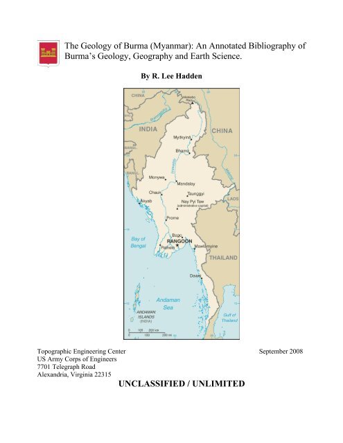
<strong>The</strong> <strong>Geology</strong> <strong>of</strong> <strong>Burma</strong> (Myanmar): An Annotated Bibliography <strong>of</strong><br />
<strong>Burma</strong>’s <strong>Geology</strong>, Geography and Earth Science.<br />
By R. Lee Hadden<br />
Topographic Engineering Center September 2008<br />
US Army Corps <strong>of</strong> Engineers<br />
7701 Telegraph Road<br />
Alexandria, Virginia 22315<br />
UNCLASSIFIED / UNLIMITED
Bibliography <strong>of</strong> <strong>Burma</strong>n Earth Science<br />
REPORT DOCUMENTATION PAGE<br />
Public reporting burden for this collection <strong>of</strong> information is estimated to average 1 hour per response, including the time for reviewing instructions, searching<br />
existing data sources, gathering and maintaining the data needed, and completing and reviewing this collection <strong>of</strong> information. Send comments regarding this<br />
burden estimate or any other aspect <strong>of</strong> this collection <strong>of</strong> information, including suggestions for reducing this burden to Department <strong>of</strong> Defense, Washington<br />
Headquarters Services, Directorate for Information Operations and Reports (0704-0188), 1215 Jefferson Davis Highway, Suite 1204, Arlington, VA 22202-4302.<br />
Respondents should be aware that notwithstanding any other provision <strong>of</strong> law, no person shall be subject to any penalty for failing to comply with a collection <strong>of</strong><br />
information if it does not display a currently valid OMB control number. PLEASE DO NOT RETURN YOUR FORM TO THE ABOVE ADDRESS.<br />
1. REPORT 2. REPORT TYPE: Bibliography<br />
DATE<br />
4. TITLE AND SUBTITLE: <strong>The</strong> <strong>Geology</strong> <strong>of</strong> <strong>Burma</strong> (Myanmar): An Annotated<br />
Bibliography <strong>of</strong> <strong>Burma</strong>’s <strong>Geology</strong>, Geography and Earth Science.<br />
6. AUTHOR(S) HADDEN, Robert Lee<br />
7. PERFORMING ORGANIZATION NAME(S) AND ADDRESS(ES)<br />
US Army Corps <strong>of</strong> Engineers<br />
Topographic Engineering Center<br />
ATTN: CEERD-TO-I<br />
7701 Telegraph Road<br />
Alexandria, VA 22315-3864<br />
9. SPONSORING / MONITORING AGENCY NAME(S) AND ADDRESS(ES)<br />
Geospatial 7701 Telegraph Road<br />
<strong>Library</strong> Alexandria, VA 22315-3864<br />
12. DISTRIBUTION / AVAILABILITY STATEMENT<br />
Unclassified/Unlimited<br />
13. SUPPLEMENTARY NOTES:<br />
14. ABSTRACT<br />
A bibliography on <strong>Burma</strong> prepared by the Topographic Engineering Center<br />
(TEC) to assist with humanitarian efforts <strong>of</strong>fered by the US Government<br />
after the devastating Cyclone Nargis hit <strong>Burma</strong> on May 2, 2008. As such,<br />
this bibliography covers items <strong>of</strong> interest to disaster engineers and<br />
emergency planners, including citations on topography, transportation,<br />
water, medical concerns, and security.<br />
15. SUBJECT TERMS: <strong>Burma</strong>. Climate. Earth Sciences. Forests. <strong>Geology</strong>. Geography.<br />
Groundwater. Hydrology. Maps. Meteorology. Mining. Myanmar. Soils.<br />
Surface-water. Transportation. Water.<br />
16. SECURITY CLASSIFICATION OF: 17. LIMITATION 18. NUMBER OF PAGES 312<br />
Unclassified/Unlimited OF ABSTRACT<br />
a. REPORT b. ABSTRACT<br />
c. THIS PAGE<br />
Unclassified/Unlimited Unlimited<br />
September 2008 2
<strong>Burma</strong><br />
<strong>The</strong> <strong>Geology</strong> <strong>of</strong> <strong>Burma</strong> (Myanmar):<br />
An Annotated Bibliography <strong>of</strong> <strong>Burma</strong>’s<br />
<strong>Geology</strong>, Geography and Earth Science<br />
By<br />
R. Lee Hadden<br />
Topographic Engineering Center (TEC)<br />
Engineer Research and Development Center (ERDC)<br />
7701 Telegraph Road<br />
Alexandria, VA 22315<br />
September 2008<br />
Robert.L.Hadden@us.army.mil<br />
Preface<br />
This bibliography was produced quickly by the Topographic Engineering Center<br />
(See: http://tec.army.mil/<strong>Burma</strong>/index.html) in response to the humanitarian crisis caused<br />
by the Cyclone Nargis which hit <strong>Burma</strong> in May 2, 2008. <strong>The</strong> cyclone packed winds <strong>of</strong><br />
215 km/hr (135mph) and with very heavy rains. <strong>The</strong> cyclone made landfall in <strong>Burma</strong> as a<br />
Category 4 cyclone, with catastrophic results, with estimates <strong>of</strong> 146,000 fatalities, and<br />
thousands more people missing, injured and homeless.<br />
<strong>The</strong>se two images below are provided from NASA, and show the overwhelming<br />
amount <strong>of</strong> damage caused by Cyclone Nargis to <strong>Burma</strong>. Flood water can be difficult to<br />
see in photo-like satellite images, particularly when the water is muddy. This pair <strong>of</strong><br />
images from the Moderate Resolution Imaging Spectroradiometer (MODIS) on NASA’s<br />
Terra satellite uses a combination <strong>of</strong> visible and infrared light to make the floodwaters<br />
obvious to the viewer. Water is blue or nearly black, vegetation is bright green, bare<br />
ground is tan, and the clouds are white or light blue.<br />
On April 15, 2008 (the top image), rivers and lakes are sharply defined against a<br />
backdrop <strong>of</strong> vegetation and fallow agricultural land. <strong>The</strong> Irrawaddy River flows south<br />
through the left-hand side <strong>of</strong> the image, splitting into numerous distributaries known as<br />
the Mouths <strong>of</strong> the Irrawaddy. <strong>The</strong> wetlands near the shore are a deep blue green. Cyclone<br />
Nargis came ashore across the Mouths <strong>of</strong> the Irrawaddy and followed the coastline<br />
northeast.<br />
<strong>The</strong> entire coastal plain <strong>of</strong> <strong>Burma</strong> is flooded in the May 5 image (the bottom<br />
image). <strong>The</strong> fallow agricultural areas appear to have been especially hard hit. For<br />
example, Yangôn (population over 4 million) is almost completely surrounded by floods.<br />
Several large cities (population 100,000–500,000) are in the affected area. Muddy run<strong>of</strong>f<br />
colors the Gulf <strong>of</strong> Martaban turquoise.<br />
<strong>The</strong> high-resolution image provided above is at MODIS’ maximum spatial<br />
resolution (level <strong>of</strong> detail) <strong>of</strong> 250 meters per pixel. <strong>The</strong> MODIS Rapid Response Team<br />
provides twice-daily images <strong>of</strong> the region in additional resolutions and formats, including<br />
photo-like natural color.
Bibliography <strong>of</strong> <strong>Burma</strong>n Earth Science<br />
Relief efforts were slowed or non-existent as the Burmese military rulers initially<br />
refused aid from outside the country. By May 12-20, 2008, the US Department <strong>of</strong><br />
Defense coordinated $1.2 million dollars <strong>of</strong> relief supplies on 36 USAF C-130 flights.<br />
<strong>The</strong> relief supplies would provide needed help to some 113,000 storm victims. Much<br />
more aid was needed.<br />
President George Bush also ordered the Essex group, composed <strong>of</strong> the USS<br />
Essex, the USS Juneau, the USS Harpers Ferry, and elements <strong>of</strong> the Third Marine<br />
September 2008 4
Bibliography <strong>of</strong> <strong>Burma</strong>n Earth Science<br />
Expeditionary Force (III MEF), to stand by <strong>of</strong>fshore with relief supplies, disaster<br />
engineering expertise and medical assistance.<br />
<strong>The</strong> Topographic Engineering Center (TEC) has scanned a number <strong>of</strong> geological<br />
and hydrological maps <strong>of</strong> <strong>Burma</strong> to assist the disaster planners on these ships and<br />
elsewhere. This data is used to select locations for supply dumps, emergency hospital<br />
locations, sanitation and clean water supplies. Other data on transportation and terrain<br />
helped with the airlifting <strong>of</strong> supplies, evacuating <strong>of</strong> the injured, and the prevention <strong>of</strong><br />
bottlenecks in air, land and water traffic.<br />
<strong>The</strong> government <strong>of</strong> <strong>Burma</strong> refused permission for the US Navy and Marines to<br />
aid the survivors. <strong>The</strong> Essex group stood <strong>of</strong>f the coast <strong>of</strong> <strong>Burma</strong>, waiting for permission<br />
to lend its support <strong>of</strong> supplies, helicopters and manpower, but it was never given.<br />
Although the humanitarian aid was refused, the TEC webpage has also helped<br />
civilian relief agencies in their efforts. <strong>The</strong> data is available around the world, and the US<br />
government, the United Nations and a number <strong>of</strong> non-governmental organizations have<br />
made use <strong>of</strong> this data in their humanitarian relief efforts.<br />
Copyrighted and sensitive materials have been placed behind the PKI site, and are<br />
available only to US government civilian and military personnel with CAC access.<br />
However, most <strong>of</strong> the information is from open sources, and thus is available to anyone.<br />
Special thanks are given to all those people outside <strong>of</strong> the Topographic<br />
Engineering Center who helped in this emergency project. <strong>The</strong>y include the Reference<br />
Staff <strong>of</strong> the US Geological Survey <strong>Library</strong> who replied promptly to our requests and<br />
made their services so accessible (http://library.usgs.gov/); the public services staff <strong>of</strong> the<br />
Defense Technical Information Center (DTIC) who responded so quickly to our requests,<br />
and bent over backwards to make their information available online to the public<br />
(http://www.dtic.mil/dtic/index.html); the Reference Staff <strong>of</strong> the Geography and Map<br />
Division, <strong>The</strong> <strong>Library</strong> <strong>of</strong> Congress (http://www.loc.gov/rr/geogmap/) and to Mr. Willie<br />
Sayeed <strong>of</strong> RefWorks for the use <strong>of</strong> their services in putting together and updating the<br />
bibliography <strong>of</strong> citations from so many different electronic and manual resources so<br />
quickly (www.RefWorks.com).<br />
Introduction<br />
<strong>The</strong> Land:<br />
<strong>The</strong> country is known by several names: the conventional long form: “Union <strong>of</strong><br />
<strong>Burma</strong>”; conventional short form: “<strong>Burma</strong>”; local long form: “Pyidaungzu Myanma<br />
Naingngandaw” (translated by the US Government as “Union <strong>of</strong> Myanma” and by the<br />
Burmese as “Union <strong>of</strong> Myanmar”); local short form: “Myanma Naingngandaw”; former:<br />
“Socialist Republic <strong>of</strong> the Union <strong>of</strong> <strong>Burma</strong>”. Note: since 1989 the military authorities in<br />
<strong>Burma</strong> have promoted the name Myanmar as a conventional name for their state; this<br />
decision was not approved by any sitting legislature in <strong>Burma</strong>, and the US Government<br />
did not adopt the name, which is a derivative <strong>of</strong> the Burmese short-form name Myanma<br />
Naingngandaw.<br />
<strong>The</strong> capital city is Rangoon (Yangon), with geographic coordinates: 16 48 N, 96<br />
09 E. Strategically, <strong>Burma</strong> holds a strategic location near major Indian Ocean shipping<br />
lanes.<br />
September 2008 5
Bibliography <strong>of</strong> <strong>Burma</strong>n Earth Science<br />
<strong>The</strong> time difference: UTC+6.5 (11.5 hours ahead <strong>of</strong> Washington, DC during<br />
Standard Time). Note: Nay Pyi Taw is actually the administrative capital. <strong>The</strong>re are<br />
seven administrative division (taing-myar, singular - taing) and 7 states (pyi ne-myar,<br />
singular - pyi ne). <strong>The</strong> divisions are: Ayeyarwady, Bago, Magway, Mandalay, Sagaing,<br />
Tanintharyi, Yangon. <strong>The</strong> seven states are: Chin, Kachin, Kayah, Kayin, Mon, Rakhine<br />
and Shan.<br />
<strong>Burma</strong> lies in Southeastern Asia, bordering the Andaman Sea and the Bay <strong>of</strong><br />
Bengal, between Bangladesh and Thailand. It is slightly smaller in land area than Texas,<br />
and has a total area <strong>of</strong> 678,500 sq km. Of this, land covers 657,740 sq km, and water<br />
covers 20,760 sq km. <strong>The</strong> national boundaries total: 5,876 km, with border countries<br />
boundaries <strong>of</strong>: Bangladesh at 193 km; China at 2,185 km; India at 1,463 km; Laos at 235<br />
km and Thailand with a shared boundary <strong>of</strong> 1,800 km. <strong>The</strong>re is also 1,930 km <strong>of</strong><br />
coastline.<br />
<strong>The</strong> Physical Features <strong>of</strong> <strong>Burma</strong> 1<br />
<strong>Geology</strong>, Topology and Terrain<br />
As a country, <strong>Burma</strong> slopes downward in elevation from the north to the south,<br />
and is naturally divided into “Upper <strong>Burma</strong>” and “Lower <strong>Burma</strong>”. <strong>The</strong> terrain is made up<br />
<strong>of</strong> central lowlands ringed by steep, rugged highlands. In the north, the Hengduan Shan<br />
mountains form the border with China. Mount Hkakabo Razi, located in the Kachin State,<br />
is at an elevation <strong>of</strong> 5,881 m (19,295 ft), and is the highest point in <strong>Burma</strong>. <strong>The</strong> mountain<br />
ranges in <strong>Burma</strong> generally run from north to south as well. Three <strong>of</strong> these mountain<br />
ranges, namely the Rakhine Yoma, the Bago Yoma, and the Shan Plateau, all exist within<br />
<strong>Burma</strong>, and all <strong>of</strong> these ranges run from north-to-south from the Himalayas.<br />
<strong>The</strong>se mountain chains also divide <strong>Burma</strong>'s three main river systems, which are<br />
the Irrawaddy (aka Ayeyarwady), the Salween (aka Thanlwin), and the Sittang rivers.<br />
<strong>Burma</strong>'s longest river, the Irrawaddy River, is nearly 2,170 kilometers (1,348 mi) long,<br />
and it flows through the country and into the Gulf <strong>of</strong> Martaban. Fertile plains exist in the<br />
valleys between the mountain chains. <strong>The</strong> majority <strong>of</strong> <strong>Burma</strong>'s population lives in the<br />
Irrawaddy valley, which is situated between the Rakhine Yoma and the Shan Plateau.<br />
As a whole, <strong>Burma</strong> can be divided into five physiographic regions: the northern<br />
mountains; the western ranges; the eastern plateau; the central basin and lowlands, and<br />
finally the coastal plains.<br />
<strong>The</strong> northern mountain region consists <strong>of</strong> a series <strong>of</strong> ranges that form a geological<br />
complex at Mount Hkakabo. In terms <strong>of</strong> plate tectonics, this geological complex or<br />
“geologic knot” marks the northeastern limit <strong>of</strong> the encroaching Indian-Australian Plate.<br />
<strong>The</strong> Indian-Australian Plate has been colliding with the southern edge <strong>of</strong> the Eurasian<br />
Plate for roughly the past 50 million years, and has been thrusting up the mountain ranges<br />
1 <strong>The</strong> data in this introductory section are collected from a number <strong>of</strong> open literature and common<br />
knowledge publications and resources, such as various almanacs, AGI’s “Glossary <strong>of</strong> <strong>Geology</strong>”,<br />
geographical dictionaries and gazetteers; encyclopedias such as the World Survey <strong>of</strong> Climatology, the<br />
Encyclopedia Britannica, Encarta, Water Encyclopedia, etc.; open source government publications and<br />
websites from the US Department <strong>of</strong> State, the <strong>Library</strong> <strong>of</strong> Congress, the Defense Technical Information<br />
Center, the Food and Agriculture Organization <strong>of</strong> the UN and others; the CIA Factbook, and several<br />
different reports, articles and books on <strong>Burma</strong> from federal government geological and geographical<br />
resources.<br />
September 2008 6
Bibliography <strong>of</strong> <strong>Burma</strong>n Earth Science<br />
<strong>of</strong> <strong>Burma</strong> and the regions beyond. This northern mountain physiographic region contains<br />
the sources <strong>of</strong> several <strong>of</strong> Asia’s great rivers, including the Irrawaddy, which rises and<br />
flows wholly within <strong>Burma</strong>, and the Salween, which rises to the north in China. <strong>The</strong><br />
upper courses <strong>of</strong> these rivers all flow through deep gorges within a short distance <strong>of</strong> each<br />
other, separated by steep, sheer peaks. Jade and other minerals are mined in these<br />
northern mountains.<br />
<strong>The</strong> western range region traverses the entire western side <strong>of</strong> <strong>Burma</strong>, from the<br />
northern mountains to the southern tip <strong>of</strong> the Rakhine (Arakan) Peninsula, where they run<br />
under the sea and then reappear above the ocean as the Andaman and Nicobar Islands,<br />
territories <strong>of</strong> India. <strong>The</strong> mountains’ average elevation is about 1,800 meters (6,000 feet),<br />
although some peaks rise in height to 3,000 meters (10,000 feet) or higher. <strong>The</strong>se<br />
mountains consist <strong>of</strong> old crystalline rocks surrounded by hard, tightly folded sedimentary<br />
rocks on either side. From north to south, the Patkai Range, the Naga Hills, and the Chin<br />
Hills form the borders between India and <strong>Burma</strong>. To the south <strong>of</strong> these are the Rakhine<br />
Mountains (Arakan Mountains), which lie entirely within <strong>Burma</strong> and separate the coastal<br />
strip from the central basin.<br />
Occupying the eastern half <strong>of</strong> the country, the Shan Plateau is deeply dissected,<br />
with an average elevation <strong>of</strong> about 900 meters (3,000 feet). <strong>The</strong> Shan Plateau to the east<br />
rises abruptly from the central basin, <strong>of</strong>ten in a single step <strong>of</strong> some 600 meters (2,000<br />
feet). Because <strong>of</strong> the geology <strong>of</strong> this region, rubies and sapphires have been mined in the<br />
northern Shan Plateau since pre-colonial times. <strong>Burma</strong>’s rulers depend on sales <strong>of</strong> these<br />
precious stones such as sapphires, pearls and jade to fund their regime. Rubies are the<br />
biggest earner; 90% <strong>of</strong> the world's rubies come from the country, whose red stones are<br />
prized for their purity and hue. Thailand buys the majority <strong>of</strong> the country's gems. <strong>Burma</strong>'s<br />
“Valley <strong>of</strong> Rubies”, in the mountainous Mogok area, about 200 km (125 miles) north <strong>of</strong><br />
Mandalay, and is noted for its rare pigeon's blood rubies and blue sapphires<br />
<strong>The</strong> Shan Plateau was formed during the Mesozoic Era, some 248 to 65 million<br />
years ago, and thus is a much older geologic feature than the western mountains. But the<br />
Shan Plateau also shows more-recent and intensive folding than the western mountains,<br />
with north-south longitudinal ranges rising steeply to elevations <strong>of</strong> 1,800 to 2,600 meters<br />
(6,000 to 8,600 feet) above the plateau surface. Northward, the plateau merges into the<br />
northern mountains, and southward it continues into the Dawna Range and to the<br />
peninsular Tenasserim Mountains (aka Tanintharyi Mountains), each a series <strong>of</strong> parallel<br />
ranges with narrow valleys.<br />
<strong>The</strong> central basin and lowlands, lying between the Rakhine Mountains and the<br />
Shan Plateau, are structurally connected with the folding <strong>of</strong> the western ranges. <strong>The</strong> basin<br />
was deeply excavated by the predecessors <strong>of</strong> the Irrawaddy, Chindwin, and Sittang rivers;<br />
the valleys are now occupied by these rivers, which cover the ancient s<strong>of</strong>t sandstones,<br />
shales, and clays with their alluvial deposits.<br />
<strong>The</strong> Basin <strong>of</strong> the Irrawaddy, with its tributaries the Chindwin, Shweli, and<br />
Myitnge rivers, occupies most <strong>of</strong> <strong>Burma</strong>. In the delta regions formed by the Irrawaddy<br />
and Sittang rivers, the landscape is absolutely flat, and the monotony is relieved only by a<br />
few blocks <strong>of</strong> erosion-resistant rocks that are never more than 18 meters (60 feet) high.<br />
<strong>The</strong> basin is divided into two unequal parts, the larger Irrawaddy valley and the smaller<br />
Sittang valley. Between these two valleys are the Bago Mountains. In the centre <strong>of</strong> the<br />
basin and also structurally connected with the Bago Mountains and their northern<br />
September 2008 7
Bibliography <strong>of</strong> <strong>Burma</strong>n Earth Science<br />
extension, is a line <strong>of</strong> extinct volcanoes with small crater lakes and eroded cones. <strong>The</strong><br />
largest <strong>of</strong> these eroded volcanic cones is Popa Hill, at 1,518 meters (4,981 feet).<br />
<strong>The</strong> coastal areas consist <strong>of</strong> the narrow Rakhine and Tenasserim plains, which are<br />
backed by the higher ranges <strong>of</strong> the Rakhine and Tenasserim mountains. <strong>The</strong>se coastal<br />
regions are fringed with numerous islands <strong>of</strong> varying sizes.<br />
As to economic geology, <strong>Burma</strong> is rich in certain minerals, including metal ores,<br />
petroleum, and natural gas. Deposits <strong>of</strong> silver, lead, zinc, and gold are concentrated in the<br />
northern Shan Plateau; tin and tungsten in the Tenasserim region, and barite around the<br />
town <strong>of</strong> Maymyo in the central basin. Copper mining at the town <strong>of</strong> Monywa began in<br />
the early 1980s and has been growing, despite intermittent setbacks caused by shortages<br />
<strong>of</strong> fuel and supplies as well as by economic sanctions imposed by foreign governments.<br />
Large-scale exploitation <strong>of</strong> <strong>Burma</strong>’s mineral deposits began in the mid-1970s.<br />
Although production generally has been increasing since the late 20th century, mining<br />
accounts for only a tiny fraction <strong>of</strong> the country’s GDP and a comparable portion <strong>of</strong> the<br />
workforce.<br />
<strong>The</strong> country also has significant deposits <strong>of</strong> precious and semi-precious stones.<br />
Burmese rubies are internationally known for their deep color and quality. <strong>The</strong> country<br />
also produces smaller quantities <strong>of</strong> spinels 2 , diamonds, and other gemstones.<br />
Weather and Climate<br />
Although <strong>Burma</strong> is located in the monsoon region <strong>of</strong> Asia, its climate is greatly<br />
modified by its geographic position and its topographical relief. <strong>The</strong> cold air masses <strong>of</strong><br />
Central Asia bring snow to the northern mountains for two months <strong>of</strong> the year, but this<br />
mountain wall prevents the cold air masses from moving farther south, so that <strong>Burma</strong> lies<br />
primarily under the influence <strong>of</strong> the monsoon winds. <strong>The</strong> north-south alignment <strong>of</strong> ranges<br />
and valleys also creates a pattern <strong>of</strong> alternate zones <strong>of</strong> heavy and scanty precipitation<br />
during both the northeast and southwest monsoons. Most <strong>of</strong> the precipitation, however,<br />
comes from the southwest monsoon. <strong>The</strong> west coast is subject to occasional tropical<br />
cyclones.<br />
Most <strong>of</strong> <strong>Burma</strong> lies between the Tropic <strong>of</strong> Cancer and the Equator. <strong>The</strong> Tropic <strong>of</strong><br />
Cancer divides the country into two regions: the tropical south that covers two-thirds <strong>of</strong><br />
the country, and the sub-tropical and temperate north, which is the remaining one-third <strong>of</strong><br />
<strong>Burma</strong>. This causes two distinct seasons: the dry season from mid-October to Mid-May,<br />
and the wet season. <strong>The</strong>re is a cooler spell during the wet season from December to<br />
February.<br />
<strong>The</strong> coastal regions and the western and southeastern ranges receive more than<br />
200 inches (5,000 mm) <strong>of</strong> precipitation annually, while the delta regions receive about<br />
100 inches (2,500 mm). <strong>The</strong> central region is not only positioned away from the sea but<br />
also on the drier, lee side- in the rain shadow- <strong>of</strong> the Rakhine Mountains. Precipitation<br />
gradually decreases northward until in the region’s dry zone it amounts to only 20 to 40<br />
2 Probably named from the Latin word "spina", (meaning "thorn"), for its pointed (octahedral) crystals.<br />
Spinel is a hard mineral with octahedral crystals found in igneous and carbonate rocks. Spinel occurs<br />
typically as a contact metamorphism <strong>of</strong> impure dolomitic limestone, and less commonly as an accessory<br />
mineral <strong>of</strong> basic igneous rocks. Spinal also occurs in alluvial deposits. It consists essentially <strong>of</strong> alumina and<br />
magnesia (MgAl2O4), but commonly contains ferrous iron and sometimes also chromium. It is found in a<br />
variety <strong>of</strong> colors including blue, green, brown, black, and the valuable red variety which resembles a ruby,<br />
and is frequently used as a gemstone.<br />
September 2008 8
Bibliography <strong>of</strong> <strong>Burma</strong>n Earth Science<br />
inches (500 to 1,000 mm) per year. <strong>The</strong> Shan Plateau, because <strong>of</strong> its elevation, usually<br />
receives between 75 and 80 inches (1,900 and 2,000 mm) annually.<br />
Monsoons<br />
As said above, <strong>Burma</strong> also lies in the monsoon region <strong>of</strong> Asia, with its coastal<br />
regions receiving over 5,000 mm (200 in) <strong>of</strong> rain annually. Annual rainfall in the<br />
southern delta region is approximately 2,500 mm (100 in), while average annual rainfall<br />
in the Dry Zone, which is located in central <strong>Burma</strong>, is less than 1,000 mm (40 in).<br />
<strong>Burma</strong> has a monsoon climate with three main seasons: the hot period, the rainy<br />
season and the cooler period.<br />
<strong>The</strong> hottest period is between February and May, with little or no rain. At the end<br />
<strong>of</strong> this season, generally from March to April, the average monthly temperature reaches<br />
the upper 30°s C (lower 100°s F) in many parts <strong>of</strong> <strong>Burma</strong>. <strong>The</strong> average daily<br />
temperatures in Yangon (Rangoon) range from 24° to 36°C (75 to 97°F) in April, during<br />
the hot season.<br />
<strong>The</strong> climate <strong>of</strong> <strong>Burma</strong> and other countries in South and Southeast Asia follows a<br />
typical monsoon pattern. During the half <strong>of</strong> the year that the sun’s rays strike directly<br />
above the equator, the land mass <strong>of</strong> Asia is heated more than is the Indian Ocean. This<br />
draws moist hot air from over the ocean onto the land, bringing the rains <strong>of</strong> the southwest<br />
monsoon season. <strong>The</strong> Monsoon or Rainy season, also called “the hot and wet season”,<br />
exists usually from May to October.<br />
In <strong>Burma</strong> during this hot and wet season, rain usually falls nearly every day and<br />
sometimes all day long, and almost all <strong>of</strong> <strong>Burma</strong>’s annual rainfall occurs during this time.<br />
Rainfall during the monsoon season totals more than 500 cm (200 in) in upper <strong>Burma</strong> and<br />
over 250 cm (100 in) in lower <strong>Burma</strong> and Yangon (Rangoon). Central <strong>Burma</strong>, called the<br />
dry zone, and Mandalay, the chief city in this area, each receive about 76 cm (30 in). By<br />
July rains have brought the average temperature down to 29°C (84°F) in Mandalay and<br />
27°C (81°F) in Yangon.<br />
Average annual rainfall during this season varies from about 5,000 mm (about<br />
200 in) on the Tenasserim Coast to about 760 mm (about 30 in) at Mandalay. <strong>The</strong><br />
country receives practically all its rainfall between mid-May and October, the period <strong>of</strong><br />
the Southwest Monsoon. Annual precipitation in most <strong>of</strong> Upper <strong>Burma</strong> averages about<br />
890 mm (about 35 in) and in Lower <strong>Burma</strong> about 5080 mm (about 200 in). <strong>The</strong> climate is<br />
tropical monsoon, with cloudy, rainy, hot and humid summers during the height <strong>of</strong> the<br />
southwest monsoon season, from June to September.<br />
When the tilt <strong>of</strong> the earth brings the direct sun rays south <strong>of</strong> the equator, the<br />
heating <strong>of</strong> the Indian Ocean draws the cooler dry air <strong>of</strong> the northeast monsoon from the<br />
highlands <strong>of</strong> Asia across the countries <strong>of</strong> South and Southeast Asia. <strong>The</strong> dry, cooler<br />
weather is from October/November to February. <strong>The</strong> hot, dry inter-monsoonal season is<br />
from mid-February to mid-May. <strong>The</strong> country is less cloudy, with scant rainfall and mild<br />
temperatures and lower humidity during the winter. This is the time <strong>of</strong> the cool, relatively<br />
dry northeast monsoon.<br />
In this cooler season, which runs from late October to mid-February, the<br />
temperature for January averages 25°C (77°F) in Yangon in Lower <strong>Burma</strong> and 20°C<br />
(68°F) in Mandalay in Upper <strong>Burma</strong>. <strong>The</strong> average daily temperatures in Yangon<br />
(Rangoon) range from 18° to 32°C (64-90°F) in January, during this cooler season.<br />
September 2008 9
Bibliography <strong>of</strong> <strong>Burma</strong>n Earth Science<br />
In <strong>Burma</strong>, the mean annual temperature is 27°C (81°F). Although <strong>Burma</strong> is a<br />
tropical country, temperatures are not uniformly high throughout the year and throughout<br />
the country. <strong>The</strong> daily temperature range in <strong>Burma</strong> is greater than that temperature range<br />
in nearly all other parts <strong>of</strong> Southeast Asia. But no region in <strong>Burma</strong> has a continental type<br />
<strong>of</strong> climate (i.e., one characterized by large seasonal differences in average temperature).<br />
However, the average daily temperatures in <strong>Burma</strong> show little variation across the<br />
country, ranging from 26 °C to 28 °C (79 °F to 82 °F) between Sittwe in the Rakhine<br />
region, Yangon near the coast, and Mandalay in the northern part <strong>of</strong> the central basin. At<br />
Lashio, on the Shan Plateau, the average daily temperature is somewhat cooler, around 22<br />
°C (71 °F).<br />
Elevation and distance from the sea affect temperature as well, and temperatures<br />
are generally lower in <strong>Burma</strong>’s mountainous regions. <strong>The</strong> northern regions <strong>of</strong> <strong>Burma</strong> are<br />
the coolest in the country, with average temperatures <strong>of</strong> 21°C (70°F). Thus the climate in<br />
upper <strong>Burma</strong>, especially at altitudes ranging from about 300 to 1,220 meters (1,000–<br />
4,000 ft) <strong>of</strong> elevation, remains the most temperate throughout the year.<br />
Mandalay, in the centre <strong>of</strong> the dry zone, has some <strong>of</strong> the greatest daily<br />
temperature ranges, which span about 12°C (22°F) annually.<br />
Lower <strong>Burma</strong>, especially in the river delta and along the coastal regions, is the<br />
most humid part <strong>of</strong> the country. <strong>The</strong> coastal and delta regions have a mean annual<br />
temperature <strong>of</strong> 32°C (90°F).<br />
Surface and Ground Water Resources<br />
<strong>The</strong> water resources in <strong>Burma</strong> from 1999 include 1,045.6 cubic kilometers <strong>of</strong> total<br />
renewable water resources. Freshwater withdrawal for domestic, industrial and<br />
agricultural use, totals about 33.23 cu km/yr (1%/1%/98%); per capita water withdrawal<br />
in 2000 is about 658 cu m/yr. Environmentally, <strong>Burma</strong> suffers from deforestation and the<br />
industrial pollution <strong>of</strong> air, soil, and water. Also the inadequate sanitation and water<br />
treatment contribute to disease.<br />
Like the mountains, <strong>Burma</strong>’s main rivers run mainly from north to south. About<br />
three-fifths <strong>of</strong> the country’s surface is drained by the Irrawaddy River and its tributaries.<br />
<strong>The</strong> Rakhine coastal plains are drained by short, rapid streams, which, after forming<br />
broad river deltas, flow into the Bay <strong>of</strong> Bengal. <strong>The</strong> Tenasserim plains also are drained<br />
by short and rapid rivers, which enter the Gulf <strong>of</strong> Martaban.<br />
<strong>The</strong> Bassein River, also known as the Pathein River, drains the southern Rakhine<br />
Mountains. <strong>The</strong> Bassein River is about 257 kilometers (160 miles) long, and is chiefly a<br />
navigable outlet <strong>of</strong> the Irrawaddy River in the western part <strong>of</strong> the delta.<br />
Chindwin River: <strong>The</strong> great tributary <strong>of</strong> the Irrawaddy, the Chindwin, is about<br />
1,158 km (750 miles) long, and drains the western region. <strong>The</strong> Chindwin River<br />
(Burmese: Chindwin Myit) is the largest tributary <strong>of</strong> the Irrawaddy River. It flows<br />
entirely within <strong>Burma</strong> and is known as “Ning-thi” to the Manipuris. <strong>The</strong> Chindwin rises<br />
in the Kumon Range in northern <strong>Burma</strong>, and flows northwest through the Hukawang<br />
Valley, then south along the Indian border and then southeast to the Irrawaddy River at<br />
Myingyan.<br />
<strong>The</strong> Chindwin is navigable for some 500 miles (800 km) from its confluence with<br />
the Irrawaddy below Mandalay to the confluence with the Uyu River, its chief tributary.<br />
September 2008 10
Bibliography <strong>of</strong> <strong>Burma</strong>n Earth Science<br />
<strong>The</strong> Chindwin is served by regular river-going vessels up to the town <strong>of</strong> Homalin. Much<br />
<strong>of</strong> Chindwin's course lies in the within mountain ranges and forests.<br />
Due to the difficulty <strong>of</strong> access, much <strong>of</strong> the un-navigable river area remains<br />
unspoiled. <strong>The</strong> government <strong>of</strong> <strong>Burma</strong> recently created a very large (2,500 square mile)<br />
sanctuary for the endangered tiger within the Hukawng Valley. Teak forests within the<br />
drainage area have been a valuable resource since ancient times. <strong>The</strong> Hukawng Valley is<br />
known for its abundance <strong>of</strong> Burmese amber. Along the river, there are also deposits <strong>of</strong><br />
jade, but the best jade is found in the region around the headwaters <strong>of</strong> the Uyu river.<br />
<strong>The</strong> Irrawaddy River: <strong>The</strong> country’s trade in rice is dependent on water transport,<br />
and the Irrawaddy River is the backbone <strong>of</strong> <strong>Burma</strong>’s transportation system. <strong>The</strong><br />
Irrawaddy River starts in the North <strong>of</strong> Kachin State, at the confluence <strong>of</strong> the Mali Hka<br />
and N'Mai Hka rivers north <strong>of</strong> Myitkyina. <strong>The</strong> western Mali Hka branch arises from the<br />
end <strong>of</strong> the southern Himalayas, north <strong>of</strong> Putao, and, like the main river, is called “Nam<br />
Kiu” in the Shan language. <strong>The</strong> river then flows south through <strong>Burma</strong> to the Bay <strong>of</strong><br />
Bengal through several mouths near Rangoon. Flowing entirely through <strong>Burma</strong>, the<br />
Irrawaddy is about 2,092 km long (1,300 miles), and it is navigable year round for nearly<br />
1,000 miles (1,600 km) up to the junction with the Bhamo, the main tributary <strong>of</strong> the<br />
Chindwin River.<br />
<strong>The</strong> Irrawaddy River bisects the country from north to south and empties into the<br />
Indian Ocean through a nine-armed Irrawaddy Delta. In colonial times, before railways<br />
and automobiles, the river was known as the “Road to Mandalay”. Although navigable by<br />
large vessels to Myitkyina for a distance over 1,600 km from the ocean, the river is also<br />
full <strong>of</strong> sandbanks and islands, making such navigation difficult. For many years, the only<br />
bridge built to cross the Irrawaddy River was the Inwa Bridge.<br />
At the apex <strong>of</strong> its delta, the Irrawaddy breaks up into a vast network <strong>of</strong> streams<br />
and empties into the Andaman Sea through multiple mouths. <strong>The</strong> many streams <strong>of</strong> the<br />
Irrawaddy delta are navigable, and there is a regional system <strong>of</strong> inter-connecting canals.<br />
<strong>The</strong> Kaladan River is a river located in the west <strong>of</strong> the country around the Sittwe<br />
area. <strong>The</strong> Burmese government was working on a $500 million project in cooperation<br />
with India to attempt to facilitate river trade between the two nations. <strong>The</strong> Kaladan River<br />
trade will open up not only Mizoram but India's entire North East as a hinterland for the<br />
<strong>Burma</strong> port <strong>of</strong> Sittwe. Development <strong>of</strong> the river is also being negotiated with the Shwe<br />
Gas Project for economic enhancement.<br />
<strong>The</strong> Kok River originates in Shan State, <strong>Burma</strong>. It flows down and across the<br />
<strong>Burma</strong>-Thailand border to Mae Ai district, Chiang Mai Province. Most <strong>of</strong> its length is in<br />
Chiang Rai Province passing the districts Mueang Chiang Rai, Mae Chan, Chiang Saen<br />
and Wiang Chai. It becomes a tributary to the Mekong River in Chiang Saen district.<br />
<strong>The</strong> Mali River (Mali Hka) is a river that originates in northern <strong>Burma</strong>. It flows<br />
approximately 320 km, when it meets with the Nmai River and their confluence forms<br />
the Irrawaddy River.<br />
<strong>The</strong> Mekong is one <strong>of</strong> the world’s major rivers. It is the 11th-longest river in the<br />
world, and 7th longest in Asia, discharging 475 km 3 /114 cu mi <strong>of</strong> water annually. Its<br />
estimated length is 4,350 km (2,703 mi), and it drains an area <strong>of</strong> 795,000 km 2<br />
(307,000 square miles). From high in the Tibetan Plateau, the Mekong runs through<br />
China's Yunnan province, then through <strong>Burma</strong>, Thailand, Laos, Cambodia and Vietnam.<br />
All the other countries except China and <strong>Burma</strong> belong to the Mekong River<br />
September 2008 11
Bibliography <strong>of</strong> <strong>Burma</strong>n Earth Science<br />
Commission. <strong>The</strong> extreme seasonal variations in flow and the presence <strong>of</strong> rapids and<br />
waterfalls have made navigation extremely difficult along the river.<br />
<strong>The</strong> Moei River is a tributary <strong>of</strong> the Salween River. It originates in Phop Phra<br />
district, Tak Province. Unlike most rivers in Thailand, the Moei flows north. <strong>The</strong> river<br />
forms the natural border line between Thailand and <strong>Burma</strong>. <strong>The</strong> districts along the Moei<br />
River bank <strong>of</strong> Thailand, from South to North are Mae Sot, Mae Ramat, Tha Song Yang<br />
and finally it enters the Salween River in Sop Moei district <strong>of</strong> Mae Hong Son Province.<br />
<strong>The</strong> river is about 327 km long.<br />
<strong>The</strong> Rangoon River, also known as the Yangon River, is about 40 km long (25<br />
miles), and flows from southern <strong>Burma</strong> as an outlet <strong>of</strong> the Irrawaddy River into the<br />
Irrawaddy delta. <strong>The</strong> Rangoon River drains the Bago Mountains; both the Rangoon and<br />
the Bassein Rivers enter the Irrawaddy at the delta.<br />
<strong>The</strong> Ruak River is a river along the Thai-<strong>Burma</strong> border. It originates within the<br />
hills <strong>of</strong> the Shan State <strong>of</strong> <strong>Burma</strong>, and becomes the boundary river between Thailand and<br />
<strong>Burma</strong> at the confluence with the Mae Sai River at the northernmost point <strong>of</strong> Thailand. It<br />
then meanders to the east until it empties into the Mekong River at Ban Sop Ruak,<br />
Tambon Wiang, Chiang Saen district, Chiang Rai Province. <strong>The</strong> boundary section <strong>of</strong> the<br />
river is 26.75 km long.<br />
<strong>The</strong> Shan Plateau is drained by the Salween River, which enters <strong>Burma</strong> from<br />
southern China and empties into the Gulf <strong>of</strong> Martaban southeast <strong>of</strong> the Sittang. <strong>The</strong><br />
Salween rises in the Plateau <strong>of</strong> Tibet, and then flows east through Sichuan, then south<br />
through the western Yunnan province <strong>of</strong> southwestern China. <strong>The</strong> Salween is about 2,415<br />
km long (1500 miles). Many <strong>of</strong> its tributaries are more than 480 km (300 miles) long and<br />
join the Salween in cascades. <strong>The</strong> river continues south through <strong>Burma</strong>, and its lower<br />
course becomes part <strong>of</strong> the boundary between Thailand and <strong>Burma</strong>. <strong>The</strong> river empties<br />
into the Gulf <strong>of</strong> Martaban at Moulmein. <strong>The</strong> Salween River, because <strong>of</strong> its rapids, is<br />
navigable for less than 160 km (100 miles) from the sea.<br />
<strong>The</strong> Salween River is deeply entrenched and crosses the Shan Plateau in a series<br />
<strong>of</strong> deep gorges. It is home to over 7,000 species <strong>of</strong> plants and 80 rare or endangered<br />
animals and fish. UNESCO said this region “may be the most biologically diverse<br />
temperate ecosystem in the world” and designated it a World Heritage Site in 2003.<br />
<strong>The</strong> Salween is the longest undammed river in mainland Southeast Asia.<br />
Proposals to build several dams along the river, mainly in <strong>Burma</strong>, are controversial.<br />
Thailand is studying the feasibility <strong>of</strong> jointly constructing the Hatgyi Dam on the<br />
Salween River near the border with <strong>Burma</strong>; citing environmental, cultural, and social<br />
concerns, China is reconsidering construction <strong>of</strong> 13 dams on the Salween River but<br />
energy-starved <strong>Burma</strong> with backing from Thailand remains intent on building five hydroelectric<br />
dams downstream, despite identical regional and international protests.<br />
<strong>The</strong> Sittang River flows into the Gulf <strong>of</strong> Martaban <strong>of</strong> the Andaman Sea. <strong>The</strong><br />
Sittang flows in east central <strong>Burma</strong>, and then flows south to the head <strong>of</strong> the Gulf <strong>of</strong><br />
Martaban. <strong>The</strong> river is about 418 km long (260 miles) and, for a comparatively short<br />
river, it has a large valley and delta.<br />
Although the Sittang River flows through fairly flat country, the Sittang has a<br />
notorious tidal bore at its mouth which has precluded any but very small craft navigating<br />
the river. Strong currents make the river even less valuable as a means <strong>of</strong> transport in<br />
eastern <strong>Burma</strong>. <strong>The</strong> Sittang, in spite <strong>of</strong> its silt, is usable by smaller boats, but its basin<br />
September 2008 12
Bibliography <strong>of</strong> <strong>Burma</strong>n Earth Science<br />
does not have the same richness for agriculture as the Irrawaddy because there is no soil<br />
flowing from the Himalayas.<br />
<strong>The</strong> Zawgyi River is a river <strong>of</strong> eastern <strong>Burma</strong>. It flows through the foothills <strong>of</strong> the<br />
Shan Mountain range in Shan State.<br />
<strong>Burma</strong> has two major lakes. <strong>The</strong> Indawgyi Lake, in the northern hills, runs some<br />
24 km (15 miles) from north to south and 13 km (8 miles) from east to west. <strong>The</strong><br />
Indawgyi is one <strong>of</strong> the largest natural inland lakes <strong>of</strong> Southeast Asia.<br />
Somewhat smaller is Inle Lake, stretching about 22 km (14 miles) from north to<br />
south and 11 km (7 miles) from east to west, is located on the Shan Plateau. <strong>The</strong> Inle<br />
Lake is fed by dozens <strong>of</strong> streams.<br />
September 2008 13
Bibliography <strong>of</strong> <strong>Burma</strong>n Earth Science<br />
Geography<br />
<strong>The</strong> life expectancy in <strong>Burma</strong> is: Male 58 years; Female 63. Hospitals 1:1,586.<br />
<strong>The</strong> literacy rate is 78%.<br />
<strong>The</strong> major ethnic groups in <strong>Burma</strong> are: <strong>Burma</strong>n 68%, Shan 9%, Karen 7%,<br />
Rakhine 4%, Chinese 3%, Indian 2%, Mon 2%, other 5%. Complicating national unity,<br />
over half <strong>of</strong> <strong>Burma</strong>'s population consists <strong>of</strong> diverse ethnic groups who have substantial<br />
numbers <strong>of</strong> kin living in neighboring countries. Thailand must deal with Karen and other<br />
ethnic refugees, asylum seekers, and rebels, as well as illegal cross-border activities from<br />
<strong>Burma</strong>. India also seeks cooperation from <strong>Burma</strong> to keep Indian Nagaland separatists,<br />
such as the United Liberation Front <strong>of</strong> Assam, from hiding in the remote Burmese<br />
Uplands.<br />
Image taken from: “<strong>Burma</strong>: A Country Study.” 1984.<br />
Foreign Area Studies, the American University. 3 rd edition. US GPO.<br />
September 2008 14
Bibliography <strong>of</strong> <strong>Burma</strong>n Earth Science<br />
<strong>The</strong> <strong>Burma</strong>ns, who form the largest ethnic group, account for more than half <strong>of</strong><br />
the population. <strong>The</strong>y are concentrated in the Irrawaddy River valley and in the coastal<br />
strips, with an original homeland in the central dry zone.<br />
<strong>The</strong> Shans (shahns) are about 9% <strong>of</strong> the population. “Once the masters <strong>of</strong> the<br />
<strong>Burma</strong>ns when they ruled after the collapse <strong>of</strong> the Pagan-based monarchy, the Shans have<br />
no historical inferiority complex. In the centuries after the Pagan period, the Shans<br />
developed their own monarchies where Shan mandalas <strong>of</strong> power oscillated constantly as<br />
more powerful Burmese and Thai kings contested each other. Deference to outside<br />
royalty was a small price to pay for considerable Shan independence internally. <strong>The</strong><br />
Shans in 1983 were basically rice farmers, skillful traders, and a valley people. In matters<br />
<strong>of</strong> governance, historically they have allowed an aristocratic elite to rule them.”<br />
<strong>The</strong> Shan <strong>of</strong> the Shan Plateau have little ethno-linguistic affinity with the<br />
<strong>Burma</strong>ns, and, although historically led by hereditary rulers, their society was less<br />
elaborately structured than that <strong>of</strong> the plains peoples. <strong>The</strong> Shan represent a small but<br />
significant portion <strong>of</strong> the country’s population. <strong>The</strong> ethnographic complexity <strong>of</strong> the<br />
highlands occasionally leads to mis-groupings <strong>of</strong> some <strong>of</strong> the smaller communities with<br />
their more prominent neighbors. For example, the Wa and the Palaung <strong>of</strong> the Shan<br />
Plateau are <strong>of</strong>ten grouped with the larger, but ethnically and linguistically distinct, Shan<br />
community.<br />
<strong>The</strong> Karen ethnic group is about 7% <strong>of</strong> the Brumese population. “It has been<br />
fashionable to call the traditional religion <strong>of</strong> people like the Karens a form <strong>of</strong> animism, or<br />
‘spirit worship.’ <strong>The</strong> word never does justice to such beliefs, which may be as complex<br />
and l<strong>of</strong>ty as those <strong>of</strong> the major religions <strong>of</strong> the world. Traditional Karens, like so many<br />
other peoples, believe that both matter and spirit are realities, each possibly inhabiting the<br />
same entity at a given time or perhaps later separated but still linked. <strong>The</strong>re are Karen<br />
gods, rituals, and oral religious traditions so impressive that early missionaries toyed with<br />
the belief that the Karens were a lost tribe <strong>of</strong> Israel. No matter where Karens live, they<br />
characteristically have a strong sense <strong>of</strong> ethnic pride.”<br />
<strong>The</strong> Karen are the only hill people who have settled in significant numbers in the<br />
plains. Constituting about one-tenth <strong>of</strong> the population, they are the second largest ethnic<br />
group in <strong>Burma</strong>. <strong>The</strong>y are found in the deltas among the <strong>Burma</strong>ns, in the Bago<br />
Mountains, and along both sides <strong>of</strong> the lower Salween River. <strong>The</strong> Kayah, who live on the<br />
southern edge <strong>of</strong> the Shan Plateau, were once known as the Red Karen, or Karenni,<br />
apparently for their red robes. Although ethnically and linguistically Karen, they tend to<br />
maintain their own identity and hereditary leadership.<br />
<strong>The</strong> Chin (pronounced “JIN”): In the western hills and the Chindwin River valley<br />
are various groups called by the comprehensive name <strong>of</strong> Chin. “Turbulent, competitive,<br />
legalistic, and yet very social, the Chins did not take to Christianity as well as did the<br />
Karens. Like the Karens, those who are Christians (possibly one-quarter <strong>of</strong> the<br />
population) have hoped to use their new faith to link with outside powers to protect their<br />
people from being engulfed by <strong>Burma</strong>ns. <strong>The</strong> Chin religion, in which the door to paradise<br />
is opened by hinting done in the proper way to honor and contend with the spirits <strong>of</strong> what<br />
is killed, can be seen in contrast to the Buddhism <strong>of</strong> their neighbors, where taking life is<br />
normatively scorned. Animal sacrifice, so common among hill peoples, is likewise<br />
condemned by valley Buddhists.” <strong>The</strong> Naga on the <strong>Burma</strong> side <strong>of</strong> the frontier with India<br />
sometimes are mistakenly placed with the Chin<br />
September 2008 15
Bibliography <strong>of</strong> <strong>Burma</strong>n Earth Science<br />
Numerous small ethnic groups, most <strong>of</strong> which inhabit the upland regions, together<br />
account for roughly one-fifth <strong>of</strong> <strong>Burma</strong>’s population. <strong>The</strong> upper Irrawaddy valley and the<br />
northern hills are occupied by groups under the comprehensive name <strong>of</strong> Kachin. <strong>The</strong>se<br />
peoples long have had an association with the <strong>Burma</strong>ns. <strong>The</strong> Muhso (a Lahu people) in<br />
northeastern <strong>Burma</strong> are sometimes grouped with the Kachin.<br />
Chinese, Indians, and other minorities in <strong>Burma</strong>: “Since only people who can<br />
prove long familial links to <strong>Burma</strong> are accorded full citizenship, ethnic populations such<br />
as Muslims, Indians, and Chinese, continued to be denied full citizenship and to be<br />
excluded from government positions. People without full citizenship are not free to travel<br />
domestically and are barred from certain advanced university programs in medicine and<br />
technological fields. Anti-Chinese and anti-Muslim sentiment remained pervasive.”<br />
Religions<br />
<strong>The</strong> major religions <strong>of</strong> the country are: Buddhist 89%, Christian 4% (Baptist 3%,<br />
Roman Catholic 1%), Muslim 4%, animist 1%, other 2%.<br />
<strong>The</strong>ravada Buddhism: “In strict orthodox <strong>The</strong>ravada Buddhism, Gotama<br />
(Siddhārtha Gautama) was merely a human being; he does not exist anywhere to hear<br />
people’s prayers. His words are left in the sacred books and can be learned from his<br />
‘sons,’the living <strong>The</strong>ravada monks, who exist today as the Buddha once instructed the<br />
first monks to live. All <strong>Burma</strong>ns share in this heritage and follow some semblance <strong>of</strong> the<br />
strict orthodox teachings. <strong>The</strong> Buddhism <strong>of</strong> the Pali scriptures, however, <strong>of</strong>ten differs<br />
from actual religious beliefs and practices in modern <strong>Burma</strong>.” (all quotations are from the<br />
<strong>Library</strong> <strong>of</strong> Congress Country Studies/Area Handbook--<strong>Burma</strong> [Myanmar])<br />
Hinduism: <strong>Burma</strong> has a substantial number <strong>of</strong> Hindu adherents in Rakhine.<br />
However, many <strong>Burma</strong>ns remember the use <strong>of</strong> Indian soldiers to colonize and conquer<br />
<strong>Burma</strong>, and thus are looked upon unfavorably by the majority. Also, many <strong>of</strong> the<br />
Buddhist beliefs claim superiority over Hinduism, and the traditional Hindu gods are<br />
relegated to godlings who must be reborn as Buddhist humans.<br />
Islam: “<strong>The</strong> historically porous border between <strong>Burma</strong> and Bangladesh and India<br />
has been the source <strong>of</strong> perpetual movement <strong>of</strong> Muslims back and forth in response to<br />
their various political fortunes. Although the potential was always there for Buddhist-<br />
Muslim confrontation, in general the two groups have managed to live peaceably side by<br />
side but without much interaction.” Mosques are found in Arakan, Rangoon, and in all<br />
areas where the Muslim community is strong, some <strong>of</strong> these groups having established<br />
themselves in <strong>Burma</strong> centuries ago. Mosques are primarily found within the Rakhine<br />
State. Like the Hindu and Chinese populations, Muslims have to keep a low pr<strong>of</strong>ile in<br />
terms <strong>of</strong> asserting their ethnic identity in order to avoid the racial antagonism that has<br />
<strong>of</strong>ten flared up in the past.” (Human Rights Report...)<br />
Christian: Many Chins, Kachins, Karens and others are Christian. “Minorities in<br />
<strong>Burma</strong> face a Buddhist majority, and Christianity remains an option for asserting one’s<br />
distinctness, not only for the Karens or Chins, for example, but also for those who have<br />
had a genuine Christian conversion and for others who retain a fierce loyalty to all things<br />
British. On a visit to Mandalay, a visitor attempting, however ineptly, to speak Burmese<br />
should not be surprised to have an impeccably dressed older man watch for a while with a<br />
smile and then speak in exquisite English with a perfect Oxford accent. <strong>The</strong> same elderly<br />
September 2008 16
Bibliography <strong>of</strong> <strong>Burma</strong>n Earth Science<br />
gentleman will finish his days as an ardent Christian. No revolution will convert him into<br />
either a Buddhist or a socialist.”<br />
Languages<br />
<strong>The</strong> majority language is Burmese, though minority ethnic groups have their own<br />
languages.<br />
Many indigenous languages—as distinct from mere dialects—are spoken in<br />
<strong>Burma</strong>. <strong>The</strong> <strong>of</strong>ficial language <strong>of</strong> the country is Burmese, spoken by the people <strong>of</strong> the<br />
plains and, as a second language, by most people <strong>of</strong> the hills. During the colonial period,<br />
English became the <strong>of</strong>ficial language, but Burmese continued as the primary language in<br />
all other settings. Both English and Burmese were compulsory subjects in schools and<br />
colleges. Burmese, Chinese, and Hindi were the languages <strong>of</strong> commerce. After<br />
independence English ceased to be the <strong>of</strong>ficial language, and after the military coup <strong>of</strong><br />
1962 it lost its importance in schools and colleges; an elementary knowledge <strong>of</strong> English,<br />
however, is still required, and its instruction is again being encouraged.<br />
<strong>The</strong> local languages <strong>of</strong> <strong>Burma</strong> belong to three language families. Burmese and<br />
most <strong>of</strong> the other languages belong to the Tibeto-<strong>Burma</strong>n subfamily <strong>of</strong> Sino-Tibetan<br />
languages. <strong>The</strong> Shan language belongs to the Tai family. Languages spoken by the Mon<br />
<strong>of</strong> southern <strong>Burma</strong> and by the Wa and Palaung <strong>of</strong> the Shan Plateau are members <strong>of</strong> the<br />
Mon-Khmer subfamily <strong>of</strong> Austro-Asiatic languages.<br />
Speakers <strong>of</strong> Burmese and Mon historically have lived in the plains, while<br />
speakers <strong>of</strong> a unique dialect <strong>of</strong> Burmese (that perhaps retains some archaic features <strong>of</strong><br />
pronunciation) have occupied the Rakhine and Tenasserim coastal plains. <strong>The</strong> hills were<br />
inhabited by those speaking Shan, Kachin, Chin, and numerous other languages. In the<br />
plains the ancient division between northern and southern <strong>Burma</strong> (Upper <strong>Burma</strong> and<br />
Lower <strong>Burma</strong>, respectively) was based not only on geographic differences but also on a<br />
linguistic one. <strong>The</strong> Mon (now a small minority) lived in southern <strong>Burma</strong>, while the<br />
majority <strong>Burma</strong>n population lived in the northern dry zone.<br />
Until colonial times only Burmese, Mon, Shan, and the languages <strong>of</strong> the ancient<br />
Pyu kingdom <strong>of</strong> northern <strong>Burma</strong> were written. Writing systems for the languages <strong>of</strong> the<br />
Karen, Kachin, and Chin peoples were developed later.<br />
September 2008 17
Bibliography <strong>of</strong> <strong>Burma</strong>n Earth Science<br />
Land Use<br />
<strong>The</strong> area <strong>of</strong> arable land in <strong>Burma</strong> during 2005 was 14.92% <strong>of</strong> the country, with<br />
permanent crops: 1.31% and other uses: 83.77%. In 2003, there were 18,700 sq km <strong>of</strong><br />
irrigated land. <strong>The</strong> major agricultural products <strong>of</strong> <strong>Burma</strong> are rice, pulses, beans, sesame,<br />
groundnuts, sugarcane; hardwood; fish and fish products.<br />
According to <strong>of</strong>ficial estimates, about half <strong>of</strong> <strong>Burma</strong> remains covered with forests<br />
or jungles <strong>of</strong> various types (depending on elevation and the amount <strong>of</strong> precipitation).<br />
Even after centuries <strong>of</strong> rice cultivation involving the clearing <strong>of</strong> forested areas, large<br />
tracts <strong>of</strong> forest remain, but actual coverage may be less than estimated, however.<br />
Subtropical and temperate forests <strong>of</strong> oak and pine are found at elevations above<br />
3,000 feet (900 meters). In the northern mountains, above 6,000 feet (1,800 meters), are<br />
forests <strong>of</strong> rhododendrons. Elephants are numerous in <strong>Burma</strong>, and many are trained for<br />
work, especially in the timber industries. Tigers, leopards, and wildcats are still common<br />
in the wild. Some bears are found in the hilly regions, and gibbons and monkeys <strong>of</strong><br />
various kinds inhabit the thicker parts <strong>of</strong> the forests.<br />
Tropical evergreen rainforests <strong>of</strong> hardwood trees occur in areas receiving more<br />
than 2,000 mm (80 inches) <strong>of</strong> rain annually. In regions where the rainfall is between<br />
1,000 and 2,000 mm (40 and 80 inches) are found broad-leaved tropical-deciduous<br />
monsoon forests, the trees <strong>of</strong> which shed their leaves during the hot season. <strong>The</strong>y produce<br />
valuable woods, notably teak. <strong>The</strong> jungles <strong>of</strong> <strong>Burma</strong> are home to a pr<strong>of</strong>usion <strong>of</strong> birdlife,<br />
including grouse, pheasants, parrots, peafowl and other wild fowl. <strong>The</strong> Asian two-horned<br />
rhinoceros (Dicerorhinus sumatrensis), the wild water buffalo, the gaur (a species <strong>of</strong> wild<br />
cattle), and various kinds <strong>of</strong> deer were once plentiful but they are now reduced in number<br />
and are protected.<br />
Where rainfall is less than 40 inches, the forests gradually open into scrubland.<br />
<strong>The</strong>re are no true grasslands in <strong>Burma</strong>, but bamboo, bracken (ferns), and coarse grass<br />
grow in areas where the forest has been cleared and then abandoned.<br />
Snakes include pythons, cobras, and vipers, and crocodiles are found in the deltas.<br />
Turtles live in coastal regions, and edible fish abound in every stream.<br />
<strong>The</strong> country <strong>of</strong> <strong>Burma</strong> can be divided into three distinct agricultural regions: the<br />
Irrawaddy river delta, where cultivation <strong>of</strong> rice in flooded paddies predominates; the<br />
largely irrigated dry zone, an area primarily <strong>of</strong> rice production but where a wide variety<br />
<strong>of</strong> other crops also are raised; and the hill and plateau regions, where forestry and<br />
cultivation <strong>of</strong> rice and other crops through shifting agriculture are most important.<br />
Delta<br />
<strong>The</strong> delta’s traditional agriculture consisted primarily <strong>of</strong> rice in normal years, with<br />
the substitution <strong>of</strong> millet in drier years or when there was insufficient moisture for rice.<br />
Both millet and rice yielded good returns on the alluvial soils.<br />
Although the dry zone was <strong>Burma</strong>’s most important agricultural region in the<br />
past, the rice production <strong>of</strong> the Irrawaddy River delta now provides much <strong>of</strong> the country’s<br />
export earnings and the staple diet <strong>of</strong> the country’s people. In the Irrawaddy and Sittang<br />
river deltas are also found tidal forests <strong>of</strong> mangrove trees that grow as high as 30 meters<br />
(100 feet) and these trees supply firewood and bark for tanning.<br />
September 2008 18
Bibliography <strong>of</strong> <strong>Burma</strong>n Earth Science<br />
<strong>The</strong> lowland regions are covered with alluvial soils- mainly silt and clay. Low in<br />
nutrients and organic matter, the planted soils are improved by fertilizers. <strong>Burma</strong>’s richest<br />
soils are found in a narrow alluvial strip along the Bay <strong>of</strong> Bengal, where mountain<br />
streams irrigate the land in the wide Irrawaddy and Sittang river valleys. <strong>The</strong>se deep soil<br />
deposits form a vast, fertile belt especially suitable for rice cultivation because <strong>of</strong> the<br />
abundant moisture.<br />
Dry Zone<br />
<strong>The</strong> Dry Zone covers approximately 8,718,898 hectares or about 13% <strong>of</strong> the<br />
country's total land area, and is situated in the lower Sagaing, Mandalay and Magway<br />
Divisions. Based on mean annual precipitation rates the Dry Zone covers 13<br />
administrative districts and 57 townships. <strong>The</strong> topography is generally undulating. Most<br />
<strong>of</strong> the local streams are dry for much <strong>of</strong> the year with water flow is usually limited to the<br />
rainy periods.<br />
Crops grown in the dry zone, in addition to rice and millet, include sugarcane,<br />
fruits (such as plantains), legumes, peanuts or groundnuts, maize, onions, sesame, rubber,<br />
and allspice. To cultivate much <strong>of</strong> this land successfully, however, irrigation is required.<br />
<strong>The</strong> earliest known irrigation works were constructed in the 1st century and<br />
greatly improved during the 11th century. Although the irrigation system maintenance<br />
lapsed somewhat after the fall <strong>of</strong> the monarchy in the late 19th century, many <strong>of</strong> the<br />
ditches and streams are still in active service. As in the delta, the arrival <strong>of</strong> the British in<br />
the dry zone led to increased commercial and public-works activities. British authorities<br />
repaired and extended parts <strong>of</strong> these ancient systems during the early 20th century. Most<br />
<strong>of</strong> <strong>Burma</strong>’s irrigated land is in the dry zone, and almost all <strong>of</strong> it is planted in rice. <strong>The</strong><br />
portions <strong>of</strong> the dry zone that are not irrigated are utilized for the production <strong>of</strong> crops that<br />
are less sensitive to the seasonality or irregularity <strong>of</strong> rainfall than rice. In addition to the<br />
crops mentioned above, cotton and millet are cultivated, although neither is <strong>of</strong><br />
considerable significance. Cattle also are raised there.<br />
<strong>The</strong> Dry Zone townships are characterized by clay, sandy loam and sandy soils<br />
that include gravel. <strong>The</strong> soils clearly vary with topography. According to soil survey data,<br />
all soil series in the Dry Zone have low fertility and have declining organic matter levels.<br />
Potassium levels are also low for agriculture. Nitrogen is required for all non-legume<br />
crops on all soil types. This also suggests the consistent low organic matter level in the<br />
soil.<br />
<strong>The</strong> soil moisture holding capacity <strong>of</strong> the soils <strong>of</strong> the Dry Zone are low and with<br />
the high level <strong>of</strong> evapotranspiration, impacts agriculture. This lack <strong>of</strong> moisture in the<br />
ground constitutes a major constraint to crop growth during periods <strong>of</strong> inadequate<br />
rainfall, such as in June and July. Farm management practices that conserve soil moisture<br />
or increase the water holding capacity <strong>of</strong> the soils are being practiced to help take<br />
advantage <strong>of</strong> the full growing season. Hard pan formation is common to all the upland<br />
areas.<br />
In the dry belt <strong>of</strong> the central region are found red-brown soils rich in calcium and<br />
magnesium. In the same region, however, when the soil has a low clay content, and it<br />
becomes saline under high evaporation that is recognizable by its yellow or brown color.<br />
Soil erosion is a serious problem and in some places in the Dry Zone the soil has<br />
been almost completely removed by water and wind erosion. Soil erosion is particularly<br />
September 2008 19
Bibliography <strong>of</strong> <strong>Burma</strong>n Earth Science<br />
severe in the upland areas <strong>of</strong> Kyaukpadaung and Chaung U, largely as a result <strong>of</strong> the high<br />
intensity <strong>of</strong> rainfall and rapid surface run<strong>of</strong>f. Moreover, since most <strong>of</strong> the soil in these<br />
areas is moderately textured with a slope ranging from 5-15%, the erodibility <strong>of</strong> the soil<br />
is also high. In Chaung U, the most severe erosion occurs in the upland areas. In contrast,<br />
the incidence <strong>of</strong> soil erosion in the foot plain is lower. Sheet and rill erosion and vertical<br />
dissection are widespread, resulting in an uneven topography.<br />
In Magway, because <strong>of</strong> the sandy topsoil there is also a high level <strong>of</strong> erosion. <strong>The</strong><br />
susceptibility <strong>of</strong> the soil to erosion is compounded by the high level <strong>of</strong> rainfall occurring<br />
over short periods. Wind erosion is a particularly severe problem while sheet and gully<br />
erosion are largely confined to wasteland areas. Soil erosion and land degradation are the<br />
two components responsible for declining production potential.<br />
Hill and Plateau Country<br />
<strong>The</strong> third agricultural zone, the hill and plateau country, occupies perhaps twothirds<br />
<strong>of</strong> the area <strong>of</strong> <strong>Burma</strong>. This land has less economic significance than the other two<br />
zones; it is the home <strong>of</strong> many <strong>of</strong> the country’s non-<strong>Burma</strong>n ethnic groups, most <strong>of</strong> whom<br />
are engaged in shifting cultivation. More-sedentary modes <strong>of</strong> agriculture also exist,<br />
however, and have been imposed with the advance <strong>of</strong> agricultural technology, increased<br />
population, and central planning.<br />
<strong>The</strong> highland regions <strong>of</strong> <strong>Burma</strong> are covered with highly leached, iron-rich, dark<br />
red and reddish brown soils. When protected by forest cover, these soils absorb the<br />
region’s heavy rain, but they erode quickly once the forest cover has been cleared.<br />
Outside the forest areas <strong>of</strong> these highlands, the principal crops raised are rice, yams, and<br />
millet, and large numbers <strong>of</strong> pigs and poultry are kept. Bullocks and buffalo are used as<br />
draft animals, and goats, pigs, and poultry are raised for food in all parts <strong>of</strong> the country.<br />
September 2008 20
Bibliography <strong>of</strong> <strong>Burma</strong>n Earth Science<br />
Myanmar Dominant Soils. Geographical distribution <strong>of</strong> 10 dominant<br />
soil types in Myanmar. Map created by FAO/NRL from Harmonized<br />
World Soil Database (HWSD) – FAO<br />
September 2008 21
Bibliography <strong>of</strong> <strong>Burma</strong>n Earth Science<br />
Economy<br />
<strong>Burma</strong> is one <strong>of</strong> the poorest nations in southeastern Asia, suffering from decades<br />
<strong>of</strong> stagnation, mismanagement and isolation. <strong>Burma</strong>'s GDP grows at an average rate <strong>of</strong><br />
2.9% annually – the lowest rate <strong>of</strong> economic growth in the Greater Mekong Sub-region.<br />
Agriculture, forestry, and fishing together constitute the largest contributor to<br />
<strong>Burma</strong>’s economy. About half <strong>of</strong> all agricultural land in <strong>Burma</strong> is devoted to rice, and to<br />
increase production the government has promoted multiple cropping (sequential<br />
cultivation <strong>of</strong> two or more crops on a single piece <strong>of</strong> land in a single year), a system that<br />
is easily supported by the country’s climate. As a whole, the sector accounts for nearly<br />
one-half <strong>of</strong> the country’s gross domestic product and employs about two-thirds <strong>of</strong> the<br />
labor force.<br />
<strong>The</strong> second most important element in the diet, after rice, is fish, either fresh fish<br />
or in the form <strong>of</strong> ngapi, a sort <strong>of</strong> nutritional paste that is prepared in a variety <strong>of</strong> ways and<br />
eaten as a condiment. Marine fisheries are not well developed, although the industry’s<br />
reported commercial catch is much greater than that reported from inland waters. Much<br />
private, noncommercial fishing is provided, however, in virtually every type <strong>of</strong><br />
permanent, seasonal, or artificial body <strong>of</strong> inland water <strong>of</strong> any size. Non-indigenous fish,<br />
including the European carp and the tilapia, originally brought from Thailand, have<br />
become the focus <strong>of</strong> a growing aquaculture industry.<br />
Under British administration and until the early 1960s, <strong>Burma</strong> was the wealthiest<br />
country in Southeast Asia. It was once the world's largest exporter <strong>of</strong> rice. After <strong>Burma</strong><br />
was <strong>of</strong>ficially annexed to British India in 1886, however, colonial policy called for a<br />
more commercially oriented and more extensive cultivation <strong>of</strong> rice. Since the indigenous<br />
labor force was thought to be insufficient to support the colonial export economy, the<br />
immigration <strong>of</strong> Indian and Chinese laborers into <strong>Burma</strong> was <strong>of</strong>ficially encouraged during<br />
the early decades <strong>of</strong> the 20th century. Despite the departure <strong>of</strong> much <strong>of</strong> the immigrant<br />
labor force and the relatively low growth in rice production after World War II, rice<br />
remained both the basic food and, until the 1990s (when it was overtaken by dry beans),<br />
the principal agricultural export <strong>of</strong> <strong>Burma</strong>.<br />
Also during the British administration, <strong>Burma</strong> supplied oil through the <strong>Burma</strong>h<br />
Oil Company. <strong>Burma</strong> also had a wealth <strong>of</strong> natural and labor resources. It produced 75%<br />
<strong>of</strong> the world's teak and had a highly literate population. <strong>The</strong> country was believed to be<br />
on the fast track to development.<br />
After a parliamentary government was formed in 1948, Prime Minister U Nu<br />
attempted to make <strong>Burma</strong> a welfare state. His administration adopted the Two-Year<br />
Economic Development Plan, which was a failure. <strong>The</strong> 1962 coup d’état was followed by<br />
an economic scheme called the “Burmese Way to Socialism”, a plan to nationalize all<br />
industries, with the exception <strong>of</strong> agriculture. In 1989, the Burmese government began<br />
decentralizing economic control. It has since liberalized certain sectors <strong>of</strong> the economy,<br />
although lucrative industries <strong>of</strong> gems, oil and forestry remain heavily regulated. <strong>The</strong>se<br />
industries have recently been exploited by foreign corporations and governments which<br />
have partnered with the local government to gain access to <strong>Burma</strong>'s natural resources.<br />
<strong>The</strong> major occupations in <strong>Burma</strong> are in agricultural processing; wood and wood<br />
products; copper, tin, tungsten, iron; cement, construction materials; pharmaceuticals;<br />
fertilizer; natural gas; garments, jade and gems. <strong>The</strong> labor force in 2001 was 70% in<br />
agriculture; 7% in industry and 23% in services.<br />
September 2008 22
Bibliography <strong>of</strong> <strong>Burma</strong>n Earth Science<br />
Transportation<br />
Airports. <strong>The</strong>re are 86 airports in <strong>Burma</strong> in 2007. <strong>The</strong>re are 25 airports with paved<br />
runways over 3,047 meters long; 8 airports with paved runways from 2,438 to 3,047<br />
meters long; 10 airports with paved runways from 1,524 to 2,437 meters long; 5 airports<br />
with paved runways from 914 to 1,523 meters long and one airport that has a runway that<br />
is under 914 meters long.<br />
Airports with unpaved runways total 61. Airports with unpaved runways over<br />
3,047 m: 1; airports 1,524 to 2,437 m: 14; airports 914 to 1,523 m: 14; and those airports<br />
with unpaved runways under 914 m: 32.<br />
In 2007, there were four heliports listed in <strong>Burma</strong>. <strong>The</strong> state-run <strong>Burma</strong> Airways<br />
International runs frequent domestic flights between Yangon and other cities; it also has<br />
international service from Yangon to several major Southeast Asian cities. <strong>The</strong>re are also<br />
small privately owned airlines that <strong>of</strong>fer domestic and very limited international service.<br />
International airports are located only in Yangon and Mandalay.<br />
Railroads in <strong>Burma</strong> are old and rudimentary, with inadequate and few repairs<br />
since their construction in the late nineteenth century. Railways total 3,955 km <strong>of</strong> narrow<br />
gauge track and 3,955 km <strong>of</strong> 1.000-m gauge in 2006.<br />
<strong>The</strong> first railway line, running from Yangon to Pyay (Prome) and built in 1877,<br />
followed the route <strong>of</strong> the Irrawaddy River valley. <strong>The</strong> line was not extended to Mandalay;<br />
instead, after 1886 a new railway from Yangon up the Sittang valley was constructed,<br />
meeting the Irrawaddy at Mandalay. From Mandalay it crossed the river and, avoiding<br />
the Irrawaddy valley, went up the Mu River valley to connect with the Irrawaddy again at<br />
Myitkyina. A short branch line railroad now connects Naba to Katha on the Irrawaddy<br />
below Bhamo.<br />
<strong>The</strong> Yangon-Mandalay-Myitkyina railway is the main artery, and from it there are<br />
branch lines connecting the northern and central Shan Plateau with the Irrawaddy. Other<br />
branches run from Pyinmana across the Bago Mountains to Kyaukpadaung and from<br />
Bago to Mawlamyine to Ye. <strong>The</strong> Pyay-Yangon railway has a branch crossing the apex <strong>of</strong><br />
the delta to Hinthada and Pathein (Bassein).<br />
Roads and highways are normally unpaved, except in the major cities. About 78<br />
percent <strong>of</strong> the main roads are paved, with about two-thirds <strong>of</strong> the roads constructed <strong>of</strong><br />
gravel, and the rest passable most easily only by jeep or ox cart. In 2005, there were a<br />
total <strong>of</strong> 27,000 km <strong>of</strong> roadways in <strong>Burma</strong>, <strong>of</strong> which 3,200 km are paved and 23,800 km<br />
are unpaved.<br />
<strong>The</strong> road system, until independence, was confined to the Irrawaddy and Sittang<br />
valleys, and effectively duplicated the railway route. <strong>The</strong>re are extensive road links and<br />
several bridge links with Thailand and China. A road goes from Pyay along the<br />
Irrawaddy to the oil fields, and many other roads extend into the rural areas.<br />
<strong>The</strong>se rural roads, however, are <strong>of</strong>ten impassable during the wet season. In the<br />
1990s the government focused considerable energy on reconstructing roads, <strong>of</strong>ten with<br />
volunteer or forced labor. <strong>The</strong>re were originally three international roads in use during<br />
World War II: the <strong>Burma</strong> Road from Lashio to Kunming in China; the Stilwell, or Ledo,<br />
Road between Myitkyina and Ledo in India; and the road between Kengtung, in the<br />
southeastern Shan Plateau, and northern Thailand. <strong>The</strong> <strong>Burma</strong> Road, which extended<br />
September 2008 23
Bibliography <strong>of</strong> <strong>Burma</strong>n Earth Science<br />
from northeast <strong>of</strong> Mandalay into China, played an important role in World War II. <strong>The</strong>se<br />
roads subsequently became neglected but more recently have been rebuilt and extended.<br />
<strong>The</strong>re are about 12,800 km (2007) <strong>of</strong> waterways in <strong>Burma</strong>. In 2008, the merchant<br />
marine in <strong>Burma</strong> has a total <strong>of</strong> 27 registered ships (1000 GRT 3 or over) 170,403 GRT and<br />
211,739 DWT 4 ; by type: bulk carrier 2, cargo 19, passenger 2, passenger/cargo 3,<br />
specialized tanker 1; foreign-owned: 3 (Germany 2, Japan 1).<br />
<strong>The</strong> long coastline and numerous islands in <strong>Burma</strong> provide several good harbors.<br />
Small steamers and country boats also serve the coasts <strong>of</strong> the Rakhine and Tenasserim<br />
regions. <strong>The</strong> major ports and terminals are: Moulmein, Yangon and Sittwe. Yangon, as<br />
the terminus <strong>of</strong> road, rail, and river-transport systems, is the country’s major port, with<br />
up-to-date equipment and facilities. Pathein, Mawlamyine, and Sittwe are also important<br />
ports.<br />
Bibliography and Sources <strong>of</strong> Citations<br />
This bibliography on the geology, geography and earth sciences <strong>of</strong> <strong>Burma</strong> was<br />
gathered from a variety <strong>of</strong> different abstracting, bibliographical and cartographical<br />
resources. <strong>The</strong>y include 592 citations from agriculture, botany, engineering, geology,<br />
geography, medical, military science, soils, transportation and other subject resources.<br />
<strong>The</strong>se citation resources are provided by a number <strong>of</strong> scientific societies, such as the<br />
American Geographical Society; from government resources, such as the Defense<br />
Technical Information Center; non-governmental organizations such as the United<br />
Nation’s Food and Agricultural Organization (FAO); and from commercial databanks<br />
such as GeoRef, WorldCat and GeoBase. Many unique citations were collected from the<br />
catalogs and resources <strong>of</strong> major research libraries, such as the <strong>Library</strong> <strong>of</strong> Congress and<br />
the US Geological Survey <strong>Library</strong>.<br />
Within this bibliography, the article retrieval information is given as much as<br />
possible. <strong>The</strong>se include specific ISSN, ISBN, OCLC and <strong>Library</strong> <strong>of</strong> Congress numbers<br />
that allow the electronic borrowing or copying <strong>of</strong> these items through library networks.<br />
Alternately, the citations also include information on acquiring these items through<br />
document delivery companies and commercial services. Very <strong>of</strong>ten, scientific<br />
publications in less developed countries are not published in large numbers, and it is very<br />
difficult to retrieve reports or maps more than even a few years old. This bibliography is<br />
intended to be a resource for those scientific citations on <strong>Burma</strong> that can still be retrieved.<br />
Also included, when possible, are the addresses and contact information <strong>of</strong> the<br />
journal authors. Many <strong>of</strong> these experts could be reached as needed during the crisis for<br />
additional information and support.<br />
Within these citations are many variations in spelling and place names. Many<br />
scientific and cartographic investigations were done in various local languages, and the<br />
languages <strong>of</strong> neighboring countries. Thus, the same name may be spelled differently<br />
3 Gross Register Tonnage (GRT) represents the total internal volume <strong>of</strong> a vessel, with some exemptions for<br />
non-productive spaces such as crew quarters; 1 gross register ton is equal to a volume <strong>of</strong> 100 cubic feet<br />
(2.83 m³), which volume, if filled with water, would weigh around 2,800 kg or 2.8 tons.<br />
4 Deadweight (<strong>of</strong>ten abbreviated as DWT for deadweight tons) is the displacement at any loaded condition<br />
minus the lightship weight. It includes the crew, passengers, cargo, fuel, water, and stores. Like<br />
Displacement, it is <strong>of</strong>ten expressed either in long tons or in metric tons.<br />
September 2008 24
Bibliography <strong>of</strong> <strong>Burma</strong>n Earth Science<br />
according to the language(s) used. Variations on single and doubled consonants<br />
(geminated consonants) and single and doubled vowels (diphthongs) are common.<br />
Rangoon and Yangon are variations on the name <strong>of</strong> the same city. <strong>The</strong> river<br />
Irrawaddy can be spelled Irrawaddi, Arrawadi, Ayeyarwady etc., according to the<br />
language used. So any search for authors, place names and locations in this bibliography<br />
should take into account spelling variations.<br />
Abbreviations and links to resources used:<br />
(All links and URLs in this bibliography are current as <strong>of</strong> August 2008)<br />
AGI: American Geological Institute, Alexandria, VA. See: www.agiweb.org. <strong>The</strong><br />
AGI also has a document delivery service. <strong>The</strong>y say, “When you see a document or map<br />
cited in the GeoRef database you can simply order a copy from the GeoRef Document<br />
Delivery Service. We provide copies <strong>of</strong> earth-science documents available in the U.S.<br />
Geological Survey <strong>Library</strong> in Reston, VA, the <strong>Library</strong> <strong>of</strong> Congress, the AGI <strong>Library</strong>, and<br />
through an international network <strong>of</strong> exchange partners including organizations in<br />
Germany, China, and the Russian Federation.” <strong>The</strong> document delivery service is found<br />
at: http://www.agiweb.org/georef/dds/index.html.<br />
AGS: American Geographical Society <strong>Library</strong>, University <strong>of</strong> Wisconsin,<br />
Milwaukee Campus. See: http://www.amergeog.org<br />
AS&T: Applied Science & Technology from H.W. Wilson is a bibliographic<br />
database that indexes articles <strong>of</strong> at least one column in length. English-language<br />
periodicals published in the United States and elsewhere are covered; non-English<br />
language articles are included if English abstracts are provided. Periodical coverage<br />
includes trade and industrial publications, journals issued by pr<strong>of</strong>essional and technical<br />
societies, and specialized subject periodicals, as well as special issues such as buyers'<br />
guides, directories, and conference proceedings. See:<br />
http://www.hwwilson.com/Databases/applieds.htm#Abstracts<br />
ASFA: Aquatic Sciences and Fisheries Abstracts Input to ASFA is provided by a<br />
growing international network <strong>of</strong> information centers monitoring more than 5,000 serial<br />
publications, books, reports, conference proceedings, translations, and limited<br />
distribution literature. ASFA is a component <strong>of</strong> the Aquatic Sciences and Fisheries<br />
Information System (ASFIS), formed by four United Nations agency sponsors <strong>of</strong> ASFA<br />
and a network <strong>of</strong> international and national partners. Aquatic Sciences and Fisheries<br />
Abstracts are produced by CSA under contract to FAO. See: http://www.csa.com/<br />
British <strong>Library</strong>: <strong>The</strong> British <strong>Library</strong> Document Supply Service can supply many<br />
<strong>of</strong> the article citations and reports given in this bibliography, especially those maps and<br />
other materials owned by the British <strong>Library</strong>. See:<br />
http://www.bl.uk/services/document/dsc.html<br />
CISTI: Canada Institute <strong>of</strong> Scientific and Technical Information. This is a<br />
Canadian document supply service for scientific and technical literature. “Through<br />
Global Service, CISTI can obtain any document for you, from anywhere in the world.<br />
Most documents are supplied within four weeks. You can specify the level <strong>of</strong> service you<br />
prefer at the time <strong>of</strong> ordering by choosing the appropriate line from the drop down menu<br />
on any <strong>of</strong> the CISTI order forms.” See: http://cisti-icist.nrc-cnrc.gc.ca/<br />
CSA Technology Research Database: This comprehensive database provides a<br />
single mega-file <strong>of</strong> all the unique records available through its 3 components: the CSA<br />
September 2008 25
Bibliography <strong>of</strong> <strong>Burma</strong>n Earth Science<br />
Materials Research Database with METADEX, CSA High Technology Research<br />
Database with Aerospace, and the CSA Engineering Research Database. <strong>The</strong> database<br />
content represents the most comprehensive and current coverage <strong>of</strong> the relevant serial and<br />
non-serial literature available. Sources covered include over 4,000 periodicals,<br />
conference proceedings, technical reports, trade journal/newsletter items, patents, books,<br />
and press releases. See: http://www.csa.com/<br />
DTIC: Defense Technical Information Center, Alexandria, VA. See:<br />
www.dtic.mil<br />
ESPM: <strong>The</strong> CSA Environmental Sciences and Pollution Management database<br />
<strong>of</strong>fers access to the international literature in the environmental sciences. Abstracts and<br />
citations are drawn from over 6000 serials including scientific journals, conference<br />
proceedings, reports, monographs, books and government publications. See:<br />
http://www.csa.com/<br />
FAO: Food and Agriculture Organization <strong>Library</strong>, United Nations, Rome, Italy.<br />
See: www.fao.org<br />
GeoBase: GEOBASE is a unique multidisciplinary database supplying<br />
bibliographic information and abstracts for development studies, the Earth sciences,<br />
ecology, geomechanics, human geography, and oceanography. <strong>The</strong> database provides<br />
current coverage <strong>of</strong> almost 2,000 international journals, including both peer-reviewed<br />
titles and trade publications, and provides archival coverage <strong>of</strong> several thousand<br />
additional journal titles and books. GEOBASE is unequalled in its coverage <strong>of</strong><br />
international literature <strong>of</strong> the core scientific and technical periodicals. Papers are selected,<br />
read, and classified using a unique classification scheme that is versatile and updated<br />
annually to adapt coverage to current research trends. <strong>The</strong> material covered includes<br />
refereed scientific papers; trade journal and magazine articles, product reviews,<br />
directories and any other relevant material. GEOBASE has a unique coverage <strong>of</strong> non-<br />
English language and less readily available publications including books, conference<br />
proceedings and reports, making this the best resource available for multidisciplinary<br />
searches <strong>of</strong> international literature. <strong>The</strong> content crosses over subject, language, and<br />
cultural boundaries, providing a unique research tool to users. All material in GEOBASE<br />
is also available as print in the following Elsevier/Geo Abstracts journals: Geographical<br />
Abstracts, Physical Geography, Human Geography, Geological Abstracts, Ecological<br />
Abstracts, International Development Abstracts and Oceanographic Literature Review,<br />
Geomechanics Abstracts. See: www.elsevier.com<br />
GeoRef: see: American Geological Institute, Alexandria, VA, listed above. <strong>The</strong><br />
American Geological Institute not only identified materials for the abstracting database,<br />
GeoRef, but also locates and supplies materials as a document delivery service. See:<br />
www.agiweb.org<br />
ISBN: International Standard Book Number. This unique number can be used to<br />
identify and locate library holdings <strong>of</strong> a particular book or report title. See:<br />
http://www.isbn.org/standards/home/index.asp<br />
ISSN: International Standard Serial Number. This unique number can be used to<br />
locate libraries which have subscriptions to this journal, magazine or serial. See:<br />
http://www.issn.org/<br />
<strong>Library</strong> <strong>of</strong> Congress Control Number – LCCN: This is a unique number applied<br />
by the <strong>Library</strong> <strong>of</strong> Congress to identify individual publications. This number can be used<br />
September 2008 26
Bibliography <strong>of</strong> <strong>Burma</strong>n Earth Science<br />
to identify copies <strong>of</strong> this item in libraries held in the US and abroad. See:<br />
http://www.loc.gov/marc/lccn_structure.html<br />
LC or LOC: <strong>Library</strong> <strong>of</strong> Congress, Geography and Map Division, Washington,<br />
DC. <strong>The</strong> Geography and Map Division has the largest collection in the world, with 5.4<br />
million maps, 75,000 atlases, 500 globes, 3,000 three-dimensional objects and thousands<br />
<strong>of</strong> digital files. Recently, the <strong>Library</strong> <strong>of</strong> Congress has digitally scanned and mounted its<br />
10,000 th map online. See: http://www.loc.gov/rr/geogmap/<br />
Linda Hall <strong>Library</strong>: “Our Document Delivery Services Department allows<br />
students, researchers, and businesses to request copies <strong>of</strong> journal articles, conference<br />
proceedings, historical documents, or many other documents housed at the Linda Hall<br />
<strong>Library</strong>. We are committed to filling every in-scope, properly cited request within 24-48<br />
hours. Requests are processed during the local working hours <strong>of</strong> 8 am – 5 pm, U. S.<br />
Central Time, Monday through Friday. Our fee is a cost recovery fee intended to support<br />
a strong collection and dedicated services.“ See:<br />
http://www.lhl.lib.mo.us/services/document_delivery/index.shtml<br />
Northwestern University Transportation <strong>Library</strong>: <strong>The</strong> Transportation <strong>Library</strong> was<br />
founded in 1958 to support the curricula and research programs <strong>of</strong> the Transportation<br />
Center and the Center for Public Safety <strong>of</strong> Northwestern University, including the School<br />
<strong>of</strong> Police Staff and Command. Containing over 400,000 items, the Transportation <strong>Library</strong><br />
<strong>of</strong> Northwestern University is one <strong>of</strong> the largest transportation information centers in the<br />
world, encompassing information on all transportation modalities, including: air, rail,<br />
highway, pipeline, water, urban transport and logistics. Its collection <strong>of</strong> environmental<br />
impact statements is one <strong>of</strong> the most complete in the world. See:<br />
http://www.library.northwestern.edu/transportation/<br />
NTIS: National Technical Information Service, Alexandria, VA. See:<br />
www.ntis.gov<br />
OA: Oceanic Abstracts. For over 32 years, Oceanic Abstracts from Cambridge<br />
Scientific Abstracts has been focused exclusively on worldwide technical literature<br />
pertaining to the marine and brackish-water environment. <strong>The</strong> journal has long been<br />
recognized as a leading source <strong>of</strong> information on topics relating to oceans. It focuses on<br />
and is totally comprehensive in its coverage <strong>of</strong> marine biology and physical<br />
oceanography, fisheries, aquaculture, non-living resources, meteorology and geology,<br />
plus environmental, technological, and legislative topics. See:<br />
http://www.csa.com/factsheets/oceanic-set-c.php<br />
OCLC: Founded in 1967, OCLC <strong>Online</strong> Computer <strong>Library</strong> Center is a nonpr<strong>of</strong>it,<br />
membership, computer library service and research organization dedicated to the public<br />
purposes <strong>of</strong> furthering access to the world's information and reducing information costs.<br />
More than 41,555 libraries in 112 countries and territories around the world use OCLC<br />
services to locate, acquire, catalog, lend and preserve library materials. Researchers,<br />
students, faculty, scholars, pr<strong>of</strong>essional librarians and other information seekers use<br />
OCLC services to obtain bibliographic, abstract and full-text information when and<br />
where they need it. See: http://www.oclc.org/ or their free service at: www.worldcat.org<br />
SWRA: Selected Water Resources Abstracts (1967-94). SWRA provides more<br />
than 271,138 abstracts compiled by the Water Resources Scientific Information Center<br />
(WRSIC) <strong>of</strong> the USGS. SWRA provides thorough coverage <strong>of</strong> worldwide technical<br />
literature across the life, physical, and social-science aspects <strong>of</strong> water resources as well as<br />
September 2008 27
Bibliography <strong>of</strong> <strong>Burma</strong>n Earth Science<br />
U.S. Government documents produced by the USGS's many research facilities. Records<br />
are drawn from journals, monographs, conference proceedings, reports, court cases, and<br />
other federal and state publications. SWRA, and now Water Resources Abstracts, are your<br />
best sources for issues pertaining to groundwater, water quality, water planning, and<br />
water law and rights.<br />
TRIS: TRIS is a bibliographic database funded by sponsors <strong>of</strong> the Transportation<br />
Research Board (TRB), primarily the state departments <strong>of</strong> transportation and selected<br />
federal transportation agencies. TRIS <strong>Online</strong> is hosted by the National Transportation<br />
<strong>Library</strong> under a cooperative agreement between the Bureau <strong>of</strong> Transportation Statistics<br />
and TRB. See: http://ntlsearch.bts.gov/tris/index.do<br />
UN: United Nations <strong>Library</strong>, New York, NY. See: www.un.org<br />
USGS: US Geological Survey <strong>Library</strong>, Reston, VA. See: www.usgs.gov/library<br />
University <strong>of</strong> Texas at Austin. Perry-Castañeda <strong>Library</strong> Map Collection: “Many<br />
<strong>of</strong> these maps have been scanned and are available for downloading and other uses.” See:<br />
http://www.lib.utexas.edu/maps/<br />
WorldCat: Among other things, this a free database from OCLC showing local<br />
library holdings <strong>of</strong> desired publications. See: http://www.worldcat.org/<br />
September 2008 28
Bibliography <strong>of</strong> <strong>Burma</strong>n Earth Science<br />
Bibliography<br />
Adamson, P. 2001. “Hydrological Perspectives <strong>of</strong> the Lower Mekong.”<br />
Int. Water Power Dam Constr. Mar. Volume 53, Issue 3, Pages 16-21.<br />
Descriptors: Article Subject Terms: Catchment area; Catchment areas;<br />
Dry season; Hydroelectric Power; Hydrology; International waters;<br />
Policies; Potential resources; Resource development; River Flow;<br />
Rivers; Seasonal Variations; Seasons; Stream flow; Streams (in<br />
natural channels); Water reservoirs; Water resources; Watersheds;<br />
Article Geographic Terms: Cambodia; China, People's Rep. China,<br />
People's Rep., Lancang Jiang R. Myanmar; Thailand; Vietnam; China,<br />
People's Rep., Mekong R. Notes: TR: CS0635532. Abstract: Regulation<br />
<strong>of</strong> the downstream flow regime, defined as some degree <strong>of</strong> denaturalisation<br />
<strong>of</strong> the seasonal flow pattern by reallocating water from<br />
the wet to the dry season, is <strong>of</strong>ten perceived to be one <strong>of</strong> the adverse<br />
impacts <strong>of</strong> reservoir development. If the resource development does<br />
not involve the consumptive use <strong>of</strong> water or its diversion out <strong>of</strong> the<br />
catchment, and if the focus is directed at the broad seasonal<br />
characteristics <strong>of</strong> the regulated flow regime and not at the detailed<br />
consequences <strong>of</strong> operational policy, then it is reasonably<br />
straightforward to describe a simple quantitative measure <strong>of</strong> the<br />
potential degree <strong>of</strong> flow modification. It is anticipated, from the<br />
information that is available, that the development <strong>of</strong> reservoir storage<br />
for hydro power generation on the Lancang Jiang (Upper Mekong) in<br />
Yunnan, China, fits into this simpler non-consumptive category <strong>of</strong><br />
water resource development and that the major hydrological impact<br />
will be a decrease in the characteristic amplitude <strong>of</strong> the seasonal cycle<br />
<strong>of</strong> flow in the lower basin. <strong>The</strong> Lower Mekong system is defined as that<br />
portion <strong>of</strong> the total catchment which drains parts <strong>of</strong> Lao PDR,<br />
Myanmar, Thailand, Cambodia and Viet Nam. Database: ASFA: Aquatic<br />
Sciences and Fisheries Abstracts. ISSN/ISBN: 0306-400X.<br />
Agrawal, P. N. 1972. “Structural Response Results during July 29,<br />
1970 Earthquake in <strong>Burma</strong>-India Border Region.” Bulletin <strong>of</strong> the<br />
Seismological Society <strong>of</strong> America. Seismological Society <strong>of</strong> America: El<br />
Cerrito, CA, USA. Feb. Volume 62, Issue 1, Pages 101-114.<br />
Descriptors: Response spectra; Fault planes; <strong>Burma</strong>-India border<br />
September 2008 29
Bibliography <strong>of</strong> <strong>Burma</strong>n Earth Science<br />
earthquake; July 29; 1970; Earthquake Damage. Abstract: <strong>The</strong> data<br />
from the structural response recorder installation during the July 29,<br />
1970, earthquake in the <strong>Burma</strong>-India border region have been<br />
interpreted in terms <strong>of</strong> structural response results. <strong>The</strong>se results<br />
suggest the possibility <strong>of</strong> dependence <strong>of</strong> the nature <strong>of</strong> the response<br />
spectrum curves on the azimuth <strong>of</strong> recording. <strong>The</strong> strike <strong>of</strong> the fault<br />
plane, determined on the basis <strong>of</strong> the direction <strong>of</strong> the maximum<br />
recorded amplitudes, coincides with the local structural trend and is in<br />
conformity with the fault-plane solutions for some previous<br />
earthquakes in the region. Database: Earthquake Engineering<br />
Abstracts. ISSN: 0037-1106.<br />
Ahmad, Nafis. 1971. Economic Resources <strong>of</strong> the Union <strong>of</strong> <strong>Burma</strong>. US<br />
Army Natick Laboratories, Natick, Massachusetts. Earth Sciences<br />
Laboratory. Technical Report 71-61-ES. Description: xii, 307 p. maps.<br />
27 cm. May 1971. Descriptors: <strong>Burma</strong>- Economic conditions- 1948.<br />
<strong>Burma</strong>- Social conditions. Report Date: May 1971. Report<br />
Classification: Unclassified. Abstract: (U) <strong>The</strong> report presents an indepth<br />
study <strong>of</strong> the economic geography <strong>of</strong> <strong>Burma</strong>. It discusses the<br />
historical background <strong>of</strong> the country, its economy to 1967, a<br />
consideration <strong>of</strong> the population distribution and <strong>of</strong> the various tribal<br />
and racial groups, and its physical base <strong>of</strong> geology and<br />
geomorphology, climate, vegetation, forests and soils. One section<br />
examines the agriculture and mineral resources and another the<br />
industries, transportation, trade and commerce. A final chapter<br />
analyzes and evaluates economic development in <strong>Burma</strong>, and<br />
especially the economic programs and policies which were formulated<br />
in the early years <strong>of</strong> independence from colonial status. Distribution<br />
Statement: Approved for public release; distribution is unlimited.<br />
OCLC: 1675994. DTIC Accession Number: AD0748834. Url:<br />
http://handle.dtic.mil/100.2/AD748834<br />
Aiken, S. Robert, Frost, David B. and Leigh, Colin H. 1980. “Dengue<br />
Hemorrhagic Fever and Rainfall in Peninsular Malaysia: Some<br />
Suggested Relationships.” Social Science & Medicine. Part D: Medical<br />
Geography,. 9. Volume 14, Issue 3, Pages 307-316. Abstract: Dengue<br />
hemorrhagic fever (DHF) is a viral disease which has spread<br />
throughout Southeast Asia over the past 25 years. Ae. aegypti is the<br />
main vector <strong>of</strong> the disease. <strong>The</strong> location <strong>of</strong> DHF outbreaks, the number<br />
<strong>of</strong> infected individuals, and the diffusion <strong>of</strong> the disease are related to<br />
September 2008 30
Bibliography <strong>of</strong> <strong>Burma</strong>n Earth Science<br />
several socio-economic, environmental and host factors. A number <strong>of</strong><br />
writers have discussed the relationships between DHF outbreaks and<br />
rainfall in different parts <strong>of</strong> Southeast Asia. A review <strong>of</strong> the literature<br />
suggests that there are positive correlations between the two variables<br />
in <strong>Burma</strong>, Thailand and the Philippines, all <strong>of</strong> which have one wet<br />
season and prolonged “dry periods”, but that the relationships in<br />
countries closer to the equator, such as Peninsular Malaysia and<br />
Singapore, where there are two wet seasons, are unclear. In two case<br />
studies <strong>of</strong> Selangor and Johore in Peninsular Malaysia for the period<br />
1973–1977, the relationships between DHF cases and moisture<br />
surpluses and deficits, the latter derived from Thornthwaite's method<br />
for calculating the water balance, are investigated on a monthly basis.<br />
It is shown that there is an increase in DHF cases following the March<br />
to May wet season and that the size <strong>of</strong> the increase is positively<br />
related to the size <strong>of</strong> the moisture surplus. <strong>The</strong> importance <strong>of</strong> moisture<br />
deficits is also underscored. <strong>The</strong>re is, however, an apparent lack <strong>of</strong><br />
association between DHF cases and rainfall during the second wet<br />
season, September–November, <strong>of</strong> each year. It is suggested that<br />
relationships between DHF and rainfall should be sought for a<br />
sequence <strong>of</strong> years, and that investigations must be based on a more<br />
sophisticated measure <strong>of</strong> moisture availability than raw monthly<br />
rainfall data. Topics for further research are outlined.<br />
Air Force Combat Climatology Center Scott AFB IL; Taxler, Kathleen M.<br />
Donahue, Christopher A. Edwards, Michelle E. Cloys, Kenneth P. and<br />
Walters, Kenneth R.,Sr. 1997. “Southeast Asia-A Climatological<br />
Study.” MAY. Descriptors: Climatology; Southeast Asia; Control;<br />
Clouds; Weather; Hazards; Wind; Precipitation; Visibility; Climate;<br />
Meteorology; Geography; Vietnam; Thailand; Commonality; Seasons;<br />
Cambodia; Laos; Malaysia; Trafficability. Abstract: A climatological<br />
study <strong>of</strong> southeast Asia, a region that comprises Cambodia, Laos,<br />
Myanmar, Malaysia, Thailand, and Vietnam. After describing the<br />
geography and major meteorological features <strong>of</strong> the entire region, the<br />
study discusses in detail the climatic controls <strong>of</strong> each <strong>of</strong> southeast Asia<br />
5 six zones <strong>of</strong> climatic commonality.” Each “season” is defined and<br />
discussed in considerable detail, to include general weather, clouds,<br />
visibility, winds, precipitation, temperature, hazards, and trafficability.<br />
September 2008 31
Bibliography <strong>of</strong> <strong>Burma</strong>n Earth Science<br />
Notes: Distribution Statement: Approved for public release. DTIC<br />
Accession Number: ADA383372. ADA286960. ADA286962. URL:<br />
http://handle.dtic.mil/100.2/ADA286960 and<br />
http://handle.dtic.mil/100.2/ADA286962.<br />
Akaishi, F., Satake, M., Otaki, M. and Tominaga, N. 2006. “Surface<br />
Water Quality and Information about the Environment Surrounding<br />
Inle Lake in Myanmar.” Limnology. Apr. Volume 7, Issue 1, Pages 57-<br />
62. Descriptors: Article Subject Terms: Alkalinity; Anions; Bacteria;<br />
Calcium; Cations; Coliforms; Laboratories; Lakes; Limestone;<br />
Limnology; Surface Water; Water Quality; agriculture; culture;<br />
plateaus; Article Geographic Terms: Myanmar. Abstract: Inle Lake is<br />
the second largest lake in Myanmar and one <strong>of</strong> the nine key sites for<br />
sightseeing there. An analysis <strong>of</strong> its water quality has not been<br />
published before. <strong>The</strong> objective <strong>of</strong> this study is to reveal the current<br />
situation and find any major problems with the lake. For this purpose,<br />
the natural and cultural environments were examined. Some physical<br />
and chemical aspects <strong>of</strong> the surface water were assayed in situ for 2<br />
days in November 2004. <strong>The</strong> principal ions were analyzed in our<br />
laboratory. <strong>The</strong> main cation and anion species in the lake surface<br />
water are Ca super(2+) and HCO super(-) sub(3). Its high calcium<br />
content can be attributed to the limestone <strong>of</strong> Shan Plateau around the<br />
lake. <strong>The</strong> alkalinity <strong>of</strong> the lake water was 3829-4114 acid-neutralizing<br />
capacity (ANC) (pH 7.8-8.0); it can be attenuated by Ca super(2+).<br />
<strong>The</strong> concentrations <strong>of</strong> PO sub(4)-P, NO sub(2)-N, and NO sub(3)-N<br />
were relatively high; these could originate from domestic and<br />
agriculture uses. <strong>The</strong> trophic state is eutrophic. <strong>The</strong> concentrations <strong>of</strong><br />
coliform bacteria indicated that the lake water was unfit to drink, but<br />
some people use it for drinking anyway. <strong>The</strong> bacteria could enter the<br />
lake through the direct latrine system used there. <strong>The</strong> thermal type <strong>of</strong><br />
the lake is presumed to be warm polymictic. More extensive studies<br />
are needed because the lake is thought to be the most changing site in<br />
Myanmar as a result <strong>of</strong> both the tourism boom and increasing<br />
agricultural activity. Database: Environmental Sciences and Pollution<br />
Mgmt. ISSN: 1439-8621.<br />
September 2008 32
Bibliography <strong>of</strong> <strong>Burma</strong>n Earth Science<br />
Aki, Koichi and Berthelot, R. 1974. “Hydrology <strong>of</strong> Humid Tropical Asia.”<br />
UNESCO, Nat. Resour. Res. Ser. Volume 12, Pages 145-158.<br />
Descriptors: abundance; Asia; Bangladesh; Brahmaputra River;<br />
<strong>Burma</strong>; conservation; data processing; discharge; Far East; floods;<br />
Ganges River; hydrogeology; hydrology; India; Indian Peninsula;<br />
Indochina; mathematical models; Mekong River; models; Mu River;<br />
Nam Pung; precipitation; programs; regional; rivers and streams;<br />
southeast; surface waters; Thailand; Tibet; utilization; Vietnam;<br />
volume; water resources. Notes: NRSRAV; Short separate note on<br />
application <strong>of</strong> computer model to specific reclamation problem; FE:<br />
illus. incl. tables; CY: GeoRef, Copyright 2007, American Geological<br />
Institute. Database: GeoRef.<br />
Alam, M., Chowdhury, M. L. R., Gani, M. R., Alam, M. M. and Curray<br />
J.R. Affiliation: M.M. Alam, Department <strong>of</strong> <strong>Geology</strong>, University <strong>of</strong><br />
Dhaka, Dhaka 1000 Country: Bangladesh Email:,mmalam@bdcom.com.<br />
2003. “An Overview <strong>of</strong> the Sedimentary<br />
<strong>Geology</strong> <strong>of</strong> the Bengal Basin in Relation to the Regional Tectonic<br />
Framework and Basin-Fill History.” Sediment. Geol. 2005 Elsevier Ltd.<br />
All rights reserved.: 01 FEB. Volume 155, Issue 3-4, Pages 179-208<br />
Additional Info: Netherlands. Descriptors: Regional structure and<br />
tectonics; paleogeography; continental collision; basin fill;<br />
sedimentation; depositional environment; stratigraphy; basin<br />
evolution; tectonic evolution. Notes: References: Number: 117;<br />
Geographic: India- Bengal Basin Bay <strong>of</strong> Bengal. Abstract: <strong>The</strong> Bengal<br />
Basin in the northeastern part <strong>of</strong> Indian subcontinent, between the<br />
Indian Shield and Indo-<strong>Burma</strong>n Ranges, comprises three geo-tectonic<br />
provinces: (1) <strong>The</strong> Stable Shelf; (2) <strong>The</strong> Central Deep Basin<br />
(extending from the Sylhet Trough in the northeast towards the Hatia<br />
Trough in the south); and (3) <strong>The</strong> Chittagong-Tripura Fold Belt. Due to<br />
location <strong>of</strong> the basin at the juncture <strong>of</strong> three interacting plates, viz.,<br />
the Indian, <strong>Burma</strong> and Tibetan (Eurasian) Plates, the basin-fill history<br />
<strong>of</strong> these geotectonic provinces varied considerably. Precambrian<br />
metasediments and Permian-Carboniferous rocks have been<br />
encountered only in drill holes in the stable shelf province. After<br />
Precambrian peneplanation <strong>of</strong> the Indian Shield, sedimentation in the<br />
Bengal Basin started in isolated graben-controlled basins on the<br />
September 2008 33
Bibliography <strong>of</strong> <strong>Burma</strong>n Earth Science<br />
basement. With the breakup <strong>of</strong> Gondwanaland in the Jurassic and<br />
Cretaceous, and northward movement <strong>of</strong> the Indian Plate, the basin<br />
started down warping in the Early Cretaceous and sedimentation<br />
started on the stable shelf and deep basin; and since then<br />
sedimentation has been continuous for most <strong>of</strong> the basin. Subsidence<br />
<strong>of</strong> the basin can be attributed to differential adjustments <strong>of</strong> the crust,<br />
collision with the various elements <strong>of</strong> south Asia, and uplift <strong>of</strong> the<br />
eastern Himalayas and the Indo-<strong>Burma</strong>n Ranges. Movements along<br />
several well-established faults were initiated following the breakup <strong>of</strong><br />
Gondwanaland and during down warping in the Cretaceous. By<br />
Eocene, because <strong>of</strong> a major marine transgression, the stable shelf<br />
came under a carbonate regime, whereas the deep basinal area was<br />
dominated by deep-water sedimentation. A major switch in<br />
sedimentation pattern over the Bengal Basin occurred during the<br />
Middle Eocene to Early Miocene as a result <strong>of</strong> collision <strong>of</strong> India with the<br />
<strong>Burma</strong> and Tibetan Blocks. <strong>The</strong> influx <strong>of</strong> clastic sediment into the basin<br />
from the Himalayas to the north and the Indo-<strong>Burma</strong>n Ranges to the<br />
east rapidly increased at this time; and this was followed by an<br />
increase in the rate <strong>of</strong> subsidence <strong>of</strong> the basin. At this stage, deep<br />
marine sedimentation dominated in the deep basinal part, while deep<br />
to shallow marine conditions prevailed in the eastern part <strong>of</strong> the basin.<br />
By Middle Miocene, with continuing collision events between the plates<br />
and uplift in the Himalayas and Indo-<strong>Burma</strong>n Ranges, a huge influx <strong>of</strong><br />
clastic sediments came into the basin from the northeast and east.<br />
Throughout the Miocene, the depositional settings continued to vary<br />
from deep marine in the basin to shallow and coastal marine in the<br />
marginal parts <strong>of</strong> the basin. From Pliocene onwards, large amounts <strong>of</strong><br />
sediment were filling the Bengal Basin from the west and northwest;<br />
and major delta building processes continued to develop the presentday<br />
delta morphology. Since the Cretaceous, architecture <strong>of</strong> the<br />
Bengal Basin has been changing due to the collision pattern and<br />
movements <strong>of</strong> the major plates in the region. However, three notable<br />
changes in basin configuration can be recognized that occurred during<br />
Early Eocene, Middle Miocene and Plio-Pleistocene times, when both<br />
the paleogeographic settings and source areas changed. <strong>The</strong> present<br />
basin configuration with the Ganges-Brahmaputra delta system on the<br />
north and the Bengal Deep Sea Fan on the south was established<br />
September 2008 34
Bibliography <strong>of</strong> <strong>Burma</strong>n Earth Science<br />
during the later part <strong>of</strong> Pliocene and Pleistocene; and delta<br />
progradation since then has been strongly affected by orogeny in the<br />
eastern Himalayas. Pleistocene glacial activities in the north<br />
accompanied sea level changes in the Bay <strong>of</strong> Bengal. ISSN: 0037-<br />
0738.<br />
Albritton, Robert B. 2001. “<strong>The</strong> Mekong River and the Struggle for<br />
Indochina: Water, War, and Peace.” PJAS. Volume 36, Issue 3, Pages<br />
310-311. Descriptors: Nonfiction; Rivers; War; Water supply; History;<br />
Politics; Geography; Economics. Notes: Geographic: China <strong>Burma</strong> Laos<br />
Thailand Cambodia Vietnam Mekong River. Abstract: “<strong>The</strong> Mekong<br />
River and the Struggle for Indochina: Water, War, and Peace” by<br />
Nguyen Thi Dieu is reviewed. ISSN/ISBN: 0021-9096.<br />
Alexander, John B. and Henry R Norman. 1958. “Irrawaddy River<br />
System <strong>of</strong> <strong>Burma</strong>.” Reprinted from the Journal <strong>of</strong> the Waterways and<br />
Harbors Divsion, Proceedings <strong>of</strong> the ASCE, vol. 84, no. WW4. 19<br />
pages, photos, maps, tables. OCLC: 82439465.<br />
Alfaro, M. E., Sellins, S. L., Karns, D. R., Voris, H. K. and Abernathy E.<br />
Affiliation: H.K. Voris, Department <strong>of</strong> Zoology, Field Museum <strong>of</strong> Natural<br />
History, 1400 S. Lake Shore Drive, Chicago, IL 60605 Country: United<br />
States E-mail:,hvoris@fieldmuseum.org. 2004. “Phylogeny <strong>of</strong> Cerberus<br />
(Serpentes: Homalopsinae) and Phylogeography <strong>of</strong> Cerberus<br />
Rynchops: Diversification <strong>of</strong> a Coastal Marine Snake in Southeast<br />
Asia.” J. Biogeogr. 2004 Elsevier Ltd. All rights reserved.: Volume 31,<br />
Issue 8, Pages 1277-1292 Additional Info: United Kingdom.<br />
Descriptors: Evolution and Speciation; plate tectonics; evolution;<br />
snake; phylogeography; phylogeny Species Term: Cerberus rynchops;<br />
Cerberus australis; Cerberus microlepis; Homalopsis buccata; Bitia<br />
hydroides; Enhydris enhydris; Enhydris plumbea. Notes: References:<br />
Number: 87; Geographic: Viet Nam Singapore [Southeast Asia]<br />
Australia Sulawesi Sumatra Thailand India Andamans Philippines<br />
Borneo Myanmar Sri Lanka Southeast Asia Australasia South Asia<br />
Indian Ocean islands Asia Indian Ocean. Abstract: Aim: <strong>The</strong><br />
biogeography <strong>of</strong> Southeast Asia has been greatly affected by plate<br />
tectonic events over the last 10 Myr and changing sea levels during<br />
the Quaternary. We investigated how these events may have<br />
September 2008 35
Bibliography <strong>of</strong> <strong>Burma</strong>n Earth Science<br />
influenced the evolution <strong>of</strong> Cerberus Cuvier, a marine coastal snake<br />
belonging to the Homalopsinae (Oriental-Australian Rear-fanged Water<br />
Snakes). This study is an expansion <strong>of</strong> a previous study on the<br />
biogeography and systematics <strong>of</strong> Cerberus. Location: We obtained<br />
species from localities across the range <strong>of</strong> the widely distributed<br />
Cerberus: India, Sri Lanka, the Andaman islands, Myanmar, the<br />
Philippines, Borneo, Suluwesi, Sumatra, Vietnam, Thailand, Singapore<br />
and Australia. Methods: We analysed mtDNA sequences (12S, ND3,<br />
ATPase, 2338 nucleotide characters) from 21 localities. <strong>The</strong> sample<br />
consisted <strong>of</strong> 65 Cerberus rynchops (Schneider), three Cerberus<br />
australis (Gray) and four Cerberus microlepis Boulenger. One<br />
Homalopsis buccata (Linnaeus), one Bitia hydroides Gray, one<br />
Enhydris enhydris (Schneider), and two Enhydris plumbea (Boie) were<br />
used as outgroups. Results: We produced phylogenetic trees based on<br />
parsimony, maximum likelihood and Bayesian analysis. We did not find<br />
unambiguous support for the monophly <strong>of</strong> Cerberus. Cerberus austalis,<br />
H. buccata and all other Cerberus populations formed a three-way<br />
basal polytomy under parsimony and C. australis formed the sister<br />
group to a clade consisting <strong>of</strong> H. buccata and all other Cerberus in<br />
likelihood and Bayesian analysis. <strong>The</strong> non-Australian Cerberus were<br />
monophyletic and consisted <strong>of</strong> four primary biogeographical clades:<br />
Indian and Mayanmar, Philippines, Greater Sunda Islands and<br />
Suluwesi, and the Thai-Malay peninsula and Gulf <strong>of</strong> Thailand. <strong>The</strong><br />
range <strong>of</strong> genetic divergence between these clades and Australian<br />
Cerberus was 0.06-0.12. Genetic divergence among clades to the west<br />
<strong>of</strong> Australia was less pronounced (Thai-Malay peninsula and Gulf <strong>of</strong><br />
Thailand = 0.02-0.05; Sunda Islands and Suluwesi = 0.02-0.05;<br />
Philippines = 0.02-0.06; India and Myanmar = 0.04-0.06, Philippines<br />
= 0.02-0.5). Main conclusions: Gyi [University <strong>of</strong> Kansas Publications,<br />
Museum <strong>of</strong> Natural History 20 (1970), 47] recognized three species <strong>of</strong><br />
Cerberus: C. australis (from Australia), C. microlepis (known only from<br />
Lake Buhi in the Philippines), and the widely distributed C. rynchops<br />
(India to Wallacea). We did not find strong support for the monophyly<br />
<strong>of</strong> the genus. Cerberus australis is highly divergent from all other<br />
Cerberus lineages sampled from this region. <strong>The</strong> geographically<br />
widespread C. rynchops is resolved into four biogeographical clades<br />
(Indian and Myanmar, Philippines, Greater Sunda Islands and<br />
September 2008 36
Bibliography <strong>of</strong> <strong>Burma</strong>n Earth Science<br />
Suluwesi, and the Thai-Malay Peninsula and Gulf <strong>of</strong> Thailand). We<br />
discuss how the dispersal biology <strong>of</strong> a salt-water tolerant, coastal<br />
marine taxon and the complex geological history <strong>of</strong> the region<br />
(Tertiary plate tectonic movements and Quaternary sea-level changes)<br />
could produce the observed patterns <strong>of</strong> diversification. ISSN: 0305-<br />
0270.<br />
Ambraseys, N. N. Mainstone, R. J. Pichard, Pierre and Penzien, Joseph.<br />
1977. [Selected Papers] 19-21 Dec. 1977. Paris. [Selected Papers] 19-<br />
21 Dec. 1977. Descriptors: Historic buildings; Congresses; Risk<br />
assessment; Seismology; <strong>Burma</strong>; International Council <strong>of</strong> Monuments<br />
and Sites. International Seismological Committee. Unesco. Abstract:<br />
Meeting <strong>of</strong> Experts on the Protection <strong>of</strong> Monuments in Seismic Areas<br />
(1977: Paris) Final report (CC-77/Conf.616/1).--Working paper: for<br />
discussion on the documentation <strong>of</strong> monuments in seismic regions, by<br />
N.N. Ambraseys.--Historic buildings as structures... Draft [by] Rowland<br />
J. Mainstone.--<strong>Burma</strong>: seismic risk for the monuments <strong>of</strong> Pagan [by]<br />
Pierre Pichard [also in French].--Notes for discussion on structural<br />
aspects <strong>of</strong> protection.--A working plan for the ICOMOS Seismological<br />
Committee for the protection <strong>of</strong> monuments and sites against<br />
earthquakes, by Joseph Penzien. Database: Earthquake Engineering<br />
Abstracts. OCLC Accession Number: O25169509.<br />
Andersen, N. M. and Grimaldi, D. 2001. “A Fossil Water Measurer from<br />
the Mid-Cretaceous Burmese Amber (Hemiptera: Gerromorpha:<br />
Hydrometridae).” Insect Syst. Evol. Volume 32, Issue 4, Pages 381-<br />
392. Descriptors: Article Subject Terms: Amber; Animal fossils;<br />
Cretaceous; Fossils; Geographical distribution; New genera; New<br />
species; Article Taxonomic Terms: Carinametra burmensis;<br />
Gerromorpha; Hydrometridae; Article Geographic Terms: <strong>Burma</strong>;<br />
Myanmar; Hemiptera; Marsh treaders; Semiaquatic bugs; amber.<br />
Notes: TR: CS0221290. Abstract: Semiaquatic bugs (Hemiptera:<br />
Gerromorpha) comprise about 1,800 extant species classified in eight<br />
families. So far, 38 fossil species belonging to six families have been<br />
described or recorded, most <strong>of</strong> Cenozoic age. Knowledge about the<br />
evolutionary history <strong>of</strong> the major groups <strong>of</strong> Gerromorpha is seriously<br />
hampered by the scarcity <strong>of</strong> well-preserved Mesozoic fossils, especially<br />
September 2008 37
Bibliography <strong>of</strong> <strong>Burma</strong>n Earth Science<br />
from the Cretaceous. <strong>The</strong> present paper reports on a well-preserved<br />
semiaquatic bug from amber collected in the northern part <strong>of</strong> Myanmar<br />
(<strong>Burma</strong>). <strong>The</strong> source <strong>of</strong> this fossiliferous amber was previously<br />
considered to be Eocene in age, but recent evidence indicates that it<br />
originated in the Middle Cretaceous (Turonian-Cenomanian), or 100-90<br />
Ma. <strong>The</strong> fossil species is described as Carinametra burmensis gen. et<br />
sp. n. <strong>The</strong> presence <strong>of</strong> three pairs <strong>of</strong> cephalic trichobothria, a<br />
prolonged head, long slender antennae and legs, reduced wing<br />
venation, etc., places the fossil in the gerromorphan family<br />
Hydrometridae or water measurers. Other characters suggest a close<br />
relationship with the two extant genera <strong>of</strong> the most basal <strong>of</strong> the<br />
hydrometrid subfamilies, Heterocleptinae. We present and discuss the<br />
available evidence used in the dating <strong>of</strong> Burmese amber. Finally, we<br />
discuss the phylogenetic, paleobiological, and biogeographic<br />
significance <strong>of</strong> the new fossil. Database: ASFA: Aquatic Sciences and<br />
Fisheries Abstracts. ISSN: 0013-8711.<br />
Anji Reddy, M. and Jhansi Lakshmi, K. V. “Disinfestation <strong>of</strong> Eleusine<br />
Coracana (L.) Gaertn. and Pennsietum Typhoides (<strong>Burma</strong>. F.) Stapf.<br />
and Hubb. Seeds by Hot Water Treatment Cochiliobolus Nodulosus.”<br />
Notes: Source: Geobios. Sept/Nov 1982. v. 9 (5/6): p. 277-278.<br />
Additional Info: Jodphur: Dr. David N. Sen. Publishing Agencies: Non-<br />
US Imprint, not FAO.<br />
Army Construction Engineering Research Lab Champaign Ill;<br />
Schomaker, Norbert B. and Aufmuth, Raymond E. 1971. “<strong>Burma</strong> Soils.<br />
A Study <strong>of</strong> the Effects <strong>of</strong> Lime and Cement on Paddy and Laterite<br />
Material.” Mar. Descriptors: Soils; <strong>Burma</strong>; Roads; Construction;<br />
Stabilization; Cements; Compressive Properties; Soil Mechanics Civil<br />
Engineering. Abstract: Laboratory tests were performed on samples <strong>of</strong><br />
paddy and laterite soils obtained from the proposed right-<strong>of</strong>-way <strong>of</strong> the<br />
Rangoon-Mandalay Highway, <strong>Burma</strong>. <strong>The</strong>se tests were conducted to<br />
determine the basic engineering properties <strong>of</strong> the soils and to evaluate<br />
the feasibility <strong>of</strong> stabilizing these soils with lime and cement. <strong>The</strong><br />
addition <strong>of</strong> lime to these soils had little beneficial effect on either soil.<br />
This was due to the non-reactive nature <strong>of</strong> the soils and the poor<br />
stabilizing quality <strong>of</strong> the lime available in <strong>Burma</strong>. Special tests using<br />
September 2008 38
Bibliography <strong>of</strong> <strong>Burma</strong>n Earth Science<br />
American lime indicated a strength increase <strong>of</strong> about 300% over the<br />
natural soil strength, compared to an increase <strong>of</strong> less than 100% with<br />
<strong>Burma</strong> lime. Addition <strong>of</strong> cement, on the order <strong>of</strong> 6% by dry weight <strong>of</strong><br />
soil, effectively stabilizes both soils. Unconfined compressive strengths<br />
<strong>of</strong> both are increased on the order <strong>of</strong> 300%. (Author). Notes:<br />
Distribution Statement: Approved for public release. OCLC:<br />
AD0720993.<br />
Army Engineer Inst For Water Resources Fort Belvoir Va; Priscoli, J. D.<br />
Moon, J. Groen, P. van; Bradley, J. and Fujii, C. 1985. “Report <strong>of</strong> the<br />
Inland Waterway Transport (IWT) Mission, 5 February-20 April 1985.<br />
Main Report.” JUN. Descriptors: Transportation; Inland Waterways;<br />
Pakistan; Water; Navigation; Transport; Rivers; Dredging; Harbors;<br />
Asia; China; Philippines; Thailand; Indonesia; <strong>Burma</strong>; Sri Lanka;<br />
Malaysia; Geography Hydrology, Limnology And Potamology. Abstract:<br />
Report identifies major problems and needs <strong>of</strong> inland waterways<br />
transport across nine Asian countries: Bangladesh, <strong>Burma</strong>, China,<br />
Indonesia, Malaysia, Pakistan, Philippines, Sri Lanka, Thailand. It also<br />
recommended and prioritized 70 projects to meet these needs and<br />
problems. Originator-supplied keywords: Inland waterway transport,<br />
Water resources, Navigation, Asia, Escap, U.N., Ports and harbors,<br />
Dredging, Planning, Operation, Rivers. Notes: Distribution Statement:<br />
Approved for public release. DTIC Accession Number: ADA159724.<br />
Url: http://handle.dtic.mil/100.2/ADA159724 and<br />
http://handle.dtic.mil/100.2/ADA159725<br />
Army Engineer Inst For Water Resources Fort Belvoir Va; Priscoli, J. D.<br />
Moon, J. Groen, P. van; Bradley, J. and Fujii, C. 1985. “Report <strong>of</strong> the<br />
Inland Waterway Transport (IWT) Mission, 5 February-20 April 1985.<br />
Appendices.” Jun. Descriptors: Transportation; Inland Waterways;<br />
Pakistan; Computations; Reports; Documents; Transport; Background;<br />
Resources; Asia; China; Philippines; Thailand; Indonesia; <strong>Burma</strong>; Sri<br />
Lanka; Malaysia; Geography Hydrology, Limnology And Potamology.<br />
Abstract: Report identifies major problems and needs <strong>of</strong> inland<br />
waterways transport across nine Asian countries. It also recommended<br />
and prioritized 70 projects to meet these needs and problems.<br />
Contents <strong>of</strong> this volume: Terms <strong>of</strong> Reference and Nature <strong>of</strong> Services;<br />
September 2008 39
Bibliography <strong>of</strong> <strong>Burma</strong>n Earth Science<br />
People Interviewed; Non-ESCAP Team Members; Background Reports<br />
<strong>of</strong> Countries Visited; Project Documentations; Basis <strong>of</strong> Personnel and<br />
Resources Calculations for IWT Study Centre Alternatives. Notes:<br />
Distribution Statement: Approved for public release. OCLC:<br />
ADA159725.<br />
Army Natick Labs Ma Earth Sciences Lab; Dalrymple, Paul C. Everett,<br />
Kaye R. Wollaston, Sarah; Hastings, Jr, Andrew D. and Robison,<br />
William C. 1970. “Environment <strong>of</strong> the Central Asian Highlands.” DEC.<br />
Descriptors: Climatology; Geography; Plants(Botany); Wind;<br />
Atmospheric Temperature; Mountains; Trees; Asia; Glaciers; Water<br />
Supplies; Forestry; Army Operations; Maps; Solar Radiation;<br />
Barometric Pressure. Abstract: <strong>The</strong> report presents a survey <strong>of</strong><br />
environmental conditions - physiography, vegetation, and climate -<br />
which might affect military personnel and equipment above the 2,000meter<br />
elevation in Central Asia. <strong>The</strong>se highlands include some <strong>of</strong> the<br />
world's highest and most inacessible mountain ranges, such as the<br />
Himalaya, Karakoram, Pamir, Hindu Kush, Kun Lun Shan, Anme<br />
Machin, Tien Shan, Nan Shan, and Great Snowy Range, as well as the<br />
high plateaus <strong>of</strong> Tibet and the generally lower mountains <strong>of</strong> Mongolia.<br />
<strong>The</strong> study treats portions <strong>of</strong> Afghanistan, Bhutan, <strong>Burma</strong>, China<br />
(including all <strong>of</strong> occupied Tibet), India, Mongolia, Nepal, Pakistan,<br />
Sikkim, and the Soviet Union. It is organized in two parts: a general<br />
synopsis <strong>of</strong> environmental characteristics <strong>of</strong> the area as a whole, and a<br />
series <strong>of</strong> more detailed treatments by sections. For the latter, Central<br />
Asia is subdivided into five sections comprising the Sino-Burmese<br />
Ranges, Tibetan Plateau and associated ranges, Pamir Knot and<br />
associated ranges, Tiem Shan and associated ranges, and the<br />
Mongolian Highlands. All <strong>of</strong> these except the Mongolian Highlands are<br />
shown in topographic and cultural maps at a scale <strong>of</strong> approximately<br />
1:3,800,000. <strong>The</strong> distribution <strong>of</strong> terrain, vegetation, and climatic<br />
elements over the area as a whole is shown in a series <strong>of</strong> smaller-scale<br />
maps at 1:10,000,000. Notes: Distribution Statement: Approved for<br />
public release. Database: DTIC. DTIC Accession Number: AD0728460.<br />
URL: http://handle.dtic.mil/100.2/AD728460.<br />
September 2008 40
Bibliography <strong>of</strong> <strong>Burma</strong>n Earth Science<br />
Arntz, W. and Zetzmann, D. 1986. Multipurpose Cargo Ships Sagaing<br />
And Magwe. Abstract: <strong>The</strong>se are single-screw motor vessels with two<br />
continuous decks built by the Seebeckwerft for the <strong>Burma</strong> Five Star<br />
Shipping Corporation. <strong>The</strong>re are four cargo holds, all arranged forward<br />
<strong>of</strong> the superstructure. <strong>The</strong> hatchways have been selected to suit the<br />
dimensions <strong>of</strong> standard containers; base pads for securing containers<br />
are welded to the tank tops. Most bulkheads are flat with the stiffeners<br />
located outside the cargo holds. Five 25-t electrohydraulic cranes are<br />
provided for cargo handling, arranged as a single crane between holds<br />
1 and 2 and as twin cranes between holds 2 and 3 and holds 3 and 4;<br />
the latter two pairs can be coupled by spreaders to provide a total<br />
lifting capacity <strong>of</strong> 100 t. Propulsion is by a M.A.N.-B&W 5L60MCE diesel<br />
engine developing 6650 kW at 110 rpm driving a 5.4 m diameter<br />
propeller; a stern bulb improves the inflow to the propeller. Principal<br />
particulars are: Length oa/bp 149.00/140.00 m; Breadth 22.40 m;<br />
Depth 10.75 m; Draught, freeboard 8.05 m; Deadweight 13,055 t;<br />
Container capacity 215 TEU under deck, 168 TEU on deck; Speed 16.9<br />
knots. A general arrangement drawing is given. Notes: Hansa, 123<br />
(1986), p.553 (No.7, Apr.) [6 pp., 5 fig., 2 tab.]. OCLC: 00689947.<br />
URL: Transportation Research Board.<br />
Audy, J. R. and Harrison, J. L. 1951. “A Review <strong>of</strong> Investigations <strong>of</strong><br />
Mite Typhus in <strong>Burma</strong> and Malaya, 1945–1950.” Transactions <strong>of</strong> the<br />
Royal Society <strong>of</strong> Tropical Medicine and Hygiene,. 2. Volume 44, Issue<br />
4, Pages 371-404. Abstract: Summary This paper reviews in general<br />
terms the epidemiological work <strong>of</strong> an Army research unit on the Indo-<br />
<strong>Burma</strong> border in 1945–46 (Scrub Typhus Research Laboratory,<br />
Imphal, South-East Asia Command), and a Colonial Office unit,<br />
supported by Colonial Development and Welfare funds and attached to<br />
the Institute for Medical Research, from 1947 onwards. Only one<br />
vector <strong>of</strong> importance to man is recognized. This exists in two forms,<br />
Trombicula deliensis (= walchi), being the most widespread, and T.<br />
akamushi (= fletcheri), occurring particularly in the east and north. In<br />
a wide area <strong>of</strong> overlap, the parasitic larvae <strong>of</strong> both forms may transmit<br />
infection in neighbouring foci or even in the same focus. <strong>The</strong> vector is<br />
a member <strong>of</strong> a distinct species-group <strong>of</strong> which many members have<br />
now been found. Larval mites <strong>of</strong> the family Trombiculidae were the<br />
September 2008 41
Bibliography <strong>of</strong> <strong>Burma</strong>n Earth Science<br />
dominant external parasites <strong>of</strong> small mammals in all the areas<br />
investigated. <strong>The</strong> life cycle <strong>of</strong> the vector has been studied by Mr.<br />
Cockings by breeding it through several generations in the laboratory,<br />
in which conditions the cycle is being completed in 5 ½ to 8 weeks.<br />
<strong>The</strong> cycle <strong>of</strong> T. deliensis in nature appeared to be completed in 8 to 12<br />
weeks during the monsoon in the Imphal area. <strong>The</strong> vector is<br />
distributed on the smallest scale as restricted colonies or “miteislands”<br />
which form an irregular pattern on the ground. <strong>The</strong> basic<br />
infestation pattern is decided largely by the behaviour and numbers <strong>of</strong><br />
the primary hosts <strong>of</strong> the parasitic larvae. Though not always the<br />
principal hosts in individual foci, the most important and universal<br />
hosts <strong>of</strong> the larvae <strong>of</strong> the vector are field forms <strong>of</strong> Rattus rattus—in<br />
Imphal, R. r. bullocki; in Malaya, R. r. argentiventer—but others may<br />
take their place, e.g., the bandicoot, Bandicota bengalensis, in villages<br />
and towns in <strong>Burma</strong>, and forms <strong>of</strong> R. exulans (e.g., concolor, browni)<br />
in Pacific Islands. Some small birds such as quail contribute to the<br />
basic pattern. An important group <strong>of</strong> other hosts with longer ranges<br />
are responsible for distributing mites but not appreciably for the basic<br />
pattern <strong>of</strong> infestation. <strong>The</strong> common giant rats (R. sabanus, R. mülleri)<br />
in the Malayan forest are the proper hosts <strong>of</strong> members <strong>of</strong> the vectorspecies<br />
group <strong>of</strong> mites, and R. mülleri is the most prominent host <strong>of</strong> T.<br />
deliensis itself in the forest. Heavy infestations by the vector are,<br />
however, found outside the forest on forms <strong>of</strong> R. rattus. <strong>The</strong> number<br />
<strong>of</strong> questing larvae <strong>of</strong> the vector (and, therefore, the risk <strong>of</strong> infection) is<br />
related to soil moisture and surface humidity, and hence to rainfall<br />
(seasonal incidence) and to the lowered humidity which obtains during<br />
sunny days and after clearing undergrowth. Even in very dry seasons<br />
larvae persist in foci which are kept moist by ground water. Rainfall<br />
affects the distribution <strong>of</strong> the vector in both space and time, and also<br />
influences the activity <strong>of</strong> the rodent hosts to a marked extent. Studies<br />
on infection in and infectivity <strong>of</strong> the vector mite, and <strong>of</strong> the congenital<br />
transmission <strong>of</strong> infection, are progressing in collaboration with Dr. S.<br />
R. Savoor. Some evidence has been gained that the congenital<br />
transmission <strong>of</strong> infection may be inefficient.<br />
Auldridge, Larry, Bartlett, Dan C., Houbert, S., Guyonnet, P., Collins,<br />
Bart and Hatley, Allen G. 1978. “Southeast Asia Report.” Oil Gas J.<br />
September 2008 42
Bibliography <strong>of</strong> <strong>Burma</strong>n Earth Science<br />
Volume 76, Issue 9, Pages 2475118. Descriptors: Petroleum<br />
Prospecting; Natural Gas Deposits - Asia; Natural Gas, Liquefied -<br />
Asia; Oil Well Drilling - Equipment. Abstract: This special report covers<br />
oil and gas activities and prospects in Southeast Asia, throughout the<br />
vast swath <strong>of</strong> islands and waters from <strong>Burma</strong> and Thailand east and<br />
southeast <strong>of</strong> Malaysia, the Philippines, and Indonesia to Australia and<br />
New Zealand. It includes special articles on equipment and techniques<br />
used to cut costs and solve problems peculiar to this region, on the<br />
Philippines' first oil field, on crude-oil handling in Indonesia's second<br />
largest oil field, and on eliminating teething troubles at Southeast<br />
Asia's first big LNG plant in Brunei.<br />
Aung Kyaw Myat. 1994. Preliminary Study on Earthquake Resistant<br />
Capacity <strong>of</strong> some Famous Pagan Pagodas (<strong>The</strong>oretical Approach).<br />
[Yangon, <strong>Burma</strong>]: [Yangon Institute <strong>of</strong> Technology, Dept. <strong>of</strong> Civil<br />
Engineering]. Pages: 35 leaves. Descriptors: Pagodas; <strong>Burma</strong>; Pagan;<br />
Earthquake effects; Stupas; Temples; Buddhist; Pagan (<strong>Burma</strong>);<br />
Buildings; Structures; etc. Yangon Institute <strong>of</strong> Technology. Dept. <strong>of</strong><br />
Civil Engineering. OCLC: O35574075. Database: Earthquake<br />
Engineering Abstracts.<br />
Aung Kywe and Australian International Development Assistance<br />
Bureau. 1988. Water for the Villagers: <strong>The</strong> <strong>Burma</strong> Village Water<br />
Supply Project. Canberra: Australian Government Pub. Service. Pages:<br />
33. Descriptors: Water-supply- <strong>Burma</strong>- International co-operation;<br />
Water resources development- <strong>Burma</strong>; Wells- <strong>Burma</strong>; Government<br />
publication; National government publication. Notes: iv; ill., maps; 25<br />
cm. Responsibility: Aung Kywe ... [et al.]. ISBN: 0644081007; OCLC:<br />
29259696.<br />
Aung Myo, Han, Khin Nwe, D., Tin, Aye and <strong>The</strong>in, Hlaing. 1986.<br />
“Personal Toilet After Defaecation and the Degree <strong>of</strong> Hand<br />
Contamination According to Different Methods used.” J. Trop. Med.<br />
Hyg. J. Trop. Med. Hyg. Oct. Volume 89, Issue 5, Pages 237-41<br />
Additional Info: ENGLAND. Descriptors: Defecation; Hygiene;<br />
Adolescent; Adult; Child; Child Care; Child, Preschool; Diarrheaepidemiology;<br />
Diarrhea- microbiology; Diarrhea- transmission;<br />
September 2008 43
Bibliography <strong>of</strong> <strong>Burma</strong>n Earth Science<br />
Dysentery- epidemiology; Dysentery- microbiology; Dysenterytransmission;<br />
Educational Status; Female; Hand- microbiology;<br />
Humans; Infant; Myanmar. Notes: Citation: Status: MEDLINE Owner:<br />
NLM; Date <strong>of</strong> Entry: 19870206; Date Completed: 19870206; Date <strong>of</strong><br />
Update: 20041117. Abstract: Transmission due to contaminated hands<br />
is one <strong>of</strong> the important routes by which diarrhoea pathogens spread.<br />
<strong>The</strong> hands commonly become contaminated while cleaning the anus<br />
after defaecation. This study deals with the commonly used methods<br />
<strong>of</strong> anal cleansing in a low socioeconomic community in Rangoon,<br />
<strong>Burma</strong> and with the degree <strong>of</strong> hand contamination that results<br />
according to the method used. A cross-sectional survey was employed<br />
for collection <strong>of</strong> behavioural and hand contamination data. <strong>The</strong><br />
incidence <strong>of</strong> acute diarrhoea and dysentery among under-fives in this<br />
community was monitored for 1 month and was correlated with the<br />
cleaning method used by their mothers. Water was the principal<br />
method used for cleaning the anus in all age groups. No one used<br />
toilet paper and only 4 to 9% used paper other than toilet paper. <strong>The</strong><br />
level <strong>of</strong> education seemed to be a factor in determining the use <strong>of</strong><br />
paper or water. <strong>The</strong> hands <strong>of</strong> mothers using water were more<br />
contaminated than those using paper. However, thorough hand<br />
washing with soap and water was found to be effective in<br />
decontaminating the hands. Furthermore, there was a relation<br />
between the incidence <strong>of</strong> diarrhoea and dysentery and the method <strong>of</strong><br />
cleaning. ISSN: 0022-5304 (Print).<br />
AUNG, H. T. A. Y. 1970. “Severe Cyclonic Storm Responsible for Flash<br />
Flood in Pakokku and Monywa Districts during the Month <strong>of</strong> October<br />
1967.” In: Forecasting <strong>of</strong> Heavy Rains and Floods, Proc Joint Seminar<br />
<strong>of</strong> Regional Associations 2 and 5 <strong>of</strong> World Meteorological Organization,<br />
Nov 11-23, 1968, Kuala Lumpur. Malaysia; Published By World<br />
Meteorological Organization, Geneva. Volume P 213-220, Pages 5 FIG.<br />
Descriptors: Floods; Rainfall-Run<strong>of</strong>f Relationships; Flash Floods;<br />
Antecedent Precipitation; Rainfall Intensity; Storms; Cloudbursts;<br />
Tropical Regions; Tropical Cyclones; ECAFE; <strong>Burma</strong>. Abstract: heavy<br />
rains which occurred on october 23-24, 1967 caused a flash flood in<br />
the pakokku and monywa districts <strong>of</strong> central burma. <strong>The</strong> flash flood<br />
and the severe cyclonic storm responsible for the heavy rain are<br />
September 2008 44
Bibliography <strong>of</strong> <strong>Burma</strong>n Earth Science<br />
described. Heavy rainfall started on the evening <strong>of</strong> october 23 and<br />
stopped on the morning <strong>of</strong> october 24. <strong>The</strong> flash flood thus started on<br />
the night <strong>of</strong> the 23rd and was over on the morning <strong>of</strong> october 24. <strong>The</strong><br />
occurrence <strong>of</strong> the flash flood during the night and the strong winds due<br />
to the land depression was unfavorable for evacuation <strong>of</strong> the<br />
inhabitants <strong>of</strong> pakokku and monywa districts. Most <strong>of</strong> the flash floods<br />
in burma are associated with heavy rainfall. Forecasting <strong>of</strong> flash floods<br />
depends on forecasting <strong>of</strong> heavy rainfall, which in turn depends on the<br />
movement <strong>of</strong> the storm. (KNAPP-USGS). Database: Water Resources<br />
Abstracts.<br />
Aung, M., Htung, S., Than, A., et al. 2001. “Ecology and Social<br />
Organization <strong>of</strong> a Tropical Deer (Cervus Eldithamin).” J. Mammal.<br />
Volume 82, Issue 3, Pages 836-847. Descriptors: Social organization;<br />
Radio-tagging; Seasonal variations; Homerange; Reproductive status;<br />
Cervus eldi; Myanmar; Eld's Deer. Notes: RX: 1 (on May 07, 2008).<br />
Abstract: From 1995 to 1999, we conducted an ecological study <strong>of</strong><br />
thamin(Cervus eldi thamin) at Chatthin Wildlife Sanctuary in central<br />
Myanmar; we maintained records on deer sightings and<br />
radiotracked11 adult male and 8 adult female deer. Based on 747<br />
sightings, a0.63:1.0 adult male: female ratio and 0.51:1.0 fawn: adult<br />
female ratio were observed. Mean group size was variable (1.0-5.9<br />
deer)and showed seasonal differences, with few groups observed<br />
inAugust-September and groups <strong>of</strong> less than or equal to 70individuals<br />
observed in March-April. Based on the fixed-kernel method, annual<br />
home range was 9.04 km super(2) plus or minus 5.67SD and 7.25 km<br />
super(2) plus or minus 3.45 SD for males and females, respectively.<br />
Thamin increased their seasonal home range during the hot-dry<br />
season, possibly in response to decreased forage and water availability<br />
and increased mating activity. <strong>The</strong> observed synchrony <strong>of</strong> estrous<br />
onset (March-April) and fawning(October-November) in female thamin<br />
is unusual for a tropical cervid species, but reproductive seasonality<br />
appears timed to balance fawn survival with doe nutrition in a<br />
monsoon environment. Database: BioOne Abstracts and Indexes.<br />
ISSN: 1545-1542.<br />
September 2008 45
Bibliography <strong>of</strong> <strong>Burma</strong>n Earth Science<br />
Aung, W., Hlaing, K. K., Kyaw, K. P., Win, M. M. and Kyaw, A. 1999.<br />
“Stability <strong>of</strong> Russell's Viper Venom Toxoid (Lyophilized Form) on<br />
Storage.” Japanese Journal <strong>of</strong> Infectious Diseases, 1999 Dec.<br />
52(6):234-7: JAPAN. Volume 52, Issue 6, Pages 234-237. Descriptors:<br />
Animals; Biological Assay; Desiccation; Drug Stability; Drug Storage;<br />
Female; Formaldehyde: pharmacology; Freeze Drying; Hydrogen-Ion<br />
Concentration; Lethal Dose 50; Male; Mice; Myanmar; Preservatives,<br />
Pharmaceutical: pharmacology; Refrigeration; Safety; Temperature;<br />
Time Factors; Toxoids: chemistry; Viper Venoms: chemistry; Viper<br />
Venoms: toxicity. Notes: RN: 0 (Preservatives, Pharmaceutical); 0<br />
(Toxoids); 0 (Viper Venoms); 0 (viper venoid); 50-00-0<br />
(Formaldehyde); LR: 20061115. Abstract: A previously developed<br />
Russell's viper venom toxoid in Myanmar is in a liquid form that shows<br />
reversion in the form <strong>of</strong> a reduced number <strong>of</strong> formaldehyde linkages<br />
and toxicity during storage at 37 degrees C and at room temperature.<br />
In order to have a safe, potent and stable toxoid, a lyophilized form<br />
was prepared in the present study from the liquid toxoid through the<br />
use <strong>of</strong> a freeze dryer. Both the liquid and lyophilized forms were then<br />
stored at 4 degrees C and at room temperature, and in addition to<br />
safety and immunogenicity tests, biochemical parameters such as the<br />
protein content, the activity <strong>of</strong> venom enzymes (proteinase,<br />
phospholipase A, phosphodiesterase, and arginine esterase), and the<br />
released free formalin amounts were assessed at 3-month intervals<br />
over a period <strong>of</strong> 1 year. <strong>The</strong> results indicate that under both<br />
conditions, the lyophilized toxoid shows minimum changes in enzyme<br />
activity, a reduced tendency toward formaldehyde linkage, no toxicity,<br />
and more immunogenicity in comparison with the respective liquid<br />
toxoids. It could therefore be hypothesized that Russell's viper venom<br />
toxoid in a lyophilized form is more promising in terms <strong>of</strong> efficacy and<br />
stability for prophylactic use in human immunization than the<br />
conventional toxoid in a liquid form. Database: TOXLINE. ISSN: 1344-<br />
6304.<br />
Avni, Yoav. 1999. “Lithology as the Main Factor Causing Aridization; an<br />
Example from <strong>Burma</strong> (Myanmar); Annual Meeting, 1999; Dead Sea.”<br />
Annual Meeting - Israel Geological Society. Israel Geological Society,<br />
Jerusalem, Israel (ISR): Israel (ISR). Volume 1999, Pages 9.<br />
September 2008 46
Bibliography <strong>of</strong> <strong>Burma</strong>n Earth Science<br />
Descriptors: agriculture; Asia; <strong>Burma</strong>; clastic rocks; desertification;<br />
deserts; developing countries; eolian features; Far East; hydrology;<br />
infiltration; Irowaddi Formation; Irrawaddi River; land use; lith<strong>of</strong>acies;<br />
planning; run<strong>of</strong>f; sandstone; seasonal variations; sedimentary rocks;<br />
surface water; water management; water resources; water supply.<br />
Database: GeoRef. ISSN/ISBN: 0334-0694.<br />
Aye, T. and Finch, J. 2007. “Legal Aspects <strong>of</strong> Hydropower Projects in<br />
Myanmar.” Int. J. Hydro. Dams. Volume 14, Issue 1, Pages 62-70.<br />
Descriptors: Article Subject Terms: Dam Construction; Dams;<br />
Hydroelectric Plants; International cooperation; Investment; Legal<br />
Aspects; Article Geographic Terms: Myanmar. Notes: TR: CS0749942.<br />
Abstract: Myanmar is rich in hydro potential, and has a major<br />
development programme under way, with a number <strong>of</strong> large and small<br />
schemes under construction and planned. As a member <strong>of</strong> the Greater<br />
Mekong Subregion and also an ASEAN member, the country <strong>of</strong>fers<br />
possibilities for international cooperation in the region. This paper<br />
discusses the legal framework relating to investment in hydro<br />
schemes. Database: ASFA: Aquatic Sciences and Fisheries Abstracts.<br />
ISSN: 1352-2523.<br />
Aye, T. T. and Siriarayapon, P. Affiliation: Department <strong>of</strong> Health,<br />
Ministry <strong>of</strong> Health, Myanmar. 2004. “Typhoid Fever Outbreak in<br />
Madaya Township, Mandalay Division, Myanmar, September 2000.” J.<br />
Med. Assoc. Thai. J. Med. Assoc. Thai. Apr. Volume 87, Issue 4, Pages<br />
395-9 Additional Info: Thailand. Descriptors: Disease Outbreaks;<br />
Adolescent; Adult; Female; Humans; Male; Middle Aged; Thailandepidemiology;<br />
Typhoid Fever- epidemiology. Abstract: In September<br />
2000, an outbreak <strong>of</strong> typhoid fever was reported in a rural village <strong>of</strong><br />
Central Myanmar. <strong>The</strong> authors investigated the outbreak in the<br />
affected village. A suspected case was a person suffering from fever<br />
with either constipation, abdominal pain, diarrhoea/bloody diarrhoea.<br />
A probable case was a suspected case who had positive result on the<br />
diazo urine test or widal test. Based on probable cases, the authors<br />
conducted a case-control study comparing history <strong>of</strong> contact with the<br />
cases, water source, and personal hygiene. Control was a person living<br />
in the village was not ill and having a negative result for diazo urine<br />
September 2008 47
Bibliography <strong>of</strong> <strong>Burma</strong>n Earth Science<br />
test. Among 49 suspected cases, 33 were probable. Attack rate was<br />
1.2%. Three cases had a positive culture for Salmonella typhi and<br />
were not drug resistant. <strong>The</strong> following risk factors were identified:<br />
drinking unboiled river water (adjusted OR 12.5, 95%CI 2.8-75.3),<br />
history <strong>of</strong> contact with other patients before the illness (adjusted OR<br />
22, 95%CI 3.5-76.2), no hand washing with soap after defecation<br />
(adjusted OR 0.15, 95% CI 0.03-0.81). Environmental investigation<br />
result showed that most <strong>of</strong> the households had unsanitary latrine and<br />
some latrines were constructed near the edge <strong>of</strong> a river. <strong>The</strong> outbreak<br />
subsided quickly after intervention. ISSN: 0125-2208.<br />
B<br />
Baird, I. G. and Beasley I.L. Affiliation: I.G. Baird, Department <strong>of</strong><br />
Geography, University <strong>of</strong> British Columbia, Vancouver, BC Country:<br />
Canada E-mail:,ianbaird@shaw.ca. 2005. “Irrawaddy Dolphin Orcaella<br />
Brevirostris in the Cambodian Mekong River: An Initial Survey.” Oryx.<br />
Volume 39, Issue 3, Pages 301-310 Additional Info: United Kingdom.<br />
Descriptors: Marine mammals- dolphin; coastal water; river system;<br />
habitat; river basin; survival Species Term: Orcaella brevirostris;<br />
Cetacea; Orcaella; Animalia. Notes: References: 18; Geographic: Bay<br />
<strong>of</strong> Bengal Mekong River Cambodia Ayeyarwady Mahakam Delta<br />
Australia Indian Ocean Asia Southeast Asia Myanmar Kalimantan<br />
Australasia Eurasia Indonesia. Abstract: Irrawaddy dolphins Orcaella<br />
brevirostiris are found in coastal waters from the Bay <strong>of</strong> Bengal east to<br />
Palawan, Philippines and south to northern Australia. <strong>The</strong>y also occur<br />
in three large tropical river systems in South-east Asia: the Mekong,<br />
Mahakam and Ayeyarwady. In March and May 1997 approximately 350<br />
km <strong>of</strong> riverine habitat in parts <strong>of</strong> north-east Cambodia were surveyed,<br />
discussions took place with local people, and reported dry season<br />
dolphin habitat was mapped. Our objectives were to investigate the<br />
status, habitat and distribution <strong>of</strong> dolphins in north-east Cambodia and<br />
identify threats to the continued survival <strong>of</strong> dolphins in the Mekong<br />
River Basin. Nine groups <strong>of</strong> dolphins were observed in the Mekong<br />
River. A 'best' estimate <strong>of</strong> 40 animals were seen. Irrawaddy dolphins<br />
were generally confined to sections <strong>of</strong> the river with water levels >8-<br />
10 m during the dry season. It appears that the Mekong River dolphin<br />
September 2008 48
Bibliography <strong>of</strong> <strong>Burma</strong>n Earth Science<br />
population is rapidly declining. In 1997 there were probably no more<br />
than 100-150 dolphins left in north-east Cambodia (including southern<br />
Laos) and no more than 200 within the entire Mekong River Basin,<br />
although these numbers remain tentative. Anthropogenic mortality is<br />
high, albeit largely unintentional, and there is considerable risk that<br />
the dolphin population will become locally extinct in the Mekong River<br />
in the near future. <strong>The</strong> establishment <strong>of</strong> community-managed deep<br />
water Fish Conservation Zones with government support may<br />
represent the best opportunity for reducing dry season dolphin<br />
mortality from large-meshed gillnet entanglement. Efforts to establish<br />
protected areas for dolphins are currently underway. ISSN: 0030-<br />
6053.<br />
Bajracharya, D. Affiliation: Chief Water and Environmental Sanitation<br />
Section, UNICEF, Yangon, Myanmar. dbajracharya@nicef.org. 2003.<br />
“Myanmar Experiences in Sanitation and Hygiene Promotion: Lessons<br />
Learned and Future Directions.” Int. J. Environ. Health Res. Int. J.<br />
Environ. Health Res. Jun. Volume 13 Suppl 1: S141-52 Additional Info,<br />
Pages England. Descriptors: Communicable Disease Control; Health<br />
Promotion; Hygiene; Sanitation; Communication; Community-<br />
Institutional Relations; Diarrhea- etiology; Diarrhea- mortality;<br />
Diarrhea- prevention & control; Handwashing; Humans; Myanmar;<br />
Public Health; Rural Population; Toilet Facilities. Notes: Citation:<br />
Status: MEDLINE Owner: NLM. Abstract: Recent activities in<br />
connection with the National Sanitation Week (NSW) and Social<br />
Mobilisation for Sanitation and Hygiene have contributed to a<br />
significant increase in access to sanitary means <strong>of</strong> excreta disposal,<br />
from 45% in 1997 to 67% in 2001. Handwashing with soap and water<br />
after defecation has also increased from 18% in 1996 to 43% in 2001.<br />
Success is attributable to high level political commitment, state or<br />
division level action and community mobilisation by village level<br />
authorities. Multi-level efforts such as mass media, planning<br />
workshops, training sessions and house-to-house visits by village<br />
authorities and health <strong>of</strong>ficials have raised greater awareness <strong>of</strong><br />
sanitation and hygiene issues and led to construction <strong>of</strong> latrines on a<br />
self-help basis. <strong>The</strong> challenge ahead is to give greater attention to the<br />
'hard to reach' who live in less accessible areas and are more resistant<br />
September 2008 49
Bibliography <strong>of</strong> <strong>Burma</strong>n Earth Science<br />
to change. <strong>The</strong> 2002 NSW has accordingly given special emphasis to<br />
activities in 73 <strong>of</strong> 324 townships where 50% or more <strong>of</strong> the<br />
households have no access to a sanitary latrine. <strong>The</strong> communication<br />
and social mobilisation package has been improved to upgrading<br />
unsanitary latrines and integrating handwashing more systematically<br />
with promotion <strong>of</strong> sanitary latrines. Programmatic follow-up to the<br />
NSW is being provided in selected townships through more intensive<br />
social mobilisation for 'hard to reach' households and activity-based<br />
school sanitation and hygiene education. This approach will contribute<br />
further towards improved hygienic practices and reduce diarrhoeal<br />
morbidity and mortality. ISSN: 0960-3123 (Print); 1369-1619<br />
(Electronic).<br />
Banerjee, P. K., Bagchi, A., Vaz, G. G. and Sengupta B.J. Affiliation:<br />
P.K. Banerjee, 315 B Upen Banerjee Rd, Calcutta 700 060<br />
Country:,India. 2001. “A Qualitative Assessment <strong>of</strong> Seismic Risk Along<br />
the Peninsular Coast <strong>of</strong> India, South <strong>of</strong> 19°N.” Journal <strong>of</strong> Geodynamics.<br />
Volume 31, Issue 5, Pages 481-498 Additional Info: United Kingdom.<br />
Descriptors: Earthquakes; Earthquake mechanisms and effects;<br />
natural hazard; earthquake; seismicity; seismic hazard; risk<br />
assessment. Notes: References: Number: 66; Geographic: India.<br />
Abstract: Many earthquakes have been recorded from the coastal<br />
margin <strong>of</strong> the Indian peninsular shield during the last 200 years.<br />
Largely made up <strong>of</strong> Precambrian assemblages with variable cover <strong>of</strong><br />
Jurassic to Quaternary sedimentary rocks and Cretaceous-Eocene<br />
volcanics, the peninsular shield was long held to be aseismic. Recent<br />
measurements, however, show that this continental fragment is being<br />
pushed northeastward by the Carlsberg and Central Indian ridges; and<br />
the Indo-Myanmar subduction zone is exerting vigorous slab pull<br />
towards the east. Repeated cycles <strong>of</strong> sea level change during the<br />
Quaternary have also induced continuing hydro-isostatic adjustment<br />
due to variable melt water loading in the Bay <strong>of</strong> Bengal and the<br />
Arabian sea. All these forces produce space-time fluctuations <strong>of</strong> strain<br />
around many small to large faults, which occur in the upper crust <strong>of</strong><br />
the shield. Some <strong>of</strong> the faults have been intermittently active (during<br />
the past 100 kyr); others were active earlier. Although the Shillong<br />
plateau and the associated hill ranges <strong>of</strong> northeastern India and<br />
September 2008 50
Bibliography <strong>of</strong> <strong>Burma</strong>n Earth Science<br />
Myanmar are subject to the maximum seismic hazard, the peninsular<br />
coast is also vulnerable to intermittent seismicity. We present<br />
illustrative evidence <strong>of</strong> some active faults, which are recognisable (a)<br />
on coastal land by displaced Pleistocene weathered cover, hot springs,<br />
leakages <strong>of</strong> native mercury and allochthonous geochemical anomalies<br />
<strong>of</strong> base metals and (b) <strong>of</strong>fshore below the inner shelf by horst-shaped<br />
uplifted segments and intra-formational slump folds on and below the<br />
top shallow seismic (3.5 khz) reflector. On the other hand, there are<br />
long stretches <strong>of</strong> the east coast at Vishakhapatnam and Manappad<br />
Point, which do not show active faults. Step-like marine terraces,<br />
which occur up to + 6 m above the low tide level (LTL) preserve<br />
records <strong>of</strong> relative sea level fluctuations during the Holocene and the<br />
Last Interglacial. In such sectors, absence <strong>of</strong> tectonic disturbance<br />
during the last 100 ka is also corroborated by lateral continuity <strong>of</strong><br />
shallow seismic reflectors below the inner shelf over many kilometers.<br />
Since authentic historical (200-1000 years B.P.) records <strong>of</strong> seismicity<br />
along the Peninsular coast are virtually unavailable, the likely<br />
recurrence interval between earthquakes in each sector cannot be<br />
gauged. We, therefore, propose a scale <strong>of</strong> seismic risk, based on<br />
geometry <strong>of</strong> the mappable faults and available seismic records <strong>of</strong> the<br />
last two centuries. <strong>The</strong>se could be used in combination to rank the<br />
densely populated coastal tracts sector-wise. ISSN: 0264-3707.<br />
Bannert, D. 1993. “Facies Developments in Hydrocarbon Basins from<br />
Landsat Images.” Environmental Research Istitute <strong>of</strong> Michigan, Ann<br />
Arbor. Pages: 159-168. Descriptors: GEOGRAPHICAL ABSTRACTS:<br />
PHYSICAL GEOGRAPHY- 71; hydrocarbon basin; Landsat imagery;<br />
sedimentation. Abstract: A set <strong>of</strong> isopach maps was constructed<br />
showing the depositional features <strong>of</strong> the shelf area <strong>of</strong> Tertiary <strong>Burma</strong>.<br />
Oligocene sediments, which were believed to be absent in the northern<br />
part (Chindwin Basin) could be proven in an area defined during the<br />
course <strong>of</strong> the work. Indications for the rise <strong>of</strong> the Arakan Yoma during<br />
Post-Oligocene times could be deduced. A second example where<br />
Landsat MSS image interpretation yielded valuable information on the<br />
sedimentary process lies at the eastern Makran coast in Pakistan.<br />
<strong>The</strong>re, the fast uplift <strong>of</strong> the accretionary prism <strong>of</strong> flysch sediments put<br />
deep water sediments into near shore position documented by a<br />
September 2008 51
Bibliography <strong>of</strong> <strong>Burma</strong>n Earth Science<br />
change from clay to coarse sandstone. -from Author. Notes:<br />
References: Number: 27; Notes: Special Features: 1 map, 3 photos,<br />
27 references. OCLC: 1013892.<br />
Bay, E. C. and Self, L. S. 1972. “Observations <strong>of</strong> the Guppy, Poecilia<br />
Reticulata Peters, in Culex Pipiens Fatigans Breeding Sites in Bangkok,<br />
Rangoon, and Taipei.” P 407-416: VOL 46, NO 3. Descriptors: Asia;<br />
Human Diseases; Public Health; Mosquitoes; Organic Wastes; Water<br />
Pollution; Cities; Bangkok; Culex-Pipiens-Fatigans; Guppy; Mosquito<br />
Control; Poecilia-Reticulata; Rangoon; Taipei; Wuchereria-Bancr<strong>of</strong>ti.<br />
Abstract: the successful establishment <strong>of</strong> the guppy in a number <strong>of</strong><br />
shallow, highly polluted ground pools beneath low income housing in<br />
bangkok, thailand was previously reported. Whether bangkok guppies<br />
evolved a higher tolerance to organic pollution than p. Reticulata that<br />
had never been exposed to these conditions was questioned; the<br />
possibilities <strong>of</strong> using these fish elsewhere to control c. Pipiens fatigens<br />
(especially in rangoon, burma, and taipei, taiwan) where this mosquito<br />
is the vector <strong>of</strong> wuchereria bancr<strong>of</strong>ti which affects humans are<br />
discussed. Database: Environmental Sciences and Pollution Mgmt.<br />
Beech, Hannah. 2007. “A Bend in the River.” TMAS. Sep 10. Volume<br />
170, Issue 10, Pages 26. Descriptors: Dams; Hydroelectric plants;<br />
Environmental protection; Water flow; Shipping industry; Industrial<br />
parks; Farmers; Environmental economics; Entrepreneurs; Economic<br />
expansion; Construction. Notes: Geographic: China Mekong River.<br />
Abstract: In 2001, Chinese crews, brought in by Southeast Asian<br />
governments eager to increase traffic and trade, began blasting and<br />
dredging a stretch <strong>of</strong> the river running from <strong>Burma</strong> and Laos to<br />
Thailand, clearing away islands, reefs and rapids that once blocked the<br />
passage <strong>of</strong> ships. ISSN: 1064-0304.<br />
Benammi, Mouloud, Soe, Aung Naing, Tun, Than, et al. 1989. “First<br />
Magnetostratigraphic Study <strong>of</strong> the Pondaung Formation: Implications<br />
for the Age <strong>of</strong> the Middle Eocene Anthropoids <strong>of</strong> Myanmar; Diamonds<br />
from Myanmar and Thailand: Characteristics and Possible Origins;<br />
Myanmar's Upstream Sector Hobbled by Pipeline Controversy, Poor<br />
E&D Results; Myanmar's Mann Field Awaits Search, Investment; A<br />
September 2008 52
Bibliography <strong>of</strong> <strong>Burma</strong>n Earth Science<br />
New Primate from the Middle Eocene <strong>of</strong> Myanmar and the Asian Early<br />
Origin <strong>of</strong> Anthropoids; Myanmar Faces Energy Crisis Despite Potential;<br />
Polyphase Deformation in a Fore-arc/back-Arc Basin, Salin Subbasin,<br />
Myanmar (<strong>Burma</strong>); Exiting Myanmar; an Integrated Oil Industry Runs<br />
in Chindwin Basin, Myanmar; Myanmar's Indaw/Chindwin Area has<br />
Tertiary, Cretaceous Targets; Working Elephants; on the Road to<br />
<strong>Burma</strong>; Indochina Becoming Prime Target for Foreign Investment in<br />
E&D; <strong>Burma</strong> to Buy 30 Soko Attack Jets, Will Likely Avoid Embargo on<br />
Engine; Seismicity and Tectonic Stress Field <strong>of</strong> a Part <strong>of</strong> the <strong>Burma</strong>-<br />
Andaman-Nicobar Arc.” J. Geol. November; January/February; June<br />
26; March 20; October 15; August 30; October; December 15;<br />
October 20; October 20; January; October; May 18; August 13;<br />
August. Volume 110; 96; 98; 98; 286; 97; 82; 95; 95; 95; 274; 196;<br />
90; 133; 79, Issue 6; 1; 26; 12; 5439; 35; 10, Pages 748; 159; 24;<br />
80; 528; 42+; 1837; 25; 63+; 76; 82; 13; 19; 29; 989-756; 170; 29;<br />
81; 530; 1856; 7+; 87; 14; 22+; 1005. Descriptors: Paleontology-<br />
Myanmar; Paleontology-Eocene; Magnetite-Analysis; Diamond mines<br />
and mining/Myanmar; Diamond mines and mining-Thailand;<br />
<strong>Geology</strong>/Southeast Asia; Oil and gas leases-Myanmar; Natural gas<br />
pipe lines/Myanmar; Civil rights; Fossil primates; Petroleum<br />
supply/Myanmar; Electric power/Consumption; Fuel supply/Myanmar;<br />
Foreign investments/Myanmar; Petroleum geology/Myanmar; Plate<br />
tectonics-Myanmar; Rocks-Deformation; American corporations-<br />
Myanmar; Petroleum industry-Political aspects; Atlantic Richfield Co.<br />
Atlantic Richfield Co./Foreign business; Petroleum industry/Myanmar;<br />
Natural gas geology/Myanmar; Elephants; Lumber industry/Myanmar;<br />
Lumbering; Mining law/Myanmar; Oil and gas leases/Indochina; Oil<br />
and gas leases-Thailand; Military airplanes-Myanmar; Earthquakes-<br />
Myanmar; Submarine canyons. Notes: Physical Description:<br />
Bibliography; Graph; Map; Physical Description: Bibliography;<br />
Illustration; Map; Physical Description: Diagram; Map; Physical<br />
Description: Bibliography; Illustration; Physical Description:<br />
Bibliography; Illustration; Map; Physical Description: Illustration; Map;<br />
Physical Description: Diagram; Illustration; Map; Physical Description:<br />
Illustration; Physical Description: Illustration; Map; Physical<br />
Description: Bibliography; Map; Diagram. Abstract: We report the<br />
results <strong>of</strong> a magnetostratigraphic investigation to improve the<br />
September 2008 53
Bibliography <strong>of</strong> <strong>Burma</strong>n Earth Science<br />
stratigraphical and chronological resolution <strong>of</strong> the Pondaung Formation<br />
<strong>of</strong> central Myanmar. A total <strong>of</strong> 98 samples were collected from 45 sites<br />
through a 319-m-thick section at the fossiliferous locality <strong>of</strong> Yashe<br />
Kyitchaung or the Primate Resort (yielding primate species Bahinia<br />
pondaungensis, Amphipithecus mogaungensis, and Myanmarpithecus<br />
yarshensis) near the Bahin village. <strong>The</strong>rmal and alternating field<br />
demagnetization allowed separation <strong>of</strong> two remanence components.<br />
<strong>The</strong> high-temperature component is interpreted as the characteristic<br />
magnetization. Rock magnetic experiments show that the remanence<br />
magnetization is mainly carried by magnetite. This investigation<br />
documents normal polarity remanent magnetization, with a mean<br />
direction D = 336.7°, I = 45.5° (N = 74, a95 = 7.1, k = 12). A local<br />
anticlockwise tectonic rotation <strong>of</strong> about 32° [plus or minus] 0.94°<br />
about a vertical axis is suggested, therefore. <strong>The</strong> magnetostratigraphic<br />
data indicate that the Bahin section can be correlated with chron<br />
C17n.1n, and an age <strong>of</strong> between 37 and 37.4 Ma can thus be assigned<br />
to the anthropoid locality. A study <strong>of</strong> the characteristics and possible<br />
origins <strong>of</strong> diamonds from Myanmar and Thailand is presented. <strong>The</strong><br />
alluvial diamond deposits under investigation do not contain typical<br />
diamond indicator minerals. Evidence including isotopic data, the<br />
dominantly peridotitic nature <strong>of</strong> the syngenetic inclusions, indications<br />
<strong>of</strong> long surface transport, and association with glacial-marine<br />
sediments suggest that these diamonds originated in northwestern<br />
Australia or within the Sibumasu terrane itself before the Early<br />
Permian separation <strong>of</strong> the Sibumasu terrane from the Gondwanaland<br />
margin. Although a number <strong>of</strong> large <strong>of</strong>fshore gas discoveries in the<br />
early 1990s boosted Myanmar's oil and gas industry, the sector is<br />
faltering once again. Several factors are causing problems for the<br />
sector, including tensions between state oil company Myanma Oil &<br />
Gas Enterprise and the ruling military government that are hampering<br />
development and disappointing results from onshore oil exploration.<br />
Both <strong>of</strong> these factors are leading operators to reduce investment in the<br />
sector. Furthermore, the domestic and international pressures facing<br />
America's Unocal Corp. and Britain's Premier Oil plc over allegations <strong>of</strong><br />
serious human rights abuses in pipeline projects in which they are<br />
involved are putting a further strain on the sector. Meanwhile, the<br />
Clinton administration in May 2000 renewed unilateral sanctions<br />
September 2008 54
Bibliography <strong>of</strong> <strong>Burma</strong>n Earth Science<br />
against Myanmar. A big onshore oil field in Myanmar has responded to<br />
initial production improvement work and is in line for a big waterflood<br />
scheme later in 2000. Mann field also appears to be ready for<br />
subthrust, flank, and deeper pool exploration, according to the field's<br />
new operator. Myanmar Petroleum Resources Ltd. (MPRL), Yangon,<br />
Myanmar, with 100 percent working interest, has bought a workstation<br />
and is interpreting reprocessed data from a 31,000-acre 3D seismic<br />
survey carried out in 1997. MPRL is operating the field under a<br />
production compensation contract with state Myanma Oil & Gas<br />
Enterprise. A new genus and species <strong>of</strong> anthropoid primate, Bahinia<br />
pondaungensis gen. et sp. nov., is described from the Yashe<br />
Kyitchaung locality in the Late Middle Eocene Pondaung Formation<br />
(Myanmar). It is related to Eosimias, but it is represented by more<br />
complete remains, including upper dentition with associated lower jaw<br />
fragment. It is interpreted as a new representative <strong>of</strong> the family<br />
Eosimiidae, which corresponds to the sister group <strong>of</strong> the<br />
Amphipithecidae and <strong>of</strong> all other anthropoids. Eosimiidae are now<br />
recorded from three distinct Middle Eocene localities in Asia, giving<br />
support to the hypothesis <strong>of</strong> an Asian origin <strong>of</strong> anthropoids. Although<br />
Myanmar possesses huge energy resources in terms <strong>of</strong> potential<br />
petroleum reserves and hydroelectric power potential, it is facing an<br />
increasing shortfall in energy supply. A report presented by Energy<br />
Minister Lun Thi highlighted the fact that an anticipated significant rise<br />
in demand and a deficiency in energy infrastructure required to<br />
support the anticipated demand growth are making the issue <strong>of</strong> energy<br />
availability increasingly serious. Significant domestic and foreign<br />
capital is required to initiate large-scale energy infrastructure projects.<br />
However, obtaining such funding is extremely difficult due to the fact<br />
that Myanmar's poverty and serious political problems have prompted<br />
most overseas investors to look beyond the country for project<br />
development. <strong>The</strong> deformation history <strong>of</strong> the Salin subbasin, Myanmar,<br />
<strong>Burma</strong>, was studied. In the study, field-based geological observations<br />
and interpretations <strong>of</strong> geophysical data were integrated with regional<br />
tectonics. Exploration <strong>of</strong> the mechanisms <strong>of</strong> creation and deformation<br />
can be carried out in this region due to the configuration <strong>of</strong> the basin<br />
being preserved as a result <strong>of</strong> intense structural shortening due to<br />
continental collision. An insight into the structural and tectonic<br />
September 2008 55
Bibliography <strong>of</strong> <strong>Burma</strong>n Earth Science<br />
processes at work is provided. In mid-November 1997, ARCO<br />
announced its intention to reduce its operations in Myanmar by selling<br />
an interest in gas-prone blocks in Gulf <strong>of</strong> Martaban--a withdrawal that<br />
appears to have been forced by protest groups in the U.S. that have<br />
been targeting companies with interests in Myanmar. <strong>The</strong> reactions <strong>of</strong><br />
other petroleum companies that have been targeted by these protest<br />
groups are discussed. Part <strong>of</strong> a special section on oil and gas<br />
exploration in Myanmar (<strong>Burma</strong>) discusses the integrated oil industry<br />
in the Chindwin basin, covering exploration methods, drilling practices,<br />
production, transportation, refining, and marketing and distribution.<br />
Oil occurrence testifies to the potential oil source rocks <strong>of</strong> the Eocene<br />
in the Chindwin basin, and it seems likely that the oil potential <strong>of</strong> the<br />
Eocene at Indaw makes the structure a good candidate for a giant<br />
discovery. Part <strong>of</strong> a special section on oil and gas exploration in<br />
Myanmar (<strong>Burma</strong>). On July 21, 1997, Pacrim Energy NL <strong>of</strong> Brisbane,<br />
Australia, signed production sharing contracts with Myanmar to<br />
explore two blocks known as C-1 (Indaw) and RSF-9 (Pyalo). RSF-9<br />
covers 600,229 acres in the old Central <strong>Burma</strong> oil belt. It is situated<br />
east <strong>of</strong> the Ayeyerwady (Irrawaddy) River north <strong>of</strong> Prome Oil field,<br />
approximately 180 miles northwest <strong>of</strong> Yangon (Rangoon). It has one<br />
depleted and/or not fully developed gas field, at Pyalo, and the block is<br />
very lightly explored. Block C-1, modified and enlarged relative to the<br />
earlier Block C-1 held by Yukong Ltd. <strong>of</strong> Korea in 1989-94, now<br />
comprises almost 4.8 million acres. <strong>The</strong> block is located in Northwest<br />
Myanmar, with its center about 150 miles northwest <strong>of</strong> Mandalay in<br />
the remote Chindwin basin. This block, which was extended to the east<br />
to include the Mettaung thrust belt and to the north to include the<br />
Yenan anticline west <strong>of</strong> the Chindwin River, is discussed in detail. In<br />
Myanmar, formerly <strong>Burma</strong>, the use <strong>of</strong> elephants for logging provides<br />
benefits for both the country's forests and an endangered species.<br />
Myanmar has some <strong>of</strong> the largest tracts <strong>of</strong> unspoilt forest on the earth,<br />
thanks to a century-old policy <strong>of</strong> harvesting selected trees and<br />
transporting the logs by teams <strong>of</strong> men and elephants. <strong>The</strong> traditional<br />
practice keeps vast sections <strong>of</strong> forest robust and highly productive.<br />
<strong>The</strong> environmental benefits <strong>of</strong> using elephants over machines for<br />
logging; the importance <strong>of</strong> the numbers <strong>of</strong> logging elephants to the<br />
overall population <strong>of</strong> Asian elephants; and attempts to inseminate<br />
September 2008 56
Bibliography <strong>of</strong> <strong>Burma</strong>n Earth Science<br />
female elephants as part <strong>of</strong> a breeding program are discussed. Recent<br />
alterations to the mining laws in Myanmar, which was previously<br />
known as <strong>Burma</strong>, have generated renewed interest in this area <strong>of</strong><br />
Southeast Asia. <strong>The</strong> law now provides for 3 types <strong>of</strong> permits. <strong>The</strong>se<br />
are 3-year-life for prospecting/exploration in virgin areas, 1-year-life<br />
for exploration/feasibility-study in areas with extensive data extant,<br />
and 15-year-life for mine development/production. Indochina is<br />
emerging as a prime candidate for foreign investment in oil and gas<br />
exploration and development (E&D) and should retain that status for<br />
the rest <strong>of</strong> the decade as the trend toward privatization accelerates<br />
there. With the exception <strong>of</strong> Thailand and its market-oriented<br />
economy, the region's countries have been experiencing years <strong>of</strong><br />
international isolation caused by war or civil unrest, and some are<br />
looking for foreign private investment in oil and gas for the first time in<br />
more than 10 years. According to A. D. Melzer, managing director at<br />
Premier Consolidated Oilfields, oil firms generally take a cautious but<br />
favorable stance toward E&D in Indochina. However, progress could be<br />
impeded by the confusing array <strong>of</strong> boundary claims among Southeast<br />
Asian countries and by the vast number <strong>of</strong> unexploded bombs and<br />
ordnance left by decades <strong>of</strong> war in the region. E&D efforts in Thailand,<br />
Myanmar, Cambodia, Laos, and Vietnam are discussed. ISSN/ISBN:<br />
0022-1376; 0361-0128; 0030-1388; 0030-1388; 0036-8075; 0030-<br />
1388; 0149-1423; 0030-1388; 0030-1388; 0030-1388; 0036-8733;<br />
0095-8948; 0030-1388; 0005-2175; 0037-1106.<br />
Bender, F. Bannert, D. Brinckmann, J. Gramann, F. and Helmcke, D.<br />
1983. <strong>Geology</strong> <strong>of</strong> <strong>Burma</strong>. Federal Republic <strong>of</strong> Germany: Gebrueder<br />
Borntraeger Verlagsbuchhandlung, Berlin-Stuttgart, Federal Republic<br />
<strong>of</strong> Germany. Beitraege Zur Regionalen Geologie Der Erde. Volume: 16,<br />
Language: English. Descriptors: areal geology; Asia; <strong>Burma</strong>; Far East;<br />
hydrogeology; monographs; regional; soils. Notes: CD: BRGEA4; FE:<br />
References: 940; illus. incl. 92 plates, table, geol. sketch map, sect.,<br />
strat. col. Map Scale: 1:2,000,000. type: Geologic map. ISSN: 0522-<br />
7038.<br />
Bernardi, Michele. 2008. “Nargis Rain Rate Animation.” Rain rate<br />
during the Cyclone Nargis, 30 April - 2 May, 2008. Naval Research<br />
September 2008 57
Bibliography <strong>of</strong> <strong>Burma</strong>n Earth Science<br />
Laboratory, Marine Meteorology Division, Monterey CA, USA. GIF<br />
animation was created by FAO/NR. See:<br />
http://www.fao.org/nr/myanmar/Nargis_30Apr_02May_08-animate.gif<br />
Bert, W. 1990. “Chinese Policy Toward Democratization Movements:<br />
<strong>Burma</strong> and the Philippines.” Asian Survey. Volume 30, Issue 11, Pages<br />
1066-1083. Descriptors: WATER; reform movement; democratisation;<br />
Chinese foreign policy. Notes: Geographic: <strong>Burma</strong> Philippines China.<br />
Abstract: This article is an inquiry into China's attitude and policy<br />
toward situations where a reform movement was trying to replace or<br />
reform a rigid and inefficient government in a geographical area <strong>of</strong><br />
strategic and economic importance to China. As the crises deepened in<br />
<strong>Burma</strong> and the Philippines, was China's policy toward democratization<br />
aimed at continuing good relations with the friendly but now<br />
threatened “old regime' and maintaining the status quo or at<br />
establishing rapport with and supporting the movement or party<br />
attempting to take power; and were China's reasons for giving or with<br />
holding support based on its advocacy <strong>of</strong> reform per se, or protection<br />
<strong>of</strong> its security and economic interests through diplomatic and foreign<br />
policy means? ISSN: 0004-4687.<br />
Bird, M. I., Robinson, R. A. J., Win Oo, N., et al. “A Preliminary<br />
Estimate <strong>of</strong> Organic Carbon Transport by the Ayeyarwady (Irrawaddy)<br />
and Thanlwin (Salween) Rivers <strong>of</strong> Myanmar.” Quaternary<br />
International,. Volume In Press, Corrected Pro<strong>of</strong>,<br />
Blaber, S. J. M., Brewer, D. T., Milton, D. A., et al. 1999. “<strong>The</strong> Life<br />
History <strong>of</strong> the Protandrous Tropical Shad Tenualosa Macrura (Alosinae:<br />
Clupeidae): Fishery Implications.” Estuarine, Coastal and Shelf<br />
Science. 11. Volume 49, Issue 5, Pages 689-701. Descriptors: tropical;<br />
coastal waters; Tenualosa; protandry; overfishing; distribution.<br />
Abstract: Tenualosa macrura is a tropical shad that was previously<br />
found throughout the estuaries and coastal waters <strong>of</strong> Sumatra and<br />
Borneo where it formed the basis <strong>of</strong> flourishing fisheries. <strong>The</strong> only<br />
viable fishery today has contracted to the Riau Province <strong>of</strong> Sumatra,<br />
Indonesia. To provide information for conservation and fisheries<br />
management, a two-year study <strong>of</strong> the biology, ecology and life history<br />
characteristics <strong>of</strong> T. macrura was conducted. <strong>The</strong> evidence from sizes<br />
September 2008 58
Bibliography <strong>of</strong> <strong>Burma</strong>n Earth Science<br />
<strong>of</strong> sexes, sex ratios and histology is that T. macrura is a protandrous<br />
hermaphrodite. It changes from male to female mainly between 14<br />
and 20 cm SL (standard length) (six months to one year in age), after<br />
the male has spawned. Almost all fish in their second year are<br />
females; the species does not appear to live beyond two years. <strong>The</strong>re<br />
is a regular movement <strong>of</strong> spawning males and females between the<br />
Strait <strong>of</strong> Malacca (salinity 28–30) and the spawning grounds in the<br />
sheltered straits (salinity 20–28) <strong>of</strong> Riau Province on each new and full<br />
moon. <strong>The</strong>ir occurrence in the inshore straits leads to heavy fishing<br />
during these moon phases. <strong>The</strong> main nursery areas are the shallow<br />
coastal waters <strong>of</strong> the Strait <strong>of</strong> Malacca. <strong>The</strong> decline in catches <strong>of</strong> T.<br />
macrura has probably been as a result <strong>of</strong> fishers intensively targeting<br />
aggregations <strong>of</strong> spawning females. Furthermore, most are caught<br />
before spawning. It is postulated that the protandrous habit <strong>of</strong> this<br />
species, and its likewise endangered congener <strong>of</strong> Sarawak, T. toli,<br />
renders them more vulnerable to overfishing than is the gonochoristic<br />
and more widespread T. ilisha that is heavily fished from <strong>Burma</strong><br />
through the Indian sub-continent to Kuwait.<br />
Blaber, SJM; Milton, DA; Fry, G. and Chenery, SR. 2003. New Insights<br />
into the Life History <strong>of</strong> Tenualosa Ilisha and Fishery Implications.<br />
American Fisheries Society. Am. Fish. Soc. Symp.Volume: 35, Pages:<br />
223-240. Descriptors: Article Subject Terms: Age groups; Anadromous<br />
species; Bays; Biodiversity; Brackishwater environment; Catch<br />
statistics; Coastal fisheries; Coastal waters; Commercial species;<br />
Correlation; Depleted stocks; Distribution records; Estuaries; Estuarine<br />
fisheries; Fecundity; Fishery management; Geochemistry; Growth<br />
rate; Migrations; Monsoons; Otolith reading; Population dynamics;<br />
Population structure; Recruitment; Rivers; Salinity gradients; Sex<br />
ratio; Sexual maturity; Spawning grounds; Stock assessment;<br />
Temperature effects; Water temperature; Article Taxonomic Terms:<br />
Tenualosa ilisha; Article Geographic Terms: Australia; Bangladesh;<br />
ISW, Indian Ocean, Bengal Bay; Kuwait; Myanmar; PSE, East Indian<br />
Ocean; Pakistan; Hilsa; Sex ratio bias; Shads; Brackish. Abstract:<br />
Tenualosa ilisha (known as hilsa) is the most widespread <strong>of</strong> the five<br />
species <strong>of</strong> tropical shads Tenualosa spp. It is found from North<br />
Sumatra in the east to Kuwait in the west. It is the basis <strong>of</strong> important<br />
September 2008 59
Bibliography <strong>of</strong> <strong>Burma</strong>n Earth Science<br />
fisheries in Bangladesh, India, <strong>Burma</strong>, Pakistan, and Kuwait and is<br />
probably the basis <strong>of</strong> the largest estuarine fishery in the world. In<br />
Bangladesh, T. ilisha comprises 25% <strong>of</strong> total fish production (total =<br />
about 200,000 metric tons per year). To date, there has been no<br />
attempt to relate the marine, estuarine, and freshwater components <strong>of</strong><br />
the populations and describe the full life history <strong>of</strong> the species. To<br />
address this, studies were conducted in Bangladesh by the<br />
Commonwealth Scientific and Industrial Research Organization,<br />
Australia, and the Fisheries Research Institute <strong>of</strong> Bangladesh between<br />
1996 and 2000. Results show that male and female T. ilisha reach<br />
sexual maturity at 200 mm when they are 1 year old and that both are<br />
able to spawn at this size. Unlike other Tenualosa species, there is no<br />
histological or macroscopic evidence for sex change in T. ilisha, but<br />
there is a bias in the sex ratio. <strong>The</strong> majority <strong>of</strong> individuals over 300<br />
mm and almost all over 400 mm are females. Males predominate<br />
between 100 and 250 mm, but the sex ratio below 100 mm is more<br />
even. <strong>The</strong> biases in the sex ratio suggest that males may not live as<br />
long as females. Spawning occurs throughout the year from upstream<br />
at the Indian border to the coast at Chittagong and even in the sea <strong>of</strong>f<br />
Cox's Bazar. Contrary to the previous belief that T. ilisha is strictly<br />
anadromous, the data show clearly that T. ilisha spawn in rivers, in<br />
estuaries, and on the coast. Otolith core microchemistry indicates that<br />
some fish (e.g., from Cox's Bazar) are born in middle to high salinities,<br />
which suggests that salinity per se may not be relevant to the location<br />
<strong>of</strong> spawning areas. <strong>The</strong> previously documented large-scale movements<br />
<strong>of</strong> T. ilisha show a marked correlation with water temperature.<br />
Upstream movements during the monsoon (July-September) take<br />
place when water temperatures are highest inland. Conversely, the<br />
movement toward the sea corresponds with a marked drop in<br />
upstream water temperature from about October, when sea<br />
temperatures are 3-4 degree C higher than riverine temperatures.<br />
Otolith Sr:Ca ratios and reproductive surveys indicate that the<br />
movement patterns <strong>of</strong> T. ilisha are complex and variable. Individuals<br />
attain 20 cm standard length by the end <strong>of</strong> their first year and grow at<br />
similar rates to other tropical clupeids. <strong>The</strong> population is now<br />
dominated by 1-year-old fish, whereas in the 1960s it was composed<br />
mainly <strong>of</strong> 3-year-old fish. Hence, the probability <strong>of</strong> recruitment failure<br />
September 2008 60
Bibliography <strong>of</strong> <strong>Burma</strong>n Earth Science<br />
has greatly increased because 1-year-old fish now contribute most to<br />
egg production and have a relatively low fecundity. This, together with<br />
a decline in female fecundity, has implications for the future <strong>of</strong> the<br />
fishery which recorded large declines in catches in 2000 and 2001.<br />
Notes: SO: Biodiversity, Status, and Conservation <strong>of</strong> the World's<br />
Shads. pp. 223-240. American Fisheries Society Symposium [Am. Fish.<br />
Soc. Symp.]. Vol. 35. TR: CS0509113. ISBN: 1888569514. Database:<br />
ASFA: Aquatic Sciences and Fisheries Abstracts. OCLC: 5707398.<br />
Bodden, Ralf. 1987. “Kinda Dam Hydroelectric Power Plant Makes an<br />
Important Contribution to <strong>Burma</strong>'s Power Supply.” Energy &<br />
Automation. Volume 9, Issue 6, Pages 52-53. Descriptors:<br />
HYDROELECTRIC POWER PLANTS- <strong>Burma</strong>; DAMS- <strong>Burma</strong>; ELECTRIC<br />
POWER PLANTS- <strong>Burma</strong>. Abstract: <strong>The</strong> Kinda Dam hydroelectric power<br />
plant was commissioned at the end <strong>of</strong> 1985 after a construction period<br />
<strong>of</strong> just under five years. It is part <strong>of</strong> a multi-purpose project built for<br />
the Electric Power Corporation and financed by the World Bank and the<br />
Kreditanstalt fuer Wiederaufbau. In January 1986 the plant, which is<br />
Germany's major development aid project for <strong>Burma</strong>, was visited by<br />
Dr. Richard von Weizsaecker, President <strong>of</strong> the Federal Republic <strong>of</strong><br />
Germany. <strong>The</strong> Kinda Dam storage reservoir was built to afford<br />
protection against flooding in the rainy season and for irrigation <strong>of</strong><br />
wide areas <strong>of</strong> land for more intensive rice cultivation, since the severe<br />
seasonal water shortage is a problem in the dry zone <strong>of</strong> central <strong>Burma</strong>.<br />
Bodet, F. and Schaerer, U. 2001. “Pb Isotope Systematics and Time-<br />
Integrated Th/U <strong>of</strong> SE-Asian Continental Crust Recorded by Single K-<br />
Feldspar Grains in Large Rivers.” Chem. Geol. 30 Jul. Volume 177,<br />
Issue 3-4, Pages 265-285. Descriptors: Article Subject Terms:<br />
Erosion; Feldspars; Fluvial Sediments; Fluvial deposits; Geochemistry;<br />
Geologic History; Geomorphology; Isotope Studies; Lead; Lead<br />
Radioisotopes; Radioactive Dating; Radiometric dating; Sediment<br />
chemistry; Sediment sources; Thorium; Uranium; Uranium<br />
Radioisotopes; Article Geographic Terms: Asia, Mekong R. Asia, Red R.<br />
Asia, Salween R. <strong>Burma</strong>, Irrawaddy R. Asia, Mekong R. Notes: TR:<br />
CS0208582. Abstract: To elucidate time-integrated Th/U and Pb<br />
isotope characteristics <strong>of</strong> the SE-Asian continent, 159 individual K-<br />
September 2008 61
Bibliography <strong>of</strong> <strong>Burma</strong>n Earth Science<br />
feldspar grains from the rivers Mekong, Salween, Irrawaddy and Red<br />
River were analyzed. Earlier U-Pb dating and Hf isotope results <strong>of</strong><br />
zircon and baddeleyite from the same river sands have established its<br />
crustal growth and recycling history, also showing that these heavy<br />
minerals are sufficiently representative for the evolution <strong>of</strong> large<br />
continental regions. We therefore consider K-feldspar populations in<br />
these sands to be the best possible way to investigate Pb isotope<br />
systematics on the continental scale, and analyzing individual grains<br />
overcomes the averaging effect <strong>of</strong> multi-grain measurements. To test<br />
the basic condition that U/Pb-ratios are very low in K-feldspar, Pb<br />
concentration were measured in all grains, and U in about 10% <strong>of</strong><br />
them, corroborating Pb concentrations between 4 and 292 ppm with a<br />
mean value <strong>of</strong> 80 plus or minus 40 ppm, and U and Th well below 0.1<br />
and 0.4 ppm, respectively. In situ decay <strong>of</strong> U can therefore be<br />
neglected in all grains and measured Pb isotope ratios are those<br />
acquired by the magmatic or metamorphic host material at the time <strong>of</strong><br />
K-feldspar crystallization. Relative to the model evolution <strong>of</strong><br />
super(206)Pb super(204)Pb in upper continental crust, model ages<br />
range between 0.5 and 0.2 Ga, whereas many super(207)Pb<br />
super(204)Pb are significantly more radiogenic than any type <strong>of</strong><br />
Phanerozoic crust. This confirms important recycling <strong>of</strong> Precambrian<br />
crust into the K-feldspar source material such as already observed by<br />
Hf signatures for the heavy mineral source lithologies. An important<br />
observation is that none <strong>of</strong> the K-feldspars has preserved Precambrian<br />
Pb isotope signature and in consequence, detrital sediments covering<br />
the SE-Asian continent must essentially originate from Phanerozoic<br />
orogenic belts, where K-feldspars have been re-equilibrated by<br />
metamorphic reactions or crystallization in newly formed melts. To<br />
dominate delivery <strong>of</strong> detrital material to such a large extent on the<br />
continental scale, these Phanerozoic orogenies must have generated<br />
important high mountains ranges, to be subsequently flattened by<br />
erosion; today topographic highs are exclusively due to uplift in<br />
relation to the India-Asia collision. Database: Water Resources<br />
Abstracts. ISSN: 0009-2541.<br />
Bolin, T. D., Genge, J. R., Duncombe, V. M., Soe-Aung and Myo-Khin<br />
Affiliation: Gastrointestinal Unit, Prince <strong>of</strong> Wales Hospital, Randwick,<br />
September 2008 62
Bibliography <strong>of</strong> <strong>Burma</strong>n Earth Science<br />
New South Wales,,Australia. 1996. “Patterns <strong>of</strong> Methane Production in<br />
a Burmese (Myanmar) Population.” J. Gastroenterol. Hepatol. J.<br />
Gastroenterol. Hepatol. Jan. Volume 11, Issue 1, Pages 71-6<br />
Additional Info: AUSTRALIA. Descriptors: Adolescent; Adult; Age<br />
Factors; Aged; Aged, 80 and over; Breath Tests; Child; Child,<br />
Preschool; Cross-Sectional Studies; Diet; Female; Humans; Infant;<br />
Infant, Newborn; Male; Methane- metabolism; Middle Aged; Myanmar;<br />
Sex Factors; Smoking- epidemiology; Socioeconomic Factors. Notes:<br />
Chemical Subst: Methane [74-82-8]; Citation: Status: MEDLINE<br />
Owner: NLM. Abstract: While up to 50% <strong>of</strong> Western populations<br />
produce methane, this is less than that <strong>of</strong> rural black Africans and<br />
there is no information on methane production in populations from<br />
Asian developing countries. Females consistently produce methane<br />
more commonly than males, and methane production in children under<br />
the age <strong>of</strong> five years, except in Nigeria, is unusual. Breath methane<br />
was sampled in 1426 subjects from Myanmar ranging in age from 1<br />
month to 88 years, with a mean age <strong>of</strong> 26.2 years. Half (49.8%) <strong>of</strong><br />
the Myanmar population produced methane, this figure comprising<br />
53% <strong>of</strong> females and 46% <strong>of</strong> males sampled. Methane production<br />
increases with age and reaches adult levels after 10 years <strong>of</strong> age. A<br />
high prevalence <strong>of</strong> methane production was found in children under 3<br />
years <strong>of</strong> age (15.8%). Methane production was absent in 13 solely<br />
breast-fed children and increased as other food was introduced into<br />
the diet. <strong>The</strong>re was an association <strong>of</strong> methane production within<br />
families and with smoking. <strong>The</strong> prevalence <strong>of</strong> methane production<br />
increased in male and female smokers, with 75% <strong>of</strong> smokers<br />
producing methane. Methane production was not associated with<br />
occupation, education, income, water source, latrine type, previous<br />
diarrhoea, antibiotic usage or socio-economic status. ISSN: 0815-9319<br />
(Print); 1440-1746 (Electronic).<br />
Bondre, N. 2007. “Earthquakes: <strong>Burma</strong>'s Fault.” Nature; Nature. Sep<br />
6. Volume 449, Issue 7158, Pages 33 Additional Info: England.<br />
Descriptors: Models, <strong>The</strong>oretical; Natural Disasters; Myanmar; Oceans<br />
and Seas; Water Movements; Earthquakes; Tidal waves; <strong>Geology</strong>.<br />
Notes: Notes: Comment On: Nature. 2007 Sep 6; 449 (7158): 75-8<br />
PMID: 17805292; Citation: Status: MEDLINE Owner: NLM. Abstract:<br />
September 2008 63
Bibliography <strong>of</strong> <strong>Burma</strong>n Earth Science<br />
<strong>The</strong> Sumatra-Andaman earthquake and Indian Ocean tsunami <strong>of</strong> 2004<br />
came as a surprise to most <strong>of</strong> the Earth science community. While it is<br />
now widely recognized that the risk <strong>of</strong> another giant earthquake is<br />
high <strong>of</strong>f central Sumatra, just east <strong>of</strong> the 2004 earthquake, there<br />
seems to be relatively little concern about the subduction zone to the<br />
north, in the northern Bay <strong>of</strong> Bengal along the coast <strong>of</strong> Myanmar<br />
(formerly <strong>Burma</strong>). Phil Cummins suggests, however, that giant<br />
earthquake activity is possible in this region, and that a large and<br />
vulnerable population may be facing a significant earthquake and<br />
tsunami hazard. ISSN/ISBN: 0028-0836 (Print); 1476-4687<br />
(Electronic).<br />
Boonpiraks, S. 1992. “Thai-Myanmar Joint Hydro Schemes.”<br />
International Water Power and Dam Construction IWPCDM, Vol.44,<br />
no.10, p 40-41. October 1992. 1 fig. Descriptors: Hydroelectric<br />
projects; Myanmar; Thailand; Water resources development; Water<br />
resources management; Cost analysis; Dams; Developing countries;<br />
International agreements; Regional planning. Abstract: Both Thailand<br />
and the Union <strong>of</strong> Myanmar have, for a long time, been interested in<br />
the development <strong>of</strong> the water resources <strong>of</strong> their bordering rivers. <strong>The</strong><br />
two countries agreed in 1989 to cooperate on eight hydro projects<br />
along their common border: Nam Mae Sai, Klong Kra, Upper Salawin,<br />
Lower Salawin, Nam Moei 1, Nam Moei 2, Nam Moei 3, and Mak Kok.<br />
Preliminary studies <strong>of</strong> the projects have since been carried out and<br />
choices for dam type and electric power generation equipment have<br />
been made. <strong>The</strong> total capacity <strong>of</strong> the eight stations will be 6397.5 MW,<br />
requiring a total investment <strong>of</strong> some US $5.12 billion. Database:<br />
Environmental Sciences and Pollution Mgmt. ISSN: 0306-400X.<br />
Boucher, Francois. 2007. Southeast Asia. A Rail Network from China to<br />
Singapore. LA VIE DU RAIL. no. 3, Pages: pp 28-35. Descriptors:<br />
<strong>Burma</strong>; China; Network analysis (Planning); Networks; Railroad<br />
transportation; Railroads; Regional development; Regional planning;<br />
Regional transportation; Singapore; Southeast Asia; Vietnam.<br />
Abstract: By 2015, a 5,500-km unified Pan-Asian railway network<br />
should be completed, replacing the existing metric gauge mosaic <strong>of</strong><br />
railway lines in Southeast Asia. Since 1995, this project has mobilized<br />
September 2008 64
Bibliography <strong>of</strong> <strong>Burma</strong>n Earth Science<br />
the key railway players and stakeholders in this part <strong>of</strong> the globe.<br />
Between China and Singapore, and between Vietnam and <strong>Burma</strong>, 8<br />
countries are involved. However, not all these countries have the same<br />
level <strong>of</strong> development nor the same priorities as do the aforementioned<br />
nations. This article discusses the logistics, barriers, and possible<br />
solutions involved in constructing the proposed Pan-Asian railway<br />
network throughout Southeast Asia. OCLC Accession Number:<br />
01082418.<br />
Boucot, A. J., Cocks, L. R. M. and Racheboeuf P.R. Affiliation: A.J.<br />
Boucot, Department <strong>of</strong> Zoology, Oregon State University, Corvallis,<br />
OR,97331. 1999. “Early Devonian Brachiopods from Satun Province,<br />
Southern Thailand.” J. Paleontol. 2005 Elsevier Ltd. All rights<br />
reserved.: Volume 73, Issue 5, Pages 850-859 Additional Info: United<br />
States. Descriptors: Invertebrates; Devonian; paleobiogeography<br />
Species Term: Quasiprosserella samedensis; Plectodonta forteyi;<br />
Caplinoplia thailandensis; Clorinda wongwanichi; Brachiopoda;<br />
Entovalva; Plectodonta; Quasiprosserella. Notes: References: Number:<br />
52; Geographic: Thailand- Satun Province. Abstract: Twelve<br />
brachiopod taxa are described from the Early Devonian (probable early<br />
Emsian) Pa Samed Formation <strong>of</strong> southern Thailand, including the new<br />
genus and species Quasiprosserella samedensis (Ambocoeliidae?) and<br />
the new species Plectodonta forteyi, Caplinoplia thailandensis, and<br />
Clorinda wongwanichi. <strong>The</strong>y are the first undoubted Devonian<br />
brachiopods from Thailand. <strong>The</strong>y represent the deeper-water Benthic<br />
Assemblages BA4-5, and, although clearly indicative <strong>of</strong> the Old World<br />
Realm, cannot be assigned to a particular biogeographical region. A<br />
new undescribed fauna from the contemporary Zebingyi Formation <strong>of</strong><br />
<strong>Burma</strong> (Myanmar) is also noted. ISSN/ISBN: 0022-3360.<br />
Bray, J. 1993. “<strong>Burma</strong> Politics and Petroleum.” Geopolitics <strong>of</strong> Energy.<br />
2005 Elsevier Ltd. All rights reserved.: Volume 15, Issue 5, Pages 6-8.<br />
Descriptors: WATER; gas; petroleum; political factors; <strong>of</strong>fshore<br />
exploration. Notes: Geographic: <strong>Burma</strong>. Abstract: Interest in <strong>Burma</strong> is<br />
provoked mainly by <strong>of</strong>fshore prospects and the possibility that such<br />
gas dicoveries may be related to others in the Gulf <strong>of</strong> Thailand, thus<br />
making the region a gas province <strong>of</strong> importance to continental<br />
September 2008 65
Bibliography <strong>of</strong> <strong>Burma</strong>n Earth Science<br />
Southeast Asia and possibly a source <strong>of</strong> additional LNG trade. <strong>The</strong><br />
geological opportunities for <strong>of</strong>fshore exploration are considered<br />
attractive, but the bleak political outlook sours the prospects for<br />
economic expansion. ISSN: 0273-1371.<br />
Brichieri-Columbi, J. S. A. 1983. “Hydrological Studies <strong>of</strong> the<br />
Irrawaddy Delta.” Hydrology <strong>of</strong> Humid Tropical Regions IAHS<br />
Publication no.140, 1983. Proceedings <strong>of</strong> a Symposium Held at the<br />
18th General Assembly <strong>of</strong> the International Union <strong>of</strong> Geodesy and<br />
Geophysics. Hamburg, West Germany. Volume August 15-27, Pages 3<br />
ref. Descriptors: Hydrology; Irrawaddy Delta; Mathematical models;<br />
Surveys; Drainage basins; Deltas; Hydrologic regime; Short-term<br />
planning; Available water; Mali River; N'Mai River; <strong>Burma</strong>; China.<br />
Abstract: <strong>The</strong> Irrawaddy is formed by the confluence <strong>of</strong> the Mali and<br />
N'Mai rivers which rise among 6,000 m peaks on the <strong>Burma</strong>-China<br />
border, and drains a 415,000 sq km drainage basin. As it is navigable<br />
for much <strong>of</strong> its 2,000 km length, and provides a constant supply <strong>of</strong><br />
fresh water to the dry central zone, it has played a dominant role in<br />
the history and economic life <strong>of</strong> <strong>Burma</strong>. <strong>The</strong> delta starts at Kyangin,<br />
380 km from the Gulf <strong>of</strong> Martaban, at an altitude <strong>of</strong> 15 m, and extends<br />
over an area <strong>of</strong> 31,000 sq km between the confining hills <strong>of</strong> the 1,300<br />
m Arakan Yomas in the west and the 900 Pegu Yomas in the east. <strong>The</strong><br />
river fans out from its braided channel above Kyangin in a complex <strong>of</strong><br />
tidal creeks which drain into the gulf by 12 major mouths extending<br />
over 260 km <strong>of</strong> coast. In the period November 1977-March 1981, a<br />
hydrological survey was carried out by various British government and<br />
private organizations under a project funded by the IDA and ODA<br />
(UK). <strong>The</strong> study objectives were (a) to establish hydrological design<br />
parameters for paddy projects; (b) to determine the availability <strong>of</strong><br />
fresh water in the lower delta channels; (c) to assess the effect <strong>of</strong><br />
short-term projects for development <strong>of</strong> 400,000 ha <strong>of</strong> paddyland, and<br />
long-term development with widespread embanking, on the hydraulic<br />
regime <strong>of</strong> the delta. To satisfy the second and third objectives, a onedimensional<br />
mathematical model <strong>of</strong> the delta was set up to study the<br />
fluvio-tidal interaction under low flow and flood conditions. <strong>The</strong><br />
modelling work was carried out in parallel with a major survey effort in<br />
order to concentrate the survey efficiently, and to identify errors in the<br />
September 2008 66
Bibliography <strong>of</strong> <strong>Burma</strong>n Earth Science<br />
survey or modelling while the teams were still available. (See also<br />
W87-00086). Database: Environmental Sciences and Pollution Mgmt.<br />
Brinckmann, J. and Hinze, C. 1981. “On the <strong>Geology</strong> <strong>of</strong> the Bawdwin<br />
Lead-Zinc Mine, Northern Shan State, <strong>Burma</strong>.” Geologisches Jahrbuch,<br />
Reihe D. 2005 Elsevier Ltd. All rights reserved.: Volume 43, Pages 7-<br />
45. Descriptors: MINERALOGY. Notes: Special Feature: 2 figs, 11<br />
coloured photos, 2 coloured geological maps (1:10 000 & 1:4800), 5<br />
coloured plans. Abstract: Detailed geological re-mapping shows a close<br />
association between the Pb(Ag)-Zn ore <strong>of</strong> the Bawdwin mine and the<br />
rhyolitic country rocks. <strong>The</strong>se 2000 m-thick volcaniclastic sediments<br />
and shalow rhyolite intrusive are intercalated in Lower Palaeozoic<br />
shallow-water deposits. <strong>The</strong> late phase <strong>of</strong> this volcanism was<br />
characterized by pneumatolytic and/or hydrothermal solutions which<br />
gave three sulphide orebodies (the Shan, Chinaman and Meingtha<br />
lodes) and surrounding low-grade ore in volcaniclastics sediments. <strong>The</strong><br />
position <strong>of</strong> the high-grade orebodies was controlled by the Bawdwin<br />
fault zone. Several features <strong>of</strong> the Bawdin ore and its felsitic host<br />
rocks are similar to the Japanese Kuroko ore deposit. <strong>The</strong> Bawdwin<br />
lodes are <strong>of</strong> the 'fissure-filling vein type' and/or 'stockwork ore' <strong>of</strong> the<br />
Kuroko-type deposits.<br />
Browder, Greg John. 1998. Negotiating an International Regime for<br />
Water Allocation in the Mekong River Basin (Cambodia, Laos, Thailand,<br />
Vietnam). Stanford University. DAI. Volume: 59, 06A, Pages: 359-<br />
2178. Descriptors: Political Science, International Law And Relations;<br />
Political Science, General; Environmental Sciences; Urban And<br />
Regional Planning. Abstract: This study analyzes negotiations for the<br />
1995 Mekong Agreement and examines the early implementation <strong>of</strong><br />
the Agreement. <strong>The</strong> Mekong regime is defined as a governance system<br />
for water management in the Mekong Basin. <strong>The</strong> regime-member<br />
states are Cambodia, Laos, Thailand, and Vietnam; the two upper<br />
basin states, China and Myanmar, are not members. Although the<br />
regime has existed since 1957, the Agreement signaled the start <strong>of</strong> a<br />
new era in which water allocation is a key issue. <strong>The</strong> research question<br />
is: How, and to what extent, has the Mekong regime made progress<br />
on water allocation issues? <strong>The</strong> dissertation reviews the history <strong>of</strong> the<br />
September 2008 67
Bibliography <strong>of</strong> <strong>Burma</strong>n Earth Science<br />
Mekong regime, surveys current water resource development in the<br />
Mekong Basin, and describes the geopolitical context for the<br />
Agreement. Negotiations for the Agreement and its early<br />
implementation are then examined. <strong>The</strong> study constructs an analytic<br />
framework based on the work <strong>of</strong> three negotiation researchers:<br />
Howard Raiffa, James Sebenius, and Lawrence Susskind. Information<br />
for the analysis comes from interviews with the negotiators,<br />
negotiation documents, press reports, and the author's personal<br />
experiences. Three levels <strong>of</strong> hierarchical rules exist in the Mekong<br />
regime: constitutional, legislative, and administrative. <strong>The</strong> Agreement<br />
represents a new constitution because it specifies principles,<br />
procedures and organizational arrangements. <strong>The</strong> Agreement was<br />
possible because: (i) the Mekong states wanted to maintain amicable<br />
relations in the post-Cold War era, (ii) governments from Europe and<br />
Japan subsidize the Mekong regime, and (iii) planned Chinese<br />
reservoirs will augment the dry season water supply. Mediation by the<br />
United Nations Development Programme was necessary in formulating<br />
the Agreement. <strong>The</strong> Agreement created the Mekong River Commission<br />
(MRC), and requires the MRC to formulate legislative rules on: (i)<br />
minimum flows in the Mekong River, (ii) procedures for reviewing<br />
proposed water uses, and (iii) a non-binding basin development plan.<br />
<strong>The</strong> MRC has encountered difficulties drafting these legislative rules<br />
because <strong>of</strong> the absence <strong>of</strong> mediation, the MRC's low status on the<br />
region's foreign policy agenda, and the contentious nature <strong>of</strong> water<br />
allocation issues. <strong>The</strong> restructuring <strong>of</strong> the Mekong regime will not be<br />
complete until the MRC has a set <strong>of</strong> administrative rules on specific<br />
water uses. Notes: Degree: PH.D. OCLC: AAG9837180.<br />
Brown, L. R. Renner, M. and Halweil, B. 1999. Vital Signs 1999. <strong>The</strong><br />
Environmental Trends that are Shaping Our Future. Norton (W.W.) and<br />
Company, Incorporated. Pages: 197 p. Descriptors: <strong>Burma</strong>; Cellular<br />
phones; Economic conditions; Environmental quality; Laos;<br />
Newspapers; Scientists; Weather and climate. Abstract: This eighth<br />
volume in the series from the Worldwatch Institute shows the key<br />
trends that <strong>of</strong>ten escape the attention <strong>of</strong> the news media and world<br />
leaders- and that are <strong>of</strong>ten ignored by economic experts as they plan<br />
for the future. This book provides key indicators that show social,<br />
September 2008 68
Bibliography <strong>of</strong> <strong>Burma</strong>n Earth Science<br />
economic, and environmental progress, or the lack <strong>of</strong> it. <strong>The</strong> data have<br />
been extracted from thousands <strong>of</strong> documents obtained from<br />
government, industry, scientists, and international organizations into<br />
“vital signs” <strong>of</strong> our times. Among the findings are the following: 1998<br />
was the hottest year since record keeping began in 1866; Yak<br />
caravans in the mountains <strong>of</strong> Laos and <strong>Burma</strong> now use cell phones to<br />
find the best route to market during the rainy season. ISBN:<br />
0393318931. OCLC Accession Number: 00765528.<br />
Brown, P., Kenney, A. J., Htwe, N. M., et al. 2008. “Farmers'<br />
Knowledge, Attitudes, and Practices for Rodent Management in<br />
Myanmar.” Int. J. Pest Manage. Volume 54, Issue 1, Pages 69-76<br />
Additional Info: United Kingdom. Descriptors: Pests; crop damage;<br />
crop yield; farmers attitude; farmers knowledge; farming system;<br />
perception; pest control; pest species; rice; rodent Species Term:<br />
Hexapoda; Rattus; Rodentia. Notes: References: Number: 29;<br />
Geographic: Asia Eurasia Myanmar Southeast Asia. Abstract: A survey<br />
<strong>of</strong> 350 farmers was conducted in the lowland rainfed agricultural<br />
system <strong>of</strong> central Myanmar (<strong>Burma</strong>) to examine the importance <strong>of</strong><br />
rodents, farmers' perception <strong>of</strong> the causes <strong>of</strong> yield loss, and their<br />
beliefs as to why they undertake rodent management. Farmers grew<br />
monsoon rice, summer rice and mungbeans with the major constraints<br />
upon production identified as pests (29.4% <strong>of</strong> respondents), followed<br />
by insufficient water (19.4%). <strong>The</strong> main pests were insects (48.6%),<br />
followed by rats (40.9%); however, farmers thought that rats caused<br />
most damage to their crops (47.7% <strong>of</strong> respondents; insects 30.3%),<br />
and were the most important pest to control. Farmers estimated that<br />
rodents caused 13% yield loss. Most farmers believed they could<br />
increase yields if they were to work together to control rats, but<br />
61.1% applied rodent control individually. Most farmers (81%) thought<br />
that rodenticides were not safe despite 33% using them. Rodents were<br />
clearly identified as a significant problem by farmers. With an<br />
understanding <strong>of</strong> the main rodent pest species, ecology and crop<br />
damage, ecologically based management strategies for the lowland<br />
rainfed rice system in Myanmar can be developed. ISSN: 0967-0874;<br />
Electronic- 1366-5863.<br />
September 2008 69
Bibliography <strong>of</strong> <strong>Burma</strong>n Earth Science<br />
Bruneau, M. 1991. “Modeles Spatiaux Des Etats De l'Asie Du Sud-Est<br />
Continentale Translated Title: State Spatial Models <strong>of</strong> Continental<br />
Southeast Asia.” Cahiers De Geographie Du Quebec. Volume 35, Issue<br />
94, Pages 89-116. Descriptors: Spatial Analysis, Location <strong>The</strong>ory;<br />
WATER; developing country; spatial model; regional variation;<br />
simulation model; colonisation process; national territory; coreperiphery<br />
relations; capitalist economy; regional development; state<br />
control; uneven development; territorial administration. Notes:<br />
Geographic: Asia- (Southeast) <strong>Burma</strong> Thailand Laos Cambodia.<br />
Abstract: Within four states <strong>of</strong> continental Southeast Asia (<strong>Burma</strong>,<br />
Thailand, Laos, Cambodia) we observe the persistency <strong>of</strong> a concentric<br />
circle spatial model <strong>of</strong> uneven development and decreasing control <strong>of</strong><br />
the central power. This model originates from the muang or<br />
principality <strong>of</strong> the precolonial period whose autonomy was challenged<br />
only by the rise <strong>of</strong> strong kingdoms. <strong>The</strong> colonisation and the<br />
penetration <strong>of</strong> the capitalist economy did not succeed in truly<br />
integrating the national space in spite <strong>of</strong> the development <strong>of</strong><br />
communication networks and <strong>of</strong> the rationalisation <strong>of</strong> territorial<br />
administration. Thailand, not directly colonised, has gone the farthest<br />
in the way <strong>of</strong> a unified national territory because <strong>of</strong> the continuity <strong>of</strong> its<br />
monarchy and the integration <strong>of</strong> her Chinese bourgeoisie. <strong>The</strong> two<br />
buffer-states <strong>of</strong> Laos and Cambodia, and <strong>Burma</strong> are still economically<br />
underdeveloped and have a very loosely integrated external ring. <strong>The</strong><br />
present trend for them is to become peripheries to Thailand and<br />
especially its center Bangkok where population, activity and capital<br />
accumulate. ISSN: 0007-9766.<br />
Bruneau, M. And Bernot, L. 1974. “A Lake Population: <strong>The</strong> Intha <strong>of</strong><br />
Lake Inle. (Southern Shan States, <strong>Burma</strong>), (in French).” J Agric Trop<br />
Bot Appl.19(10/11); P 401-441. 1972(1974). Descriptors: Asia; Lakes;<br />
Rice; Human Population; Forests; Geography; Water Hyacinth;<br />
Nuisance Algae; Bibligraphies; <strong>Burma</strong>; Ceratophyllum; Dipterocarpus-<br />
Tuberculatus; Eichornia-Crassipes; Ephydatia-Fluviatilis; Hydrilla;<br />
Imperata; Inle; Intha; Shan; Utricularia. Abstract: cultural data on the<br />
people and a bibliography <strong>of</strong> geographic, ethnographic and biological<br />
works on this area are provided. <strong>The</strong> yaungshwe basin contains 2<br />
distinct types <strong>of</strong> forest: one characterized by dipterocarpus<br />
September 2008 70
Bibliography <strong>of</strong> <strong>Burma</strong>n Earth Science<br />
tuberculatus and associated plants; the other by imperata. <strong>The</strong><br />
lacustral zone occupies a portion <strong>of</strong> the basin and is composed <strong>of</strong> 3<br />
sections: the central section, characterized by ceratophyllum; the area<br />
around the lake, composed <strong>of</strong> floating islands <strong>of</strong> living and dead<br />
plants, especially the water hyacinth eichornia crassipes, a rapidly<br />
growing south american plant which is considered a nuisance; and the<br />
intermediate paludal zone, the bottom <strong>of</strong> which is covered with<br />
hydrilla, ceratophyllum and utricularia. This last zone is also rich in the<br />
sponge, ephydatia fluviatilis. <strong>The</strong> principal industry in the area is rice<br />
growing. Database: Environmental Sciences and Pollution Mgmt.<br />
Bryant, R. L. 1994. “Fighting Over the Forests: Political Reform,<br />
Peasant Resistance and the Transformation <strong>of</strong> Forest Management in<br />
Late Colonial <strong>Burma</strong>.” Journal <strong>of</strong> Commonwealth & Comparative<br />
Politics. 2005 Elsevier Ltd. All rights reserved.: Volume 32, Issue 2,<br />
Pages 244-260. Descriptors: WATER; political reform; colonial period;<br />
peasant resistance; forest management. Notes: Geographic: <strong>Burma</strong>.<br />
Abstract: Although contemporary forest politics in South-East Asia<br />
differs from the past in that it features new actors (that is NGOs) and<br />
a pronounced international dimension, there are important continuities<br />
with the past. Political reforms and peasant resistance combined to<br />
transform forest management in colonial <strong>Burma</strong> between 1923 and<br />
1942. <strong>The</strong> essay addresses two issues <strong>of</strong> central importance during<br />
this period: peasant access to the plains reserves, and the<br />
<strong>Burma</strong>nisation <strong>of</strong> the forest sector. <strong>The</strong> former was an issue which<br />
largely pitted the peasantry against the forest department but which<br />
also implicated nationalist leaders who sought peasant political<br />
support. In contrast, the latter was primarily an affair <strong>of</strong> the urban<br />
middle class - not surprisingly, since it was this class which would<br />
benefit most from the employment opportunities in government and<br />
business that would occur with reform in this area. Together, these<br />
two issues dominated forest politics in the late colonial period, and<br />
contributed to the transformation <strong>of</strong> forest management.<br />
Bryant, R. L. 1994. “Shifting the Cultivator: <strong>The</strong> Politics <strong>of</strong> Teak<br />
Regeneration in Colonial <strong>Burma</strong>.” Modern Asian Studies. 2005 Elsevier<br />
Ltd. All rights reserved.: Volume 28, Issue 2, Pages 225-250.<br />
September 2008 71
Bibliography <strong>of</strong> <strong>Burma</strong>n Earth Science<br />
Descriptors: HISTORICAL GEOGRAPHY; WATER; cultural conflict;<br />
political process; colonial period; economic control; plantation<br />
forestry; forest policy; shifting cultivators; teak production; taungya<br />
forestry; state control; teak plantation. Notes: Geographic: <strong>Burma</strong>.<br />
Abstract: One <strong>of</strong> the most innovative aspects <strong>of</strong> forest policy in colonial<br />
<strong>Burma</strong> was the employment <strong>of</strong> shifting cultivators in order to create<br />
teak plantations. As developed in the 19th and early 20th centuries,<br />
this system <strong>of</strong> plantation forestry (taungya forestry) represented a farsighted<br />
attempt to establish teak production on a long-term basis. In<br />
considering the politics <strong>of</strong> taungya forestry in colonial <strong>Burma</strong>, this<br />
paper challenges the view, popularized by such colonial forest <strong>of</strong>ficials<br />
as Nisbet and Stebbing, that the system developed without conflict,<br />
and was somehow above politics. Rather, the author starts from the<br />
premise that taungya forestry was a highly political process, and<br />
examines the different considerations that shaped its contested<br />
introduction. Whereas colonial <strong>of</strong>ficials hoped to derive important<br />
political and economic advantage from taungya forestry, the hill Karen<br />
whose labour was primarily in contention feared (accurately as it<br />
turned out) the erosion <strong>of</strong> their traditional shifting lifestyle. Not<br />
surprisingly, these differing interests and perceptions made conflict<br />
inevitable. ISSN: 0026-749X.<br />
Bryant, R. L. 1994. “<strong>The</strong> Rise and Fall <strong>of</strong> Taungya Forestry: Social<br />
Forestry in Defence <strong>of</strong> the Empire.” Ecologist. 2005 Elsevier Ltd. All<br />
rights reserved.: Volume 24, Issue 1, Pages 21-26. Descriptors: Forest<br />
Resources; WATER; social system; sustainable development; forestry<br />
production; developing country; taungya system; agr<strong>of</strong>orestry;<br />
taungya forestry; colonialism; sustainable forestry; indigenous people;<br />
social forestry. Notes: Geographic: <strong>Burma</strong>. Abstract: <strong>The</strong> taungya<br />
system <strong>of</strong> agr<strong>of</strong>orestry developed by the British in the teak forests <strong>of</strong><br />
<strong>Burma</strong> has been extolled by some foresters as a model for a modern<br />
sustainable forestry system which is compatible with shifting<br />
agriculture. However, taungya forestry was not the result <strong>of</strong><br />
premeditated “scientific' design, but the outcome <strong>of</strong> an antagonistic<br />
relationship between an acquisitive colonial power and a threatened<br />
indigenous people whose reactions varied from covert resistance to<br />
defensive compliance. Applications <strong>of</strong> taungya forestry within present-<br />
September 2008 72
Bibliography <strong>of</strong> <strong>Burma</strong>n Earth Science<br />
day social contexts are likely to mainifest the same tensions. ISSN:<br />
0261-3131.<br />
Buffetaut, E. 1978. “A Dyrosaurid (Crocodylia, Mesosuchia) from the<br />
Upper Eocene <strong>of</strong> <strong>Burma</strong>.” Neues Jahrbuch Fuer Geologie Und<br />
Palaeontologie.Monatshefte. E. Schweizerbart'sche<br />
Verlagsbuchhandlung, Stuttgart, Federal Republic <strong>of</strong> Germany: Federal<br />
Republic <strong>of</strong> Germany. May. Issue 5, Pages 273-281. Descriptors:<br />
Archosauria; Asia; biogeography; biostratigraphy; bones; <strong>Burma</strong>;<br />
Cenozoic; Chordata; Crocodilia; Diapsida; Dyrosauridae; environment;<br />
Eocene; Far East; fresh-water environment; morphology;<br />
paleoecology; Paleogene; paleontology; Pondaung Formation; Reptilia;<br />
teeth; Tertiary; Tetrapoda; upper Eocene; Vertebrata. References: 19;<br />
plates; ISSN: 0028-3630.<br />
Bunce GE Affiliation: Department <strong>of</strong> Biochemistry, Virginia Polytechnic<br />
Institute and State University, Blacksburg, VA 24061,<br />
USA.,gebunce@vt.edu. 2005. “Nutrition Surveys in <strong>Burma</strong> and<br />
Northeast Brazil.” J. Nutr. J. Nutr. May. Volume 135, Issue 5, Pages<br />
1281-2 Additional Info: United States. Descriptors: Nutrition Surveys;<br />
Brazil; Crops, Agricultural; Developing Countries; Humans; Interpr<strong>of</strong>essional<br />
Relations; Myanmar. Notes: Citation: Status: MEDLINE<br />
Owner: NLM. Abstract: Participation <strong>of</strong> the author in the<br />
Interdepartmental Committee on Nutrition for National Defense<br />
sponsored nutrition surveys <strong>of</strong> <strong>Burma</strong> and northeast Brazil is<br />
described. <strong>The</strong>se surveys not only collected important data on<br />
nutritional status but also guided the subsequent research interests <strong>of</strong><br />
the author. <strong>The</strong> Brazil survey results contributed to the creation <strong>of</strong><br />
legislation that mandated the addition <strong>of</strong> water-dispersible vitamin A to<br />
skimmed-milk powder products. This additive has greatly diminished<br />
the likelihood <strong>of</strong> vitamin A deficiency syndrome occurring in children<br />
after famine relief efforts. ISSN: 0022-3166 (Print); 1541-6100<br />
(Electronic).<br />
Bureau <strong>of</strong> Intelligence and Research (State) Washington, DC. 1970.<br />
“International Boundary Study. Series A. Limits in the Seas. Number<br />
14, Straight Baselines: <strong>Burma</strong>.” 14 MAR. Descriptors: Boundaries;<br />
September 2008 73
Bibliography <strong>of</strong> <strong>Burma</strong>n Earth Science<br />
Geographic Areas; <strong>Burma</strong>; Coastal Regions; International; Geography<br />
Sociology and Law. Abstract: <strong>The</strong> following declaration by the<br />
Chairman <strong>of</strong> the Revolutionary Council <strong>of</strong> the Union <strong>of</strong> <strong>Burma</strong> is<br />
published for general information: WHEREAS International Law has<br />
always recognised that the sovereignty <strong>of</strong> a State extends to a belt <strong>of</strong><br />
sea adjacent to its coast, AND WHEREAS international practice is not<br />
uniform as regards the extent <strong>of</strong> this sea belt commonly known as the<br />
territorial sea <strong>of</strong> the State, and consequently it is necessary to make a<br />
declaration as to the extent <strong>of</strong> the territorial sea <strong>of</strong> the Union <strong>of</strong><br />
<strong>Burma</strong>, the Chairman <strong>of</strong> the Revolutionary Council <strong>of</strong> the Union <strong>of</strong><br />
<strong>Burma</strong> hereby declares-- That notwithstanding any rule <strong>of</strong> law or<br />
practice to the contrary which may have been observed in the past<br />
relating to the Union <strong>of</strong> <strong>Burma</strong> or any part there<strong>of</strong>, the territorial sea<br />
<strong>of</strong> the Union <strong>of</strong> <strong>Burma</strong> shall extend into the sea to a distance <strong>of</strong> twelve<br />
nautical miles measured from the appropriate base line. Except as<br />
provided for in paragraph 3, the low-water line along the coast, as<br />
marked on large-scale charts <strong>of</strong>ficially recognised by the Government<br />
<strong>of</strong> the Union <strong>of</strong> <strong>Burma</strong>, shall be the base line for measuring the<br />
breadth <strong>of</strong> the territorial sea <strong>of</strong> the Union <strong>of</strong> <strong>Burma</strong>. That where it is<br />
necessary by reason <strong>of</strong> the geographical conditions prevailing on the<br />
Union <strong>of</strong> <strong>Burma</strong> coasts, and for the purpose <strong>of</strong> safeguarding the vital<br />
economic interest <strong>of</strong> the inhabitants <strong>of</strong> the coastal regions, to establish<br />
the system <strong>of</strong> straight base lines drawn between fixed points on the<br />
mainland, on islands or rocks, the breadth <strong>of</strong> the territorial sea shall be<br />
measured from such base lines. <strong>The</strong> fixed points between which such<br />
straight base lines shall be drawn are indicated in detail in the<br />
schedule annexed to this declaration. Notes: Distribution Statement:<br />
Approved for public release. DTIC Accession Number: ADA090816.<br />
<strong>Burma</strong>. 1973. Development Credit Agreement (Inland Water Transport<br />
Project) between the Union <strong>of</strong> <strong>Burma</strong> and International Development<br />
Association. Uniform Title: Treaties, etc. International Development<br />
Association, 1973 July 2. Washington, D.C: International Development<br />
Association. Descriptors: Loans, Foreign- <strong>Burma</strong>; Debts, External-<br />
<strong>Burma</strong>; Inland water transportation- <strong>Burma</strong>- Finance; Economic<br />
assistance- <strong>Burma</strong>; International Development Association- Finance;<br />
Government publication; International government publication. Notes:<br />
September 2008 74
Bibliography <strong>of</strong> <strong>Burma</strong>n Earth Science<br />
19 p. 27 cm. Notes: “Conformed copy.”; Other Titles: Inland water<br />
transport project. OCLC: 45278606.<br />
<strong>Burma</strong>. 1968. <strong>The</strong> Inland Steam-Vessels Manual: Containing the<br />
Notifications in Force Issued Under the Inland Steam-Vessels Act,<br />
1917 (as Modified Up to 6th October 1956): Corrected Up to 8th may<br />
1964. Rangoon: Central Press. Descriptors: Steamboats- Law and<br />
legislation- <strong>Burma</strong>; Inland water transportation- Law and legislation-<br />
<strong>Burma</strong>; Government publication; National government publication.<br />
Notes: ill. (some col.), forms; 25 cm. Notes: Includes index. OCLC:<br />
63539791.<br />
<strong>Burma</strong> Issues (Organization). 2003. Khu’an Salawin: Soknattakam<br />
Song Phændin, Phændin, Sainam læ Lomhaichai Khong Klum<br />
Chatphan Thi Cha Chom Tai Nam. Krung <strong>The</strong>p: <strong>Burma</strong> Issues. Pages:<br />
152. Descriptors: Water resources development- <strong>Burma</strong>; Refugees-<br />
<strong>Burma</strong>; Salawin river (<strong>Burma</strong>)- History; <strong>Burma</strong>- Politics and<br />
government; Thailand- Foreign relations- <strong>Burma</strong>. Notes: ill. (some<br />
col.); 21 cm. Responsibility: [ruam chattham doi <strong>Burma</strong> Issues ... et<br />
al.]; Khru’akhai Mænam `Esia Tawan`ok chiang tai læ Sunkhao<br />
Salawin, bannathikan]. ISBN: 974912300X; 9789749123003 LCCN:<br />
2003-532674. OCLC: 53263149.<br />
<strong>Burma</strong>. Inland Water Transport Board. 1952. Handbook <strong>of</strong> Sailings and<br />
General Information. Rangoon: Printed at the Royal Stationery Supply<br />
House. Descriptors: Inland water transportation- <strong>Burma</strong>. Notes: 87 p.<br />
illus., maps. 19 cm. Notes: Cover title. Advertising matter<br />
interspersed. OCLC: 43713858.<br />
<strong>Burma</strong>. Lay` ya Cuik` pyui” re” nhan`’ Chaññ` mron`” Van` kri”<br />
Thana. 2003. Water Resources Management in Myanmar. Yangon,<br />
Myanmar: Ministry <strong>of</strong> Agriculture and Irrigation. Pages: 20.<br />
Descriptors: Water resources development- <strong>Burma</strong>; Irrigation projects-<br />
<strong>Burma</strong>; Natural resources- <strong>Burma</strong>; Environmental management-<br />
<strong>Burma</strong>. Notes: ill. 23 cm. Notes: Cover title. “March, 2003.”<br />
Responsibility: Ministry <strong>of</strong> Agriculture and Irrigation, the Union <strong>of</strong><br />
Myanmar. OCLC: 76911339.<br />
September 2008 75
Bibliography <strong>of</strong> <strong>Burma</strong>n Earth Science<br />
<strong>Burma</strong> and Ministry <strong>of</strong> Electric Power. 2003. Contract between Myanma<br />
Electric Power Enterprise and Sichuan Machinery & Equipment Import<br />
& Export Co., Ltd. for Supply and Technical Service <strong>of</strong> 230 kV Twin<br />
Bundle Double Circuit Transmission Line Material and Substation<br />
Equipment for Shweli Hydropower Project. Rangoon: Govt. <strong>of</strong> the<br />
Union <strong>of</strong> Myanmar, Ministry <strong>of</strong> Electric Power. Descriptors: Water<br />
resources development- <strong>Burma</strong>; Government publication; National<br />
government publication. Notes: 27, [38] leaves; 31 cm. Notes: Cover<br />
title. At head <strong>of</strong> title: <strong>The</strong> Government <strong>of</strong> the Union <strong>of</strong> Myanmar,<br />
Ministry <strong>of</strong> Electric Power. “Contract No. 29/EL/MEPE (PL)/2003-2004.”<br />
OCLC: 85765526.<br />
<strong>Burma</strong>; Ministry <strong>of</strong> Transport and Communications and Waterways<br />
Dept. 1984. Terms <strong>of</strong> Reference for Feasibility Study on Improvement<br />
<strong>of</strong> Waterways <strong>of</strong> the Irrawaddy and Lower Chindwin Rivers. Rangoon:<br />
<strong>The</strong> Dept. Descriptors: Inland navigation- Government policy- <strong>Burma</strong>;<br />
Inland water transportation- Government policy- <strong>Burma</strong>. Notes: 14<br />
leaves; 30 cm. Notes: “November 1984.”; Responsibility: Socialist<br />
Republic <strong>of</strong> the Union <strong>of</strong> <strong>Burma</strong>, Ministry <strong>of</strong> Transport and<br />
Communications, Waterways Department. OCLC Accession Number:<br />
34354969.<br />
<strong>Burma</strong> Needs Aid. 1986. Simmons-Boardman Publishing Corporation.<br />
Int. Railway J. Volume: 26, no. 12, Pages: p. 36-38. Descriptors:<br />
<strong>Burma</strong>; <strong>Burma</strong> railways corporation; Myanmar; Railroads. Abstract: No<br />
abstract provided. ISSN: 0744-5326. OCLC: 00431885. URL:<br />
Transportation Research Board.<br />
<strong>Burma</strong> Road Is Test Bed For New Technology. 1983. International<br />
Road Federation; Route One Publishing Limited. World Highways /<br />
Routes Du Monde. Volume: 34, no. 7, Pages: p. 1-2. Descriptors:<br />
Bituminous materials; Bituminous surfacing; Developing countries;<br />
Flexible pavements; Granular materials; Highway construction; Road<br />
construction; Seal coats; Surface texture; Surface treating; Texture.<br />
Abstract: A 700 kilometer road, connecting the seaport <strong>of</strong> Bassein, in<br />
the Irrawaddy River delta, with the provincial town <strong>of</strong> Monywa, on the<br />
Chindwin River west <strong>of</strong> Mandalay, is under construction in <strong>Burma</strong>. <strong>The</strong><br />
September 2008 76
Bibliography <strong>of</strong> <strong>Burma</strong>n Earth Science<br />
road will provide a through link on the west side <strong>of</strong> the Irrawaddy<br />
River, and is part <strong>of</strong> the Burmese government's program to develop<br />
this relatively isolated area. It will also provide a north-south<br />
connection between a number <strong>of</strong> existing and proposed east-west<br />
roads running from the Irrawaddy valley across the Arakan mountains<br />
to the Arakan coast on the Bay <strong>of</strong> Bengal. In 1977 the Burmese<br />
government requested assistance from the Australian government in<br />
constructing and surfacing the Bassein-Monywa road. <strong>The</strong> Australian<br />
Development Assistance Bureau appointed the Snowy Mountains<br />
Engineering Corporation (SMEC) to implement the project, with the<br />
following specific objectives: to introduce appropriate low-cost<br />
pavement construction and surfacing technology; to assist in<br />
upgrading the output <strong>of</strong> the construction unit by improved plant<br />
utilization and overall job planning; to introduce modern road location,<br />
survey and design techniques for use on the Bassein-Monywa road; to<br />
upgrade mechanical support facilities and methods and fuel handling<br />
to increase equipment serviceability; and to introduce appropriate road<br />
maintenance methods and management. Following a study it was<br />
agreed that a granular flexible pavement using readily available river<br />
gravels surfaced with bituminous surface treatment, would be more<br />
appropriate than the previously proposed concrete pavement. <strong>The</strong> final<br />
design comprises subbase and base courses <strong>of</strong> natural gravels which<br />
are crushed and mixed on the road. <strong>The</strong> gravels are taken from rivers<br />
and streams encountered at regular intervals <strong>of</strong> between 15 and 30<br />
kilometers along the road line. Bituminous surface sealing technology<br />
has been introduced on the project to provide a low-cost all-weather<br />
seal coat. After tests were made <strong>of</strong> various combinations <strong>of</strong> prime<br />
coat, primer seal, and single and double surface treatment, a standard<br />
design was chosen comprising a primer seal with various size cover<br />
aggregates, and a single surface treatment. Local technicians learned<br />
the surface treatment techniques so quickly that the operations were<br />
handed over to them within one year. <strong>The</strong> work force has continued to<br />
produce excellent results. <strong>The</strong> pavement has proved to be an excellent<br />
performer except in areas <strong>of</strong> poor drainage, where it has become<br />
necessary to modify the gravel aggregate. Results to date indicate that<br />
over 95 percent <strong>of</strong> the finished pavement will have a useful life <strong>of</strong> 20<br />
September 2008 77
Bibliography <strong>of</strong> <strong>Burma</strong>n Earth Science<br />
years or more. ISSN: 0964-4598. OCLC Accession Number: 00380469.<br />
URL: Transportation Research Board.<br />
<strong>Burma</strong>'s Forgotten Fleet. 2007. Volume: 1 videodisc (DVD) (ca. 50<br />
min.), Descriptors: Inland water transportation- <strong>Burma</strong>- History;<br />
Irrawaddy River (<strong>Burma</strong>); Videorecording. Abstract: Summary: “Looks<br />
at the world's largest ever river fleet, the Irrawaddy Flotilla Company.<br />
<strong>The</strong>se boats played a major role in the making <strong>of</strong> British <strong>Burma</strong>, and<br />
helped turn the country into one <strong>of</strong> the richest colonies in South East<br />
Asia.”--Container. Notes: Named Corp: Irrawaddy Flotilla Company.<br />
System Info: DVD R, compatible in most generic DVD players. Notes:<br />
Off-air recording: broadcast by ABC TV on 20 May 2007. OCLC:<br />
225480564.<br />
“<strong>Burma</strong> to Buy 30 Soko Attack Jets, Will Likely Avoid Embargo on<br />
Engine.” 1990. Aviation Week & Space Technology. August 13. Volume<br />
133, Pages 29. Descriptors: Military airplanes/Myanmar. ISSN: 0005-<br />
2175.<br />
Butts, Kent H.; Jasparro, Christopher; Turner, Curtis W. 2003.<br />
"Environmental Security Cooperation" USARPAC's: Defense<br />
Environmental and International Cooperation (DEIC) Conference<br />
(Center <strong>of</strong> Strategic Leadership Issue Paper, Volume 07-03,<br />
September 2003). Corporate Author: Army War College, Carlisle<br />
Barracks, PA. Center for Strategic Leadership. Report Date: Sep 2003.<br />
Report Classification: Unclassified. Abstract: (U) <strong>The</strong> U.S Counterterrorism<br />
(CT) program for Southeast Asia received important support<br />
in June when attendees at the United States Defense Environmental<br />
and International Cooperation (DEIC) Conference developed a militarybased<br />
model for identifying and preventing the causes <strong>of</strong><br />
environmental terrorism, preventing attacks on critical infrastructure,<br />
and providing consequence management and mitigation <strong>of</strong> man-made<br />
and natural disasters. Distribution Statement: approved for public<br />
release. DTIC Accession Number: ADA430704. Url:<br />
http://handle.dtic.mil/100.2/ADA430704<br />
Byron, P. 1991. DWE Supplies Second Hopper Dredger for Myanmar.<br />
Descriptors: Areindamar; Hopper dredgers. Abstract: <strong>The</strong><br />
Deggendorfer Werft und Eisenbau GmbH (DWE) handed over a second<br />
HYDROTRAIL-dredger to the Myanma Port Authority (previously known<br />
September 2008 78
Bibliography <strong>of</strong> <strong>Burma</strong>n Earth Science<br />
as the <strong>Burma</strong> Port Authority) at the beginning <strong>of</strong> May 1991. <strong>The</strong><br />
HYDROTRAIL 1000 AREINDAMAR is the DWE's 237th longitudinally<br />
split vessel built on the firm's “HYDROKLAPP” principle. General<br />
arrangement drawings are given. Notes: Schiff & Hafen Seewirtschaft,<br />
v 43 n 6, June 1991, p 28 [5 p, 6 fig]. OCLC: 00700905. URL:<br />
Transportation Research Board.<br />
C<br />
Cadet, D. L. and Greco, S. 1987. “Water Vapor Transport Over the<br />
Indian Ocean during the 1979 Summer Monsoon: Part II. Water Vapor<br />
Budgets.” Monthly Weather Review MRWEAB Vol.115. No. 10, p 2358-<br />
2366. October. Pages 16 ref. NOAA Grant NA83AA-D-00053.<br />
Descriptors: Hydrologic budget; Water vapor; Monsoons; Indian<br />
Ocean; Climatology; Meteorology; Weather patterns; Arabian Sea; Bay<br />
<strong>of</strong> Bengal; Evaporation; Rainfall; Southern Hemisphere; India; <strong>Burma</strong>;<br />
Malaysia. Abstract: Over the Arabian Sea the different terms <strong>of</strong> the<br />
moisture balance equation, except evaporation, strongly fluctuate<br />
depending on the activity <strong>of</strong> the monsoon. <strong>The</strong> relative contribution to<br />
the monsoon moisture supply by water vapor transport across the<br />
equator and Arabian Sea evaporation varies as the monsoon intensity<br />
changes from active through break and back to revival stages;<br />
however, it is shown that water vapor from the Southern Hemisphere<br />
is the major source <strong>of</strong> moisture for Indian rainfall. Total evaporation<br />
during the active period following the onset <strong>of</strong> the monsoon was 30-<br />
40% <strong>of</strong> the total eastward flux across the west coast <strong>of</strong> India. This<br />
ratio increases to 40-45% during break conditions, but falls below<br />
20% during a revival phase. Moisture budgets over the Bay <strong>of</strong> Bengal<br />
depend strongly on the monsoon intensity and the amount <strong>of</strong> moisture<br />
advected across the western coast <strong>of</strong> India and into the Bay <strong>of</strong> Bengal<br />
by the monsoon circulation. Moisture supply from the Southern<br />
Hemisphere via cross-equatorial flux at the longitude <strong>of</strong> the Bay <strong>of</strong><br />
Bengal is very weak. Compared to weak monsoon periods a much<br />
larger percentage <strong>of</strong> the water vapor supplied by evaporation and<br />
boundary fluxes is transported towards <strong>Burma</strong> and Malaysia during<br />
active monsoon periods, fueling the heavy rainfall there. (Author 's<br />
September 2008 79
Bibliography <strong>of</strong> <strong>Burma</strong>n Earth Science<br />
abstract). Database: Environmental Sciences and Pollution Mgmt.<br />
ISSN/ISBN: 0027-0644.<br />
Cadet, D. L. and Greco, S. 1987. “Water Vapor Transport Over the<br />
Indian Ocean during the 1979 Summer Monsoon. Part I: Water Vapour<br />
Fluxes.” Mon. Weather Rev. 2005, Volume 115, Issue 3, Pages 653-<br />
663. Descriptors: HYDROLOGY; METEOROLOGY AND CLIMATOLOGY.<br />
Abstract: <strong>The</strong> analysis is based on wind fields from the European<br />
Centre for Medium Range Weather Forecasts and humidity fields<br />
derived from a 3-layer precipitable water dataset. After the onset <strong>of</strong><br />
the monsoon the cross-equatorial water vapor flux W <strong>of</strong> 50oE does not<br />
vary much; it undergoes significant fluctuations E <strong>of</strong> that longitude.<br />
<strong>The</strong> bulk <strong>of</strong> water vapor crossing the W coast <strong>of</strong> India comes from the<br />
Southern Hemisphere. <strong>The</strong> latitude band between 10o and 20oS<br />
appears as a major source <strong>of</strong> moisture during the N summer. <strong>The</strong><br />
major moisture supply for the W coast <strong>of</strong> <strong>Burma</strong> and Thailand is<br />
advected over the Bay from the Arabian Sea branch <strong>of</strong> the monsoon.<br />
<strong>The</strong> early retreat <strong>of</strong> the 1979 monsoon is associated with a decreasing<br />
trend in moisture transport over the Arabian Sea. In the Bay <strong>of</strong><br />
Bengal, the cross-equatorial flux is not affected by the break/active<br />
cycle <strong>of</strong> the monsoon.-from Authors. ISSN: 0027-0644.<br />
Catling, H. D., De Datta, S. K., Vergara, B. S., Hillerislambers, D. And<br />
Jackson, B. R. “Deep-Water Tour <strong>of</strong> Thailand, <strong>Burma</strong>, And India<br />
[Genetic Evaluation <strong>of</strong> Rice].” Descriptors: Thailand; <strong>Burma</strong>; India;<br />
Subj Category: Plant Genetics and Breeding. Notes: Source: Int Rice<br />
Res Newsl Int Rice Res Inst (DEC 1977): 10-11.<br />
Chai, J. Y., Han, E. T., Shin, E. H., et al. 2003. “An Outbreak <strong>of</strong><br />
Gnathostomiasis among Korean Emigrants in Myanmar.” Am. J. Trop.<br />
Med. Hyg. Am. J. Trop. Med. Hyg. Jul. Volume 69, Issue 1, Pages 67-<br />
73 Additional Info: United States. Descriptors: Disease Outbreaks;<br />
Emigration and Immigration; Adult; Animals; Child; Child, Preschool;<br />
Eosinophilia- complications; Female; Fishes- parasitology; Food<br />
Parasitology; Gnathostoma- isolation & purification; Humans; Infant;<br />
Korea- ethnology; Male; Middle Aged; Myanmar- epidemiology;<br />
Recurrence; Spirurida Infections- complications; Spirurida Infections-<br />
September 2008 80
Bibliography <strong>of</strong> <strong>Burma</strong>n Earth Science<br />
drug therapy; Spirurida Infections- epidemiology; Spirurida Infectionspathology.<br />
Notes: Citation: Status: MEDLINE Owner: NLM. Abstract:<br />
Thirty-eight (designated as cases) <strong>of</strong> 60 Korean emigrants who<br />
consumed raw fresh water fish in Yangon, Myanmar developed<br />
migratory swellings and creeping eruptions on the back, abdomen,<br />
flank, and other cutaneous areas 1-10 weeks later. <strong>The</strong> symptoms<br />
included itching, nodule formation, fatigue, urticaria, fever, pain on the<br />
skin, and erythematous plaques. Skin biopsies <strong>of</strong> two cases revealed<br />
no parasites. However, the mean +/- SD peripheral blood eosinophilia<br />
among the cases was 6.3 +/- 6.5% (n = 29) and 9.0 +/- 9.8% (n =<br />
26) in two examinations. An enzyme-linked immunosorbent assay <strong>of</strong><br />
their serum samples, using Gnathostoma doloresi adult worms as the<br />
antigen, showed mean +/- SD optical densities <strong>of</strong> 0.47 +/- 0.29 (n =<br />
28) and 0.32 +/- 0.20 (n = 30) in two examinations and 0.12 +/- 0.09<br />
(n = 50) in healthy controls. Two advanced third-stage larvae <strong>of</strong> G.<br />
spinigerum were found in two <strong>of</strong> six catfish purchased at a local<br />
market in Yangon. <strong>The</strong> outbreak <strong>of</strong> the human infection is suggested<br />
to have been due to G. spinigerum, which is known to live out its life<br />
cycle in the Yangon area <strong>of</strong> Myanmar. ISSN: 0002-9637 (Print); 1476-<br />
1645 (Electronic).<br />
Chalise, Suresh Raj. 2001. “An Introduction to Climate, Hydrology, and<br />
Landslide Hazards in the Hindu Kush-Himalayan Region.” Nepal (NPL):<br />
International Centre for Integrated Mountain Development,<br />
Kathmandu, Nepal (NPL). Descriptors: Afghanistan; Asia; <strong>Burma</strong>;<br />
China; climate; debris flows; Far East; fluvial sedimentation; geologic<br />
hazards; Himalayas; Hindu Kush; human activity; hydrology; Indian<br />
Peninsula; land management; land use; landslides; Mahabharat<br />
Range; mass movements; mitigation; monsoons; Nepal;<br />
sedimentation; Siwalik Range; slope stability; Tibetan Plateau;<br />
topography. References: 22; illus. incl. 2 tables, sect., sketch map;<br />
ISBN: 9291153281. Database: GeoRef.<br />
Chandrasekaran, A. R. and Das, Josodhir. 1989. Analysis <strong>of</strong> Strong<br />
Motion Accelerograms <strong>of</strong> N.E. India Earthquake <strong>of</strong> 18 May, 1987.<br />
University <strong>of</strong> Roorkee, Roorkee, India: Dept. <strong>of</strong> Earthquake<br />
Engineering. Pages: 1 v. (various pagings). Descriptors: Earthquakes;<br />
September 2008 81
Bibliography <strong>of</strong> <strong>Burma</strong>n Earth Science<br />
India; Accelerograms; <strong>Burma</strong>; University <strong>of</strong> Roorkee. Dept. <strong>of</strong><br />
Earthquake Engineering. OCLC: O21371683.<br />
Chaplin, George. 2005. “Physical Geography <strong>of</strong> the Gaoligong Shan<br />
Area <strong>of</strong> Southwest China in Relation to Biodiversity.” Proceedings <strong>of</strong><br />
the California Academy <strong>of</strong> Sciences (1907). California Academy <strong>of</strong><br />
Sciences, San Francisco, CA, United States: United States. 30 Dec.<br />
Volume 56, Issue 27-37, Pages 527-556. Descriptors: Asia;<br />
biodiversity; <strong>Burma</strong>; China; ecology; Eurasian Plate; Far East; fluvial<br />
features; Gaoligong Shan; geographic information systems;<br />
geography; Hengduan Mountains; hydrology; information systems;<br />
Kachin <strong>Burma</strong>; landforms; mountains; plate tectonics; soils; South<br />
China Block; valleys; World Heritage Sites; Yunnan China. References:<br />
37; illus. incl. 2 tables, geol. sketch maps. Abstract: <strong>The</strong> Gaoligong<br />
Shan mountains (Gaoligong Shan) comprise the western-most part <strong>of</strong><br />
the Hengduan Mountain Range. <strong>The</strong>y include all <strong>of</strong> the contiguous<br />
ridges west <strong>of</strong> the Nujiang River and east <strong>of</strong> the Irrawadi-Nmai Rivers<br />
and lie at the junction <strong>of</strong> the Indo-Malaya and Palearctic zoogeographic<br />
realms. <strong>The</strong> Gaoligong Shan are one <strong>of</strong> the world's most significant<br />
biodiversity hotspots outside <strong>of</strong> the tropics. <strong>The</strong> Hengduan Mountains,<br />
<strong>of</strong> which the Gaoligong Shan are a part, are a result <strong>of</strong> the collision <strong>of</strong><br />
the South China Block and Eurasian Plate during the late Mesozoic.<br />
During the Cenozoic, the Gaoligong Shan have also been affected by<br />
the continuing movements <strong>of</strong> the Indo-Australasian Plate and Eurasian<br />
Plates to the west <strong>of</strong> the Hengduan Mountains. <strong>The</strong> Gaoligong Shan<br />
are characterized by a number <strong>of</strong> unusual features. <strong>The</strong>ir high,<br />
contiguous ridges extend further south than do most <strong>of</strong> those <strong>of</strong> the<br />
other Hengduan Mountains. Also, their river valleys are unusually<br />
narrow and deep because they are incised into hard rock that<br />
maintains steep slope pr<strong>of</strong>iles. Continuing uplift, steep gradients, and<br />
swiftly flowing rivers have eroded deep gorges. <strong>The</strong> north-south<br />
orientation <strong>of</strong> the river valleys causes the Gaoligong Shan to have an<br />
unusual face aspect relative to the sun; nearly all slopes face either<br />
east or west. <strong>The</strong> deep valleys and north-south orientation <strong>of</strong> the<br />
ridges result in the region having a more moderate climate than<br />
surrounding non-mountainous areas situated at the same latitude.<br />
Because <strong>of</strong> their antiquity, the Gaoligong Shan have accumulated a<br />
September 2008 82
Bibliography <strong>of</strong> <strong>Burma</strong>n Earth Science<br />
high level <strong>of</strong> biodiversity. At the same time, their high elevations and<br />
deep gorges have acted as barriers to migration for most terrestrial<br />
organisms. Moreover, because <strong>of</strong> their unusual climate and many<br />
protected environments, the Gaoligong Shan provide a refugium from<br />
global climate perturbations. It is significant that the difficult terrain<br />
has, until recently, deterred extensive human habitation, thus<br />
preserving the region's biodiversity. ISSN: 0068-547X.<br />
Chen, W. -P and Molnar, P. 1990. “Source Parameters <strong>of</strong> Earthquakes<br />
and Intraplate Deformation Beneath the Shillong Plateau and the<br />
Northern Indoburman Ranges.” Journal <strong>of</strong> Geophysical Research.<br />
American Geophysical Union. 10 Aug. Volume 95, Issue B8, Pages<br />
12527-12552. Descriptors: Seismicity; India; <strong>Burma</strong>; earthquakes;<br />
source mechanisms; Seismology. Abstract: <strong>The</strong> fault plane solutions<br />
and focal depths were determined for 17 earthquakes beneath the<br />
Shillong Plateau in India and the northern Indo-<strong>Burma</strong>n ranges by<br />
combining results from the inversion <strong>of</strong> long-period P and SH<br />
waveforms and amplitudes, from polarities <strong>of</strong> first motions, and from<br />
the identification <strong>of</strong> pP and sP phases on short-period seismograms.<br />
Findings are discussed. Database: Earthquake Engineering Abstracts.<br />
ISSN: 0148-0227.<br />
Chenoweth, J. L., Malano, H. M. and Bird J.F. Affiliation: J.L.<br />
Chenoweth, Dept. <strong>of</strong> Civil/Envrn. Engineering, Victoria 3010<br />
Country:,Australia. 2001. “Integrated River Basin Management in the<br />
Multi-Jurisdictional River Basins: <strong>The</strong> Case <strong>of</strong> the Mekong River Basin.”<br />
Int. J. Water Resour. Dev. 2005 Elsevier Ltd. All rights reserved.:<br />
Volume 17, Issue 3, Pages 365-377 Additional Info: United Kingdom.<br />
Descriptors: Run<strong>of</strong>f, stream flow and basins; integrated approach;<br />
basin management; international cooperation. Notes: References:<br />
Number: 38; Geographic: Cambodia- Mekong Basin Thailand- Mekong<br />
Basin Laos- Mekong Basin Viet Nam- Mekong Basin Myanmar- Mekong<br />
Basin. Abstract: Achieving integrated river basin management in large<br />
multi-jurisdictional river basins is a difficult task. In the Mekong River<br />
basin some <strong>of</strong> the countries have begun to implement a cooperative<br />
framework, which indicates a desire to achieve a form <strong>of</strong> integrated<br />
management. Significant progress has been made but results still fall<br />
September 2008 83
Bibliography <strong>of</strong> <strong>Burma</strong>n Earth Science<br />
short <strong>of</strong> the ideal. <strong>The</strong> primary reasons for this includes the lack <strong>of</strong><br />
institutional capacity <strong>of</strong> the multi-jurisdictional cooperative authority<br />
and its counterpart organizational in each <strong>of</strong> the participating<br />
countries, together with a lack <strong>of</strong> political drive to develop integrated<br />
management as a priority. ISSN: 0790-0627.<br />
Chia, Aik Song; Liew, Soo Chin; Heng, Alice W. C. and Kwoh, Leong<br />
Keong. 2005. Satellite Observations <strong>of</strong> Coastline Changes in the<br />
Andaman Islands After the 2004 Sumatra Earthquake. Seoul, South<br />
Korea: Institute <strong>of</strong> Electrical and Electronics Engineers Inc.,<br />
Piscataway, NJ 08855-1331, United States. Volume: 3, Pages: 1838-<br />
1840. 2005 IEEE International Geoscience and Remote Sensing<br />
Symposium, IGARSS 2005. Conference: Jul 25-29 2005. Descriptors:<br />
Coastal engineering; Satellites; Earthquakes; Imaging systems;<br />
Subsidence; Parameter estimation. Abstract: Following the M9.0<br />
Sumatra earthquake on December 26, 2004, elevation and subsidence<br />
on separate parts <strong>of</strong> the coastline <strong>of</strong> the Andaman Islands have been<br />
reported. In this study, we use satellite imagery to map the coastline<br />
changes due to land elevation or subsidence after the earthquake in<br />
the Andaman Islands. <strong>The</strong> NIR band <strong>of</strong> SPOT-5 images before and<br />
after the earthquake was used to delineate coastlines. Images with<br />
similar tide levels were chosen for comparison. Elevation or subsidence<br />
is indicated by the emergence or submersion <strong>of</strong> corals and mud flats in<br />
the pre- and post-earthquake images. Our results indicate a general<br />
tilt <strong>of</strong> the main Andaman Islands in a direction in agreement with<br />
seismological estimates <strong>of</strong> the thrust-faulting between the <strong>Burma</strong> and<br />
Indian plates. Changes in coastal bathymetry were estimated using a<br />
shallow water reflectance model. <strong>The</strong> vertical displacement is<br />
estimated to be about 1 m for the uplifted areas on the northwestern<br />
coast. T3: International geoscience and remote sensing symposium<br />
(IGARSS). URL: http://dx.doi.org/10.1109/IGARSS.2005.1526364.<br />
Chin, Victor A. 2007. <strong>The</strong> Prospect <strong>of</strong> China's Access to Naval Facilities<br />
in <strong>Burma</strong> and the Ramifications for Regional Stability. Corporate<br />
Author: Naval Postgraduate School Monterey, CA. June 2007.<br />
Abstract: This thesis examines the prospect <strong>of</strong> the People's Liberation<br />
Army Navy to gain access to naval facilities in <strong>Burma</strong> and the<br />
implications for the Asia-Pacific region. With much <strong>of</strong> China's energy<br />
September 2008 84
Bibliography <strong>of</strong> <strong>Burma</strong>n Earth Science<br />
resources sailing through the Strait <strong>of</strong> Malacca, <strong>Burma</strong> is in a strategic<br />
position to affect China's energy security design. If China were given<br />
access to port facilities in <strong>Burma</strong> to service the expanding Chinese<br />
naval fleet, it would give PLAN the ability to control maritime trade<br />
routes as well as the ability to command strategic chokepoints along<br />
those routes jeopardizing the security interests <strong>of</strong> the maritime powers<br />
that depend on these waters. <strong>The</strong> increase in PLAN's capabilities could<br />
generate an uncertain climate and prompt a build up <strong>of</strong> rival naval<br />
powers in the region. This thesis will argue that although the PLA Navy<br />
will be able to ply China's extended sea lines <strong>of</strong> communication with<br />
the help <strong>of</strong> Burmese naval facilities, the Chinese naval vessels have<br />
not attained sufficient modernization to pose a major threat to the<br />
United States or the regional powers. It is also unlikely China would<br />
challenge the U.S., the current guarantor <strong>of</strong> freedom <strong>of</strong> navigation, for<br />
dominance <strong>of</strong> the sea. <strong>The</strong> danger will come from the regional<br />
instability caused by the naval arms race to counter the expanded<br />
capabilities <strong>of</strong> the PLA Navy. Distribution Statement: Approved for<br />
public release; distribution is unlimited. Accession Number:<br />
ADA469978. Url: http://handle.dtic.mil/100.2/ADA469978.<br />
Cho-Nwe-Oo, Khin-Mg-Naing, Tin-Tin-Oo, <strong>The</strong>in-Than and Mg-Mg-<br />
Thwin. 1984. “Endemic Goitre in Lowland <strong>Burma</strong>.” Southeast Asian J.<br />
Trop. Med. Public Health; Southeast Asian J. Trop. Med. Public Health.<br />
Jun. Volume 15, Issue 2, Pages 217-23 Additional Info: THAILAND.<br />
Descriptors: Adolescent; Adult; Age Factors; Child; Child, Preschool;<br />
Diet; Female; Goiter, Endemic- epidemiology; Goiter, Endemicmetabolism;<br />
Humans; Infant; Infant, Newborn; Iodine- analysis;<br />
Iodine- urine; Male; Myanmar; Sex Factors; Thyrotropin- blood;<br />
Thyroxine- blood; Triiodothyronine- blood; Water- analysis. Notes:<br />
Chemical Subst: Triiodothyronine [6893-02-3] Thyroxine [7488-70-2]<br />
Iodine [7553-56-2] Water [7732-18-5] Thyrotropin [9002-71-5].<br />
Abstract: <strong>The</strong> problem <strong>of</strong> endemic goitre in <strong>Burma</strong> was thought to be<br />
confined to hilly regions and therefore goitre control programme has<br />
been focussed on these areas only. However, sporadic evidences<br />
accrued that there might also be pockets <strong>of</strong> endemic goitre in low-lying<br />
areas <strong>of</strong> the country. Goitre surveys and indepth study were carried<br />
out to determine the magnitude and nature <strong>of</strong> endemic goitre in<br />
lowland <strong>Burma</strong>. <strong>The</strong> overall goitre rate was 67% and the male:female<br />
ratio was 1:1.2. <strong>The</strong> findings <strong>of</strong> the study indicate that the problem <strong>of</strong><br />
endemic goitre is also <strong>of</strong> public health significance in the lowland areas<br />
September 2008 85
Bibliography <strong>of</strong> <strong>Burma</strong>n Earth Science<br />
<strong>of</strong> the country. It is recommended that effective and appropriate<br />
intervention programmes be extended to these areas. ISSN: 0125-<br />
1562.<br />
Chubb, H. J. Duckworth, Christian Leslie Dyce and Joint Author. 1973.<br />
Irrawaddy Flotilla Company Limited, 1865-1950. London: National<br />
Maritime Museum. Pages: 177. Descriptors: Inland water<br />
transportation- <strong>Burma</strong>- History; Irrawaddy Flotilla Company- History.<br />
Notes: ill. 30 cm. Responsibility: by H.J. Chubb and C.L.D. Duckworth.<br />
LCCN: 77-355705. OCLC Accession Number: 2985073.<br />
Cities Service Company, Exploration Staff, Tulsa, Okla., United States.<br />
1980. “Hydrocarbon Plays in Tertiary S.E. Asia Basins.” Oil Gas J.<br />
PennWell, Tulsa, OK, United States: United States. 21 Jul. Volume 78,<br />
Issue 29, Pages 90-96. Descriptors: Asia; Barito Basin; Cenozoic;<br />
Central <strong>Burma</strong> Basin; detection; East Java Sea Basin; economic<br />
geology; hydrocarbons; Indonesian Seas; Java Sea; Kutei Basin;<br />
middle Tertiary; Northwest Palawan Basin; oil and gas fields; organic<br />
compounds; organic materials; Pacific Ocean; petroleum; petroleum<br />
exploration; production; reserves; reservoir rocks; Sabah-Sarawak<br />
Basin; South Sumatra Basin; Southeast Asia; subsurface reservoirs;<br />
Talang Akar Formation; Tertiary; West Java Sea Basin; West Pacific.<br />
Notes: illus. incl. sketch maps. Database: GeoRef. ISSN: 0030-1388.<br />
Cities Service Company, Exploration staff and Beddoes, Leslie R. 1981.<br />
“Hydrocarbon Plays in Tertiary Basins <strong>of</strong> Southeast Asia.” Energy. 11.<br />
Volume 6, Issue 11, Pages 1141-1163. Abstract: Oil and gas fields in<br />
Tertiary basins <strong>of</strong> Southeast Asia are catalogued into a pattern <strong>of</strong><br />
hydrocarbon occurrence related to regional cycles <strong>of</strong> sedimentation.<br />
Eight basin areas, peripheral to the Sunda Shield—from <strong>Burma</strong><br />
through Indonesia and East Malaysia to northwest Palawan—are cited<br />
as exhibiting a general continuity <strong>of</strong> sedimentary cycles during Tertiary<br />
time. However, each <strong>of</strong> these basins has its unique structural,<br />
stratigraphic and temperature gradient character, reflecting its<br />
individual platetectonic setting. Magnitudes <strong>of</strong> oil and gas reserves, in<br />
both clastic and carbonate facies, show a pattern <strong>of</strong> distribution within<br />
these sedimentary cycles <strong>of</strong> deposition. Empirically, this relationship<br />
September 2008 86
Bibliography <strong>of</strong> <strong>Burma</strong>n Earth Science<br />
forms a basis for improved exploration predictability in other Tertiary<br />
basin areas <strong>of</strong> Southeast Asia. Detailed examples <strong>of</strong> Tertiary<br />
depositional cycles and hydrocarbon occurrences are cited from<br />
exploration areas in the East Java Sea (Indonesia) and northwest<br />
Palawan (Philippines).<br />
Cocks, L. R. M., Fortey, R. A. and Lee C.P. Affiliation: L.R.M. Cocks,<br />
Department <strong>of</strong> Palaeontology, <strong>The</strong> Natural History Museum, Cromwell<br />
Road, London SW7 5BD Country: United Kingdom Email:,r.cocks@nhm.ac.uk.<br />
2005. “A Review <strong>of</strong> Lower and Middle<br />
Palaeozoic Biostratigraphy in West Peninsular Malaysia and Southern<br />
Thailand in its Context within the Sibumasu Terrane.” Journal <strong>of</strong> Asian<br />
Earth Sciences. Volume 24, Issue 6, SPEC. ISS., Pages 703-717<br />
Additional Info: United Kingdom. Descriptors: Palaeozoic;<br />
biostratigraphy; Paleozoic. Notes: References: Number: 93;<br />
Geographic: West Malaysia Thailand Malaysia Southeast Asia Asia<br />
Eurasia Eastern Hemisphere World. Abstract: Fossils from the<br />
Cambrian to Devonian rocks <strong>of</strong> southern Thailand, the Langkawi<br />
Islands, mainland Kedah, Perlis, north Perak and central West<br />
Peninsular Malaysia are listed and reviewed, and their stratigraphy and<br />
correlation reassessed. <strong>The</strong> hitherto anomalous record <strong>of</strong> the trilobite<br />
Dalmanitina from Malaysia is reviewed and found to be <strong>of</strong> latest<br />
Ordovician (Hirnantian) age, rather than Lower Silurian age as<br />
previously reported, and is considered a probable synonym <strong>of</strong> the<br />
widespread Mucronaspis mucronata. A new stratigraphical<br />
nomenclature is erected for part <strong>of</strong> the Langkawi, mainland Kedah and<br />
Perlis area successions, in which the term Setul Limestone (which<br />
stretched from the Ordovician to the Devonian) is abandoned and<br />
replaced by the Middle Ordovician Kaki Bukit Limestone, the late<br />
Ordovician and early Silurian Tanjong Dendang Formation, the Silurian<br />
Mempelam Limestone, and the early Devonian Timah Tasoh<br />
Formation, all underlying the paraconformity with the late Devonian<br />
Langgun Red Beds. <strong>The</strong>re was a single depositional basin in the<br />
generally shallow-water and cratonic areas <strong>of</strong> southern Thailand,<br />
Langkawi, and mainland Kedah and Perlis, in contrast to the deeperwater<br />
basin <strong>of</strong> north Perak. Only Silurian rocks are dated with certainty<br />
within another basin in central West Malaysia, near Kuala Lumpur,<br />
September 2008 87
Bibliography <strong>of</strong> <strong>Burma</strong>n Earth Science<br />
which were also cratonic and shallow-water, although to the east in<br />
west Pahang there are basal Devonian deeper-water sediments with<br />
graptolites. <strong>The</strong> area is reviewed in its position within the Sibumasu<br />
Terrane, which, in the Palaeozoic, also included central and northern<br />
Thailand, <strong>Burma</strong> (Myanmar) and southwest China (part <strong>of</strong> Yunnan<br />
Province). ISSN: 1367-9120.<br />
Colin, Christophe, Bertaux, Jacques, Turpin, Laurent and Kissel,<br />
Catherine. 2001. “Dynamique De l'Erosion Dans Le Bassin Versant De<br />
l'Irrawaddy Au Cours Des Deux Derniers Cycles Climatiques (280-0<br />
Ka). Dynamics <strong>of</strong> the Erosion in the Irrawaddy River Basin during the<br />
Last Two Climate Cycles, 280 Ka to Present.” Comptes Rendus De<br />
l'Academie Des Sciences, Serie II. Sciences De La Terre Et Des<br />
Planetes. Volume 332, Issue 8, Pages 483-489. Descriptors: Andaman<br />
Sea; Asia; atmospheric precipitation; <strong>Burma</strong>; Cenozoic; chemical<br />
weathering; chlorite; chlorite group; clastic rocks; clastic sediments;<br />
clay; clay minerals; cores; dynamics; erosion; Far East; feldspar<br />
group; fluvial sedimentation; framework silicates; hydrolysis; illite;<br />
Indian Ocean; intensity; Irrawaddy River basin; isotope ratios;<br />
isotopes; kaolinite; marine sedimentation; marine sediments; metals;<br />
mineral assemblages; monsoons; Nd-144/Nd-143; neodymium; O-<br />
18/O-16; oxygen; paleoclimatology; pedogenesis; physical<br />
weathering; quartz; Quaternary; rare earths; sedimentary rocks;<br />
sedimentation; sediments; sheet silicates; silica minerals; silicates;<br />
smectite; soil erosion; soils; stable isotopes; terrigenous materials;<br />
upper Quaternary; weathering. Abstract: Core MD77-169, located in<br />
the Andaman Sea, is characterized by epsilon (sub Nd) (0) ranging<br />
between -9.5 and -11, implying that the Irrawaddy River is the main<br />
contributor <strong>of</strong> detrital material. <strong>The</strong> pedogenic clays (smectite and<br />
kaolinite) to primary mineral (feldspar, quartz, illite and chlorite) ratios<br />
show strong precessional cycles, suggesting that they are controlled<br />
by past changes in the monsoon intensity. Wet periods <strong>of</strong> summer<br />
monsoon reinforcement are characterized by the increase <strong>of</strong> chemical<br />
weathering and/or physical erosion <strong>of</strong> the Irrawaddy plain soils.<br />
Database: GeoRef. ISSN: 1251-8050.<br />
September 2008 88
Bibliography <strong>of</strong> <strong>Burma</strong>n Earth Science<br />
Cook, P. 1993. “Myanmar: Experience with Aid and Management<br />
Development during Transition.” Public Administration & Development.<br />
Volume 13, Issue 4, Pages 423-434. Descriptors: GEOGRAPHICAL<br />
ABSTRACTS: HUMAN GEOGRAPHY; WATER; market transition;<br />
economic policy; developing country; reform process; management<br />
development; technical assistance; UNDP; management development<br />
programme; economic reform; bureaucracy; administration; market<br />
reform; socialist economy. Notes: Geographic: Malaysia- <strong>Burma</strong><br />
<strong>Burma</strong>. Abstract: This article examines the role <strong>of</strong> the UNDP's<br />
management development programme in Myanmar between 1988 and<br />
1992. It describes the economic and political background against<br />
which technical assistance was provided to assist the transition from a<br />
centrally planned to a market-oriented economy. It is argued that<br />
present reforms can be interpreted as part <strong>of</strong> a survival strategy. <strong>The</strong><br />
article analyses the principal findings <strong>of</strong> the various components <strong>of</strong><br />
assistance between these years, and reports on implementation. In<br />
particular, attention is given to problems that occur in reforming both<br />
central bureaucratic institutions and patterns <strong>of</strong> decision-making, and<br />
to changes in these key areas. <strong>The</strong> concluding part summarizes the<br />
lessons that arise from implementation and indicates that forms <strong>of</strong><br />
state-led planning are likely to continue alongside attempts to embody<br />
market principles. -Author.<br />
Cummins, P. R. Affiliation: Geoscience Australia, GPO Box 378,<br />
Canberra ACT 2601, Australia.,phil.cummins@ga.gov.au. 2007. “<strong>The</strong><br />
Potential for Giant Tsunamigenic Earthquakes in the Northern Bay <strong>of</strong><br />
Bengal.” Nature. Sep 6. Volume 449, Issue 7158, Pages 75-8<br />
Additional Info: England. Descriptors: Models, <strong>The</strong>oretical; Natural<br />
Disasters- history; Water Movements; History, 18th Century;<br />
Myanmar; Oceans and Seas; Time Factors. Notes: Comment In:<br />
Nature. 2007 Sep 6; 449 (7158): 33 PMID: 17805283. Abstract: <strong>The</strong><br />
great Sumatra-Andaman earthquake and Indian Ocean tsunami <strong>of</strong><br />
2004 came as a surprise to most <strong>of</strong> the earth science community.<br />
Although it is now widely recognized that the risk <strong>of</strong> another giant<br />
earthquake is high <strong>of</strong>f central Sumatra, just east <strong>of</strong> the 2004<br />
earthquake, there seems to be relatively little concern about the<br />
subduction zone to the north, in the northern Bay <strong>of</strong> Bengal along the<br />
September 2008 89
Bibliography <strong>of</strong> <strong>Burma</strong>n Earth Science<br />
coast <strong>of</strong> Myanmar. Here I show that similar indicators suggest a high<br />
potential for giant earthquakes along the coast <strong>of</strong> Myanmar. <strong>The</strong>se<br />
indicators include the tectonic environment, which is similar to other<br />
subduction zones that experience giant megathrust earthquakes,<br />
stress and crustal strain observations, which indicate that the<br />
seismogenic zone is locked, and historical earthquake activity, which<br />
indicates that giant tsunamigenic earthquakes have occurred there in<br />
the past. <strong>The</strong>se are all consistent with active subduction in the<br />
Myanmar subduction zone and I suggest that the seismogenic zone<br />
extends beneath the Bengal Fan. I conclude therefore that giant<br />
earthquakes probably occur <strong>of</strong>f the coast <strong>of</strong> Myanmar, and that a large<br />
and vulnerable population is thereby exposed to a significant<br />
earthquake and tsunami hazard. ISSN: 0028-0836 (Print); 1476-4687<br />
(Electronic).<br />
Curiale, Joseph A. and Gibling, Martin R. 1992. “Organic Geochemistry<br />
<strong>of</strong> Mae Sot Basin Oil Shales, Thailand; Implications for Depositional<br />
Setting and Basin Reconstruction; 1992 AAPG International Conference<br />
and Exhibition; Abstracts.” AAPG Bull. American Association <strong>of</strong><br />
Petroleum Geologists, Tulsa, OK, United States: United States. Jul.<br />
Volume 76, Issue 7, Pages 1095. Descriptors: Asia; basins; brackishwater<br />
environment; <strong>Burma</strong>; C-13/C-12; carbon; Cenozoic; deposition;<br />
economic geology; Far East; fresh-water environment; geochemistry;<br />
hydrocarbons; isotopes; kerogen; lacustrine environment; Mae Sot<br />
Basin; oil shale; organic carbon; organic compounds; organic<br />
materials; organic residues; reconstruction; sedimentary rocks; stable<br />
isotopes; steranes; Thailand; western Thailand. Database: GeoRef.<br />
ISSN: 0149-1423.<br />
Curiale, Joseph A., Kyi, Pe, Collins, Ian D., et al. 1994. “<strong>The</strong> Central<br />
Myanmar (<strong>Burma</strong>) Oil Family; Composition and Implications for<br />
Source.” Org. Geochem. Pergamon, Oxford-New York, International<br />
(III): International (III). Nov. Volume 22, Issue 2, Pages 237-255.<br />
Descriptors: aliphatic hydrocarbons; alkanes; aromatic hydrocarbons;<br />
Asia; bicadinanes; biodegradation; <strong>Burma</strong>; C-13/C-12; cadalene;<br />
carbon; Cenozoic; central <strong>Burma</strong>; chemical composition; clastic rocks;<br />
coal; Eocene; Far East; gas chromatograms; geochemistry;<br />
September 2008 90
Bibliography <strong>of</strong> <strong>Burma</strong>n Earth Science<br />
hydrocarbons; isoprenoids; isotope ratios; isotopes; kerogen; mass<br />
spectra; Miocene; Neogene; oil seeps; oleanane; organic compounds;<br />
organic materials; organic residues; Paleogene; petroleum; phytane;<br />
pristane; reservoir rocks; resins; sedimentary rocks; shale; source<br />
rocks; spectra; stable isotopes; steranes; sulfur; Tertiary; thermal<br />
maturity; traps; variations. Notes: References: 54; illus. incl. chart, 4<br />
tables, sketch map. Database: GeoRef. ISSN: 0146-6380.<br />
Curiale, Joseph A., Kyi, Pe, Collins, Ian D., et al. 1994. “<strong>The</strong> Central<br />
Myanmar (<strong>Burma</strong>) Oil Family; Composition and Implications for<br />
Source; AAPG Annual Convention.” Annual Meeting Abstracts -<br />
American Association <strong>of</strong> Petroleum Geologists and Society <strong>of</strong> Economic<br />
Paleontologists and Mineralogists. American Association <strong>of</strong> Petroleum<br />
Geologists and Society <strong>of</strong> Economic Paleontologists and Mineralogists,<br />
Tulsa, OK, United States: United States. Volume 1994, Pages 130.<br />
Descriptors: aliphatic hydrocarbons; aromatic hydrocarbons; Asia;<br />
biodegradation; <strong>Burma</strong>; C-13/C-12; carbon; Cenozoic; central <strong>Burma</strong>;<br />
clastic rocks; coal; Eocene; Far East; geochemistry; hydrocarbons;<br />
isotope ratios; isotopes; maturity; Michigan; oil seeps; organic<br />
compounds; organic materials; organic residues; Paleogene;<br />
petroleum; reservoir rocks; resins; saturated hydrocarbons;<br />
sedimentary rocks; shale; source rocks; stable isotopes; steranes;<br />
sulfur; Tertiary; thermal maturity; United States; variations. ISSN:<br />
0094-0038.<br />
Das, I. 1996. “First Record <strong>of</strong> Heosemys Spinosa from the Philippines,<br />
with Biogeographic Notes.” Chelonian Conserv. Biol. Feb. Volume 2,<br />
Issue 1, Pages 80-82. Descriptors: Article Subject Terms: Aquatic<br />
reptiles; Biogeography; Ecological distribution; Geographical<br />
distribution; Inland water environment; New records; Rivers; Article<br />
Geographic Terms: Borneo; Indo-China; Myanmar; Philippines;<br />
Freshwater. Notes: TR: CS0516169. Abstract: Heosemys spinosa, the<br />
spiny turtle, is a widespread southeast Asian batagurid, distributed<br />
from Tenasserim in southern Myanmar, south to the tip <strong>of</strong> the Malay<br />
Peninsula, and also on the islands <strong>of</strong> Sumatra, Borneo, and Natuna<br />
D<br />
September 2008 91
Bibliography <strong>of</strong> <strong>Burma</strong>n Earth Science<br />
(Smith, 1931; Pritchard, 1979; Iverson, 1992). It is apparently absent<br />
from Indo-China, and not previously known from the Philippines.<br />
Database: ASFA: Aquatic Sciences and Fisheries Abstracts. ISSN:<br />
1071-8443.<br />
Dasgupta, P. K., Mukherjee, R. and Biswas, A. 2005. “Evolution <strong>of</strong> the<br />
Assam-Arakan Orogen; Basinal Configuration and Sedimentation;<br />
Himalaya (Geological Aspects).” Current Trends in <strong>Geology</strong>. Satish<br />
Serial Publishing House, Delhi, India. Volume 15, Part 1, Pages 465-<br />
493. Descriptors: Asia; Assam India; Assam-Arakan Basin; Barail<br />
Group; Barail-Sylhet Sub-basin; basins; Bengal; <strong>Burma</strong>; Cenozoic;<br />
Chhotanagpur Gneiss; clastic rocks; crust; deep-water environment;<br />
depositional environment; Far East; foreland basins; geodynamics;<br />
gneisses; Himalayan Orogeny; India; Indian Peninsula; Indian Plate;<br />
Indus-Yarlung Zangbo suture zone; island arcs; Jaintia Group;<br />
lith<strong>of</strong>acies; lithostratigraphy; metamorphic rocks; Miocene; Naga Hills;<br />
Naga Schuppen Zone; Neogene; Northeastern India; ocean floors;<br />
oceanic crust; Oligocene; orogenic belts; orogeny; paleo-currents;<br />
paleoenvironment; Paleogene; paleogeography; plate collision; plate<br />
tectonics; sea-level changes; sedimentary basins; sedimentary rocks;<br />
sedimentary structures; sedimentation; Surma Basin; Surma Group;<br />
syntectonic processes; tectonic units; tectonics; Tertiary; Tethys;<br />
Tipam Formation; trenches; turbidite. References: 52; illus. incl. 1<br />
table, geol. sketch maps. Abstract: <strong>The</strong> problems <strong>of</strong> “Tethyan<br />
Paradox”, Palaeo-Tethys, Neo-Tethys interlinked in time, Cimmerianand<br />
Himalayan Orogenies are addressed to understand the<br />
geodynamic background in which the large remnant ocean basin from<br />
Neo-Tethys termed as Assam-Arakan Basin (AAB) originated in the<br />
eastern part <strong>of</strong> India that extended from Myanmar to Chhotonagpur<br />
Gneiss and bounded in the north by Indus-Tsangpo suture. Oceanic<br />
crust in the northeast was subjected to an oblique collision (Andean<br />
Type) involving three plates: Asian, Myanmar and Indian. A back arc<br />
configuration was postulated from Eocene to Miocene to the east <strong>of</strong><br />
Indo-Myanmar Range. <strong>The</strong> sedimentation in the entire AAB through<br />
the Tertiary was under an overall control <strong>of</strong> Arc-trench system.<br />
Western part <strong>of</strong> the basin is named as Bengal Basin and in the north <strong>of</strong><br />
AAB existed foreland basinal set-ups with petroliferous sub-crops. <strong>The</strong><br />
September 2008 92
Bibliography <strong>of</strong> <strong>Burma</strong>n Earth Science<br />
remnant AAB got modified through the Tertiary and gave rise to<br />
several sub-basins such as the Indo-Myanmar-, Oligocene Barail-<br />
Sylhet- and Mio-Pliocene Surma. On the basis <strong>of</strong> facies analysis and<br />
basinal evolution <strong>of</strong> AAB, it has been envisaged that the Barail- and<br />
Surma turbidite sub basins were opened up successively owing to the<br />
action <strong>of</strong> listric faulting in phases during the Tertiary near the active<br />
margin <strong>of</strong> Indo-Myanmar plate convergence. Thrust sheets from the<br />
fore arc side in the east were gradually piled up in the west to form<br />
rising accretionary prism complexes and adjacent to Naga Schuppen<br />
Zone to the west with the northern continental blocks was the main<br />
provenance. Sedimentation styles appear to have continued from<br />
Palaeogene to Neogene with an angular unconformity in between. <strong>The</strong><br />
sub-basins were gradually filled up by Palaeogene-Neogene<br />
synorogenic turbidite- and associated deep-water facies complexes,<br />
punctuated by shallow marine facies associations. Subsequently<br />
periodic shallowing <strong>of</strong> the basin during the closing phases <strong>of</strong> Bhuban,<br />
Bokabil and Tipam caused sedimentation to continue in narrow shelf,<br />
tidal- and fluvial set-ups. Moreover, basal Tipam witnessed a pulse <strong>of</strong><br />
terrestrial acid- to intermediate volcanism. Such sedimentation<br />
patterns as suggested from the spatio-vertical juxtaposition <strong>of</strong><br />
different synorogenic turbidite-, shallow marine- and fluvial facies<br />
indicate an overall basinward progradation <strong>of</strong> time transgressive<br />
wedges punctuated by minor transgressive pulses during the<br />
Oligocene, Miocene and Pliocene. Salient aspects <strong>of</strong> post-depositional<br />
tectonics such as folding, repetitive under-thrusting and overthrusting,<br />
crustal shortening and duplex formation similar to Rocky<br />
Mountain type are documented in the Oligo-Mio-Pliocene deformed<br />
rock strata. Database: GeoRef. ISSN: 0971-1481.<br />
Daly, Charles. 2007. Humanitarian Assistance and Disaster Relief<br />
Communications for the 21st Century. Corporate Author: Naval War<br />
College, Newport, RI. Joint Military Operations Dept. 10 May 2007.<br />
Abstract: Communication requirements for humanitarian assistance or<br />
disaster relief operations (HADR) differ from conventional combat<br />
operations -- the military commander requires an unclassified,<br />
information-sharing architecture to effectively collaborate and<br />
coordinate with the civilian agencies and organizations involved in such<br />
an operation. <strong>The</strong> military response is <strong>of</strong>ten at the operational level<br />
September 2008 93
Bibliography <strong>of</strong> <strong>Burma</strong>n Earth Science<br />
but this response can have strategic effects on U.S. prestige and<br />
credibility in a given region. All combatant commands must be ready<br />
to respond to a humanitarian crisis or natural disaster, and to do so<br />
effectively they must share information with civilian entities in the<br />
operating environment. This paper will do the following: analyze<br />
Operation Unified Assistance, the United States Pacific Command's<br />
response to the 2004 tsunami natural disaster; draw conclusion about<br />
the communications architecture used in this operation; and discuss<br />
the lessons learned for operational commanders who are involved in<br />
HADR communications and collaboration. Distribution Statement:<br />
Approved for public release; distribution is unlimited. Accession<br />
Number: ADA470757. Url: http://handle.dtic.mil/100.2/ADA470757.<br />
Denyer, J. E. 1945. “<strong>Burma</strong>; Miscellaneous Notes on Water Supply.”<br />
India, Geol. Surv., Strategic Branch, Tech. Note. Strategic Branch,<br />
Tech. Note. Volume 58, Pages 28. Descriptors: Asia; <strong>Burma</strong>; Far East;<br />
water supply; water, ground and surface. Notes: illus. Abstract: An<br />
account <strong>of</strong> the general characteristics <strong>of</strong> water-bearing strata in <strong>Burma</strong><br />
and descriptions <strong>of</strong> a number <strong>of</strong> specific localities with data on present<br />
and potential water supplies. Database: GeoRef.<br />
Dickinson, Rob. 1997. Myanma Railways 1996. Continental Railway<br />
Circle. Continental Railway Station. Descriptors: <strong>Burma</strong>; Myanmar;<br />
Railroads. Abstract: No abstract provided. Notes: Continental Railway<br />
Journal, NO. 110 (Summer 1997), P. 607-614: ILL., MAP. ISSN: 0306-<br />
6177. OCLC Accession Number: 00878331. URL: Transportation<br />
Research Board.<br />
Dillon, C.P. and Andrews, Mark J. 1996. 1996 Annual Tropical Cyclone<br />
Report. Corporate Author: Naval Pacific Meteorology and<br />
Oceanography Center Pearl Harbor, Hawaii. Joint Typhoon Warning<br />
Center. Report Date: Jan 1996. Report Classification: Unclassified.<br />
Abstract: (U) Annual publication summarizing tropical cyclone activity<br />
in the Western North Pacific, Bay <strong>of</strong> Bengal, Arabian Sea, Western<br />
South Pacific and South Indian Oceans. A best track is provided for<br />
each significant tropical cyclone. A brief narrative is given for all<br />
tropical cyclones in the Western North pacific and North Indian<br />
Oceans. All fix data used to construct the best tracks are provided<br />
upon request on diskettes. Forecast verification data and statistics for<br />
the Joint Typhoon Warning Center (JTWC) are submitted. Distribution<br />
September 2008 94
Bibliography <strong>of</strong> <strong>Burma</strong>n Earth Science<br />
Limitation(s): Approved For Public Release. DTIC Accession Number:<br />
ADA399576. Url: http://handle.dtic.mil/100.2/ADA399576<br />
Doherty, C. B. Gauvin, C. A. Marcolini, R. A. and O'Brien, J. L. 1980.<br />
Open Ocean Pollution Response - the Coast Guard System (Ixtoc).”<br />
Pages: 245-253. Descriptors: Ecological Abstracts. Abstract: Describes<br />
the US Coast Guard's integrated system approach, operational test<br />
results, and actual performance during the IXTOC I blowout and<br />
<strong>Burma</strong>h Agate response.-from Selected Water Resources Abstracts.<br />
Special Features: 7 figs. OCLC Accession Number: 0401048.<br />
Douville, H. and Royer J.-F. Affiliation: H. Douville, Meteo-<br />
France/CNRM, 42 Avenue Coriolis, Toulouse Cedex 31057,France.<br />
1996. “Sensitivity <strong>of</strong> the Asian Summer Monsoon to an Anomalous<br />
Eurasian Snow Cover within the Meteo-France GCM.” Clim. Dyn. 2005<br />
Volume 12, Issue 7, Pages 449-466. Descriptors: Synoptic<br />
meteorology; Asian monsoon; ARPEGE model; monsoon; snow cover;<br />
GCM. Notes: Geographic: Asia. Abstract: An updated version <strong>of</strong> the<br />
ARPEGE climate model <strong>of</strong> Meteo-France, including a simple but<br />
physically-based snow parameterization, is used to test the impact <strong>of</strong><br />
an increased snow mass prescribed at the beginning <strong>of</strong> March on the<br />
simulated summer monsoon circulation and rainfall. <strong>The</strong> large-scale<br />
features <strong>of</strong> the Asian monsoon are reproduced in a realistic way in the<br />
control integration, which is a necessary premise <strong>of</strong> such a sensitivity<br />
test. In the heavy snow cover experiment, the anomalous persistence<br />
<strong>of</strong> the winter snow pack delays the springtime continental heating.<br />
This weakens the thermal low over northern India and Persia as well<br />
as the southwesterly winds over the monsoon area. <strong>The</strong>re is also a<br />
significant decrease in the rainfall over western India and Bengal-<br />
<strong>Burma</strong>, which usually represent the centers <strong>of</strong> maximum precipitation.<br />
Radiative, turbulence transfer and hydrological processes seem to be<br />
involved in the snow-monsoon relationship. <strong>The</strong> changes in the<br />
monsoon precipitation are strongly related to changes in the<br />
atmospheric circulation and are not reinforced by a local<br />
evaporation/convection feedback in the experiment. ISSN: 0930-7575.<br />
Dumont, Henri J. and Green, Jim. 2005. “Eodiaptomus Indawgyi n.<br />
Sp., a Pelagic Calanoid Copepod Presumed Endemic to Ancient Lake<br />
September 2008 95
Bibliography <strong>of</strong> <strong>Burma</strong>n Earth Science<br />
Indawgyi, Myanmar.” Hydrobiologia. Jan. Volume 533, Issue 1, Pages<br />
41-44. Descriptors: Article Subject Terms: Copepods; Crustaceans;<br />
Ecology; Endemic species; Freshwater crustaceans; Lakes; New<br />
species; Taxonomy; Zooplankton; Article Taxonomic Terms:<br />
Copepoda; Eodiaptomus; Article Geographic Terms: Myanmar;<br />
Freshwater. TR: CS0524775. Abstract: <strong>The</strong> little-known prepleistocene<br />
Lake Indawgyi (Myanmar) is shown to harbor an endemic<br />
pelagic Eodiaptomus species, described herein. <strong>The</strong> area around the<br />
lake is inhabited by another species in the same genus. Related<br />
species occur throughout South-East Asia, and a presumed close<br />
relative is endemic to a chain <strong>of</strong> pre-pleistocene lakes in Celebes.<br />
Database: Aqualine. ISSN: 1573-5117.<br />
Durkee, E. F. and Gerrard, M. J. 1997. “An Integrated Oil Industry<br />
Runs in Chindwin Basin, Myanmar.” Oil & Gas Journal. October 20.<br />
Volume 95, Pages 63+. Descriptors: Petroleum industry-Myanmar.<br />
Notes: Physical Description: Illustration; Map. Abstract: Part <strong>of</strong> a<br />
special section on oil and gas exploration in Myanmar (<strong>Burma</strong>)<br />
discusses the integrated oil industry in the Chindwin basin, covering<br />
exploration methods, drilling practices, production, transportation,<br />
refining, and marketing and distribution. Oil occurrence testifies to the<br />
potential oil source rocks <strong>of</strong> the Eocene in the Chindwin basin, and it<br />
seems likely that the oil potential <strong>of</strong> the Eocene at Indaw makes the<br />
structure a good candidate for a giant discovery. ISSN: 0030-1388.<br />
Durkee, Ed F. 1997. “Myanmar's Indaw/Chindwin Area has Tertiary,<br />
Cretaceous Targets.” Oil & Gas Journal. October 20. Volume 95, Pages<br />
76-7+. Descriptors: Petroleum geology/Myanmar; Natural gas<br />
geology/Myanmar. Notes: Physical Description: Diagram; Illustration;<br />
Map. Abstract: Part <strong>of</strong> a special section on oil and gas exploration in<br />
Myanmar (<strong>Burma</strong>). On July 21, 1997, Pacrim Energy NL <strong>of</strong> Brisbane,<br />
Australia, signed production sharing contracts with Myanmar to<br />
explore two blocks known as C-1 (Indaw) and RSF-9 (Pyalo). RSF-9<br />
covers 600,229 acres in the old Central <strong>Burma</strong> oil belt. It is situated<br />
east <strong>of</strong> the Ayeyerwady (Irrawaddy) River north <strong>of</strong> Prome Oil field,<br />
approximately 180 miles northwest <strong>of</strong> Yangon (Rangoon). It has one<br />
depleted and/or not fully developed gas field, at Pyalo, and the block is<br />
September 2008 96
Bibliography <strong>of</strong> <strong>Burma</strong>n Earth Science<br />
very lightly explored. Block C-1, modified and enlarged relative to the<br />
earlier Block C-1 held by Yukong Ltd. <strong>of</strong> Korea in 1989-94, now<br />
comprises almost 4.8 million acres. <strong>The</strong> block is located in Northwest<br />
Myanmar, with its center about 150 miles northwest <strong>of</strong> Mandalay in<br />
the remote Chindwin basin. This block, which was extended to the east<br />
to include the Mettaung thrust belt and to the north to include the<br />
Yenan anticline west <strong>of</strong> the Chindwin River, is discussed in detail.<br />
ISSN: 0030-1388.<br />
Dutta, Dhiren N. 1995. Fifty Years <strong>of</strong> Planning for Water Power in<br />
South Asia. San Francisco, CA, USA: ASCE, New York, NY, USA.<br />
Volume: 1, Pages: 212-221. Part 1 <strong>of</strong> 3. Conference: Jul 25-28 1995.<br />
Descriptors: Water power; Hydro-electric power; Environmental<br />
impact; Project management; Strategic planning. Abstract: Water<br />
power is an important part <strong>of</strong> planning for energy in the Indian<br />
subcontinent and <strong>Burma</strong>. Hydropower projects in the four countries <strong>of</strong><br />
South Asia: Pakistan, India, Bangladesh and <strong>Burma</strong> are reviewed,<br />
focusing on the challenges <strong>of</strong> foundation problems, construction in<br />
seismic areas, storage in Karstic areas and long-term planning for<br />
large and complex water power and multipurpose projects.<br />
Proceedings <strong>of</strong> the international conference on hydropower -<br />
waterpower. ISSN: 1057-1841.<br />
E<br />
Earthquakes, Tsunamis, and Volcanoes in the Northeastern Indian<br />
Ocean. 1968. Corporate Author: Naval Oceanographic Office Nstl<br />
Station, MS. Report Date: Aug 1968. Abstract: (U) <strong>The</strong> report gives<br />
information on earthquakes, tsunamis and volcanoes in the<br />
Northeastern Indian Ocean and adjacent land areas. Most <strong>of</strong> the<br />
seismic activity in this region has occurred along the <strong>Burma</strong>-Sunda<br />
arcs, the 89th meridian between 5 degrees N. and 5 degrees S., and<br />
southwest <strong>of</strong> Ceylon. Tsunamis and other large waves have been<br />
reported from most coastal sectors in the area. Damage by tsunamis<br />
has been restricted to the coasts <strong>of</strong> Sumatra and adjacent islands.<br />
Active volcanoes in the area are located on Sumatra and Barren<br />
Island. A submarine eruption was reported on the flank <strong>of</strong> the Ninety<br />
East Ridge in 1883. Mud volcanoes have been reported from the coast<br />
<strong>of</strong> <strong>Burma</strong> and <strong>of</strong>f the southwest coast <strong>of</strong> India. Report Classification:<br />
Unclassified. Distribution Statement: Approved for public release;<br />
September 2008 97
Bibliography <strong>of</strong> <strong>Burma</strong>n Earth Science<br />
distribution is unlimited. Accession Number: AD0840477. Url:<br />
http://handle.dtic.mil/100.2/AD840477<br />
Earth Sciences Div Army Natick Labs, Mass and Ohman, Howard L.<br />
1965. “Climatic Atlas <strong>of</strong> Southeast Asia (Temperature, Rainfall,<br />
Temperature-Humidity Index).” DEC. Descriptors: (*Climate;<br />
Southeast Asia); Thailand; Vietnam; Laos; Cambodia; <strong>Burma</strong>; Malaya;<br />
Singapore; Meteorological Phenomena; Geography; Maps;<br />
Meteorology. Abstract: Eighty-seven maps present the distribution in<br />
Southeast Asia (Thailand, Vietnam, Laos, Cambodia, <strong>Burma</strong> south <strong>of</strong><br />
25 degrees N. Latitude, and the peninsular portion <strong>of</strong> Malaysia) <strong>of</strong><br />
various climatic statistics <strong>of</strong> temperature, rainfall, and the<br />
temperature-humidity index. Maps for each month <strong>of</strong> the year have<br />
been prepared for: mean monthly temperature, mean daily maximum<br />
temperature, mean daily minimum temperature, absolute maximum<br />
temperature, mean monthly rainfall, mean number <strong>of</strong> rainy days per<br />
month, and mean daily temperature-humidity index for the warmest<br />
hour <strong>of</strong> the day. Single maps <strong>of</strong> mean annual rainfall, the<br />
physiography <strong>of</strong> the region, and <strong>of</strong> the names and location <strong>of</strong> climatic<br />
stations are also included. <strong>The</strong> maps are drawn in considerable detail<br />
having been based not only on the available climatic data but also on<br />
the distribution <strong>of</strong> mountain ranges, major water bodies, and other<br />
geographic features. A brief text discusses the preparation <strong>of</strong> the maps<br />
and describes a few <strong>of</strong> the important distributional aspects <strong>of</strong> climate<br />
shown by the maps. Notes: Distribution Statement: Approved for<br />
public release. DTIC Accession Number: AD0632878.<br />
Ecker, A. 1983. “Surface and Subsurface Water-Flow Directions in a<br />
Tectonically Young Area <strong>of</strong> <strong>Burma</strong>.” Current Research - Geological<br />
Survey <strong>of</strong> Israel. Geological Survey <strong>of</strong> Israel, Jerusalem, Israel.<br />
Volume 1982, Pages 51-53. Descriptors: aquifers; Asia; <strong>Burma</strong>;<br />
central <strong>Burma</strong>; drainage patterns; Far East; fluvial features;<br />
geomorphology; ground water; hydrogeology; hydrology;<br />
neotectonics; surface water; surveys; tectonics; water quality.<br />
References: 5; illus. ISSN: 0333-6425.<br />
Economic Bulletin for Asia and the Pacific, v. 32, no. 1, June 1981.<br />
1981. New York: UN. Pages: 123. Descriptors: Economic<br />
September 2008 98
Bibliography <strong>of</strong> <strong>Burma</strong>n Earth Science<br />
Development; Asia And <strong>The</strong> Pacific; Water Management; India; Sri<br />
Lanka; Rural Water Supply; Bangladesh; Myanmar; Indonesia; Nepal;<br />
Pakistan; Thailand. Notes: v; charts, graphs, tables. Notes: UN sales<br />
publications. Stock no: 81.II.F.18. OCLC: 78504651.<br />
Engel, M. S. 2002. “<strong>The</strong> Smallest Snakefly (Raphidioptera:<br />
Mesoraphidiidae): A New Species in Cretaceous Amber from Myanmar,<br />
with a Catalog <strong>of</strong> Fossil Snakeflies.” Am. Mus. Novit. American Museum<br />
<strong>of</strong> Natural History: Mar. Volume 363, Issue 1, Pages 1-22. Descriptors:<br />
New species; New genera; Fossils; Systematics; Amber; Cretaceous;<br />
aphidioptera; Mesoraphidiidae; <strong>Burma</strong>. Abstract: <strong>The</strong> world's smallest<br />
snakefly (Raphidioptera) is described and figured from a fossil<br />
preserved in Cretaceous amber from Myanmar (formerly <strong>Burma</strong>).<br />
Nanoraphidia electroburmica, new genus and species, is distinguished<br />
from other mesoraphidiids by characters <strong>of</strong> the wing venation and<br />
head morphology. Brief comments are made on the diminutive size <strong>of</strong><br />
the specimen (forewing length just over4 mm) and the geological<br />
history <strong>of</strong> the order is reviewed. Additionally, a larval snakefly is<br />
described from the same deposits, but is not considered to be<br />
congeneric with Nanoraphidia. A taxonomic catalog <strong>of</strong> all described,<br />
fossil snakeflies is appended. <strong>The</strong> following taxonomic changes are<br />
proposed: Priscaenigmatidae, new family, including Priscaenigma<br />
Whalley and Hondelagia Bode; Huaxiaraphidiidae, Sinoraphidiidae, and<br />
Jilinoraphidiidae, new synonyms <strong>of</strong> Mesoraphidiidae; Cratoraphidia and<br />
Rudiraphidia, new synonyms <strong>of</strong> Baissoptera; Caloraphidia, Mioraphidia,<br />
Phiradia, Xynoraphidia, and Yanoraphidia, new synonyms <strong>of</strong><br />
Mesoraphidia; Mi<strong>of</strong>ibla, new synonym <strong>of</strong> Fibla (Reisserella);<br />
Cretoraphidiopsis, new name for Cretoraphidia Willmann (non<br />
Cretoraphidia Ponomarenko); Baissoptera pulchra (Martins-Neto and<br />
Nel), new combination; B. liaoningensis Ren, resurrected combination;<br />
Cretoraphidiopsisbontsaganensis (Ponomarenko), new combination;<br />
Fibla (Reisserella) cerdanica (Nel), new combination; Pararaphidia<br />
vitimica (Martynova), new combination; Mesoraphidia furcivenata Ren<br />
and M. pterostigmalis Martynova, resurrected combinations; and M.<br />
gaoi(Ren), M. glossophylla (Ren), M. longistigmosa (Ren), M.<br />
myrioneura (Ren), M. obliquivenatica (Ren), M. polyphlebia (Ren),and<br />
September 2008 99
Bibliography <strong>of</strong> <strong>Burma</strong>n Earth Science<br />
M. shangyuanensis (Ren), all new combinations in Mesoraphidia.<br />
Database: BioOne Abstracts and Indexes. ISSN: 0003-0082.<br />
Engel, M. S. and Grimaldi, D. A. 2002. “<strong>The</strong> First Mesozoic Zoraptera<br />
(Insecta).” Am. Mus. Novit. American Museum <strong>of</strong> Natural History: Mar.<br />
Volume 362, Issue 1, Pages 1-20. Descriptors: New species; New<br />
genera; Phylogeny; Amber; Reclassification; Evolution; Cretaceous;<br />
Zoraptera; Zorotypus; Xenozorotypusburmiticus; <strong>Burma</strong>; Zorapterans.<br />
Abstract: <strong>The</strong> earliest representatives <strong>of</strong> the polyneopteran insect<br />
order Zoraptera are described and figured. Four species, representing<br />
both alate and apterous morphs, are preserved in Cretaceous amber<br />
from Myanmar (<strong>Burma</strong>) and are the first fossil records <strong>of</strong> the<br />
orderfrom the Old World and the Mesozoic. Zorotypus cretatus, new<br />
species, is represented by an apterous individual <strong>of</strong> indeterminate sex<br />
whereas Z. nascimbenei, new species, is represented by analate<br />
female and Z. acanthothorax, new species, is known from analate<br />
male. Xenozorotypus burmiticus, new genus and species, is<br />
represented by an alate male and possesses distinct plesiomorphies<br />
suggesting that it may be sister to all other zorapterans (Recent and<br />
extinct). Based on some peculiar apomorphies <strong>of</strong> the metafemoral and<br />
terminalic structure as well as wing venation it is placed in a separate<br />
genus. <strong>The</strong>se species, particularly Z. cretatus, Z. acanthothorax, and<br />
Z. nascimbenei, are remarkably similar to living zorapterans, which<br />
indicates antiquity <strong>of</strong> the genus Zorotypus and the order, the latter<br />
perhaps Lowermost Mesozoic in origin. Phylogeny and classification <strong>of</strong><br />
Polyneopterais briefly reviewed, and a list <strong>of</strong> zorapterans and their<br />
distributions is updated along with general comments on the evolution<br />
<strong>of</strong> the order. Database: BioOne Abstracts and Indexes. ISSN: 0003-<br />
0082.<br />
Engineering Consultants, Inc and Electric Power Corporation. 1973.<br />
Thaukyegat Hydroelectric Project: Interim Report. Denver, Co:<br />
Engineering Consultants, Inc. Descriptors: Hydroelectric power plants-<br />
<strong>Burma</strong>; Water-power- <strong>Burma</strong>; <strong>Burma</strong>- Economic conditions. Notes: 1<br />
v. (various pagings): ill., maps; 28 cm. Notes: “September 1973.”<br />
Responsibility: Engineering Consultants, Inc. Electric Power<br />
Corporation. OCLC: 42740764.<br />
September 2008 100
Bibliography <strong>of</strong> <strong>Burma</strong>n Earth Science<br />
Eveans, Sarah and Lavin, Elizabeth. 2007. “Growing Together.” D.<br />
June. Volume 34, Issue 6, Pages 64-69. Descriptors: Refugees-<br />
Photographs; Gardeners- Photographs. Notes: Details: il. Abstract:<br />
Over the past two decades, the East Dallas Community Garden, more<br />
commonly known as the Asian Garden, has been a place where<br />
refugees from Cambodia, Vietnam, <strong>Burma</strong>, and Somalia have grown<br />
foods from their homelands to sustain their families and communities.<br />
<strong>The</strong> farmers pay $30 per year to rent a 10-by-30 plot on which they<br />
cultivate Chinese broccoli, water spinach, edible lo<strong>of</strong>ah, Thai round<br />
eggplant, Kafir lime, and lemongrass. <strong>The</strong> facility is one <strong>of</strong> six in Dallas<br />
backed by the nonpr<strong>of</strong>it Gardeners in Community Development.<br />
Photographs <strong>of</strong> some <strong>of</strong> the farmers who use the East Dallas<br />
Community Garden are presented. ISSN: 0164-8292.<br />
Facilitation <strong>of</strong> Travel in the Asian Region. 2000. United Nations. Pages:<br />
40 pages. Descriptors: Asia; Bangladesh; <strong>Burma</strong>; East Asia; Economic<br />
and social factors; Facilitation; India; Pacific Area; Sri Lanka; Strategic<br />
planning; Thailand; Tourism; Tourists; Travel; Travel behavior;<br />
Travelers. Abstract: This issue <strong>of</strong> the Economic and Social Commission<br />
for Asia and the Pacific (ESCAP) Tourism Review <strong>of</strong>fers analysis and<br />
insight into the experiences <strong>of</strong> selected member countries in<br />
addressing values <strong>of</strong> facilitation as part <strong>of</strong> the national tourism<br />
development strategies. Viewpoints <strong>of</strong> selected international<br />
organizations are also presented in order to better understand some <strong>of</strong><br />
the many complex issues related to the facilitation <strong>of</strong> travel and<br />
tourism. This paper concentrates and makes recommendations for the<br />
countries <strong>of</strong> Bangladesh, India, Myranmar, Sri Lanka and Thailand.<br />
ISBN: 9211199794. OCLC: 01042579. URL: Transportation Research<br />
Board.<br />
Falshaw, Ruth, Furneaux, Richard H., Wong, Herbert, Liao, Ming-Long,<br />
Bacic, Antony and Chandrkrachang, Suwalee. 1996. “Structural<br />
Analysis <strong>of</strong> Carrageenans from Burmese and Thai Samples <strong>of</strong> Catenella<br />
Nipae Zanardini.” Carbohydrate Research. 5/14. Volume 285, Pages<br />
81-98. Descriptors: Carrageenan, α-, β-, ι-, and ϰ-; Galactans,<br />
sulfated; Structure determination; Reductive hydrolysis; Reductive<br />
partial-hydrolysis; Polysaccharides. Abstract: <strong>The</strong> carrageenans<br />
September 2008 101
Bibliography <strong>of</strong> <strong>Burma</strong>n Earth Science<br />
extracted from samples <strong>of</strong> the red seaweed Catenella nipae Zanardini<br />
from <strong>Burma</strong> and Thailand have been characterised by recently<br />
developed chemical derivatization procedures (utilizing reductive<br />
hydrolysis and reductive partial-hydrolysis techniques) combined with<br />
GLC-MS analysis and by IR and NMR spectroscopy. Both<br />
polysaccharides are linear polymers composed primarily <strong>of</strong> 4-linked<br />
3,6-anhydro-α--galactopyranosyl-2-sulfate residues alternating with 3linked<br />
β--galactopyranosyl residues that are either un-substituted (αcarrageenan)<br />
or 4-sulfated (ι-carrageenan). <strong>The</strong> Burmese sample has<br />
a somewhat higher proportion <strong>of</strong> α-carrageenan residues. <strong>The</strong> Thai C.<br />
nipae carrageenan was shown to have minor proportions <strong>of</strong> β- and ϰcarrageenan<br />
residues. 1H-1H COSY, 13C-1H COSY and TOCSY NMR<br />
spectroscopic examinations <strong>of</strong> polymer segments produced from this<br />
polysaccharide as well as ι-carrageenan itself, have permitted the 1H<br />
and 13C NMR assignments for ι-carrageenan to be independently<br />
verified and for characteristic 1H and 13C chemical shifts for αcarrageenan<br />
to be identified and assigned for the first time.<br />
Feldhake, C. J. 1954. “Well Drilling and Latrine Construction in Rural<br />
<strong>Burma</strong>.” Public Health Rep. Public Health Rep. Apr. Volume 69, Issue<br />
4, Pages 391-7. Descriptors: Sanitation; Toilet Facilities; Water<br />
Supply. ISSN: 0094-6214 (Print).<br />
F<br />
Fernando, C. H. 1984. “Reservoirs and Lakes <strong>of</strong> Southeast Asia;<br />
Oriental Region.” Netherlands. Volume: 23, Descriptors: Asia;<br />
Bangladesh; <strong>Burma</strong>; Cambodia; Celebes; ecosystems; engineering<br />
geology; Far East; geomorphology; Grand Lac; hydrology; India;<br />
Indian Peninsula; Indonesia; lacustrine features; Lake Lanao; Lake<br />
Parakrama; lakes; Laos; limnology; Malaysia; Nepal; Oriental Region;<br />
Philippine Islands; ponds; reservoirs; Singapore; Southeast Asia; Sri<br />
Lanka; surveys; Tasek Bera; Thailand; Tonle Sap; Vietnam. Notes: FE:<br />
References: 176; illus. incl. 6 tables, sketch maps. GeoRef Accession<br />
Number: 1985-024462.<br />
September 2008 102
Bibliography <strong>of</strong> <strong>Burma</strong>n Earth Science<br />
Fohs, D. G. 1991. Federal Highway Administration Moves Toward<br />
Metric Units. Transportation Research Board. TR News. no. 155, 3<br />
pages. Descriptors: Benefits; Costs; Department <strong>of</strong> transportation;<br />
Federal highway administration; Implementation; International system<br />
<strong>of</strong> units; Metric system; National cooperative highway research;<br />
National Cooperative Highway Research Program; Policy; Problem<br />
identification; Transportation departments; U.S. Federal Highway<br />
Administration; United States. Abstract: <strong>The</strong> International System <strong>of</strong><br />
Units (SI), a modern version <strong>of</strong> the metric system <strong>of</strong> measurement, is<br />
being adopted throughout the world. Three nations have yet to convert<br />
to SI: <strong>Burma</strong>, Liberia, and the United States. On May 8, 1990, the U.S.<br />
Department <strong>of</strong> Transportation issued Order 1020.1C, which established<br />
its policy and administrative procedures for orderly transition to the<br />
metric system. This article discusses the activities being undertaken by<br />
the U.S. Department <strong>of</strong> Transportation toward conversion to the metric<br />
system; problems identified by the Federal Highway Administration in<br />
developing and implementing a plan for conversion to SI for the<br />
highway industry; and the costs and benefits <strong>of</strong> metrication. An insert<br />
with this article, authored by K.S. Opiela, Senior Program Officer,<br />
Transportation Research Board, addresses metrication within the<br />
National Cooperative Highway Research Program (NCHRP). Notes:<br />
Page range: pp 10-11, 28. ISSN: 0738-6826. OCLC: 00612009. URL:<br />
Transportation Research Board.<br />
Fontaine, Henri; Beauvais, Louise; Tran Duc Luong and Vietnam,<br />
General Department <strong>of</strong> <strong>Geology</strong>, Ho Chi Minh City, Vietnam. 1986.<br />
Distribution <strong>of</strong> the Jurassic Corals in South-East Asia; First Conference<br />
on <strong>Geology</strong> <strong>of</strong> Indochina. Gen. Dep. Geol. Vietnam, Hanoi, Vietnam.<br />
Volume: 1, First Conference on <strong>Geology</strong> <strong>of</strong> Indochina, Ho Chi Minh<br />
City. Vietnam Conference: Dec. 5-7, 1986. Descriptors: algae;<br />
Anthozoa; Asia; benthic taxa; biogeography; Borneo; Brachiopoda;<br />
Bryozoa; <strong>Burma</strong>; Cambodia; carbonate rocks; Chordata; Coelenterata;<br />
East Malaysia; Echinodermata; Far East; Foraminifera; Gastropoda;<br />
Indonesia; Invertebrata; Jurassic; Laos; limestone; Malay Archipelago;<br />
Malaysia; marine environment; Mesozoic; micrite; micr<strong>of</strong>ossils;<br />
Mollusca; occurrence; paleo-environment; Philippine Islands; Plantae;<br />
Protista; Reptilia; Sarawak Malaysia; sedimentary rocks; shallow-<br />
September 2008 103
Bibliography <strong>of</strong> <strong>Burma</strong>n Earth Science<br />
water environment; Southeast Asia; stratigraphy; Sumatra; Tethys;<br />
Tetrapoda; Thailand; Vermes; Vertebrata; Vietnam. References: 23;<br />
sketch map. GeoRef Accession Number: 1990-020020.<br />
Ford, L. R. 1993. “A Model <strong>of</strong> Indonesian City Structure.” Geogr. Rev.<br />
Volume 83, Issue 4, Pages 374-396. Descriptors: Descriptive- Water;<br />
developing country; model application; urban change; city structure;<br />
morphological model; urban form; cities; urbanization. Geographic:<br />
Indonesia. Abstract: With approximately 30 cities <strong>of</strong> more than a<br />
quarter-million population, including seven with more than one million,<br />
Indonesia is a primary focus for the study <strong>of</strong> the city in Southeast Asia.<br />
By occupying a position midway between the hyper-development <strong>of</strong><br />
Singapore and the isolation <strong>of</strong> <strong>Burma</strong>, Indonesian cities provide insight<br />
into both continuity and change in the region. A morphological model<br />
identifies political and economic trends that influence urban form<br />
through time. Based chiefly on large, coastal provincial capitals, the<br />
model applies in some degree to all cities in Indonesia. ISSN: 0016-<br />
7428.<br />
Forest land use map, showing management land categories: Bago<br />
Forest Division. 1995. [Rangoon, <strong>Burma</strong>?]: Forest Dept., Ministry <strong>of</strong><br />
Forestry. 1 map: col. ; 62 x 47 cm. Scale [ca. 1:510,000] (E 95 --E<br />
96 /N 19 --N 18 ). Notes: Shows division boundaries and<br />
geographical entities. Includes note and location map. Descriptors:<br />
Land use --<strong>Burma</strong> --Pegu (Division) --Maps. Forests and forestry --<br />
<strong>Burma</strong> --Pegu (Division) --Maps. Pegu (<strong>Burma</strong> : Division) --Maps.<br />
LCCN: 2003684660. URL: http://lccn.loc.gov/2003684660.<br />
Fortey, R. A., Talent, John (convener), Young, Gavin (convener) and<br />
Wright, Tony (convener). 1997. “Ordovician Palaeogeography <strong>of</strong> the<br />
Shan-Thai Terrane; Palaeobiogeography <strong>of</strong> Australasian Faunas and<br />
Floras; Abstracts and Programme.” Abstracts - Geological Society <strong>of</strong><br />
Australia. Geological Society <strong>of</strong> Australia, Sydney, N.S.W., Australia.<br />
Volume 48, Pages 25. Descriptors: ancient ice ages; Arthropoda; Asia;<br />
Australasia; Australia; biogeography; Brachiopoda; <strong>Burma</strong>;<br />
Caradocian; carbonate rocks; China; endemic taxa; Far East; faunal<br />
studies; glaciation; Gondwana; Invertebrata; limestone; Mollusca;<br />
September 2008 104
Bibliography <strong>of</strong> <strong>Burma</strong>n Earth Science<br />
North China Platform; Ordovician; Pa Kae Formation; Pagoda<br />
Limestone; paleogeography; Paleozoic; sedimentary rocks; shallowwater<br />
environment; Shan-Thai Terrane; South China Block;<br />
synonymy; Thailand; Trilobita; Trilobitomorpha; Upper Ordovician.<br />
Database: GeoRef. ISSN: 0729-011X.<br />
“Foundation and Subgrade Sealing for Two Dams Resting on Quartzite<br />
and Diorite (<strong>Burma</strong>): Kutzner, C. Proc 6th National Rock Mechanics<br />
Symposium, Aachen, 3–4 April 1985 P177–181. Publ Essen: German<br />
Society for Soil Mechanics and Foundation Engineering, 1985.” 1986.<br />
International Journal <strong>of</strong> Rock Mechanics and Mining Science &<br />
Geomechanics Abstracts. 2. Volume 23, Issue 1, Pages A27-A27. ISSN:<br />
0020-7624. OCLC: 02139425.<br />
Fox, P. G. and Kumchum, S. Affiliation: College <strong>of</strong> Nursing<br />
Department <strong>of</strong> Public Health, Mental Health and Administrative<br />
Nursing, University <strong>of</strong> Illinois, Chicago, U.S.A. 1996. “Caring for<br />
Myanmar Refugees in Thailand.” Int. Nurs. Rev. Int. Nurs. Rev. Sep-<br />
Oct. Volume 43, Issue 5, Pages 154-8. Additional Info: Switzerland.<br />
Descriptors: Nursing Care; Primary Health Care; Refugees; Adult;<br />
Child; Health Priorities; Health Services- supply & distribution;<br />
Humans; Hygiene; International Cooperation; Myanmar; Nutrition<br />
Physiology. Abstract: Massive refugee movements continue due to<br />
conflicts between and within nations. To combat the major causes <strong>of</strong><br />
mortality in refugee camps- under-nutrition, measles, diarrhea,<br />
pneumonia and malaria- 13 nurses are following the principles <strong>of</strong><br />
primary health care and are promoting adequate food, safe drinking<br />
water, shelter, environmental sanitation and immunization. ISSN:<br />
0020-8132 (Print); 1466-7657 (Electronic).<br />
Frenken, Karen. 2008. “Land and Water Summary Fact Sheet for<br />
Myanmar (from Aquastat).” Data on land, population, renewable water<br />
resources, water withdrawal, irrigation, and drainage. For more<br />
information visit Aquastat web site. PDF, 35KB:<br />
http://www.fao.org/nr/myanmar/aquastat_fact_sheet_mmr.pdf<br />
Frenken, Karen. 2008. “Irrigated areas in percentage <strong>of</strong> total area<br />
(from Aquastat).” Stefan Siebert, Petra Döll, Sebastian Feick, Jippe<br />
Hoogeveen and Karen Frenken (2007) Global Map <strong>of</strong> Irrigation Areas<br />
September 2008 105
Bibliography <strong>of</strong> <strong>Burma</strong>n Earth Science<br />
version 4.0.1. Johann Wolfgang Goethe University, Frankfurt am Main,<br />
Germany / Food and Agriculture Organization <strong>of</strong> the United Nations,<br />
Rome, Italy. PDF, 202KB:<br />
http://www.fao.org/nr/myanmar/myanmar_irr_area.pdf<br />
Fu Hong, Chen Lide, Luo Ping, et al. 1997. “Medium-Short-Impending<br />
Prediction and Precursory Anomalous Characteristics on M= 7.3<br />
Earthquake on July 12, 1995 in Border Area between Yunnan's<br />
Menglian and <strong>Burma</strong>; 3.” Dizhen Yanjiu= Journal <strong>of</strong> Seismological<br />
Research. Seismological Bureau <strong>of</strong> Yannan, Yunnan, China. Oct.<br />
Volume 20, Issue 4, Pages 343-344. Descriptors: anomalies; Asia;<br />
<strong>Burma</strong>; China; earthquake prediction; earthquakes; Far East;<br />
geochemistry; ground water; hydrochemistry; Menglian China;<br />
mercury; metals; noble gases; precursors; radon; Yunnan China.<br />
References: 1; illus. Abstract: <strong>The</strong> medium-short-impending anomalies<br />
<strong>of</strong> 151 station-items at 55 stations occurred before Menglian M = 7.3<br />
earthquake in Yunnan and within the epicentral distances <strong>of</strong> 600 km,<br />
including 13 observations, such as short leveling, short base line, tilt,<br />
water radon, water level and water mercury, have been studied. <strong>The</strong><br />
results show that the percentage for medium-short-impending<br />
anomaly station-items is 38% before the earthquake, and mainly<br />
concentrated within 200-400 km. Medium anomalies have features <strong>of</strong><br />
long lasting and big amplitude. Features for short-impending<br />
anomalies are that medium anomaly tendency ends or observation<br />
varies oppositely, partial items appear dramatic anomalies, earlier<br />
outside and later nearby, and monthly station-items <strong>of</strong> anomalies<br />
increase with the earthquake approaching. Database: GeoRef. ISSN:<br />
1000-0666.<br />
Fujisaka, S., Moody, K. and Ingram, K. 1993. “A Descriptive Study <strong>of</strong><br />
Farming Practices for Dry Seeded Rainfed Lowland Rice in India,<br />
Indonesia, and Myanmar.” Agriculture, Ecosystems & Environment. Volume<br />
45, Issue 1-2, Pages 115-128. Descriptors: Crop and livestock<br />
production - general; weed control; rice production; labour costs; dry<br />
seeded rice; cropping intensity; direct seeding; farmers' practice.<br />
Notes: Geographic: <strong>Burma</strong> India Indonesia. Abstract: Farmers'<br />
traditional dry seeded rice systems were examined: practices were<br />
matched to field environments and included ways to address not only<br />
September 2008 106
Bibliography <strong>of</strong> <strong>Burma</strong>n Earth Science<br />
weeds, but also poor soil physical properties, water deficit and excess,<br />
and poor plant stand. Among others, farmers used pigmented rice<br />
cultivars to be able to rogue wild rice and rotated or switched from dry<br />
seeded to transplanted rice because <strong>of</strong> weeds or a too rapid onset <strong>of</strong><br />
rains. Redistribution <strong>of</strong> seedlings and manual weeding were used to<br />
improve plant stand and soil physical properties in addition to reducing<br />
weeds. Farmers' dry-seeding systems did not necessarily reduce labor,<br />
but could increase cropping intensity, result in stable yields using low<br />
material inputs, or distribute labor demands where some fields are dry<br />
seeded and others transplanted. Because <strong>of</strong> difficult and uncertain<br />
environmental conditions, research on direct seeding must build upon<br />
farmer practices and knowledge. -from Authors. ISSN: 0167-8809.<br />
Fumio, Yonechi and Maung, Win. 1986. “Sub-divison on the<br />
Anastomosing River Channel with a Proposal <strong>of</strong> the Irrawaddy Type.”<br />
Science Reports <strong>of</strong> the Tohoku University. Series 7: Geography =<br />
Tohoku Daigaku Rika Hokoku. Dai 7: Shu Chirigaku. Tohoku<br />
University, Faculty <strong>of</strong> Science, Sendai, Japan. Dec. Volume 36, Issue<br />
2, Pages 102-113. Descriptors: anastomosing channels; Asia; bars;<br />
<strong>Burma</strong>; channel geometry; channels; classification; Far East; fluvial<br />
features; geomorphology; hydrology; Irrawaddy River; Irrawaddy<br />
type; patterns; Poronai type; sinuosity; surveys. References: 21; illus.<br />
incl. 2 tables, sketch maps. Database: GeoRef. ISSN: 0375-7854.<br />
Furuichi, Takahisa. 2005. “A Preliminary Report on Sediment Sources,<br />
Erosion Processes, and Sedimentation in Lake Inle in Mid-Eastern<br />
Myanmar (<strong>Burma</strong>); Abstracts <strong>of</strong> the International Conference on<br />
Environmental Hazards and Geomorphology in Monsoon Asia; Progress<br />
in Process Study and GIS Mapping.” Chikei= Transactions - Japanese<br />
Geomorphological Union. Nippon Chikeigaku Rengo, Kyoto, Japan. Apr.<br />
Volume 26, Issue 2, Pages 160-161. Descriptors: alkali metals;<br />
alkaline earth metals; Asia; Be-7; beryllium; <strong>Burma</strong>; cesium; cores;<br />
Cs-137; drainage basins; erosion; Far East; geochemistry; hydrology;<br />
isotopes; lacustrine environment; Lake Inle; lake sediments; major<br />
elements; metals; radioactive isotopes; rainfall; sediment supply;<br />
sedimentation; sediments; soil erosion; soils. Database: GeoRef.<br />
ISSN: 0389-1755.<br />
September 2008 107
Bibliography <strong>of</strong> <strong>Burma</strong>n Earth Science<br />
G<br />
Gambrill, M. 1994. “An Engineering Response to the Needs <strong>of</strong> Burmese<br />
Refugees in Bangladesh.” Waterlines. Volume 13, Issue 1, Pages 7-10.<br />
Descriptors: Water supply and sanitation; refugee camp; Burmese<br />
refugees; water supply. Geographic: Bangladesh. Abstract: <strong>The</strong><br />
engineering response to the flood <strong>of</strong> refugees from <strong>Burma</strong> in 1992<br />
solved the short-term water supply problems, but recruiting local<br />
engineers and handing over the technical work made the situation<br />
workable for the long term. -Author. ISSN: 0262-8104.<br />
Gavrilovich, P. and Pichard, P. 1984. Methodology for Strengthening<br />
and Repair <strong>of</strong> Earthquake Damaged Monuments in Pagan, <strong>Burma</strong>. Inc ,<br />
Englewood Cliffs, New Jersey: Prentice-Hall. Pages: 609-616.<br />
Proceedings <strong>of</strong> the Eighth World Conference on Earthquake<br />
Engineering; Proceedings <strong>of</strong> the Eighth World Conference on<br />
Earthquake Engineering. Descriptors: <strong>Burma</strong>; Historical structures;<br />
Strengthening; Repairs; Earthquake hazards; Mathematical models;<br />
Reinforced concrete; Nonlinear structures; analysis; Response spectra;<br />
Earthquake-Resistant Design. Abstract: A method for repair and<br />
strengthening <strong>of</strong> these monument structures is developed based on<br />
seismic studies, seismic hazard assessment, and geophysical and soil<br />
investigations to define local soil conditions. Dynamic characteristics <strong>of</strong><br />
the structures are determined. <strong>The</strong> properties <strong>of</strong> the construction<br />
materials and the formulated representative mathematical models for<br />
dynamic structural response to expected seismic effects are<br />
considered. Based on defined seismic design criteria, a methodology<br />
for repair and strengthening <strong>of</strong> this type <strong>of</strong> structure has been<br />
developed and presented. ISBN: 0132463644. Database: Earthquake<br />
Engineering Abstracts.<br />
Gordon, Robert, 19th cent. 1989. Fragment Containing a Discussion <strong>of</strong><br />
a New Formula for the Flow <strong>of</strong> Water in Open Channels. Milano: Tip. e<br />
litografia degli ingegneri. Descriptors: Channels (Hydraulic<br />
engineering); Stream measurements- <strong>Burma</strong>; Irrawaddy River<br />
(<strong>Burma</strong>); Micr<strong>of</strong>ilm; Master micr<strong>of</strong>orm. Notes: 48 p., 2 folded leaves <strong>of</strong><br />
plates: ill. 31 cm. Notes: Part <strong>of</strong> a report on the Irrawaddy<br />
September 2008 108
Bibliography <strong>of</strong> <strong>Burma</strong>n Earth Science<br />
Embankment Works, printed by the Local Government <strong>of</strong> <strong>Burma</strong> for<br />
circulation in the Public Works Department <strong>of</strong> India. Includes<br />
bibliographical references. OCLC: 213080079.<br />
Gordon, Robert, 19th cent. 1875. Fragment Containing a Discussion <strong>of</strong><br />
a New Formula for the Flow <strong>of</strong> Water in Open Channels. Milano:<br />
Tipografia e litografia degli ingegneri. Descriptors: Channels (Hydraulic<br />
engineering); Stream measurements- <strong>Burma</strong>. Notes: 48 p., [2] folded<br />
leaves: 1 chart; 31 cm. Notes: Cover title. Part <strong>of</strong> a report on the<br />
Irrawaddy Embankment Works, printed by the Local Government <strong>of</strong><br />
<strong>Burma</strong> for circulation in the Public Works Department <strong>of</strong> India.<br />
Includes bibliographical references. OCLC: 14638139.<br />
Green, J. Affiliation: J. Green, 17 King Edwards Grove, Teddington,<br />
Middx TW11 9LY Country: United Kingdom E-mail:<br />
jgreen711@btinternet.com. 2007. “Morphological Variation <strong>of</strong> Keratella<br />
Cochlearis (Gosse) in Myanmar (<strong>Burma</strong>) in Relation to Zooplankton<br />
Community Structure.” Hydrobiologia. Volume 593, Issue 1, Pages 5-<br />
12. Descriptors: Freshwater ecology: community structure and<br />
function; community structure; crustacean; flatworm; morphology;<br />
morphometry; zooplankton Species Term: Copepoda; Crustacea;<br />
Cyclopoida; Diaptomidae; Heliodiaptomus; Keratella cochlearis;<br />
Keratella; Lorica; Rotifera. Notes: References: Number: 19;<br />
Geographic: Asia England Eurasia Europe Myanmar Southeast Asia<br />
Thames River [England] United Kingdom Western Europe. Abstract:<br />
Keratella cochlearis was present in 27 <strong>of</strong> 35 water bodies sampled in<br />
Myanmar, and was the most abundant rotifer in 10. Measurements <strong>of</strong><br />
lorica length and posterior spine length from 20 localities showed that<br />
posterior spine length varied both with lorica length and with the<br />
composition <strong>of</strong> the crustacean zooplankton. Long spines were<br />
associated with dominance by Heliodiaptomus. <strong>The</strong> shortest spines<br />
were found in samples dominated by cladocerans or cyclopoid<br />
copepods. Posterior spine length was positively correlated with the<br />
number <strong>of</strong> diaptomid copepods. Forms without posterior spines were<br />
found in 17 localities. <strong>The</strong> lorica lengths <strong>of</strong> these spineless forms were<br />
generally similar to those <strong>of</strong> co-occurring spined forms (r = 0.68), but<br />
in a few samples the loricas <strong>of</strong> the spineless forms were significantly<br />
September 2008 109
Bibliography <strong>of</strong> <strong>Burma</strong>n Earth Science<br />
larger. <strong>The</strong>se larger forms are similar to the 'aspina' forms recently<br />
recognised in the River Thames in England. <strong>The</strong>se samples were<br />
dominated by cladocerans or cyclopoid copepods. In one locality<br />
spineless forms were found without spined forms. <strong>The</strong> crustacean<br />
zooplankton in this locality was also dominated by cladocerans. ISSN:<br />
0018-8158 E- 1573-5117.<br />
Green, J. and Davies, J. 2005. “<strong>The</strong> Freshwater Medusa Limnocnida<br />
and Associated Plankton in the Floodplain <strong>of</strong> the Ayeyarwaddy River,<br />
Myanmar.” J. Nat. Hist. Volume 39, Issue 23, Pages 2083-2088.<br />
Descriptors: Article Subject Terms: Associated species; Catchment<br />
area; Flood plains; Freshwater environments; Geographical<br />
distribution; Inland water environment; Lakes; Phytoplankton;<br />
Plankton; Rivers; Zooplankton; Article Taxonomic Terms: Copepoda;<br />
Craspedacusta; Limnocnida; Limnocnida indica; Rotifera; Article<br />
Geographic Terms: Africa; Europe; Myanmar; Myanmar, Ayeyarwaddy<br />
R. North America; Copepods; Rotifers; Wheel animalcules. TR:<br />
CS0517387. Abstract: Freshwater medusae <strong>of</strong> the genus Limnocnida<br />
were found in a shallow lake in the floodplain <strong>of</strong> the Ayeyarwaddy<br />
River. <strong>The</strong> medusae are described and identified as a small form <strong>of</strong> L.<br />
indica. Single immature specimens were found in two other localities in<br />
Myanmar, within the Ayeyarwaddy catchment. <strong>The</strong>se records are an<br />
eastward extension <strong>of</strong> the known range <strong>of</strong> Limnocnida, and indicate<br />
that it is probably widespread in the Ayeyarwaddy catchment. <strong>The</strong><br />
associated phytoplankton and zooplankton are listed, and the<br />
zooplankters are compared to those found with Limnocnida in a<br />
floodplain lake <strong>of</strong> the River Sokoto in West Africa. In both situations<br />
there was a marked preponderance <strong>of</strong> rotifers and cyclopoid copepods.<br />
This indicates that Limnocnida influences the zooplankton in a manner<br />
similar to that found in various studies on the freshwater medusa<br />
Craspedacusta in Europe and North America. Database: ASFA: Aquatic<br />
Sciences and Fisheries Abstracts. ISSN: 0022-2933.<br />
Greenwald, Peter T. 1992. <strong>The</strong> United States and Environmental<br />
Security: Deforestation and Conflict in Southeast Asia. Corporate<br />
Author: Naval Postgraduate School Monterey, CA. Report Date: June<br />
1992. Report Classification: Unclassified. Abstract: (U) In the post Cold<br />
War era, the East-West conflict may be succeeded by a new<br />
September 2008 110
Bibliography <strong>of</strong> <strong>Burma</strong>n Earth Science<br />
confrontation which pits an industrialized North against a developing<br />
South. In June 1992, world attention was fixed on the Earth Summit in<br />
Rio de Janeiro. This event marked a milestone in global environmental<br />
awareness; but just as the end <strong>of</strong> the Cold War has provided new<br />
opportunities for the US, the world is now faced with new sources <strong>of</strong><br />
conflict which have advanced to the forefront <strong>of</strong> the national security<br />
debate. Among the new sources <strong>of</strong> conflict, environmental problems<br />
are rapidly becoming preeminent. Within national security debates,<br />
those environmental problems which respect no international boundary<br />
are <strong>of</strong> particular concern. Worldwide deforestation, and the related<br />
issues <strong>of</strong> global warming and the loss <strong>of</strong> biodiversity, represent a clear<br />
threat to national security. Two percent <strong>of</strong> the Earth's rainforests are<br />
lost each year; one 'football field' is lost each second. Deforestation<br />
has already led to conflict and instability within several regions <strong>of</strong> the<br />
world including Southeast Asia. <strong>The</strong> United States must recognize the<br />
character and dynamics <strong>of</strong> these new sources <strong>of</strong> conflict in order to<br />
successfully realize its policy aims in national security. <strong>The</strong> US should<br />
preempt conflict through cooperation and develop a shared concern for<br />
the environment throughout the world. <strong>The</strong> US military may play a key<br />
role in this effort. Rainforest, Deforestation, Tropical timber, Logging,<br />
Southeast Asia, Philippines, Malaysia, Indonesia, Thailand, <strong>Burma</strong>,<br />
Laos, Japan Cambodia, Vietnam, Human rights, Plywood, Pulp, Paper,<br />
World Bank, U.S. Agency for International Development. Distribution<br />
Statement: Approved for public release; distribution is unlimited.<br />
Document partially illegible. DTIC: ADA258057. Url:<br />
http://handle.dtic.mil/100.2/ADA258057<br />
Griffard, B.F., Butts, Kent H. and Bradshaw, Art. 2006. Support to Civil<br />
Authority in Seismic Disasters: Regional Initiatives. U.S. Pacific<br />
Command Southeast Asia Seismic Disaster Preparedness Conference.<br />
Center for Strategic Leadership Issue Paper, Volume 02-06, February<br />
2006. Corporate Author: Army War College, Carlisle Barracks, PA.<br />
Center for Strategic Leadership. Report Date: Feb 2006. Report<br />
Classification: Unclassified. Abstract: (U) This paper summarizes the<br />
results <strong>of</strong> the "Southeast Asia Seismic Disaster Preparedness<br />
Conference", which was held in Honolulu, Hawaii, on 26-28 September<br />
2005. Circling the Pacific Basin, on the bottom <strong>of</strong> the sea bed, lie a<br />
dramatic series <strong>of</strong> volcanic arcs and oceanic trenches. <strong>The</strong> zone -- the<br />
'Ring <strong>of</strong> Fire' -- notorious for frequent earthquakes and volcanic<br />
eruptions coincides with the edges <strong>of</strong> one <strong>of</strong> the world's main tectonic<br />
plates" (BBC News - January 29, 1999). <strong>The</strong> "Ring <strong>of</strong> Fire" includes<br />
over 75% <strong>of</strong> the world's active and dormant volcanoes, and along their<br />
fence line are a series <strong>of</strong> dynamic tectonic plates that produce<br />
frequent, and sometimes violent, seismic events. This delicate<br />
September 2008 111
Bibliography <strong>of</strong> <strong>Burma</strong>n Earth Science<br />
relationship between man and nature was brought home to Southeast<br />
Asia on December 26, 2004 when a 9.0 earthquake <strong>of</strong>f the coast <strong>of</strong><br />
Sumatra produced a Tsunami that devastated the region. Following the<br />
December 2004 tsunami, the establishment <strong>of</strong> effective disaster<br />
preparedness planning capabilities at the national and regional levels<br />
became a goal <strong>of</strong> the governments in the region. In addition to being a<br />
sound political initiative, such preparedness planning speeds the<br />
national and regional reaction time, and assists international<br />
organizations and other countries in identifying appropriate response<br />
support. Knowing who to call in a crisis is a key piece <strong>of</strong> information.<br />
<strong>The</strong> Southeast Asia Seismic Disaster Preparedness Conference allowed<br />
the region's key disaster preparedness planners to meet face-to-face<br />
and laid the foundations for the friendship and trust necessary in the<br />
development <strong>of</strong> working relationships. Seismic events will continue to<br />
occur and impact lives within the "Ring <strong>of</strong> Fire," however, there is<br />
awareness among the Southeast Asian nations that there are actions<br />
within their reach that can mitigate the effects <strong>of</strong> the next major<br />
seismic event. Distribution Statement: Approved for public release;<br />
distribution is unlimited. DTIC Accession Number: ADA444924. Url:<br />
http://handle.dtic.mil/100.2/ADA444924<br />
Griffin, W. L., Win, T. T. and Davies, R. 2001. “Diamonds from<br />
Myanmar and Thailand: Characteristics and Possible Origins.”<br />
Economic <strong>Geology</strong> and the Bulletin <strong>of</strong> the Society <strong>of</strong> Economic<br />
Geologists. January/February 2001. Volume 96, Issue 1, Pages 159-<br />
70. Descriptors: Diamond mines and mining; Myanmar; Thailand;<br />
<strong>Geology</strong>/Southeast Asia. Notes: Bibliography; Illustration; Map;<br />
Feature Article. Abstract: A study <strong>of</strong> the characteristics and possible<br />
origins <strong>of</strong> diamonds from Myanmar and Thailand is presented. <strong>The</strong><br />
alluvial diamond deposits under investigation do not contain typical<br />
diamond indicator minerals. Evidence including isotopic data, the<br />
dominantly peridotitic nature <strong>of</strong> the syngenetic inclusions, indications<br />
<strong>of</strong> long surface transport, and association with glacial-marine<br />
sediments suggest that these diamonds originated in northwestern<br />
Australia or within the Sibumasu terrane itself before the Early<br />
Permian separation <strong>of</strong> the Sibumasu terrane from the Gondwanaland<br />
margin. Database: Applied Science & Technology. ISSN: 0361-0128.<br />
Grimaldi, D. A., Engel, M. S. and Nascimbene, P. C. 2002.<br />
“Fossiliferous Cretaceous Amber from Myanmar (<strong>Burma</strong>): Its<br />
September 2008 112
Bibliography <strong>of</strong> <strong>Burma</strong>n Earth Science<br />
Rediscovery, Biotic Diversity, and Paleontological Significance.” Am.<br />
Mus. Novit. American Museum <strong>of</strong> Natural History: Mar. Volume 361,<br />
Issue 1, Pages 1-71. Descriptors: New species; New genera;<br />
Morphology; Fossils; Amber; Cretaceous; nychophora; Peripatidae;<br />
Ixodidae; <strong>Burma</strong>; Velvet worms; Ticks. Abstract: Amber from Kachin,<br />
northern <strong>Burma</strong>, has been used in China for at least a millennium for<br />
carving decorative objects, but the only scientific collection <strong>of</strong> inclusion<br />
fossils, at the Natural History Museum, London (NHML), was made<br />
approximately 90 years ago. Age <strong>of</strong> the material was ambiguous, but<br />
probably Cretaceous. Numerous new records and taxa occur in this<br />
amber, based on newly excavated material in the American Museum <strong>of</strong><br />
Natural History (AMNH) containing 3100 organisms. Without having all<br />
groups studied, significant new records and taxa thus far include the<br />
following (refers to extinct taxa): For Plants: An angiosperm flower<br />
(onlythe third in Cretaceous amber), spores and apparent sporangia<br />
<strong>of</strong>an unusual but common fungus, hepatophyte thalli and<br />
anarchegoniophore <strong>of</strong> Marchantiaceae, and leafy shoots <strong>of</strong><br />
Metasequoia (Coniferae). Metasequoia is possibly the source <strong>of</strong> the<br />
amber. For Animals: ermithidae and other Nematoda; the oldest ixodid<br />
tick (alarval Amblyomma); bird feathers; and the only Mesozoic record<br />
<strong>of</strong>the Onychophora ('velvet' worms), described as Cretoperipatus<br />
burmiticus, n. gen., n. sp. (Peripatidae). Poinar's classification <strong>of</strong> the<br />
Onychophora is substantially revised. Still largely unstudied, the fauna<br />
<strong>of</strong> mites (Acari) and spiders (Araneae) appears to be the most diverse<br />
ones known for the Mesozoic. For Insecta: Odonata indet. (wing<br />
fragment); Plecoptera indet. new genera <strong>of</strong> Dermaptera, Embiidina,<br />
and Zoraptera (the latter two as the only definitive Mesozoic fossils <strong>of</strong><br />
their orders). Within Hemiptera, there are primitive new genera in the<br />
Aradidae, Hydrometridae, Piesmatidae, Schizopteridae, and<br />
Cimicomorpha (Heteroptera), as well as in Tajmyraphididae<br />
(Aphidoidea), and 'otopsyllidiidae. An adult snakefly (Raphidioptera:<br />
Mesoraphidiidae) is the smallest species in the order, and newgenera<br />
occur in the Neuroptera: Coniopterygidae, Berothidae, and<br />
Psychopsidae, as well as larvae <strong>of</strong> apparent Nevrorthidae. Coleoptera<br />
are largely unstudied, but are probably the most diverse assemblage<br />
known from the Cretaceous, particularly for Staphylinidae. An adult<br />
lymexylid, the most primitive species <strong>of</strong> Atractocerus, is the first<br />
September 2008 113
Bibliography <strong>of</strong> <strong>Burma</strong>n Earth Science<br />
Mesozoic record <strong>of</strong> the family. In Hymenoptera there are primitive ants<br />
(Formicidae: Ponerinae n. gen., and Sphecomyrma n. sp<br />
[Sphecomyrminae]), the oldest record <strong>of</strong> the Pompilidae, and<br />
significant new records <strong>of</strong> Serphitidae and Stigmaphronidae, among<br />
others. Diptera are the most diverse andabundant, with the oldest<br />
definitive Blephariceridae and mosquito (Culicidae), as well as new<br />
genera in the Acroceridae, Bibionidae, Empidoidea; a new genus near<br />
the enigmatic genus Valeseguya, and an unusual new genus in the<br />
Archizelmiridae. Chimeromyia (Diptera: Eremoneura), known<br />
previously in ambers from the Lower Cretaceous, is also represented.<br />
<strong>The</strong> stratigraphic distribution <strong>of</strong> exclusively Mesozoic arthropods in<br />
Burmese amber is reviewed, which indicates a probable Turonian-<br />
Cenomanian age <strong>of</strong> this material (90-100 Ma). Pale<strong>of</strong>aunal differences<br />
between the NHML and AMNH collections are discussed, as is the<br />
distinct tropical nature <strong>of</strong> the original biota. Burmese amber probably<br />
harbors the most diverse biota in amber from the Cretaceous, and one<br />
<strong>of</strong> the most diverse Mesozoic microbiotas now known. Database:<br />
BioOne Abstracts and Indexes. ISSN: 0003-0082.<br />
Gross, Dorit. 2008. “Soil Map for Myanmar.” Geographical distribution<br />
<strong>of</strong> 10 dominant soil types in Myanmar. Map created by FAO/NRL from<br />
Harmonized World Soil Database (HWSD). United Nations Food and<br />
Agricultural Organization (FAO). JPEG (875KB):<br />
http://www.fao.org/nr/myanmar/SoilMap_Myanmar_300dpi.jpg ; PDF<br />
(448KB):<br />
http://www.fao.org/nr/myanmar/SoilMap_Myanmar_300dpi.jpg<br />
Grossman, R. L. and Durran, D. R. 1984. “Interaction <strong>of</strong> Low-Level<br />
Flow with the Western Ghat Mountains and Offshore Convection in the<br />
Summer Monsoon.” Mon. Weather Rev. Volume 112, Issue 4, Pages<br />
652-672. Descriptors: Hydrology; Meteorology And Climatology; India;<br />
<strong>Burma</strong>; Thailand; Philippines; boundary layer; summer monsoon<br />
experiment. Abstract: Seven-year averaged values <strong>of</strong> percent<br />
frequency <strong>of</strong> occurrence <strong>of</strong> highly reflective cloud for the months June,<br />
July, and August indicate that <strong>of</strong>fshore convection is a major<br />
component <strong>of</strong> the cloudiness <strong>of</strong> the southwest monsoon. Principal<br />
areas <strong>of</strong> convection occur <strong>of</strong>f <strong>of</strong> the western coasts <strong>of</strong> India, <strong>Burma</strong>,<br />
September 2008 114
Bibliography <strong>of</strong> <strong>Burma</strong>n Earth Science<br />
Thailand, and the Philippines. Analysis <strong>of</strong> a special boundary layer<br />
mission flown during the WMO/ICSU Summer Monsoon Experiment<br />
leads us to believe that partial deceleration <strong>of</strong> the monsoon flow by<br />
upstream blocking effects <strong>of</strong> the mountains initiates and maintains a<br />
vertical and horizontal motion field that could support the observed<br />
convection.-from Authors. ISSN: 0027-0644.<br />
“Ground Water; Beyond 2000; What Future for Asian Supplies.” 1987.<br />
Water Resour. J. United Nations, Economic and Social Commission for<br />
Asia and the Pacific, New York, NY, International (III). Sep. Volume<br />
154, Pages 76-81. Descriptors: Afghanistan; Asia; Bangladesh;<br />
Bhutan; <strong>Burma</strong>; Cambodia; China; Commonwealth <strong>of</strong> Independent<br />
States; Far East; ground water; hydrogeology; India; Indian Ocean<br />
Islands; Indian Peninsula; Korea; Laos; Malaysia; Maldive Islands;<br />
Mongolia; Nepal; Pakistan; Singapore; Sri Lanka; surveys; Thailand;<br />
USSR; Vietnam. ISSN: 0377-8053.<br />
Grundy-Warr, C. 1993. “Coexistent Borderlands and Intra-State<br />
Conflicts in Mainland Southeast Asia.” Singapore Journal <strong>of</strong> Tropical<br />
Geography. 2005 Elsevier Ltd. All rights reserved.: Volume 14, Issue<br />
1, Pages 42-57. Descriptors: Political; WATER; geopolitical relations;<br />
border area; developing region; political geography; intra-state<br />
conflict; borders; conflict; state control. Geographic: <strong>Burma</strong> Thailand<br />
Cambodia Asia- (Southeast). Abstract: This paper examines recent<br />
developments in two distinct borderlands <strong>of</strong> mainland Southeast Asia,<br />
namely <strong>Burma</strong>-Thailand and Thailand-Cambodia. It aims to show how<br />
an analysis <strong>of</strong> cross-border space provides a better understanding <strong>of</strong><br />
the political and military conflicts within <strong>Burma</strong> and Cambodia and the<br />
international dimensions <strong>of</strong> these conflicts. In both cases the intrastate<br />
conflicts have at times become externalized involving<br />
considerable inter-state tension. Borderlands reflect the inter-state and<br />
transnational dimensions <strong>of</strong> these mostly intra-state level conflicts. -<br />
Author. ISSN: 0129-7619.<br />
Gugliotta, Guy; Sawyer, Kathy; Weiss, Rick; Sawyer, Kathy and Weiss,<br />
Rick. 1999. Science Notebook. WP. Oct 18. pages: A, 9:1. Descriptors:<br />
Paleontology; Moon; Breast cancer; Water; Drug therapy. Abstract:<br />
September 2008 115
Bibliography <strong>of</strong> <strong>Burma</strong>n Earth Science<br />
Paleontologists have discovered a new species <strong>of</strong> early primate in<br />
central <strong>Burma</strong>, <strong>of</strong>fering fresh evidence that the ancestor <strong>of</strong> all<br />
monkeys and apes may have been from Asia, rather than Africa. <strong>The</strong><br />
Burmese-French scientific team found fossilized teeth and jawbone<br />
fragments from Bahinia in <strong>Burma</strong>'s Pondaung Formation, along with<br />
the jawbone <strong>of</strong> a more advanced primate. <strong>The</strong> fossils are about 40<br />
million years old. Team leader Jean-Jacques Jaeger, <strong>of</strong> the Universite<br />
Montpellier- II, said the new fossil was definitely anthropoid--an<br />
ancestor <strong>of</strong> modern monkeys and apes--and showed strong similarities<br />
to a more fragmentary fossil found in China. ISSN: 0190-8286.<br />
Gupta, S. M. and Srinivasan, M. S. 1992. “Late Miocene Radiolarian<br />
Biostratigraphy and Paleoceanography <strong>of</strong> Sawai Bay Formation, Neill<br />
Island, Andamans, India.” Micropaleontology. Volume 38, Issue 3,<br />
Pages 209-235. Descriptors: Micropalaeontology; Geochronology,<br />
stratigraphy and palaeontology; radiolaria; palaeoceanography;<br />
palaeogeography; palaeoclimate; Miocene; biostratigraphy;<br />
radiolarian; Sawai Bay Formation Species Term: Radiolaria<br />
(protozoans); Didymocyrtis; Bacillariophyta; Botryostrobus; Peregrina.<br />
Notes: Geographic: India- Andaman Islands- Neill Island India-<br />
Andamans- Neill Island. Abstract: Stichocorys peregrina, Didymocyrtis<br />
penultima and Didymocyrtis antepenultima Late Miocene radiolarian<br />
zones are encountered from mudstone strata <strong>of</strong> Sawai Bay Formation,<br />
Neill Island, Andamans. Percentage data <strong>of</strong> 45 coarser taxonomic<br />
groups <strong>of</strong> radiolarians were subjected to Q-mode cluster analysis.<br />
Based on the ecology <strong>of</strong> the modern homeomorphs <strong>of</strong> the dominant<br />
radiolarian groups, it is suggested that the resulting clusters indicate<br />
colder and warmer periods due to the monsoonal upwelling during<br />
warmer periods. This finding is also substantiated with<br />
diatom/radiolaria ratio. Presence and absence <strong>of</strong> deep (1200-2000m)<br />
and intermediate (700-1200m) water dwelling radiolarians like the<br />
Plectopyramids, Botryostrobus and Sethoperinids groups indicate<br />
basinal shallowing during Late Miocene. It may be due to subduction <strong>of</strong><br />
the Indian plate below the Asian plate, coupled with huge sediment<br />
discharged from the Irrawaddy River <strong>of</strong> <strong>Burma</strong> during monsoon<br />
dominated warmer periods (5.0-6.3 and 8.5-7.7 Ma) in Late Miocene. -<br />
from Authors. ISSN: 0026-2803.<br />
September 2008 116
Bibliography <strong>of</strong> <strong>Burma</strong>n Earth Science<br />
Gyi, L. T. 1973. “Seismic Zoning Map <strong>of</strong> the Union <strong>of</strong> <strong>Burma</strong>.”<br />
Individual Studies by Participants at the International Institute <strong>of</strong><br />
Seismology and Earthquake Engineering. Volume 9, Pages 218-237.<br />
Descriptors: Maps; seismic zoning; <strong>Burma</strong>; Alpide-Himalayan Belt;<br />
Seismology; Earthquake Risk. Abstract: <strong>Burma</strong> is located at the<br />
easternmost end <strong>of</strong> the Alpide-Himalayan belt. <strong>The</strong> whole country can<br />
be divided into three seismic zones, namely: (1) active zone<br />
comprising central and northern <strong>Burma</strong> above 21 degree N latitude,<br />
(2) less active zone comprising south <strong>Burma</strong>, below 21 degree N<br />
latitude and (3) nonseismic zone <strong>of</strong> the east and southeastern border<br />
regions. <strong>The</strong> frequency <strong>of</strong> occurrence <strong>of</strong> earthquakes and their<br />
magnitude are found to increase in the north and northwest along the<br />
Indian border. <strong>The</strong> “b” value obtained from the calculation for the<br />
whole country is 0.99 and the “A” values are calculated according to<br />
the formula A equal to (2.70 log N (det)/D) plus 2.93. Here A is<br />
selected as the measure <strong>of</strong> seismicity. A lower D value <strong>of</strong> 0.58 is<br />
taken. This paper has its limitations because <strong>of</strong> the lack <strong>of</strong> data and<br />
earthquake records due to the absence <strong>of</strong> seismological observatories.<br />
Further studies on earthquakes should be made utilizing this new<br />
method for quantitative seismicity maps. Database: Earthquake<br />
Engineering Abstracts. ISSN: 0074-6606.<br />
Han, A. M. and Myint, T. M. 1986. “Knowledge, Attitudes and<br />
Behaviour in Relation to Diarrhoea in a Rural Community in <strong>Burma</strong>.”<br />
Southeast Asian J. Trop. Med. Public Health; Southeast Asian J. Trop.<br />
Med. Public Health. Mar. Volume 17, Issue 1, Pages 59-62 Additional<br />
Info: THAILAND. Descriptors: Adult; Behavior; Child, Preschool;<br />
Defecation; Diarrhea- prevention & control; Female; Food<br />
Contamination; Handwashing; Humans; Infant; Male; Myanmar; Rural<br />
Health; Soaps; Water Supply. Notes: Chemical Subst: Soaps [0].<br />
Abstract: A study was conducted in a rural community in <strong>Burma</strong>, to<br />
determine how people perceive the importance <strong>of</strong> food, water and<br />
defecation in the causation <strong>of</strong> diarrhoea and to determine whether<br />
people wash hands or use soap after defecation or before preparing<br />
and eating food. 90% <strong>of</strong> mothers with under-five children in the<br />
community were interviewed. 53 to 86% <strong>of</strong> people were aware <strong>of</strong> the<br />
importance <strong>of</strong> food, water and defecation in the causation <strong>of</strong> diarrhoea.<br />
September 2008 117
Bibliography <strong>of</strong> <strong>Burma</strong>n Earth Science<br />
Although 34 to 88% practised hand washing before eating/food<br />
handling or after defecation, only 5 to 12% regularly used soap.<br />
Furthermore, drinking water for under-five children was obtained by<br />
dipping the drinking mug or cup into the drinking water pot (83%)<br />
which could result in contamination <strong>of</strong> drinking water. ISSN: 0125-<br />
1562 (Print).<br />
Han, A. M., Oo, K. N., Aye, T. and Hlaing, T. Affiliation: Epidemiology<br />
Division, Department <strong>of</strong> Medical Research, Yangon, Myanmar. 1991.<br />
“Bacteriologic Studies <strong>of</strong> Food and Water Consumed by Children in<br />
Myanmar: 2 Lack <strong>of</strong> Association between Diarrhoea and Contamination<br />
<strong>of</strong> Food and Water.” J. Diarrhoeal Dis. Res. Jun. Volume 9, Issue 2,<br />
Pages 91-3 Additional Info: BANGLADESH. Descriptors: Food<br />
Microbiology; Water Microbiology; Child, Preschool; Diarrhea,<br />
Infantile- epidemiology; Enterobacteriaceae- isolation & purification;<br />
Humans; Incidence; India- epidemiology; Infant; Risk Factors.<br />
Abstract: <strong>The</strong> association between contamination <strong>of</strong> morning samples<br />
<strong>of</strong> food and water <strong>of</strong> 208 children aged 6-29 months and the incidence<br />
<strong>of</strong> diarrhoea was investigated for 3 months in Yangon, Myanmar.<br />
Contamination <strong>of</strong> the samples was determined by isolation <strong>of</strong> faecal<br />
coliforms (FC) by standard methods. <strong>The</strong> children were divided into<br />
three groups, high, medium and low, according to the proportion <strong>of</strong><br />
food and water samples found to be contaminated. <strong>The</strong> incidence <strong>of</strong><br />
diarrhoea was recorded by weekly recall. Of the 779 food samples, 504<br />
(65%), and <strong>of</strong> the 860 drinking water samples, 187 (22%) were<br />
positive for FC. <strong>The</strong> association between food and water contamination<br />
and the incidence <strong>of</strong> diarrhoea was assessed by comparing the<br />
cumulative incidences in the high and medium groups with that in the<br />
low group which served as reference. Diarrhoea risk ratios (RR) for<br />
children in the medium and high contamination groups (food, RR =<br />
1.04 in medium and 0.78 in high vs 1 in low; water, RR = 0.73 and<br />
0.73 vs 1) were not significantly different from those who were in the<br />
low-contamination group even after controlling for the confounding<br />
variables. ISSN: 0253-8768 (Print).<br />
Han, A. M., Oo, K. N., Midorikawa, Y. and Shwe, S. Affiliation:<br />
Epidemiology Division, Department <strong>of</strong> Medical Research, Rangoon,<br />
September 2008 118
Bibliography <strong>of</strong> <strong>Burma</strong>n Earth Science<br />
<strong>Burma</strong>. 1989. “Contamination <strong>of</strong> Drinking Water during Collection and<br />
Storage.” Trop. Geogr. Med. Apr. Volume 41, Issue 2, Pages 138-40<br />
Descriptors: Water Microbiology; Water Pollution- prevention &<br />
control; Water Supply; Bacillus- isolation & purification; Fecesmicrobiology;<br />
Hygiene; Myanmar. Abstract: Drinking water<br />
contamination during abstraction, storage and use was determined in<br />
a suburban community in Rangoon, <strong>Burma</strong>, by detecting fæcal<br />
coliforms (FC) with membrane filtration method. Increasing<br />
contamination during water collection, from the source to home<br />
storage, was found in all the studied households using 4 different<br />
types <strong>of</strong> drinking water. <strong>The</strong> implications <strong>of</strong> the findings are discussed.<br />
ISSN: 0041-3232 (Print).<br />
Hands Across <strong>The</strong> River- <strong>The</strong> Greater Mekong Subregion. 1995. John<br />
Wiley & Sons, Incorporated. Infrastructure. Descriptors: Asia<br />
(Southeastern); Public works; Southeast Asia; Transportation.<br />
Abstract: Joint Projects for China, <strong>Burma</strong>, Thailand, Laos, Cambodia<br />
And Vietnam Including Road, Rail And Water Transportation And<br />
Airports. Notes: Infrastructure, Dec. 1995, P. 14-16: ILL. ISSN: 1081-<br />
7174. OCLC: 00871443. URL: Transportation Research Board.<br />
Hanrahan, Charles E. 2005. Indian Ocean Earthquake and Tsunamis:<br />
Food Aid Needs and the U.S. Response. Corporate Author: <strong>Library</strong> <strong>of</strong><br />
Congress, Washington, DC. Congressional Research Service. Report<br />
Date: 16 Feb 2005. Report Classification: Unclassified. Abstract: (U)<br />
On December 26, 2004, an undersea earthquake <strong>of</strong> magnitude 9.0 <strong>of</strong>f<br />
the coast <strong>of</strong> Aceh Province (Sumatra) in Indonesia set <strong>of</strong>f a series <strong>of</strong><br />
large tsunamis across the Indian Ocean region. In all, 12 countries<br />
were hit by wave surges, with the brunt <strong>of</strong> the impact in coastal<br />
communities in Indonesia, the Maldives, Sri Lanka, and Thailand. <strong>The</strong><br />
death toll has been estimated at 140,000-200,000. It is believed that<br />
between 3 and 5 million people have been affected, including those<br />
displaced, or who have lost their homes and livelihoods. An estimated<br />
2 million people are in urgent need <strong>of</strong> food aid. Thus far, the United<br />
States, other countries, and international organizations have pledged<br />
over $4 billion in emergency assistance. <strong>The</strong> U.S. pledged contribution,<br />
including food aid valued at $34.5 million, currently stands at $350<br />
million. <strong>The</strong> President requested, on February 14, 2005, an additional<br />
$701 million in supplemental appropriations for tsunami relief, some <strong>of</strong><br />
which could be used for food aid. Prior to the Indian Ocean disaster,<br />
September 2008 119
Bibliography <strong>of</strong> <strong>Burma</strong>n Earth Science<br />
U.S. and global food aid resources were facing considerable demand<br />
for emergency food aid to respond to urgent needs, especially in sub-<br />
Saharan Africa. Congress may be confronted with a number <strong>of</strong><br />
interrelated food aid issues early in the 109th Congress, including<br />
reconciling emergency and non-emergency uses <strong>of</strong> food aid,<br />
determining the U.S. share <strong>of</strong> global food aid for tsunami victims as<br />
well as other food-insecure people in Africa and elsewhere, and<br />
funding alternatives for U.S. emergency and non-emergency food aid.<br />
This report will be updated. Distribution Statement: Approved for<br />
public release; distribution is unlimited. DTIC Accession Number:<br />
ADA461392. Url: http://handle.dtic.mil/100.2/ADA461392<br />
Haupt, M., Leith<strong>of</strong>f, H., Meier, D., Puls, J., Richter, H. G. and Faix, O.<br />
2003. “Heartwood Extractives and Natural Durability <strong>of</strong> Plantation-<br />
Grown Teakwood (Tectona Grandis L.) - A Case Study.” Holz Als Roh -<br />
Und Werkst<strong>of</strong>f. Springer Verlag: Volume 61, Issue 6, Pages 473-474.<br />
Descriptors: Wood; Extraction; Durability; Plants (botany); Growth<br />
kinetics; Composition; Enzyme inhibition; Biosynthesis; Fungi; Gas<br />
chromatography; High performance liquid chromatography. Abstract:<br />
<strong>The</strong> causes <strong>of</strong> the exceptionally low natural durability <strong>of</strong> one individual<br />
plantation-grown teak tree from Panama were investigated. In<br />
durability tests with Coriolus versicolor (Leith<strong>of</strong>f et al. 2001) the<br />
heartwood <strong>of</strong> this tree had shown a mass loss between 32% und 43%<br />
while the reference material <strong>of</strong> a durable teak from Myanmar revealed<br />
only 2.3% up to 12.1% mass losses. Further studies on the antifungal<br />
effects <strong>of</strong> extractives <strong>of</strong> this specimen have been performed and the<br />
results compared with those <strong>of</strong> durable teak woods from the same<br />
plantation and from natural forests in Myanmar as well. As highest<br />
antifungal activity was found in the acetone/water extract, this extract<br />
will be analysed here in relation to the inhibitor effect <strong>of</strong> fractionated<br />
substances on mycelium growth <strong>of</strong> Coriolus versicolor (white rot) and<br />
Coniophora puteana (brown rot). In parallel studies Windeisen et al.<br />
(2003) surveyed the chemical composition <strong>of</strong> plantation-grown<br />
teakwood from the same origin in Panama. ISSN: 0018-3768.<br />
Hawkes, Rebecca B., Franzmann, Peter D., O'Hara, Graham and<br />
Plumb, Jason J. 2006. “Ferroplasma Cupricumulans Sp. Nov., a Novel<br />
Moderately <strong>The</strong>rmophilic, Acidophilic Archaeon Isolated from an<br />
Industrial-Scale Chalcocite Bioleach Heap.” Extremophiles: Life Under<br />
September 2008 120
Bibliography <strong>of</strong> <strong>Burma</strong>n Earth Science<br />
Extreme Conditions, 2006 Dec. 10(6):525-30. Epub: 2006 May 24:<br />
Germany. Volume 10, Issue 6, Pages 525-530. Descriptors:<br />
Biodegradation, Environmental; Copper; DNA, Archaeal: analysis;<br />
Environmental Remediation; Ferric Compounds: metabolism; Ferrous<br />
Compounds: metabolism; Hydrogen-Ion Concentration; Industrial<br />
Waste: analysis; Kinetics; Metallurgy; Myanmar; Oxidation-Reduction;<br />
Phylogeny; RNA, Ribosomal, 16S: genetics; Ribotyping; Sequence<br />
Homology, Nucleic Acid; Temperature; <strong>The</strong>rmoplasma: classification;<br />
<strong>The</strong>rmoplasma: genetics; <strong>The</strong>rmoplasma: growth & development;<br />
<strong>The</strong>rmoplasma: isolation & purification; <strong>The</strong>rmoplasma: metabolism.<br />
Notes: RN: 0 (DNA, Archaeal); 0 (Ferric Compounds); 0 (Ferrous<br />
Compounds); 0 (Industrial Waste); 0 (RNA, Ribosomal, 16S); 10028-<br />
22-5 (ferric sulfate); 7440-50-8 (Copper); 7720-78-7 (ferrous<br />
sulfate). Abstract: A new species <strong>of</strong> Archaea was isolated from an<br />
industrial mineral sulphide bioleach heap. Strain BH2, a non-motile<br />
pleomorphic coccus, was capable <strong>of</strong> chemomixotrophic growth on<br />
ferrous sulphate and yeast extract. Growth was not supported in the<br />
absence <strong>of</strong> yeast extract. Phylogenetic analysis based on the 16S rRNA<br />
gene showed that strain BH2 was most closely related to the species<br />
Ferroplasma acidiphilum; however, it showed only 95% sequence<br />
similarity with this species. Strain BH2 had a temperature optimum <strong>of</strong><br />
53.6 degrees C and a temperature range for growth between 22 and<br />
63 degrees C. Thus, it is the first moderately thermophilic member <strong>of</strong><br />
the genus Ferroplasma. <strong>The</strong> optimum pH for the growth <strong>of</strong> the strain<br />
occurred between pH 1.0 and 1.2 and the lowest pH at which growth<br />
was observed was 0.4. Based on 16S rRNA gene sequence analysis<br />
and other physiological characteristics, strain BH2 constitutes a new<br />
species within the genus Ferroplasma. <strong>The</strong> name Ferroplasma<br />
cupricumulans is proposed for the new species and strain BH2 (DSM<br />
16651) is proposed as the type strain. Database: TOXLINE. ISSN:<br />
1431-0651. Availability: Print-Electronic.<br />
Hawkes, Rebecca B., Franzmann, Peter D. and Plumb, Jason J. 2006.<br />
“Moderate <strong>The</strong>rmophiles Including “Ferroplasma Cupricumulans” Sp.<br />
Nov. Dominate an Industrial-Scale Chalcocite Heap Bioleaching<br />
Operation.” Hydrometallurgy. Volume 83, Issue 1-4, Pages 229-236.<br />
Descriptors: Leaching; Microorganisms; Cell culture; Metabolism;<br />
September 2008 121
Bibliography <strong>of</strong> <strong>Burma</strong>n Earth Science<br />
Molecular structure; Microbiology; Genes. Abstract: This study<br />
describes the microbiology <strong>of</strong> the MICCL Monywa chalcocite heap<br />
bioleaching operation. Microorganisms were detected in the heap using<br />
culture-based techniques and culture-independent PCR-DGGE analysis<br />
<strong>of</strong> the 16S rRNA gene. <strong>The</strong> metabolic requirements, temperature and<br />
pH optima were determined for selected strains isolated from the heap<br />
material. Six strains (BH1-BH6) were enriched and isolated from heap<br />
solids and leachate samples. Phylogenetic analysis <strong>of</strong> the 16S rRNA<br />
genes showed that strains BH3 and BH4 were closely related to the<br />
acidophilic bacterium Acidithiobacillus caldus and strains BH5 and BH6<br />
were closely related to Leptospirillum ferriphilum. <strong>The</strong> optimum growth<br />
temperature for one <strong>of</strong> the L. ferriphilum strains was 41.3°C and the<br />
optimum pH range was 1.1 to 1.5. A new species <strong>of</strong> Archaea was<br />
isolated from the heap samples. Cells <strong>of</strong> the proposed species,<br />
“Ferroplasma cupricumulans” (formerly “Ferroplasma<br />
cyprexacervatum”), were non-motile pleomorphic cocci, capable <strong>of</strong><br />
chemomixotrophic growth with ferrous sulphate and yeast extract.<br />
Cells grew anaerobically on potassium tetrathionate and yeast extract<br />
as electron donors with ferric iron as the electron acceptor. Growth<br />
occurred from 22°C to 63°C, with an optimum temperature <strong>of</strong> 53.6°C.<br />
<strong>The</strong> optimal pH for growth was 1.0-1.2. Phylogenetic analysis based on<br />
the 16S rRNA gene showed the most closely related described species<br />
to strain BH2 was Ferroplasma acidiphilum YT (95% sequence<br />
similarity). Molecular analysis <strong>of</strong> mine samples (16S rRNA PCR-DGGE)<br />
detected the above-mentioned cultured strains as well as species <strong>of</strong><br />
Sulfobacillus and unknown representatives <strong>of</strong> the Proteobacteria. <strong>The</strong><br />
microbial community <strong>of</strong> the Myanmar bioleach heaps contained similar<br />
levels <strong>of</strong> diversity to a dump bioleach operation in Chile, but contained<br />
greater amounts <strong>of</strong> biomass than another heap bioleach operation in<br />
Australia. <strong>The</strong> operating parameters <strong>of</strong> the Myanmar heaps have<br />
selected for the growth <strong>of</strong> moderately thermophilic microorganisms<br />
that are more commonly found in extremely low pH acidic mine<br />
drainage sites than in heap bioleach systems. <strong>The</strong> novel species <strong>of</strong><br />
Ferroplasma is considered to be involved in the aerobic and anaerobic<br />
cycling <strong>of</strong> iron within the heap bioleaching environment. ISSN: 0304-<br />
386X.<br />
September 2008 122
Bibliography <strong>of</strong> <strong>Burma</strong>n Earth Science<br />
He, Yuanqing, Zhang, Zhongli n., <strong>The</strong>akstone, Wilfred H., et al. 2003.<br />
“Recent Variability <strong>of</strong> the Climate and Glaciers in China's Monsoon<br />
Region.” IAHS-AISH Publication. IAHS Press, Wallingford, Oxfordshire,<br />
OX10 8BB, United Kingdom: Issue 280, Pages 104-116. Descriptors:<br />
Global warming; Glaciers; Ice; Precipitation (chemical). Abstract:<br />
Climatic data, ice core records, the tree-ring index and recorded<br />
glacier variations have been compared, and used to reconstruct a<br />
history <strong>of</strong> climatic and glacial changes in the monsoonal temperateglacier<br />
region <strong>of</strong> southwestern China during the last 400 years. <strong>The</strong><br />
results indicate that the region's temperature has increased in a<br />
fluctuating manner during the 20th century, after the two cold stages<br />
<strong>of</strong> the Little Ice Age <strong>of</strong> the 17th-19th centuries, with a corresponding<br />
retreat <strong>of</strong> most <strong>of</strong> the glaciers during the 20th century, against a<br />
background <strong>of</strong> global warming. Rates <strong>of</strong> retreat accelerated after the<br />
1980s. <strong>The</strong> few advancing glaciers that did exist have started to<br />
retreat in recent years. <strong>The</strong> amount, trend and amplitude <strong>of</strong> variation<br />
<strong>of</strong> precipitation have differed in different parts <strong>of</strong> the region. <strong>The</strong><br />
climatic records in the Dasuopu ice core, from the Himalaya area in the<br />
western part <strong>of</strong> the region, show a decreasing trend in precipitation,<br />
the converse <strong>of</strong> the trend in temperature. However, in the Hengduan<br />
Mountains and other areas <strong>of</strong> the eastern part <strong>of</strong> the region, a rising<br />
trend in rainfall has accompanied increasing temperatures, a result <strong>of</strong><br />
the variable atmospheric circulations from different sources. <strong>The</strong> data<br />
indicate that the Southwest Monsoon, which is the principal controlling<br />
factor in the Chinese monsoonal temperate-glacier region, can be<br />
classified into two parts. One is the Indian Monsoon from the Arabian<br />
Sea, passing across the Indian Peninsula. This transports the vapour<br />
for precipitation in the Himalaya area, the western part <strong>of</strong> the<br />
monsoonal temperate-glacier region. <strong>The</strong> other part is the Bengal<br />
Monsoon originating in the Bay <strong>of</strong> Bengal, passing over Bengal and<br />
<strong>Burma</strong>. This is the major source <strong>of</strong> precipitation in the Hengduan<br />
Mountains and other areas in the eastern part <strong>of</strong> the region. In<br />
addition, the eastern part is influenced by the Southeast Monsoon<br />
arriving from the western Pacific, whilst the western part is affected in<br />
winter by the southern branch <strong>of</strong> the westerly circulation. This complex<br />
atmospheric situation results in differing patterns <strong>of</strong> precipitation in<br />
the western and eastern zones. Although it is clear that both<br />
September 2008 123
Bibliography <strong>of</strong> <strong>Burma</strong>n Earth Science<br />
temperature and precipitation affect the glaciers, further work is<br />
needed to confirm which is the major factor influencing present glacier<br />
change. ISSN: 0144-7815.<br />
Health Data Publications No. 30. <strong>Burma</strong> (Union <strong>of</strong> <strong>Burma</strong>). 1966.<br />
Corporate Author: Walter Reed Army Medical Center Washington, DC.<br />
Report Date: Jan 1966. Abstract: Geography, area, and population;<br />
Socio-economic; Government and education; Resources and<br />
commerce; Transportation and communications; Diet, nutrition, and<br />
food sanitation; Housing and water supplies; Sewage waste, garbage<br />
disposal; Plants <strong>of</strong> medical importance; Animals <strong>of</strong> medical<br />
importance; Diseases <strong>of</strong> <strong>Burma</strong>; Community health services; Medical<br />
personnel and facilities. Report Classification: Unclassified. Distribution<br />
Limitation(s): Approved For Public Release. Accession Number:<br />
ADA001424. Url: http://handle.dtic.mil/100.2/ADA001424<br />
Health Unlimited. 2006. She Qu Huan Jing Wei Sheng Yu Gai Shui Gai<br />
Ce = Yingguo Wu Guo Jie Wei Sheng Zu Zhi (HU) Miandian Shan Bang<br />
Dong Bu Di 4 Te Qu Wei Sheng He Zuo Xiang Mu Pei Xun Jiao Cai.<br />
Eastern Shan State, Myanmar: HU-Special Region 4 Porject Office.<br />
Pages: 36. Descriptors: Public health- <strong>Burma</strong>; Water-supply- <strong>Burma</strong>;<br />
Toilets- <strong>Burma</strong>. Notes: ill. 29 cm. Other Titles: Community's<br />
environmental sanitation manual. Responsibility: [Health Unlimited].<br />
OCLC: 80018831.<br />
“<strong>The</strong> Henzadah Plain and Reclamation Works.” 1889. S.l: s.n.,<br />
Surveyor General. Descriptors: Flood control- <strong>Burma</strong>- Henzada<br />
District- Maps; Flood control- <strong>Burma</strong>- Bassein River- Maps; Flood<br />
control- <strong>Burma</strong>- Irrawaddy River- Maps; Reclamation <strong>of</strong> land- <strong>Burma</strong>-<br />
Henzada District- Maps; Hydraulic engineering- <strong>Burma</strong>- Henzada<br />
District- Maps; Floods- <strong>Burma</strong>- Bassein River; Government publication;<br />
National government publication. Notes: Description: 1 map; mounted<br />
on linen; 61 x 41 cm. Map Info: Scale [ca. 380,160]. 6 miles: 1 inch.<br />
Category <strong>of</strong> scale: Relief shown by shading. Includes “Pr<strong>of</strong>ile <strong>of</strong><br />
Nawoon River thalweg and floods,” and pr<strong>of</strong>iles <strong>of</strong> Henzada<br />
embankment, and Taboo Canal. “Photozincographed at the Surveyor<br />
General's Office, Calcutta, August 1889.” “XXII.”; Other Titles:<br />
Alternate title: Henzadah Plain. OCLC Accession Number: 53058900.<br />
September 2008 124
Bibliography <strong>of</strong> <strong>Burma</strong>n Earth Science<br />
Heymann, Johannes. 2000. “Mapping and Land-use Planning for<br />
Watershed Management and Land Degradation Assessment in<br />
Myanmar.” Petermanns Geographische Mitteilungen. VEB Hermann<br />
Haack Geographisch-Kartographische Anstalt Gotha/Leipzig, Gotha-<br />
Leipzig, Federal Republic <strong>of</strong> Germany: Federal Republic <strong>of</strong> Germany.<br />
Volume 144, Issue 4, Pages 4-5. Descriptors: aerial photography;<br />
Asia; <strong>Burma</strong>; drainage basins; erosion; Far East; image analysis; land<br />
management; land use; remote sensing; satellite methods; soil<br />
erosion; soils; thematic mapper; water management. Notes: geol.<br />
sketch maps. Database: GeoRef In Process. ISSN: 0031-6229.<br />
Heymann, Johannes and Loeffler, Ernst. 1997. “Mangrove Degradation<br />
in the Ayeyarwady Delta, Myanmar.” Petermanns Geographische<br />
Mitteilungen. VEB Hermann Haack Geographisch-Kartographische<br />
Anstalt Gotha/Leipzig, Gotha-Leipzig, Federal Republic <strong>of</strong> Germany:<br />
Federal Republic <strong>of</strong> Germany. Volume 141, Issue 5-6, Pages 291-306.<br />
Descriptors: Asia; <strong>Burma</strong>; conservation; degradation; deltas;<br />
ecosystems; erosion; Far East; land use; littoral erosion; mangrove<br />
swamps; mires; remote sensing; satellite methods; shore features;<br />
swamps; vegetation; water erosion. References: 21; illus. incl. geol.<br />
sketch maps. Database: GeoRef In Process. ISSN: 0031-6229.<br />
Hila-Gyaw, S., Sann-Myint, K., Chen, H. and Tu, M. 1971.<br />
“Bacteriological Findings in Lake, River and Well Water Supplies <strong>of</strong><br />
Rangoon.” Union <strong>Burma</strong> J Life Sci. Vol 4, no 1. P 95-103. 1971. Illus.<br />
Descriptors: Alcaligenes-Faecalis; Baxillus-Sp; Bacteriological Studies;<br />
<strong>Burma</strong>(Rangoon); Citrobacter-Freundii; Clostridium-Perfringens;<br />
Enterobacter-Aerogenes; Escherichia-Coli; Klebsiella-Aerogenes;<br />
Proteus-Mirabilis; Proteus-Morganii; Proteus-Vulgaris; Providencia;<br />
Pseudomonas-Aeruginosa; Pseudomonas-Fluorescens; Streptococcus-<br />
Faecalis; Water Supply. Abstract: water samples, both unchlorinated<br />
and chlorinated, from 20 natural water sources in rangoon towns<br />
comprising lakes, river and wells were examined during the period July<br />
1966 to July 1968 for the presumptive coliform count, the presumptive<br />
enterococcus count and the presence <strong>of</strong> presumptive clostridium<br />
perfringens. Bacteria isolated from macconkey bile salt lactose<br />
peptone water and sodium azide medium primary cultures were<br />
September 2008 125
Bibliography <strong>of</strong> <strong>Burma</strong>n Earth Science<br />
identified. Using as criteria the presumptive coliform count, the<br />
presumptive enterococcus count and the isolation <strong>of</strong> escherichia coli<br />
and/or klebsiella aerogenes and/or streptococcus faecalis, 18 out <strong>of</strong> 20<br />
samples were found unsatisfactory for drinking purposes. <strong>The</strong> bacteria<br />
isolated were e. Coli, k. Aerogenes, citrobacter freundii, enterobacter<br />
aerogenes, alcaligenes faecalis, a bacillus sp., proteus mirabilis, p.<br />
Morganii, p. Vulgaris, a providencia strain, pseudomonas aeruginosa,<br />
p. Fluorescens and s. Faecalis. Database: Environmental Sciences and<br />
Pollution Mgmt.<br />
“<strong>The</strong> Himalaya-Ganges Problem in the Context <strong>of</strong> Peace and Resourceuse<br />
Conflict Management.” 1984. Mountain Research & Development.<br />
Volume 4, Issue 4, Pages 363-365. Abstract: Conflict over resource<br />
use has been identified as between ethnic and religious groups for<br />
forest and agricultural land; for forest and mineral resources between<br />
urban commercial enterprises and hill peoples; different uses <strong>of</strong> water;<br />
pressures on land through migration; and nationalistic rivalries<br />
between Bangladesh, China, India, Pakistan, Afghanistan, Bhutan,<br />
Nepal, <strong>Burma</strong>, and the USSR. ISSN: 0276-4741.<br />
Hirsch, Philip. Affiliation: U Sydney. 2006. “Water Governance Reform<br />
and Catchment Management in the Mekong Region.” J. Environ. Dev.<br />
June. Volume 15, Issue 2, Pages 184-201. Descriptors: Economic<br />
Development: Agriculture; Natural Resources; Energy; Environment;<br />
Other Primary Products; Economic Development: Regional, Urban, and<br />
Rural Analyses; Socialist Systems and Transitional Economies: Urban,<br />
Rural, and Regional Economics; Socialist Systems and Transitional<br />
Economies: Natural Resources; Environment; Renewable Resources<br />
and Conservation: Water; Environmental Economics: Government<br />
Policy; Rivers; Water. Notes: Geographic: Cambodia China Laos<br />
Myanmar Thailand Vietnam Region: Asia. Abstract: This article<br />
investigates complexities and dynamics <strong>of</strong> water governance reforms<br />
at a number <strong>of</strong> levels in the Mekong Region. It looks comparatively at<br />
countries within the region and at the Mekong as a transboundary<br />
basin. <strong>The</strong> study takes catchment management processes as a focus<br />
for reform agendas related to water and relates water management in<br />
a river basin context to wider issues <strong>of</strong> governance reform. A central<br />
September 2008 126
Bibliography <strong>of</strong> <strong>Burma</strong>n Earth Science<br />
argument is that the effectiveness <strong>of</strong> water governance cannot be<br />
assessed in terms <strong>of</strong> simple environmental, economic, or social<br />
outcomes, or even against a more comprehensive “triple bottom line.”<br />
Governance agendas and definitions are too diverse, and stakeholder<br />
interests too complex, to come up with a straightforward “best<br />
practice” <strong>of</strong> catchment-oriented water governance toward which policy<br />
reform should aspire. Rather, catchment governance in the Mekong is<br />
an arena for negotiating more sustainable, equitable, and productive<br />
use and management <strong>of</strong> water at multiple scales. ISSN: 1070-4965.<br />
Availability:<br />
http://www.sagepub.co.uk/journalsProdDesc.nav?prodId=Journal2007<br />
86.<br />
Hong Kong, Fugro Scott Wilson Joint Venture, Hong Kong, China (CHN)<br />
and Hong Kong, Fugro Scott Wilson Joint Venture, Hong Kong, China<br />
(CHN). 2001. “Section 1; Detailed Study <strong>of</strong> Slope Distress at Queen's<br />
Hill, <strong>Burma</strong> Lines Camp, Fanling; Investigation <strong>of</strong> some Selected<br />
Landslides in 1998; Volume 5.” China: <strong>The</strong> Government <strong>of</strong> the Hong<br />
Kong Special Administrative Region, Civil Engineering Department,<br />
Geotechnical Engineering Office, Hong Kong, China. GEO Report. Aug<br />
2001. Volume: 112, Pages: 5-106. Descriptors: Asia; <strong>Burma</strong> Lines<br />
Camp; China; erosion; Fanling China; Far East; geologic hazards;<br />
Hong Kong; landslides; mass movements; Queen's Hill; slope stability;<br />
slopes; stability; water erosion. References: 6; illus. incl. 4 tables,<br />
sects. Database: GeoRef. GeoRef: 2003-050510.<br />
Hori, Hiroshi. 2000. <strong>The</strong> Mekong; Environment and Development.<br />
Japan: United Nations University Press, Tokyo, Japan. Descriptors:<br />
Asia; <strong>Burma</strong>; Cambodia; dams; development; drainage basins;<br />
environmental analysis; Far East; hydrology; hydropower;<br />
international cooperation; Lancang Basin; land use; Laos; Mekong<br />
Delta; Mekong River basin; mineral resources; natural resources;<br />
rivers and streams; Thailand; tropical environment; Vietnam; water<br />
resources; water rights. Notes: Transl. from the Japanese, publ. by<br />
Koken Shoin, April 1997; individual chapters are not cited separately;<br />
illus. incl. 48 tables, geol. sketch maps. ISBN: 9280809865. Database:<br />
GeoRef.<br />
September 2008 127
Bibliography <strong>of</strong> <strong>Burma</strong>n Earth Science<br />
Hsü, Kenneth J., Li, Jiliang, Chen, Haihong, Wang, Qingchen, Sun, Shu<br />
and Sengör, A. M. C. 1990. “Tectonics <strong>of</strong> South China: Key to<br />
Understanding West Pacific <strong>Geology</strong>.” Tectonophysics. 11/1. Volume<br />
183, Issue 1-4, Pages 9-39. Abstract: South China is not a post-<br />
Caledonian platform, but a composite <strong>of</strong> orogenic belts. This late<br />
Proterozoic/Mesozoic orogen is a collage <strong>of</strong> three continental<br />
fragments. <strong>The</strong> three blocks are Yangzi, Huanan, and Dongnanya, and<br />
they are separated by the Banxi-Nanpanjiang (formerly Xianggangzhe)<br />
and Gunanhai Suture zones. Yangzi was separated from<br />
Gondwanaland during Late Precambrian when an open ocean, called<br />
Banxi, was present between the two continents. Tectonic processes at<br />
an active margin during Sinian and Early Paleozoic time led to the<br />
genesis <strong>of</strong> an accretionary wedge complex, the Banxi Melange and the<br />
Huanan Flysch Nappes, on the northern margin <strong>of</strong> Huanan, which was<br />
then the northern margin <strong>of</strong> the Gondwana Continent. Reorganization<br />
<strong>of</strong> plates during the Devonian suspended subduction at the Huanan<br />
active margin. Huanan was uplifted and unconformably overlain by<br />
transgressive deposits <strong>of</strong> Devonian and/or Carboniferous age. A<br />
remnant ocean, the Nanpanjiang Sea, still existed between Yangzi and<br />
Huanan, and deep-water sedimentation continued both at the southern<br />
margin <strong>of</strong> Yangzi and at the northwestern margin <strong>of</strong> Huanan. <strong>The</strong><br />
latter again became an active margin during Late Paleozoic, when<br />
Permian and Triassic flysch sediments were deposited in foredeeps<br />
ahead <strong>of</strong> advancing nappes. Huanan and Yangzi collided during the<br />
Triassic, and resulted in the deformation <strong>of</strong> the passive margin <strong>of</strong> the<br />
latter to form the Yangzi Deformed Belt. Huanan was separated from a<br />
more southerly continent, Dongnanya, in the Devonian by seafloor<br />
spreading which created a Late Paleozoic and early Mesozoic ocean<br />
(Gunanhai Ocean). A continuously deposited sequence, ranging in age<br />
from Devonian to Triassic, was laid down on the southern passive<br />
margin <strong>of</strong> Huanan. On the other side <strong>of</strong> the ocean, the Dongnanya<br />
Permian strata include glacial marine deposits <strong>of</strong> Gondwanaland<br />
affinity. Dongnanya became separated from Gondwanaland during the<br />
Late Permian, when it marched northward to be reunited with Huanan.<br />
<strong>The</strong> Huanan passive margin sequence was deformed by folding and<br />
overthrusting after the late Mesozoic collision <strong>of</strong> Huanan and<br />
Dongnanya. Scattered outcrops <strong>of</strong> the Suture melange resulting from<br />
September 2008 128
Bibliography <strong>of</strong> <strong>Burma</strong>n Earth Science<br />
this collision occur at a few localities in coastal Fujian. Dongnanya, in<br />
our model, was the Mesozoic continent <strong>of</strong> Southeast Asia, peripheral to<br />
mainland Asia. This may or may not have been the eastern<br />
continuation <strong>of</strong> the microcontinent Sibumasu (Siam (Thailand)-<strong>Burma</strong>-<br />
Malaysia-Sumatra). <strong>The</strong> collision <strong>of</strong> Dongnanya and Asia gave rise not<br />
only to the Gunanhai Melange <strong>of</strong> coastal Fujian, but also to the<br />
ophiolite melanges, parts <strong>of</strong> which are present in Taiwan (Tailuko), the<br />
Philippines and western Malaysia. ISSN: 0040-1951.<br />
Huke, Robert E. 1962. Temperature change with Elevation in <strong>Burma</strong>: A<br />
Study. Bloomington, IN: Indiana University Foundation Research<br />
Division. July 1962. Descriptors: Atmospheric temperature- <strong>Burma</strong>.<br />
Mountains- <strong>Burma</strong>. By Robert E. Huke; edited by Don C. Bennett.<br />
Notes: Includes bibliographical references. Publication: 143 pages: ill.,<br />
maps; 23 cm. OCLC: 1933371.<br />
Huke, Robert E. 1965. Rainfall in <strong>Burma</strong>. Corporate Author:<br />
Dartmouth College, Hanover, NH. Report Date: Jan 1965. Report<br />
Classification: Unclassified, Distribution Limitation(s): Approved For<br />
Public Release. Accession Number: AD0622073. Url:<br />
http://handle.dtic.mil/100.2/AD622073<br />
Hundley, H. G. 1961. “<strong>The</strong> Forest Types <strong>of</strong> <strong>Burma</strong>.” Tropical Ecology.<br />
International Society for Tropical Ecology, Allahabad, India. Volume 2,<br />
numbers 1 & 2, pages 48-76. ISSN: 0564-3295<br />
Husaini, S. H. 1964. Report on Fellowship to Study Conditions in<br />
Inland Water Transport in <strong>Burma</strong>, the United Kingdom, the Federal<br />
Republic <strong>of</strong> Germany and the Netherlands, March to August, 1964.<br />
Geneve: Descriptors: Inland water transportation- <strong>Burma</strong>; Inland<br />
water transportation- Great Britain; Inland water transportation-<br />
Germany (West); Inland water transportation- Netherlands. Notes: iii,<br />
84 l. 28 cm. Responsibility: by S.H. Husaini. LCCN: 75-270946. OCLC:<br />
163597.<br />
Hutchison, J. H. and Holroyd, P. A. 1996. “Preliminary Report on the<br />
Lower Vertebrate Fauna <strong>of</strong> the Late Middle Eocene Pondaung<br />
Sandstones; Fifty-Sixth Annual Meeting; Society <strong>of</strong> Vertebrate<br />
Paleontology; Abstracts <strong>of</strong> Papers.” Journal <strong>of</strong> Vertebrate Paleontology.<br />
September 2008 129
Bibliography <strong>of</strong> <strong>Burma</strong>n Earth Science<br />
University <strong>of</strong> Oklahoma, Norman, OK, United States: United States. 19<br />
Sep. Volume 16, Issue 3, Pages 43. Descriptors: Agamidae; Anapsida;<br />
Archosauria; Asia; assemblages; biogeography; biostratigraphy;<br />
<strong>Burma</strong>; Cenozoic; Chelonia; Chindwin-Irrawaddy Basin; Chordata;<br />
Crocodilia; Diapsida; endemic taxa; Eocene; Far East; fluvial<br />
environment; fresh-water environment; Mammalia; middle Eocene;<br />
new taxa; Paleogene; Pondaung Sandstones; Reptilia; species<br />
diversity; Tertiary; Testudines; Tetrapoda; Vertebrata. Database:<br />
GeoRef. ISSN: 0272-4634.<br />
“Hydropower Plays a Leading Role in Myanmar's Power Development<br />
Plans.” 2005. Int. J. Hydro. Dams. Volume 12, Issue 2, Pages 119-<br />
123. Descriptors: Article Subject Terms: Dam Construction; Dams;<br />
Electric Power Production; Export; Hydroelectric Power; Priorities;<br />
Article Geographic Terms: Myanmar. Abstract: With eight major<br />
schemes under construction and 16 more planned, Myanmar is moving<br />
ahead with a major programme <strong>of</strong> hydropower development. <strong>The</strong><br />
Ministry <strong>of</strong> Electric Power regards hydro development as a priority,<br />
both to meet domestic needs and for export to neighbouring countries.<br />
With only about 2 per cent <strong>of</strong> hydro resources currently developed, the<br />
Ministry's Department <strong>of</strong> Hydroelectric Power has much work ahead.<br />
This article gives an overview <strong>of</strong> plans and current activities, including<br />
a description <strong>of</strong> the 132 m-high Yeywa RCC dam and 790 MW hydro<br />
scheme now under construction near Mandalay. Database: Water<br />
Resources Abstracts. ISSN: 1352-2523.<br />
India, Geological Survey, Strategic Branch. 1945. “<strong>Burma</strong>; Ramree,<br />
Cheduba, and the Baronga Islands.” India, Geol. Surv., Strategic<br />
Branch, Tech. Note. Strategic Branch, Tech. Note. Volume 43, Pages<br />
48. Descriptors: Asia; <strong>Burma</strong>; construction materials; Far East;<br />
geology; military geology; Ramree- Cheduba-Baronga islands;<br />
Ramree-Cheduba-Baronga islands; water supply. Notes: (processed),<br />
geol. sketch maps. Abstract: An account <strong>of</strong> the physical and geologic<br />
features, soils, water supply, and construction materials <strong>of</strong> military<br />
significance <strong>of</strong> an island group <strong>of</strong>f the west coast <strong>of</strong> central <strong>Burma</strong><br />
which includes Ramree, Cheduba, and the Baronga islands. Database:<br />
GeoRef.<br />
September 2008 130
Bibliography <strong>of</strong> <strong>Burma</strong>n Earth Science<br />
India, Geological Survey, Strategic Branch. 1944. “<strong>Burma</strong>; the<br />
Rangoon Area.” India, Geol. Surv., Strategic Branch, Tech.Note.<br />
Strategic Branch, Tech. Note. Volume 39, Pages 11. Descriptors: Asia;<br />
<strong>Burma</strong>; Far East; geology; military geology; Rangoon region; road<br />
materials; water supply. Notes: (processed), geol. sketch map.<br />
Abstract: Brief notes on Tertiary and younger formations, soils,<br />
physical features, water supply, and road materials <strong>of</strong> the Rangoon<br />
region, <strong>Burma</strong>. Database: GeoRef.<br />
“Indochina Becoming Prime Target for Foreign Investment in E&D.”<br />
1992. Oil & Gas Journal. May 18. Volume 90, Pages 19-22+.<br />
Descriptors: Oil and gas leases/Indochina; Oil and gas<br />
leases/Thailand; Petroleum industry/Myanmar. Notes: Physical<br />
Description: Illustration; Map. Abstract: Indochina is emerging as a<br />
prime candidate for foreign investment in oil and gas exploration and<br />
development (E&D) and should retain that status for the rest <strong>of</strong> the<br />
decade as the trend toward privatization accelerates there. With the<br />
exception <strong>of</strong> Thailand and its market-oriented economy, the region's<br />
countries have been experiencing years <strong>of</strong> international isolation<br />
caused by war or civil unrest, and some are looking for foreign private<br />
investment in oil and gas for the first time in more than 10 years.<br />
According to A. D. Melzer, managing director at Premier Consolidated<br />
Oilfields, oil firms generally take a cautious but favorable stance<br />
toward E&D in Indochina. However, progress could be impeded by the<br />
confusing array <strong>of</strong> boundary claims among Southeast Asian countries<br />
and by the vast number <strong>of</strong> unexploded bombs and ordnance left by<br />
decades <strong>of</strong> war in the region. E&D efforts in Thailand, Myanmar,<br />
Cambodia, Laos, and Vietnam are discussed. ISSN: 0030-1388.<br />
Infrastructure Opportunities In Southeast Asia. Held In San Francisco,<br />
California On June 18-20, 1996. 1996. Louis Berger and Associates,<br />
Incorporated. Pages: 308 p. Descriptors: Asia (Southeastern); Energy<br />
sector; Exports; Feasibility analysis; Feasibility studies; Financing;<br />
Financing plans; Infrastructure; Infrastructure economics;<br />
International trade; Planning; Programming (Planning); Project<br />
management; Project planning; Project pr<strong>of</strong>iles; Southeast Asia;<br />
Transportation; Transportation sector. Abstract: This briefing book was<br />
September 2008 131
Bibliography <strong>of</strong> <strong>Burma</strong>n Earth Science<br />
prepared for the U.S. Trade and Development Agency (TDA) by Louis<br />
Berger Internationaal to be presented at TDA's conference in San<br />
Francisco, CA, June 18-20, 1996. <strong>The</strong> document presents pr<strong>of</strong>iles on a<br />
total <strong>of</strong> 61 infrastructure projects in the transportation and energy<br />
sectors in Southeast Asia. <strong>The</strong> potential for exports <strong>of</strong> goods and<br />
services deriving from these projects is estimated to be at least $34.6<br />
billion. Included in Section I is a regional overview and Section II<br />
presents country reports for <strong>Burma</strong>, Indonesia, Malaysia, Philippines,<br />
Singapore, Thailand, and Vietnam. Section III addresses project<br />
financing issues while Section IV presents case studies <strong>of</strong> major TDA<br />
feasibility studies in the Southeast Asia region. Section V contains<br />
pr<strong>of</strong>iles <strong>of</strong> 22 transportation sector projects and, finally, Section VI<br />
contains pr<strong>of</strong>iles <strong>of</strong> 39 energy sector projects. Notes: This document<br />
was provided to NTIS by the U.S. Trade and Development Agency,<br />
Rosslyn, VA. OCLC: 00730655. URL: Transportation Research Board.<br />
Inouye, J. 1987. “On Floating Rice and its Ecological Traits in<br />
Southeast Asia.” Southeast Asian Studies (Kyoto). Volume 25, Issue 1,<br />
Pages 51-61. Descriptors: General Microbial Ecology; rice; ecotype<br />
Species Term: Oryza sativa. Notes: Geographic: Thailand Vietnam<br />
Cambodia <strong>Burma</strong>. Abstract: Floating rice (grown in low-lying areas <strong>of</strong><br />
Thailand, Vietnam, Cambodia and <strong>Burma</strong>) is characterized by its ability<br />
to elongate at the internod in lage phases during the rise in water<br />
level. -from English summary.<br />
International Boundary Study. Series A. Limits in the Seas. Number<br />
14, Straight Baselines: <strong>Burma</strong>. 1970. Corporate Author: Bureau <strong>of</strong><br />
Intelligence and Research (State) Washington DC. Report Date:<br />
14 Mar 1970. Abstract: <strong>The</strong> following declaration by the Chairman <strong>of</strong><br />
the Revolutionary Council <strong>of</strong> the Union <strong>of</strong> <strong>Burma</strong> is published for<br />
general information: WHEREAS International Law has always<br />
recognised that the sovereignty <strong>of</strong> a State extends to a belt <strong>of</strong> sea<br />
adjacent to its coast, AND WHEREAS international practice is not<br />
uniform as regards the extent <strong>of</strong> this sea belt commonly known as the<br />
territorial sea <strong>of</strong> the State, and consequently it is necessary to make a<br />
declaration as to the extent <strong>of</strong> the territorial sea <strong>of</strong> the Union <strong>of</strong><br />
<strong>Burma</strong>, the Chairman <strong>of</strong> the Revolutionary Council <strong>of</strong> the Union <strong>of</strong><br />
<strong>Burma</strong> hereby declares-- That notwithstanding any rule <strong>of</strong> law or<br />
practice to the contrary which may have been observed in the past<br />
September 2008 132
Bibliography <strong>of</strong> <strong>Burma</strong>n Earth Science<br />
relating to the Union <strong>of</strong> <strong>Burma</strong> or any part there<strong>of</strong>, the territorial sea<br />
<strong>of</strong> the Union <strong>of</strong> <strong>Burma</strong> shall extend into the sea to a distance <strong>of</strong> twelve<br />
nautical miles measured from the appropriate base line. Except as<br />
provided for in paragraph 3, the low-water line along the coast, as<br />
marked on large-scale charts <strong>of</strong>ficially recognised by the Government<br />
<strong>of</strong> the Union <strong>of</strong> <strong>Burma</strong>, shall be the base line for measuring the<br />
breadth <strong>of</strong> the territorial sea <strong>of</strong> the Union <strong>of</strong> <strong>Burma</strong>. That where it is<br />
necessary by reason <strong>of</strong> the geographical conditions prevailing on the<br />
Union <strong>of</strong> <strong>Burma</strong> coasts, and for the purpose <strong>of</strong> safeguarding the vital<br />
economic interest <strong>of</strong> the inhabitants <strong>of</strong> the coastal regions, to establish<br />
the system <strong>of</strong> straight base lines drawn between fixed points on the<br />
mainland, on islands or rocks, the breadth <strong>of</strong> the territorial sea shall be<br />
measured from such base lines. <strong>The</strong> fixed points between which such<br />
straight base lines shall be drawn are indicated in detail in the<br />
schedule annexed to this declaration. Report Classification:<br />
Unclassified. Distribution Limitation: approved for public release.<br />
Accession Number: ADA090816. Url:<br />
http://handle.dtic.mil/100.2/ADA090816<br />
International Energy Agency. 1999. South East Asia Gas Study. Paris<br />
and Washington, D.C.: Organisation for Economic Co-operation and<br />
Development, International Energy Agency. Descriptors: Gas Utilities;<br />
Pipelines; Water Utilities- L950; Energy: Demand and Supply; Energy<br />
Supply; Energy; Gas. Abstract: Supplement to the IEA's Asia Gas<br />
Study (1996) reviews the situation and prospects <strong>of</strong> the gas sectors <strong>of</strong><br />
the Philippines, Vietnam, and Myanmar. For each country, describes<br />
the economy, energy supply and demand, the current status and<br />
future plans for the gas sector, and the challenges ahead. No index.<br />
Notes: 76. ISBN: 92-64-17174-6. OCLC: 0531208.<br />
Inthavanh, Chanpheng. 1996. <strong>The</strong> Mekong Basin Under Legal<br />
International Cooperation (Myanmar, Laos, Thailand, Vietnam).<br />
University <strong>of</strong> Calgary (Canada). Adviser: Alastair R. Lucas. May.<br />
Volume: 35, 01, Page(S): 230-114. Descriptors: Political Science,<br />
International Law And Relations; Environmental Sciences; Urban And<br />
Regional Planning. Abstract: This thesis studies legal aspects and<br />
institutional issues <strong>of</strong> cooperation in utilizing and conserving water <strong>of</strong><br />
the international Mekong River flowing through six countries in South-<br />
East Asia: China, Myanmar, Laos, Thailand, and Viet Nam before<br />
emptying into the South China Sea. Needs for the use <strong>of</strong> waters <strong>of</strong> this<br />
September 2008 133
Bibliography <strong>of</strong> <strong>Burma</strong>n Earth Science<br />
“giant sleeping river” constitute an important area for cooperation<br />
among these countries in particular the four lower Mekong States. <strong>The</strong><br />
thesis examines, inter alia, three key international instruments: (1)<br />
the '1957 Statute <strong>of</strong> the Mekong Committee'; (2) the '1975 Joint<br />
Declaration <strong>of</strong> Principles for Utilization <strong>of</strong> the Waters <strong>of</strong> the Lower<br />
Mekong' operated under the sole body Mekong Committee's mandate<br />
at the time and; (3) the present '1995 Agreement on Co-operation for<br />
the Sustainable Development <strong>of</strong> the Mekong River Basin' undertaken<br />
by the Mekong River Commission. Finally the thesis will also discuss<br />
the effectiveness <strong>of</strong> the new agreement on large dam projects.<br />
Degree: LL.M. ISBN: 0-612-12931-4.<br />
“Investor Focus on Lancang-Mekong River Region, Yunnan Province,<br />
China.” 1997. Hydro Power and Equipment. Volume 3, Pages 89-92.<br />
Descriptors: Water resources development - general; river basin<br />
development; water resources; hydropower development; transport<br />
system. Notes: Geographic: China- Yunnan Province- Lancang-Mekong<br />
River. Abstract: This international river originates in China and runs for<br />
almost 5000km through the south-east Asian countries <strong>of</strong> Myanmar,<br />
Laos, Thailand, Cambodia, and Viet Nam. It has a total basin area <strong>of</strong><br />
180 000km2. A number <strong>of</strong> regional financial institutes and foreign<br />
investors are showing interest in its development, particularly<br />
hydroelectric power development. International co-operation will be<br />
key to multipurpose development and utilisation <strong>of</strong> such rivers in<br />
future. This article briefly reviews the importance <strong>of</strong> this river in terms<br />
<strong>of</strong> ecology; social, historical and cultural heritage; economy; and<br />
natural resources. China's past development activities and plans for its<br />
sub-region <strong>of</strong> the river are outlined. <strong>The</strong>se include a number <strong>of</strong> dams<br />
and associated hydroelectric power stations, and water transportation<br />
and dredging projects. River trade is outlined. ISSN: 1007-4740.<br />
Jaeger, J. -J, <strong>The</strong>in, Tin and Benammi, M. 1999. “A New Primate from<br />
the Middle Eocene <strong>of</strong> Myanmar and the Asian Early Origin <strong>of</strong><br />
Anthropoids.” Science. October 15. Volume 286, Issue 5439, Pages<br />
528-530. Descriptors: Paleontology/Myanmar; Fossil primates;<br />
J<br />
September 2008 134
Bibliography <strong>of</strong> <strong>Burma</strong>n Earth Science<br />
Paleontology/Eocene. Notes: Physical Description: Bibliography;<br />
Illustration. Abstract: A new genus and species <strong>of</strong> anthropoid primate,<br />
Bahinia pondaungensis gen. et sp. nov., is described from the Yashe<br />
Kyitchaung locality in the Late Middle Eocene Pondaung Formation<br />
(Myanmar). It is related to Eosimias, but it is represented by more<br />
complete remains, including upper dentition with associated lower jaw<br />
fragment. It is interpreted as a new representative <strong>of</strong> the family<br />
Eosimiidae, which corresponds to the sister group <strong>of</strong> the<br />
Amphipithecidae and <strong>of</strong> all other anthropoids. Eosimiidae are now<br />
recorded from three distinct Middle Eocene localities in Asia, giving<br />
support to the hypothesis <strong>of</strong> an Asian origin <strong>of</strong> anthropoids. ISSN:<br />
0036-8075.<br />
Jancloes, M. Affiliation: Division <strong>of</strong> Intensified Cooperation with<br />
Countries and Peoples in Greatest Need, World Health Organization,<br />
Geneva, Switzerland. jancloesm@who.ch. 1998. “<strong>The</strong> Poorest First:<br />
WHO's Activities to Help the People in Greatest Need.” World Health<br />
Forum; World Health Forum. Volume 19, Issue 2, Pages 182-7.<br />
Descriptors: Poverty; Delivery <strong>of</strong> Health Care, Integrated- organization<br />
& administration; Developing Countries; Humans; World Health<br />
Organization- organization & administration; Guinea-bissau; Health;<br />
International Cooperation; Low Income Population; Primary Health<br />
Care; Social Development; Social Policy; Viet Nam; Who Africa; Africa<br />
South Of <strong>The</strong> Sahara; Americas; Angola; Arab Countries; Asia;<br />
Bangladesh; Bolivia; Burkina Faso; Central America; China; Delivery<br />
Of Health Care; Developed Countries; Eastern Asia; Eastern Europe;<br />
Economic Factors; Europe; French Speaking Africa; Guatemala; Health<br />
Services; International Agencies; Latin America; Middle Africa;<br />
Moldova; Myanmar; New Independent States; North America;<br />
Organizations; Policy; Portuguese Speaking Africa; Social Class;<br />
Socioeconomic Factors; Socioeconomic Status; South America;<br />
Southeastern Asia; Southern Asia; Un; Western Africa; Western Asia;<br />
Yemen. World Health Forum. Abstract: Through its Division <strong>of</strong><br />
Intensified Cooperation with Countries and Peoples in Greatest Need,<br />
WHO is giving special attention to the relationship between poverty<br />
and ill-health. <strong>The</strong> work <strong>of</strong> the Division is outlined in the present<br />
article. Poverty is the main reason why babies are not vaccinated,<br />
September 2008 135
Bibliography <strong>of</strong> <strong>Burma</strong>n Earth Science<br />
clean water and sanitation are not provided, curative drugs and other<br />
treatments are not available, and mothers die in childbirth. It is the<br />
main cause <strong>of</strong> low life expectancy, handicap, disability, and starvation,<br />
and a major factor in mental illness, stress, suicide, family<br />
disintegration, and substance abuse. Poverty is spreading, just as the<br />
gap between rich and poor is growing in both developed and<br />
developing countries. In 1989, the World Health Assembly asked the<br />
World Health Organization (WHO) to pay attention to the special needs<br />
<strong>of</strong> the most poor countries, a request which led to the development<br />
and launching <strong>of</strong> the Intensified Cooperation with Countries and<br />
Peoples in Greatest Need initiative. <strong>The</strong> goals <strong>of</strong> the initiative are to<br />
enable poor countries to develop public policies and implement<br />
strategies for improving the health status <strong>of</strong> their populations, to<br />
promote innovative intersectoral action, and to make the best possible<br />
use <strong>of</strong> international cooperation in health matters. <strong>The</strong> main task has<br />
been to develop and implement community-based strategies for<br />
primary care in approximately 30 countries. In-country actions are<br />
described for Angola, Bangladesh, Bolivia, Burkina Faso, China,<br />
Guatemala, Guinea-Bissau, Moldova, Myanmar, Vietnam, and Yemen.<br />
Lessons learned are presented and future requirements considered.<br />
ISSN: 0251-2432 (Print).<br />
Jayaram, K. C. 1981. <strong>The</strong> Freshwater Fishes <strong>of</strong> India, Pakistan,<br />
Bangladesh, <strong>Burma</strong> and Sri Lanka: A Handbook. Calcutta: <strong>The</strong> Survey.<br />
pages: xxii, 475. Descriptors: Fishes, Fresh-water- India; Bibliography.<br />
Aquatic Biology And Ecology, Animals. Notes: 14 leaves <strong>of</strong> plates: ill.<br />
(some col.); 24 cm. OCLC: CAT83787315.<br />
Jayawardena, A. W. and Mahanama S.P.P. Affiliation: Pr<strong>of</strong>. A.W.<br />
Jayawardena, Dept. <strong>of</strong> Civil Engineering, <strong>The</strong> Univ. <strong>of</strong> Hong Kong<br />
Country: Hong Kong E-mail: hrecjaw@hkucc.hku.hk. 2002. “Meso-<br />
Scale Hydrological Modeling: Application to Mekong and Chao Phraya<br />
Basins.” J. Hydrol. Eng. Volume 7, Issue 1, Pages 12-26 Additional<br />
Info: United States. Descriptors: Run<strong>of</strong>f, streamflow and basins;<br />
hydrological modeling; river flow; river discharge; atmospheric forcing.<br />
Notes: References: Number: 32; Geographic: Asia- Mekong Basin<br />
Asia- Chao Phraya Basin. Abstract: In this paper, an attempt has been<br />
September 2008 136
Bibliography <strong>of</strong> <strong>Burma</strong>n Earth Science<br />
made to predict river flow in meso-scale basins using the general<br />
circulation model generated atmospheric forcing by coupling a land<br />
surface model and a river routing model. Several versions <strong>of</strong> the<br />
variable infiltration capacity model were used as the land surface<br />
model, including one that incorporates a double parabolic curve to<br />
describe the infiltration capacity <strong>of</strong> the soil. In the run<strong>of</strong>f routing<br />
model, which uses a much finer grid, backward distribution <strong>of</strong><br />
observed river discharges to upstream cells as well as flood plain<br />
inundation are introduced. <strong>The</strong> proposed models and the procedures<br />
are applied to two major river basins in the Southeast Asian Regionthe<br />
Mekong and the Chao Phraya. <strong>The</strong> Mekong is an international river<br />
that runs through China, Myanmar, Lao, Thailand, Cambodia, and<br />
Vietnam, and the Chao Phraya River id contained within Thailand.<br />
Despite the limitations in the data availability, the results <strong>of</strong> daily river<br />
discharge predictions seem to be reasonable in the scale concerned.<br />
ISSN: 1084-0699.<br />
Jayawardena, A. W. and Mahanama, S. P. P. 2002. “Meso-Scale<br />
Hydrological Modeling: Application to Mekong and Chao Phraya<br />
Basins.” J. Hydrol. Eng. Jan-Feb. Volume 7, Issue 1, Pages 12-26.<br />
Descriptors: Article Subject Terms: Basins; Hydrologic models;<br />
Hydrology; Infiltration; Model Studies; River Flow; River discharges;<br />
River flow forecasting; Run<strong>of</strong>f; Watersheds; Article Geographic Terms:<br />
Cambodia, Mekong R. China, People's Rep., Lancang Jiang R. Laos,<br />
Menam Khong R. Myanmar, Mekong R. Southeast Asia, Mekong R.<br />
Thailand, Chao Phraya R. Thailand, Mekong R. Abstract: In this paper,<br />
an attempt has been made to predict river flow in meso-scale basins<br />
using the general circulation model generated atmospheric forcings by<br />
coupling a land surface model and a river routing model. Several<br />
versions <strong>of</strong> the variable infiltration capacity model were used as the<br />
land surface model, including one that incorporates a double parabolic<br />
curve to describe the infiltration capacity <strong>of</strong> the soil. In the run<strong>of</strong>f<br />
routing model, which uses a much finer grid, backward distribution <strong>of</strong><br />
observed river discharges to upstream cells as well as flood plain<br />
inundation are introduced. <strong>The</strong> proposed models and the procedures<br />
are applied to two major river basins in the Southeast Asian Region -<br />
the Mekong and the Chao Phraya. <strong>The</strong> Mekong is an international river<br />
September 2008 137
Bibliography <strong>of</strong> <strong>Burma</strong>n Earth Science<br />
that runs through China, Myanmar, Lao, Thailand, Cambodia, and<br />
Vietnam, and the Chao Phraya River is contained within Thailand.<br />
Despite the limitations in the data availability, the results <strong>of</strong> daily river<br />
discharge predictions seem to be reasonable in the scale concerned.<br />
Database: Water Resources Abstracts. ISSN: 1084-0699.<br />
Johari, Zaiton B. 2000. <strong>The</strong> Role <strong>of</strong> the Tatmadaw in Modern Day<br />
<strong>Burma</strong>: An Analysis. Corporate Author: Naval Postgraduate School,<br />
Monterey, CA. Report Date: Mar 2000. Report Classification:<br />
Unclassified. Abstract: (U) <strong>The</strong> Tatmadaw (Burmese Army) has<br />
dominated <strong>Burma</strong>'s politics since the Japanese and British occupation<br />
<strong>of</strong> <strong>Burma</strong> until today. Its role in <strong>Burma</strong> has received international<br />
attention, especially while other countries in Southeast Asia have seen<br />
the decline <strong>of</strong> military power, the most recent that being Indonesia.<br />
<strong>The</strong> Tatmadaw seems unshaken with all the recent development<br />
affecting the military institution in Southeast Asia. This study is<br />
significant in that it attempts to understand how the Tatmadaw can<br />
continue to play an important role in the politics <strong>of</strong> <strong>Burma</strong> despite<br />
popular opposition. From this study, much will be learned about how<br />
<strong>Burma</strong>'s military managed to sustain its rule. It also tries to provide an<br />
answer as to why the Tatmadaw has become what it is today.<br />
Distribution Limitation(s): APPROVED FOR PUBLIC RELEASE. Accession<br />
Number: ADA378032. Url: http://handle.dtic.mil/100.2/ADA378032<br />
K<br />
Kadushkin, Anatoly, Siddiqui, Zuhaib and Shipin, Oleg. 2004.<br />
“Groundwater Quality Assessment and Management in Selected<br />
Countries <strong>of</strong> East and South-East Asia.” Water Resour. J. United<br />
Nations, Economic and Social Commission for Asia and the Pacific, New<br />
York, NY, International (III). Dec. Volume 216, Pages 83-108.<br />
Descriptors: aquifer vulnerability; aquifers; arsenic; Asia; Bangladesh;<br />
<strong>Burma</strong>; cadmium; Cambodia; carcinogens; China; chromium; copper;<br />
decision-making; drinking water; ecosystems; Far East; fluorine;<br />
fresh-water environment; geologic hazards; ground water; halogens;<br />
heavy metals; India; Indian Peninsula; international cooperation; Iran;<br />
Laos; lead; mercury; metals; Middle East; Nepal; nickel; numerical<br />
models; Pakistan; policy; pollutants; pollution; public health; risk<br />
assessment; soils; Southeast Asia; surface water; Thailand; toxicity;<br />
water management; water quality; water resources; water supply;<br />
September 2008 138
Bibliography <strong>of</strong> <strong>Burma</strong>n Earth Science<br />
West Bengal India; zinc. References: 51; illus. incl. 5 tables, sketch<br />
map. Abstract: Supply <strong>of</strong> fresh and clean drinking water is a basic<br />
need for all human beings the Earth, yet it has been observed that<br />
millions <strong>of</strong> people worldwide are deprived <strong>of</strong> this service. An estimated<br />
668 million people in Asia and the Pacific still lack access to safe<br />
drinking water, while an estimated 1,888 million lack adequate<br />
sanitation, representing 18 per cent and 52 per cent <strong>of</strong> the region's<br />
population, respectively. In the Millennium Declaration 2000,<br />
Governments across the world pledged to “reduce by half <strong>of</strong> the<br />
proportion <strong>of</strong> people without sustainable access to safe drinking water”<br />
by 2015. <strong>The</strong> Johannesburg Plan <strong>of</strong> Implementation (JPOI) <strong>of</strong> the<br />
World Summit on Sustainable Development in September 2002 called<br />
for the water supply goal to be extended to include sanitation. In<br />
simple numerical terms, over Asia as a whole this implies that<br />
improved water and sanitation services should be provided for an<br />
additional 40 million people each year, or more that 100,000 people<br />
each day for the next 15 years. This represents a highly significant<br />
challenge. Despite some notable achievements, the Asia and Pacific<br />
region, as well as some individual countries, have not, so far, done too<br />
well in making significant progress towards achieving water-related<br />
MDG and JPOI goals. <strong>The</strong> contamination <strong>of</strong> soil, groundwater and<br />
surface water by heavy metals/metalloids has become a major<br />
environmental and public health hazard and a major constraint to<br />
sustainable development in many countries <strong>of</strong> Asia and the Pacific.<br />
Many rivers, lakes and groundwater resources are becoming<br />
increasingly polluted. <strong>The</strong> main source <strong>of</strong> freshwater pollution can be<br />
attributed to discharge <strong>of</strong> untreated waste, dumping <strong>of</strong> industrial<br />
effluent, mineral mining, and run-<strong>of</strong>f from agricultural fields. Industrial<br />
growth, urbanization and the increasing use <strong>of</strong> synthetic organic<br />
substances have serious and adverse impacts on freshwater bodies. It<br />
is a generally accepted fact that the developing countries <strong>of</strong> East and<br />
South-East Asia are facing problems <strong>of</strong> agriculture run-<strong>of</strong>f into water<br />
sources, toxic chemical discharges from industries polluting drinking<br />
water, which leads to water-borne diseases and affects the human<br />
health. <strong>The</strong> levels <strong>of</strong> suspended solids in Asian rivers have risen by a<br />
factor <strong>of</strong> four over the last three decades. Millions <strong>of</strong> people worldwide<br />
are consuming water from groundwater sources that contain arsenic<br />
September 2008 139
Bibliography <strong>of</strong> <strong>Burma</strong>n Earth Science<br />
above safe levels. Long-term exposure to such poisoned water can<br />
lead to serious health problems, collectively called arsenicosis, which<br />
include skin lesions, skin cancers, internal cancers affecting the<br />
bladder, kidney and lungs, and hypertension. <strong>The</strong> total exposed<br />
population in various parts <strong>of</strong> world is estimated at approximately 100<br />
million, which makes it a disaster <strong>of</strong> global dimensions. <strong>The</strong> research<br />
on arsenic contamination <strong>of</strong> groundwater in the region during the last<br />
decade confirmed its existence in the groundwater resources <strong>of</strong><br />
Bangladesh, Cambodia, China, the Islamic Republic <strong>of</strong> Iran, Lao PDR,<br />
Myanmar, Nepal, Pakistan, Thailand, Viet Nam and the West Bengal<br />
Province <strong>of</strong> India. Bangladesh, Nepal and the West Bengal Province <strong>of</strong><br />
India are believed to be among the most affected areas in Asia. <strong>The</strong><br />
severity and dimensions <strong>of</strong> the arsenic crisis in Asia, however, are only<br />
now becoming fully understood. Conservative estimates put the total<br />
number <strong>of</strong> people drinking arsenic-contaminated water from 60 to 75<br />
million in the Asia region. Overall, arsenic contamination <strong>of</strong> the<br />
groundwater threatens at least 20 million people in the East and<br />
South-East Asia region. Arsenic contamination is a complex problem,<br />
involving both technological and policy challenges, and its solution<br />
requires clear thinking and a comprehensive strategic response. A<br />
number <strong>of</strong> critical technological, institutional and policy-related<br />
problems are still to be overcome. <strong>The</strong>re exists an urgent necessity for<br />
much stronger regional cooperation <strong>of</strong> such international organisations<br />
as ESCAP, UNICEF, WHO etc., local NGOs, governments and other<br />
relevant stakeholders. It appears the current situation is such that only<br />
the urgent measures will prevent a crisis situation in the East and<br />
South-East Asia to occur on the scale <strong>of</strong> the current calamity in<br />
Bangladesh. <strong>The</strong> paper overviews status quo <strong>of</strong> the problem in the<br />
light <strong>of</strong> the past and future human risk dynamics in the East and<br />
South-East Asian region and puts forward recommendations for proper<br />
mitigation measures. Database: GeoRef. ISSN: 0377-8053.<br />
Kajisa, T., Oo, A. T. and Fujiki, K. 2005. “Data Generation <strong>of</strong> Daily<br />
Rainfall Time Series for Myanmar's Water Resources Planning.” Int.<br />
Agric. Eng. J. Volume 14, Issue 1, Pages 29-34. Descriptors: Article<br />
Subject Terms: Agricultural Engineering; Hydrologic Data; Planning;<br />
Precipitation; Rain; Rainfall; Structural Engineering; Water Resources;<br />
September 2008 140
Bibliography <strong>of</strong> <strong>Burma</strong>n Earth Science<br />
Article Geographic Terms: Japan; Myanmar. Abstract: <strong>The</strong> time<br />
stochastic structure <strong>of</strong> daily precipitation in Japan and Myanmar were<br />
analyzed using data for 30 years from 1962 to 1991. In this analysis,<br />
the daily precipitation data generation method, which consisted <strong>of</strong> two<br />
components <strong>of</strong> the rain characteristics, the occurrence and rain<br />
intensity, was applied for Japan where there is no rainy season,<br />
making it possible to be used for Myanmar, which has a rainy season.<br />
It was expected that the data generation <strong>of</strong> daily precipitation for the<br />
dry season in Myanmar could be the same as Japan, because<br />
simulation <strong>of</strong> continuous dry days is more reasonable than the<br />
simulation <strong>of</strong> continuous rainy days for the dry season in Myanmar. On<br />
the other hand, simulation <strong>of</strong> continuous rainy days is more reasonable<br />
than the simulation <strong>of</strong> continuous dry days for the rainy season in<br />
Myanmar. In addition, the time independency <strong>of</strong> daily precipitation <strong>of</strong><br />
the rainy season in Myanmar was found to be as large as that in<br />
Japan. <strong>The</strong>refore, the effect <strong>of</strong> daily precipitation on the next day's<br />
precipitation was confirmed to be small in both places. Database:<br />
Environmental Sciences and Pollution Mgmt. ISSN: 0858-2114.<br />
Karen Rivers Watch (Organization). 2004. Damming at Gunpoint:<br />
<strong>Burma</strong> Army Atrocities Pave the Way for Salween Dams in Karen<br />
State. Kawthoolei: Karen Rivers Watch. Pages: 78. Descriptors:<br />
Human rights- <strong>Burma</strong>- Karen State; Hydroelectric power plants-<br />
<strong>Burma</strong>- Salween River. Notes: iv; illustrations (chiefly color), color<br />
maps; 21 cm. Notes: “November 2004.” Other Titles: <strong>Burma</strong> army<br />
atrocities pave the way for Salween dams in Karen State. OCLC:<br />
57551837.<br />
Karenni Development Research Group. 2006. Dammed by <strong>Burma</strong>'s<br />
Generals: <strong>The</strong> Karenni Experience with Hydropower Developmentfrom<br />
Lawpita to the Salween. <strong>Burma</strong>: Karenni Development Research<br />
Group (KDRG). Pages: 69. Descriptors: Water-power- Political aspects-<br />
<strong>Burma</strong>- Kayah State; Water-power- Social aspects- <strong>Burma</strong>- Kayah<br />
State; Water-power- Ecomonic aspects- <strong>Burma</strong>- Kayah State. Notes:<br />
ill., col. maps; 25 cm. Notes: “A report by the Karenni Development<br />
Research Group”--Cover. Includes bibliographical references. OCLC:<br />
133996207.<br />
September 2008 141
Bibliography <strong>of</strong> <strong>Burma</strong>n Earth Science<br />
Karmanov, I. I. 1997. “A Characterization <strong>of</strong> Dark Tropical Vertisols.”<br />
Eurasian Soil Sci. Scripta Technica, Silver Spring, MD, United States:<br />
United States. Jun. Volume 30, Issue 6, Pages 587-594. Descriptors:<br />
Asia; <strong>Burma</strong>; Calcareous soils; characterization; chemical properties;<br />
Far East; granulometry; homogeneity; leaching; physicochemical<br />
properties; sediment-water interface; size distribution; soil group;<br />
soils; Vertisols. References: 17; 3 tables. ISSN: 1064-2293.<br />
Kawamoto, F., Win, T. T., Mizuno, S., et al. 2002. “Unusual<br />
Plasmodium Malariae-Like Parasites in Southeast Asia.” J. Parasitol.<br />
American Society <strong>of</strong> Parasitologists: Apr. Volume 88, Issue 2, Pages<br />
350-357. Descriptors: Malaria; Polymerase chain reaction; Variants;<br />
Plasmodium malariae; yanmar; Asia; new forms. Abstract: During<br />
malaria surveys in Myanmar, 2 peculiar forms <strong>of</strong> Plasmodiummalariaelike<br />
parasites were found. <strong>The</strong> morphologies <strong>of</strong> theirearly trophozoite<br />
stages were distinct from that <strong>of</strong> the typical P.malariae, resembling<br />
instead that <strong>of</strong> Plasmodium vivax, var. minuta, reported by Emin, and<br />
Plasmodium tenue, reported byStephens, both in 1914. Two<br />
polymerase chain reaction (PCR)-baseddiagnoses, which target the<br />
same regions in the small subunitribosomal RNA (SSUrRNA) genes,<br />
indicated that these parasites were new variant forms <strong>of</strong> P. malariae<br />
and that they could be separated into 2 genetic types that correlated<br />
with the 2 morphological types. Sequence analysis <strong>of</strong> the SSUrRNA<br />
and the circumsporozoiteprotein genes revealed that they were distinct<br />
both from eachother and from other known P. malariae isolates and<br />
that the P.tenue-like type was closer to a monkey quartan malaria<br />
parasite, Plasmodium brasilianum. <strong>The</strong>se results illustrate that the<br />
microscopic appearance <strong>of</strong> human P. malariae parasites may be more<br />
varied than previously assumed and suggest the value <strong>of</strong> molecular<br />
tools in the evaluation <strong>of</strong> malaria morphological variants. Database:<br />
BioOne Abstracts and Indexes. ISSN: 0022-3395.<br />
Full Text (pdf) Availability: View Full Text (pdf) File: /U2/a439426.pdf<br />
September 2008 142
Kelley, Sean W. 2005. An Analysis <strong>of</strong> the Use <strong>of</strong> Medical Applications<br />
Required for Complex Humanitarian Disasters and Emergencies via<br />
Hastily Formed Networks (HFN) in the Field. Naval Postgraduate<br />
School Monterey CA. Dept <strong>of</strong> Informational Sciences.<br />
Report Date: 01 Sep 2005. Abstract: This thesis analyzes the<br />
feasibility, efficacy and usability <strong>of</strong> medical operations working in<br />
concert with a Fly-Away-Kit (FLAK) and the forming <strong>of</strong> Hastily Formed<br />
Networks (HFNs) in support <strong>of</strong> Humanitarian Assistance and Disaster<br />
Relief (HA/DR) operations. <strong>The</strong> initial focus <strong>of</strong> this research is on the<br />
requirements, situation, area <strong>of</strong> operations, and mission differences<br />
between nongovernmental organizations and governmental<br />
organizations. <strong>The</strong> thesis researches and discusses the possibilities for<br />
implementing medical technology in the field and the conditions and<br />
scenarios in HA/DR that may affect its success. This process will also<br />
define the requirements for medical operations as well as facilitate a<br />
methodology for ensuring those requirements are met. This thesis<br />
investigates the suitability <strong>of</strong> currently available COTS hardware and<br />
s<strong>of</strong>tware components for medical operations. In addition, it includes a<br />
comprehensive review <strong>of</strong> the value <strong>of</strong> electronic medical records and<br />
telemedicine technologies. Virtually all organizations responding to the<br />
December 26, 2004 Southeast Asia tsunami did not have the benefit <strong>of</strong><br />
large scale medical information technology. For example, the ability to<br />
ascertain the real extent <strong>of</strong> injuries due to the tsunami was hampered<br />
by the lack <strong>of</strong> a central database. Initial media reports claimed a death<br />
toll <strong>of</strong> over 300,000 people, when in fact hindsight now provides a<br />
more accurate tally <strong>of</strong> just over 200,000 dead. This disparity resulted<br />
from an archaic system <strong>of</strong> tracking and accounting. Undoubtedly,<br />
humanitarian medical organizations will greatly benefit from the<br />
implementation <strong>of</strong> medical information technology capabilities. This<br />
thesis lays the groundwork for further research into medical<br />
technologies that can be deployed in the field with humanitarian<br />
medical teams in the near future. Distribution Statement: Approved for<br />
public release; distribution is unlimited. Accession Number:<br />
ADA439426. Url: http://handle.dtic.mil/100.2/ADA439426.<br />
Kemmer, Teresa M., Bovill, Maria E., Kongsomboon, Wantanee,<br />
Hansch, Steven J. and et al. 2003. “Iron Deficiency is Unacceptably<br />
High in Refugee Children from <strong>Burma</strong>.” Volume 133, Issue 12, Pages<br />
4143-9. Descriptors: anemia; iron deficiency; refugee; micronutrient;<br />
zinc protoporphyrin. Notes: Community and international nutrition.<br />
Abstract: Iron-deficiency anemia (IDA) in refugees is reported to be<br />
among the major medical problems worldwide. Because food rations
Bibliography <strong>of</strong> <strong>Burma</strong>n Earth Science<br />
are typically inadequate in iron, long-term reliance is a key predictor <strong>of</strong><br />
anemia among displaced people. Comprehensive nutritional<br />
assessments <strong>of</strong> refugee children from <strong>Burma</strong> have not previously been<br />
completed. Refugee children aged 6-59 mo were studied to determine<br />
1) the prevalences <strong>of</strong> anemia, iron deficiency (ID) and IDA and 2) the<br />
factors associated with anemia and ID. Cluster sampling in three<br />
camps and convenience sampling in two additional camps were used.<br />
Hemoglobin (Hb) levels were measured and µmol zinc<br />
protoporphyrin/mol hæme were determined in 975 children. Logistic<br />
regression analyses (95% CI) determined predictors <strong>of</strong> anemia and ID.<br />
<strong>The</strong> prevalences <strong>of</strong> IDA, anemia and ID in these refugee children were<br />
64.9, 72.0 and 85.4%, respectively. Predictors <strong>of</strong> anemia included<br />
young age (P < 0.001), food ration lasting
Bibliography <strong>of</strong> <strong>Burma</strong>n Earth Science<br />
the last two-decades, country's power supply system mainly depends<br />
on a number <strong>of</strong> gas turbine and combined cycle power plants, which<br />
requires relatively shorter implementation time and lower investment<br />
cost. Presently, on-shore natural gas available for domestic utilization<br />
become insufficient and so power generation from gas turbine and<br />
combined cycle power plants gradually declined and become power<br />
shortage in the country. In order to overcome the present insufficient<br />
power supply situation and to meet the future power demand, the<br />
Ministry <strong>of</strong> Electric Power had developed many hydropower stations<br />
throughout the country. Since 1988, (28) Nos. <strong>of</strong> small and medium<br />
size hydropower stations were put into operation. At present, about 16<br />
Nos. <strong>of</strong>f medium to large-scale hydropower projects are in various<br />
stages <strong>of</strong> implementation and several more are under planning. This<br />
report describes the status <strong>of</strong> the projects under implementation and<br />
in planning. ISSN: 0256-3118.<br />
Khan, M. U. and Munshi, M. H. 1983. “Clinical Illnesses and Causes <strong>of</strong><br />
Death in a Burmese Refugee Camp in Bangladesh.” Int. J. Epidemiol.<br />
Dec. Volume 12, Issue 4, Pages 460-4. Descriptors: Morbidity;<br />
Mortality; Refugees; Adolescent; Adult; Aged; Bangladesh; Child;<br />
Diarrhea- epidemiology; Diarrhea- microbiology; Diarrhea- mortality;<br />
Female; Humans; Infant; Male; Myanmar- ethnology. Abstract: In<br />
1978 almost 200,000 Burmese refugees entered Bangladesh. Thirteen<br />
camps were set up for refugees. Data for the camp at Leda is<br />
presented here. <strong>The</strong>re were four medical clinics; including a diarrhoea<br />
clinic operated by the International Centre for Diarrhoeal Disease<br />
Research, Bangladesh. <strong>The</strong> four clinics recorded a total <strong>of</strong> 174 201<br />
visits by the refugees, <strong>of</strong> which 28% were for watery diarrhoea, 32%<br />
for dysentery and 40% for other illnesses. Of 2321 diarrhoea stools<br />
cultured, 29.2% yielded pathogens <strong>of</strong> which 22% were Shigellae<br />
alone. Coliform count <strong>of</strong> water was extremely high. <strong>The</strong> death rate<br />
(89/1000/year) was higher than the birth rate (28/1000/year). Most <strong>of</strong><br />
the deaths were among infants (640), children (357) and old people<br />
(131). Main causes <strong>of</strong> death were clinical diarrhoea (11.8%), fever<br />
(23%) and poor nutrition (52%). Prompt arrangements for food,<br />
identifying the vulnerable groups, and proper sanitation perhaps could<br />
September 2008 145
Bibliography <strong>of</strong> <strong>Burma</strong>n Earth Science<br />
have reduced the number <strong>of</strong> deaths considerably. ISSN: 0300-5771<br />
(Print); 1464-3685 (Electronic).<br />
Khan, P. K. and Chakraborty, P. P. 2005. “Two-Phase Opening <strong>of</strong><br />
Andaman Sea: A New Seismotectonic Insight.” Earth Planet. Sci. Lett.<br />
Jan. Volume 229, Issue 3-4, Pages 259-271. Descriptors: <strong>Burma</strong>;<br />
Indonesia; Pacific Ocean; Seas; Seismology; Tectonics; Slabs;<br />
Deformation; Seamounts; Correlation analysis; Seismic engineering;<br />
Seismic phenomena. Abstract: High-resolution reconstruction <strong>of</strong><br />
Beni<strong>of</strong>f zone depth-dip angle trajectory for <strong>Burma</strong>-Java subduction<br />
margin between 2 and 17N Lat. reveals two major episodes <strong>of</strong> plate<br />
geometry change expressed as abrupt deviation in subduction angle.<br />
Estimation <strong>of</strong> effective rate <strong>of</strong> subduction in different time slices (and<br />
then length <strong>of</strong> subducted slab) allowed drawing <strong>of</strong> isochrones in Ma<br />
interval through these trajectories for the time period 5-12 Ma. With<br />
these isochrones, the deformation events on the subducting Indian<br />
plate are constrained in time as <strong>of</strong> 4-5 and 11 Ma old. This wellconstrained<br />
time connotation <strong>of</strong>fered scope for the correlation <strong>of</strong> slab<br />
deformation events with the well-established two-phase opening<br />
history <strong>of</strong> the Andaman Sea. While the 11 Ma event recorded from<br />
southern part <strong>of</strong> the study area is correlated with early stretching and<br />
rifting phase, the 4-5 Ma event is interpreted as major forcing behind<br />
the spreading phase <strong>of</strong> the Andaman Sea. Systematic spatio-temporal<br />
evaluation <strong>of</strong> Indian plate obliquity on the Andaman Sea evolution<br />
shows its definite control on the early rifting phase, initiated towards<br />
south near northwest Sumatra. <strong>The</strong> much young spreading phase<br />
recorded towards north <strong>of</strong> 7 Lat. is possibly the result <strong>of</strong> late Miocene-<br />
Pliocene trench retreat and follow-up transcurrent movement (along<br />
Sagaing and Sumatran fault system) with NW-SE pull-apart extension.<br />
Nonconformity between plate shape and subduction margin geometry<br />
is interpreted as the causative force behind Mid-Miocene intraplate<br />
extension and tearing. Enhanced stretching in the overriding plate<br />
consequently caused active forearc subsidence, recorded all along this<br />
plate margin. Initial phase <strong>of</strong> the Andaman Sea opening presumably<br />
remains concealed in this early-middle Miocene forearc subsidence<br />
history. <strong>The</strong> late Miocene-Pliocene pull-apart opening and spreading<br />
was possibly initiated near the western part <strong>of</strong> the Mergui-Sumatra<br />
September 2008 146
Bibliography <strong>of</strong> <strong>Burma</strong>n Earth Science<br />
region and propagated northward in subsequent period. A temporary<br />
halt in rifting at this pull-apart stage and northeastward veering <strong>of</strong> the<br />
Andaman Sea Ridge (ASR) are related with uplifting <strong>of</strong> oceanic crust in<br />
post-middle Miocene time in form <strong>of</strong> Alcock and Sewell seamounts,<br />
lying symmetrically north and south <strong>of</strong> this spreading ridge. Database:<br />
Earthquake Engineering Abstracts. ISSN: 0012-821X.<br />
Khin Maung, U., <strong>The</strong>in <strong>The</strong>in, Myint, Butler, T., Myo, Khin, Nyunt<br />
Nyunt, Wai and Nyi Win, Hman. 1992. “Risk Factors for the<br />
Development <strong>of</strong> Persistent Diarrhoea and Malnutrition in Burmese<br />
Children.” Int. J. Epidemiol. Volume 21, Issue 5, Pages 1021-1029.<br />
Descriptors: Water; persistent diarrhoea; malnutrition; hygiene; risk<br />
factors; diarrhoeal disease. Abstract: To identify socioeconomic and<br />
behavioural risk factors for development <strong>of</strong> persistent diarrhoea and<br />
malnutrition in children, a case-control study was carried out in<br />
<strong>Burma</strong>. Results indicated that persistent diarrhoea and malnutrition in<br />
<strong>Burma</strong> is caused by a complex <strong>of</strong> several interrelated socioeconomic<br />
factors, unsanitary behaviour pertaining to personal hygiene, the<br />
practice <strong>of</strong> demand breastfeeding and lack <strong>of</strong> certain weaning foods,<br />
and low education <strong>of</strong> mothers. ISSN: 0300-5771.<br />
Khin, M. M. and Than, K. A. 1983. “Transovarial Transmission <strong>of</strong><br />
Dengue 2 Virus by Aedes Aegypti in Nature.” Am. J. Trop. Med. Hyg.<br />
Am. J. Trop. Med. Hyg. May. Volume 32, Issue 3, Pages 590-4<br />
Descriptors: Aedes- microbiology; Animals; Dengue- transmission;<br />
Dengue Virus- growth & development; Female; Larva- microbiology;<br />
Male; Ovum- microbiology. Abstract: Dengue 2 virus was recovered<br />
from three <strong>of</strong> 123 pools <strong>of</strong> naturally infected Aedes aegypti larvae<br />
(6,200 insects) collected from water containers in Rangoon. <strong>The</strong> virus<br />
was also isolated from two <strong>of</strong> 76 pools (7,730 mosquitoes) <strong>of</strong> male Ae.<br />
aegypti, collected as larvae and reared in the laboratory to adults.<br />
Minimum field infection rates among these two groups <strong>of</strong> mosquitoes<br />
were 1:2,067 and 1:3,865, respectively. Insect pools were inoculated<br />
into Toxorhynchites splendens mosquitoes and dengue viral antigen<br />
was subsequently detected in headsquash preparations by direct<br />
fluorescent antibody technique. Identification <strong>of</strong> the dengue serotype<br />
was done by complement-fixation test. This is the first report <strong>of</strong><br />
September 2008 147
Bibliography <strong>of</strong> <strong>Burma</strong>n Earth Science<br />
dengue virus isolation from naturally infected mosquito larvae. <strong>The</strong>se<br />
findings suggest that transovarial transmission <strong>of</strong> dengue virus occurs<br />
in nature. ISSN: 0002-9637 (Print); 1476-1645 (Electronic).<br />
Khin-Maung-Naing, Cho-Nwe-Oo, Tin-Tin-Oo and Thane-Toe Affiliation:<br />
Nutrition Research Division, Department <strong>of</strong> Medical Research,<br />
Rangoon, <strong>Burma</strong>. 1989. “A Study on the Aetiology <strong>of</strong> Endemic Goitre in<br />
Lowland <strong>Burma</strong>.” Eur. J. Clin. Nutr. Oct. Volume 43, Issue 10, Pages<br />
693-8. Descriptors: Adolescent; Adult; Cross-Sectional Studies;<br />
Environment; Female; Goiter, Endemic- etiology; Humans; Iodinedeficiency;<br />
Iodine- urine; Male; Myanmar. Notes: Chemical Subst:<br />
Iodine [7553-56-2]. Abstract: <strong>The</strong> prevalence and aetiology <strong>of</strong> lowland<br />
endemic goitre was studied in Bawlle Village, Htan-ta-bin Township,<br />
Rangoon Division. <strong>The</strong> total goitre rate was found to be 40.9 per cent.<br />
Low urinary iodine excretion and high 24-h uptake <strong>of</strong> 131I by the<br />
thyroids <strong>of</strong> the subjects indicated iodine deficiency which was further<br />
confirmed by direct chemical analysis <strong>of</strong> diet samples. <strong>The</strong> serum<br />
thiocyanate level <strong>of</strong> non-smokers from this area was found to be low,<br />
which indicates that dietary goitrogens do not appear to play a role in<br />
the aetiology <strong>of</strong> endemic goitre in this area. <strong>The</strong> iodine content <strong>of</strong><br />
water was also very low and the iodine content <strong>of</strong> soil was also about<br />
10 times lower than soil samples from urban Rangoon. Thus, the<br />
present study indicates that the aetiology <strong>of</strong> endemic goitre in lowland<br />
<strong>Burma</strong> is due to environmental iodine deficiency, the same aetiological<br />
factor as in hilly regions <strong>of</strong> <strong>Burma</strong>. ISSN: 0954-3007.<br />
Khin-Maung-U, Myo-Khin, Nyunt-Nyunt-Wai, et al. 1990. “Effect <strong>of</strong><br />
Short-Term Intermittent Antibiotic Treatment on Growth <strong>of</strong> Burmese<br />
(Myanmar) Village Children.” <strong>The</strong> Lancet. 11/3. Volume 336, Issue<br />
8723, Pages 1090-1093.<br />
Khin-Maung-U, Nyunt-Nyunt-Wai, Myo-Khin, Mu-Mu-Khin, Tin-U and<br />
Thane-Toe. 1986. “Effect <strong>of</strong> Boiled-Rice Feeding in Childhood Cholera<br />
on Clinical Outcome.” Hum. Nutr. Clin. Nutr. Jul. Volume 40, Issue 4,<br />
Pages 249-54. Descriptors: Oryza sativa; Body Weight; Child,<br />
Preschool; Cholera- complications; Cholera- therapy; Clinical Trials as<br />
Topic; Dehydration- etiology; Dehydration- therapy; Diarrhea- diet<br />
September 2008 148
Bibliography <strong>of</strong> <strong>Burma</strong>n Earth Science<br />
therapy; Diarrhea- etiology; Female; Fluid <strong>The</strong>rapy; Humans; Male;<br />
Myanmar; Random Allocation; Water-Electrolyte Balance. Abstract:<br />
Forty-eight children, aged 2-5 years, presenting with watery diarrhoea<br />
<strong>of</strong> less than 48 h duration at home prior to hospitalization, were<br />
admitted into a randomized controlled clinical trial, 24 children being<br />
treated during the first 24 h <strong>of</strong> admission with oral rehydration solution<br />
(ORS) alone and 24 children being given 'ORS plus boiled-rice feeding'.<br />
<strong>The</strong> latter group received boiled-rice to supply at least 55 kcal/kg/d<br />
(about 150 g boiled-rice per feed, given four times daily). Vibrio<br />
cholerae were isolated by stool culture on admission from all children.<br />
No antibiotics were given. Clinical characteristics <strong>of</strong> children in the two<br />
treatment groups were comparable. Among children given 'ORS plus<br />
boiled rice', there was a significant increase in volume <strong>of</strong> diarrhoea<br />
stools (P less than 0.05), duration <strong>of</strong> diarrhoea in hospital (P less than<br />
0.01), and more frequent diarrhoea motions (not significant<br />
statistically). However, the children fed boiled rice absorbed and<br />
retained 176 ml more fluid, and had gain in body weight comparable<br />
to that observed in children who were not fed during the first 24 h <strong>of</strong><br />
hospitalization. ISSN: 0263-8290.<br />
Khin-Maung-U, Tin-Aye, Myo-Khin, Nyunt-Nyunt-Wai and Thane-Toe.<br />
1986. “Composition and Contamination <strong>of</strong> Oral Rehydration Solutions<br />
Prepared with Well Water by Village Mothers in <strong>Burma</strong>.” Transactions<br />
<strong>of</strong> the Royal Society <strong>of</strong> Tropical Medicine and Hygiene. Volume 80,<br />
Issue 2, Pages 329-332. Abstract: A field study was carried out at<br />
Htaukkyant village in <strong>Burma</strong> to assess (i) whether village mothers<br />
could use condensed milk tins to measure one litre <strong>of</strong> water with<br />
reasonable accuracy for the preparation <strong>of</strong> oral rehydration solutions<br />
(ORS) and (ii) whether the extent <strong>of</strong> bacterial contamination <strong>of</strong> well<br />
water was serious and if this affected the bicarbonate content <strong>of</strong> the<br />
ORS solution. Empty condensed milk tins have a fairly uniform volume<br />
around 330 ml and using three condensed milk tins full <strong>of</strong> water<br />
mothers made up one litre quite consistently. Mothers also proved<br />
capable <strong>of</strong> preparing ORS solution by dissolving one packet <strong>of</strong> oral<br />
rehydration salt (ORS) in three condensed milk tins full <strong>of</strong> water to<br />
obtain solutions which contained acceptable and safe concentrations <strong>of</strong><br />
sodium and potassium. Contamination <strong>of</strong> well water with faecal<br />
September 2008 149
Bibliography <strong>of</strong> <strong>Burma</strong>n Earth Science<br />
coliforms was present. Both storing water in domestic vessels and<br />
boiling water reduced the coliform count. Storing could be a good way<br />
<strong>of</strong> reducing the risk <strong>of</strong> infection if repeated contamination from dipping<br />
in to the water could be avoided. <strong>The</strong> counts on coliforms and faecal<br />
coliforms in ORS both increased by aboaut 1 log per day over the first<br />
and second 24 hours after the preparation with contaminated well<br />
water. Despite this the bicarbonate content <strong>of</strong> ORS remained stable. In<br />
the absence <strong>of</strong> boiled water, ORS solution can be made using the<br />
cleanest available water and using it within 24 hours. ISSN: 0035-9203.<br />
Kite, G. Affiliation: G. Kite, Hydrologic-Solutions, Bryn Eithin, Cefn<br />
Bychan Rd., Pantymwyn, Flintshire, UK. E-mail: ge<strong>of</strong>fkite@hydrologic-<br />
solutions.com. 2001. “Modelling the Mekong: Hydrological Simulation<br />
for Environmental Impact Studies.” Journal <strong>of</strong> Hydrology. 15 NOV.<br />
Volume 253, Issue 1-4, Pages 1-13 Descriptors: Run<strong>of</strong>f, streamflow<br />
and basins; environmental impact assessment; hydrological cycle;<br />
Internet; hydrological modeling. References: Number: 28; Geographic:<br />
China- Mekong River Laos- Mekong River Myanmar- Mekong River<br />
Thailand- Mekong River Cambodia- Mekong River Viet Nam- Mekong<br />
River. Abstract: <strong>The</strong> Mekong, with a basin area <strong>of</strong> almost 800,000 km2<br />
and a length <strong>of</strong> 4500 km, is one <strong>of</strong> the most important rivers <strong>of</strong> the<br />
world. <strong>The</strong> many lakes and wetlands along the fiver, including<br />
Cambodia's Tonle Sap (Grand Lac), are major sources <strong>of</strong>fish for the<br />
riparian peoples and form an important part <strong>of</strong> the regional economy.<br />
This resource may be affected by proposed developments in the basin.<br />
Using climatic, topographic and land cover data from the Internet, the<br />
semi-distributed land-use run<strong>of</strong>f process (SLURP) hydrological model<br />
was used to simulate the complete hydrological cycle <strong>of</strong> the Mekong<br />
and its tributaries, Information on dam locations and reservoir<br />
characteristics were obtained from local sources. <strong>The</strong> model was<br />
verified by comparing simulated flows with recorded daily flows for the<br />
Mekong River and by comparing simulated levels <strong>of</strong> the Tonle Sap lake<br />
with recorded daily levels. <strong>The</strong> daily computed levels <strong>of</strong> the Tonle Sap<br />
lake were then converted into flooded areas for each land cover<br />
around the lake which were then used in a fish production model to<br />
evaluate the possible impacts <strong>of</strong> basin development on the fisheries.<br />
Model outputs may also be used to investigate issues such as water<br />
September 2008 150
Bibliography <strong>of</strong> <strong>Burma</strong>n Earth Science<br />
allocations and the effects <strong>of</strong> land use change or climate change on<br />
water resources and the aquatic and riparian environments. ISSN:<br />
0022-1694.<br />
Knott, David. 1997. “Exiting Myanmar.” Oil & Gas Journal. December<br />
15. Volume 95, Pages 25. Descriptors: American corporations-<br />
Myanmar; Petroleum industry-Political aspects; Atlantic Richfield Co.<br />
Abstract: In mid-November 1997, ARCO announced its intention to<br />
reduce its operations in Myanmar by selling an interest in gas-prone<br />
blocks in Gulf <strong>of</strong> Martaban- a withdrawal that appears to have been<br />
forced by protest groups in the U.S. that have been targeting<br />
companies with interests in Myanmar. <strong>The</strong> reactions <strong>of</strong> other<br />
petroleum companies that have been targeted by these protest groups<br />
are discussed. ISSN: 0030-1388.<br />
Kojicic, Bozidar; Berggren, Gretchen Glode; Khin Maung U; UNICEF<br />
and International Nutrition Communication Service. 1979-1986.<br />
[Nutrition Policy and Children in <strong>Burma</strong> Materials]. Descriptors:<br />
Nutrition- <strong>Burma</strong>; Nutrition policy- <strong>Burma</strong>; Children- <strong>Burma</strong>- Nutrition;<br />
Diarrhea in children- <strong>Burma</strong>; Public health- <strong>Burma</strong>; Water-supply-<br />
<strong>Burma</strong>. Abstract: Guidelines for drilling water wells Bozidar Kojicic,<br />
UNICEF. 1979- Consultant report for <strong>Burma</strong>: policy recommendations<br />
for alleviating national maternal and infant nutrition problems<br />
Gretchen Glodé; INCS. 1980 (v.2)- Interactions in diarrhoea, intestinal<br />
absorption and child growth, nutrition by Khin Maung U. 1986. Notes:<br />
3 pieces: ill. 28-36 cm. Notes: Includes bibliographical references.<br />
OCLC: 64057348.<br />
Kollars, T. M., Jr and Sithiprasasna, R. 2000. “New Host and<br />
Distribution Record <strong>of</strong> Amblyomma Javanense (Acari: Ixodidae) in<br />
Thailand.” J. Med. Entomol. Entomological Society <strong>of</strong> America. Jul.<br />
Volume 37, Issue 4, Pages 640. Descriptors: Geographical distribution;<br />
Host preferences; Thailand; <strong>Burma</strong>; xodidae; Amblyomma javanense;<br />
Manis javanica; Sus scr<strong>of</strong>a; Acari; Pig. Abstract: Amblyomma<br />
javanense (Supino) was collected from a Malayan pangolin (Manis<br />
javanica Desmarest) and a wild boar (Sus scr<strong>of</strong>a L.) from Tak province<br />
on the western boundary <strong>of</strong> Thailand along the Myanmar (<strong>Burma</strong>)<br />
September 2008 151
Bibliography <strong>of</strong> <strong>Burma</strong>n Earth Science<br />
border. To date, this tick species has not been recorded from this area<br />
and from a wild boar. Database: BioOne Abstracts and Indexes. ISSN:<br />
0022-2585.<br />
Kraññ` Khan`, U”. 1997. Nam`’ Kinnari Jat` Lam`”. Ran` kun`: Ca pe<br />
Biman’. Pages: 270. Descriptors: Hydroelectric power plants- <strong>Burma</strong>.<br />
Abstract: Reminiscences <strong>of</strong> the author about the project to set up the<br />
hydroelectric power plant in <strong>Burma</strong>. Notes: ill. 19 cm. Notes: “1996<br />
khu nhac`, a myui` sa” chon` pud` mya” ca pe pruin` pvai, kyam`”<br />
ca mu, tatiya chu ra.” Includes bibliographical references (p. 263).<br />
Responsibility: Kraññ` Khan`. LCCN: 98-903216. OCLC: 40550995.<br />
Krishna, K. and Grimaldi, D. A. 2003. “<strong>The</strong> First Cretaceous<br />
Rhinotermitidae (Isoptera): A New Species, Genus, and Subfamily in<br />
Burmese Amber.” Am. Mus. Novit. American Museum <strong>of</strong> Natural<br />
History: Feb. Volume 390, Issue 1, Pages 1-10. Descriptors: New<br />
species; New genera; Fossils; Amber; Rhinotermitidae; <strong>Burma</strong>;<br />
Isoptera. Abstract: A new subfamily, genus, and species,<br />
Archeorhinotermitinae, Archeorhinotermes rossi, from Burmese amber,<br />
dated as Turonian-Cenomanian (90-100 mya) <strong>of</strong> the Cretaceous<br />
period, are described and figured. Comparisons are made between the<br />
other subfamilies <strong>of</strong> the Rhinotermitidae and the new subfamily. This is<br />
the first fossil record <strong>of</strong> the family Rhinotermitidae from the<br />
Cretaceous. Database: BioOne Abstracts and Indexes. ISSN: 0003-<br />
0082.<br />
Kumar, Arun and Sanoujam, Manichandra. 2007. “Landslide Studies<br />
Along the National Highway (NH 39) in Manipur; Hazards and Disaster<br />
Mitigation.” Nat. Hazards. Kluwer Academic Publishers, Dordrecht,<br />
Netherlands. Mar. Volume 40, Issue 3, Pages 603-614. Descriptors:<br />
Asia; atmospheric precipitation; <strong>Burma</strong>; Churachandpur-Mao Thrust;<br />
creep; displacements; failures; Far East; faults; fluctuations; geologic<br />
hazards; ground water; India; Indian Peninsula; Indo-Myanmar<br />
subduction zone; kinematics; landslides; Manipur India; mass<br />
movements; National Highway 39; Northeastern India; pressure<br />
meters; rain; slip rates; slope stability; slopes; strike-slip faults;<br />
September 2008 152
Bibliography <strong>of</strong> <strong>Burma</strong>n Earth Science<br />
subduction zones; transportation; water table. References: 22; illus.<br />
incl. 6 tables, sketch map. ISSN: 0921-030X.<br />
Kumar, M. R., Rao, N. P. and Chalam, S. V. 1996. “A Seismotectonic<br />
Study <strong>of</strong> the <strong>Burma</strong> and Andaman Arc Regions using Centroid Moment<br />
Tensor Data.” Tectonophysics. 10 Mar. Volume 253, Issue 1-2, Pages<br />
155-165. Descriptors: <strong>Burma</strong> arc; Andaman arc; Tectonics;<br />
Seismology. Abstract: <strong>The</strong> concept <strong>of</strong> a “mean slip angle” is<br />
introduced. This enables a classification <strong>of</strong> focal mechanisms in any<br />
region into predominantly strike-slip, thrust and normal categories.<br />
Based on this concept, the Harvard Centroid Moment Tensor (CMT)<br />
data, in the <strong>Burma</strong> and Andaman arc regions for 1977 to 1992,<br />
comprising 167 focal mechanism solutions, are examined and<br />
categorized. Distinct trends on the surface and in depth sections<br />
emerge on examination <strong>of</strong> these categories. ISSN: 0040-1951.<br />
Kumar, P. L., Fenton, B., Duncan, G. H., Jones, A. T., Sreenivasulu, P.<br />
and Reddy, D. V. R. 2001. “Assessment <strong>of</strong> Variation in Aceria Cajani<br />
using Analysis <strong>of</strong> rDNA ITS Regions and Scanning Electron Microscopy:<br />
Implications for the Variability Observed in Host Plant Resistance to<br />
Pigeonpea Sterility Mosaic Disease.” Ann. Appl. Biol. Aug. Volume 139,<br />
Issue 1, Pages 61-73. Descriptors: Article Subject Terms: Biotypes;<br />
Biotyping; DNA; Host plants; Nucleotide sequence; Pest resistance;<br />
Plant viruses; Restriction fragment length polymorphism; Spacer<br />
region; Vectors; rRNA; Article Taxonomic Terms: Aceria cajani;<br />
Cajanus cajan; Eriophyidae; Article Geographic Terms: <strong>Burma</strong>; India;<br />
Myanmar; Nepal; Pigeonpea; pigeonpea sterility mosaic disease.<br />
Notes: RX: 1 (on May 07, 2008). Abstract: Aceria cajani on pigeonpea<br />
(Cajanus cajan) is the vector <strong>of</strong> the agent <strong>of</strong> pigeonpea sterility mosaic<br />
disease (PSMD), a very damaging virus-like disease in the Indian<br />
subcontinent. PCR was used to amplify A. cajani nuclear ribosomal<br />
DNA (rDNA) internal transcribed spacers (ITS) and associated rDNA<br />
genes. <strong>The</strong>y were assessed for variation in this genome region by<br />
nucleotide sequencing and RFLP. A. cajani-specific rDNA primers are<br />
described. Several A. cajani populations were collected from pigeonpea<br />
plants from various PSMD endemic locations in India, Nepal and<br />
Myanmar. No significant variation was identified in rDNA regions, or in<br />
September 2008 153
Bibliography <strong>of</strong> <strong>Burma</strong>n Earth Science<br />
morphological features. <strong>The</strong>se results suggest strongly that A. cajani<br />
on pigeonpea across the Indian subcontinent constitutes one species<br />
and that no other Aceria species and probably no A. cajani biotypes<br />
that differ in vectoring ability are involved in the transmission <strong>of</strong> the<br />
agent <strong>of</strong> PSMD. <strong>The</strong> implications <strong>of</strong> these findings for the variability<br />
observed in PSMD-resistant pigeonpea genotypes across various<br />
locations in India are discussed. ISSN: 0003-4746.<br />
Kumar, S. 1981. “Geodynamics <strong>of</strong> <strong>Burma</strong> and Andaman-Nicobar<br />
Region, on the Basis <strong>of</strong> Tectonic Stresses and Regional Seismicity.”<br />
Tectonophysics. 20 Oct. Volume 79, Issue 1/2, Pages 75-95.<br />
Descriptors: Seismicity; Andaman-Nicobar region; <strong>Burma</strong>; tectonics;<br />
Seismology. Abstract: <strong>The</strong> nature and distribution (in depth and<br />
latitude) <strong>of</strong> earthquakes and deformation in different regions <strong>of</strong> <strong>Burma</strong><br />
and Andaman-Nicobar indicate rather unequal horizontal compression<br />
and relative movement <strong>of</strong> different segments. <strong>The</strong> east-west<br />
longitudinal distribution <strong>of</strong> earthquakes delineates well-defined zones<br />
<strong>of</strong> seismicity dipping 30-50 degrees from the Andaman trench to a<br />
depth <strong>of</strong> about 180 km under the Andaman Islands. Fault-plane<br />
solutions show that the strike-slip, normal, and thrust faults are<br />
associated with seismic and aseismic regions. <strong>The</strong> change in nature <strong>of</strong><br />
volcanism from andesite (south) to basalt (north) in <strong>Burma</strong> suggested<br />
that the stress field changed from compressional to tensional. <strong>The</strong><br />
mechanical coupling, by the deformation <strong>of</strong> two different segments,<br />
caused an extensive contortion <strong>of</strong> the sediments in the southern<br />
Assam massif. Database: Earthquake Engineering Abstracts. ISSN:<br />
0040-1951.<br />
Kundal, Pradeep and Wanjarwadkhar, K. M. 2003. “Dasycladacean<br />
Algae from Late Paleocene Limestone <strong>of</strong> Middle Andaman Island,<br />
Andaman, India; Implication to Paleoenvironments, Paleobathymetry<br />
and Stratigraphy; Recent Developments in Indian Micropaleontology.”<br />
Gondwana Geological Magazine. Gondwana Geological Society,<br />
Nagpur, India. Aug. Volume Special volume 6, Pages 277-288.<br />
Descriptors: Acroporella indica; algae; Andaman Islands; Asia;<br />
Baratang Formation; Bengal Islands; biostratigraphy; <strong>Burma</strong> Dera<br />
Member; Cenozoic; Chlorophyceae; Chlorophyta; Cymopolia;<br />
September 2008 154
Bibliography <strong>of</strong> <strong>Burma</strong>n Earth Science<br />
Dactylopora minuta; Dasycladaceae; depositional environment; floral<br />
studies; Furcuporella diplopora; India; Indian Peninsula; marine<br />
environment; micr<strong>of</strong>ossils; Middle Andaman Island; morphology; new<br />
taxa; paleobathymetry; Paleocene; paleoenvironment; Paleogene;<br />
Plantae; shallow-water environment; taxonomy; Tertiary; Trinocladus<br />
bellus; upper Paleocene. References: 52; illus. incl. strat. cols., 3<br />
plates, geol. sketch map. Abstract: <strong>The</strong> Cenozoic Dasycladales include<br />
about 40 genera and 200 species and the rich Cenozoic assemblages<br />
have been found during Paleocene and Paleocene-Eocene in different<br />
parts <strong>of</strong> the world while from Indian Paleocene-Eocene sedimentary<br />
sequences only 15 Dasycladacean species are known. <strong>The</strong> greyish<br />
white algal limestone belonging to <strong>Burma</strong> Dera Member (Late<br />
Paleocene) <strong>of</strong> Baratang Formation is exposed at <strong>Burma</strong> Dera and<br />
Budha Nala localities <strong>of</strong> Middle Andaman Island, Andaman, India. Thin<br />
sections <strong>of</strong> this limestone show a rich assemblage <strong>of</strong> Dasycladacean<br />
algae comprising six species, namely Acroporella indica sp. nov.,<br />
Cymopolia elongata (Defrance) Monier-Chalmas, C. mayaense Johnson<br />
and Kaska, Dactylopora minuta sp. nov., Furcoporella diplopora Pia<br />
and Trinocladus bellus Yu-Jing. <strong>The</strong> species have Tethyan affinities and<br />
indicate that the limestone <strong>of</strong> <strong>Burma</strong> Dera Member <strong>of</strong> Baratang<br />
Formation was deposited in shallow marine tropical water at a depth <strong>of</strong><br />
about 10-12 m below low tide level. Database: GeoRef. ISSN: 0970-<br />
261X.<br />
Kuo, Albert; Lewis, J. K. and Fang, C. S. 1976. Hydrography and<br />
Hydrodynamics <strong>of</strong> Virginia Estuaries: VII. Mathematical Model Studies<br />
<strong>of</strong> Water Quality <strong>of</strong> the Pagan Estuary. Gloucester Point, Va: VIMS.<br />
Pages: 78. Descriptors: Water quality- <strong>Burma</strong>- Pagan Estuary. Notes:<br />
ill. 28 cm. OCLC: 3716178.<br />
Kyaw Myint. 1957. Freight Rates <strong>of</strong> the Inland Water Transport Board<br />
<strong>of</strong> <strong>Burma</strong>. Rangoon: Departments <strong>of</strong> Economics, Statistics &<br />
Commerce University <strong>of</strong> Rangoon. Pages: 38. Descriptors: Shipping-<br />
Rates- <strong>Burma</strong>; <strong>Burma</strong> (Union). Inland Water Transport Board. Notes:<br />
illustrations; 27 cm. Notes: Bibliography: p. 38. LCCN: 79-313259.<br />
OCLC: 5445421.<br />
September 2008 155
Bibliography <strong>of</strong> <strong>Burma</strong>n Earth Science<br />
Kyaw, U. W., Zaw, U. M., Dredge, A., Fischer, P. and Steiger, K. 2007.<br />
“Myanmar's Yeywa RCC Dam.” Int. J. Hydro. Dams. Volume 14, Issue<br />
4, Pages 77-82. Descriptors: Article Subject Terms: Dam Construction;<br />
Dam Design; Dams; Hydroelectric Plants; Materials Testing;<br />
Pozzolans; Article Geographic Terms: Myanmar. Abstract: This article<br />
provides an overview <strong>of</strong> the development and design <strong>of</strong> Myanmar's<br />
largest dam and hydro project, Yeywa, with emphasis on the RCC<br />
dam. Details are included <strong>of</strong> the investigations for, and testing <strong>of</strong>,<br />
natural pozzolans located near the site, as well as and ongoing<br />
progress with construction. ISSN: 1352-2523.<br />
Kyi, B. A. 1970. “Lower and Middle Irrawaddy Floods in Relation to<br />
Heavy Rainfall in the Head Water Regions <strong>of</strong> Chindwin and Irrawaddy<br />
Rivers.” In: Forecasting <strong>of</strong> Heavy Rains and Floods, Proc Joint Seminar<br />
<strong>of</strong> Regional Associations 2 and 5 <strong>of</strong> World Meteorological Organization,<br />
Nov 11-23, 1968, Kuala Lumpur, Malaysia. Published by the World<br />
Meteorological Organization, Geneva. Volume P 221-242, Pages 4.<br />
Descriptors: Floods; Rainfall-Run<strong>of</strong>f Relationships; Flood Forecasting;<br />
Monsoons; Tropical Cyclones; Synoptic Analysis; Rainfall Intensity;<br />
Storms; Weather Forecasting; Climatology; Meteorology; Ecafe;<br />
<strong>Burma</strong>. Abstract: Studies <strong>of</strong> 15 floods in the middle and lower<br />
Irrawaddy River, <strong>Burma</strong> indicated that all widespread floods were<br />
associated with rainstorms in the monsoon trough <strong>of</strong> at least 3 days<br />
duration. Because the northern part <strong>of</strong> the country is a mountainous<br />
region it appears that the active monsoon trough effect was added by<br />
the orographic effect, thereby producing intense rainstorms favoring<br />
formation <strong>of</strong> floods in the middle and lower Irrawaddy catchments. For<br />
major floods the lag time between the end <strong>of</strong> significant rain in the<br />
head-water regions and the time <strong>of</strong> occurrence <strong>of</strong> peak at henzada was<br />
about 15 days. Forecasting <strong>of</strong> floods along middle and lower Irrawaddy<br />
by using known meteorological conditions in the head-water regions <strong>of</strong><br />
Chindwin and upper Irrawaddy appears to have advantages over any<br />
<strong>of</strong> the existing methods because preliminary warning can be issued<br />
well in advance. Database: Water Resources Abstracts. OCLC:<br />
66857337; 222391725.<br />
L<br />
September 2008 156
Bibliography <strong>of</strong> <strong>Burma</strong>n Earth Science<br />
Lahiri, S. and Chanthaphone, S. Affiliation: Water and Sanitation<br />
Program, Vientiane, Lao PDR. Slahiri@worldbank.org. 2003. “Water,<br />
Sanitation and Hygiene: A Situation Analysis Paper for Lao PDR.” Int.<br />
J. Environ. Health Res. Int. J. Environ. Health Res. Jun. Volume 13<br />
Suppl 1: S107-14. Descriptors: Hygiene; Sanitation; Water Supply;<br />
Community-Institutional Relations; Decision Making; Humans; Laos;<br />
Public Health; Rural Population. Abstract: <strong>The</strong> Lao People's Democratic<br />
Republic (Lao PDR) is located in the Greater Mekong sub-region in East<br />
Asia, neighboring with China, Cambodia, Myanmar, Thailand and<br />
Vietnam, with a land area <strong>of</strong> 236,800 square kilometers, and an<br />
average population density <strong>of</strong> 22 persons per square kilometer. <strong>The</strong><br />
population <strong>of</strong> Lao PDR is 5.5 million with 49 ethnic groups. Most <strong>of</strong> the<br />
population is located in rural areas, with a significant number <strong>of</strong> the<br />
neediest villages in remote localities. In the past decade, there have<br />
been many positive developments in the rural water supply and<br />
sanitation (RWSS) sector. Despite improved coverage in latrine and<br />
water supply services, health remains a serious problem. <strong>The</strong><br />
improved services were <strong>of</strong>ten not sustained or poorly maintained,<br />
while hygiene received inadequate attention. In Lao PDR, as in many<br />
other countries, the provision <strong>of</strong> a safe and reliable water supply and<br />
appropriate sanitation services, based on sustainable approaches,<br />
therefore, remains a challenge. This paper will provide an overview <strong>of</strong><br />
the Lao PDR's RWSS Sector. Special emphasis is placed on actual field<br />
level application <strong>of</strong> informed choices for water supply, sanitation and<br />
hygiene awareness. ISSN: 0960-3123 (Print); 1369-1619 (Electronic).<br />
Laluraj, C. M., Balachandran, K. K., Sabu, P. and Panampunnayil, S. U.<br />
2006. “Persistent Volcanic Signature Observed Around Barren Island,<br />
Andaman Sea, India.” Mar. Geophys. Res. Volume 27, Issue 4, Pages<br />
283-288. Descriptors: air; Andaman Sea; Asia; Barren Island; <strong>Burma</strong><br />
Microplate; climate; earthquakes; Far East; geologic hazards; global<br />
change; global warming; great earthquakes; hydrographs; Indian<br />
Ocean; Indonesia; ocean floors; Sumatra; Sumatra earthquake 2004;<br />
temperature; tsunamis; volcanic features; volcanism; volcanoes;<br />
winds. References: 37; illus. incl. sketch map. ISSN: 0025-3235.<br />
September 2008 157
Bibliography <strong>of</strong> <strong>Burma</strong>n Earth Science<br />
Landcover. Landcover datasets from University <strong>of</strong> Maryland and the<br />
World Land Cover dataset from the USGS EROS Data Centres Global<br />
Land Characteristics Database. See:<br />
http://www.inform.umd.edu/landcover/global-cover.html ;<br />
http://edcdaac.usgs.gov/glcc/glcc.html ;<br />
http://www.fao.org/countrypr<strong>of</strong>iles/Maps/MMR/09/lc/index.html<br />
Le Bacquer, Alain and Prado, Vincent. 1996. “On <strong>The</strong> Train, Between<br />
<strong>Burma</strong>'s Pagodas And Mountains.” Les Editions la Vie du Rail. La Vie<br />
Du Rail Et Des Transports. Descriptors: <strong>Burma</strong>; Myanmar; Passenger<br />
traffic; Railroads. No abstract provided. Pages 20-24: Color<br />
illustrations. La Vie Du Rail Et Des Transports No 2573 (4 DEC. 1996).<br />
ISSN: 1145-4466. OCLC: 00867335. Database: Transportation<br />
Research Board.<br />
Lee, Kyung-Hee, Chai, Hee-Byung, Tamez, Pamela A., et al. 2003.<br />
“Biologically Active Alkylated Coumarins from Kayea Assamica.”<br />
Phytochemistry. 9. Volume 64, Issue 2, Pages 535-541. Descriptors:<br />
Kayea assamica; Clusiaceae; Alkylated coumarins; Xanthones;<br />
Cytotoxicity; Antimalarial activity. Abstract: Four coumarin derivatives,<br />
theraphins A (1), B (2), C (3), and D (4), along with three known<br />
xanthones, 2-hydroxyxanthone, 1,7-dihydroxyxanthone, and 5hydroxy-1-methoxyxanthone,<br />
were isolated from the bark <strong>of</strong> Kayea<br />
assamica (Clusiaceae) native to Myanmar. <strong>The</strong>ir structures were<br />
determined using spectroscopic and chemical techniques. <strong>The</strong> absolute<br />
configuration <strong>of</strong> 1 was established by the modified Mosher ester<br />
method. <strong>The</strong>raphins A (1), B (2), and C (3) exhibited good cytotoxicity<br />
against Col2, KB, and LNCaP human cancer cell lines. <strong>The</strong>raphin D (4)<br />
showed mild activity only against the KB cell line. <strong>The</strong> coumarins also<br />
exhibited mild antimalarial activities.<br />
Lehmann, B., Yungyusul, N., Khositanont, S., Hohndorf, A. and<br />
Kuroda, Y. 1992. “<strong>The</strong> Magmatic and Hydrothermal Evolution <strong>of</strong> the<br />
Pilok (Thailand) and Hermyingyi (<strong>Burma</strong>) Tin-Tungsten Ore System;<br />
Seventh Regional Conference on <strong>Geology</strong>, Mineral and Hydrocarbon<br />
Resources <strong>of</strong> Southeast Asia (GEOSEA VII).” Journal <strong>of</strong> Southeast<br />
Asian Earth Sciences. May. Volume 7, Issue 4, Pages 280. Descriptors:<br />
age; alkaline earth metals; Asia; <strong>Burma</strong>; Cenozoic; crystallization;<br />
September 2008 158
Bibliography <strong>of</strong> <strong>Burma</strong>n Earth Science<br />
dates; Far East; Hermyingyi <strong>Burma</strong>; hydrothermal alteration;<br />
hydrothermal processes; igneous processes; interpretation; isotopes;<br />
Jurassic; magmas; Mesozoic; metal ores; metals; metasomatism;<br />
mineral assemblages; mineral deposits, genesis; mineral exploration;<br />
mineralization; Paleocene; Paleogene; Pilok Thailand; Rb/Sr; Sr-87/Sr-<br />
86; stable isotopes; strontium; Tertiary; Thailand; tin ores; tungsten<br />
ores. ISSN: 0743-9547.<br />
Leicester, Peter. 1972. “Key Map <strong>of</strong> Insein Town, Insein District.” N.p.<br />
Descriptors: Wells- <strong>Burma</strong>- Insein- Maps; Groundwater- <strong>Burma</strong>-<br />
Insein- Maps; Insein (<strong>Burma</strong>)- Maps. Description: map; 125 x 110 cm.<br />
on 2 sheets 128 x 63 cm. Scale ca. 1:3,600. Notes: “Plate IV.” Map<br />
source: <strong>The</strong> <strong>Geology</strong> and underground water <strong>of</strong> Rangoon (with special<br />
reference to tube-wells) by the Geological Survey <strong>of</strong> <strong>Burma</strong>. 1959.<br />
Base map: G.U.C.P.O. No. 416, L.G.D., 10.11.1932. [By] Sd P.<br />
Leicester, asst. superintendent, Geological Survey <strong>of</strong> India. Includes<br />
index to 4 sheets. Reproduction: Photocopy. Other Titles: Insein<br />
Town. LCCN: 75-695038. OCLC Accession Number: 5473684.<br />
Lenz, H. and Mueller, P. 1981. “Rb/Sr Determinations (Total Rock) <strong>of</strong><br />
Rocks <strong>of</strong> the the Bawdwin Volcanic formation/northern Shan State,<br />
<strong>Burma</strong>.” Geologisches Jahrbuch. Reihe D: Mineralogie, Petrographie,<br />
Geochemie, Lagerstaettenkunde. Schweizerbart in Komm. Stuttgart,<br />
Germany; Geochemie, Lagerstaettenkunde. Volume 43, Pages 47-52.<br />
Descriptors: absolute age; alkaline earth metals; Asia; Bawdwin Mine;<br />
<strong>Burma</strong>; Cambrian; dates; economic geology; Far East; geochemistry;<br />
geochronology; homogenization; hydrothermal alteration; igneous<br />
rocks; lead-zinc deposits; Mesozoic; metal ores; metals;<br />
metasomatism; Ordovician; Paleozoic; Rb/Sr; rhyolites; Shan;<br />
strontium; Triassic; volcanic rocks; volcaniclastics; whole rock.<br />
References: 10; illus. incl. 2 tables. ISSN: 0341-6429.<br />
Liao Zhijie, Tong Wei and Zhang Baoshan. 1985. “Cenozoic Volcanism<br />
and Geothermal Activities in Southwest China.” <strong>The</strong> Records <strong>of</strong><br />
Geological Research. [publisher unknown], China. Volume 1985, Pages<br />
177-185. Descriptors: Asia; <strong>Burma</strong>; Cenozoic; China; Eurasian Plate;<br />
Far East; Hengduan; hydrothermal alteration; hydrothermal<br />
September 2008 159
Bibliography <strong>of</strong> <strong>Burma</strong>n Earth Science<br />
processes; Indian Peninsula; Indian Plate; Jammu and Kashmir;<br />
Kashmir; metasomatism; petrology; Qiangtang Plateau; Southwestern<br />
China; Tengchong; Tibet; volcanic belts; volcanism; volcanology;<br />
Yunnan China. References: 13; sketch maps. Database: GeoRef.<br />
Liebscher, Hans-Juergen. 2005. “Oekologische Und<br />
Wasserwirtschaftliche Auswirkungen Des Seebebens Im Indischen<br />
Ozean Und Des Nachfolgenden Tsunami Am 26.12.2004.” Translated<br />
title: “<strong>The</strong> Earthquake and Tsunami in the Indian Ocean on 26<br />
December 2004; the Ecological Consequences and Impacts on Water-<br />
Resources.” Hydrologie Und Wasserbewirtschaftung. Bundesanstalt<br />
fuer Gewaesserkunde, Koblenz, Federal Republic <strong>of</strong> Germany. Volume<br />
49, Issue 3, Pages 133-141. Descriptors: Africa; Asia; Bangladesh;<br />
<strong>Burma</strong>; catastrophes; damage; East Africa; ecology; environmental<br />
geology; erosion; evaluation; Far East; fertilizers; geologic hazards;<br />
hydrology; India; Indian Ocean; Indian Ocean Islands; Indian<br />
Peninsula; Indonesia; Kenya; Malaysia; Maldive Islands; pesticides;<br />
petroleum; pollutants; pollution; Seychelles; Somali Republic;<br />
Southern Africa; Sri Lanka; subsidence; Sumatra; Tanzania; Thailand;<br />
tsunamis; water; water management. References: 16; illus. incl. 1<br />
table, geol. sketch maps. ISSN: 1439-1783.<br />
Liu, Heng, Liu, Jiufu and Tang, Haixing. 1998. “Present and Future <strong>of</strong><br />
Water Resources Development in Lancang River Basin in Yunnan<br />
Province.” Shuikexue Jinzhan/Advances in Water Science. Volume 9,<br />
Issue 1, Pages 70-76. Abstract: Lancang River is an international river<br />
flowing from China to Vietnam via Myanmar, Laos, Thailand and<br />
Cambodia. <strong>The</strong> downstream river from the border <strong>of</strong> China, Laos and<br />
Myanmar to the river mouth is called Mekong River. Lancang is the<br />
largest international river in China and one <strong>of</strong> very important<br />
hydropower bases in southwest China. <strong>The</strong>re are 8 cascade dams that<br />
are planned with one completed. <strong>The</strong> Lancang river basin abounds with<br />
natural resources and has great potential for further development, but<br />
the water resources development is lower in potential. <strong>The</strong> further<br />
development will focus on hydropower, navigation and irrigation. <strong>The</strong><br />
development has some special characters, i.e. integrated, hydropower<br />
priority and international cooperation. Refering to the international<br />
September 2008 160
Bibliography <strong>of</strong> <strong>Burma</strong>n Earth Science<br />
river and riparian countries’ concerns, the water resources<br />
development in Lancang should follow principles <strong>of</strong> peaceful use,<br />
friendly negotiation and equally mutual benefits. ISSN: 1001-6791.<br />
Lukkunaprasit, Panitan. 1998. Development <strong>of</strong> Earthquake Disaster<br />
Mitigation Technologies in Thailand- Region Report: Thailand. RIKEN,<br />
Miki, Japan: Earthquake Disaster Mitigation Research Center. Pages:<br />
82-95. EDM Technical Report Series no. 2; Multi-Lateral Workshop on<br />
Development <strong>of</strong> Earthquake and Tsunami Disaster Mitigation<br />
Technologies and their Integration for the Asia-Pacific Region.<br />
Descriptors: Thailand; strong-motion instrument arrays; Myanmar<br />
earthquake; July 12; 1995; accelerograms; Low-seismicity regions;<br />
earthquakes; Earthquake hazard analysis; research. Abstract:<br />
Although Thailand is low in seismic activity from a global perspective,<br />
some activities have been ongoing towards development <strong>of</strong> earthquake<br />
disaster mitigation technologies. <strong>The</strong>se are addressed in this paper.<br />
<strong>The</strong>y include establishment <strong>of</strong> seismic monitoring facilities, seismic<br />
hazard assessment, research on active faults and soil amplification <strong>of</strong><br />
ground motion, and earthquake engineering research. Contact<br />
agencies are listed. Database: Earthquake Engineering Abstracts.<br />
OCLC: 41337526.<br />
Lwin, Nyo and Thin, Maung. 1981. “Occurrence and Quality <strong>of</strong> Ground<br />
Waters in Myingyan-Natogyi-Taungtha Area.” Contributions to<br />
Burmese <strong>Geology</strong>. Ministry <strong>of</strong> Mines, Dep. <strong>of</strong> Geological Survey and<br />
Mineral Exploration, [Rangoon], <strong>Burma</strong>. Jan. Volume 1, Issue 1, Pages<br />
23-28. Descriptors: aquifers; Asia; <strong>Burma</strong>; Far East; ground water;<br />
interpretation; irrigation; Myingyan <strong>Burma</strong>; Natogyi <strong>Burma</strong>; pollution;<br />
Taungtha <strong>Burma</strong>; water management; water quality. References: 15;<br />
1 table, geol. sketch map. Database: GeoRef. OCLC: 28988077.<br />
Lwin, Thura U. Thaung. 1996. Railways Are A Vital Development Tool.<br />
Simmons-Boardman Publishing Corporation. Int. Railway J.<br />
Descriptors: <strong>Burma</strong>; Myanmar; Railroads. Abstract: Subtitle: <strong>The</strong><br />
Government Of Myanmar Believes That Expansion Of <strong>The</strong> Country's<br />
Railways Is Vital For Economic Development And Improving <strong>The</strong><br />
Quality Of Life Of <strong>The</strong> People. International Railway Journal, V. 36, No.<br />
September 2008 161
Bibliography <strong>of</strong> <strong>Burma</strong>n Earth Science<br />
3 (MAR. 1996), P. 19-20: Illustrations, Map. ISSN: 0744-5326. OCLC:<br />
00872789.<br />
M<br />
MacDonald, Rhona. 2007. “Human Rights Abuses Threaten Health in<br />
<strong>Burma</strong>.” Lancet. Aug 4-Aug 10, 2007: Aug 4-Aug 10. Volume 370,<br />
Issue 9585, Pages 375-376. Descriptors: Humanitarian aid; Human<br />
immunodeficiency virus--HIV; Public health; Water supply; Population;<br />
Mortality; Medical supplies; Malaria; Living conditions; Health services;<br />
Geneva Conventions; Disease; Civilians; Armed forces; Tuberculosis.<br />
Notes: Details: Photographs. Geographic: <strong>Burma</strong>. Abstract: According<br />
to a recent report by researchers from the Human Rights Center <strong>of</strong> the<br />
University <strong>of</strong> California at Berkeley and Johns Hopkins Bloomberg<br />
School <strong>of</strong> Public Health, the Burmese military is destroying medical<br />
supplies intended for civilian populations and detaining and killing<br />
medical workers in areas <strong>of</strong> internal conflict. <strong>The</strong> report-which is based<br />
on data on infectious diseases gathered from health clinics and<br />
interviews with health pr<strong>of</strong>essionals, governmental <strong>of</strong>ficials, and nongovernmental<br />
and community-based organisations-also states that<br />
decades <strong>of</strong> neglect, civil war, and corruption have rendered the<br />
country's health system incapable <strong>of</strong> responding to these endemic<br />
infectious diseases and that even with substantial amounts <strong>of</strong> foreign<br />
aid <strong>Burma</strong>'s capacity to curb these diseases is hindered by its military<br />
leaders. ISSN: 0140-6736.<br />
Malik, Mohan. 2005. Regional Reverberations from Regime Shake-Up<br />
in Rangoon. Corporate Author: Asia-Pacific Center for Security Studies<br />
Honolulu, HI. Report Date: Jan 2005. Report Classification:<br />
Unclassified. Abstract: (U) <strong>The</strong> reverberations from the recent regime<br />
shake-up in Rangoon continue to be felt in regional capitals. Since<br />
Prime Minister Khin Myunt was the chief architect <strong>of</strong> closer China-<br />
<strong>Burma</strong> strategic ties, his sudden removal has been interpreted as a<br />
major setback for China's strategic goals in <strong>Burma</strong>. However, an<br />
objective assessment <strong>of</strong> China's strategic and economic needs and<br />
<strong>Burma</strong>'s predicament shows that Beijing is unlikely to easily give up<br />
what it has already gained in and through <strong>Burma</strong>. From China's<br />
perspective, <strong>Burma</strong> should be satisfied to gain a powerful friend, a<br />
permanent member <strong>of</strong> the UN Security Council, and an economic<br />
September 2008 162
Bibliography <strong>of</strong> <strong>Burma</strong>n Earth Science<br />
superpower that comes bearing gifts <strong>of</strong> much needed military<br />
hardware, economic aid, infrastructure projects and diplomatic<br />
support. <strong>The</strong> fact remains that ASEAN, India and Japan cannot<br />
compete with China either in providing military assistance, diplomatic<br />
support or in <strong>of</strong>fering trade and investment benefits. With the UNbrokered<br />
talks on political reconciliation having reached a dead end, it<br />
might be worthwhile to start afresh with a dialogue framework <strong>of</strong><br />
ASEAN+3 (ASEAN plus China, India and Japan) on <strong>Burma</strong>. This would<br />
also put to test China's <strong>of</strong>t-stated commitment to multi-lateralism and<br />
Beijing's penchant for "Asian solutions to Asian problems. Distribution<br />
Statement: Approved for public release; distribution is unlimited. DTIC<br />
Accession Number: ADA445161. Url:<br />
http://handle.dtic.mil/100.2/ADA445161<br />
Manfrino, Annick. 1998. “Letpadaung, Myanmar; Mineralisation<br />
Controls and Indicator Variographic Analysis on a Large Porphyry<br />
Copper Deposit; Geoscience for the New Millennium; Abstracts.”<br />
Abstracts - Geological Society <strong>of</strong> Australia. Geological Society <strong>of</strong><br />
Australia, Sydney, N.S.W., Australia. Volume 49, Pages 287.<br />
Descriptors: andesites; Asia; breccia; <strong>Burma</strong>; Cenozoic; clastic rocks;<br />
copper ores; enrichment; Far East; fracture zones; framework<br />
silicates; geochemical controls; hydrothermal alteration; igneous<br />
rocks; intrusions; Letpadaung Deposit; metal ores; metasomatism;<br />
mineral deposits, genesis; models; oxidation; porphyry copper;<br />
quartz; sedimentary rocks; silica minerals; silicates; spatial<br />
distribution; statistical analysis; structural controls; sulfides; Tertiary;<br />
upper Tertiary; variance analysis; variograms; volcanic rocks. ISSN:<br />
0729-011X.<br />
Manimaran, G. and Ravindran A. Affiliation: G. Manimaran, School <strong>of</strong><br />
Tectonics, Department <strong>of</strong> <strong>Geology</strong>, V.O. Chidambaram College,<br />
Tuticorin 628 008, India. E-mail: acugemmani@yahoo.co.in. 2007. “A<br />
Caution on Forthcoming Volcanogenic Tsunami in Indian Ocean.” Res.<br />
J. Chem. Environ. Volume 11, Issue 1, Pages 19-22 Additional Info:<br />
India. Descriptors: Coastal protection; Earthquakes; Indian Ocean<br />
tsunami 2004; aftershock; earthquake event; island arc; landslide;<br />
marine sediment; nuclear explosion; submarine volcano; tsunami;<br />
volcanic eruption. References: Number: 11; Geographic: Andamans<br />
and Nicobars Andamans Asia Eurasia Greater Sunda Islands India<br />
September 2008 163
Bibliography <strong>of</strong> <strong>Burma</strong>n Earth Science<br />
Indian Ocean islands Indian Ocean Indonesia Java Malay Archipelago<br />
Myanmar South Asia Southeast Asia Sunda Isles. Abstract: Tsunamies<br />
are generated due to sudden displacement <strong>of</strong> vertical sea water<br />
column during the events <strong>of</strong> earthquakes [Magnitude>7], eruptions <strong>of</strong><br />
submarine and coastal volcanoes, sudden slumping <strong>of</strong> marine<br />
sediments, land slides near the coast, the large meteor impact on sea<br />
from space and manmade nuclear explosion in the sea. Recently on 26<br />
December 2004, a destructive Tsunami <strong>of</strong> Indian Ocean was generated<br />
due to the second largest earthquake <strong>of</strong> the world ever recorded<br />
(Magnitude 9.3) which occurred at <strong>of</strong>f the west coast <strong>of</strong> Northern<br />
Sumatra. Subsequently on 28 March 2005 a weak tsunamigenic but<br />
great earthquake <strong>of</strong> magnitude 8.7 occurred at western shelf region <strong>of</strong><br />
Northern Sumatra. Northernly moving thousands <strong>of</strong> after-shocks <strong>of</strong><br />
December 2004 earthquake up to <strong>Burma</strong> border and Southeasternly<br />
moving hundreds <strong>of</strong> after shocks <strong>of</strong> March 2005 earthquakes occurred<br />
upto Java are still going on and releasing tremendous energy along<br />
this seismic belt. <strong>The</strong> couplet <strong>of</strong> the great earthquakes and their<br />
aftershocks were triggered eruptions <strong>of</strong> inland volcanoes like Talang<br />
volcano <strong>of</strong> Central Sumatra and <strong>of</strong> Barren Volcano <strong>of</strong> Andaman. A<br />
chain <strong>of</strong> hundreds <strong>of</strong> active volcanoes are seen along the Andaman -<br />
Indonesian Volcanic Arc System. It is a right time to remember the<br />
tsunamigenic, violent explosion <strong>of</strong> Krakatau Volcano on 27 August<br />
1883, which was triggered due to the Tsunamigenic Car Nicobar<br />
earthquake (Magnitude 7.9) occuring on 31 December 1881 and had<br />
its aftershocks upto August 1883. On considering the above scenario,<br />
it is possible for a consecutive great earthquake <strong>of</strong> December 2004<br />
and March 2005 with their ongoing aftershocks to trigger and explode<br />
any one <strong>of</strong> the submarine volcanoes <strong>of</strong> the Andaman - Indonesian Arc<br />
System. As a result, a Volcanogenic Tsunami may be generated in<br />
Indian Ocean probably before the end <strong>of</strong> the year 2007 or in near<br />
future. ISSN: 0972-0626.<br />
Margesson, Rhoda. 2005. Indian Ocean Earthquake and Tsunami:<br />
Humanitarian Assistance and Relief Operations. Corporate Author:<br />
<strong>Library</strong> <strong>of</strong> Congress Washington DC. Congressional Research Service.<br />
Report Date: 10 Feb 2005. Report Classification: Unclassified.<br />
Abstract: (U) On December 26, 2004, a magnitude 9.0 undersea<br />
earthquake <strong>of</strong>f the west coast <strong>of</strong> northern Sumatra, Indonesia,<br />
September 2008 164
Bibliography <strong>of</strong> <strong>Burma</strong>n Earth Science<br />
unleashed a tsunami that affected more than 12 countries throughout<br />
south and southeast Asia and stretched as far as the northeastern<br />
African coast. Current <strong>of</strong>ficial estimates indicate that more than<br />
160,000 people are dead and millions <strong>of</strong> others are affected, including<br />
those injured, missing, or displaced, making this the deadliest tsunami<br />
on record. News reports suggest that the death toll may be well above<br />
200,000. Sections <strong>of</strong> Indonesia, Sri Lanka, India, and Thailand have<br />
suffered the worst devastation. Eighteen Americans are confirmed<br />
dead, with another sixteen presumed dead, and 153 remain<br />
unaccounted for. In response, the United Nations, the United States,<br />
and other donor nations have organized what some have called the<br />
world's largest relief and recovery operation to date. President Bush<br />
pledged $350 million in aid and mobilized the U.S. military to provide<br />
logistical and other assistance. Funding the Indian Ocean tsunami<br />
relief and reconstruction effort is likely to be a challenge faced by the<br />
109th Congress. Even before the disaster struck, Congress was<br />
expected to struggle to find the resources to sustain U.S. aid pledges<br />
amid efforts to tackle rising budget deficits by, among other measures,<br />
slowing or reducing discretionary spending. Congress also may wish to<br />
consider debt relief as a means <strong>of</strong> helping those nations hit by the<br />
tsunami to recover economically. Additionally, there have been calls to<br />
institute a tsunami detection and warning system in the Atlantic<br />
and/or Indian Oceans, both <strong>of</strong> which would require allocations <strong>of</strong><br />
funds. Distribution Statement: Approved for public release; distribution<br />
is unlimited. DTIC Accession Number: ADA461370. Url:<br />
http://handle.dtic.mil/100.2/ADA461370<br />
Marshall, T. R., Amos, B. J. and Stephenson, D. 1983. “Base Metal<br />
Concentrations in Kaolinised and Silicified Lavas <strong>of</strong> the Central <strong>Burma</strong><br />
Volcanics; Residual Deposits; Surface Related Weathering Processes<br />
and Materials.” Special Publication - Geological Society <strong>of</strong> London.<br />
Geological Society <strong>of</strong> London, UK. Volume 11, Pages 59-68.<br />
Descriptors: Asia; base metals; <strong>Burma</strong>; central <strong>Burma</strong>; economic<br />
geology; exogene processes; Far East; hydrothermal alteration;<br />
igneous rocks; kaolinization; leaching; metal ores; metasomatism;<br />
mineral deposits, genesis; minor elements; potential deposits;<br />
processes; silicification; tropical environment; volcanic rocks;<br />
weathering. References: 1 p. illus. incl. 7 anal., 1 table, sketch map,<br />
sect., sketch map. ISSN: 0375-6440.<br />
September 2008 165
Bibliography <strong>of</strong> <strong>Burma</strong>n Earth Science<br />
Maryland Univ Baltimore Dept <strong>of</strong> Microbiology and Wisseman, Jr,<br />
Charles L. 1978. “Clinical and Epidemiological Studies on Rickettsial<br />
Infections.” 01 OCT. Descriptors: Infectious Diseases; Tickborne<br />
Diseases; Rickettsia; Rats; Rodents; Ethiopia; <strong>Burma</strong>; Epidemiology;<br />
Tables (Data); Medicine And Medical Research. Abstract: <strong>The</strong><br />
observations reported confirm and extend the material previously<br />
reported. Thus, in Ethiopia and <strong>Burma</strong>, as in other areas we are<br />
studying, murine typhus is intimately associated with introduced<br />
commensal rodents (Rattus, Mus musculus, etc.) and shrews (Suncus)<br />
and their ectoparasites, indoors. In Ethiopia, native rodents, like<br />
Praomys and Mastomys, that may act like commensals do not seem to<br />
play a role in the ecology <strong>of</strong> this rickettsiosis in the absence <strong>of</strong><br />
concurrent infestation with Rattus, even though they may be common<br />
in domiciles and parasitized by Xenopsylla cheopis, the presumed<br />
vector. If Rattus coexist indoors with Praomys, then the latter (and<br />
probably other native murines as well) may become secondarily<br />
infected on a limited scale. In Rangoon, 5 species <strong>of</strong> small mammals<br />
are peridomestic and all have been frequently found naturally infected<br />
with Rickettsia mooseri, the etiological agent. Among the naturally<br />
infected fleas found in this study are X. bantorum, Leptopsylla segnis<br />
and Ctenocephalides felis. Rat-lice in Ethiopia and Rangoon have also<br />
been found to harbor R. mooseri. Rats from shops in Kuching,<br />
Sarawak, were demonstrated to have a high rate <strong>of</strong> natural infection<br />
with this rickettsiosis. Infection with the spotted fever-group <strong>of</strong><br />
rickettsiae was shown to be widespread in Ethiopian rodents, including<br />
some 'wild' rodents that entered domiciles. Notes: Distribution<br />
Statement: Approved for public release. Database: DTIC. DTIC:<br />
ADA061952. URL: http://handle.dtic.mil/100.2/ADA061952.<br />
Mastny, Lisa. 2003. “Messing with the Mekong.” World Watch.<br />
Nov./Dec. Volume 16, Issue 6, Pages 21-28. Descriptors: Regional<br />
economic development- Southeast Asia; Water resources<br />
development- Southeast Asia. Notes: Details: il map tab. Geographic:<br />
Mekong River valley. China- Foreign relations- Southeast Asia.<br />
Southeast Asia- Foreign relations- China. Abstract: A number <strong>of</strong><br />
concerns have been raised about planned development by China on<br />
the Mekong River, Southeast Asia. China aims to open up northern<br />
September 2008 166
Bibliography <strong>of</strong> <strong>Burma</strong>n Earth Science<br />
segments <strong>of</strong> the Mekong River to year-round navigation by large cargo<br />
ships. If fully implemented, dredging and subsequent channelization<br />
would more than double the annual shipping capacity <strong>of</strong> the Mekong.<br />
Laos, which, together with <strong>Burma</strong> and Thailand, has formally agreed to<br />
the plans, hopes the development will bring economic rewards.<br />
However, villagers fear that incoming Chinese vessels will flood local<br />
markets with inexpensive goods and undermine local shopkeepers and<br />
farmers. <strong>The</strong>re are also concerns about the potential environmental<br />
effects <strong>of</strong> blasting and channeling the river. Resistance, although slow<br />
to emerge, is underway. ISSN: 0896-0615.<br />
Matsubara, Takumi, Higuchi, Atsushi, Nakamura, Kenji and Akimoto,<br />
Fumie. 2005. “Characteristics <strong>of</strong> Precipitation Distribution Over the<br />
Irrawaddy and the Mekong Watersheds using Tropical Rainfall<br />
Measuring Misson (TRMM) Data.” J. Japan Soc. Hydrol. Water Resour.<br />
Japan Society <strong>of</strong> Hydrology and Water Resources. Volume 18, Issue 2,<br />
Pages 116-131. Descriptors: Article Subject Terms: Climatology;<br />
Fronts; Global precipitation; Precipitation; Precipitation distribution;<br />
Radar; Rainfall Distribution; Rainfall amount; River Basins; Satellite<br />
data; Tropical Rainfall Measuring Mission (TRMM); Watersheds;<br />
Weather; Wind direction; Article Geographic Terms: Asia, Mekong R.<br />
basin; Myanmar, Irrawaddy R. Southeast Asia. Abstract: <strong>The</strong><br />
Precipitation Radar (PR), boarded on Tropical Rainfall Measuring<br />
Mission (TRMM), has a higher horizontal resolution than global<br />
precipitation datasets such as Global Precipitation Climatology Project<br />
(GPCP) and makes it possible to observe rain distribution over the<br />
watershed scale. This study focused on the two river basins, the<br />
Irrawaddy river basin and the Mekong river basin on the southeast<br />
Asia region, and analized the rain distribution characteristics by four<br />
years and seasonal averaged TRMMPR data, around the divides <strong>of</strong> two<br />
watersheds.Results were summarized as follows. 1). <strong>The</strong> intersection<br />
angle <strong>of</strong> lower wind direction with the line <strong>of</strong> strike influenced on the<br />
amount <strong>of</strong> precipitation. <strong>The</strong> case <strong>of</strong> the lower wind to blow in upslope<br />
<strong>of</strong> mountain with a right angle was larger rain than the others.<br />
Averaged rainfall frequencies, rainfall amount and rain rate depended<br />
on the surface elevation in the all cases. 2). <strong>The</strong> tendency <strong>of</strong><br />
precipitation increased far windward <strong>of</strong> the mountain slope and<br />
September 2008 167
Bibliography <strong>of</strong> <strong>Burma</strong>n Earth Science<br />
represented the maximum in the front <strong>of</strong> the divide. In the<br />
mountainous areas, the peak <strong>of</strong> precipitation corresponded to the<br />
locations <strong>of</strong> valleys. 3). Relationship between IPDD (Index <strong>of</strong><br />
Precipitation Distribution over the Divide), defined as the normalized<br />
ratio <strong>of</strong> the rainfall amount in windward and leeward, and divide<br />
elevation was appeared, but also confirmed with seasonality and<br />
regionality. However, it was suggested that some threshold elevation<br />
<strong>of</strong> the divide separate the nature <strong>of</strong> rainfall, such as barrier effect. 4).<br />
This study could not demonstrate universal relationship for the effect<br />
<strong>of</strong> divide over all analyzed area. However, it was proposed that IPDD<br />
could be applied as useful indicator for the estimation <strong>of</strong> the river<br />
basin rainfall amount from global precipitation datasets with coarse<br />
horizontal resolution. ISSN: 1349-2853.<br />
Matsui S Affiliation: Graduate School <strong>of</strong> Global Environmental Studies,<br />
Kyoto University, Yoshida-honmachi, Sakyo-ku, Kyoto City, Japan.<br />
matsui@eden.env.kyoto-u.ac.jp. 2005. “Protecting Human and<br />
Ecological Health Under Viral Threats in Asia.” Water Sci. Technol.<br />
Volume 51, Issue 8, Pages 91-7. Descriptors: Disease Outbreaks;<br />
Public Health; Social Conditions; Agriculture; Animals; Animals,<br />
Domestic; Animals, Wild; Asia, Southeastern- epidemiology; Birds;<br />
Feces- virology; Housing; Humans; Influenza Vaccines; Influenza in<br />
Birds- epidemiology; Influenza in Birds- transmission; Influenza,<br />
Human- epidemiology; Influenza, Human- prevention & control;<br />
Influenza, Human- transmission; Mammals; Risk Factors; Severe<br />
Acute Respiratory Syndrome- epidemiology; Severe Acute Respiratory<br />
Syndrome- transmission; Waste Disposal, Fluid- methods; Zoonoses.<br />
Abstract: Severe acute respiratory syndrome (SARS) outbroke in<br />
2003, and the avian influenza A (H5N1) also outbroke in 2003 and<br />
continued to 2004. <strong>The</strong>se pandemic viral diseases originated in South<br />
East Asia. Many human and animal lives were lost. Economic damages<br />
due to the pandemics were also very large. <strong>The</strong> question arises <strong>of</strong> why<br />
did the pandemics originate from South East Asian areas. Human<br />
influenza A consists <strong>of</strong> many sub-types <strong>of</strong> coronaviruses including the<br />
SARS virus and the avian influenza (H5N1) that are all variants <strong>of</strong> RNA<br />
<strong>of</strong> avian coronavirus. Variants are formed during infection <strong>of</strong> a<br />
coronavirus through not only birds but also mammals, including<br />
September 2008 168
Bibliography <strong>of</strong> <strong>Burma</strong>n Earth Science<br />
human beings. <strong>The</strong>re are hot spots where viral infection rates are<br />
accelerated among birds, mammals and human beings. Suspicious<br />
areas are in South East Asia, where living conditions <strong>of</strong> birds,<br />
mammals and human beings are so close that there are always risks <strong>of</strong><br />
viral infection. When we see the living conditions <strong>of</strong> farmers in<br />
southern China, northern Vietnam, Laos and northern Myanmar, they<br />
commonly raise ducks/chickens with pigs sharing ponds into which<br />
they discharge household wastewater, including human excreta, and<br />
pig excreta that are significant carriers <strong>of</strong> viruses. Bird faeces are also<br />
key carriers <strong>of</strong> the viruses. In the ponds, they raise ducks and conduct<br />
fish culture. Other important players are migrating birds from North<br />
Asia, which are principal vectors <strong>of</strong> avian influenza viruses. <strong>The</strong>re is an<br />
urgent necessity <strong>of</strong> improving human and ecological health in South<br />
East Asia to control viral infection among birds, mammals and human<br />
beings. We can hinder the vicious cycle <strong>of</strong> virus infection through<br />
water contamination in ponds by providing good human, pig and<br />
chicken sanitation. It is easy to provide good sanitation practices for<br />
human, pigs and chickens, introducing collection and treatment <strong>of</strong><br />
excreta. Our modern water technology can find good solutions for the<br />
problem. ISSN: 0273-1223 (Print).<br />
May, W. 2004. “Simulation <strong>of</strong> the Variability and Extremes <strong>of</strong> Daily<br />
Rainfall during the Indian Summer Monsoon for Present and Future<br />
Times in a Global Time-Slice Experiment.” Clim. Dyn. Mar. Volume 22,<br />
Issue 2-3, Pages 183-204. Article Subject Terms: Atmospheric<br />
convergences; Atmospheric precipitations; Climate; Climates;<br />
Climatology; Coasts; Convergence zones; Daily precipitation; Data<br />
reanalysis; Future climates; General circulation models; Global<br />
Precipitation Climatology Project (GPCP); Hydrologic Data; Monsoon<br />
rainfall variations; Monsoons; Oceans; Rainfall; Rainfall Intensity;<br />
Rainy season; Summer; Summer monsoon; Tropical meteorology;<br />
Variability; Article Geographic Terms: Bangladesh; China, People's<br />
Rep., Xizang; China, People's Rep., Xizang, Tibetan Plateau; Arabian<br />
Sea; Bangladesh, Bengal Bay; Indian Ocean, Bengal Bay; Myanmar;<br />
Pakistan; Tropical Indian Ocean; India; India, Himalaya Mts.<br />
Myanmar; Pakistan; Pakistan, Himalayas; Marine. Notes: TR:<br />
CS0408979. Abstract: In this study the simulation <strong>of</strong> the variability<br />
September 2008 169
Bibliography <strong>of</strong> <strong>Burma</strong>n Earth Science<br />
and extremes <strong>of</strong> daily rainfall during the Indian summer monsoon for<br />
the present-day and the future climate is investigated. This is done on<br />
the basis <strong>of</strong> a global time-slice experiment (TSL) with the ECHAM4<br />
atmospheric general circulation model (GCM) at a high horizontal<br />
resolution <strong>of</strong> T106. <strong>The</strong> first time-slice (period: 1970-1999) represents<br />
the present-day climate and the second (2060-2089) the future<br />
climate. Moreover, observational rainfall data from the Global<br />
Precipitation Climatology Project (GPCP, 1997-2002) and rainfall data<br />
from the ECMWF re-analysis (ERA, 1958-2001) are considered. ERA<br />
reveals serious deficiencies in its representation <strong>of</strong> the variability and<br />
extremes <strong>of</strong> daily rainfall during the Indian summer monsoon. <strong>The</strong>se<br />
are mainly a severe overestimation <strong>of</strong> the frequency <strong>of</strong> wet days over<br />
the oceans and in the Himalayas, where also the rainfall intensity is<br />
overestimated. Further, ERA shows unrealistically heavy rainfall events<br />
over the tropical Indian Ocean. <strong>The</strong> ECHAM4 atmospheric GCM at a<br />
horizontal resolution <strong>of</strong> T106, on the other hand, simulates the<br />
variability and extremes <strong>of</strong> daily rainfall in good agreement with the<br />
observations. <strong>The</strong> only marked deficiencies are an underestimation <strong>of</strong><br />
the rainfall intensity on the west coast <strong>of</strong> the Indian peninsula and in<br />
Bangladesh, an overestimation over the tropical Indian Ocean, due to<br />
an erroneous northwestward extension <strong>of</strong> the tropical convergence<br />
zone, and an overestimation <strong>of</strong> the frequency <strong>of</strong> wet days in Tibet.<br />
Further, heavy rainfall events are relatively strong in the centre <strong>of</strong> the<br />
Indian peninsula. For the future, TSL predicts large increases in the<br />
rainfall intensity over the tropical Indian Ocean as well as in northern<br />
Pakistan and northwest India, but decreases in southern Pakistan, in<br />
the centre <strong>of</strong> the Indian peninsula, and over the western part <strong>of</strong> the<br />
Bay <strong>of</strong> Bengal. <strong>The</strong> frequency <strong>of</strong> wet days is markedly increased over<br />
the tropical Indian Ocean and decreased over the northern part <strong>of</strong> the<br />
Arabian Sea and in Tibet. <strong>The</strong> intensity <strong>of</strong> heavy rainfall events is<br />
generally increased in the future, with large increases over the Arabian<br />
Sea and the tropical Indian Ocean, in northern Pakistan and northwest<br />
India as well as in northeast India, Bangladesh, and Myanmar. ISSN:<br />
0930-7575.<br />
McCrae, Alister; Prentice, Alan and Joint Author. 1978. Irrawaddy<br />
Flotilla. Paisley: James Paton Limited. Descriptors: Inland water<br />
September 2008 170
Bibliography <strong>of</strong> <strong>Burma</strong>n Earth Science<br />
transportation- <strong>Burma</strong>- History; Irrawaddy Flotilla Company- History.<br />
Notes: 195 p., [12] p. <strong>of</strong> plates: ill., 2 maps; 23 cm. Notes: Includes<br />
index. Bibliography: p. 191. Responsibility: by Alister McCrae and<br />
Alan Prentice; with a foreword by Bernard Fergusson. ISBN:<br />
0950606103; 9780950606101. OCLC: 5125832.<br />
McShea, W. J., Wemmer, C., Monfort, S., Aung, M. and Poszig, D.<br />
2001. “Forage, Habitat use, and Sexual Segregation by a Tropical Deer<br />
(Cervus Eldi Thamin) in a Dipterocarp Forest.” J. Mammal. Volume 82,<br />
Issue 3, Pages 848-857. Descriptors: Foraging behavior; Habitat<br />
utilization; Aggregation behavior; Sex differences; Cervus eldi thamin;<br />
Myanmar; sexual segregation. Abstract: We monitored use <strong>of</strong> plants<br />
and habitat in a population <strong>of</strong> thamin (Cervis eldi thamin) in Chatthin<br />
Wildlife Sanctuary in central Myanmar from 1996 through 1999.<br />
Habitat use within the deciduous dipterocarp forest was monitored by<br />
radio tracking 19 individuals during daylight hours and conducting<br />
biannual fecal pellet surveys along 87 km <strong>of</strong> marked transects. Habitat<br />
abundance was determined by classifying a LANDSAT image <strong>of</strong> the<br />
region, collecting vegetation parameters at 201 plots located within<br />
the sanctuary, and pacing habitat types along marked transects.<br />
Thamin consumed primarily forbs, grasses, and agricultural crops but<br />
also fruits <strong>of</strong> 8 common tree species. Thamin used dipterocarp forest<br />
habitat but showed some seasonal shifts and distinct individual<br />
differences in habitat use. Except during <strong>of</strong> the mating season<br />
(January-April), females were found more <strong>of</strong>ten in degraded forests<br />
and closer to crops than males. Sex differences in habitat selection<br />
were due to either female selection <strong>of</strong> habitats with lower predation<br />
risk or increased nutritional needs associated with lactation. ISSN:<br />
1545-1542.<br />
“<strong>The</strong> Mekong: Dammed if You Don't.” 1995. ECT. Economist<br />
Newspaper Group, Incorporated. Nov 18, 1995: Volume 337, Issue<br />
7941, Pages 38. Descriptors: Asia & the Pacific; Short articles; Natural<br />
resources; Economic policy & planning; Water supply; Treaties;<br />
Problems; Dams; Rivers; International relations. Notes: Geographic:<br />
Southeast Asia Vietnam Thailand Myanmar Mekong River Laos China<br />
Cambodia. Abstract: Thailand, Vietnam, Laos and Cambodia intend to<br />
September 2008 171
Bibliography <strong>of</strong> <strong>Burma</strong>n Earth Science<br />
share the resources <strong>of</strong> the Mekong River if China and Myanmar will<br />
cooperate. A special meeting <strong>of</strong> the new Mekong River Commission on<br />
Nov 20, 1995 may smooth relations. ISSN: 0013-0613.<br />
Mekong Development Research Network. 1993-1999. Investigation<br />
and Study <strong>of</strong> the Current Status <strong>of</strong> the Mekong River and the River<br />
Basin Area in Myanmar. Bangkok, Thailand: Mekong Development<br />
Research Network. Descriptors: Water resources development-<br />
Mekong River Watershed; Water resources development- <strong>Burma</strong>;<br />
Irrigation- Mekong River Watershed; Irrigation- <strong>Burma</strong>. Notes: 23, [9]<br />
leaves: maps; 29 cm. Notes: “Draft copy for workshop review.” “Part<br />
<strong>of</strong> a 6-country study <strong>of</strong> the Mekong River Basin, supported by the<br />
International Research Development Center <strong>of</strong> Canada.” Includes<br />
bibliographical references. OCLC: 43075178.<br />
Mekong River Commission. Mekong River Commission for Sustainable<br />
Development. Phnom Penh: Mekong River Commission. Descriptors:<br />
Environmental management; Sustainable development; Water quality<br />
management; Cambodia; Laos; Vietnam; Thailand; China; <strong>Burma</strong>;<br />
Mekong River Watershed; Development; Environment. Abstract: Web<br />
site <strong>of</strong> the UN-sponsored Mekong River Commission which promotes<br />
sustainable management and development <strong>of</strong> water and related<br />
resources among member countries. Provides background information<br />
about the organization and activities. <strong>The</strong> information resources page<br />
includes “Catch and culture” newsletter with back issues and<br />
publications. Extensive collection <strong>of</strong> information about the region<br />
includes maps and links to related Web sites. Notes: Named Corp:<br />
Mekong River Commission. Genre/Form: Article/Paper/Report. Map.<br />
World Wide Web: http://www.mrcmekong.org/. Notes: Description<br />
based on contents viewed Sept. 18, 2002; title from home page.<br />
OCLC: 50628429.<br />
Milton, D. A. and Chenery S.R. Affiliation: D.A. Milton, CSIRO Division<br />
<strong>of</strong> Marine Research, PO Box 129, Cleveland, QLD 4163, Australia Email:<br />
david.milton@marine.csiro.au. 2001. “Can Otolith Chemistry<br />
Detect the Population Structure <strong>of</strong> the Shad Hilsa Tenualosa Ilisha?<br />
Comparison with the Results <strong>of</strong> Genetic and Morphological Studies.”<br />
September 2008 172
Bibliography <strong>of</strong> <strong>Burma</strong>n Earth Science<br />
Mar. Ecol. Prog. Ser. 05 NOV. Volume 222, Pages 239-251.<br />
Descriptors: Fisheries and aquatic resources; Case studies; stock<br />
assessment; genetic structure; otolith; chemical composition;<br />
morphology; fishery management Species Term: Tenualosa ilisha;<br />
Hilsa; Ilisha; Tenualosa. Notes: References: Number: 49; Geographic:<br />
Bay <strong>of</strong> Bengal. Abstract: <strong>The</strong> stock structure <strong>of</strong> the valuable tropical<br />
shad Tenualosa ilisha ('hilsa') has been studied in Bangladesh and<br />
India by analysing morphometric and genetic data. However, these<br />
studies had a narrow geographic scope and their results conflict. We<br />
made a comprehensive study <strong>of</strong> the stock structure <strong>of</strong> hilsa with otolith<br />
microchemistry in conjunction with complementary genetic and<br />
morphometric studies <strong>of</strong> the same fish. We examined the traceelement<br />
composition <strong>of</strong> the otolith cores <strong>of</strong> hilsa with laser-ablation<br />
inductively coupled plasma mass spectrometry. <strong>The</strong> otoliths <strong>of</strong> fish<br />
from 19 collections at 13 sites in Bangladesh and 6 collections at 4<br />
sites from elsewhere within the species' range (Kuwait, SE India,<br />
Myanmar and Sumatra) were analysed for 8 trace elements. Samples<br />
were collected from Bangladesh mainly during 2 comprehensive<br />
surveys (1996 and 1997). When these data were analysed separately,<br />
there were significant differences in otolith composition among sites.<br />
However, when both years' data were analysed together, there were<br />
few significant differences among sites, and some sites separated by<br />
hundreds <strong>of</strong> kilometres that were sampled in different seasons and<br />
years had very similar compositions. This was in spite <strong>of</strong> both large<br />
seasonal intra-site and between-site differences in water chemistry.<br />
Repeat samples from 5 sites (4 in Bangladesh) showed that differences<br />
in otolith composition at a single site were significant and <strong>of</strong> similar<br />
magnitude to that found among sites. Our results support the<br />
conclusion from allozyme studies that there is extensive movement<br />
and mixing <strong>of</strong> hilsa throughout Bangladesh, and therefore the<br />
population should be managed as a single stock. Genetic and otolith<br />
data both showed that hilsa from SE India and Myanmar were not<br />
significantly different from fish collected in coastal areas <strong>of</strong><br />
Bangladesh, and suggest that hilsa in the Bay <strong>of</strong> Bengal were a single<br />
stock. Both methods also separated fish from Sumatra and Kuwait<br />
from other sites, providing strong evidence <strong>of</strong> separate stocks in those<br />
regions. In contrast, morphometric studies separate fish from several<br />
September 2008 173
Bibliography <strong>of</strong> <strong>Burma</strong>n Earth Science<br />
nearby sites in Bangladesh, but these differences are likely to be<br />
largely due to phenotypic variability and are unlikely to be genetically<br />
based. Our results suggest that otolith microchemistry may be a good<br />
proxy for genetic structure at large scales where differences in water<br />
chemistry are highly likely. However, for sedentary species and those<br />
without distinct spawning and non-breeding areas, it requires both<br />
comprehensive and repeated sampling at finer scales before any<br />
confidence should be placed in the results. ISSN: 0171-8630.<br />
Mirumachi, N. and Nakayama M. Affiliation: N. Mirumachi, Department<br />
<strong>of</strong> International Studies, Graduate School <strong>of</strong> Frontier Sciences,<br />
University <strong>of</strong> Tokyo, Japan. 2007. “Improving Methodologies for<br />
Transboundary Impact Assessment in Transboundary Watercourses:<br />
Navigation Channel Improvement Project <strong>of</strong> the Lancang-Mekong River<br />
from China-Myanmar Boundary Marker 243 to Ban Houei Sai <strong>of</strong> Laos.”<br />
Int. J. Water Resour. Dev. Volume 23, Issue 3, Pages 411-425<br />
Additional Info: United Kingdom. Descriptors: Concepts and issues in<br />
environmental planning; Environmental Assessment and Monitoring;<br />
economic impact; environmental impact assessment; environmental<br />
monitoring; underpinning. References: Number: 13; Geographic: Asia<br />
Eurasia Laos Mekong River Southeast Asia. Abstract: This paper<br />
analyzes the factors underpinning transboundary Environmental<br />
Impact Assessment (EIA) methodologies through an examination <strong>of</strong><br />
the Navigation Channel Improvement Project <strong>of</strong> the Lancang-Mekong<br />
River from China-Myanmar Boundary Marker 243 to Ban Houei Sai <strong>of</strong><br />
Laos. A comparison <strong>of</strong> the project's expected and reported transboundary<br />
impacts shows that the EIA failed to predict a number <strong>of</strong><br />
adverse impacts, including social and economic impacts. <strong>The</strong> restricted<br />
scale and scope <strong>of</strong> the transboundary impact assessment (TIA) is<br />
probably due to certain fundamental restrictions on how the EIA was<br />
conducted. <strong>The</strong> case study highlights the importance <strong>of</strong> public<br />
involvement (including advance notification) and adequate regulatory<br />
frameworks or guidelines in the EIA and TIA processes. ISSN: 0790-<br />
0627; Electronic: 1360-0648.<br />
Mitchell, A. H. G. 1986. “Ophiolite and Associated Rocks in Four<br />
Settings: Relationships to Subduction and Collision.” Memoir <strong>of</strong> the<br />
September 2008 174
Bibliography <strong>of</strong> <strong>Burma</strong>n Earth Science<br />
Geological Society <strong>of</strong> China (Taiwan). Volume 7, Pages 91-105.<br />
Descriptors: Mineralogy. Special Feature: 1 map. Abstract: In <strong>Burma</strong>,<br />
Oman and Cyprus detachment <strong>of</strong> ophiolite from oceanic lithosphere<br />
prior to emplacement onto a continent can best be explained by<br />
initiation <strong>of</strong> subduction at a spreading axis. Subduction <strong>of</strong> the<br />
spreading system may have resulted in basic dykes in the detached<br />
ophiolite slab, deposition <strong>of</strong> stratiform massive sulphides, and<br />
indirectly in amphibolite facies metamorphism <strong>of</strong> basalt subducted<br />
beneath the young hot ophiolite wedge. Continued subduction <strong>of</strong><br />
colder remnant ocean-basin lithosphere resulted in volcanism above<br />
the ophiolite, and eventually in closure <strong>of</strong> the remnant basin. Accretion<br />
<strong>of</strong> imbricate nappes <strong>of</strong> flysch and pelagic sediments beneath the<br />
ophiolite preceded and accompanied collision <strong>of</strong> a continental fragment<br />
(<strong>Burma</strong>) or continental margin (Oman, and possibly Cyprus) with the<br />
arc system. In Cyprus and <strong>Burma</strong> ophiolite emplacement onto the<br />
continental margin was probably accompanied by serpentinization <strong>of</strong><br />
harzburgite with water expelled from underthrust sediments.<br />
Serpentinized harzburgite rose as sheets into the overlying sediments.<br />
Olistostromes were deposited above or adjacent to the ophiolite after<br />
their emplacement into a continental margin. <strong>The</strong> Lichi melange in<br />
Taiwan can speculatively be explained by mobilization, diapiric rise,<br />
extrusion <strong>of</strong> eastward flow <strong>of</strong> sediments including bentonite clays,<br />
tectonically buried by collision-related east-directed back-thrusting.<br />
ISSN: 0578-1825.<br />
Mittermayr, Florian. 2006. “Loeslichkeitsexperimente,<br />
Kristallisationsversuche Und Analytische Untersuchungen an Korund.”<br />
Mitteilungen Der Oesterreichischen Mineralogischen Gesellschaft<br />
(Print). Oesterreichische Mineralogische Gesellschaft, Vienna, Austria.<br />
Volume 152, Pages 68-69. Descriptors: Asia; <strong>Burma</strong>; color centers;<br />
corundum; electron probe; experimental studies; Far East; fluid<br />
inclusions; hydrothermal conditions; inclusions; natural materials;<br />
oxides; recrystallization; solubility; spectroscopy; synthetic materials;<br />
theses. ISSN: 1609-0144.<br />
Moe, Kyaw, Hummelman, Erik G., Oo, Win Mar, Lwin, Thandar and<br />
Htwe, Tin Tin. 2005. “Hospital-Based Surveillance for Rotavirus<br />
September 2008 175
Bibliography <strong>of</strong> <strong>Burma</strong>n Earth Science<br />
Diarrhea in Children in Yangon, Myanmar.” <strong>The</strong> Journal <strong>of</strong> Infectious<br />
Diseases. Sep 1, 2005. Volume 192, Pages S111-3 (3 pp.). Notes:<br />
Rotavirus in Asia: 3rd Workshop <strong>of</strong> the Asian Rotnvirus Surveillance<br />
Network, Manila, <strong>The</strong> Philippines, October 2003. Abstract:<br />
Diarrhea is a common childhood illness in Myanmar, and rotavirus is<br />
the single most important etiological agent <strong>of</strong> diarrhea. Surveillance<br />
for rotavirus diarrhea in children
Bibliography <strong>of</strong> <strong>Burma</strong>n Earth Science<br />
Vietnam) are discussed based on a 1996 document entitled<br />
Doenstream implications <strong>of</strong> China's dams on the Lancang Jiang (Upper<br />
Mekong) and their potential significance for greater regional cooperation<br />
basin-wide. <strong>The</strong> various agencies involved in the scheme,<br />
associated studies, and China's role in co-ordinating the various<br />
political and technical aspects <strong>of</strong> the project are discussed. ISSN:<br />
0306-400X.<br />
Molnar, A. 1990. “Land Tenure Issues in Watershed Development.” IN:<br />
Watershed Development in Asia: Strategies and Technologies. World<br />
Bank Technical Paper no.127. World Bank, Washington, DC. 1990.<br />
Pages 131-158.2. Tab, 76 Ref. append. Descriptors: Asia; Economic<br />
aspects; Land tenure; Land use; Public rights; Soil conservation;<br />
Water conservation; Watershed management; Watersheds; Arable<br />
soils; <strong>Burma</strong>; China; Federal jurisdiction; Financial feasibility;<br />
Government finance; Human population; India; Indonesia; Java;<br />
Malaysia; Philippines; Population density; Subsidies; Taiwan; Thailand.<br />
Abstract: Watershed development projects aim at improving the<br />
overall productivity, sustainability and equity <strong>of</strong> land use in fragile,<br />
arable and nonarable lands. Land tenure can be an important factor in<br />
achieving these goals. Systems <strong>of</strong> land tenure in the Asian uplands are<br />
<strong>of</strong>ten adapted to certain ecological/economic conditions,<br />
cultural/historical traditions, and population densities, and may be (1)<br />
watersheds with relatively stable land tenure systems, such as the<br />
island <strong>of</strong> Java or Taiwan; (2) watersheds with relatively ancient, staterecognized<br />
land tenure systems, such as <strong>Burma</strong>, China, India and<br />
Nepal; or (3) watersheds in frontier areas, such as the Philippines,<br />
north Thailand, Malaysia, or the Outer Islands <strong>of</strong> Indonesia. Certain<br />
kinds <strong>of</strong> tenure changes can have a positive impact on adoption, and in<br />
some cases, titling or land consolidation on private land in areas with<br />
socially recognized tenure rights is effective. Some positive measures<br />
that can be included in projects to support land tenure changes or to<br />
broaden the range <strong>of</strong> adoption within existing tenure systems include:<br />
providing increased extension support, providing sources <strong>of</strong> credit,<br />
focusing on technologies with quicker and higher returns,<br />
strengthening local institutions, and providing mediation or legal aid to<br />
participants. <strong>The</strong> World Bank needs to continue to study the<br />
September 2008 177
Bibliography <strong>of</strong> <strong>Burma</strong>n Earth Science<br />
relationship between land tenure and the adoption <strong>of</strong> soil and water<br />
conservation technologies, so that clearer directives can be given to<br />
task managers as to what strategies are most productive, sustainable,<br />
and equitable in different Asian settings. OCLC: 21902908; 150444674.<br />
Mooley D.A. Editor: Ikeda, S. 1980. “Suitable Probability Model for<br />
Severe Cyclonic Storms Striking the Coast Around the Bay <strong>of</strong> Bengal.”<br />
Elsevier Scientific. Pages: 349-357. Descriptors: Hydrology;<br />
Meteorology and Climatology; cyclonic storms; Arakan Coast; <strong>Burma</strong>;<br />
Bangladesh; India; Sri Lanka; Swed and Eisenhart's runs test; Mann<br />
Kendall Rank Statistic test; interval; random. Abstract: All the 141<br />
severe cyclonic storms which struck the Arakan Coast <strong>of</strong> <strong>Burma</strong> and<br />
the coasts <strong>of</strong> Bangla Desh, E. India and Sri Lanka during the period<br />
1877-1977 have been considered in this study. Swed and Eisenhart's<br />
runs test for runs above and below the median to detect trend or<br />
oscillation and Mann-Kendall Rank Statistic test for randomness were<br />
applied to the time interval between successive severe cyclonic storms<br />
which struck the coast. <strong>The</strong> results <strong>of</strong> these tests suggest that this<br />
interval can be generally taken to be random. Special Features: 2<br />
figures, 5 tables, 11 refs. OCLC: 0031682.<br />
Moore, E. and Win S. Affiliation: E. Moore, Department <strong>of</strong> Art and<br />
Archaeology, SOAS, University <strong>of</strong> London, UK. 2007. “<strong>The</strong> Gold Coast:<br />
Suvannabhumi? Lower Myanmar Walled Sites <strong>of</strong> the First Millennium<br />
A.D.” Asian Perspectives. Volume 46, Issue 1, Pages 202-232<br />
Additional Info: United States. Descriptors: <strong>The</strong> Holocene; Iron Age;<br />
archaeological evidence; architectural design; artifact; historical<br />
perspective; settlement history; water management. References:<br />
Number: 68; Geographic: Asia Eurasia Myanmar Southeast Asia.<br />
Abstract: <strong>The</strong> high rainfall <strong>of</strong> the Lower Myanmar coast is balanced by<br />
the aridity <strong>of</strong> the country's inland plains. <strong>The</strong> article pr<strong>of</strong>iles three sites<br />
in a laterite-rich area located in the northern part <strong>of</strong> the Lower<br />
Myanmar peninsula. <strong>The</strong> walls and moats <strong>of</strong> these sites underline their<br />
role in water management, one where control <strong>of</strong> water was the<br />
decisive catalyst. <strong>The</strong> sites <strong>of</strong> Kyaikkatha, Kelasa, and Winka illustrate<br />
how slight changes in topography signal critical junctures, the points<br />
where walls and moats were constructed. As a result, up to seven<br />
September 2008 178
Bibliography <strong>of</strong> <strong>Burma</strong>n Earth Science<br />
walls flank the higher edges <strong>of</strong> these sites; these protected the interior<br />
by diverting excess water to lower areas. Using large finger-marked<br />
bricks and terra-cotta artifacts such as votive tablets, plaques, and<br />
architectural elements, a broad chronology <strong>of</strong> c. the sixth to ninth<br />
centuries a.d. is proposed, although a majority <strong>of</strong> the pieces dated to<br />
the seventh century a.d. Attention is also drawn to evidence <strong>of</strong> Lower<br />
Myanmar prehistoric habitation in lowland areas close to the coast,<br />
where natural and man-made changes continue to alter the ecology<br />
and affect archaeological interpretation. <strong>The</strong> survey is used to<br />
encourage comparative studies, drawing in environmentally diverse<br />
but culturally related areas <strong>of</strong> South and Southeast Asia. ISSN: 0066-<br />
8435.<br />
Moravec, F., Taraschewski, H., Anantaphruti, M. T., Maipanich, W. and<br />
Laoprasert T Affiliation: Institute <strong>of</strong> Parasitology, Biological Centre,<br />
Academy <strong>of</strong> Sciences <strong>of</strong> the Czech Republic, Branisovská 31, Ceské<br />
Budejovice, Czech Republic. moravec@paru.cas.cz. 2007. “Heliconema<br />
Longissimum (Ortlepp, 1923) (Nematoda: Physalopteridae) from<br />
Pisodonophis Boro (Teleostei: Ophichthidae) in Thailand, with Remarks<br />
on the Taxonomy <strong>of</strong> the Proleptinae Schulz, 1927.” Syst. Parasitol.<br />
Jan. Volume 66, Issue 1, Pages 73-80. Descriptors: Animals; Eelsparasitology;<br />
Microscopy, Electron, Scanning; Spirurida- anatomy &<br />
histology; Spirurida- classification; Spirurida- isolation & purification;<br />
Spirurida- ultrastructure; Stomach- parasitology; Thailand. Abstract:<br />
Physalopterid nematodes identified as Heliconema longissimum<br />
(Ortlepp, 1923) were collected from the stomach <strong>of</strong> rice-paddy eels<br />
Pisodonophis boro (Hamilton) (Anguilliformes: Ophichthidae) from two<br />
brackish-water localities (mangroves) in Thailand: one in Phan-Nga<br />
Province, southwestern Thailand, northeast <strong>of</strong> Phuket Island, and one<br />
in Ranong Province, near the border with Myanmar. Study <strong>of</strong> the<br />
morphology <strong>of</strong> this hitherto insufficiently known nematode species,<br />
including its first SEM examination, enabled a detailed redescription <strong>of</strong><br />
H. longissimum. Present taxonomic problems in the subfamily<br />
Proleptinae Schulz, 1927 are discussed, where a new delimitation <strong>of</strong><br />
Proleptus Dujardin, 1845, Heliconema Travassos, 1919 and Paraleptus<br />
Wu, 1927 is proposed based on the cephalic dentation. H. minnanensis<br />
[sic] Damin & Heqing, 2001 is transferred to Paraleptus Wu, 1927 as<br />
September 2008 179
Bibliography <strong>of</strong> <strong>Burma</strong>n Earth Science<br />
P. minnanensis (Damin & Heqing, 2001) n. comb. and Paraleptus<br />
chiloscyllii Yin & Zhang, 1983 transferred by Damin & Heqing (2001) to<br />
Heliconema, is retained in Paraleptus. H. ahiri Karve, 1941 is<br />
considered a junior synonym <strong>of</strong> H. longissimum (Ortlepp, 1923). <strong>The</strong><br />
present finding <strong>of</strong> H. longissimum in Pisodonophis boro represents the<br />
first host record and the first record <strong>of</strong> this nematode from Thailand.<br />
ISSN: 0165-5752.<br />
Morgan, Dan. 1996. Water Project Funding Drained in House Bill. WP.<br />
Jul 26. Pages: A, 4:1. Descriptors: Government spending; Federal<br />
legislation; Water supply; Foreign investment. Abstract: Congress<br />
moved ahead on more spending bills Jul 25, 1996, and in the process<br />
put its stamp on matters as close to home as a major water project in<br />
Colorado and as far-flung as US investment in military-ruled <strong>Burma</strong>.<br />
Notes: Details: Photograph; Named Corp: Congress; Geographic:<br />
Colorado; <strong>Burma</strong>. ISSN: 0190-8286.<br />
Mukherjee, A., Sengupta, M. K., Hossain, M. A., et al. 2006. “Arsenic<br />
Contamination in Groundwater: A Global Perspective with Emphasis on<br />
the Asian Scenario.” Journal <strong>of</strong> Health Population and Nutrition. Jun.<br />
Volume 24, Issue 2, Pages 142-63. Descriptors: Arsenic- adverse<br />
effects; Arsenic- analysis; Arsenic Poisoning- epidemiology; Arsenic<br />
Poisoning- etiology; Arsenic Poisoning- prevention & control; Water<br />
Pollutants, Chemical- adverse effects; Water Pollutants, Chemicalanalysis;<br />
Water Supply- analysis; Water Supply- statistics & numerical<br />
data; World Health; Asia- epidemiology; Cause <strong>of</strong> Death;<br />
Environmental Exposure- adverse effects; Environmental Exposureanalysis;<br />
Environmental Exposure- statistics & numerical data;<br />
Environmental Monitoring; Health Services Needs and Demand; Health<br />
Status; Humans; Incidence; Population Surveillance; Public Healthstatistics<br />
& numerical data; Risk Factors; Water Purification. Notes:<br />
References: Number: 161; Chemical Subst: Water Pollutants, Arsenic<br />
[7440-38-2]. Abstract: <strong>The</strong> incidence <strong>of</strong> high concentrations <strong>of</strong> arsenic<br />
in drinking-water has emerged as a major public-health problem. With<br />
newer-affected sites discovered during the last decade, a significant<br />
change has been observed in the global scenario <strong>of</strong> arsenic<br />
contamination, especially in Asian countries. This communication<br />
September 2008 180
Bibliography <strong>of</strong> <strong>Burma</strong>n Earth Science<br />
presents an overview <strong>of</strong> the current scenario <strong>of</strong> arsenic contamination<br />
in countries across the globe with an emphasis on Asia. Along with the<br />
present situation in severely-affected countries in Asia, such as<br />
Bangladesh, India, and China, recent instances from Pakistan,<br />
Myanmar, Afghanistan, Cambodia, etc. are presented. ISSN: 1606-<br />
0997.<br />
Murray, D. 1994. “From Battlefield to Market Place' - Regional<br />
Economic Co-Operation in the Mekong Zone.” Geography. Volume 79,<br />
Issue 4, Pages 350-353. Descriptors: Geographical Abstracts: Human<br />
Geography; Water; infrastructure development; regional trade; trading<br />
block; economic association; developing region; geopolitical relations;<br />
trading bloc; regional cooperation. Geographic: Asia- (Southeast)-<br />
Mekong Delta Asia- (Southeast). Abstract: Since 1993 some progress<br />
has occurred towards developing a regional trading bloc in mainland<br />
Southeast Asia. Improved infrastructure has been identified as a<br />
prerequisite to economic growth in an Asian Development Bank report<br />
whose recommendations are briefly discussed. Consideration <strong>of</strong> recent<br />
activity in the area suggests that the proposals' prospects are bright.<br />
Though sources <strong>of</strong> funding for projects appear to be available, there<br />
are difficulties related to the stability <strong>of</strong> peace and political problems<br />
such as the human rights record <strong>of</strong> Myanmar (<strong>Burma</strong>). Doubts also<br />
exist about the complementarity <strong>of</strong> the economies <strong>of</strong> the countries<br />
involved. While prospects for inter-regional trade and infrastructure<br />
development are good, there is the prospect that capitalist competition<br />
rather than neighbourly co-operation will influence economic<br />
development in the Mekong zone. ISSN: 0016-7487.<br />
Musa, A. G. and Tarn<strong>of</strong>f, A. 2005. “An Enduring Commitment to<br />
Sustainable Community Development in Myanmar: <strong>The</strong> Yetagun Socio-<br />
Eco Development Program.” Kuala Lumpur, Malaysia: Society <strong>of</strong><br />
Petroleum Engineers. Volume: 2005, Pages: 71-74. 2005 SPE Asia<br />
Pacific Health, Safety and Environment Conference and Exhibition -<br />
Proceedings. Conference: Sep 19-20 2005. Descriptors: Petroleum<br />
industry; Health care; Oil wells; Economic and social effects;<br />
Education; Pipelines; Knowledge acquisition. Abstract: In 1997, three<br />
years before the production <strong>of</strong> gas and condensate went on-line in the<br />
September 2008 181
Bibliography <strong>of</strong> <strong>Burma</strong>n Earth Science<br />
Yetagun Field <strong>of</strong> the Andaman Sea in territorial waters <strong>of</strong> the Union <strong>of</strong><br />
Myanmar, the start <strong>of</strong> the Yetagun Socio-Economic Development<br />
Program represented the collective commitment and vision <strong>of</strong> Yetagun<br />
Joint Venture Partners. <strong>The</strong> objective is to improve the social and<br />
economic condition <strong>of</strong> local residents in the onshore pipeline corridor <strong>of</strong><br />
operations and the country as a whole. <strong>The</strong> Yetagun Socio-Economic<br />
Development Program has been implementing a series <strong>of</strong><br />
complementary programs to address the most essential health,<br />
education and income generating needs <strong>of</strong> disadvantaged<br />
communities, especially women and children. <strong>The</strong> Yetagun Socio-<br />
Economic Development Program has reached over 150,000<br />
beneficiaries. Immediate and measurable improvements in the quality<br />
<strong>of</strong> life for thousands <strong>of</strong> beneficiaries have also strengthened the<br />
capacity and empowered communities with the knowledge, skills and<br />
tools to achieve long-term and sustainable impact for generations to<br />
come. T3: 2005 SPE Asia pacific health, safety and environment<br />
conference and exhibition - proceedings. OCLC: 61747848.<br />
Mya, Maung. 1994. “On the Road to Mandalay: A Case Study <strong>of</strong> the<br />
Sinonization <strong>of</strong> Upper <strong>Burma</strong>.” Asian Survey. Volume 34, Issue 5,<br />
Pages 447-459. Descriptors: Water; socioeconomic impact; trade.<br />
Notes: Geographic: <strong>Burma</strong>- Mandalay; China. Abstract: Since 1988,<br />
Chinese traders, engineers, and trucks loaded with Chinese goods and<br />
modern arms have been traveling on the famous <strong>Burma</strong> Road that<br />
runs across the Shan state <strong>of</strong> northern <strong>Burma</strong> to the ancient “Golden<br />
City' <strong>of</strong> Mandalay. This study analyzes and evaluates the<br />
socioeconomic impact <strong>of</strong> China's free access to <strong>Burma</strong> and is based<br />
mostly on Burmese sources. ISSN: 0004-4687.<br />
Myanmar; UNDP and FAO. 2000. Myanmar: Watershed Management<br />
for Three Critical Areas: Project Findings and Recommendations.<br />
Rome: UNDP: FAO. Descriptors: River Basins; River Basin<br />
Development; Water Management; Sustainable Development;<br />
Myanmar; Project Activities; UNDP- Programme management;<br />
Government publication; International government publication.<br />
Abstract: Conclusion: collaborative borders 111(2): Carrying Cargo in<br />
the Borderlands 113(25) Introduction: independence and regulation<br />
September 2008 182
Bibliography <strong>of</strong> <strong>Burma</strong>n Earth Science<br />
113(1) Long-distance truck and boat operations 114(10) Longdistance<br />
transport and the state 124(10) Conclusion: regulatory<br />
nonchalance? 134(4) Women, Space and History: Long-Distance Trade<br />
138(25) Introduction: mobile women 138(2) From Chiang Khong to<br />
Oudomaxai and Mengla 140(10) A space <strong>of</strong> opportunity 150(9)<br />
Conclusion: travelling identities 159(4) Entrepreneurs, Bureaucrats<br />
and the Army: Sawmills and the Timber Trade 163(23) Introduction:<br />
incident at Sin Udom 163(3) Entrepreneurs: Thai investment in<br />
sawmilling 166(4) Bureaucrats: regulating the timber industry 170(7)<br />
<strong>The</strong> Army: changing the rules 177(5) Conclusion: a new regional<br />
resource economy? 182(4) Conclusion 186(8) Regulation and<br />
liberalisation 186(3) <strong>The</strong> future <strong>of</strong> the Economic Quadrangle 189(5)<br />
Epilogue: <strong>The</strong> Legend <strong>of</strong> the Golden Boat 194(2) Bibliography 196(29)<br />
Index 225 ( ). Notes: vii, 30 pages. Notes: FO:DP/MYA/93/005.<br />
Terminal report. Report prepared for the Government <strong>of</strong> Myanmar by<br />
the Food and Agriculture Organization <strong>of</strong> the United Nations, acting as<br />
executing agency for UNDP. Material type: Development projects.<br />
Material type: Specialized agencies (incl. GATT and IAEA) material.<br />
OCLC: 78363019.<br />
“Myanmar Faces Energy Crisis Despite Potential.” 1999. Oil & Gas<br />
Journal. August 30. Volume 97, Issue 35, Pages 42+. Descriptors:<br />
Petroleum supply/Myanmar; Electric power/Consumption; Fuel<br />
supply/Myanmar; Foreign investments/Myanmar. Abstract: Although<br />
Myanmar possesses huge energy resources in terms <strong>of</strong> potential<br />
petroleum reserves and hydroelectric power potential, it is facing an<br />
increasing shortfall in energy supply. A report presented by Energy<br />
Minister Lun Thi highlighted the fact that an anticipated significant rise<br />
in demand and a deficiency in energy infrastructure required to<br />
support the anticipated demand growth are making the issue <strong>of</strong> energy<br />
availability increasingly serious. Significant domestic and foreign<br />
capital is required to initiate large-scale energy infrastructure projects.<br />
However, obtaining such funding is extremely difficult due to the fact<br />
that Myanmar's poverty and serious political problems have prompted<br />
most overseas investors to look beyond the country for project<br />
development. ISSN: 0030-1388.<br />
September 2008 183
Bibliography <strong>of</strong> <strong>Burma</strong>n Earth Science<br />
“Myanmar's Upstream Sector Hobbled by Pipeline Controversy, Poor<br />
E&D Results.” 2000. Oil & Gas Journal. June 26. Volume 98, Issue 26,<br />
Pages 24-29. Descriptors: Oil and gas leases/Myanmar; Natural gas<br />
pipe lines/Myanmar; Civil rights. Physical Description: Diagram; Map.<br />
Abstract: Although a number <strong>of</strong> large <strong>of</strong>fshore gas discoveries in the<br />
early 1990s boosted Myanmar's oil and gas industry, the sector is<br />
faltering once again. Several factors are causing problems for the<br />
sector, including tensions between state oil company Myanma Oil &<br />
Gas Enterprise and the ruling military government that are hampering<br />
development and disappointing results from onshore oil exploration.<br />
Both <strong>of</strong> these factors are leading operators to reduce investment in the<br />
sector. Furthermore, the domestic and international pressures facing<br />
America's Unocal Corp. and Britain's Premier Oil plc over allegations <strong>of</strong><br />
serious human rights abuses in pipeline projects in which they are<br />
involved are putting a further strain on the sector. Meanwhile, the<br />
Clinton administration in May 2000 renewed unilateral sanctions<br />
against Myanmar. ISSN: 0030-1388.<br />
“Myanmar's Mann Field Awaits Search, Investment.” 2000. Oil & Gas<br />
Journal. March 20. Volume 98, Issue 12, Pages 80-81. Descriptors: Oil<br />
and gas leases/Myanmar. Abstract: A big onshore oil field in Myanmar<br />
has responded to initial production improvement work and is in line for<br />
a big waterflood scheme later in 2000. Mann field also appears to be<br />
ready for subthrust, flank, and deeper pool exploration, according to<br />
the field's new operator. Myanmar Petroleum Resources Ltd. (MPRL),<br />
Yangon, Myanmar, with 100 percent working interest, has bought a<br />
workstation and is interpreting reprocessed data from a 31,000-acre<br />
3D seismic survey carried out in 1997. MPRL is operating the field<br />
under a production compensation contract with state Myanma Oil &<br />
Gas Enterprise. ISSN: 0030-1388.<br />
Myat <strong>The</strong>in and Naing Oo. 1986. An Evaluation <strong>of</strong> Rural Water Supply<br />
Project in Ayadaw Township, <strong>Burma</strong>. Rangoon: PHC-BHS Project, Dept.<br />
<strong>of</strong> Health. Descriptors: Water-supply, Rural- <strong>Burma</strong>- Sagaing<br />
(Division); Drinking water- <strong>Burma</strong>- Sagaing (Division); Water<br />
resources development- <strong>Burma</strong>- Sagaing (Division). Notes: 44 leaves;<br />
28 cm. Notes: “In honour <strong>of</strong> 1986 Sasakawa health prize winner.”<br />
September 2008 184
Bibliography <strong>of</strong> <strong>Burma</strong>n Earth Science<br />
“March 1986”--P. [4] <strong>of</strong> cover. Includes bibliographical references<br />
(leaves 43-44). Responsibility: Myat <strong>The</strong>in, Naing Oo. OCLC:<br />
64007953.<br />
Myat, U. A. K. 1994. Preliminary Study on Earthquake Resistant<br />
Capacity <strong>of</strong> some Famous Pagan Pagodas (<strong>The</strong>oretical Approach).<br />
[Yangon, <strong>Burma</strong>]: [Dept. <strong>of</strong> Civil Engineering, Yangon Inst. <strong>of</strong><br />
Technology]. Pages: 1 vol. Descriptors: Structural Dynamics; Pagodas;<br />
bending; Temples; stress analysis; Pagan; <strong>Burma</strong>; religious<br />
structures; Stupas. Abstract: Calculation <strong>of</strong> lateral seismic forces on<br />
integrated portions <strong>of</strong> some famous Pagan pagodas has been carried<br />
out in this project. For simplification the prescribed ground motions (a<br />
subscript h = horizontal component <strong>of</strong> ground acceleration = 50 gals<br />
and 100 gals) are used to compute seismic coefficient “K.” Successive<br />
steps involved in calculations are as follows: (Step I-1) Computation <strong>of</strong><br />
weights and masses <strong>of</strong> pagodas. (Step I-2) Computation <strong>of</strong> lateral<br />
forces induced by ground motion by Empirical Dynamic Method. (Step<br />
I-3) Computation <strong>of</strong> stresses due to the lateral seismic forces achieved<br />
from step I-2. Database: Earthquake Engineering Abstracts.<br />
Myint Aung, U. and Zaw Win, U. 1983. Small Hydro Power<br />
Development: <strong>The</strong> Socialist Republic <strong>of</strong> the Union <strong>of</strong> <strong>Burma</strong>. Vienna:<br />
UN. Descriptors: Hydroelectric Power; Energy Resources Development;<br />
Myanmar; Government publication; International government<br />
publication. Notes: ii, 5 p. Responsibility: by U Zaw Win and U Myint<br />
Aung. OCLC: 84204993.<br />
Myint <strong>The</strong>in. 1968. “Hydrocarbon Type Composition <strong>of</strong> Prome Crude<br />
from Different Depths.” Union <strong>of</strong> <strong>Burma</strong> Journal <strong>of</strong> Science and<br />
Technology. Union <strong>of</strong> <strong>Burma</strong> Applied Research Institute, Rangoon,<br />
<strong>Burma</strong>. Volume 1, Issue 3, Pages 399-400. Descriptors: Asia; <strong>Burma</strong>;<br />
composition; economic geology; Far East; hydrocarbons; organic<br />
compounds; organic materials; petroleum; Prome field. ISSN: 0566-<br />
7542.<br />
Myo, Htike H. 2002. “Relocation <strong>of</strong> Hypocenter and Focal Mechanisms<br />
<strong>of</strong> Myanmar Earthquakes.” Individual Studies by Participants at the<br />
September 2008 185
Bibliography <strong>of</strong> <strong>Burma</strong>n Earth Science<br />
International Institute <strong>of</strong> Seismology and Earthquake Engineering.<br />
Volume 38, Pages 89-105. Descriptors: Seismic phenomena;<br />
Myanmar; Seismic engineering; Networks; Earthquake engineering;<br />
Relocation; Position (location); Time measurements; Seismology;<br />
<strong>Geology</strong>; Positioning. Abstract: Hypocenters and focal mechanisms <strong>of</strong><br />
earthquakes in Myanmar are determined using data from the bulletins<br />
<strong>of</strong> the International Seismological Center (ISC) and the Myanmar<br />
Seismic Network. Hypocenter relocation was carried out for events<br />
that occurred in the Myanmar region (10 degrees N - 28 degrees N<br />
and 92 degrees E - 101 degrees E) in 1998 that were reported by ISC<br />
and four analog stations <strong>of</strong> the Myanmar Seismic Network.<br />
Hypocenters were relocated using HYPOCENTER 3.2, a Fortran<br />
program for locating local, regional and global earthquakes. Slight<br />
differences exist between the relocated hypocenters in this study and<br />
those reported by ISC. Location did not seem to be improved due to<br />
the limited data and the small number <strong>of</strong> seismic stations used in this<br />
study. However, it is shown that it would be possible to improve the<br />
accuracy <strong>of</strong> hypocenters using both the Myanmar Seismic Network<br />
data and the ISC data if the timing system were improved. For<br />
determination <strong>of</strong> the focal mechanisms, data from only the ISC<br />
bulletins for the period 1970 to 1999 was used. All earthquakes with<br />
ISC magnitudes 5.5 or greater occurring only in the Myanmar region<br />
were analysed. Eighteen focal mechanisms were determined using the<br />
P-wave first motion method. Six mechanisms indicate reverse faulting<br />
and twelve strike-slip faulting. A predominance <strong>of</strong> strike-slip faulting is<br />
consistent with geological evidence for the Sagaing fault. Most <strong>of</strong> the<br />
focal mechanism solutions for these earthquakes are similar to the<br />
Harvard CMT solutions. Among the 18 focal mechanisms determined,<br />
most <strong>of</strong> the shallow earthquakes were generated on strike-slip faults<br />
and the intermediate-depth earthquakes, on reverse faults. ISSN:<br />
0074-6606.<br />
N<br />
Naval Weather Service Command Washington DC. 1972. “Summary <strong>of</strong><br />
Synoptic Meteorological Observations. Southeast Asian Coastal Marine<br />
Areas. Volume 4. Area 12 - Victoria Point, Area 13 - Rangoon, Area 14<br />
September 2008 186
Bibliography <strong>of</strong> <strong>Burma</strong>n Earth Science<br />
- Pagoda Point.” SEP. Descriptors: Marine Meteorology; Coastal<br />
Regions; Ocean Waves; Wind; Atmospheric Temperature; Humidity;<br />
<strong>Burma</strong>; Ceiling; Cloud Cover; Visibility; Tables (Data); Surface<br />
Temperature; Meteorology. Abstract: <strong>The</strong> report contains data taken<br />
from marine surface observations in the areas <strong>of</strong> Victoria Point,<br />
Rangoon, and Pagoda Point. Notes: Distribution Statement: Approved<br />
for public release. DTIC: AD0750159. URL:<br />
http://handle.dtic.mil/100.2/AD750159.<br />
Nelson, B.W. Affiliation: Department <strong>of</strong> Environmental Sciences,<br />
University <strong>of</strong> Virginia, Charlottesville 22903. bwn@virginia.edu. 2001.<br />
“Sediment Dynamics in Rangoon River, Myanmar.” Sci. Total Environ.<br />
Feb 5. Volume 266, Issue 1-3, Pages 15-21. Abstract: <strong>The</strong> behavior <strong>of</strong><br />
fine-grained sediment in Rangoon River depends on seasonal<br />
variations in freshwater discharge and tidal amplitudes that range from<br />
2 to 5 m. During the monsoon, freshwater with sediment<br />
concentrations <strong>of</strong> 1 g/l, or less, causes unidirectional, seaward flow. In<br />
the dry season, salinities reach 20% and sediment concentrations rise<br />
to 6 g/l. <strong>The</strong> saline intrusion advects large quantities <strong>of</strong> sediment<br />
landward from seaward sources. Near-surface sediment concentrations<br />
are very low during neap tides, while a layer <strong>of</strong> 'fluid mud' rests on the<br />
bottom. Current speeds greater than 0.2 m/s are needed to entrain<br />
sediment into the upper layer. Layered suspensions occur most<br />
commonly during decelerating phases <strong>of</strong> tidal flow and are dispersed<br />
by rapidly accelerating flow. When current speeds exceed 0.6 m/s, no<br />
'fluid mud' forms, and sediment concentrations as great as 6-8 g/l<br />
extend through the water column. ISSN/ISBN: 0048-9697 (Print).<br />
Nelson, B. W., Tin Tut, U. and Saw Lwin, U. 1990. “Fine-Grained<br />
Sediment Transport in Rangoon River, <strong>Burma</strong>.” 13th International<br />
Sedimentological Congress; Abstracts. International Sedimentological<br />
Congress. International Association <strong>of</strong> Sedimentologists, Comparative<br />
Sedimentology Division, Utrecht, Netherlands. Volume 13, Pages 382.<br />
Descriptors: Asia; <strong>Burma</strong>; Far East; fines; hydrogeology; hydrology;<br />
Rangoon River; rivers and streams; sedimentation; sediments; stream<br />
transport. OCLC: 27379089.<br />
September 2008 187
Bibliography <strong>of</strong> <strong>Burma</strong>n Earth Science<br />
Nelson, Bruce W. 2001. “Clay Mineral Clues to Estuarine Sediment<br />
Provenance.” Geological Society <strong>of</strong> America, 2001 Annual Meeting.<br />
Abstracts with Programs - Geological Society <strong>of</strong> America. Geological<br />
Society <strong>of</strong> America, Boulder, CO. Nov. Volume 33, Issue 6, Pages 407.<br />
Descriptors: Asia; <strong>Burma</strong>; clay mineralogy; climate; estuarine<br />
sedimentation; Far East; hydrology; Irrawaddy River; Malaysia;<br />
provenance; Rangoon River; rivers and streams; sediment transport;<br />
sedimentation; sediments; Selangor River; stream transport;<br />
suspended materials; tributaries; tropical environment; weathering.<br />
Abstract: <strong>The</strong> clay mineral composition <strong>of</strong> estuarine sediments reflects<br />
tectonic and climatic conditions that exist in the source areas, modified<br />
by differential transportation and diagenesis. Rangoon River (<strong>Burma</strong>)<br />
and Selangor River (Malaysia) illustrate extremes that may be<br />
compared with mid-latitude estuaries elsewhere. Rangoon River is an<br />
estuarine distributary <strong>of</strong> the Irrawaddy River whose headwaters drain<br />
the Himalayas; the main stream then flows within an inter-arc trough<br />
adjacent to a Cenozoic volcanic arc. <strong>The</strong> river carries well-defined<br />
muscovite, chlorite, quartz, and feldspar above Mandalay. Below<br />
Mandalay and above the delta, the Cenozoic volcanics add significant<br />
amounts <strong>of</strong> fine-grained smectite. <strong>The</strong> estuary is macro-tidal. During<br />
the dry season, high sediment concentrations and multi-layered<br />
suspensions are found and the net transport is landward. Smectite is<br />
most abundant in the concentrated suspensions, while muscovite and<br />
chlorite dominate in the low concentration suspensions during average<br />
and neap tidal flows. This leads to preferential concentration <strong>of</strong><br />
smectite in estuarine deposits. High discharge during the monsoon<br />
<strong>of</strong>ten flushes much <strong>of</strong> the accumulated sediment load seaward.<br />
Selangor River drains granitic and metamorphic terrain <strong>of</strong> Paleozoic<br />
age. <strong>The</strong> deep, tropically weathered soils contain clays rich in kaolinite<br />
and gibbsite (and little mica or feldspar). <strong>The</strong>se clay minerals become<br />
the most abundant components <strong>of</strong> the estuarine sediments. <strong>The</strong><br />
Selangor is a mesotidal estuary where multi-layered suspensions have<br />
not been detected. Little differentiation in mineral composition exists<br />
between the suspended and deposited sediments. <strong>The</strong> clay minerals<br />
reflect their origin in a mature tropical landscape. <strong>The</strong> highest<br />
freshwater discharges rarely push the 0 o/oo isohaline beyond the<br />
mouth, so the sediment load is trapped within the estuary. <strong>The</strong> clay<br />
September 2008 188
Bibliography <strong>of</strong> <strong>Burma</strong>n Earth Science<br />
mineral composition <strong>of</strong> estuarine sediment in mid-latitude and<br />
temperate estuaries is usually intermediate in composition to those<br />
above, and it reflects intermediate tectonic and climatic conditions in<br />
their source areas. ISSN: 0016-7592.<br />
Nelson, Bruce W. 2001. “Sediment Dynamics in Rangoon River,<br />
Myanmar.” <strong>The</strong> Science <strong>of</strong> the Total Environment. 2/5. Volume 266,<br />
Issue 1-3, Pages 15-21. Descriptors: Sediment dynamics; Estuarine;<br />
Rangoon River. Abstract: <strong>The</strong> behavior <strong>of</strong> fine-grained sediment in<br />
Rangoon River depends on seasonal variations in freshwater discharge<br />
and tidal amplitudes that range from 2 to 5 m. During the monsoon,<br />
freshwater with sediment concentrations <strong>of</strong> 1 g/l, or less, causes<br />
unidirectional, seaward flow. In the dry season, salinities reach 20‰<br />
and sediment concentrations rise to 6 g/l. <strong>The</strong> saline intrusion advects<br />
large quantities <strong>of</strong> sediment landward from seaward sources. Nearsurface<br />
sediment concentrations are very low during neap tides, while<br />
a layer <strong>of</strong> ‘fluid mud’ rests on the bottom. Current speeds greater than<br />
0.2 m/s are needed to entrain sediment into the upper layer. Layered<br />
suspensions occur most commonly during decelerating phases <strong>of</strong> tidal<br />
flow and are dispersed by rapidly accelerating flow. When current<br />
speeds exceed 0.6 m/s, no ‘fluid mud’ forms, and sediment<br />
concentrations as great as 6–8 g/l extend through the water column.<br />
OCLC: 39284343.<br />
Ngo, Quoc-Trung. 1980. An Economic Analysis <strong>of</strong> Water Resources<br />
Development in Deltaic Regions Of Asia: <strong>The</strong> Case <strong>of</strong> Central Thailand.<br />
<strong>The</strong> University <strong>of</strong> Wisconsin - Madison. DAI. Volume: 41, 05A, Pages:<br />
301-2226. Descriptors: Economics, Agricultural. Abstract: This study<br />
analyzes the process <strong>of</strong> transforming a large deltaic basin, such as the<br />
Chao Phya Plain in central Thailand, into irrigated agricultural lands.<br />
<strong>The</strong> strategic role <strong>of</strong> infrastructure improvement in the process <strong>of</strong><br />
agricultural modernization is well recognized. <strong>The</strong> historical<br />
experiences <strong>of</strong> Japan, Taiwan, Korea, and more recent experience <strong>of</strong><br />
the Philippines, indicate that increasing population pressure on<br />
agricultural land has provided a strong stimulus for irrigation<br />
construction, and also for the introduction <strong>of</strong> land-saving technologies<br />
in the form <strong>of</strong> modern fertilizer-responsive rice varieties and improved<br />
September 2008 189
Bibliography <strong>of</strong> <strong>Burma</strong>n Earth Science<br />
farm practices. But irrigation and drainage facilities, which are a basic<br />
condition for the diffusion <strong>of</strong> the new technology, can require capital<br />
investments so large as to overwhelm the financial capacity <strong>of</strong> many<br />
less developed countries. Rainfall patterns and topography are<br />
relevant considerations.Where rainfall is well distributed over the year<br />
and where the hydrography <strong>of</strong> the country consists <strong>of</strong> physically<br />
separate watersheds, water control can be achieved through individual<br />
projects generally <strong>of</strong> small or medium size. Such agroclimatic<br />
conditions have supported a relatively fast rate <strong>of</strong> land infrastructure<br />
improvement in the insular countries <strong>of</strong> Asia. In contrast, the deltaic<br />
regions <strong>of</strong> <strong>Burma</strong>, Thailand, and Viet Nam, which are the traditional<br />
rice exporting areas, face very different environmental conditionssharply<br />
seasonal rainfall patterns and vast, flat terrain--which require<br />
large scale basin-wide irrigation construction. <strong>The</strong> mobilization <strong>of</strong><br />
enormous amounts <strong>of</strong> resources and complex and lengthy planning are<br />
necessary. <strong>The</strong> development <strong>of</strong> water resources in the Chao Phya<br />
Delta is analyzed, using conventional cost benefit analysis, as a case<br />
study to illustrate this problem. <strong>The</strong>re, water control development had<br />
to be undertaken in successive phases, with the earliest phases <strong>of</strong><br />
construction yielding low social returns. <strong>The</strong> early projects, however,<br />
constitute the backbone structure necessary to support the further<br />
development <strong>of</strong> the Delta. <strong>The</strong> analysis shows that the latent benefits<br />
<strong>of</strong> Phase One construction built in the 1950's and early 1960's were<br />
not captured until the intensive construction <strong>of</strong> Phase Three was<br />
completed in the late 1970's. <strong>The</strong> development <strong>of</strong> large alluvial deltas<br />
requires huge initial investments that can pay <strong>of</strong>f only after an<br />
extensive gestation period. <strong>The</strong> need for international financial<br />
assistance is crucial. This pattern is in contrast with the experience <strong>of</strong><br />
insular countries where irrigation can easily be started with small<br />
pr<strong>of</strong>itable projects at the earliest stage <strong>of</strong> agricultural development.<br />
Analysis <strong>of</strong> distribution <strong>of</strong> the social gains derived from irrigation<br />
investments in the Chao Phya Plain indicates that a large share <strong>of</strong> the<br />
benefits accrues to rice consumers in other food-deficit less developed<br />
countries. This effect gives added support to the argument calling for<br />
international assistance to support the development <strong>of</strong> large alluvial<br />
rice growing deltas in Asia. Finally, results from the analysis <strong>of</strong> Chao<br />
Phya Delta development are used to provide perspectives to the<br />
September 2008 190
Bibliography <strong>of</strong> <strong>Burma</strong>n Earth Science<br />
problem <strong>of</strong> developing <strong>of</strong> the Mekong Delta in Viet Nam. Notes:<br />
Degree: PH.D. OCLC: AAG8015222.<br />
Nieuwolt, S. Editor: Takahashi, K. and Arakawa, H. 1981. “<strong>The</strong><br />
Climates <strong>of</strong> Continental Southeast Asia.” World survey <strong>of</strong> Climatology,<br />
v. 9. Pages: 1-66. Descriptors: Hydrology; Meteorology and<br />
Climatology. Abstract: Describes the climates <strong>of</strong> Vietnam, Laos,<br />
Kampuchea, Thailand, <strong>Burma</strong>, Malaya and Singapore, analysing in<br />
turn: the NE monsoon season; the inter-monsoon period; the SW<br />
monsoon season; climatic variations; local factors; the variability <strong>of</strong><br />
the climatic parameters; and sources <strong>of</strong> statistical data. Concludes<br />
with 29 tables <strong>of</strong> climatic data for the region.-L.F. Musk. Notes: Special<br />
Features: 9 figs, 38 tables, 51 refs. OCLC: 7282817.<br />
Nu Nu San. 2004. Study on Aquatic Birds Around Inle Wetland<br />
Sanctuary. Taunggyi: Taunggyi University, Zoology Department.<br />
Pages: 10. Descriptors: Bird refuges- <strong>Burma</strong>- Inle Lake; Water birds-<br />
<strong>Burma</strong>- Inle Lake. Notes: 49 p. <strong>of</strong> plates: 1 map; 22 cm. Notes: A<br />
research paper. Includes bibliographical references (p. 38).<br />
Responsibility: Nu Nu San ... [et al.]. LCCN: 2006-349337. OCLC:<br />
83252724.<br />
Nuttall, Martin. 1999. “On the Road to Mandalay.” Harding Publishing<br />
Company, Incorporated. International Railway Traveler. Descriptors:<br />
<strong>Burma</strong>; Myanmar; Passenger service; Railroads. Abstract: Author's<br />
Account <strong>of</strong> a 15-Hour Trip From Yangon (Rangoon). Notes:<br />
International Railway Traveler, Number 105 (March 1999), Pages 1+:<br />
Illustrations, Map. ISSN: 0891-7655. OCLC: 00893907.<br />
Nyíri, Pál. 2006. “<strong>The</strong> Yellow Man's Burden: Chinese Migrants on a<br />
Civilizing Mission.” CHIJ. Australian National University, Contemporary<br />
China Centre. July 2006. Issue 56, Pages 83-7. Descriptors:<br />
International organizations; Economic indicators; Government<br />
subsidies; Real estate developments; Christianity. Notes: Details:<br />
Photographs; References. Abstract: Not coincidentally, the expanding<br />
scope <strong>of</strong> projects financed by China abroad, mainly in Africa and South<br />
America but also closer to home in <strong>Burma</strong>, Cambodia and Laos,<br />
September 2008 191
Bibliography <strong>of</strong> <strong>Burma</strong>n Earth Science<br />
attracted considerable attention from Western media in 2005. From<br />
Guyana to Nigeria, China has emerged as a key source <strong>of</strong> state-led<br />
investment in infrastructure projects without the good-governance and<br />
human-rights strings that are attached to financing through<br />
international development structures, and Chinese companies have<br />
become a visible presence as major builders <strong>of</strong> roads, pipelines,<br />
bridges, hospitals, harbors, stadiums, water-supply facilities and so<br />
on. 3 In the Sudan, Chinese state-owned enterprises have invested<br />
US$3 billion in the oil industry and helped to build a 1,540-kilometre<br />
pipeline and a refinery. 4 In July 2005, censured by the UN for evicting<br />
700,000 people from their houses, Zimbabwe's President Robert<br />
Mugabe traveled to China for a US $300 million loan (he was denied<br />
it). <strong>The</strong> authors' optimistic evaluation contrasts starkly with the view<br />
taken by international organizations and their advisors, who are wary<br />
<strong>of</strong> the risks posed by the sudden introduction <strong>of</strong> a cash economy, the<br />
displacement <strong>of</strong> slash-and-burn agriculturalists, and the<br />
commodification <strong>of</strong> sexual exchanges that accompany such projects,<br />
not to mention the smuggling <strong>of</strong> drugs and gems that finance the<br />
Burmese junta and the borderland ethnic armies allied to it. 9 <strong>The</strong><br />
situation in Sudan (to which, as to <strong>Burma</strong>, China provides military aid)<br />
is similar: while Western-based NGOs blame the Chinese government<br />
for fuelling Khartoum's ethnic cleansing, 10 Chinese diplomats and<br />
managers portray their investment in the oil industry as a selfless<br />
contribution to development: When we started, they were an oil<br />
importer, and now they are an oil exporter. 11 A Western company<br />
couldn't have done what we did... ISSN: 1324-9347.<br />
O'Brien, Morrough Parker. 1934. Rangoon Tidal Model. Descriptors:<br />
Tidal flats- Models; Hydraulic models. Notes: 1 folder; Geographic:<br />
Rangoon River (<strong>Burma</strong>); Notes: Typescript, bound. OCLC: 27296938.<br />
Obukhova, V. A. and Fedorov, K. N. 1974. “Micromorphology <strong>of</strong> the<br />
Hydromorphic Soils <strong>of</strong> the Irrawaddy Delta.” Moscow University Soil<br />
Science Bulletin. Volume 29, Issue 1-2, Pages 29-32. Descriptors:<br />
Asia; <strong>Burma</strong>; deltas; Far East; horizons; hydromorphic; Irrawaddy<br />
O<br />
September 2008 192
Bibliography <strong>of</strong> <strong>Burma</strong>n Earth Science<br />
River; micromorphology; morphology; soils; tropical. ISSN: 0147-<br />
6874.<br />
Obukhova, V. A. and Fedorov, K. N. 1974. “Micromorphology <strong>of</strong><br />
Hydromorphic Soils <strong>of</strong> Irrawaddy River Delta, (in Russian).” Vestnik<br />
Moskovskogo Universiteta Seriya VI Biologiya Pochvovedenie. 29(2), P<br />
85-90. 1974. Descriptors: Clays; Soils; Geomorphology; Deltas;<br />
Rivers; Iron; Manganese; Cultivation; Soil Pr<strong>of</strong>iles; <strong>Burma</strong>(Irrawaddy<br />
River Delta); Gleying; Hydromorphic Soils; Nodules; Paddy; Burmese<br />
SoilS. Abstract: permanent use <strong>of</strong> these Burmese soils for many years<br />
under paddy cultivation promoted surface gleying, accumulation <strong>of</strong><br />
various kinds <strong>of</strong> fe and mn nodules, intensive biochemical<br />
decomposition <strong>of</strong> organic matter, the significant accumulation <strong>of</strong><br />
oriented clays in meadow gley soils throughout the pr<strong>of</strong>ile and in<br />
illuvial layers <strong>of</strong> degraded soils. ISSN: 0579-9422.<br />
Ohman, Howard L. 1965. Climatic Atlas <strong>of</strong> Southeast Asia<br />
(Temperature, Rainfall, Temperature-Humidity Index). Technical<br />
reptort, Earth Sciences Div Army Natick Labs Mass. DEC 1965. Pages:<br />
103. Abstract: Eighty-seven maps present the distribution in<br />
Southeast Asia (Thailand, Vietnam, Laos, Cambodia, <strong>Burma</strong> south <strong>of</strong><br />
25 degrees N. Latitude, and the peninsular portion <strong>of</strong> Malaysia) <strong>of</strong><br />
various climatic statistics <strong>of</strong> temperature, rainfall, and the<br />
temperature-humidity index. Maps for each month <strong>of</strong> the year have<br />
been prepared for: mean monthly temperature, mean daily maximum<br />
temperature, mean daily minimum temperature, absolute maximum<br />
temperature, mean monthly rainfall, mean number <strong>of</strong> rainy days per<br />
month, and mean daily temperature-humidity index for the warmest<br />
hour <strong>of</strong> the day. Single maps <strong>of</strong> mean annual rainfall, the<br />
physiography <strong>of</strong> the region, and <strong>of</strong> the names and location <strong>of</strong> climatic<br />
stations are also included. <strong>The</strong> maps are drawn in considerable detail<br />
having been based not only on the available climatic data but also on<br />
the distribution <strong>of</strong> mountain ranges, major water bodies, and other<br />
geographic features. A brief text discusses the preparation <strong>of</strong> the maps<br />
and describes a few <strong>of</strong> the important distributional aspects <strong>of</strong> climate<br />
shown by the maps. (Author). Distribution Statement: Approved For<br />
Public Release. URL: http://handle.dtic.mil/100.2/AD632878<br />
Omote, Shunichiro. 1971. Report on Preliminary Survey <strong>of</strong> Present<br />
Status and Scope <strong>of</strong> Seismology and Earthquake Engineering in the<br />
Union <strong>of</strong> <strong>Burma</strong>. Tokyo: Overseas Technical Cooperation Agency.<br />
September 2008 193
Bibliography <strong>of</strong> <strong>Burma</strong>n Earth Science<br />
Pages: 234. Descriptors: Seismology; <strong>Burma</strong>; Earthquake engineering;<br />
Japanese Mission on Seismology & Earthquake Engineering. Notes:<br />
NU: callno 400/O47/1971; oclc O25608546. Database: Earthquake<br />
Engineering Abstracts. OCLC: 311376 (EQ).<br />
“On the Road to <strong>Burma</strong>.” 1995. Eng. Min. J. October. Volume 196,<br />
Pages 13-14. Descriptors: Mining law/Myanmar; Foreign investments-<br />
Myanmar. Abstract: Recent alterations to the mining laws in Myanmar,<br />
which was previously known as <strong>Burma</strong>, have generated renewed<br />
interest in this area <strong>of</strong> Southeast Asia. <strong>The</strong> law now provides for 3<br />
types <strong>of</strong> permits. <strong>The</strong>se are 3-year-life for prospecting and exploration<br />
in virgin areas, 1-year-life for exploration and feasibility-study in areas<br />
with extensive data extant, and 15-year-life for mine development and<br />
production. ISSN: 0095-8948.<br />
Oo, H. H., Araki, T. and Kubota, F. 2005. “Effects <strong>of</strong> Drought and<br />
Flooding Stresses on Growth and Photosynthetic Activity <strong>of</strong> Mungbean,<br />
Vigna Radiata (L.) Wilczek, Cultivars.” J. Fac. Agric. Kyushu Univ. Oct.<br />
Volume 50, Issue 2, Pages 533-542. Descriptors: Article Subject<br />
Terms: Accumulation; Chlorophyll; Conductance; Damage; Drought;<br />
Droughts; Environmental effects; Flooding; Fluorescence; Gas<br />
exchange; Growth; Growth Rates; Growth rate; Photosynthesis;<br />
Photosystem II; Stress; Article Taxonomic Terms: Vigna radiata;<br />
Geographic Terms: Myanmar. Notes: TR: CS0741371. Abstract: <strong>The</strong><br />
responses to drought and flooding stresses and the recovery from<br />
stress-induced damages were compared between three mungbean<br />
cultivars, Chinese (CN), and newly released cultivars in Myanmar,<br />
VC2991-112B-1B (VC) and KPS2 (KP). Growth, gas exchange rate and<br />
chlorophyll fluorescence quenching <strong>of</strong> these cultivars were<br />
investigated. <strong>The</strong> results were as follows: (1) CN was sensitive to both<br />
drought and flooding treatments compared to the other cultivars. VC<br />
and KP were less sensitive to drought and flooding, respectively. (2)<br />
<strong>The</strong> photosynthetic rate (P sub(N)) and stomatal conductance (G<br />
sub(s)) in VC were less affected by drought, with a quick recovery by<br />
re-watering. On the other hand, both parameters in KP were strongly<br />
depressed by drought, but less by flooding. (3) VC showed a higher<br />
value for the quantum yield <strong>of</strong> photosystem II (Phi sub(e)) and a lower<br />
September 2008 194
Bibliography <strong>of</strong> <strong>Burma</strong>n Earth Science<br />
value for the photorespiration ratio (P sub(R)/T sub(C)) than the other<br />
cultivars in the drought treatment. KP had a higher Phi sub(e) and<br />
lower P sub(R)/T sub(C) in the flooding treatment. (4) <strong>The</strong> stomatal<br />
behavior was closely related to the stress-tolerance <strong>of</strong> mungbean<br />
cultivars. A partial retainment <strong>of</strong> gas exchange under the stress<br />
conditions was essential to sustain electron transport in the<br />
photosystems and prevent functional damages caused by excessive<br />
accumulation <strong>of</strong> energy in leaves. ISSN: 0023-6152.<br />
Oo, K. N., Aung, K. S., Thida, M., Knine, W. W., Soe, M. M. and Aye, T<br />
Affiliation: Bacteriology Research Division, Department <strong>of</strong> Medical<br />
Research, Yangon, Myanmar. 1993. “Effectiveness <strong>of</strong> Potash Alum in<br />
Decontaminating Household Water.” J. Diarrhoeal Dis. Res. J.<br />
Diarrhoeal Dis. Res. Sep. Volume 11, Issue 3, Pages 172-4 Additional<br />
Info: BANGLADESH. Descriptors: Alum Compounds; Decontaminationmethods;<br />
Humans; Myanmar; Water Supply- standards. Notes:<br />
Chemical Subst: Alum Compounds [0] aluminum sulfate [10043-01-3].<br />
Abstract: To evaluate the effectiveness <strong>of</strong> potash alum in purifying<br />
household water, this study was carried out in a suburban community<br />
in Yangon, Myanmar. It was designed to test whether the application<br />
<strong>of</strong> potash alum (0.05%) regularly into household water storage vessels<br />
during water replenishment was capable <strong>of</strong> decontaminating household<br />
water in homes using shallow well water. It was conducted in 100<br />
households (50 each in intervention and control groups). After alum<br />
(0.05%) was added, the contamination level <strong>of</strong> water decreased on the<br />
2nd and 3rd days. <strong>The</strong> alum-treated water was well tolerated by the<br />
users; only one member complained <strong>of</strong> a metallic taste. We conclude<br />
that potash alum was effective and acceptable in this community in<br />
decontaminating household water. ISSN: 0253-8768 (Print).<br />
Oo, K. N., Aung, W. W., Thida, M., Toe, M. M., Lwin, H. H. and Khin EE<br />
Affiliation: Department <strong>of</strong> Medical Research, Yangon Children Hospital,<br />
Myanmar. 2000. “Relationship <strong>of</strong> Breast-Feeding and Hand-Washing<br />
with Dehydration in Infants with Diarrhoea due to Escherichia Coli.” J.<br />
Health Popul. Nutr. Sep. Volume 18, Issue 2, Pages 93-6. Descriptors:<br />
Breast Feeding; Escherichia coli Infections- complications; Escherichia<br />
coli Infections- microbiology; Cohort Studies; Dehydration- etiology;<br />
September 2008 195
Bibliography <strong>of</strong> <strong>Burma</strong>n Earth Science<br />
Diarrhea, Infantile- complications; Diarrhea, Infantile- microbiology;<br />
Escherichia coli- isolation & purification; Handwashing- methods;<br />
Humans; Infant; Prospective Studies; Risk Factors; Severity <strong>of</strong> Illness<br />
Index. Abstract: This prospective cohort study was carried out in the<br />
neonatal unit <strong>of</strong> the Yangon Children Hospital, Myanmar, to gather<br />
more information on the types <strong>of</strong> feedings and hand-washing practices<br />
<strong>of</strong> mothers as the determinant <strong>of</strong> severe dehydration in infants with<br />
acute diarrhoea due to Escherichia coli. <strong>The</strong> study subjects included<br />
100 infants with diarrhoea, aged less than 4 months, admitted to the<br />
hospital from June 1997 to May 1998. Data on isolation <strong>of</strong> E. coli from<br />
rectal swab samples, types <strong>of</strong> feedings, hand-washing practices, and<br />
dehydration status were collected. Of the 100 cases, E. coli was<br />
isolated from rectal swab samples <strong>of</strong> 48 infants. Of these 48 cases, 28<br />
had some dehydration and 20 had severe dehydration. Exclusive<br />
breast-feeding was observed only in the age group 1-2 month(s). <strong>The</strong><br />
association <strong>of</strong> the severity <strong>of</strong> dehydration with other types <strong>of</strong> feedings<br />
compared to exclusive breast-feeding was not statistically significant.<br />
In this study, most mothers washed their hands with water only after<br />
cleansing their children's defaecation, and before and after feeding<br />
their children. <strong>The</strong> severity <strong>of</strong> dehydration was statistically significant<br />
in hand-washing practices when compared to washing with water only<br />
and washing with soap and water. This study has shown the<br />
association between types <strong>of</strong> feedings and hand-washing practices<br />
with dehydration in infants with acute diarrhoea due to E. coli. <strong>The</strong><br />
results <strong>of</strong> the study suggest that there is a need for appropriate<br />
intervention programmes to promote exclusive breast-feeding and<br />
hand-washing practices with soap and water after cleansing children's<br />
defaecation, and before and after feeding children. ISSN: 1606-0997 .<br />
Oo, K. N., Han, A. M., Hlaing, T. and Aye T Affiliation: Bacteriology<br />
Division, Department <strong>of</strong> Medical Research, Yangon, Myanmar. 1991.<br />
“Bacteriologic Studies <strong>of</strong> Food and Water Consumed by Children in<br />
Myanmar: 1. the Nature <strong>of</strong> Contamination.” J. Diarrhoeal Dis. Res. Jun.<br />
Volume 9, Issue 2, Pages 87-90. Descriptors: Food Microbiology;<br />
Water Microbiology; Bacterial Toxins- biosynthesis; Child, Preschool;<br />
Escherichia coli- growth & development; Humans; India; Infant;<br />
Salmonella- growth & development; Vibrio cholerae- growth &<br />
September 2008 196
Bibliography <strong>of</strong> <strong>Burma</strong>n Earth Science<br />
development; Water Supply. Abstract: To isolate major bacterial<br />
pathogens from children's food and drinking water, a 3-month study<br />
was conducted in a suburban community in Yangon, Myanmar. From<br />
the morning meals and stored drinking water <strong>of</strong> 208 randomly selected<br />
children, 775 food and 113 water samples were collected and were<br />
cultured using standard methods. Escherichia coli, Vibrio cholerae non-<br />
01, and Salmonella were isolated from 505, 28 and 6 food samples<br />
respectively, and E. coli and V. cholerae non-01 were isolated from 29<br />
and 5 water samples respectively. Among the E. coli isolates, 8<br />
produced heat-stable toxin (ST) and 3 were enteroinvasive. Nine V.<br />
cholerae non-01 produced cholera-like toxin. Of the 29 E. coli isolates<br />
from the samples <strong>of</strong> drinking water, 3 produced ST. All water samples<br />
were negative for Salmonella. <strong>The</strong> study underscores the importance<br />
<strong>of</strong> bacterial contamination <strong>of</strong> children's food and drinking water and<br />
stresses the need to improve environmental sanitation. ISSN: 0253-<br />
8768.<br />
Oo, K. N., Myint, T., Nwe, Y. Y. and Aye, T. 1993. “Vibrio Spp. Isolated<br />
from Natural Waters <strong>of</strong> the City <strong>of</strong> Yangon, Myanmar.” J. Diarrhoeal<br />
Dis. Res. Jun. Volume 11, Issue 2, Pages 105-7. Descriptors: Water<br />
Microbiology; Cholera- transmission; Disease Reservoirs; Humans;<br />
Myanmar; Vibrio- classification; Vibrio- isolation & purification; Vibriopathogenicity;<br />
Virulence. Abstract: Virulence properties <strong>of</strong> the<br />
environmental isolate <strong>of</strong> vibrios from natural waters <strong>of</strong> Yangon,<br />
Myanmar were studied. Vibrio spp. were isolated for identification by<br />
the membrane filtration method and cultured on thio-sulphate-bilesucrose<br />
media. No Vibrio cholerae O1 were isolated. V. cholerae non-<br />
O1 were the major vibrio species isolated from the samples. None <strong>of</strong><br />
them were detected for cholera-toxin-like toxin, thermostable direct<br />
haemolysin, or heat-stable enterotoxin. Sixty-one isolates gave<br />
haemolytic activity; 27 V. cholerae non-O1 and 6 V. fluvialis isolates<br />
produced protease. ISSN: 0253-8768.<br />
Oo, Nay Win, Robinson, Ruth A. J., Bird, Michael Ian, et al. 2007. “Re-<br />
Analysis <strong>of</strong> the Nineteenth Century Hydrology and Sediment Load Data<br />
for the Ayeyarwady River, Myanmar; Geographical Reports <strong>of</strong> Tokyo<br />
Metropolitan University; Special Issue in Honor <strong>of</strong> Pr<strong>of</strong>essor Nobuyuki<br />
September 2008 197
Bibliography <strong>of</strong> <strong>Burma</strong>n Earth Science<br />
Hori.” Geographical Reports <strong>of</strong> Tokyo Metropolitan University. Tokyo<br />
Metropolitan University, Faculty <strong>of</strong> Science, Department <strong>of</strong> Geography,<br />
Tokyo, Japan. Volume 42, Pages 71-84. Descriptors: Asia; Ayeyarwady<br />
River; bedload; <strong>Burma</strong>; concentration; denudation; discharge;<br />
drainage basins; errors; Far East; filters; flows; Gulf <strong>of</strong> Martaban;<br />
hydrographs; hydrology; Indian Ocean; land use; measurement;<br />
monsoons; regression analysis; statistical analysis; suspended<br />
materials; Thanlwin River; velocity. Abstract: <strong>The</strong> Ayeyarwady<br />
(Irrawaddy) River <strong>of</strong> Myanmar (formerly <strong>Burma</strong>) is generally though to<br />
have the 5th largest suspended load <strong>of</strong> any world river, and the 4th<br />
highest total dissolved load. From these flux estimates, the combined<br />
systems <strong>of</strong> the Ayeyarwady and Thanlwin (Salween) rivers are<br />
regarded as contributing 20% <strong>of</strong> the total flux <strong>of</strong> material from the<br />
Himalayan-Tibetan orogen and deliver it over a short length <strong>of</strong><br />
coastline into the Gulf <strong>of</strong> Martaban in the eastern Indian Ocean. <strong>The</strong><br />
estimates for the Ayeyarwady are taken from published quotes <strong>of</strong> a<br />
19th Century dataset (Gordon 1885) and there are no available<br />
published data for the Thanlwin. We present a reanalysis <strong>of</strong> the<br />
Ayeyarwady data from the original 550 page report <strong>of</strong> Gordon (1879)<br />
covering ten years <strong>of</strong> discharge (1869-1879) and one year <strong>of</strong> sediment<br />
concentration measurements (1877) and demonstrate that the<br />
commonly cited values <strong>of</strong> sediment loads (and therefore chemical<br />
fluxes) are in error. Taken at face value, the sediment flux estimates<br />
are conservatively assessed as being underestimated by 18%, and<br />
possibly as much as 38%, due to omission <strong>of</strong> the fine particulate load.<br />
However, an early 20th Century Ayeyarwady River engineer criticised<br />
Gordon's discharge measuring methods, suggesting they lead to overestimation<br />
<strong>of</strong> both water and sediment fluxes. <strong>The</strong>se two opposing<br />
uncertainties require careful review. We describe the approaches<br />
employed, evaluate Gordon's measurements, calculations, and<br />
subsequent adjustments and present our revised interpretation <strong>of</strong> daily<br />
and annual discharges and sediment fluxes along with an estimate <strong>of</strong><br />
uncertainty. Our re-evaluation suggests that the annual sediment flux<br />
from the Ayeyarwady-Thanlwin system may be significant for ocean<br />
geochemistry and estimation <strong>of</strong> denudation rates. <strong>The</strong> new values<br />
suggest that the Ayeyarwady and Thanlwin rivers contribute half the<br />
September 2008 198
Bibliography <strong>of</strong> <strong>Burma</strong>n Earth Science<br />
present day Ganges-Brahmaputra flux to the Indian Ocean. ISSN:<br />
0386-8710.<br />
Oo, T. T., Storch, V. and Becker, N. Affiliation: Zoological Institute,<br />
University <strong>of</strong> Heidelberg, Germany. 2002. “Studies on the Bionomics <strong>of</strong><br />
Anopheles Dirus (Culicidae: Diptera) in Mudon, Mon State, Myanmar.”<br />
Journal <strong>of</strong> Vector Ecology. Jun. Volume 27, Issue 1, Pages 44-54<br />
Additional Info: United States. Descriptors: Anopheles; Environment;<br />
Animals; Fishes; Insects; Larva- growth & development; Myanmar;<br />
Plants; Population Dynamics; Predatory Behavior; Water; Well water<br />
Anopheles dirus; Larvae; Pupae; Population density; Population<br />
ecology; Breeding places; Wells; Water quality; Environmental factors;<br />
Rain; Shade; Vegetation; Salinity; Predatory insects; Insectivorous<br />
fishes; Myanmar. Notes: Chemical Subst: Water [7732-18-5].<br />
Abstract: This study examined some environmental factors influencing<br />
the larval habitats <strong>of</strong> Anopheles dirus (breeding in wells) in Mudon,<br />
Myanmar, from May 1998 to March 2000. <strong>The</strong> larval/pupal density was<br />
found to be directly proportional to rainfall and indirectly proportional<br />
to the well water level. Shade, vegetation and debris on the surface <strong>of</strong><br />
well water were important factors influencing the abundance <strong>of</strong> the<br />
aquatic stages <strong>of</strong> An. dirus. Salinity had an inverse correlation with the<br />
larval and pupal density. Other mosquito species associated with An.<br />
dirus were identified. Important predators <strong>of</strong> the mosquito larvae were<br />
larvivorous fish, damselfly and dragonfly nymphs. All wells examined<br />
were lined with lateritic rocks. Chemical analysis <strong>of</strong> water samples<br />
from wells was conducted. ISSN: 1081-1710.<br />
P<br />
Pal, S. C. 1986. “Dysentery: An Overview. Still Problems to Resolve.”<br />
Descriptors: Communicable Disease Control; Communicable Diseases;<br />
Developing Countries; Diarrhea; Digestive System; Disease; Disease<br />
Outbreaks; Education; Health; Health Education; Information<br />
Services; Public Health; Asia; Biology; Delivery <strong>of</strong> Health Care; Health<br />
Planning; Health Services; India; Infection; Knowledge; Organization<br />
and Administration; Physiology; Preventive Medicine; Vaccination;<br />
Diseases; Epidemics; Gastrointestinal Effects; Iec; Southern Asia Asia;<br />
September 2008 199
Bibliography <strong>of</strong> <strong>Burma</strong>n Earth Science<br />
Infections; Program Activities; Programs. Source: Dialogue on<br />
diarrhoea (Dialogue Diarrhoea) 1986 June (25): Abstract: This article<br />
reviews the global situation with regard to bacillary dysentery, with<br />
particular emphasis on findings from the recent epidemic in West<br />
Bengal. Infection is by the fecal-oral route and generally spread by<br />
person-to-person transmission. Serious epidemics caused by the<br />
multiple-drug-resistant Shigella shigae have occurred recently in<br />
Bangladesh, Somalia, South India, <strong>Burma</strong>, Sri Lanka, Nepal, Bhutan,<br />
Rwanda, and Zaire. In each situation, dysentery attacked over 10% <strong>of</strong><br />
the population and killed 2-10% <strong>of</strong> hospitalized cases. In 1984, a<br />
dysentery epidemic spread rapidly throughout West Bengal, especially<br />
among young children, and was resistant to most commonly available<br />
drugs and antibiotics. A mass media campaign was initiated which<br />
emphasized boiling or chlorination <strong>of</strong> drinking water, covering feces<br />
with soil, protecting food from flies, avoiding exposed raw vegetables<br />
and cut fruits, and hand washing. However, these measures were<br />
difficult to implement and the epidemic subsided only gradually.<br />
Scientific knowledge about the exact mode <strong>of</strong> transmission <strong>of</strong> the<br />
pathogen, the mechanisms <strong>of</strong> pathogenicity, and the actual cause <strong>of</strong><br />
death in dysentery cases could contribute to the development <strong>of</strong><br />
practical public health interventions and an effective vaccine. ISSN:<br />
0950-0235.<br />
Paoletto, G. and Uitto, J.I. Affiliation: G. Paoletto, Academic Division,<br />
<strong>The</strong> United Nations University, 5-53-70 Jingumae, Shibuya-ku, Tokyo<br />
150 Country:,Japan. 1996. “<strong>The</strong> Salween River: Is International<br />
Development Possible?” Asia Pacific Viewpoint. Volume 37, Issue 3,<br />
Pages 269-282. Descriptors: Water Resources: Economic; Water<br />
resources development - general; water resources; developing region;<br />
regional cooperation; river basin development; regional development;<br />
international water resources; water resources management. Notes:<br />
Geographic: Asia- Salween River. Abstract: Running through China,<br />
Myanmar and Thailand, the Salween River is rich in water resources<br />
with the potential to play a major role in regional development<br />
strategy. Issues related to its development are complex, but recent<br />
trends call for a closer examination <strong>of</strong> the types <strong>of</strong> possibilities<br />
available. This paper examines issues surrounding the Salween,<br />
September 2008 200
Bibliography <strong>of</strong> <strong>Burma</strong>n Earth Science<br />
considers governance systems for international waters, and draws<br />
some preliminary conclusions on the options that may be available to<br />
the riparians. <strong>The</strong>re is a clear need for further scientific, technical and<br />
analytical work in identifying the alternative scenarios for the<br />
development <strong>of</strong> the river system, and their environmental and social<br />
impacts, as well as moving towards an international governance<br />
system for joint management and conflict resolution along the river.<br />
ISSN: 1360-7456.<br />
Penney, D. 2003. “Afrarchaea Grimaldii, A New Species <strong>of</strong> Archaeidae<br />
(Araneae) In Cretaceous Burmese Amber.” J. Arachnol. American<br />
Arachnological Society: Apr. Volume 31, Issue 1, Pages 122-130.<br />
Descriptors: New species; Geographical distribution; Fossils; Amber;<br />
Afrarchaeagrimaldii; Archaeidae; <strong>Burma</strong>; Araneae. Abstract:<br />
Afrarchaea grimaldii new species (Archaeidae, Archaeinae) from 88-95<br />
Ma (Cenomanian-Turonian) Upper Cretaceous amber (Burmite) from<br />
Myanmar (<strong>Burma</strong>) is described. This is the first spider to be described<br />
from this deposit and is the oldest known Archaeidaesensu stricto<br />
extending the known range <strong>of</strong> the family by approximately 50 Ma from<br />
the previously oldest recorded specimens in Baltic and Bitterfeld<br />
ambers, and provides further evidence that spiders were not severely<br />
affected by the end-Cretaceous mass extinction event. It represents<br />
the oldest fossil record <strong>of</strong> anaraneophagic spider. This species could be<br />
used to argue for both the theory <strong>of</strong> mobilistic biogeography and<br />
ousted relicts to explain the zoogeography <strong>of</strong> the genus, but until new<br />
data becomeavailable, supports neither reliably. ISSN: 0161-8202.<br />
Penney, David, Ross, Andrew J. (prefacer) and York, Peter V.<br />
(prefacer). 2004. “A New Genus and Species <strong>of</strong> Pisauridae (Araneae)<br />
in Cretaceous Burmese Amber; the Lower Cretaceous (Albian)<br />
Arthropod Fauna <strong>of</strong> Burmese Amber, Myanmar.” Journal <strong>of</strong> Systematic<br />
Palaeontology. Cambridge University Press, Cambridge, United<br />
Kingdom. Jun. Volume 2, Issue 2, Pages 141-145. Descriptors: Albian;<br />
amber; Arachnida; Araneae; Arthropoda; Asia; <strong>Burma</strong>; Chelicerata;<br />
Cretaceous; Far East; fresh-water environment; Invertebrata; Lower<br />
Cretaceous; Mesozoic; morphology; new taxa; organic minerals;<br />
September 2008 201
Bibliography <strong>of</strong> <strong>Burma</strong>n Earth Science<br />
Palaeohygropoda myanmarensis; paleoenvironment; Pisauridae;<br />
taxonomy. Notes: FE: References: 47; illus. ISSN: 1477-2019.<br />
Peretti, Adolf and Mullis, Joseph. 1997. “Distinction <strong>of</strong> Natural and<br />
Synthetic Rubies by Fluid Inclusion Analyses; Proceedings <strong>of</strong> the XIVth<br />
European Current Research on Fluid Inclusions.” Proceedings <strong>of</strong> the<br />
...European Current Research on Fluid Inclusions (ECROFI).<br />
International (III). Volume 14, Pages 264-265. Descriptors: Asia;<br />
<strong>Burma</strong>; calcium carbonate; carbon dioxide; Commonwealth <strong>of</strong><br />
Independent States; Far East; fluid inclusions; gems; hydrogen<br />
sulfide; inclusions; natural materials; nitrogen; Novosibirsk Russian<br />
Federation; paleosalinity; potassium chloride; ruby; Russian<br />
Federation; synthetic materials; temperature; water. OCLC:<br />
38445608.<br />
Permanent Crops and Arable Land. 2008. Derived by CGIAR from the<br />
USGS Earth Resources Observation System (EROS) Data Centre (EDC)<br />
1998, 1 km resolution, global land cover characteristics database,<br />
version 1.2 which is based on monthly NDVI data from April 1992 to<br />
March 1993. Agricultural land includes irrigated and rainfed cropland,<br />
managed pastures, orchards vineyards and plantations. Sparsely<br />
vegetated includes desert, semi-desert and tundra. Raster data-set<br />
has been exported as ASCII raster file type. See:<br />
http://www.fao.org/countrypr<strong>of</strong>iles/Maps/MMR/12/al/index.html<br />
Perret, J.L. Affiliation: Service de Pathologie Infectieuse et Tropicale,<br />
l'Hopital d'Instruction des Armées Laveran, Marseille, France. 1997.<br />
“La Mélioïdose: Une “Bombe à Retardement Tropicale” En Voie De<br />
Dissémination? Translated Title: [Melioidosis: A Tropical Time Bomb<br />
that is Spreading].” Mars. Volume 57, Issue 2, Pages 195-201<br />
Descriptors: Endemic Diseases; Tropical Medicine; World Health; Anti-<br />
Bacterial Agents- therapeutic use; Humans; Incidence; Melioidosisdrug<br />
therapy; Melioidosis- epidemiology; Melioidosis- microbiology;<br />
Melioidosis- transmission; Microbial Sensitivity Tests; Tropical Climate.<br />
Notes: References: Number: 64. Abstract: Melioidosis, an infectious<br />
disease that affects many mammals, was first identified in <strong>Burma</strong> by<br />
Whitmore in 1912. It is caused by Burkholderia pseudomallei, a gram<br />
negative bacillus <strong>of</strong> the Pseudomonas family, which is found in soil and<br />
water. Long present in Southeast Asia and numerous tropical areas,<br />
September 2008 202
Bibliography <strong>of</strong> <strong>Burma</strong>n Earth Science<br />
melioidosis has recently appeared in temperate zones including<br />
mainland France. <strong>The</strong> incidence in endemic areas is between 6% and<br />
20% <strong>of</strong> the population and short period <strong>of</strong> exposure is sufficient to be<br />
contaminated. In man the contamination occurs mainly through skin<br />
wounds and the disease can be clinically inapparent. Diabetes, renal<br />
disease, and various forms <strong>of</strong> immunodepression are triggering factors<br />
for the onset <strong>of</strong> a variety <strong>of</strong> symptoms ranging from acute septicemia<br />
to abscesses involving almost any organ in the body. Ceftazidime<br />
alone or a combination <strong>of</strong> clavulanate and amoxicilline is the treatment<br />
<strong>of</strong> choice but the mortality rate in patients with acute forms is still<br />
40% and relapse can occur if treatment is stopped too soon.<br />
Bacteriologic and serologic tests can fail and awareness <strong>of</strong> a history <strong>of</strong><br />
geographic exposure is an important diagnostic criteria for this disease<br />
which has been expanded with the growth <strong>of</strong> international travel.<br />
ISSN: 0025-682X.<br />
Perret, J. L., Vidal, D. and Thibault F Affiliation: HIA Laveran, Service<br />
de Pathologie Infectieuse et Tropicale,,Marseille. 1998. “La Mélioïdose<br />
Pulmonaire. Translated Title: [Pulmonary Melioidosis].” Rev. Pneumol.<br />
Clin. Dec. Volume 54, Issue 6, Pages 365-72. Descriptors: Melioidosisdiagnosis;<br />
Melioidosis- drug therapy; Pneumonia, Bacterial- diagnosis;<br />
Pneumonia, Bacterial- drug therapy; Amoxicillin- therapeutic use; Anti-<br />
Bacterial Agents- therapeutic use; Anti-Infective Agents- therapeutic<br />
use; Ceftazidime- therapeutic use; Cephalosporins- therapeutic use;<br />
Chloramphenicol- therapeutic use; Clavulanic Acid- therapeutic use;<br />
Diagnosis, Differential; Doxycycline- therapeutic use; Drug <strong>The</strong>rapy,<br />
Combination- therapeutic use; Humans; Penicillins- therapeutic use;<br />
Radiography, Thoracic; Trimethoprim-Sulfamethoxazole Combinationtherapeutic<br />
use. References: Number: 65; Chemical Substances: Anti-<br />
Bacterial Agents [0] Anti-Infective Agents [0] Cephalosporins [0]<br />
Penicillins [0] Amoxicillin [26787-78-0] Chloramphenicol [56-75-7]<br />
Doxycycline [564-25-0] Clavulanic Acid [58001-44-8] Ceftazidime<br />
[78439-06-2] Trimethoprim-Sulfamethoxazole Combination [8064-90-<br />
2]. Abstract: Melioidosis is most frequently encountered in pulmonary<br />
localization. Melioidosis is an infectious disease caused by Burkholderia<br />
pseudomallei first described by Whitmore in 1912 in <strong>Burma</strong>. B.<br />
pseudomallei is a Gram negative rod belonging to the<br />
September 2008 203
Bibliography <strong>of</strong> <strong>Burma</strong>n Earth Science<br />
Pseudomonadaceae family. Soil and water are the natural reservoirs<br />
for the germ which is a specific pathogen for several mammal species.<br />
Long endemic in Southeast Asia and several tropical zones, B.<br />
pseudomallei has recently been found in temperate zones, including<br />
France. Human contamination occurs via the transcutaneous route and<br />
<strong>of</strong>ten leads to dormant inapparent infection. Many conditions, such as<br />
diabetes, renal lithiasis, various circumstances <strong>of</strong> immunodepression<br />
or stress, facilitate clinical manifestations which vary greatly.<br />
Pulmonary manifestations may be acute and extensive, producing a<br />
torpid pseudo-tuberculous condition or a variety <strong>of</strong> clinical and<br />
radiological features mimicking other diseases. Bacteriological and<br />
serological tests may be negative. Exposure in an endemic zone, the<br />
notion <strong>of</strong> a favorable context, weight loss, cavitary images on<br />
successive chest x-rays and the presence <strong>of</strong> extra-pulmonary<br />
localizations may be suggestive. Ceftazidime or the amoxicillinclavulanic<br />
acid combinations are indicated, but mortality in acute<br />
forms still reaches 40%. Relapse can be expected if the treatment<br />
duration is too short. ISSN: 0761-8417.<br />
Peters, Charles M., Henderson, Andrew, Maung, U. Myint, et al. 2007.<br />
“<strong>The</strong> Rattan Trade <strong>of</strong> Northern Myanmar: Species, Supplies, and<br />
Sustainability.” Econ. Bot. Thomson 2007: SPR 2007. Volume 61,<br />
Issue 1, Pages 3-13. Notes: Social biology and human ecology,<br />
Ecology: environmental biology - General and methods, Ecology:<br />
environmental biology - Plant, Botany: general and systematic -<br />
Monocotyledones, Botany: general and systematic - Floristics and<br />
distribution, Forestry and forest products; Major Concepts:<br />
Biogeography; Forestry Broader Terms: Population Studies; Super<br />
Taxa: Primates Mammalia Vertebrata Chordata; Geographic:<br />
Myanmar; Geopolitical Location(s): Asia; Zoogeographical Region:<br />
Oriental region; Misc Descript: species management rattan supply<br />
rattan sustainability rattan trade. Abstract: Although Myanmar exports<br />
millions <strong>of</strong> dollars <strong>of</strong> rattan cane each year, the last systematic<br />
treatment <strong>of</strong> rattans in this country was done over 100 years ago, and<br />
virtually nothing has been written about the collection and trade <strong>of</strong> this<br />
important forest resource. Here we report the results from a study <strong>of</strong><br />
rattans in the Hukaung Valley Tiger Reserve in northern Myanmar. A<br />
September 2008 204
Bibliography <strong>of</strong> <strong>Burma</strong>n Earth Science<br />
total <strong>of</strong> 15 species <strong>of</strong> rattan were encountered; seven species are new<br />
records for Myanmar and two species are new to science. Inventory<br />
transects revealed that the density <strong>of</strong> commercial rattans in local<br />
forests averages 40.5 canes >= 4m long/hectare. Populations <strong>of</strong> all<br />
species appear to be actively regenerating. <strong>The</strong> current pattern <strong>of</strong><br />
rattan exploitation, however, is largely uncontrolled and will eventually<br />
lead to resource depletion unless some form <strong>of</strong> management is<br />
implemented. ISSN: 0013-0001.<br />
Phien, H. N. and Lee, S. T. 1986. “Forecasting <strong>of</strong> Daily Discharges <strong>of</strong><br />
Burmese Rivers.” International Journal for Development Technology.<br />
Sept. Volume 4, Issue 3, Pages 173-188. maps. Geographic: <strong>Burma</strong>.<br />
ISSN: 0263-418X.<br />
Phien, H. N. and Lee, Shyh-Tsai. 1986. “Forecasting Of Daily<br />
Discharges Of Burmese Rivers.” International Journal for Development<br />
Technology. Volume 4, Issue 3, Pages 173-188. Descriptors: Rivers-<br />
Discharge; Hydrology - Mathematical Models; Meteorology - Weather<br />
Forecasting. Additional Info: Beirut: International Centre for Technical<br />
Research. Publishing Agencies: Non-US Imprint, not FAO. Descriptors:<br />
River basins; River water; Rain; Forecasting; Discharges; Hydrological<br />
models; Hybrid model. Abstract: <strong>The</strong> forecasting <strong>of</strong> daily river<br />
discharges plays a very important part in the national development <strong>of</strong><br />
<strong>Burma</strong>. In this study a model for forecasting daily discharges with a<br />
lead-time <strong>of</strong> one day, as adopted by the Department <strong>of</strong> Meteorology<br />
and Hydrology <strong>of</strong> <strong>Burma</strong>, is developed. This model is essentially an<br />
extension <strong>of</strong> the Hybrid Model, also known as the Linear Perturbation<br />
Model, in which old (past) values <strong>of</strong> both rainfall and discharge<br />
departures from their corresponding means are used. Application <strong>of</strong><br />
the model to actual data from the Chindwin River Basin <strong>of</strong> <strong>Burma</strong><br />
shows that it is capable <strong>of</strong> excellent forecasts that are much more<br />
accurate than those obtained from the original Hybrid Model. Results<br />
also show that for all the stations considered in this study, old values<br />
<strong>of</strong> discharge contribute more significantly to forecasts than do values<br />
<strong>of</strong> rainfall. ISSN/ISBN: 0263-418X.<br />
September 2008 205
Bibliography <strong>of</strong> <strong>Burma</strong>n Earth Science<br />
Phone, Hla and Suzuki, Hiroshi. 2004. “Macrobrachium Patheinense, a<br />
New Species <strong>of</strong> Freshwater Prawn (Crustacea: Decapoda:<br />
Palaemonidae) from Myanmar.” Proc. Biol. Soc. Wash. Biological<br />
Society <strong>of</strong> Washington: Volume 117, Issue 4, Pages 523-528.<br />
Descriptors: Animal appendages; Animal morphology; Inland water<br />
environment; New species; Taxonomy; Telson; Article Taxonomic<br />
Terms: Chela; Macrobrachium patheinense; Palaemonidae; Article<br />
Geographic Terms: Myanmar; Freshwater. Notes: TR: CS0523798.<br />
Abstract: A new species <strong>of</strong> freshwater palaemonid prawn,<br />
Macrobrachium patheinense, is described from Mayan Creek near<br />
Pathein City, Ayeyawaddy Division, Myanmar. <strong>The</strong> new species is most<br />
closely related to M. mirabile (Kemp, 1917), M. palaemonoides<br />
Holthuis, 1950, M. superbum (Heller, 1862) and M. inflatum Liang &<br />
Yan, 1985, but can be differentiated by the rostrum shape and<br />
dentition, telson shape, and the second pereiopod chela proportions.<br />
ISSN: 0006-324X.<br />
Phyu, S., Lwin, T., Ti, T., et al. 2005. “Drug-Resistant Tuberculosis in<br />
Yangon, Myanmar.” Scand. J. Infect. Dis. Volume 37, Issue 11-12,<br />
Pages 846-851. Descriptors: Article Subject Terms: Drug resistance;<br />
Isoniazid; Sputum; Tuberculosis; Article Taxonomic Terms:<br />
Mycobacterium tuberculosis. Geographic Terms: Myanmar. Abstract:<br />
<strong>The</strong> extent <strong>of</strong> drug resistant tuberculosis (TB) in the capital city <strong>of</strong><br />
Myanmar, Yangon has not yet been reported. This study aimed to<br />
determine the proportion and pattern <strong>of</strong> drug resistance to first-line<br />
anti-TB drugs, among Mycobacterium tuberculosis complex isolates<br />
from sputum smear positive TB patients who attended National TB<br />
Programme Yangon centres in April-August and October-December<br />
2002. Drug susceptibility was determined by the Mycobacteria Growth<br />
Indicator Tube manual system (Becton Dickinson, MD, USA). Of the<br />
567 patients, sputum specimens from 447 (79%) had a positive<br />
culture. Of these, 357 isolates (80%) had a susceptibility test result.<br />
Isolates from 76 <strong>of</strong> 259 (29.3%) new patients and from 45 <strong>of</strong> 98<br />
(45.9%) previously treated patients were resistant to at least 1 <strong>of</strong> the<br />
anti-TB drugs. Resistance to isoniazid (INH) (22.0% vs 40.8%: new vs<br />
previously treated patients) and to greater than or equal to 2 drugs<br />
(17.8% vs 29.6%: new vs previously treated patients) was common.<br />
September 2008 206
Bibliography <strong>of</strong> <strong>Burma</strong>n Earth Science<br />
Multidrug- resistant TB (MDR-TB) among new and previously treated<br />
patients was 4.2% and 18.4%, respectively. INH-resistant (adjusted<br />
OR: 2.0, 95% CI 1.1-3.6) and MDR-TB (adjusted OR: 3.4, 95% CI<br />
1.4-8.3) cases were more likely to have taken anti-TB drugs greater<br />
than or equal to 1 month previously. Collectively, prevalence <strong>of</strong> MDR-<br />
TB and TB resistance to greater than or equal to 2 drugs are not rare<br />
in Yangon. ISSN: 0036-5548.<br />
Piper-Jenks, N., Horowitz, H. W. and Schwartz E Affiliation: Hudson<br />
River Health Care, Peekskill, New York. 2000. “Risk <strong>of</strong> Hepatitis E<br />
Infection to Travelers.” J. Travel Med. Jul-Aug. Volume 7, Issue 4,<br />
Pages 194-9. Descriptors: Adolescent; Adult; Africa- epidemiology;<br />
Age Factors; Aged; Asia- epidemiology; Child; Female; Hepatitis E-<br />
epidemiology; Humans; Male; Middle Aged; Risk Factors; Travelstatistics<br />
& numerical data; Tropical Climate. References: Number: 73;<br />
Comment In: J Travel Med. 2000 Jul-Aug; 7 (4): 167-9. Abstract:<br />
Hepatitis E virus (HEV), previously referred to as enterically<br />
transmitted non-A, non-B hepatitis, is a major cause <strong>of</strong> epidemic<br />
hepatitis and acute, sporadic hepatitis in endemic areas <strong>of</strong> the world.<br />
<strong>The</strong> existence <strong>of</strong> HEV was suspected based upon epidemiological<br />
grounds for many years. However, it was only in the early 1990s that<br />
confirmation occurred when two prototype strains <strong>of</strong> HEV from <strong>Burma</strong><br />
and Mexico were sequenced. Outbreaks <strong>of</strong> HEV infection as well as<br />
sporadic transmission commonly occur in Asia, Africa, Central and<br />
South America, the Middle East, and the Republics <strong>of</strong> the former USSR.<br />
Southeast Asia seems to be a particularly high HEV endemic region.<br />
HEV is transmitted via the fecal-oral route, and contaminated drinking<br />
water is a common source <strong>of</strong> infection. Many <strong>of</strong> the large outbreaks<br />
have occurred after heavy rains and flooding.4 During interepidemic<br />
periods sporadic infections occur frequently. This suggests a constant<br />
environmental reservoir, allowing for transmission between epidemics.<br />
<strong>The</strong> existence <strong>of</strong> a zoonotic reservoir for the virus is likely. HEV has<br />
been detected in a number <strong>of</strong> species, including swine, rats, and<br />
chicken. ISSN: 1195-1982 (Print); 1708-8305 (Electronic).<br />
Pivnik, D. A., Nahm, J. and Tucker, R. S. 1998. “Polyphase<br />
Deformation in a Fore-arc/back-Arc Basin, Salin Subbasin, Myanmar<br />
September 2008 207
Bibliography <strong>of</strong> <strong>Burma</strong>n Earth Science<br />
(<strong>Burma</strong>).” AAPG Bull. October. Volume 82, Issue 10, Pages 1837-<br />
1856. Descriptors: Petroleum geology/Myanmar; Plate<br />
tectonics/Myanmar; Rocks/Deformation. Notes: Physical Description:<br />
Bibliography; Illustration; Map. Abstract: <strong>The</strong> deformation history <strong>of</strong><br />
the Salin subbasin, Myanmar, <strong>Burma</strong>, was studied. In the study, fieldbased<br />
geological observations and interpretations <strong>of</strong> geophysical data<br />
were integrated with regional tectonics. Exploration <strong>of</strong> the mechanisms<br />
<strong>of</strong> creation and deformation can be carried out in this region due to the<br />
configuration <strong>of</strong> the basin being preserved as a result <strong>of</strong> intense<br />
structural shortening due to continental collision. An insight into the<br />
structural and tectonic processes at work is provided. ISSN: 0149-<br />
1423.<br />
Pocha, Jehangir. 2004. Water Crisis Looming for China, Officials Warn.<br />
BOST. Jan 2. Pages: A.8. Descriptors: Water resources; Industrial<br />
development; Environmental protection; Water supply; Drought.<br />
Abstract: Picturesque Hubei Province, home to Beijing, is known as the<br />
“Province <strong>of</strong> a Thousand Lakes.” But industrialization has turned more<br />
than three-fourths <strong>of</strong> its once pristine lakes into sandpits. Beijing<br />
responded this year by finalizing a massive project that will transfer 50<br />
billion cubic meters <strong>of</strong> water each year from the Yangtze River in the<br />
south to the Yellow, Huai, and Hai rivers in the north. Western<br />
diplomatic <strong>of</strong>ficials in Beijing say they are also troubled by China's<br />
damming <strong>of</strong> the Mekong River and its diversion <strong>of</strong> water from<br />
Cambodia, Thailand, Laos, and Vietnam. Some <strong>of</strong>ficials also are<br />
concerned that China could divert rivers that originate in Tibet, such as<br />
the Indus and Sutlej, which are also critical to India and Pakistan, and<br />
the Brahmaputra, which is critical to India and <strong>Burma</strong>. Notes: Named<br />
Corp: International Bank for Reconstruction & Development.<br />
Geographic: China. ISSN: 0743-1791.<br />
Polhemus, D. A. 2001. “A Review <strong>of</strong> the Genus Ptilomera (Heteroptera:<br />
Gerridae) in Indochina, with Descriptions <strong>of</strong> Two New Species.” J. N. Y.<br />
Entomol. Soc. New York Entomological Society. August. Volume 109,<br />
Issue 2, Pages 214-234. Descriptors: Taxonomic revision; New<br />
species; Ptilomera; Gerridae; Asia,Southeast; <strong>Burma</strong>; Thailand;<br />
Hemiptera; Water striders. Abstract: <strong>The</strong> water strider species <strong>of</strong> the<br />
September 2008 208
Bibliography <strong>of</strong> <strong>Burma</strong>n Earth Science<br />
genus Ptilomera occurring inIndochina are reviewed, and two new<br />
species are described andfigured: P. fang from northern Thailand, and<br />
P. burmana fromnorthern <strong>Burma</strong>. Keys to species for both males and<br />
females areprovided for all taxa found in the region, accompanied by<br />
detaileddistributional records and range maps. ISSN: 0028-7199.<br />
Postlewaite, Susan. 2000. Wrath <strong>of</strong> the Monsoons. Chronicle Publishing<br />
Company Oct 31, 2000. SF. Oct 31. Pages: A.12. Descriptors: Series &<br />
special reports; Rain; Foreign aid; Floods. Abstract: According to the<br />
Mekong River Commission, Cambodia and Vietnam are the nations<br />
most vulnerable because <strong>of</strong> their location toward the mouth <strong>of</strong> the<br />
2,600-mile Mekong River that begins high up in the Tibetan Plateau<br />
and doubles in volume as it passes through China, <strong>Burma</strong> and Laos<br />
before reaching Cambodia and Vietnam. Some economists say<br />
Cambodia's economic growth will suffer in the next two years because<br />
<strong>of</strong> severe damage to agriculture and infrastructure. <strong>The</strong> Asian<br />
Development Bank, which is carrying development loans <strong>of</strong> $400<br />
million in Cambodia, recently revised its estimate for the nation's<br />
annual economic growth rate in 2000 from 5 percent to 4 percent. <strong>The</strong><br />
situation is much the same in Vietnam, where more than 300 people<br />
have died, entire villages are submerged and agriculture has been<br />
severely damaged. “People can live with flooding, but not <strong>of</strong> this<br />
magnitude,” said Sok Saing Im, a senior hydrologist with the Phnom<br />
Penh-based Mekong River Commission, which includes representatives<br />
<strong>of</strong> Laos, Vietnam, Thailand and Cambodia. “<strong>The</strong>re is too much<br />
damage.” Geographic: Cambodia Mekong River.<br />
Praññ` tvan`” re kron” say` yu pui’ chon` re” ko` ma rhan`. 1952.<br />
Praññ` Tvan`” Re Kron” Say` Yu Pui’ Chon` Re” Ko` Ma Rhan` e* a Ci<br />
Ran` Kham Ca. Ran` kun`: Praññ` thon` cu Mran` ma nuin` nam to`<br />
a cui” ra ca pum nhip` tuik`. Descriptors: Inland water transportation-<br />
<strong>Burma</strong>; Praññ` tvan`” re kron” say` yu pui’ chon` re” ko` ma rhan`.<br />
Notes: 102 p. 34 cm. Notes: Burmese and English. Responsibility:<br />
[Praññ` tvan`” re kron” say` yu pui’ chon` re” ko` ma rhan`]. LCCN:<br />
77-986057. OCLC: 39101626.<br />
September 2008 209
Bibliography <strong>of</strong> <strong>Burma</strong>n Earth Science<br />
Prasada Rao, R. D. V. J. and Chakrabarty, S. K. 1990. “Interception <strong>of</strong><br />
Peanut Stripe Virus in Groundnut Seeds Imported from Myanmar.” FAO<br />
Plant Prot. Bull. Volume 38, Issue 1, Pages 48-49. Descriptors: Article<br />
Subject Terms: seed-borne diseases; transmission (seed); Article<br />
Taxonomic Terms: Arachis hypogaea; Article Geographic Terms:<br />
Myanmar; peanut stripe virus; quarantine; seeds. Abstract: Groundnut<br />
(Arachis hypogaea L.) germplasm introduced into India is rigorously<br />
tested for seedborne viruses <strong>of</strong> quarantine significance by testing<br />
individual seed using the enzyme-linked immunosorbent assay method<br />
(ELISA), followed by a growing-out test in the screenhouse. During<br />
1988, when groundnut seeds imported from Myanmar were tested by<br />
ELISA, one seed out <strong>of</strong> 410 was found to contain peanut stripe virus<br />
(PStV). ISSN: 0254-9727.<br />
Precipitation. 2008. Derived from the Global Agro-Ecological Zones<br />
Study, Food and Agriculture Organization <strong>of</strong> the United Nations (FAO),<br />
Land and Water Development Division (AGL) with the collaboration <strong>of</strong><br />
the International Institute for Applied Systems Analysis (IIASA), 2000.<br />
Data averaged over a period <strong>of</strong> 37 years. Raster data-set has been<br />
exported as ASCII raster file type.<br />
http://www.iiasa.ac.at/Research/LUC/GAEZ/index.htm ;<br />
http://www.fao.org/countrypr<strong>of</strong>iles/Maps/MMR/06/pp/index.html<br />
Proceedings <strong>of</strong> the 3rd Regional Symposium on the Development <strong>of</strong><br />
Deltaic Areas (Held at Bangkok, Thailand, 22-28 November 1977).<br />
1978. New York: UN. Pages: 274. Descriptors: Asia And <strong>The</strong> Pacific;<br />
Bangladesh; Myanmar; Deltas; Flood Control; India; Indonesia;<br />
Malaysia; Philippines; Sri Lanka; Thailand; Water Management; Water<br />
Resources; Conference publication; Government publication;<br />
International government publication. Notes: ix; figures, maps, tables.<br />
Notes: UN sales no.: 78.II.F.10. Conferences, etc. (proceedings/final<br />
reports). Distribution: General. Other Titles: Regional Symposium on<br />
the Development <strong>of</strong> Deltaic Areas (3rd: 1979: Bangkok). Proceedings.<br />
Stock no: 78.II.F.10. OCLC: 84200262.<br />
Puckridge, D. W., Catling, H. D., Vongsaroj, Prasan, Boonyawivatana,<br />
Samlee, Niyomwit, Lavan and Thongbai, Pongmanee. 1989. “Factors<br />
Affecting Deepwater Rice in the Central Plain <strong>of</strong> Thailand.” Field Crops<br />
Research. 1. Volume 19, Issue 4, Pages 263-283. Abstract: Deepwater<br />
September 2008 210
Bibliography <strong>of</strong> <strong>Burma</strong>n Earth Science<br />
rices from Thailand have been among the most promising lines tested<br />
in the deep-water areas <strong>of</strong> Africa, <strong>Burma</strong>, Indonesia, and Vietnam, and<br />
the effect <strong>of</strong> environmental factors and cultural practices on production<br />
in Thailand is relevant to those countries. In Thailand, approximately<br />
800 000 ha <strong>of</strong> deepwater rice is grown in fields which are flooded to<br />
depths <strong>of</strong> 50 cm or more for over a month during the growing season.<br />
Most <strong>of</strong> this specially adapted rice is grown in three regions <strong>of</strong> the<br />
central plain. Dry seeds are broadcast on ploughed fields at the<br />
beginning <strong>of</strong> the wet season, and the crop grows under rainfed dryland<br />
conditions for about 3 months before floods arrive in July–August. <strong>The</strong><br />
plants elongate to maintain foliage above the floodwater, which may<br />
be as deep as four m. <strong>The</strong> crop is harvested after the fields drain in<br />
December–January. Investigations were made to assess yields in<br />
farmers' fields, and to determine yield-limiting factors and crop<br />
responses to inputs. Farmers were interviewed to determine<br />
production practices, and fields were sampled to estimate yields.<br />
Samples from 30 fields gave an average yield <strong>of</strong> 2.18 t ha−1 (0.7–3.5<br />
t ha−1) for the 1981/1982 season, and from 63 fields in 1982/1983<br />
gave an average <strong>of</strong> 1.83 t ha−1 (0.1–2.9 t ha−1). <strong>The</strong>re were 32<br />
different varieties. Maximum water depths ranged from 60 cm to 200<br />
cm. Major pests were yellow stem-borers and rats. A multi-location<br />
factorial experiment with 13 sites tested the possibility <strong>of</strong> improving<br />
yields by nitrogen and phosphorus fertilizer, or by use <strong>of</strong> a herbicide<br />
spray to control broadleaved weeds. However, grain yields were<br />
increased by N only at four sites, by P at one site, and by herbicide<br />
spraying at one site. Major yield-limiting factors were drought and<br />
poor plant stands in the pre-flood period, and some flood damage.<br />
Better characterisation <strong>of</strong> the environment and <strong>of</strong> its interaction with<br />
genotypes is necessary before adequate prediction <strong>of</strong> performance and<br />
improvements in production will be obtained. OCLC: 38873178.<br />
Quantity with Quality: A Report on Expert Group Meeting on Drinking<br />
Water Quality Surveillance and Monitoring: 23 June 2000. 2001.<br />
Yangon: Pages: 7. Descriptors: Drinking water- <strong>Burma</strong>- Quality<br />
Q<br />
September 2008 211
Bibliography <strong>of</strong> <strong>Burma</strong>n Earth Science<br />
control- Congresses; Conference publication. Notes: 24, 8; col. ill. 30<br />
cm. Notes: Cover title. OCLC: 56416518.<br />
Quang, Nguyen Nhan. 2002. “Vietnam and the Sustainable<br />
Development <strong>of</strong> the Mekong River Basis.” Water Science and<br />
Technology. Volume 45, Issue 11, Pages 261-266. Descriptors:<br />
Hydrology; Rivers; Sustainable development; Water power. Abstract:<br />
Vietnam is a riparian country located in most downstream area <strong>of</strong> the<br />
Mekong river basin which is also shared by other states namely China,<br />
Myanmar, Laos, Thailand and Cambodia. While the Central Highlands<br />
<strong>of</strong> Vietnam has a great potential for hydropower development in<br />
tributaries <strong>of</strong> Mekong river, the Mekong delta in Vietnam territory is<br />
rich in natural resources which are favorable for agricultural<br />
development. However, besides local constraints which being gradually<br />
remedied by Vietnam, the development <strong>of</strong> the Mekong delta is subject<br />
to, in both terms <strong>of</strong> quantity and quality, availability <strong>of</strong> water<br />
resources which relates to the water use <strong>of</strong> or discharge into the river<br />
<strong>of</strong> upper riparians. With a view to co-developing these resources in a<br />
sustainable and mutually beneficial manner, Vietnam has cooperated<br />
with other states through framework <strong>of</strong> the Mekong River Commission<br />
set up by the 1995 Mekong Agreement. This paper describes the<br />
strategy and action plan applied by Viet Nam National Mekong<br />
Committee to reach the sustainable development <strong>of</strong> the Mekong river<br />
basin in general and <strong>of</strong> Vietnam parts located in the Mekong basin in<br />
particular. ISSN: 0273-1223.<br />
Quin-Harkin, A. J. 1996. Imperial Airways, 1924-1940. In: Air<br />
Transport. Ashgate Publishing Company. Studies in Transport History.<br />
Pages: p. 27-45. Descriptors: Air transportation; Airlines; Cargo<br />
handling; England; Technological innovations; Tourists; Traffic.<br />
Abstract: <strong>The</strong> story <strong>of</strong> Imperial Airways is sixteen years <strong>of</strong> pioneering<br />
and development--sixteen years <strong>of</strong> glorious achievement. From its<br />
birth as a public company in 1924 to its absorption within the stateowned<br />
British Overseas Airways Corporation, this virile airline,<br />
begotten <strong>of</strong> the first generation <strong>of</strong> a new form <strong>of</strong> transport, had by the<br />
outbreak <strong>of</strong> war in September 1939 surveyed, opened, and put into<br />
regular operation air services between the United Kingdom and the<br />
September 2008 212
Bibliography <strong>of</strong> <strong>Burma</strong>n Earth Science<br />
Dominions and Colonies <strong>of</strong> the British Commonwealth. In the<br />
beginning Imperial Airways operated a heterogeneous fleet <strong>of</strong> thirteen<br />
single and twin-engine serviceable aircraft, and its' only service was to<br />
the nearby capitals <strong>of</strong> Western Europe, with the tourist traffic to Paris<br />
featured as its most popular and lucrative service. At the outbreak <strong>of</strong><br />
war, fifteen years later, its four-engined fleet <strong>of</strong> over thirty flying boats<br />
and twenty landplanes was carrying passengers, mail, and cargo to<br />
South Africa, India, <strong>Burma</strong>, Malaya, and the territories between, and<br />
was also flying to Australia and New Zealand, in association with<br />
Queensland and Northern Territories Air Service (QANTAS) and<br />
Tasman Empire Airways (TEA). It had, further, inaugurated a service<br />
between the USA and Bermuda, joined Bangkok to Hong Kong, and<br />
Khartoum with Kano, and had moreover operated in the summers and<br />
early autumns <strong>of</strong> 1937, 1938, and 1939 a series <strong>of</strong> experimental<br />
transatlantic flights. Notes: Originally published in Journal <strong>of</strong> Transport<br />
History, 1st series, vol. I, no. 4 (1954) pp. 197-215. ISBN:<br />
1859283004. OCLC: 00794173.<br />
Rajendran, K. and Gupta, H. K. 1989. “Seismicity and Tectonic Stress<br />
Field <strong>of</strong> a Part <strong>of</strong> the <strong>Burma</strong>-Andaman-Nicobar Arc.” Bulletin <strong>of</strong> the<br />
Seismological Society <strong>of</strong> America. Seismological Society <strong>of</strong> America.<br />
Aug. Volume 79, Issue 4, Pages 989-1005. Descriptors: Seismicity;<br />
<strong>Burma</strong>-Andaman-Nicobar arc; Tectonics; Seismology; Earthquake<br />
Risk. Abstract: <strong>The</strong> nature <strong>of</strong> instrumentally recorded seismicity for a<br />
part <strong>of</strong> the <strong>Burma</strong>-Andaman-Nicobar arc bounded by latitudes 2<br />
degrees and 24 degrees N and longitudes 91 degrees and 99 degrees<br />
E was investigated. Based on the spatial distribution <strong>of</strong> the<br />
earthquakes and their focal mechanism solutions, four tectonic units<br />
were identified: the Sumatra trench region, the Andaman spreading<br />
ridge, the Andaman-Nicobar ranges, and the Indo-<strong>Burma</strong>n ranges<br />
region. <strong>The</strong> stress orientations in these segments and their changes<br />
with depth were studied in relation to the tectonics <strong>of</strong> the region.<br />
Notes: Bibliography; Map; Diagram. ISSN: 0037-1106.<br />
R<br />
September 2008 213
Bibliography <strong>of</strong> <strong>Burma</strong>n Earth Science<br />
Ramalingaswami, V. and Purcell, R.H. Affiliation: Fogarty International<br />
Center, National Institutes <strong>of</strong> Health, Bethesda, Maryland. 1988.<br />
“Waterborne Non-A, Non-B Hepatitis.” Lancet. Mar 12. Volume 1,<br />
Issue 8585, Pages 571-3. Descriptors: Adolescent; Adult; Africa; Asia,<br />
Central; Disease Outbreaks- epidemiology; Feces- microbiology;<br />
Female; Hepatitis C- epidemiology; Hepatitis C- prevention & control;<br />
Hepatitis C- transmission; Hepatitis Viruses- isolation & purification;<br />
Hepatitis, Viral, Human- epidemiology; Humans; Hygiene;<br />
Immunization, Passive; India; Indonesia; Male; Myanmar; Nepal;<br />
Pregnancy; Thailand; Water Pollution; Water Supply. Abstract:<br />
Waterborne non-A, non-B hepatitis (NANB) is responsible for<br />
outbreaks <strong>of</strong> hepatitis with a predilection for young adults. <strong>The</strong> disease<br />
is usually mild, except in pregnant women, who have a high casefatality<br />
rate from fulminant hepatic failure. Diagnosis is largely based<br />
on the epidemiological findings <strong>of</strong> faecal contamination <strong>of</strong> drinking<br />
water and serological exclusion <strong>of</strong> hepatitis A and B virus infection.<br />
Histological features <strong>of</strong> liver biopsy specimens are characteristic and<br />
virus-like particles in the stool are aggregated by antibody present in<br />
acute and convalescent phase sera <strong>of</strong> the test subject. NANB is<br />
widespread in India and several countries <strong>of</strong> South-East Asia; it is<br />
increasingly recognised in Africa and may occur in Latin America.<br />
Control measures include provision <strong>of</strong> clean water supplies, safe<br />
disposal <strong>of</strong> human excreta, and sound personal and food hygiene<br />
practices. Passive immunisation with immunoglobulin derived from<br />
healthy donors resident in the countries affected by the disease may<br />
protect vulnerable groups. ISSN: 0140-6736 (Print); 1474-547X<br />
(Electronic).<br />
Rastogi, B. K., Singh, J. and Verma, R. K. 1973. “Earthquake<br />
Mechanisms and Tectonics in the Assam-<strong>Burma</strong> Region.”<br />
Tectonophysics. July. Volume 18, Issue 3/4, Pages 355-366.<br />
Descriptors: Plate tectonics; Assam-<strong>Burma</strong>; Himalayas; Focal<br />
mechanisms; <strong>Burma</strong>; Assam-<strong>Burma</strong> region; Seismology. Abstract:<br />
Eleven new focal mechanisms from earthquakes in the Assam-<strong>Burma</strong><br />
region have been determined using P-wave first-motion directions<br />
reported in the Bulletin <strong>of</strong> the International Seismological Centre<br />
(Edinburgh). Out <strong>of</strong> them, eight mechanisms indicate thrust faulting,<br />
September 2008 214
Bibliography <strong>of</strong> <strong>Burma</strong>n Earth Science<br />
two normal faultings and one strike-slip faulting. In the thrust type <strong>of</strong><br />
mechanism solutions, sense <strong>of</strong> motion on the shallow dipping <strong>of</strong> the<br />
two nodal planes is consistent with underthrusting beneath the arc-like<br />
mountain ranges. Seismic slip vectors strike in almost a northerly<br />
direction along the eastern Himalayas and in almost an easterly<br />
direction along the Burmese arc. A predominance <strong>of</strong> thrust faulting is<br />
consistent with geological evidences <strong>of</strong> thrusting and uplift in the<br />
Himalayas and the Assam-<strong>Burma</strong> region. ISSN: 0040-1951.<br />
Ratterman, Walt and Garwood, Anna. 2005. “Solar Power in the War<br />
Zone: <strong>Burma</strong>'s Clinics Light Up.” Refocus. Volume 6, Issue 1, Pages<br />
46-48. Descriptors: Solar energy; Photovoltaic cells; Electricity;<br />
Renewable energy resources; Project management; Patient<br />
monitoring; Diseases; Societies and institutions; Hospitals; Personnel<br />
training; Lighting; Rural areas; Fossil fuels; Social aspects; Finance;<br />
Potable water; Health care. Abstract: <strong>The</strong> efforts <strong>of</strong> the Karen Health<br />
and Welfare Department, <strong>Burma</strong>, Palang Thai (Thailand-based nonpr<strong>of</strong>it<br />
organization), and Portland-based Green Empowerment (nonpr<strong>of</strong>it<br />
organization), in assisting various clinics in <strong>Burma</strong> with solar<br />
photovoltaic power, are discussed. <strong>The</strong> Karen Health and Welfare<br />
Department manages 26 remote clinics, scattered 600 miles, to serve<br />
the needs <strong>of</strong> internally displaced people (IDP). Most <strong>of</strong> the clinics are<br />
deprived <strong>of</strong> electricity due to their remote location. <strong>The</strong> role <strong>of</strong> Green<br />
Empowerment is to catalyze the use <strong>of</strong> renewable energy for<br />
community needs by providing organizational support, fundraising<br />
assistance and technical expertise to local groups. ISSN: 1471-0846.<br />
“RCC Dams in Asia.” 2007. Int. J. Hydro. Dams. Volume 14, Issue 4,<br />
Pages 84-88. Descriptors: Article Subject Terms: Dam Construction;<br />
Dams; Hydroelectric Plants; Article Geographic Terms: China, People's<br />
Rep. Myanmar; Vietnam. Abstract: <strong>The</strong> world's largest RCC dam<br />
schemes currently under construction are in Asia, with Longtan setting<br />
the record in terms <strong>of</strong> scale, and RCC placement. This feature brings<br />
updates on progress from the sites <strong>of</strong> some <strong>of</strong> the most important<br />
schemes currently under way in China, Vietnam, Laos and Myanmar.<br />
ISSN: 1352-2523.<br />
September 2008 215
Bibliography <strong>of</strong> <strong>Burma</strong>n Earth Science<br />
Reddy Keshav, Tirupati and Basu, S. 2007. “Gas-to-Liquid<br />
Technologies: India's Perspective.” Fuel Processing Technology. 5.<br />
Volume 88, Issue 5, Pages 493-500. Descriptors: GTL; Syngas<br />
technology; Direct conversion <strong>of</strong> methane; Oxygenates. Abstract: Gasto-liquid<br />
(GTL) technologies are capable <strong>of</strong> converting gas to clean,<br />
useful liquid hydrocarbons and thus suitable for addressing problems<br />
<strong>of</strong> remote gas utilization, increase in crude oil price, depletion <strong>of</strong> fossil<br />
fuel and environmental pollution. <strong>The</strong> Indian state <strong>of</strong> Tripura is<br />
considered to be the richest province with 26 billion cubic meters <strong>of</strong><br />
gas reserves. Neighboring country Myanmar has huge gas reserves but<br />
these reserves remain unutilized mainly because <strong>of</strong> land-locked<br />
situation. GTL is a well developed and proven technology and it is an<br />
important option for moving natural gas to the market place. GTL<br />
options include not only the well-known production <strong>of</strong> Fischer–Tropsch<br />
synthesis liquids but also the production <strong>of</strong> oxygen containing fuels,<br />
fuel additives and chemicals, such as methanol and DME. An<br />
alternative, promising option to convert surplus gas is the direct route<br />
<strong>of</strong> methane conversion, which is more energy efficient than the<br />
indirect route since it bypasses the energy intensive endothermic<br />
steam reforming step <strong>of</strong> syngas formation. On-site conversion to liquid<br />
products <strong>of</strong> commercial importance using direct route would make<br />
transportation <strong>of</strong> these natural deposits much more economical and<br />
practical. In this paper an attempt has been made to review recent<br />
developments in syngas technologies, direct routes <strong>of</strong> methane<br />
conversion into useful liquids, and status <strong>of</strong> both existing and future<br />
developments in GTL industry around the world. Finally challenges in<br />
GTL technology are discussed. OCLC: 38877066.<br />
“Report <strong>of</strong> the Chemical Examiner and Bacteriologist to the<br />
Government <strong>of</strong> <strong>Burma</strong> for the Year...” 1900s-1915. Office <strong>of</strong> the Supt.,<br />
Govt. Print., <strong>Burma</strong>: Rangoon. Descriptors: Bacteria- <strong>Burma</strong>- Tables;<br />
Blood Chemical Analysis- <strong>Burma</strong>- Tables; Poisons- analysis- <strong>Burma</strong>-<br />
Tables; Water- analysis- <strong>Burma</strong>- Tables; Forensic Medicine- <strong>Burma</strong>-<br />
Tables; National <strong>Library</strong> <strong>of</strong> Medicine: W2 JB8. Succeeding Title: Report<br />
<strong>of</strong> the chemical examiner to the government <strong>of</strong> <strong>Burma</strong> for the year ...<br />
Notes: Frequency: Annual; -1915. v; Genre/Form: Statistics. Notes:<br />
September 2008 216
Bibliography <strong>of</strong> <strong>Burma</strong>n Earth Science<br />
Description based on: 1911, published in 1912. British National<br />
<strong>Library</strong>: 9516289; SR0085966.<br />
Report on Rivers and Lakes <strong>of</strong> <strong>Burma</strong>. 1943. New Delhi: General<br />
Headquarters, 1943. Notes: 25th March, 1943, amended 15th July,<br />
1943. Cover title. Description: ii, 83 pages; 22 cm. <strong>Burma</strong> --<br />
Description and travel. <strong>Burma</strong> -- Rivers. OCLC: 23742448.<br />
Reyes, G. R., Yarbough, P. O., Tam, A. W., et al. 1991. “Hepatitis E<br />
Virus (HEV): <strong>The</strong> Novel Agent Responsible for Enterically Transmitted<br />
Non-A, Non-B Hepatitis.” Gastroenterol. Jpn. Jul. Volume 26 Suppl 3:<br />
142-7. Descriptors: Cloning, Molecular; Genes, Viral; Hepatitis E-<br />
microbiology; Hepatitis Viruses- genetics; Humans; Open Reading<br />
Frames; RNA, Viral- genetics. Abstract: A normally endemic form <strong>of</strong><br />
viral hepatitis is the cause <strong>of</strong> major epidemic outbreaks in developing<br />
countries. This disease has a global distribution and has been referred<br />
to as water-borne, epidemic or enterically transmitted non-A, non-B<br />
hepatitis (ET-NANBH). Although the fecal-oral route <strong>of</strong> transmission<br />
predominates, person-to-person routes <strong>of</strong> exposure were also<br />
suggested in some epidemiologic studies. <strong>The</strong> disease has been<br />
documented as having an extremely high mortality in pregnant women<br />
(approximately 20%). Sporadic cases <strong>of</strong> ET-NANBH, as well as<br />
imported travel exposures, have been reported in developed countries.<br />
Molecular cloning was hampered by the lack <strong>of</strong> a tissue culture system<br />
for virus propagation, however, an available animal model and a newly<br />
developed non-specific amplification procedure were used to clone and<br />
identify an exogenous cDNA (ET1.1) from a <strong>Burma</strong>-isolate infected<br />
animal. Molecular clones were also identified by immunoscreening <strong>of</strong> a<br />
cDNA library made from a fecal specimen collected from a Mexican<br />
outbreak <strong>of</strong> ET-NANBH. <strong>The</strong> isolation and sequencing <strong>of</strong> a set <strong>of</strong><br />
overlapping cDNA clones had led to the recognition that this form <strong>of</strong><br />
hepatitis is caused by a virus unlike any <strong>of</strong> the other viral hepatitis<br />
agents. <strong>The</strong> molecular characterization <strong>of</strong> HEV will lead to important<br />
pathobiologic insights and hasten the development <strong>of</strong> potentially useful<br />
diagnostic and therapeutic products for ET-NANBH. ISSN: 0435-1339<br />
(Print).<br />
September 2008 217
Bibliography <strong>of</strong> <strong>Burma</strong>n Earth Science<br />
Rice, Edward B. 1997. Paddy Irrigation and Water Management in<br />
Southeast Asia. Washington, D.C.: World Bank. Descriptors: Land<br />
Ownership and Tenure; Land Reform; Land Use; Irrigation- Q150;<br />
Irrigation; Water. Abstract: Assesses the agro-economic impacts <strong>of</strong><br />
investments in gravity-fed irrigation schemes in the paddylands <strong>of</strong><br />
Southeast Asia, and determines whether and how the quality <strong>of</strong><br />
operation and maintenance services influence the sustainability <strong>of</strong><br />
those impacts. Based on a study <strong>of</strong> six gravity-fed irrigation schemes<br />
with reservoirs for water storage in Thailand, Myanmar, and Vietnam<br />
and on an audit <strong>of</strong> a flood control and drainage project at three sites in<br />
Bangladesh. No index. Notes: xix, 63. ISBN: 0-8213-3914-1. OCLC:<br />
0425610.<br />
Ripley, S. D. and Beehler, B. M. 1989. “Ornithogeographic Affinities <strong>of</strong><br />
the Andaman and Nicobar Islands.” J. Biogeogr. Volume 16, Issue 4,<br />
Pages 323-332. Descriptors: General Microbial Ecology; island;<br />
avifauna; colonization. Geographic: <strong>Burma</strong> India- Andaman Islands<br />
India- Nicobar Islands. Abstract: Despite an intervening deep water<br />
barrier, the 2 island groups share a single insular avifauna, the<br />
Nicobarese species list comprising a subset <strong>of</strong> that <strong>of</strong> the Andaman<br />
Islands. As measured by shared breeding species, the Andaman and<br />
Nicobar avifauna is closest to that <strong>of</strong> SW <strong>Burma</strong> (78% shared species)<br />
and should be considered Indochinese. Colonization apparently<br />
occurred primarily by island-hopping from SW <strong>Burma</strong>. <strong>The</strong><br />
Andamanese and Nicobarese avifauna is an assemblage <strong>of</strong> species that<br />
have crossed permanent water barriers to colonize the archipelago.<br />
<strong>The</strong> breeding avifauna is notably poor in passerines and<br />
disproportionately rich in herons (11 species), hawks (9), pigeons (8)<br />
and kingfishers (8). Nearly all sister-groups <strong>of</strong> endemic insular species<br />
are widespread forms that range from SE Asia to India. ISSN: 0305-<br />
0270.<br />
Roberge, Daniel. 2005. “Apres Le Tsunami.” Translated title: “After the<br />
Tsunami.” Geomatica. Canadian Institute <strong>of</strong> Geomatics, Ottawa,<br />
Ontario, Canada: Volume 59, Issue 4, Pages 445-450. Descriptors:<br />
Disasters; Tsunamis; Earthquake effects; Reconstruction (structural);<br />
Laws and legislation; Public policy. Abstract: In the early hours <strong>of</strong> the<br />
September 2008 218
Bibliography <strong>of</strong> <strong>Burma</strong>n Earth Science<br />
day after Christmas 2004, a major earthquake measuring 9.0 on the<br />
Richter scale struck the coast <strong>of</strong> many South-East Asian countries. <strong>The</strong><br />
quake triggered a powerful tsunami, reaching ten to twenty metres in<br />
height moving through the Indian Ocean at over 500 kilometres an<br />
hour. <strong>The</strong> tsunami flooded coastal areas in India, Indonesia, Sri Lanka,<br />
Thailand, Maldives, Myanmar, Seychelles, and Somalia, wiping away<br />
homes and lives. This cataclysm made us realize how vulnerable<br />
humanity is in the face <strong>of</strong> nature's strength. <strong>The</strong> weeks that followed<br />
the tragedy were focused on rescue efforts and tending to the<br />
survivors; trying to meet the latter's primary needs by providing them<br />
care, food and water, and emergency shelters were obvious priorities.<br />
Reconstruction <strong>of</strong> infrastructures such as roads, bridges, sanitary<br />
networks, etc. would have to follow. How can we resettle communities<br />
while respecting land rights that prevailed before the deadly wave that<br />
wiped out all landmarks? During the reconstruction phase, the<br />
international community <strong>of</strong> land surveyors will have to be present in<br />
order to promote the importance <strong>of</strong> land rights issues and tenure. If<br />
the land related issues are well managed in the resettlement plan, it<br />
can translate into an opportunity to improve the land rights situation.<br />
If not, it can aggravate an already problematic situation. <strong>The</strong><br />
International Federation <strong>of</strong> Surveyors (FIG) must take the lead along<br />
with the United Nations (UN) agencies to promote land tenure issues<br />
and ensure that they are taken into consideration in the reconstruction<br />
and resettlement plans for the communities affected by such natural<br />
disasters. ISSN: 1195-1036.<br />
Robertson Research International. 1977. “S. E. Asia map series.<br />
<strong>Geology</strong>-<strong>Burma</strong>.” Compiled, drawn, and printed by Robertson Research<br />
Int. Ltd. Llandudno, Gwynedd: Robertson Research, [1977]. 3 maps:<br />
color; 33 x 51 cm. or smaller. Series: South-east Asia geological map<br />
series. Robertson Research International. Relief shown by spot<br />
heights. "June 1977." Map sheets and overlays separately designated:<br />
North- Central- South. Accompanied by text: <strong>Burma</strong>, 1:2,000,000,<br />
explanatory notes. 13 p.: tables, maps; 30 cm. Also accompanied by<br />
transparent overlays: S. E. Asia map series. Landsat-1 interpretation-<br />
<strong>Burma</strong>. 3 sheets ; 43 cm. Includes index map. Map Data: Scale<br />
1:2,000,000; Lambert conic conformal projection, standard parallels.<br />
Subjects: <strong>Geology</strong>- <strong>Burma</strong>- Maps. Other authors: Robertson Research<br />
International. S. E. Asia map series. Landsat-1 interpretation- <strong>Burma</strong>.<br />
September 2008 219
Bibliography <strong>of</strong> <strong>Burma</strong>n Earth Science<br />
1977. Other titles: South East Asia map series. <strong>Geology</strong>-<strong>Burma</strong>. South<br />
East Asia map series. Landsat-1 interpretation-<strong>Burma</strong>. Series Entry:<br />
Robertson Research International. South-east Asia geological map<br />
series. OCLC: 5519983.<br />
Robinson, R. A. J., Bird, M. I., Oo, Nay Win, et al. 2007. “<strong>The</strong><br />
Irrawaddy River Sediment Flux to the Indian Ocean; the Original<br />
Nineteenth-Century Data Revisited.” J. Geol. University <strong>of</strong> Chicago<br />
Press, Chicago, IL. Nov. Volume 115, Issue 6, Pages 629-640.<br />
Descriptors: annual variations; Asia; bedload; <strong>Burma</strong>; Cenozoic;<br />
discharge; Far East; fluvial sedimentation; geomorphology; historical<br />
records; history; Holocene; hydrology; Indian Ocean; Irrawaddy River;<br />
modern; Quaternary; rivers and streams; sediment transport;<br />
sedimentation; sedimentation rates; stream transport; suspended<br />
materials; upper Holocene. References: 26; illus. incl. 1 table, sketch<br />
map. Abstract: <strong>The</strong> Irrawaddy (Ayeyarwady) River <strong>of</strong> Myanmar is<br />
ranked as having the fifth-largest suspended load and the fourthhighest<br />
total dissolved load <strong>of</strong> the world's rivers, and the combined<br />
Irrawaddy and Salween (Thanlwin) system is regarded as contributing<br />
20% <strong>of</strong> the total flux <strong>of</strong> material from the Himalayan-Tibetan orogen.<br />
<strong>The</strong> estimates for the Irrawaddy are taken from published quotations<br />
<strong>of</strong> a nineteenth-century data set, and there are no available published<br />
data for the Myanmar reaches <strong>of</strong> the Salween. Apart from our own<br />
field studies in 2005 and 2006, no recent research documenting the<br />
sediment load <strong>of</strong> these important large rivers has been conducted,<br />
although their contribution to biogeochemical cycles and ocean<br />
geochemistry is clearly significant. We present a reanalysis <strong>of</strong> the<br />
Irrawaddy data from the original 550-page report <strong>of</strong> Gordon covering<br />
10 yr <strong>of</strong> discharge (1869-1879) and 1 yr <strong>of</strong> sediment concentration<br />
measurements (1877-1878). We describe Gordon's methodologies,<br />
evaluate his measurements and calculations and the adjustments he<br />
made to his data set, and present our revised interpretation <strong>of</strong><br />
nineteenth-century discharge and sediment load with an estimate <strong>of</strong><br />
uncertainty. <strong>The</strong> 10-yr average <strong>of</strong> annual suspended sediment load<br />
currently cited in the literature is assessed as being underestimated by<br />
27% on the basis <strong>of</strong> our sediment rating curve <strong>of</strong> the nineteenthcentury<br />
data. On the basis <strong>of</strong> our sampling <strong>of</strong> suspended load, the<br />
nineteenth-century concentrations are interpreted to be missing about<br />
September 2008 220
Bibliography <strong>of</strong> <strong>Burma</strong>n Earth Science<br />
18% <strong>of</strong> their total mass, which is the proportion <strong>of</strong> sediment recovered<br />
by a 0.45-mu m filter. <strong>The</strong> new annual Irrawaddy suspended sediment<br />
load is 364+ or -60 MT. Our revised estimate <strong>of</strong> the annual sediment<br />
load from the Irrawaddy-Salween system for the nineteenth century<br />
(600 MT) represents more than half the present-day Ganges-<br />
Brahmaputra flux to the Indian Ocean. Since major Chinese rivers<br />
have reduced their load due to damming, the Irrawaddy is likely the<br />
third-largest contributor <strong>of</strong> sediment load in the world. ISSN: 0022-<br />
1376.<br />
Robinson, Ruth. 2006. Reanalysis <strong>of</strong> the 19th Century Hydrology and<br />
Sediment Load Dataset for the Irrawaddy, Myanmar. Descriptors:<br />
Article Subject Terms: Myanmar; Hydrology; Sediment pollution;<br />
Sediments; Sediment load. Notes: 2006 BGRG international<br />
conference on geomorphology and earth system science (GESS 2006),<br />
Loughborough University, Loughborough (UK), 28-30 June 2006.<br />
Database: Conference Papers Index. OCLC: 4262491.<br />
Rodger, Alex and National <strong>Library</strong> <strong>of</strong> Australia. Forest Reservation in<br />
<strong>Burma</strong> in the Interests <strong>of</strong> an Endangered Water-Supply. Canberra:<br />
National <strong>Library</strong> <strong>of</strong> Australia. Descriptors: Water-supply- <strong>Burma</strong>;<br />
Forest influences- <strong>Burma</strong>; Forest reserves- <strong>Burma</strong>; Government<br />
publication; National government publication; Micr<strong>of</strong>iche. Notes: 1<br />
micr<strong>of</strong>iche (36 fr.): negative, ill. Notes: Reproduction <strong>of</strong>: Calcutta:<br />
Supt. Govt. Printing, India, 1909. OCLC: 38324479.<br />
Rosati, Ilaria. 2008. “Maps <strong>of</strong> Mangrove and Flooded Area.” Maps <strong>of</strong><br />
mangrove and flooded area in Myanmar. Maps created by FAO/NRCE.<br />
Flooded areas from UNOSAT. Mangrove map from Landsat (2000-2002<br />
World Atlas <strong>of</strong> Mangroves). Mangrove only (762KB):<br />
http://www.fao.org/nr/myanmar/Myanmar_flood1_red.jpg ; Flooded<br />
area (898KB):<br />
http://www.fao.org/nr/myanmar/Myanmar_flood2_red.jpg ; Flooded<br />
area; zoom (1.4MB):<br />
http://www.fao.org/nr/myanmar/Myanmar_flood3c_red.jpg<br />
Rose, C. J. 1973. “Management Science in the Developing Countries: A<br />
Comparative Approach to Irrigation Feasibility.” Management Science,<br />
Vol 20, no 4. Pages 423-438, December. Volume PART I, Pages 5 REF.<br />
September 2008 221
Bibliography <strong>of</strong> <strong>Burma</strong>n Earth Science<br />
Descriptors: Irrigation; Feasibility Studies; Operations Research;<br />
Management; Agriculture; Economics; Rivers; Decision Making;<br />
Constraints; Methodology; Crops; Natural Resources; Mathematical<br />
Models; Developing Countries; <strong>Burma</strong>; Mixed Integer Programming;<br />
Water Availability; Mu River (<strong>Burma</strong>). Abstract: an irrigation feasibility<br />
study is described in which systems analysis methods were used to<br />
select for a well-defined geographical area an irrigation system best<br />
suited to both local and national needs. <strong>The</strong> problem was to decide<br />
what major works to build and crops to grow to make optimal use <strong>of</strong><br />
the available natural and human resources, the availability <strong>of</strong> water<br />
being a prime consideration. <strong>The</strong> area examined comprises some one<br />
million acres <strong>of</strong> land in <strong>Burma</strong>, and the study was undertaken for the<br />
burmese government under the auspices <strong>of</strong> the united nations. <strong>The</strong><br />
solution technique used was mixed integer programming in order to be<br />
able to handle some 750 continuous variables, 50 integer variables,<br />
and 250 constraints. This paper reports on a specific project, the mu<br />
river valley multipurpose scheme, and is divided into three sections:<br />
the real problem description, adoption <strong>of</strong> solution approach, and study<br />
results. <strong>The</strong> problem was solved using both conventional and<br />
operations research methods independently; a complete comparison <strong>of</strong><br />
the relative merits <strong>of</strong> both approaches is considered in detail. <strong>The</strong><br />
advantages arising from the use <strong>of</strong> a mathematical model are<br />
considerable. ISSN: 0025-1909.<br />
Rose, E. P. F. and Clatworthy J.C. Affiliation: E.P.F. Rose, Department<br />
<strong>of</strong> <strong>Geology</strong>, Royal Holloway, University <strong>of</strong> London, Egham, Surrey, UK.<br />
E-mail: ted.rose@virgin.net. 2007. “Specialist Maps <strong>of</strong> the Geological<br />
Section, Inter-Service Topographical Department: Aids to British<br />
Military Planning during World War II.” Cartographic Journal. 2007.<br />
Volume 44, Issue 1, Pages 13-43 Additional Info: United Kingdom.<br />
Descriptors: Applications: human; GIS, Remote Sensing; geological<br />
mapping; military application; permeability; planning method; terrain;<br />
thematic mapping; topographic mapping. Notes: References: Number:<br />
34. Abstract: Between November 1943 and May 1946, geologists<br />
assisted the Inter-Service Topographical Department (ISTD) to<br />
prepare reports and maps to guide planning <strong>of</strong> British military<br />
operations in Europe and the Far East. Early reports were illustrated by<br />
September 2008 222
Bibliography <strong>of</strong> <strong>Burma</strong>n Earth Science<br />
pre-war geological maps reprinted by the Geographical Section,<br />
General Staff, (GSGS), later reports by new simplified geological<br />
maps, usually accompanied by one or more thematic maps. An airfield<br />
suitability map for Bulgaria and soils maps for both the Middle Danube<br />
region (Hungary) and Austria were printed as part <strong>of</strong> the GSGS<br />
Miscellaneous map series, and groundwater and soils maps prepared<br />
as tracing overlays for use with topographical maps for parts <strong>of</strong><br />
Germany. Simplified geological maps were prepared by ISTD and<br />
printed by GSGS for Sumatra, Borneo, Formosa, the Kra Isthmus<br />
region <strong>of</strong> the <strong>Burma</strong>/Thailand peninsula, Siam (Thailand) and Indo-<br />
China, Java, Hainan, and the Hong Kong to Canton region <strong>of</strong> China.<br />
<strong>The</strong>se were mostly at a scale <strong>of</strong> 1:1000 000 but in varying styles, to<br />
innovatively indicate terrain features <strong>of</strong> specific military significance.<br />
Airfield suitability maps were printed at scales between 1:250 000 and<br />
1:1000 000 for many <strong>of</strong> these regions, based on ground features and<br />
predicted soil permeability. All these specialist maps were printed in<br />
small numbers, and few copies have survived the war - notably in the<br />
British <strong>Library</strong>, the National Archives, or the library <strong>of</strong> the Royal<br />
Geographical Society. <strong>The</strong> ISTD Geological Section constituted the<br />
larger <strong>of</strong> only two teams <strong>of</strong> British military geologists to be established<br />
in either World War, exercising a role in military intelligence that is<br />
seldom acknowledged. ISSN: 0008-7041.<br />
Rosegrant, M. W. and Meinzen-Dick, R. S. 1996. “Water Resources in<br />
the Asia-Pacific Region: Managing Scarcity.” Asian-Pacific Economic<br />
Literature. 2005. Volume 10, Issue 2, Pages 32-53. Descriptors: Water<br />
Resources: Planning; Irrigated agriculture; resources management;<br />
developing region; water resources; water scarcity; irrigation demand;<br />
agricultural growth; water resources management; irrigated<br />
agriculture. Geographic: Asia. Abstract: Irrigation, together with<br />
improved crop varieties and substantial growth in fertiliser use in the<br />
late 1960s through the early 1980s, was a key factor in stimulating<br />
strong agricultural growth in much <strong>of</strong> the Asia-Pacific region. New<br />
sources <strong>of</strong> water are increasingly expensive to exploit, but irrigation<br />
continues to be a major catalyst for agricultural growth. In the face <strong>of</strong><br />
increasing degradation, the maintenance <strong>of</strong> the water resource base<br />
must be a high priority policy objective. This paper reviews the<br />
September 2008 223
Bibliography <strong>of</strong> <strong>Burma</strong>n Earth Science<br />
management <strong>of</strong> water resources in the Asia-Pacific region, for<br />
countries with significant irrigated area: Cambodia, China, Indonesia,<br />
Korea-DPR, Republic <strong>of</strong> Korea, Laos, Malaysia, Mongolia, Myanmar<br />
(<strong>Burma</strong>), Philippines, Thailand and Vietnam. ISSN: 0818-9935.<br />
Rothwell, Eric L. and Wood, Spencer H. 2004. “Characterization <strong>of</strong><br />
Gravel Bars <strong>of</strong> the Mekong River Near the Golden Triangle <strong>of</strong> Northern<br />
Thailand; Geological Society <strong>of</strong> America, Rocky Mountain Section, 56th<br />
Annual Meeting; Geological Society <strong>of</strong> America, Cordilleran Section,<br />
100th Annual Meeting.” Abstracts with Programs - Geological Society<br />
<strong>of</strong> America. Geological Society <strong>of</strong> America, Boulder, CO. April. Volume<br />
36, Issue 4, Pages 31. Descriptors: Asia; bars; <strong>Burma</strong>; Cambodia;<br />
characterization; China; Chordata; clastic sediments; exploitation; Far<br />
East; geomorphology; gravel; human activity; hydroelectric energy;<br />
hydrology; land use; Laos; Mekong River; natural resources; North<br />
Pacific; Northwest Pacific; Pacific Ocean; Pisces; sedimentation;<br />
sediments; South China Sea; Thailand; vegetation; Vertebrata; water<br />
resources; West Pacific. Abstract: <strong>The</strong> Mekong River starts in the<br />
Qinghai Province, China near Tibet; the river flows as a border<br />
between Laos and <strong>Burma</strong> and between Thailand and Laos before<br />
flowing through Cambodia and finally to the South China Sea through<br />
Vietnam. Each <strong>of</strong> these countries has industrial and agricultural<br />
interests for the river; for the people living near the Mekong, the river<br />
is a source <strong>of</strong> subsistence fishing and is widely used for transport and<br />
tourism. <strong>The</strong> Mekong River is also a unique ecological and hydrologic<br />
system. With multiple hydroelectric dams and two reservoirs (Xiaowan<br />
and Dachaoshan) on the Mekong River in China and continued interest<br />
in dam development in Laos for hydropower production, flow changes<br />
to the river are inevitable. This study focuses on characterizing gravel<br />
bars near Chiang Saen, Thailand, with the purpose <strong>of</strong> documenting the<br />
current size distribution <strong>of</strong> bed-load gravels and the bed form or<br />
texture. <strong>The</strong> study site consists <strong>of</strong> two lateral bars on the Laotian side.<br />
During bank full flow the river is approximately 0.6km wide and has an<br />
approximate depth <strong>of</strong> 10m over the gravel bars. Annual peak flows are<br />
around 10,000 cubic meters/second, and the maximum flow <strong>of</strong> record<br />
is 23,600 cubic meters/second, occurring on September 3, 1966. <strong>The</strong><br />
pebble counts yield a D (sub 50) <strong>of</strong> 75mm, and outsized clasts <strong>of</strong> 250<br />
September 2008 224
Bibliography <strong>of</strong> <strong>Burma</strong>n Earth Science<br />
mm (maximum diameters) conducted on exposed bars during low<br />
flows <strong>of</strong> January, 2004. <strong>The</strong> gravel bars also exhibit large ripples<br />
spaced approximately 4m with amplitude <strong>of</strong> 0.5m. Most <strong>of</strong> the bars<br />
and islands in this reach <strong>of</strong> the Mekong are <strong>of</strong> fine to medium sand,<br />
but these gravel bars are important to local people for harvesting<br />
algae and may be an important bed form for fish habitat. ISSN: 0016-<br />
7592.<br />
Rowland, H. A. K. And Ohn Kyi, D. A. W. 1969. “<strong>The</strong> Effects <strong>of</strong> Climatic<br />
and Environmental Factors on the Incidence <strong>of</strong> Diarrhoeic Disorders in<br />
<strong>Burma</strong>: I. Data from Rangoon Dispensaries.” Descriptors: <strong>Burma</strong>;<br />
Climatic; Diarrheic; Disorders; Dispensaries; Dysentery;<br />
Environmental; Human; Incidence; Living; Mangoes-D; Rangoon;<br />
Space. SO: Union <strong>Burma</strong> J Life Sci. 2(1): 67-74. Illustrations. 1969.<br />
Abstract: the incidence <strong>of</strong> diarrhea and <strong>of</strong> dysentery was calculated for<br />
the populations attending 25 Rangoon dispensaries for each <strong>of</strong> the 12<br />
mo. In 1967. <strong>The</strong> effect <strong>of</strong> 14 climatic and environmental factors was<br />
investigated by means <strong>of</strong> multiple regression analysis. Climatic factors<br />
had no effect, but the prevalence <strong>of</strong> mangoes was an important cause<br />
<strong>of</strong> variation in diarrhea incidence between months. Water supply had a<br />
pr<strong>of</strong>ound effect on the incidence <strong>of</strong> both diarrhea and dysentery and<br />
population per medical <strong>of</strong>ficer and the attendance <strong>of</strong> patients suffering<br />
from non-diarrheic illness greatly influenced the record attendance <strong>of</strong><br />
those with diarrheic disorders. <strong>The</strong> floor space per person in their<br />
homes was thought to exert its effect through its relationship with<br />
some other unidentified factor and was perhaps related to the<br />
attending habits <strong>of</strong> the dispensary populations which were themselves<br />
thought to influence the incidence <strong>of</strong> both diarrhea and dysentery<br />
attendances. Other measures <strong>of</strong> congestion, sewage disposal and<br />
income had no effect on the incidence <strong>of</strong> either diarrhea or dysentery.<br />
ISSN: 0503-2377.<br />
Rozanov, A.G. 1967. Distribution <strong>of</strong> Phosphates and Silicic Acid in the<br />
Water <strong>of</strong> the Northern Part <strong>of</strong> the Indian Ocean. Corporate Author:<br />
Naval Oceanographic Office Washington DC. Report Date: Jan 1967.<br />
Abstract: <strong>The</strong> distribution <strong>of</strong> the dissolved mineral phosphates and<br />
silicates in water <strong>of</strong> the northern part <strong>of</strong> the Indian Ocean is discussed.<br />
<strong>The</strong> content <strong>of</strong> phosphates in surface water oscillates from 0.1<br />
September 2008 225
Bibliography <strong>of</strong> <strong>Burma</strong>n Earth Science<br />
microgram-at P/1 (Bay <strong>of</strong> Bengal and Andaman Sea) to 0.4<br />
microgram-at P/1 (Arabian Sea and to southeast <strong>of</strong> Ceylon) and<br />
depends on seasons. <strong>The</strong> maximum content <strong>of</strong> phosphates in the<br />
Arabian Sea and the Bay <strong>of</strong> Bengal is 2.9 micrograms-at P/1 and to<br />
the south <strong>of</strong> 10 degrees S in the open part <strong>of</strong> the Indian Ocean the<br />
maximum content <strong>of</strong> phosphates is 2.4 micrograms-at P/1. <strong>The</strong><br />
content <strong>of</strong> total organic phosphorus is not more than 0.5 microgramsat<br />
P/1. <strong>The</strong> distribution <strong>of</strong> dissolved silicates is characterized by<br />
constant increase from the thermocline layer to the bottom. <strong>The</strong><br />
maximum content <strong>of</strong> silicates is 150-160 micrograms-at Si/1 in the<br />
Arabian Sea, 140 micrograms-at Si/1 in the Bay <strong>of</strong> Bengal and 130-<br />
140 micrograms-at Si/1 in the open northern part <strong>of</strong> the Indian Ocean.<br />
<strong>The</strong> content <strong>of</strong> dissolved mineral phosphates and silicates is compared<br />
with water circulation, plankton and seasons. (Author). Distribution<br />
Limitation(s): approved for public release. Report Classification:<br />
Unclassified. Accession Number: AD0659561. Url:<br />
http://handle.dtic.mil/100.2/AD659561<br />
Rozanov, A. G. and Bykova, V.S. 1967. Distribution <strong>of</strong> Nitrates and<br />
Nitrites in the Water <strong>of</strong> North Indian Ocean. Corporate Author: Naval<br />
Oceanographic Office Washington, DC. Report Date: Jan 1967.<br />
Abstract: <strong>The</strong> general distribution <strong>of</strong> dissolved mineral nitrates and<br />
nitrites in the Arabian Sea, Bay <strong>of</strong> Bengal, Andaman Sea and in the<br />
open northern part <strong>of</strong> the Indian Ocean is given. Mean value <strong>of</strong><br />
nitrates: 1 micrograms-at N/1 in surface water, sharply increasing to<br />
22-26 micrograms-at N/1 with depth. After achieving these<br />
concentrations the content <strong>of</strong> nitrate changes little. Nitrites as a thin<br />
layer were dissolved in the thermocline layer and under it in quantities<br />
depending on zooplankton (up to 2 micrograms-at N/1). In the Arabian<br />
Sea the second maximum <strong>of</strong> nitrites was discovered (up to 5<br />
micrograms-at N/1 in 150-1500); it can be explained by the reduction<br />
conditions <strong>of</strong> these water. (Author). Report Classification: Unclassified.<br />
Distribution Limitation(s): Approved for Public Release. Accession<br />
Number: AD0651200. Url: http://handle.dtic.mil/100.2/AD651200 .<br />
Rubeykin, V. Z. Marinov, N. A. Vostokova, Ye A. Abrosimov, I. K. and<br />
Samylin, A. I. 1974. “Gidrogeologicheskaya Oblast' Basseyna Stoka<br />
Indiyskogo Okeana.” Translated title: “<strong>The</strong> Hydrogeological Province <strong>of</strong><br />
the Drainage Basin <strong>of</strong> the Indian Ocean.” Izd. Nedra, Moscow, USSR.<br />
Descriptors: Arabian Peninsula; Arabian Sea; artesian basins; artesian<br />
waters; Asia; <strong>Burma</strong>; Commonwealth <strong>of</strong> Independent States; east; Far<br />
East; ground water; Gulf <strong>of</strong> Aden; hydrogeology; India; Indian Ocean;<br />
September 2008 226
Bibliography <strong>of</strong> <strong>Burma</strong>n Earth Science<br />
Indian Peninsula; Iraq; Koryak; Middle East; Oman; Red Sea region;<br />
Sri Lanka; surveys; USSR. Notes: illus. incl. tables, sketch maps.<br />
OCLC: 1977-001379.<br />
de la Rue, Warren and Mueller, Hugo. 1857. “Chemical Examination <strong>of</strong><br />
Burmese Naphtha, Or Rangoon Tar.” Proceedings <strong>of</strong> the Royal Society<br />
<strong>of</strong> London. Royal Society <strong>of</strong> London, United Kingdom. Volume 8, Issue<br />
51-75, Pages 221-228. Descriptors: Asia; <strong>Burma</strong>; chemical<br />
composition; Far East; hydrocarbons; organic compounds; petroleum;<br />
properties. ISSN: 0370-1662.<br />
Ryder, Grainne. 1997. “Stauen Des Mekong; Regionale Energiepolitik.”<br />
Federal Republic <strong>of</strong> Germany: Secolo-Verl., Osnabruck, Federal<br />
Republic <strong>of</strong> Germany. Descriptors: Asia; <strong>Burma</strong>; Cambodia; China;<br />
dams; ecology; Far East; fluvial features; hydroelectric energy; Laos;<br />
planning; policy; power plants; rivers; spatial distribution; streams;<br />
Thailand; Vietnam; water management; water supply. ISBN:<br />
3929979373. OCLC: 296709-10.<br />
S<br />
San Pe, U. and Aung Than, V. 1972. “Earthquake Resistant Design <strong>of</strong><br />
Reinforced Concrete Buildings for <strong>Burma</strong>.” Individual Studies by<br />
Participants at the International Institute <strong>of</strong> Seismology and<br />
Earthquake Engineering. Volume 8, Pages 207-248. Descriptors:<br />
Reinforced concrete structures; design; <strong>Burma</strong>; building standards;<br />
Earthquake-Resistant Design. Abstract: In this paper an attempt is<br />
made to introduce simple and practical earthquake resistant design<br />
procedures for reinforced concrete buildings, which hopefully can be<br />
adopted in <strong>Burma</strong> until such time when a more detailed and proper<br />
Design Code is compiled. <strong>The</strong> paper is divided into five chapters: (1)<br />
general philosophy, (2) detail design procedures by seismic coefficient<br />
method, (3) new proposal method <strong>of</strong> Japan, (4) seismicresistant<br />
design <strong>of</strong> reinforced concrete members by ultimate strength design<br />
method, and (5) a discussion <strong>of</strong> the proposed values <strong>of</strong> earthquake<br />
resistant design procedure. <strong>The</strong>re are also a number <strong>of</strong> useful graphs,<br />
September 2008 227
Bibliography <strong>of</strong> <strong>Burma</strong>n Earth Science<br />
maps <strong>of</strong> <strong>Burma</strong> and tabulated results <strong>of</strong> design examples <strong>of</strong> 5-story<br />
and 12-story buildings included in the appendix. ISSN: 0074-6606.<br />
Sanderson, W. C. and Jee-Peng, Tan. 1995. “Population in Asia.” World<br />
Bank; Regional and Sectoral Studies. Pages: 243p. Descriptors:<br />
Fertility; Water; population growth; family planning; policy approach;<br />
fertility control; social policy; fertility; demography. Abstract: Building<br />
on the existing literature, this study attempts to draw together<br />
quantitative information on the countries <strong>of</strong> East and South Asia to<br />
inform policy dialogue on a broad range <strong>of</strong> issues relating to fertility<br />
and population growth. (Bangladesh, Bhutan, Cambodia, China, India,<br />
Indonesia, <strong>The</strong> Republic <strong>of</strong> Korea, the People's Democratic Republic <strong>of</strong><br />
Korea, Lao People's Democratic Republic, Malaysia, Myanmar, Nepal,<br />
Pakistan, Papus New Guinea, the Philippines, Sri Lanka, Thailand, and<br />
VietNam, occasionally data on Mongolia). Data for these countries are<br />
also used to highlight the nature <strong>of</strong> the population issues in the region<br />
and the options potentially available to address them. <strong>The</strong> study<br />
addresses three separate aspects <strong>of</strong> population issues, with countries<br />
as the units <strong>of</strong> observation; the demography <strong>of</strong> Asian populations and<br />
the power <strong>of</strong> policies to affect fertility and future population size; the<br />
design <strong>of</strong> current intervetions to lower fertility through family planning<br />
programs; and population prospects and their implications in selected<br />
sectors. Geographic: Asia- (East) Asia- (South) Asia. ISBN:<br />
0821331310. OCLC: 1162706.<br />
Sann-Myint, K., Tu, M. and Chen, H. 1970. “<strong>The</strong> Bacteriology <strong>of</strong> the<br />
Water Supplies <strong>of</strong> Rangoon: Ii. Cool Dry and Hot Dry Seasons.” Union<br />
<strong>Burma</strong> J Life Sci. Vol 3, no 2, P 181-190. 1970. ILLUS. Descriptors:<br />
Alcaligenes-Faecalis; Bacteriology; <strong>Burma</strong>(Rangoon); Citrobacter-<br />
Freundii; Coliform Count; Clostridium-Perfringens; Enterobacter; E.<br />
Coli; Hot; Klebsiella-Aerogenes; Proteus-Mirabilis; Proteus-Vulgaris;<br />
Pseudomonas-Aeruginosa; Pseudomonas-Fluorescens; Seasons;<br />
Staphylococcus-Epidermidis; Streptococcus-Fecalis; Water Supply.<br />
Abstract: water samples from 19 piped and natural sources in rangoon<br />
were examined bacteriologically during the cool dry season <strong>of</strong> 1966-67<br />
and the hot dry season <strong>of</strong> 1967 for the presumptive coliform count,<br />
the presumptive enterococcus count and the presence <strong>of</strong> presumptive<br />
September 2008 228
Bibliography <strong>of</strong> <strong>Burma</strong>n Earth Science<br />
clostridium perfringens. Bacteria isolated from macconkey bile salt<br />
lactose peptone water and sodium azide medium primary cultures<br />
were identified. Using as criteria the presumptive coliform count and<br />
the isolation <strong>of</strong> escherichia coli and/or klebsiella aerogens and/or<br />
streptococcus faecalis, for the cool dry season, all <strong>of</strong> the 15 samples<br />
tested were found unsatisfactory for drinking purposes. Again, for the<br />
cool dry season, all <strong>of</strong> the 16 samples tested were found<br />
unsatisfactory. <strong>The</strong> bacteria isolated were e. Coli, k. Aerogenes,<br />
citrobacter freundii, enterobacter spp., alcaligenes faecalis, proteus<br />
mirabilis, p. Morganii, p. Vulgaris, pseudomonas aeruginosa, p.<br />
Fluorescens, staphylococcus epidermis and s. Faecalis. At room<br />
temperature, in the coliforms, e. Coli and k. Aerogenes were viable up<br />
to 140, and c. Freundii (1 strain) up to 14 days. At 4 c, k. Aerogenes,<br />
c. Freundii (1 strain) and/or enterobacter sp. (1 strain) were viable for<br />
56, 14, and 7 days, respectively, and in the noncoliforms, p. Mirabilis<br />
and p. Morganii for 14, p. Vulgaris (1 strain) for 28, and p. Fluorescens<br />
for 56 days. ISSN: 0503-2377.<br />
Saravanapavananthan, N. 1986. “Water Supply and Sanitation in the<br />
Southeast-Asia Region.” World Health Statistics Quarterly Vol. 39. No.<br />
1, p 58-70. Pages 1 ref. Descriptors: Community development;<br />
Regional development; Southeast Asia; Water supply development;<br />
Sanitation; Human population; Bangladesh; <strong>Burma</strong>; India; Indonesia;<br />
Maldives; Nepal; Sri Lanka; Thailand; Statistical analysis. Abstract:<br />
<strong>The</strong> progress <strong>of</strong> community water supply and sewage disposal services<br />
development in the member states <strong>of</strong> the World Health Organization,<br />
South-East Asia Region, since the beginning <strong>of</strong> the International<br />
Drinking Water Supply and Sanitation Decade is reviewed. Countries<br />
participating in the Decade progress monitoring activities were:<br />
Bangladesh, <strong>Burma</strong>, India, Indonesia, Maldives, Nepal, Sri Lanka, and<br />
Thailand. Two sets <strong>of</strong> aggregated analyses were carried out: one<br />
without India and one including India. In urban areas, water supply<br />
coverage did not keep pace with increasing populations, whereas in<br />
rural areas it appears that mid-decade targets will be achieved overall,<br />
but on a country by country basis, only Bangladesh, India, Indonesia,<br />
and Sri Lanka are likely to meet or exceed their mid-decade targets. In<br />
the area <strong>of</strong> sanitation, coverage increased in urban areas in the 1981-<br />
September 2008 229
Bibliography <strong>of</strong> <strong>Burma</strong>n Earth Science<br />
83 period, but in rural areas improvements in sanitation coverage did<br />
not keep pace with population. Major constraints identified by the<br />
countries in the 1983 sector update were as follows: lack <strong>of</strong> adequate<br />
financial resources, lack <strong>of</strong> community participation, logistics,<br />
insufficient health education, and import restrictions. ISSN: 0379-8070.<br />
Saw, H. 2001. “Seismological Monitoring System <strong>of</strong> Myanmar.” Bulletin<br />
<strong>of</strong> the International Institute <strong>of</strong> Seismology and Earthquake<br />
Engineering. 2005. Volume 35, Pages 165-174. Descriptors:<br />
Earthquakes; Earthquake mechanisms and effects; earthquake;<br />
monitoring; seismology. Notes: Geographic: Myanmar. Abstract:<br />
Myanmar lies in one <strong>of</strong> the earthquake belts <strong>of</strong> the world namely the<br />
Alpide-Himalayan Belt. <strong>The</strong> Department <strong>of</strong> Meteorology and Hydrology<br />
realizing the importance <strong>of</strong> maintaining earthquake records had<br />
prepared the publication <strong>of</strong> earthquake for 1950 to 1999, making use<br />
<strong>of</strong> the information on felt earthquakes reported by observers in the<br />
meteorological observations scattered over the country. At present<br />
there are 4 seismological stations operating the Japanese Katsujima<br />
seismographs in Yangon, Mandalay, Sittway and Dawei. <strong>The</strong><br />
Department <strong>of</strong> Meteorology and Hydrology now takes pride in<br />
publishing the seismological data and technical notes for the needs <strong>of</strong><br />
various national projects. ISSN: 0074-655X.<br />
Saw, Naw Tha. 1988. Crop-Climate Relationships in the Dry Season on<br />
the Irrawaddy Delta (<strong>Burma</strong>). University <strong>of</strong> California, Riverside, CA.<br />
Advisor: Robert W. Pease. DAI. Volume: 49, 08B, Pages: 241-3075.<br />
Descriptors: Physical Geography; Agriculture, Agronomy. Abstract:<br />
<strong>The</strong> geography <strong>of</strong> the Irrawaddy Delta (<strong>Burma</strong>) and the neccessity to<br />
grow more rice, soybeans and maize are briefly discussed. Empirical<br />
methods for estimating potential evapotranspiration for the Irrawaddy<br />
Delta during the dry season are evaluated to determine water use for<br />
soybeans, maize and rice. According to the statistical methods applied,<br />
the Penman method as modified by Frere and Popov appears most<br />
suitable. Two methodologies, the Equivalent Hours <strong>of</strong> Maximum Net<br />
Photosynthesis (EHMNP) and the growing degree days (GDD) are used<br />
to evaluate the possibility <strong>of</strong> the growing <strong>of</strong> rice, maize and soybeans<br />
on the delta during the dry season. <strong>The</strong> EHMNP unit is the net<br />
September 2008 230
Bibliography <strong>of</strong> <strong>Burma</strong>n Earth Science<br />
photosynthetic response <strong>of</strong> a plant for one hour at optimum condition<br />
<strong>of</strong> temperature and light where hours with partial responses can add<br />
together to make full hours. EHMNP totals regressed against yields <strong>of</strong><br />
rice, soybeans and maize grown in the United States result in a<br />
positive linear relationship. Application <strong>of</strong> EHMNP totals to the<br />
Irrawaddy Delta in the dry season suggest relatively low yields <strong>of</strong> rice,<br />
soybeans and maize. <strong>The</strong> GDD used here is obtained by the<br />
summation <strong>of</strong> mean temperature above a threshold temperatures for<br />
the corresponding crops. Regression analysis <strong>of</strong> GDD versus crop<br />
yields suggest that within the domain <strong>of</strong> the data used, rice yields<br />
decrease as GDD increase. <strong>The</strong>re is a curvilinear relationship between<br />
GDD and yields <strong>of</strong> soybeans and maize, where yields increase as GDD<br />
increase to a certain degree beyond which yields decline. <strong>The</strong> GDD<br />
indicated lower than optimum yields <strong>of</strong> soybeans, maize and rice<br />
during the dry season. Degree: PH.D. Dissertation Abstracts:<br />
AAG8822063. OCLC: 20399501.<br />
Schmidt, Michael J. 1996. “Working Elephants.” Scientific American.<br />
January. Volume 274, Pages 82-87. Descriptors: Elephants; Lumber<br />
industry/Myanmar; Lumbering. Notes: Physical Description:<br />
Illustration. Abstract: In Myanmar, formerly <strong>Burma</strong>, the use <strong>of</strong><br />
elephants for logging provides benefits for both the country's forests<br />
and an endangered species. Myanmar has some <strong>of</strong> the largest tracts <strong>of</strong><br />
unspoilt forest on the earth, thanks to a century-old policy <strong>of</strong><br />
harvesting selected trees and transporting the logs by teams <strong>of</strong> men<br />
and elephants. <strong>The</strong> traditional practice keeps vast sections <strong>of</strong> forest<br />
robust and highly productive. <strong>The</strong> environmental benefits <strong>of</strong> using<br />
elephants over machines for logging; the importance <strong>of</strong> the numbers<br />
<strong>of</strong> logging elephants to the overall population <strong>of</strong> Asian elephants; and<br />
attempts to inseminate female elephants as part <strong>of</strong> a breeding<br />
program are discussed. ISSN: 0036-8733.<br />
Schmidt-Vogt D. Affiliation: Dr. D. Schmidt-Vogt, School <strong>of</strong><br />
Environment Rsrc./Devmt., Asian Institute <strong>of</strong> Technology, P.O. Box 4,<br />
Klong Luang, Pathumthani, Thailand. E-mail: Schmidt@ait.ac.th. 2004.<br />
“Staudämme Am Mekong.” Translated Title: “Dams Along the Mekong<br />
River.” Geographische Rundschau. Volume 56, Issue 12, Pages 22-27.<br />
September 2008 231
Bibliography <strong>of</strong> <strong>Burma</strong>n Earth Science<br />
Descriptors: Agriculture, resource development and the environment;<br />
National and Land-Use Planning; dam construction; land use planning;<br />
international cooperation; hydroelectric power. References: Number:<br />
13; Geographic: Mekong River Asia Eurasia Eastern Hemisphere World.<br />
Abstract: <strong>The</strong> Mekong river is the largest river <strong>of</strong> Southeast Asia and<br />
provides a linkage between six countries: Vietnam, Cambodia, Laos,<br />
Thailand, Myanmar and Yunnan Province <strong>of</strong> the People's Republic <strong>of</strong><br />
China. After decades <strong>of</strong> retarded economic development, the Mekong<br />
river is <strong>of</strong> being converted into a highway <strong>of</strong> hydro-development<br />
through a total <strong>of</strong> about 50 large dam projects. <strong>The</strong> project goals<br />
include irrigation, flood control, and improving navigation, but the<br />
most important goal is hydropower development. China has embarked<br />
in the 1980s on a scheme to build eight dams on the upper Mekong<br />
mainly to generate power for Yunnan Province and for export to<br />
Thailand. Export <strong>of</strong> energy is also the main rationale for plans <strong>of</strong> the<br />
Lao government to construct a string <strong>of</strong> dams along tributaries <strong>of</strong> the<br />
Mekong. Dam projects in Thailand, Cambodia and Vietnam are on a<br />
smaller scale, and Thailand has actually abandoned plans to further<br />
develop hydropower on its own territory in the face <strong>of</strong> massive<br />
protests and the availability <strong>of</strong> power from Laos. Potential negative<br />
effects <strong>of</strong> theses dams on the hydrology and ecology <strong>of</strong> the Mekong<br />
are causing concern. <strong>The</strong> most prominent concern is with the effect <strong>of</strong><br />
dams on fisheries. Despite the existence <strong>of</strong> international institutions<br />
for integrated development in the Mekong-region - the Mekong River<br />
Commission (MRC) and the Greater Mekong Subregion (GMS)<br />
Programme <strong>of</strong> the Asian Development Bank - communication between<br />
countries, and coordination <strong>of</strong> the various national dam projects is<br />
relatively poor, and likely to cause ecological disruptions and regional<br />
conflicts in the future. ISSN: 0016-7460.<br />
Schomaker, N. B. and Aufmuth, R. E. 1971. <strong>Burma</strong> Soils: A Study <strong>of</strong><br />
the Effects <strong>of</strong> Lime and Cement on Paddy and Laterite Material.<br />
Construction Engineering Research Laboratory. Descriptors: Calcium<br />
oxide; Cement; Compressive strength; Laterites; Lime; Paddy field<br />
soil; Soil stabilization; Strength; Strength <strong>of</strong> materials. Abstract:<br />
laboratory tests were performed on samples <strong>of</strong> paddy and laterite soils<br />
obtained from the proposed right-<strong>of</strong>-way <strong>of</strong> the Rangoon-Mandalay<br />
September 2008 232
Bibliography <strong>of</strong> <strong>Burma</strong>n Earth Science<br />
highway, <strong>Burma</strong>. <strong>The</strong>se tests were conducted to determine the basic<br />
engineering properties <strong>of</strong> the soils and to evaluate the feasibility <strong>of</strong><br />
stabilizing these soils with lime and cement. <strong>The</strong> addition <strong>of</strong> lime had<br />
little beneficial effect on either soil, due to the non- reactive nature <strong>of</strong><br />
the soils and the poor stabilizing quality <strong>of</strong> lime available in <strong>Burma</strong>.<br />
Special tests using American lime indicated a strength increase <strong>of</strong><br />
about 300% over the natural soil strength, compared to an increase <strong>of</strong><br />
less than 100% with burma lime. Addition <strong>of</strong> cement, on the order <strong>of</strong><br />
6% by dry weight <strong>of</strong> soil, effectively stabilizes both soils. Unconfined<br />
compressive strengths <strong>of</strong> both are increased on the order <strong>of</strong> 300%.<br />
Notes: Tech Rept M-6, 12 PP. OCLC: 00233085.<br />
Schwendinger, Peter Josef. 1990. Zur Taxonomie, Biologie Und<br />
Okologie Einiger Orthognather Spinnenfamilien Von Thailand (Araneae:<br />
Liphistiidae, Atypidae, Idiopidae, Dipluridae) Translated Title: On<br />
Taxonomy, Biology And Ecology Of Some Families Of Orthognathous<br />
Spiders From Thailand (Araneae: Liphistiidae, Atypidae, Idiopidae,<br />
Dipluridae). Innsbruck University (Austria). DAI. Volume: 53, 03C,<br />
Pages: 162-443. Abstract: Data obtained in the course <strong>of</strong> a<br />
2${1over2}$-year research project at the University <strong>of</strong> Chiang Mai,<br />
Thailand, are presented in 8 separate parts, as manuscripts and<br />
published papers*. Ground-dwelling spiders <strong>of</strong> the families Liphistiidae,<br />
Atypidae, Idiopidae and Dipluridae in Thailand are treated<br />
taxonomically. A new genus, Prothemenops, several new species,<br />
Liphistius ornatus, L. lannaianus, L. marginatus, L. thaleban, Atypus<br />
suthepicus, A. lannaianus, Prothemenops siamensis, Idiops pylorus,<br />
and hitherto unknown males <strong>of</strong> L. trang, L. lordae Platnick & Sedgwick,<br />
L. niphanae Ono, A. dorsualis Thorell, A. javanus Thorell are<br />
described; the liphistiid trap-door spiders <strong>of</strong> Thailand and <strong>Burma</strong> and<br />
the purseweb spiders <strong>of</strong> the world are revised. New taxonomic<br />
characters, including histological and microstructural details, are<br />
given; the variation <strong>of</strong> characters is analyzed, taxonomic relationships<br />
are shown. For the spiders observed, information is given on habitat,<br />
distribution, web- and burrow structure, annual cycle, postembryonic<br />
development, mating, behaviour, prey, predators and parasites. <strong>The</strong><br />
communities <strong>of</strong> orthognathous spiders in Thailand, and Chiang Mai<br />
Province in particular, are shown; their horizontal, vertical and annual<br />
September 2008 233
Bibliography <strong>of</strong> <strong>Burma</strong>n Earth Science<br />
distribution are discussed. Finally, experimental data on the<br />
transpiration rates <strong>of</strong> 16 species from Thailand and <strong>Burma</strong> are<br />
compared with similar results on orthognathous spiders from the<br />
literature. <strong>The</strong> comparatively high water losses <strong>of</strong> the species<br />
examined are explained with adaptation to life in a burrow. Bulletin <strong>of</strong><br />
the British Arachnological Society; Natural History Bulletin <strong>of</strong> the Siam<br />
Society; Zoological Scripta. Degree: DR. NAT. Dissertations Abstracts:<br />
AAGC173502.<br />
Scott, Ken. 1995. Golden Triangle- Roads And Energy To Replace<br />
Opium. John Wiley & Sons, Incorporated. Infrastructure. Descriptors:<br />
Asia; Roads. Abstract: Subtitle: With Adb Support, <strong>The</strong> Economic<br />
Prospects Of <strong>The</strong> Neighbouring Corners Of Thailand, China, <strong>Burma</strong> And<br />
Laos Are Set To Converge Despite Past Enmities. Notes:<br />
Infrastructure, Oct. 1995, P. 42-44: ILL. ISSN: 1081-7174. OCLC:<br />
00871446.<br />
Sebastian, A., Myint Myint, Sein and Myat Myat, Thu. 1990.<br />
“Suppression <strong>of</strong> Aedes Aegypti (Diptera: Culicidae) using<br />
Augmentative Release <strong>of</strong> Dragonfly Larvae (Odonata: Libellulidae) with<br />
Community Participation in Yangon, Myanmar.” Bull. Entomol. Res.<br />
2005. Volume 80, Issue 2, Pages 223-232. Descriptors: Evolution And<br />
Palaeoecology; International Development Abstracts; Diptera;<br />
dragonfly; Odonata; biological control; community participation;<br />
mosquito control; water storage; vector control; dengue haemorrhagic<br />
fever Species Term: Aedes aegypti; Libellulidae; Anisoptera<br />
(dragonflies); Culicidae; Crocothemis servilia. Notes: Geographic:<br />
<strong>Burma</strong>- Rangoon. Abstract: Describes periodic augmentative release <strong>of</strong><br />
predatory larvae <strong>of</strong> Crocothemis servilia to suppress a mosquito, <strong>of</strong><br />
which >90% <strong>of</strong> pre-adults occurred in domestic water-storage<br />
containers. <strong>The</strong> trial's success was ascribed to: virtual confinement <strong>of</strong><br />
pre-adult stages <strong>of</strong> the target mosquito to containers accessible to<br />
control operators; behaviour, growth rate, survival and ready<br />
availability <strong>of</strong> the chosen species <strong>of</strong> dragonfly; and participation <strong>of</strong><br />
local householders. ISSN: 0007-4853.<br />
September 2008 234
Bibliography <strong>of</strong> <strong>Burma</strong>n Earth Science<br />
Seekins, D. M. 1992. “Japan's Aid Relations with Military Regimes in<br />
<strong>Burma</strong>, 1962-1991: <strong>The</strong> Kokunaika Process.” Asian Survey. 2005.<br />
Volume 32, Issue 3, Pages 246-262. Descriptors: Water; Japanese<br />
aid; military regime; aid relations. Geographic: <strong>Burma</strong>. Abstract: <strong>The</strong><br />
central argument <strong>of</strong> this article is that Japan's aid relations with <strong>Burma</strong><br />
are comprehensible in terms <strong>of</strong> the kind <strong>of</strong> state Japan has evolved<br />
into since the end <strong>of</strong> World War Two. Both Japan's political process,<br />
controlled by the business-oriented Liberal Democratic Party and a<br />
bureaucratic elite that overshadows the Diet, and the country's foreign<br />
policy can usefully be described as kokunaika (domesticization).<br />
Domesticized polities operate on the basis <strong>of</strong> closed, though not<br />
necessarily unbreachable circles <strong>of</strong> individuals and groups who confer<br />
favors upon each other within the framework <strong>of</strong> long-term, reciprocal<br />
relationships. Such group dynamics have tended to preclude the<br />
pursuit <strong>of</strong> an active role in global affairs or major contributions to what<br />
can be called “international public goods'. ISSN: 0004-4687.<br />
Sein, T. and Vernigora, E. G. 1990. Feasibility Study <strong>of</strong> the<br />
Improvements in Navigability <strong>of</strong> the Irrawaddy and Chindwin Rivers.<br />
Descriptors: Channel deepening; Developing countries;<br />
Improvements; River navigation; Rivers; Ship pilotage; Waterway<br />
improvement; Waterways. Abstract: <strong>The</strong> Irrawaddy and Chindwin<br />
rivers are the main arteries <strong>of</strong> inland navigation in <strong>Burma</strong>. Transport<br />
on these is inexpensive, which has limited road and railway<br />
development. However, navigation is impaired during the low water<br />
season. In order to alleviate this problem, a study was undertaken to<br />
investigate solutions requiring minimum investment and which are<br />
largely self-maintaining, without the need for recurrent dredging. <strong>The</strong><br />
study and its conclusions are presented in this paper. Notes: PIANC<br />
International Navigation Congress, 27th; Maritime Ports and Seaways,<br />
Subject 5 (for commercial, fishery and pleasure navigation); Osaka,<br />
May 1990, p 97. Notes: 7 pages, 2 ref, 1 table, 5 figures. OCLC:<br />
00698910.<br />
Self, L. S. and Tun, M. M. 1970. “Summary <strong>of</strong> Field Trials in 1964-69<br />
in Rangoon, <strong>Burma</strong>, <strong>of</strong> Organophosphorus Larvicides and Oils Against<br />
Culex Pipiens Fatigans Larvae in Polluted Water.” Bulletin <strong>of</strong> the World<br />
September 2008 235
Bibliography <strong>of</strong> <strong>Burma</strong>n Earth Science<br />
Health Organization: the International Journal <strong>of</strong> Public Health. Volume 43(6):<br />
841-851. 1970. French Summary. Descriptors: Abate; <strong>Burma</strong>; Culex-<br />
Pipiens-Fatigans; Dursban; Fenthion; Field; Larvae; Larvicides; Oils;<br />
Organo; Phosphorus; Polluted; Rangoon; Trials. Abstract: Tests <strong>of</strong> the<br />
larvicidal activity <strong>of</strong> various organophosphorus compounds against c.<br />
P. Fatigans, showed that the activity usually lasted much longer in<br />
septic tanks and pit latrines than in open drains. Dursban, abate,<br />
fenthion and several other emulsifiable concentrates caused high larval<br />
mortality at a concentration <strong>of</strong> 0.05 ppm but 0.5 ppm was normally<br />
required to obtain a minimum <strong>of</strong> 1-2 wk <strong>of</strong> complete larval control. For<br />
the desired residual activity, dosages about 40-400 times the<br />
laboratory lc95 values were normally required, depending on the<br />
compound used. <strong>The</strong> most effective formulation was dursban<br />
emulsifiable concentrate, which, at a concentration <strong>of</strong> 0.5 ppm, was<br />
effective for 3,7 and 12 wk in concrete drains, pit latrines and septic<br />
tanks, respectively. Petroleum oils applied at rates <strong>of</strong> 25-40 us gal/ac<br />
(approx. 237 1/ha-380 1/ha) and a pyrethrum derivative at a<br />
concentration <strong>of</strong> 1.0 ppm were toxic to larvae but not highly residual.<br />
Some emulsifiable-concentrate/oil mixtures appeared to be<br />
outstandingly effective, although inconsistent results also occurred.<br />
Granular formulations were normally less effective than the<br />
emulsifiable concentrates. ISSN: 0042-9686.<br />
Selth, Andrew. 1999. “<strong>The</strong> <strong>Burma</strong> Navy Under the SLORC.” J Contemp<br />
Asia. Volume 29, Issue 2, Pages 227-247. Named Corp: <strong>Burma</strong>. State<br />
Law and Order Restoration Council. Myanmar. Navy. Abstract: <strong>The</strong><br />
Burmese navy has changed considerably since the creation <strong>of</strong> the<br />
State Law and Order Restoration Council (SLORC) in 1988. Prior to<br />
this, the navy was small, ill-equipped, and crippled by its reliance on<br />
foreign logistics. However, it has always been, and is still, an<br />
important element in <strong>Burma</strong>'s internal security. This view appears to<br />
be shared by the new generation <strong>of</strong> military leaders in the capital,<br />
Rangoon, because the the navy has experienced dramatic growth<br />
under the SLORC, with the fleet almost doubling since 1988. In a few<br />
years, <strong>Burma</strong> could have a blue water capability for the first time in its<br />
history, providing the SLORC's ambitious naval modernization program<br />
is successful. ISSN: 0047-2336.<br />
September 2008 236
Bibliography <strong>of</strong> <strong>Burma</strong>n Earth Science<br />
Selth, Andrew. “From Brown Water to Blue Water.” N&A Publishing<br />
Services 1998: Descriptors: Armed forces. Naval Forces. Volume 19<br />
(6) 1998: pages 30-33. Details: Photograph; Map; Named Corp: Navy-<br />
Myanmar; Geographic: Myanmar. Abstract: <strong>The</strong> Myanmar Navy was<br />
small, with limited capabilities, until 1988. In only a few years, the<br />
Navy has been transformed from a weak brown water navy to a much<br />
larger force more capable <strong>of</strong> blue water operations. ISSN: 0722-8880.<br />
Sen Gupta, R. Ali, Mohamed; Bhuiyan, A. L., et al. 1990. “State <strong>of</strong> the<br />
Marine Environment in the South Asian Seas Region.” International<br />
(III): United Nations Environment Programme, Regional Seas<br />
Programme, Geneva, International (III). UNEP Regional Seas Reports<br />
and Studies. 1990. Volume: 123, Pages: 42. Descriptors: Asia;<br />
Bangladesh; <strong>Burma</strong>; environmental geology; experimental studies; Far<br />
East; India; Indian Ocean; Indian Ocean Islands; Indian Peninsula;<br />
Indonesian Seas; Malaysia; Maldive Islands; monitoring; Pacific<br />
Ocean; Pakistan; pollutants; pollution; sea water; southern Asia; Sri<br />
Lanka; Thailand; water; West Pacific. Notes: FE: References: 61; 9<br />
tables, sketch maps. ISSN: 1014-8647. OCLC: 1992-041070.<br />
Shan Sapawa Environmental Organization. 2006. Warning Signs: An<br />
Update on Plans to Dam the Salween in <strong>Burma</strong>'s Shan State. Chiang<br />
Mai, Thailand: Shan Sapawa Environmental Organization. Pages: 29.<br />
Descriptors: Dams- Social aspects- <strong>Burma</strong>- Shan State; Hydroelectric<br />
power plants- Social aspects- <strong>Burma</strong>- Shan State; Human rights-<br />
<strong>Burma</strong>- Shan State. Notes: illustrations (some color), maps (chiefly<br />
color); 21 cm. OCLC: 81144155; 80805370.<br />
Shaw, R. P. 1992. “<strong>The</strong> Impact <strong>of</strong> Population Growth on Environment:<br />
<strong>The</strong> Debate Heats Up.” Environ. Impact Assess. Rev. Environ. Impact<br />
Assess. Rev. Feb. Volume 12: 11-36. Descriptors: Conservation <strong>of</strong><br />
Natural Resources; Energy-Generating Resources; Models, <strong>The</strong>oretical;<br />
Politics; Population Growth; Poverty; Sanitation; Urbanization; Water<br />
Supply; Demography; Economics; Environment; Geography; Health;<br />
Population; Population Dynamics; Public Health; Research;<br />
Socioeconomic Factors; Urban Population; Deforestation;<br />
Desertification; Energy Supply; Environmental Degradation; Models;<br />
September 2008 237
Bibliography <strong>of</strong> <strong>Burma</strong>n Earth Science<br />
<strong>The</strong>oretical; Political Factors; World Demographic Factors; Economic<br />
Factors; Geographic Factors; Natural Resources; Research<br />
Methodology; Spatial Distribution; Urban Spatial Distribution. Abstract:<br />
A proposed framework, which was introduced at the 1989 meetings <strong>of</strong><br />
the American Association for the Advancement <strong>of</strong> Science, included<br />
political constraints as well as population growth as a proximate cause<br />
with potentially important impacts on the environment in Paul and Ann<br />
Ehrlich's well-known PAT equation. PAT limitations are identified as the<br />
1.2 billion people caught in the debt-poverty trap, less developed<br />
countries' balance <strong>of</strong> payments deficits, and “distortionary factors” that<br />
undermined economic incentives and contributed to mismanagement<br />
<strong>of</strong> resources. Such factors could be keeping farm prices low and have<br />
an impact on deterring use <strong>of</strong> environmentally sound traditional<br />
agricultural practices. Mismanagement <strong>of</strong> public lands occurs when<br />
large commercial enterprises or large scale mechanization displace<br />
population onto marginal or less productive lands. Intergroup warfare<br />
is a new form impacting on the environment. In <strong>Burma</strong> loggers are<br />
authorized to clear cut large tracts <strong>of</strong> teak forests in order to ferret out<br />
Karen guerrillas. Over 15 million refugees were thus displaced and<br />
forced to live in encampments that require trees for shelter, firewood<br />
for survival, and overgrazing <strong>of</strong> livestock. Social and economic<br />
environments are also undermined by “dependency” factors such as<br />
trade protectionism, brain drain, and limited foreign aid. <strong>The</strong> Group <strong>of</strong><br />
77 Non-Aligned Developing Countries proposed that discussions <strong>of</strong> the<br />
links between population and the environment be omitted from the<br />
agenda <strong>of</strong> the 1994 UN Conference on Population and Development.<br />
Basic clarifications are needed to distinguish ultimate versus proximate<br />
factors and current versus future concerns. <strong>The</strong> debate ignores<br />
distribution patterns, migration, or changing age structures. <strong>The</strong><br />
debate blames unjustifiably rapid population growth as the ultimate<br />
cause <strong>of</strong> global environmental degradation and links population growth<br />
to a host <strong>of</strong> other social problems such as famine and refugees, while<br />
ignoring civil unrest. <strong>The</strong> evidence suggests that population limitation<br />
will probably prevent environmental degradation in poor, resource<br />
constrained countries from getting worse. Resource conservation will<br />
remain unaffected. <strong>The</strong> World Bank proposes National Environmental<br />
September 2008 238
Bibliography <strong>of</strong> <strong>Burma</strong>n Earth Science<br />
Action Plans or the Cleaver Schreiber proposal for a “nexus strategy”<br />
for balancing food supply and population in Africa. ISSN: 0195-9255.<br />
Shi, G. U., Wang, C., Tropper, P., Cui, W. and Tan J. Affiliation: G.U.<br />
Shi, China University <strong>of</strong> Geosciences, Beijing, China E-mail:<br />
shiguanghai@263.net.cn. 2005. “Methane (CH4)-Bearing Fluid<br />
Inclusions in the Myanmar Jadeitite.” Geochem. J. 2006. Volume 39,<br />
Issue 6, Pages 503-516. Descriptors: Hydrochemistry; jadeite; fluid<br />
inclusion; methane. References: Number: 93; Geographic: Myanmar<br />
Southeast Asia Asia Eurasia. Abstract: A combined hydrogen-carbonisotope<br />
and microthermometric study has been carried out on CH4bearing<br />
fluid inclusions high-pressure jadeitites from the famous<br />
jadeite tract Myanmar. Two types <strong>of</strong> fluid inclusions were found in<br />
jadeites, large H2O-rich and CH4-poor inclusions and small H2O-poor<br />
and CH4-rich inclusions, thus indicating a possible entrapment <strong>of</strong> CH4-<br />
H2O fluids under unmixing conditions. Microthermometric results yield<br />
lower temperature limits for the entrapment <strong>of</strong> these fluid inclusions <strong>of</strong><br />
ca. 300 to 400°C. <strong>The</strong> bulk composition <strong>of</strong> the fluid inclusions is<br />
mostly H2O (87 to 94 mol.% H2O) and the isotopic composition <strong>of</strong><br />
methane and water in the inclusions is characterized by δ<br />
13C(CH4) values ranging from -30.1 to -25.5‰,and<br />
δD)(H2O) values ranging from -56.3 to -49.8‰. <strong>The</strong><br />
stable isotope data would be indicative <strong>of</strong> an abiogenic mechanism <strong>of</strong><br />
CH4 formation; the occurrence <strong>of</strong> the jadeite veins in this paleosubduction<br />
zone thus most likely point to the formation <strong>of</strong> these CH4bearing<br />
fluid inclusions by abiogenic thermal maturation <strong>of</strong> subducted<br />
organic carbon. <strong>The</strong>se data not only provide evidence for cycling <strong>of</strong><br />
organic carbon in paleo-subduction zones but also show that CH4 not<br />
only occurs as shallow CH4-rich plumes in accretionary prisms <strong>of</strong><br />
recent subduction zones but also occurs in deeper portions <strong>of</strong> at least<br />
the upper 20 km <strong>of</strong> paleo-subduction zones. ISSN: 0016-7002.<br />
Schomaker, Norbert B. and Aufmuth, Raymond E. 1971. <strong>Burma</strong> Soils.<br />
A Study <strong>of</strong> the Effects <strong>of</strong> Lime and Cement on Paddy and Laterite<br />
Material. Report Date: Mar 1971. Corporate Author: Army Construction<br />
Engineering Research Lab Champaign ILL. Report Classification:<br />
Unclassified. Abstract: Laboratory tests were performed on samples <strong>of</strong><br />
paddy and laterite soils obtained from the proposed right-<strong>of</strong>-way <strong>of</strong> the<br />
September 2008 239
Bibliography <strong>of</strong> <strong>Burma</strong>n Earth Science<br />
Rangoon-Mandalay Highway, <strong>Burma</strong>. <strong>The</strong>se tests were conducted to<br />
determine the basic engineering properties <strong>of</strong> the soils and to evaluate<br />
the feasibility <strong>of</strong> stabilizing these soils with lime and cement. <strong>The</strong><br />
addition <strong>of</strong> lime to these soils had little beneficial effect on either soil.<br />
This was due to the non-reactive nature <strong>of</strong> the soils and the poor<br />
stabilizing quality <strong>of</strong> the lime available in <strong>Burma</strong>. Special tests using<br />
American lime indicated a strength increase <strong>of</strong> about 300% over the<br />
natural soil strength, compared to an increase <strong>of</strong> less than 100% with<br />
<strong>Burma</strong> lime. Addition <strong>of</strong> cement, on the order <strong>of</strong> 6% by dry weight <strong>of</strong><br />
soil, effectively stabilizes both soils. Unconfined compressive strengths<br />
<strong>of</strong> both are increased on the order <strong>of</strong> 300%. (Author). Distribution<br />
Limitation(s): APPROVED FOR PUBLIC RELEASE. DTIC Accession<br />
Number: AD0720993. Url: http://handle.dtic.mil/100.2/AD720993<br />
Siddiqa-Agha, Ayesha. 2000. “Nuclear Navies?” Bulletin <strong>of</strong> the Atomic<br />
Scientists. September/October. Volume 56, Issue 5, Pages 12-14.<br />
Descriptors: Nuclear weapons- Pakistan; Nuclear weapons- India.<br />
Notes: Details: illustrations. Named Corp: India Indian Navy;<br />
Geographic: Pakistan- Foreign relations- India. India- Foreign<br />
relations- Pakistan. Abstract: India's naval plans are worrying its longterm<br />
adversary, Pakistan. India is developing nuclear weapons and<br />
boosting military technological capabilities, and the country's<br />
policymakers think that it should also to assert itself at sea. <strong>The</strong><br />
Pakistani government, which makes no claim to being a regional<br />
power, is concerned by India's technological acquisitions. Pakistani<br />
analysts think that, with its increasing naval power and blue-water<br />
capability, India would be capable <strong>of</strong> throttling its smaller adversary in<br />
the event <strong>of</strong> war. India's assertion <strong>of</strong> naval power will probably also be<br />
challenged by China, which is attempting to make inroads into the<br />
Indian Ocean by forging links with Myanmar, where Chinese naval<br />
bases are being constructed. ISSN: 0096-3402.<br />
Sillitoe, R. H. 1999. “Styles <strong>of</strong> High-Sulphidation Gold, Silver and<br />
Copper Mineralisation in Porphyry and Epithermal Environments;<br />
PACRIM '99 Congress; Proceedings [Modified].” Publication Series -<br />
Australasian Institute <strong>of</strong> Mining and Metallurgy. AusIMM - Australasian<br />
Institute <strong>of</strong> Mining and Metallurgy, Parkville, Victoria, Australia.<br />
Volume 4-99, Pages 29-44. Descriptors: absorption; Arizona; Asia;<br />
Bisbee Arizona; <strong>Burma</strong>; chalcocite; Cochise County Arizona; copper<br />
September 2008 240
Bibliography <strong>of</strong> <strong>Burma</strong>n Earth Science<br />
ores; covellite; depth; digenite; enargite; epithermal processes;<br />
Esmeralda County Nevada; Far East; gold ores; Goldfield Nevada;<br />
ground water; igneous rocks; metal ores; metasomatism; mineral<br />
deposits, genesis; mineral exploration; mineralization; Monywa<br />
<strong>Burma</strong>; Nevada; Peru; Pierina Peru; porphyry; sericitization; silver<br />
ores; South America; sulfarsenates; sulfidation; sulfides; sulfosalts;<br />
United States; volatiles; zoning. Notes: FE: References: 77; illus. incl.<br />
1 table, sects. Abstract: High-sulphidation (HS) gold, silver and/or<br />
copper deposits are generated in both the epithermal and the upper<br />
parts <strong>of</strong> the underlying porphyry environments over vertical intervals<br />
<strong>of</strong> up to 2 km. <strong>The</strong> HS deposits are generated in advanced argillic<br />
lithocaps, which are products <strong>of</strong> the absorption <strong>of</strong> acidic magmatic<br />
volatiles by voluminous groundwater systems. Mineralisation styles in<br />
HS systems reflect depth <strong>of</strong> formation as well as the interplay between<br />
structural, lithological and hydrothermal parameters. <strong>The</strong> deep parts <strong>of</strong><br />
HS systems, at depths <strong>of</strong> >1000 m, are typified by disseminated<br />
copper+ or -gold mineralisation comprising digenite, chalcocite and<br />
covellite in pervasive advanced argillic as well as underlying sericitic<br />
alteration. In highly telescoped systems, such mineralisation may<br />
overprint porphyry stocks and associated quartz-veinlet stockworks.<br />
Intermediate levels <strong>of</strong> HS systems commonly contain fault-controlled<br />
copper-gold mineralisation, typically as enargite in bodies <strong>of</strong> vuggy<br />
residual quartz, silicification and/or massive pyritic sulphide. <strong>The</strong><br />
shallow parts <strong>of</strong> HS systems, at depths <strong>of</strong>
Bibliography <strong>of</strong> <strong>Burma</strong>n Earth Science<br />
deposits in the shallow parts <strong>of</strong> systems that were subjected to<br />
supergene oxidation, thereby permitting heap-leach treatment (e.g.,<br />
Yanacocha, Pierina). To these preferred HS styles may be added the<br />
low-sulphidation vein or disseminated gold+ or -silver mineralisation<br />
that is commonplace alongside many HS systems (e.g., Victoria at<br />
Lepanto). ISSN: 1324-6240.<br />
Singh, D. and Tiong R.L.K. Affiliation: R.L.K. Tiong, School <strong>of</strong><br />
Civil/Environ. Engineering, Centre for Adv. Construction Studies,<br />
Nanyang Technological University, Nanyang Avenue, Singapore. Email:<br />
clktiong@ntu.edu.sg. 2005. “Development <strong>of</strong> Life Cycle Costing<br />
Framework for Highway Bridges in Myanmar.” Int. J. Project Manage.<br />
2005. Volume 23, Issue 1, Pages 37-44 Additional Info: United<br />
Kingdom. Descriptors: Hydraulic structures; Transport And<br />
Communications; cost; life cycle analysis; engineering; road transport;<br />
transportation planning; bridge. References: Number: 20; Geographic:<br />
Myanmar Southeast Asia Asia Eurasia Eastern Hemisphere World.<br />
Abstract: <strong>The</strong> aim <strong>of</strong> any engineering design is to minimize the total<br />
cost <strong>of</strong> the structure without compromising the functional<br />
requirements while maximizing the utility <strong>of</strong> the structure to the users<br />
in particular and to the society in general. Life cycle costing is a<br />
technique for determining the most effective capital investment option<br />
for achieving technical-economic optimization <strong>of</strong> a structure/system.<br />
This paper briefly describes a detailed procedure for developing a<br />
framework for life cycle costing analysis (LCCA) <strong>of</strong> highway bridges in<br />
Myanmar. <strong>The</strong> paper discusses various cost components and other<br />
statistical factors that need to be taken into consideration while<br />
assessing the life cycle cost (LCC) <strong>of</strong> a highway structure. A stepwise<br />
procedure to determine various cost components that come into LCC<br />
calculation is also illustrated. <strong>The</strong> effect <strong>of</strong> uncertainties associated<br />
with various factors on the total cost <strong>of</strong> the structure is demonstrated<br />
performing sensitivity analysis. An attempt is also made to<br />
demonstrate how better quality construction with increased initial cost<br />
can lead to lower LCC <strong>of</strong> a highway structure. <strong>The</strong> study has made a<br />
call for the development <strong>of</strong> comprehensive life cycle costing framework<br />
for transportation-related projects in Myanmar in order to be able to<br />
strike a balance between the need for maintenance and replacement <strong>of</strong><br />
September 2008 242
Bibliography <strong>of</strong> <strong>Burma</strong>n Earth Science<br />
highway structures and limited funds available for their upkeep. ISSN:<br />
0263-7863.<br />
Singh, D. D. and Rastogi, B. K. 1980. “Source-Mechanism <strong>of</strong> the<br />
<strong>Burma</strong>-India Border Earthquake <strong>of</strong> October 17, 1969.” Tectonophysics.<br />
Volume 67, Issue 1/2, Pages 139-151. Descriptors: India-<strong>Burma</strong><br />
border; earthquake; Oct. 17; 1969; Focal mechanisms; <strong>Burma</strong>-India<br />
border earthquake; <strong>Burma</strong>-India border; Seismology. Abstract: <strong>The</strong><br />
focal mechanism for the <strong>Burma</strong>-India border earthquake <strong>of</strong> Oct. 17,<br />
1969, has been determined using the P-wave first motions, S-wave<br />
polarization angles, and surface wave spectral data. A combination <strong>of</strong><br />
thrust and strike-slip faulting is obtained along a plane with a strike<br />
N34 degree W, dip 26 degree SW and slip angle 141 degree. <strong>The</strong><br />
direction <strong>of</strong> rupture propagation is southward. This earthquake, which<br />
occurred at latitude 23 degree N, indicates north-south compression<br />
and change in the thrusting direction which is in general east-west in<br />
the <strong>Burma</strong> region. This earthquake mechanism may suggest<br />
southward underthrusting <strong>of</strong> the Burmese block, or contortion <strong>of</strong> the<br />
lithospheric block <strong>of</strong> the Indian plate. <strong>The</strong> source parameters have<br />
been estimated for this event by using the body and surface wave<br />
spectra. From the surface waves, calculated values <strong>of</strong> the magnitude,<br />
radiated energy, moment, and apparent stress are 5.7, 0.21 x 10<br />
superscript 21 ergs, 0.32 x 10 superscript 26 dyne-cm and 2 bar,<br />
respectively. From P-waves, the seismic moment, fault length, stress<br />
drop, and dislocation are determined to be 0.9 x 10 superscript 26<br />
dyne-cm, 51 km, 2.4 bar and 15 cm, respectively. ISSN: 0040-1951.<br />
SINGH, G. P. 1974. “<strong>The</strong> Sewage System <strong>of</strong> the City <strong>of</strong> Rangoon.” <strong>The</strong><br />
Public Health Engineer. Issue number 9, Page 96. MAY 1974.<br />
Descriptors: Water Supply; Sewerage; Sewers; Municipal Wastes;<br />
Waste Water Treatment; Water Utilization; History; <strong>Burma</strong> (Rangoon).<br />
Abstract: the existing sewerage system in Rangoon was installed in<br />
the year 1874 during the British regime; it covered an area <strong>of</strong> 3.4<br />
square miles <strong>of</strong> central Rangoon, <strong>Burma</strong>. From 1915 to 1924 the<br />
system was extended, bringing the total area covered to 6.3 square<br />
miles. <strong>The</strong> remaining 44 suburbs have no sewerage at present, but are<br />
served with bucket and pit latrines. <strong>The</strong> contents <strong>of</strong> both collecting<br />
September 2008 243
Bibliography <strong>of</strong> <strong>Burma</strong>n Earth Science<br />
chambers flow into the main sewers which discharge into the eastern<br />
end <strong>of</strong> the Irrawaddy river. Municipal sewage is discharged into the<br />
main sewers by ejector stations at the roadside. Water consumption in<br />
the city is about 35 gallons per head per day or 70 million gallons per<br />
day. <strong>The</strong> supply is insufficient and authorities have begun the<br />
construction <strong>of</strong> a water reservoir project at pugyi, 32 miles from<br />
Rangoon. ISSN: 0300-5925.<br />
Sirisanthana, T., Navachareon, N., Tharavichitkul, P., Sirisanthana, V.<br />
and Brown, A. E. 1984. “Outbreak <strong>of</strong> Oral-Oropharyngeal Anthrax: An<br />
Unusual Manifestation <strong>of</strong> Human Infection with Bacillus Anthracis.” Am.<br />
J. Trop. Med. Hyg. Jan. Volume 33, Issue 1, Pages 144-50.<br />
Descriptors: Disease Outbreaks; Abattoirs; Adult; Animals; Anthraxepidemiology;<br />
Anthrax- pathology; Buffaloes; Cattle; Female;<br />
Humans; Male; Meat- adverse effects; Middle Aged; Mouth- pathology;<br />
Mouth Diseases- epidemiology; Mouth Diseases- pathology;<br />
Pharyngeal Diseases- epidemiology; Pharyngeal Diseases- pathology;<br />
Pharynx- pathology; Thailand. Abstract: An oral-oropharyngeal form <strong>of</strong><br />
human anthrax is described in 24 individuals. <strong>The</strong> cases occurred as an<br />
epidemic in northern Thailand, concurrent with an epidemic <strong>of</strong> the<br />
common cutaneous form. This syndrome is a potentially fatal, febrile<br />
illness, characterized by a mucosal lesion in the oral cavity and/or<br />
oropharynx which can progress to pseudomembranous necrosis, and<br />
to cervical adenopathy and edema. Cattle and water buffaloes,<br />
recently arrived from <strong>Burma</strong> and eaten raw or undercooked, were the<br />
probable source <strong>of</strong> the infection. Determination <strong>of</strong> etiology was based<br />
on both microbiologic and epidemiologic evidence. <strong>The</strong> clinical<br />
syndrome and epidemiology are discussed. ISSN: 0002-9637 (Print);<br />
1476-1645 (Electronic).<br />
Smart, J. Samuel and Moruzzi, Victor L. 1971. “Quantitative Properties<br />
<strong>of</strong> Delta Channel Networks.” JAN. Pages: 29. Descriptors: Hydrology;<br />
Limnology And Potamology; (*Deltas; Mathematical Models);<br />
Topology; Distribution Functions; Matrices (Mathematics); Networks<br />
deltas; Networks; Network Flows; Geomorphology; Graphs. Abstract:<br />
Some simple procedures are developed for studying the topologic and<br />
geometric properties <strong>of</strong> delta distributary systems. A delta channel<br />
September 2008 244
Bibliography <strong>of</strong> <strong>Burma</strong>n Earth Science<br />
network has three kinds <strong>of</strong> vertices (forks, junctions, and outlets) and<br />
six kinds <strong>of</strong> links, each corresponding to one <strong>of</strong> the six possible<br />
combinations <strong>of</strong> upstream and downstream vertices. Various functions<br />
<strong>of</strong> the vertex and link numbers may be used to specify the topologic<br />
properties <strong>of</strong> the network. A particularly useful function is the<br />
recombination factor, or ratio <strong>of</strong> number <strong>of</strong> junctions to number <strong>of</strong><br />
forks. This ratio varies from zero from networks with no recombination<br />
to unify for braided streams. A detailed topologic study <strong>of</strong> the<br />
networks <strong>of</strong> five natural deltas (Colville, Irrawaddy, Yukon, Niger, and<br />
Parana) shows recombination factors ranging from 0.5 to 0.85. <strong>The</strong><br />
frequency <strong>of</strong> different kinds <strong>of</strong> links can be explained reasonably well<br />
be a simple model that assumes random connection <strong>of</strong> vertices. <strong>The</strong><br />
link lengths for a given network appear to belong to a common<br />
distribution and to depend relatively little on location with respect to<br />
the coast. <strong>The</strong> results on the Parana suggest that it should be<br />
considered as two deltas in tandem, each with its characteristic<br />
recombination factor. Notes: IBM WATSON RESEARCH CENTER<br />
YORKTOWN HEIGHTS NY; Contract Number(s): N00014-70-C-0188<br />
(N0001470C0188); Report Number(s): TR-3 (TR3) RC-3217<br />
(RC3217); Task Number(s): NR-389-155; Distribution Limitation(s):<br />
Approved for public release. DTIC: AD0719918.<br />
http://handle.dtic.mil/100.2/AD719918<br />
Smedley, Pauline L. 2003. “Arsenic in Groundwater; South and East<br />
Asia.” Kluwer. Descriptors: aquifers; arsenic; Asia; Bangladesh;<br />
<strong>Burma</strong>; Cambodia; case studies; China; concentration; drinking water;<br />
Far East; geochemistry; ground water; hydrochemistry; Indian<br />
Peninsula; metals; mineral composition; Nepal; Pakistan; pollutants;<br />
pollution; public health; risk assessment; Taiwan; Thailand; toxic<br />
materials; Vietnam; water resources. Notes: FE: 11 tables, sketch<br />
maps. ISBN: 1402073178. OCLC: 2003-076254.<br />
Sobhan, Rehman. Affiliation: Centre for Policy Dialogue, Dhaka. 2000.<br />
“Growth Zones in South Asia: Potential and Feasibility.” Asia-Pacific<br />
Development Journal. June. Volume 7, Issue 1, Pages 23-41.<br />
Descriptors: International Linkages to Development; Role <strong>of</strong><br />
International Organizations; Industrial Policy; Sectoral Planning<br />
September 2008 245
Bibliography <strong>of</strong> <strong>Burma</strong>n Earth Science<br />
Methods; Economic Development: Regional, Urban, and Rural<br />
Analyses. Geographic: S. Asia Region: Asia. Abstract: Following the<br />
apparent success <strong>of</strong> growth zones in South-East Asia and southern<br />
China the feasibility <strong>of</strong> a growth zone embodying Bangladesh, Bhutan,<br />
India (north-east India and West Bengal), Myanmar and Nepal<br />
(BBIMN) in South Asia needs to be examined. <strong>The</strong> paper argues that<br />
there are significant structural complementarities between the<br />
countries concerned to make such a zone a success. <strong>The</strong>se<br />
complementarities create opportunities in the fields <strong>of</strong> transport, water<br />
and energy. However, there are substantial concerns arising from<br />
possible political differences between the countries that will need to be<br />
resolved before such a zone can be translated into reality. ISSN:<br />
1020-1246.<br />
Soe, Kyaw and et al. 2007. “Possible Correlation between Iron<br />
Deposition and Enhanced Proliferating Activity in Hepatitis C Virus-<br />
Positive Hepatocellular Carcinoma in Myanmar (<strong>Burma</strong>).” Journal <strong>of</strong><br />
Gastroenterology. Mar 2007. Volume 42, Issue 3, Pages 225-35 (11<br />
pp.). Descriptors: Adult; Aged; Apoptosis; Carcinoma, Hepatocellularmetabolism;<br />
Carcinoma, Hepatocellular- virology; Cell Proliferation;<br />
Fas Ligand Protein- metabolism; Female; Hepatitis C- complications;<br />
Humans; Immunohistochemistry; In Situ Nick-End Labeling; Ironmetabolism;<br />
Liver Neoplasms- metabolism; Liver Neoplasms- virology;<br />
Male; Middle Aged; Myanmar. Abstract: <strong>The</strong> aim <strong>of</strong> this study was to<br />
survey the effect <strong>of</strong> deposited iron on the cell kinetics <strong>of</strong> hepatitis C<br />
virus (HCV)-positive hepatocellular carcinoma (HCC) in Myanmar<br />
(Burmese) patients. METHODS: Formalin-fixed and paraffin-embedded<br />
liver tissues from 34 Myanmar patients with HCC were used. To detect<br />
iron deposition, Prussian blue staining was performed. Cell<br />
proliferation and apoptosis were assessed by Ki-67 staining and by the<br />
terminal deoxynucleotidyl transferase (TdT)-mediated dUTP-biotin nick<br />
end labeling (TUNEL) assay, respectively. HCV RNA was detected by in<br />
situ hybridization, and HCV protein, Fas and Fas ligand (FasL) were<br />
localized by immunohistochemistry. To identify the subtype <strong>of</strong><br />
lymphocytes, CD8 was used as a surface marker. RESULTS: Iron<br />
deposition was found in 43% <strong>of</strong> the HCC cases, and was heavier in<br />
moderately differentiated HCC than in well-differentiated HCC. <strong>The</strong> Ki-<br />
September 2008 246
Bibliography <strong>of</strong> <strong>Burma</strong>n Earth Science<br />
67 labeling index (LI) in cancer cells was higher in Prussian bluepositive-HCC<br />
than in -negative HCC (3.8 +/- 2.2 vs 1.5 +/- 1.7, mean<br />
+/- SD; P=0.0067), whereas there was no significant difference<br />
between these groups in TUNEL LI. HCV protein was localized in cancer<br />
cells, and was found in 89% <strong>of</strong> the patients. In addition, Fas was<br />
expressed in HCC cells, and FasL was localized in HCC cells as well as<br />
in infiltrating CD8+ T lymphocytes. <strong>The</strong> frequency <strong>of</strong> apoptosis <strong>of</strong> HCC<br />
cells was correlated significantly with the population density <strong>of</strong><br />
infiltrating CD8+ T lymphocytes. CONCLUSIONS: Our results indicated<br />
that, in Myanmar patients with HCC, iron deposition might accelerate<br />
hepatocarcinogenesis, by promoting cancer cell proliferation, without<br />
affecting the Fas/FasL apoptotic system. ISSN: 0944-1174.<br />
Soe, T., Batterham, R. L. and Drynan, R. G. 1994. “Demand for Food<br />
in Myanmar (<strong>Burma</strong>).” Agricultural Economics. 2005 Elsevier Ltd. All<br />
rights reserved.: Volume 11, Issue 2-3, Pages 207-217. Descriptors:<br />
Geographical Abstracts: Human Geography; Water; developing<br />
country; food demand; double-log model; almost ideal demand<br />
system; welfare implication; income elasticity; food pricing policy.<br />
Geographic: <strong>Burma</strong>. Abstract: Aggregate quarterly time series data<br />
from 1975 to 1987 on government procurement prices and open<br />
(black) market prices were used in estimating an almost ideal demand<br />
system (AIDS) and double-log models for consumption <strong>of</strong> foodstuffs in<br />
Myanmar. <strong>The</strong> results from the AIDS model were superior to those<br />
from the double-log models. <strong>The</strong> estimated income elasticity <strong>of</strong><br />
demand for non-meat foodstuffs was high. <strong>The</strong> income elasticities for<br />
the non-cereals are positive and less than one. Contrary to<br />
expectation, the income elasticities for all meat items are low. Ownprice<br />
elasticities for most foodstuffs were less than one. <strong>The</strong> estimated<br />
cross-price elasticities indicate the complementary nature <strong>of</strong> the basic<br />
food items to rice. A brief analysis <strong>of</strong> the effects <strong>of</strong> taxing Myanmarese<br />
rice exports and subsidising consumers indicated that there are net<br />
costs to government, unevenly distributed welfare gains to consumers<br />
and welfare losses to farmers. ISSN: 0169-5150.<br />
Sood, L. and Basu, S. 1979. “Bacteriophage Typing <strong>of</strong> Salmonella<br />
Weltevreden.” Antonie Van Leeuwenhoek. Volume 45, Issue 4, Pages<br />
September 2008 247
Bibliography <strong>of</strong> <strong>Burma</strong>n Earth Science<br />
595-604. Descriptors: Bacteriophage Typing- methods; Carrier Statemicrobiology;<br />
Disease Outbreaks; Gastroenteritis- microbiology;<br />
Humans; India; Salmonella- classification; Salmonella Infectionsmicrobiology;<br />
Salmonella Phages. Abstract: Salmonella weltevreden<br />
has been found to be one <strong>of</strong> the commonest Salmonella serotypes<br />
isolated from diverse sources in India and has also been isolated in a<br />
number <strong>of</strong> other countries. A phage typing scheme was developed for<br />
this serotype using a set <strong>of</strong> six typing phages. <strong>The</strong>se phages had been<br />
selected out <strong>of</strong> 146 phage strains isolated and purified from stool<br />
samples <strong>of</strong> man, laboratory animals and other animals, sewage and<br />
surface water sources, and the lytic mutants <strong>of</strong> temperate phages form<br />
S. weltevreden. <strong>The</strong> phage typing scheme was applied systematically<br />
to type the 946 strains from India isolated during 1958-1974 and 148<br />
strains originating from Australia, <strong>Burma</strong>, England, Gan Island,<br />
Holland, Hong Kong, Malaysia, New Zealand, Papua New Guinea, <strong>The</strong><br />
Philippines, Thailand, <strong>The</strong> United States and Vietnam during 1953-<br />
1971. <strong>The</strong> scheme was particularly studied to evaluate its utility in<br />
mapping the epidemiologically related strains from various sources.<br />
<strong>The</strong> S. weltevreden strains could be classified into ten phage types.<br />
Phage types 2 and 7 were found exclusively amongst Indian strains,<br />
type 6 from Vietnam and type 8 from <strong>Burma</strong>, Thailand and Vietnam.<br />
Phage types were found to be stable and consistent with the<br />
independent epidemiological data available. ISSN: 0003-6072.<br />
Sood, L. R. and Basu, S. 1977. “Phage-Typing <strong>of</strong> Salmonella<br />
Weltevreden Based on Lysogeny. II. Epidemiological Usefulness <strong>of</strong> the<br />
System and Geographical Distribution <strong>of</strong> its Phage-Types.” Antonie Van<br />
Leeuwenhoek. Volume 43, Issue 3-4, Pages 262-8. Descriptors:<br />
Lysogeny; Water Microbiology; Animals; Bacteriophage Typingmethods;<br />
Humans; India; Salmonella- classification; Salmonella<br />
Infections- epidemiology; Salmonella Infections- microbiology;<br />
Salmonella Infections, Animal- epidemiology; Salmonella Infections,<br />
Animal- microbiology. Abstract: Nine hundred and forty-six strains <strong>of</strong><br />
Salmonella weltevreden isolated in different states <strong>of</strong> India during<br />
1958-1974 and 124 strains from Australia, <strong>Burma</strong>, Holland, Hong<br />
Kong, New Zealand, Papua New Guinea, the Philippines, Thailand, the<br />
United States and Vietnam during 1953-1971 were phage-typed<br />
September 2008 248
Bibliography <strong>of</strong> <strong>Burma</strong>n Earth Science<br />
according to the phage-typing scheme described in the first part <strong>of</strong> this<br />
paper (Sood and Basu, 1977). <strong>The</strong> epidemiological incidence and<br />
geographical distribution <strong>of</strong> phage-types <strong>of</strong> Salmonella weltevreden<br />
were studied. All the phage-types were present in India, the<br />
predominant phage-types being b, d and i. Phage-type g was isolated<br />
exclusively from India. All the 14 strains from Hawaii belonged to<br />
phage-type i. Phage-type h was the most predominant phage-type in<br />
Vietnam. <strong>The</strong> 15 strains isolated from Papua New Guinea in 1965,<br />
which were supposed to have originated from a single source,<br />
belonged to 3 phage-types. Except these cultures all the available<br />
epidemiologically related strains were <strong>of</strong> uniform phage-types - a<br />
finding which establishes the epidemiological validity <strong>of</strong> the scheme.<br />
ISSN: 0003-6072.<br />
Southeast Asia Regional Office/World Health Organization. 2006.<br />
“Health Aspects <strong>of</strong> Disaster Preparedness and Response--Panel Session<br />
1: Water-Related Hazards.” Prehosp. Disaster Med. Sep-Oct. Volume<br />
21, Issue 5, Pages s79-81 Additional Info: United States. Descriptors:<br />
Natural Disasters; Asia, Southeastern; Disaster Planning- organization<br />
& administration; Humans. Abstract: This Panel Session consisted <strong>of</strong><br />
three country reports (Bagladesh, Bhutan, and Myanmar) and the<br />
common issues identified during the Panel discussions relative to<br />
water-related hazards and events in the Southeast Asia Region. <strong>The</strong><br />
primary event discussed regardless <strong>of</strong> the hazards encountered was<br />
flooding. <strong>The</strong> merits <strong>of</strong> the responses generated in Bangladesh before,<br />
during, and following the 2004 floods provide evidence <strong>of</strong> what can be<br />
accomplished in community and national levels <strong>of</strong> preparedness. Many<br />
key issues arose in the discussions: (1) command and control systems<br />
and SOPs; (2) ready resources; (3) public information and education<br />
and human resource development; (4) community-level preparedness;<br />
(5) accessibility to health care; (6) increased focus on disease<br />
prevention and control; (7) management <strong>of</strong> dead bodies; (8) need for<br />
a legal framework; (9) funding and the management <strong>of</strong> funds; and<br />
(10) relationships with the media. ISSN: 1049-023X (Print).<br />
“Special Report: <strong>The</strong> Sweet Serpent <strong>of</strong> South-East Asia - the Mekong<br />
River.” 2004. ECT. <strong>The</strong> Economist Newspaper Ltd. Jan 3. Volume 370,<br />
September 2008 249
Bibliography <strong>of</strong> <strong>Burma</strong>n Earth Science<br />
Issue 8356, Pages 28-30. Descriptors: Asia & the Pacific; Natural<br />
resources; Economic policy & planning; Rivers; Dams; Water<br />
resources; Environmental impact; Economic impact; Economic<br />
development. Geographic: Southeast Asia Mekong River. Abstract:<br />
Uniquely for such a big river in the heart <strong>of</strong> tropical Asia, the biggest<br />
city along the Mekong River's banks - Phnom Penh - has a mere 1.1<br />
million inhabitants. That makes the river unusual in another respect:<br />
the pressure <strong>of</strong> a burgeoning population and fast economic growth is<br />
only just beginning to make its mark on the Mekong. But the outcome<br />
could be all too familiar: a poor compromise between conservation and<br />
development. <strong>The</strong> Asian Development Bank is promoting a scheme to<br />
integrate the economies <strong>of</strong> the greater Mekong sub-region. Two northsouth<br />
highways are under construction to link China and Thailand, one<br />
via Laos and the other via Myanmar. One element <strong>of</strong> the current<br />
development drive is bound to leave its mark on the Mekong: dambuilding.<br />
ISSN: 0013-0613.<br />
Steinberg, D. I. 1991. “Democracy, Power, and the Economy in<br />
Myanmar: Donor Dilemmas.” Asian Survey. Volume 31, Issue 8, Pages<br />
729-742. Descriptors: Water; aid donors; political change; democracy;<br />
economic reform. Geographic: <strong>Burma</strong>. Abstract: <strong>The</strong> world's critical<br />
bilateral economic donors have made the relationship between open<br />
markets and open polities explicit. <strong>The</strong> US Agency for International<br />
Development has recently stated a conscious and programmatic link<br />
between the two. This essay attempts to demonstrate in the<br />
contemporary Myanmar context the gulf between a hypothetically<br />
attractive development program and the desirability <strong>of</strong> its ends, on the<br />
one hand, and on the other, the lack <strong>of</strong> “leverage' <strong>of</strong> those who might<br />
contribute to supporting it as well as the complexity <strong>of</strong> the<br />
relationship. It considers the developmental dilemmas both the<br />
Burmese and sympathetic donors face in moving toward an<br />
economically and politically pluralistic nation, beginning with discussion<br />
<strong>of</strong> fundamental issues and then focusing on more narrow (although no<br />
less acute) problems. ISSN: 0004-4687.<br />
Stoll, Heather M., Vance, Derek and Arevalos, Alicia. 2007. “Records <strong>of</strong><br />
the Nd Isotope Composition <strong>of</strong> Seawater from the Bay <strong>of</strong> Bengal;<br />
September 2008 250
Bibliography <strong>of</strong> <strong>Burma</strong>n Earth Science<br />
Implications for the Impact <strong>of</strong> Northern Hemisphere Cooling on ITCZ<br />
Movement.” Earth Planet. Sci. Lett. 15 Mar. Volume 255, Issue 1-2,<br />
Pages 213-228. Descriptors: Arakan Basin; Asia; Bay <strong>of</strong> Bengal;<br />
Brahmaputra River; <strong>Burma</strong>; Cenozoic; cores; discharge; drainage; Far<br />
East; Foraminifera; Ganges River basin; general circulation models;<br />
Holocene; hydrology; ice sheets; ICP mass spectra; Indian Ocean;<br />
Indian Peninsula; Inter-Tropical Convergence Zone; Invertebrata;<br />
Irrawaddy River basin; isotope ratios; isotopes; last glacial maximum;<br />
mass spectra; metals; micr<strong>of</strong>ossils; Mn/Ca; monsoons; Nd-144/Nd-<br />
143; neodymium; O-18/O-16; oxygen; paleocirculation;<br />
paleoclimatology; planktonic taxa; Protista; provenance; Quaternary;<br />
rainfall; rare earths; sea water; sediment yield; simulation; snow;<br />
spectra; stable isotopes; upper Holocene. References: 57; illus. incl. 4<br />
tables, geol. sketch maps. Abstract: This study presents a record <strong>of</strong><br />
planktonic foraminiferal neodymium isotopic gradients along a northsouth<br />
transect in the Bay <strong>of</strong> Bengal during time slices <strong>of</strong> late Holocene<br />
and last glacial maximum (LGM) age, together with a record <strong>of</strong><br />
planktonic foraminiferal variation in the northern Bay <strong>of</strong> Bengal (15<br />
degrees N) over the last 195 ky. In late Holocene core top planktonic<br />
foraminifera, the north-south epsilon (sub Nd) gradient rises from<br />
nonradiogenic values <strong>of</strong> -12 at 20 degrees N to -10 at 5 degrees N, in<br />
parallel with the modern surface salinity gradient controlled by<br />
discharge <strong>of</strong> Himalayan rivers in the northern Bay. During the LGM,<br />
epsilon (sub Nd) increased throughout the Bay, the contrast between<br />
northernmost and southernmost sites decreased, and maximum<br />
epsilon (sub Nd) values <strong>of</strong> -6.5 occurred between 12 and 15 degrees<br />
N. A small part <strong>of</strong> the shift to higher mean epsilon (sub Nd) throughout<br />
the Bay during the glacial may arise from a uniform increase in<br />
deposition <strong>of</strong> far-field dust from Arabian and Persian Gulf regions.<br />
However, the spatial pattern <strong>of</strong> epsilon (sub Nd) variation between<br />
LGM and late Holocene also suggests a shift from modern dominance<br />
<strong>of</strong> nonradiogenic Nd sources from the Ganges-Brahmaputra basin to<br />
LGM dominance <strong>of</strong> more radiogenic Nd sources from Arakan coastal<br />
rivers. Over the last 195 ky at 15 degrees N, the most radiogenic<br />
epsilon (sub Nd) values <strong>of</strong> -7 occur at glacial maxima and the most<br />
nonradiogenic values <strong>of</strong> -11 occur during interglacials. epsilon (sub Nd)<br />
values are highly correlated with glacial interglacial variations in<br />
September 2008 251
Bibliography <strong>of</strong> <strong>Burma</strong>n Earth Science<br />
planktonic foraminiferal delta (super 18) O. In this record, shifts in<br />
river sources from the more northerly Ganges-Brahmaputra watershed<br />
to the more southerly Arakan coastal river systems respond<br />
dominantly to Inter-Tropical Convergence Zone (ITCZ) movement<br />
driven by Northern Hemisphere cooling during 100 ky glacialinterglacial<br />
cycles, with a small component <strong>of</strong> variation on precessional<br />
timescales. <strong>The</strong> nonlinear correlation <strong>of</strong> epsilon (sub Nd) with ice<br />
volume suggests that ITCZ movement responds to aerial coverage <strong>of</strong><br />
ice sheets and snow rather than to ice thickness and volume. <strong>The</strong>se<br />
data add support to recent general circulation models <strong>of</strong> ITCZ response<br />
to Northern Hemisphere ice sheets, which simulate decreased glacial<br />
precipitation in the Ganges-Brahmaputra basin and increased glacial<br />
precipitation in the southern Arakan coastal basin. ISSN: 0012-821X.<br />
Su, M. and Jassby A.D. Affiliation: A.D. Jassby, Dept. <strong>of</strong> Envrn. Science<br />
and Policy, University <strong>of</strong> California, Davis, CA. E-mail:<br />
adjassby@ucdavis.edu. 2000. “Inle: A Large Myanmar Lake in<br />
Transition.” Lakes and Reservoirs: Research and Management. 2005.<br />
Volume 5, Issue 1, Pages 49-54. Descriptors: Pollution; Pollution and<br />
waste recycling; lake dynamics; lake pollution; environmental<br />
management; agricultural run<strong>of</strong>f; industrial waste Species Term:<br />
Cyprinus carpio; elephant; Saccharum hybrid cultivar; Aves;<br />
Pennisetum purpureum; Saccharum. References: Number: 7;<br />
Geographic: Myanmar- Inle Lake. Abstract: Inle Lake is situated in the<br />
southern part <strong>of</strong> Shan State in Myanmar. It is the country's secondlargest<br />
lake, home to more than 120 000 people and a large bird<br />
sanctuary and a major source <strong>of</strong> hydroelectric power for southern<br />
Myanmar. Several distinct environmental problems have arisen in the<br />
lake basin. A long-term decrease in lake area has taken place over the<br />
last 30 years, probably because <strong>of</strong> siltation and climate. <strong>The</strong> drought<br />
<strong>of</strong> the last 2 years in particular has caused a drop in hydroelectric<br />
power output, which is affecting southern Myanmar. Many marginal<br />
parts <strong>of</strong> the lake are occupied by elephant grass mats (Saccharum<br />
spotaneum L.), known locally as kaing. <strong>The</strong>se mats mature to form<br />
solid, floating islands, which are used for a unique form <strong>of</strong> agriculture<br />
but are also an increasing source <strong>of</strong> pesticide and fertilizer run<strong>of</strong>f into<br />
the lake. Textile cottage industries also abound, and both natural and<br />
September 2008 252
Bibliography <strong>of</strong> <strong>Burma</strong>n Earth Science<br />
manufactured dyes are discharged into the lake. Households, including<br />
many houses built on stilts in the lake, are a source <strong>of</strong> garbage and<br />
sewage. Livestock breeding also is a source <strong>of</strong> sewage. Shifting<br />
(taungyar) cultivation and village expansion has greatly increased<br />
erosion. Dredging is now necessary in many places and water clarity<br />
has decreased. <strong>The</strong> Inle carp (Cyprinus carpio intha), known locally as<br />
nga-phane, plays an important role in the food supply, as well as being<br />
a cultural symbol <strong>of</strong> the local Intha people. Nga-phane population<br />
abundance is currently low, probably because <strong>of</strong> changes in water<br />
chemistry and decreased clarity in the lake water. Partially because <strong>of</strong><br />
the perceived potential for tourism, many sectors are now involved in<br />
lake rehabilitation and management. ISSN: 1320-5331.<br />
Subramanian, V. and Ittekkot V. Editor: Degens, E.T. 1990. “Carbon<br />
Transport by the Himalayan Rivers.” Wiley; SCOPE 42. Pages: 157-<br />
168. Descriptors: carbon transport; river transport; surface water<br />
quality; sediment transport. Abstract: <strong>The</strong> Himalayan rivers, i.e.<br />
Ganges, Brahmaputra, Indus and Irrawady, contribute one-third <strong>of</strong> the<br />
global sediment transport to the world oceans. Elemental transport by<br />
these rivers assumes global importance in continent-ocean mass<br />
balance studies. Basic hydrological data for these rivers is<br />
summarised. With the exception <strong>of</strong> the Irrawady, they drain<br />
predominantly Tertiary or younger rock types <strong>of</strong> variable chemical<br />
composition. <strong>The</strong> common watersheds for these rivers lie on either<br />
side <strong>of</strong> an axis running a distance <strong>of</strong> more than 1500 km west to east.<br />
-from Authors. Notes: Geographic: <strong>Burma</strong>- Irrawady India- Ganges<br />
River Bangladesh- Brahmaputra River Pakistan- Indus River. OCLC:<br />
0870803.<br />
Sukhtankar, R. K., Pandian, R. S. and Guha, S. K. 1993.<br />
“Seismotectonic Studies <strong>of</strong> the Coastal Areas <strong>of</strong> India, Pakistan,<br />
Bangladesh, and <strong>Burma</strong>.” Nat. Hazards. Kluwer. May. Volume 7, Issue<br />
3, Pages 201-210. Descriptors: Tectonics; India; Pakistan;<br />
Bangladesh; <strong>Burma</strong>; seismicity; induced; Tsunamis; Indo-Australian<br />
plate; Seismology. Abstract: Major geotectonic elements that are<br />
seismically active in the near-shore areas <strong>of</strong> the Indian subcontinent<br />
are reviewed. <strong>The</strong> coastal belt exhibits varied degrees <strong>of</strong> seismicity<br />
September 2008 253
Bibliography <strong>of</strong> <strong>Burma</strong>n Earth Science<br />
from intensely seismic areas, like the Mekran coast <strong>of</strong>f Pakistan, Kutch<br />
(India) and the Arakan-Yoma belt <strong>of</strong> <strong>Burma</strong>, with earthquake<br />
magnitudes <strong>of</strong> more than 8.0, while the intervening coastal areas <strong>of</strong><br />
Peninsular India are moderately seismic to aseismic. <strong>The</strong> remaining<br />
areas, namely, the major part <strong>of</strong> the coastal belt <strong>of</strong> Bay <strong>of</strong> Bengal in<br />
India and Bangladesh are broadly aseismic. However, the active<br />
Godavari graben and the eastern part <strong>of</strong> the coast <strong>of</strong> Bangladesh are<br />
frequented by low- to moderate-magnitude earthquakes. An extension<br />
<strong>of</strong> the active Arakan-Yoma belt in the Bay <strong>of</strong> Bengal in the form <strong>of</strong> the<br />
Andaman-Nicobar Island complex is highly seismic with a maximum<br />
earthquake magnitude <strong>of</strong> more than 8.0, while the Lakshadweep-<br />
Minicoy island complex, situated on the Chagos-Laccadive ridge, is<br />
moderately seismic. This broad picture <strong>of</strong> coastal and marginal<br />
seismicity is corroborated by the geodynamics <strong>of</strong> the northern part <strong>of</strong><br />
the Indo-Australian Plate. ISSN: 0921-030X.<br />
Sullivan, Donna M. 1995. Logistics Planning and Logistics Planning<br />
Factors for Humanitarian Operations. Corporate Author: Naval<br />
Postgraduate School Monterey, CA. Report Date: Sep 1995. Report<br />
Classification: Unclassified. Abstract: (U) Due to the increasing<br />
demand on the military to conduct humanitarian operations, the need<br />
for logistics planning factors that are applicable to these operations<br />
has arisen. This thesis develops a model for humanitarian operations<br />
and employs the model to develop logistics planning factors for<br />
material consumption and a computer-assisted planning aid relating to<br />
the support <strong>of</strong> the victim population. Distribution Limitation(s):<br />
Approved For Public Release. DTIC Accession Number: ADA303995.<br />
Url: http://handle.dtic.mil/100.2/ADA303995<br />
Summary <strong>of</strong> Synoptic Meteorological Observations. Southeast Asian<br />
Coastal Marine Areas. Volume 4. Area 12 - Victoria Point, Area 13 -<br />
Rangoon, Area 14 - Pagoda Point. Corporate Author: Naval Weather<br />
Service Command Washington, DC. Report Date: Sep 1972. Report<br />
Classification: Unclassified. Abstract: (U) <strong>The</strong> report contains data<br />
taken from marine surface observations in the areas <strong>of</strong> Victoria Point,<br />
Rangoon, and Pagoda Point. Distribution Statement: Approved for<br />
public release; distribution is unlimited. DTIC Accession Number:<br />
AD0750159. Url: http://handle.dtic.mil/100.2/AD750159<br />
Surface Currents. Northeast Indian Ocean Including the Bay <strong>of</strong> Bengal,<br />
Andaman Sea and the South China Sea. 1977. Corporate Author:<br />
September 2008 254
Bibliography <strong>of</strong> <strong>Burma</strong>n Earth Science<br />
Naval Oceanographic Office Nstl Station, MS. Report Date: Oct 1977.<br />
Report Classification: Unclassified. Abstract: (U) This atlas, and the<br />
series <strong>of</strong> which it is a part, is computer generated and automatically<br />
plotted. It makes available to user the most recent surface current<br />
data collected and will be updated whenever sufficient amounts <strong>of</strong> data<br />
are added to the data file. This and the other atlases are based on a<br />
vast quantity <strong>of</strong> data as compared to the previous manually-compiled<br />
editions printed in the mid-thirties. This surface current information is<br />
based mainly on ship drift, which is the difference between the dead<br />
reckoning position and the position determined by any type <strong>of</strong><br />
navigational fix. This difference describes the direction and speed <strong>of</strong><br />
the current. Distribution Statement: Approved for public release;<br />
distribution is unlimited. Document partially illegible. DTIC Accession<br />
Number: ADA093994. Url: http://handle.dtic.mil/100.2/ADA093994<br />
“Sustainable Formula Sought for Rural Energy Development in Asia.”<br />
2003. Refocus. 7. Volume 4, Issue 4, Pages 14-14. Abstract: A threeday<br />
meeting in Bangkok has affirmed <strong>of</strong>ficial belief in sustainable<br />
energy access as the essential “Missing Link” in the global quest for<br />
poverty reduction among disadvantaged rural people. <strong>The</strong> “Expert<br />
Group Meeting on Integration <strong>of</strong> Energy and Rural Development<br />
Policies and Programmes”, 25-27 June 2003, was coordinated by the<br />
United Nations Economic and Social Commission for Asia and the<br />
Pacific (UNESCAP), in collaboration with the United Nations<br />
Development Programme (UNDP). A crucial problem is that energy is<br />
rarely considered in rural planning and agricultural development.<br />
Senior specialists from Bangladesh, Cambodia, Laos, Myanmar<br />
(<strong>Burma</strong>), Nepal, Pakistan, Sri Lanka and Vietnam, all countries seeking<br />
urgent solutions to considerable rural poverty problems, exchanged<br />
views. Ms Keiko Okaido, who currently heads the UNESCAP secretariat<br />
in Bangkok, pointed out, “<strong>The</strong> World Summit on Sustainable<br />
Development (WSSD) recognized benefits that energy services could<br />
bring about, and identified key areas for action to promote energy for<br />
sustainable development.” Robert English, UNDP Resident<br />
Representative in Thailand, identified sustainable energy development<br />
as the “Missing Link” in rural poverty alleviation and environmental<br />
conservation. Bangladesh, participants learned, has immense potential<br />
for biogas energy technology, wind energy in coastal areas and solar<br />
energy. Landlocked Nepal, in contrast, has sustainable fuel-wood<br />
September 2008 255
Bibliography <strong>of</strong> <strong>Burma</strong>n Earth Science<br />
resources <strong>of</strong> about 15 million metric tons, although only half the<br />
country’s forests are accessible. Hydropower potential is huge in the<br />
mountainous terrain. Sri Lanka already boasts some 100 microhydropower<br />
installations supplying electricity to around 3,000 families.<br />
[Lanna B B] This is a short news story only. Visit www.re-focus.net for<br />
the latest renewable energy news.<br />
Swe, T. 1987. “Aseismic Design <strong>of</strong> Fifteen Story Reinforced Concrete<br />
Building.” Individual Studies by Participants at the International<br />
Institute <strong>of</strong> Seismology and Earthquake Engineering. Volume 23,<br />
Pages 167-180. Descriptors: <strong>Burma</strong>; building codes; Japan; Reinforced<br />
concrete structures; design; linear response; Tall buildings;<br />
Rectangular structures; Framed structures; Reinforced concrete shear<br />
walls; Story drift; Earthquake-Resistant Design. Abstract: This report<br />
presents the procedure and results <strong>of</strong> a seismic-resistant design <strong>of</strong> a<br />
15-story reinforced concrete building, based on the New Aseismic<br />
Design Code and Reinforced Concrete Building Standard <strong>of</strong> the<br />
Architectural Inst. <strong>of</strong> Japan and the Burmese design base shear. <strong>The</strong><br />
structure is a rectangular shaped and uniform span frame structure<br />
with three spans in the X-direction, three spans in the Y-direction, and<br />
two shear walls in the Y-direction. <strong>The</strong> main purpose <strong>of</strong> this report is to<br />
make a comparative study <strong>of</strong> the seismic performance <strong>of</strong> this building<br />
based upon the seismic codes <strong>of</strong> Japan and <strong>Burma</strong>. ISSN: 0074-6606.<br />
T<br />
Tarling, N. 1993. “<strong>The</strong> Cambridge History <strong>of</strong> Southeast Asia. Volume 2:<br />
<strong>The</strong> Nineteenth and Twentieth Centuries.” Cambridge University Press.<br />
Volume: 2: the nineteenth and twentieth centuries, Pages: 706p.<br />
Descriptors: Historical Geography; Water; historical studies;<br />
nineteenth century; twentieth century; regional history; political<br />
structure. Abstract: <strong>The</strong> history <strong>of</strong> the whole <strong>of</strong> mainland and island<br />
Southeast Asia from <strong>Burma</strong> to Indonesia is analysed. This second<br />
volume <strong>of</strong> the history takes us into the 19th and 20th centuries, from<br />
the late 18th century <strong>of</strong> the Christian era, when most <strong>of</strong> the region<br />
was incorporated into European empires, to the complexity and<br />
dramatic change after WWII. This volume covers economic and social<br />
September 2008 256
Bibliography <strong>of</strong> <strong>Burma</strong>n Earth Science<br />
life as well as the religious and popular culture <strong>of</strong> the region as they<br />
develop over two centuries. <strong>The</strong> political structures <strong>of</strong> the region are<br />
also closely examined, from the insurgencies and rebellions <strong>of</strong> early<br />
this century to the modern nationalist movements which challenged<br />
the control <strong>of</strong> the colonial powers and led to the formation <strong>of</strong><br />
independent states. <strong>The</strong> final section <strong>of</strong> the book indicates that by the<br />
late 20th century, a greater degree <strong>of</strong> regional cohesion has emerged<br />
and the Southeast Asian states have gained marginally more control<br />
over their futures. Notes: Geographic: Asia- (Southeast); Notes:<br />
Special Features: index. ISBN: 0521355060. OCLC: 1021137.<br />
Taylor, Dennis and Van Leeuwen, <strong>The</strong>o. 1980. “Porphyry-Type<br />
Deposits in Southeast Asia; Granitic Magmatism and Related<br />
Mineralization.” Kozan Chishitsu = Mining <strong>Geology</strong>. Nihon Shigen<br />
Chishitsu Gakkai - Society <strong>of</strong> Resource Geologists <strong>of</strong> Japan, Tokyo,<br />
Japan. Issue 8, Pages 95-116. Descriptors: Asia; Borneo; <strong>Burma</strong>;<br />
Celebes; Cenozoic; continental margin; copper ores; East Malaysia;<br />
economic geology; Far East; faults; geologic maps; gold ores;<br />
hydrothermal alteration; hydrothermal processes; igneous rocks;<br />
Indonesia; island arcs; Loei; Malala; Malay Archipelago; Malaysia;<br />
maps; Mesozoic; metal ores; metals; metasomatism; mineral<br />
deposits, genesis; molybdenum; Monywa; paleogeographic maps;<br />
plate tectonics; polymetallic ores; porphyry; processes; Sabah<br />
Malaysia; silver ores; strike-slip faults; subduction; Sumatra;<br />
tectonics; tectonophysics; Thailand; transform faults; Triassic.<br />
References: 42; illus. incl. tables, geol. sketch maps. ISSN: 0026-<br />
5209.<br />
Tet Ne Wunn. 2006. Quality <strong>of</strong> Bottled Drinking Water and Risk<br />
Management Systems. Descriptors: Bottled water; Bottled water<br />
industry; Drinking water- Standards; Drinking water- Health aspects;<br />
Water quality management; Water quality management- <strong>Burma</strong>;<br />
<strong>The</strong>sis/dissertation (deg). Notes: viii, 74 leaves, bound: ill. 30 cm.<br />
Dissertation: <strong>The</strong>sis (M.Eng.Sc.)--University <strong>of</strong> Melbourne, Dept. <strong>of</strong><br />
Civil & Engineering Science, 2006. Notes: Typescript. Includes<br />
bibliographical references (leaves 57-62). Responsibility: Tet Ne Wunn.<br />
OCLC: 225234029.<br />
September 2008 257
Bibliography <strong>of</strong> <strong>Burma</strong>n Earth Science<br />
Than Nyunt. 1968. “Early Performance Review <strong>of</strong> the Middle Fifth Sand<br />
Water Flood Project in North Central Fault Block Chauk Field.” Union <strong>of</strong><br />
<strong>Burma</strong> Journal <strong>of</strong> Science and Technology. Volume 1, Pages 23-31.<br />
Descriptors: Asia; <strong>Burma</strong>; Chauk field; economic geology; Far East;<br />
petroleum; production; reserves; water injection. Notes: Illustrations<br />
(incl. sketch map). Abstract: Oil reservoirs, cross faults, north-south<br />
trending asymmetrical anticlines, <strong>Burma</strong>. ISSN: 0566-7542.<br />
Than, U. A. 1989. “Earthquake Disaster Mitigation Problems in <strong>Burma</strong>.”<br />
Bulletin <strong>of</strong> the International Institute <strong>of</strong> Seismology and Earthquake<br />
Engineering. Volume 23, Pages 37-60. Descriptors: Seismicity; <strong>Burma</strong>;<br />
Maps; Seismic zoning; Building codes; Damage; Earthquake-Resistant<br />
Design. Abstract: Earthquake disaster mitigation problems in <strong>Burma</strong><br />
are discussed. Although historically a region <strong>of</strong> high seismicity, <strong>Burma</strong><br />
has had to rely on instrumental records from developed countries to<br />
indicate earthquake occurrence, and damage potential has thus been<br />
difficult to assess. Northern <strong>Burma</strong> is more seismically active than<br />
southern <strong>Burma</strong>, but most <strong>of</strong> the cities are located in the central valley<br />
or plain bounded by fault lines and are also subject to earthquakes.<br />
<strong>The</strong> Burmese government enlisted the aid <strong>of</strong> the Japanese government<br />
for an expert mission to <strong>of</strong>fer advice and to help draft earthquakeresistant<br />
regulations. Civil engineers and seismologists are sent to<br />
Japan for training, seismic observation stations are being increased,<br />
and a natural disaster committee has been formed. This paper<br />
discusses these priorities. ISSN: 0074-655X.<br />
<strong>The</strong>t-Khine, Z., Maung-U, K., Myint, Y. Y., Thi, M. and May, K. K. 1992.<br />
“Sodium Balance during Acute Diarrhoea in Malnourished Children.” J.<br />
Trop. Pediatr. Aug. Volume 38, Issue 4, Pages 153-157. Additional<br />
Info: Oxford: Oxford University Press. Publishing Agencies: Non-US<br />
Imprint, not FAO. Descriptors: Malnutrition; Diarrhea; Sodium; Blood<br />
serum; Human feces; Urine; Hydrocortisone; Balance studies; Boys;<br />
Preschool children. Notes: Geographic: <strong>Burma</strong>. Subj Category: Diet<br />
and Diseases. Abstract: Forty-six male children 12-59 months old (27<br />
malnourished and 19 with normal nutrition) admitted for acute water<br />
diarrhoea <strong>of</strong>
Bibliography <strong>of</strong> <strong>Burma</strong>n Earth Science<br />
period, balance studies were carried out up to 48 hours. Blood, stool,<br />
and urine samples were analysed for sodium and potassium levels.<br />
Serum cortisol levels were determined using radio-immunoassay in a<br />
subsample <strong>of</strong> six normal and five malnourished children. Malnourished<br />
children lost more sodium in their stools and urine during diarrhoea, so<br />
that they had significantly diminished gut net sodium balance and<br />
significantly diminished total body sodium balance. Significantly higher<br />
levels <strong>of</strong> serum cortisol were observed initially on admission among<br />
children with malnutrition. This study demonstrated that malnourished<br />
children had poorer sodium balance during acute diarrhoea. ISSN:<br />
0142-6338.<br />
Thomas, Axel. 1992. “Agricultural Water Balance <strong>of</strong> Yunnan Province,<br />
PR China: Agroclimatic Zoning with a Geographical Information<br />
System.” Agricultural Water Management. 9. Volume 21, Issue 4,<br />
Pages 249-263. Abstract: Yunnan Province is located in the extreme<br />
southwest <strong>of</strong> the PR China, bordering Vietnam and <strong>Burma</strong>. Mostly<br />
mountainous in character it features a subtropical monsoon climate<br />
and moderate temperatures due to average elevations <strong>of</strong> 1000–3000<br />
m. ISSN: 0378-3774.<br />
Tin Tun Aung, Barbier, E., Dickson, M. H. and Fanelli, M. 1988.<br />
“Geothermal Resources <strong>of</strong> <strong>Burma</strong>; Small Geothermal Resources; Part<br />
2, Geothermal Projects in Developing Countries.” Geothermics.<br />
Pergamon Press. International (III). Volume 17, Issue 2/3, Pages 429-<br />
437. Descriptors: Asia; <strong>Burma</strong>; chemical composition; distribution;<br />
economic geology; exploration; Far East; geothermal energy; hot<br />
springs; hydrogeology; igneous activity; Karen State; Magwe Division;<br />
Mandalay Division; metamorphic rocks; metasedimentary rocks; Mon<br />
State; Sagaing Division; Shan State <strong>Burma</strong>; springs; Tenasserim<br />
Division; thermal waters. Notes: References: 1; 1 table, geol. sketch<br />
maps. ISSN: 0375-6505.<br />
Tin U, U., Lun Wai, U., Ba Tun, U., Mya Win, U. and <strong>The</strong>in Dan, U.<br />
1988. “'We Want Water, Not Gold.” World Health Forum. WHFODN.<br />
Vol. 9, no. 4, pages 519-525. 1988. Descriptors: <strong>Burma</strong>; Sanitation;<br />
Technology transfer; Public health; Developing countries; Water<br />
September 2008 259
Bibliography <strong>of</strong> <strong>Burma</strong>n Earth Science<br />
supply; Community development; Economic aspects; Social<br />
participation; Financing; Social aspects; Planning; Education. Abstract:<br />
A study in the dry-zone township <strong>of</strong> Ayadaw, <strong>Burma</strong> has shown that<br />
the success <strong>of</strong> health development activities is largely attributable to<br />
collective leadership, viable community organization, balance between<br />
local and central priorities, the use <strong>of</strong> appropriate interventions and<br />
technology, community participation, and the maintenance <strong>of</strong> a proper<br />
community financing system. <strong>The</strong> Ayadaw township People's Health<br />
Plan Committee was awarded the 1986 Sasakawa Health Prize at the<br />
Thirty-ninth World Health Assembly. Since the People's Health Plan<br />
was introduced in 1978, the water supply and sanitation program has<br />
been one <strong>of</strong> the country's major health service programs, as part <strong>of</strong><br />
the national development plan under the International Water Supply<br />
and Sanitation Decade. <strong>The</strong> main challenge facing technical staff was<br />
that <strong>of</strong> encouraging people to improve their health by their own<br />
efforts. An educational campaign dealt with disease carried by water<br />
and human waste, the benefits <strong>of</strong> safe water and sanitation, and the<br />
activities required <strong>of</strong> villagers to combat adverse sanitary conditions.<br />
Volunteer health workers were assigned tasks intended to satisfy<br />
urgent needs <strong>of</strong> the community. <strong>The</strong> Ayadaw case study has thrown<br />
light on how community organization evolved in relation to primary<br />
health care. It has also indicated effective mechanisms <strong>of</strong> technology<br />
transfer and has shown the importance <strong>of</strong> timing and sequencing <strong>of</strong><br />
steps taken for the implementation <strong>of</strong> health development plans.<br />
Further study should help towards planning the expansion <strong>of</strong><br />
community participation in this work. ISSN: 0251-2432.<br />
Tin, Myint, Myo <strong>The</strong>t, Htoon and Tin, Shwe. 1992. “Estimation <strong>of</strong><br />
Leprosy Prevalence in Bago and Kawa Townships using Two-Stage<br />
Probability Proportionate to Size Sampling Technique.” Int. J.<br />
Epidemiol. 2005. Volume 21, Issue 4, Pages 778-783. Descriptors:<br />
Medical Geography; Water; medical geography; developing country;<br />
leprosy; disease prevalence; control programme; disease estimation<br />
technique; leprosy prevalence; disability. Notes: Geographic: <strong>Burma</strong>-<br />
Myanmar- Bago Township <strong>Burma</strong>- Myanmar- Kawa Township <strong>Burma</strong>.<br />
Abstract: Two surveys to estimate leprosy prevalence using two-stage<br />
probability proportionate to size sampling technique were conducted in<br />
September 2008 260
Bibliography <strong>of</strong> <strong>Burma</strong>n Earth Science<br />
Bago and Kawa townships. A total <strong>of</strong> 3519 and 3739 individuals were<br />
examined in each township. <strong>The</strong> two surveys were finished within 25<br />
(Bago) and 30 (Kawa) working days at a cost <strong>of</strong> Kyats 10 000 (US$<br />
1500) for each survey. <strong>The</strong> estimated leprosy prevalence obtained in<br />
Bago was 9.95 per 1000 population (95% confidence interval (CI):<br />
7.11-12.78) and in Kawa it was 12.04 per 1000 population (95% CI:<br />
8.85-15.22). A total <strong>of</strong> 30 (Bago) and 34 (Kawa) new leprosy cases<br />
were detected in the two surveys. Grade I disability was seen to be<br />
20% in Bago and 18.78% in Kawa, whereas grade II disability was<br />
17.14% in Bago and 15.56% in Kawa. ISSN: 0300-5771.<br />
Towards Ecological Recovery and Regional Alliance (Organization) and<br />
Nuin` nam to` Nrim` vap` Pi pra” mhu Taññ` chok` re” A phvai’<br />
(<strong>Burma</strong>). 1997. Hydroelectric and Trans-Basin Water Diversion<br />
Projects in the Salween River Basin Including Project Proposals <strong>of</strong> the<br />
Royal Thai Government and the State Law and Order Restoration<br />
Council (SLORC), <strong>Burma</strong>. Bangkok: <strong>The</strong> Alliance. Pages: 39.<br />
Descriptors: Hydroelectric power plants- Thailand; Hydroelectric power<br />
plants- <strong>Burma</strong>; Salween River Watershed; Micr<strong>of</strong>iche; Master<br />
micr<strong>of</strong>orm. Notes: maps; 30 cm. Notes: Includes bibliographical<br />
references (p. 39). Reproduction: Micr<strong>of</strong>iche. New Delhi: <strong>Library</strong> <strong>of</strong><br />
Congress Office; Washington, D.C.: <strong>Library</strong> <strong>of</strong> Congress<br />
Photoduplication Service, 2000. 1 micr<strong>of</strong>iche. Responsibility: compiled<br />
by Towards Ecological Recovery and Regional Alliance. LCCN: 98-<br />
943692. OCLC: 43885956.<br />
Transportation and World Trade. Daily Report. Twin Coast Newspapers,<br />
Incorporated. Journal <strong>of</strong> Commerce. Pages: n.p. Descriptors:<br />
International trade; Liner services; Liner shipping; Sailing schedules;<br />
Sailing ships; Schedules; Scheduling; Ship motion; Ship movements;<br />
Trade routes. Abstract: <strong>The</strong> Journal <strong>of</strong> Commerce publishes a daily<br />
sailings list in its Transportation and World Trade section. This list<br />
includes sailings from the Atlantic Coast to Europe, Iceland, the<br />
Mediterranean, South, East, and West Africa, the Red Sea-Persian<br />
Gulf, India-Pakistan-<strong>Burma</strong>, South and Central America and Mexico,<br />
Atlantic Islands, the Far East, Indonesia, and Australia-New Zealand;<br />
and from the Gulf Coast, Pacific Coast, and Great Lakes ports to all <strong>of</strong><br />
September 2008 261
Bibliography <strong>of</strong> <strong>Burma</strong>n Earth Science<br />
the relevant destinations listed above. Also included are future ship<br />
arrivals at Atlantic ports; incoming vesels at Gulf, Pacific, Great Lakes,<br />
and East Canadian Ports; a 4-day list <strong>of</strong> vessels due at New York; and<br />
sailed from-arrived at information for New York on a daily basis. ISSN:<br />
1542-3867.<br />
Travis, John. 2003. “Children <strong>of</strong> Sea See Clearly Underwater.” Sci.<br />
News. May 17. Volume 163, Issue 20, Pages 308-309. Descriptors:<br />
Bajau (Southeast Asian people); Sight- Man. Abstract: In the May 13<br />
Current Biology, Gislén and colleagues report that children <strong>of</strong> a sea<br />
gypsy tribe <strong>of</strong> Southeast Asia have enhanced underwater vision. <strong>The</strong><br />
researchers compared the underwater vision <strong>of</strong> 6 children <strong>of</strong> the<br />
Moken tribe, which inhabits the archipelago along the west coasts <strong>of</strong><br />
<strong>Burma</strong> and Thailand, with that <strong>of</strong> 28 European children and found that<br />
the sea gypsy children had superior resolving power and better<br />
perception <strong>of</strong> contrasts. As sea gypsies have depended on the ocean<br />
for hundreds <strong>of</strong> years, Moken children may have inherited genetic<br />
variations that enable them to see more clearly under water, although<br />
regular diving may simply help the eye learn to adapt to the<br />
underwater environment. ISSN: 0036-8423.<br />
TU, M., HLA-GYAW, S. and CHEN, H. 1970. “Bacteriological Findings in<br />
the Chlorinated Water Supplies <strong>of</strong> 1968 in Rangoon.” Union <strong>of</strong> <strong>Burma</strong><br />
Journal <strong>of</strong> Life Sciences. Volume 3, Number 1. Volume P 59-70, Pages<br />
ILLUS. Descriptors: Alcaligenes-Faecalis; Bacteriological Studies;<br />
<strong>Burma</strong>; Chlorinated Water Supply; Citrobacter-Freundii; Clostridium-<br />
Perfringens; Coliforms; Enterobacter; Enterococcus; Escherichia-Coli;<br />
Klebsiella-Aerogenes; Proteus-Fluroescens; Proteus-Vulgaris;<br />
Pseudomonas; Rangoon; Serratia-Marcescens; Streptococcus-Fecalis.<br />
Abstract: chlorinated waters from 20 sites in Rangoon were sampled<br />
and examined bacteriologically for coliforms enterococcis and<br />
clostridium perfringens. Bacterial species obtained from primary<br />
macconkey bile-salt lactose peptone water and sodium azide cultures<br />
were identified. Of a total <strong>of</strong> 26 samples tested, 22 were <strong>of</strong><br />
unsatisfactory, and 1 <strong>of</strong> suspicious, bacterial sanitary quality. <strong>The</strong><br />
remaining 3 samples should be considered satisfactory. <strong>The</strong> criteria<br />
used were the presumptive coliform count, the presumptive<br />
September 2008 262
Bibliography <strong>of</strong> <strong>Burma</strong>n Earth Science<br />
enterococcus count, and/or the isolation <strong>of</strong> escherichia coli. <strong>The</strong><br />
bacterial species isolated included e. Coli, klebsiella aerogenes,<br />
citrobacter freundii, streptococcus faecalis, alcaligenes faecalis, and<br />
enterobacter, proteus and pseudomonas spp. <strong>The</strong> viabilities <strong>of</strong> coliform<br />
species at 4 deg c extended up to 112 days in 2 e. Coli and 3 k.<br />
Aerogenes strains, and up to 56 days in 2 enterobacter strains and 1<br />
e. Coli strain. In the noncoliform species tested 3 a. Faecalis strains<br />
persisted till the 112th, and 1 p. Aeruginosa strain, 2 p. Fluorescens<br />
strains and 1 serratia marcescens strain till the 56th day. None <strong>of</strong> 5 s.<br />
Faecalis strains tested persisted till the 56th day. <strong>The</strong> viabilities <strong>of</strong><br />
coliform species at room temperature extended up to 112 days in 2 e.<br />
Coli and 5 k. Aerogenes strains, and up to 56 days in 3 e. Coli strains,<br />
3 k. Aerogenes strains, and 1 strain each <strong>of</strong> c. Freundii and an<br />
enterobacter species. In the noncoliform species tested, 1 bacillus<br />
strain, 2 p. Mirabilis strains, 2 p. Aeruginosa strains and 1 p.<br />
Fluorescens strain persisted till the 112th, and 2 a. Faecalis strains, 1<br />
bacillus strain, 1 p. Vulgaris strain, a providence b strain and 4 p.<br />
Fluorescens strains till the 56th day. None <strong>of</strong> 3 s. Faecalis strains<br />
tested persisted till the 56th day. ISSN: 0503-2377.<br />
Tuckey, Michael Edward. 1988. Global Biogeography, Biostratigraphy<br />
and Evolutionary Patterns <strong>of</strong> Ordovician and Silurian Bryozoa. Michigan<br />
State University; 0128. DAI. Volume: 49, 10B, Pages: 194-4206.<br />
Descriptors: Paleontology; <strong>Geology</strong>. Abstract: <strong>The</strong> data for each <strong>of</strong> the<br />
chapters in this thesis was dervied from a global bryozoan data base<br />
assembled for this project. <strong>The</strong> data base contains information on<br />
nearly all species <strong>of</strong> Ordovician and Silurian Bryozoa which have been<br />
described in the literature. <strong>The</strong> information recorded for each reported<br />
occurrence <strong>of</strong> a species includes: geographic locality, geologic<br />
formation, lithology <strong>of</strong> the formation, and colony morphology. Ages <strong>of</strong><br />
formations were estimated from recently published stratigraphic<br />
charts. Taxonomy and synonymies <strong>of</strong> bryozoan clades were assembled<br />
with the advice <strong>of</strong> Dr. Robert Anstey. <strong>The</strong> bibliography <strong>of</strong> sources for<br />
the data base is contained in Appendix A. Four independent problems<br />
were addressed in this thesis: (1) An investigation <strong>of</strong> the biogeography<br />
<strong>of</strong> Ordovician and Silurian Bryozoa revealed the existence <strong>of</strong> four<br />
major Ordovician bryozoans provinces: Baltic, North American,<br />
September 2008 263
Bibliography <strong>of</strong> <strong>Burma</strong>n Earth Science<br />
Siberian and Mediterranean. <strong>The</strong> Llandeilo-Carodoc was a period <strong>of</strong><br />
high provinciality as all four provinces were in existence. Provinciality<br />
was reduced in the Ashgill, as the North American and Siberian and<br />
the Baltic and Mediterranean Provinces merged. In the Llandovery and<br />
Wenlock, the temperate latitude Mongolian Province existed on the<br />
northern portion <strong>of</strong> the Siberian plate. Silurian provinciality was<br />
reduced with the merging <strong>of</strong> the North American-Siberian and Baltic<br />
Provinces in the Wenlock. (2) An investigation <strong>of</strong> Ordovician-Silurian<br />
radiations <strong>of</strong> the Bryozoa revealed that the major center <strong>of</strong> origin <strong>of</strong><br />
bryozoan radiation in the Early Ordovician was the temperate latitude<br />
continent <strong>of</strong> Baltica. Within North America, bryozoan genera and<br />
families made their first appearances in shallow water and reef<br />
environments along the continental margin, while speciation rates<br />
were highest in <strong>of</strong>fshore areas <strong>of</strong> the craton. (3) <strong>The</strong> statistical<br />
technique <strong>of</strong> gradient analysis was found to be useful for stratigraphic<br />
correlation, and faunas from Poland and <strong>Burma</strong> were dated by this<br />
method. (4) <strong>The</strong> Late Ordovician mass extinction was found to be a<br />
composite <strong>of</strong> three separate extinction events. <strong>The</strong> major extinction<br />
occurred at the end <strong>of</strong> the Rawtheyan, and was associated with a<br />
marine regression which affected primarily species from terrigenous<br />
lithotopes. Degree: PH.D. Dissertation Abstracts: AAG8900113. OCLC:<br />
21878408.<br />
Tun-Lin, W., Htay-Aung, Moe-Moe, Sebastian, A., Myo-Paing and Myat-<br />
Myat-Thu. 1987. “Some Environmental Factors Influencing the<br />
Breeding <strong>of</strong> Anopheles Balabacensis Complex (Dirus) in Domestic Wells<br />
in <strong>Burma</strong>.” J. Commun. Dis. Dec. Volume 19, Issue 4, Pages 291-9<br />
Additional Info: INDIA. Descriptors: Breeding; Seasons; Social<br />
Environment; Water Supply; Animals; Anopheles- physiology; Female;<br />
Larva- physiology; Myanmar. ISSN: 0019-5138 (Print).<br />
Tun-Lin, W., Maung-Maung-Mya, Sein-Maung-Than and Tin-Maung-<br />
Maung Affiliation: Medical Entomology Research Division, Ministry <strong>of</strong><br />
Health, Yangon, Myanmar. 1995. “Rapid and Efficient Removal <strong>of</strong><br />
Immature Aedes Aegypti in Metal Drums by Sweep Net and Modified<br />
Sweeping Method.” Southeast Asian J. Trop. Med. Public Health. Dec.<br />
Volume 26, Issue 4, Pages 754-9. Descriptors: Aedes; Insect Vectors;<br />
September 2008 264
Bibliography <strong>of</strong> <strong>Burma</strong>n Earth Science<br />
Water Supply; Analysis <strong>of</strong> Variance; Animals; Cost-Benefit Analysis;<br />
Dengue- prevention & control; Humans; Larva; Mosquito Controlinstrumentation;<br />
Myanmar; Time Factors. Abstract: A modified<br />
sweeping method was developed using a cotton sweep net for control<br />
<strong>of</strong> Ae. aegypti immatures in 200 liter (44 gallon) metal drums which<br />
are major sources <strong>of</strong> breeding in Yangon. Laboratory experiments<br />
revealed that with only 4 sweeps (approximately 10 minutes duration),<br />
the mean % removal (+/- SD) <strong>of</strong> Ae. aegypti fourth stage larvae was<br />
88.5% +/- 1.47. This was followed by a field study undertaken in<br />
Sanchaung township, Yangon. Twenty-eight drums with moderate (or<br />
= 500 immatures) Ae. aegypti density were tested in the field. It was<br />
found that with only 4 sweeps per drum, a total <strong>of</strong> 24,886 immatures<br />
were removed out <strong>of</strong> 29,155 immatures in these 28 drums, giving a<br />
mean % removal per drum <strong>of</strong> 85.36% +/- 10.74 (range = 55.54-<br />
98.62%). This sweeping method is simple, cost-effective, and readily<br />
accepted by the community. It could be an appropriate technology for<br />
control <strong>of</strong> the dengue hemorrhagic fever (DHF) vector Ae. aegypti.<br />
ISSN: 0125-1562 (Print).<br />
U<br />
U Khim Zaw, U Aung Pwa and U <strong>The</strong>t Aung Zan. 1984. “Lead-Zinc<br />
Mineralization at <strong>The</strong>ingon Mine, Bawsaing, Southern Shan State,<br />
<strong>Burma</strong>; a Mississippi Valley-Type Deposit?” Buletin Persatuan Geologi<br />
Malaysia = Bulletin Geological Society <strong>of</strong> Malaysia. Geological Society<br />
<strong>of</strong> Malaysia, Kuala Lumpur, Malaysia. Dec. Volume 17, Pages 283-306.<br />
Descriptors: Asia; Bawsaing; <strong>Burma</strong>; carbonate rocks; clastic rocks;<br />
claystone; copper ores; economic geology; epigene processes; Far<br />
East; hydrothermal alteration; hydrothermal processes; leaching;<br />
lead-zinc deposits; metal ores; metasomatism; meteoric water;<br />
mineral deposits, genesis; mineralization; mississippi valley-type<br />
deposits; Ordovician; ore-forming fluids; Paleozoic; sedimentary<br />
rocks; Shan State <strong>Burma</strong>; <strong>The</strong>ingon Mine; Wunbye Formation. Notes:<br />
References: 36; illus. incl. 2 tables, sects., geol. sketch maps. ISSN:<br />
0126-6187.<br />
September 2008 265
Bibliography <strong>of</strong> <strong>Burma</strong>n Earth Science<br />
U Khin Zaw and Daw Khin Myo <strong>The</strong>t. 1983. “A Note on a Fluid<br />
Inclusion Study <strong>of</strong> Tin-Tungsten Mineralization at Mawchi Mine, Kayah<br />
State, <strong>Burma</strong>.” Econ. Geol. Bull. Soc. Econ. Geol. Economic <strong>Geology</strong><br />
Publishing Company, Lancaster, PA. May. Volume 78, Issue 3, Pages<br />
530-534. Descriptors: Asia; <strong>Burma</strong>; economic geology; Far East; fluid<br />
inclusions; fluorides; fluorite; framework silicates; geologic<br />
thermometry; halides; homogenization; hydrothermal alteration;<br />
hydrothermal processes; inclusions; Kayah; Mawchi Mine; metal ores;<br />
metasomatism; mineral deposits, genesis; ore-forming fluids;<br />
paleosalinity; quartz; scheelite; silica minerals; silicates; temperature;<br />
tin ores; tungstates; tungsten ores. Notes: References: 13; illus. incl.<br />
1 table, geol. sketch map. ISSN: 0361-0128.<br />
U, K. M., Khin, M., Wai, N. N., Hman, N. W., Myint, T. T. and Butler T<br />
Affiliation: Department <strong>of</strong> Medical Research, Ministry <strong>of</strong> Health, Yangon<br />
(Rangoon), Myanmar, <strong>Burma</strong>. 1992. “Risk Factors for the Development<br />
<strong>of</strong> Persistent Diarrhoea and Malnutrition in Burmese Children.” Int. J.<br />
Epidemiol. Oct. Volume 21, Issue 5, Pages 1021-9. Descriptors: Case-<br />
Control Studies; Child, Preschool; Diarrhea- epidemiology; Diarrheaetiology;<br />
Health Knowledge, Attitudes, Practice; Humans; Infant;<br />
Myanmar- epidemiology; Nutrition Disorders- epidemiology; Nutrition<br />
Disorders- etiology; Risk Factors; Socioeconomic Factors. Abstract: To<br />
identify socioeconomic and behavioural risk factors for development <strong>of</strong><br />
persistent diarrhoea and malnutrition in children, a case-control study<br />
was carried out in <strong>Burma</strong>. Cases were 67 children 1-59 months old<br />
hospitalized for diarrhoea lasting > 14 days and complicated by severe<br />
malnutrition; for each case, a healthy control child was selected who<br />
was age- and sex-matched from the same neighbourhood. Homes <strong>of</strong><br />
cases and controls were visited for interviews and for direct<br />
observation <strong>of</strong> household child-care practices. Risk factors were<br />
catalogued and calculations made for relative risk and etiologic<br />
fractions. Risk factors that were associated with persistent diarrhoea<br />
and malnutrition included low family income, low education <strong>of</strong><br />
mothers, unhygienic latrines, flies in the house and on the child, dirty<br />
appearance <strong>of</strong> child and mother, mother not using soap and water<br />
when washing child's hands, defaecation <strong>of</strong> child on floor,<br />
breastfeeding on demand, child eating food from floor, not feeding<br />
September 2008 266
Bibliography <strong>of</strong> <strong>Burma</strong>n Earth Science<br />
recommended weaning foods, and lack <strong>of</strong> knowledge by mother about<br />
causes <strong>of</strong> diarrhoea and about foods that prevent malnutrition. <strong>The</strong>se<br />
results indicated that persistent diarrhoea and malnutrition in <strong>Burma</strong> is<br />
caused by a complex <strong>of</strong> several interrelated socioeconomic factors,<br />
unsanitary behaviour pertaining to personal hygiene, the practice <strong>of</strong><br />
demand breastfeeding and lack <strong>of</strong> certain weaning foods, and low<br />
education <strong>of</strong> mothers who showed less knowledge about causes <strong>of</strong><br />
diarrhoea and prevention <strong>of</strong> malnutrition. ISSN: 0300-5771 (Print);<br />
1464-3685 (Electronic).<br />
Uchida T Affiliation: Department <strong>of</strong> Pathology, Nihon University School<br />
<strong>of</strong> Medicine, Tokyo, Japan. 1992. “Hepatitis E: Review.” Gastroenterol.<br />
Jpn. Oct. Volume 27, Issue 5, Pages 687-96. Descriptors: Hepatitis E-<br />
microbiology; Hepatitis E- pathology; Animals; Humans. References:<br />
Number: 55. Abstract: Hepatitis E is endemic, <strong>of</strong>ten provoking<br />
epidemics in many developing countries. It resembles hepatitis A<br />
clinically and epidemiologically but shows a higher mortality rate and<br />
less infectiousness. Several lines <strong>of</strong> evidence strongly support the<br />
assumption that humans become immunized once they contract<br />
hepatitis E. Because <strong>of</strong> the low infectiousness, most <strong>of</strong> the adult<br />
population <strong>of</strong> endemic areas are susceptible to hepatitis E until an<br />
epidemic occurs, although they are almost always infected with<br />
hepatitis A during infancy. Epidemics are caused by accidental<br />
contamination by the hepatitis E virus (HEV) in feces <strong>of</strong> water provided<br />
to these people. <strong>The</strong> liver change reveals necroinflammation related to<br />
the immune-mediated mechanism. <strong>The</strong> HEV is molecularly cloned and<br />
sequenced and has a single-stranded, positive-sense RNA genome,<br />
7,194 nucleotides followed by a poly (A) tail. <strong>The</strong>re are three open<br />
reading frames. <strong>The</strong> non-structural gene, approximately 5 kb is<br />
located at the 5' end, while the structural gene, approximately 2 kb is<br />
located at the 3' end <strong>of</strong> the genome. <strong>The</strong>re is a low level <strong>of</strong> nucleotide<br />
variations among HEV strains isolated from Myanmar and China and a<br />
single serotype appears to exist. <strong>The</strong> HEV may be a new RNA virus or<br />
belong to Caliciviridae family. Further investigation include in vitro<br />
propagation, elucidation <strong>of</strong> the gene replication, global<br />
seroepidemiology and vaccination <strong>of</strong> the HEV. ISSN: 0435-1339.<br />
September 2008 267
Bibliography <strong>of</strong> <strong>Burma</strong>n Earth Science<br />
Ul-Haq, Islam. 2005. “Ground Water Arsenic Contamination Integrated<br />
Approach for Making Arsenic Free Drinking Water National Action Plan<br />
for Arsenic Mitigation (NAPAM, 2005-09); Geological Society <strong>of</strong><br />
America, 2005 Annual Meeting.” Abstracts with Programs - Geological<br />
Society <strong>of</strong> America. Oct. Volume 37, Issue 7, Pages 454-455.<br />
Descriptors: aquifers; arsenic; Asia; Bangladesh; <strong>Burma</strong>; cartography;<br />
China; drinking water; Far East; ground water; India; Indian<br />
Peninsula; metals; National Action Plan for Arsenic Mitigation; Nepal;<br />
Pakistan; pollutants; pollution; public health; Vietnam; water<br />
pollution; water quality; water treatment. Abstract: Ground water<br />
arsenic contamination has exponentially endangered the human life<br />
and complicated the efforts for obtaining and maintaining drinking<br />
water quality standards. <strong>The</strong> deadly contaminant (arsenic) has created<br />
an alarming and catastrophic crises world over, especially in South<br />
Asia, e.g., Bangladesh, India, Nepal, Vietnam, China and Myanmar<br />
who are facing ground water arsenic contamination problems. Every<br />
affected country is combating the arsenic contamination menace within<br />
the framework <strong>of</strong> their own socio-economic, legal and cultural<br />
perspectives which may not be cost-effective and efficient in time and<br />
space dimensions. <strong>The</strong> reason might be <strong>of</strong> devoid <strong>of</strong> integration<br />
approach amongst the key stakeholders. Hence, under the<br />
circumstances, there was a dire need <strong>of</strong> an integrated approach to<br />
combat the arsenic contamination which has virtually emerged as a<br />
crises situation thus necessitating formulation <strong>of</strong> national action plan<br />
for arsenic mitigation. Strategies and objectives within the Action Plan<br />
Framework are based on the earlier initiatives <strong>of</strong> addressing the<br />
serious issue <strong>of</strong> arsenic contamination resulting in the formulation <strong>of</strong><br />
national action plan for arsenic mitigation which includes, establishing<br />
integrated institutional arrangement and developing capacity,<br />
coordination mechanism among all the implementing agencies at<br />
various levels <strong>of</strong> administration with government(s), NGOs, donor<br />
agencies and other departments, policy decisions and legislation to<br />
enforce for arsenic mitigation, monitoring and surveillance <strong>of</strong> water<br />
quality/aquifer mapping/treatment and data base there<strong>of</strong>, establishing<br />
case diagnosis/treatment <strong>of</strong> affected arsenicosis under health<br />
department, developing effective and sustainable behavioral change<br />
program including community participation/social mobilization and<br />
September 2008 268
Bibliography <strong>of</strong> <strong>Burma</strong>n Earth Science<br />
developing cost-effective water treatment technologies and<br />
establishment <strong>of</strong> research related infrastructures. <strong>The</strong> major<br />
components <strong>of</strong> national action plan for arsenic mitigation are described<br />
diagrammatically in the subsequent paragraphs. This paper is based<br />
on the arsenic contamination status in Pakistan and inferences thus<br />
were drawn and shaped as national action plan for arsenic mitigation<br />
(NAPAM) which is going to be equally good for any affected country.<br />
ISSN: 0016-7592.<br />
Umbangtalad, S., Parkpian, P., Visvanathan, C., Delaune, R. D. and<br />
Jugsujinda A Affiliation: Environmental Engineering and Management<br />
Program, School <strong>of</strong> Environment Resources and Development, Asian<br />
Institute <strong>of</strong> Technology, Pathumthani, Thailand. 2007. “Assessment <strong>of</strong><br />
Hg Contamination and Exposure to Miners and Schoolchildren at a<br />
Small-Scale Gold Mining and Recovery Operation in Thailand.” Journal<br />
<strong>of</strong> Environmental Science and Health - Part A Toxic/Hazardous<br />
Substances and Environmental Engineering. Dec. Volume 42, Issue 14,<br />
Pages 2071-9. Descriptors: Gold; Mining; Child; Creatine- analysis;<br />
Creatine- metabolism; Creatine- urine; Environmental Exposureanalysis;<br />
Female; Geography; Hair- metabolism; Humans; Male;<br />
Mercury- analysis; Mercury- metabolism; Mercury- urine; Studentsstatistics<br />
& numerical data; Thailand. Notes: Chemical Subst: Creatine<br />
[57-00-1] Mercury [7439-97-6] Gold [7440-57-5]. Abstract: Gold<br />
extracted by Hg-amalgamation process, which can cause both health<br />
and environmental problems, is widespread in South East Asia<br />
including Myanmar, Laos, Cambodia, and Thailand. Small-scale gold<br />
mining operations have been carried out since the year 2000 in<br />
Phanom Pha District, Phichit Province, Thailand. Since no data is<br />
available for evaluating Hg exposure, an investigation <strong>of</strong> mercury (Hg)<br />
contamination and exposure assessment was carried out at this mine<br />
site. Environmental monitoring illustrated the total Hg in water was as<br />
high as 4 microg/l while Hg in sediment ranged between 102 to 325<br />
microg/kg dry weight. Both Hg deposition from the air (1.28<br />
microg/100 cm(2)/day) and concentration in surface soil (20,960<br />
microg/kg dry weight) were elevated in the area <strong>of</strong> amalgamation. <strong>The</strong><br />
potential <strong>of</strong> Hg exposure to miners as well as to schoolchildren was<br />
assessed. <strong>The</strong> concentrations <strong>of</strong> Hg in urine <strong>of</strong> 79 miners who were<br />
September 2008 269
Bibliography <strong>of</strong> <strong>Burma</strong>n Earth Science<br />
directly (group I) or indirectly (group II) involved in the gold recovery<br />
operation were 32.02 and 20.04 microg/g creatinine, respectively,<br />
which did not exceed regulatory limits (35 microg/g creatinine). Hair<br />
Hg levels in both groups (group I and group II) also were not<br />
significantly higher than the non-exposed group. In terms <strong>of</strong> risk<br />
factors, gender and nature <strong>of</strong> food preparation and consumption were<br />
the two significant variables influencing the concentration <strong>of</strong> Hg in<br />
urine <strong>of</strong> miners (P < 0.05). A hazard quotient (HQ) was estimated<br />
based on the inorganic Hg exposure <strong>of</strong> individual miners. <strong>The</strong> HQ<br />
values <strong>of</strong> group I were in a range 16 to 218 times higher than the<br />
safety level set as 1. By comparison the group II HQ index was very<br />
low (0.03-0.39). <strong>The</strong> miners in group I who worked and ate food from<br />
this area experienced potentially high exposure to Hg associated with<br />
the mining process. In a second Hg exposure assessment, a group <strong>of</strong><br />
59 schoolchildren who attended an elementary school near the gold<br />
mine site was evaluated for Hg exposure. A slightly higher Hg urine<br />
concentration was detected in group I and group II (involved and not<br />
involved in gold recovery) at average levels <strong>of</strong> 15.82 and 9.95<br />
microg/g creatinine, respectively. <strong>The</strong> average Hg values for both<br />
groups were below the established levels indicating no risk from Hg<br />
intake. Average Hg hair level in all schoolchildren (0.93 microg/g) was<br />
not significantly higher than reference group. <strong>The</strong>re were two variables<br />
(gender and personal hygiene) which affected the concentration <strong>of</strong> Hg<br />
in urine <strong>of</strong> schoolchildren (P < 0.05). <strong>The</strong> result (HQ) also suggested<br />
that schoolchildren were not at risk (< 1). Schoolchildren involved in<br />
gold mining activities showed some indirect exposure to Hg from the<br />
adults working in mining area. ISSN: 1093-4529 (Print); 1532-4117<br />
(Electronic).<br />
UN University. 1993. Food and Nutrition Bulletin. Vol. 14, no. 4,<br />
December 1992. Tokyo: United Nations University Press. Descriptors:<br />
Breast-Feeding; Turkey; Child Nutrition; Infant Mortality; Native<br />
Americans; Peru; Nutrition; Diet; Food Consumption; Seasonal<br />
Variations; Households; Chad; Food Distribution; Child Feeding; Food<br />
Aid; Guatemala; Nutrition Programmes; Food Shortage; Niger;<br />
Maternal And Child Health; Health Services; Nutritional Diseases;<br />
Mongolia; Women Workers; Food Security; Ghana; Myanmar;<br />
September 2008 270
Bibliography <strong>of</strong> <strong>Burma</strong>n Earth Science<br />
Malaysia; Sorghum; Nigeria; Iron; Water Supply; Soils; Rural<br />
Population; Urban Population; Early Warning Systems; Joint<br />
Who/Unicef Nutrition Support Programme. Notes: p. 289-371: charts,<br />
graphs, tables. Notes: Includes bibliographical references. Reports and<br />
studies. General (not for deposit). OCLC: 81951160; 123412897.<br />
ISSN: 0379-5721.<br />
UN University. 1982. Food and Nutrition Bulletin, v. 4, no. 4, Oct.<br />
1982. Tokyo: United Nations University. Pages: 81. Descriptors:<br />
Cretinism; Statistical Data; Health Statistics; China; Malnutrition;<br />
Mexico; Breast-Feeding; Myanmar; Child Development; Nutrition;<br />
Maternal Welfare; Family; Child Nutrition; Nutrition Statistics; Food;<br />
International Trade; Trade Statistics; Protein Research; Fish;<br />
Conferences; Infant Feeding; Developing Countries; Vitamins; Water<br />
Hyacinth. Notes: charts, diagram, ill., maps, tables. Notes: Includes<br />
bibliographical references. Miscellaneous documents. ISBN:<br />
9280804618; 9789280804614. OCLC: 78567245.<br />
UN. Department <strong>of</strong> Technical Cooperation for Development. 1986.<br />
Ground Water in Continental Asia (Central, Eastern, Southern, South-<br />
Eastern Asia). New York: UN. Pages: 391. Descriptors: Groundwater;<br />
Water Resources; Maps; Asia; East Asia; South Asia; Southeast Asia;<br />
Afghanistan; Bangladesh; Bhutan; Myanmar; China; Cambodia; India;<br />
Lao People's Democratic Republic; Malaysia; Maldives; Mongolia;<br />
Nepal; Pakistan; Republic Of Korea; Singapore; Sri Lanka; Thailand;<br />
Siberia; Ussr; Viet Nam; Hydrogeology; Hydrology; Government<br />
publication; International government publication. Notes: viii; maps,<br />
tables. Notes: At head <strong>of</strong> title: Department <strong>of</strong> Technical Co-operation<br />
for Development. “Annex: Ground-water projects in continental Asia<br />
sponsored by the United Nations Development Programme”: p. 390-<br />
391. Includes bibliographical references. Includes UN map no. 3323:<br />
Asia (Mar. 1985); UN map no. 3323.1x: [Asia]: surface configuration;<br />
UN map no. 3323.2x: [Asia]: geologic structure; UN map no. 3323.3x:<br />
[Asia]: rainfall; UN map no. 3323.4x: [Asia]: population; UN map no.<br />
3319: Afghanistan (Feb. 1985); UN map no. 3323.5: Afghanistan:<br />
hydrogeology (June 1985); UN map no. 3323.6x: Bangladesh: mean<br />
annual rainfall and major rivers; UN map no. 3323.7x: Bangladesh:<br />
September 2008 271
Bibliography <strong>of</strong> <strong>Burma</strong>n Earth Science<br />
depth to main aquifer; UN map no. 3323.8x: Bangladesh:<br />
potentiometric surface, June 1979; UN map no. 3323.9x: Bangladesh:<br />
depth to water, June 1979; UN map no. 3323.10x: Bangladesh:<br />
transmissivity <strong>of</strong> wells, tapping main aquifer; UN map no. 3323.11x:<br />
Bangladesh: total dissolved solids, dry season, 1978; UN map no.<br />
3323.12: Bhutan: geological sketch (Apr. 1985); UN map no.<br />
3323.14x: <strong>Burma</strong>: rainfall distribution; UN map no. 3323.13: <strong>Burma</strong>:<br />
geological sketch (Apr. 1985); UN map no. 3323.15x: <strong>Burma</strong>:<br />
hydrogeological map <strong>of</strong> the dry zone; UN map no. 3323.29x: China:<br />
hydrogeology; UN map no. 3323.16: Democratic Kampuchea:<br />
geological-lithological sketch (May 1985); UN map no. 3323.17: India:<br />
main ground-water units (May 1985); UN map no. 3323.18x: India:<br />
average annual rainfall; UN map no. 3323.21x: Lao People's<br />
Democratic Republic: summary geology; UN map no. 3323.22x: Lao<br />
People's Democratic Republic: hydrographic basins; UN map no.<br />
3323.23x: Malaysia: simplified hydrogeological map; UN map no.<br />
3323.24x: Malaysia: areas <strong>of</strong> hydrological investigations in Sarawak;<br />
UN map no. 1692 rev. 1: Maldives (Apr. 1982); UN map no. 3215:<br />
Mongolia (Jan. 1983); UN map no. 3323.25x: Nepal: geological map;<br />
UN map no. 3112: Pakistan: administrative divisions (Aug. 1980); UN<br />
map no. 3323.26x: Pakistan: physiography; UN map no. 3323.27x:<br />
Pakistan: aquifers <strong>of</strong> Punjab, Sind and north-west frontier provinces;<br />
UN map no. 3323.28x: Pakistan: aquifers <strong>of</strong> Baluchistan; UN map no.<br />
3323.21x: Korean peninsula: geology; UN map no. 3323.20x: Republic<br />
<strong>of</strong> Korea: ground-water resources; UN map no. 3323.30x: [Singapore:<br />
geology]; UN map no. 3323.31x: [Singapore: sketch map and section<br />
<strong>of</strong> the Quarternary basin in the eastern part <strong>of</strong> Singapore]; UN map<br />
no. 3323.32x: Sri Lanka: wet and dry zones; UN map no. 3323.33x:<br />
Sri Lanka: geology; UN map no. 3323.34x: Sri Lanka: system “A”<br />
project area; UN map no. 3323.35x: Thailand: physiographic<br />
provinces; UN map no. 3323.36x: Thailand: main aquifers; UN map<br />
no. 3323.37: Outline <strong>of</strong> the hydrological zones <strong>of</strong> the Asian part <strong>of</strong> the<br />
USSR (May 1985); UN map no. 3323.38x: Viet Nam: hydrological<br />
regions. UN sales no.: 86.II.A.2. Contains: Maps (in UN documents).<br />
General Info: Distribution: General. ISSN/ISBN: 9211041759;<br />
9789211041750; Stock no: 86.II.A.2. OCLC: 123533779.<br />
September 2008 272
Bibliography <strong>of</strong> <strong>Burma</strong>n Earth Science<br />
UN. Economic and Social Council (1995: New York and Geneva). 1996.<br />
Report <strong>of</strong> the Economic and Social Council for the Year 1995. New<br />
York: UN. Pages: 184. Descriptors: Transport; Communications;<br />
Economic Development; External Debt; Agricultural Development;<br />
Women In Development; Resources Mobilization; Economic<br />
Cooperation Among Developing Countries; Africa; Human Rights;<br />
Cambodia; Cuba; Lebanon; Iran (Islamic Republic Of); Haiti;<br />
Myanmar; Afghanistan; Sudan; Bosnia And Herzegovina; Rwanda;<br />
Burundi; Democratic Republic Of <strong>The</strong> Congo; Equatorial Guinea;<br />
Operational Activities; Organizational Change; Drought;<br />
Desertification; Science And Technology; Narcotic Drugs; Drug<br />
Control; Disaster Relief; Disaster Prevention; Humanitarian Assistance;<br />
Health Hazards; Decolonization; Programmes Of Action; Women's<br />
Rights; Women's Advancement; Youth; Ageing Persons; Disabled<br />
Persons; Indigenous Peoples; Refugees; Human Settlements; Social<br />
Development; Crime Prevention; Criminal Justice; Sustainable<br />
Development; Sustainable Agriculture; Water Supply; Sanitation;<br />
Natural Resources; Population; International Migration; Conferences;<br />
International Trade; Regional Cooperation; Environmental Protection;<br />
Hazardous Wastes; Territories Occupied By Israel; Permanent<br />
Sovereignty; Aids Prevention; Coordination Within Un System; Inter-<br />
Agency Cooperation; Statistics; Information Systems; Non-<br />
Governmental Organizations; Election Of Members; Work<br />
Organization; Agenda; Subsidiary Bodies; Work Programme;<br />
International Years; International Decades; Un. Economic And Social<br />
Council- Activities (1995); UN. Economic and Social Council (1995,<br />
substantive sess.: Geneva); UN. Economic and Social Council (1995,<br />
high-level segment: Geneva); UN. ECONOMIC AND SOCIAL COUNCIL-<br />
WORK PROGRAMME (1996-1997); UN. Commission on Human Rights;<br />
UN. Centre for Human Rights; UN High Commissioner for Refugees;<br />
World Food Programme. Committee on Food Aid Policies and<br />
Programmes; UN University; UN Commission on Crime Prevention and<br />
Criminal Justice (4th sess.: 1995: Vienna); UN Congress on the<br />
Prevention <strong>of</strong> Crime and the Treatment <strong>of</strong> Offenders (9th: 1995:<br />
Cairo); International Conference on Population and Development<br />
(1994: Cairo); UN Conference on International Migration and<br />
Development (Proposed); World Conference against Racism, Racial<br />
September 2008 273
Bibliography <strong>of</strong> <strong>Burma</strong>n Earth Science<br />
Discrimination, Xenophobia and Related Intolerance (2001: Durban,<br />
South Africa); Meeting <strong>of</strong> Experts on the United Nations Programme in<br />
Public Administration and Finance (12th: 1995: New York);<br />
Government publication; International government publication;<br />
Internet resource (url). Notes: viii; tables. Title Subject: International<br />
Year <strong>of</strong> Older Persons (1999) UN New Agenda for the Development <strong>of</strong><br />
Africa in the 1990s (1991) Decade for Action to Combat Racism and<br />
Racial Discrimination (3rd: 1993-2002) World Youth Programme <strong>of</strong><br />
Action to the Year 2000 and Beyond (1995) International Decade for<br />
Natural Disaster Reduction (1990-2000) Declaration on the Granting <strong>of</strong><br />
Independence to Colonial Countries and Peoples (1960) International<br />
Drinking Water Supply and Sanitation Decade (1981-1990); Notes: UN<br />
Job no.: N9617196 E. Material type: Annual/sessional reports (UN).<br />
Issued under agenda item 12, agenda document A/50/251. General<br />
Info: Distribution: General. ISSN: 0082-8203. OCLC: 84598802.<br />
UN. ESCAP. 1998. Towards Efficient Water use in Urban Areas in Asia<br />
and the Pacific. New York: UN. Pages: 146. Descriptors: Water<br />
Consumption; Water Management; Urban Areas; Water Reuse; Water<br />
Statistics; Asia And <strong>The</strong> Pacific; Water Conservation; Water Pollution;<br />
Singapore; Water Supply; Phnom Penh (Cambodia); Cambodia; China;<br />
Hong Kong; Manila (Philippines); Philippines; Sri Lanka; Sewage<br />
Disposal; Iran (Islamic Republic Of); Maldives; Thailand; Myanmar;<br />
Regional Seminar on Efficient Water Use in Urban Areas in Asia and<br />
the Pacific (1997: Singapore); Conference publication; Government<br />
publication; International government publication. Notes: vi; graphs,<br />
tables. Notes: UN sales no.: 98.II.F.60. Material type: Sales<br />
publications (UN). Material type: Conferences, etc. (proceedings/final<br />
reports). General Info: Distribution: General. ISBN: 9211198461;<br />
9789211198461; Stock no: 98.II.F.60. OCLC: 82701263.<br />
UN. ESCAP. 1996. Water Pricing Policies and Structures and<br />
Investment Promotion in the Water Sector in Asia and the Pacific. New<br />
York: UN. Pages: 209. Descriptors: Water Prices; Bangladesh;<br />
Cambodia; China; India; Indonesia; Malaysia; Myanmar; Nepal;<br />
Pakistan; Papua New Guinea; Philippines; Republic Of Korea;<br />
Singapore; Sri Lanka; Thailand; Viet Nam; Water Supply; Investment<br />
September 2008 274
Bibliography <strong>of</strong> <strong>Burma</strong>n Earth Science<br />
Promotion; Lao People's Democratic Republic; Russian Federation;<br />
Uzbekistan; Asia And <strong>The</strong> Pacific; Government publication;<br />
International government publication. Notes: ix; tables. Notes: UN<br />
sales no.: 97.II.F.11. Material type: Sales publications (UN). General<br />
Info: Distribution: General. ISBN: 9211197406; 9789211197402;<br />
Stock no: 97.II.F.11 Series 0082-8130. OCLC: 82644272.<br />
UN. ESCAP. 1993. Water Resources Journal. June 1993. Bangkok: UN.<br />
Pages: 85. Descriptors: Irrigation; India; Water Management;<br />
Mongolia; Hydroelectric Power; Pakistan; Hydraulic Engineering;<br />
Drought; Cyclones; Floods; Asia And <strong>The</strong> Pacific; China; Hong Kong;<br />
Japan; Republic Of Korea; Myanmar; Philippines; Thailand; Viet Nam;<br />
Water Prices; Run<strong>of</strong>f; Mathematical Models. Notes: charts, graphs,<br />
maps, tables. Notes: Reports and studies. OCLC: 79030775.<br />
UN. ESCAP. 1991. <strong>The</strong> use <strong>of</strong> Microcomputers in Selected Fields <strong>of</strong><br />
Water Resources Development. New York: UN. Pages: 347.<br />
Descriptors: Water Resources Development; Bangladesh; China;<br />
India; Viet Nam; Myanmar; Nepal; Philippines; Sri Lanka; Thailand;<br />
Urban Water Supply; Sewerage; Water Supply; Iran (Islamic Republic<br />
Of); Water Management; Water Policy; Computer Applications;<br />
Microcomputers; Mathematical Models; Data Processing; Conferences;<br />
Seminar on the Use <strong>of</strong> Microcomputers in Water Resources<br />
Development (1989: Bangkok); Government publication; International<br />
government publication. Notes: xii; ill., charts, graphs, tables. Notes:<br />
Material type: Misc. General Info: Distribution: General. OCLC:<br />
79192857.<br />
UN. ESCAP. Committee on Natural Resources (7th sess.). 1981.<br />
Proceedings <strong>of</strong> the Seventh Session <strong>of</strong> the Committee on Natural<br />
Resources. New York: UN. Descriptors: Australia; Bangladesh;<br />
Myanmar; China; Indonesia; Japan; Nepal; New Zealand; Philippines;<br />
Samoa; Sri Lanka; Ussr; Water Resources; Water Resources<br />
Development; Asia And <strong>The</strong> Pacific; Industry; River Basin<br />
Development; Rural Water Supply; Water Consumption; Work<br />
Programme; Terms Of Reference; Recommendations; UN. ESCAP.<br />
Committee On Natural Resources- Work Programme (1980-1981); Un.<br />
September 2008 275
Bibliography <strong>of</strong> <strong>Burma</strong>n Earth Science<br />
Escap. Committee On Natural Resources- Work Programme (1982-<br />
1983); Un. Escap. Committee on Natural Resources- Terms <strong>of</strong><br />
Reference; Un. Escap. Committee on Natural Resources (7th Sess.:<br />
1980: Bangkok)- Recommendations; Government publication;<br />
International government publication. Notes: viii, 146: figures, tables.<br />
Notes: UN sales no.: 81.II.F.10. Material type: Annual/sessional<br />
reports (UN). Material type: Sales publications (UN). General Info:<br />
Distribution: General. Other Titles: CNR [ESCAP]. (7th sess.).<br />
Proceedings. UN Stock no: 81.II.F.10. OCLC: 83881107.<br />
UN. ESCAP. Secretariat. 1995-09-21. Water Transport: Shipping, Ports<br />
and Inland Waterways: Note. Bangkok: UN. Pages: 30. Descriptors:<br />
Inland Water Transport; Ports; Bangladesh; Cambodia; China; India;<br />
Indonesia; Lao People's Democratic Republic; Myanmar; Papua New<br />
Guinea; Thailand; Viet Nam; Maritime Transport; Merchant Marine;<br />
Shipping Policy; Maritime Safety; Multimodal Transport; Shipping<br />
Statistics; Statistical Data; Asia And <strong>The</strong> Pacific; Cargo Ships;<br />
Container Ships. Notes: i; graphs, tables. Notes: Issued under agenda<br />
item 4, agenda document E/ESCAP/CTC/(2)/L.1. Miscellaneous<br />
documents. Responsibility: by the Secretariat. OCLC: 81697987;<br />
123415586.<br />
UN. ESCAP. Secretariat. 1982-10-13. Review <strong>of</strong> Developments in<br />
Inland Waterways: Note. Bangkok: UN. Pages: 15. Descriptors: Inland<br />
Water Transport; Bangladesh; Myanmar; China; India; Indonesia; Lao<br />
People's Democratic Republic; Pakistan; Papua New Guinea;<br />
Philippines; Sri Lanka; Thailand; Transport Statistics; Statistical Data;<br />
Asia And <strong>The</strong> Pacific. Notes: graphs, tables. Notes: Issued under<br />
agenda item 4, agenda document E/ESCAP/STC/6/L.1. Miscellaneous<br />
documents. Responsibility: by the Secretariat. OCLC: 78932963;<br />
123397448.<br />
UN. ESCAP and UNDP. 1991. Conversion <strong>of</strong> Dumb Barges to Push-<br />
Towing Barges. New York: UN. Pages: 372. Descriptors: Inland Water<br />
Transport; Asia And <strong>The</strong> Pacific; Bangladesh; China; India; Myanmar;<br />
Thailand; Viet Nam; Barges; Cargo Handling. Notes: xvi; ill., graphs,<br />
September 2008 276
Bibliography <strong>of</strong> <strong>Burma</strong>n Earth Science<br />
maps, tables. Notes: At head <strong>of</strong> title: United Nations Development<br />
Programme. Miscellaneous documents. OCLC: 84510934; 123435152.<br />
UNDP. Administrator. 1994. Assistance to the Union <strong>of</strong> Myanmar:<br />
Note. New York: UN. Pages: 13. Descriptors: Country Programmes;<br />
Development Assistance; Primary Health Care; Aids Prevention; Water<br />
Supply; Sanitation; Primary Education; Food Security; Sustainable<br />
Development; Myanmar; Project Evaluation; Programme Management;<br />
UNDP- Programme management; Government publication;<br />
International government publication. Notes: tables. Notes: UN Job<br />
no.: N9419301 E. Material type: Misc. Issued under agenda item 5,<br />
agenda document DP/1994/L.2. General Info: Distribution: General.<br />
Responsibility: by the Administrator. OCLC: 82871107.<br />
UNDP. Governing Council (26th sess.: 1979: New York). 1979.<br />
“Country and Intercountry Programming and Projects: [UNDP].”<br />
Descriptors: Country Programmes; Caribbean Region; Barbados;<br />
Benin; Bhutan; Myanmar; Ghana; Guinea; India; Kuwait; Liberia;<br />
Morocco; Mozambique; Papua New Guinea; Sao Tome And Principe;<br />
Saudi Arabia; Suriname; Swaziland; Trinidad And Tobago; Yemen;<br />
Development Assistance; Technical Cooperation; Development<br />
Finance; Democratic People's Republic Of Korea; Intercountry<br />
Programmes; Least Developed Countries; Asia And <strong>The</strong> Pacific;<br />
Indicative Planning Figures; Developing Island Countries; Oceania;<br />
Antigua And Barbuda; Saint Kitts And Nevis; Anguilla; Saint Lucia;<br />
Dominica; Saint Vincent And <strong>The</strong> Grenadines; Guatemala; Programme<br />
Management; Decolonization; Global Programmes; Disease Control;<br />
Diarrhoeal Diseases; Rice Research; Cotton; Research And<br />
Development; Fertilizer Use; Training Programmes; Water Supply;<br />
Sanitation; Programme Implementation; Locusts; Emergency Relief;<br />
Project Finance; Pest Management; GovDoc: DP/DEC/79/6. Notes:<br />
Named Corp: UNDP- Programme management. Notes: Adopted at the<br />
635th meeting, 8 June 1979. Material type: Resolutions/decisions<br />
(UN). General Info: Distribution: General. In: Governing Council <strong>of</strong> the<br />
United Nations Development Programme: report on the 26th session,<br />
6 June-16 July 1979. - E/1979/40. - 1979. - p. 140-142. - (ESCOR,<br />
1979, Suppl. no. 10). OCLC: 123526448.<br />
September 2008 277
Bibliography <strong>of</strong> <strong>Burma</strong>n Earth Science<br />
UNDP and UN. ESCAP. 1992. Guidelines for the Determination <strong>of</strong><br />
Standard High and Low Water Levels (SHWL & SLWL). New York: UN.<br />
Pages: 163. Descriptors: Inland Water Transport; Rhine River; Mekong<br />
River; Bangladesh; China; India; Thailand; Myanmar; Hydrology;<br />
Inland Waters; Standards. Notes: vii; ill., charts, graphs, maps, tables.<br />
Notes: At head <strong>of</strong> title: United Nations Development Programme. -<br />
Bibliography: p. 118-120. Miscellaneous documents. OCLC: 80929149;<br />
123383459.<br />
UNEP International Environmental Technology Centre; Mekong River<br />
Commission; UN. ESCAP and UNEP. Regional Office for Asia and the<br />
Pacific. 2001. International Consultation on the Transfer and<br />
Implementation <strong>of</strong> Environmentally Sound Technologies for Water<br />
Quality Management in the Mekong River Basin: Regional Consultation<br />
with Stakeholders to Identify Needs and Actions, November 14-16,<br />
2000 in Phnom Penh, Cambodia; November 20, 2000, in Bangkok,<br />
Thailand. Osaka; Shiga, Japan: UNEP International Environmental<br />
Technology Centre. Pages: 86. Descriptors: Water Quality; Mekong<br />
River; River Basin Development; Water Quality Management; Mekong<br />
River Basin; Environmentally Sound Technology; Cambodia; Lao<br />
People's Democratic Republic; Myanmar; Thailand; Viet Nam;<br />
Eutrophication; Lakes; China; Waste Management; Urban<br />
Development; Technology Transfer; Consultations; International<br />
Consultation on the Transfer and Implementation <strong>of</strong> Environmentally<br />
Sound Technologies for Water Quality Management in the Mekong<br />
River Basin: Regional Consultation; with Stakeholders to Identify<br />
Needs and Action (2000: Phnom Penh and Bangkok); Conference<br />
publication; Government publication; International government<br />
publication. Notes: iv; ill., charts, graphs, maps, tables. Notes:<br />
Organized by UNEP International Environmental Technology Centre in<br />
cooperation with the Mekong River Commission; supported by ESCAP<br />
and the UNEP Regional Office for Asia and the Pacific. Includes<br />
bibliographical references. Sales no. not printed. UN sales no.:<br />
01.III.D.29. Material type: Conferences, etc. (proceedings/final<br />
reports). Material type: Addresses, essays, etc. General Info:<br />
Distribution: General (not for deposit). Other Titles: Transfer and<br />
implementation <strong>of</strong> environmentally sound technologies (ESTs) for<br />
September 2008 278
Bibliography <strong>of</strong> <strong>Burma</strong>n Earth Science<br />
water quality management in the Mekong River Basin: Regional<br />
Consultation with Stakeholders to Identify Needs and Action. ISBN:<br />
9280719823; 9789280719826; UN Stock no: 01.III.D.29. OCLC:<br />
153315728.<br />
UNICEF. 1987. Project Plans <strong>of</strong> Action: Water Supply and<br />
Environmental Sanitation (1987-1990). Rangoon: Government <strong>of</strong> the<br />
Socialist Republic <strong>of</strong> the Union <strong>of</strong> <strong>Burma</strong> in cooperation with the United<br />
Nations Children's Fund. Descriptors: Water-supply- <strong>Burma</strong>-<br />
International cooperation; Sanitation- <strong>Burma</strong>- International<br />
cooperation; Community development- <strong>Burma</strong>; Rural development<br />
projects- <strong>Burma</strong>. Notes: 1 v. [various pagings); 28 cm. Notes: Spiral<br />
binding. OCLC: 221361458.<br />
UNICEF Myanmar. 1998. Universal Salt Iodization in Myanmar, from<br />
Sea Water to IDD Elimination. Yangon: UNICEF, Myanmar. Pages: 23.<br />
Descriptors: Iodine deficiency diseases- <strong>Burma</strong>; Iodized salt- <strong>Burma</strong>;<br />
NAL: RA645.I55 U54 1998; Bibliography. Notes: [6] leaves <strong>of</strong> plates:<br />
ill. (some col.), col. maps; 30 cm. OCLC: CAT30935353.<br />
UNICEF. Executive Director. 1991-02-11. Country Programme<br />
Recommendation: Myanmar. New York: UN. Descriptors: Children;<br />
Women; Socio-Economic Indicators; Country Programmes; Water<br />
Supply; Sanitation; Child Development; Child Health; Nutrition<br />
Programmes; Immunization; Primary Health Care; Education;<br />
Statistical Data; Myanmar; Programme Management;<br />
Recommendations; Financing; Unicef--Programme Management;<br />
Unicef--Financing. Notes: 19 p. Notes: Consists <strong>of</strong> recommendation <strong>of</strong><br />
the Executive Director <strong>of</strong> UNICEF. UN development projects. OCLC:<br />
82808310.<br />
UNICEF. Executive Director. 1987-02-19. Country Programme<br />
Recommendation: <strong>Burma</strong>. New York: UN. Pages: 26. Descriptors:<br />
Basic Services; Children; Nutrition; Drinking Water; Sanitation;<br />
Primary Education; Immunization; Oral Rehydration; Primary Health<br />
Care; Literacy Programmes; Non-Formal Education; Women In<br />
Development; Country Programmes; Statistical Data; Socio-Economic<br />
September 2008 279
Bibliography <strong>of</strong> <strong>Burma</strong>n Earth Science<br />
Indicators; Maps; Myanmar; Recommendations; Programme<br />
Management; Financing; Unicef--Programme Management. Notes:<br />
map, tables. Notes: Includes UN map no. 3107 rev. 1: <strong>Burma</strong> (Apr.<br />
1981). - Consists <strong>of</strong> recommendation <strong>of</strong> the Executive Director <strong>of</strong><br />
UNICEF. UN development projects. UN maps included in documents.<br />
OCLC: 79373883.<br />
UNICEF. Executive Director. 1987. Country Programme<br />
Recommendation: <strong>Burma</strong>. New York: UN. Pages: 26. Descriptors:<br />
Basic Services; Children; Nutrition; Drinking Water; Sanitation;<br />
Primary Education; Immunization; Oral Rehydration; Primary Health<br />
Care; Literacy Programmes; Non-Formal Education; Women In<br />
Development; Country Programmes; Statistical Data; Socio-Economic<br />
Indicators; Maps; Myanmar; Recommendations; Programme<br />
Management; Financing; UNICEF- Programme management;<br />
Government publication; International government publication. Notes:<br />
map, tables. Notes: Includes UN map no. 3107 rev. 1: <strong>Burma</strong> (Apr.<br />
1981). Consists <strong>of</strong> recommendation <strong>of</strong> the Executive Director <strong>of</strong><br />
UNICEF. Material type: Development projects. Contains: Maps (in UN<br />
documents). OCLC: 123445293.<br />
United Nations Development Programme and World Meteorological<br />
Organization. 1968. <strong>Burma</strong>: Expansion <strong>of</strong> Meteorological and<br />
Hydrological Services, Report. Geneva: United Nations Development<br />
Programme: World Meteorological Organization. Pages: 31.<br />
Descriptors: Meteorological services- <strong>Burma</strong>- International<br />
cooperation; Hydrometeorological services- <strong>Burma</strong>- International<br />
cooperation; Technical assistance- <strong>Burma</strong>; Economic development<br />
projects- <strong>Burma</strong>- Costs- Statistics; Government publication;<br />
International government publication. Notes: ill., maps; 28 cm. Other<br />
Titles: Expansion <strong>of</strong> meteorological and hydrological services. <strong>Burma</strong>;<br />
Responsibility: prepared for the Government <strong>of</strong> <strong>Burma</strong> by the World<br />
Meteorological Organization acting as executing agency for the United<br />
Nations Development Programme. OCLC: 50050587.<br />
United Nations Sittang River Valley Survey Mission. 1964. Report on<br />
Sittang Valley Water Resources Development. Rangoon, <strong>Burma</strong>:<br />
September 2008 280
Bibliography <strong>of</strong> <strong>Burma</strong>n Earth Science<br />
United Nations Sittang River Valley Survey Mission. Descriptors: Water<br />
resources development- <strong>Burma</strong>- Sittang River Valley. Notes: 1<br />
portfolio (2 v.): ill., maps; 34 cm. Notes: “September 1964.” OCLC:<br />
45428050.<br />
United Nations, Economic and Social Commission for Asia and the<br />
Pacific, Bangkok, Thailand. 1995. “Guidebook to Water Resources, Use<br />
and Management in Asia and the Pacific; Volume One, Water<br />
Resources and Water use.” Water Resources Series. United Nations,<br />
New York, NY. Volume 74, Pages 305. Descriptors: Afghanistan; Asia;<br />
Australasia; Australia; Bangladesh; Bhutan; Borneo; Brunei; <strong>Burma</strong>;<br />
Cambodia; Caroline Islands; China; Cook Islands; drainage; Far East;<br />
Fiji; French Polynesia; ground water; Guam; hydrology; Indian Ocean<br />
Islands; Indian Peninsula; Indonesia; Iran; Japan; Kiribati; Korea;<br />
Laos; Malay Archipelago; Malaysia; Maldive Islands; Mariana Islands;<br />
Marshall Islands; Melanesia; Micronesia; Middle East; Mongolia; Nauru<br />
Island; Nepal; New Zealand; Oceania; Pacific region; Pakistan; Palau;<br />
Papua New Guinea; patterns; Philippine Islands; Polynesia; run<strong>of</strong>f;<br />
Samoa; Singapore; Solomon Islands; Sri Lanka; surface water;<br />
Thailand; Tonga; Tuvalu; Vanuatu; Vietnam; water management;<br />
water quality; water resources; water use; waterways. Notes:<br />
References: 66; illus. incl. 154 tables. ISSN: 0082-8130.<br />
United Nations, Economic and Social Commission for Asia and the<br />
Pacific, New York, NY, United States. 1997. <strong>Geology</strong> and Mineral<br />
Resources <strong>of</strong> Myanmar. International (III): United Nations Economic<br />
and Social Commission for Asia and the Pacific, Bangkok. Atlas <strong>of</strong><br />
Mineral Resources <strong>of</strong> the ESCAP Region. Volume: 12, Language:<br />
English. Descriptors: Asia; <strong>Burma</strong>; coal; coal seams; economic geology<br />
maps; export; Far East; gems; geologic maps; ground water; hot<br />
springs; import; industrial minerals; lith<strong>of</strong>acies; lithostratigraphy;<br />
magmatism; maps; metal ores; metallogeny; mineral deposits,<br />
genesis; mineral exploration; mineral resources; mines; mining;<br />
mining geology; mining legislation; oil and gas fields; petroleum;<br />
sedimentary rocks; springs; tectonics; thermal waters. Notes:<br />
References: 191; illus. incl. sects., strat. cols., 32 tables, geol. sketch<br />
September 2008 281
Bibliography <strong>of</strong> <strong>Burma</strong>n Earth Science<br />
maps; MP: Scale: 1:1,500,000; 1:1,500,000. type: Geologic map;<br />
economic geology map. ISBN: 9211196825.<br />
United Nations and Dept. <strong>of</strong> Technical Cooperation for Development.<br />
1986. Ground Water in Continental Asia (Central, Eastern, Southern,<br />
South-Eastern Asia). New York: United Nations. Pages: 391.<br />
Descriptors: Groundwater- Asia; Groundwater; Water Resources;<br />
Maps; Asia; East Asia; South Asia; Southeast Asia; Afghanistan;<br />
Bangladesh; Bhutan; Myanmar; China; Cambodia; India; Lao People's<br />
Democratic Republic; Malaysia; Maldives; Mongolia; Nepal; Pakistan;<br />
Republic Of Korea; Singapore; Sri Lanka; Thailand; Siberia; Ussr; Viet<br />
Nam; Hydrogeology; Hydrology; Government publication;<br />
International government publication. Notes: viii; [1] folded leaf <strong>of</strong><br />
plates: ill. 28 cm. Responsibility: Department <strong>of</strong> Technical Co-<br />
Operation for Development. ISBN: 9211041759; 9789211041750.<br />
LCCN: 87-106389. OCLC: 14269367.<br />
United Nations and Economic and Social Commission for Asia and the<br />
Pacific. 1995. Assessment <strong>of</strong> Water Resources and Water Demand by<br />
User Sectors in Myanmar. New York: United Nations. Pages: 54.<br />
Descriptors: Water resources development- <strong>Burma</strong>; Water-supply-<br />
<strong>Burma</strong>; Water consumption- <strong>Burma</strong>; Government publication;<br />
International government publication. Notes: ix; ill., maps; 30 cm.<br />
Notes: At head <strong>of</strong> title: Economic and Social Commission for Asia and<br />
the Pacific. “ST/ESCAP/1573”--T.p. verso. “Sales. No. E.95.II.F.13”--<br />
T.p. verso. Includes bibliographical references. ISBN: 9211196787;<br />
9789211196788. OCLC: 35405064.<br />
United States; Agency for International Development and Metcalf &<br />
Eddy. 1965. Report on Immediate Improvements to Water Distribution<br />
System, Rangoon, <strong>Burma</strong>. Boston: Metcalf & Eddy Engineers.<br />
Descriptors: Water resources development- <strong>Burma</strong>; Water-supply-<br />
<strong>Burma</strong>; Water use- <strong>Burma</strong>; Water consumption- <strong>Burma</strong>. Notes: 1 v.<br />
(various pagings); 29 cm. Notes: Prepared for National Housing &<br />
Town and Country Development Board, Union <strong>of</strong> <strong>Burma</strong> and United<br />
States Agency for International Development. OCLC: 22439674.<br />
September 2008 282
Bibliography <strong>of</strong> <strong>Burma</strong>n Earth Science<br />
Upadhyay, S. K., Ahuja, V. K. and Sri Ram, V. 1983. “Focal Mechanism<br />
Solutions and Dynamic Parameters <strong>of</strong> Earthquakes in the Eastern<br />
Himalayas and Northern <strong>Burma</strong>.” Tectonophysics. 10 Apr. Volume 93,<br />
Issue 3/4, Pages 233-244. Descriptors: Tectonics; <strong>Burma</strong>; Himalayas;<br />
Indian plate; Faults; Seismology. Abstract: Focal-mechanism solutions<br />
<strong>of</strong> four earthquakes in the eastern Himalayas and northern <strong>Burma</strong> are<br />
determined using the first motion <strong>of</strong> compressional waves. Two<br />
possible solutions thus obtained for each event reveal a steeply<br />
dipping fault with predominantly strike-slip motion. <strong>The</strong> stress<br />
directions inferred from the focal mechanism solutions are interpreted<br />
in light <strong>of</strong> predictions using plate tectonics theory, i.e., the<br />
underthrusting <strong>of</strong> the Indian plate in the <strong>Burma</strong> region in an easterly<br />
direction. Dynamic parameters (seismic moment, apparent stress, and<br />
average dislocations) are obtained using the corrected spectra <strong>of</strong> Love<br />
waves. <strong>The</strong> earthquakes are found to possess low seismic moment and<br />
apparent stress values. A comparison <strong>of</strong> these estimates with values<br />
for intraplate earthquakes is made. ISSN: 0040-1951.<br />
USSR. Selkhozpromexport; UN; UNDP and <strong>Burma</strong>. 1977. Development<br />
<strong>of</strong> the Sittang River Valley: Yenwe-Pyuntaza Project. Moscow:<br />
Selkhozpromexport. Descriptors: Agricultural Development; Maps;<br />
Water Resources Development; Project Activities; Myanmar; Project<br />
Management; Undp--Programme Management. Notes: Prepared by<br />
Selkhozpromexport for the United Nations acting as executing agency<br />
for UNDP. 3 parts in 14 volumes: charts, maps; ans, tables. Project<br />
symbol: BUR-68-513. Government. UN development projects.<br />
Responsibility: Selkhozpromexport. OCLC: 82119060; 123416233.<br />
Valmet Barge Feeder Boris Polevoy. 1984. Shipbuilding & Marine<br />
Engineering International. Volume 107, page 192 (4 pp., gen. arr.<br />
plan, 8 fig.). Descriptors: Boris polevoy. Abstract: A Soviet shipping<br />
company operates Seabee type barge carriers, carrying 1070 dwt<br />
Danube barges between the Black Sea and India, the Bay <strong>of</strong> Bengal,<br />
and <strong>Burma</strong>. <strong>The</strong> first <strong>of</strong> a pair <strong>of</strong> feeder vessels to supplement these<br />
long-distance barge carriers has now been delivered; this vessel is<br />
V<br />
September 2008 283
Bibliography <strong>of</strong> <strong>Burma</strong>n Earth Science<br />
capable <strong>of</strong> carrying either 6 Danube barges or 12 LASH barges, and<br />
can also operate as a ro-ro or conventional container vessel. <strong>The</strong> twinscrew<br />
ship is propelled by a pair <strong>of</strong> 7560-bhp Diesel engines, and there<br />
is an 80-kN bow thruster. Principal dimensions are:-length oa/bp<br />
158.9/141.2m; breadth 31.0m; depth 15.4m; draught<br />
operating/trimmed down 4.4/9.3m; deadweight 8800 t; Speed 23.4<br />
knots. ISSN: 0262-463X.<br />
van Spilbergen, Joris; Balbi, Gasparo; Viaggio dell' Indie Orientali, et<br />
al. 1606. Indiæ Orientalis. Pars Septima, Nauigationes Duas: Primam,<br />
Trium Annorum, à Georgio Spilbergio, Trium Nauium Præfecto, Ann.<br />
1601, Ex Selandia in Indiam Orientalem Susceptam: Alteram, Nouem<br />
Annorum,à Casparo Balby, Gemmario Veneto, Anno. 1579, Ex Alepo<br />
Babyloniam Versus, & Inde Porro Ad Regnum Pegu Vsque<br />
Continuatam, Continens: Omnium, Quæ Illi Quidem Ad Annum 1604,<br />
Huic Vero Ad Annum 1588, Vsque Acciderunt, Commemoratione:<br />
Regum Item, Locorum, Populorum, Rituumque Variorum Descriptione<br />
Addita. Franc<strong>of</strong>urti: Typis VVolffgangi Richteri, Place: Germany.<br />
Descriptors: Mon (Southeast-Asiatic people)- Early works to 1800;<br />
Voyages and travels- Early works to 1800; Water-marks- Specimens;<br />
Spilbergen, Joris van, 1568?-1620; Sri Lanka- Description and travel-<br />
Early works to 1800; Sri Lanka- Discovery and exploration- Early<br />
works to 1800; <strong>Burma</strong>- Description and travel- Early works to 1800;<br />
<strong>Burma</strong>- Discovery and exploration- Early works to 1800; Syria-<br />
Description and travel- Early works to 1800. Notes: [4], 126, [2] p.,<br />
[22] leaves <strong>of</strong> plates (some folded): ill. (engravings), maps; rt. 32 cm.<br />
(fol.); References: Church, E.D. Discovery,; 216. Genre/Form:<br />
Exploration literature- Germany- Frankfurt am Main- 17th century.<br />
Travel literature- Germany (West)- Frankfurt am Main- 17th century.<br />
Engravings- Germany (West)- Frankfurt am Main- 17th century.<br />
Notes: Sole ed., 2nd issue. Signatures: (:)2, A-Q4, a-b4, c-d2, e-f4,<br />
g6 (Q4 and g6 blanks). Engraved t.p. border, dedication vignette with<br />
coat <strong>of</strong> arms <strong>of</strong> Johann Adam, Archbishop <strong>of</strong> Mayence, ornaments.<br />
Sidenotes. Separate t.p. to plates, sig. a1r: Icones, hoc est: Veræ<br />
variorvm popvlorvm et regvm ... Contains: 1. An account <strong>of</strong> a voyage<br />
made under the command <strong>of</strong> Joris van Spilbergen to Ceylon in 1601-<br />
1604: p. 1-42. It was first published at Delft; was translated into<br />
September 2008 284
Bibliography <strong>of</strong> <strong>Burma</strong>n Earth Science<br />
German, for the German ed. <strong>of</strong>: India Orientalis, by Gotthardt Artus,<br />
and again into Latin for the present ed. these translations are much<br />
abridged and mutilated. 2. <strong>The</strong> relation <strong>of</strong> the voyage <strong>of</strong> Gasparo<br />
Balbi, a Venetian, to the kingdom <strong>of</strong> Pegu, via Syria, in 1579-1588: p.<br />
43-126. This translation was made from the Italian ed., published at<br />
Venice under the title: Viaggio dell' Indie Orientali ... Other Titles:<br />
Nauigationes duas. 1606; India Orientalis. Pars 7. Indiæ Orientalis.<br />
Pars 7. Indiæ Orientalis. Pars VII. Icones, hoc est, Veræ variorvm<br />
popvlorvm et regvm ... Veræ variorvm popvlorvm et regvm ...<br />
Responsibility: auctore M. Gotardo Arthvs Dantiscano; omnia<br />
elegantissimis in æs incisis iconibus illustrata & in lucem emissa, à<br />
Ioanne <strong>The</strong>odoro et Ioanne Israële de Bry ... OCLC: 81988425.<br />
Vandewiele, G. L., Chong-Yu, Xu and Ni-Lar-Win. 1992. “Methodology<br />
and Comparative Study <strong>of</strong> Monthly Water Balance Models in Belgium,<br />
China and <strong>Burma</strong>.” Journal <strong>of</strong> Hydrology. 2005. Volume 134, Issue 1-<br />
4, Pages 315-347. Descriptors: Run<strong>of</strong>f, streamflow and basins;<br />
rainfall/run<strong>of</strong>f; water balance; river discharge; areal precipitation;<br />
evapotranspiration. Geographic: Belgium China <strong>Burma</strong>. Abstract: A set<br />
<strong>of</strong> new monthly rainfall run<strong>of</strong>f models is defined, for use in river<br />
catchments smaller than about 4000km2, without appreciable frost or<br />
natural or artificial lakes. <strong>The</strong> input series are areal precipitation and<br />
potential evapotranspiration. <strong>The</strong> output is riverflow. <strong>The</strong> number <strong>of</strong><br />
parameters used in the description <strong>of</strong> the hydrological phenomena in<br />
the catchment, is in most cases three or four. <strong>The</strong> statistical<br />
methodology used for calibrating the models <strong>of</strong> given catchments is<br />
described; it reduces essentially to regression analysis, including<br />
residual analysis, sensitivity to calibration period and extrapolation<br />
test. Automatic calibration is used, excluding subjective elements.<br />
ISSN: 0022-1694.<br />
Varady, Robert G. 1982. Draft Environmental Pr<strong>of</strong>ile <strong>of</strong> <strong>Burma</strong>.<br />
Washington, D.C. : [United States National Committee for Man and the<br />
Biosphere, Dept. <strong>of</strong> State], 1982. Notes: "National Park Service<br />
Contract No. CX-0001-0-0003 with U.S. Man and the Biosphere<br />
Secretariat, Department <strong>of</strong> State, Washington, D.C." "June 1982."<br />
Prepared by the Arid Lands Information Center, Office <strong>of</strong> Arid Lands<br />
September 2008 285
Bibliography <strong>of</strong> <strong>Burma</strong>n Earth Science<br />
Studies, University <strong>of</strong> Arizona; Robert G. Varady, compiler. viii, 233<br />
pages: ill., maps. Environmental protection -- <strong>Burma</strong>. Environmental<br />
impact analysis -- <strong>Burma</strong>. Natural resources -- <strong>Burma</strong>. OCLC:<br />
12151724.<br />
Vaziri, M. 2006. “Sustainable Development <strong>of</strong> Urban Water Resources:<br />
An Appraisal for Asian Monsoon Region.” Asian J. Water Enviro. Pollut.<br />
Volume 3, Issue 2, Pages 43-50. Descriptors: Article Subject Terms:<br />
Droughts; Economics; Flooding; Meteorology; Monsoons; Sustainable<br />
development; Urban areas; Wastewater treatment; Water resources;<br />
Water wells; air flow; summer; sustainability; taxonomy; water<br />
demand; winter. Abstract: <strong>The</strong> challenges <strong>of</strong> water resources<br />
sustainable development are enormous in the Asian monsoon region.<br />
Meteorological behaviour in this region is signified by its warm and<br />
moist winds, northwest monsoon, blowing from the sea to the land<br />
during summer and bringing heavy rains in India and South East Asia.<br />
On the contrary, the northeast monsoon occurs when cold and dry<br />
winter air flows out <strong>of</strong> the interior <strong>of</strong> Asia from the northeast and bring<br />
the cool and dry winter season. This unique cyclic behaviour <strong>of</strong>ten<br />
results in several months <strong>of</strong> drought followed by a period <strong>of</strong> flooding,<br />
demanding robust water resources management at regional as well as<br />
local scales. <strong>The</strong> objective <strong>of</strong> this study was to assess water resources<br />
sustainable development for selected urban areas in the Asian<br />
monsoon region during the last decade. Using centralized databases <strong>of</strong><br />
international agencies, for the period <strong>of</strong> 1993 to 1998, urban<br />
information pertinent to water resources were collected, analyzed and<br />
modelled. <strong>The</strong> study database consisted <strong>of</strong> information regarding<br />
urban water accessibility, consumption, price, wastewater treatment,<br />
and other pertinent social, environmental and economic indicators.<br />
Due to data inaccessibility, incompleteness and missing, less than 20<br />
cities from Bangladesh, Brunei, China, India, Indonesia, Laos,<br />
Myanmar, Malaysia, <strong>The</strong> Philippines, Singapore, Sri Lanka, South<br />
Korea, Thailand and Vietnam were selected for detailed analysis. <strong>The</strong><br />
statistical analyses for the selected cities showed interesting results<br />
and relations in connection with urban water resources sustainable<br />
development <strong>of</strong> Asian monsoon region. For the period <strong>of</strong> 1993 to 1998,<br />
elasticity <strong>of</strong> database indicators were developed. Using elasticities, a<br />
September 2008 286
Bibliography <strong>of</strong> <strong>Burma</strong>n Earth Science<br />
composite urban water resources sustainability index was suggested.<br />
<strong>The</strong> elasticities and index were used in taxonomy <strong>of</strong> the selected cities,<br />
and reflected considerable variations in urban water demand and<br />
supply development. <strong>The</strong> study confirmed the significance <strong>of</strong> urban<br />
areas water resources sustainability challenges <strong>of</strong> the 21st century for<br />
the Asian monsoon region. Database: Environmental Sciences and<br />
Pollution Mgmt. ISSN: 0972-9860.<br />
Verma, R. K. and Krishna Kumar, G. V. R. 1987. “Seismicity and the<br />
Nature <strong>of</strong> Plate Movement Along the Himalayan Arc, Northeast India<br />
and Arakan-Yoma: A Review.” Tectonophysics. 1 Mar. Volume 134,<br />
Issue 1-3, Pages 153-175. Descriptors: Seismicity; Himalayas; India;<br />
Tectonics; Source mechanisms; Faults; <strong>Burma</strong>; Seismology. Abstract:<br />
<strong>The</strong> seismicity along the entire Himalayas and northern <strong>Burma</strong> is<br />
studied in detail. In addition to the main boundary fault and the main<br />
central thrust, several very active transverse features are described,<br />
which appear to behave like steeply dipping fracture zones. Along the<br />
Arakan-Yoma the relation between seismicity and subduction <strong>of</strong> the<br />
Indian lithosphere to the east is evaluated. Focal mechanism solutions<br />
are analyzed for the Himalayas. Orientation <strong>of</strong> P-axes for all thrust<br />
solutions is described. ISSN: 0040-1951.<br />
Verma, R. K., Mukhopadhyay, M. and Ahluwalia, M. S. 1976.<br />
“Seismicity, Gravity, and Tectonics <strong>of</strong> Northeast India and Northern<br />
<strong>Burma</strong>.” Bulletin <strong>of</strong> the Seismological Society <strong>of</strong> America. Oct. Volume<br />
66, Issue 5, Pages 1683-1694. Descriptors: Tibetan plate; Tectonics;<br />
<strong>Burma</strong>; India; Seismicity; Plate tectonics; Indian plate; Himalayas;<br />
Dauki fault; Burmese plate; Seismology; Earthquake Risk. Abstract:<br />
Practically the whole <strong>of</strong> northeastern India and northern <strong>Burma</strong> is<br />
characterized as an anomalous gravity field as well as an area <strong>of</strong> high<br />
seismicity. <strong>The</strong> Bouguer anomaly in the region varies from +44mgals<br />
over Shillong Plateau to -255mgals near North Lakhimpur in Assam<br />
Valley. Isostatic anomaly (Hayford) varies from +100 to -130mgals in<br />
these areas. Over Arakan-Yoma and the Burmese plains, the isostatic<br />
anomalies vary from -20mgals to -100mgals. Regions <strong>of</strong> high<br />
seismicity in the area include the eastern Himalaya (including Assam<br />
syntaxis), Arakan-Yoma including the folded belt <strong>of</strong> Tripura, Irrawaddy<br />
September 2008 287
Bibliography <strong>of</strong> <strong>Burma</strong>n Earth Science<br />
basin, Shillong Plateau, Dauki fault and the northern part <strong>of</strong> Bengal<br />
basin. <strong>The</strong> abnormal gravity and seismicity are related to large-scale<br />
tectonic movements that have taken place in the area mostly during<br />
the Cretaceous and Cenozoic times, due to interaction <strong>of</strong> the Indian,<br />
Tibetan, and Burmese plates. <strong>The</strong> high seismicity indicates that the<br />
movements are continuing. <strong>The</strong> seismic zone underlying <strong>Burma</strong> is<br />
approximately V shaped and dips toward the east underneath Arakan-<br />
Yoma. Most <strong>of</strong> the intermediate-focus earthquakes in <strong>Burma</strong> underlie<br />
the area characterized by negative isostatic anomalies, indicating the<br />
probable existence <strong>of</strong> a subduction zone underneath the Arakan-Yoma<br />
and the Burmese plains. <strong>The</strong> Shillong Plateau has a history <strong>of</strong> vertical<br />
uplift since Cretaceous times. Provided this statement is true, the uplift<br />
<strong>of</strong> the plateau preceded Himalayan tectonics starting 20 to 30m.y.<br />
before continental India made solid contact with the Eurasian plate.<br />
<strong>The</strong> plateau is characterized by large positive isostatic anomalies as<br />
well as high seismicity. <strong>The</strong> positive isostatic anomalies may be due to<br />
intrusion or incorporation <strong>of</strong> basic material from the mantle into the<br />
crust underlying the plateau. <strong>The</strong>se intrusions may have taken place<br />
through deep seated faults such as the Dauki and could be responsible<br />
for its uplift as well. ISSN: 0037-1106.<br />
Verma, R. K., Mukhopadhyay, M. and Nag, A. K. 1980. “Seismicity and<br />
Tectonics in South China and <strong>Burma</strong>,” Tectonophysics. 1 Apr. Volume<br />
64, Issue 1/2, Pages 85-96. Descriptors: Tibet; tectonics; Seismicity;<br />
<strong>Burma</strong>; People's Republic <strong>of</strong> China; Plate tectonics; Focal mechanisms;<br />
People's Republic <strong>of</strong> China earthquakes; Seismology. Abstract: A<br />
seismicity map <strong>of</strong> southwest-south China, eastern <strong>Burma</strong>, and<br />
adjoining areas lying between latitudes 19 degree and 35 degree N,<br />
and between longitudes 91 degree and 108 degree E for the period<br />
1900-1975 (except the period 1952-1954) is presented using all<br />
available data. <strong>The</strong> relationship between seismicity and tectonics <strong>of</strong> the<br />
area has been studied. On the basis <strong>of</strong> analysis, it is suggested that<br />
the seismicity in the region is well-defined by several arcuate fracture<br />
belts surrounding the Assam wedge. Intense seismic activity is<br />
observed along the Burmese arc, Assam wedge, Hengtuan ranges,<br />
Kang Ting and Red River faults, Kang Tien ranges, and western<br />
Szechwan province. Twenty-five new focal mechanism solutions for<br />
September 2008 288
Bibliography <strong>of</strong> <strong>Burma</strong>n Earth Science<br />
earthquakes in south China and the adjoining areas have been<br />
determined. <strong>The</strong>se, in conjunction with the results obtained through<br />
earlier studies, suggest the dominance <strong>of</strong> thrust and normal faulting in<br />
the Burmese arc as well as in the Himalayan region, while normal<br />
faulting predominates in the mountainous regions in south China. <strong>The</strong><br />
Kang Ting and Red River faults are mostly associated with strike-slip<br />
faulting. <strong>The</strong> results indicate that, in <strong>Burma</strong>, the seismic slip vectors<br />
are directed towards the east from the Arakan-Yoma side and towards<br />
the west from the Shan plateau side, thus creating a V-shaped seismic<br />
zone underlying the Irrawaddy plains. Focal mechanism solutions <strong>of</strong><br />
Himalayan earthquakes located north as well as south <strong>of</strong> the Indus<br />
suture zone indicate that the Indian plate is underthrusting the Tibetan<br />
plateau towards the north, whereas the latter is underthrusting the<br />
Indian plate towards the south. It further appears that, following the<br />
convergence <strong>of</strong> the Indian and the Eurasian plates, the Tibetan and<br />
surrounding landmass is moving east to southeast. This, in turn,<br />
seems to create strike-slip faulting along giant faults in eastern Tibet<br />
and south China. ISSN: 0040-1951.<br />
Verma, Rishendra and Jaiswal, T. N. 1998. “Haemorrhagic Septicaemia<br />
Vaccines.” Vaccine. 7. Volume 16, Issue 11-12, Pages 1184-1192.<br />
Descriptors: Haemorrhagic septicaemia vaccines; immune responses.<br />
Abstract: Haemorrhagic septicaemia (HS), an economically important<br />
disease <strong>of</strong> cattle and buffaloes, is caused by Pasteurella multocida<br />
(6:B). Vaccination against this disease is widely practised. Plain broth<br />
bacterins, or alum precipitated and aluminium hydroxide gel vaccines<br />
are administered twice a year since these vaccines <strong>of</strong>fer an immunity<br />
<strong>of</strong> 4–6 months. Many countries use oil adjuvant vaccine (OAV), which<br />
gives both a higher degree and a longer duration <strong>of</strong> immunity up to 1<br />
year. A double emulsion and multiple emulsion vaccine consisting <strong>of</strong> a<br />
thin viscosity have also been experimentally developed that gave an<br />
immunity parallel to OAV. Recently, a live vaccine developed from a<br />
fallow deer strain (B:3,4) has been used in Myanmar that <strong>of</strong>fers an<br />
immunity for more than a year but is not free from constraints. <strong>The</strong><br />
present review provides information on HS vaccines developed from<br />
time to time using whole bacteria or their components. <strong>The</strong> kinetics<br />
and isotype <strong>of</strong> antibody and cell-mediated immune responses have<br />
September 2008 289
Bibliography <strong>of</strong> <strong>Burma</strong>n Earth Science<br />
also been poorly understood so far, and hence information on their<br />
role in protection against HS is reviewed.<br />
LaViolette, Paul E. 1967. “Temperature, Salinity, and Density <strong>of</strong> the<br />
World's Seas: Bay <strong>of</strong> Bengal and Andaman Sea.” Naval Oceanographic<br />
Office, Nstl Station, Mississippi. Aug. Descriptors: (*Oceanographic<br />
Data; Indian Ocean); Surface Temperature; Climate; Salinity; Periodic<br />
Variations; Rainfall; Drainage; Wind; Transport Properties; Ocean<br />
Currents; Physical Properties; Density; Weather; Meteorology Physical<br />
And Dynamic Oceanography. Abstract: <strong>The</strong> values and variations <strong>of</strong><br />
temperature, salinity, and density in the Bay <strong>of</strong> Bengal and the<br />
Andaman Sea depend largely on the monsoonal regime. In addition,<br />
because <strong>of</strong> the semienclosed geography <strong>of</strong> the region, water masses<br />
outside the area can influence the bay waters only from the south. <strong>The</strong><br />
wind, rain, and land drainage cause a year-round low-salinity surface<br />
layer to form. Toward the end <strong>of</strong> the northeast monsoon, the surface<br />
waters in the Bay <strong>of</strong> Bengal and Andaman Sea become warmer and<br />
more saline, reaching the year's maximum for temperature and<br />
salinity in May. As the southwest monsoon approaches the east coast<br />
<strong>of</strong> India, the warm, highly stratified surface layers cool, tumble and<br />
mix thoroughly. Upwelling is a prominent feature <strong>of</strong> both monsoons.<br />
During the northeast monsoon it is prevalent along the coasts <strong>of</strong><br />
<strong>Burma</strong> and eastern India, whereas during the southwest monsoon it<br />
occurs along the coasts <strong>of</strong> southwestern India and the Malay<br />
Peninsula. (Author). Distribution Statement: Approved for public<br />
release. DTIC Accession Number: AD0820709.<br />
http://handle.dtic.mil/100.2/AD820709<br />
Volker A. Editor: Keller, R. 1983. “Rivers <strong>of</strong> Southeast Asia: <strong>The</strong>ir<br />
Regime, Utilization and Regulation.” International Association <strong>of</strong><br />
Hydrological Sciences; IAHS Publication 140. Pages: 127-138.<br />
Descriptors: Hydrology; Meteorology and Climatology; hydrological<br />
regime; Irrawaddy; Chao Phya; Mekong; Red River. Abstract: Deals<br />
mainly with the hydrological regime, utilization and possible regulation<br />
<strong>of</strong> large rivers such as the Irrawaddy (<strong>Burma</strong>), Chao Phya (Thailand),<br />
Mekong (an international river), and the Red River (Vietnam).<br />
Emphasis is given to the effects <strong>of</strong> human intervention in the river<br />
September 2008 290
Bibliography <strong>of</strong> <strong>Burma</strong>n Earth Science<br />
valleys and deltas on the river regime.-from Author. Abstract:<br />
Southeast Asia is a region with copious rainfall, large rivers and a high<br />
population density. <strong>The</strong> population is concentrated in the lower river<br />
valleys and deltas where lowland rice, the staple diet is produced.<br />
<strong>The</strong>refore river flooding and high rainfall play an important role in<br />
agricultural water supply. <strong>The</strong> annual average per capita volume <strong>of</strong><br />
water available is 4,000 cu m, which is below the world average and<br />
about equal to that for Europe. <strong>The</strong> intimate relationship between man<br />
and rivers in southeast Asia is due both to these facts and to the warm<br />
climate. <strong>The</strong> paper deals mainly with the hydrological regime,<br />
utilization and possible regulation <strong>of</strong> large rivers such as the Irrawaddy<br />
(<strong>Burma</strong>), Chao Phya (Thailand), Mekong (an international river), and<br />
the Red River (Vietnam); some smaller rivers are also considered.<br />
Emphasis is given to the effects <strong>of</strong> human intervention in the river<br />
valleys and deltas on the river regime. Some <strong>of</strong> these effects are: 1)<br />
possible rise <strong>of</strong> flood levels due to embarking, 2) possible rise <strong>of</strong> river<br />
levels due to embanking, 3) elimination <strong>of</strong> silt creating a situation<br />
where agricultural lands are being deprived <strong>of</strong> the fertilizing effect <strong>of</strong><br />
silt, and 4) elimination <strong>of</strong> the beneficial flushing and rinsing effects <strong>of</strong><br />
the floods removing dirt, waste products and human disposal. Notes:<br />
Special Features: 9 figs, 5 refs. OCLC: 0486679.<br />
Volker, A. Boekelman, R. H. de Haas, A. W., et al. 1993. “Hydrology<br />
and Water Management <strong>of</strong> Deltaic Areas.” Rotterdam, Netherlands: A.A.<br />
Balkema. Volume: 93-5, Descriptors: Africa; aquifers; Argentina; Asia;<br />
<strong>Burma</strong>; case studies; coastal environment; deltaic environment;<br />
deltas; discharge; drainage basins; ecology; ecosystems; Egypt;<br />
estuarine environment; Europe; Far East; floods; geologic hazards;<br />
ground water; human activity; hydrology; Irrawaddy Delta; land use;<br />
marshes; Mekong Delta; mires; Netherlands; Niger Delta; Nigeria; Nile<br />
Delta; North Africa; Parana River; planning; policy; pollution;<br />
preventive measures; protection; reclamation; Rhine River; salt-water<br />
intrusion; sea-level changes; soils; South America; surface water;<br />
urban environment; Vietnam; water management; water quality;<br />
water resources; water supply; West Africa; Western Europe. Notes:<br />
Includes seven appendices; References: 195; illus. ISBN:<br />
9054101687.<br />
September 2008 291
Bibliography <strong>of</strong> <strong>Burma</strong>n Earth Science<br />
Vorosmarty, Charles J., Ericson, Jason P., Dingman, S. Lawrence,<br />
Ward, Larry G. and Meybeck, Michel. 2007. “Future Impacts <strong>of</strong><br />
Freshwater Resource Management; Sensitivity <strong>of</strong> Coastal Deltas;<br />
Water Quality and Sediment Behaviour <strong>of</strong> the Future; Predictions for<br />
the 21st Century.” IAHS-AISH Publication. International Association <strong>of</strong><br />
Hydrological Sciences. Volume 314, Pages 231-238. Descriptors:<br />
Andaman Sea; Asia; <strong>Burma</strong>; coastal environment; deltaic<br />
environment; deltas; economics; environmental management; Far<br />
East; fresh water; geologic hazards; hydrocarbons; hydrology; Indian<br />
Ocean; Irrawaddy Delta; land subsidence; landform evolution; organic<br />
compounds; risk assessment; sea-level changes; sedimentation; water<br />
management; water resources; watersheds. References: 19; illus. incl.<br />
3 tables, sketch map. Abstract: We present an assessment <strong>of</strong><br />
contemporary and future effective sea-level rise (ESLR) using a sample<br />
<strong>of</strong> 40 deltas distributed worldwide. For any delta, ESLR is a net rate<br />
defined by eustatic sea-level rise, natural gross rates <strong>of</strong> fluvial<br />
sediment deposition and subsidence, and accelerated subsidence due<br />
to groundwater and hydrocarbon extraction. Present-day ESLR,<br />
estimated from geospatial data and a simple model <strong>of</strong> deltaic<br />
dynamics, ranges from 0.5 to 12.5 mm year (super -1). Reduced<br />
accretion <strong>of</strong> fluvial sediment from upstream siltation <strong>of</strong> reservoirs and<br />
freshwater consumptive irrigation losses are primary determinants <strong>of</strong><br />
ESLR in nearly 70% <strong>of</strong> the deltas, while for only 12% eustatic sea-level<br />
rise predominates. Future scenarios indicate a much larger impact on<br />
deltas than previously estimated. Serious challenges to human<br />
occupancy <strong>of</strong> deltas worldwide are conveyed by upland watershed<br />
factors, which have been studied less comprehensively than the<br />
climate change and sea-level rise question. ISBN: 1901502145.<br />
Vouillamoz, J. M., Baltassat, J. M., Legchenko, A., Chatenoux, B. and<br />
Mathieu, F. Affiliation: J.M. Vouillamoz, Institut de Recherche pour le<br />
Développement, Indo-French Cell for Water Science, Indian Institute <strong>of</strong><br />
Science, Bangalore, India E-mail: Jean-Michel.Vouillamoz@ird.fr.<br />
2007. “Efficiency <strong>of</strong> Joint use <strong>of</strong> MRS and VES to Characterize Coastal<br />
Aquifer in Myanmar.” J. Appl. Geophys. 2007. Volume 61, Issue 2,<br />
Pages 142-154 Additional Info: Netherlands. Descriptors: Electricity;<br />
Geophysical techniques; vertical electrical sounding; coastal aquifer;<br />
September 2008 292
Bibliography <strong>of</strong> <strong>Burma</strong>n Earth Science<br />
water quality; hydrogeology; geophysical survey; site investigation;<br />
magnetic survey; electron spin resonance; phreatic zone; borehole<br />
logging; drilling; pumping; electrical conductivity; electrical resistivity.<br />
References: Number: 23; Geographic: Myanmar Southeast Asia Asia<br />
Eurasia. Abstract: <strong>The</strong> productivity and the water quality <strong>of</strong> coastal<br />
aquifers can be highly heterogeneous in a complex environment. <strong>The</strong><br />
characterization <strong>of</strong> these aquifers can be improved by hydrogeological<br />
and complementary geophysical surveys. Such an integrated approach<br />
is developed in a non-consolidated coastal aquifer in Myanmar<br />
(previously named <strong>Burma</strong>). A preliminary hydrogeological survey is<br />
conducted to know better the targeted aquifers. <strong>The</strong>n, 25 sites are<br />
selected to characterize aquifers through borehole drillings and<br />
pumping tests implementation. In the same sites, magnetic resonance<br />
soundings (MRS) and vertical electrical soundings (VES) are carried<br />
out. Geophysical results are compared to hydrogeological data, and<br />
geophysical parameters are used to characterize aquifers using<br />
conversion equations. Finally, combining the analysis <strong>of</strong> technical and<br />
economical impacts <strong>of</strong> geophysics, a methodology is proposed to<br />
characterize non-consolidated coastal aquifers. Depth and thickness <strong>of</strong><br />
saturated zone is determined by means <strong>of</strong> MRS in 68% <strong>of</strong> the sites<br />
(evaluated with 34 soundings). <strong>The</strong> average accuracy <strong>of</strong> confined<br />
storativity estimated with MRS is ± 6% (evaluated over 7 pumping<br />
tests) whereas the average accuracy <strong>of</strong> transmissivity estimation with<br />
MRS is ± 45% (evaluated using 15 pumping tests). To reduce<br />
uncertainty in VES interpretation, the aquifer geometry estimated with<br />
MRS is used as a fixed parameter in VES inversion. <strong>The</strong> accuracy <strong>of</strong><br />
groundwater electrical conductivity evaluation from 15 VES is enough<br />
to estimate the risk <strong>of</strong> water salinity. In addition, the maximum depth<br />
<strong>of</strong> penetration <strong>of</strong> the MRS depends on the rocks' electrical resistivity<br />
and is between 20 and 80 m at the study area. ISSN: 0926-9851.<br />
Vuoristo, K. -V. 1994. “Kaakkois-Aasian Erityistalousalueet<br />
Translated.” Title: “<strong>The</strong> Special Economic Zones and Regions in<br />
Southeast Asia.” Terra. 2005. Volume 106, Issue 2, Pages 96-104.<br />
Descriptors: Water; international cooperation; developing region;<br />
economic zone; regional development; export processing zone; special<br />
economic zone; trade; foreign direct investment; industrial<br />
September 2008 293
Bibliography <strong>of</strong> <strong>Burma</strong>n Earth Science<br />
development. Geographic: Asia- (Southeast). Abstract: A lot <strong>of</strong><br />
economic zones and regions have been established during last decades<br />
in the Asean member countries in order to improve industrial regional<br />
development and foreign trade and to get foreign direct investments to<br />
Southeast Asia. Some development projects cross the state borders.<br />
<strong>The</strong>y are known as triangles or quandrangles, and most <strong>of</strong> them are<br />
still not in operation. One regional project (<strong>The</strong> Golden Quadrangle)<br />
will be developed in cooperation between an Asean (Afta-) country<br />
(Thailand) and three non-member neighbours (Myanmar, Laos, China).<br />
<strong>The</strong> most interesting inter-state economic region is <strong>The</strong> Southern<br />
Triangle (Singapore-Johore-Batam) around the globally important<br />
“Straits <strong>of</strong> Malaka'. Most <strong>of</strong> these economic regions are however areas<br />
or zones which are situated in one country or province. In this article,<br />
the different types <strong>of</strong> economic triangles and regions are presented<br />
and analyzed, especially the most important ones. ISSN: 0040-3741.<br />
W<br />
Wain, Barry. 2004. “<strong>The</strong> Mekong's Toothless Guardian.” FER. Far<br />
Eastern Economic Review. Dow Jones & Company Inc. Aug 26, 2004:<br />
Aug 26. Volume 167, Issue 34, Pages 50. Descriptors: Asia & the<br />
Pacific; Natural resources; Short articles; Rivers; Resource<br />
management; Conservation; Water resources. Notes: Geographic:<br />
Mekong River Asia. Abstract: Efforts to ensure that the Mekong isn't<br />
ruined by development are hampered by the lack <strong>of</strong> an umbrella<br />
organization with authority over the entire river. <strong>The</strong> Mekong River<br />
Commission, formed by Thailand, Vietnam, Laos and Cambodia in<br />
1995 to coordinate the management and conservation <strong>of</strong> the Mekong<br />
basin, has some obvious flaws: China isn't a member. Nor is <strong>Burma</strong>,<br />
also along the river's upper reaches. ISSN: 0014-7591.<br />
Walker, Andrew. 1999. <strong>The</strong> Legend <strong>of</strong> the Golden Boat: Regulation,<br />
Trade and Traders in the Borderlands <strong>of</strong> Laos, Thailand, China, and<br />
<strong>Burma</strong>. Richmond: Curzon. Pages: 232. Descriptors: Boundaries-<br />
Mekong River Region; Ethnology- Mekong River Region; Inland water<br />
transportation- Mekong River; Trade regulation- Laos; Trade<br />
regulation- Thailand; Trade regulation- China; Trade regulation-<br />
September 2008 294
Bibliography <strong>of</strong> <strong>Burma</strong>n Earth Science<br />
<strong>Burma</strong>; Mekong River Region- Commerce; Southeast Asia- Commerce.<br />
Notes: xviii; [4] leaves <strong>of</strong> plates: ill., maps; 25 cm. Notes: Includes<br />
bibliographical references (p. 196-224) and index. ISBN: 0700710744;<br />
9780700710744. OCLC: 42682034.<br />
Walter Reed Army Medical Center Washington D C. 1966. “Health Data<br />
Publications no. 30. <strong>Burma</strong> (Union <strong>of</strong> <strong>Burma</strong>).” JAN. Descriptors: Public<br />
Health; <strong>Burma</strong>; Transportation; Government (Foreign); Natural<br />
Resources; Demography; Diseases; Communication And Radio<br />
Systems; Maps; Animals; Infectious Diseases; Medical Services;<br />
Nutrition; Agriculture; Geography; Southeast Asia; Epidemiology;<br />
Plants(Botany); Sanitary Engineering; Disease Vectors; Medicine And<br />
Medical Research. Abstract: Contents: Geography, area, and<br />
population; Socio-economic; Government and education; Resources<br />
and commerce; Transportation and communications; Diet, nutrition,<br />
and food sanitation; Housing and water supplies; Sewage waste,<br />
garbage disposal; Plants <strong>of</strong> medical importance; Animals <strong>of</strong> medical<br />
importance; Diseases <strong>of</strong> <strong>Burma</strong>; Community health services; Medical<br />
personnel and facilities. Notes: Distribution Statement: Approved for<br />
public release. DTIC: ADA001424.<br />
Wang, Dandan; Yuan, Xiping and Gan, Shu. 2008. Study on Land<br />
Cover Remote Sensing Monitoring and LUCC Analysis in Frontier Small<br />
River Basin. Barcelona, Spain: Institute <strong>of</strong> Electrical and Electronics<br />
Engineers Inc., Piscataway, NJ. Pages: 3482-3485. 2007 IEEE<br />
International Geoscience and Remote Sensing Symposium, IGARSS<br />
2007. Conference: Jun 23-28 2007. Descriptors: Remote sensing;<br />
Geographic information systems; Land use; River basin projects.<br />
Abstract: Selected WanDing river basin as a case study which is<br />
located in Yunnan frontier area, based on comprehensive integrated<br />
application <strong>of</strong> remote sensing and GIS technology, this research used<br />
interpretation method to extract study area's land use/land cover<br />
information in 2004, and adopted spectrum direct comparison method<br />
to extract its land use/land cover change information from 1990 to<br />
2004. In consideration <strong>of</strong> the small river basin's special character that<br />
its land cover or landscape not only has spatial integrity <strong>of</strong> surface<br />
unit, and internal characteristic similarity, but also has some difference<br />
September 2008 295
Bibliography <strong>of</strong> <strong>Burma</strong>n Earth Science<br />
in land use forms and intensions between different neighboring<br />
nations, in order to obtain LUCC information in this study area, this<br />
research analyzed each land use type's quantity, spatial distribution<br />
characteristic and their land use/land cover change's quantity, spatial<br />
distribution characteristic, land use change degree characteristic etc,<br />
emphasized on those characteristics' difference between different<br />
neighboring nations. Finally, took the area in china in this basin as<br />
example, discussed and analyzed the main driving factors which<br />
caused its land use/land cover change, and their influence process.<br />
<strong>The</strong> preliminary results indicate that: 1) remote sensing monitoring<br />
and GIS processing technology is necessary, progressive, and scientific<br />
when apply to this kind <strong>of</strong> special area, and after field sampling<br />
analysis we could come to conclusion that the interpretation precision<br />
<strong>of</strong> this study area's monitoring result comes near to 90%; 2) the<br />
landscape pattern in 2004 was that the percentage <strong>of</strong> woodland was<br />
the biggest one (47.35%), the next was farmland (30.68%), the<br />
remaining lawn, water area, construction land and unused land were<br />
14.14%, 1.06%, 4.43%, and 2.34% respectively; 3) contrasted the<br />
land use structure status belongs to our country and <strong>Burma</strong> in this<br />
basin, we can find that there exited obvious difference in land use<br />
forms and its effect in 2004, the most obvious representation was<br />
construction land use, its proportion in our country was 6.34%,while<br />
3.62% in <strong>Burma</strong>, this phenomena shows that the urbanization level<br />
was higher in our country, and our land use degree was greater than<br />
that <strong>of</strong> our neighboring country; 4) it can be concluded from LUCC<br />
monitoring result that, from 1990 to 2004, the total area whose land<br />
use type had changed in this basin up to 25.81Km2, reached 12.06%<br />
<strong>of</strong> the whole basin's area, it indicates that, the land use changed<br />
greatly, the most prominent performance was that construction land<br />
expanded to a large degree, its grow index up to 6.02% per year, the<br />
spatial distribution <strong>of</strong> this expansion main occurred along important<br />
road regions on the edge <strong>of</strong> WanDing economic development zone,<br />
and expanded at the cost <strong>of</strong> occupying a mass <strong>of</strong> farmland. <strong>The</strong> next<br />
prominent performance was that water area and woodland reduced in<br />
a large-scale. 5) contrasted and analyzed the two neighboring<br />
countries' LUCC in this basin, we can conclude that, except water area<br />
and construction land changed in a consistent way, the others were all<br />
September 2008 296
Bibliography <strong>of</strong> <strong>Burma</strong>n Earth Science<br />
presented a different tendency, this distinction fully presents land use<br />
difference between the two countries; 6) made analysis to nature<br />
factors and humanities factors which affects land use and land cover<br />
change in the part <strong>of</strong> china in this basin, it indicates that, the special<br />
climate and terrain landform natural factors, the rapid growth <strong>of</strong><br />
population and economical, the progress <strong>of</strong> social product level and<br />
technical, and the guidance function to land use by system and policy<br />
were the main driving forces, within them, the driving function <strong>of</strong><br />
social economy factor was dominant. International geoscience and<br />
remote sensing symposium (IGARSS). ISBN: 1424412129.<br />
“Water Legislation in Asia and the Far East; Part I: Afghanistan,<br />
Brunei, <strong>Burma</strong>, Republic <strong>of</strong> China, Hong Kong, Iran, Japan, New<br />
Zealand, Philippines and Thailand. Number 31, Water Resources<br />
Series, ECAFE, Bangkok.” 1969. Journal <strong>of</strong> Hydrology, 6. Volume 8,<br />
Issue 2, Pages 243-243. ISSN: 0022-1694.<br />
Water resources data sheet for Myanmar. 2008. United Nations. Food<br />
and Agriculture Organization (FAO). “FAO's estimation <strong>of</strong> the main<br />
elements <strong>of</strong> the water balance are presented in a Micros<strong>of</strong>t Excel<br />
worksheet.” This worksheet can be downloaded at:<br />
http://www.fao.org/nr/water/aquastat/water_res/myanmar/myanmar<br />
_wr.xls<br />
Waters, Dale C. 1995. Food Aid and Security: <strong>The</strong> Hunger<br />
Pr<strong>of</strong>essionals' Dilemma. Corporate Author: National War College,<br />
Washington, DC. Report Date: Jan 1995. Report Classification:<br />
Unclassified. Abstract: (U) Traditional views <strong>of</strong> world hunger that<br />
propel the actions <strong>of</strong> global relief agencies are increasingly<br />
dysfunctional in the chaotic security environment <strong>of</strong> the post-Cold War<br />
world. <strong>The</strong> current crop <strong>of</strong> starving children are not random victims <strong>of</strong><br />
drought or other "acts <strong>of</strong> God." <strong>The</strong>y are not just starving, they are<br />
being starved. <strong>The</strong>y are the targets <strong>of</strong> man-made famines, the victims<br />
<strong>of</strong> savage tribal and ethnic warfare. Those providing aid to the starving<br />
are finding out that food alone is not enough. Without security-<br />
without lasting political solutions- food is just another weapon to<br />
sustain the conflicts and magnify the suffering. If emerging realities<br />
show a direct connection between effective security and effective<br />
humanitarian aid, then the organizations that can enforce security and<br />
those that provide aid must learn to work together. And that is the<br />
September 2008 297
Bibliography <strong>of</strong> <strong>Burma</strong>n Earth Science<br />
rub. To a significant degree, international relief groups and the armies<br />
and security forces <strong>of</strong> the world operate with different world views --<br />
one focused on relieving human suffering regardless <strong>of</strong> cause, and the<br />
other devoted to protecting the security and interests <strong>of</strong> individual<br />
nation-states. <strong>The</strong> aid givers and security providers contemplate each<br />
other across this ideological chasm with open suspicion and thinly<br />
veiled hostility. Nonetheless, global realities are driving them together.<br />
<strong>The</strong> following discussion will look at how these groups differ, the<br />
chaotic situation compelling their cooperation, and some suggestions<br />
for practical ways to further their common interests. Distribution<br />
Statement: Approved for public release; distribution is unlimited.<br />
Accession Number: ADA441050. Url:<br />
http://handle.dtic.mil/100.2/ADA441050<br />
Wellner, P. 1994. “A Pipeline Killing Field: Exploitation <strong>of</strong> <strong>Burma</strong>'s<br />
Natural Gas.” Ecologist. 2005. Volume 24, Issue 5, Pages 189-193.<br />
Descriptors: Water; natural gas; gas production; cultural impact;<br />
energy investment; investment source; pipeline; social impact;<br />
environmental impact; hydrocarbon exploration; gas industry.<br />
Abstract: <strong>Burma</strong> received independence from Britain in 1948 but has<br />
been under military rule since 1962 when the military seized power<br />
from the democratic government. <strong>The</strong> military leaders in need <strong>of</strong> funds<br />
for their operations have in the past sold timber and fishing<br />
concessions to foreign companies. Multinationals have also been<br />
invited to prospect freely for oil. Economical workable quantities <strong>of</strong><br />
reserves seemed for some time to be unlikely leading some companies<br />
to pull out until the discovery <strong>of</strong> natural gas in the Yadama field. This<br />
gas field is expected to be on line by 1998. To enable transportation a<br />
gas pipeline is being constructed from the Andaman Sea across<br />
Tenasserim to Thailand. Its construction has resulted in the forcible<br />
displacement <strong>of</strong> villages, deforestation and enforced labour. This paper<br />
investigates the source <strong>of</strong> both moral and financial support for these<br />
abuses from both governments and multinationals. ISSN: 0261-3131.<br />
Wijayananda, N. P. and Cronan, D. S. 1994. “<strong>The</strong> Geochemistry and<br />
Mineralogy <strong>of</strong> Marine Sediments from the Eastern Indian Ocean.”<br />
Marine <strong>Geology</strong>. 3. Volume 117, Issue 1-4, Pages 275-285. Abstract:<br />
Chemical, mineralogical and smear slide analyses <strong>of</strong> marine sediments<br />
from the eastern Indian Ocean have revealed at least eight sediment<br />
September 2008 298
Bibliography <strong>of</strong> <strong>Burma</strong>n Earth Science<br />
groups in the region. <strong>The</strong> Bay <strong>of</strong> Bengal contains sediments derived<br />
from the Himalayan Range, Indian subcontinent, Sri Lanka and West<br />
<strong>Burma</strong>. Sediments from the Indian subcontinent are carried south,<br />
passing the eastern abyssal plain <strong>of</strong> Sri Lanka and then turn west. This<br />
sediment path can be identified by A1, Fe and smectite distributions.<br />
<strong>The</strong> principal sediment source to the Andaman Sea is the Irrawaddy<br />
River. In the Central Indian and Wharton Basins, hydrogenous<br />
sediments contain additional material slumped from Java and Sumatra<br />
and wind blown from Western Australia. ISSN: 0025-3227.<br />
Wilson, John G. and Brennan, Edward. 1987. Structural Control <strong>of</strong> Gold<br />
Mineralisation at a Plate Boundary; the Kyauk Pahto Photogeological<br />
Case History North-Central <strong>Burma</strong>; Pacific Rim Congress 87; an<br />
International Congress on the <strong>Geology</strong>, Structure, Mineralisation and<br />
Economics <strong>of</strong> the Pacific Rim. Australia: Australas. Inst. Min. and<br />
Metall. Parkville, Victoria, Australia. Pacific Rim Congress 87; an<br />
International Congress on the <strong>Geology</strong>, Structure, Mineralisation and<br />
Economics <strong>of</strong> the Pacific Rim, Gold Coast, Queensl. Australia<br />
Conference: Aug. 26-29,1987. Descriptors: Asia; <strong>Burma</strong>; controls;<br />
economic geology; Far East; faults; fractures; geophysical surveys;<br />
gold ores; hydrothermal alteration; Kyauk Pahto; Landsat; metal ores;<br />
metasomatism; mineral deposits, genesis; mineralization;<br />
photogeology; remote sensing; Sagaing Fault; satellite methods;<br />
seismicity; structural controls; surveys. Notes: IGC, international<br />
geological congress; References: 4; illus. incl. sketch map. ISBN:<br />
0949106151. OCLC: 1988-031511.<br />
Wilson, T. and Reid, J. A. 1949. “Malaria among Prisoners <strong>of</strong> War in<br />
Siam (“F” Force).” Transactions <strong>of</strong> the Royal Society <strong>of</strong> Tropical<br />
Medicine and Hygiene. 11. Volume 43, Issue 3, Pages 257-272. ISSN:<br />
0035-9203.<br />
WIN, K., KYI, T. and HMUN, T. “Changes <strong>of</strong> Ph in Gyogon Paddy Soils<br />
Under Water-Logged Condition.” Notes: Source: Union <strong>of</strong> <strong>Burma</strong><br />
Journal <strong>of</strong> Life Sciences. Volume 2, no. 1 (JAN 1969): 11-15. Notes:<br />
Bibliography: P. 15. Subj Category: Soils and Fertilizers. ISSN: 0503-<br />
2377.<br />
September 2008 299
Bibliography <strong>of</strong> <strong>Burma</strong>n Earth Science<br />
WIN, K.H.I.N., KYI, T.I.N. and HMUN, T.R. 1969. “Changes <strong>of</strong> Ph in<br />
Gyogon Paddy Soils Under Water-Logged Condition.” Descriptors:<br />
<strong>Burma</strong>; Condition; Gyogon; Paddy-M; Ph; Soils; Under; Waterlogged.<br />
Union <strong>of</strong> <strong>Burma</strong> Journal <strong>of</strong> Life Sciences. Volume 2(1): 11-15.<br />
Illustrations. Abstract: a study on changes <strong>of</strong> ph values <strong>of</strong> Gyogon<br />
paddy growing soil for 3 yr showed a steady rise <strong>of</strong> ph from 4.26-4.98<br />
and 5.45 to 6.26. Ph values increased with duration <strong>of</strong> submergence;<br />
it reached peak values at 120 days and declined on non-submergence.<br />
ISSN: 0503-2377.<br />
Win, U. 1987. “Irrigation in <strong>Burma</strong>: An Overview.” Int. J. Water<br />
Resour. Dev. Volume 3, Issue 3, Pages 193-200. Descriptors:<br />
Irrigation- <strong>Burma</strong>; Water Resources - Reviews; Data Processing -<br />
Natural Sciences Applications; Economics. Abstract: Spatial and<br />
temporal variations in the availability <strong>of</strong> water for cultivation has given<br />
rise to the critical importance <strong>of</strong> irrigation in the Burmese economy.<br />
Recently <strong>Burma</strong> has increased its investment by 25 to 30 million<br />
dollars for irrigation development projects. Since the projects have<br />
been mainly focused on medium and large-scale operations, <strong>Burma</strong><br />
has encountered problems such as the inadequacy <strong>of</strong> basic data,<br />
shortage <strong>of</strong> skilled laborers and inadequacy <strong>of</strong> financial resources.<br />
Existing underutilized systems and low acreage under multiple<br />
cropping suggest a need for emphasis on vertical expansion rather<br />
than horizontal extension. ISSN: 0790-0627.<br />
Win, U. Aung, U. Kyaw and Oo, U. <strong>The</strong>t. 1992. “Myanmar; Water<br />
Quality Monitoring Activities and Irrigation Water Quality in some<br />
Areas; Groundwater Quality and Monitoring in Asia and the Pacific.”<br />
United Nations, New York, NY. Water Resources Series. 1992. Volume:<br />
70, Pages: 195-201. Descriptors: Asia; <strong>Burma</strong>; Far East; ground<br />
water; irrigation; monitoring; water quality; water resources.<br />
References: 22. ISBN: 9211195950. OCLC: 1994-018698.<br />
Wongwanich, Thanis and Burrett, Clive. 1995. “<strong>The</strong> Upper Ordovician<br />
Deeper Water Stromatolites <strong>of</strong> Thailand and its Correlation in SE Asia;<br />
Proceedings <strong>of</strong> the International Symposium; <strong>Geology</strong> <strong>of</strong> Southeast<br />
Asia and Adjacent Areas.” Journal <strong>of</strong> <strong>Geology</strong>, Series B. Geological<br />
September 2008 300
Bibliography <strong>of</strong> <strong>Burma</strong>n Earth Science<br />
Survey <strong>of</strong> Vietnam, Hanoi, Vietnam. Volume 1995, Issue 5-6, Pages<br />
172-173. Descriptors: algae; Asia; biogenic structures; <strong>Burma</strong>;<br />
correlation; deep-water environment; Far East; IGCP; Linwe<br />
Formation; micr<strong>of</strong>ossils; Naungkangi Group; Nyaungbaw Formation;<br />
Ordovician; Pa Kae Formation; Paleozoic; Pindaya Group; Plantae;<br />
Satun Thailand; sedimentary structures; Shan State <strong>Burma</strong>; Southeast<br />
Asia; stromatolites; Thailand; Upper Ordovician. Notes: International<br />
Geological Correlation Programme; IGCP Project No. 306, 321, 359.<br />
ISSN: 0866-7381.<br />
Wood, Gordon D. 1996. “<strong>The</strong> Importance <strong>of</strong> Palynology and<br />
Palyn<strong>of</strong>acies in Geochemical and <strong>The</strong>rmal Maturation Modeling;<br />
Geoscience for the Community; 13th Australian Geological Convention<br />
[Modified].” Abstracts - Geological Society <strong>of</strong> Australia. Volume 41,<br />
Pages 481. Descriptors: Asia; bi<strong>of</strong>acies; <strong>Burma</strong>; carbon; case studies;<br />
Cenozoic; Chindwin Basin; correlation; Cretaceous; depositional<br />
environment; Eocene; exploitation; Far East; hydrogen; Indian<br />
Peninsula; Jatta Gypsum; kerogen; macerals; Mesozoic; micr<strong>of</strong>ossils;<br />
models; Neogene; organic carbon; organic compounds; organic<br />
materials; outcrops; Pakistan; Paleogene; palynomorphs; petroleum;<br />
petroleum exploration; Pleistocene; Pliocene; provenance;<br />
Quaternary; reflectance; reworking; Robat Pakistan; source rocks;<br />
South America; Tertiary; thermal maturity; Upper Cretaceous;<br />
vitrinite. ISSN: 0729-011X.<br />
Wooltorton, F. L. 1944. A Foundation Problem in <strong>Burma</strong>. Highway<br />
Research Board. Highway Research Board Proceedings. Descriptors:<br />
Chemical analysis; Climate; Climatic conditions; Field tests;<br />
Foundation problems; Foundations; Insitu methods; Loading; Loads;<br />
Measurement; Permeability; Pressure; Shrinkage; Shrinkage tests;<br />
Swelling soils. Abstract: an unusual phenomenon <strong>of</strong> swelling pressure<br />
<strong>of</strong> soils is described, including its effect on structures, the methods<br />
used in studying the problem, and recommendations to minimize its<br />
action. <strong>The</strong> type, formation and chemical analyses <strong>of</strong> the soil and the<br />
climatic conditions are given and their relationship discussed. <strong>The</strong><br />
value <strong>of</strong> in situ permeability and shrinkage tests and observations is<br />
stressed. A minimum rather than a maximum safe loading is<br />
September 2008 301
Bibliography <strong>of</strong> <strong>Burma</strong>n Earth Science<br />
recommended for the soils in question and if the transmitted loading is<br />
less than the effective swelling pressure <strong>of</strong> the soil allowance should be<br />
made for the stresses induced by soil movements. Notes: Vol 24, pp<br />
441-444, 1 Table, 5 References. OCLC: 00237981.<br />
World Bank; Asia Projects Dept and International Development<br />
Association. 1973. Appraisal <strong>of</strong> an Inland Water Transport Project,<br />
<strong>Burma</strong>. Washington, D.C: International Bank for Reconstruction and<br />
Development [and] International Development Association.<br />
Descriptors: Inland water transportation- <strong>Burma</strong>; Government<br />
publication; International government publication. Notes: 1 v. (various<br />
pagings): ill. 28 cm. + 1 folded col. map. Notes: Title from cover. “May<br />
31, 1973.” Prepared by: Asia Projects Dept. OCLC: 223193486.<br />
World Meteorological Organization; <strong>Burma</strong> and United Nations<br />
Development Programme. 1968. Expansion <strong>of</strong> Meteorological and<br />
Hydrological Services; Geneva: United Nations Development<br />
Programme. Descriptors: Meteorology- Research- <strong>Burma</strong>; Hydrology-<br />
Research- <strong>Burma</strong>. Notes: 28 p. illus. 28 cm. Notes: At head <strong>of</strong> title:<br />
<strong>Burma</strong>. Responsibility: report prepared for the Government <strong>of</strong> <strong>Burma</strong><br />
by the World Meteorological Organization acting as executing agency<br />
for the United Nations Development Programme. Published by O.N.U.,<br />
Programme pour le Développement et Organisation Météorologique<br />
Mondiale, 1968. Original from the University <strong>of</strong> Michigan. Digitized Aug<br />
3, 2007. LCCN: 70-476169. OCLC: 82680.<br />
World Meteorological Organization; <strong>Burma</strong> and United Nations<br />
Development Programme. 1900-1983. Expansion <strong>of</strong> Meteorological<br />
and Hydrological Services. Geneva: United Nations Development<br />
Programme. Descriptors: Meteorological research- <strong>Burma</strong>; Hydrology-<br />
Research- <strong>Burma</strong>; Government publication; International government<br />
publication; Micr<strong>of</strong>iche. Notes: 28 pages illus. 28 cm. Notes: At head<br />
<strong>of</strong> title: <strong>Burma</strong>. Reproduction: Micr<strong>of</strong>iche. New York, N.Y., New York<br />
Public <strong>Library</strong>, 19--. Responsibility: report prepared for the<br />
Government <strong>of</strong> <strong>Burma</strong> by the World Meteorological Organization acting<br />
as executing agency for the United Nations Development Programme.<br />
LCCN: nuc 87-813523. OCLC: 22504777.<br />
September 2008 302
Bibliography <strong>of</strong> <strong>Burma</strong>n Earth Science<br />
World Meteorological Organization and United Nations Development<br />
Programme. 1968. <strong>Burma</strong>, Expansion <strong>of</strong> Meteorological and<br />
Hydrological Services; Report Prepared for the Government <strong>of</strong> <strong>Burma</strong><br />
by the World Meterological Organization Acting as Executing Agency<br />
for the United Nations Development Programme. Geneva: United<br />
Nations Development Programme; World Meteorological Organization.<br />
Descriptors: Meteorology- Research; Hydrology- <strong>Burma</strong>- Research;<br />
Meteorology- <strong>Burma</strong>. Notes: 30 p. illus. 28 cm. LCCN: 70-476169.<br />
OCLC: 63228325.<br />
Wyszogrodzka, Anna Julia. 1984. Multiple Pathogen Inoculation and<br />
Selection For Gummy Stem Blight Resistance In Cucumbers (Cucumis,<br />
Didymella, Screening). <strong>The</strong> University <strong>of</strong> Wisconsin Madison. DAI.<br />
Volume: 45, 04B, Pages: 142-1077. Descriptors: Agriculture, Plant<br />
Pathology. Abstract: Methodology was developed for simultaneous<br />
inoculation <strong>of</strong> cucumber seedlings with Pseudomonas syringae pv.<br />
lachrymans, Pseudoperonospora cubensis, Colletotrichum orbiculare<br />
race 1 and Cladosporium cucumerinum and sequential inoculation with<br />
Corynespora cassiicola under controlled environments. Localized<br />
inoculation <strong>of</strong> selected sites on two-day-postemergent cotyledons with<br />
P. syringae pv. lachrymans (2.2 x 10('4) colony forming units<br />
delivered into a toothpick wound), with P. cubensis (50 zoospores in 1<br />
(mu)l <strong>of</strong> water), with C. orbiculare (200 spores in 5 (mu)l <strong>of</strong> water)<br />
and with C. cucumerinum (2000 spores in 10 (mu)l <strong>of</strong> water delivered<br />
on the apical growing point), followed by 48 hr incubation at 20 C,<br />
100% RH in the dark and 24 hr in a 20 C lighted growth chamber,<br />
resulted in interaction phenotypes permitting differentiation between<br />
resistant and susceptible cucumber cultivars GY14, Wisconsin SMR18,<br />
GY3 and Straight 8. No induced resistance was observed in GY14 when<br />
C. cassiicola was inoculated (1000 spores in 5 (mu)l <strong>of</strong> water followed<br />
by 48 hr incubation at 24 C, 100% RH in the dark) 72 hr after<br />
inoculation with the above pathogens. Resistance to gummy stem<br />
blight (Didymella bryoniae) was not detected among 1208 cucumber<br />
lines <strong>of</strong> diverse origin when cotyledons <strong>of</strong> four-day-old seedlings were<br />
inoculated with an aqueous suspension <strong>of</strong> 5000 spores <strong>of</strong> D. bryoniae<br />
delivered to freshly crushed tissue, followed by 48 hr incubation at 20<br />
C, 100% RH in the dark. Among 49 lots evaluated for gummy stem<br />
September 2008 303
Bibliography <strong>of</strong> <strong>Burma</strong>n Earth Science<br />
blight in the field, cv. Homegreen #2 and PI 200818 from <strong>Burma</strong> were<br />
resistant. Earliness in fruit maturity was positively correlated with<br />
susceptibility to gummy stem blight (r = 0.424). Cucumber accessions<br />
differed in the incidence <strong>of</strong> stem and hypocotyl cankers. In greenhouse<br />
grown plants at the 2nd-3rd leaf stage, differentiation <strong>of</strong> resistant lines<br />
was obtained by spraying plants with an aqueous suspension <strong>of</strong><br />
10('6)/ml D. bryoniae spores followed by 48 hr incubation at 20 C,<br />
100% RH in the dark. One cycle <strong>of</strong> mass selection in Homegreen #2<br />
resulted in improved gummy stem blight resistance. Notes: Degree:<br />
PH.D. OCLC: AAG8410804.<br />
Xu Zongxue, Gong Tongliang and Liu Changming. 2007. “Detection <strong>of</strong><br />
Decadal Trends in Precipitation Across the Tibetan Plateau;<br />
Methodology in Hydrology.” IAHS-AISH Publication. International<br />
Association <strong>of</strong> Hydrological Sciences, [Louvain]. Volume 311, Pages<br />
271-276. Descriptors: Asia; atmospheric precipitation; Bhutan;<br />
Brahmaputra River; <strong>Burma</strong>; China; climate; climate change; data<br />
bases; data processing; Far East; geographic information systems;<br />
Himalayas; hydrology; India; Indian Peninsula; information systems;<br />
land use; Lhasa China; meteorology; mountains; Nepal; seasonal<br />
variations; Sikkim India; Tibetan Plateau; water resources; Xizang<br />
China. Notes: CD: PIHSD9; FE: References: 10; illus. incl. sketch<br />
maps. ISBN: 1901502930.<br />
Yamamoto, K., Fukuda, Y., Nakaegawa, T. and Nishijima J. Affiliation:<br />
K. Yamamoto, Department <strong>of</strong> Geophysics, Graduate School <strong>of</strong> Science,<br />
Kyoto University, Kitashirakawa Oiwake-cho, Sakyo-ku, Kyoto<br />
Country: Japan E-mail:,yamamoto@kugi.kyoto-u.ac.jp. 2007.<br />
“Landwater Variation in Four Major River Basins <strong>of</strong> the Indochina<br />
Peninsula as Revealed by GRACE.” Earth, Planets and Space. 2007.<br />
Volume 59, Issue 4, Pages 193-200. Descriptors: Applications:<br />
hydrosphere; estimation method; gravity field; hydrological modeling;<br />
numerical model; river basin; satellite imagery; water storage. Notes:<br />
References: Number: 26; Geographic: Asia Central Region [Thailand]<br />
Chao Phraya Basin Eurasia Indochina Irrawaddy River Mekong Basin<br />
Myanmar Salween Basin Southeast Asia Thailand. Abstract: We<br />
estimated mass variations in four major river basins - the Mekong,<br />
September 2008 304
Bibliography <strong>of</strong> <strong>Burma</strong>n Earth Science<br />
Irrawaddy, Salween and Chao Phraya river basins - <strong>of</strong> the Indochina<br />
Peninsula using the newly released GRACE (Gravity Recovery and<br />
Climate Experiment) monthly gravity field solutions <strong>of</strong> UTCSR RL02<br />
(University <strong>of</strong> Texas at Austin, Center for Space Research Release 02),<br />
JPL RL02 (Jet Propulsion Laboratory Release 02) and GFZ RL03<br />
(GeoForschungsZentrum Potsdam Release 03). <strong>The</strong> estimated<br />
variations were compared with that calculated from a numerical model.<br />
<strong>The</strong> results show that there is a good agreement between the GRACE<br />
estimations and the model calculation for the Mekong and Irrawaddy<br />
basins, while the aggreement for the Salween and Chao Phraya basins<br />
is poor, mainly due to the spatial scale <strong>of</strong> the areas concerned. <strong>The</strong><br />
comparison over the combined area <strong>of</strong> the four river basins shows<br />
fairly good agreement, although there are small quantitative<br />
discrepancies. <strong>The</strong> amplitudes <strong>of</strong> the annual signals <strong>of</strong> the GRACE<br />
solutions are 0.9- to 1.4-fold larger than that <strong>of</strong> the hydrological<br />
model, and the phases are delayed about 1 month compared with the<br />
model signal. <strong>The</strong> phase differences are probably due to improper<br />
treatments <strong>of</strong> the groundwater storage process in the hydrological<br />
model, suggesting that the GRACE data possibly provide constraints to<br />
the model parameters. ISSN: 1343-8832.<br />
Yan, X., Ohara, T. and Akimoto H. Affiliation: X. Yan, Frontier Res.<br />
System Global Change, Yokohama, Japan. E-mail:<br />
yanxy@jamstec.go.jp. 2003. “Development <strong>of</strong> Region-Specific<br />
Emission Factors and Estimation <strong>of</strong> Methane Emission from Rice Fields<br />
in the East, Southeast and South Asian Countries.” Global Change Biol.<br />
2005. Volume 9, Issue 2, Pages 237-254 Additional Info: United<br />
Kingdom. Descriptors: Global Ecology; Biogeochemical cycles; rice;<br />
agricultural emission; methane; geographical distribution; estimation<br />
method. References: Number: 83. Abstract: Rice cultivation areas in<br />
East, Southeast and South Asia account for 89% <strong>of</strong> the world total,<br />
and field measurements <strong>of</strong> methane (CH4) emission from rice<br />
cultivation have been widely performed in this area. In this paper, we<br />
assembled most <strong>of</strong> the measurements and developed region-specific<br />
CH4 emission factors. Efforts were made in order to regionalize rice<br />
fields by climate and soil properties, and to incorporate the effect <strong>of</strong><br />
organic input and water regime on emission. Data on rice cultivation<br />
September 2008 305
Bibliography <strong>of</strong> <strong>Burma</strong>n Earth Science<br />
areas <strong>of</strong> 1995 were collected at subdivision level (province, state,<br />
prefecture, etc.). Total emission from these areas was estimated at<br />
25.1 Tg CH4 year-1, <strong>of</strong> which 7.67 Tg was emitted from China and<br />
5.88 Tg from India. Irrigated and rainfed rice fields contributed 70.4<br />
and 27.5% to the total emission, respectively. Deepwater rice fields<br />
had a very small share. A high-resolution and quality emission<br />
distribution map was constructed as the emission was directly<br />
estimated at province level and below that, a 30-second land-use<br />
dataset was used in order to translate the emission to grid format. As<br />
the rice cultivation area in the study region accounts for 89% <strong>of</strong> the<br />
world total, extrapolating the estimate to the global scale indicates a<br />
global emission <strong>of</strong> 28.2 Tg CH4 year-1. <strong>The</strong> estimate was compared<br />
with country reports made by local scientists. For some countries -<br />
such as Indonesia, Myanmar, Thailand, Vietnam, Japan, South Korea,<br />
Pakistan and the Philippines - the results <strong>of</strong> this estimate agree<br />
reasonably well with their country reports (CV
Bibliography <strong>of</strong> <strong>Burma</strong>n Earth Science<br />
and the pressure 500-800 MPa. Jadeite ore is closely related to<br />
glaucophane schist. ISSN: 1005-9539.<br />
Yang, Zhixian and Zhang, Peizhen. 1997. “Seismic Hazard Assessment<br />
in the Boundary Region <strong>of</strong> Indo-China: First Phase <strong>of</strong> Implementation<br />
<strong>of</strong> the Global Seismic Hazard Assessment Program (GSHAP) in<br />
Continental Asia.” Earthquake Research in China. Volume 11, Issue 3,<br />
Pages 323-340. Descriptors: People's Republic <strong>of</strong> China; ground<br />
motion attenuation; India; earthquake hazard analysis; Bangladesh;<br />
<strong>Burma</strong>; Vietnam; Tibetan plateau; Himalayan region; Indian plate;<br />
Eurasian plate; Earthquake catalogs; Acceleration; maximum ground;<br />
Tectonics; Indo-China; seismic source zones. Abstract: <strong>The</strong> primary<br />
goal <strong>of</strong> the demonstration project endorsed by the Scientific and<br />
Technical Committee for IDNDR in 1992 is to ensure that national<br />
agencies are able to assess seismic hazard in a regionally coordinated<br />
fashion by using advanced methods. China, as a Regional Center <strong>of</strong><br />
Central Southern Asia, has contacted with countries <strong>of</strong> the region to<br />
realistically practice seismic hazard assessments <strong>of</strong> continental Asia. A<br />
test area located in the collision boundary between the Indian and<br />
Eurasian plates was chosen to examine the seismic hazard assessment<br />
approach in the regional coordinates. <strong>The</strong> seismotectonics and three<br />
versions <strong>of</strong> seismic sources <strong>of</strong> the test area are described in this<br />
paper; and under the Global Seismic Hazard Assessment Program<br />
(GSHAP) guidelines an earthquake catalogue <strong>of</strong> the test area was<br />
assembled. Because <strong>of</strong> the incompleteness <strong>of</strong> earthquake data in<br />
different countries, we adopt different time windows for different<br />
magnitude intervals in order to obtain the seismicity parameters <strong>of</strong><br />
sources. By using a computer program (FRISK88M), we compute peak<br />
ground acceleration with 10% excess probability in the coming 50<br />
years for the test area. <strong>The</strong> result is roughly consistent with the<br />
Chinese National Seismic Zonation Map. ISSN: 0891-4176.<br />
Zangaki. 1889. [Album <strong>of</strong> Photographs <strong>of</strong> <strong>Burma</strong>, India and Egypt].<br />
Descriptors: Buddhist temples- <strong>Burma</strong>; Carts & wagons; Castles &<br />
palaces- <strong>Burma</strong>; Churches- India; Clubhouses- India; Dancers-<br />
Z<br />
September 2008 307
Bibliography <strong>of</strong> <strong>Burma</strong>n Earth Science<br />
<strong>Burma</strong>; Forts & fortifications- <strong>Burma</strong>- Mandalay; Forts & fortifications-<br />
India; Gardens- India; Markets- India; Men- Clothing & dress; Monks-<br />
<strong>Burma</strong>; Monuments & memorials; Mosques- India; Nuns- <strong>Burma</strong>;<br />
Pagodas- <strong>Burma</strong>; Palms; Railroad stations- India; Sailing ships-<br />
Egyptian; Schools- <strong>Burma</strong>; Taj Mahal (Agra, India); Tombs &<br />
sepulchral monuments- India; Water buffaloes; Wells- Egypt; Women-<br />
<strong>Burma</strong>- Clothing & dress; Graphic; Photograph. Abstract: Views in<br />
<strong>Burma</strong>: Mandalay: fort and moat, and the King Thibaw's classroom in<br />
the fort; the palace; pagodas; pagodas and monasteries at Wunsho,<br />
Rangoon and other locations, and including view <strong>of</strong> Phomsee school,<br />
and monks with begging bowls; individuals and groups, including<br />
group from Sagiang, a Burmese princess in court costume, Shan<br />
woman, Kachin woman, Hunthol (?) woman, women and girls including<br />
one identified as “Sussanah, the artist's wife”; a Burmese nun; men, a<br />
father and child; women cleaning rice; men and water buffalo at oil<br />
cake factory; water buffalo-drawn carts; dancers who performed for<br />
Prince Albert Victor… Notes: 1 album (68 photographic prints); Named<br />
Person: Thibaw, King <strong>of</strong> <strong>Burma</strong>, fl.1875-1885- Homes and haunts.<br />
Genre/Form: Albums. Group portraits. Portraits. Albumen prints.<br />
Photographic prints. Silver gelatin prints. Notes: Title devised by<br />
cataloger. Photographic prints are mounted on heavy paper in a halfleather-bound<br />
album. “Early photos <strong>of</strong> the East” in pencil on inside<br />
cover. Two images depict dancers who performed for Prince Albert<br />
Victor who visited <strong>Burma</strong> beginning late 1889. See Rees, H.R.H. <strong>The</strong><br />
Duke <strong>of</strong> Clarence and Avondale in Southern India, 1891. Most are<br />
captioned in English on page below photographs. Those that lack<br />
captions are silver gelatin prints which may have been added to the<br />
album later. Some are numbered and captioned in English in negative;<br />
images by “Zangaki,” have photographer's name, captions in French<br />
and numbers in negative. General Info: Admission is granted through<br />
application to the Office <strong>of</strong> Special Collections. Transfer from Dance<br />
Collection, 1985. Other Titles: Early photos <strong>of</strong> the east. OCLC:<br />
81220913.<br />
Zaw, Khin. 2004. “Geological Setting and Formation <strong>of</strong> the Bawdwin<br />
Deposit, Northern Shan State, Myanmar; a Silver-Rich, Volcanic-<br />
Hosted Polymetallic Massive Sulfide Deposit; Dynamic Earth; Past,<br />
September 2008 308
Bibliography <strong>of</strong> <strong>Burma</strong>n Earth Science<br />
Present and Future.” Abstracts - Geological Society <strong>of</strong> Australia.<br />
Geological Society <strong>of</strong> Australia, Sydney, N.S.W., Australia. Volume 73,<br />
Pages 139. Descriptors: Asia; Bawdwin Deposit; <strong>Burma</strong>; Cambrian;<br />
Far East; hydrothermal vents; igneous rocks; intrusions; isotope<br />
ratios; isotopes; marine environment; massive deposits; massive<br />
sulfide deposits; metal ores; mineral deposits, genesis; Paleozoic;<br />
pipes; polymetallic ores; rhyolitic composition; S-34/S-32; Shan State<br />
<strong>Burma</strong>; silver ores; stable isotopes; sulfur; volcanic rocks;<br />
volcaniclastics. ISSN: 0729-011X.<br />
Zaw, Khin. 2002. “Sediment-Hosted Gold Mineralisation at<br />
Kyaukpahto, Kawlin-Wuntho District, Northern Myanmar; Geoscience<br />
2002; Expanding Horizons; Abstracts <strong>of</strong> the 16th Australian Geological<br />
Convention.” Abstracts - Geological Society <strong>of</strong> Australia. Geological<br />
Society <strong>of</strong> Australia, Sydney, N.S.W., Australia. Volume 67, Pages 349.<br />
Descriptors: aliphatic hydrocarbons; alkanes; Asia; <strong>Burma</strong>; carbon<br />
dioxide; Cenozoic; clastic rocks; disseminated deposits; Eocene;<br />
epithermal processes; Far East; faults; fluid inclusions; fractures; gold<br />
ores; hydrocarbons; inclusions; Kawlin-Wuntho mining district;<br />
Kyaukpahto <strong>Burma</strong>; laser ablation; laser methods; Male Formation;<br />
metal ores; methane; mineral deposits, genesis; Miocene; Neogene;<br />
northern <strong>Burma</strong>; organic compounds; Paleogene; Sagaing Fault;<br />
sandstone; sedimentary rocks; strike-slip faults; sulfides; sulfur;<br />
Tertiary; transfer faults. Notes: References: 2. ISSN: 0729-011X.<br />
Zaw, Khin. 1998. “Geological Evolution <strong>of</strong> Selected Granitic Pegmatites<br />
in Myanmar (<strong>Burma</strong>); Constraints from Regional Setting, Lithology,<br />
and Fluid-Inclusion Studies.” Int. Geol. Rev. Winston & Son, Silver<br />
Spring, MD. Jul. Volume 40, Issue 7, Pages 647-662. Descriptors:<br />
Asia; beryl; <strong>Burma</strong>; dikes; Far East; fluid inclusions; gems; geologic<br />
thermometry; granites; granitic composition; hydrothermal conditions;<br />
igneous rocks; inclusions; intrusions; kaolin deposits; lith<strong>of</strong>acies;<br />
metal ores; mineral deposits, genesis; mineral exploration;<br />
mineralization; ore-forming fluids; P-T conditions; pegmatite;<br />
petrography; plutonic rocks; ring silicates; S-type granites; silicates;<br />
structural controls; tin ores; tungsten ores; veins. Notes: References:<br />
71; illus. incl. 3 tables. Abstract: Pegmatite deposits commonly occur<br />
September 2008 309
Bibliography <strong>of</strong> <strong>Burma</strong>n Earth Science<br />
in the 1500 km long, N-S-trending, tungsten-tin-bearing granitoid belt<br />
in Myanmar. Pegmatites are emplaced as veins and dikes that cut<br />
granitoid, migmatite, gneiss, gneiss, and schist. <strong>The</strong> pegmatite veins<br />
and dikes are mostly 2 to 5 meters wide and 30 to 150 meters long,<br />
and some are traceable over a distance <strong>of</strong> 300 meters. <strong>The</strong> pegmatites<br />
are composed <strong>of</strong> quartz, orthoclase, albite, microcline microperthite,<br />
and muscovite, with minor biotite, tourmaline, beryl, garnet, topaz,<br />
lepidolite, magnetite, wolframite, cassiterite, and rare columbite. <strong>The</strong>y<br />
are commonly zoned, feldspars and muscovite being more abundant in<br />
the center and quartz more common at the margin. <strong>The</strong> zoning pattern<br />
is rather distinct in the pegmatite body, where tourmaline is present.<br />
<strong>The</strong> light-colored felsic minerals are confined to the core zone and the<br />
dark-colored tourmaline crystals to the outer zone. Numerous fluid<br />
inclusions have been found in quartz, topaz, and beryl. Most <strong>of</strong> the<br />
inclusions are rounded to elliptical, with a variable degree <strong>of</strong> liquid<br />
filling. All inclusions are aqueous, two-phase (liquid and vapor)<br />
inclusions with no daughter minerals. Homogenization temperatures <strong>of</strong><br />
173 fluid inclusions were measured in this study. Geothermometric<br />
studies indicate that the pegmatites were formed over a<br />
homogenization temperature range <strong>of</strong> 230 degrees to 410 degrees C.<br />
Salinities <strong>of</strong> fluid inclusions in pegmatite minerals yielded from 1.0 to<br />
10.8 NaCl equiv. wt%. Topaz and quartz single crystals (several cm<br />
across) from the Sakangyi pegmatite provide an opportunity to extract<br />
the fluids trapped in these minerals. <strong>The</strong> Na/K ratios <strong>of</strong> the fluid<br />
inclusions in two topaz samples were 3.0 to 4.9, and those <strong>of</strong> two<br />
quartz samples were 2.9 to 10.5, suggesting the presence <strong>of</strong><br />
substantial potassium in the pegmatite-forming fluids. In this study,<br />
evidence for phase separation <strong>of</strong> the pegmatite-forming fluids was not<br />
observed. <strong>The</strong> post-magmatic, hydrothermal fluids responsible for the<br />
pegmatite veins evidently emanated from cooling S-type granitoids,<br />
with which they are spatially associated. ISSN: 0020-6814.<br />
Zhang, J. and Zang, S. 1986. “Characteristics <strong>of</strong> Earthquake<br />
Distribution and the Mechanism <strong>of</strong> Earthquakes in the Boundary Area<br />
between <strong>Burma</strong>, India and China.” Acta Seismologica Sinica. Aug.<br />
Volume 8, Issue 3, Pages 240-253. Descriptors: India; earthquakes;<br />
faults; People's Republic <strong>of</strong> China; <strong>Burma</strong>; Source mechanisms; <strong>Burma</strong><br />
September 2008 310
Bibliography <strong>of</strong> <strong>Burma</strong>n Earth Science<br />
earthquakes; India earthquakes; People's Republic <strong>of</strong> China<br />
earthquakes; Seismology. Abstract: <strong>The</strong> spatial distribution was<br />
studied <strong>of</strong> the earthquakes <strong>of</strong> m subscript b greater than or equal to<br />
4.0 which occurred in the region from January 1965 to October 1981.<br />
Fault plane solutions for 38 earthquakes occurring in the same period<br />
have also been determined. ISSN: 1000-9116.<br />
Zhu, B. Q., Mao, C. X., Lugmair, G. W. and Macdougall, J. D. 1983.<br />
“Isotopic and Geochemical Evidence for the Origin <strong>of</strong> Plio- Pleistocene<br />
Volcanic Rocks Near the Indo-Eurasian Collisional Margin at<br />
Tengchong, China.” Earth & Planetary Science Letters. 2005. Volume<br />
65, Issue 2, Pages 263-275. Descriptors: Mineralogy. Notes: Notes:<br />
Special Feature: 10 figs, 2 maps. Abstract: In Yunnan Province, China,<br />
regional extensional stresses associated with the collision between<br />
India and Asia have formed a series <strong>of</strong> downfaulted N-S-trending<br />
basins. Near Tengchong, in extreme W Yunnan, close to the <strong>Burma</strong><br />
border, one <strong>of</strong> these basins is characterized by volcanism which began<br />
in the Pliocene (approx 7 m.y. B.P.) and has continued until historic<br />
times. This suite ranges in composition from basalt to dacite, with<br />
most lavas being K- rich. Five chemical groups are recognized, which<br />
are broadly consistent with previous groupings made on the basis <strong>of</strong><br />
geological and age data. <strong>The</strong> main series <strong>of</strong> lavas was derived by<br />
partial melting <strong>of</strong> a metasomatized and heterogeneous mantle source,<br />
with crustal and possibly sea-water components probably related to<br />
prior subduction beneath Asia. An andesite-dacite series with<br />
similarities to Tibetan calc-alkaline lavas shows clear indications <strong>of</strong><br />
assimilated crust and crystal fractionation. <strong>The</strong>re is no evidence for a<br />
strongly depleted subcontinental mantle such as has been recognized<br />
elsewhere. ISSN: 0012-821X.<br />
Zhu, B-Q, Mao, C-X, Lugmair, G. W. and Macdougall, J. D. 1983.<br />
“Isotopic and Geochemical Evidence for the Origin <strong>of</strong> Plio-Pleistocene<br />
Volcanic Rocks Near the Indo-Eurasian Collisional Margin at<br />
Tengchong, China.” Earth and Planetary Science Letters. 11. Volume<br />
65, Issue 2, Pages 263-275. ISSN: 0012-821X.<br />
September 2008 311
Bibliography <strong>of</strong> <strong>Burma</strong>n Earth Science<br />
Ziegler, Jean and UN. Commission on Human Rights. Special<br />
Rapporteur on the Right to Food. 2003. <strong>The</strong> Right to Food: Report.<br />
Geneva: UN. Descriptors: Right To Food; Food Security; Right To<br />
Drinking Water; Guidelines; Hunger; Malnutrition; Food Policy; Case<br />
Studies; Niger; Bangladesh; Brazil; Human Rights Violations;<br />
Zimbabwe; Myanmar; Territories Occupied By Israel;<br />
Recommendations; FAO; UN. Committee on Economic, Social and<br />
Cultural Rights; World Food Summit: Five Years Later (2002: Rome);<br />
Government publication; International government publication;<br />
Internet resource. Abstract: Reports on the Special Rapporteur's<br />
activities to promote greater awareness and implementation <strong>of</strong> the<br />
right to food; focuses on the development <strong>of</strong> International Guidelines<br />
on the Right to Food, under the auspices <strong>of</strong> FAO, and a new General<br />
Comment no. 15 on the right to water by the Committee on Economic,<br />
Social and Cultural Rights; describes the process in place for receiving<br />
and responding to allegations <strong>of</strong> violations <strong>of</strong> the right to food; ends<br />
with conclusions and recommendations. Notes: 23 p. Title Subject:<br />
International Guidelines on the Right to Food (Draft) International<br />
Covenant on Economic, Social and Cultural Rights (1966); Notes:<br />
Includes bibliographical references (p. 21-23). UN Job no.: G0311070<br />
E. Material type: Reports/studies. Issued under agenda item 10,<br />
agenda document E/CN.4/2003/1. OCLC: 81285490.<br />
September 2008 312