
The short half-mile interpretive trail along Deception Falls is a great stop for a quick stretch of the legs as you drive over Stevens Pass. The highlight is the tumbling, multi-tiered waterfall and its distinctive 90 degree turn the creek makes at a stop along the way.
Most travelers zoom by this trail as they power over Stevens Pass. It begins at an inauspicious "rest area" east of Skykomish on the west side of the pass, but within moments of leaving the parking lot you feel well away from civilization.
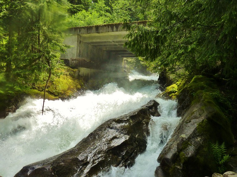
Going counter-clockwise is an 0.2 mile ADA-accessible trail to a bridge that spans the Upper Falls. This is a great place to take people with limited mobility. Deception Creek originates in the Alpine Lakes Wilderness, and this is its last run before joining the Tye River. The water quite powerful and in early summer expect to get a face full of mist.
Continuing down the creek, interpretive signs explain the ecology of the area and showcase the impressive whitewater. At the final major stop, marvel as water crashes down the falls and slams into a granite wall - making an abrupt 90-degree turn to the right. There is a loop to return to the parking lot to finish your trip.
The Deception Falls rest area has a vault toilet and picnic tables. It is generally open from Memorial Day to Labor Day each year.
Deception Falls National Recreation Area

-
 Length
- 0.5 miles, roundtrip
-
 Elevation Gain
- 50 feet
The short half-mile interpretive trail along Deception Falls is a great stop for a quick stretch of the legs as you drive over Stevens Pass. The highlight is the tumbling, multi-tiered waterfall and its distinctive 90 degree turn the creek makes at a stop along the way.
Continue reading
Hiking Deception Falls National Recreation Area
Deception Falls National Recreation Area
Map & Directions
 Trailhead
Before You Go
Parking Pass/Entry Fee
NoneWTA Pro Tip: Save a copy of our directions before you leave! App-based driving directions aren't always accurate and data connections may be unreliable as you drive to the trailhead.


